SA67 7DG - 3 bedroom cottage for sale in Nestor Square, Narberth, SA67
View on Property Piper
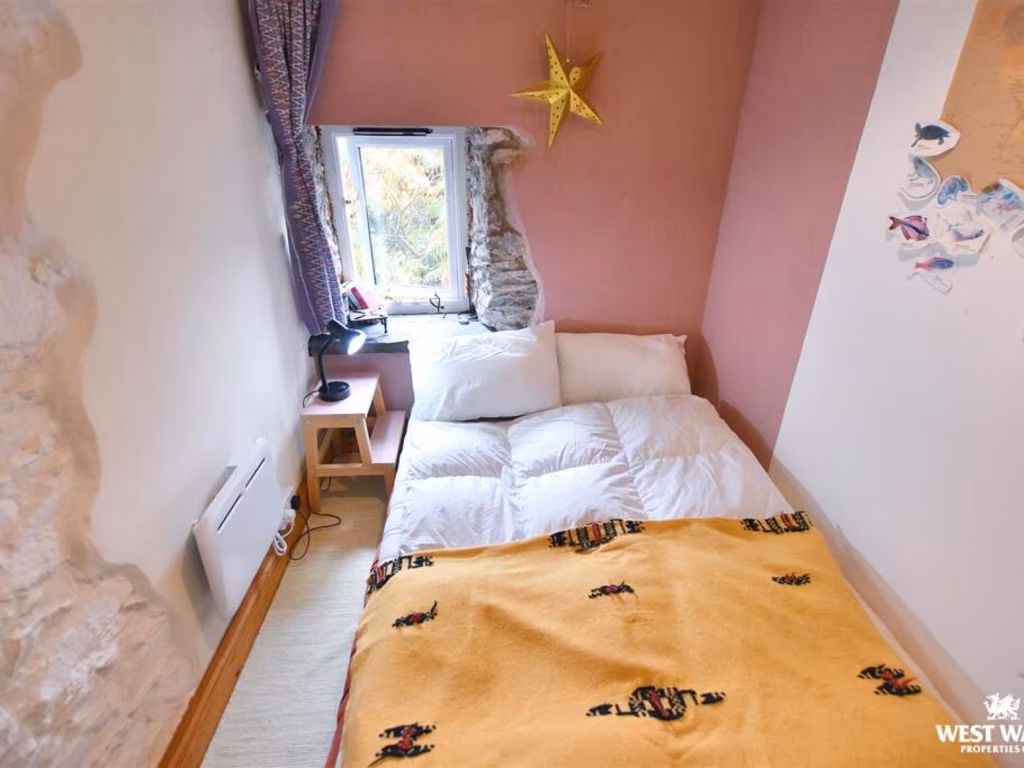
3 bedroom cottage for sale in Nestor Square, Narberth, SA67
Property Details
- Price: £230000
- Bedrooms: 3
- Bathrooms: 2
- Property Type: undefined
- Property SubType: undefined
Image Descriptions
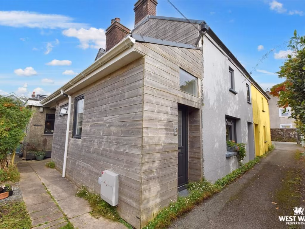
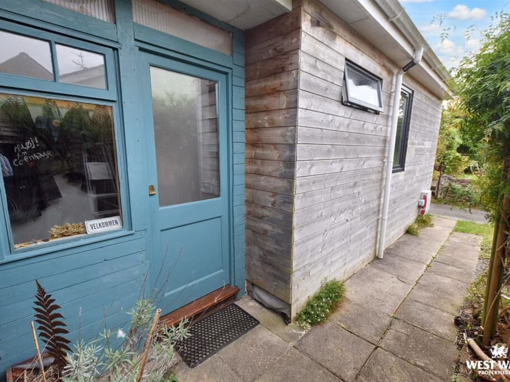
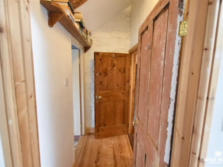
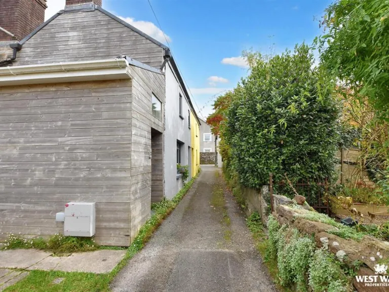
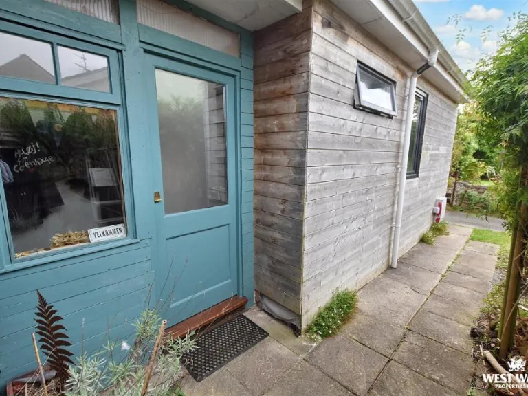
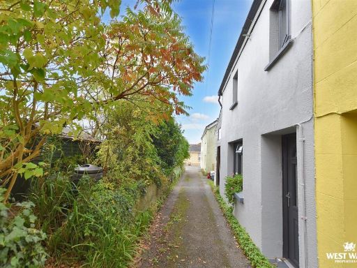
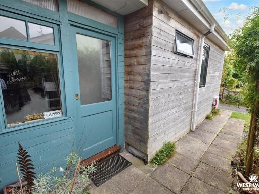
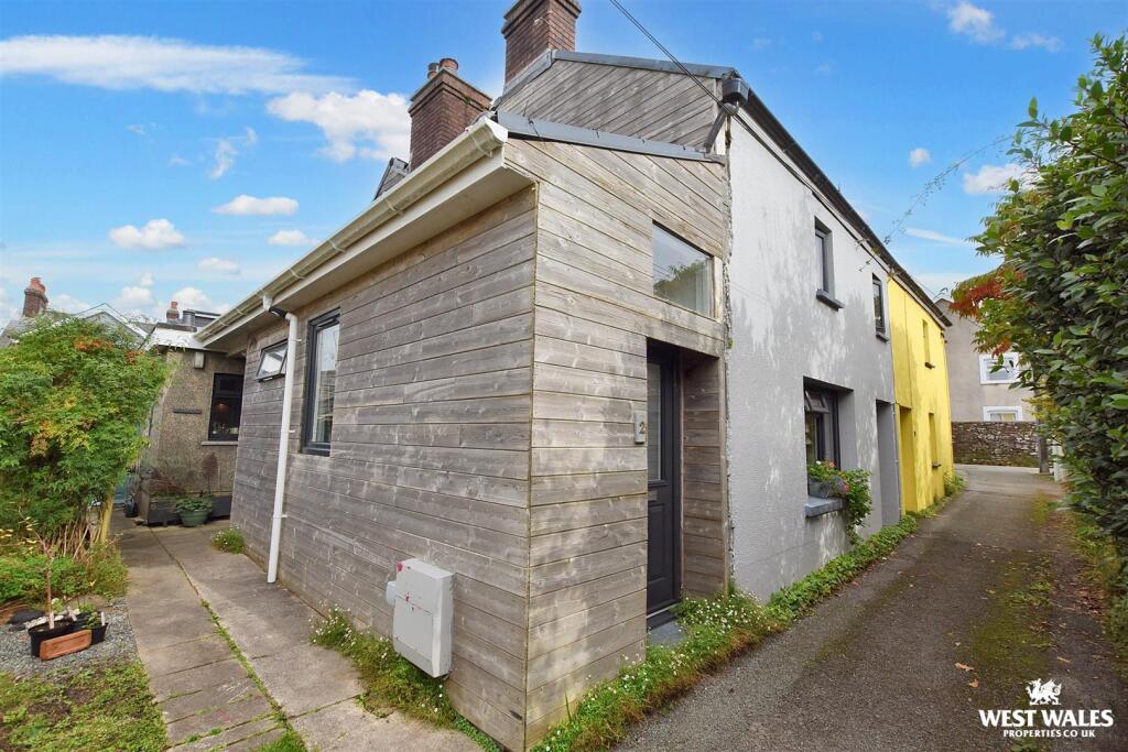
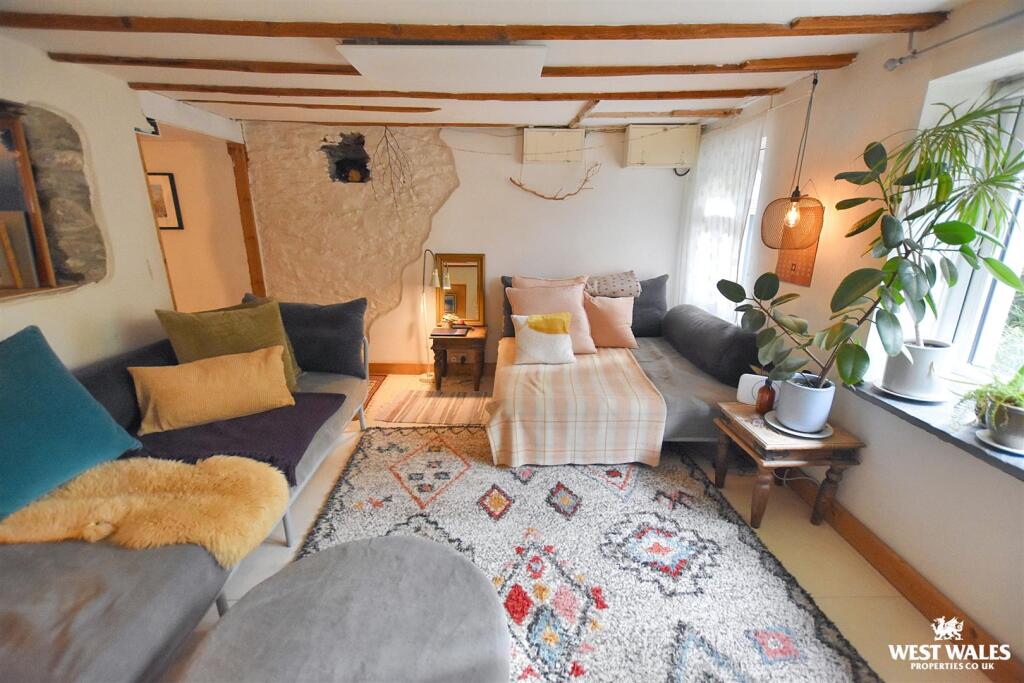
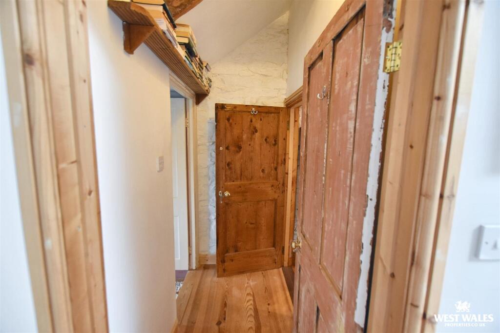
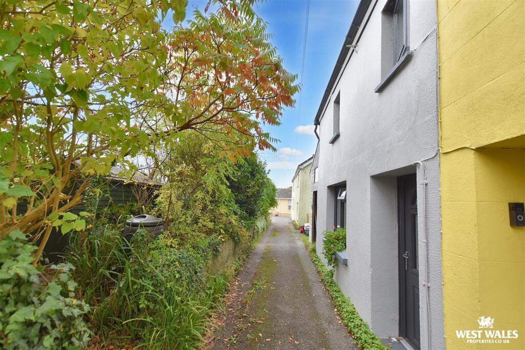
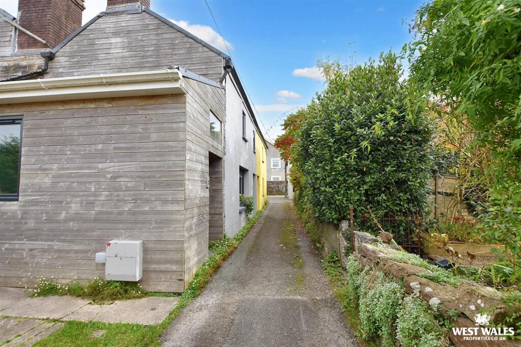
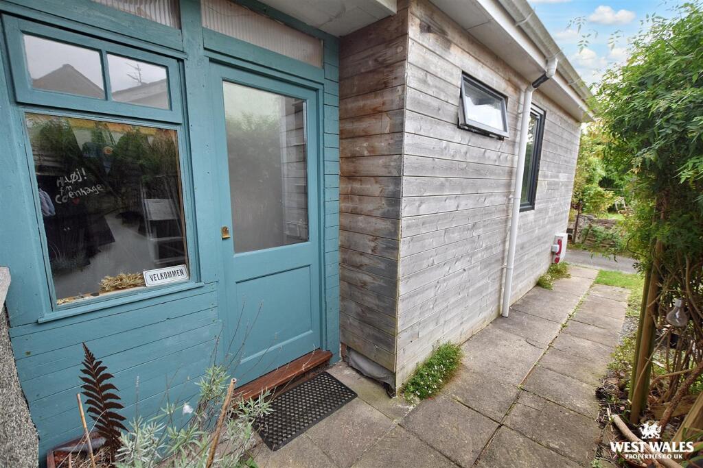
- house exterior modern extension to traditional terrace
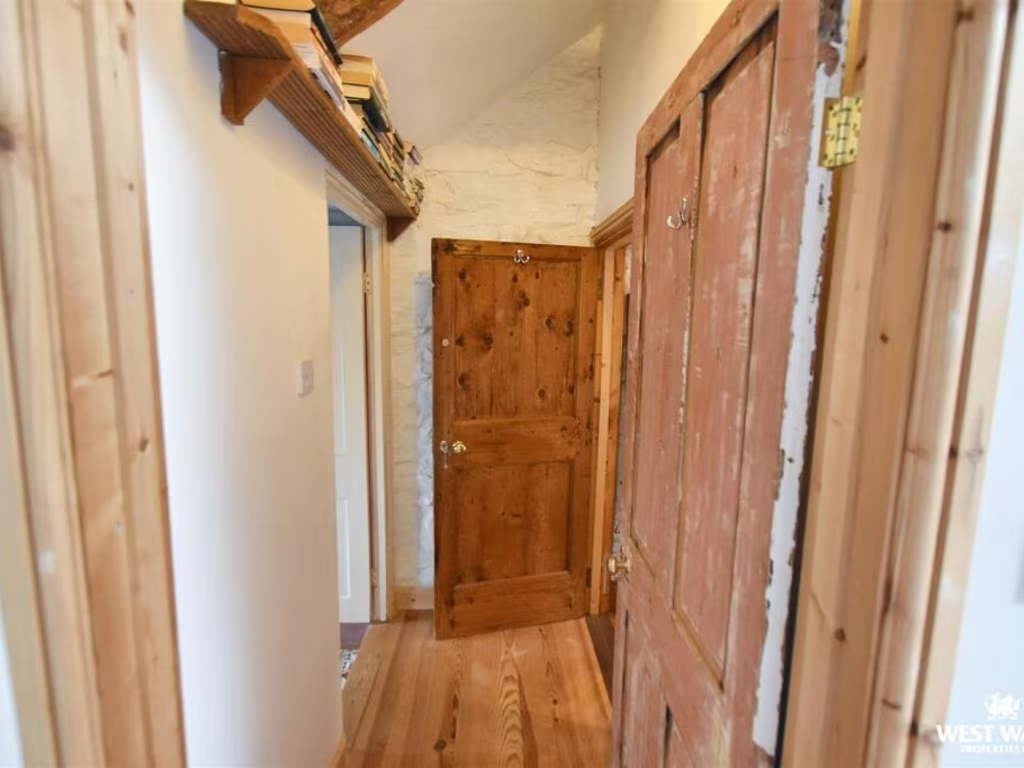
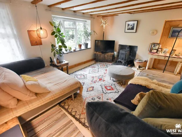
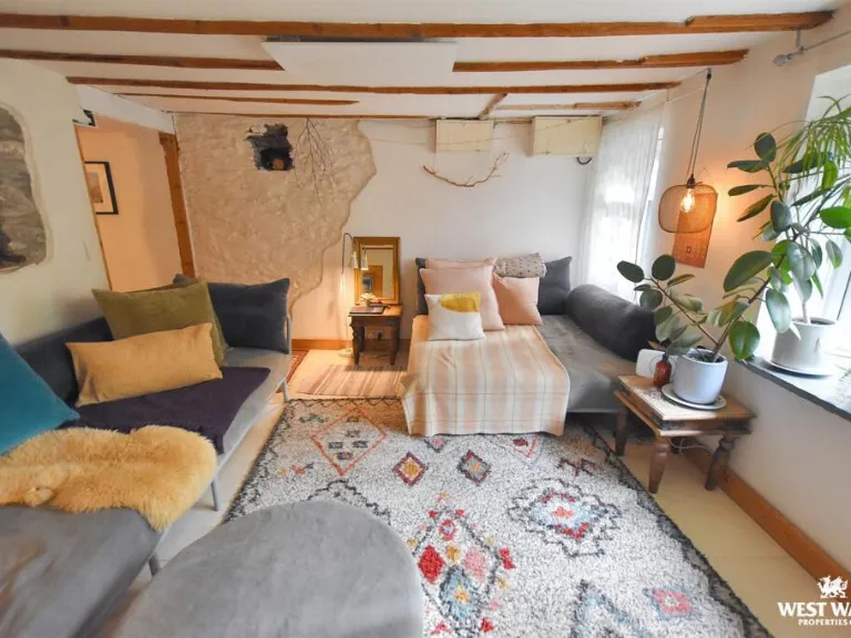
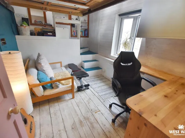
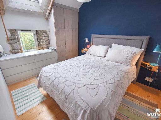
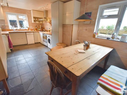
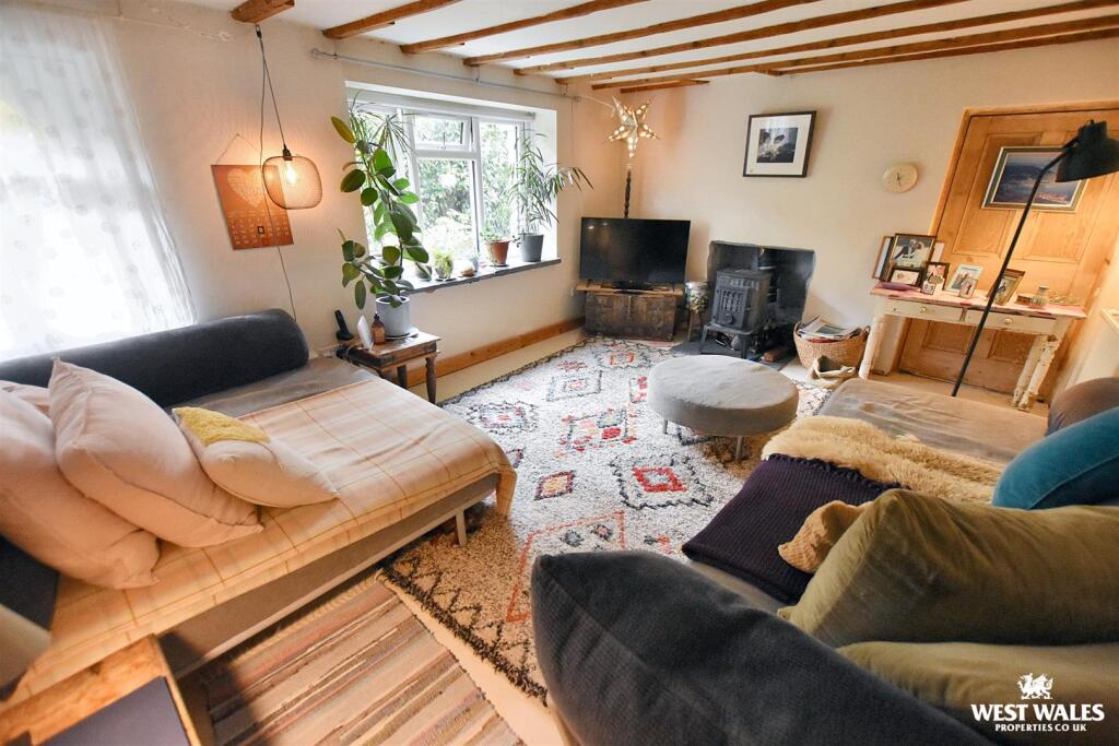
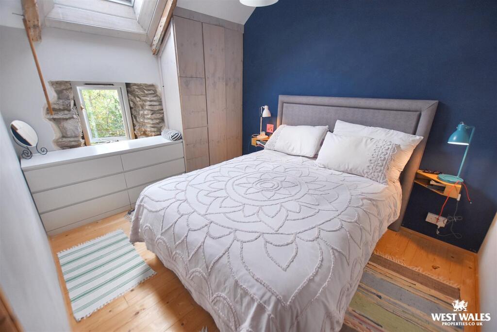
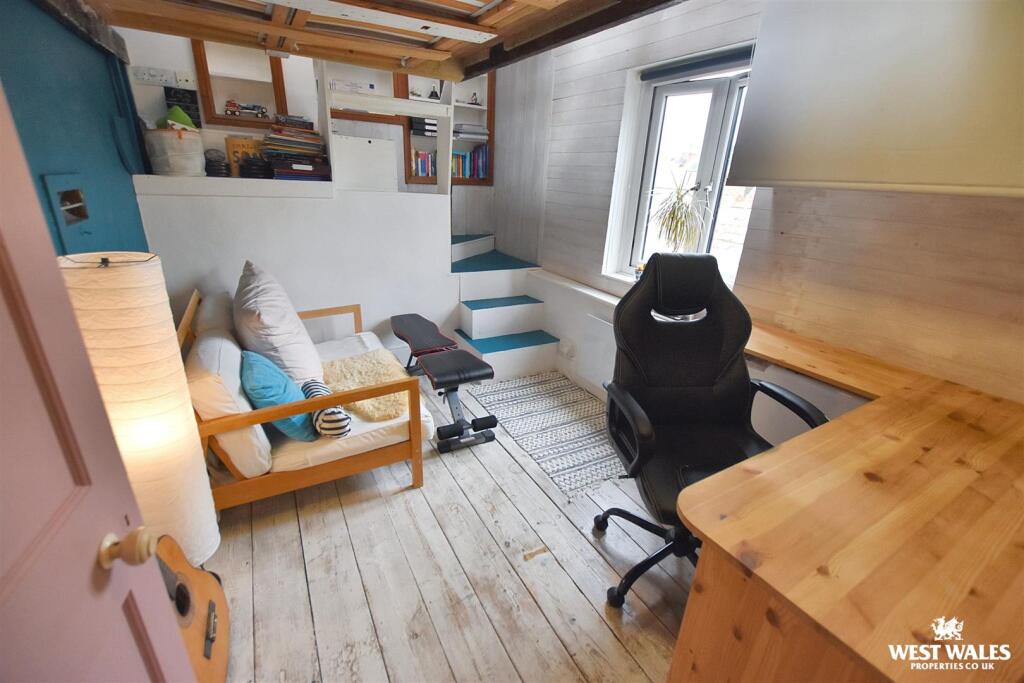
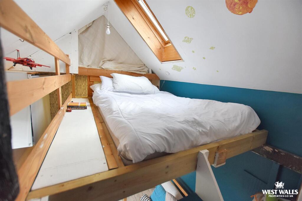
- living room cottage
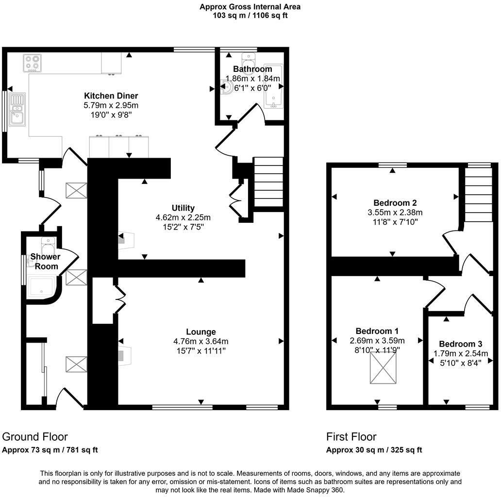
Floorplan Description
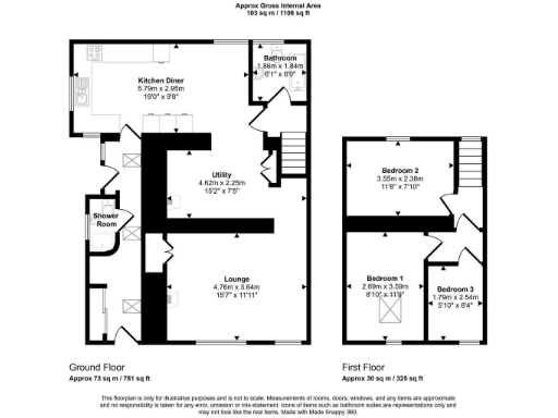
- Approx Gross Internal Area shown on plan: 1106 sq ft
Rooms
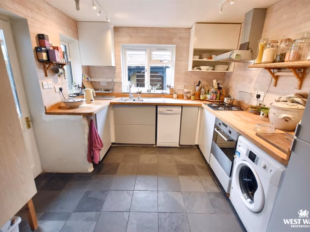
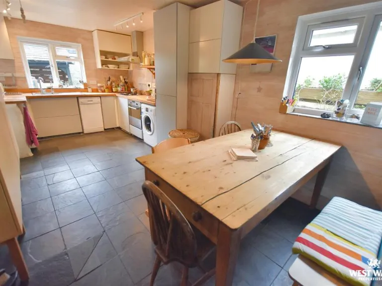
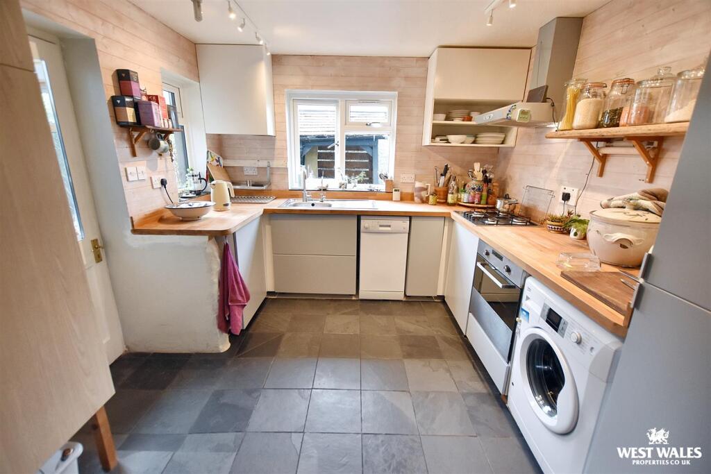
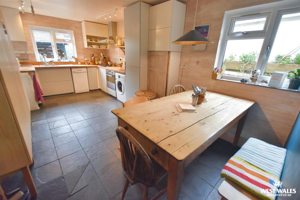
- Kitchen Diner:
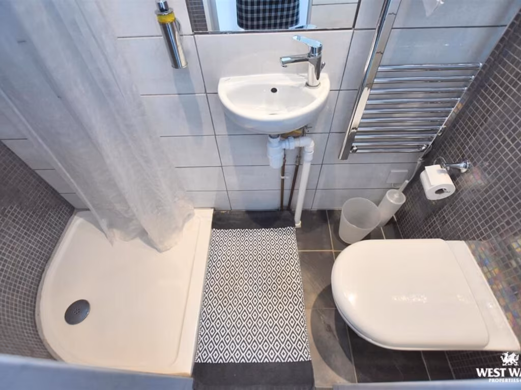
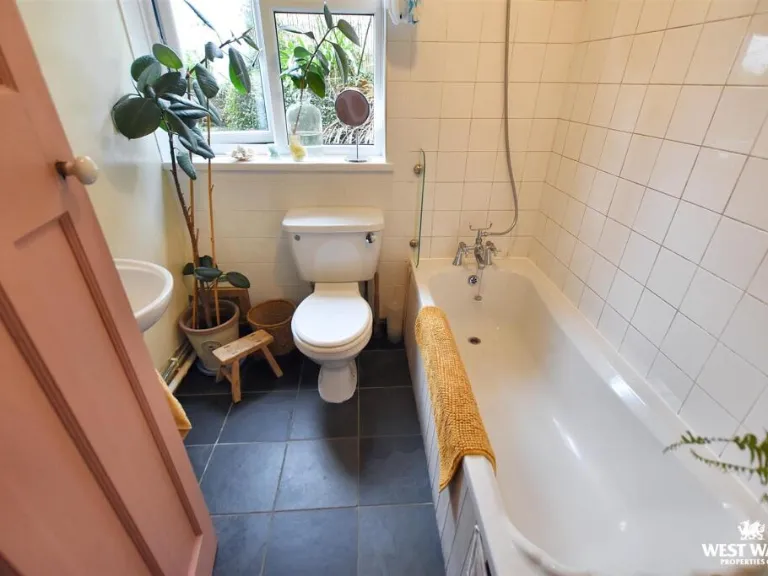
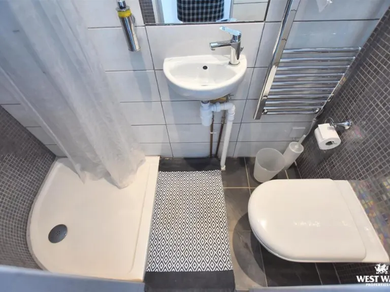
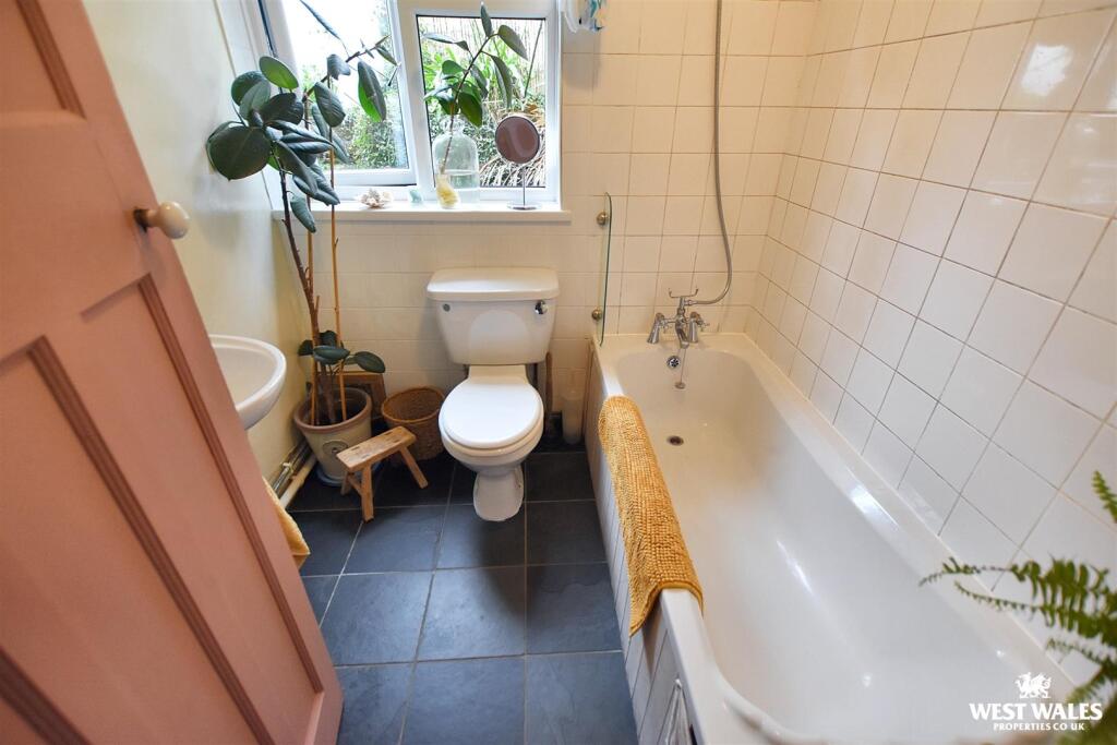
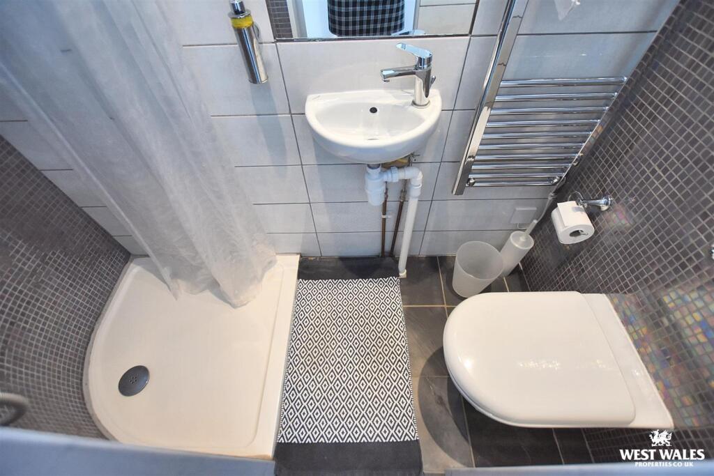
- Bathroom:
- Utility:
- Lounge:
- Shower Room:
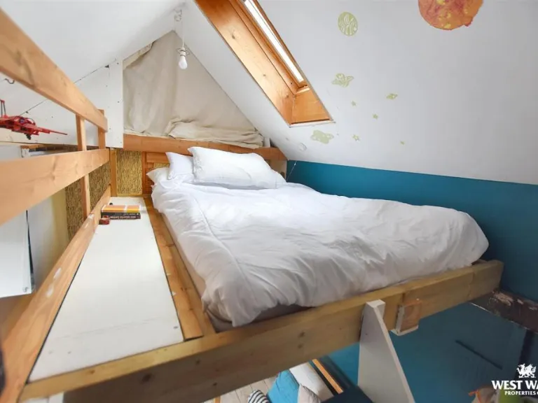
- Bedroom 2:
- Bedroom 1:
- Bedroom 3:
Textual Property Features
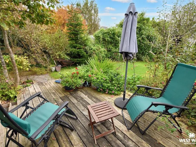
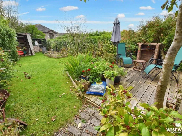
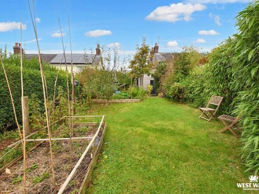
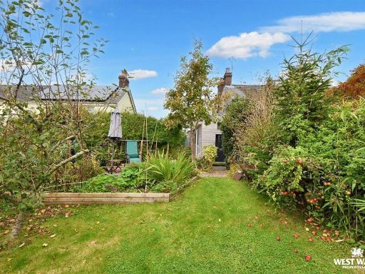
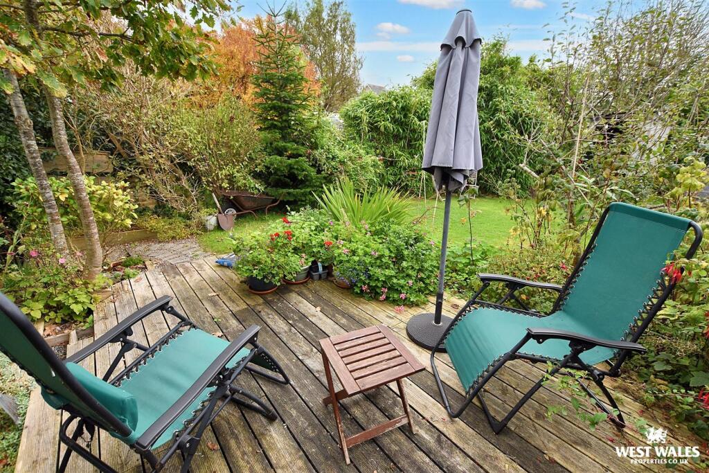
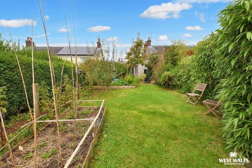
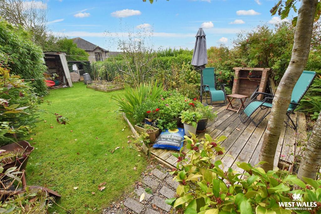
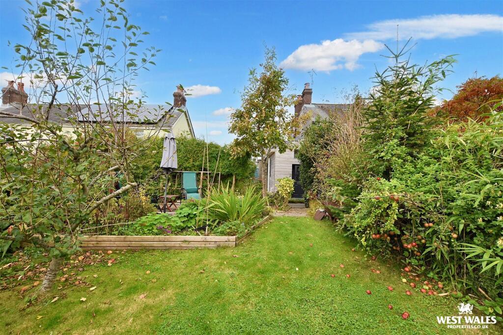
- Has Garden
- Chain Free
- Success
Detected Visual Features
- modern extension
- traditional terrace
- wooden cladding
- chimneys
- side alley
- grey facade
- cottage
- living room
- exposed beams
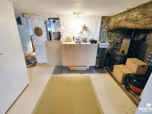
- country style
- rustic
- quaint
- cozy
- period features
Nearest General Shops
- Id: 2063184391
- Tags:
- Addr:
- Housenumber: 7
- Postcode: SA67 7AR
- Street: High Street
- Fhrs:
- Name: Ultracomida
- Shop: deli
- Source:
- Website: https://www.ultracomida.co.uk/
- TagsNormalized:
- Lat: 51.7994082
- Lon: -4.7439245
- FullGeoHash: gchwsjc96t99
- PartitionGeoHash: gchw
- Images:
- FoodStandards:
- Id: 856792
- FHRSID: 856792
- LocalAuthorityBusinessID: 231555
- BusinessName: Ultracomida
- BusinessType: Retailers - other
- BusinessTypeID: 4613
- AddressLine1: 7 High Street
- AddressLine2: null
- AddressLine3: Narberth
- AddressLine4: Pembrokeshire
- PostCode: SA67 7AR
- RatingValue: 5
- RatingKey: fhrs_5_en-GB
- RatingDate: 2019-02-06
- LocalAuthorityCode: 565
- LocalAuthorityName: Pembrokeshire
- LocalAuthorityWebSite: http://www.pembrokeshire.gov.uk
- LocalAuthorityEmailAddress: foodratings@pembrokeshire.gov.uk
- Scores:
- Hygiene: 0
- Structural: 5
- ConfidenceInManagement: 0
- NewRatingPending: false
- Geocode:
- Longitude: -4.74365300000000
- Latitude: 51.79893600000000
- Distance: 71.1
,- Id: 6019567975
- Tags:
- Name: Badhams
- Shop: stationery
- TagsNormalized:
- Lat: 51.7995309
- Lon: -4.7439131
- FullGeoHash: gchwsjcd4u6j
- PartitionGeoHash: gchw
- Images:
- FoodStandards: null
- Distance: 67.7
,- Id: 6019559098
- Tags:
- TagsNormalized:
- Lat: 51.7997602
- Lon: -4.7437341
- FullGeoHash: gchwsjceqzpm
- PartitionGeoHash: gchw
- Images:
- FoodStandards: null
- Distance: 58.2
}
Nearest Religious buildings
- Id: 250787041
- Tags:
- Amenity: place_of_worship
- Building: church
- Denomination: catholic
- Religion: christian
- TagsNormalized:
- place of worship
- church
- catholic
- christian
- Lat: 51.7968418
- Lon: -4.7442465
- FullGeoHash: gchwsj367p1k
- PartitionGeoHash: gchw
- Images:
- FoodStandards: null
- Distance: 318.8
,- Id: 200184867
- Tags:
- Amenity: place_of_worship
- Building: yes
- Denomination: protestant
- Name: Kings Court
- Religion: christian
- TagsNormalized:
- place of worship
- protestant
- christian
- church
- Lat: 51.7975322
- Lon: -4.7426871
- FullGeoHash: gchwsj6qrru5
- PartitionGeoHash: gchw
- Images:
- FoodStandards: null
- Distance: 229.6
,- Id: 501406834
- Tags:
- Addr:
- City: Narberth
- Postcode: SA67 7AS
- Street: High Street
- Amenity: place_of_worship
- Building: church
- Denomination: baptist
- Name: Bethesda Chapel
- Religion: christian
- Url: http://www.bethesdachapel.co.uk/
- TagsNormalized:
- place of worship
- church
- baptist
- chapel
- christian
- Lat: 51.7986068
- Lon: -4.7444222
- FullGeoHash: gchwsj9hybnm
- PartitionGeoHash: gchw
- Images:
- FoodStandards: null
- Distance: 149.9
}
Nearest Medical buildings
- Id: 1125735010
- Tags:
- Amenity: pharmacy
- Building: yes
- Healthcare: pharmacy
- Name: Fferyllfa Clynderwen Pharmacy
- Name:cy: Fferyllfa Clynderwen
- Name:en: Clynderwen Pharmacy
- TagsNormalized:
- Lat: 51.8407848
- Lon: -4.7288775
- FullGeoHash: gchwumkd3ntq
- PartitionGeoHash: gchw
- Images:
- FoodStandards: null
- Distance: 4681.3
,- Id: 1717500727
- Tags:
- Amenity: doctors
- Name: Narberth Health Centre
- TagsNormalized:
- doctor
- doctors
- health
- health centre
- Lat: 51.8007877
- Lon: -4.7445725
- FullGeoHash: gchwsn117qwq
- PartitionGeoHash: gchw
- Images:
- FoodStandards: null
- Distance: 174.4
,- Id: 295116089
- Tags:
- TagsNormalized:
- Lat: 51.8007877
- Lon: -4.744555
- FullGeoHash: gchwsn117yeq
- PartitionGeoHash: gchw
- Images:
- FoodStandards: null
- Distance: 173.6
,- Id: 8018310913
- Tags:
- Amenity: pharmacy
- Name: Lloyds
- TagsNormalized:
- Lat: 51.7989444
- Lon: -4.744053
- FullGeoHash: gchwsj9qxx1e
- PartitionGeoHash: gchw
- Images:
- FoodStandards: null
- Distance: 105.3
}
Nearest Leisure Facilities
- Id: 248032726
- Tags:
- TagsNormalized:
- Lat: 51.7978282
- Lon: -4.7438752
- FullGeoHash: gchwsj985xn2
- PartitionGeoHash: gchw
- Images:
- FoodStandards: null
- Distance: 206.4
,- Id: 159631698
- Tags:
- Leisure: pitch
- Name: Narberth Cricket Club
- Sport: cricket
- TagsNormalized:
- pitch
- leisure
- cricket
- club
- sports
- Lat: 51.8007399
- Lon: -4.7410302
- FullGeoHash: gchwsn59jvz9
- PartitionGeoHash: gchw
- Images:
- FoodStandards: null
- Distance: 182.9
,- Id: 460951008
- Tags:
- TagsNormalized:
- Lat: 51.800303
- Lon: -4.7435553
- FullGeoHash: gchwsjcyehkg
- PartitionGeoHash: gchw
- Images:
- FoodStandards: null
- Distance: 90
,- Id: 460951007
- Tags:
- TagsNormalized:
- Lat: 51.8002235
- Lon: -4.7435444
- FullGeoHash: gchwsjcy5msc
- PartitionGeoHash: gchw
- Images:
- FoodStandards: null
- Distance: 81.9
,- Id: 460951004
- Tags:
- TagsNormalized:
- Lat: 51.80015
- Lon: -4.7435346
- FullGeoHash: gchwsjcvexu4
- PartitionGeoHash: gchw
- Images:
- FoodStandards: null
- Distance: 74.6
}
Nearest Tourist attractions
- Id: 200174481
- Tags:
- Addr:
- Building: yes
- Name: Wilson Museum
- Opening_hours: Tu-Sa 10:00-17:15
- Phone: +44 1834 860500
- Tourism: museum
- Website: https://www.narberthmuseum.co.uk/
- Wheelchair: yes
- TagsNormalized:
- Lat: 51.7970149
- Lon: -4.7437468
- FullGeoHash: gchwsj3eqxqj
- PartitionGeoHash: gchw
- Images:
- FoodStandards: null
- Distance: 291.9
,- Id: 4017971914
- Tags:
- Addr:
- Housenumber: 32
- Postcode: SA67 7AS
- Street: High Street
- Fhrs:
- Name: 32 Townhouse
- Opening_hours: Tu-Sa 11:00-22:00; Su 12:00-15:00
- Source:
- Takeaway: no
- Tourism: guest_house
- Website: https://32townhouse.com/
- TagsNormalized:
- Lat: 51.7982434
- Lon: -4.7437445
- FullGeoHash: gchwsj9dwsrt
- PartitionGeoHash: gchw
- Images:
- FoodStandards:
- Id: 857233
- FHRSID: 857233
- LocalAuthorityBusinessID: 232715
- BusinessName: 32 Townhouse B & B
- BusinessType: Hotel/bed & breakfast/guest house
- BusinessTypeID: 7842
- AddressLine1: 32 High Street
- AddressLine2: null
- AddressLine3: Narberth
- AddressLine4: Pembrokeshire
- PostCode: SA67 7AS
- RatingValue: 5
- RatingKey: fhrs_5_en-GB
- RatingDate: 2018-11-01
- LocalAuthorityCode: 565
- LocalAuthorityName: Pembrokeshire
- LocalAuthorityWebSite: http://www.pembrokeshire.gov.uk
- LocalAuthorityEmailAddress: foodratings@pembrokeshire.gov.uk
- Scores:
- Hygiene: 0
- Structural: 5
- ConfidenceInManagement: 5
- NewRatingPending: false
- Geocode:
- Longitude: -4.74420300000000
- Latitude: 51.79891400000000
- Distance: 159.9
,- Id: 10704178413
- Tags:
- Addr:
- Housenumber: 4a
- Street: St James Street
- Guest_house: bed_and_breakfast
- Name: Max and Caroline's Narberth Guest Rooms
- Rooms: 2
- Tourism: guest_house
- Website: http://maxandcarolines.com
- TagsNormalized:
- Lat: 51.7983723
- Lon: -4.7421953
- FullGeoHash: gchwsjdg6u6y
- PartitionGeoHash: gchw
- Images:
- FoodStandards: null
- Distance: 144.7
}
Nearest Train stations
- Id: 20694942
- Tags:
- Name: Kilgetty
- Name:cy: Cilgeti
- Naptan:
- Network: National Rail
- Operator: Trafnidiaeth Cymru
- Operator:cy: Trafnidiaeth Cymru
- Operator:en: Transport for Wales
- Public_transport: station
- Railway: station
- Ref:
- Request_stop: yes
- Train: yes
- Wikidata: Q2927580
- Wikipedia: en:Kilgetty railway station
- TagsNormalized:
- Lat: 51.7323317
- Lon: -4.7145215
- FullGeoHash: gchwk9wfxttf
- PartitionGeoHash: gchw
- Images:
- FoodStandards: null
- Distance: 7730.3
,- Id: 858361120
- Tags:
- Name: Oakwood Park Station
- Public_transport: station
- Railway: station
- Usage: tourism
- TagsNormalized:
- Lat: 51.7789542
- Lon: -4.8028585
- FullGeoHash: gchwddndm29h
- PartitionGeoHash: gchw
- Images:
- FoodStandards: null
- Distance: 4717.4
,- Id: 1590432668
- Tags:
- Name: Main Entrance Station
- Public_transport: station
- Railway: station
- Usage: tourism
- TagsNormalized:
- Lat: 51.7775924
- Lon: -4.8001387
- FullGeoHash: gchwdcbdkdv1
- PartitionGeoHash: gchw
- Images:
- FoodStandards: null
- Distance: 4633
,- Id: 20466178
- Tags:
- Alt_name: Clynderwen
- Name: Clunderwen
- Naptan:
- Network: National Rail
- Operator: Trafnidiaeth Cymru
- Operator:cy: Trafnidiaeth Cymru
- Operator:en: Transport for Wales
- Public_transport: station
- Railway: station
- Ref:
- Request_stop: yes
- Wikidata: Q3400242
- Wikipedia: en:Clunderwen railway station
- TagsNormalized:
- Lat: 51.8401054
- Lon: -4.7310195
- FullGeoHash: gchwum4yx204
- PartitionGeoHash: gchw
- Images:
- FoodStandards: null
- Distance: 4578.8
,- Id: 6049272877
- Tags:
- Name: Narberth
- Name:cy: Arberth
- Naptan:
- Network: National Rail
- Operator: Trafnidiaeth Cymru
- Operator:cy: Trafnidiaeth Cymru
- Operator:en: Transport for Wales
- Public_transport: station
- Railway: station
- Ref:
- Request_stop: yes
- Wikidata: Q2258074
- Wikipedia: en:Narberth railway station (Wales)
- TagsNormalized:
- Lat: 51.7994595
- Lon: -4.7270386
- FullGeoHash: gchwsmvcsp0e
- PartitionGeoHash: gchw
- Images:
- FoodStandards: null
- Distance: 1093.1
}
Nearest Bus stations and stops
- Id: 6353361197
- Tags:
- Bench: yes
- Bus: yes
- Highway: bus_stop
- Name: Kilgetty Community Centre
- Operator: Taf Valley Coaches, PCC, National Express,Eurolines
- Public_transport: platform
- Shelter: yes
- TagsNormalized:
- Lat: 51.7316395
- Lon: -4.7205754
- FullGeoHash: gchwk96wdsec
- PartitionGeoHash: gchw
- Images:
- FoodStandards: null
- Distance: 7710.9
,- Id: 5997560767
- Tags:
- Bus: yes
- Highway: bus_stop
- Name: Kilgetty Co-Op
- Public_transport: platform
- TagsNormalized:
- Lat: 51.732109
- Lon: -4.7171941
- FullGeoHash: gchwk9t13kj4
- PartitionGeoHash: gchw
- Images:
- FoodStandards: null
- Distance: 7709.9
,- Id: 5994254700
- Tags:
- Bus: yes
- Highway: bus_stop
- Name: St. Mary's Place
- Public_transport: platform
- Shelter: yes
- Surface: asphalt
- TagsNormalized:
- Lat: 51.7330562
- Lon: -4.7133002
- FullGeoHash: gchwk9xyuhss
- PartitionGeoHash: gchw
- Images:
- FoodStandards: null
- Distance: 7674.2
,- Id: 5999037426
- Tags:
- Bus: yes
- Highway: bus_stop
- Public_transport: platform
- TagsNormalized:
- Lat: 51.7356775
- Lon: -4.7152274
- FullGeoHash: gchwkdnqpjr9
- PartitionGeoHash: gchw
- Images:
- FoodStandards: null
- Distance: 7358.2
,- Id: 5997793811
- Tags:
- Bus: yes
- Highway: bus_stop
- Public_transport: platform
- TagsNormalized:
- Lat: 51.8003635
- Lon: -4.7387518
- FullGeoHash: gchwsjvqgpds
- PartitionGeoHash: gchw
- Images:
- FoodStandards: null
- Distance: 300.1
}
Nearest Hotels
- Id: 93543824
- Tags:
- Addr:
- Housename: Begelly Arms Inn
- Postcode: SA68 0YF
- Street: New Road
- Building: yes
- Fhrs:
- Internet_access: wlan
- Internet_access:fee: no
- Name: Begelly Arms Inn
- Rooms: 7
- Smoking: no
- Source:
- Toilets:
- Tourism: hotel
- Wheelchair: yes
- Wikidata: Q80582224
- TagsNormalized:
- Lat: 51.7306826
- Lon: -4.725499
- FullGeoHash: gchwk3qcpfht
- PartitionGeoHash: gchw
- Images:
- FoodStandards: null
- Distance: 7755.6
,- Id: 767909606
- Tags:
- Brand: SLH
- Building: yes
- Name: Grove of Narberth
- Tourism: hotel
- Website: https://slh.com/hotels/grove-of-narberth
- TagsNormalized:
- Lat: 51.7825688
- Lon: -4.7652551
- FullGeoHash: gchweddp3d2q
- PartitionGeoHash: gchw
- Images:
- FoodStandards: null
- Distance: 2437.1
,- Id: 460952422
- Tags:
- Addr:
- Postcode: SA67 7AB
- Street: Moorfield Road
- Building: yes
- Fhrs:
- Name: Plas Hyfred
- Source:
- Tourism: hotel
- TagsNormalized:
- Lat: 51.8005585
- Lon: -4.7452593
- FullGeoHash: gchwsn0857yp
- PartitionGeoHash: gchw
- Images:
- FoodStandards: null
- Distance: 192.7
}
Tags
- modern extension
- traditional terrace
- wooden cladding
- chimneys
- side alley
- grey facade
- cottage
- living room
- exposed beams
- country style
- rustic
- quaint
- cozy
- period features
Local Market Stats
- Average Price/sqft: £239
- Avg Income: £36400
- Social Housing: 4%
- Planning Success Rate: 82%
AirBnB Data
- 1km average: £99/night
- Listings in 1km: 5
Similar Properties
 3 bedroom cottage for sale in 25 Northfield Road, Narberth, SA67 — £350,000 • 3 bed • 2 bath • 1141 ft²
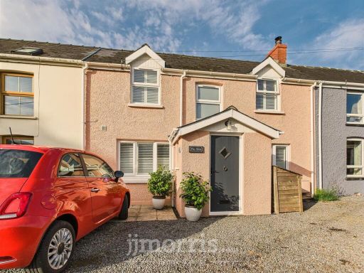 3 bedroom cottage for sale in Hillside Terrace, Narberth, SA67 — £229,950 • 3 bed • 1 bath • 729 ft²
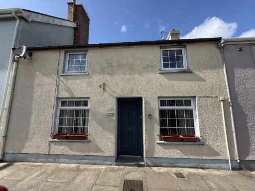 3 bedroom terraced house for sale in St. James Street, Narberth, Pembrokeshire, SA67 — £225,000 • 3 bed • 1 bath • 991 ft²
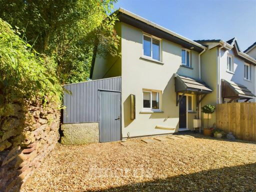 3 bedroom end of terrace house for sale in Victoria Close, Narberth, SA67 — £199,950 • 3 bed • 1 bath • 611 ft²
 2 bedroom terraced house for sale in St. James Street, Narberth, SA67 — £189,950 • 2 bed • 1 bath • 811 ft²
 4 bedroom end of terrace house for sale in Moorfield Road, Narberth, Pembrokeshire, SA67 — £410,000 • 4 bed • 3 bath • 2132 ft²
Meta
- {
"@context": "https://schema.org",
"@type": "Residence",
"name": "3 bedroom cottage for sale in Nestor Square, Narberth, SA67",
"description": "",
"url": "https://propertypiper.co.uk/property/2e848146-d463-4480-956c-47aa94cf598b",
"image": "https://image-a.propertypiper.co.uk/25fe45e6-a2a0-450b-8b13-e0148279e7d0-1024.jpeg",
"address": {
"@type": "PostalAddress",
"streetAddress": "2, NESTOR SQUARE, NARBERTH",
"postalCode": "SA67 7DG",
"addressLocality": "Pembrokeshire",
"addressRegion": "Carmarthen West and South Pembrokeshire",
"addressCountry": "Wales"
},
"geo": {
"@type": "GeoCoordinates",
"latitude": 51.7995911,
"longitude": -4.7429336
},
"numberOfRooms": 3,
"numberOfBathroomsTotal": 2,
"floorSize": {
"@type": "QuantitativeValue",
"value": 1106,
"unitCode": "FTK"
},
"offers": {
"@type": "Offer",
"price": 230000,
"priceCurrency": "GBP",
"availability": "https://schema.org/InStock"
},
"additionalProperty": [
{
"@type": "PropertyValue",
"name": "Feature",
"value": "modern extension"
},
{
"@type": "PropertyValue",
"name": "Feature",
"value": "traditional terrace"
},
{
"@type": "PropertyValue",
"name": "Feature",
"value": "wooden cladding"
},
{
"@type": "PropertyValue",
"name": "Feature",
"value": "chimneys"
},
{
"@type": "PropertyValue",
"name": "Feature",
"value": "side alley"
},
{
"@type": "PropertyValue",
"name": "Feature",
"value": "grey facade"
},
{
"@type": "PropertyValue",
"name": "Feature",
"value": "cottage"
},
{
"@type": "PropertyValue",
"name": "Feature",
"value": "living room"
},
{
"@type": "PropertyValue",
"name": "Feature",
"value": "exposed beams"
},
{
"@type": "PropertyValue",
"name": "Feature",
"value": "country style"
},
{
"@type": "PropertyValue",
"name": "Feature",
"value": "rustic"
},
{
"@type": "PropertyValue",
"name": "Feature",
"value": "quaint"
},
{
"@type": "PropertyValue",
"name": "Feature",
"value": "cozy"
},
{
"@type": "PropertyValue",
"name": "Feature",
"value": "period features"
}
]
}
High Res Floorplan Images
Compatible Floorplan Images
FloorplanImages Thumbnail