SE28 0GL - 1 bedroom flat for sale in Wyatt Point, Thamesmead, London,…
View on Property Piper
1 bedroom flat for sale in Wyatt Point, Thamesmead, London, SE28
Property Details
- Price: £245000
- Bedrooms: 1
- Bathrooms: 1
- Property Type: undefined
- Property SubType: undefined
Image Descriptions
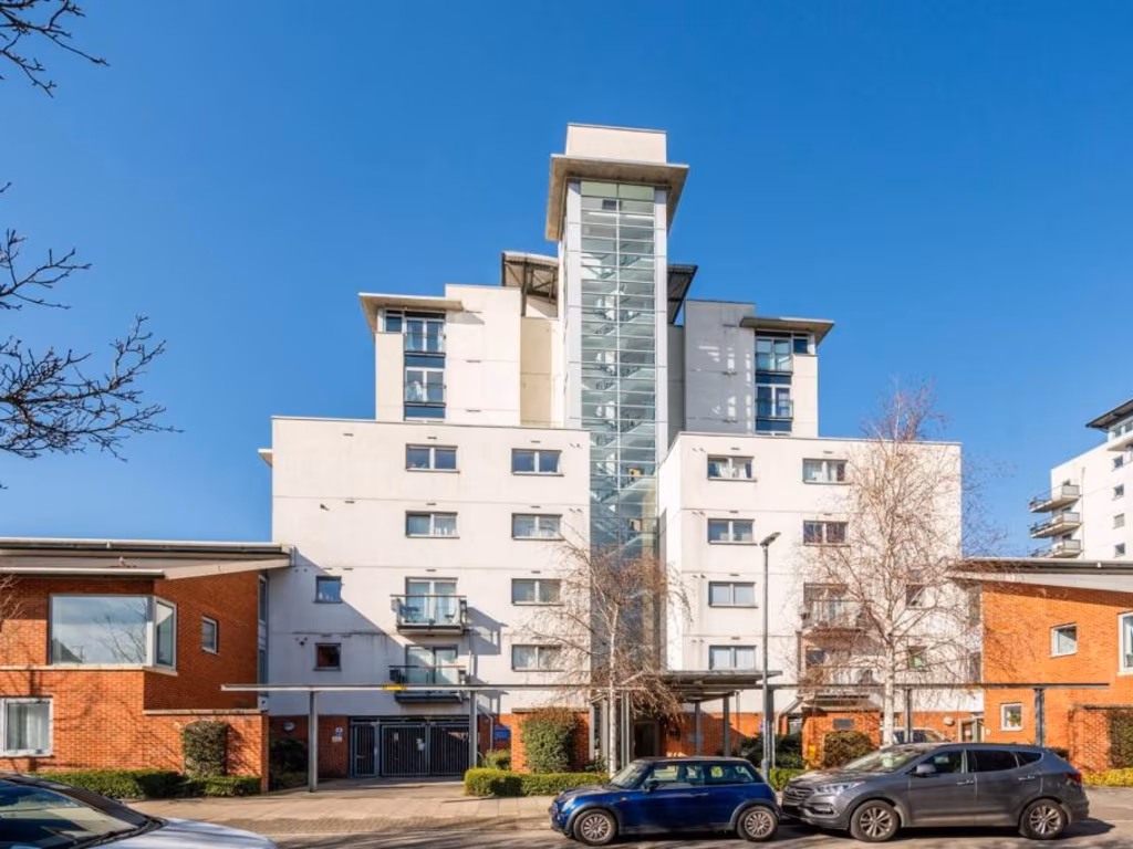
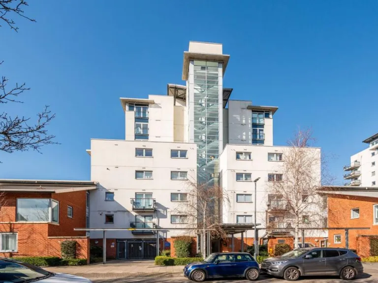
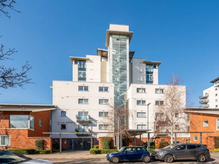
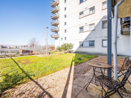
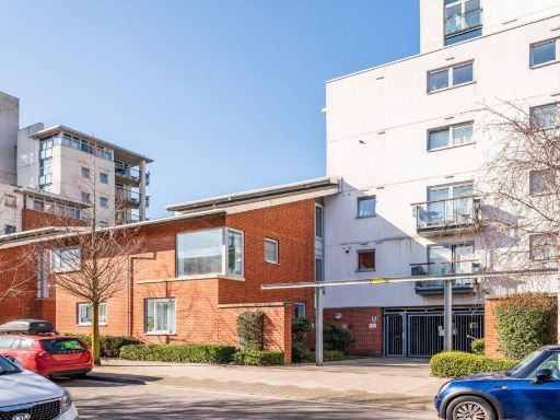
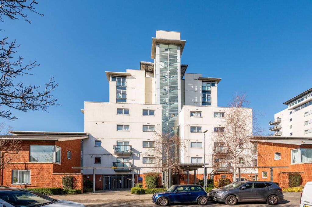
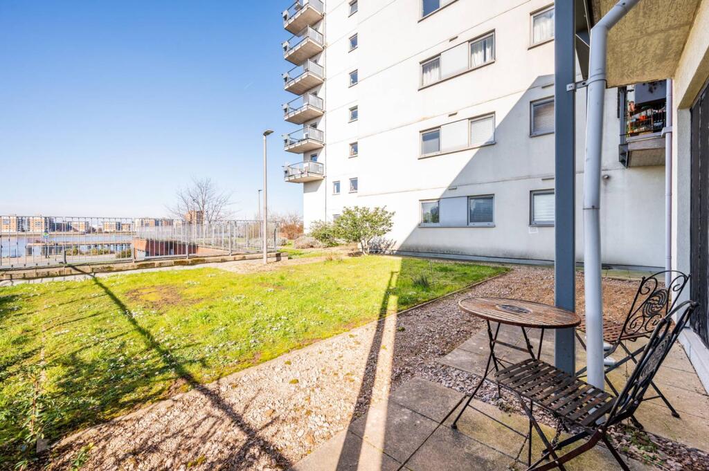
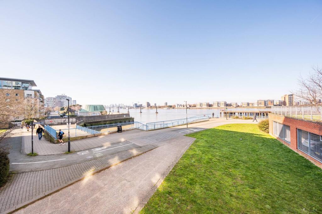
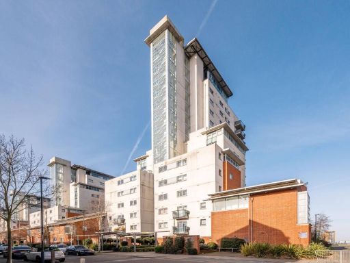
- modern apartment building modern
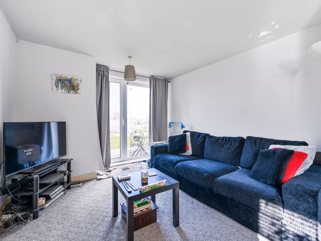
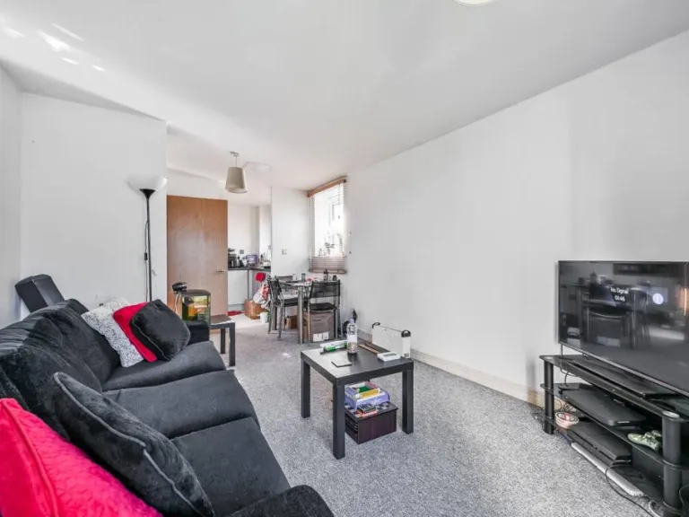
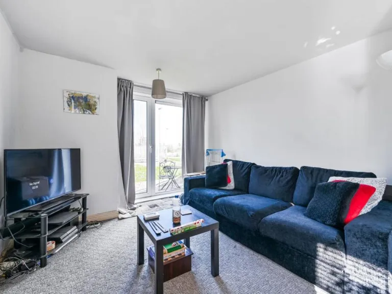
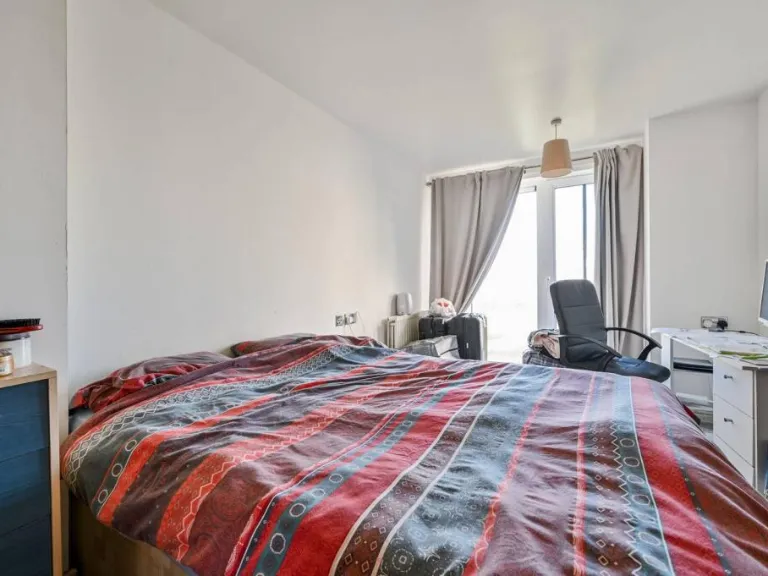
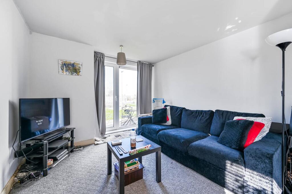
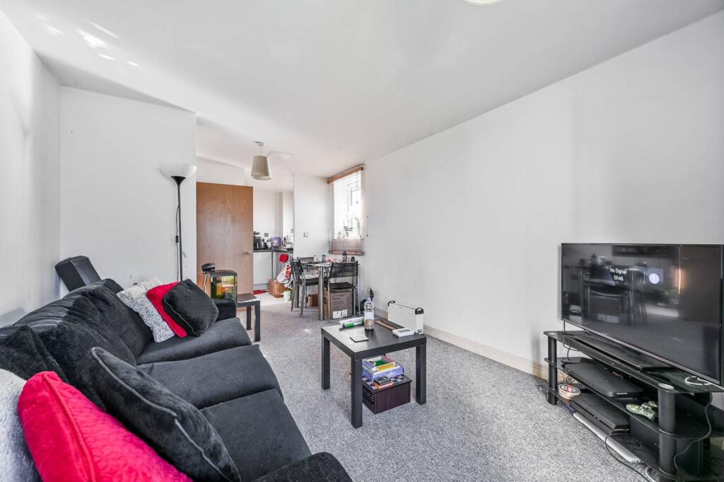
- living room contemporary
Floorplan Description
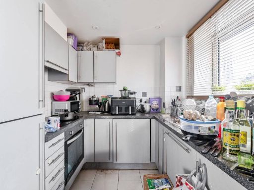
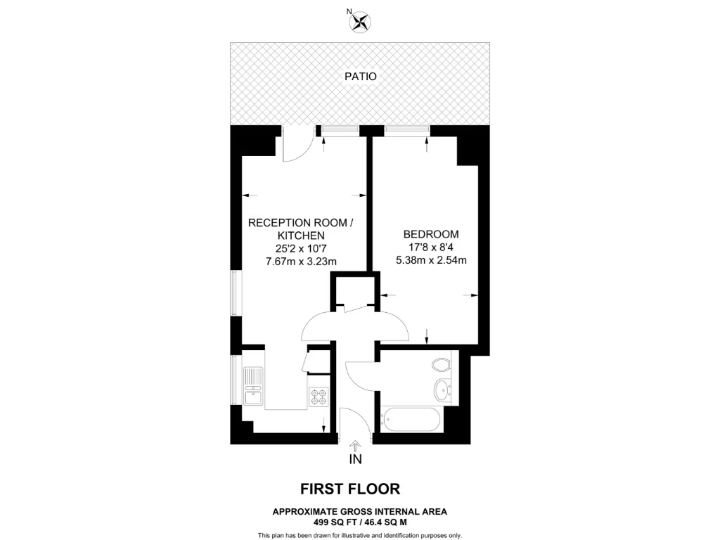
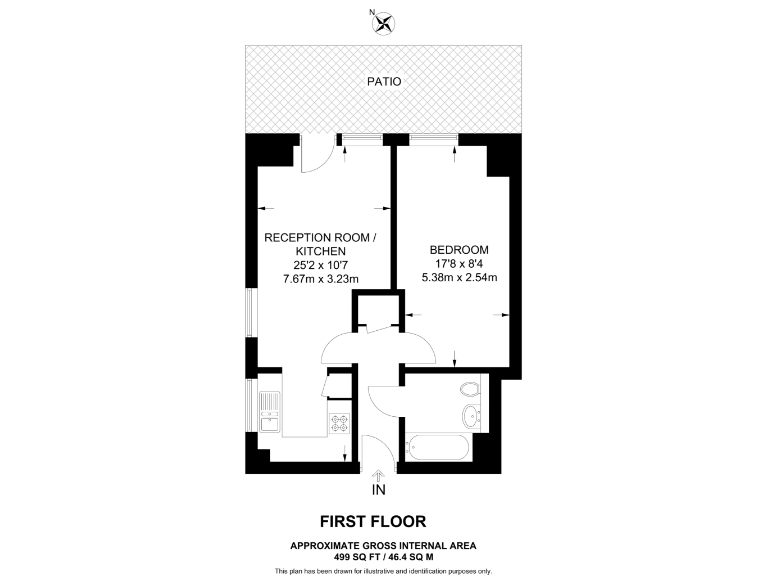
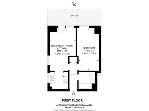
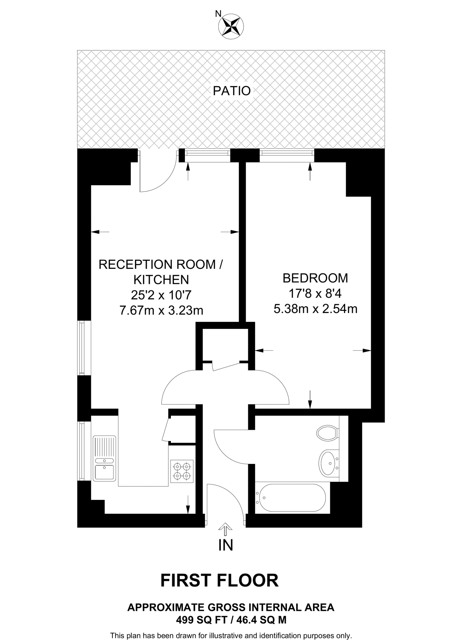
- A compact apartment with a reception room, kitchen, and one bedroom.
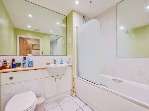
- A compact property with a reception room combined with a kitchen, a bedroom, and a bathroom.
- A one-bedroom apartment featuring a large reception room with kitchen area and a patio.
- First floor flat with reception/kitchen and bedroom
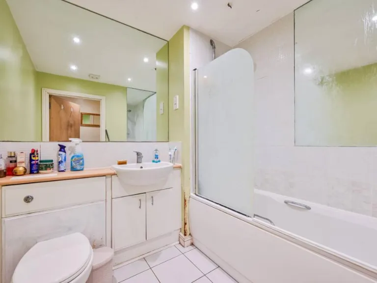
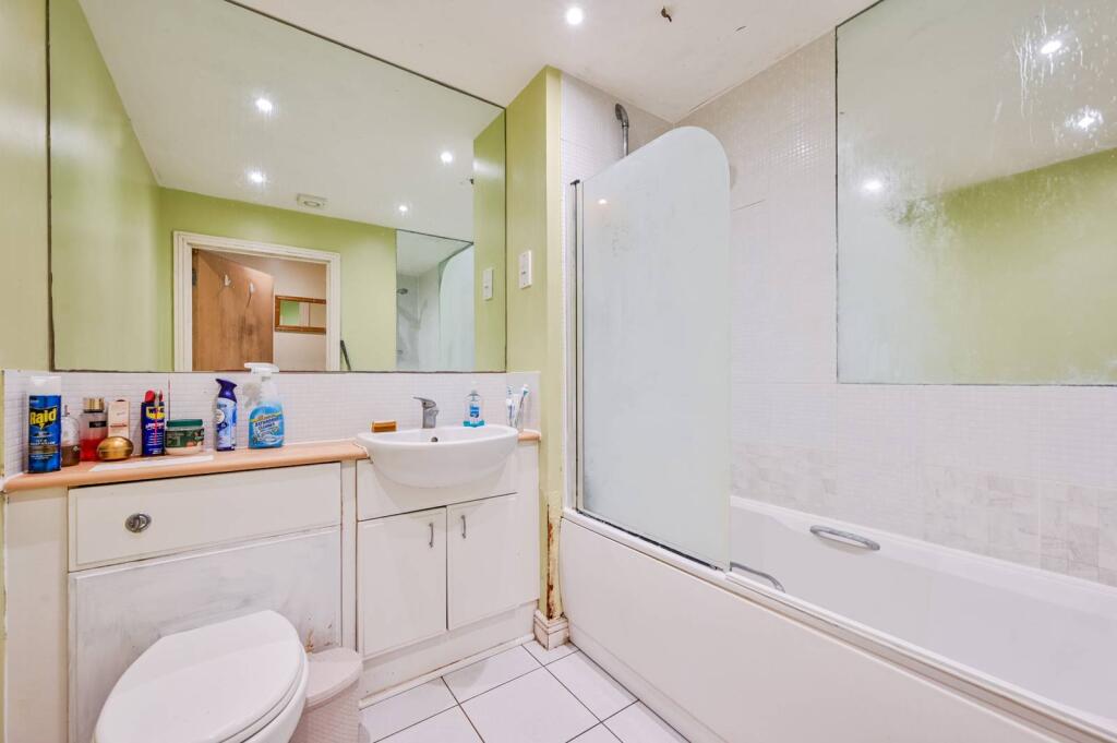
- First floor flat with reception room/kitchen, bedroom and bathroom.
- One-bedroom apartment with reception room/kitchen and bathroom, leading to a patio.
Rooms
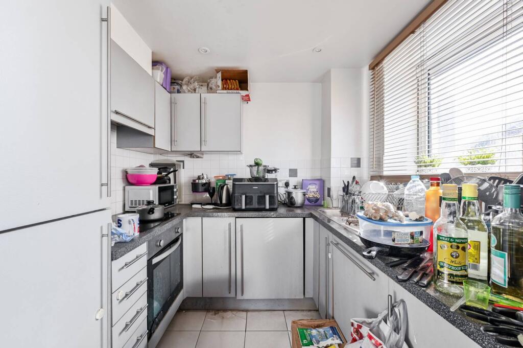
- Reception Room / Kitchen: large
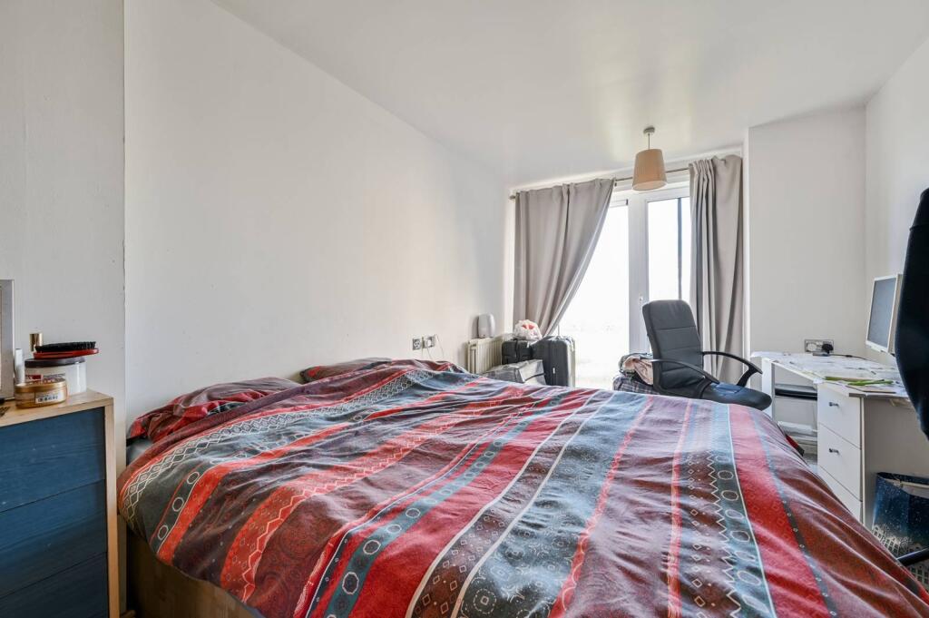
- Bedroom: average
- Reception Room / Kitchen: large
- Bedroom: average
- Reception Room / Kitchen: Large
- Bedroom: Average
- Bathroom: Small
- RECEPTION ROOM / KITCHEN:
- BEDROOM:
- RECEPTION ROOM / KITCHEN:
- BEDROOM:
- :
- RECEPTION ROOM / KITCHEN:
- BEDROOM:
Textual Property Features
Detected Visual Features
- modern
- apartment
- building
- urban
- mid-rise
- contemporary
- city living
- balconies
- glass facade
- living room
- French doors
- outdoor access
- bright
- compact
- cozy
EPC Details
- Fully double glazed
- Cavity wall, as built, insulated (assumed)
- Boiler and radiators, mains gas
- Low energy lighting in all fixed outlets
- To external air, limited insulation (assumed)
Nearby Schools
- Eglinton Primary School
- Greenslade Primary School
- Notre Dame Catholic Primary School
- Nightingale Primary School
- Plumcroft Primary School
- Rockliffe Manor Primary School
- St Peter's Catholic Primary School
- Bannockburn Primary School
- Mulgrave Primary School
- Winsor Primary School
- Timbercroft Primary School
- Plumstead Manor School
- St Patrick's Catholic Primary School
- Saint Mary Magdalene Church of England All Through School
- St Thomas A Becket Roman Catholic Primary School
- Heronsgate Primary School
- Discovery Primary School
- London Design and Engineering UTC
- Gallions Primary School
- St Margaret's Church of England Primary School
- Gallions Mount Primary School
- South Rise Primary School
- Foxfield Primary School
- Conway Primary School
- Woodhill Primary School
- Cardwell Primary School
Nearest General Shops
- Id: 1546952839
- Tags:
- Brand: Halfords Autocentre
- Brand:wikidata: Q5641894
- Check_date: 2022-11-21
- Level: 0
- Name: Halfords Autocentre
- Payment:
- Credit_cards: yes
- Debit_cards: yes
- Mastercard: yes
- Visa: yes
- Shop: car_repair
- Source: Local knowledge
- TagsNormalized:
- autocentre
- halfords
- halfords autocentre
- car repair
- repair
- shop
- Lat: 51.4922283
- Lon: 0.0842258
- FullGeoHash: u10hcvv7fx56
- PartitionGeoHash: u10h
- Images:
- FoodStandards: null
- Distance: 631.4
,- Id: 8930552131
- Tags:
- Addr:
- City: London
- Postcode: SE18 6ST
- Street: Artillery Square
- Amenity: marketplace
- Contact:
- Twitter: https://twitter.com/rafarmersmkt
- Description: Bi-monthly market (second and last Saturday of the month)
- Name: Royal Arsenal Farmers Market
- Shop: farm
- TagsNormalized:
- marketplace
- farmers
- farmers market
- farm
- shop
- Lat: 51.4939332
- Lon: 0.0693213
- FullGeoHash: u10hcw4mzkcs
- PartitionGeoHash: u10h
- Images:
- FoodStandards: null
- Distance: 594
,- Id: 8781000047
- Tags:
- Name: Sam's Unisex Salon
- Shop: hairdresser
- TagsNormalized:
- Lat: 51.4940518
- Lon: 0.082901
- FullGeoHash: u10hcyhqedzr
- PartitionGeoHash: u10h
- Images:
- FoodStandards: null
- Distance: 440.3
}
Nearest Grocery shops
- Id: 10089729091
- Tags:
- Addr:
- City: London
- Postcode: SE18 6FL
- Street: Plumstead Road
- Brand: Sainsbury's Local
- Brand:wikidata: Q13218434
- Contact:
- Phone: +44 20 8855 9699
- Website: https://stores.sainsburys.co.uk/6192/woolwich-arsenal-local
- Name: Sainsbury's Local
- Opening_hours: Mo-Su 07:00-23:00
- Shop: convenience
- TagsNormalized:
- sainsburys
- sainsburys local
- convenience
- shop
- Lat: 51.4913269
- Lon: 0.0718574
- FullGeoHash: u10hctsqdrhc
- PartitionGeoHash: u10h
- Images:
- FoodStandards: null
- Distance: 633.8
,- Id: 3932136288
- Tags:
- Addr:
- City: Woolwich
- Housenumber: 10
- Postcode: SE18 6GD
- Street: Major Draper Street
- Branch: Woolwich Express
- Brand: Tesco Express
- Brand:wikidata: Q98456772
- Contact:
- Website: https://www.tesco.com/store-locator/london/10-major-draper-st
- Name: Tesco Express
- Opening_hours: Mo-Su 07:00-23:00
- Shop: convenience
- TagsNormalized:
- tesco
- tesco express
- convenience
- shop
- Lat: 51.4924534
- Lon: 0.0713543
- FullGeoHash: u10hctgvq9j9
- PartitionGeoHash: u10h
- Images:
- FoodStandards: null
- Distance: 563
,- Id: 1870777594
- Tags:
- Name: T. West Supermarket
- Shop: convenience
- TagsNormalized:
- Lat: 51.4940843
- Lon: 0.0830936
- FullGeoHash: u10hcyhwb1p1
- PartitionGeoHash: u10h
- Images:
- FoodStandards: null
- Distance: 450.5
}
Nearest Religious buildings
- Id: 839523498
- Tags:
- Amenity: place_of_worship
- Building: church
- Denomination: anglican
- Name: St John's Church
- Religion: christian
- Wikidata: Q105076481
- TagsNormalized:
- place of worship
- church
- anglican
- christian
- Lat: 51.4871082
- Lon: 0.081292
- FullGeoHash: u10hcugnnhxe
- PartitionGeoHash: u10h
- Images:
- FoodStandards: null
- Distance: 1017.8
,- Id: 441306444
- Tags:
- Amenity: place_of_worship
- Denomination: seventh_day_adventist
- Name: Seventh Day Adventist Church
- Religion: christian
- TagsNormalized:
- place of worship
- adventist
- seventh day adventist
- church
- christian
- Lat: 51.4894656
- Lon: 0.0866766
- FullGeoHash: u10hcvr5gsnf
- PartitionGeoHash: u10h
- Images:
- FoodStandards: null
- Distance: 967.8
,- Id: 1093781495
- Tags:
- Amenity: place_of_worship
- Building: yes
- Name: Greenwich Islamic Centre
- Religion: muslim
- TagsNormalized:
- place of worship
- islamic
- muslim
- mosque
- Lat: 51.4903258
- Lon: 0.0826665
- FullGeoHash: u10hcvs0yk2t
- PartitionGeoHash: u10h
- Images:
- FoodStandards: null
- Distance: 724.5
}
Nearest Medical buildings
- Id: 1489581444
- Tags:
- Amenity: dentist
- Healthcare: dentist
- Name: Heronsgate Medical Centre
- TagsNormalized:
- Lat: 51.4933018
- Lon: 0.082466
- FullGeoHash: u10hcyh41x5j
- PartitionGeoHash: u10h
- Images:
- FoodStandards: null
- Distance: 461.4
,- Id: 8462320758
- Tags:
- Amenity: pharmacy
- Dispensing: yes
- Healthcare: pharmacy
- Name: Royal Arsenal Pharmacy
- TagsNormalized:
- Lat: 51.4925605
- Lon: 0.0734673
- FullGeoHash: u10hctvmzuvp
- PartitionGeoHash: u10h
- Images:
- FoodStandards: null
- Distance: 457.3
,- Id: 181747675
- Tags:
- Amenity: doctors
- Building: yes
- Healthcare: doctor
- Name: Heronsgate Medical Centre
- TagsNormalized:
- doctor
- doctors
- health
- healthcare
- Lat: 51.4933486
- Lon: 0.0823156
- FullGeoHash: u10hcy5fqpfv
- PartitionGeoHash: u10h
- Images:
- FoodStandards: null
- Distance: 450
,- Id: 1870777170
- Tags:
- Amenity: pharmacy
- Healthcare: pharmacy
- Name: Vantage Pharmacy Whinchat Chemist
- TagsNormalized:
- pharmacy
- health
- healthcare
- chemist
- Lat: 51.4940084
- Lon: 0.0828112
- FullGeoHash: u10hcyhq3dut
- PartitionGeoHash: u10h
- Images:
- FoodStandards: null
- Distance: 437.2
}
Nearest Airports
- Id: 260720166
- Tags:
- Aerodrome: international
- Aeroway: aerodrome
- Alt_name: Gatwick Airport
- Ele: 62
- Iata: LGW
- Icao: EGKK
- Internet_access: wlan
- Internet_access:fee: no
- Internet_access:ssid: Gatwick FREE Wi-Fi
- Name: London Gatwick Airport
- Operator: Gatwick Airport Limited
- Ref: LGW
- Website: https://www.gatwickairport.com/
- Wikidata: Q8703
- Wikipedia: en:Gatwick Airport
- TagsNormalized:
- airport
- international airport
- Lat: 51.1540917
- Lon: -0.1883773
- FullGeoHash: gcpg58qf4mzd
- PartitionGeoHash: gcpg
- Images:
- FoodStandards: null
- Distance: 42254.6
,- Id: 121158889
- Tags:
- Aerodrome: continental
- Aeroway: aerodrome
- Fhrs:
- Authority: City of London Corporation
- Iata: LCY
- Icao: EGLC
- Name: London City Airport
- Operator: London City Airport Limited
- Ref: LCY
- Website: https://www.londoncityairport.com/
- Wikidata: Q8982
- Wikipedia: en:London City Airport
- TagsNormalized:
- airport
- continental airport
- Lat: 51.5042658
- Lon: 0.0539987
- FullGeoHash: u10j10p64702
- PartitionGeoHash: u10j
- Images:
- FoodStandards: null
- Distance: 1860.4
,- Id: 103894219
- Tags:
- Aerodrome: international
- Aeroway: aerodrome
- Iata: SEN
- Icao: EGMC
- Name: London Southend Airport
- Old_name: Southend Municipal Airport
- Ref: SEN
- Wikidata: Q1415441
- TagsNormalized:
- airport
- international airport
- Lat: 51.5701749
- Lon: 0.6924624
- FullGeoHash: u10mru04p937
- PartitionGeoHash: u10m
- Images:
- FoodStandards: null
- Distance: 43345.3
}
Nearest Leisure Facilities
- Id: 161420854
- Tags:
- Access: private
- Addr:
- Housename: Royal Arsenal Gym
- Postcode: SE18 6SS
- Street: Duke of Wellington Avenue
- Building: yes
- Designation: Residents Only
- Leisure: fitness_centre
- Name: Royal Arsenal Gym
- TagsNormalized:
- fitness
- fitness centre
- leisure
- gym
- Lat: 51.4929336
- Lon: 0.0726044
- FullGeoHash: u10hcwhb5f9c
- PartitionGeoHash: u10h
- Images:
- FoodStandards: null
- Distance: 463.8
,- Id: 1009971106
- Tags:
- Addr:
- City: London
- Housenumber: 6
- Postcode: SE18 6SW
- Street: Gunnery Terrace
- Building: commercial
- Building:levels: 2
- Leisure: fitness_centre
- Name: 7R Gym
- TagsNormalized:
- fitness
- fitness centre
- leisure
- gym
- Lat: 51.4923022
- Lon: 0.0745435
- FullGeoHash: u10hctyk2uze
- PartitionGeoHash: u10h
- Images:
- FoodStandards: null
- Distance: 444.4
,- Id: 27118908
- Tags:
- TagsNormalized:
- Lat: 51.4929466
- Lon: 0.0745241
- FullGeoHash: u10hcwn20scp
- PartitionGeoHash: u10h
- Images:
- FoodStandards: null
- Distance: 381.6
,- Id: 26987465
- Tags:
- Access: no
- Leisure: park
- Name: Wellington Park
- Note: please keep off the grass
- Surface: grass
- TagsNormalized:
- Lat: 51.4935281
- Lon: 0.0738147
- FullGeoHash: u10hcwjg8125
- PartitionGeoHash: u10h
- Images:
- FoodStandards: null
- Distance: 358.2
,- Id: 810576962
- Tags:
- Leisure: park
- Name: Royal Arsenal Thames Path Garden
- TagsNormalized:
- Lat: 51.4954545
- Lon: 0.0734251
- FullGeoHash: u10hcwmqybmx
- PartitionGeoHash: u10h
- Images:
- FoodStandards: null
- Distance: 272.3
}
Nearest Tourist attractions
- Id: 7999204685
- Tags:
- Name: Thalía
- Tourism: apartment
- TagsNormalized:
- Lat: 51.4926366
- Lon: 0.0688189
- FullGeoHash: u10hctfn7e5j
- PartitionGeoHash: u10h
- Images:
- FoodStandards: null
- Distance: 690.5
,- Id: 7999204585
- Tags:
- Addr:
- Name: Minotaur house
- Tourism: apartment
- TagsNormalized:
- Lat: 51.4929246
- Lon: 0.06886
- FullGeoHash: u10hcw40h8ce
- PartitionGeoHash: u10h
- Images:
- FoodStandards: null
- Distance: 671.6
,- Id: 8001029312
- Tags:
- Addr:
- Housenumber: 5
- Street: thunderer walk
- Name: Amphion
- Name:en: Amphion house
- Tourism: apartment
- TagsNormalized:
- Lat: 51.4928584
- Lon: 0.069225
- FullGeoHash: u10hctfrth9c
- PartitionGeoHash: u10h
- Images:
- FoodStandards: null
- Distance: 653.6
}
Nearest Bus stations and stops
- Id: 469771975
- Tags:
- Bus: yes
- Highway: bus_stop
- Name: Heronsgate Primary School
- Naptan:
- AtcoCode: 490008098S
- Bearing: N
- CommonName: Heronsgate Primary School
- Street: WHINCHAT ROAD
- Public_transport: platform
- Shelter: yes
- TagsNormalized:
- Lat: 51.4936093
- Lon: 0.0828458
- FullGeoHash: u10hcyhk42w2
- PartitionGeoHash: u10h
- Images:
- FoodStandards: null
- Distance: 462.3
,- Id: 469785336
- Tags:
- Bus: yes
- Highway: bus_stop
- Local_ref: WT
- Name: Tom Cribb Road
- Naptan:
- AtcoCode: 490013703S
- Bearing: S
- CommonName: Tom Cribb Road
- Indicator: Stop WT
- Street: BROADWATER ROAD
- Public_transport: platform
- TagsNormalized:
- Lat: 51.4922692
- Lon: 0.0801962
- FullGeoHash: u10hcvfkhwww
- PartitionGeoHash: u10h
- Images:
- FoodStandards: null
- Distance: 452.6
,- Id: 469785333
- Tags:
- Bus: yes
- Highway: bus_stop
- Local_ref: S
- Name: Tom Cribb Road
- Naptan:
- AtcoCode: 490013703N
- Bearing: N
- CommonName: Tom Cribb Road
- Indicator: Stop S
- Street: BROADWATER ROAD
- Public_transport: platform
- TagsNormalized:
- Lat: 51.4925882
- Lon: 0.0800622
- FullGeoHash: u10hcvfq1d4t
- PartitionGeoHash: u10h
- Images:
- FoodStandards: null
- Distance: 416.8
,- Id: 469766273
- Tags:
- Bus: yes
- Highway: bus_stop
- Name: Carronade Place
- Naptan:
- AtcoCode: 490004816S
- Bearing: N
- CommonName: Carronade Place
- Street: BROADWATER ROAD
- Public_transport: platform
- TagsNormalized:
- Lat: 51.4937679
- Lon: 0.080789
- FullGeoHash: u10hcy4ufw0d
- PartitionGeoHash: u10h
- Images:
- FoodStandards: null
- Distance: 340.2
,- Id: 469766272
- Tags:
- Bus: yes
- Highway: bus_stop
- Name: Carronade Place
- Naptan:
- AtcoCode: 490004816N
- Bearing: N
- CommonName: Carronade Place
- Street: BROADWATER ROAD
- Public_transport: platform
- TagsNormalized:
- Lat: 51.4940457
- Lon: 0.08105
- FullGeoHash: u10hcy5n89g7
- PartitionGeoHash: u10h
- Images:
- FoodStandards: null
- Distance: 333.2
}
Nearest Hotels
- Id: 2959234563
- Tags:
- Brand: Travelodge
- Brand:wikidata: Q9361374
- Internet_access: wlan
- Internet_access:fee: customers
- Internet_access:ssid: Travelodge WiFi
- Name: Travelodge Hotel
- Tourism: hotel
- TagsNormalized:
- Lat: 51.4927255
- Lon: 0.0617961
- FullGeoHash: u10hcmuyzgy8
- PartitionGeoHash: u10h
- Images:
- FoodStandards: null
- Distance: 1129.7
,- Id: 10095832951
- Tags:
- Brand: Travelodge
- Brand:wikidata: Q9361374
- Internet_access: wlan
- Internet_access:fee: customers
- Internet_access:ssid: Travelodge WiFi
- Name: Travelodge
- Tourism: hotel
- TagsNormalized:
- Lat: 51.4923324
- Lon: 0.0630677
- FullGeoHash: u10hcmvutd6x
- PartitionGeoHash: u10h
- Images:
- FoodStandards: null
- Distance: 1062.1
,- Id: 748824064
- Tags:
- Addr:
- City: London
- Housenumber: 91
- Postcode: SE18 6BF
- Street: Beresford Street
- Suburb: Woolwich
- Branch: London Woolwich
- Brand: Premier Inn
- Brand:wikidata: Q2108626
- Building: yes
- Building:levels: 6
- Internet_access: wlan
- Internet_access:fee: customers
- Internet_access:operator: Virgin Media
- Internet_access:ssid: Premier Inn Free Wi-Fi
- Name: Premier Inn London Woolwich
- Tourism: hotel
- TagsNormalized:
- Lat: 51.4926863
- Lon: 0.0675913
- FullGeoHash: u10hctcnwurw
- PartitionGeoHash: u10h
- Images:
- FoodStandards: null
- Distance: 761.3
}
Tags
- modern
- apartment
- building
- urban
- mid-rise
- contemporary
- city living
- balconies
- glass facade
- contemporary
- living room
- French doors
- outdoor access
- bright
- compact
- cozy
Local Market Stats
- Average Price/sqft: £425
- Avg Income: £48800
- Rental Yield: 6%
- Social Housing: 33%
- Planning Success Rate: 66%
AirBnB Data
- 1km average: £145/night
- Listings in 1km: 21
Similar Properties
 2 bedroom flat for sale in Sark Tower, Thamesmead, London, SE28 — £310,000 • 2 bed • 2 bath • 920 ft²
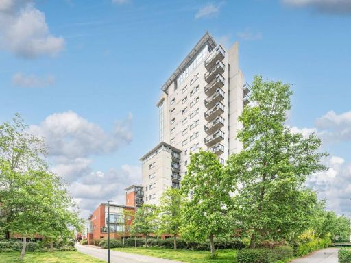 2 bedroom flat for sale in Sark Tower, Thamesmead, London, SE28 — £370,000 • 2 bed • 2 bath • 871 ft²
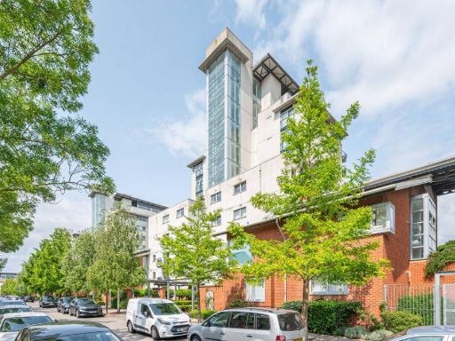 1 bedroom flat for sale in Granary Mansions, Thamesmead, London, SE28 — £245,000 • 1 bed • 1 bath • 618 ft²
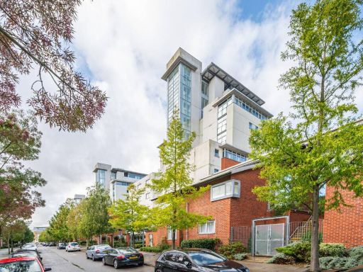 2 bedroom flat for sale in Granary Mansions, Thamesmead, London, SE28 — £330,000 • 2 bed • 2 bath • 936 ft²
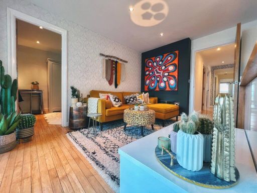 3 bedroom flat for sale in Tideslea Tower, Thamesmead, London, SE28 — £399,999 • 3 bed • 2 bath • 785 ft²
 2 bedroom apartment for sale in Greenhaven Drive, London, SE28 — £250,000 • 2 bed • 1 bath • 549 ft²
Meta
- {
"@context": "https://schema.org",
"@type": "Residence",
"name": "1 bedroom flat for sale in Wyatt Point, Thamesmead, London,…",
"description": "",
"url": "https://propertypiper.co.uk/property/2b18f19a-7214-4dff-9141-a8830ce88875",
"image": "https://image-a.propertypiper.co.uk/d800d7ec-00ce-4aba-80d0-da4eac9c2652-1024.jpeg",
"address": {
"@type": "PostalAddress",
"streetAddress": "WYATT POINT 4 EREBUS DRIVE LONDON",
"postalCode": "SE28 0GL",
"addressLocality": "Greenwich",
"addressRegion": "Greenwich and Woolwich",
"addressCountry": "England"
},
"geo": {
"@type": "GeoCoordinates",
"latitude": 51.49591517209158,
"longitude": 0.07728899158751135
},
"numberOfRooms": 1,
"numberOfBathroomsTotal": 1,
"floorSize": {
"@type": "QuantitativeValue",
"value": 499,
"unitCode": "FTK"
},
"offers": {
"@type": "Offer",
"price": 245000,
"priceCurrency": "GBP",
"availability": "https://schema.org/InStock"
},
"additionalProperty": [
{
"@type": "PropertyValue",
"name": "Feature",
"value": "modern"
},
{
"@type": "PropertyValue",
"name": "Feature",
"value": "apartment"
},
{
"@type": "PropertyValue",
"name": "Feature",
"value": "building"
},
{
"@type": "PropertyValue",
"name": "Feature",
"value": "urban"
},
{
"@type": "PropertyValue",
"name": "Feature",
"value": "mid-rise"
},
{
"@type": "PropertyValue",
"name": "Feature",
"value": "contemporary"
},
{
"@type": "PropertyValue",
"name": "Feature",
"value": "city living"
},
{
"@type": "PropertyValue",
"name": "Feature",
"value": "balconies"
},
{
"@type": "PropertyValue",
"name": "Feature",
"value": "glass facade"
},
{
"@type": "PropertyValue",
"name": "Feature",
"value": "contemporary"
},
{
"@type": "PropertyValue",
"name": "Feature",
"value": "living room"
},
{
"@type": "PropertyValue",
"name": "Feature",
"value": "French doors"
},
{
"@type": "PropertyValue",
"name": "Feature",
"value": "outdoor access"
},
{
"@type": "PropertyValue",
"name": "Feature",
"value": "bright"
},
{
"@type": "PropertyValue",
"name": "Feature",
"value": "compact"
},
{
"@type": "PropertyValue",
"name": "Feature",
"value": "cozy"
}
]
}
High Res Floorplan Images
Compatible Floorplan Images
FloorplanImages Thumbnail