ST10 4DR - 3 bedroom detached house for sale in Cheadle Road, Tean, ST…
View on Property Piper
3 bedroom detached house for sale in Cheadle Road,
Tean,
ST10 4DR, ST10
Property Details
- Price: £299950
- Bedrooms: 3
- Bathrooms: 1
- Property Type: undefined
- Property SubType: undefined
Brochure Descriptions
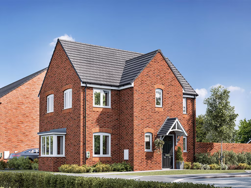
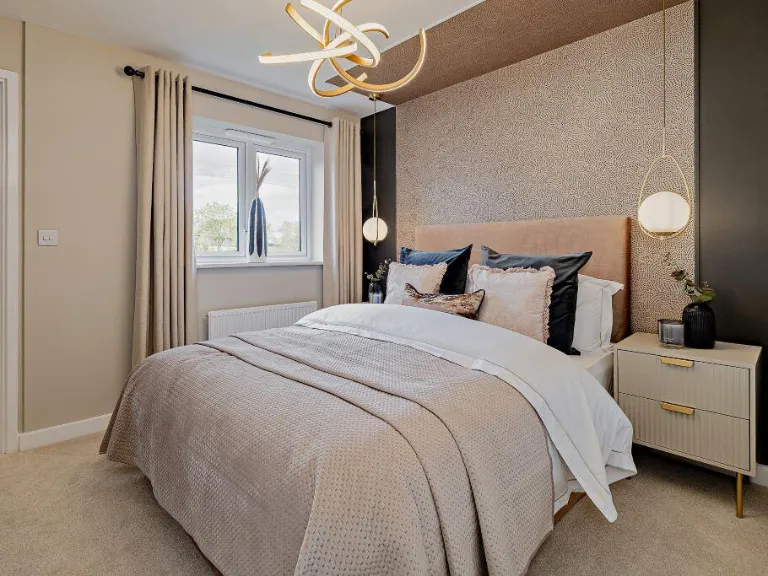
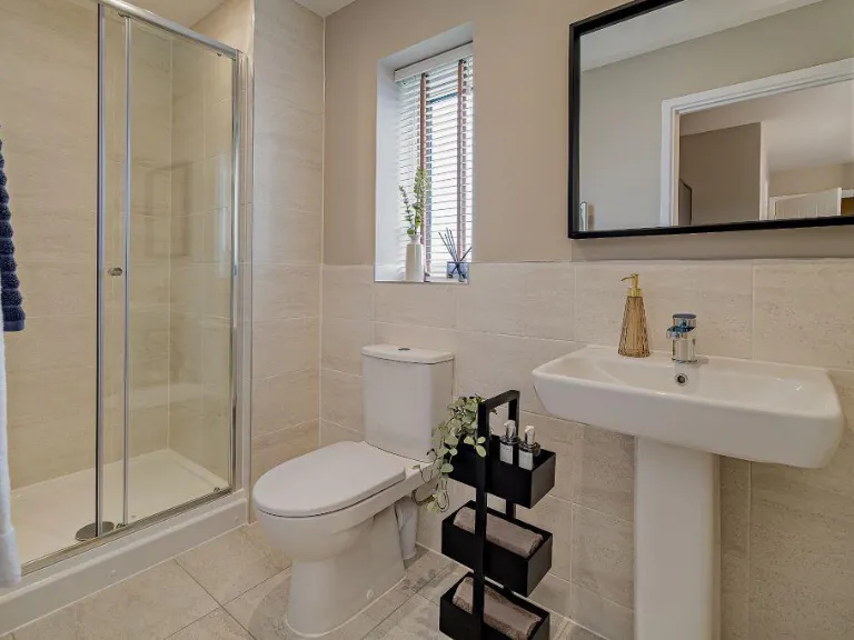
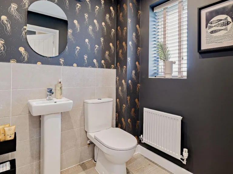
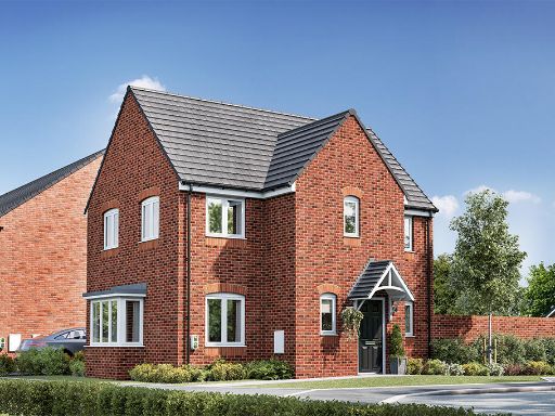
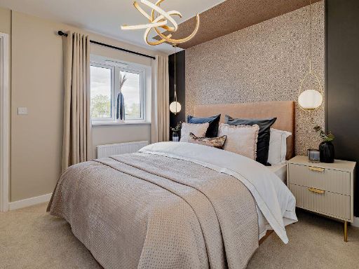
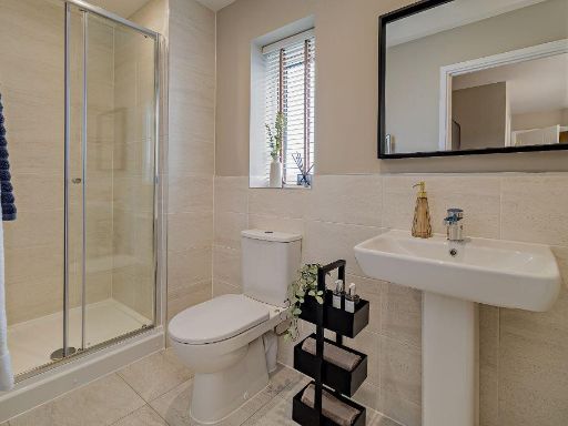
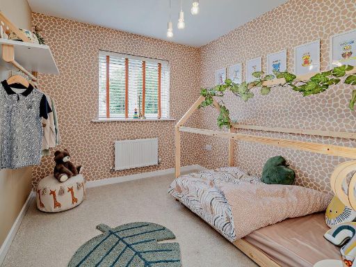
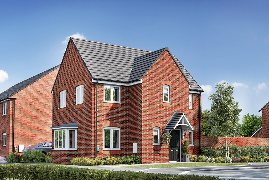
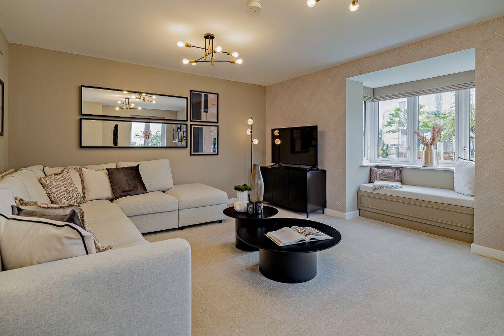
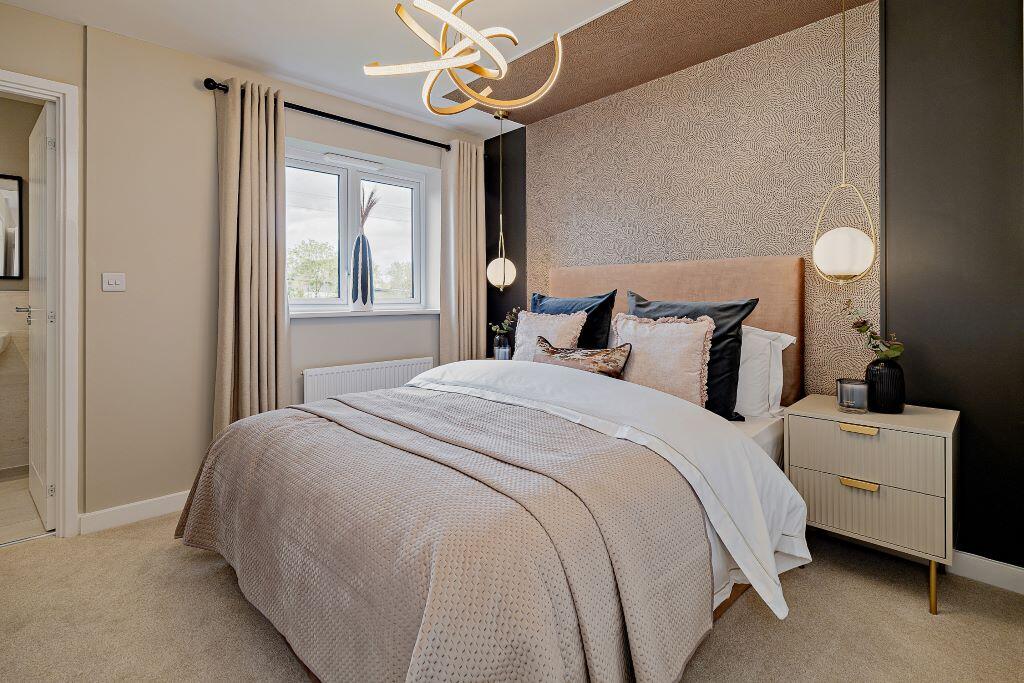
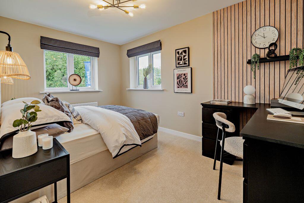
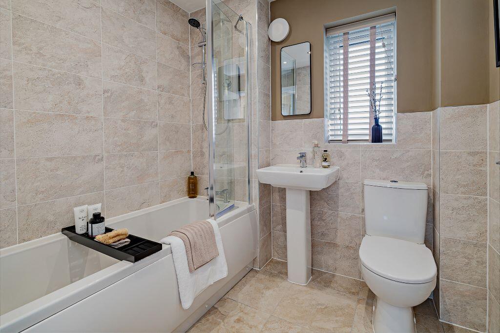
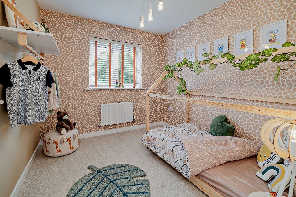
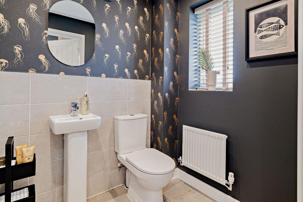
- Modern new-build residential property in a planned development (Mill Place) in Upper Tean. The brochure shows a three-storey townhouse/detached corner house with pitched roof and dormer-style third floor — typical new-build town house elevations with brick lower floors and render/light cladding to upper levels. Setting appears suburban with a street-facing aspect and small front landscaping; adjoining similar properties form a medium-sized housing estate. As seen, the property would offer compact-to-average private outdoor space (small front garden and likely modest rear garden) and internal accommodation spread over three floors providing flexible living and bedroom space. Overall property footprint is consistent with mid-sized family housing in a modern development; no exceptional views (sea/river/woodland) are visible from the image.
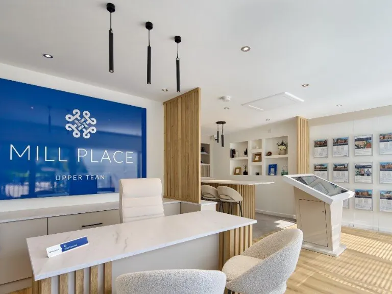
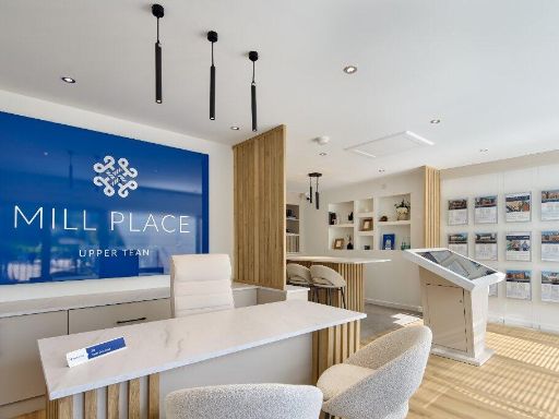
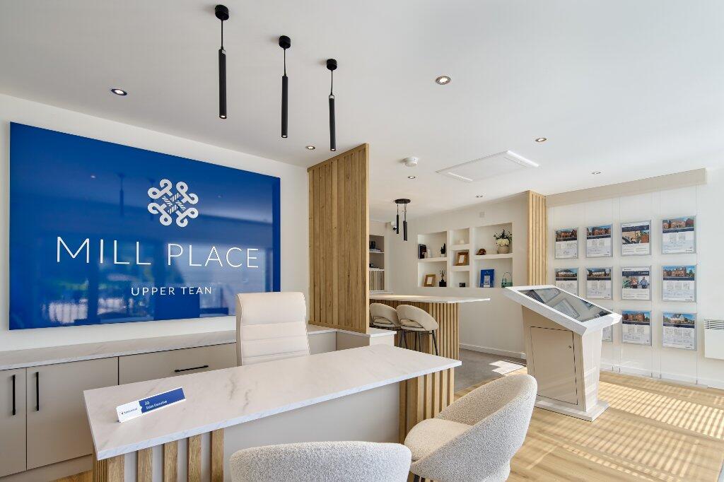
- New-build residential development marketed as "Mill Place" in Upper Tean. Brochure cover indicates a purpose-built scheme by Keepmoat, aligned with the New Homes Quality Code, suggesting modern construction standards and a developer-led finish. The marketing style implies a small-to-medium sized development of contemporary houses or apartments in a village setting (Upper Tean). No interior or external images are provided here, so room count, exact plot sizes and amenity detail cannot be determined. Overall impression: a newly constructed, developer-managed residential scheme offering modern specification and likely aimed at owner-occupiers or first-time buyers in a semi-rural/local village location.
Image Descriptions
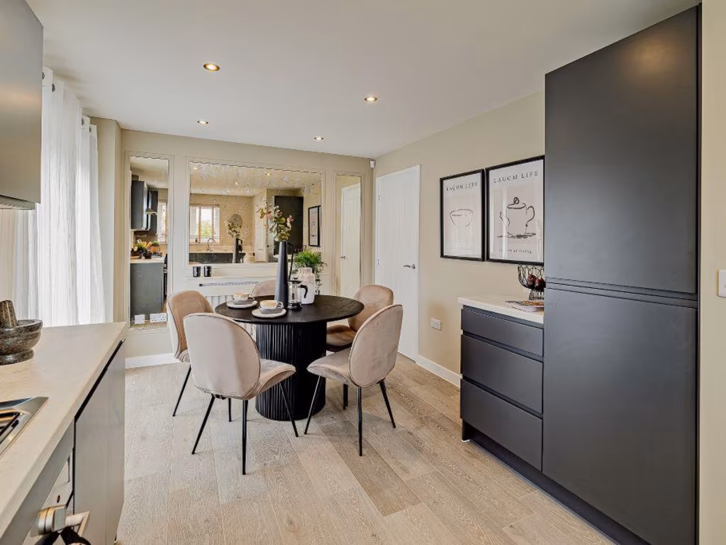
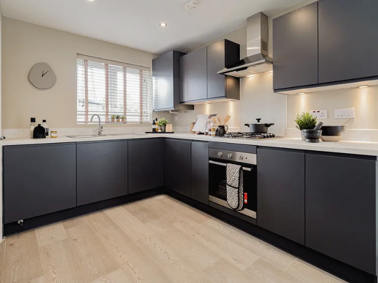
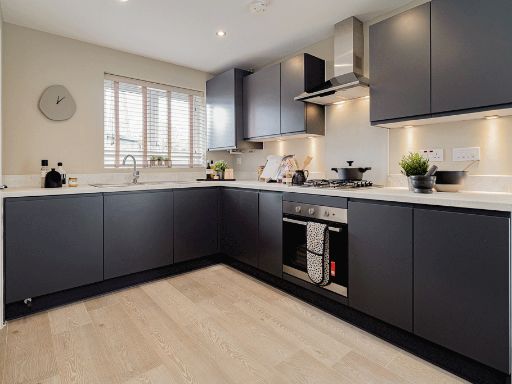
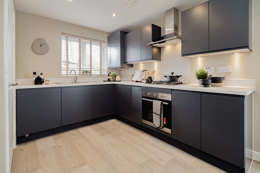
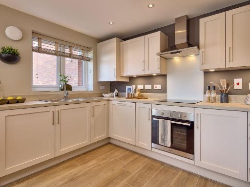
- modern kitchen modern
- modern residential home contemporary
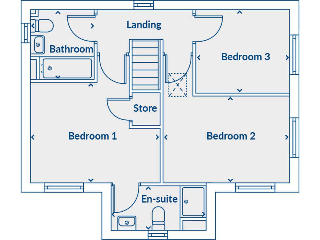
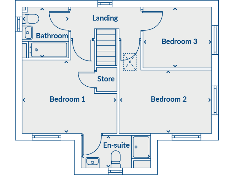
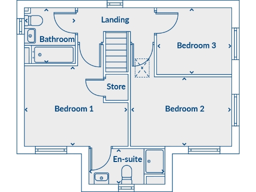
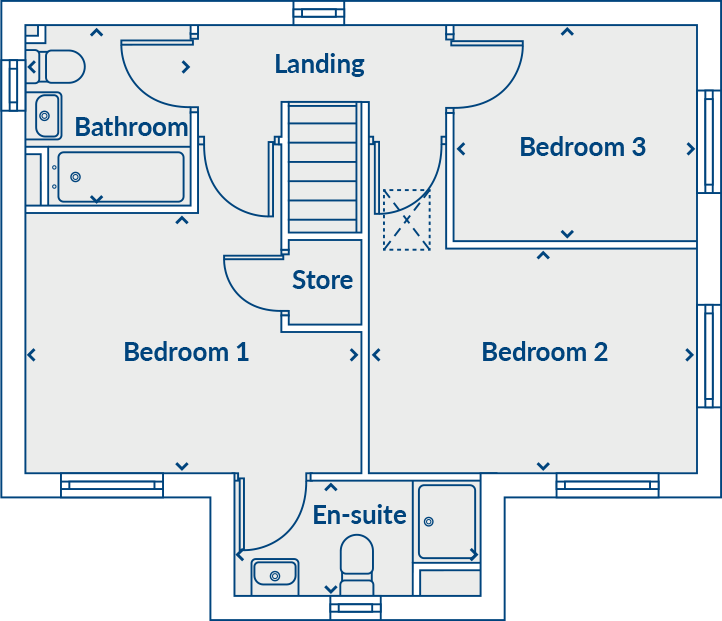
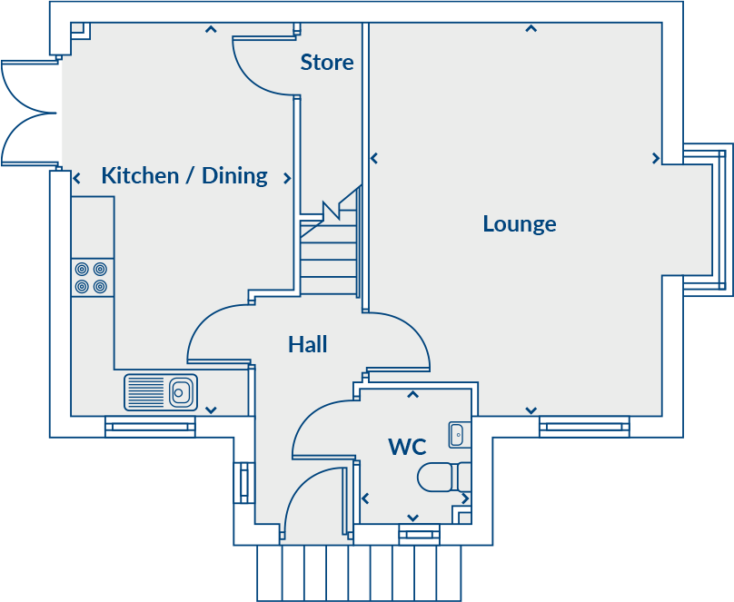
Floorplan Description
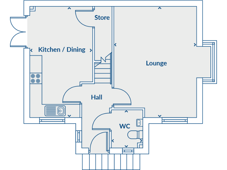
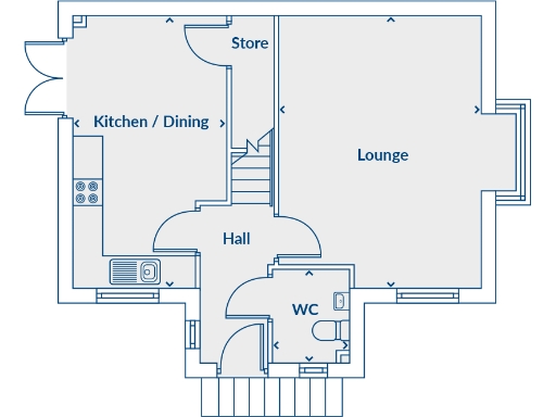
- Ground floor plan showing Kitchen / Dining, Store, Lounge, Hall and WC.
Rooms
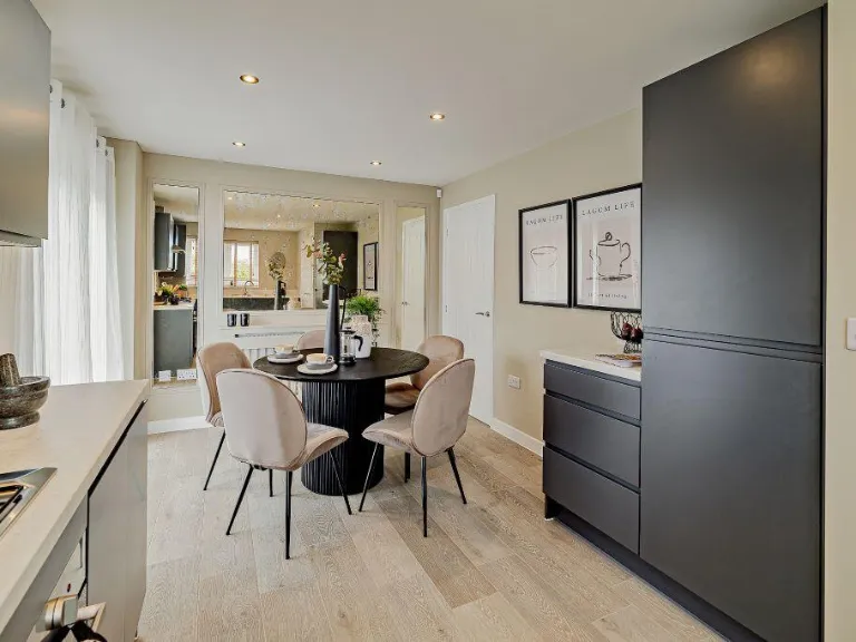
- Kitchen / Dining:
- Store:
- Lounge:
- Hall:
- WC:
- Landing:
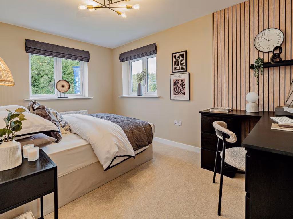
- Bedroom 3:
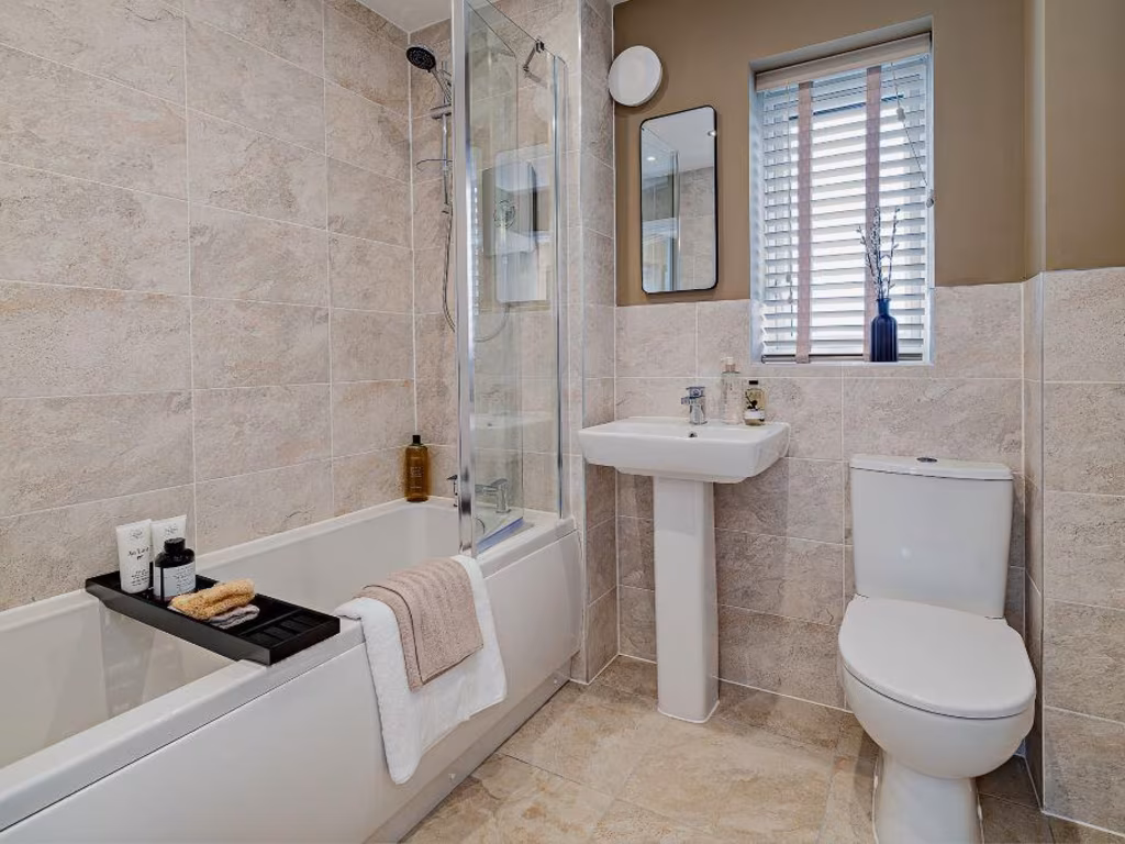
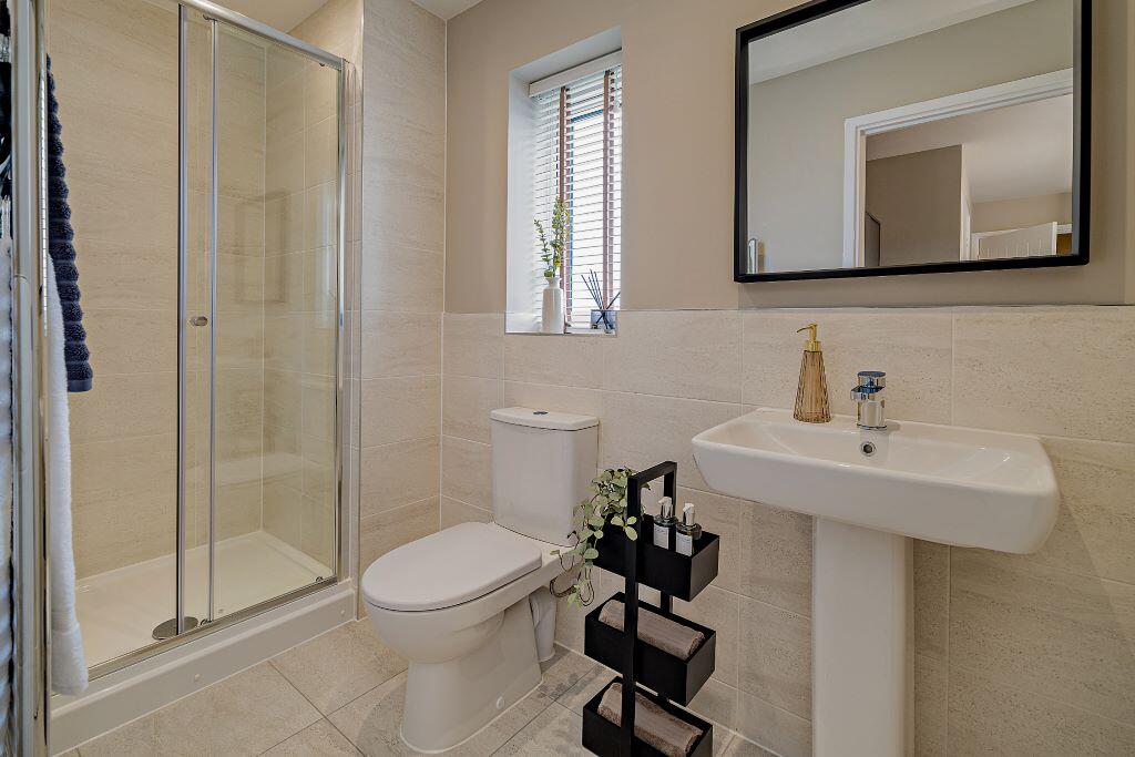
- Bathroom:
- Bedroom 1:
- Store:
- Bedroom 2:
- En-suite:
- Kitchen / Dining:
- Store:
- Lounge:
- Hall:
- WC:
Textual Property Features
Detected Visual Features
- modern kitchen
- contemporary
- sleek design
- stainless steel appliances
- wood flooring
- neutral colors
- U-shaped layout
- modern
- brick exterior
- new build
- suburban
- two-story
- detached
- driveway
- roof tiles
EPC Details
- Mostly double glazing
- Solid brick, as built, no insulation (assumed)
- Boiler and radiators, mains gas
- Low energy lighting in 40% of fixed outlets
- Solid, no insulation (assumed)
Nearby Schools
- The Faber Catholic Primary School
- Bramshall Meadows First School
- Cheadle Primary School
- Bishop Rawle CofE Primary School
- Blythe Bridge High School
- The Crescent Academy
- Weston Junior Academy
- The Valley Primary School
- All Saints' CofE First School
- Great Wood Community Primary School
- The William Amory Primary School
- Springcroft Primary School
- Forsbrook CofE Controlled Primary School
- St Filumena's Catholic Primary School
- St Werburgh's CE (A) Primary School
- Painsley Catholic College
- The Cheadle Academy
- St Giles Catholic Primary School
- Moorside High School
- Hutchinson Memorial CofE First School
- St Thomas' Catholic Primary School
- St Peter's CofE Academy Alton
- Fulford Primary School
- Dilhorne Endowed CofE Primary School
- Weston Infant Academy
Nearest Bars And Restaurants
- Id: 1234725752
- Tags:
- Amenity: pub
- Name: The Anchor
- TagsNormalized:
- Lat: 52.9615093
- Lon: -1.9910616
- FullGeoHash: gcqt69q5huuu
- PartitionGeoHash: gcqt
- Images:
- FoodStandards: null
- Distance: 478.9
,- Id: 9139825650
- Tags:
- Amenity: fast_food
- Cuisine: chinese
- Name: ru yi
- TagsNormalized:
- Lat: 52.9536446
- Lon: -1.9870129
- FullGeoHash: gcqt4zcj74zf
- PartitionGeoHash: gcqt
- Images:
- FoodStandards: null
- Distance: 446.8
,- Id: 305594468
- Tags:
- Addr:
- Postcode: ST10 4DY
- Street: High Street
- Amenity: pub
- Fhrs:
- Name: White Hart
- Source:
- TagsNormalized:
- Lat: 52.9537639
- Lon: -1.988268
- FullGeoHash: gcqt4zbnjcpc
- PartitionGeoHash: gcqt
- Images:
- FoodStandards: null
- Distance: 404.1
,- Id: 993298810
- Tags:
- Amenity: fast_food
- Building: yes
- Cuisine: fish_and_chips
- Name: tean fish bar
- Operator: tean fish bar
- TagsNormalized:
- Lat: 52.9541791
- Lon: -1.9873478
- FullGeoHash: gcqt6b0b7qqn
- PartitionGeoHash: gcqt
- Images:
- FoodStandards: null
- Distance: 383.6
,- Id: 991711825
- Tags:
- Amenity: pub
- Building: yes
- Name: cross keys ph
- TagsNormalized:
- Lat: 52.9556762
- Lon: -1.9883988
- FullGeoHash: gcqt6b214vw3
- PartitionGeoHash: gcqt
- Images:
- FoodStandards: null
- Distance: 203.7
}
Nearest General Shops
- Id: 9139825646
- Tags:
- Name: slades
- Shop: hairdresser
- TagsNormalized:
- Lat: 52.9535921
- Lon: -1.9865623
- FullGeoHash: gcqt4zcmj9pb
- PartitionGeoHash: gcqt
- Images:
- FoodStandards: null
- Distance: 466
,- Id: 9139825648
- Tags:
- Name: slades
- Shop: hairdresser
- TagsNormalized:
- Lat: 52.953601
- Lon: -1.9866408
- FullGeoHash: gcqt4zcm5ftq
- PartitionGeoHash: gcqt
- Images:
- FoodStandards: null
- Distance: 462.6
,- Id: 9139825649
- Tags:
- Name: Mandy's Cakes
- Shop: pastry
- TagsNormalized:
- Lat: 52.9536111
- Lon: -1.9868238
- FullGeoHash: gcqt4zcjpssf
- PartitionGeoHash: gcqt
- Images:
- FoodStandards: null
- Distance: 455.8
}
Nearest Grocery shops
- Id: 1232473360
- Tags:
- Addr:
- Housenumber: 131
- Postcode: ST10 1LS
- Street: Tean Road
- Brand: McColl's
- Brand:wikidata: Q16997477
- Fhrs:
- Name: McColl's
- Newspaper: yes
- Shop: convenience
- Source:
- TagsNormalized:
- Lat: 52.9783385
- Lon: -1.9866684
- FullGeoHash: gcqt6u3m5q0d
- PartitionGeoHash: gcqt
- Images:
- FoodStandards: null
- Distance: 2354.6
,- Id: 1287713595
- Tags:
- Name: Freehay Village Store
- Shop: convenience
- TagsNormalized:
- Lat: 52.9716204
- Lon: -1.9648783
- FullGeoHash: gcqt771np18x
- PartitionGeoHash: gcqt
- Images:
- FoodStandards: null
- Distance: 2317.1
,- Id: 3013802404
- Tags:
- Name: The Co-operative Food
- Shop: convenience
- TagsNormalized:
- the co-operative food
- food
- convenience
- shop
- Lat: 52.9535522
- Lon: -1.9859558
- FullGeoHash: gcqt4zcugcs4
- PartitionGeoHash: gcqt
- Images:
- FoodStandards: null
- Distance: 490.7
}
Nearest Religious buildings
- Id: 881264588
- Tags:
- Amenity: place_of_worship
- Building: church
- Denomination: anglican
- Name: St. Chad's Church
- Religion: christian
- Wikidata: Q26289698
- TagsNormalized:
- place of worship
- church
- anglican
- christian
- Lat: 52.9675515
- Lon: -1.9729368
- FullGeoHash: gcqt747q75r8
- PartitionGeoHash: gcqt
- Images:
- FoodStandards: null
- Distance: 1614.9
,- Id: 198766583
- Tags:
- Amenity: place_of_worship
- Building: yes
- Denomination: anglican
- Name: Upper Tean Christ Church
- Religion: christian
- Wikidata: Q105080813
- TagsNormalized:
- place of worship
- anglican
- church
- christian
- Lat: 52.9529232
- Lon: -1.9831427
- FullGeoHash: gcqt4zgcjkmd
- PartitionGeoHash: gcqt
- Images:
- FoodStandards: null
- Distance: 662.9
,- Id: 988068917
- Tags:
- Amenity: place_of_worship
- Building: yes
- TagsNormalized:
- Lat: 52.9548185
- Lon: -1.9856438
- FullGeoHash: gcqt6b4h5jss
- PartitionGeoHash: gcqt
- Images:
- FoodStandards: null
- Distance: 395.3
}
Nearest Medical buildings
- Id: 157395198
- Tags:
- Amenity: hospital
- Emergency: no
- Healthcare:
- Name: Cheadle Hosptal
- Operator: NHS
- Operator:type: government
- TagsNormalized:
- hospital
- general
- health
- healthcare
- Lat: 52.9844926
- Lon: -1.9906276
- FullGeoHash: gcqt6tw3p123
- PartitionGeoHash: gcqt
- Images:
- FoodStandards: null
- Distance: 3029
,- Id: 157394973
- Tags:
- Leisure: garden
- Name: Hospital Gardens
- TagsNormalized:
- Lat: 52.9840563
- Lon: -1.9903084
- FullGeoHash: gcqt6tqwqryq
- PartitionGeoHash: gcqt
- Images:
- FoodStandards: null
- Distance: 2980.2
,- Id: 9139825651
- Tags:
- Amenity: pharmacy
- Dispensing: yes
- Healthcare: pharmacy
- Name: tean pharmacy
- TagsNormalized:
- Lat: 52.9536551
- Lon: -1.9871195
- FullGeoHash: gcqt4zcj2ub2
- PartitionGeoHash: gcqt
- Images:
- FoodStandards: null
- Distance: 442.7
,- Id: 993298799
- Tags:
- Amenity: doctors
- Building: yes
- Healthcare: doctor
- TagsNormalized:
- doctor
- doctors
- health
- healthcare
- Lat: 52.9546875
- Lon: -1.9875095
- FullGeoHash: gcqt6b0ertjx
- PartitionGeoHash: gcqt
- Images:
- FoodStandards: null
- Distance: 328.7
}
Nearest Leisure Facilities
- Id: 140385157
- Tags:
- Leisure: garden
- Name: Ornamental Garden
- TagsNormalized:
- Lat: 52.9504643
- Lon: -1.9613749
- FullGeoHash: gcqt5r7fb9uy
- PartitionGeoHash: gcqt
- Images:
- FoodStandards: null
- Distance: 2057.2
,- Id: 159142344
- Tags:
- Leisure: park
- Name: Tean Recreation Ground
- TagsNormalized:
- Lat: 52.9531381
- Lon: -1.9887814
- FullGeoHash: gcqt4xzf6h3h
- PartitionGeoHash: gcqt
- Images:
- FoodStandards: null
- Distance: 464.4
,- Id: 9178464407
- Tags:
- TagsNormalized:
- Lat: 52.9533692
- Lon: -1.989285
- FullGeoHash: gcqt4xz7wr3x
- PartitionGeoHash: gcqt
- Images:
- FoodStandards: null
- Distance: 434.3
,- Id: 837904879
- Tags:
- TagsNormalized:
- Lat: 52.9595835
- Lon: -1.9875177
- FullGeoHash: gcqt6bbxzmzm
- PartitionGeoHash: gcqt
- Images:
- FoodStandards: null
- Distance: 305.5
,- Id: 167465538
- Tags:
- Leisure: park
- Name: Wentlows Playing Fields
- TagsNormalized:
- Lat: 52.9577747
- Lon: -1.9861674
- FullGeoHash: gcqt6b9tquwp
- PartitionGeoHash: gcqt
- Images:
- FoodStandards: null
- Distance: 259.3
}
Nearest Tourist attractions
- Id: 1417145387
- Tags:
- Name: Park View Guest House
- Tourism: guest_house
- TagsNormalized:
- Lat: 52.9836085
- Lon: -1.984347
- FullGeoHash: gcqt6v75ck7x
- PartitionGeoHash: gcqt
- Images:
- FoodStandards: null
- Distance: 2954.2
,- Id: 140384926
- Tags:
- Name: Ornamental Parterre Garden
- Tourism: attraction
- TagsNormalized:
- Lat: 52.9508565
- Lon: -1.9607064
- FullGeoHash: gcqt5rkm05p6
- PartitionGeoHash: gcqt
- Images:
- FoodStandards: null
- Distance: 2083.6
,- Id: 154563073
- Tags:
- Name: The Heath House
- Tourism: attraction
- Type: site
- TagsNormalized:
- Lat: 52.9503491
- Lon: -1.9638715
- FullGeoHash: gcqt5r3fnkrr
- PartitionGeoHash: gcqt
- Images:
- FoodStandards: null
- Distance: 1907.8
}
Nearest Train stations
- Id: 483375401
- Tags:
- Monorail: yes
- Name: Alton Towers Car Park
- Railway: station
- Station: monorail
- Tourism: attraction
- Usage: tourism
- TagsNormalized:
- railway
- station
- attraction
- tourism
- Lat: 52.9856788
- Lon: -1.8775033
- FullGeoHash: gcqtmm8zgn2j
- PartitionGeoHash: gcqt
- Images:
- FoodStandards: null
- Distance: 8165.6
,- Id: 1711412439
- Tags:
- Monorail: yes
- Name: Alton Towers Main Entrance
- Railway: station
- Station: monorail
- Tourism: attraction
- Usage: tourism
- TagsNormalized:
- railway
- station
- attraction
- tourism
- Lat: 52.9915619
- Lon: -1.8920461
- FullGeoHash: gcqtkyy60ph5
- PartitionGeoHash: gcqt
- Images:
- FoodStandards: null
- Distance: 7584.1
,- Id: 671328140
- Tags:
- Name: Kingsley & Froghall
- Naptan:
- Operator: Churnet Valley Railway
- Platforms: 2
- Public_transport: station
- Railway: station
- Tourism: heritage_railway
- Usage: tourism
- TagsNormalized:
- Lat: 53.0215468
- Lon: -1.9645057
- FullGeoHash: gcqtek32zswq
- PartitionGeoHash: gcqt
- Images:
- FoodStandards: null
- Distance: 7348.8
,- Id: 8361780629
- Tags:
- Name: Foxfield Colliery
- Public_transport: station
- Railway: station
- Usage: tourism
- TagsNormalized:
- Lat: 52.9984067
- Lon: -2.0369415
- FullGeoHash: gcqt98hdpg46
- PartitionGeoHash: gcqt
- Images:
- FoodStandards: null
- Distance: 5553.5
,- Id: 58978505
- Tags:
- Name: Blythe Bridge
- Naptan:
- Network: National Rail
- Public_transport: station
- Railway: station
- Ref:
- Source: GPS waypoint
- Wikidata: Q2525068
- Wikipedia: en:Blythe Bridge railway station
- TagsNormalized:
- Lat: 52.9678303
- Lon: -2.066925
- FullGeoHash: gcqt2fqzvpjp
- PartitionGeoHash: gcqt
- Images:
- FoodStandards: null
- Distance: 5288.6
}
Nearest Hotels
- Id: 492571949
- Tags:
- Amenity: pub
- Building: yes
- Name: Alton Bridge Hotel
- Outdoor_seating: yes
- Source:
- TagsNormalized:
- Lat: 52.979638
- Lon: -1.8949836
- FullGeoHash: gcqtkushg8mf
- PartitionGeoHash: gcqt
- Images:
- FoodStandards: null
- Distance: 6828.7
,- Id: 307085354
- Tags:
- Building: yes
- Name: The Weather Vane
- Tourism: hotel
- TagsNormalized:
- Lat: 52.971479
- Lon: -2.0869132
- FullGeoHash: gcqt2e0m5rks
- PartitionGeoHash: gcqt
- Images:
- FoodStandards: null
- Distance: 6684.5
,- Id: 62369256
- Tags:
- Building: yes
- Name: The Manor
- Tourism: hotel
- TagsNormalized:
- Lat: 52.9859036
- Lon: -1.9923268
- FullGeoHash: gcqt6tv1r2m6
- PartitionGeoHash: gcqt
- Images:
- FoodStandards: null
- Distance: 3189.5
}
Tags
- modern kitchen
- contemporary
- sleek design
- stainless steel appliances
- wood flooring
- neutral colors
- U-shaped layout
- modern
- contemporary
- brick exterior
- new build
- suburban
- two-story
- detached
- driveway
- roof tiles
Local Market Stats
- Average Price/sqft: £235
- Avg Income: £42000
- Social Housing: 5%
- Planning Success Rate: 82%
AirBnB Data
- 1km average: £110/night
- Listings in 1km: 2
Similar Properties
 4 bedroom detached house for sale in Cheadle Road,
Tean,
ST10 4DR, ST10 — £349,950 • 4 bed • 1 bath • 1287 ft²
4 bedroom detached house for sale in Cheadle Road,
Tean,
ST10 4DR, ST10 — £349,950 • 4 bed • 1 bath • 1287 ft² 4 bedroom detached house for sale in Cheadle Road,
Tean,
ST10 4DR, ST10 — £352,500 • 4 bed • 1 bath • 1287 ft²
4 bedroom detached house for sale in Cheadle Road,
Tean,
ST10 4DR, ST10 — £352,500 • 4 bed • 1 bath • 1287 ft² 2 bedroom terraced house for sale in Cheadle Road,
Tean,
ST10 4DR, ST10 — £249,950 • 2 bed • 1 bath • 859 ft²
2 bedroom terraced house for sale in Cheadle Road,
Tean,
ST10 4DR, ST10 — £249,950 • 2 bed • 1 bath • 859 ft²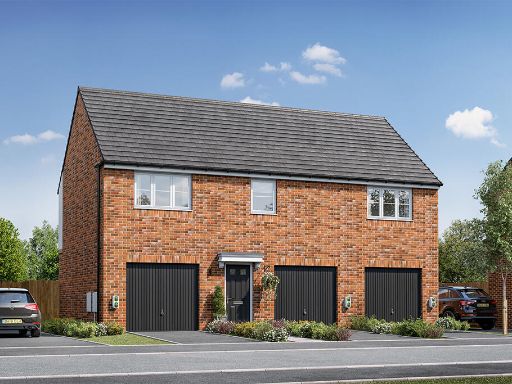 2 bedroom house for sale in Cheadle Road,
Tean,
ST10 4DR, ST10 — £209,950 • 2 bed • 1 bath • 765 ft²
2 bedroom house for sale in Cheadle Road,
Tean,
ST10 4DR, ST10 — £209,950 • 2 bed • 1 bath • 765 ft²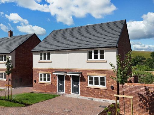 2 bedroom terraced house for sale in Cheadle Road,
Tean,
ST10 4DR, ST10 — £219,950 • 2 bed • 1 bath • 859 ft²
2 bedroom terraced house for sale in Cheadle Road,
Tean,
ST10 4DR, ST10 — £219,950 • 2 bed • 1 bath • 859 ft²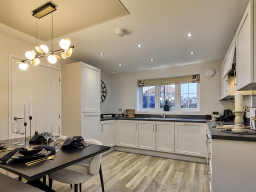 3 bedroom house for sale in Cheadle Road,
Tean,
ST10 4DR, ST10 — £254,950 • 3 bed • 1 bath • 1019 ft²
3 bedroom house for sale in Cheadle Road,
Tean,
ST10 4DR, ST10 — £254,950 • 3 bed • 1 bath • 1019 ft²
Meta
- {
"@context": "https://schema.org",
"@type": "Residence",
"name": "3 bedroom detached house for sale in Cheadle Road, Tean, ST…",
"description": "",
"url": "https://propertypiper.co.uk/property/2a209ce3-4257-449a-8151-cee572cdb29f",
"image": "https://image-a.propertypiper.co.uk/ea94363b-767a-47dd-9e78-3a7e81a9ec85-1024.jpeg",
"address": {
"@type": "PostalAddress",
"streetAddress": "75A CHEADLE ROAD TEAN STOKE-ON-TRENT",
"postalCode": "ST10 4DR",
"addressLocality": "Staffordshire Moorlands",
"addressRegion": "Stone",
"addressCountry": "England"
},
"geo": {
"@type": "GeoCoordinates",
"latitude": 52.957255308196906,
"longitude": -1.98994055636188
},
"numberOfRooms": 3,
"numberOfBathroomsTotal": 1,
"floorSize": {
"@type": "QuantitativeValue",
"value": 1020,
"unitCode": "FTK"
},
"offers": {
"@type": "Offer",
"price": 299950,
"priceCurrency": "GBP",
"availability": "https://schema.org/InStock"
},
"additionalProperty": [
{
"@type": "PropertyValue",
"name": "Feature",
"value": "modern kitchen"
},
{
"@type": "PropertyValue",
"name": "Feature",
"value": "contemporary"
},
{
"@type": "PropertyValue",
"name": "Feature",
"value": "sleek design"
},
{
"@type": "PropertyValue",
"name": "Feature",
"value": "stainless steel appliances"
},
{
"@type": "PropertyValue",
"name": "Feature",
"value": "wood flooring"
},
{
"@type": "PropertyValue",
"name": "Feature",
"value": "neutral colors"
},
{
"@type": "PropertyValue",
"name": "Feature",
"value": "U-shaped layout"
},
{
"@type": "PropertyValue",
"name": "Feature",
"value": "modern"
},
{
"@type": "PropertyValue",
"name": "Feature",
"value": "contemporary"
},
{
"@type": "PropertyValue",
"name": "Feature",
"value": "brick exterior"
},
{
"@type": "PropertyValue",
"name": "Feature",
"value": "new build"
},
{
"@type": "PropertyValue",
"name": "Feature",
"value": "suburban"
},
{
"@type": "PropertyValue",
"name": "Feature",
"value": "two-story"
},
{
"@type": "PropertyValue",
"name": "Feature",
"value": "detached"
},
{
"@type": "PropertyValue",
"name": "Feature",
"value": "driveway"
},
{
"@type": "PropertyValue",
"name": "Feature",
"value": "roof tiles"
}
]
}
High Res Floorplan Images
Compatible Floorplan Images
FloorplanImages Thumbnail