DE6 1LS - 4 bedroom detached house for sale in Harrison Way, Ashbourn…
View on Property Piper
4 bedroom detached house for sale in Harrison Way,
Ashbourne,
Derbyshire,
DE6 1LS, DE6
Property Details
- Price: £399995
- Bedrooms: 4
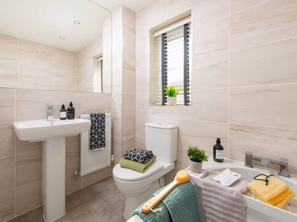
- Bathrooms: 1
- Property Type: undefined
- Property SubType: undefined
Brochure Descriptions
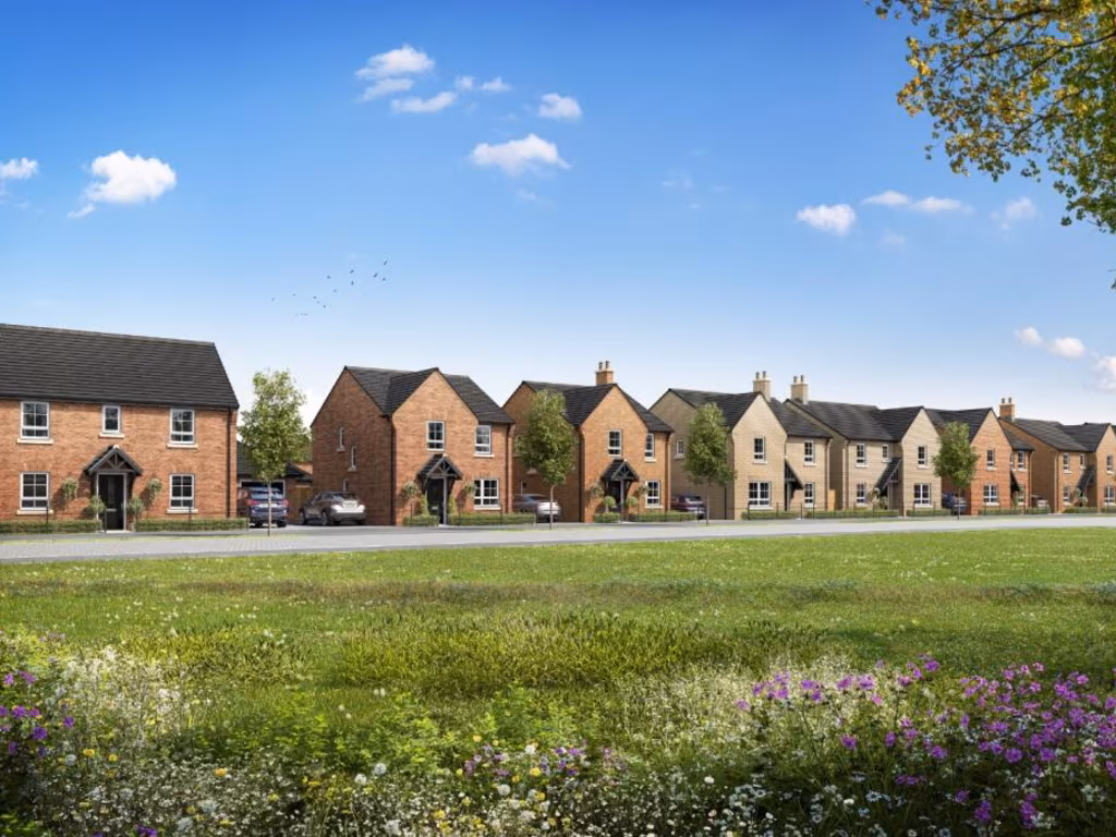
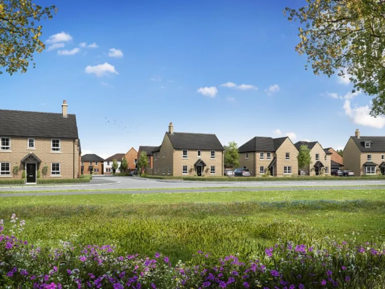
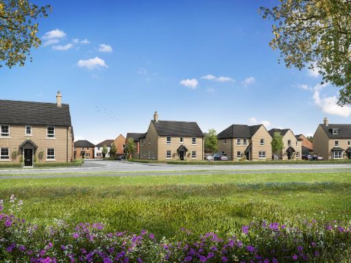
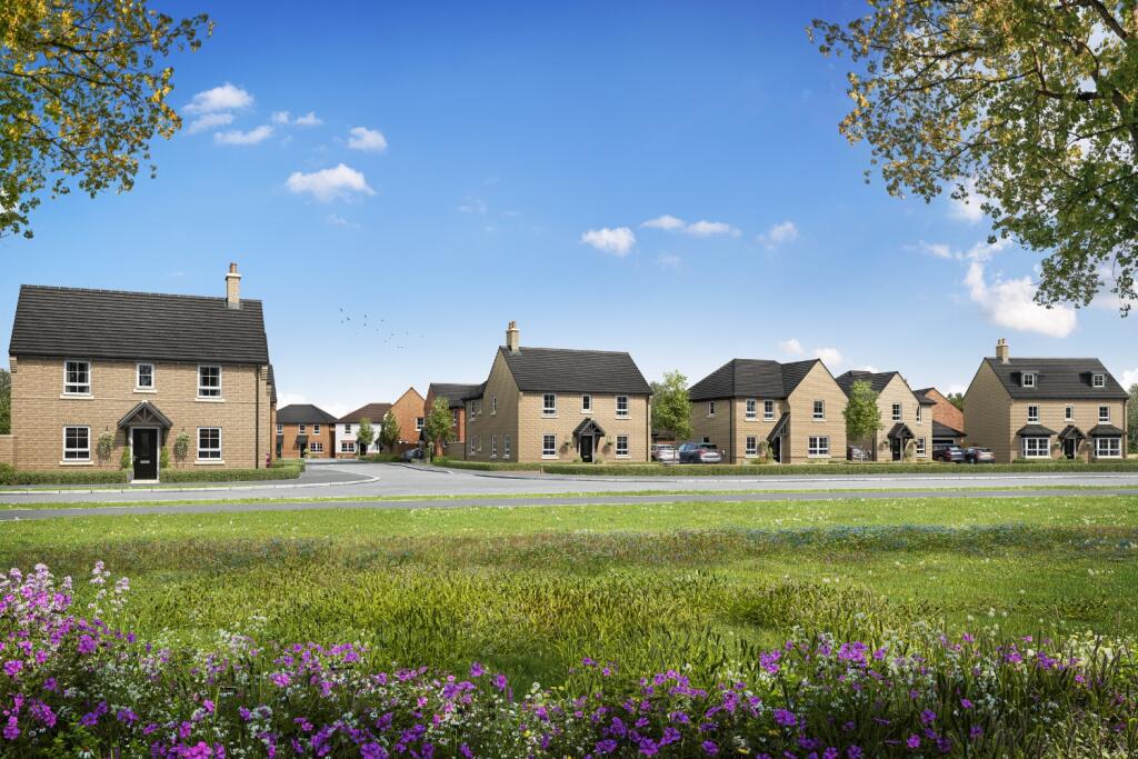
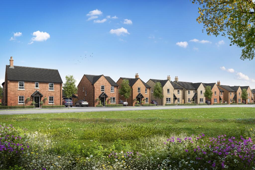
- New-build residential development comprising two-storey semi‑detached and terraced homes finished in mixed brickwork with pitched roofs. The properties appear to offer small to average front gardens, individual driveways/parking and modestly sized plots typical of contemporary suburban housing. The setting includes a large open green or meadow area to the front, providing an open outlook and pleasant communal amenity space. Overall impression: a mid‑density, family‑oriented development with well-proportioned houses and attractive landscaping; suitable for buyers seeking modern, low‑maintenance accommodation in a semi-rural edge‑of‑town location.
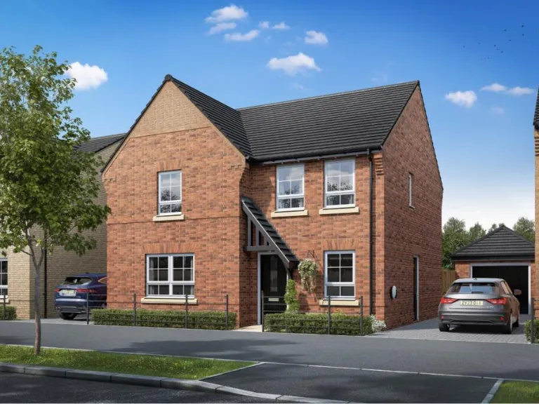
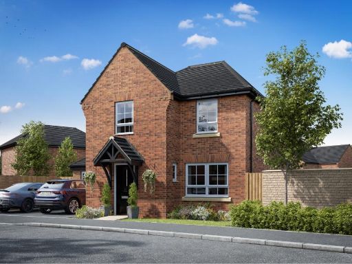
- New-build streetscape comprising two-storey red-brick family houses (semi-detached and detached). Properties feature pitched, dark-tiled roofs, symmetrical window arrangement and small gabled porches to the front entrances. Each house appears to have private off-street parking/driveway space immediately adjacent to the property. Front gardens are modest in depth and landscaped with low boundary planting. The immediate outlook includes a wide planted verge and wildflower meadow/green space between the houses and the foreground, providing an open, semi-rural or suburban aspect. Overall the development suggests average-sized family homes (2–4 bedroom typology likely), modest front gardens, and convenient driveway parking; the site benefit is the pleasant green open view to the front which would enhance amenity and perceived space.
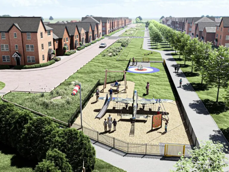
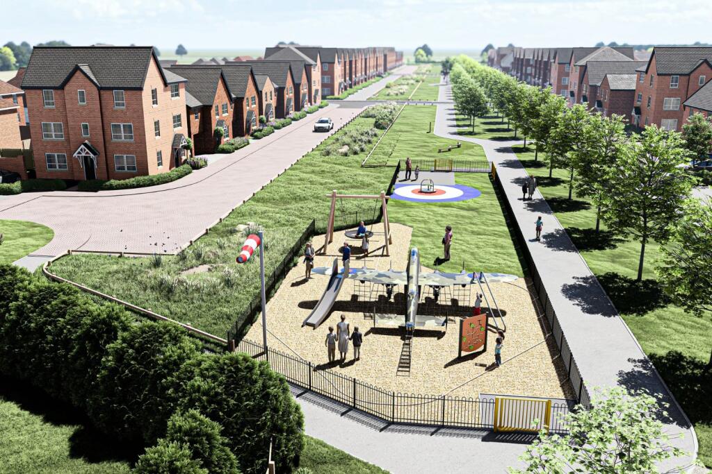
- New-build residential development located on the outskirts of Ashbourne. The brochure imagery and titling identify the site as 'Ashbourne Airfield' and show a semi-rural setting with rolling countryside views and open green space. Photographs indicate proximity to local town high street amenities (pedestrianised shopping street) and leisure/outdoor attractions (river/stepping-stone crossing and valley scenery). The site appears to offer properties with small-to-average private gardens and access to surrounding open landscape; overall the development presents as a suburban edge/small-town scheme combining countryside vistas with easy walking distance to local shops and amenities.
Image Descriptions
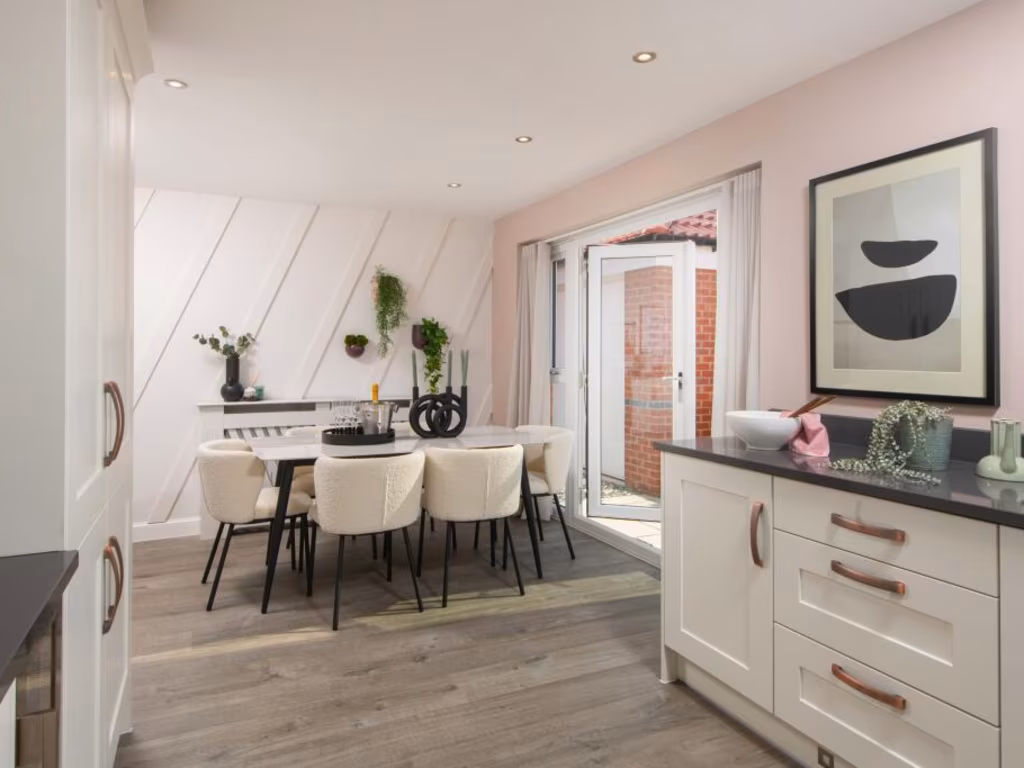
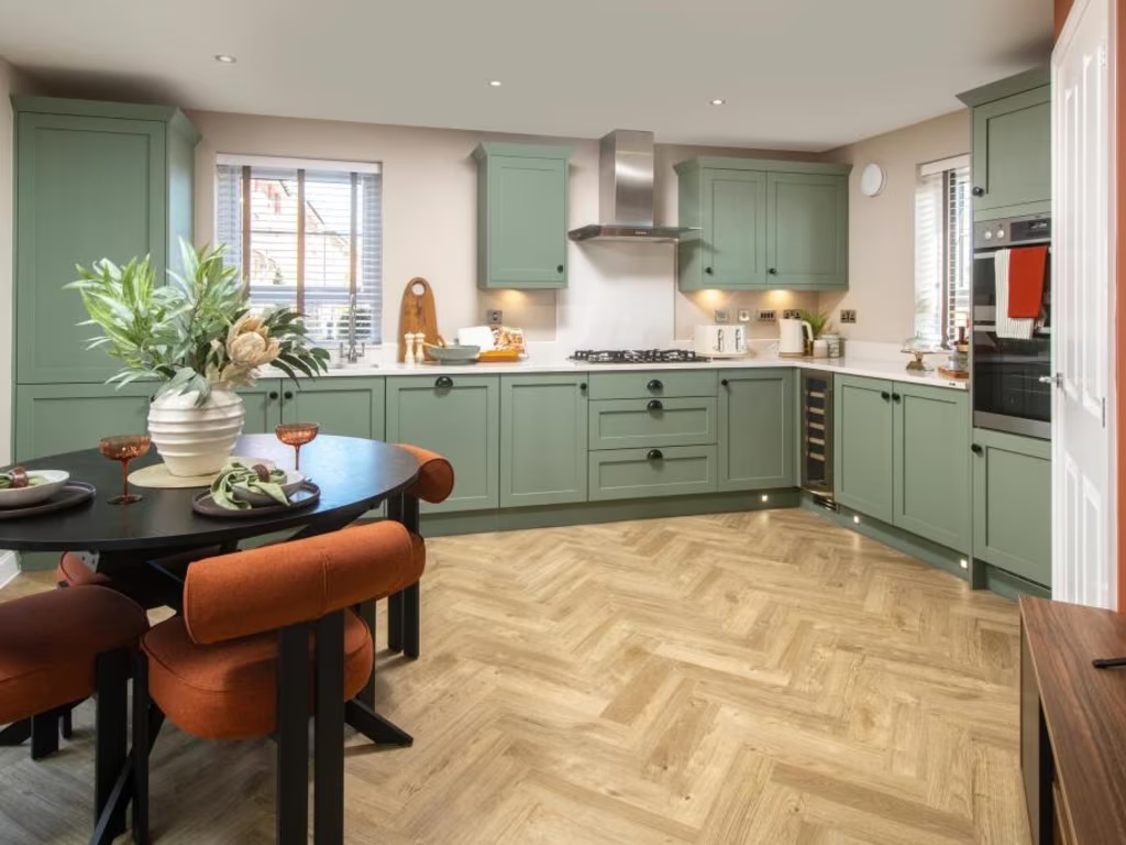
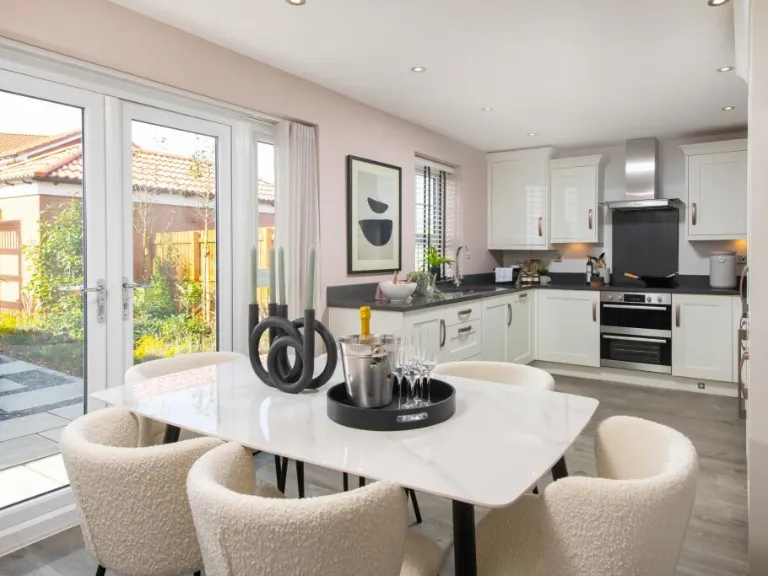
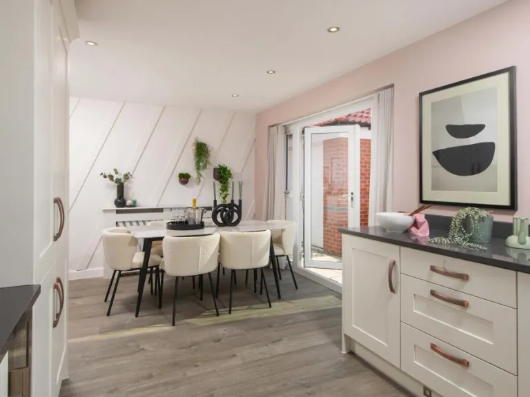
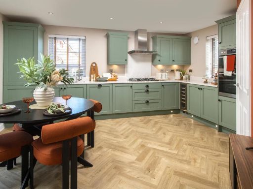
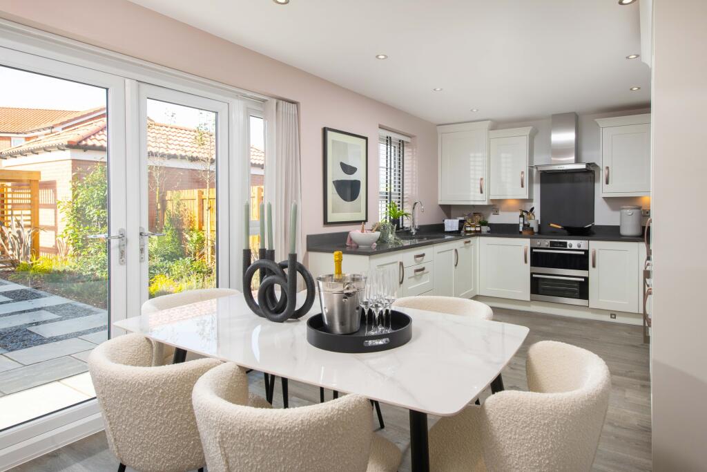
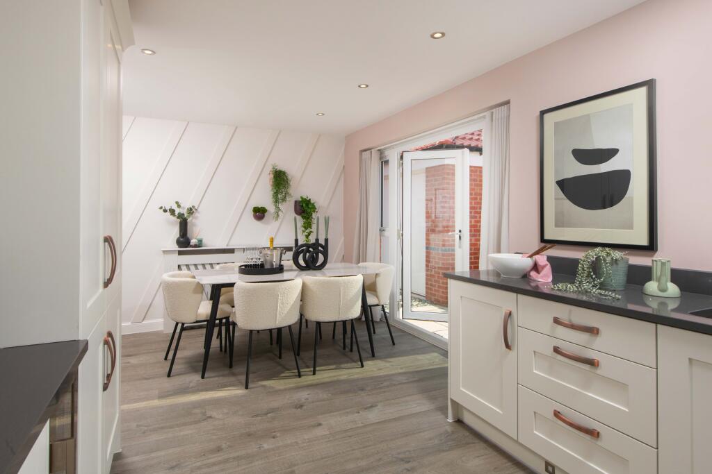
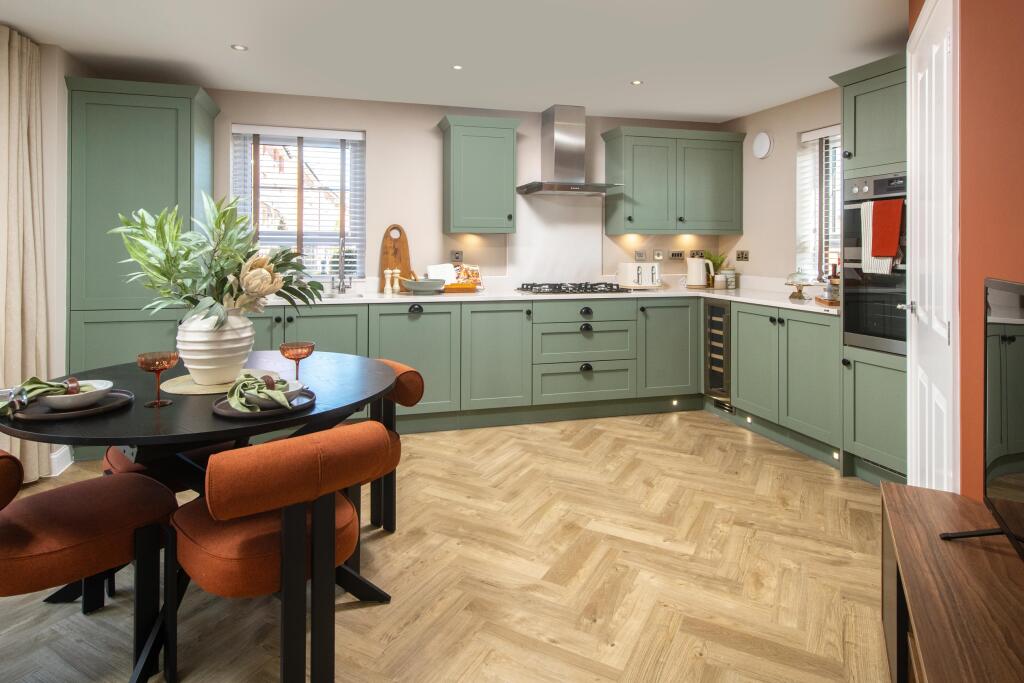
- kitchen modern
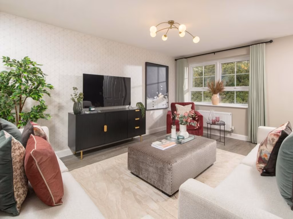
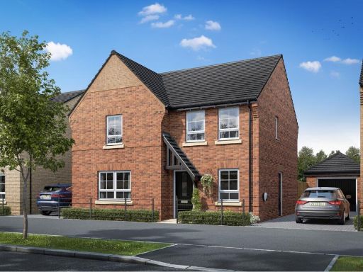
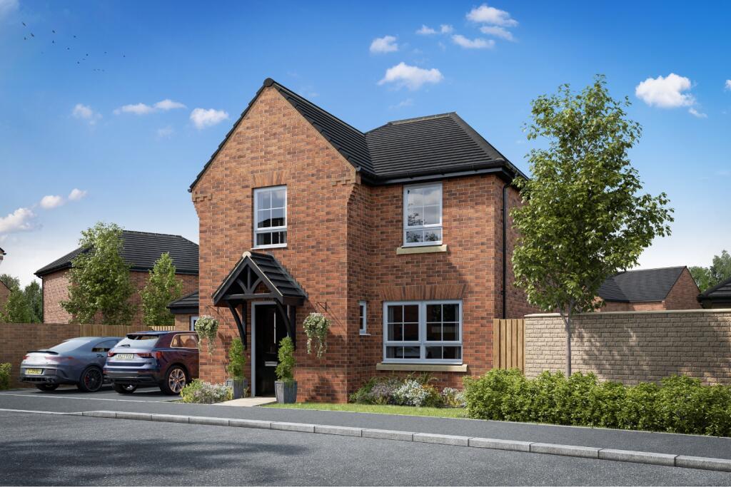
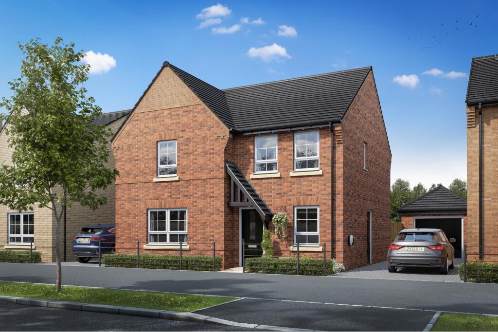
- newly built detached house modern
Floorplan Description
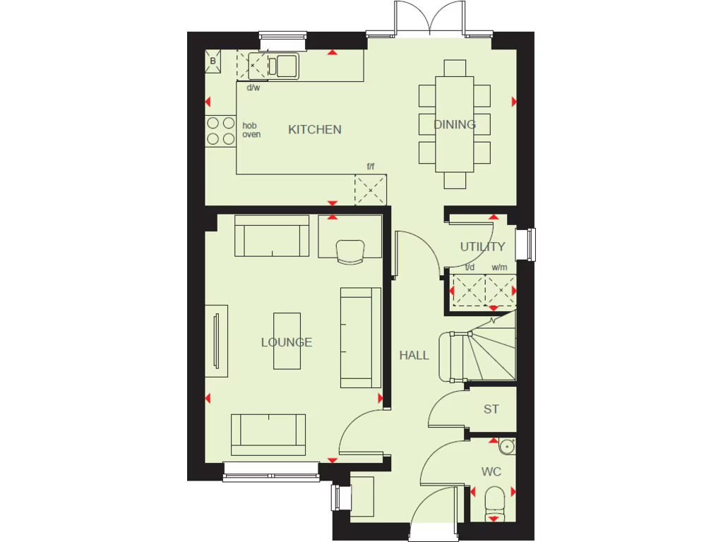
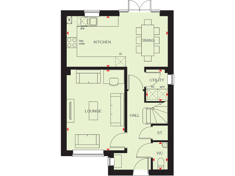
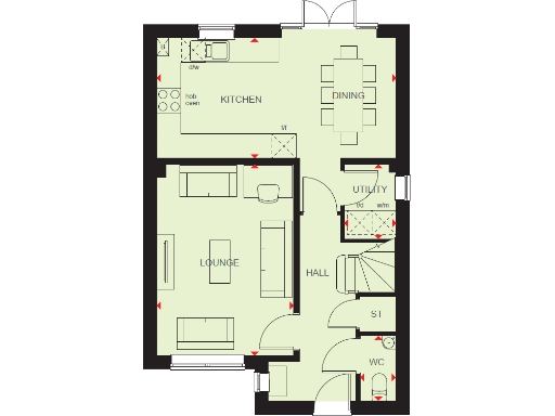
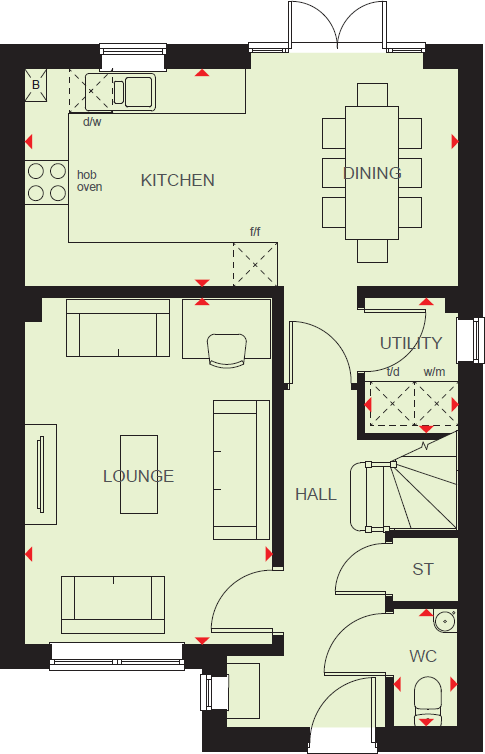
- Ground-floor plan showing KITCHEN, DINING, LOUNGE, HALL, UTILITY, ST and WC.
Rooms
- KITCHEN:
- DINING:
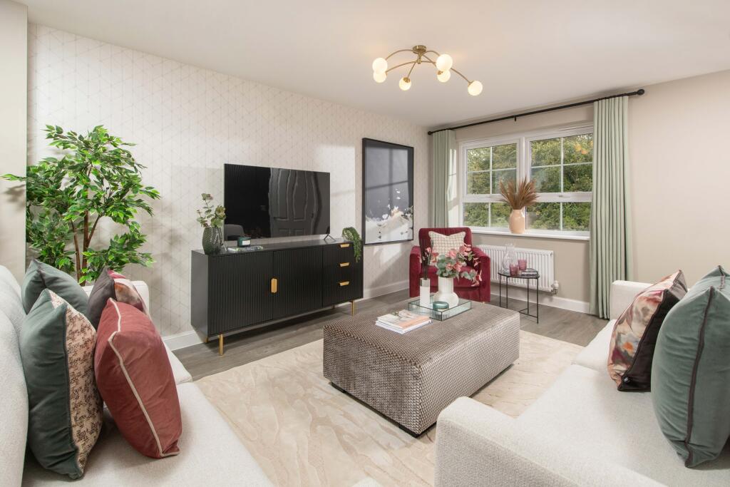
- LOUNGE:
- HALL:
- UTILITY:
- ST:
- WC:
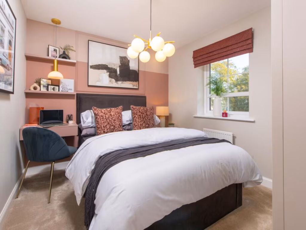
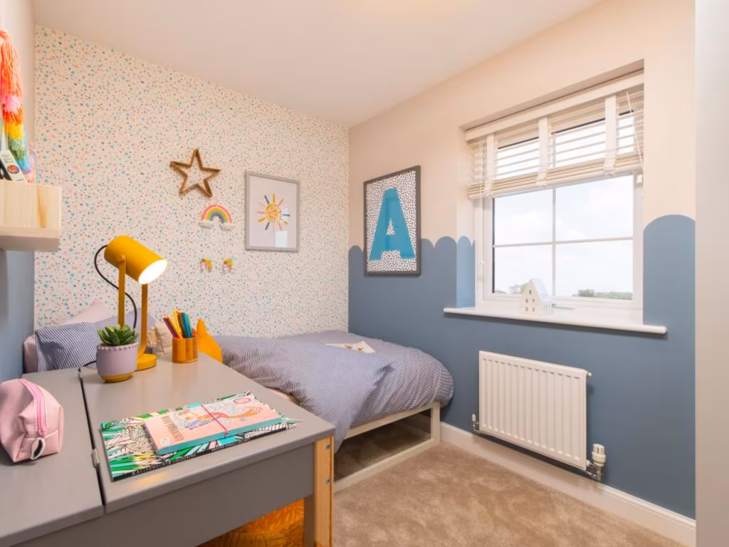
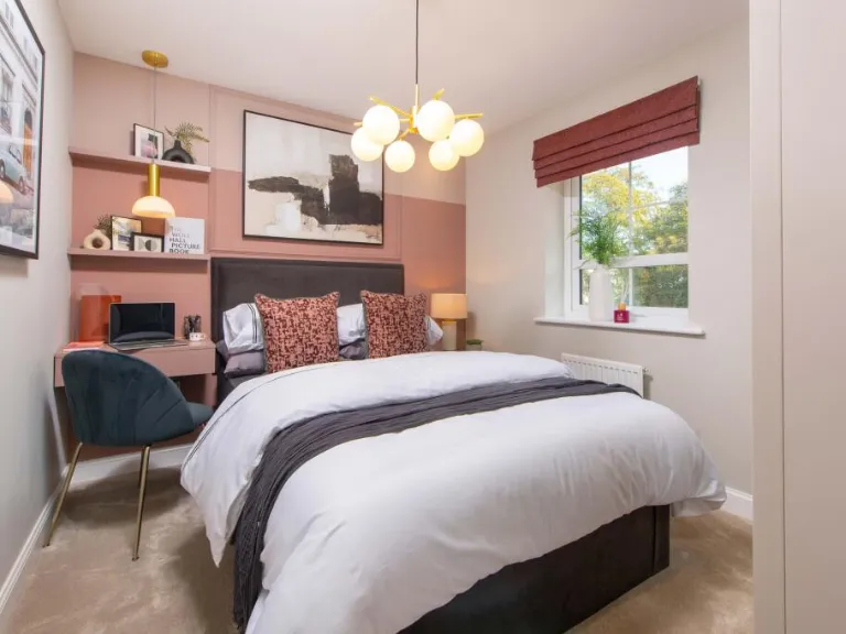
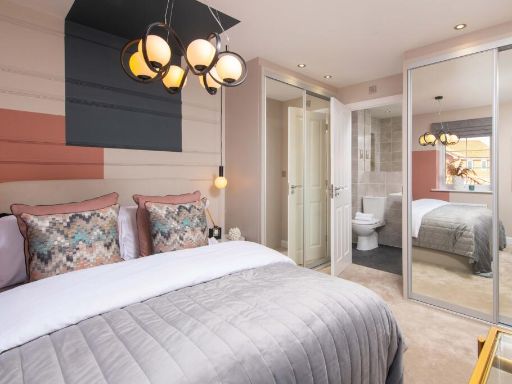
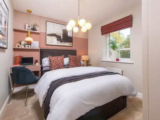
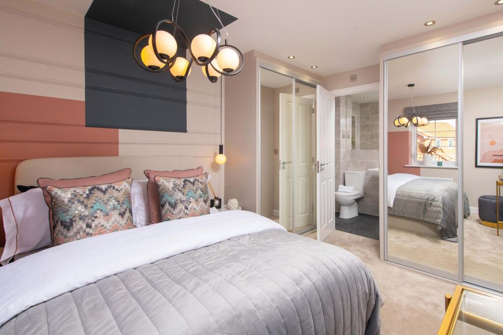
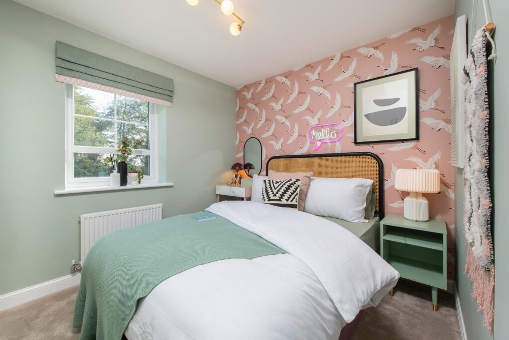
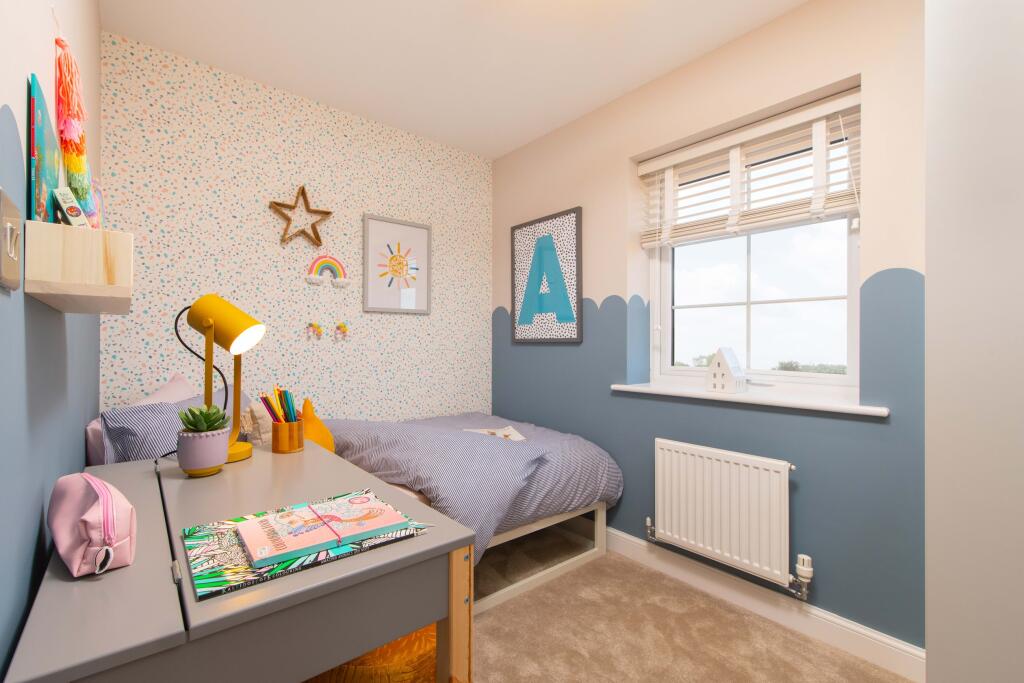
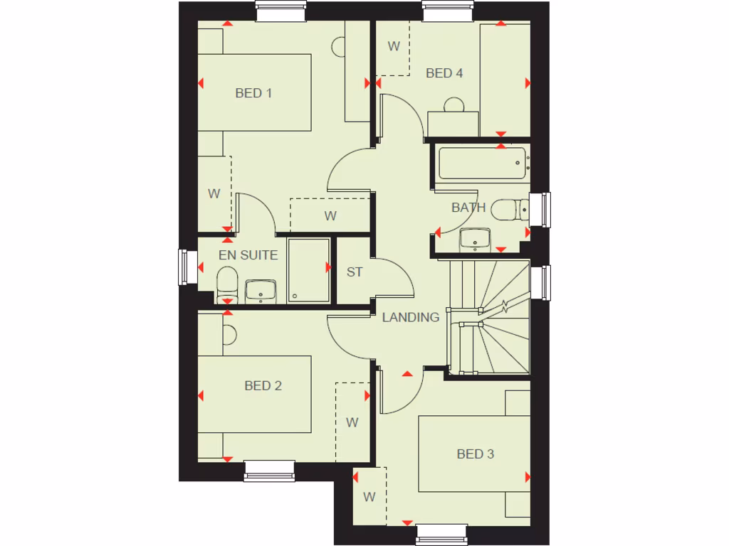
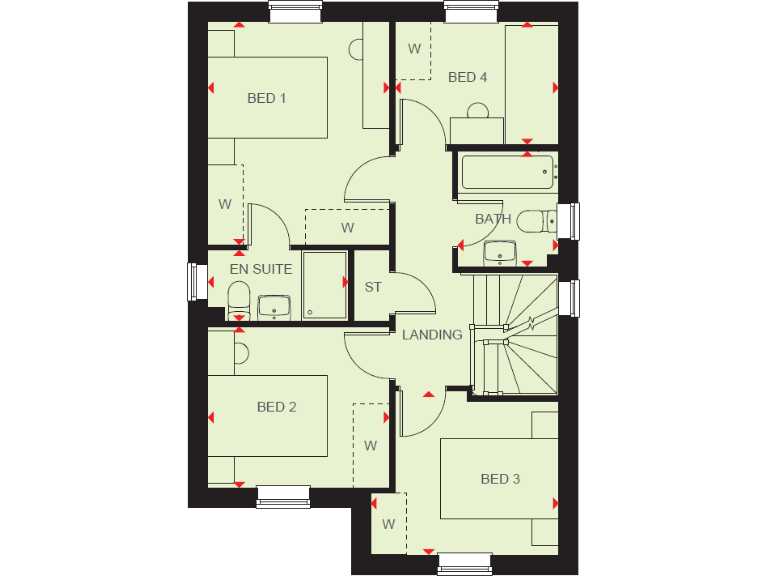
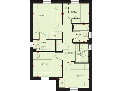
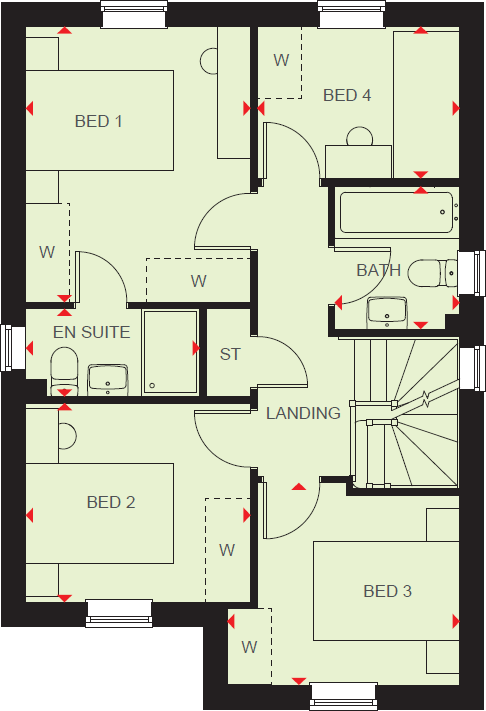
- BED 1:
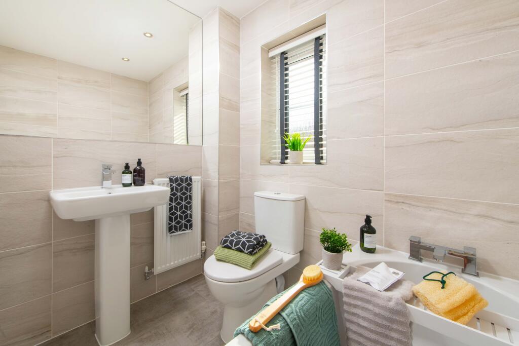
- EN SUITE:
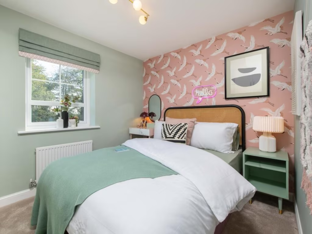
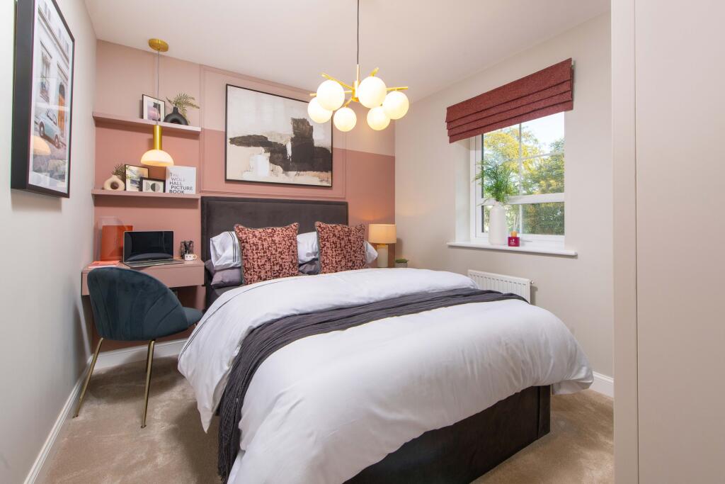
- BED 2:
- BED 4:
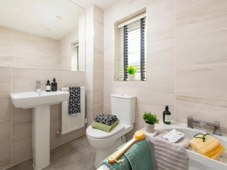
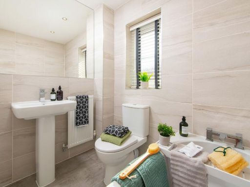
- BATH:
- LANDING:
- ST:
- BED 3:
Textual Property Features
- Is New Build
- Has Garden
- Success
Detected Visual Features
- modern kitchen
- open plan
- sliding doors
- integrated appliances
- double oven
- corner cabinets
- garden view
- breakfast bar
- modern
- detached
- brick construction
- new build
- suburban
- driveway
- quiet street
- family home
- energy-efficient
Nearby Schools
- Clifton CofE Primary School
- Kniveton CofE Primary School
- Longford CofE Primary School
- Long Lane Church of England Primary School
- St Oswald's CofE Primary School
- Fitzherbert CofE (Aided) Primary School
- Osmaston CofE (VC) Primary School
- Queen Elizabeth's Grammar School
- Kirk Ireton C of E Primary School
- Norbury CofE Primary School
Nearest General Shops
- Id: 310647333
- Tags:
- Building: yes
- Name: Code Red Computers
- Shop: computer
- TagsNormalized:
- Lat: 53.0140816
- Lon: -1.7287172
- FullGeoHash: gcqv8dvjmvp4
- PartitionGeoHash: gcqv
- Images:
- FoodStandards: null
- Distance: 2606.6
,- Id: 743704780
- Tags:
- TagsNormalized:
- Lat: 53.0071644
- Lon: -1.718297
- FullGeoHash: gcqv8csv0g8u
- PartitionGeoHash: gcqv
- Images:
- FoodStandards: null
- Distance: 1574.1
,- Id: 60748411
- Tags:
- Addr:
- City: Ashbourne
- Postcode: DE6 1LZ
- Street: Derby Road
- Building: yes
- Name: Prestons
- Shop: car
- Source: survey;OS_OpenData_StreetView
- TagsNormalized:
- Lat: 53.0065721
- Lon: -1.7187138
- FullGeoHash: gcqv8cs3xj4n
- PartitionGeoHash: gcqv
- Images:
- FoodStandards: null
- Distance: 1554.5
}
Nearest Religious buildings
- Id: 770414282
- Tags:
- Addr:
- Amenity: place_of_worship
- Building: church
- Denomination: anglican
- Ele: 164.0000000
- Name: St James's Church
- Religion: christian
- Wikidata: Q17545697
- TagsNormalized:
- place of worship
- church
- anglican
- christian
- Lat: 52.9811265
- Lon: -1.7316046
- FullGeoHash: gcqv2sgj6ty4
- PartitionGeoHash: gcqv
- Images:
- FoodStandards: null
- Distance: 2815.1
,- Id: 589751707
- Tags:
- Amenity: place_of_worship
- Building: yes
- Denomination: anglican
- Ele: 168
- Name: All Saints
- Religion: christian
- Wikidata: Q17545502
- TagsNormalized:
- place of worship
- anglican
- christian
- church
- Lat: 53.0105755
- Lon: -1.6684663
- FullGeoHash: gcqvd430czt2
- PartitionGeoHash: gcqv
- Images:
- FoodStandards: null
- Distance: 2546.2
,- Id: 310004380
- Tags:
- Addr:
- City: Ashbourne
- Postcode: DE6 1LX
- Street: Church Lane
- Amenity: place_of_worship
- Building: church
- Denomination: anglican
- Name: St Martin's
- Religion: christian
- Wikidata: Q17546033
- TagsNormalized:
- place of worship
- church
- anglican
- martins
- christian
- Lat: 52.9930638
- Lon: -1.7042255
- FullGeoHash: gcqv3pp4bxj6
- PartitionGeoHash: gcqv
- Images:
- FoodStandards: null
- Distance: 612.3
}
Nearest Airports
- Id: 11359528
- Tags:
- Aerodrome: international
- Aerodrome:type: public
- Aeroway: aerodrome
- Iata: EMA
- Icao: EGNX
- Is_in: Castle Donington,England,UK
- Name: East Midlands Airport
- Old_name: RAF Castle Donington
- Operator: Manchester Airports Holdings Limited
- Operator:type: private
- Ref: EMA
- Type: multipolygon
- Website: https://www.eastmidlandsairport.com/
- Wikidata: Q8977
- Wikipedia: en:East Midlands Airport
- TagsNormalized:
- airport
- international airport
- Lat: 52.8281122
- Lon: -1.3322143
- FullGeoHash: gcrh99jfj1vh
- PartitionGeoHash: gcrh
- Images:
- FoodStandards: null
- Distance: 31084.2
}
Nearest Leisure Facilities
- Id: 310006829
- Tags:
- Leisure: pitch
- Sport: bowls
- TagsNormalized:
- Lat: 53.002547
- Lon: -1.7336066
- FullGeoHash: gcqv88cdhnch
- PartitionGeoHash: gcqv
- Images:
- FoodStandards: null
- Distance: 2283.8
,- Id: 1042942617
- Tags:
- Bowls: pitch
- Leisure: sports_centre
- Name: Ashbourne/Mayfield Crown Green Bowls Club
- Sport: bowls
- TagsNormalized:
- sports
- sports centre
- leisure
- bowls
- club
- Lat: 53.0024835
- Lon: -1.7330409
- FullGeoHash: gcqv88f1c5p1
- PartitionGeoHash: gcqv
- Images:
- FoodStandards: null
- Distance: 2245.3
,- Id: 310006828
- Tags:
- Leisure: pitch
- Sport: bowls
- TagsNormalized:
- Lat: 53.0024234
- Lon: -1.7330409
- FullGeoHash: gcqv88f13pz4
- PartitionGeoHash: gcqv
- Images:
- FoodStandards: null
- Distance: 2243.8
,- Id: 310004906
- Tags:
- Leisure: pitch
- Source: View from road;Bing
- Sport: soccer
- TagsNormalized:
- Lat: 52.9878135
- Lon: -1.7049005
- FullGeoHash: gcqv3nns2uq5
- PartitionGeoHash: gcqv
- Images:
- FoodStandards: null
- Distance: 1177.9
,- Id: 310004903
- Tags:
- Leisure: pitch
- Source: View from east;Bing
- Sport: cricket
- TagsNormalized:
- pitch
- leisure
- cricket
- sports
- Lat: 52.9877616
- Lon: -1.7025155
- FullGeoHash: gcqv3q0k0d8m
- PartitionGeoHash: gcqv
- Images:
- FoodStandards: null
- Distance: 1152.4
}
Nearest Tourist attractions
- Id: 3222503188
- Tags:
- Name: Parkfields Stable
- Tourism: guest_house
- Website: https://parkfieldsstable.co.uk/
- TagsNormalized:
- stables
- guest house
- tourism
- Lat: 53.0265171
- Lon: -1.6859656
- FullGeoHash: gcqv9thmf5hz
- PartitionGeoHash: gcqv
- Images:
- FoodStandards: null
- Distance: 3308.7
,- Id: 60749522
- Tags:
- Addr:
- City: Ashbourne
- Postcode: DE6 1BE
- Street: Derby Road
- Building: yes
- Name: Thistle Bank Guest House
- Source: survey;OS_OpenData_StreetView
- Tourism: guest_house
- Website: https://www.thistlebank.co.uk/
- TagsNormalized:
- Lat: 53.0134857
- Lon: -1.7293426
- FullGeoHash: gcqv8du9zqh8
- PartitionGeoHash: gcqv
- Images:
- FoodStandards: null
- Distance: 2592.9
,- Id: 479261359
- Tags:
- Name: Peak Gateway
- Tourism: camp_site
- TagsNormalized:
- Lat: 53.0019258
- Lon: -1.7232292
- FullGeoHash: gcqv8b9ntg54
- PartitionGeoHash: gcqv
- Images:
- FoodStandards: null
- Distance: 1593.4
}
Nearest Train stations
- Id: 2398089855
- Tags:
- Name: Ravenstor
- Public_transport: station
- Railway: station
- Usage: tourism
- Wikidata: Q7296554
- Wikipedia: en:Ravenstor railway station
- TagsNormalized:
- Lat: 53.0901924
- Lon: -1.57288
- FullGeoHash: gcqyh0y8v1pt
- PartitionGeoHash: gcqy
- Images:
- FoodStandards: null
- Distance: 13325.4
,- Id: 251735751
- Tags:
- Name: Wirksworth
- Naptan:
- Public_transport: station
- Railway: station
- Usage: tourism
- Wikidata: Q8026960
- Wikipedia: en:Wirksworth railway station
- TagsNormalized:
- Lat: 53.0827559
- Lon: -1.5687991
- FullGeoHash: gcqvur3tkqft
- PartitionGeoHash: gcqv
- Images:
- FoodStandards: null
- Distance: 12885.7
,- Id: 1711412439
- Tags:
- Monorail: yes
- Name: Alton Towers Main Entrance
- Railway: station
- Station: monorail
- Tourism: attraction
- Usage: tourism
- TagsNormalized:
- railway
- station
- attraction
- tourism
- Lat: 52.9915619
- Lon: -1.8920461
- FullGeoHash: gcqtkyy60ph5
- PartitionGeoHash: gcqt
- Images:
- FoodStandards: null
- Distance: 12852.5
,- Id: 483375401
- Tags:
- Monorail: yes
- Name: Alton Towers Car Park
- Railway: station
- Station: monorail
- Tourism: attraction
- Usage: tourism
- TagsNormalized:
- railway
- station
- attraction
- tourism
- Lat: 52.9856788
- Lon: -1.8775033
- FullGeoHash: gcqtmm8zgn2j
- PartitionGeoHash: gcqt
- Images:
- FoodStandards: null
- Distance: 11939.2
,- Id: 251734921
- Tags:
- Name: Shottle
- Public_transport: station
- Railway: station
- Source: NPE
- Usage: tourism
- Wikidata: Q7502588
- TagsNormalized:
- Lat: 53.0182899
- Lon: -1.547398
- FullGeoHash: gcqvsg9jzj86
- PartitionGeoHash: gcqv
- Images:
- FoodStandards: null
- Distance: 10475.6
}
Nearest Bus stations and stops
- Id: 7768210349
- Tags:
- Highway: bus_stop
- Name: Yeldersley Hall
- Public_transport: platform
- TagsNormalized:
- Lat: 52.992722
- Lon: -1.691336
- FullGeoHash: gcqv3x02vp27
- PartitionGeoHash: gcqv
- Images:
- FoodStandards: null
- Distance: 842.9
,- Id: 7768210347
- Tags:
- Highway: bus_stop
- Name: Home Farm
- Public_transport: platform
- TagsNormalized:
- Lat: 52.9947142
- Lon: -1.6941261
- FullGeoHash: gcqv3rqks48p
- PartitionGeoHash: gcqv
- Images:
- FoodStandards: null
- Distance: 555
,- Id: 7768210348
- Tags:
- Highway: bus_stop
- Name: Home Farm
- Public_transport: platform
- TagsNormalized:
- Lat: 52.9952784
- Lon: -1.6949355
- FullGeoHash: gcqv3rmzc5um
- PartitionGeoHash: gcqv
- Images:
- FoodStandards: null
- Distance: 473
,- Id: 7768210346
- Tags:
- Highway: bus_stop
- Name: Painter's Lane
- Public_transport: platform
- TagsNormalized:
- Lat: 52.9973742
- Lon: -1.6996937
- FullGeoHash: gcqv3rfk468e
- PartitionGeoHash: gcqv
- Images:
- FoodStandards: null
- Distance: 84.8
,- Id: 7768210345
- Tags:
- Highway: bus_stop
- Name: Painter's Lane
- Public_transport: platform
- TagsNormalized:
- Lat: 52.9975958
- Lon: -1.7003006
- FullGeoHash: gcqv3rcvk5gv
- PartitionGeoHash: gcqv
- Images:
- FoodStandards: null
- Distance: 49.4
}
Nearest Hotels
- Id: 206247214
- Tags:
- Addr:
- Postcode: DE6 3AE
- Street: Hollington Lane
- Building: hotel
- Name: Yew Tree Inn & Lodge
- Tourism: hotel
- TagsNormalized:
- Lat: 52.9709108
- Lon: -1.6454546
- FullGeoHash: gcqv6e1cfjkp
- PartitionGeoHash: gcqv
- Images:
- FoodStandards: null
- Distance: 4752.4
,- Id: 439656303
- Tags:
- Building: yes
- Tourism: hotel
- TagsNormalized:
- Lat: 53.0206534
- Lon: -1.7484187
- FullGeoHash: gcqv8hngdyht
- PartitionGeoHash: gcqv
- Images:
- FoodStandards: null
- Distance: 4084.4
,- Id: 189200285
- Tags:
- Addr:
- City: Ashbourne
- Postcode: DE6 1AY
- Street: Carnation Way
- Brand: Travelodge
- Brand:wikidata: Q9361374
- Brand:wikipedia: en:Travelodge UK
- Building: yes
- Internet_access: wlan
- Internet_access:fee: customers
- Internet_access:ssid: Travelodge WiFi
- Name: Travelodge Ashbourne
- Source: Bing
- Tourism: hotel
- Website: https://www.travelodge.co.uk/hotels/385/Ashbourne-hotel
- TagsNormalized:
- Lat: 53.0082788
- Lon: -1.7477027
- FullGeoHash: gcqv81z7ee67
- PartitionGeoHash: gcqv
- Images:
- FoodStandards: null
- Distance: 3369.4
}
Tags
- modern kitchen
- open plan
- sliding doors
- integrated appliances
- double oven
- corner cabinets
- garden view
- breakfast bar
- modern
- detached
- brick construction
- new build
- suburban
- driveway
- quiet street
- family home
- energy-efficient
Local Market Stats
- Average Price/sqft: £280
- Avg Income: £43900
- Rental Yield: 2.6%
- Social Housing: 3%
- Planning Success Rate: 68%
Similar Properties
 4 bedroom detached house for sale in Harrison Way,
Ashbourne,
Derbyshire,
DE6 1LS, DE6 — £459,995 • 4 bed • 1 bath • 1132 ft²
4 bedroom detached house for sale in Harrison Way,
Ashbourne,
Derbyshire,
DE6 1LS, DE6 — £459,995 • 4 bed • 1 bath • 1132 ft²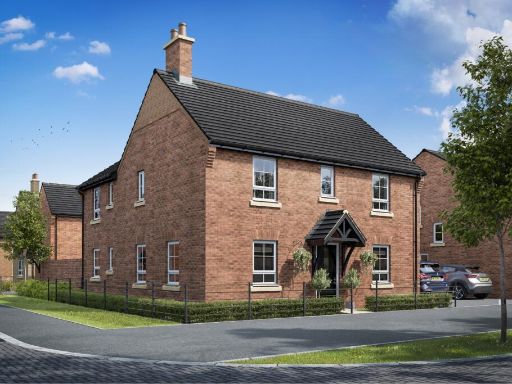 4 bedroom detached house for sale in Harrison Way,
Ashbourne,
Derbyshire,
DE6 1LS, DE6 — £494,995 • 4 bed • 1 bath • 1115 ft²
4 bedroom detached house for sale in Harrison Way,
Ashbourne,
Derbyshire,
DE6 1LS, DE6 — £494,995 • 4 bed • 1 bath • 1115 ft²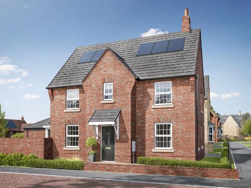 4 bedroom detached house for sale in Former Ashbourne Airfield,
Harrison Way,
Ashbourne,
Derbyshire,
DE6 1LS
, DE6 — £419,995 • 4 bed • 1 bath • 1052 ft²
4 bedroom detached house for sale in Former Ashbourne Airfield,
Harrison Way,
Ashbourne,
Derbyshire,
DE6 1LS
, DE6 — £419,995 • 4 bed • 1 bath • 1052 ft² 4 bedroom detached house for sale in Former Ashbourne Airfield,
Harrison Way,
Ashbourne,
Derbyshire,
DE6 1LS
, DE6 — £509,995 • 4 bed • 1 bath • 1302 ft²
4 bedroom detached house for sale in Former Ashbourne Airfield,
Harrison Way,
Ashbourne,
Derbyshire,
DE6 1LS
, DE6 — £509,995 • 4 bed • 1 bath • 1302 ft²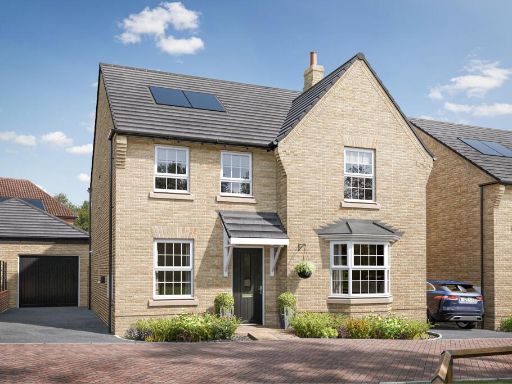 4 bedroom detached house for sale in Former Ashbourne Airfield,
Harrison Way,
Ashbourne,
Derbyshire,
DE6 1LS
, DE6 — £514,995 • 4 bed • 1 bath • 1302 ft²
4 bedroom detached house for sale in Former Ashbourne Airfield,
Harrison Way,
Ashbourne,
Derbyshire,
DE6 1LS
, DE6 — £514,995 • 4 bed • 1 bath • 1302 ft²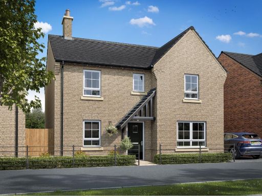 5 bedroom detached house for sale in Harrison Way,
Ashbourne,
Derbyshire,
DE6 1LS, DE6 — £514,995 • 5 bed • 1 bath • 1010 ft²
5 bedroom detached house for sale in Harrison Way,
Ashbourne,
Derbyshire,
DE6 1LS, DE6 — £514,995 • 5 bed • 1 bath • 1010 ft²
Meta
- {
"@context": "https://schema.org",
"@type": "Residence",
"name": "4 bedroom detached house for sale in Harrison Way, Ashbourn…",
"description": "",
"url": "https://propertypiper.co.uk/property/269c3212-27b5-43d4-8874-4592ced7e3b4",
"image": "https://image-a.propertypiper.co.uk/bedafef3-9e2a-497d-911e-4e6851ae7b21-1024.jpeg",
"address": {
"@type": "PostalAddress",
"streetAddress": "EVERSLEY DERBY ROAD YELDERSLEY ASHBOURNE",
"postalCode": "DE6 1LS",
"addressLocality": "Derbyshire Dales",
"addressRegion": "Derbyshire Dales",
"addressCountry": "England"
},
"geo": {
"@type": "GeoCoordinates",
"latitude": 52.998040281753376,
"longitude": -1.7003103657805874
},
"numberOfRooms": 4,
"numberOfBathroomsTotal": 1,
"floorSize": {
"@type": "QuantitativeValue",
"value": 873,
"unitCode": "FTK"
},
"offers": {
"@type": "Offer",
"price": 399995,
"priceCurrency": "GBP",
"availability": "https://schema.org/InStock"
},
"additionalProperty": [
{
"@type": "PropertyValue",
"name": "Feature",
"value": "modern kitchen"
},
{
"@type": "PropertyValue",
"name": "Feature",
"value": "open plan"
},
{
"@type": "PropertyValue",
"name": "Feature",
"value": "sliding doors"
},
{
"@type": "PropertyValue",
"name": "Feature",
"value": "integrated appliances"
},
{
"@type": "PropertyValue",
"name": "Feature",
"value": "double oven"
},
{
"@type": "PropertyValue",
"name": "Feature",
"value": "corner cabinets"
},
{
"@type": "PropertyValue",
"name": "Feature",
"value": "garden view"
},
{
"@type": "PropertyValue",
"name": "Feature",
"value": "breakfast bar"
},
{
"@type": "PropertyValue",
"name": "Feature",
"value": "modern"
},
{
"@type": "PropertyValue",
"name": "Feature",
"value": "detached"
},
{
"@type": "PropertyValue",
"name": "Feature",
"value": "brick construction"
},
{
"@type": "PropertyValue",
"name": "Feature",
"value": "new build"
},
{
"@type": "PropertyValue",
"name": "Feature",
"value": "suburban"
},
{
"@type": "PropertyValue",
"name": "Feature",
"value": "driveway"
},
{
"@type": "PropertyValue",
"name": "Feature",
"value": "quiet street"
},
{
"@type": "PropertyValue",
"name": "Feature",
"value": "family home"
},
{
"@type": "PropertyValue",
"name": "Feature",
"value": "energy-efficient"
}
]
}
High Res Floorplan Images
Compatible Floorplan Images
FloorplanImages Thumbnail