SP4 7LT - 2 bedroom terraced house for sale in Edwards Road, Amesbury…
View on Property Piper
2 bedroom terraced house for sale in Edwards Road, Amesbury, Salisbury, SP4
Property Details
- Price: £245000
- Bedrooms: 2
- Bathrooms: 1
- Property Type: undefined
- Property SubType: undefined
Image Descriptions
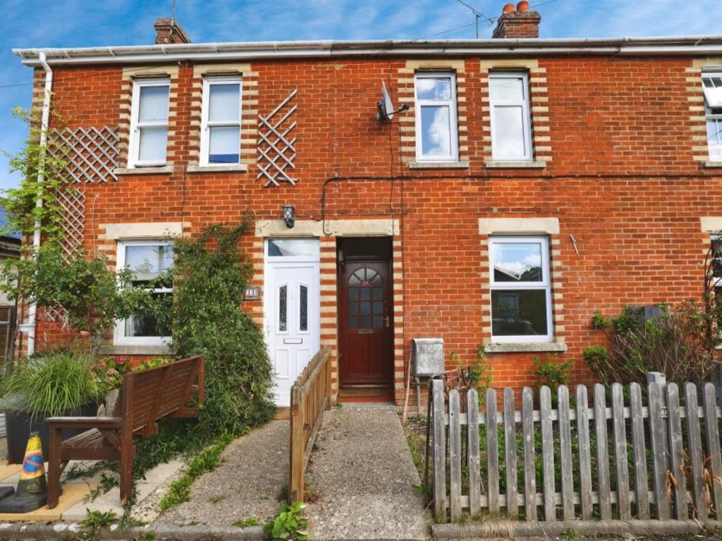
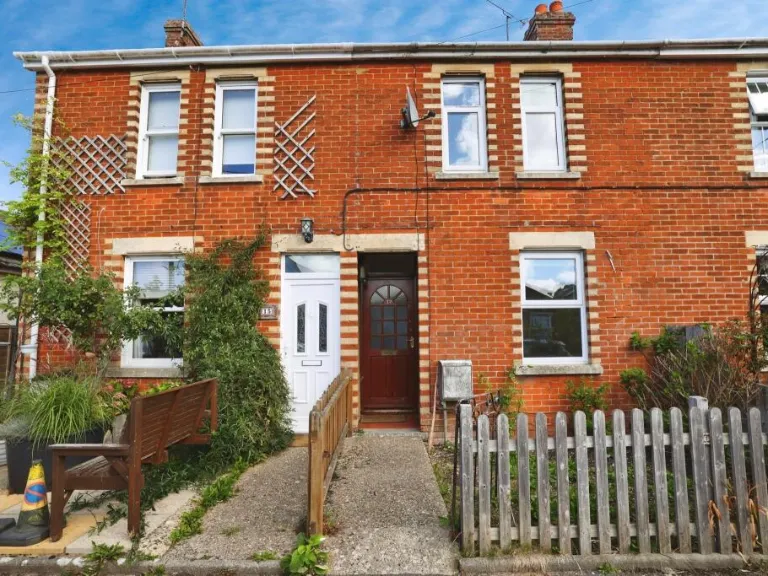
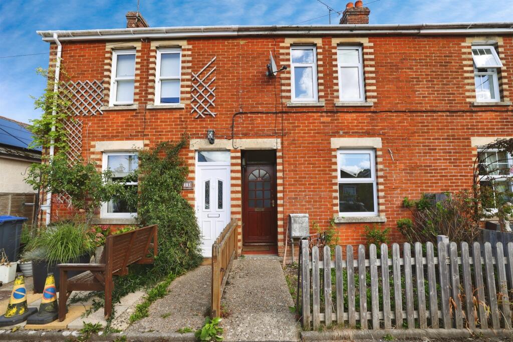
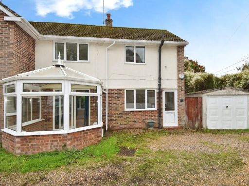
- front exterior Edwardian
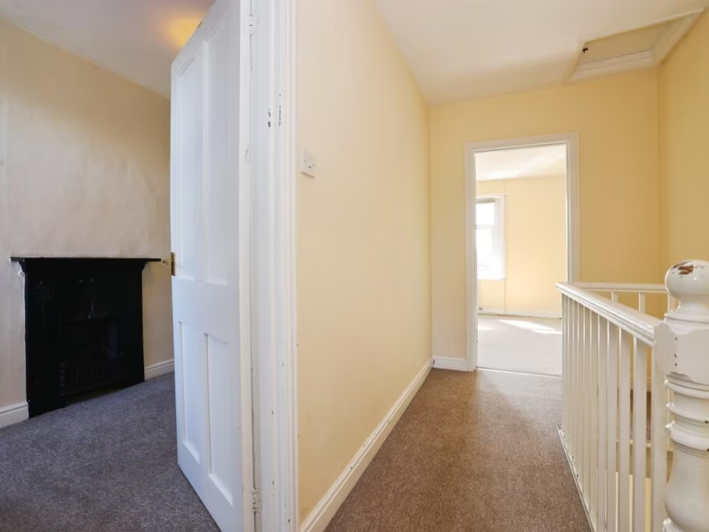
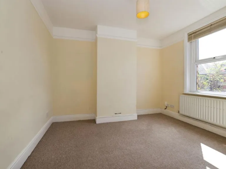
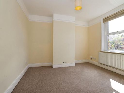
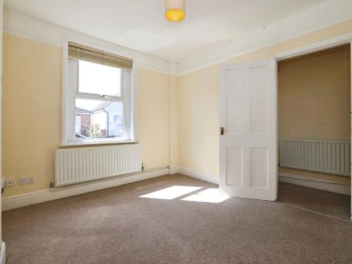
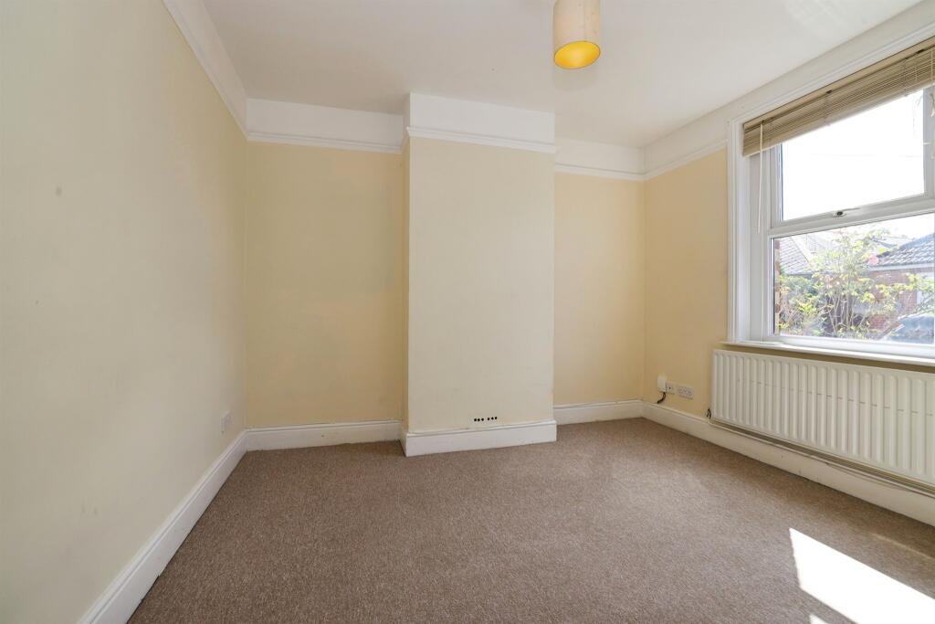
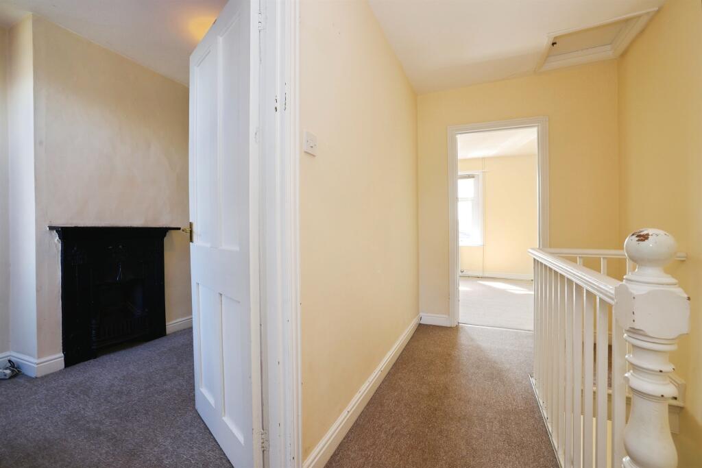
- room contemporary
Floorplan Description
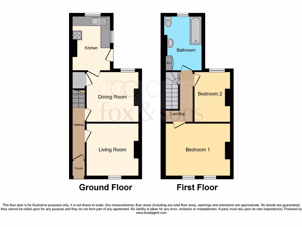
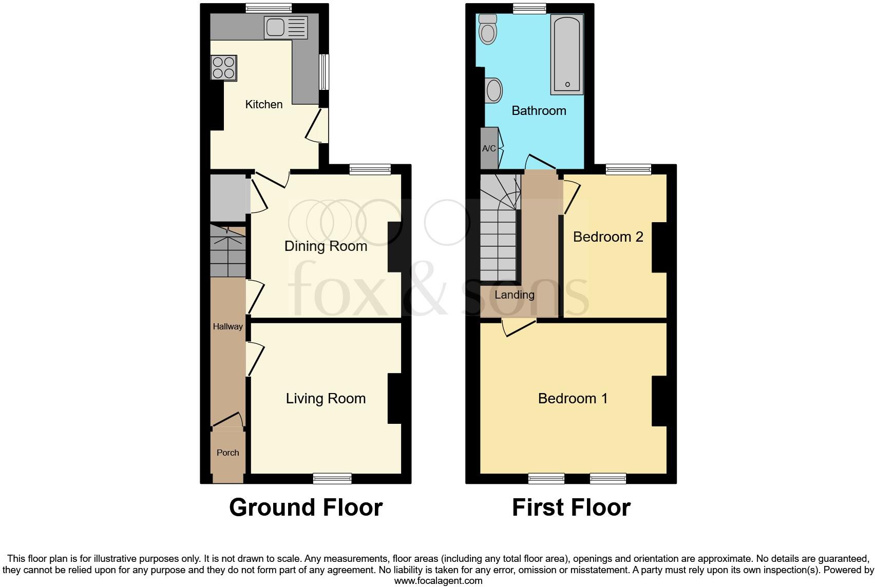
- Two-storey layout with living room, dining room, kitchen on the ground floor and two bedrooms and a bathroom on the first floor.
Rooms
- Porch:
- Hallway:
- Living Room:
- Dining Room:
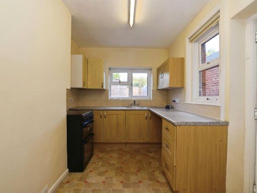
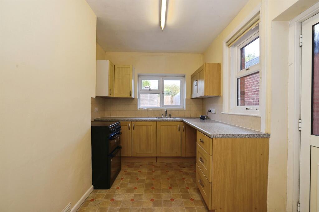
- Kitchen:
- Landing:
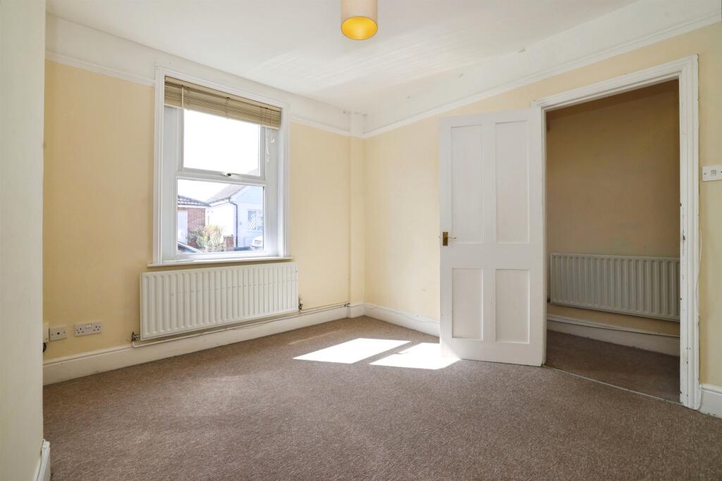
- Bedroom 1:
- Bedroom 2:
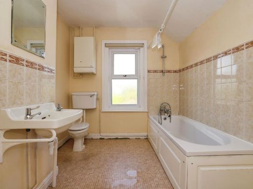
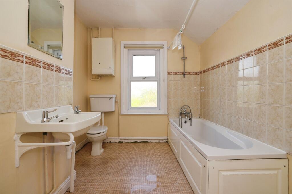
- Bathroom:
Textual Property Features
Detected Visual Features
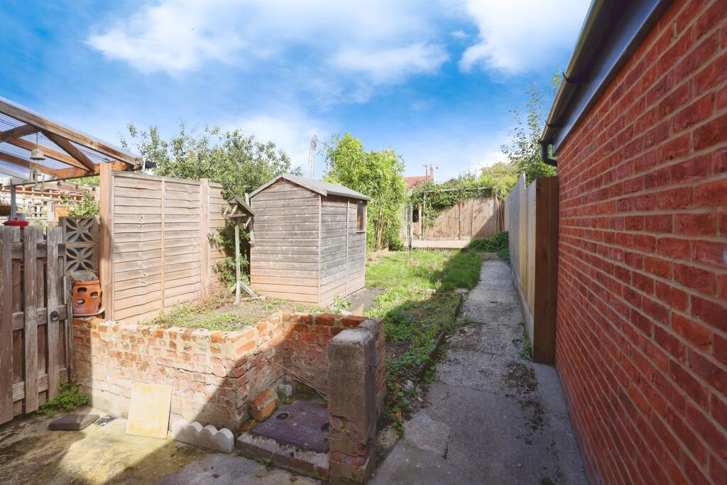
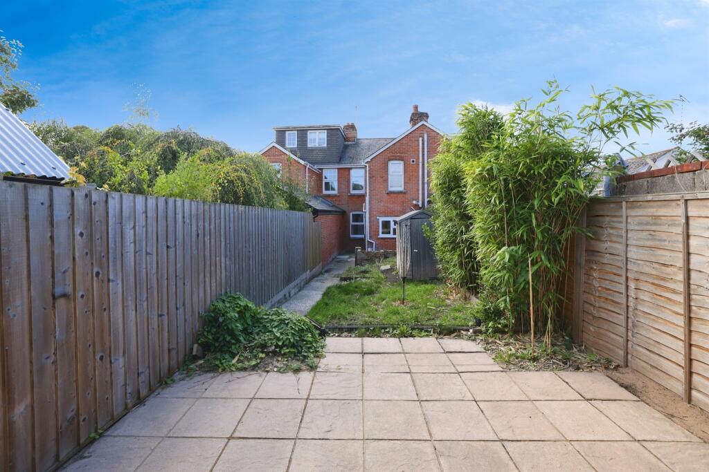
- Edwardian
- terraced house
- traditional brick
- exterior
- period property
- two-story
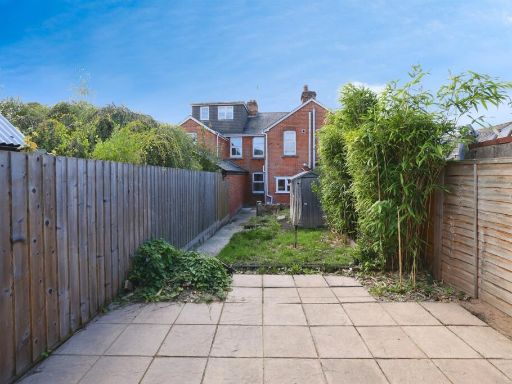
- small garden
- front path
- simple facade
- window frames
- contemporary
- neutral colors
- carpet flooring
- radiator
- ceiling light
- window
- small room
- medium room
EPC Details
- Fully double glazed
- Cavity wall, filled cavity
- Boiler and radiators, mains gas
- Low energy lighting in 33% of fixed outlets
- Suspended, no insulation (assumed)
Nearby Schools
- Old Sarum Primary School
- Gomeldon Primary School
- Newton Tony Church of England Voluntary Controlled School
- Kiwi Primary School
- Avon Valley Academy
- Durrington All Saints Church of England Voluntary Controlled Infants' School
- Shipton Bellinger Primary School
- Avondale Preparatory School
- Bulford St Leonard's C of E (VA) Primary School
- Durrington Church of England Controlled Junior School
- Woodford Valley Church of England Aided School
- St Nicholas Church of England Primary School
- King's Gate Primary School
- Christ The King Catholic School, Amesbury
- The Stonehenge School
- Larkhill Primary School
- Netheravon All Saints CofE Primary School
- Winterbourne Earls Church of England Primary School
- Amesbury Archer Primary School
- Amesbury Church of England Voluntary Controlled Primary School
- St Michael's Church of England Primary School
Nearest Bars And Restaurants
- Id: 2119762389
- Tags:
- Amenity: pub
- Name: The Bell
- Wikidata: Q26604634
- TagsNormalized:
- Lat: 51.1721008
- Lon: -1.7809522
- FullGeoHash: gcnep7x5hfcz
- PartitionGeoHash: gcne
- Images:
- FoodStandards: null
- Distance: 272.5
,- Id: 3874472532
- Tags:
- Addr:
- City: Amesbury
- Street: Flower Lane
- Amenity: fast_food
- Cuisine: fish_and_chips
- Name: Amesbury Chippy
- TagsNormalized:
- Lat: 51.1715991
- Lon: -1.7805824
- FullGeoHash: gcnep7x2jmmw
- PartitionGeoHash: gcne
- Images:
- FoodStandards: null
- Distance: 232.5
,- Id: 3114606602
- Tags:
- Addr:
- Amenity: fast_food
- Brand: Domino's
- Brand:wikidata: Q839466
- Brand:wikipedia: en:Domino's Pizza
- Contact:
- Website: https://www.dominos.co.uk/pizza-near-me/amesbury/44-salisbury-street
- Cuisine: pizza
- Name: Domino's
- Takeaway: yes
- TagsNormalized:
- fast food
- food
- dominos
- pizza
- takeaway
- Lat: 51.1716563
- Lon: -1.7799646
- FullGeoHash: gcnep7xbeb45
- PartitionGeoHash: gcne
- Images:
- FoodStandards: null
- Distance: 191.8
,- Id: 2477105099
- Tags:
- TagsNormalized:
- Lat: 51.1716382
- Lon: -1.7786006
- FullGeoHash: gcnepe8b7ser
- PartitionGeoHash: gcne
- Images:
- FoodStandards: null
- Distance: 101.6
,- Id: 7860901122
- Tags:
- Addr:
- City: Amesbury
- Housenumber: 3
- Postcode: SP4 7LY
- Street: Earls Court Road
- Amenity: fast_food
- Menu:
- Url: https://www.chefonline.co.uk/amesbury-spice-amesbury-salisbury-sp4/menu
- Name: Amesbury Spice
- Opening_hours: Mo-Su 17:30-21:00
- Website: http://www.amesburyspice.com/
- TagsNormalized:
- Lat: 51.1717137
- Lon: -1.7779067
- FullGeoHash: gcnepe92gfbd
- PartitionGeoHash: gcne
- Images:
- FoodStandards: null
- Distance: 68.9
}
Nearest General Shops
- Id: 3168312369
- Tags:
- Name: Meadow Garage
- Shop: car_repair
- Source: Local Knowledge
- TagsNormalized:
- garage
- meadow
- car repair
- repair
- shop
- Lat: 51.1698119
- Lon: -1.7782398
- FullGeoHash: gcnepe1ju023
- PartitionGeoHash: gcne
- Images:
- FoodStandards: null
- Distance: 170.1
,- Id: 416523799
- Tags:
- Addr:
- City: Amesbury
- Housenumber: 18
- Street: Salisbury Road
- Building: retail
- Contact:
- Facebook: https://www.facebook.com/Amesbury-Pet-Store-181224401971421/
- Phone: +44 1980 623182
- Name: Amesbury Pet Stores
- Shop: pet
- Source: local knowledge
- Source:geometry: bing
- TagsNormalized:
- Lat: 51.1705276
- Lon: -1.7792341
- FullGeoHash: gcnepe23uvdy
- PartitionGeoHash: gcne
- Images:
- FoodStandards: null
- Distance: 155.4
,- Id: 2092806433
- Tags:
- Name: Hills Cycles & Fishing Tackle
- Shop: bicycle
- TagsNormalized:
- Lat: 51.1715793
- Lon: -1.7786104
- FullGeoHash: gcnepe8b53gb
- PartitionGeoHash: gcne
- Images:
- FoodStandards: null
- Distance: 99.4
}
Nearest Grocery shops
- Id: 297239801
- Tags:
- Addr:
- City: Amesbury
- Postcode: SP4 7JH
- Street: Boscombe Road
- Building: commercial
- Name: The Co-operative Food
- Shop: convenience
- TagsNormalized:
- the co-operative food
- food
- convenience
- shop
- Lat: 51.1679998
- Lon: -1.7655124
- FullGeoHash: gcnepff7hw6x
- PartitionGeoHash: gcne
- Images:
- FoodStandards: null
- Distance: 896.8
,- Id: 3874479189
- Tags:
- Addr:
- City: Amesbury
- Street: Salisbury Strret
- Name: CO Operative Food
- Shop: convenience
- TagsNormalized:
- Lat: 51.1719578
- Lon: -1.7804047
- FullGeoHash: gcnep7xd3864
- PartitionGeoHash: gcne
- Images:
- FoodStandards: null
- Distance: 231.2
,- Id: 3128141111
- Tags:
- Brand: McColl's
- Brand:wikidata: Q16997477
- Brand:wikipedia: en:McColl's
- Contact:
- Website: https://www.mccolls.co.uk/storelocator/amesbury-39-salisbury-st/
- Name: McColl's
- Shop: convenience
- Source: Photograph
- TagsNormalized:
- Lat: 51.1717947
- Lon: -1.7796352
- FullGeoHash: gcnepe8173zv
- PartitionGeoHash: gcne
- Images:
- FoodStandards: null
- Distance: 174.6
}
Nearest Supermarkets
- Id: 38333521
- Tags:
- Addr:
- City: Amesbury
- Postcode: SP4 7RT
- Street: London Road
- Alt_name: Tesco Amesbury Superstore
- Brand: Tesco
- Brand:wikidata: Q487494
- Brand:wikipedia: en:Tesco
- Building: yes
- Contact:
- Website: https://www.tesco.com/store-locator/salisbury/amesbury-distribution-park
- Name: Tesco
- Opening_hours: Mo-Sa 07:00-23:00 Su 10:00-16:00
- Shop: supermarket
- TagsNormalized:
- Lat: 51.175549
- Lon: -1.7659174
- FullGeoHash: gcnepu4p5ju8
- PartitionGeoHash: gcne
- Images:
- FoodStandards: null
- Distance: 928
,- Id: 38333523
- Tags:
- Addr:
- City: Amesbury
- Housenumber: 118-130
- Postcode: SP4 7EQ
- Street: London Road
- Brand:
- Building: retail
- Name: B&M Home Store
- Opening_hours: Mo-Sa 08:00-20:00 Su 10:30-16:30
- Phone: +44 1980 625111
- Shop: supermarket
- TagsNormalized:
- Lat: 51.1762382
- Lon: -1.7706913
- FullGeoHash: gcnepsqe5yhz
- PartitionGeoHash: gcne
- Images:
- FoodStandards: null
- Distance: 723.4
,- Id: 171864782
- Tags:
- Addr:
- City: Amesbury
- Postcode: SP4 7HD
- Street: Salisbury Road
- Brand: ALDI
- Brand:wikidata: Q41171672
- Brand:wikipedia: en:Aldi
- Building: yes
- Contact:
- Website: https://stores.aldi.co.uk/amesbury/salisbury-road
- Name: ALDI
- Opening_hours: Mo-Sa 08:00-22:00; Su 10:00-16:00
- Shop: supermarket
- Source: Bing/Local Knowledege
- TagsNormalized:
- Lat: 51.171187
- Lon: -1.7799476
- FullGeoHash: gcnep7rvu0wu
- PartitionGeoHash: gcne
- Images:
- FoodStandards: null
- Distance: 184.5
}
Nearest Religious buildings
- Id: 237984795
- Tags:
- Amenity: place_of_worship
- Building: yes
- Denomination: anglican
- Name: St Mary & St Melor
- Religion: christian
- Wikidata: Q17529541
- TagsNormalized:
- place of worship
- anglican
- christian
- church
- Lat: 51.1719135
- Lon: -1.7842808
- FullGeoHash: gcnep7sdp0pf
- PartitionGeoHash: gcne
- Images:
- FoodStandards: null
- Distance: 492.6
,- Id: 422731419
- Tags:
- Amenity: place_of_worship
- Building: yes
- Denomination: catholic
- Name: Christ the King
- Religion: christian
- TagsNormalized:
- place of worship
- catholic
- christian
- church
- Lat: 51.1748314
- Lon: -1.7794264
- FullGeoHash: gcneps070258
- PartitionGeoHash: gcne
- Images:
- FoodStandards: null
- Distance: 427.6
,- Id: 3166295663
- Tags:
- Addr:
- City: Amesbury, Salisbury
- Street: High Street
- Amenity: place_of_worship
- Name: Amesbury Methodist Church
- Phone: +441980623948
- Religion: christian
- Source: Photograph
- TagsNormalized:
- place of worship
- church
- methodist
- christian
- Lat: 51.1726829
- Lon: -1.7814899
- FullGeoHash: gcnep7wy2r2z
- PartitionGeoHash: gcne
- Images:
- FoodStandards: null
- Distance: 334
}
Nearest Medical buildings
- Id: 422869863
- Tags:
- Amenity: clinic
- Building: yes
- TagsNormalized:
- Lat: 51.1945835
- Lon: -1.7349599
- FullGeoHash: gcng0x8whd01
- PartitionGeoHash: gcng
- Images:
- FoodStandards: null
- Distance: 3931.5
,- Id: 3165272370
- Tags:
- Addr:
- City: Amesbury, Salisbury
- Street: Stonehenge Walk
- Amenity: dentist
- Healthcare: dentist
- Name: Amesbury Dental Care
- TagsNormalized:
- dentist
- health
- healthcare
- dental
- Lat: 51.1733635
- Lon: -1.7799552
- FullGeoHash: gcnep7zfkn35
- PartitionGeoHash: gcne
- Images:
- FoodStandards: null
- Distance: 301.4
,- Id: 3165298937
- Tags:
- Addr:
- City: Amesbury, Salisbury
- Street: The Centre
- Amenity: doctors
- Healthcare: doctor
- Name: Barcroft Medical Centre
- Source: Local Knowledge
- TagsNormalized:
- doctor
- doctors
- health
- healthcare
- Lat: 51.173113
- Lon: -1.7791934
- FullGeoHash: gcnepeb2vz9j
- PartitionGeoHash: gcne
- Images:
- FoodStandards: null
- Distance: 248
,- Id: 3114606603
- Tags:
- Amenity: pharmacy
- Brand: Boots
- Brand:wikidata: Q6123139
- Brand:wikipedia: en:Boots (company)
- Healthcare: pharmacy
- Name: Boots
- Operator: Boots
- Source: Photograph
- TagsNormalized:
- pharmacy
- boots
- health
- healthcare
- Lat: 51.1717085
- Lon: -1.7801872
- FullGeoHash: gcnep7x8y9u5
- PartitionGeoHash: gcne
- Images:
- FoodStandards: null
- Distance: 208.2
}
Nearest Leisure Facilities
- Id: 261107508
- Tags:
- TagsNormalized:
- Lat: 51.1731934
- Lon: -1.7755253
- FullGeoHash: gcnepeg17q8m
- PartitionGeoHash: gcne
- Images:
- FoodStandards: null
- Distance: 251.6
,- Id: 261110287
- Tags:
- TagsNormalized:
- Lat: 51.1694529
- Lon: -1.7751015
- FullGeoHash: gcnepe57tjkk
- PartitionGeoHash: gcne
- Images:
- FoodStandards: null
- Distance: 249.6
,- Id: 261110286
- Tags:
- TagsNormalized:
- Lat: 51.169691
- Lon: -1.7756071
- FullGeoHash: gcnepe5j13g2
- PartitionGeoHash: gcne
- Images:
- FoodStandards: null
- Distance: 207.4
,- Id: 625100858
- Tags:
- TagsNormalized:
- Lat: 51.1727091
- Lon: -1.7791024
- FullGeoHash: gcnepe8qxumh
- PartitionGeoHash: gcne
- Images:
- FoodStandards: null
- Distance: 207.4
,- Id: 261110288
- Tags:
- Leisure: pitch
- Sport: bowls
- TagsNormalized:
- Lat: 51.1702758
- Lon: -1.7771996
- FullGeoHash: gcnepe3bknzb
- PartitionGeoHash: gcne
- Images:
- FoodStandards: null
- Distance: 105.7
}
Nearest Tourist attractions
- Id: 36970076
- Tags:
- Archaeological_site: henge
- Historic: archaeological_site
- Name: Woodhenge
- Site_type: henge
- Tourism: attraction
- Wikidata: Q534028
- Wikipedia: en:Woodhenge
- TagsNormalized:
- Lat: 51.1893844
- Lon: -1.7857749
- FullGeoHash: gcnepqexu2vs
- PartitionGeoHash: gcne
- Images:
- FoodStandards: null
- Distance: 2103.9
,- Id: 583215075
- Tags:
- Name: Mandalay Guest House
- Tourism: guest_house
- TagsNormalized:
- Lat: 51.1716868
- Lon: -1.7900982
- FullGeoHash: gcnep782xty1
- PartitionGeoHash: gcne
- Images:
- FoodStandards: null
- Distance: 893.6
,- Id: 3166294015
- Tags:
- Addr:
- City: Amesbury, Salisbury
- Street: High Street
- Name: Amesbury Aviation Heritage Centre
- Source: Photograph
- Tourism: museum
- TagsNormalized:
- Lat: 51.1727794
- Lon: -1.7811149
- FullGeoHash: gcnep7xp112r
- PartitionGeoHash: gcne
- Images:
- FoodStandards: null
- Distance: 317.1
}
Nearest Train stations
- Id: 696725
- Tags:
- Name: Mottisfont & Dunbridge
- Naptan:
- Network: National Rail
- Public_transport: station
- Railway: station
- Ref:
- Wikidata: Q6918669
- Wikipedia: en:Mottisfont & Dunbridge railway station
- TagsNormalized:
- Lat: 51.033863
- Lon: -1.5468958
- FullGeoHash: gcnfkf3tf9wf
- PartitionGeoHash: gcnf
- Images:
- FoodStandards: null
- Distance: 22183.3
,- Id: 6011146543
- Tags:
- Name: Andover
- Naptan:
- Network: National Rail
- Operator: South West Trains
- Public_transport: station
- Railway: station
- Ref:
- Wikidata: Q2003702
- Wikipedia: en:Andover railway station
- TagsNormalized:
- Lat: 51.211559
- Lon: -1.4927767
- FullGeoHash: gcngq4bbzy90
- PartitionGeoHash: gcng
- Images:
- FoodStandards: null
- Distance: 20328.9
,- Id: 6606028830
- Tags:
- Name: Pewsey
- Naptan:
- Network: National Rail
- Public_transport: station
- Railway: station
- Ref:
- Source: NPE
- Wikidata: Q2028949
- Wikipedia: en:Pewsey railway station
- TagsNormalized:
- Lat: 51.3422381
- Lon: -1.7706724
- FullGeoHash: gcnspdwdhqfg
- PartitionGeoHash: gcns
- Images:
- FoodStandards: null
- Distance: 19021.5
,- Id: 8089621
- Tags:
- Name: Dean
- Naptan:
- Network: National Rail
- Public_transport: station
- Railway: station
- Ref:
- Wikidata: Q671580
- Wikipedia: en:Dean railway station
- TagsNormalized:
- Lat: 51.0424158
- Lon: -1.634563
- FullGeoHash: gcnf6gcxxgvq
- PartitionGeoHash: gcnf
- Images:
- FoodStandards: null
- Distance: 17448.6
,- Id: 6011304341
- Tags:
- Name: Salisbury
- Naptan:
- Network: National Rail
- Public_transport: station
- Railway: station
- Ref:
- Wikidata: Q1976733
- Wikipedia: en:Salisbury railway station
- TagsNormalized:
- Lat: 51.0705706
- Lon: -1.8064141
- FullGeoHash: gcndwchees2h
- PartitionGeoHash: gcnd
- Images:
- FoodStandards: null
- Distance: 11375.1
}
Nearest Bus stations and stops
- Id: 354072931
- Tags:
- Bus: yes
- Ele: 149.0
- Highway: bus_stop
- Name: Westland Close
- Naptan:
- AtcoCode: 4600WIA56463
- Bearing: W
- BusStopType: CUS
- CommonName: Westland Close
- Indicator: W-bound
- NaptanCode: wildpwpd
- Street: Raleigh Crescent
- Verified: no
- Public_transport: platform
- Shelter: no
- TagsNormalized:
- Lat: 51.1702418
- Lon: -1.7589786
- FullGeoHash: gcnepgr0kb6q
- PartitionGeoHash: gcne
- Images:
- FoodStandards: null
- Distance: 1282.1
,- Id: 354072893
- Tags:
- Bus: yes
- Ele: 151.0
- Highway: bus_stop
- Name: Westland Close
- Naptan:
- AtcoCode: 4600WIA13091
- Bearing: E
- CommonName: Westland Close
- Indicator: E-bound
- NaptanCode: wildjgat
- Street: Raleigh Crescent
- Verified: no
- Public_transport: platform
- Shelter: yes
- TagsNormalized:
- Lat: 51.17031
- Lon: -1.7590513
- FullGeoHash: gcnepgr0ejhk
- PartitionGeoHash: gcne
- Images:
- FoodStandards: null
- Distance: 1276.5
,- Id: 901674717
- Tags:
- Bus: yes
- Highway: bus_stop
- Public_transport: platform
- TagsNormalized:
- Lat: 51.1643474
- Lon: -1.7645248
- FullGeoHash: gcnepf5jgtdu
- PartitionGeoHash: gcne
- Images:
- FoodStandards: null
- Distance: 1174
,- Id: 583215189
- Tags:
- Bus: yes
- Highway: bus_stop
- Name: Mandalay Guest House
- Naptan:
- AtcoCode: 4600WIA13061
- Bearing: W
- CommonName: Mandalay Guest House
- Indicator: o/s
- NaptanCode: wildgjmp
- Street: Stonehenge Road
- Verified: no
- Public_transport: platform
- TagsNormalized:
- Lat: 51.172423
- Lon: -1.7917499
- FullGeoHash: gcnep5xkcpn3
- PartitionGeoHash: gcne
- Images:
- FoodStandards: null
- Distance: 1016.1
,- Id: 9741702117
- Tags:
- Bus: yes
- Highway: bus_stop
- Public_transport: platform
- TagsNormalized:
- Lat: 51.1724735
- Lon: -1.7786474
- FullGeoHash: gcnepe8v682q
- PartitionGeoHash: gcne
- Images:
- FoodStandards: null
- Distance: 167.6
}
Nearest Hotels
- Id: 311088458
- Tags:
- Building: yes
- Name: The George Hotel
- Tourism: hotel
- TagsNormalized:
- Lat: 51.1719155
- Lon: -1.7824073
- FullGeoHash: gcnep7w44bky
- PartitionGeoHash: gcne
- Images:
- FoodStandards: null
- Distance: 364.2
,- Id: 2477105093
- Tags:
- Amenity: pub
- Name: The George Hotel
- TagsNormalized:
- Lat: 51.1729418
- Lon: -1.7808904
- FullGeoHash: gcnep7xpypzb
- PartitionGeoHash: gcne
- Images:
- FoodStandards: null
- Distance: 314.8
,- Id: 3161142259
- Tags:
- Name: Fairlawn House
- Source: Photograph
- Tourism: hotel
- Wikidata: Q26424029
- TagsNormalized:
- Lat: 51.1731396
- Lon: -1.7803082
- FullGeoHash: gcnep7z95u9u
- PartitionGeoHash: gcne
- Images:
- FoodStandards: null
- Distance: 298.8
}
Tags
- Edwardian
- terraced house
- traditional brick
- exterior
- period property
- two-story
- small garden
- front path
- simple facade
- window frames
- contemporary
- neutral colors
- carpet flooring
- radiator
- ceiling light
- window
- small room
- medium room
Local Market Stats
- Average Price/sqft: £318
- Avg Income: £56000
- Rental Yield: 4.2%
- Social Housing: 9%
- Planning Success Rate: 90%
AirBnB Data
- 1km average: £88/night
- Listings in 1km: 3
Similar Properties
 2 bedroom semi-detached house for sale in Countess Road, Amesbury, SP4 7DW, SP4 — £245,000 • 2 bed • 1 bath • 765 ft²
 3 bedroom terraced house for sale in Blackcross Road, Amesbury, Salisbury, SP4 — £325,000 • 3 bed • 1 bath • 685 ft²
 2 bedroom terraced bungalow for sale in Lanes Close, Amesbury, Salisbury, SP4 — £250,000 • 2 bed • 1 bath • 516 ft²
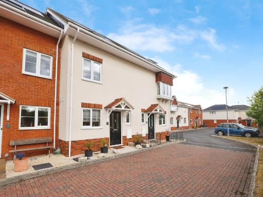 2 bedroom terraced house for sale in Sutton Close, Amesbury, Salisbury, SP4 — £318,000 • 2 bed • 2 bath • 815 ft²
 3 bedroom terraced house for sale in Sloane Court, Amesbury, SP4 — £279,950 • 3 bed • 2 bath • 1228 ft²
 2 bedroom flat for sale in Stonehenge Walk, Amesbury, Salisbury, SP4 — £130,000 • 2 bed • 1 bath • 539 ft²
Meta
- {
"@context": "https://schema.org",
"@type": "Residence",
"name": "2 bedroom terraced house for sale in Edwards Road, Amesbury…",
"description": "",
"url": "https://propertypiper.co.uk/property/26379792-cc1d-472b-b927-e0afa310a030",
"image": "https://image-a.propertypiper.co.uk/2b56ff1e-65dd-456a-bf9a-717cd8343175-1024.jpeg",
"address": {
"@type": "PostalAddress",
"streetAddress": "85 Edwards Road, Amesbury, Salisbury",
"postalCode": "SP4 7LT",
"addressLocality": "Wiltshire",
"addressRegion": "Salisbury",
"addressCountry": "England"
},
"geo": {
"@type": "GeoCoordinates",
"latitude": 51.17122405750983,
"longitude": -1.7773018399437248
},
"numberOfRooms": 2,
"numberOfBathroomsTotal": 1,
"floorSize": {
"@type": "QuantitativeValue",
"value": 415,
"unitCode": "FTK"
},
"offers": {
"@type": "Offer",
"price": 245000,
"priceCurrency": "GBP",
"availability": "https://schema.org/InStock"
},
"additionalProperty": [
{
"@type": "PropertyValue",
"name": "Feature",
"value": "Edwardian"
},
{
"@type": "PropertyValue",
"name": "Feature",
"value": "terraced house"
},
{
"@type": "PropertyValue",
"name": "Feature",
"value": "traditional brick"
},
{
"@type": "PropertyValue",
"name": "Feature",
"value": "exterior"
},
{
"@type": "PropertyValue",
"name": "Feature",
"value": "period property"
},
{
"@type": "PropertyValue",
"name": "Feature",
"value": "two-story"
},
{
"@type": "PropertyValue",
"name": "Feature",
"value": "small garden"
},
{
"@type": "PropertyValue",
"name": "Feature",
"value": "front path"
},
{
"@type": "PropertyValue",
"name": "Feature",
"value": "simple facade"
},
{
"@type": "PropertyValue",
"name": "Feature",
"value": "window frames"
},
{
"@type": "PropertyValue",
"name": "Feature",
"value": "contemporary"
},
{
"@type": "PropertyValue",
"name": "Feature",
"value": "neutral colors"
},
{
"@type": "PropertyValue",
"name": "Feature",
"value": "carpet flooring"
},
{
"@type": "PropertyValue",
"name": "Feature",
"value": "radiator"
},
{
"@type": "PropertyValue",
"name": "Feature",
"value": "ceiling light"
},
{
"@type": "PropertyValue",
"name": "Feature",
"value": "window"
},
{
"@type": "PropertyValue",
"name": "Feature",
"value": "small room"
},
{
"@type": "PropertyValue",
"name": "Feature",
"value": "medium room"
}
]
}
High Res Floorplan Images
Compatible Floorplan Images
FloorplanImages Thumbnail