DY9 9TN - 3 bedroom semidetached house for sale in Hartle Lane, Belbr…
View on Property Piper
3 bedroom semi-detached house for sale in Hartle Lane, Belbroughton, Stourbridge, Worcestershire, DY9
Property Details
- Price: £450000
- Bedrooms: 3
- Bathrooms: 1
- Property Type: undefined
- Property SubType: undefined
Brochure Descriptions
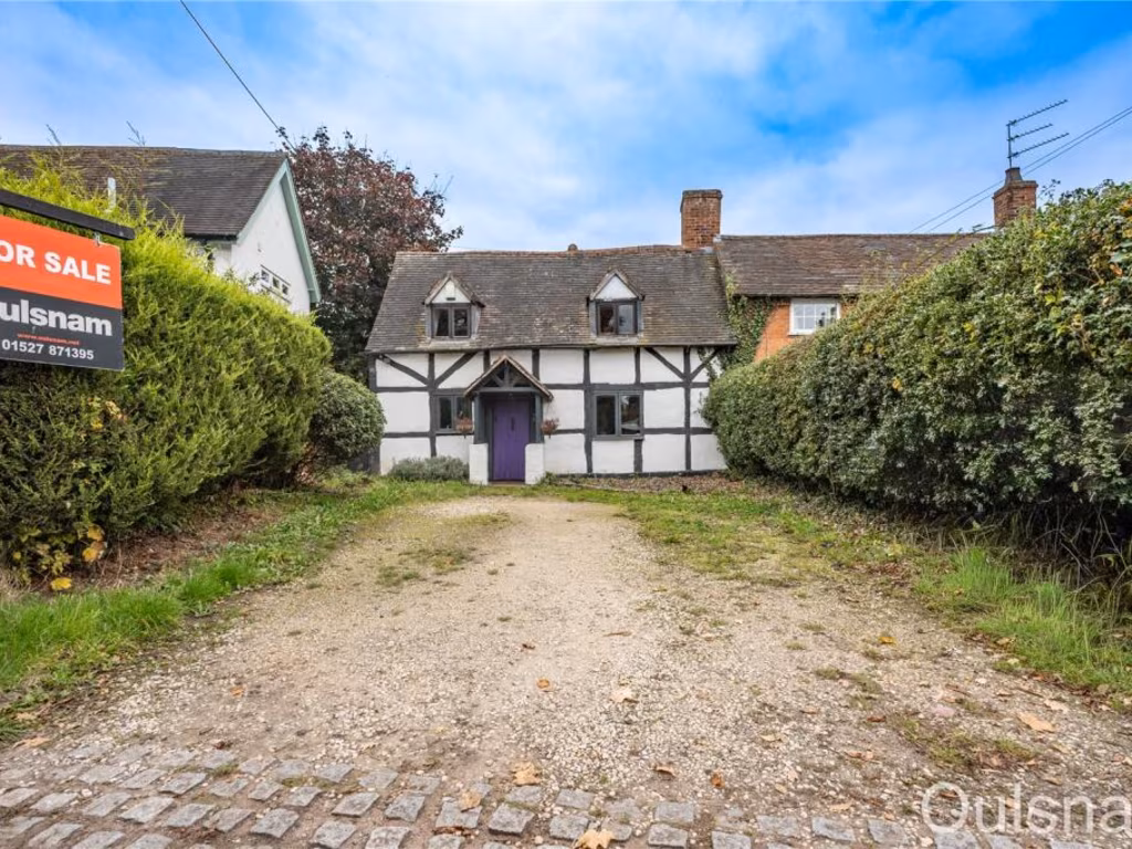
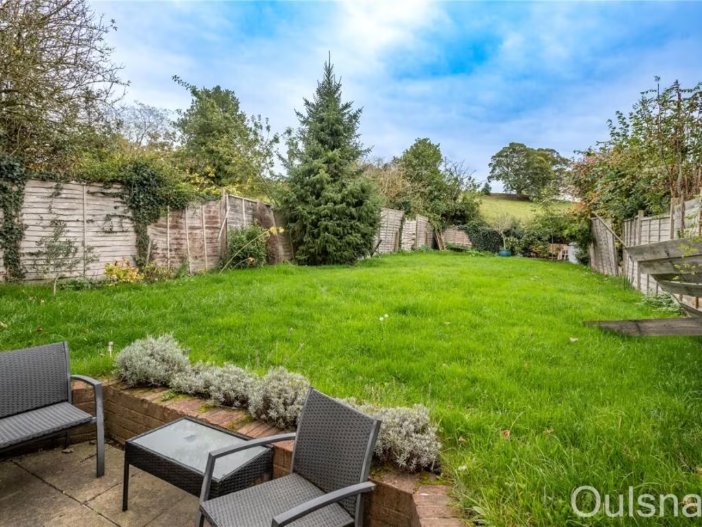
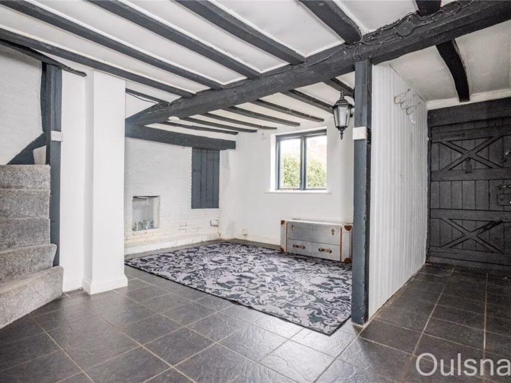
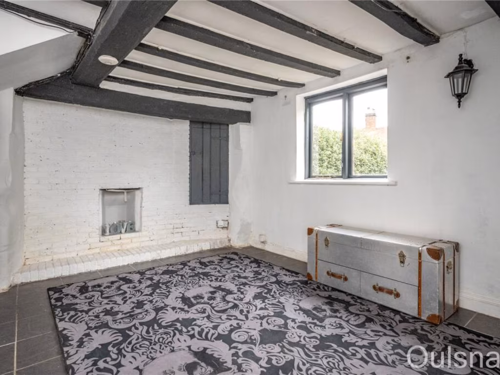
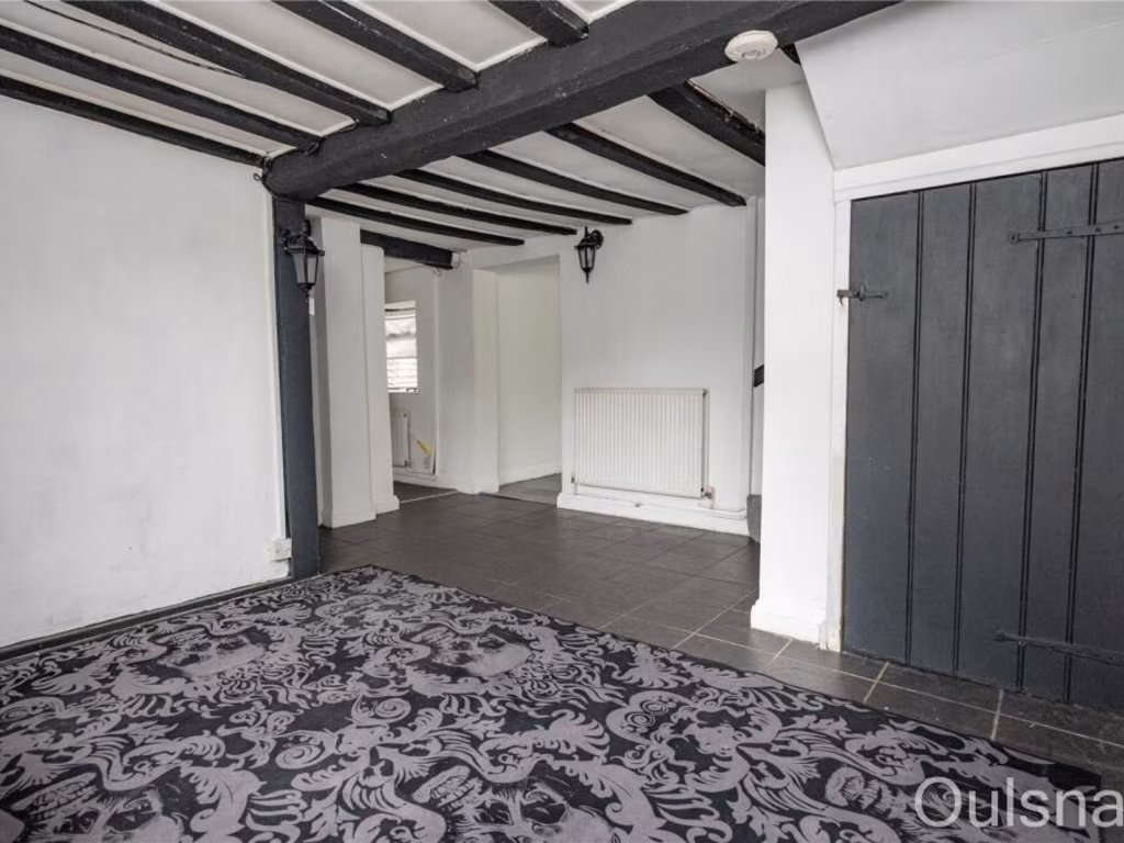
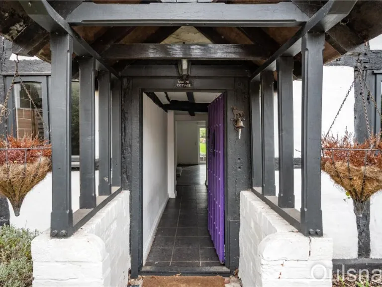
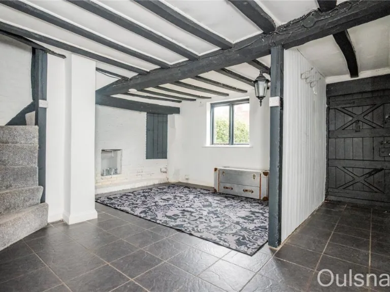
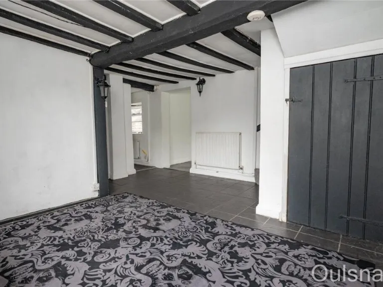
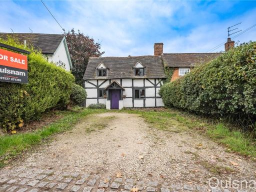
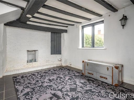
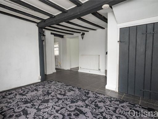
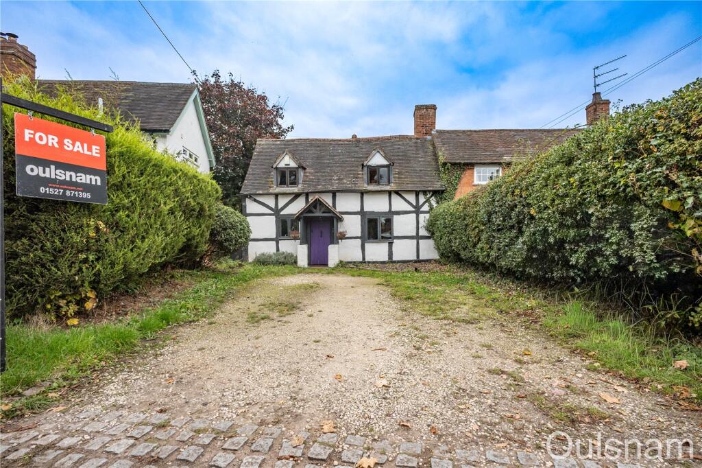
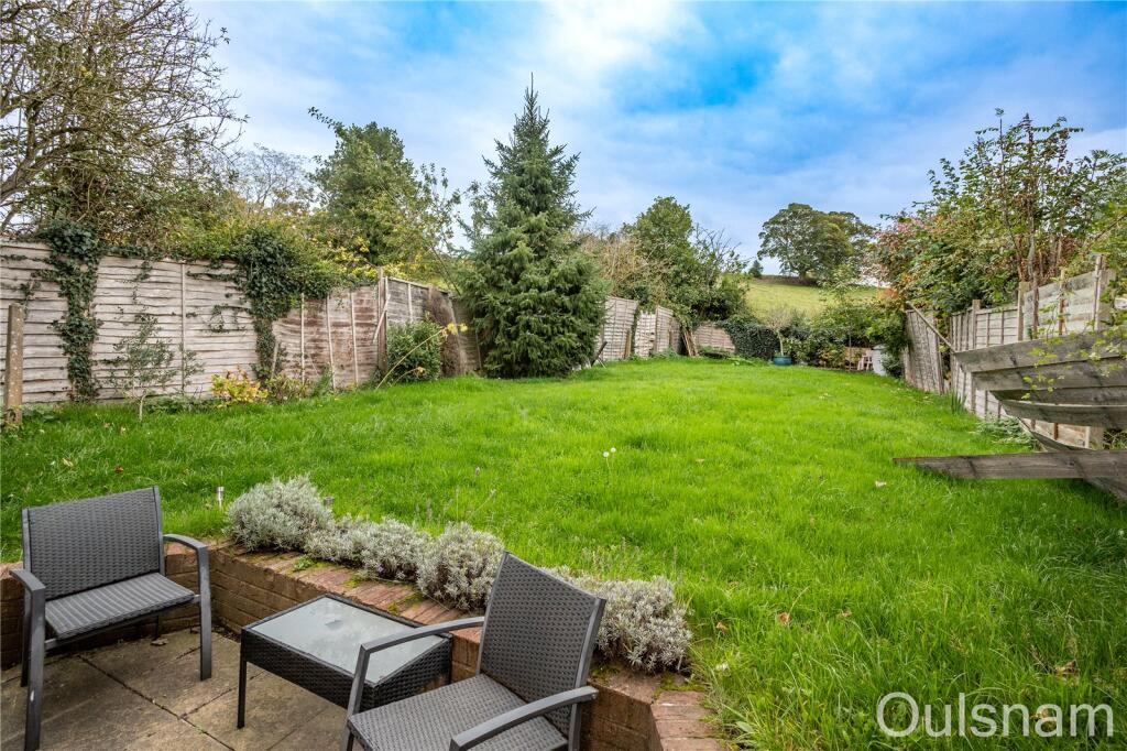
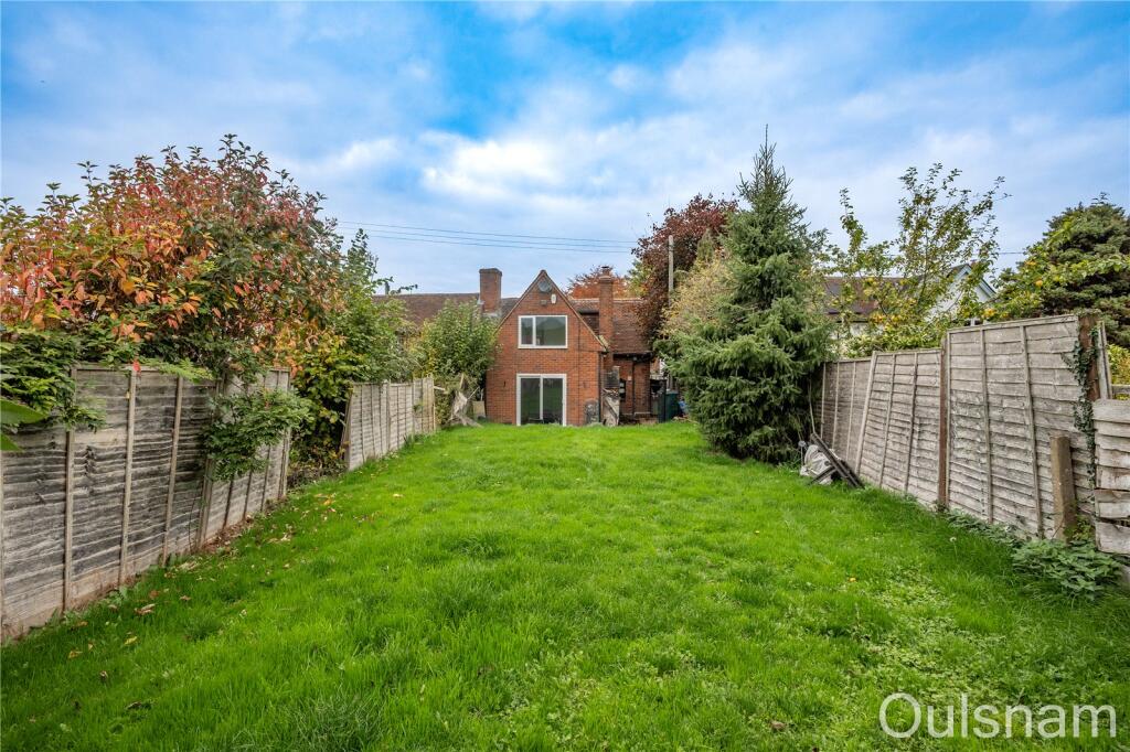
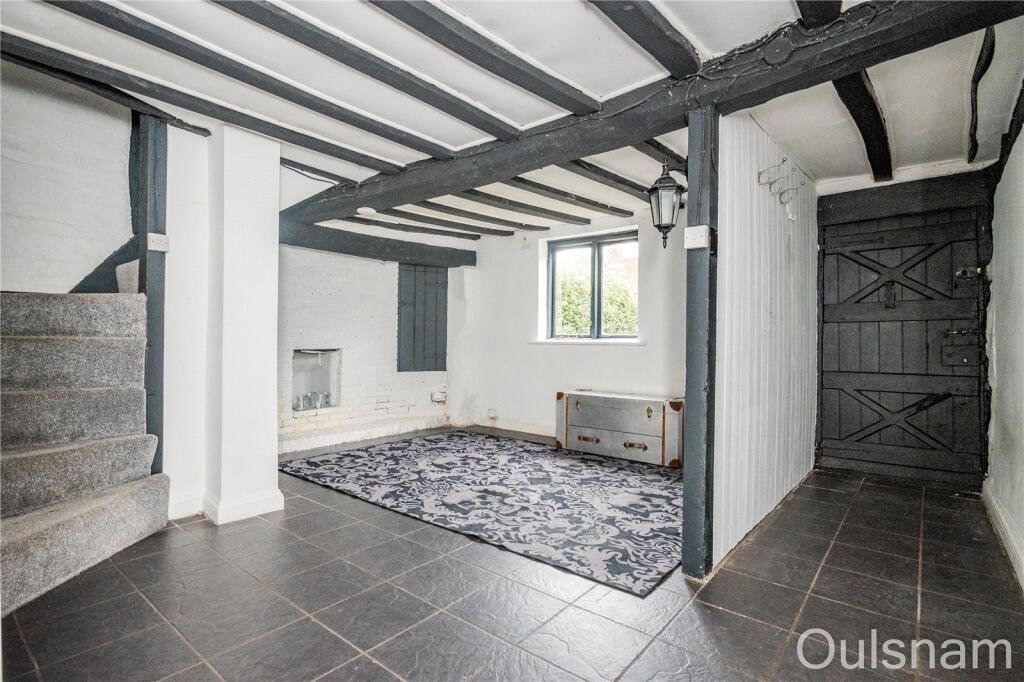
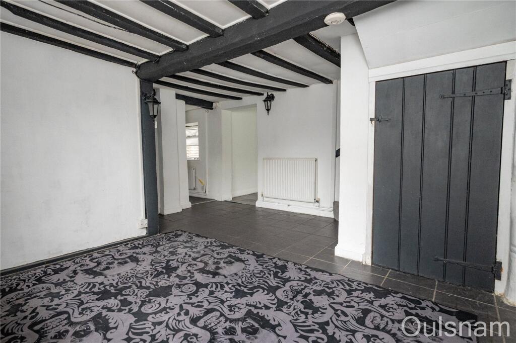
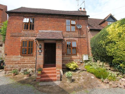
- Period semi-detached/terraced (likely originally cottage) property with exposed timber framing (black-and-white Tudor style). Two-storey accommodation with two dormer windows to the first floor and a central pitched porch over the front entrance. Gravelled driveway providing off-street parking for 1–2 cars, flanked by tall hedging providing good privacy. Small front garden/forecourt; plot appears modest in depth (small to average rear garden likely). Roof is pitched with clay tiles and there is a central chimney stack. Overall the property appears to be an older cottage requiring modernisation; suitable for refurbishment or sympathetic extension (subject to planning). No notable scenic views visible from the images (street/hedged residential outlook).
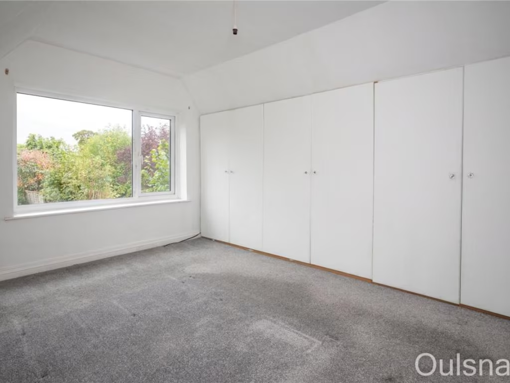
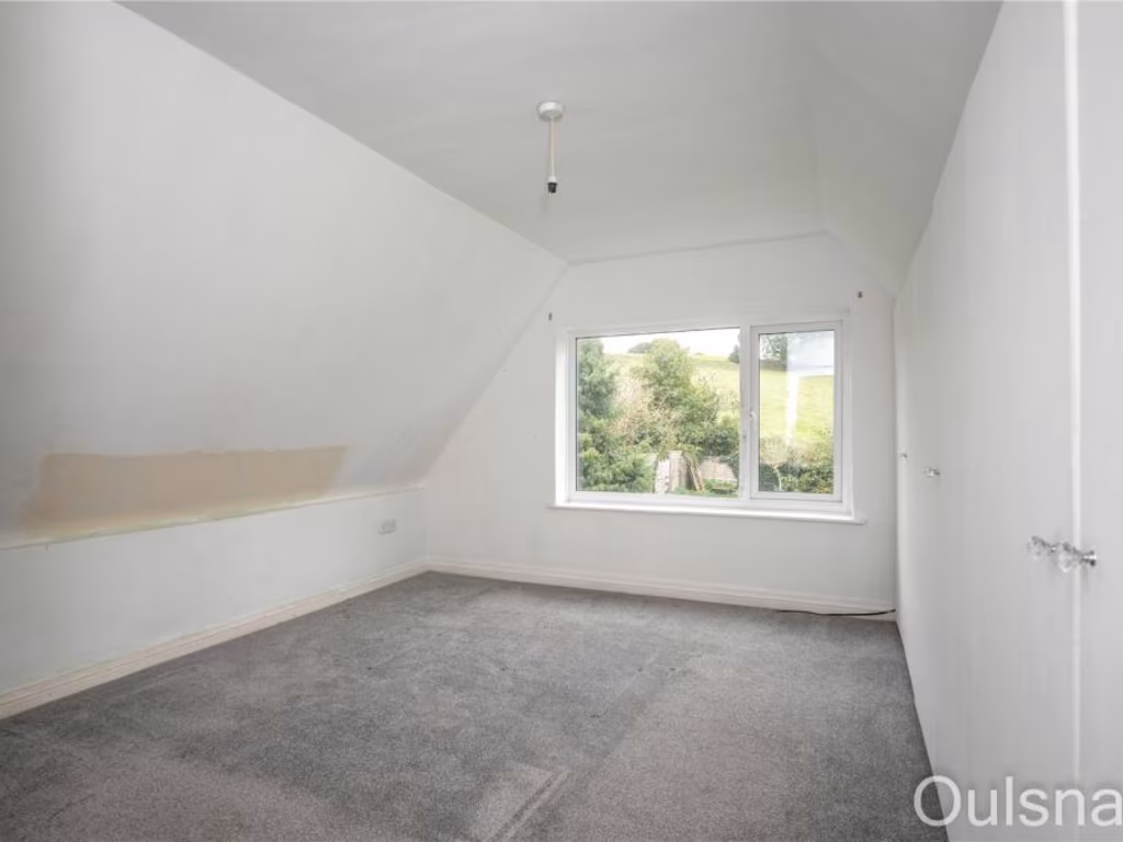
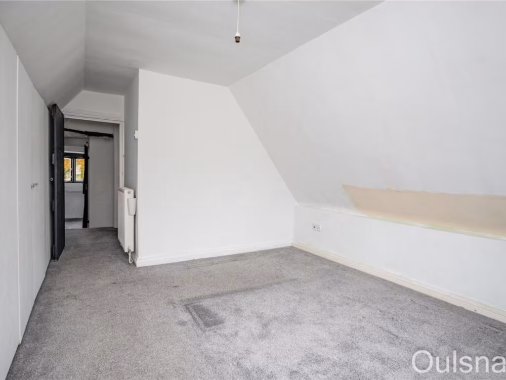
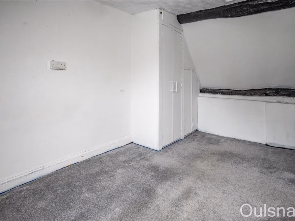
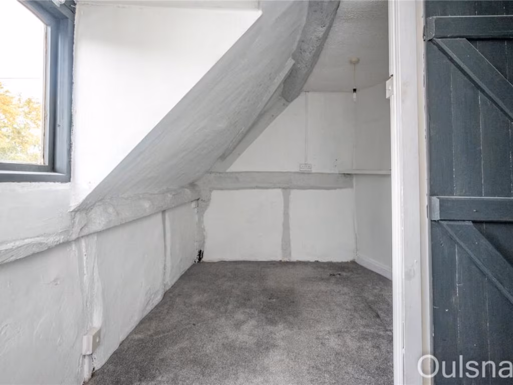
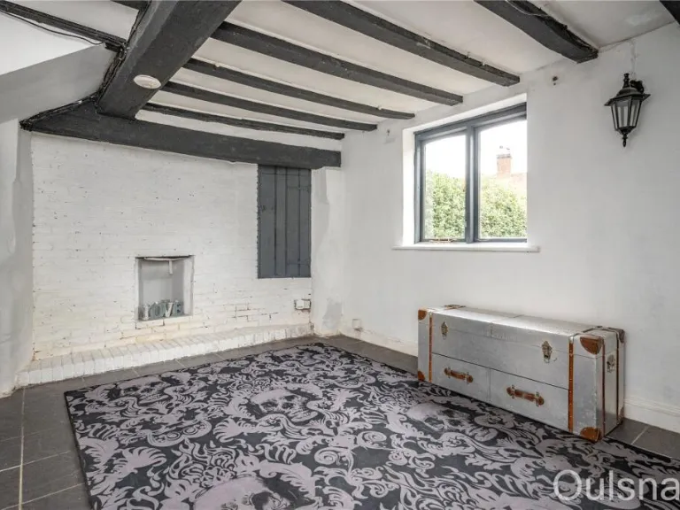
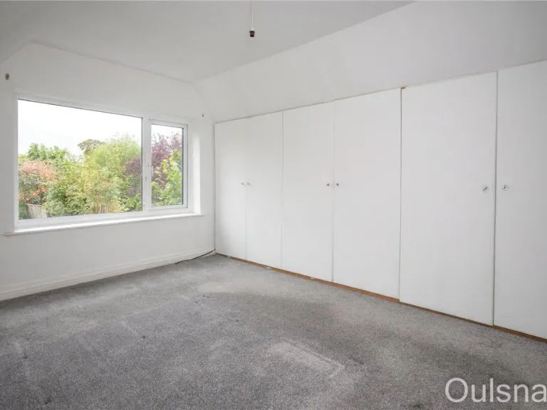
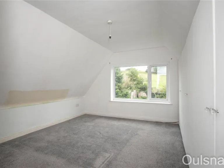
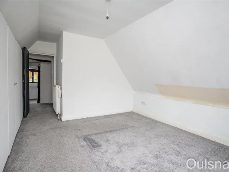
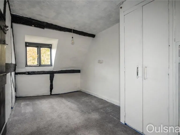
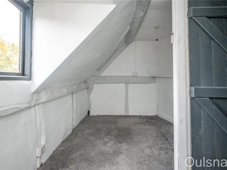
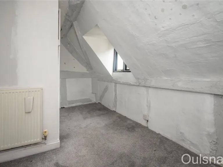
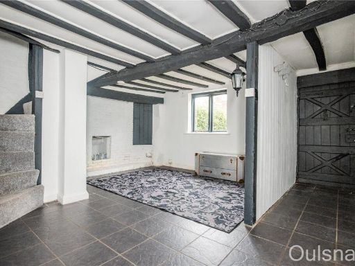
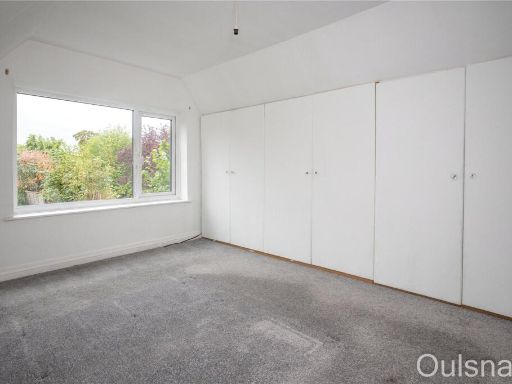
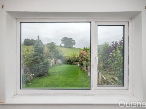
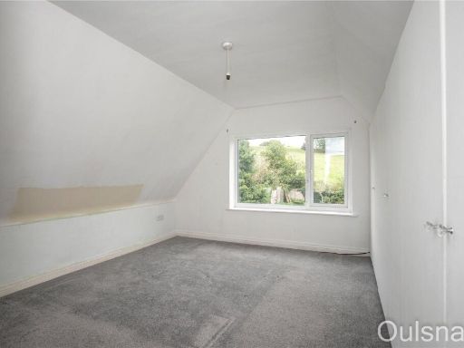
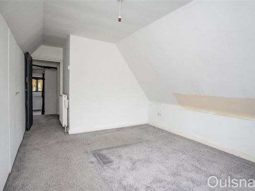
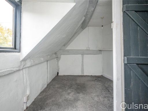
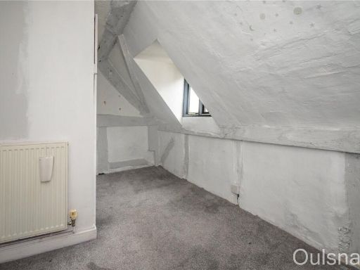
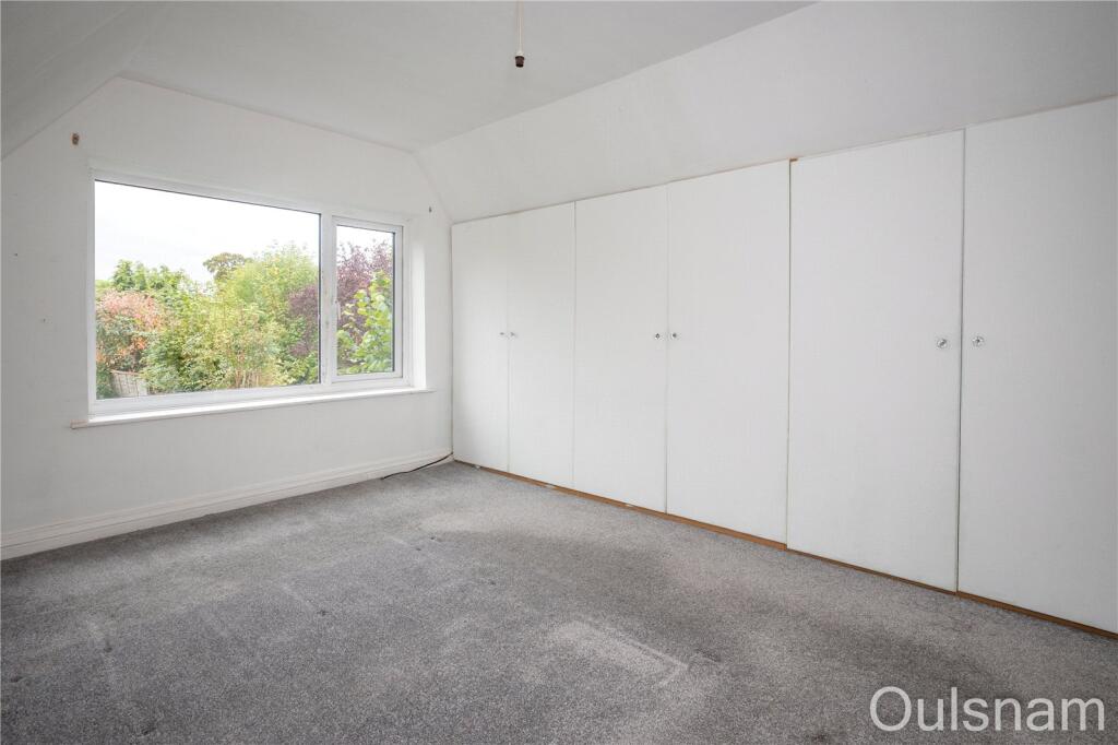
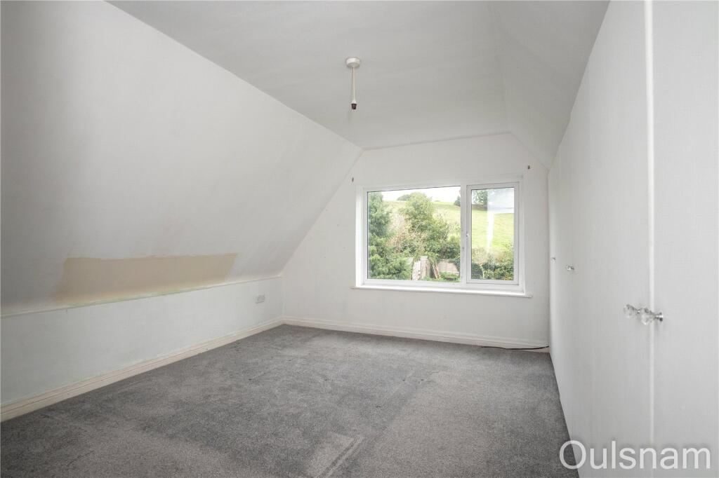
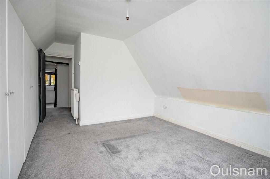
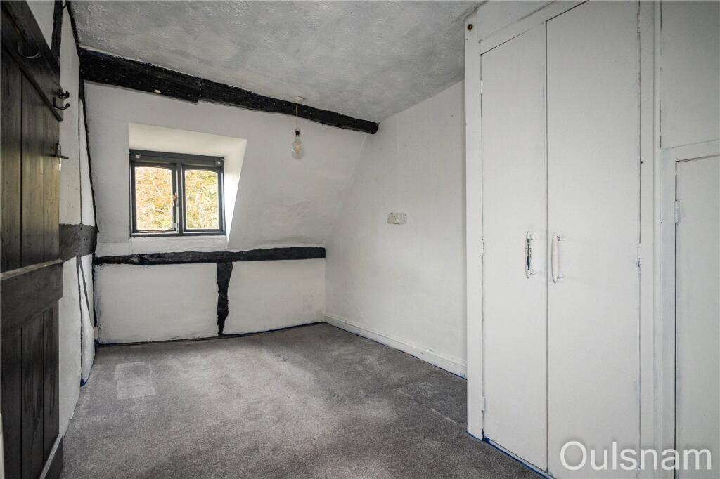
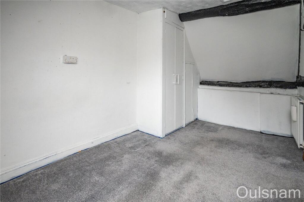
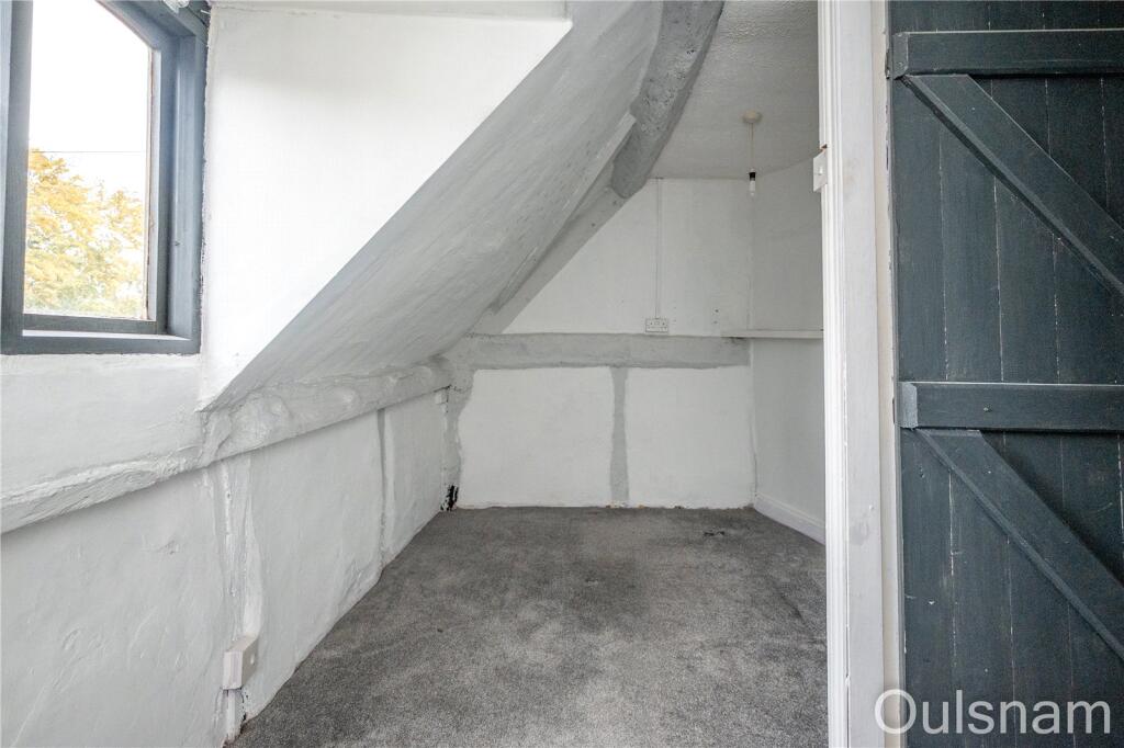
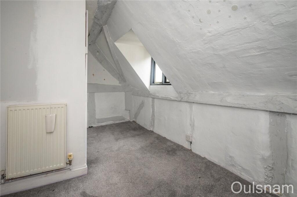
- Appears to be an upper-floor/converted loft bedroom within a residential property. Rooms have sloped ceilings and a dormer-style single window with views over garden greenery. Decoration is neutral (white walls) with grey fitted carpet throughout. Built-in storage/wardrobe runs along one wall. Room size looks small-to-average for a bedroom; overall the accommodation visible is modest and likely part of a mid-terrace/semi-detached house rather than a large detached property. No furniture or removable items were considered. No external features other than a garden view are visible.
Image Descriptions
- cottage Tudor
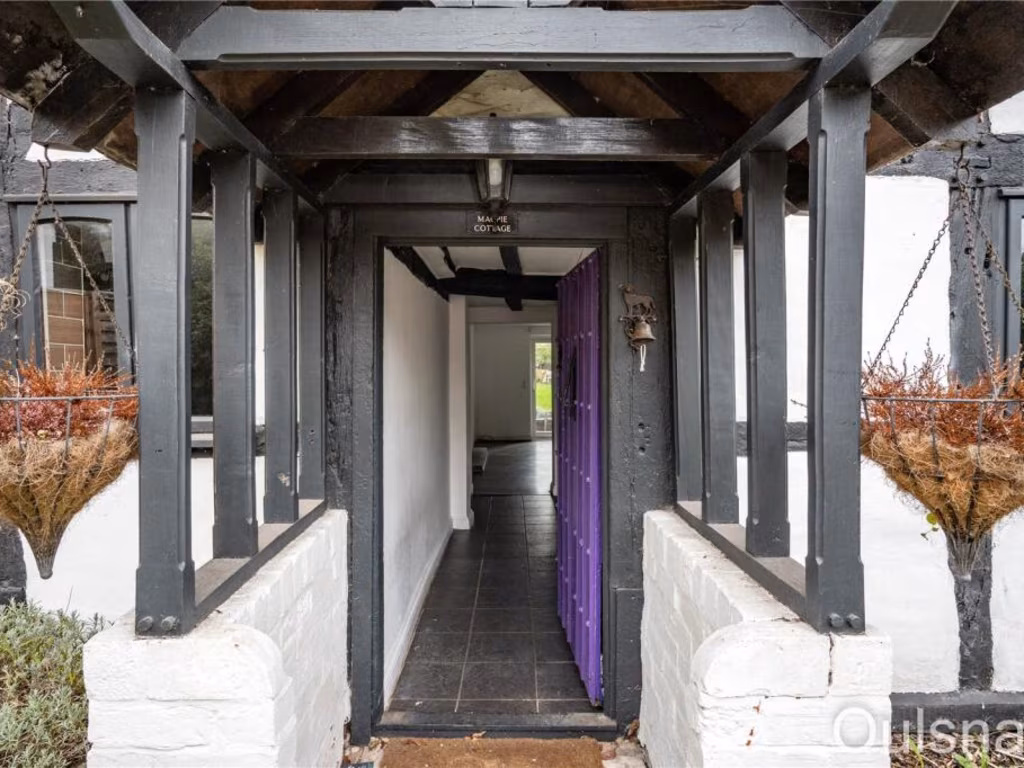
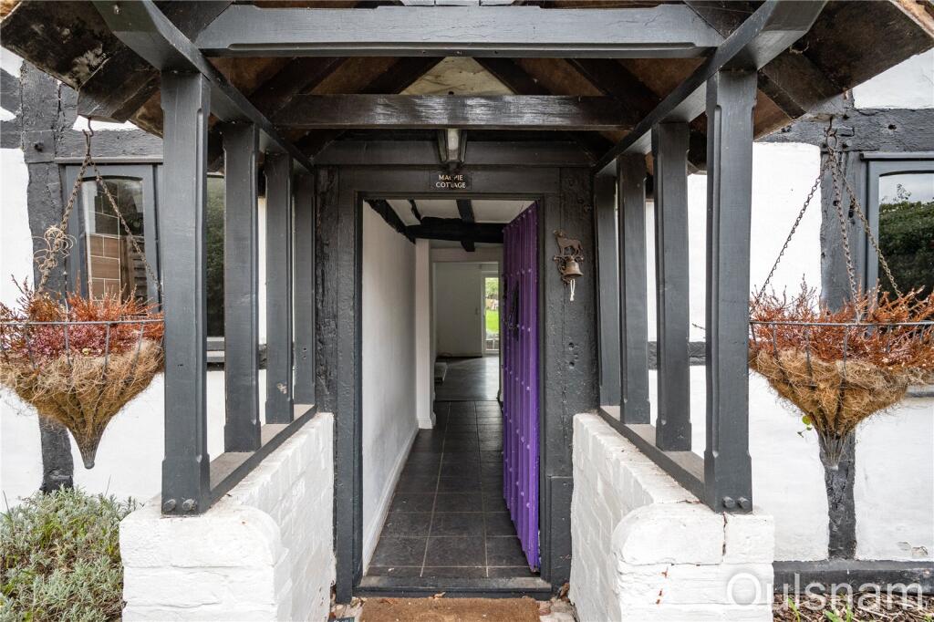
- entrance cottage
Floorplan Description
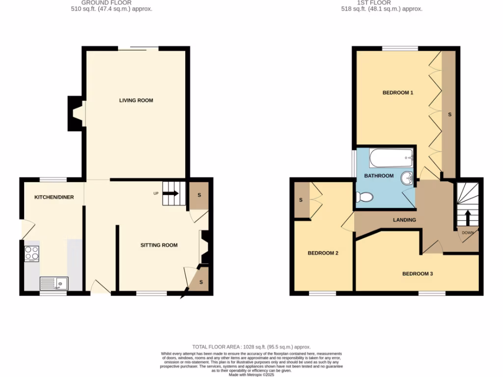
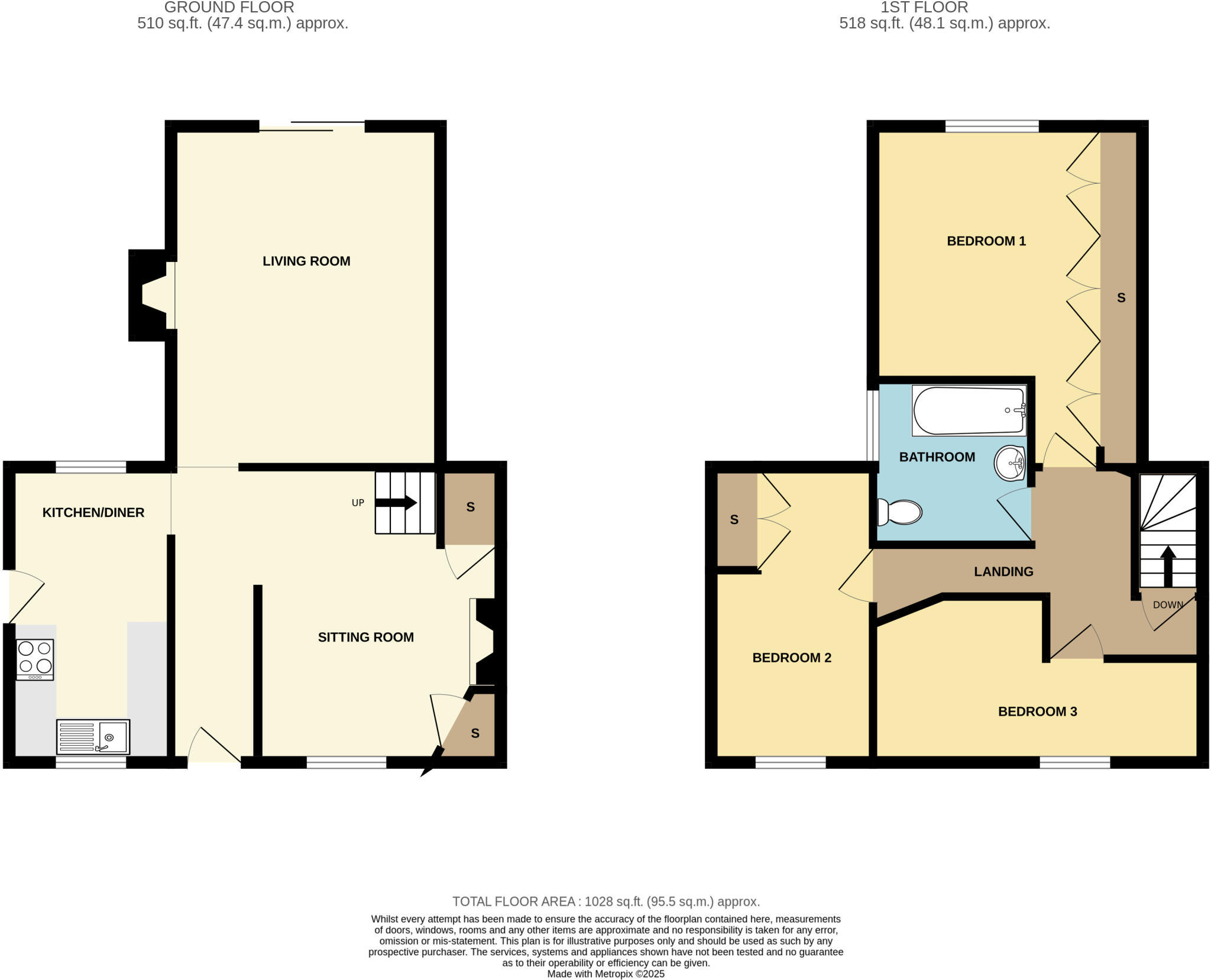
- Two-storey residential property with living spaces on the ground floor and three bedrooms on the first floor.
Rooms
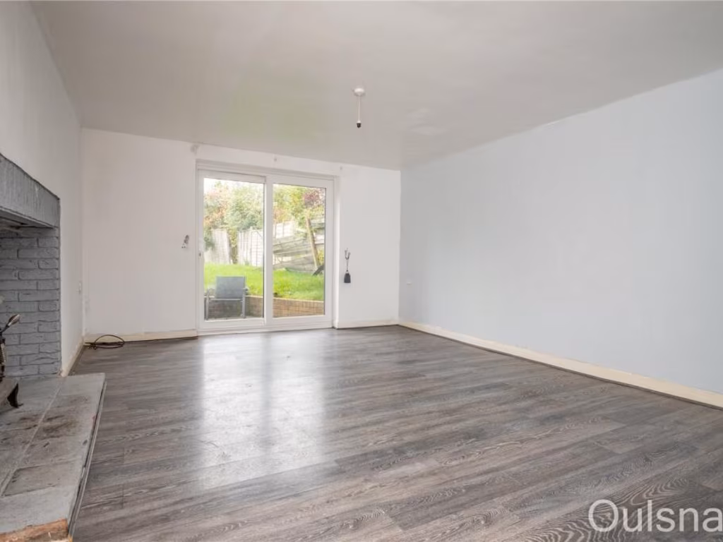
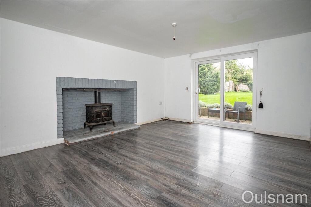
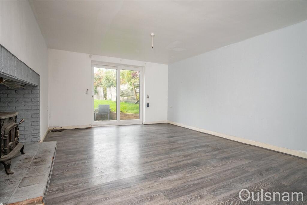
- LIVING ROOM:
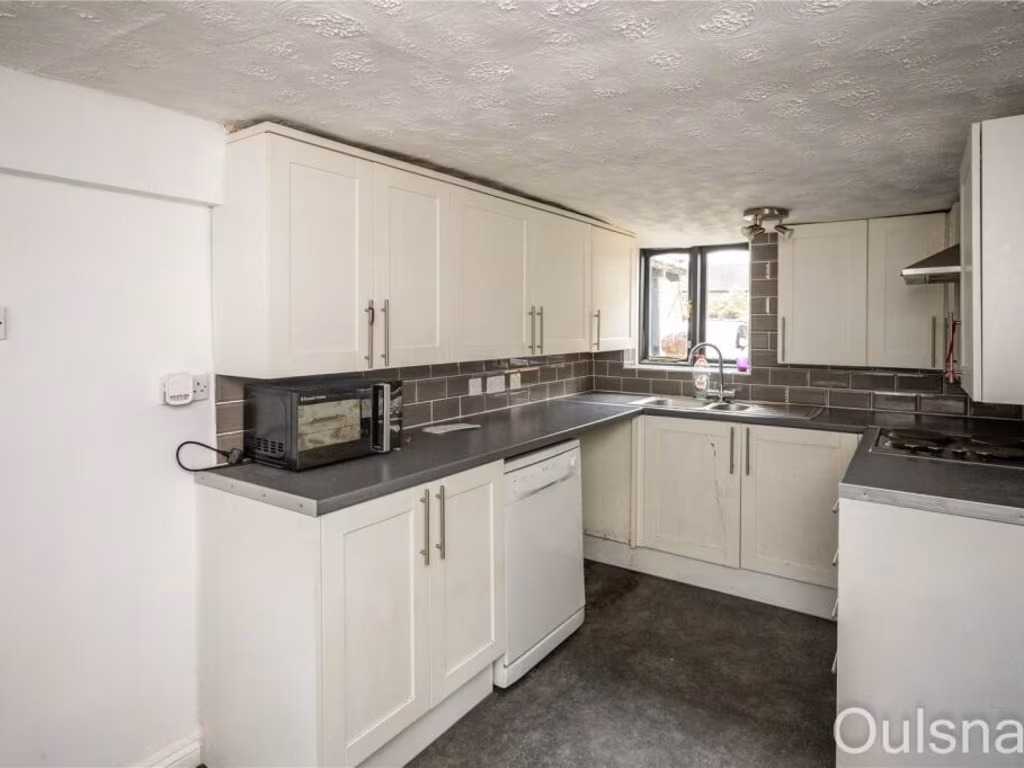
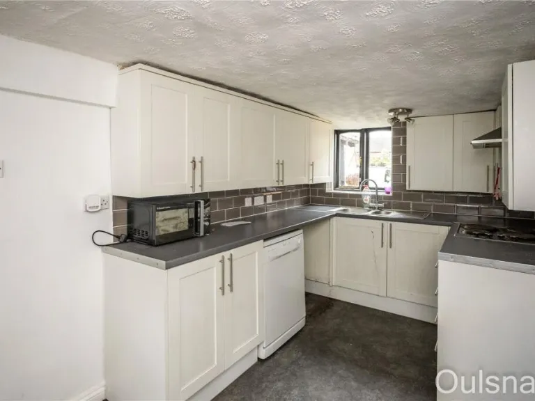
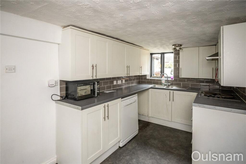
- KITCHEN/DINER:
- SITTING ROOM:
- BEDROOM 1:
- BEDROOM 2:
- BEDROOM 3:
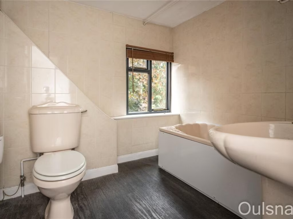
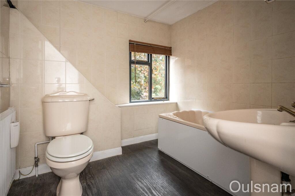
- BATHROOM:
Textual Property Features
- Is Listed Building
- Has Garden
- Chain Free
- Success
Detected Visual Features
- Tudor
- cottage
- timber-framed
- historic
- characterful
- period property
- gravel driveway
- traditional
- wood beams
- rustic
- character
- charming
Nearby Schools
- Parkside Middle School
- Meadows First School
- Dodford First School
- Chaddesley Corbett Endowed Primary School
- Rufford Primary School
- Millfields First School
- Belbroughton CofE Primary School
- Clent Parochial Primary School
- Hagley Catholic High School
- Hagley Primary School
- Caslon Primary Community School
- Wollescote Primary School
- The Orchards School
- Fairfield First School
- Blakedown CofE Primary School
- Romsley St Kenelm's CofE Primary School
- Haybridge High School and Sixth Form
- Hob Green Primary School
- Ham Dingle Primary Academy
- Oldswinford C of E Primary School
- Old Swinford Hospital
- Pedmore CE Primary School
- Lutley Primary School
- St Joseph's RC Primary School
- Elmfield Rudolf Steiner School Limited
- The Pedmore High School
Nearest Bars And Restaurants
- Id: 132701317
- Tags:
- Amenity: pub
- Building: yes
- Name: The Swan
- Source: visual survey; bing
- TagsNormalized:
- Lat: 52.377717
- Lon: -2.079773
- FullGeoHash: gcq9bxjd3f0u
- PartitionGeoHash: gcq9
- Images:
- FoodStandards: null
- Distance: 2362.3
,- Id: 280308828
- Tags:
- Amenity: pub
- Building: pub
- Name: The Bell
- Source: OS_OpenData_StreetView
- Wikidata: Q26392232
- TagsNormalized:
- Lat: 52.3924327
- Lon: -2.0891219
- FullGeoHash: gcqd03y8pcmf
- PartitionGeoHash: gcqd
- Images:
- FoodStandards: null
- Distance: 1321.2
,- Id: 264277344
- Tags:
- Addr:
- City: Belbroughton
- Postcode: DY9 0DU
- Street: Queens Hill
- Amenity: restaurant
- Building: yes
- Heritage: 2
- Heritage:operator: Historic England
- Listed_status: Grade II
- Name: The Queens
- Phone: +44 1562 730276
- Website: http://www.thequeensbelbroughton.co.uk/
- Wikidata: Q26631970
- TagsNormalized:
- Lat: 52.3914839
- Lon: -2.1215836
- FullGeoHash: gcq6p9x4e82w
- PartitionGeoHash: gcq6
- Images:
- FoodStandards: null
- Distance: 924.6
,- Id: 445027455
- Tags:
- Amenity: restaurant
- Building: yes
- Name: Ye Olde Horseshoe Inn
- TagsNormalized:
- Lat: 52.3922675
- Lon: -2.1187156
- FullGeoHash: gcq6pc9pn6e1
- PartitionGeoHash: gcq6
- Images:
- FoodStandards: null
- Distance: 758.4
,- Id: 263809719
- Tags:
- Amenity: restaurant
- Building: yes
- Name: The Talbot
- TagsNormalized:
- Lat: 52.3918629
- Lon: -2.1184657
- FullGeoHash: gcq6pc9kspj7
- PartitionGeoHash: gcq6
- Images:
- FoodStandards: null
- Distance: 728.4
}
Nearest General Shops
- Id: 278521478
- Tags:
- Addr:
- City: Clent
- Postcode: DY9 9QA
- Street: Bromsgrove Road
- Building: no
- Landuse: retail
- Name: Clent Nurseries
- Phone: +44 1562 885071
- Shop: garden_centre
- Website: https://www.clentnurseries.co.uk/
- TagsNormalized:
- retail
- nurseries
- garden centre
- shop
- Lat: 52.4119594
- Lon: -2.1200344
- FullGeoHash: gcq6pv21z97u
- PartitionGeoHash: gcq6
- Images:
- FoodStandards: null
- Distance: 2571.5
,- Id: 278479287
- Tags:
- Building: no
- Shop: garden_centre
- TagsNormalized:
- Lat: 52.391524
- Lon: -2.0732209
- FullGeoHash: gcqd0cd6dryq
- PartitionGeoHash: gcqd
- Images:
- FoodStandards: null
- Distance: 2378.3
,- Id: 278479275
- Tags:
- Addr:
- City: Belbroughton
- Postcode: DY9 9XA
- Street: Madeley Road
- Building: no
- Name: Beechcroft Nurseries & Garden Centre
- Phone: +44 1562 710358
- Shop: garden_centre
- Website: http://www.beechcroft.com/
- TagsNormalized:
- garden centre
- nurseries
- shop
- Lat: 52.3918589
- Lon: -2.0750439
- FullGeoHash: gcqd0c8uxyr5
- PartitionGeoHash: gcqd
- Images:
- FoodStandards: null
- Distance: 2258
}
Nearest Grocery shops
- Id: 437737958
- Tags:
- Brand: Shell Select
- Brand:wikidata: Q154950
- Brand:wikipedia: en:Royal Dutch Shell
- Building: yes
- Name: Shell Select
- Shop: convenience
- Source: Mapillary
- TagsNormalized:
- shell
- shell select
- convenience
- shop
- Lat: 52.4139055
- Lon: -2.1503208
- FullGeoHash: gcq6pjdjjuhs
- PartitionGeoHash: gcq6
- Images:
- FoodStandards: null
- Distance: 3904.3
,- Id: 5345071133
- Tags:
- Brand: Londis
- Brand:wikidata: Q21008564
- Brand:wikipedia: en:Londis (United Kingdom)
- Name: Londis
- Shop: convenience
- TagsNormalized:
- Lat: 52.3910932
- Lon: -2.0868364
- FullGeoHash: gcqd0982jptu
- PartitionGeoHash: gcqd
- Images:
- FoodStandards: null
- Distance: 1453.4
,- Id: 295517369
- Tags:
- Brand: McColl's
- Brand:wikidata: Q16997477
- Brand:wikipedia: en:McColl's
- Building: yes
- Contact:
- Website: https://www.mccolls.co.uk/storelocator/belbroughton-high-street/
- Name: McColl's
- Shop: convenience
- Source: bing
- TagsNormalized:
- Lat: 52.3920794
- Lon: -2.1189245
- FullGeoHash: gcq6pc9jcrrr
- PartitionGeoHash: gcq6
- Images:
- FoodStandards: null
- Distance: 765.2
}
Nearest Supermarkets
- Id: 54510515
- Tags:
- Addr:
- Country: GB
- Housenumber: 21
- Postcode: B61 8DA
- Street: Market Street
- Alt_name: ASDA Bromsgrove Superstore
- Brand: Asda
- Brand:wikidata: Q297410
- Brand:wikipedia: en:Asda
- Building: yes
- Contact:
- Facebook: https://www.facebook.com/asda/
- Twitter: @asda
- Website: https://storelocator.asda.com/west-midlands/bromsgrove/21-market-street
- Fhrs:
- Name: Asda
- Opening_hours: Mo-Sa 08:00-21:00; Su 10:00-16:00
- Operator: Asda Stores Ltd
- Shop: supermarket
- TagsNormalized:
- Lat: 52.3359934
- Lon: -2.0623338
- FullGeoHash: gcq99p6r20k3
- PartitionGeoHash: gcq9
- Images:
- FoodStandards:
- Id: 684363
- FHRSID: 684363
- LocalAuthorityBusinessID: BD/PI/000009545
- BusinessName: Asda
- BusinessType: Retailers - supermarkets/hypermarkets
- BusinessTypeID: 7840
- AddressLine1: 21 Market Street
- AddressLine2: Bromsgrove
- AddressLine3: Worcestershire
- AddressLine4: null
- PostCode: B61 8DA
- RatingValue: 5
- RatingKey: fhrs_5_en-GB
- RatingDate: 2020-03-05
- LocalAuthorityCode: 145
- LocalAuthorityName: Bromsgrove
- LocalAuthorityWebSite: https://www.worcsregservices.gov.uk
- LocalAuthorityEmailAddress: enquiries@worcsregservices.gov.uk
- Scores:
- Hygiene: 5
- Structural: 5
- ConfidenceInManagement: 5
- NewRatingPending: false
- Geocode:
- Longitude: -2.06037600000000
- Latitude: 52.33594300000000
- Distance: 6763.6
,- Id: 901629545
- Tags:
- Addr:
- City: Bromsgrove
- Postcode: B61 0DR
- Street: Birmingham Road
- Brand: ALDI
- Brand:wikidata: Q41171672
- Brand:wikipedia: en:Aldi
- Building: yes
- Contact:
- Website: https://stores.aldi.co.uk/bromsgrove/birmingham-road
- Name: ALDI
- Opening_hours: Mo-Sa 08:00-22:00; Su 10:00-16:00
- Shop: supermarket
- Source: bing
- Start_date: 2018-08-09
- TagsNormalized:
- Lat: 52.3387139
- Lon: -2.0574989
- FullGeoHash: gcq99pvz0g3t
- PartitionGeoHash: gcq9
- Images:
- FoodStandards: null
- Distance: 6660
,- Id: 132713578
- Tags:
- Brand: Tesco
- Brand:wikidata: Q487494
- Building: yes
- Name: Tesco
- Shop: supermarket
- Source: visual survey;bing
- TagsNormalized:
- Lat: 52.3944108
- Lon: -2.0144355
- FullGeoHash: gcqd44j5s604
- PartitionGeoHash: gcqd
- Images:
- FoodStandards: null
- Distance: 6380
}
Nearest Religious buildings
- Id: 97306164
- Tags:
- Addr:
- City: Clent
- Postcode: DY9 9PL
- Street: Church Avenue
- Amenity: place_of_worship
- Building: yes
- Denomination: anglican
- Heritage: 2
- Heritage:operator: Historic England
- Listed_status: Grade II*
- Name: St. Leonard's Church
- Religion: christian
- Website: http://www.clent-worcs.co.uk/
- Wikidata: Q17547530
- TagsNormalized:
- place of worship
- anglican
- church
- christian
- Lat: 52.4121191
- Lon: -2.1064211
- FullGeoHash: gcqd0j64sz4s
- PartitionGeoHash: gcqd
- Images:
- FoodStandards: null
- Distance: 2463.1
,- Id: 263806376
- Tags:
- Addr:
- City: Belbroughton
- Postcode: DY9 9TF
- Street: Bradford Lane
- Amenity: place_of_worship
- Building: yes
- Denomination: anglican
- Name: Holy Trinity Church
- Religion: christian
- Website: http://holytrinitybelbroughton.co.uk/
- Wikidata: Q17547571
- TagsNormalized:
- place of worship
- anglican
- church
- christian
- Lat: 52.3897696
- Lon: -2.1201626
- FullGeoHash: gcq6pc20s8uh
- PartitionGeoHash: gcq6
- Images:
- FoodStandards: null
- Distance: 813.7
,- Id: 264277348
- Tags:
- Addr:
- Amenity: school
- Name: Belbroughton Church of England Primary School
- Phone: +44 1562 730208
- Ref:
- Source:
- Addr:
- Postcode: get-information-schools.service.gov.uk
- Website: http://www.belbroughton-school.co.uk/
- TagsNormalized:
- Lat: 52.3889936
- Lon: -2.118708
- FullGeoHash: gcq6pc1hn80z
- PartitionGeoHash: gcq6
- Images:
- FoodStandards: null
- Distance: 723.2
}
Nearest Medical buildings
- Id: 54774044
- Tags:
- Amenity: doctors
- Building: yes
- Healthcare: doctor
- Name: Catshill Village Surgery
- TagsNormalized:
- doctor
- doctors
- health
- healthcare
- surgery
- Lat: 52.3666117
- Lon: -2.0544633
- FullGeoHash: gcq9cjpcxecn
- PartitionGeoHash: gcq9
- Images:
- FoodStandards: null
- Distance: 4478.2
,- Id: 54756412
- Tags:
- Amenity: pharmacy
- Building: retail
- Healthcare: pharmacy
- Name: Knights Pharmacy
- TagsNormalized:
- pharmacy
- retail
- health
- healthcare
- Lat: 52.3639787
- Lon: -2.0589254
- FullGeoHash: gcq9chsdr91u
- PartitionGeoHash: gcq9
- Images:
- FoodStandards: null
- Distance: 4421.1
,- Id: 384837351
- Tags:
- Amenity: dentist
- Building: yes
- Healthcare: dentist
- Name: Hagley Dental Practice
- Source: bing
- TagsNormalized:
- dentist
- health
- healthcare
- dental
- Lat: 52.4215661
- Lon: -2.143171
- FullGeoHash: gcq6ppp3u2py
- PartitionGeoHash: gcq6
- Images:
- FoodStandards: null
- Distance: 4237.9
,- Id: 385520310
- Tags:
- Amenity: pharmacy
- Brand: Well Pharmacy
- Brand:wikidata: Q7726524
- Brand:wikipedia: en:Well Pharmacy
- Building: retail
- Healthcare: pharmacy
- Name: Well Pharmacy
- Source: bing
- TagsNormalized:
- pharmacy
- well pharmacy
- retail
- health
- healthcare
- Lat: 52.4194833
- Lon: -2.1435655
- FullGeoHash: gcq6pnxje7ct
- PartitionGeoHash: gcq6
- Images:
- FoodStandards: null
- Distance: 4063.9
}
Nearest Airports
- Id: 2437117
- Tags:
- Aerodrome: international
- Aerodrome:type: public
- Aeroway: aerodrome
- Ele: 104
- Iata: BHX
- Icao: EGBB
- Internet_access: wlan
- Is_in: Birmingham,England,UK
- Name: Birmingham Airport
- Ref: BHX
- Type: multipolygon
- Website: https://www.birminghamairport.co.uk/
- Wikidata: Q8719
- Wikipedia: en:Birmingham Airport
- TagsNormalized:
- airport
- international airport
- Lat: 52.4543817
- Lon: -1.7468974
- FullGeoHash: gcqf2jpbym6y
- PartitionGeoHash: gcqf
- Images:
- FoodStandards: null
- Distance: 25523.5
}
Nearest Leisure Facilities
- Id: 264290510
- Tags:
- TagsNormalized:
- sports
- sports centre
- leisure
- Lat: 52.3894755
- Lon: -2.1156295
- FullGeoHash: gcq6pc5qy606
- PartitionGeoHash: gcq6
- Images:
- FoodStandards: null
- Distance: 508.9
,- Id: 263806379
- Tags:
- Leisure: pitch
- Sport: tennis
- TagsNormalized:
- Lat: 52.3896814
- Lon: -2.1151455
- FullGeoHash: gcq6pc7b183n
- PartitionGeoHash: gcq6
- Images:
- FoodStandards: null
- Distance: 474.1
,- Id: 264290509
- Tags:
- TagsNormalized:
- Lat: 52.3889737
- Lon: -2.1145551
- FullGeoHash: gcq6pch5zk92
- PartitionGeoHash: gcq6
- Images:
- FoodStandards: null
- Distance: 447.4
,- Id: 3929941
- Tags:
- Landuse: meadow
- Source: bing
- Sport: equestrian
- Type: multipolygon
- TagsNormalized:
- Lat: 52.3924205
- Lon: -2.1117649
- FullGeoHash: gcq6pcwrbr1c
- PartitionGeoHash: gcq6
- Images:
- FoodStandards: null
- Distance: 363.4
,- Id: 295548163
- Tags:
- Landuse: meadow
- Source: bing
- Sport: equestrian
- TagsNormalized:
- Lat: 52.3891556
- Lon: -2.110479
- FullGeoHash: gcq6pcphyq2y
- PartitionGeoHash: gcq6
- Images:
- FoodStandards: null
- Distance: 181.9
}
Nearest Tourist attractions
- Id: 504676982
- Tags:
- TagsNormalized:
- Lat: 52.4015918
- Lon: -2.0429372
- FullGeoHash: gcqd1e2mkhew
- PartitionGeoHash: gcqd
- Images:
- FoodStandards: null
- Distance: 4610.7
,- Id: 1414612469
- Tags:
- TagsNormalized:
- Lat: 52.4019361
- Lon: -2.043209
- FullGeoHash: gcqd1e2pmubu
- PartitionGeoHash: gcqd
- Images:
- FoodStandards: null
- Distance: 4603.9
,- Id: 97279544
- Tags:
- Addr:
- City: Romsley
- Country: GB
- Postcode: B62 0NH
- Street: Fieldhouse Lane
- Cabins: no
- Caravans: yes
- Dog: yes
- Dryer: yes
- Internet_access: wlan
- Internet_access:fee: yes
- Name: Clent Hills Camping and Caravanning Club Site
- Phone: +44 1562 710015
- Power_supply: yes
- Sanitary_dump_station: yes
- Tents: yes
- Tourism: camp_site
- Washing_machine: yes
- Wikipedia: en:Clent Hills
- TagsNormalized:
- Lat: 52.4111459
- Lon: -2.0681137
- FullGeoHash: gcqd0vnj13wx
- PartitionGeoHash: gcqd
- Images:
- FoodStandards: null
- Distance: 3594.4
}
Nearest Train stations
- Id: 21281283
- Tags:
- Name: Lye
- Naptan:
- Network: National Rail
- Public_transport: station
- Railway: station
- Ref:
- Source: NPE
- West_midlands_fare_zone: 5
- Wikidata: Q2044178
- Wikipedia: en:Lye railway station
- TagsNormalized:
- Lat: 52.4599417
- Lon: -2.1160497
- FullGeoHash: gcq6ry51k3yv
- PartitionGeoHash: gcq6
- Images:
- FoodStandards: null
- Distance: 7796.1
,- Id: 21281267
- Tags:
- Name: Stourbridge Town
- Naptan:
- Network: National Rail
- Public_transport: station
- Railway: station
- Ref:
- Source: NPE
- West_midlands_fare_zone: 5
- Wikidata: Q2746016
- Wikipedia: en:Stourbridge Town railway station
- TagsNormalized:
- Lat: 52.4556424
- Lon: -2.1419647
- FullGeoHash: gcq6rm22287r
- PartitionGeoHash: gcq6
- Images:
- FoodStandards: null
- Distance: 7650.8
,- Id: 21281257
- Tags:
- Name: Stourbridge Junction
- Naptan:
- Network: National Rail
- Public_transport: station
- Railway: station
- Ref:
- Source: NPE
- West_midlands_fare_zone: 5
- Wikidata: Q2045806
- Wikipedia: en:Stourbridge Junction railway station
- TagsNormalized:
- Lat: 52.4476157
- Lon: -2.1340314
- FullGeoHash: gcq6r7y192ny
- PartitionGeoHash: gcq6
- Images:
- FoodStandards: null
- Distance: 6642.8
,- Id: 21281145
- Tags:
- Name: Blakedown
- Naptan:
- Network: National Rail
- Operator: London Midland
- Public_transport: station
- Railway: station
- Ref:
- Source: NPE
- Train: yes
- Wikidata: Q2171050
- Wikipedia: en:Blakedown railway station
- TagsNormalized:
- Lat: 52.4064788
- Lon: -2.1767711
- FullGeoHash: gcq6nkqcve9y
- PartitionGeoHash: gcq6
- Images:
- FoodStandards: null
- Distance: 5001.9
,- Id: 21281240
- Tags:
- Name: Hagley
- Naptan:
- Network: National Rail
- Public_transport: station
- Railway: station
- Ref:
- Source: NPE
- Wikidata: Q2763246
- Wikipedia: en:Hagley railway station
- TagsNormalized:
- Lat: 52.4224267
- Lon: -2.1465358
- FullGeoHash: gcq6pphyy0dg
- PartitionGeoHash: gcq6
- Images:
- FoodStandards: null
- Distance: 4447
}
Nearest Hotels
- Id: 9763550
- Tags:
- Brand: Hilton
- Brand:wikidata: Q598884
- Brand:wikipedia: en:Hilton Hotels & Resorts
- Building: yes
- Name: Hilton
- Tourism: hotel
- Type: multipolygon
- TagsNormalized:
- Lat: 52.367997
- Lon: -2.0473331
- FullGeoHash: gcq9cmm1twjy
- PartitionGeoHash: gcq9
- Images:
- FoodStandards: null
- Distance: 4800
,- Id: 382485159
- Tags:
- Brand: Premier Inn
- Brand:wikidata: Q2108626
- Brand:wikipedia: en:Premier Inn
- Building: hotel
- Internet_access: wlan
- Internet_access:fee: customers
- Internet_access:operator: Virgin Media
- Internet_access:ssid: Premier Inn Free Wi-Fi
- Name: Premier Inn, Hagley
- Source: bing
- Tourism: hotel
- TagsNormalized:
- Lat: 52.4315773
- Lon: -2.1048343
- FullGeoHash: gcqd20gk1f3v
- PartitionGeoHash: gcqd
- Images:
- FoodStandards: null
- Distance: 4629.4
,- Id: 4554369612
- Tags:
- Addr:
- Postcode: B61 0RA
- Street: Barnes Close
- Description: The Greenhouse at Barnes Close is the place to belong for growing leaders & communities into fullness of life. Perfect for retreats, education & events. Whether you are looking for a venue for a refreshing group day or residential event, or for an individ
- Name: The Greenhouse at Barnes Close
- Phone: +44 1562 710231
- Tourism: hotel
- Website: https://seedbeds.org/greenhouse-at-barnes-close/
- TagsNormalized:
- Lat: 52.3946434
- Lon: -2.0482241
- FullGeoHash: gcqd16hsbvmq
- PartitionGeoHash: gcqd
- Images:
- FoodStandards: null
- Distance: 4101
}
Tags
- Tudor
- cottage
- timber-framed
- historic
- characterful
- period property
- gravel driveway
- cottage
- traditional
- historic
- wood beams
- rustic
- character
- charming
Local Market Stats
- Average Price/sqft: £286
- Avg Income: £43700
- Rental Yield: 2.8%
- Social Housing: 7%
- Planning Success Rate: 87%
Similar Properties
 4 bedroom cottage for sale in Queens Hill, Belbroughton, Stourbridge, DY9 — £675,000 • 4 bed • 1 bath • 680 ft²
 3 bedroom detached house for sale in Belbroughton Road, Blakedown, DY10 — £425,000 • 3 bed • 1 bath • 977 ft²
 5 bedroom semi-detached house for sale in Church Hill, Belbroughton, Stourbridge, DY9 — £750,000 • 5 bed • 2 bath • 2369 ft²
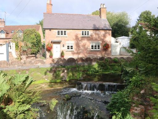 3 bedroom cottage for sale in Queens Hill, Belbroughton, Stourbridge, DY9 — £775,000 • 3 bed • 2 bath • 597 ft²
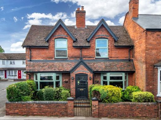 4 bedroom semi-detached house for sale in High Street, Belbroughton, Stourbridge, Worcestershire, DY9 — £550,000 • 4 bed • 2 bath • 1431 ft²
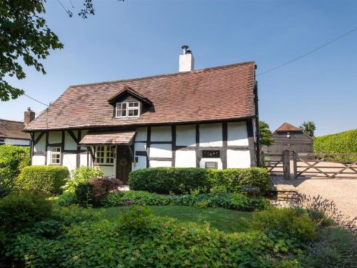 2 bedroom cottage for sale in Galtons Lane, Belbroughton, DY9 — £795,000 • 2 bed • 1 bath • 1572 ft²
Meta
- {
"@context": "https://schema.org",
"@type": "Residence",
"name": "3 bedroom semidetached house for sale in Hartle Lane, Belbr…",
"description": "",
"url": "https://propertypiper.co.uk/property/26078537-2ca1-4952-904a-8888c06834f4",
"image": "https://image-a.propertypiper.co.uk/8da4188a-ecde-4120-a0b8-d2d68a6e8b32-1024.jpeg",
"address": {
"@type": "PostalAddress",
"streetAddress": "102, Hartle Lane, Belbroughton, STOURBRIDGE",
"postalCode": "DY9 9TN",
"addressLocality": "Bromsgrove",
"addressRegion": "Bromsgrove",
"addressCountry": "England"
},
"geo": {
"@type": "GeoCoordinates",
"latitude": 52.38999425700644,
"longitude": -2.108178056654481
},
"numberOfRooms": 3,
"numberOfBathroomsTotal": 1,
"floorSize": {
"@type": "QuantitativeValue",
"value": 1028,
"unitCode": "FTK"
},
"offers": {
"@type": "Offer",
"price": 450000,
"priceCurrency": "GBP",
"availability": "https://schema.org/InStock"
},
"additionalProperty": [
{
"@type": "PropertyValue",
"name": "Feature",
"value": "Tudor"
},
{
"@type": "PropertyValue",
"name": "Feature",
"value": "cottage"
},
{
"@type": "PropertyValue",
"name": "Feature",
"value": "timber-framed"
},
{
"@type": "PropertyValue",
"name": "Feature",
"value": "historic"
},
{
"@type": "PropertyValue",
"name": "Feature",
"value": "characterful"
},
{
"@type": "PropertyValue",
"name": "Feature",
"value": "period property"
},
{
"@type": "PropertyValue",
"name": "Feature",
"value": "gravel driveway"
},
{
"@type": "PropertyValue",
"name": "Feature",
"value": "cottage"
},
{
"@type": "PropertyValue",
"name": "Feature",
"value": "traditional"
},
{
"@type": "PropertyValue",
"name": "Feature",
"value": "historic"
},
{
"@type": "PropertyValue",
"name": "Feature",
"value": "wood beams"
},
{
"@type": "PropertyValue",
"name": "Feature",
"value": "rustic"
},
{
"@type": "PropertyValue",
"name": "Feature",
"value": "character"
},
{
"@type": "PropertyValue",
"name": "Feature",
"value": "charming"
}
]
}
High Res Floorplan Images
Compatible Floorplan Images
FloorplanImages Thumbnail