EN1 2HU - 4 bedroom terraced house for sale in Edenbridge Road, Enfie…
View on Property Piper
4 bedroom terraced house for sale in Edenbridge Road, Enfield, EN1
Property Details
- Price: £700000
- Bedrooms: 4
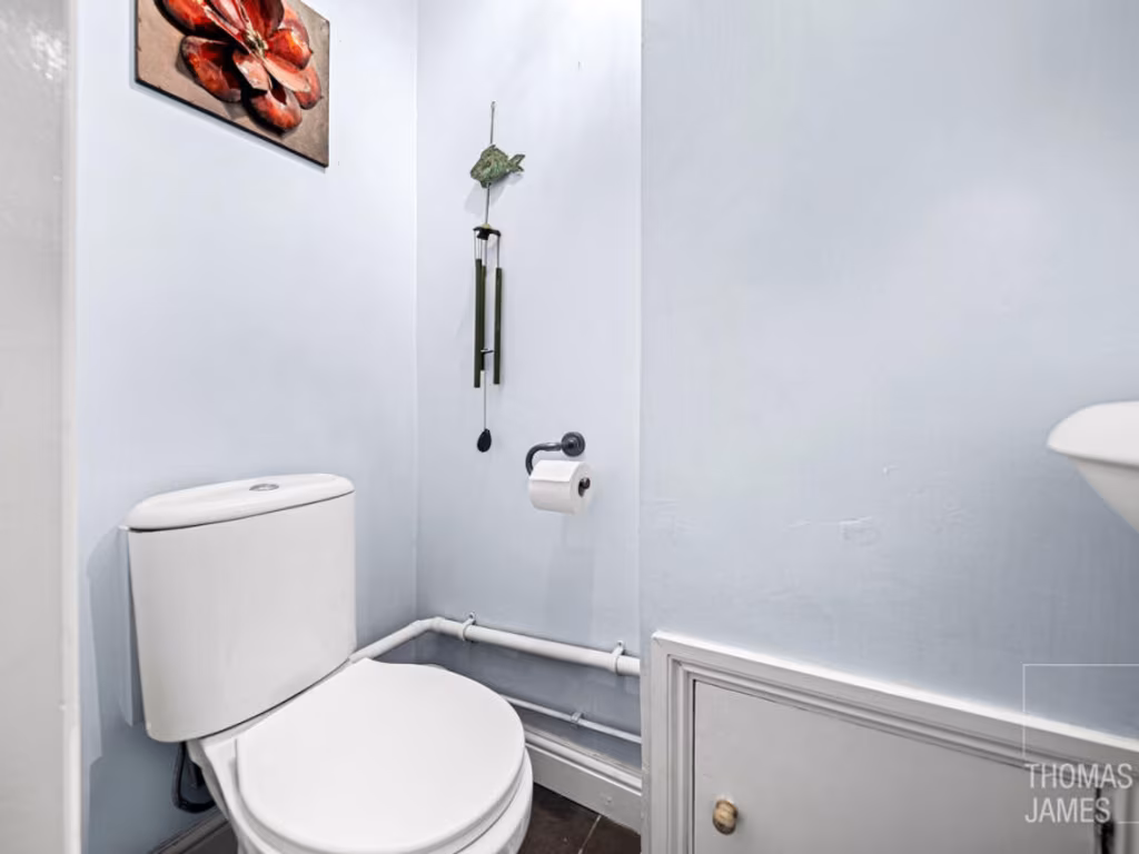
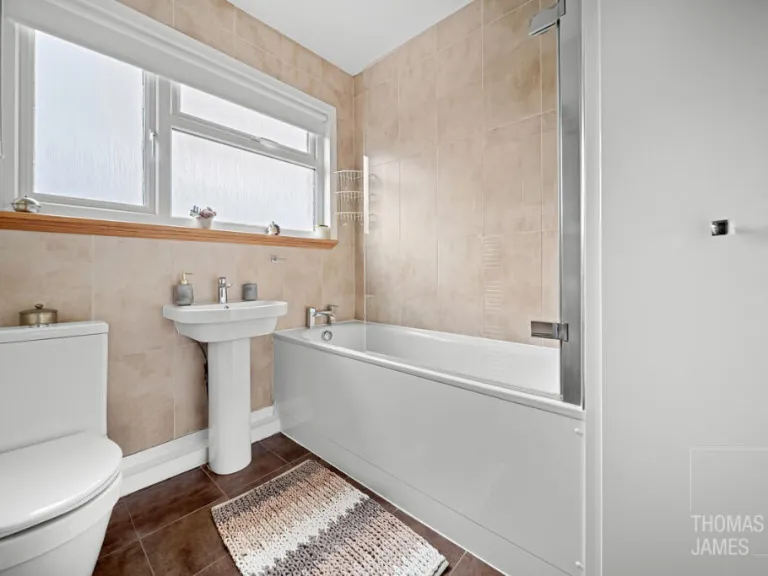
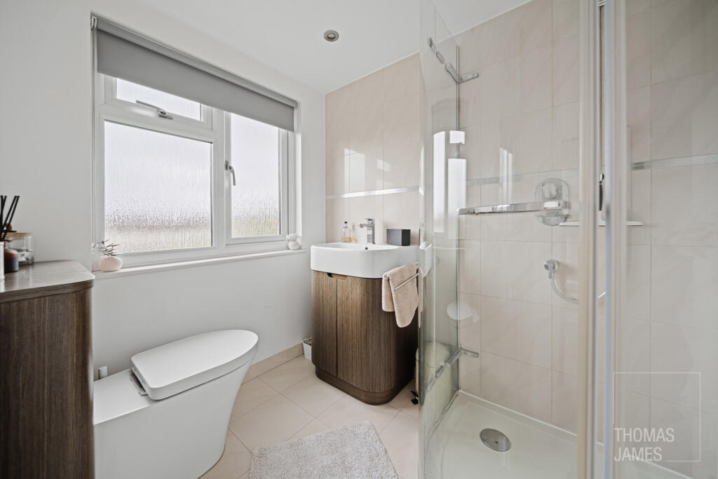
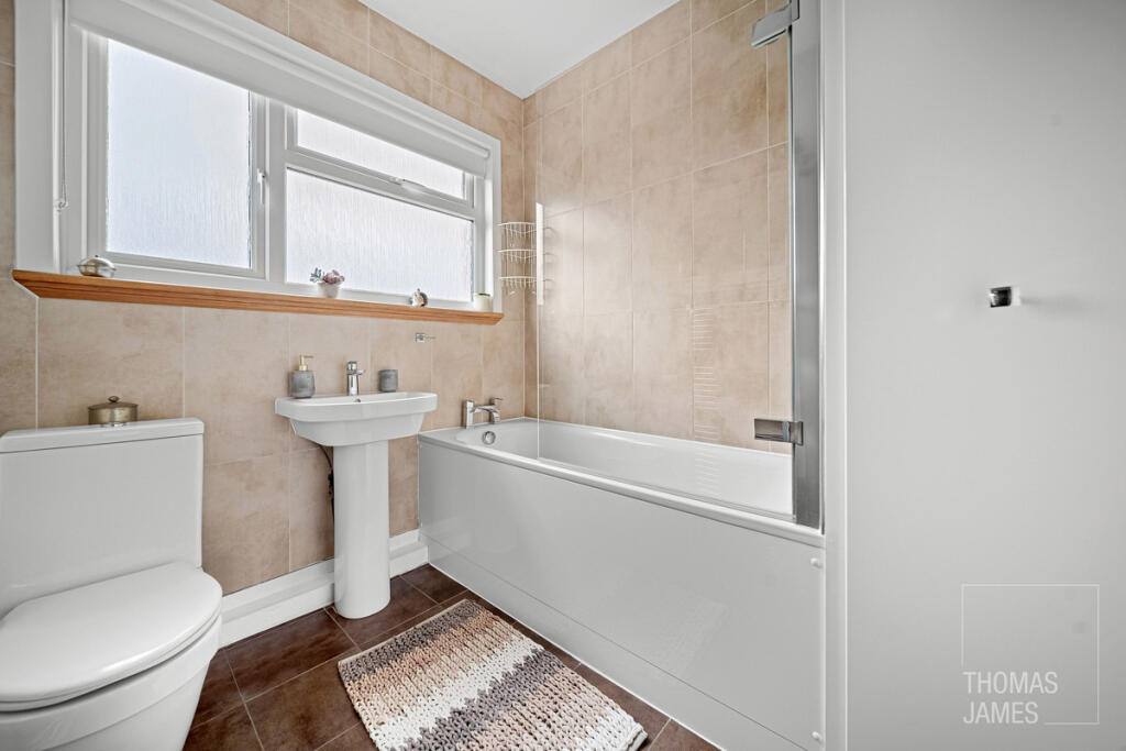
- Bathrooms: 1
- Property Type: undefined
- Property SubType: undefined
Image Descriptions
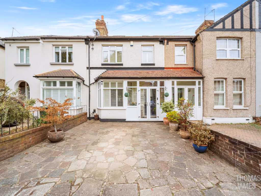
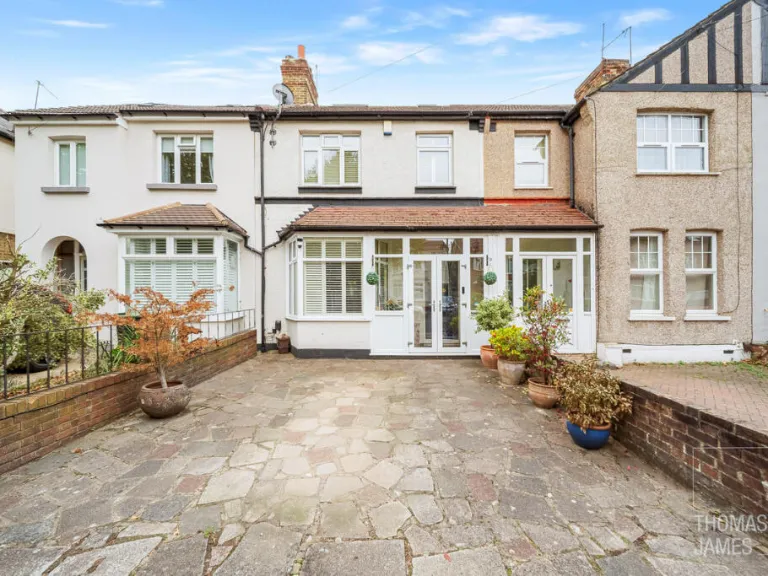
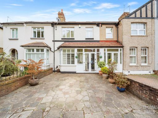
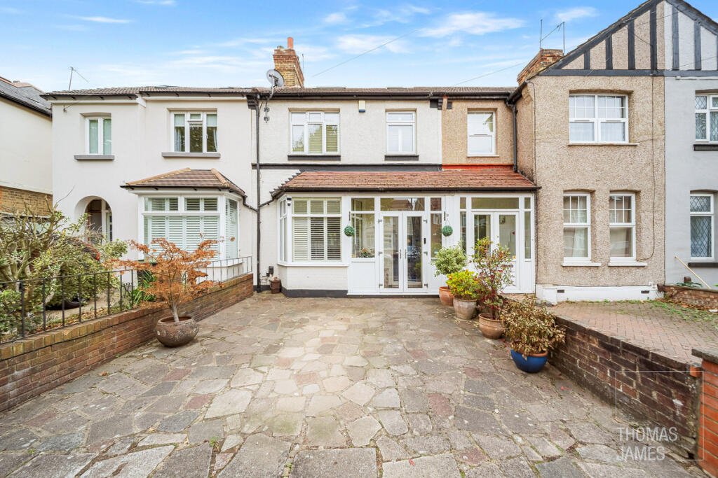
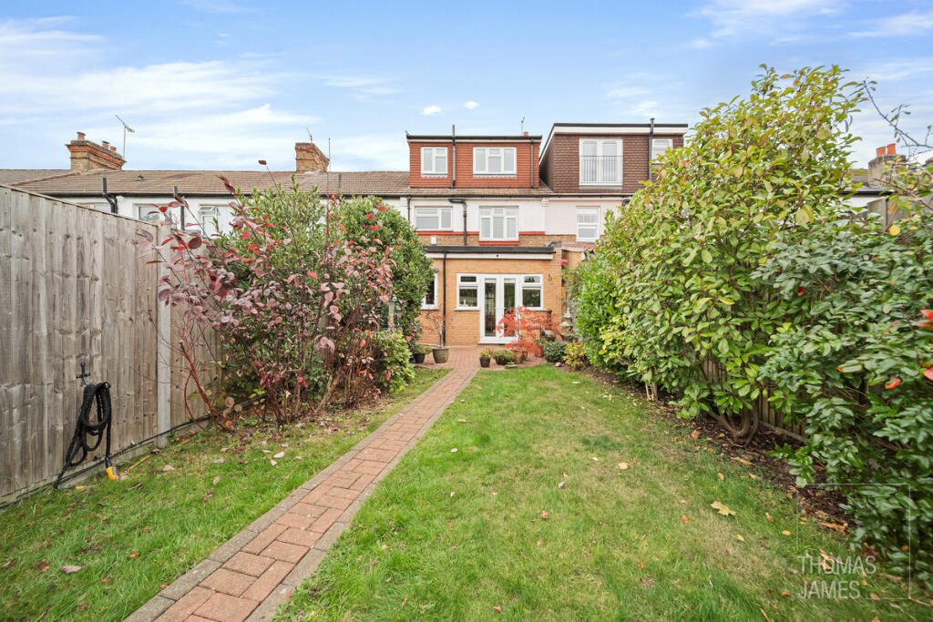
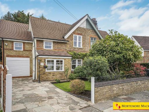
- terraced house exterior Mid-20th Century
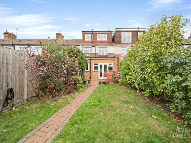
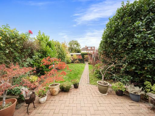
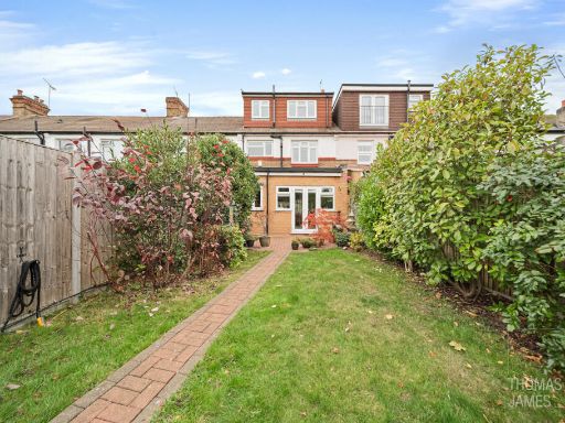
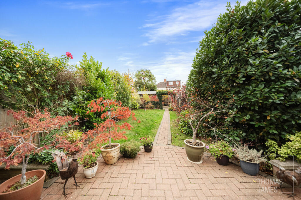
- garden suburban
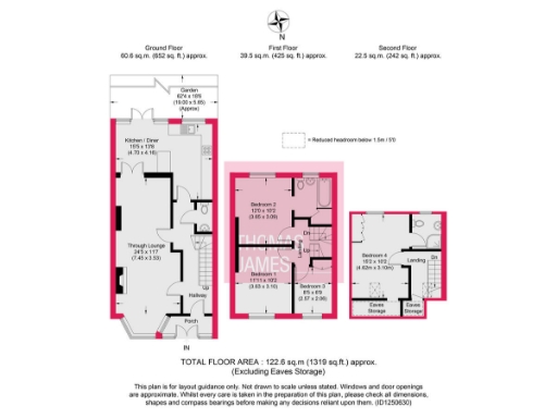
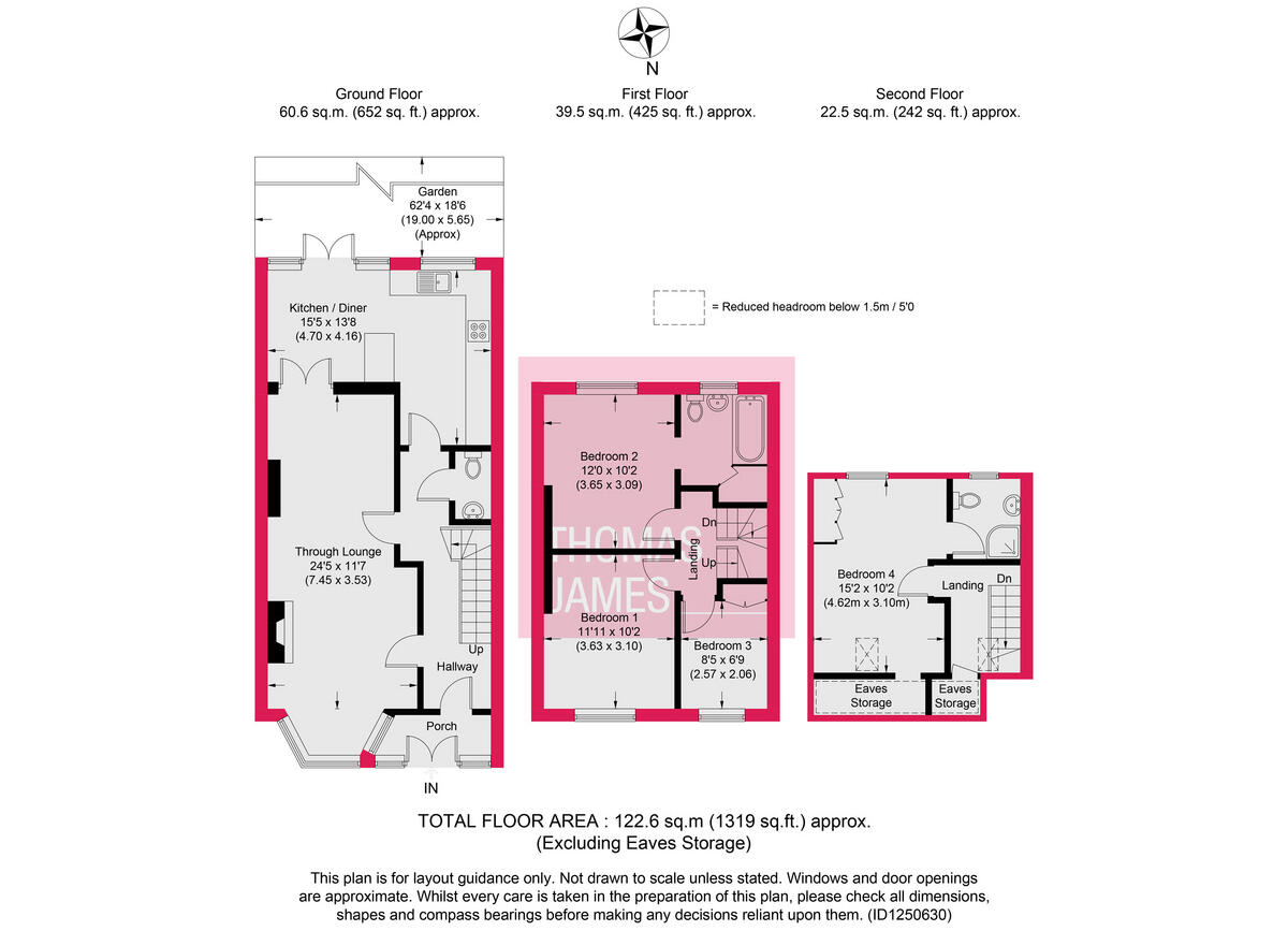
Floorplan Description
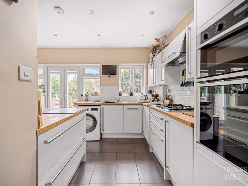
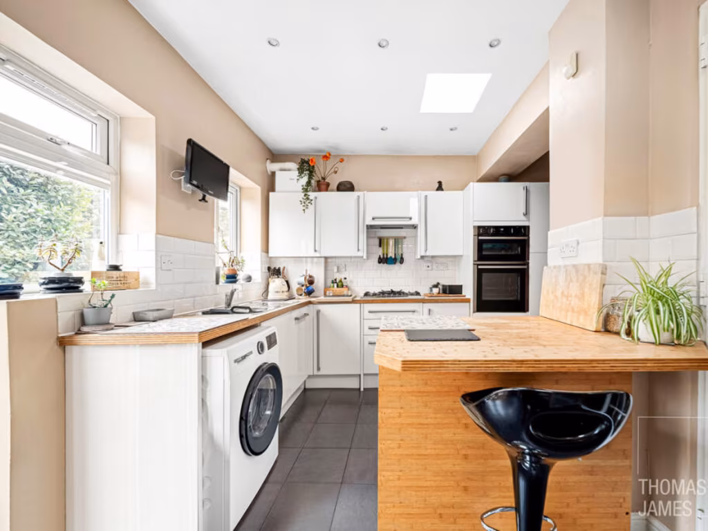
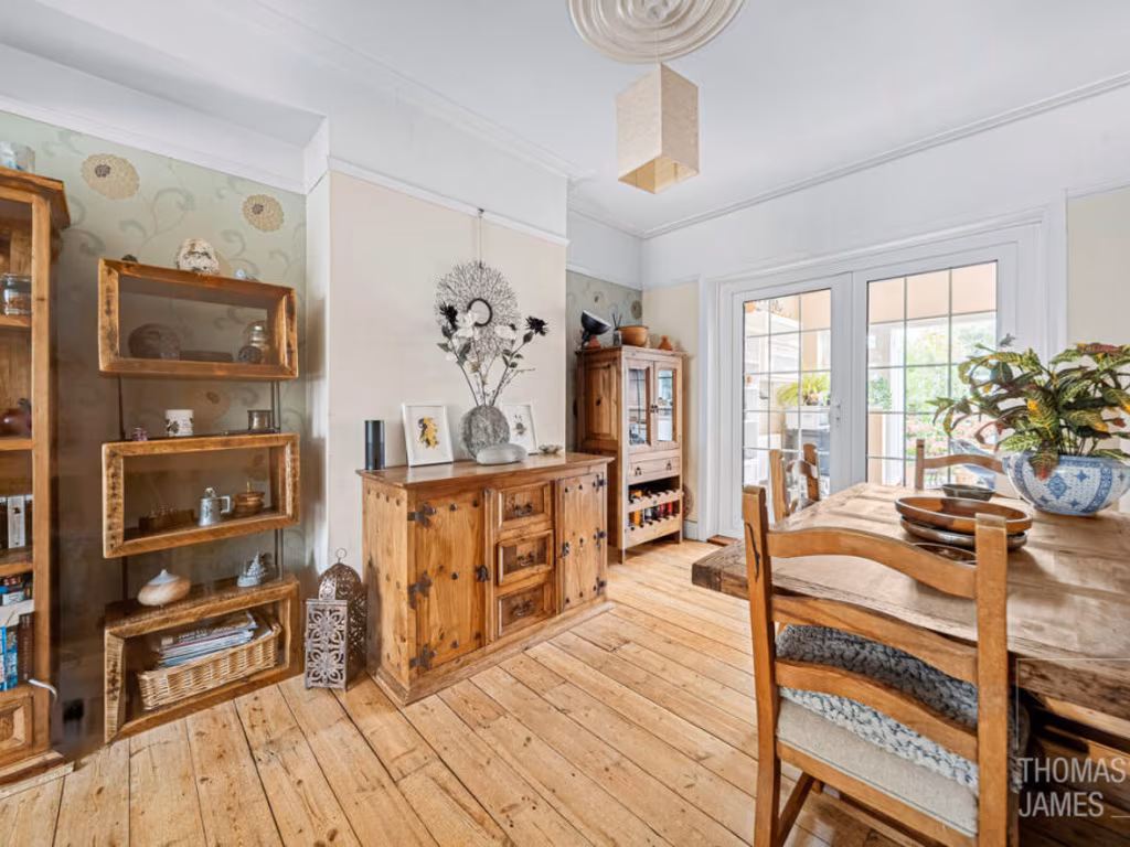
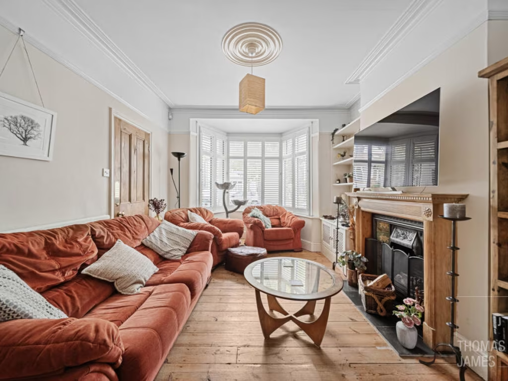
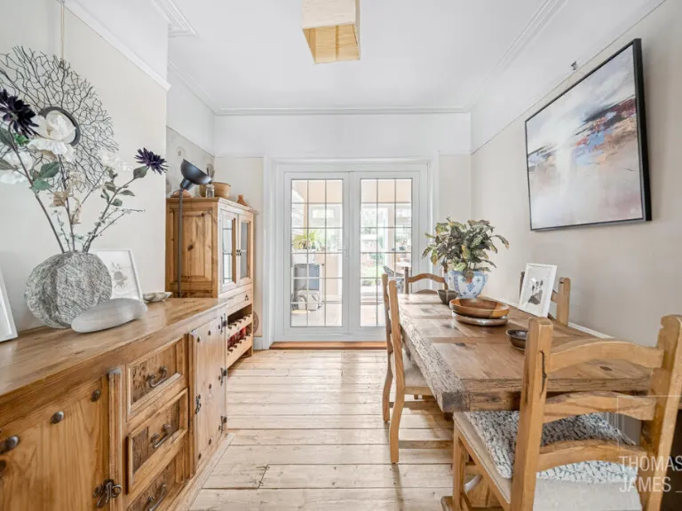
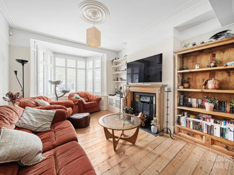
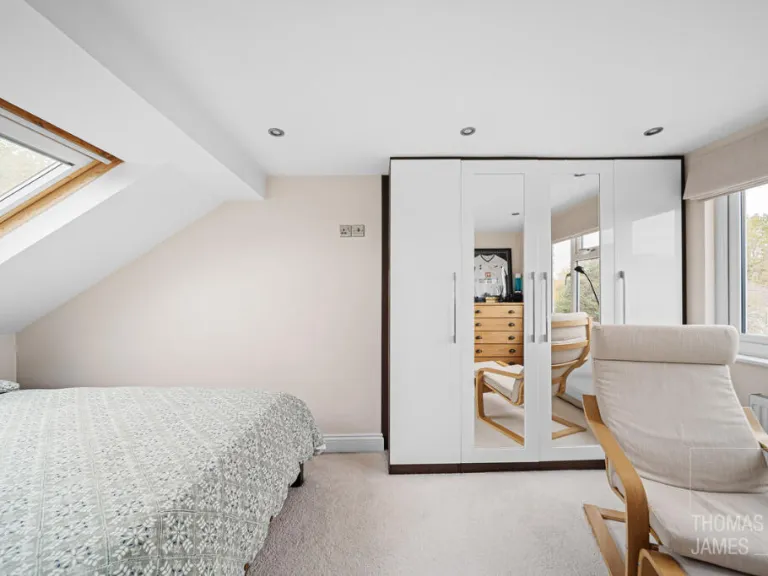
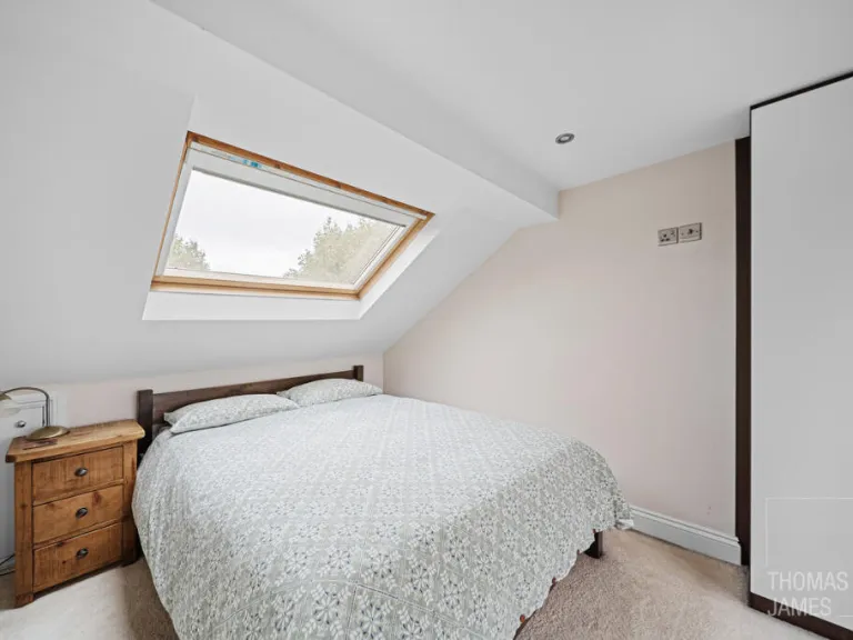
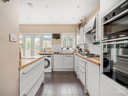
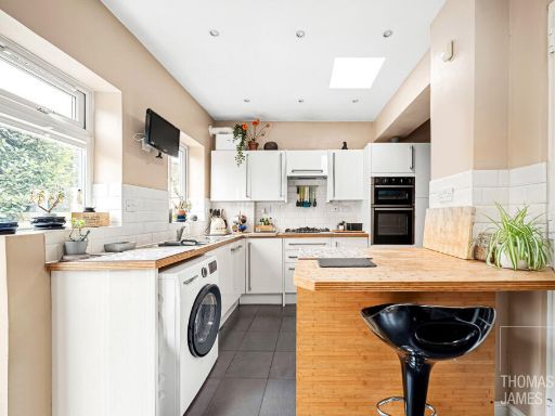
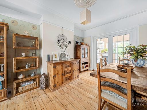
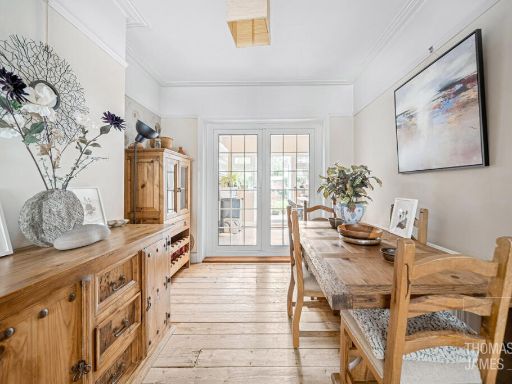
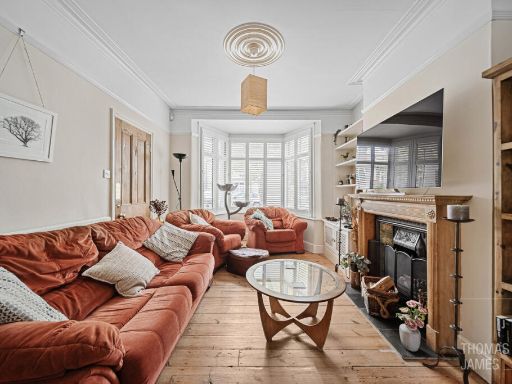
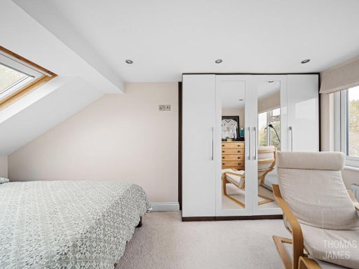
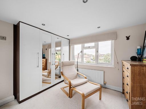
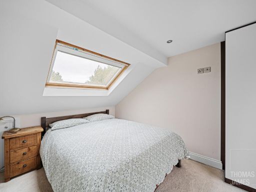
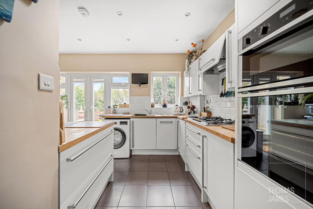
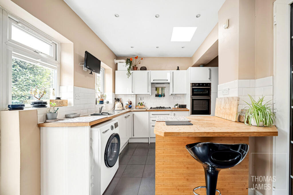
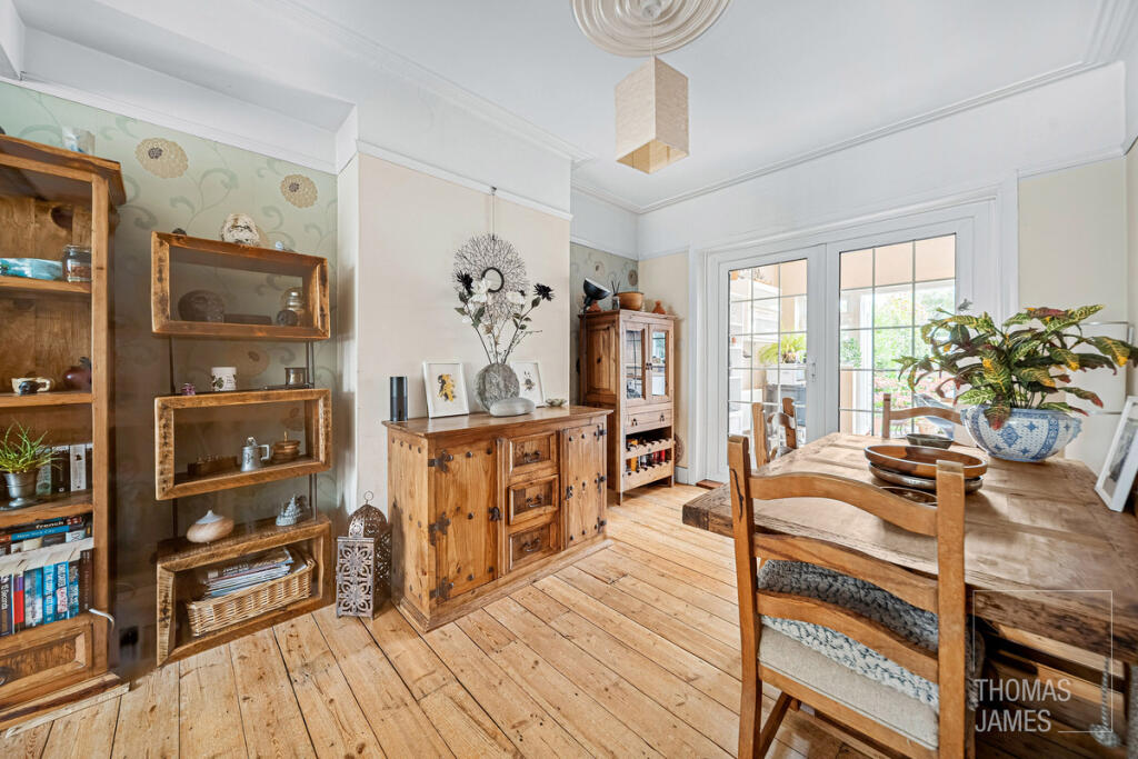
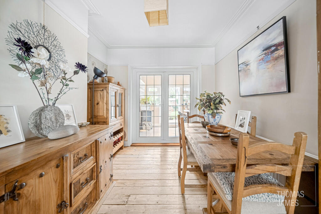
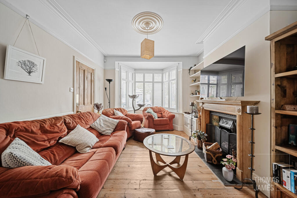
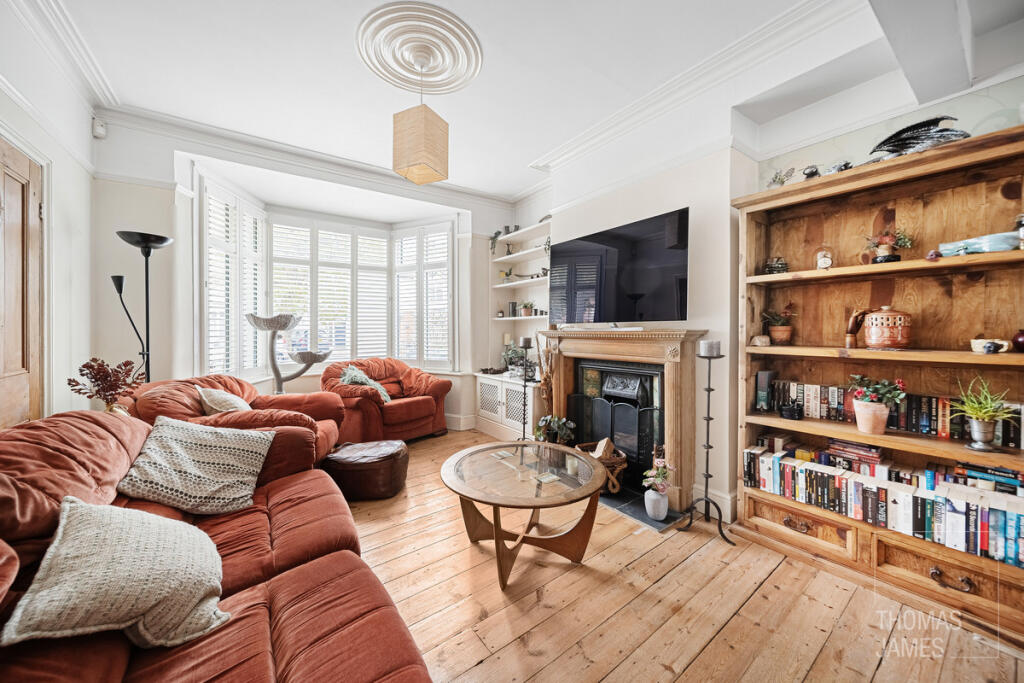
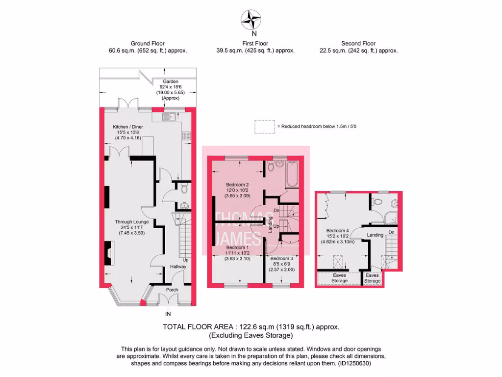
- Three-storey house with through lounge, kitchen/diner and four bedrooms.
Rooms
- Kitchen / Diner:
- Through Lounge:
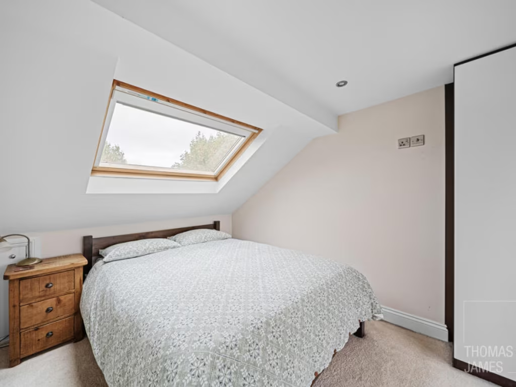
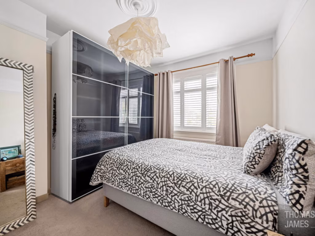
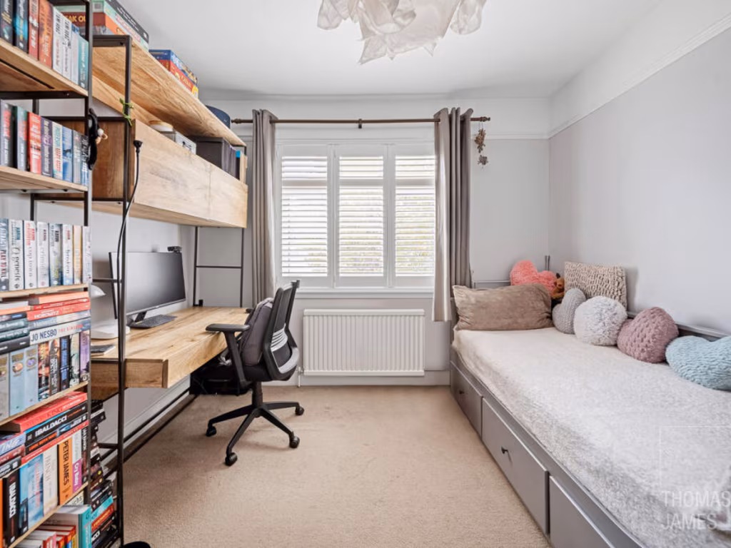
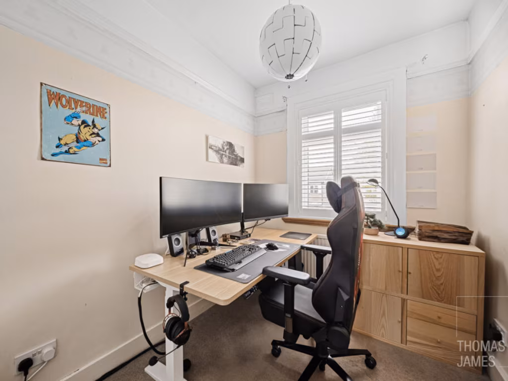
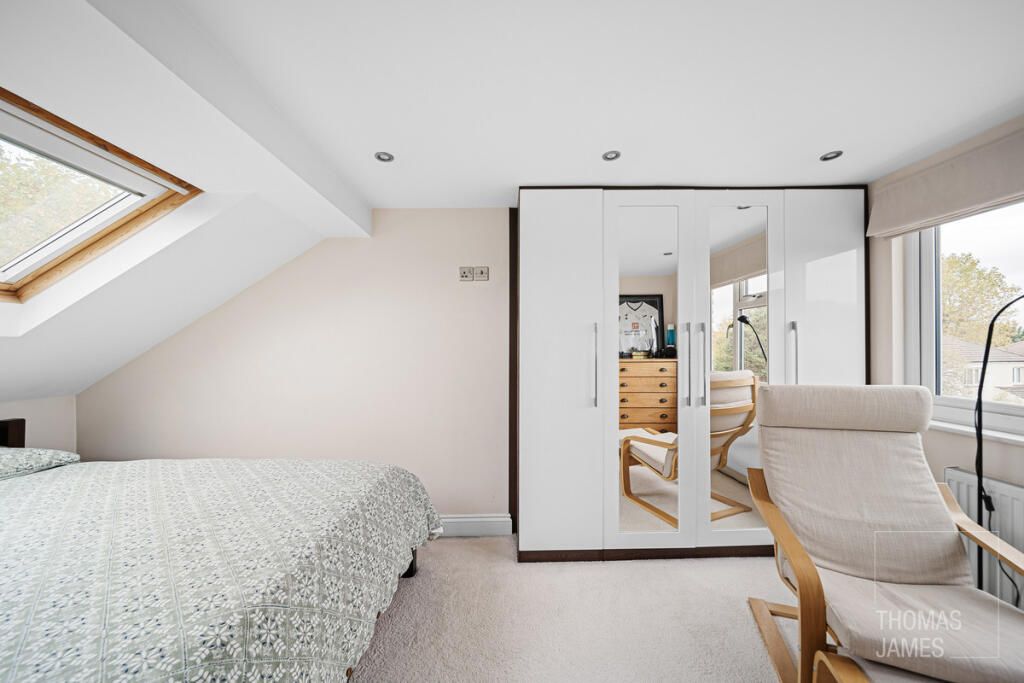
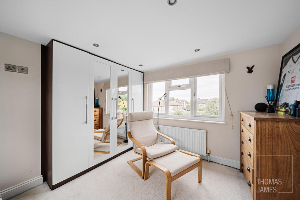
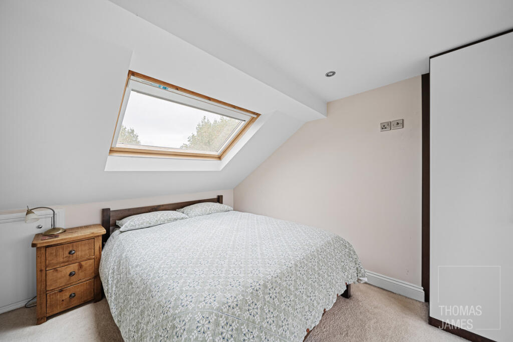
- Bedroom 2:
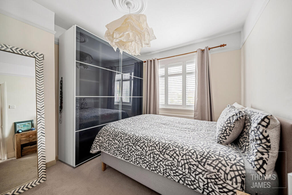
- Bedroom 1:
- Bedroom 3:
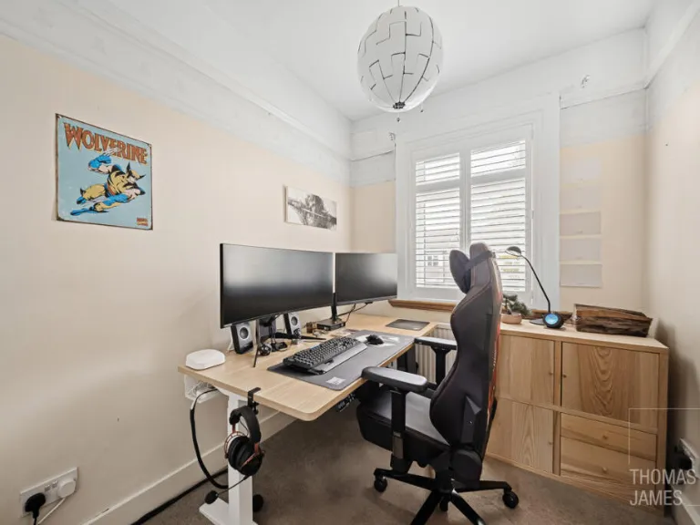
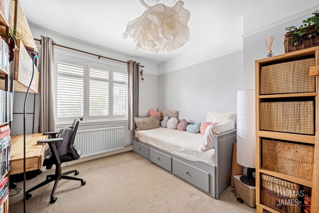
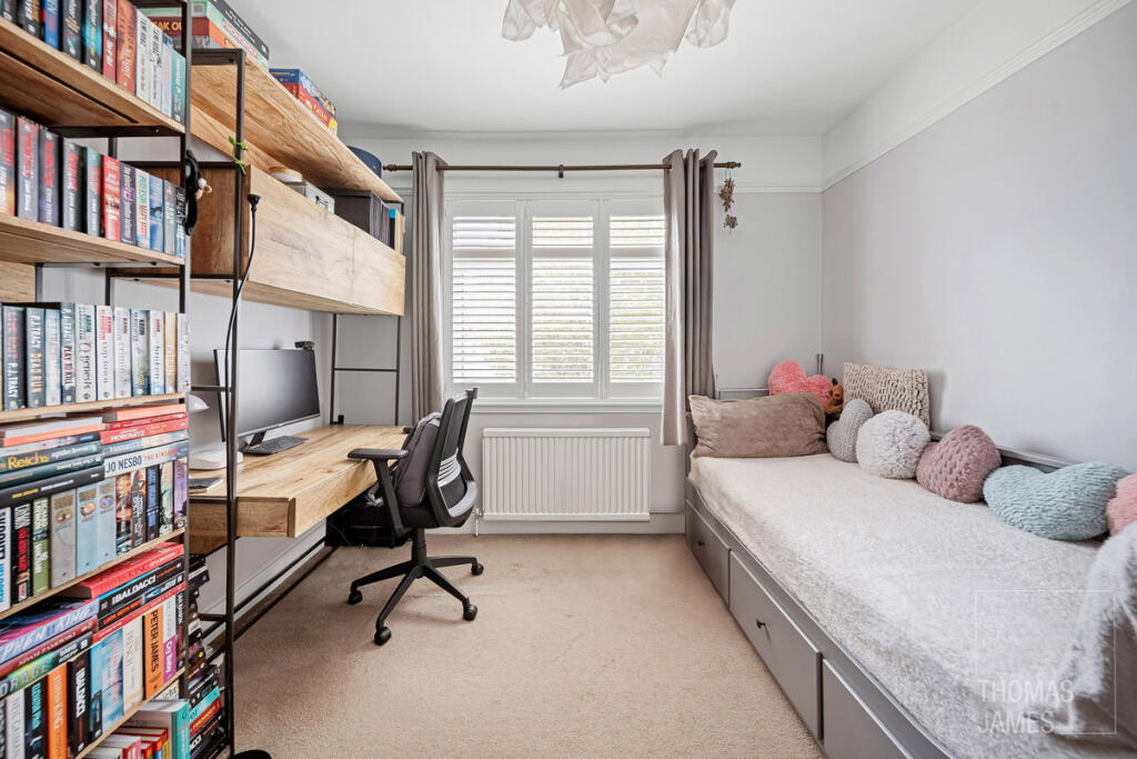
- Bedroom 4:
Textual Property Features
Detected Visual Features
- terraced house
- exterior
- mid-20th century
- brick facade
- concrete patio
- porch
- suburban
- residential area
- garden
- pathway
- well-maintained
- trees
- shrubs
- paving
- lawn
EPC Details
- Fully double glazed
- Solid brick, as built, no insulation (assumed)
- Boiler and radiators, mains gas
- Low energy lighting in all fixed outlets
- Suspended, no insulation (assumed)
Nearby Schools
- Fleecefield Primary School
- Latymer All Saints CofE Primary School
- St Edmund's Catholic Primary School
- Houndsfield Primary School
- St Paul's CofE Primary School
- The Raglan Junior School
- Galliard Primary School
- Grange Park Preparatory School
- Kingsmead School
- Enfield Grammar School
- Chase Side Primary School
- The Latymer School
- Winchmore School
- Highfield Primary School
- Churchfield Primary School
- Raglan Infant School
- Bush Hill Park Primary School
- George Spicer Primary School
- Aylward Academy
- Edmonton County School
- Chace Community School
- Hazelbury Primary School
- Firs Farm Primary School
- Alternative Centre of Education
- Starks Field Primary School
- Enfield County School for Girls
- St Andrew's CofE Primary School
- St George's Catholic Primary School
Nearest Bars And Restaurants
- Id: 3260878162
- Tags:
- Addr:
- Amenity: cafe
- Name: Bush Hill Park Cafe
- TagsNormalized:
- Lat: 51.6418071
- Lon: -0.0700829
- FullGeoHash: gcpvy3hgqfw6
- PartitionGeoHash: gcpv
- Images:
- FoodStandards: null
- Distance: 550.9
,- Id: 1932068442
- Tags:
- Amenity: pub
- Name: The Beehive
- TagsNormalized:
- Lat: 51.634544
- Lon: -0.0781264
- FullGeoHash: gcpvwpz1588s
- PartitionGeoHash: gcpv
- Images:
- FoodStandards: null
- Distance: 511.3
,- Id: 1151269566
- Tags:
- Amenity: cafe
- Name: Euro Cafe
- TagsNormalized:
- Lat: 51.6366961
- Lon: -0.0821943
- FullGeoHash: gcpvy0hjs9z6
- PartitionGeoHash: gcpv
- Images:
- FoodStandards: null
- Distance: 459.9
,- Id: 1151269550
- Tags:
- Amenity: fast_food
- Brand: Domino's
- Brand:wikidata: Q839466
- Brand:wikipedia: en:Domino's Pizza
- Contact:
- Website: https://www.dominos.co.uk/pizza-near-me/staines-upon-thames/13-the-broadway
- Cuisine: pizza
- Name: Domino's
- Takeaway: yes
- TagsNormalized:
- fast food
- food
- dominos
- pizza
- takeaway
- Lat: 51.6368053
- Lon: -0.0820075
- FullGeoHash: gcpvy0hq1n4v
- PartitionGeoHash: gcpv
- Images:
- FoodStandards: null
- Distance: 442.4
,- Id: 1932068392
- Tags:
- Amenity: pub
- Name: Stag & Hounds
- Opening_hours: Mo-Su,PH 11:30-24:00
- TagsNormalized:
- Lat: 51.6354113
- Lon: -0.0780594
- FullGeoHash: gcpvwpznj46d
- PartitionGeoHash: gcpv
- Images:
- FoodStandards: null
- Distance: 415.9
}
Nearest General Shops
- Id: 3107926819
- Tags:
- Addr:
- Housenumber: 12
- Street: Queen Anne's Place
- Contact:
- Website: http://www.wilddaisyboutique.co.uk
- Name: Wild Daisy
- Shop: boutique
- TagsNormalized:
- Lat: 51.6416832
- Lon: -0.0705075
- FullGeoHash: gcpvy3hdt53z
- PartitionGeoHash: gcpv
- Images:
- FoodStandards: null
- Distance: 518.9
,- Id: 1507914722
- Tags:
- TagsNormalized:
- Lat: 51.6363548
- Lon: -0.0810959
- FullGeoHash: gcpvy0hgw64w
- PartitionGeoHash: gcpv
- Images:
- FoodStandards: null
- Distance: 425.9
,- Id: 182836332
- Tags:
- Addr:
- Housename: Riteway Garage
- Postcode: N9 9JS
- Street: Bury Street West
- Building: yes
- Name: Worthington Jeffs
- Shop: car_repair
- TagsNormalized:
- Lat: 51.6367311
- Lon: -0.0805726
- FullGeoHash: gcpvy0jmf82e
- PartitionGeoHash: gcpv
- Images:
- FoodStandards: null
- Distance: 370.8
}
Nearest Grocery shops
- Id: 2104687112
- Tags:
- Addr:
- Housenumber: 131
- Postcode: EN1 1BA
- Street: St. Marks Road
- Brand: Sainsbury's Local
- Brand:wikidata: Q13218434
- Brand:wikipedia: en:Sainsbury's Local
- Name: Sainsbury's Bush Hill Park Local
- Shop: convenience
- Website: https://stores.sainsburys.co.uk/4978/enfield-bush-hill-park-local
- TagsNormalized:
- sainsburys
- sainsburys local
- convenience
- shop
- Lat: 51.6417392
- Lon: -0.069086
- FullGeoHash: gcpvy3jdyjvt
- PartitionGeoHash: gcpv
- Images:
- FoodStandards: null
- Distance: 605.5
,- Id: 3267014461
- Tags:
- Addr:
- Housenumber: 8
- Postcode: EN1 2PT
- Street: Queen Anne's Place
- Name: Lifestyle Express
- Shop: convenience
- TagsNormalized:
- lifestyle express
- convenience
- shop
- Lat: 51.6416312
- Lon: -0.0703696
- FullGeoHash: gcpvy3hf23b9
- PartitionGeoHash: gcpv
- Images:
- FoodStandards: null
- Distance: 523.6
,- Id: 1151269557
- Tags:
- Brand:
- Name: Costcutters
- Shop: convenience
- TagsNormalized:
- costcutter
- convenience
- shop
- Lat: 51.6367603
- Lon: -0.0820728
- FullGeoHash: gcpvy0hjztf1
- PartitionGeoHash: gcpv
- Images:
- FoodStandards: null
- Distance: 448.9
}
Nearest Religious buildings
- Id: 202966
- Tags:
- Name: St Stephens Church
- Naptan:
- StopAreaCode: 490G00011857
- StopAreaType: GPBS
- Verified: no
- Public_transport: stop_area
- Type: public_transport
- TagsNormalized:
- Lat: 51.6416876
- Lon: -0.0792074
- FullGeoHash: gcpvy1n6dk69
- PartitionGeoHash: gcpv
- Images:
- FoodStandards: null
- Distance: 338.8
,- Id: 313620657
- Tags:
- Amenity: place_of_worship
- Building: church
- Denomination: anglican
- Name: St Stephen's Parish Church
- Religion: christian
- Wikidata: Q105099996
- TagsNormalized:
- place of worship
- church
- anglican
- parish
- christian
- Lat: 51.6418306
- Lon: -0.0784196
- FullGeoHash: gcpvy1ngkwyn
- PartitionGeoHash: gcpv
- Images:
- FoodStandards: null
- Distance: 329.6
,- Id: 548474720
- Tags:
- Amenity: place_of_worship
- Building: yes
- Denomination: methodist
- Name: Bush Hill Park Methodist Church
- Religion: christian
- TagsNormalized:
- place of worship
- methodist
- church
- christian
- Lat: 51.6385717
- Lon: -0.0720806
- FullGeoHash: gcpvy2e82rky
- PartitionGeoHash: gcpv
- Images:
- FoodStandards: null
- Distance: 325.1
}
Nearest Medical buildings
- Id: 399076956
- Tags:
- Addr:
- City: Enfield
- Housenumber: 87
- Postcode: EN1 1HT
- Street: Trinity Avenue
- Amenity: dentist
- Building: yes
- Healthcare: dentist
- Name: Trinity Dental
- Website: http://www.trinitydental.co.uk/
- TagsNormalized:
- dentist
- health
- healthcare
- dental
- Lat: 51.6401456
- Lon: -0.0635285
- FullGeoHash: gcpvy8c9xsve
- PartitionGeoHash: gcpv
- Images:
- FoodStandards: null
- Distance: 918.6
,- Id: 399343180
- Tags:
- Addr:
- City: Enfield
- Housenumber: 22
- Postcode: EN1 1HS
- Street: Trinity Avenue
- Amenity: doctors
- Building: house
- Name: Bush Hill Park Trinity Surgery
- Website: https://www.trinityavenuesurgery.co.uk/
- TagsNormalized:
- Lat: 51.6408482
- Lon: -0.0666936
- FullGeoHash: gcpvy2zmtzvd
- PartitionGeoHash: gcpv
- Images:
- FoodStandards: null
- Distance: 720.3
,- Id: 2104693482
- Tags:
- Addr:
- Housenumber: 10
- Postcode: EN1 2PT
- Street: Queen Anne's Place
- Amenity: pharmacy
- Dispensing: yes
- Name: Hayward Pharmacy
- TagsNormalized:
- Lat: 51.6416604
- Lon: -0.070442
- FullGeoHash: gcpvy3hdqx4x
- PartitionGeoHash: gcpv
- Images:
- FoodStandards: null
- Distance: 521.2
,- Id: 1151269545
- Tags:
- Addr:
- Housenumber: 20
- Postcode: EN1 2HB
- Street: Bush Hill Parade
- Amenity: pharmacy
- Dispensing: yes
- Name: Lamis
- TagsNormalized:
- Lat: 51.6369876
- Lon: -0.0808119
- FullGeoHash: gcpvy0jpkbnm
- PartitionGeoHash: gcpv
- Images:
- FoodStandards: null
- Distance: 364.2
}
Nearest Airports
- Id: 121158889
- Tags:
- Aerodrome: continental
- Aeroway: aerodrome
- Fhrs:
- Authority: City of London Corporation
- Iata: LCY
- Icao: EGLC
- Name: London City Airport
- Operator: London City Airport Limited
- Ref: LCY
- Website: https://www.londoncityairport.com/
- Wikidata: Q8982
- Wikipedia: en:London City Airport
- TagsNormalized:
- airport
- continental airport
- Lat: 51.5042658
- Lon: 0.0539987
- FullGeoHash: u10j10p64702
- PartitionGeoHash: u10j
- Images:
- FoodStandards: null
- Distance: 17500.6
,- Id: 14001268
- Tags:
- Access: yes
- Aerodrome: international
- Aerodrome:type: public
- Aeroway: aerodrome
- Alt_name: London Heathrow
- Alt_name_2: London Heathrow Airport
- Ele: 25
- Iata: LHR
- Icao: EGLL
- Int_name: Heathrow Airport
- Name: London Heathrow Airport
- Note: area still approx
- Old_name: London Airport
- Operator: Heathrow Airport Limited
- Rank_aci:
- Ref: LHR
- Short_name: Heathrow
- Type: multipolygon
- Website: https://www.heathrow.com/
- Wikidata: Q8691
- Wikipedia: en:Heathrow Airport
- TagsNormalized:
- airport
- international airport
- Lat: 51.4677522
- Lon: -0.4547736
- FullGeoHash: gcpsv9kv7h2h
- PartitionGeoHash: gcps
- Images:
- FoodStandards: null
- Distance: 32342.5
}
Nearest Leisure Facilities
- Id: 1638242145
- Tags:
- Leisure: sports_centre
- Name: The Fitness Station
- TagsNormalized:
- sports
- sports centre
- leisure
- Lat: 51.6411562
- Lon: -0.0692305
- FullGeoHash: gcpvy2vxdc1z
- PartitionGeoHash: gcpv
- Images:
- FoodStandards: null
- Distance: 567.3
,- Id: 8681409
- Tags:
- Leisure: pitch
- Sport: bowls
- TagsNormalized:
- Lat: 51.6435041
- Lon: -0.072761
- FullGeoHash: gcpvy37j0wcm
- PartitionGeoHash: gcpv
- Images:
- FoodStandards: null
- Distance: 564.9
,- Id: 15137411
- Tags:
- Leisure: pitch
- Name: Bush Hill Park Lawn Tennis Club
- Sport: tennis
- TagsNormalized:
- pitch
- leisure
- tennis
- club
- sports
- Lat: 51.6433656
- Lon: -0.0787202
- FullGeoHash: gcpvy1qsmtjg
- PartitionGeoHash: gcpv
- Images:
- FoodStandards: null
- Distance: 498.3
,- Id: 150974755
- Tags:
- Addr:
- Leisure: park
- Name: Bush Hill Gardens
- Website: http://www.enfield.gov.uk/directory_record/5834/bush_hill_gardens
- TagsNormalized:
- Lat: 51.637411
- Lon: -0.0814572
- FullGeoHash: gcpvy0k9tzj4
- PartitionGeoHash: gcpv
- Images:
- FoodStandards: null
- Distance: 374.5
,- Id: 669747461
- Tags:
- TagsNormalized:
- swimming
- swimming pool
- pool
- leisure
- Lat: 51.6393767
- Lon: -0.0791039
- FullGeoHash: gcpvy0wmhtxb
- PartitionGeoHash: gcpv
- Images:
- FoodStandards: null
- Distance: 167.9
}
Nearest Tourist attractions
- Id: 3099087377
- Tags:
- TagsNormalized:
- Lat: 51.649837
- Lon: -0.0862463
- FullGeoHash: gcpvy494n76n
- PartitionGeoHash: gcpv
- Images:
- FoodStandards: null
- Distance: 1366.7
,- Id: 3099104780
- Tags:
- TagsNormalized:
- Lat: 51.6493466
- Lon: -0.0856778
- FullGeoHash: gcpvy43x7841
- PartitionGeoHash: gcpv
- Images:
- FoodStandards: null
- Distance: 1300.1
,- Id: 3196157132
- Tags:
- Name: Dugdale Centre Museum
- Tourism: museum
- Website: https://www.dugdaleartscentre.co.uk/
- Wikidata: Q17560918
- TagsNormalized:
- Lat: 51.6504326
- Lon: -0.0804069
- FullGeoHash: gcpvy4tmw6kr
- PartitionGeoHash: gcpv
- Images:
- FoodStandards: null
- Distance: 1289.9
}
Nearest Hotels
- Id: 364431460
- Tags:
- Name: Comfort Hotel (closed)
- Tourism: hotel
- TagsNormalized:
- Lat: 51.6603702
- Lon: -0.0981505
- FullGeoHash: gcpvvu2x2yvx
- PartitionGeoHash: gcpv
- Images:
- FoodStandards: null
- Distance: 2792.9
,- Id: 741685700
- Tags:
- Name: Holtwhites Hotel
- Tourism: hotel
- TagsNormalized:
- Lat: 51.6596512
- Lon: -0.0878588
- FullGeoHash: gcpvyh2528zw
- PartitionGeoHash: gcpv
- Images:
- FoodStandards: null
- Distance: 2415.1
,- Id: 216941095
- Tags:
- Addr:
- City: Enfield
- Housenumber: 1
- Postcode: EN1 1FS
- Street: Lumina Way
- Alt_name: Travelodge London Enfield
- Branch: London Enfield
- Brand: Travelodge
- Brand:wikidata: Q9361374
- Brand:wikipedia: en:Travelodge UK
- Building: yes
- Fhrs:
- Id: 449350
- Local_authority_id: PI/000173774
- Internet_access: wlan
- Internet_access:fee: customers
- Internet_access:ssid: Travelodge WiFi
- Name: Travelodge
- Toilets:
- Tourism: hotel
- Wheelchair: yes
- TagsNormalized:
- Lat: 51.6445928
- Lon: -0.0598283
- FullGeoHash: gcpvy9s7tcug
- PartitionGeoHash: gcpv
- Images:
- FoodStandards: null
- Distance: 1318.4
}
Tags
- terraced house
- exterior
- mid-20th century
- brick facade
- concrete patio
- porch
- suburban
- residential area
- garden
- suburban
- pathway
- well-maintained
- trees
- shrubs
- paving
- lawn
Local Market Stats
- Average Price/sqft: £505
- Avg Income: £54700
- Rental Yield: 4.7%
- Social Housing: 17%
- Planning Success Rate: 81%
AirBnB Data
- 1km average: £130/night
- Listings in 1km: 2
Similar Properties
 4 bedroom semi-detached house for sale in East Crescent, Enfield, EN1 — £925,000 • 4 bed • 2 bath • 1525 ft²
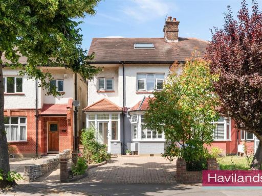 4 bedroom semi-detached house for sale in Park Avenue, Enfield, EN1 — £775,000 • 4 bed • 2 bath • 1758 ft²
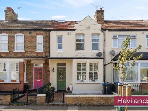 4 bedroom house for sale in Ladbroke Road, Enfield, EN1 — £650,000 • 4 bed • 2 bath • 1413 ft²
 4 bedroom end of terrace house for sale in Melbourne Way, Enfield, EN1 — £615,000 • 4 bed • 1 bath • 1136 ft²
 5 bedroom semi-detached house for sale in Village Road, Enfield, EN1 — £1,000,000 • 5 bed • 2 bath • 2239 ft²
 5 bedroom end of terrace house for sale in Forsyth Place, Enfield, EN1 — £900,000 • 5 bed • 4 bath • 2098 ft²
Meta
- {
"@context": "https://schema.org",
"@type": "Residence",
"name": "4 bedroom terraced house for sale in Edenbridge Road, Enfie…",
"description": "",
"url": "https://propertypiper.co.uk/property/1c4f21e8-9f67-4a4e-affb-474e6025e9ed",
"image": "https://image-a.propertypiper.co.uk/8f1ab8c8-18c9-4909-aea8-b017ffac40d5-1024.jpeg",
"address": {
"@type": "PostalAddress",
"streetAddress": "130 EDENBRIDGE ROAD ENFIELD",
"postalCode": "EN1 2HU",
"addressLocality": "Enfield",
"addressRegion": "Edmonton",
"addressCountry": "England"
},
"geo": {
"@type": "GeoCoordinates",
"latitude": 51.639059181488,
"longitude": -0.07672495048410186
},
"numberOfRooms": 4,
"numberOfBathroomsTotal": 1,
"floorSize": {
"@type": "QuantitativeValue",
"value": 1319,
"unitCode": "FTK"
},
"offers": {
"@type": "Offer",
"price": 700000,
"priceCurrency": "GBP",
"availability": "https://schema.org/InStock"
},
"additionalProperty": [
{
"@type": "PropertyValue",
"name": "Feature",
"value": "terraced house"
},
{
"@type": "PropertyValue",
"name": "Feature",
"value": "exterior"
},
{
"@type": "PropertyValue",
"name": "Feature",
"value": "mid-20th century"
},
{
"@type": "PropertyValue",
"name": "Feature",
"value": "brick facade"
},
{
"@type": "PropertyValue",
"name": "Feature",
"value": "concrete patio"
},
{
"@type": "PropertyValue",
"name": "Feature",
"value": "porch"
},
{
"@type": "PropertyValue",
"name": "Feature",
"value": "suburban"
},
{
"@type": "PropertyValue",
"name": "Feature",
"value": "residential area"
},
{
"@type": "PropertyValue",
"name": "Feature",
"value": "garden"
},
{
"@type": "PropertyValue",
"name": "Feature",
"value": "suburban"
},
{
"@type": "PropertyValue",
"name": "Feature",
"value": "pathway"
},
{
"@type": "PropertyValue",
"name": "Feature",
"value": "well-maintained"
},
{
"@type": "PropertyValue",
"name": "Feature",
"value": "trees"
},
{
"@type": "PropertyValue",
"name": "Feature",
"value": "shrubs"
},
{
"@type": "PropertyValue",
"name": "Feature",
"value": "paving"
},
{
"@type": "PropertyValue",
"name": "Feature",
"value": "lawn"
}
]
}
High Res Floorplan Images
Compatible Floorplan Images
FloorplanImages Thumbnail