TN27 0NH - 2 bedroom bungalow for sale in Bowl Road, ASHFORD, Kent, TN…
View on Property Piper
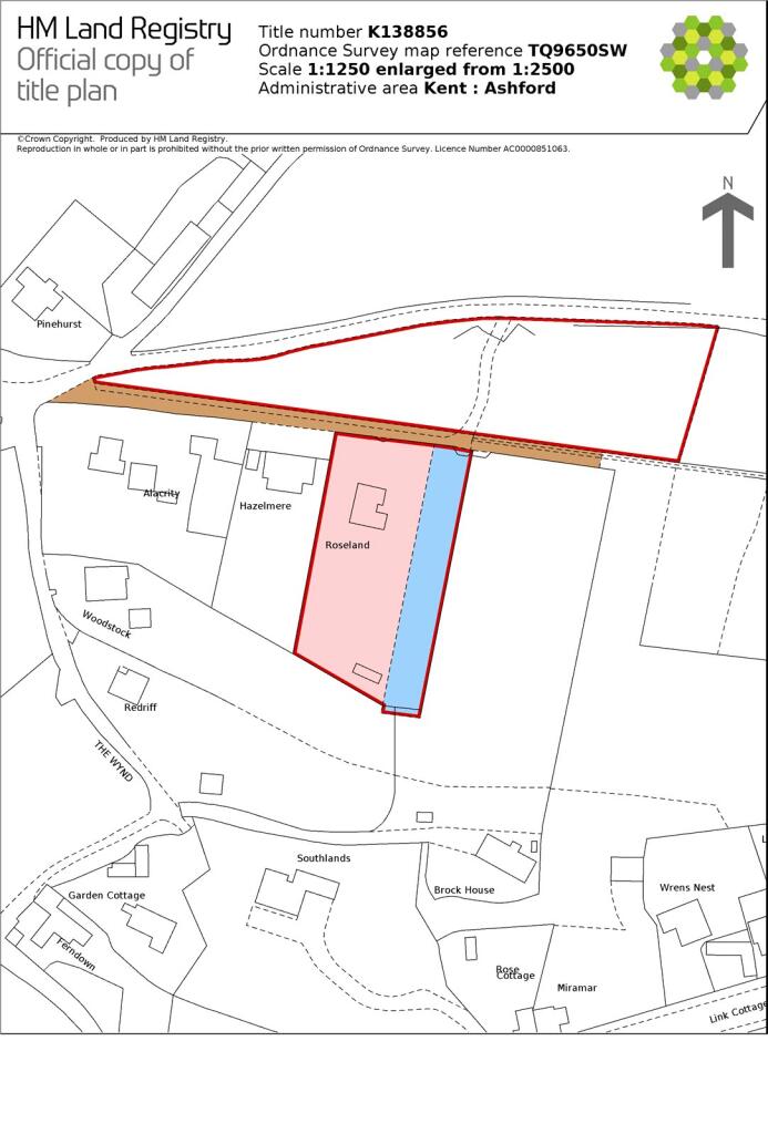
2 bedroom bungalow for sale in Bowl Road, ASHFORD, Kent, TN27
Property Details
- Price: £775000
- Bedrooms: 2
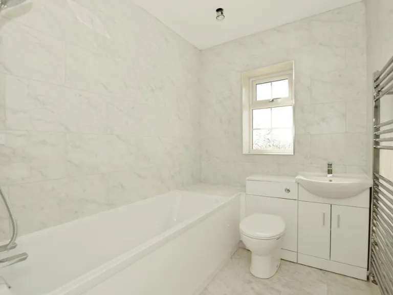
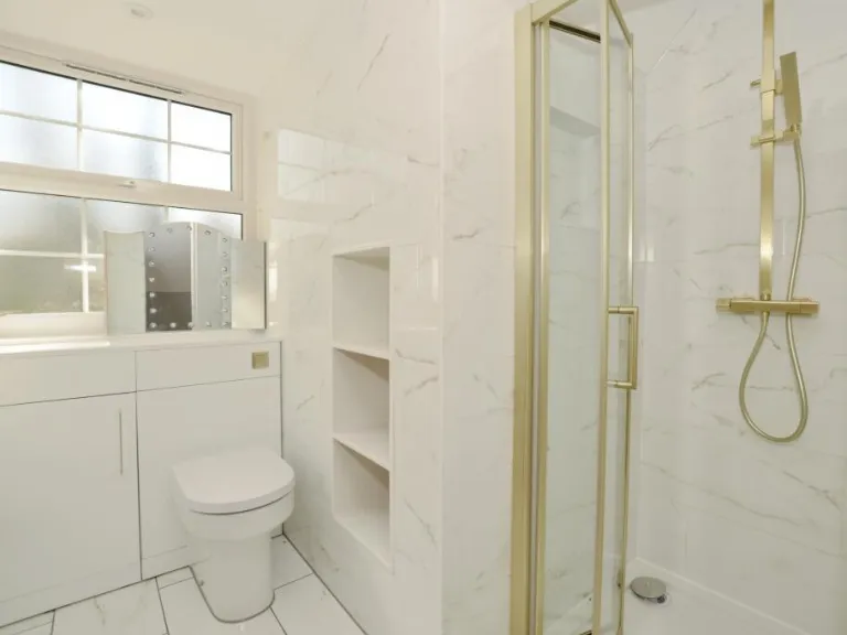
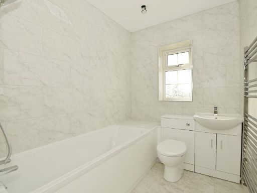
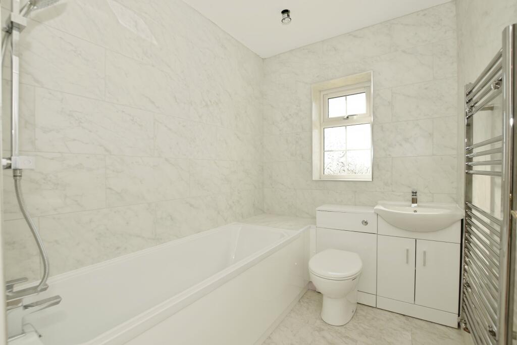
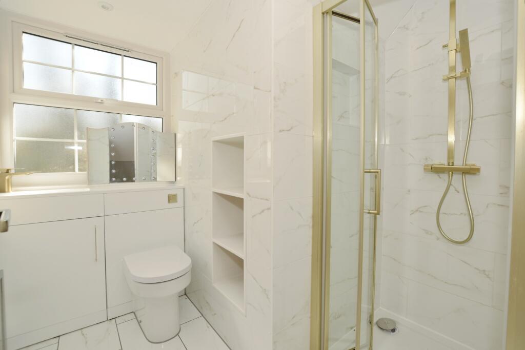
- Bathrooms: 1
- Property Type: undefined
- Property SubType: undefined
Image Descriptions
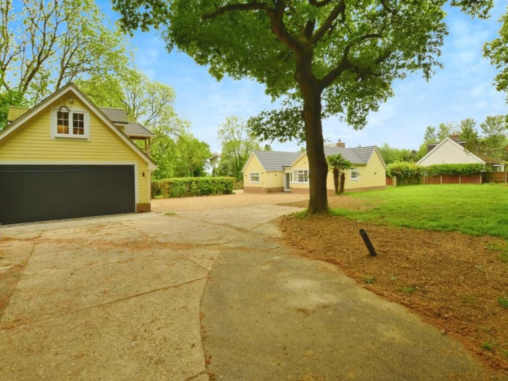
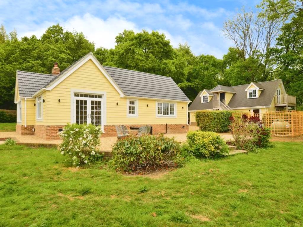
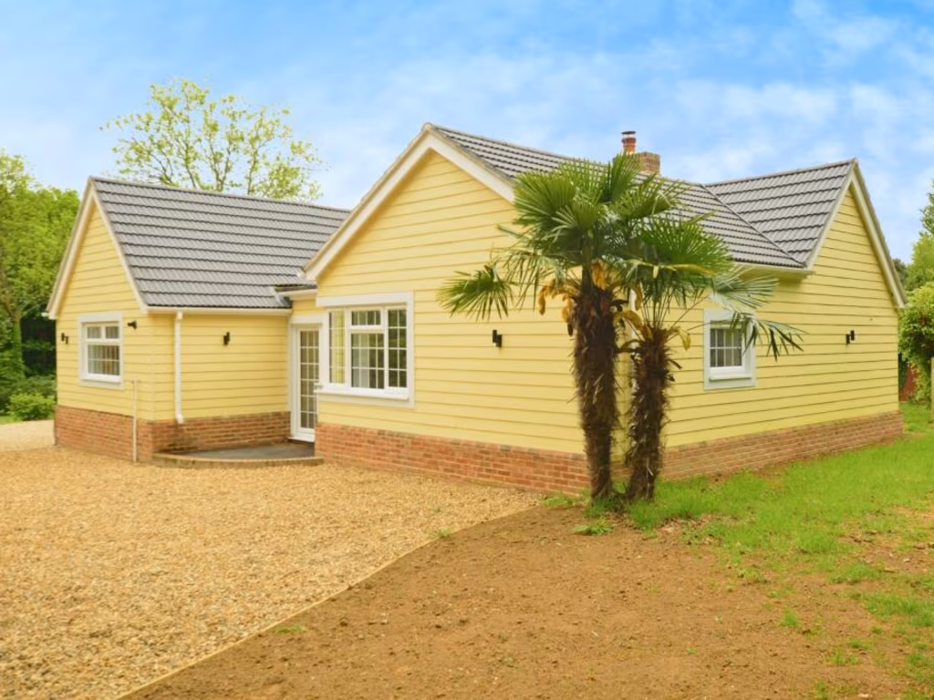
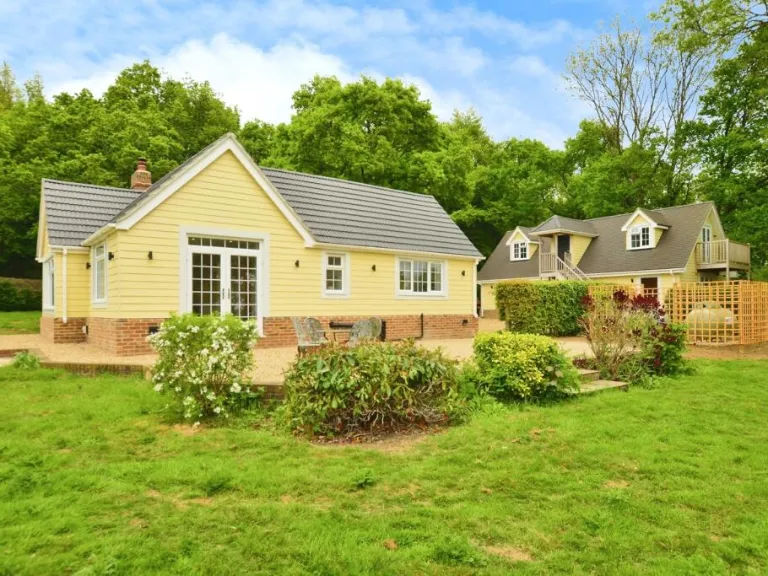
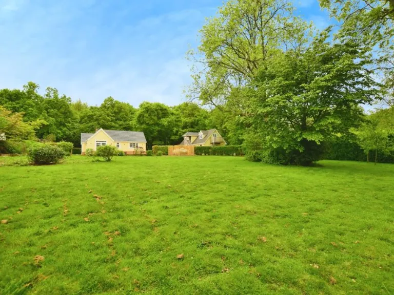
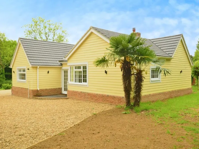
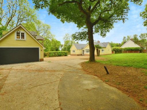
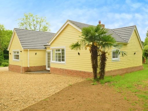
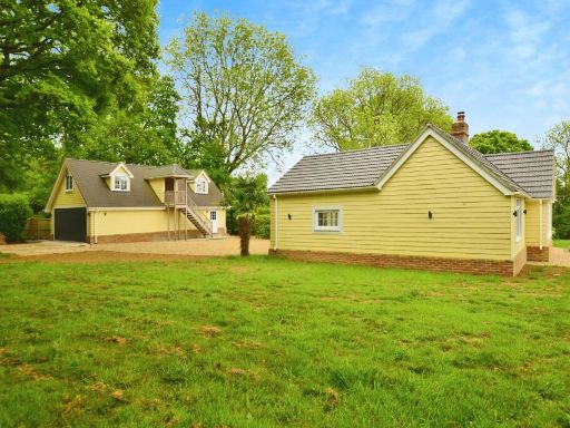
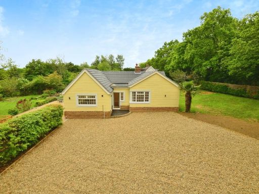
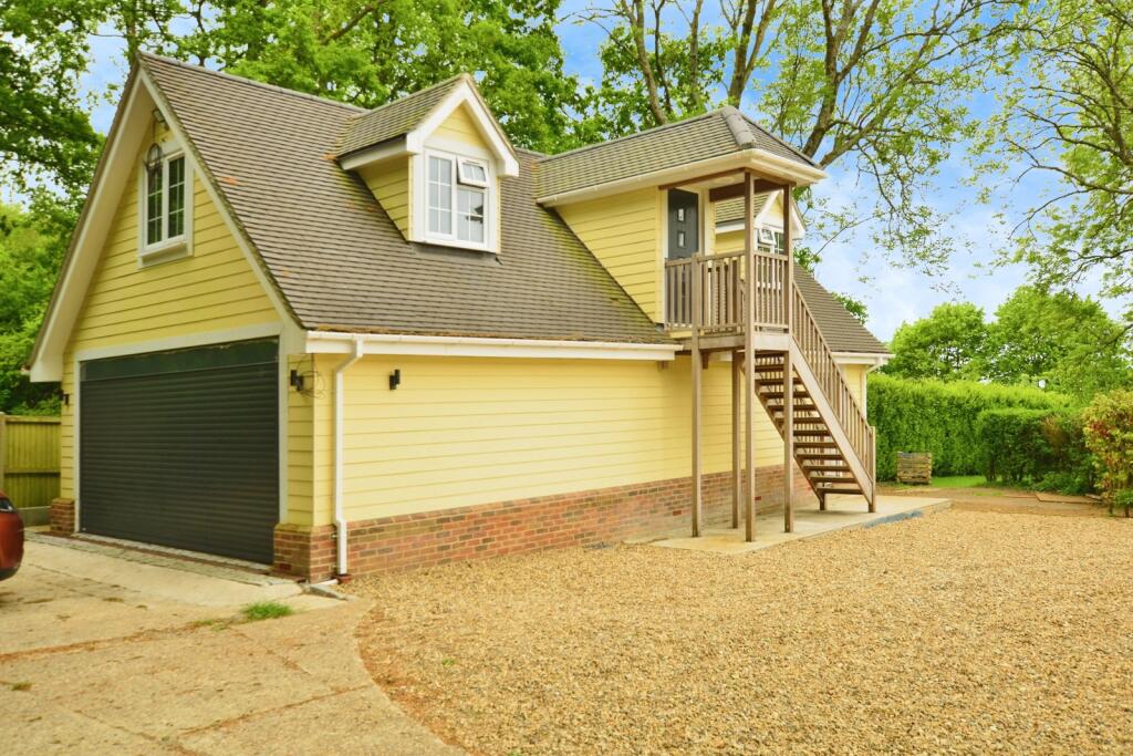
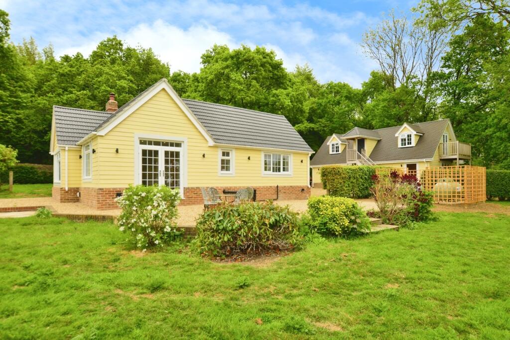
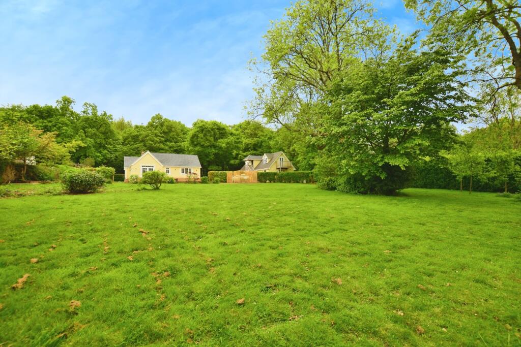
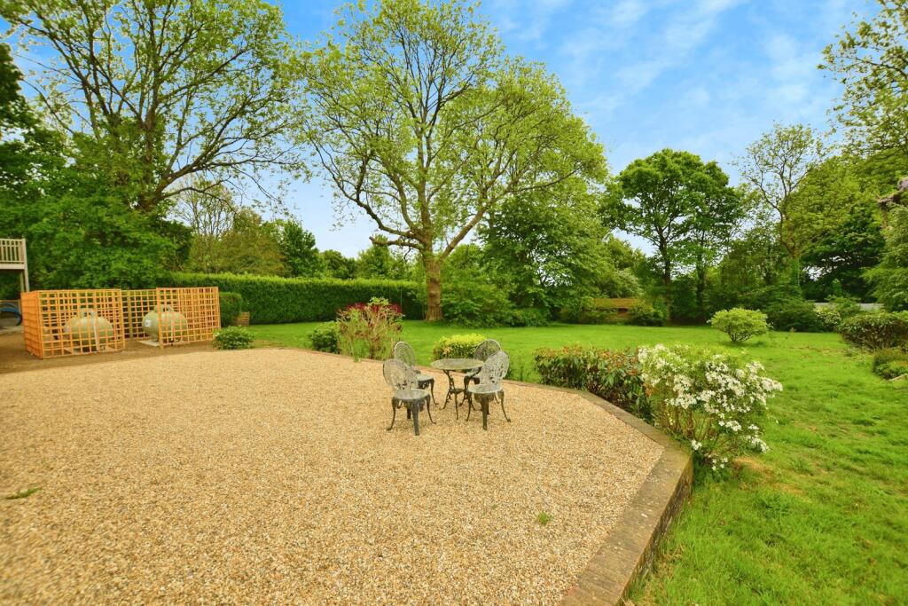
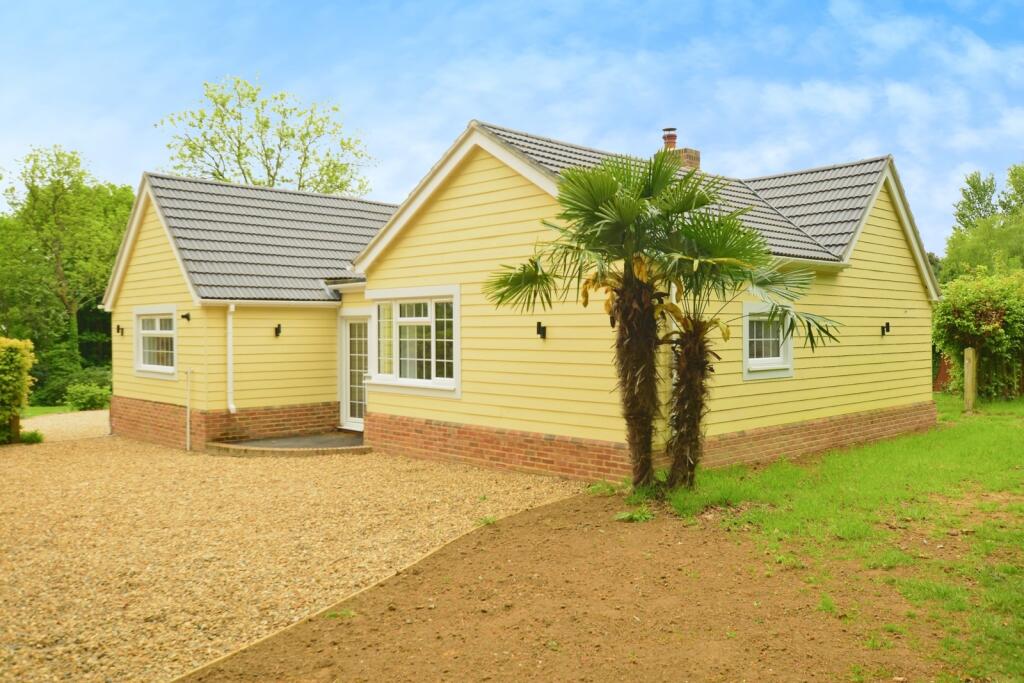
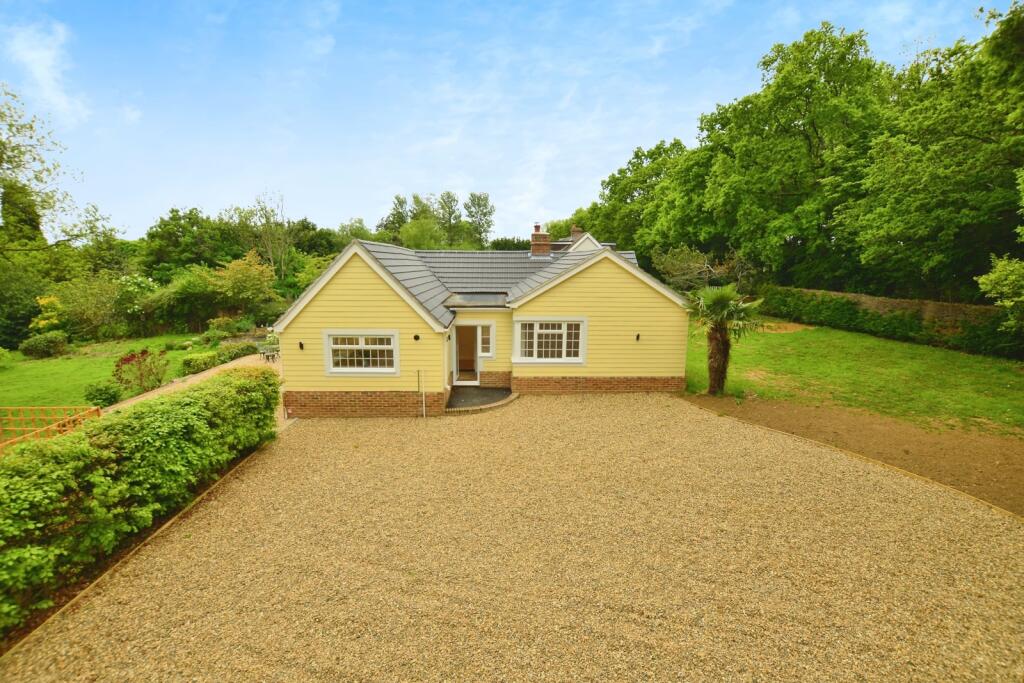
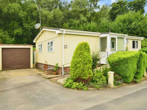
- exterior view of detached house with driveway modern bungalow
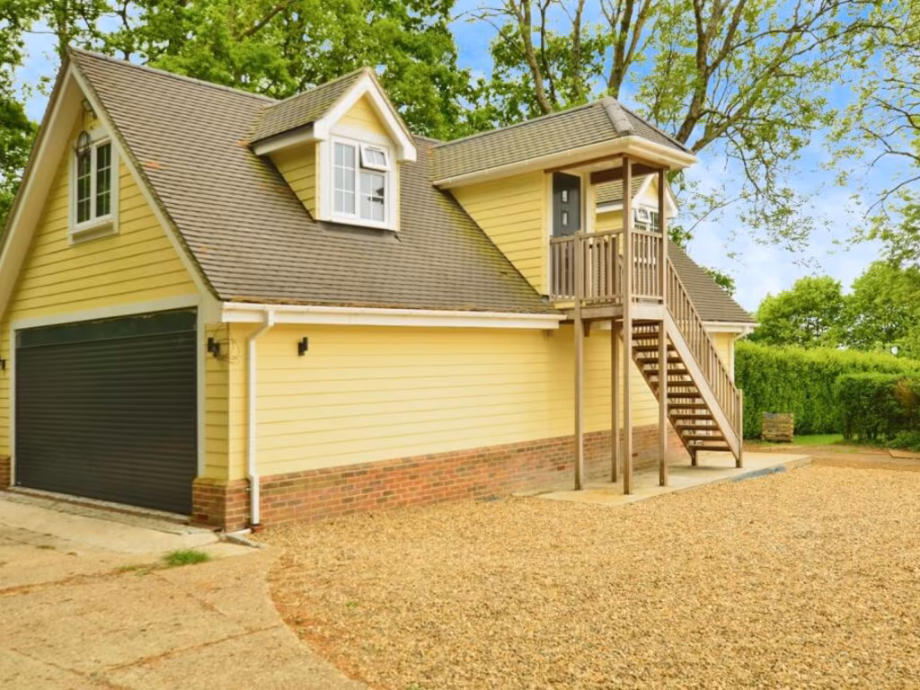
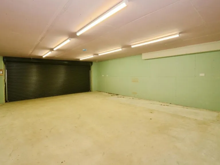
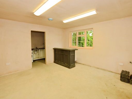
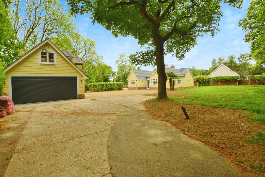
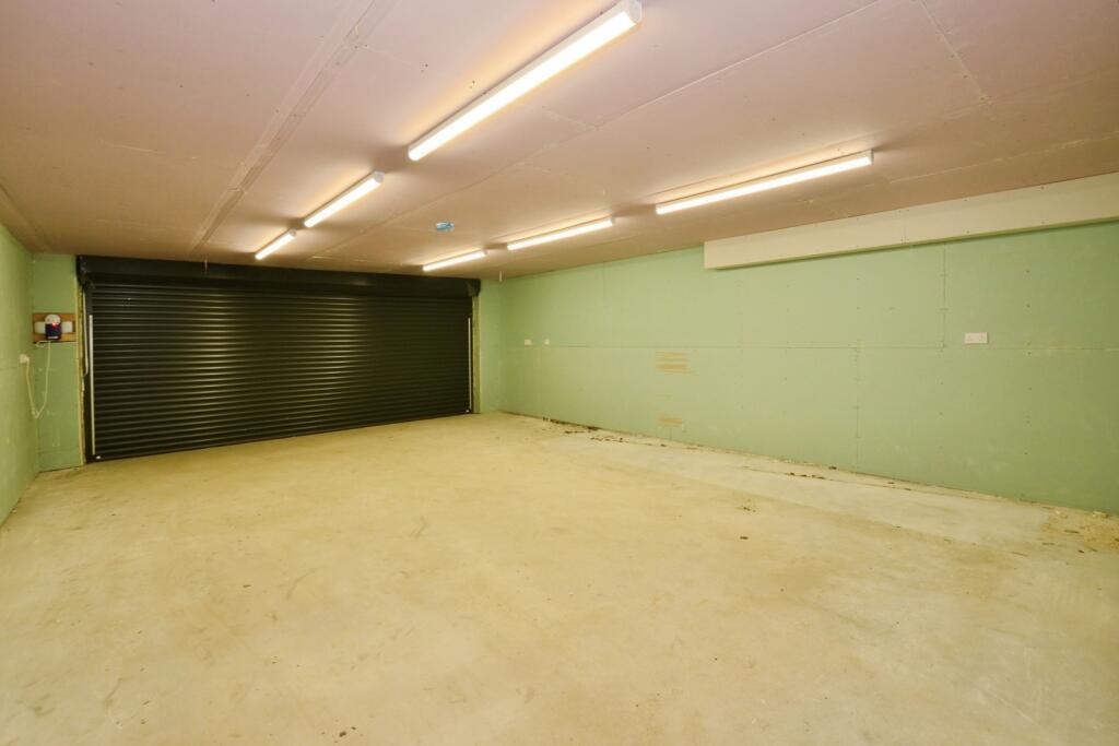
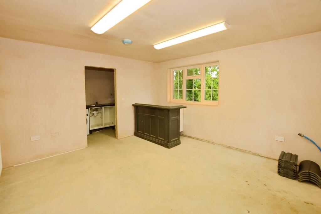
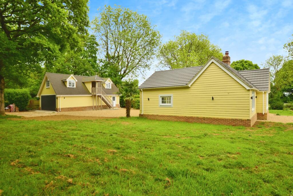
- detached garage with potential living space traditional
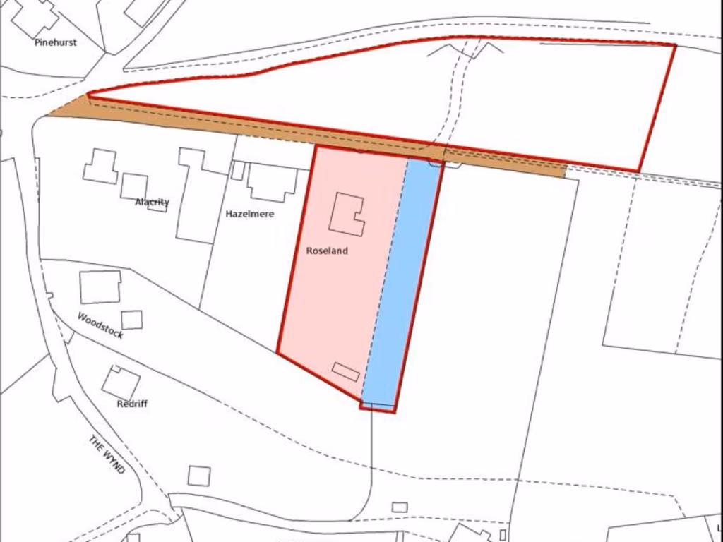
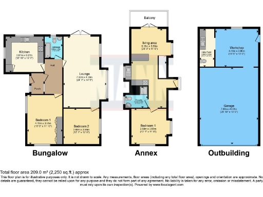
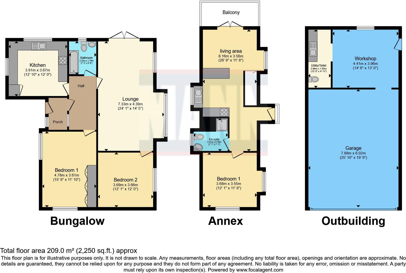
Floorplan Description
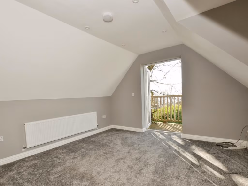
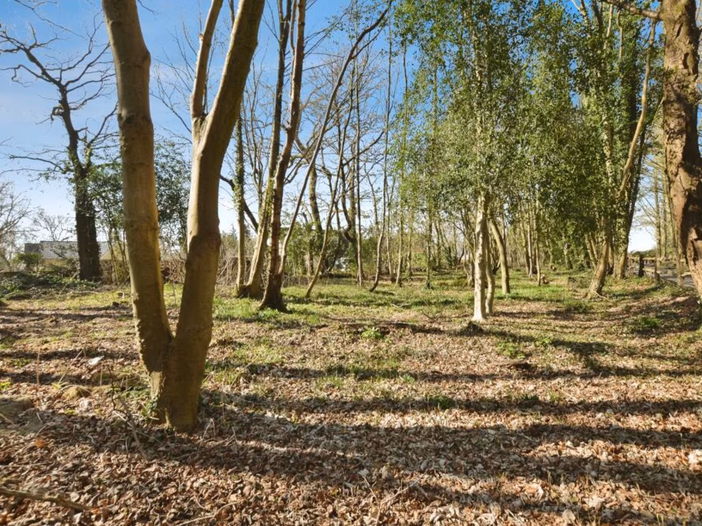
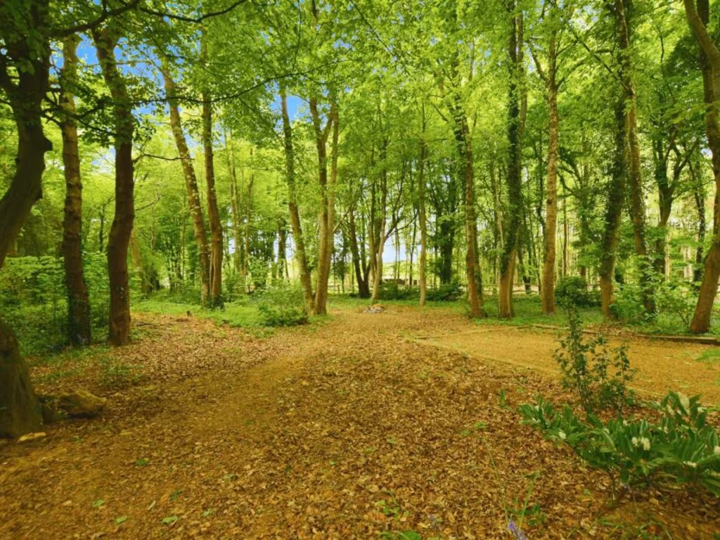
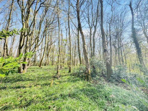
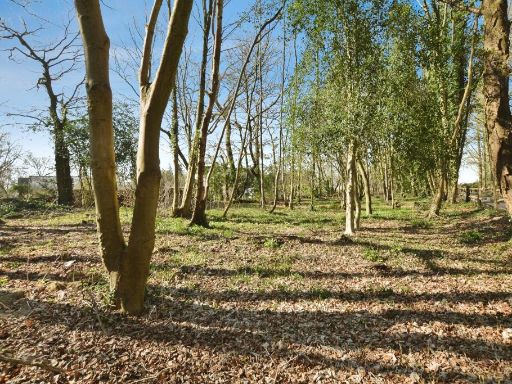
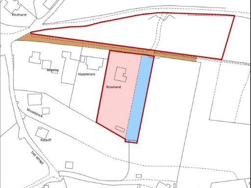
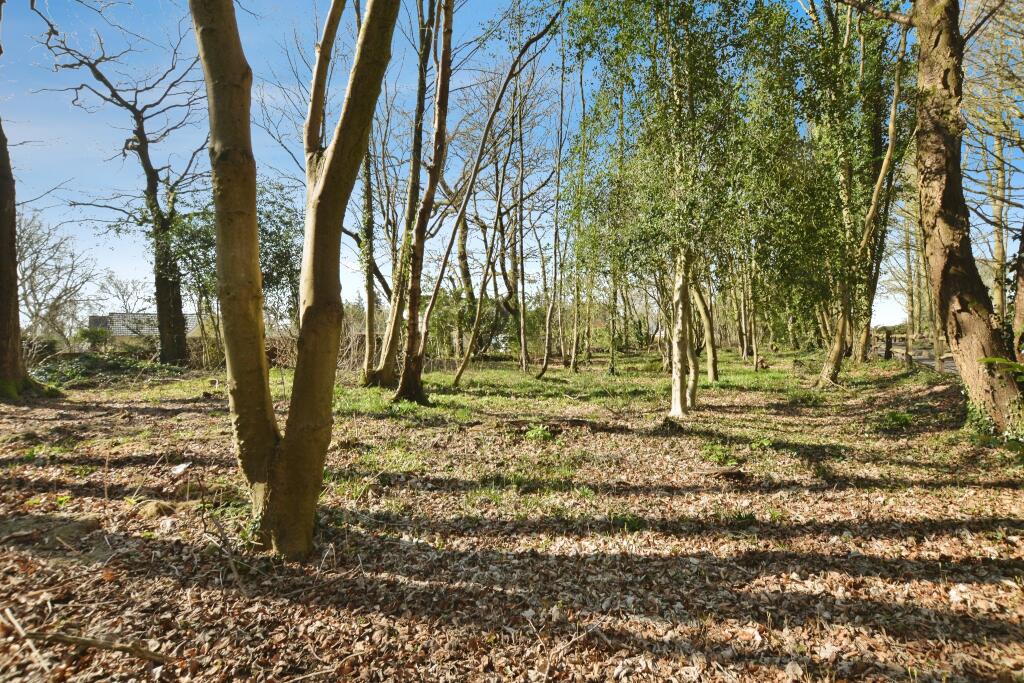
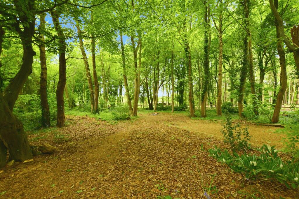
- Bungalow with annex and outbuilding, totaling approximately 2,250 sq.ft.
Rooms
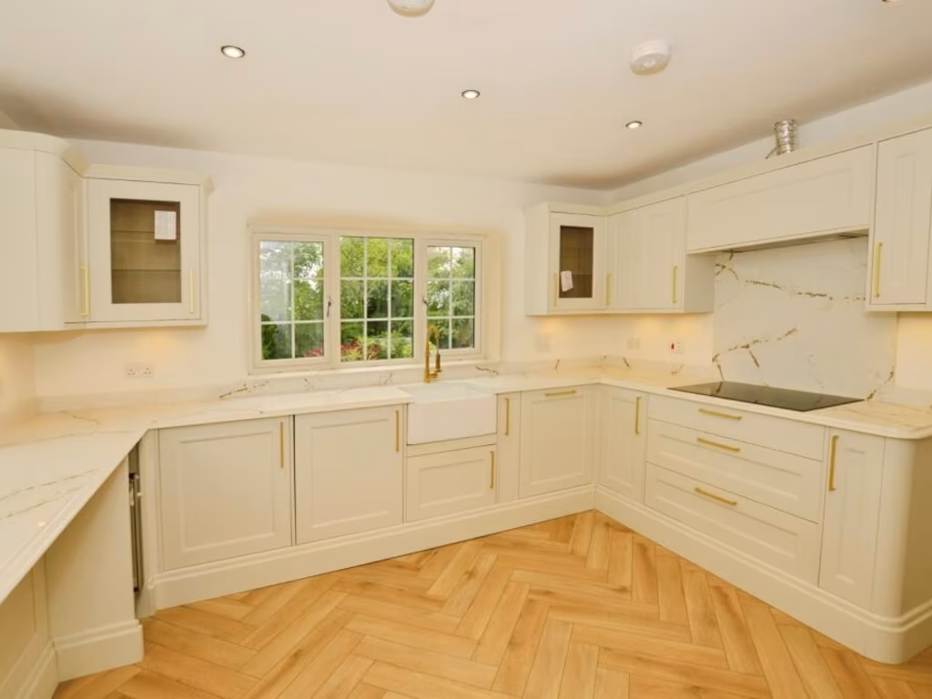
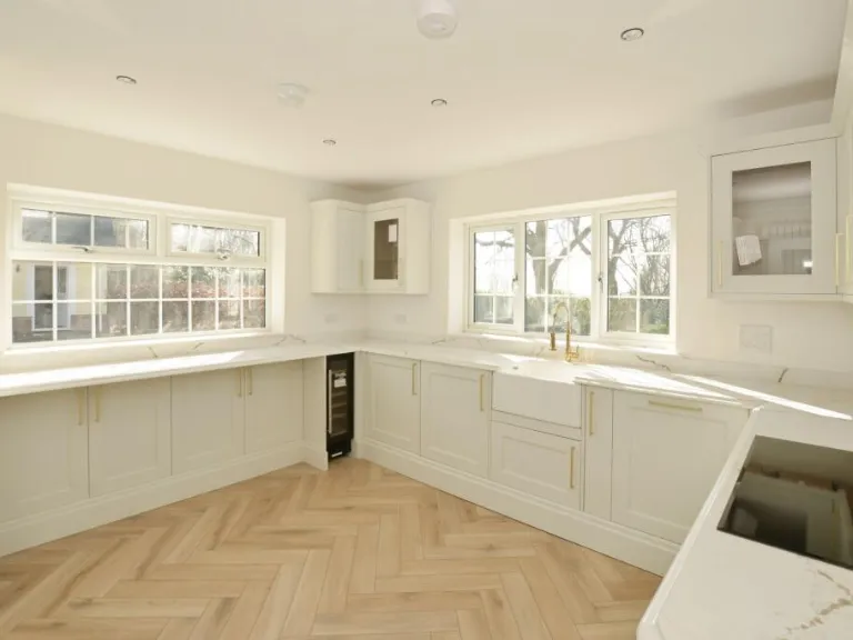
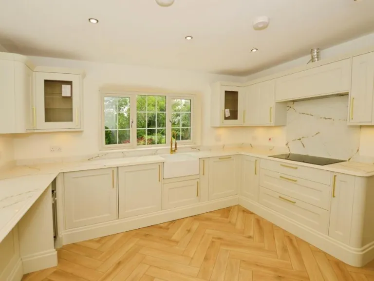
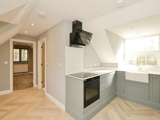
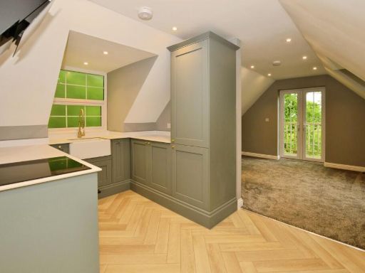
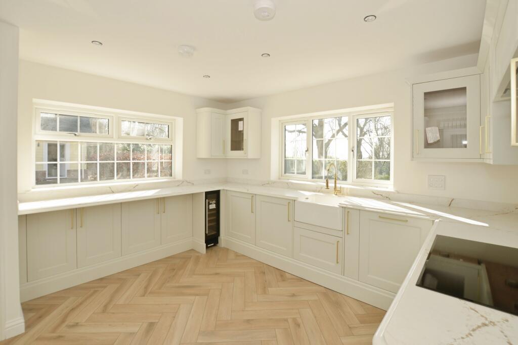
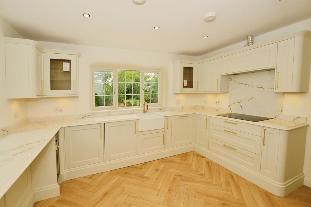
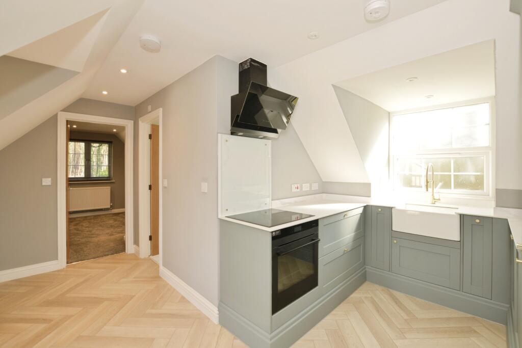
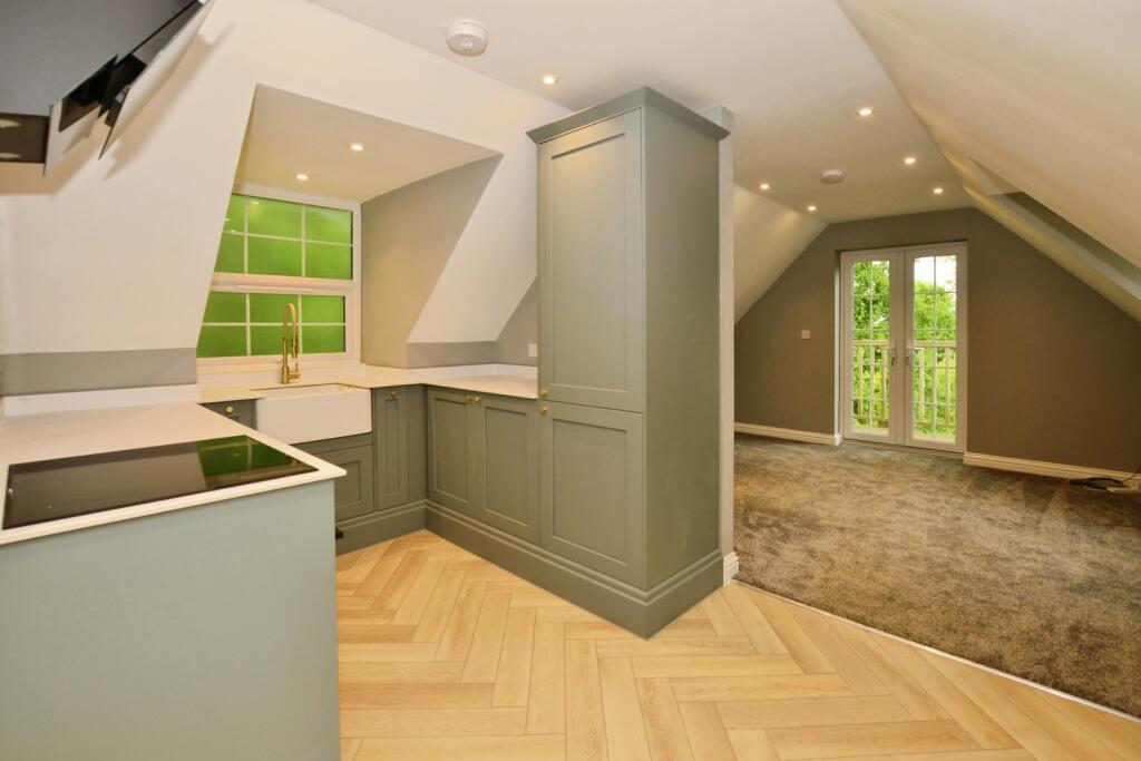
- Kitchen: average
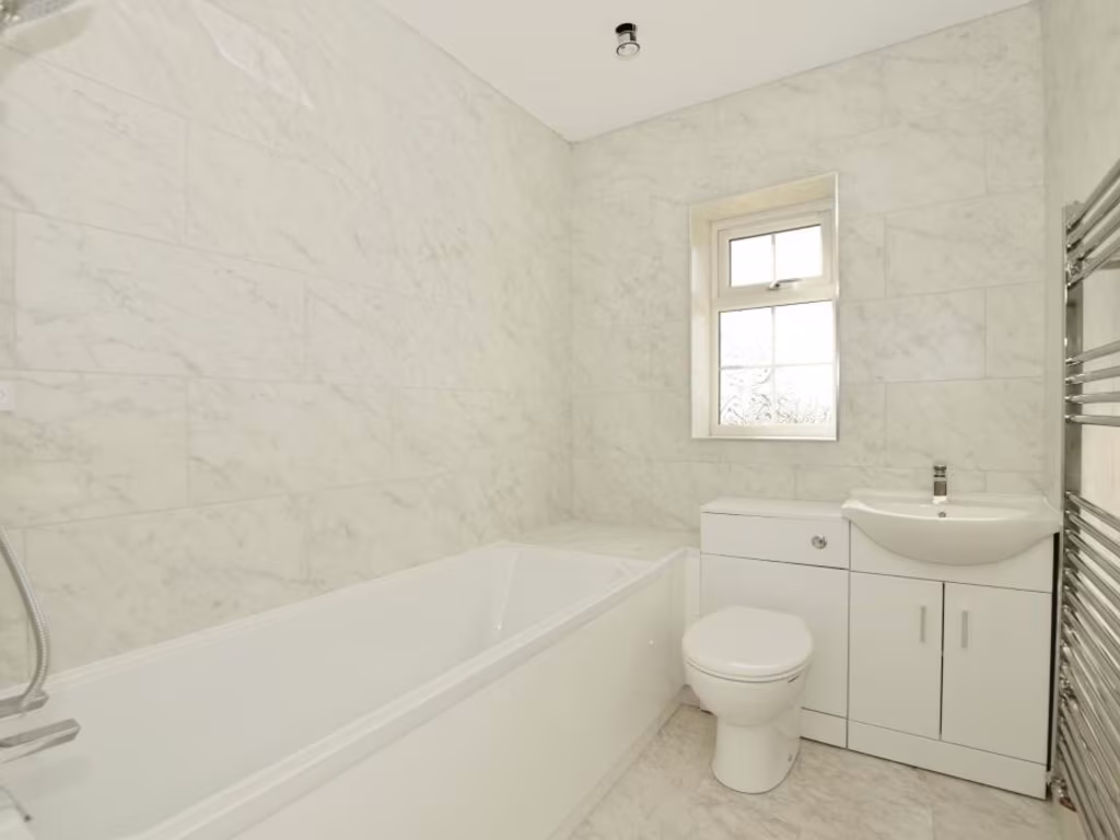
- Bathroom: small
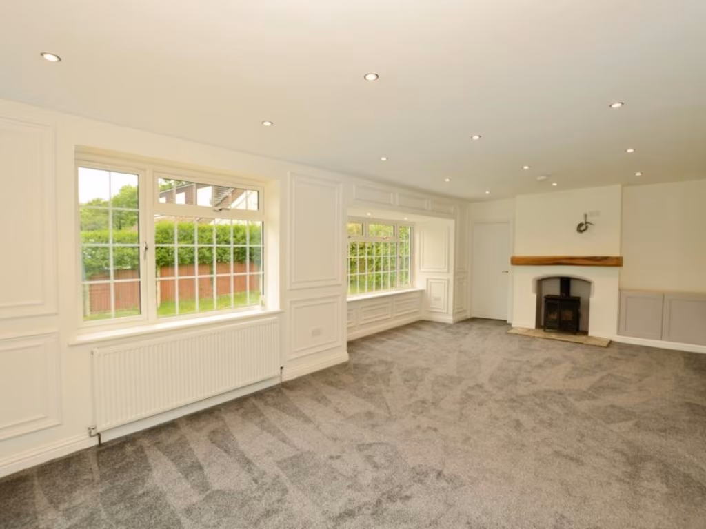
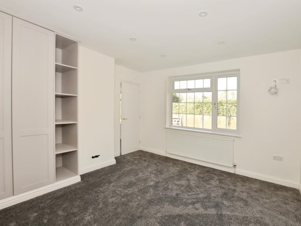
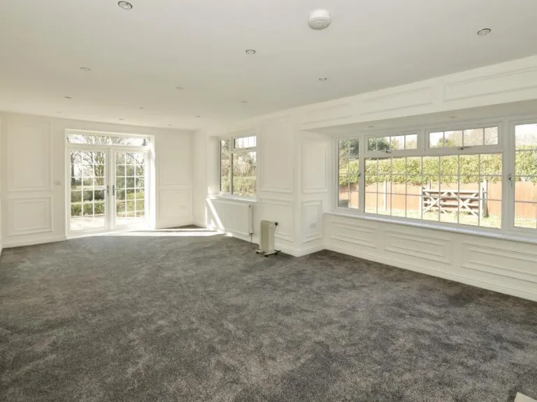
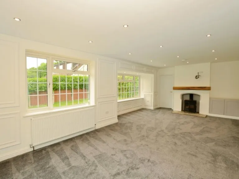
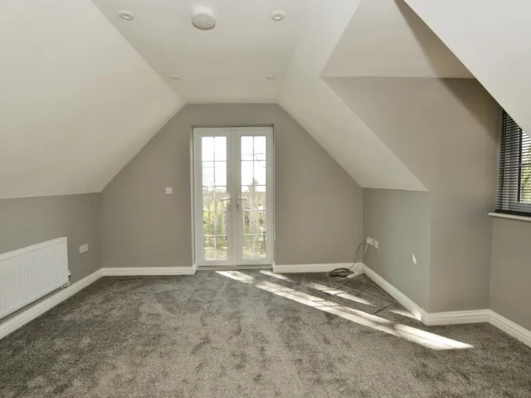
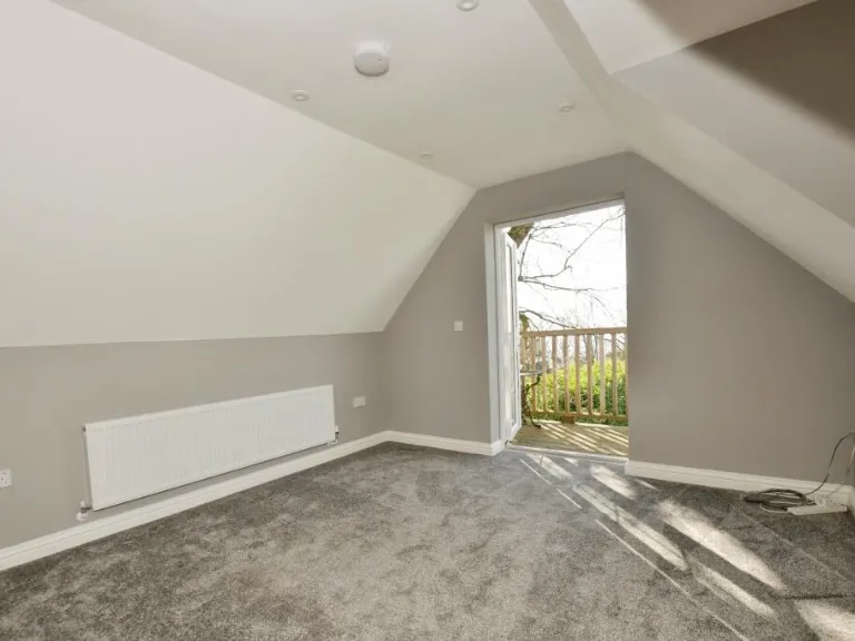
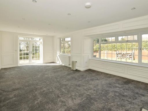
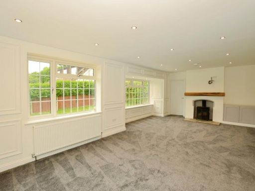
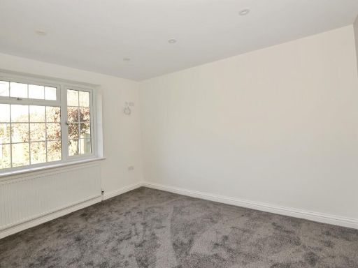
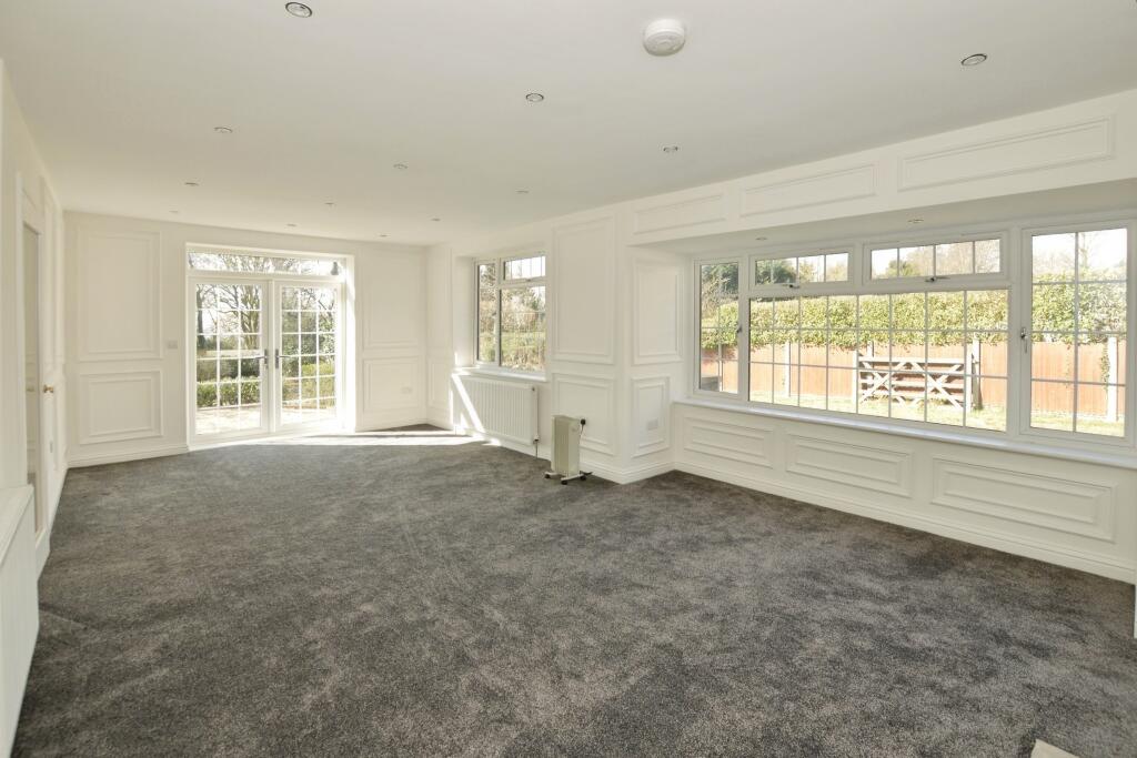
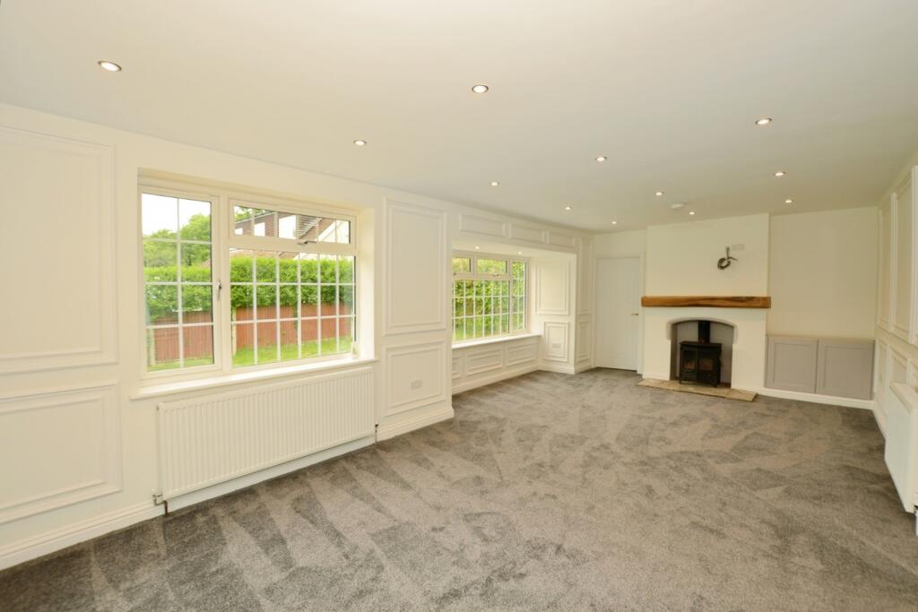
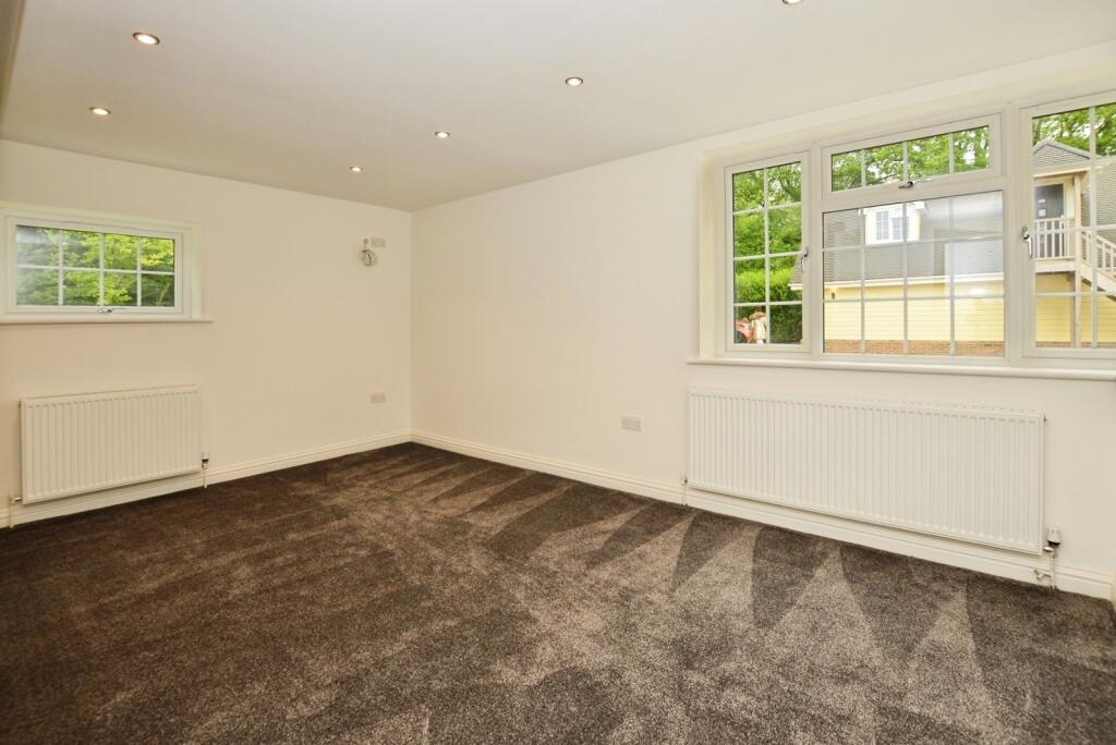
- Lounge: large
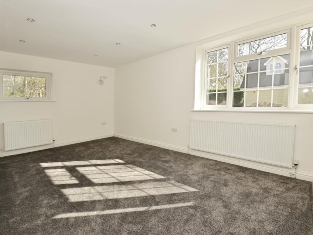
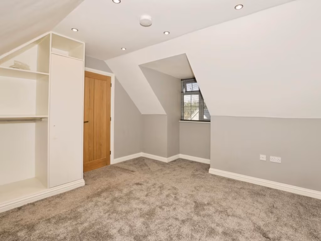
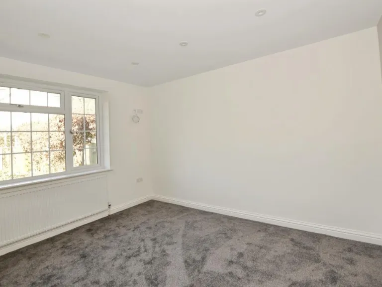
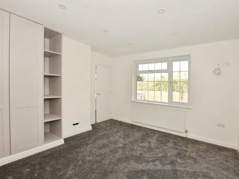
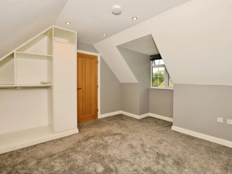
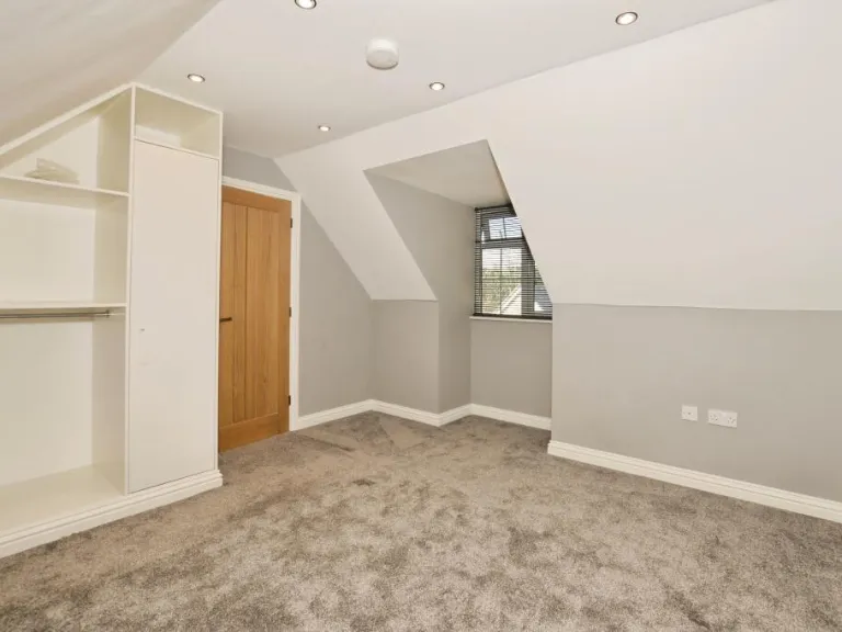
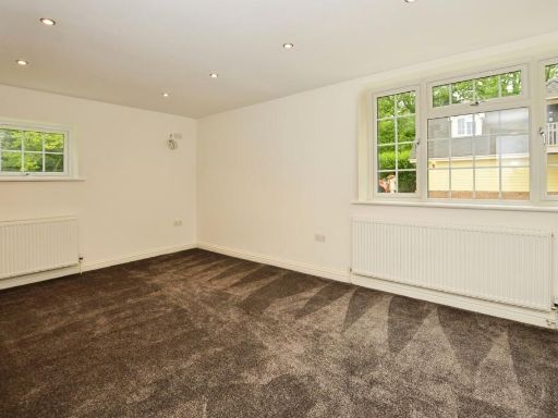
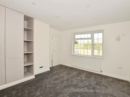
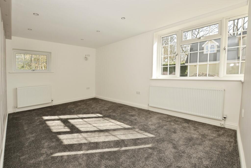
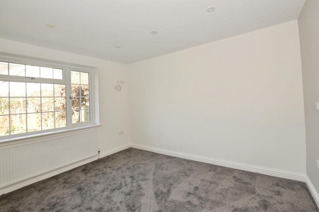
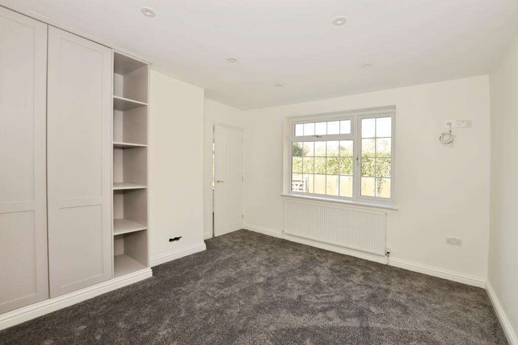
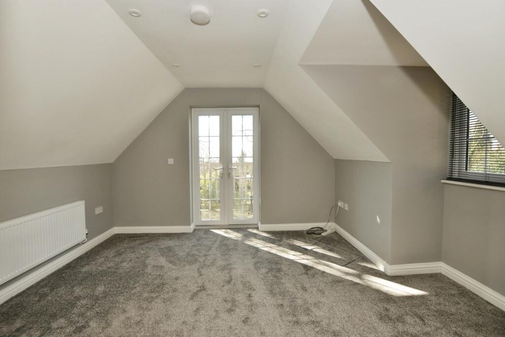
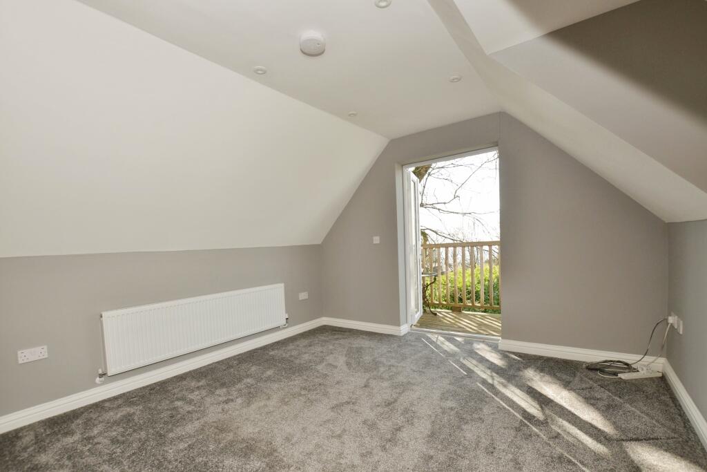
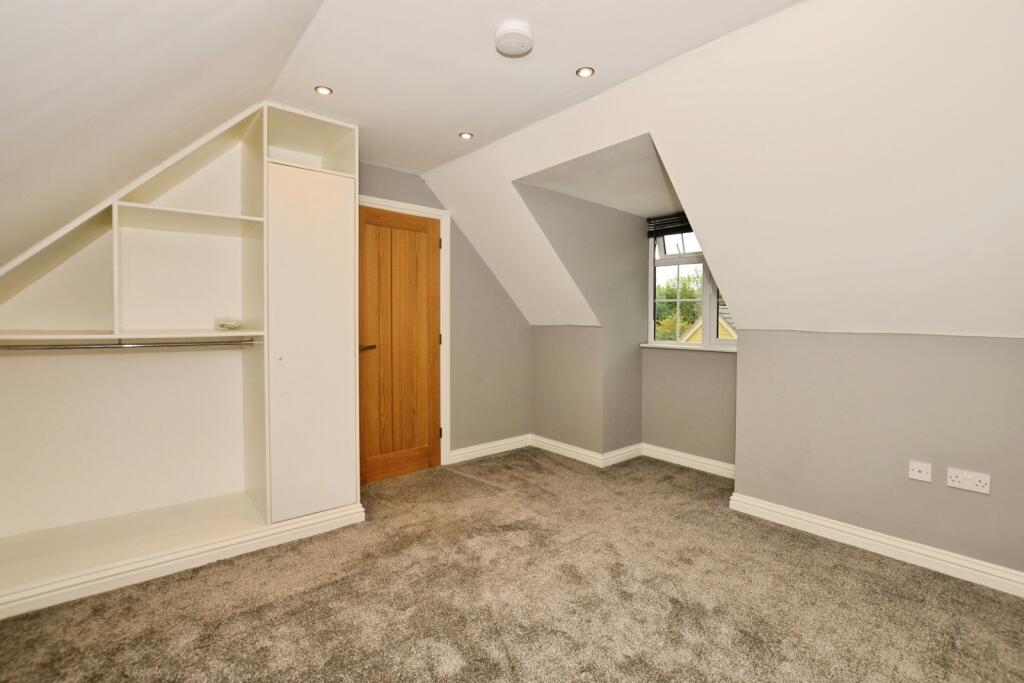
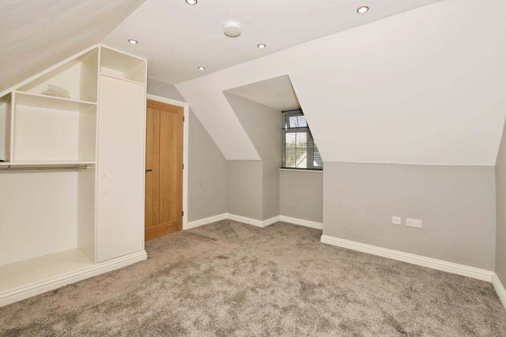
- Bedroom 1: large
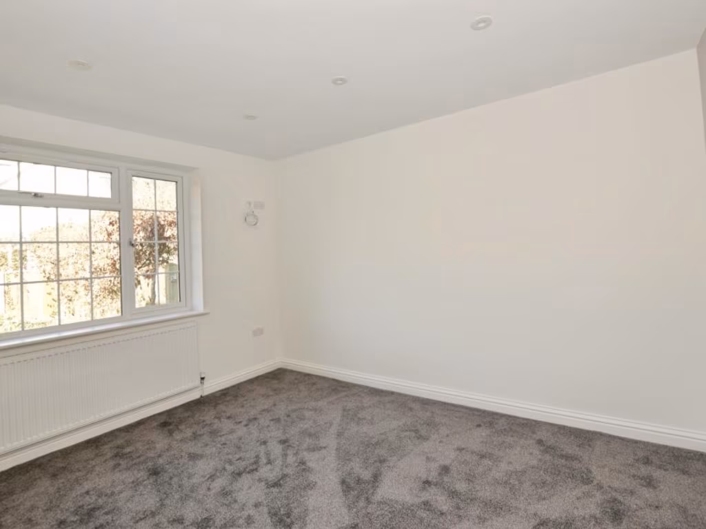
- Bedroom 2: average
- Living area: large
- Bedroom 1: average
- Workshop: average
- Garage: large
Textual Property Features
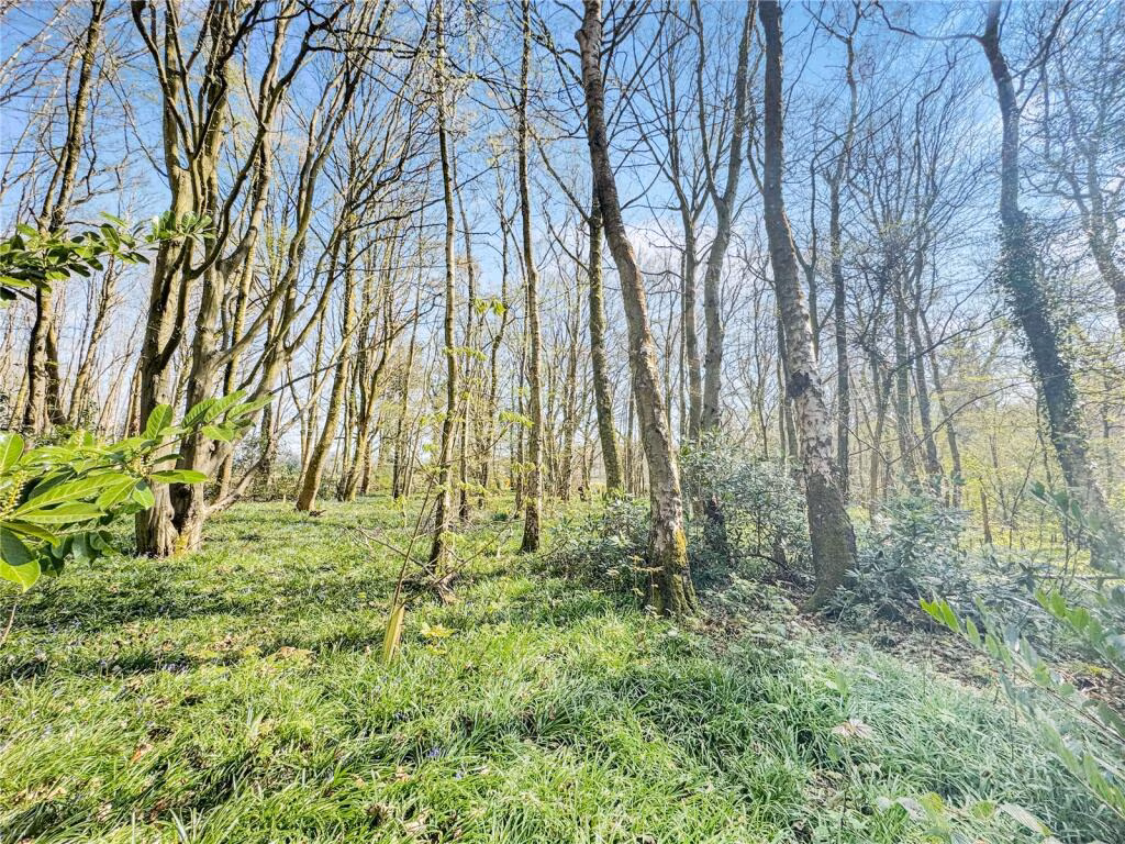
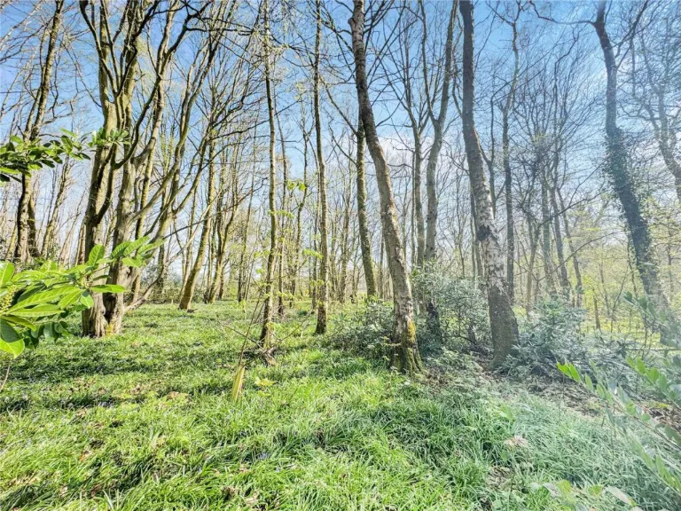
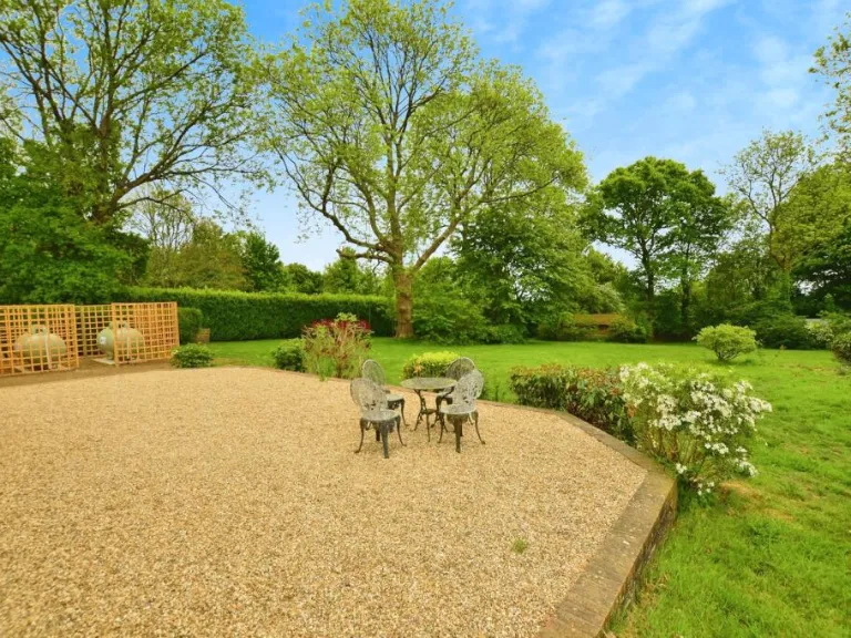
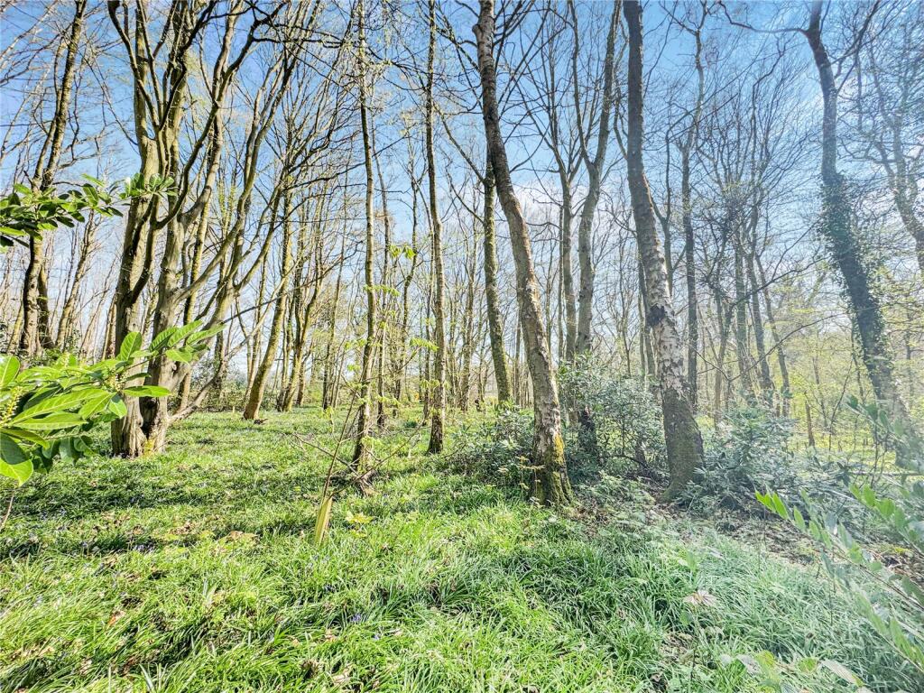
- Has Garden
- Chain Free
- Success
Detected Visual Features
- modern
- bungalow
- detached
- garage
- garden
- driveway
- spacious
- family home
- detached garage
- potential living space
- yellow siding
- external staircase
- traditional style
- dormer windows
- gravel driveway
EPC Details
- Fully double glazed
- Cavity wall, filled cavity
- Boiler and radiators, oil
- Low energy lighting in 39% of fixed outlets
- Suspended, no insulation (assumed)
Nearby Schools
- Ashford School
- Ashford, St Mary's Church of England Primary School
- Phoenix Community Primary School
- Kennington Church of England Academy
- Towers School and Sixth Form Centre
- Pluckley Church of England Primary School
- Eastling Primary School
- Sheldwich Primary School
- Godinton Primary School
- Egerton Church of England Primary School
- Lenham Primary School
- The Norton Knatchbull School
- Charing Church of England Primary School
- Challock Primary School
- Victoria Road Primary School
- Highworth Grammar School
- St Teresa's Catholic Primary School
- Repton Manor Primary School
- Downs View Infant School
- Goat Lees Primary School
- The Lenham School
Nearest General Shops
- Id: 2815254901
- Tags:
- Addr:
- City: Charing
- Housenumber: Charing Farm Shop
- Postcode: TN27 0JL
- Street: Ashford Road
- Fhrs:
- Name: Charing Farm Shop
- Phone: +44 1233 712146
- Shop: farm
- TagsNormalized:
- Lat: 51.2070189
- Lon: 0.7955814
- FullGeoHash: u10e61gqd2hm
- PartitionGeoHash: u10e
- Images:
- FoodStandards:
- Id: 265479
- FHRSID: 265479
- LocalAuthorityBusinessID: PI/000000783
- BusinessName: Charing Farm Shop
- BusinessType: Retailers - other
- BusinessTypeID: 4613
- AddressLine1: East Lyne
- AddressLine2: Ashford Road
- AddressLine3: Charing
- AddressLine4: Kent
- PostCode: TN27 0JL
- RatingValue: 5
- RatingKey: fhrs_5_en-GB
- RatingDate: 2021-07-22
- LocalAuthorityCode: 179
- LocalAuthorityName: Ashford
- LocalAuthorityWebSite: http://www.ashford.gov.uk
- LocalAuthorityEmailAddress: envhealth@ashford.gov.uk
- Scores:
- Hygiene: 0
- Structural: 0
- ConfidenceInManagement: 0
- NewRatingPending: false
- Geocode:
- Longitude: 0.79638500000000
- Latitude: 51.20635400000000
- Distance: 1338.1
,- Id: 2815360252
- Tags:
- Addr:
- City: Charing
- Postcode: TN27 0HU
- Street: The High Street
- Name: Harvey's Hair
- Phone: +44 1233 712203
- Shop: hairdresser
- TagsNormalized:
- Lat: 51.2106412
- Lon: 0.7944888
- FullGeoHash: u10e64de8gmv
- PartitionGeoHash: u10e
- Images:
- FoodStandards: null
- Distance: 1074.4
,- Id: 2815303854
- Tags:
- Addr:
- City: Charing
- Postcode: TN27 0JW
- Street: School Road
- Name: Vision Hair
- Opening_hours: Tu-Fr 09:30-17:30; Sa 09:00-16:00
- Phone: +44 1233 714030
- Shop: hairdresser
- Source: http://www.visionhairkent.co.uk/
- Website: https://www.beautynailhairsalons.com/GB/Charing/286423408153764/Vision-Hair-and-Beauty
- TagsNormalized:
- Lat: 51.2113819
- Lon: 0.7940002
- FullGeoHash: u10e64dpvt92
- PartitionGeoHash: u10e
- Images:
- FoodStandards: null
- Distance: 1046.7
}
Nearest Grocery shops
- Id: 4432321850
- Tags:
- Addr:
- Postcode: TN26 1AP
- Street: Maidstone Road
- Shop: convenience
- Source: survey
- Source:addr: FHRS Open Data
- TagsNormalized:
- Lat: 51.185054
- Lon: 0.8160359
- FullGeoHash: u10e4tfnx18k
- PartitionGeoHash: u10e
- Images:
- FoodStandards: null
- Distance: 3645.6
,- Id: 2815379681
- Tags:
- Addr:
- City: Charing
- Postcode: TN27 0HU
- Street: The High Street
- Name: The Charing Stores
- Opening_hours: Mo-Tu 07:00-17:30; We 07:00-12:00; Th-Fr 07:00-17:30; Sa 07:30-17:30; Su 08:00-12:30
- Phone: +44 1233 712325
- Shop: convenience
- TagsNormalized:
- Lat: 51.2093974
- Lon: 0.7936919
- FullGeoHash: u10e643uq7ed
- PartitionGeoHash: u10e
- Images:
- FoodStandards: null
- Distance: 1210.8
,- Id: 2815366765
- Tags:
- Addr:
- City: Charing
- Housenumber: 47
- Postcode: TN27 0LS
- Street: The High Street
- Brand: Londis
- Brand:wikidata: Q21008564
- Brand:wikipedia: en:Londis (United Kingdom)
- Fhrs:
- Name: Wady & Brett
- Opening_hours: Mo-Sa 07:00-20:00; Su 09:00-18:00
- Phone: +44 1233 712318
- Shop: convenience
- Website: https://www.londis.co.uk/our-stores/wady-and-brett
- TagsNormalized:
- Lat: 51.2108762
- Lon: 0.794635
- FullGeoHash: u10e64dsur4z
- PartitionGeoHash: u10e
- Images:
- FoodStandards:
- Id: 264952
- FHRSID: 264952
- LocalAuthorityBusinessID: PI/000031107
- BusinessName: Wady & Brett
- BusinessType: Retailers - other
- BusinessTypeID: 4613
- AddressLine1: 47 High Street
- AddressLine2: Charing
- AddressLine3: Kent
- AddressLine4: null
- PostCode: TN27 0LS
- RatingValue: 5
- RatingKey: fhrs_5_en-GB
- RatingDate: 2016-10-12
- LocalAuthorityCode: 179
- LocalAuthorityName: Ashford
- LocalAuthorityWebSite: http://www.ashford.gov.uk
- LocalAuthorityEmailAddress: envhealth@ashford.gov.uk
- Scores:
- Hygiene: 0
- Structural: 0
- ConfidenceInManagement: 5
- NewRatingPending: false
- Geocode:
- Longitude: 0.79514200000000
- Latitude: 51.21137500000000
- Distance: 1049.3
}
Nearest Supermarkets
- Id: 203898912
- Tags:
- Brand: M&S Foodhall
- Brand:wikidata: Q714491
- Brand:wikipedia: en:Marks & Spencer
- Building: retail
- Contact:
- Website: https://www.marksandspencer.com/stores/ashford-warren-retail-park-foodhall-1895
- Name: M&S Foodhall
- Operator: Marks & Spencer Food Hall
- Shop: supermarket
- Source: Bing
- TagsNormalized:
- m&s foodhall
- retail
- supermarket
- shop
- Lat: 51.1580946
- Lon: 0.8719903
- FullGeoHash: u10e5c4cwb51
- PartitionGeoHash: u10e
- Images:
- FoodStandards: null
- Distance: 8030.1
,- Id: 55854168
- Tags:
- Addr:
- Postcode: TN24 8YN
- Street: Simone Weil Avenue
- Brand: Sainsbury's
- Brand:wikidata: Q152096
- Brand:wikipedia: en:Sainsbury's
- Building: yes
- Name: Sainsbury's
- Shop: supermarket
- TagsNormalized:
- sainsburys
- supermarket
- shop
- Lat: 51.1586113
- Lon: 0.8673902
- FullGeoHash: u10e59pse8m5
- PartitionGeoHash: u10e
- Images:
- FoodStandards: null
- Distance: 7802.2
,- Id: 184336465
- Tags:
- Addr:
- Postcode: TN23 3RT
- Street: Sir Bernard Paget Avenue
- Brand: Waitrose
- Brand:wikidata: Q771734
- Brand:wikipedia: en:Waitrose & Partners
- Building: yes
- Name: Waitrose
- Operator: Waitrose & Partners
- Payment:
- Cash: yes
- Contactless: yes
- Credit_cards: yes
- Debit_cards: yes
- Shop: supermarket
- Source: www.waitrose.com
- Website: https://www.waitrose.com/
- TagsNormalized:
- Lat: 51.1555601
- Lon: 0.8574917
- FullGeoHash: u10e5886tp84
- PartitionGeoHash: u10e
- Images:
- FoodStandards: null
- Distance: 7743.8
}
Nearest Religious buildings
- Id: 348587143
- Tags:
- Addr:
- City: Charing
- Postcode: TN27 0LP
- Street: Market Place
- Amenity: place_of_worship
- Building: church
- Denomination: anglican
- Name: St Peter & St Paul
- Phone: +44 1233 712598
- Religion: christian
- Website: http://g7benefice.org/churches/charing/
- Wheelchair: no
- Wikidata: Q17529456
- TagsNormalized:
- place of worship
- church
- anglican
- paul
- christian
- Lat: 51.2102104
- Lon: 0.796666
- FullGeoHash: u10e64s15ejh
- PartitionGeoHash: u10e
- Images:
- FoodStandards: null
- Distance: 1005.3
,- Id: 276541203
- Tags:
- Amenity: public_building
- Building: yes
- Name: Church Barn
- TagsNormalized:
- Lat: 51.210396
- Lon: 0.7973814
- FullGeoHash: u10e64sdhmdx
- PartitionGeoHash: u10e
- Images:
- FoodStandards: null
- Distance: 958.1
,- Id: 678182720
- Tags:
- Amenity: place_of_worship
- Building: yes
- Denomination: baptist
- Name: St Helens Church
- Religion: christian
- TagsNormalized:
- place of worship
- baptist
- church
- christian
- Lat: 51.2184315
- Lon: 0.8118704
- FullGeoHash: u10e6kp0vzwk
- PartitionGeoHash: u10e
- Images:
- FoodStandards: null
- Distance: 443.8
}
Nearest Medical buildings
- Id: 489413814
- Tags:
- Addr:
- City: Lenham
- Postcode: ME17 2PG
- Street: The Square
- Amenity: pharmacy
- Fhrs:
- Authority: Maidstone
- Id: 720909
- Inspectiondate: 2016-09-01
- Rating: Exempt
- Name: Saxon Warrior Pharmacy
- Website: http://www.saxonwarriorpharmacy.com/
- TagsNormalized:
- Lat: 51.2369291
- Lon: 0.7177658
- FullGeoHash: u10e2r6stpug
- PartitionGeoHash: u10e
- Images:
- FoodStandards:
- Id: 720909
- FHRSID: 720909
- LocalAuthorityBusinessID: PI/000053862/MA
- BusinessName: Saxon Warrior Pharmacy
- BusinessType: Retailers - other
- BusinessTypeID: 4613
- AddressLine1: The Square
- AddressLine2: Lenham
- AddressLine3: Maidstone
- AddressLine4: Kent
- PostCode: ME17 2PG
- RatingValue: Exempt
- RatingKey: fhrs_exempt_en-GB
- RatingDate: 2016-09-01
- LocalAuthorityCode: 185
- LocalAuthorityName: Maidstone
- LocalAuthorityWebSite: http://www.maidstone.gov.uk/
- LocalAuthorityEmailAddress: EHAdmin@midkent.gov.uk
- Scores:
- Hygiene: null
- Structural: null
- ConfidenceInManagement: null
- NewRatingPending: false
- Geocode:
- Longitude: 0.71796000003815
- Latitude: 51.23738098144530
- Distance: 6511
,- Id: 3739440713
- Tags:
- Addr:
- Postcode: ME17 2QF
- Street: Groom Way
- Amenity: doctors
- Name: Len Valley Practice
- Website: www.lenvalleypractice.co.uk/
- TagsNormalized:
- Lat: 51.2374468
- Lon: 0.7233852
- FullGeoHash: u10e2rqzb075
- PartitionGeoHash: u10e
- Images:
- FoodStandards: null
- Distance: 6164.7
,- Id: 375803792
- Tags:
- Amenity: doctors
- Healthcare: doctor
- Name: Charing Surgery
- Postal_code: TN27 0HZ
- Source:
- Postal_code: http://www.thecharingsurgery.co.uk/
- Url: https://www.charingpractice.co.uk/
- TagsNormalized:
- doctor
- doctors
- health
- healthcare
- surgery
- Lat: 51.2095477
- Lon: 0.7912197
- FullGeoHash: u10e642jhz84
- PartitionGeoHash: u10e
- Images:
- FoodStandards: null
- Distance: 1325.7
,- Id: 375803794
- Tags:
- Amenity: pharmacy
- Healthcare: pharmacy
- Name: Charing Pharmacy
- TagsNormalized:
- Lat: 51.2095798
- Lon: 0.7913755
- FullGeoHash: u10e642m2ms6
- PartitionGeoHash: u10e
- Images:
- FoodStandards: null
- Distance: 1315.1
}
Nearest Leisure Facilities
- Id: 866029427
- Tags:
- Access: private
- Leisure: swimming_pool
- TagsNormalized:
- swimming
- swimming pool
- pool
- leisure
- Lat: 51.2071803
- Lon: 0.8056246
- FullGeoHash: u10e63fxkqm0
- PartitionGeoHash: u10e
- Images:
- FoodStandards: null
- Distance: 1115
,- Id: 156819824
- Tags:
- Leisure: pitch
- Sport: tennis
- TagsNormalized:
- Lat: 51.2084391
- Lon: 0.7982879
- FullGeoHash: u10e64jqc2yt
- PartitionGeoHash: u10e
- Images:
- FoodStandards: null
- Distance: 1106.7
,- Id: 375784997
- Tags:
- TagsNormalized:
- Lat: 51.2087695
- Lon: 0.7987062
- FullGeoHash: u10e64m8enw8
- PartitionGeoHash: u10e
- Images:
- FoodStandards: null
- Distance: 1060.6
,- Id: 97420994
- Tags:
- Leisure: pitch
- Sport: bowls
- TagsNormalized:
- Lat: 51.208638
- Lon: 0.8008006
- FullGeoHash: u10e64ppun00
- PartitionGeoHash: u10e
- Images:
- FoodStandards: null
- Distance: 1014.6
,- Id: 866029431
- Tags:
- Access: private
- Leisure: swimming_pool
- TagsNormalized:
- swimming
- swimming pool
- pool
- leisure
- Lat: 51.2086365
- Lon: 0.8017303
- FullGeoHash: u10e64pzcttr
- PartitionGeoHash: u10e
- Images:
- FoodStandards: null
- Distance: 994.4
}
Nearest Tourist attractions
- Id: 575044112
- Tags:
- Name: Lenham
- Tourism: village_sign
- TagsNormalized:
- Lat: 51.2356938
- Lon: 0.7341942
- FullGeoHash: u10e2xntecwf
- PartitionGeoHash: u10e
- Images:
- FoodStandards: null
- Distance: 5393.7
,- Id: 918998307
- Tags:
- Name: Dunn Street Farm
- Sanitary_dump_station: yes
- Source: survey
- Tourism: camp_site
- TagsNormalized:
- Lat: 51.1974978
- Lon: 0.8498076
- FullGeoHash: u10e724z1cq6
- PartitionGeoHash: u10e
- Images:
- FoodStandards: null
- Distance: 3768.3
,- Id: 633935497
- Tags:
- Addr:
- City: Faversham
- Postcode: ME13 0HY
- Street: Stalisfield Road
- Fee: yes
- Name: The Plough Inn
- Operator: The Plough Inn
- Power_supply: yes
- Tourism: caravan_site
- Website: https://www.campingandcaravanningclub.co.uk/campsites/uk/kent/faversham/theploughinn
- TagsNormalized:
- Lat: 51.2424191
- Lon: 0.7981904
- FullGeoHash: u10ed0mhxpmb
- PartitionGeoHash: u10e
- Images:
- FoodStandards: null
- Distance: 2853.1
}
Nearest Train stations
- Id: 4373177416
- Tags:
- Name: Warren Wood
- Public_transport: station
- Railway: station
- Usage: tourism
- TagsNormalized:
- Lat: 51.2951704
- Lon: 0.6864127
- FullGeoHash: u107zd5b48f6
- PartitionGeoHash: u107
- Images:
- FoodStandards: null
- Distance: 12007.7
,- Id: 6692612519
- Tags:
- Name: Harrietsham
- Naptan:
- Network: National Rail
- Public_transport: station
- Railway: station
- Ref:
- Wikidata: Q2683079
- Wikipedia: en:Harrietsham railway station
- TagsNormalized:
- Lat: 51.2449353
- Lon: 0.6726551
- FullGeoHash: u107x2cg3urf
- PartitionGeoHash: u107
- Images:
- FoodStandards: null
- Distance: 9770.2
,- Id: 7998566986
- Tags:
- Name: Ashford International
- Naptan:
- Network: National Rail
- Platforms: 6
- Postal_code: TN23 1EZ
- Public_transport: station
- Railway: station
- Ref:
- Crs: AFK
- Crs_Eurostar: ASI
- Toilets:
- Train: yes
- Wheelchair: yes
- Wikidata: Q800406
- Wikipedia: en:Ashford International railway station
- TagsNormalized:
- Lat: 51.143379
- Lon: 0.8752323
- FullGeoHash: u10dgym7f2ue
- PartitionGeoHash: u10d
- Images:
- FoodStandards: null
- Distance: 9529.6
,- Id: 3518996541
- Tags:
- Name: Wye
- Naptan:
- Network: National Rail
- Platforms: 2
- Public_transport: station
- Railway: station
- Ref:
- Wikidata: Q2011884
- Wikipedia: en:Wye railway station
- TagsNormalized:
- Lat: 51.1853805
- Lon: 0.9294965
- FullGeoHash: u10ejnhb6y6z
- PartitionGeoHash: u10e
- Images:
- FoodStandards: null
- Distance: 9316.3
,- Id: 6692612521
- Tags:
- Name: Charing
- Naptan:
- Network: National Rail
- Public_transport: station
- Railway: station
- Ref:
- Wikidata: Q2199062
- Wikipedia: en:Charing railway station
- TagsNormalized:
- Lat: 51.2082021
- Lon: 0.7898686
- FullGeoHash: u10e3fpjmkb8
- PartitionGeoHash: u10e
- Images:
- FoodStandards: null
- Distance: 1495
}
Nearest Hotels
- Id: 263870439
- Tags:
- Brand: Premier Inn
- Brand:wikidata: Q2108626
- Name: Premier Inn Ashford North
- Source: photo
- Tourism: hotel
- TagsNormalized:
- Lat: 51.185269
- Lon: 0.8176243
- FullGeoHash: u10e4tgru18y
- PartitionGeoHash: u10e
- Images:
- FoodStandards: null
- Distance: 3645.6
,- Id: 108510398
- Tags:
- Brand: Premier Inn
- Brand:wikidata: Q2108626
- Building: yes
- Internet_access: wlan
- Internet_access:fee: customers
- Internet_access:operator: Virgin Media
- Internet_access:ssid: Premier Inn Free Wi-Fi
- Name: Premier Inn
- Source: bing
- Tourism: hotel
- TagsNormalized:
- Lat: 51.1854549
- Lon: 0.8177573
- FullGeoHash: u10e4w52zhk5
- PartitionGeoHash: u10e
- Images:
- FoodStandards: null
- Distance: 3627.6
,- Id: 263870840
- Tags:
- Addr:
- Postcode: TN26 1AR
- Street: Maidstone Road
- Bar: yes
- Fhrs:
- Name: Holiday Inn Ashford - North
- Restaurant: yes
- Source: photo
- Source:addr: FHRS Open Data
- Stars: 3
- Tourism: hotel
- Wheelchair: yes
- TagsNormalized:
- Lat: 51.1877171
- Lon: 0.8125625
- FullGeoHash: u10e4qrwn44d
- PartitionGeoHash: u10e
- Images:
- FoodStandards: null
- Distance: 3312.8
}
Tags
- modern
- bungalow
- detached
- garage
- garden
- driveway
- spacious
- family home
- detached garage
- potential living space
- yellow siding
- external staircase
- traditional style
- dormer windows
- gravel driveway
Local Market Stats
- Average Price/sqft: £382
- Avg Income: £47500
- Rental Yield: 3.4%
- Social Housing: 5%
- Planning Success Rate: 79%
Similar Properties
 2 bedroom detached house for sale in Longbeech Park, Canterbury Road, Charing, Ashford, TN27 — £160,000 • 2 bed • 1 bath • 657 ft²
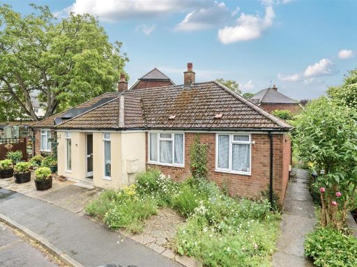 2 bedroom bungalow for sale in Downs Close, Charing, Ashford, TN27 — £250,000 • 2 bed • 1 bath • 471 ft²
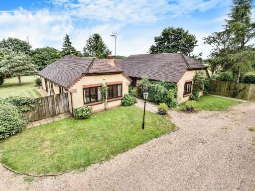 4 bedroom detached bungalow for sale in Idyllic Retreat With Land. Ravensdane Wood, Charing, TN27 — £1,000,000 • 4 bed • 3 bath • 2104 ft²
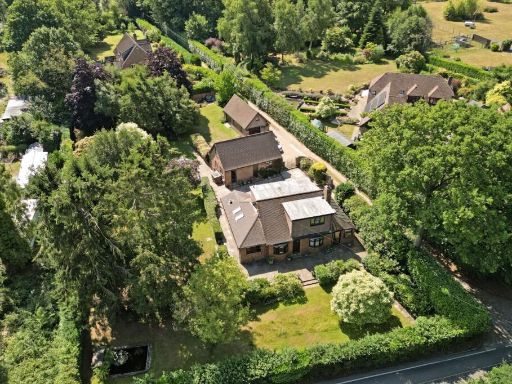 4 bedroom detached house for sale in Faversham Road, Charing, Ashford, Kent, TN27 — £725,000 • 4 bed • 2 bath
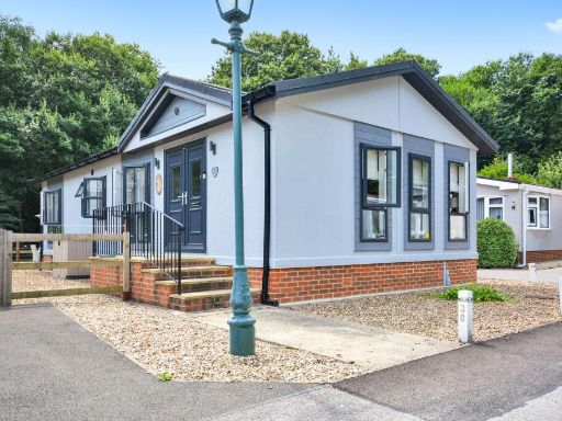 2 bedroom detached house for sale in Canterbury Road, Charing, TN27 — £250,000 • 2 bed • 2 bath • 915 ft²
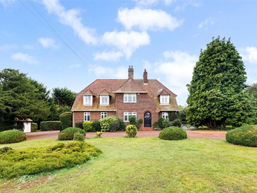 5 bedroom detached house for sale in Egg Hill Road, Charing, Ashford, Kent, TN27 — £895,000 • 5 bed • 2 bath • 2126 ft²
Meta
- {
"@context": "https://schema.org",
"@type": "Residence",
"name": "2 bedroom bungalow for sale in Bowl Road, ASHFORD, Kent, TN…",
"description": "",
"url": "https://propertypiper.co.uk/property/1644fa6c-3b14-4aed-9db3-402750224c95",
"image": "https://image-a.propertypiper.co.uk/4176cf7c-461e-4d6d-a94a-8052dfca92a8-1024.jpeg",
"address": {
"@type": "PostalAddress",
"streetAddress": "ROSELAND BOWL ROAD CHARING ASHFORD",
"postalCode": "TN27 0NH",
"addressLocality": "Ashford",
"addressRegion": "Ashford",
"addressCountry": "England"
},
"geo": {
"@type": "GeoCoordinates",
"latitude": 51.217207254117945,
"longitude": 0.805805065928603
},
"numberOfRooms": 2,
"numberOfBathroomsTotal": 1,
"floorSize": {
"@type": "QuantitativeValue",
"value": 2250,
"unitCode": "FTK"
},
"offers": {
"@type": "Offer",
"price": 775000,
"priceCurrency": "GBP",
"availability": "https://schema.org/InStock"
},
"additionalProperty": [
{
"@type": "PropertyValue",
"name": "Feature",
"value": "modern"
},
{
"@type": "PropertyValue",
"name": "Feature",
"value": "bungalow"
},
{
"@type": "PropertyValue",
"name": "Feature",
"value": "detached"
},
{
"@type": "PropertyValue",
"name": "Feature",
"value": "garage"
},
{
"@type": "PropertyValue",
"name": "Feature",
"value": "garden"
},
{
"@type": "PropertyValue",
"name": "Feature",
"value": "driveway"
},
{
"@type": "PropertyValue",
"name": "Feature",
"value": "spacious"
},
{
"@type": "PropertyValue",
"name": "Feature",
"value": "family home"
},
{
"@type": "PropertyValue",
"name": "Feature",
"value": "detached garage"
},
{
"@type": "PropertyValue",
"name": "Feature",
"value": "potential living space"
},
{
"@type": "PropertyValue",
"name": "Feature",
"value": "yellow siding"
},
{
"@type": "PropertyValue",
"name": "Feature",
"value": "external staircase"
},
{
"@type": "PropertyValue",
"name": "Feature",
"value": "traditional style"
},
{
"@type": "PropertyValue",
"name": "Feature",
"value": "dormer windows"
},
{
"@type": "PropertyValue",
"name": "Feature",
"value": "gravel driveway"
}
]
}
High Res Floorplan Images
Compatible Floorplan Images
FloorplanImages Thumbnail