LN6 9LJ - 4 bedroom detached house for sale in Rookery Close, Witham…
View on Property Piper
4 bedroom detached house for sale in Rookery Close, Witham St Hughs, LN6
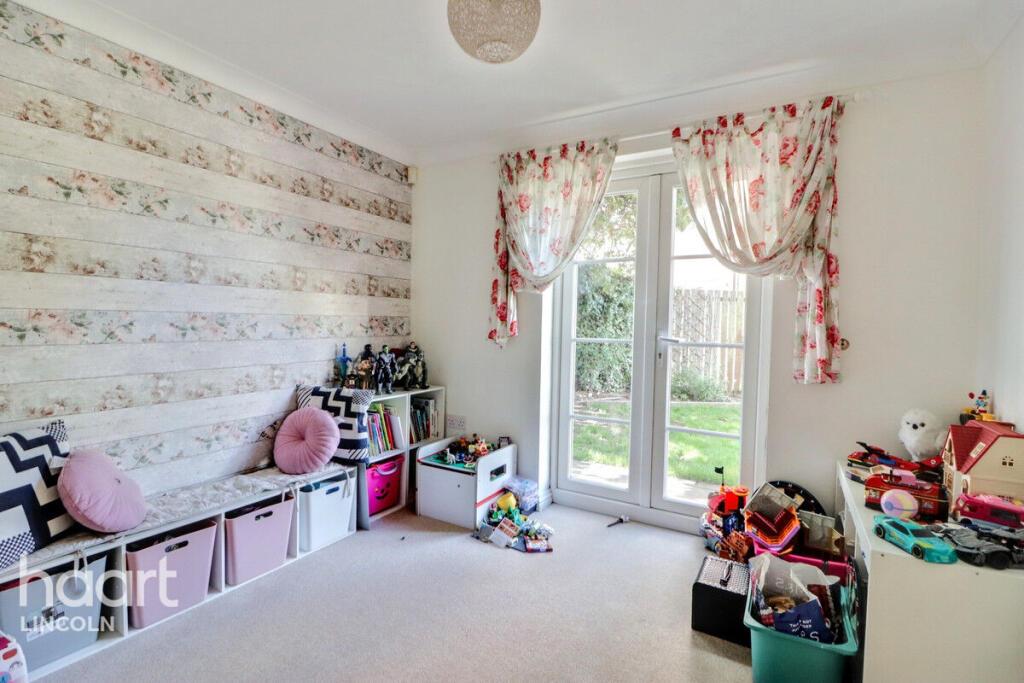
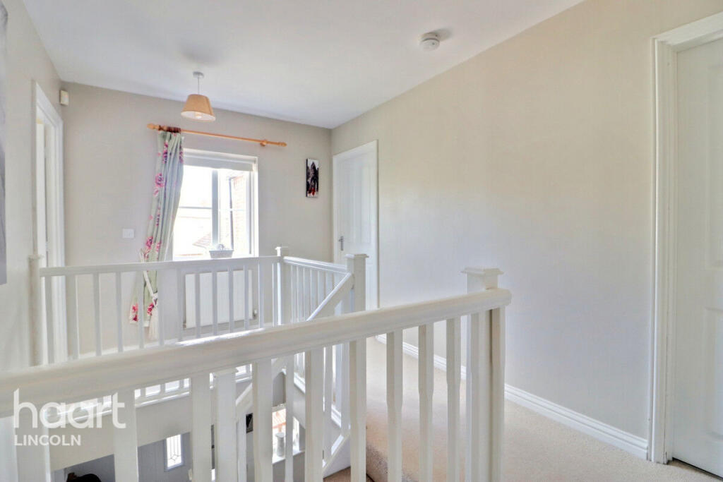
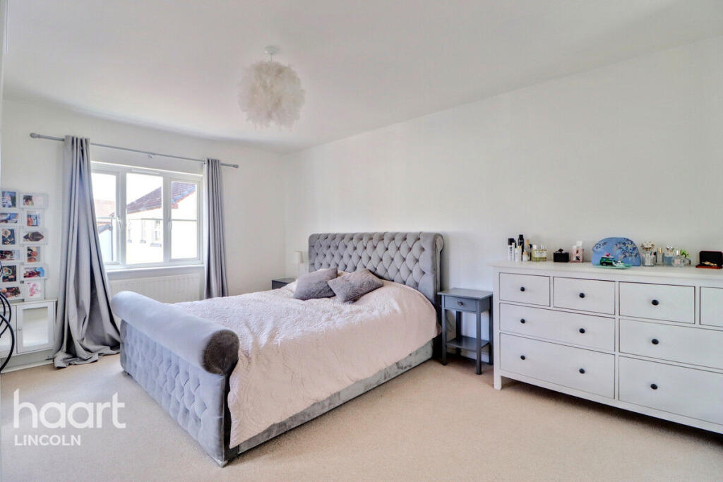
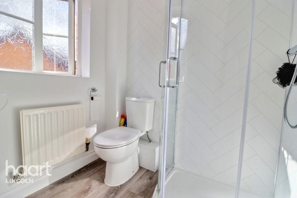
Property Details
- Price: £300000
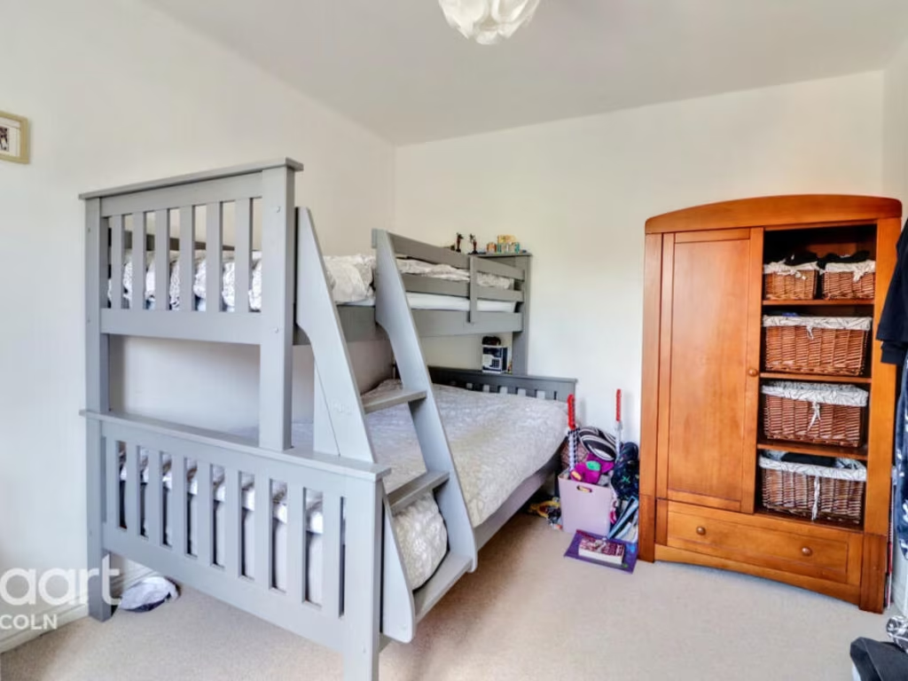
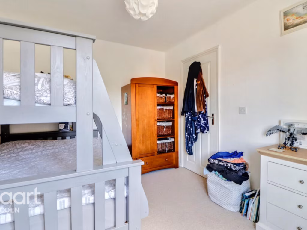
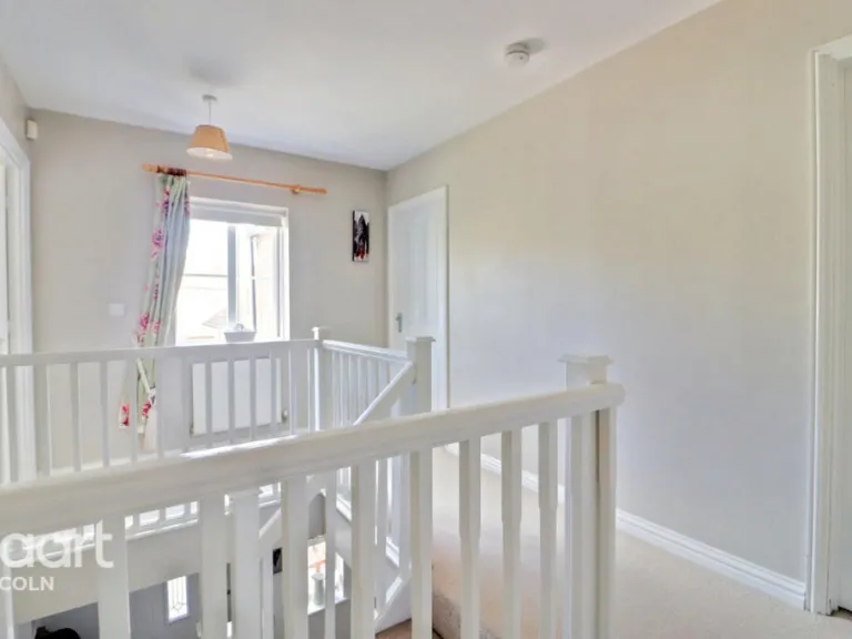
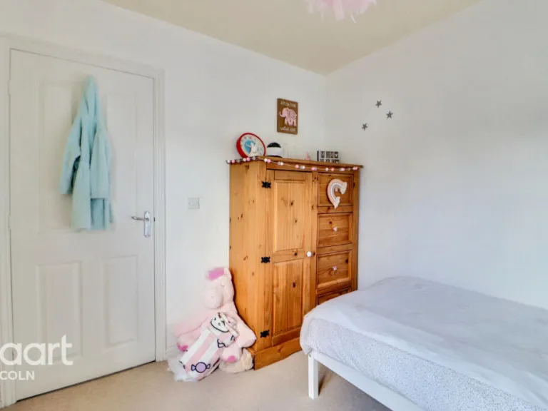
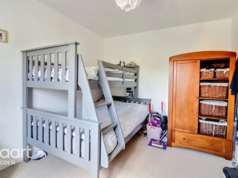
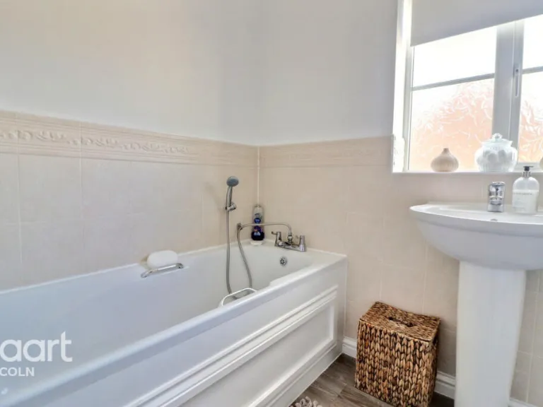
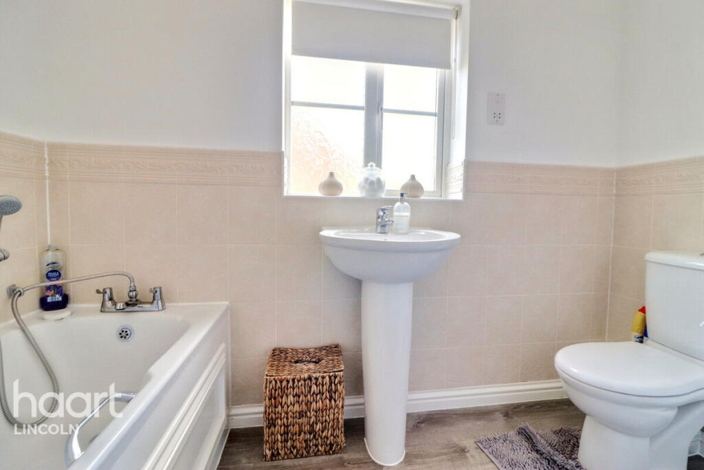
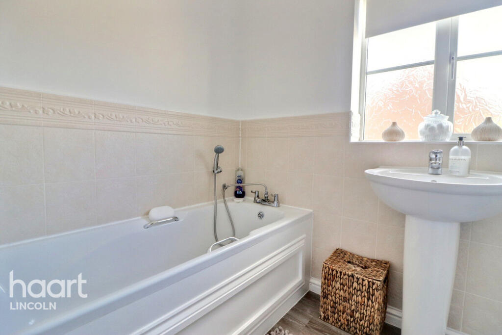
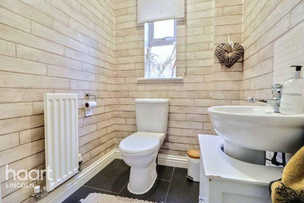
- Bedrooms: 4
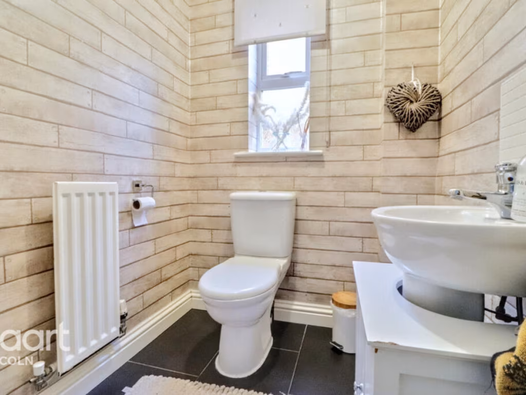
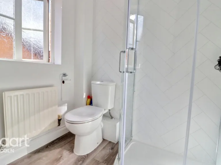
- Bathrooms: 3
- Property Type: undefined
- Property SubType: undefined
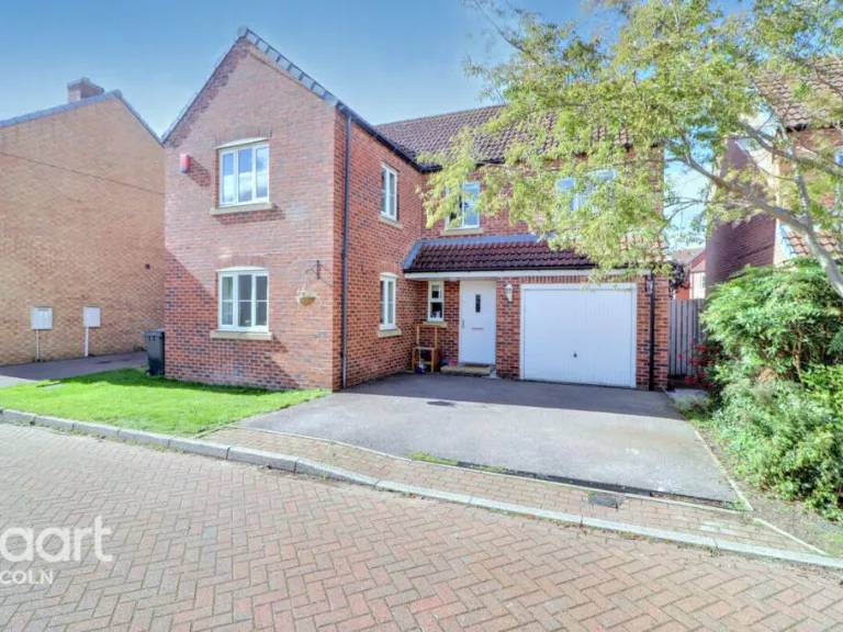
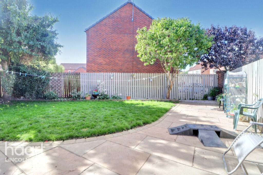
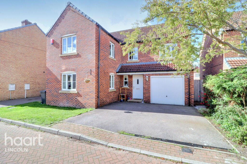
Image Descriptions
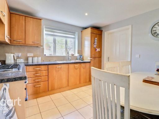
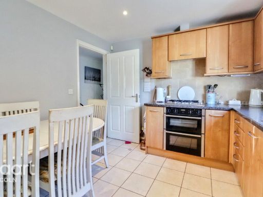
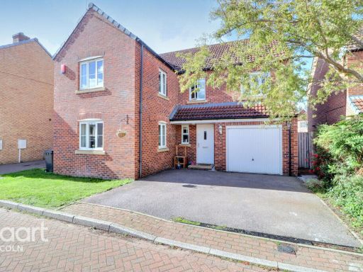
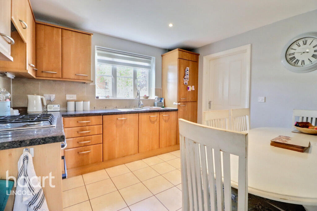
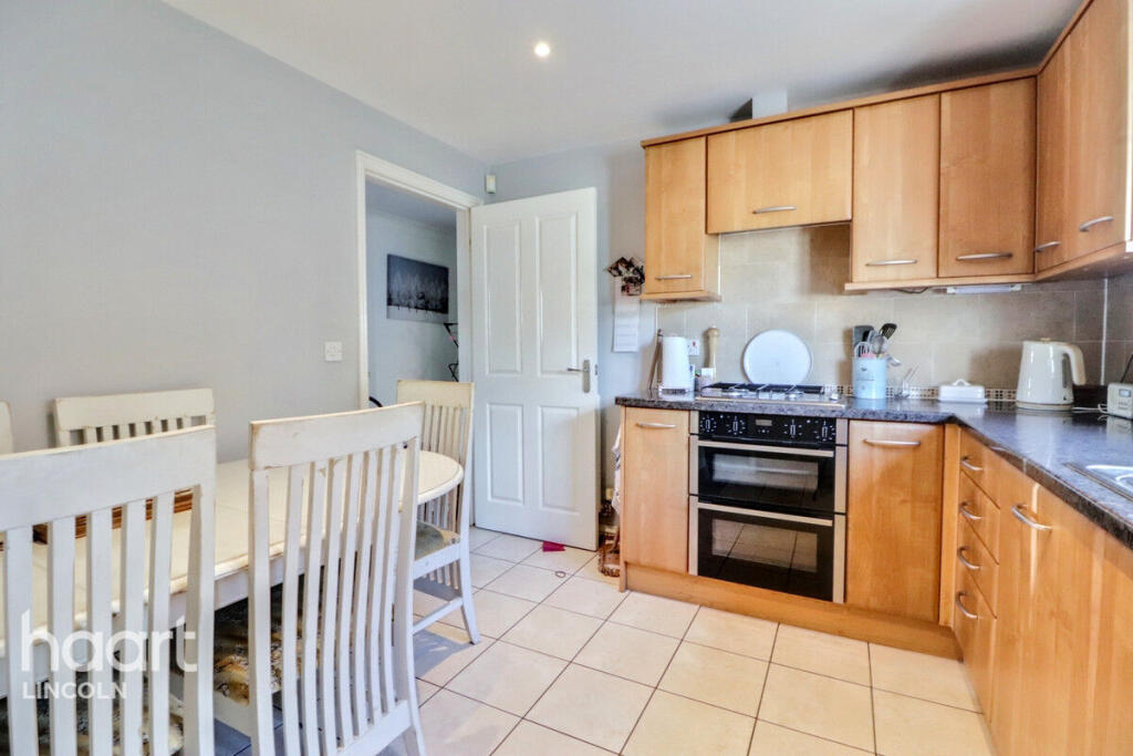
- kitchen modern
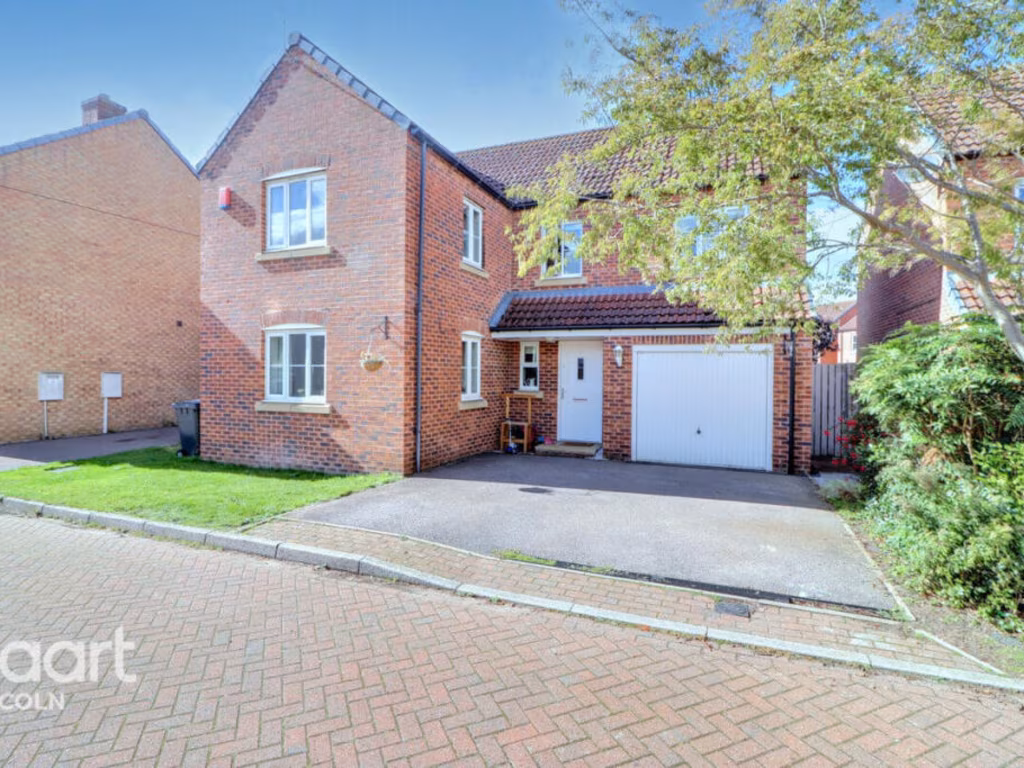
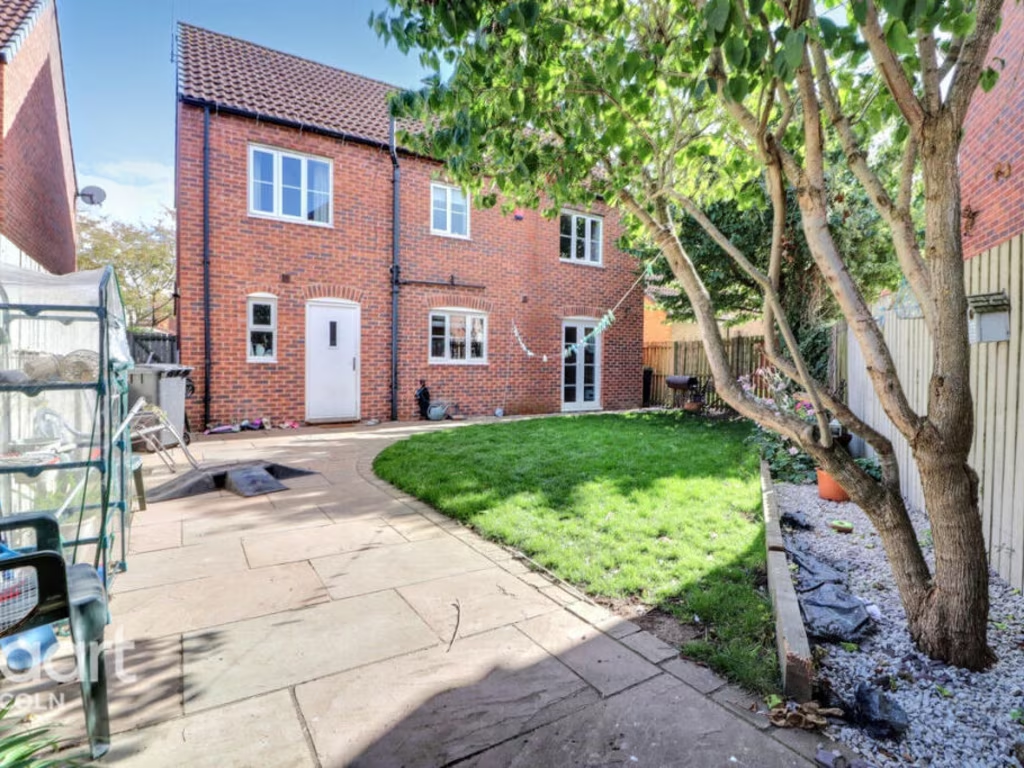
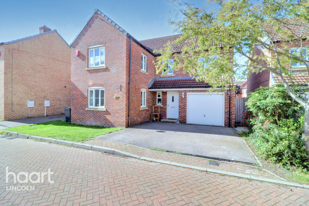
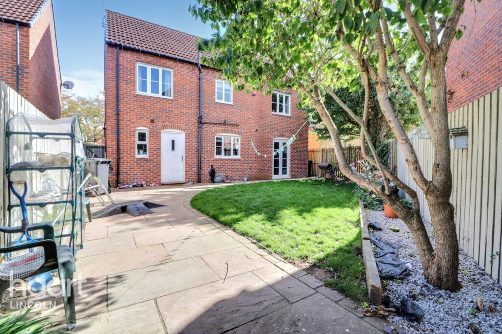
- detached house exterior modern detached
Textual Property Features
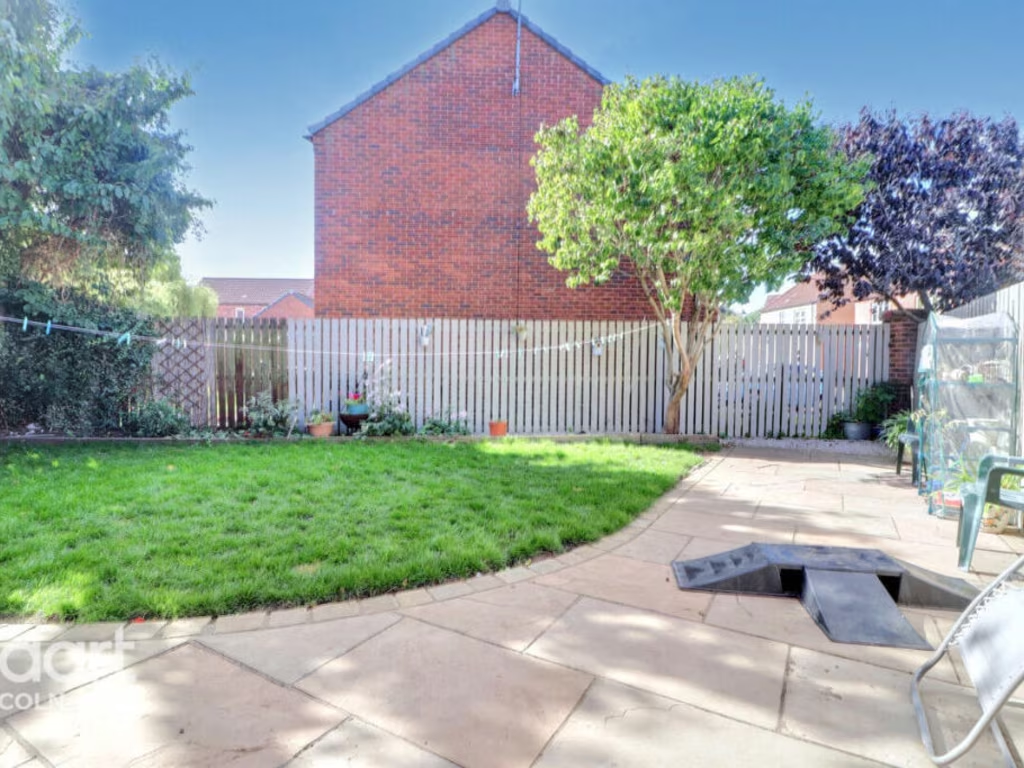
Detected Visual Features
- modern
- kitchen
- wood cabinets
- tile floor
- double sink
- bright
- well-kept
- contemporary
- functional
- detached
- house
- brick
- garage
- front garden
- driveway
- residential
- suburban
- double glazed
- pitched roof
EPC Details
- Fully double glazed
- Cavity wall, as built, insulated (assumed)
- Boiler and radiators, mains gas
- Low energy lighting in 93% of fixed outlets
- Solid, insulated (assumed)
Nearby Schools
- Brant Broughton Church of England and Methodist Primary School
- John Blow Primary School
- The South Hykeham Community Primary School
- The St Michael's Church of England Primary School, Thorpe on the Hill
- Fosse Way Academy
- Bassingham Primary School
- Manor Farm Academy
- The North Hykeham All Saints Church of England Primary School
- The Meadows Primary School
- Ling Moor Primary Academy
- Eagle Community Primary School
- Witham St Hughs Academy
- Swinderby All Saints Church of England Primary School
- Sir Robert Pattinson Academy
- North Kesteven Academy
- North Scarle Primary School
- The Lincoln Manor Leas Infants School
- Hartsholme Academy
- Coddington CofE Primary and Nursery School
- The Lincoln Manor Leas Junior School
- The Priory Witham Academy
- Leslie Manser Primary School
- St Hugh's Catholic Primary, A Voluntary Academy
- The Lancaster School
- Lincoln Birchwood Junior School
Nearest Bars And Restaurants
- Id: 550779700
- Tags:
- Amenity: pub
- Name: Green Man
- TagsNormalized:
- Lat: 53.121619
- Lon: -0.6747375
- FullGeoHash: gcrw0wkxv7x2
- PartitionGeoHash: gcrw
- Images:
- FoodStandards: null
- Distance: 2830
,- Id: 573211194
- Tags:
- Amenity: pub
- Name: Bugle Horn
- TagsNormalized:
- Lat: 53.1277729
- Lon: -0.6403883
- FullGeoHash: gcrw1rtetyev
- PartitionGeoHash: gcrw
- Images:
- FoodStandards: null
- Distance: 2766.8
,- Id: 647969553
- Tags:
- TagsNormalized:
- Lat: 53.1548583
- Lon: -0.7023064
- FullGeoHash: gcrw2h897pf2
- PartitionGeoHash: gcrw
- Images:
- FoodStandards: null
- Distance: 2502.2
,- Id: 647969571
- Tags:
- Amenity: pub
- Name: Dovecote
- TagsNormalized:
- Lat: 53.1572967
- Lon: -0.6703007
- FullGeoHash: gcrw2szzsy7d
- PartitionGeoHash: gcrw
- Images:
- FoodStandards: null
- Distance: 1196.7
,- Id: 425862194
- Tags:
- Amenity: fast_food
- Name: Taj Mahal Indian Take-Away
- TagsNormalized:
- Lat: 53.1498178
- Lon: -0.6655408
- FullGeoHash: gcrw2gek5u0u
- PartitionGeoHash: gcrw
- Images:
- FoodStandards: null
- Distance: 369
}
Nearest General Shops
- Id: 208276666
- Tags:
- Building: yes
- Clothes: motorcycle
- Name: Mark Phillips Motorcycle Clothing
- Shop: clothes
- TagsNormalized:
- Lat: 53.1695323
- Lon: -0.6416219
- FullGeoHash: gcrw3rhycphn
- PartitionGeoHash: gcrw
- Images:
- FoodStandards: null
- Distance: 3065.7
,- Id: 7918215650
- Tags:
- Name: Greens of Bassingham
- Shop: general
- TagsNormalized:
- Lat: 53.1294994
- Lon: -0.6390161
- FullGeoHash: gcrw1rytvbe0
- PartitionGeoHash: gcrw
- Images:
- FoodStandards: null
- Distance: 2687.4
,- Id: 425862198
- Tags:
- TagsNormalized:
- Lat: 53.1496273
- Lon: -0.6655322
- FullGeoHash: gcrw2ge75bxh
- PartitionGeoHash: gcrw
- Images:
- FoodStandards: null
- Distance: 349.3
}
Nearest Grocery shops
- Id: 670515523
- Tags:
- Addr:
- City: Collingham
- Housenumber: 162-164
- Postcode: NG23 7NH
- Street: High Street
- Brand: One Stop
- Brand:wikidata: Q65954217
- Building: yes
- Fhrs:
- Name: One Stop
- Opening_hours: Mo-Su 06:00-22:00
- Operator: Tesco
- Shop: convenience
- TagsNormalized:
- Lat: 53.1521049
- Lon: -0.7566144
- FullGeoHash: gcrqqu113w7r
- PartitionGeoHash: gcrq
- Images:
- FoodStandards:
- Id: 557221
- FHRSID: 557221
- LocalAuthorityBusinessID: R11A18162-/1/5848
- BusinessName: One Stop
- BusinessType: Retailers - other
- BusinessTypeID: 4613
- AddressLine1: One Stop Community Stores Ltd
- AddressLine2: 162 - 164 High Street
- AddressLine3: Collingham
- AddressLine4: Newark On Trent
- PostCode: NG23 7NH
- RatingValue: 4
- RatingKey: fhrs_4_en-GB
- RatingDate: 2022-11-28
- LocalAuthorityCode: 264
- LocalAuthorityName: Newark and Sherwood
- LocalAuthorityWebSite: http://www.newark-sherwooddc.gov.uk/
- LocalAuthorityEmailAddress: environmental.health@nsdc.info
- Scores:
- Hygiene: 0
- Structural: 10
- ConfidenceInManagement: 5
- NewRatingPending: false
- Geocode:
- Longitude: -0.75749498605728
- Latitude: 53.15129089355470
- Distance: 5983.3
,- Id: 361571024
- Tags:
- Building: yes
- Name: Shop 'n' Drive
- Shop: convenience
- TagsNormalized:
- Lat: 53.177443
- Lon: -0.6251741
- FullGeoHash: gcrw9b8v03u7
- PartitionGeoHash: gcrw
- Images:
- FoodStandards: null
- Distance: 4427.8
,- Id: 425862191
- Tags:
- TagsNormalized:
- Lat: 53.14972
- Lon: -0.6654979
- FullGeoHash: gcrw2ge7scbv
- PartitionGeoHash: gcrw
- Images:
- FoodStandards: null
- Distance: 359.7
}
Nearest Supermarkets
- Id: 5028186385
- Tags:
- Addr:
- City: North Hykeham
- Postcode: LN6 9YH
- Street: Severus Crescent
- Name: Co-op
- Operator: The Co-operative Group
- Shop: supermarket
- Source:
- Addr: Food hygiene open data
- TagsNormalized:
- Lat: 53.1782588
- Lon: -0.601759
- FullGeoHash: gcrwd2cccczy
- PartitionGeoHash: gcrw
- Images:
- FoodStandards: null
- Distance: 5608
,- Id: 828559743
- Tags:
- Brand: Lincolnshire Co-op
- Brand:wikidata: Q6551231
- Brand:wikipedia: en:Lincolnshire Co-operative
- Building: retail
- Name: Lincolnshire Co-op
- Pharmacy: yes
- Shop: supermarket
- Start_date: 2019-03-21
- TagsNormalized:
- co-op
- retail
- supermarket
- shop
- Lat: 53.1826797
- Lon: -0.6106577
- FullGeoHash: gcrwd1e7ddh9
- PartitionGeoHash: gcrw
- Images:
- FoodStandards: null
- Distance: 5505
,- Id: 223322832
- Tags:
- Addr:
- City: Witham St Hughs
- Postcode: LN6 9WF
- Street: Muntjac Way
- Branch: Food Store
- Brand: Lincolnshire Co-op
- Brand:wikidata: Q6551231
- Brand:wikipedia: en:Lincolnshire Co-operative
- Building: yes
- Name: Lincolnshire Co-op
- Not:
- Operator: Lincolnshire Co-operative
- Phone: +44 1522 868 493
- Shop: supermarket
- Website: https://www.lincolnshire.coop
- TagsNormalized:
- Lat: 53.149872
- Lon: -0.6650426
- FullGeoHash: gcrw2gesrqk2
- PartitionGeoHash: gcrw
- Images:
- FoodStandards: null
- Distance: 386.7
}
Nearest Religious buildings
- Id: 781765715
- Tags:
- Amenity: place_of_worship
- Building: church
- Denomination: anglican
- Name: St Michael & All Angels
- Religion: christian
- Wikidata: Q17549137
- TagsNormalized:
- place of worship
- church
- anglican
- christian
- Lat: 53.1270283
- Lon: -0.644392
- FullGeoHash: gcrw1r6z2efk
- PartitionGeoHash: gcrw
- Images:
- FoodStandards: null
- Distance: 2668.5
,- Id: 146541371
- Tags:
- Amenity: place_of_worship
- Building: church
- Denomination: anglican
- Name: All Saints
- Religion: christian
- Source: Bing
- Wikidata: Q17549207
- TagsNormalized:
- place of worship
- church
- anglican
- christian
- Lat: 53.1586693
- Lon: -0.7018042
- FullGeoHash: gcrw2j0zwy0y
- PartitionGeoHash: gcrw
- Images:
- FoodStandards: null
- Distance: 2656.2
,- Id: 782365452
- Tags:
- Amenity: place_of_worship
- Building: church
- Denomination: anglican
- Name: St Germain
- Religion: christian
- Wikidata: Q17549161
- TagsNormalized:
- place of worship
- church
- anglican
- christian
- Lat: 53.1448439
- Lon: -0.642514
- FullGeoHash: gcrw36sphkfy
- PartitionGeoHash: gcrw
- Images:
- FoodStandards: null
- Distance: 1668.9
}
Nearest Medical buildings
- Id: 2631273902
- Tags:
- Addr:
- Housename: Crossroads Pharmacy - Lincolnshire Co-operative
- Housenumber: 275
- Postcode: LN6 8QE
- Street: Newark Road
- Amenity: pharmacy
- Designation: Pharmacy
- Dispensing: yes
- Name: Crossroads Pharmacy - Lincolnshire Co-operative
- Source: Survey
- TagsNormalized:
- Lat: 53.1881616
- Lon: -0.5966453
- FullGeoHash: gcrwd6te3pvn
- PartitionGeoHash: gcrw
- Images:
- FoodStandards: null
- Distance: 6594.5
,- Id: 717221390
- Tags:
- Amenity: doctors
- Building: yes
- Healthcare: doctor
- Name: Richmond Medical Centre
- Operator: NHS
- TagsNormalized:
- doctor
- doctors
- health
- healthcare
- Lat: 53.187611
- Lon: -0.5969005
- FullGeoHash: gcrwd6t271qd
- PartitionGeoHash: gcrw
- Images:
- FoodStandards: null
- Distance: 6539.6
,- Id: 6279054134
- Tags:
- Amenity: pharmacy
- Dispensing: yes
- Healthcare: pharmacy
- Name: Collingham Pharmacy
- TagsNormalized:
- Lat: 53.1458865
- Lon: -0.7592601
- FullGeoHash: gcrqqdzj5zq9
- PartitionGeoHash: gcrq
- Images:
- FoodStandards: null
- Distance: 6130.4
,- Id: 6279054135
- Tags:
- Amenity: doctors
- Healthcare: doctor
- Name: Collingham Medical Centre
- TagsNormalized:
- doctor
- doctors
- health
- healthcare
- Lat: 53.1459455
- Lon: -0.7590818
- FullGeoHash: gcrqqdzm8479
- PartitionGeoHash: gcrq
- Images:
- FoodStandards: null
- Distance: 6118.4
}
Nearest Leisure Facilities
- Id: 223193748
- Tags:
- TagsNormalized:
- Lat: 53.1507252
- Lon: -0.6672731
- FullGeoHash: gcrw2gf17mm1
- PartitionGeoHash: gcrw
- Images:
- FoodStandards: null
- Distance: 449.7
,- Id: 425854303
- Tags:
- TagsNormalized:
- Lat: 53.1494523
- Lon: -0.6640903
- FullGeoHash: gcrw2gs6j842
- PartitionGeoHash: gcrw
- Images:
- FoodStandards: null
- Distance: 377.1
,- Id: 223193548
- Tags:
- TagsNormalized:
- Lat: 53.1496475
- Lon: -0.6668344
- FullGeoHash: gcrw2gd7jskh
- PartitionGeoHash: gcrw
- Images:
- FoodStandards: null
- Distance: 331.6
,- Id: 429940886
- Tags:
- TagsNormalized:
- Lat: 53.1459061
- Lon: -0.6646278
- FullGeoHash: gcrw2fuj34cw
- PartitionGeoHash: gcrw
- Images:
- FoodStandards: null
- Distance: 200.9
,- Id: 972658340
- Tags:
- TagsNormalized:
- Lat: 53.147561
- Lon: -0.6679666
- FullGeoHash: gcrw2g1wgr2n
- PartitionGeoHash: gcrw
- Images:
- FoodStandards: null
- Distance: 106.1
}
Nearest Tourist attractions
- Id: 9083761476
- Tags:
- Addr:
- City: Haddington
- Postcode: LN5 9FL
- Street: Sky Lane
- Capacity: 5
- Description: UK Caravan & Motorhome Club Certificated Location. 5 caravan maximum.
- Internet_access: wlan
- Name: Skybarn Farm CAMC CL
- Power_supply: yes
- Sanitary_dump_station: yes
- Tourism: caravan_site
- TagsNormalized:
- Lat: 53.166876
- Lon: -0.6377891
- FullGeoHash: gcrw3qxxd2jb
- PartitionGeoHash: gcrw
- Images:
- FoodStandards: null
- Distance: 2987.8
,- Id: 251760418
- Tags:
- Name: Cathedral View Holiday Park
- Source: Bing;survey
- Tourism: caravan_site
- Website: http://www.cathedralviewholidaypark.co.uk/
- TagsNormalized:
- Lat: 53.1663892
- Lon: -0.6520238
- FullGeoHash: gcrw3nthwtrc
- PartitionGeoHash: gcrw
- Images:
- FoodStandards: null
- Distance: 2417.9
,- Id: 1495206911
- Tags:
- Name: Halfway House Motel
- Source: survey
- Tourism: motel
- Website: http://www.halfway-farm-motel.co.uk/
- TagsNormalized:
- Lat: 53.1557675
- Lon: -0.6736965
- FullGeoHash: gcrw2stqv9r2
- PartitionGeoHash: gcrw
- Images:
- FoodStandards: null
- Distance: 1095.4
}
Nearest Train stations
- Id: 6415345164
- Tags:
- Name: Newark Castle
- Naptan:
- Network: National Rail
- Public_transport: station
- Railway: station
- Ref:
- Source: NPE
- Wikidata: Q4800289
- Wikipedia: en:Newark Castle railway station
- TagsNormalized:
- Lat: 53.0802549
- Lon: -0.8131753
- FullGeoHash: gcrmvqzygsst
- PartitionGeoHash: gcrm
- Images:
- FoodStandards: null
- Distance: 12218.2
,- Id: 3752912434
- Tags:
- Name: Newark North Gate
- Naptan:
- Network: National Rail
- Public_transport: station
- Railway: station
- Ref:
- Source: NPE
- Wikidata: Q3246476
- Wikipedia: en:Newark North Gate railway station
- TagsNormalized:
- Lat: 53.0813745
- Lon: -0.7994939
- FullGeoHash: gcrmvz1v6mqh
- PartitionGeoHash: gcrm
- Images:
- FoodStandards: null
- Distance: 11424.5
,- Id: 3152675224
- Tags:
- Name: Hykeham
- Naptan:
- Network: National Rail
- Operator: East Midlands Railway
- Public_transport: station
- Railway: station
- Ref:
- Source: wikipedia
- Train: yes
- Wikidata: Q2129974
- Wikipedia: en:Hykeham railway station
- TagsNormalized:
- Lat: 53.1950652
- Lon: -0.6000753
- FullGeoHash: gcrwd7g59nzk
- PartitionGeoHash: gcrw
- Images:
- FoodStandards: null
- Distance: 7003.7
,- Id: 3152675223
- Tags:
- Name: Collingham
- Naptan:
- Network: National Rail
- Operator: East Midlands Railway
- Public_transport: station
- Railway: station
- Ref:
- Source: NPE
- Wikidata: Q2369236
- Wikipedia: en:Collingham railway station
- TagsNormalized:
- Lat: 53.1439832
- Lon: -0.750266
- FullGeoHash: gcrqqftdjs90
- PartitionGeoHash: gcrq
- Images:
- FoodStandards: null
- Distance: 5538.1
,- Id: 3152675225
- Tags:
- Name: Swinderby
- Naptan:
- Network: National Rail
- Operator: East Midlands Railway
- Public_transport: station
- Railway: station
- Ref:
- Source: wikipedia
- Wikidata: Q2015746
- Wikipedia: en:Swinderby railway station
- TagsNormalized:
- Lat: 53.1693479
- Lon: -0.7026611
- FullGeoHash: gcrw2p0mfucf
- PartitionGeoHash: gcrw
- Images:
- FoodStandards: null
- Distance: 3449
}
Nearest Bus stations and stops
- Id: 5028186396
- Tags:
- Highway: bus_stop
- Name: Remus Court
- Naptan:
- AtcoCode: 270002703500
- NaptanCode: lintwgap
- Public_transport: platform
- TagsNormalized:
- Lat: 53.1820998
- Lon: -0.6055181
- FullGeoHash: gcrwd1x04muy
- PartitionGeoHash: gcrw
- Images:
- FoodStandards: null
- Distance: 5700.9
,- Id: 5028186393
- Tags:
- Highway: bus_stop
- Name: 91 Tiber Road
- Naptan:
- AtcoCode: 270002703502
- NaptanCode: lintwgaw
- Public_transport: platform
- TagsNormalized:
- Lat: 53.1793085
- Lon: -0.6014559
- FullGeoHash: gcrwd2fpcj9g
- PartitionGeoHash: gcrw
- Images:
- FoodStandards: null
- Distance: 5697.3
,- Id: 502407755
- Tags:
- Bus: yes
- Highway: bus_stop
- Name: Barnfield Road
- Naptan:
- AtcoCode: 3300NS0479
- Bearing: W
- CommonName: Barnfield Road
- Crossing: Barnfield Road
- Indicator: opp
- NaptanCode: ntsatgwm
- Notes: suggested stop
- Street: Swinderby Road
- Verified: no
- Public_transport: platform
- Source: naptan_import
- TagsNormalized:
- Lat: 53.1480578
- Lon: -0.7520779
- FullGeoHash: gcrqqgk3gk44
- PartitionGeoHash: gcrq
- Images:
- FoodStandards: null
- Distance: 5652.7
,- Id: 5028186395
- Tags:
- Highway: bus_stop
- Name: Vespasian Way
- Naptan:
- AtcoCode: 270002703501
- NaptanCode: lintwgat
- Public_transport: platform
- TagsNormalized:
- Lat: 53.1805044
- Lon: -0.6041649
- FullGeoHash: gcrwd30ncutc
- PartitionGeoHash: gcrw
- Images:
- FoodStandards: null
- Distance: 5646.9
,- Id: 502408257
- Tags:
- Bus: yes
- Highway: bus_stop
- Name: Braemer Road
- Naptan:
- AtcoCode: 3300NS0592
- Bearing: S
- CommonName: Braemer Road
- Crossing: Swinderby Road
- Indicator: S-bound
- NaptanCode: ntsdjdwa
- Notes: BW
- Street: Braemer Road
- Verified: no
- Public_transport: platform
- Source: naptan_import
- TagsNormalized:
- Lat: 53.147576
- Lon: -0.7515685
- FullGeoHash: gcrqqghxp4jz
- PartitionGeoHash: gcrq
- Images:
- FoodStandards: null
- Distance: 5617.5
}
Nearest Hotels
- Id: 214725393
- Tags:
- Brand: Best Western
- Brand:wikidata: Q830334
- Building: hotel
- Name: The Bentley Hotel
- Operator: Best Western
- Postal_code: LN6 9NH
- Source: survey
- Tourism: hotel
- TagsNormalized:
- Lat: 53.1785076
- Lon: -0.6242906
- FullGeoHash: gcrw9bc7kbr4
- PartitionGeoHash: gcrw
- Images:
- FoodStandards: null
- Distance: 4556.8
,- Id: 220089173
- Tags:
- Brand: Travelodge
- Brand:wikidata: Q9361374
- Building: hotel
- Internet_access: wlan
- Internet_access:fee: customers
- Internet_access:ssid: Travelodge WiFi
- Name: Travelodge
- Operator: Travelodge
- Tourism: hotel
- TagsNormalized:
- Lat: 53.1774927
- Lon: -0.6264744
- FullGeoHash: gcrw98xv654u
- PartitionGeoHash: gcrw
- Images:
- FoodStandards: null
- Distance: 4377.6
,- Id: 272586434
- Tags:
- Addr:
- City: Norton Disney
- Housename: Old Harbour Farm
- Postcode: LN6 9JR
- Building: hotel
- Internet_access: wlan
- Internet_access:fee: no
- Name: Norton Lodge
- Phone: +44 1522 789111
- Postal_code: LN6 9JR
- Smoking: no
- Tourism: hotel
- Website: http://www.nortonlodge.co.uk/
- TagsNormalized:
- Lat: 53.1236056
- Lon: -0.6922915
- FullGeoHash: gcrw0nzgkmy4
- PartitionGeoHash: gcrw
- Images:
- FoodStandards: null
- Distance: 3058.2
}
Tags
- modern
- kitchen
- wood cabinets
- tile floor
- double sink
- bright
- well-kept
- contemporary
- functional
- modern
- detached
- house
- brick
- garage
- front garden
- driveway
- residential
- suburban
- double glazed
- pitched roof
Local Market Stats
- Average Price/sqft: £234
- Avg Income: £40600
- Rental Yield: 4.5%
- Social Housing: 6%
- Planning Success Rate: 92%
Similar Properties
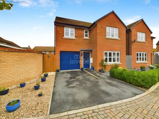 4 bedroom detached house for sale in Ivy Bank, Witham St Hughs, LN6 — £310,000 • 4 bed • 2 bath • 1311 ft²
 4 bedroom detached house for sale in Ivy Bank, Witham St Hughs, Lincoln, LN6 — £339,000 • 4 bed • 2 bath • 1442 ft²
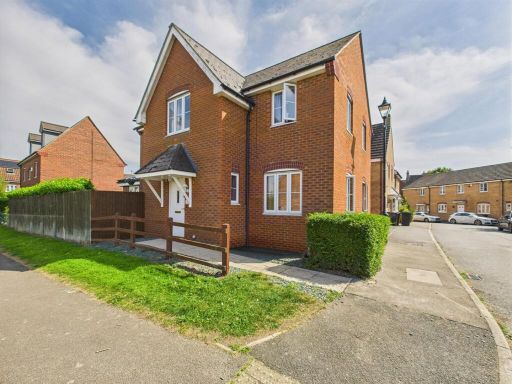 4 bedroom detached house for sale in Tall Pines Road, Witham St. Hughs, Lincoln, LN6 — £330,000 • 4 bed • 3 bath • 1434 ft²
 4 bedroom terraced house for sale in Partridge Green, Witham St Hughs, LN6 — £210,000 • 4 bed • 2 bath
 5 bedroom detached house for sale in Warren Lane, Witham St. Hughs, Lincoln, LN6 — £480,000 • 5 bed • 3 bath • 1758 ft²
 4 bedroom detached house for sale in Meadowsweet Lane, Witham St. Hughs, LN6 — £350,000 • 4 bed • 3 bath • 1507 ft²
Meta
- {
"@context": "https://schema.org",
"@type": "Residence",
"name": "4 bedroom detached house for sale in Rookery Close, Witham…",
"description": "",
"url": "https://propertypiper.co.uk/property/0fd67c1e-d1fc-4e03-8c47-aa83686b92ba",
"image": "https://image-a.propertypiper.co.uk/c4661514-9913-4718-9af9-2fa34fc01887-1024.jpeg",
"address": {
"@type": "PostalAddress",
"streetAddress": "4 ROOKERY CLOSE WITHAM ST HUGHS LINCOLN",
"postalCode": "LN6 9LJ",
"addressLocality": "North Kesteven",
"addressRegion": "Sleaford and North Hykeham",
"addressCountry": "England"
},
"geo": {
"@type": "GeoCoordinates",
"latitude": 53.146681235406014,
"longitude": -0.6673489545608787
},
"numberOfRooms": 4,
"numberOfBathroomsTotal": 3,
"offers": {
"@type": "Offer",
"price": 300000,
"priceCurrency": "GBP",
"availability": "https://schema.org/InStock"
},
"additionalProperty": [
{
"@type": "PropertyValue",
"name": "Feature",
"value": "modern"
},
{
"@type": "PropertyValue",
"name": "Feature",
"value": "kitchen"
},
{
"@type": "PropertyValue",
"name": "Feature",
"value": "wood cabinets"
},
{
"@type": "PropertyValue",
"name": "Feature",
"value": "tile floor"
},
{
"@type": "PropertyValue",
"name": "Feature",
"value": "double sink"
},
{
"@type": "PropertyValue",
"name": "Feature",
"value": "bright"
},
{
"@type": "PropertyValue",
"name": "Feature",
"value": "well-kept"
},
{
"@type": "PropertyValue",
"name": "Feature",
"value": "contemporary"
},
{
"@type": "PropertyValue",
"name": "Feature",
"value": "functional"
},
{
"@type": "PropertyValue",
"name": "Feature",
"value": "modern"
},
{
"@type": "PropertyValue",
"name": "Feature",
"value": "detached"
},
{
"@type": "PropertyValue",
"name": "Feature",
"value": "house"
},
{
"@type": "PropertyValue",
"name": "Feature",
"value": "brick"
},
{
"@type": "PropertyValue",
"name": "Feature",
"value": "garage"
},
{
"@type": "PropertyValue",
"name": "Feature",
"value": "front garden"
},
{
"@type": "PropertyValue",
"name": "Feature",
"value": "driveway"
},
{
"@type": "PropertyValue",
"name": "Feature",
"value": "residential"
},
{
"@type": "PropertyValue",
"name": "Feature",
"value": "suburban"
},
{
"@type": "PropertyValue",
"name": "Feature",
"value": "double glazed"
},
{
"@type": "PropertyValue",
"name": "Feature",
"value": "pitched roof"
}
]
}