OL2 7RF - 3 bedroom semidetached bungalow for sale in Cotswold Avenue…
View on Property Piper
3 bedroom semi-detached bungalow for sale in Cotswold Avenue, High Crompton, Shaw, Oldham, OL2
Property Details
- Price: £299950
- Bedrooms: 3
- Bathrooms: 2
- Property Type: undefined
- Property SubType: undefined
Image Descriptions
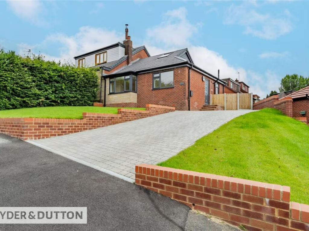
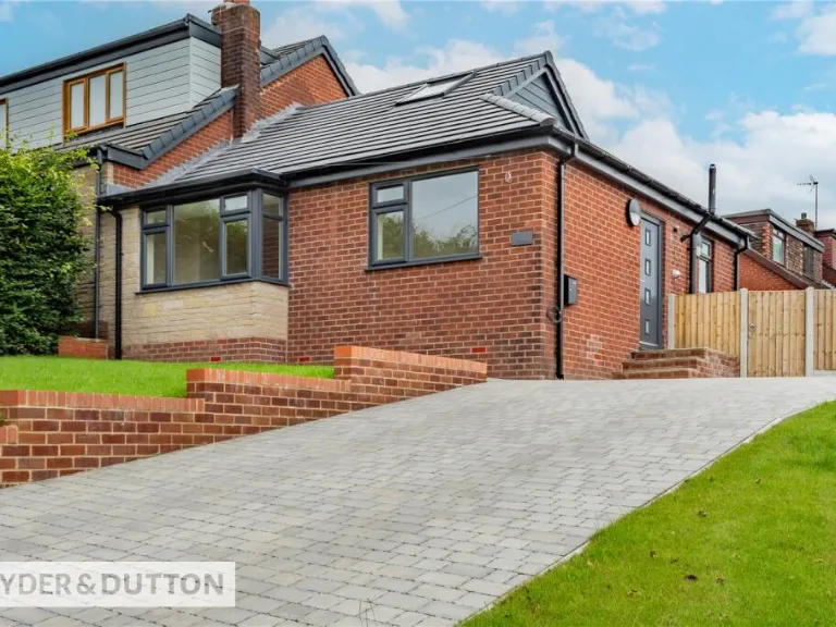
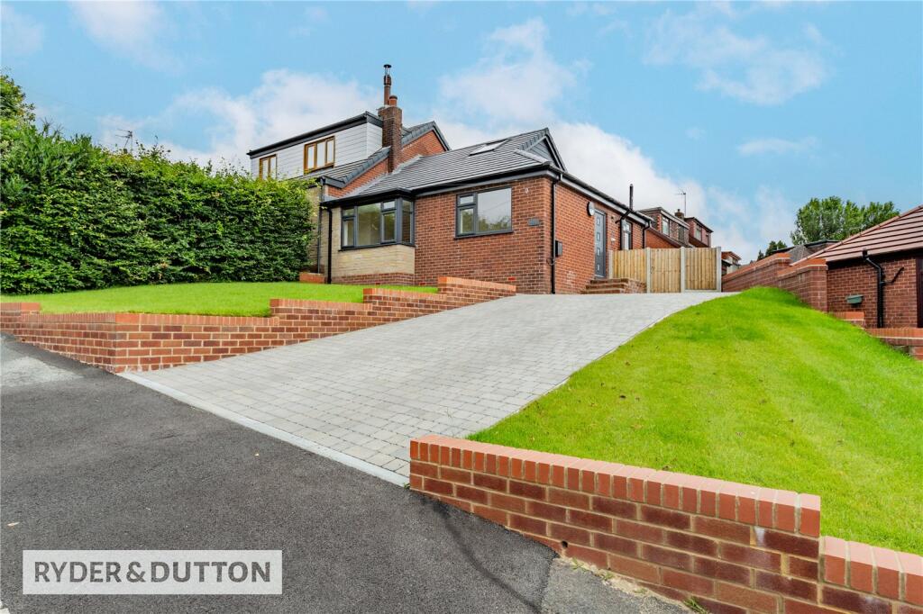
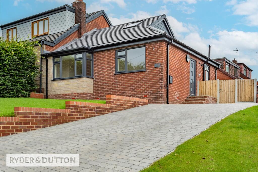
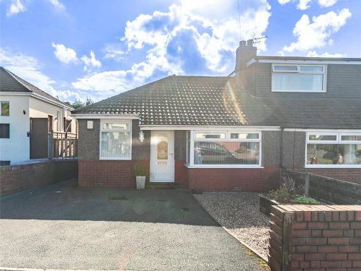
- house exterior Modern
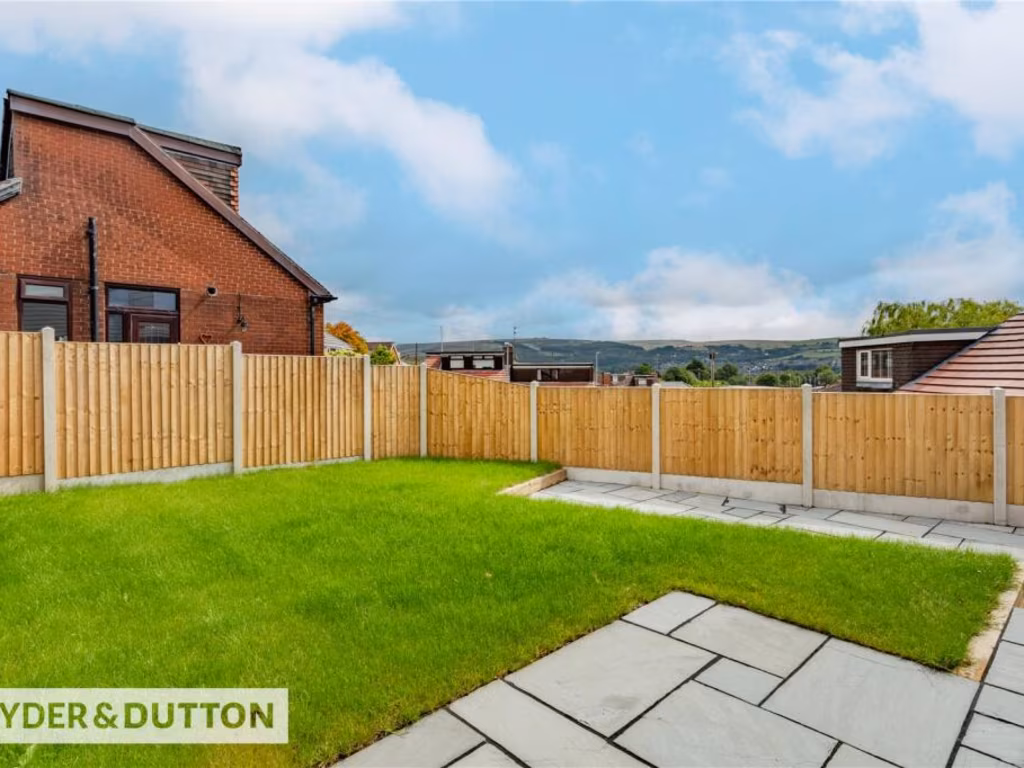
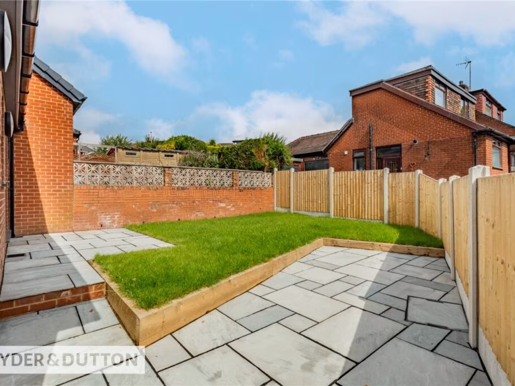
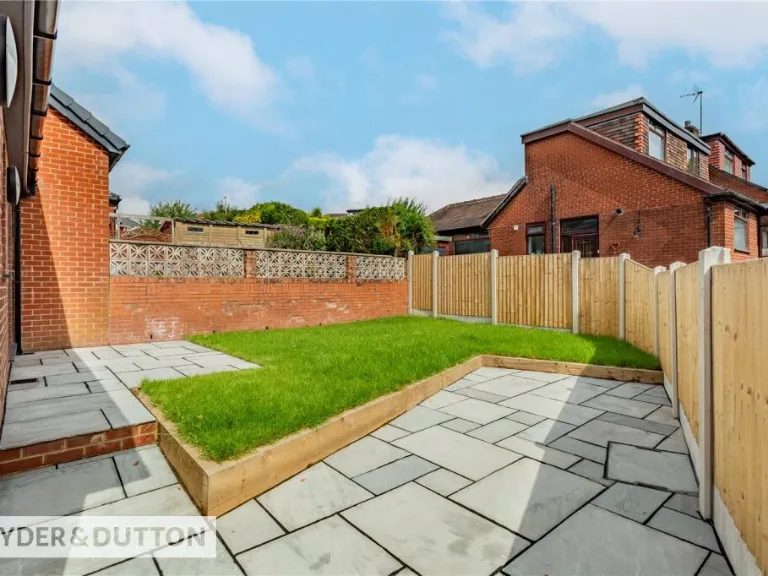
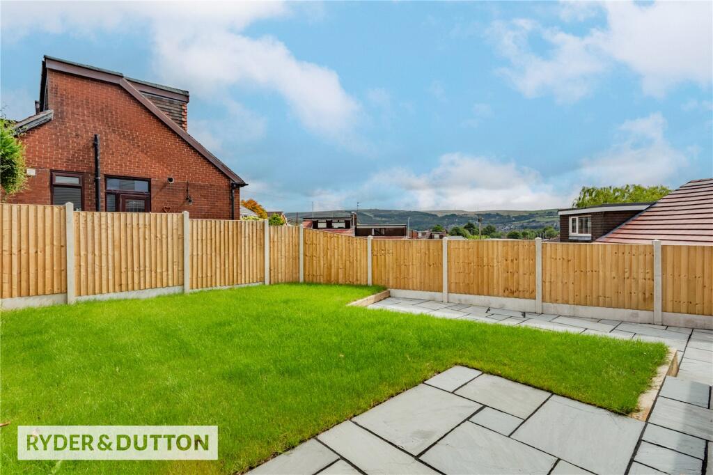
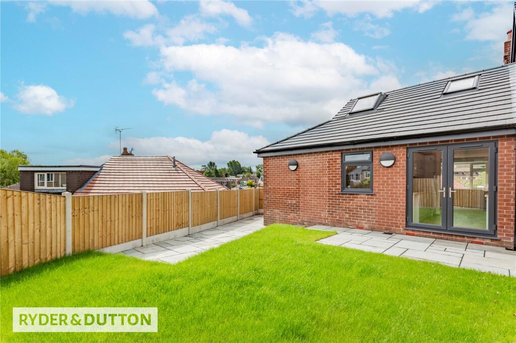
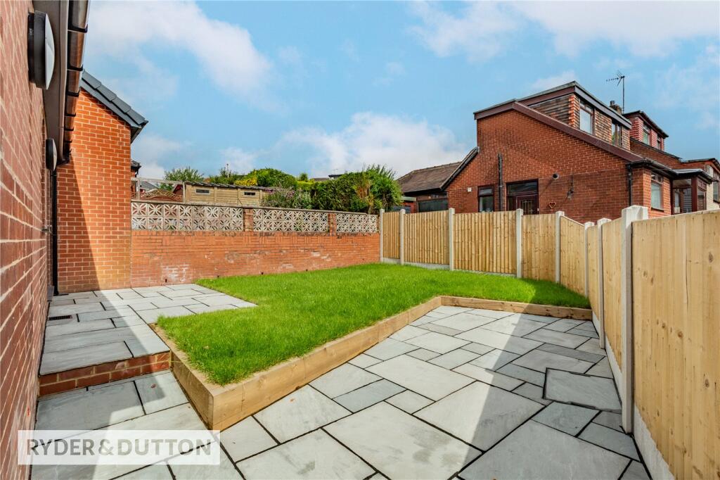
- backyard modern
Floorplan Description
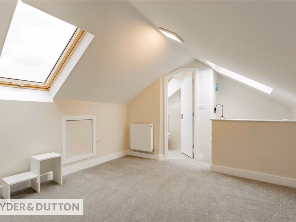
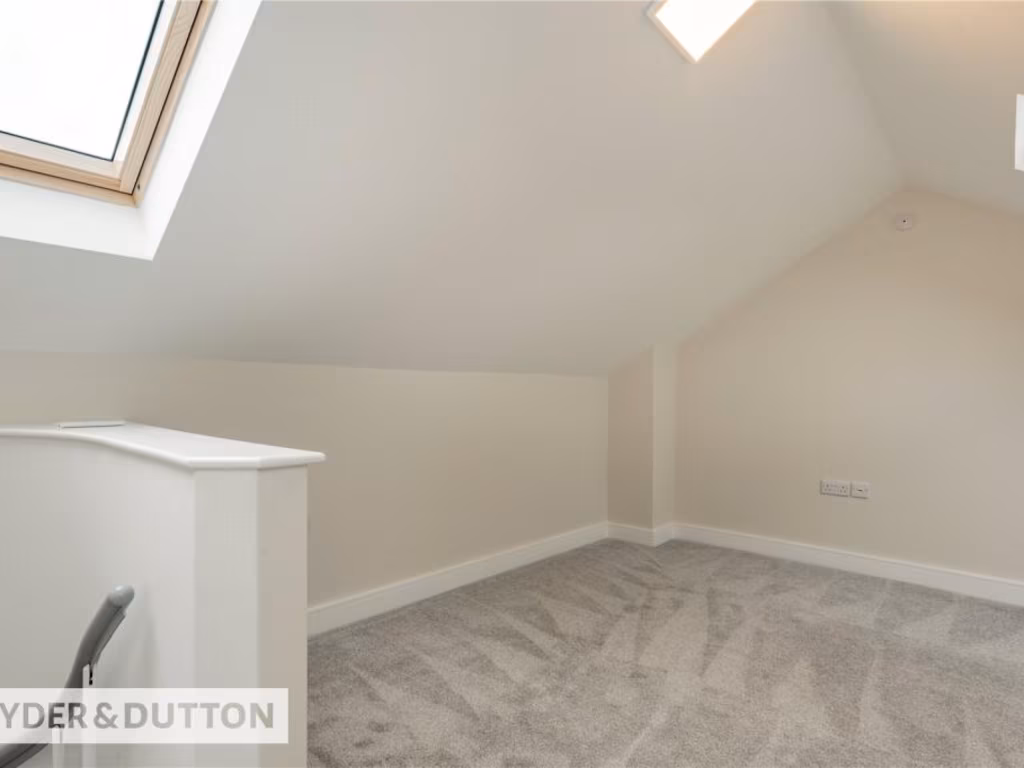
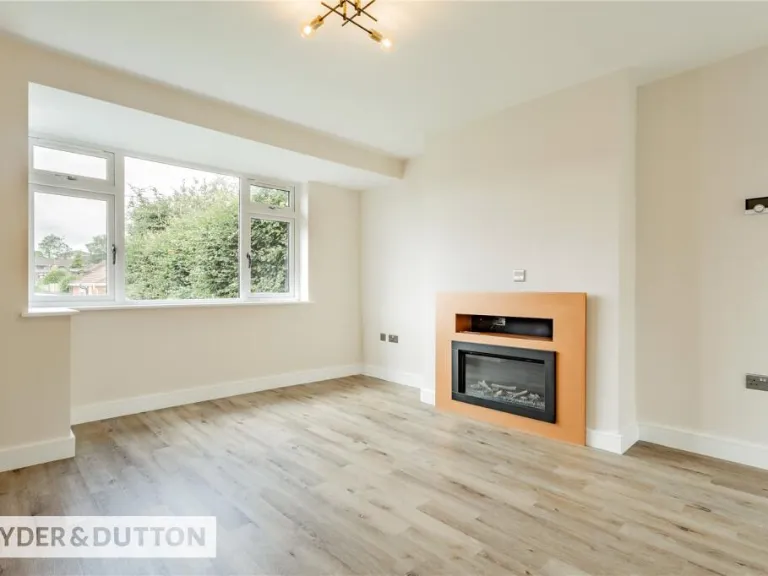
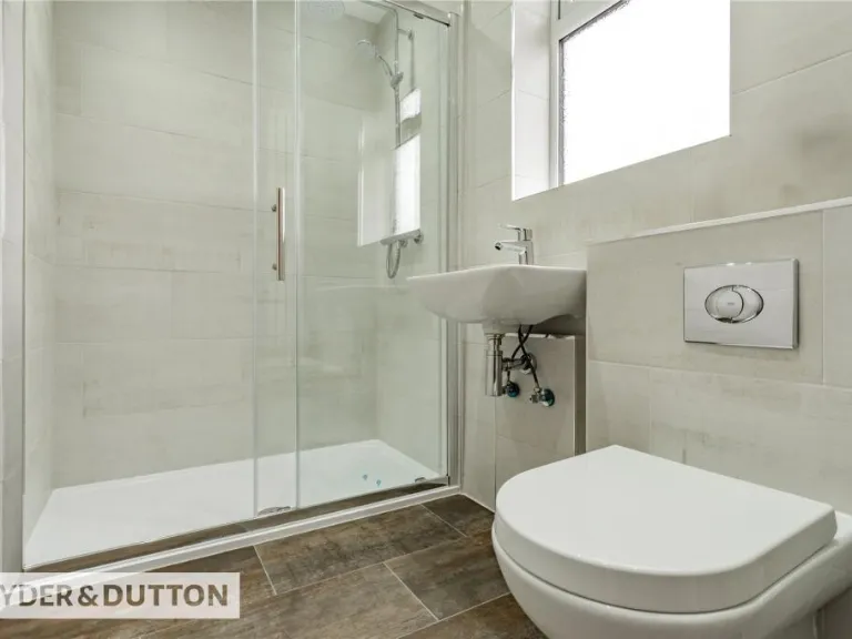
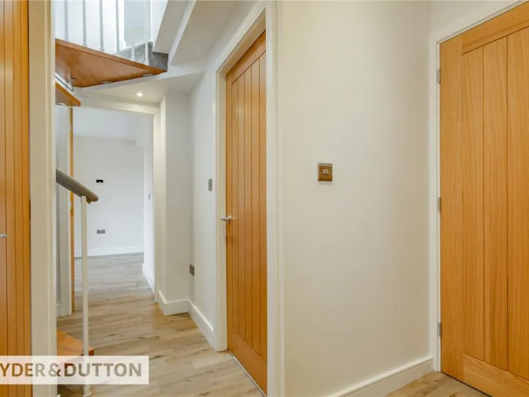
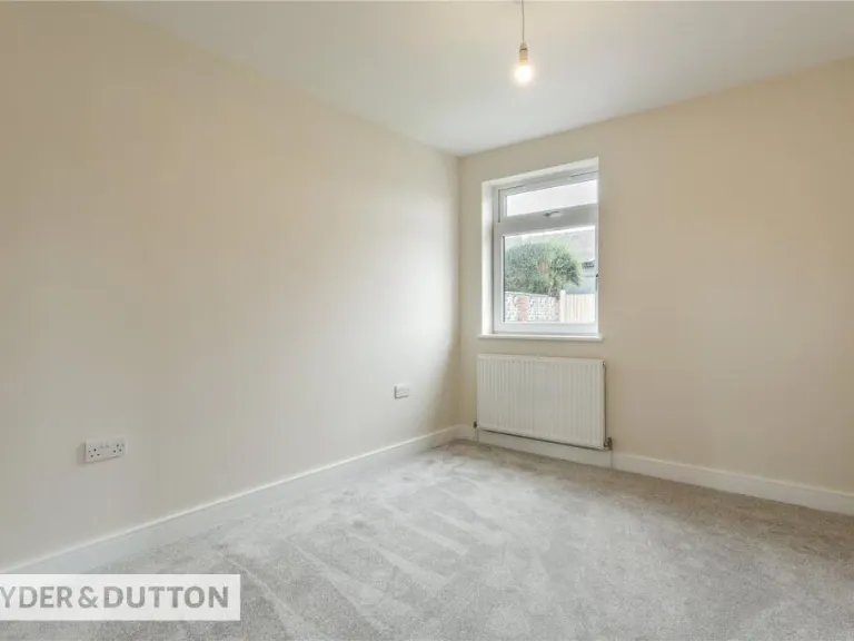
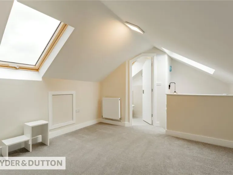
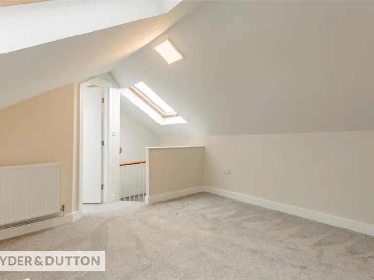
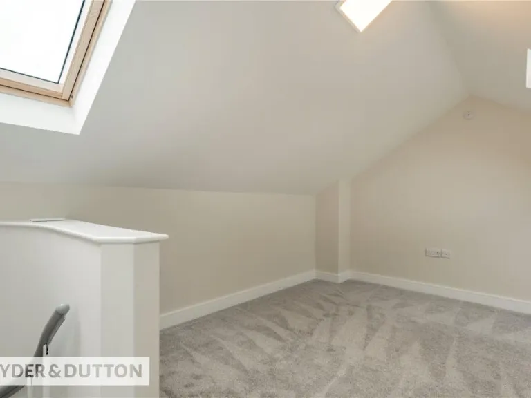
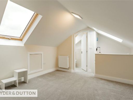
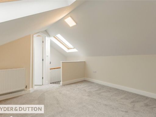
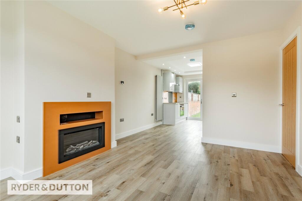
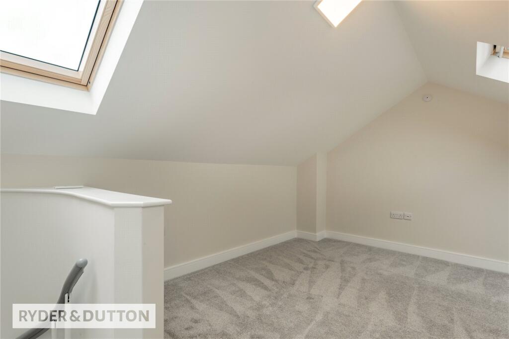
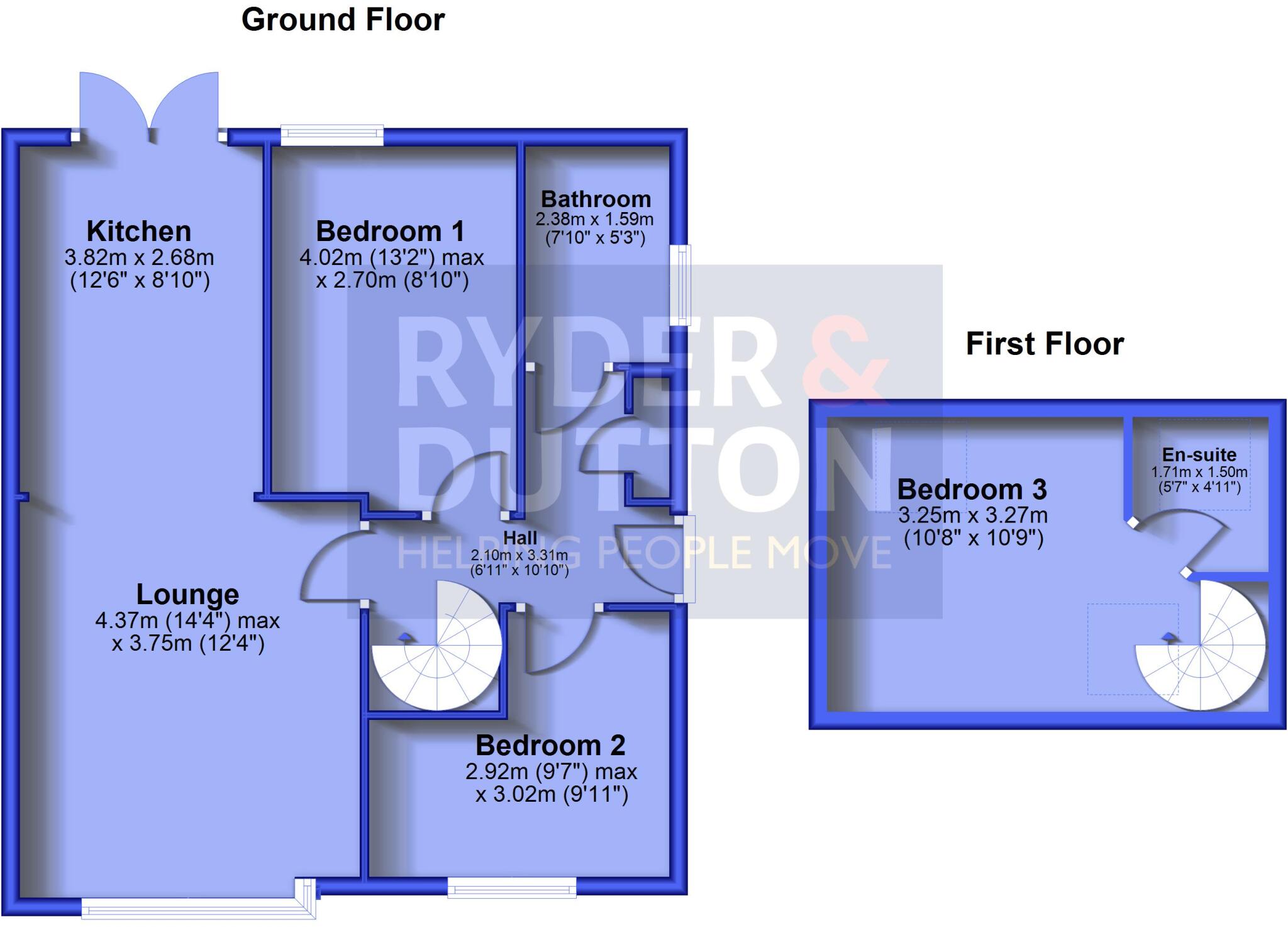
- Two-floor residence with lounge, kitchen, three bedrooms and two bathrooms
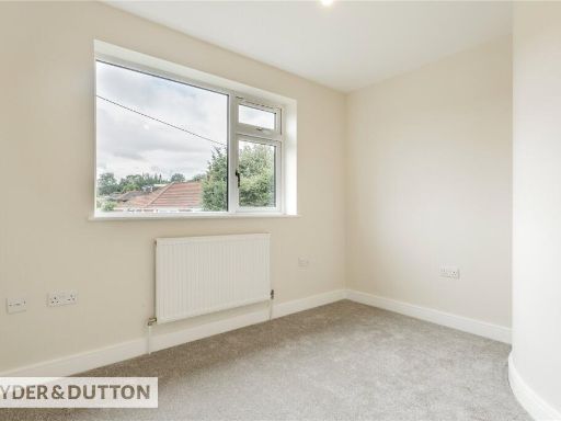
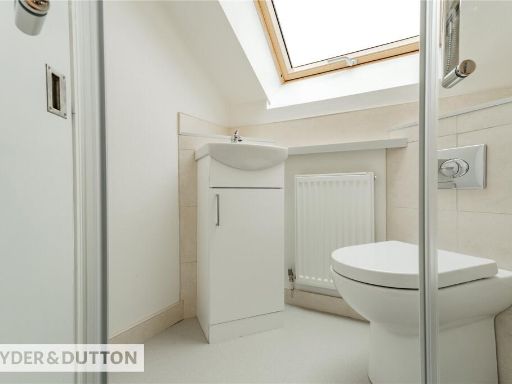
Rooms
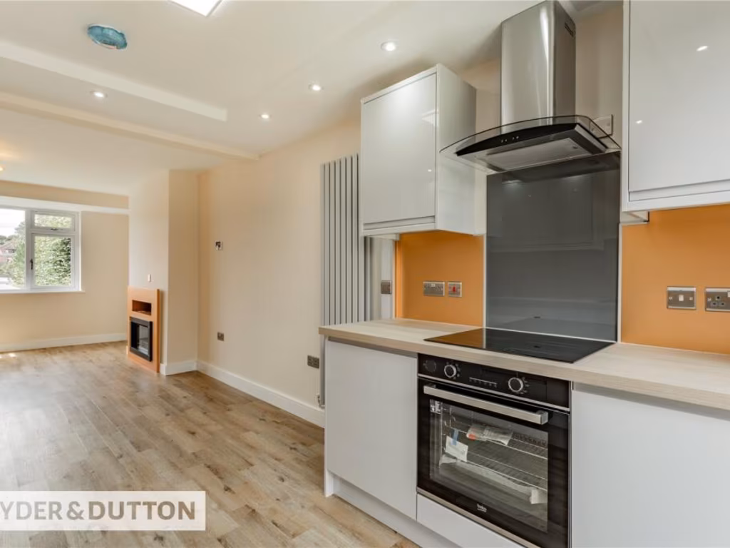
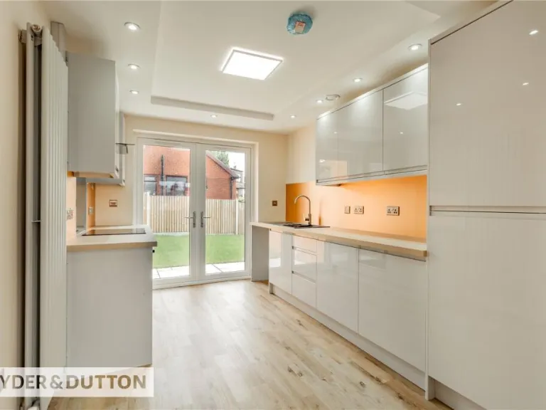
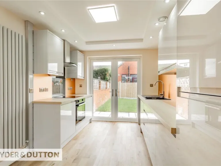
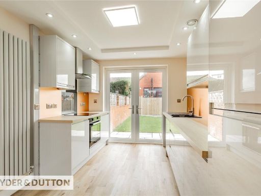
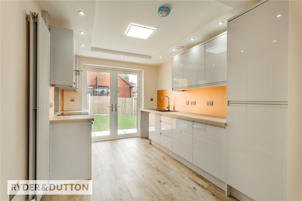
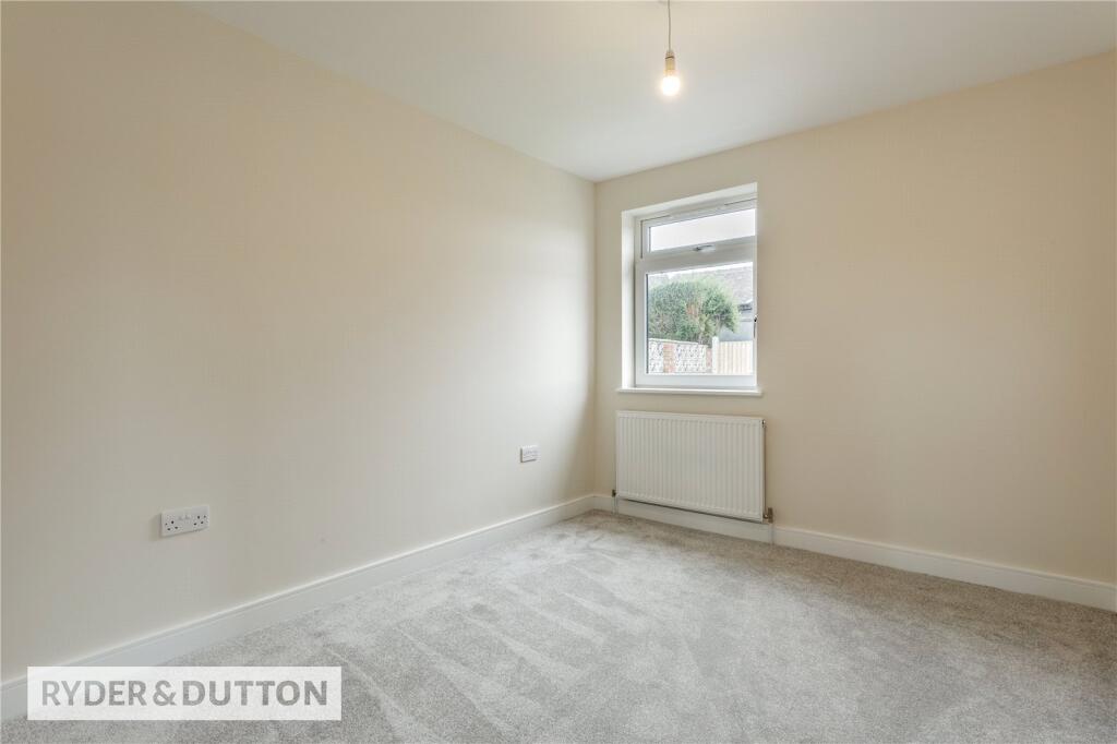
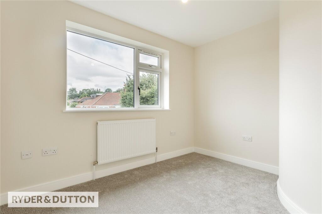
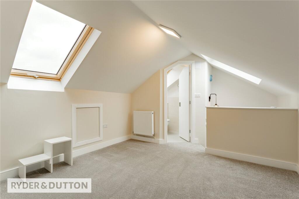
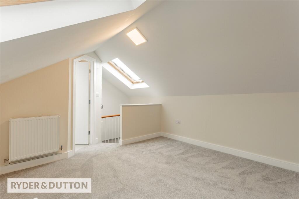
- Kitchen:
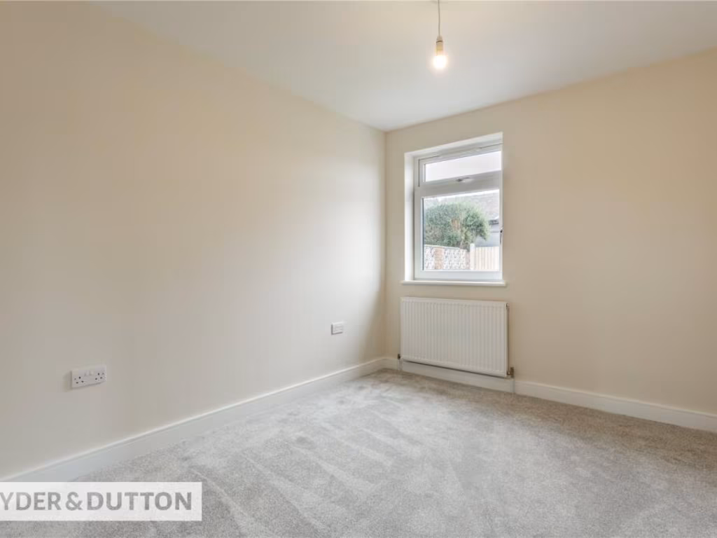
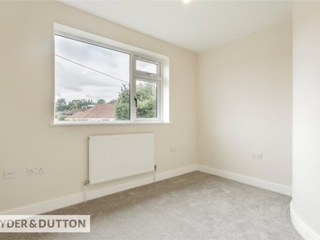
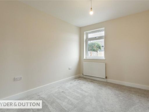
- Bedroom 1:
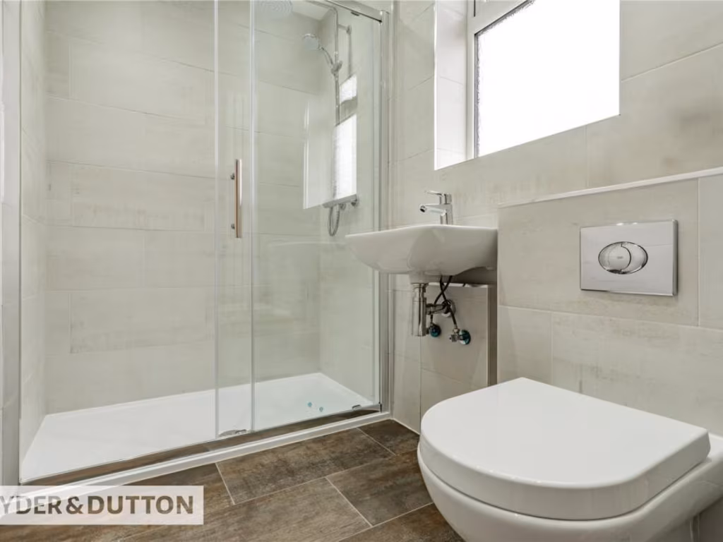
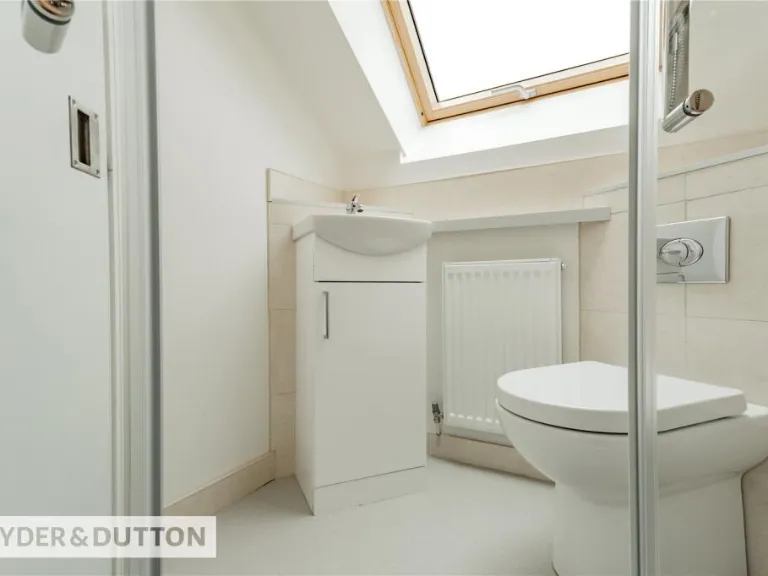
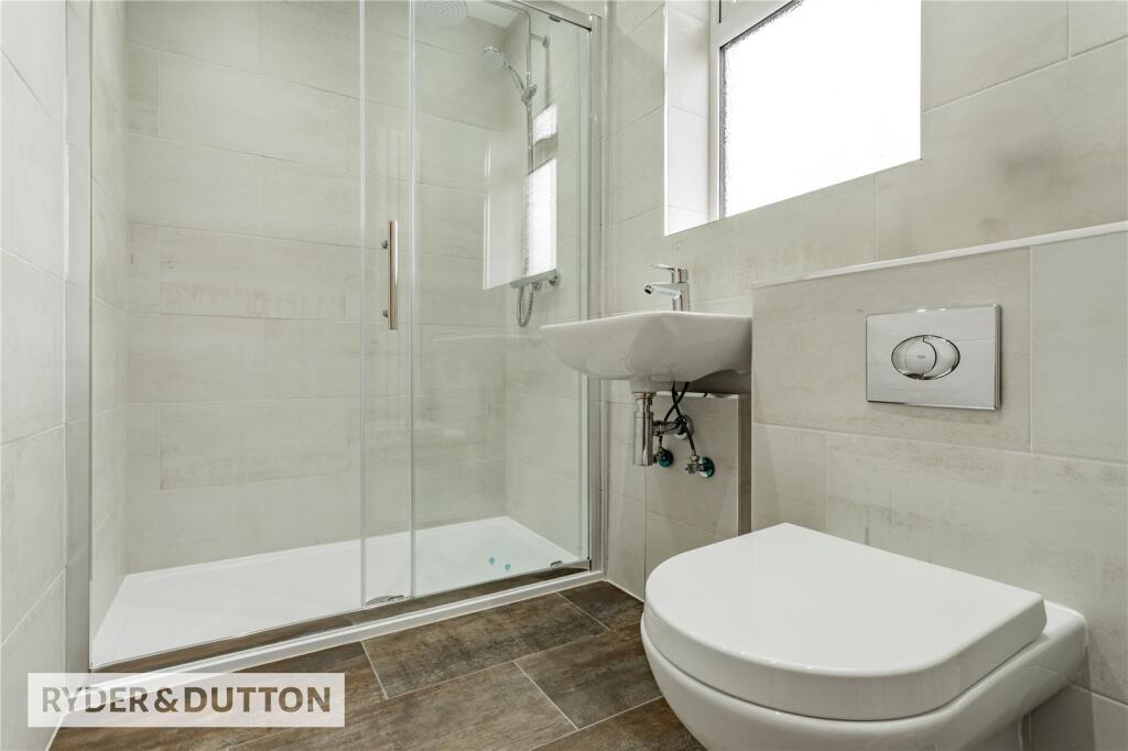
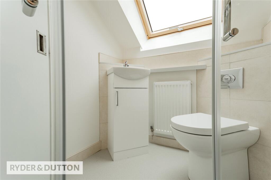
- Bathroom:
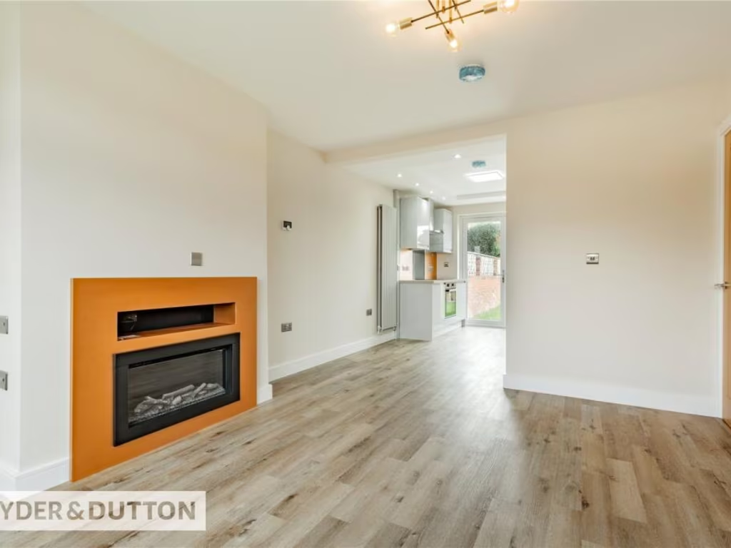
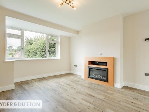
- Lounge:
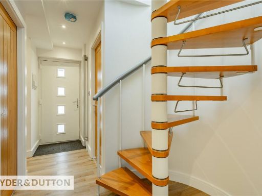
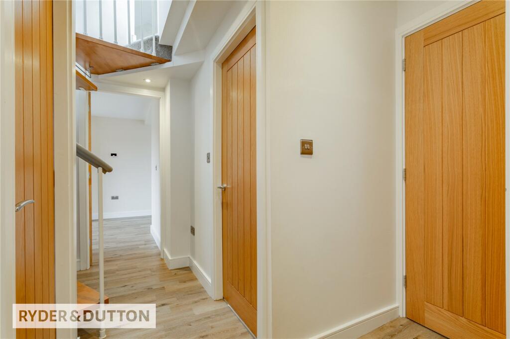
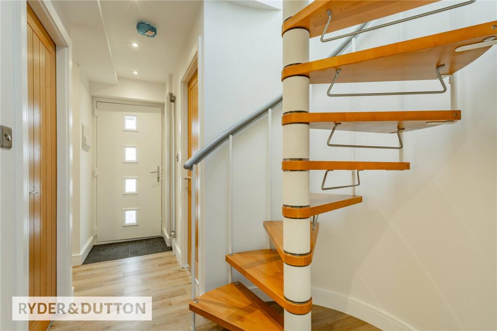
- Hall:
- Bedroom 2:
- Bedroom 3:
- En-suite:
Textual Property Features
Detected Visual Features
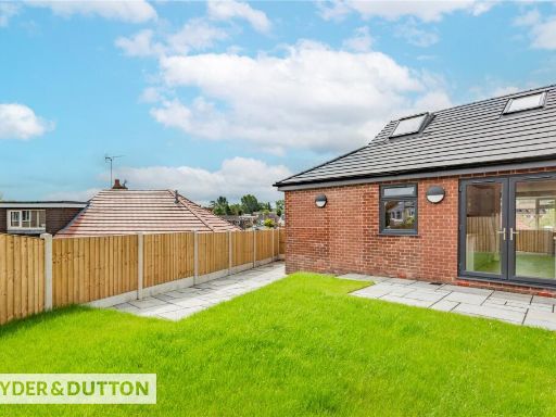
- modern
- brick exterior
- landscaped driveway
- garage
- garden
- detached
- fenced backyard
- artificial lawn
- modern garden
- low maintenance
- sidewalk paving
EPC Details
- Fully double glazed
- Cavity wall, filled cavity
- Boiler and radiators, mains gas
- Low energy lighting in 56% of fixed outlets
- Suspended, no insulation (assumed)
Nearby Schools
- Ss Aidan and Oswald's Roman Catholic Primary School
- Blackshaw Lane Primary & Nursery School
- Hollingworth Academy
- Milnrow Parish Church of England Primary School
- Royton Hall Primary School
- St Joseph's RC Junior Infant and Nursery School
- Crompton Primary School
- East Crompton St James CofE Primary School
- St Mary's CofE Primary School High Crompton
- Newhey Community Primary School
- St Thomas' Church of England Primary School
- Crossgates Primary School
- The Oldham Academy North
- Fir Bank Primary School
- Beal Vale Primary School
- The Crompton House Church of England Academy
- Thornham St James CofE Primary School
- St Cuthbert's Roman Catholic High School, a Voluntary Academy
- Moorhouse Academy
- St Anne's CofE (Aided) Primary School
- St Paul's CofE Primary School
- E-ACT Royton and Crompton Academy
- Thorp Primary School
- Farrowdale House School
- East Crompton St George's CofE School
- Buckstones Primary School
- Rushcroft Primary School
Nearest Bars And Restaurants
- Id: 4321262057
- Tags:
- Addr:
- Housenumber: 22
- Postcode: OL2 6YD
- Street: Narrowgate Brow
- Amenity: pub
- Name: Puckersley Inn
- Wheelchair: limited
- TagsNormalized:
- Lat: 53.5816505
- Lon: -2.1240413
- FullGeoHash: gcw2zdjrdr85
- PartitionGeoHash: gcw2
- Images:
- FoodStandards: null
- Distance: 1075.7
,- Id: 304550359
- Tags:
- Amenity: pub
- Brewery: W M Lees
- Building: pub
- Name: Colliers Return
- TagsNormalized:
- Lat: 53.5877614
- Lon: -2.1189658
- FullGeoHash: gcw2zg352db8
- PartitionGeoHash: gcw2
- Images:
- FoodStandards: null
- Distance: 850.6
,- Id: 5396313198
- Tags:
- Amenity: pub
- Name: Old Bulls Head
- TagsNormalized:
- Lat: 53.584338
- Lon: -2.1128268
- FullGeoHash: gcw2zftrrsd4
- PartitionGeoHash: gcw2
- Images:
- FoodStandards: null
- Distance: 321.4
,- Id: 1965804040
- Tags:
- Amenity: fast_food
- Cuisine: chinese
- Name: Chop Suey House
- Toilets:
- Wheelchair: no
- Wheelchair:description: There is no seating area or toilet in the restaurant. Ordering food is a challenge because the entrance is not ramped
- TagsNormalized:
- Lat: 53.5839987
- Lon: -2.112824
- FullGeoHash: gcw2zftmrtk4
- PartitionGeoHash: gcw2
- Images:
- FoodStandards: null
- Distance: 314.4
,- Id: 1005554434
- Tags:
- Amenity: pub
- Building: yes
- Name: North Star
- TagsNormalized:
- Lat: 53.5853354
- Lon: -2.1096388
- FullGeoHash: gcw2zfzv1ye2
- PartitionGeoHash: gcw2
- Images:
- FoodStandards: null
- Distance: 213.2
}
Nearest General Shops
- Id: 10612205653
- Tags:
- Addr:
- City: Oldham
- Housename: Lyon House
- Housenumber: 48-52
- Postcode: OL2 7SA
- Street: Rochdale Road
- Suburb: Shaw
- Name: Hedley Jackson Funeral Directors
- Shop: funeral_directors
- TagsNormalized:
- funeral
- funeral directors
- shop
- Lat: 53.5787173
- Lon: -2.0956995
- FullGeoHash: gcw8b39ywsv4
- PartitionGeoHash: gcw8
- Images:
- FoodStandards: null
- Distance: 985.3
,- Id: 10656691527
- Tags:
- Addr:
- City: Oldham
- Housenumber: 67
- Postcode: OL2 7JT
- Street: Rochdale Road
- Suburb: Shaw
- Name: Arcadia
- Shop: model
- TagsNormalized:
- Lat: 53.5786826
- Lon: -2.0962504
- FullGeoHash: gcw8b39w3y67
- PartitionGeoHash: gcw8
- Images:
- FoodStandards: null
- Distance: 957.5
,- Id: 10650737779
- Tags:
- Addr:
- City: Oldham
- Housenumber: 66-68
- Postcode: OL2 7SA
- Street: Rochdale Road
- Suburb: Shaw
- Name: Gekay Carpets & Floors
- Shop: carpet
- TagsNormalized:
- Lat: 53.5788707
- Lon: -2.0962603
- FullGeoHash: gcw8b39x997j
- PartitionGeoHash: gcw8
- Images:
- FoodStandards: null
- Distance: 945.1
}
Nearest Supermarkets
- Id: 10612413812
- Tags:
- Addr:
- City: Oldham
- Housename: Co-op Food
- Postcode: OL2 5PT
- Street: Rochdale Road
- Suburb: Royton
- Brand: Co-op Food
- Brand:wikidata: Q3277439
- Name: Co-op Food
- Shop: supermarket
- TagsNormalized:
- co-op
- co-op food
- food
- supermarket
- shop
- Lat: 53.5654804
- Lon: -2.1222967
- FullGeoHash: gcw2xxq9dckb
- PartitionGeoHash: gcw2
- Images:
- FoodStandards: null
- Distance: 2227.4
,- Id: 1965795124
- Tags:
- Addr:
- City: Shaw
- Country: GB
- Postcode: OL2 8QP
- Street: Greenfield Lane
- Brand: Asda
- Brand:wikidata: Q297410
- Brand:wikipedia: en:Asda
- Contact:
- Website: https://storelocator.asda.com/north-west/shaw-oldham/greenfield-lane
- Fhrs:
- Name: Asda
- Operator: Asda Stores Ltd
- Shop: supermarket
- Toilets:
- Wheelchair: yes
- TagsNormalized:
- Lat: 53.576024
- Lon: -2.0916309
- FullGeoHash: gcw8b3hyvqwz
- PartitionGeoHash: gcw8
- Images:
- FoodStandards:
- Id: 117796
- FHRSID: 117796
- LocalAuthorityBusinessID: 47047
- BusinessName: Asda Stores Ltd
- BusinessType: Retailers - supermarkets/hypermarkets
- BusinessTypeID: 7840
- AddressLine1: Asda Supermarket
- AddressLine2: Greenfield Lane
- AddressLine3: Shaw
- AddressLine4: Oldham
- PostCode: OL2 8QP
- RatingValue: 3
- RatingKey: fhrs_3_en-GB
- RatingDate: 2022-10-27
- LocalAuthorityCode: 418
- LocalAuthorityName: Oldham
- LocalAuthorityWebSite: https://www.oldham.gov.uk
- LocalAuthorityEmailAddress: FHRS@oldham.gov.uk
- Scores:
- Hygiene: 10
- Structural: 5
- ConfidenceInManagement: 10
- NewRatingPending: false
- Geocode:
- Longitude: -2.09286900000000
- Latitude: 53.57540300000000
- Distance: 1378.8
,- Id: 1965796430
- Tags:
- Brand: ALDI
- Brand:wikidata: Q41171672
- Brand:wikipedia: en:Aldi
- Contact:
- Website: https://stores.aldi.co.uk/shaw/1-refuge-street
- Name: ALDI
- Shop: supermarket
- Wheelchair: yes
- TagsNormalized:
- Lat: 53.57525
- Lon: -2.0936211
- FullGeoHash: gcw8b356rn6y
- PartitionGeoHash: gcw8
- Images:
- FoodStandards: null
- Distance: 1336.4
}
Nearest Religious buildings
- Id: 861296411
- Tags:
- Amenity: place_of_worship
- Building: church
- Denomination: anglican
- Name: St James
- Religion: christian
- Source: OS_OpenData_StreetView
- Wikidata: Q26456182
- TagsNormalized:
- place of worship
- church
- anglican
- christian
- Lat: 53.5809301
- Lon: -2.0926026
- FullGeoHash: gcw8b6h5wc63
- PartitionGeoHash: gcw8
- Images:
- FoodStandards: null
- Distance: 1066.7
,- Id: 837161777
- Tags:
- Amenity: place_of_worship
- Building: church
- Denomination: anglican
- Name: St Mary
- Religion: christian
- Wikidata: Q105100723
- TagsNormalized:
- place of worship
- church
- anglican
- christian
- Lat: 53.5843067
- Lon: -2.1121383
- FullGeoHash: gcw2zftzpwg8
- PartitionGeoHash: gcw2
- Images:
- FoodStandards: null
- Distance: 276.5
,- Id: 391472790
- Tags:
- Addr:
- Amenity: school
- Name: Crompton House Church of England Academy
- Ref:
- Source: OS_OpenData_StreetView
- Toilets:
- Wheelchair: yes
- Wikidata: Q5187641
- Wikipedia: en:Crompton House Church of England Academy
- TagsNormalized:
- Lat: 53.5818678
- Lon: -2.106032
- FullGeoHash: gcw8b463jbhe
- PartitionGeoHash: gcw8
- Images:
- FoodStandards: null
- Distance: 240.6
}
Nearest Airports
- Id: 1224469
- Tags:
- Addr:
- City: Manchester
- Country: GB
- Postcode: M90 1QX
- Aerodrome: international
- Aeroway: aerodrome
- Arp: yes
- Atis: 128.175
- Iata: MAN
- Icao: EGCC
- Name: Manchester Airport
- Note: rough sketched outline referring to Yahoo imagery - true boundary is where?
- Old_name: Ringway
- Operator: Manchester Airport PLC
- Size: 18720000
- Source:
- Tower_frequency: 118.625,119.400
- Type: multipolygon
- Website: https://www.manchesterairport.co.uk/
- Wikidata: Q8694
- Wikipedia: en:Manchester Airport
- TagsNormalized:
- airport
- international airport
- Lat: 53.3503197
- Lon: -2.2798822
- FullGeoHash: gcqrs05u4ukt
- PartitionGeoHash: gcqr
- Images:
- FoodStandards: null
- Distance: 28327.6
}
Nearest Leisure Facilities
- Id: 895741484
- Tags:
- Barrier: fence
- Leisure: playground
- TagsNormalized:
- Lat: 53.5858483
- Lon: -2.1136846
- FullGeoHash: gcw2zghb5w4s
- PartitionGeoHash: gcw2
- Images:
- FoodStandards: null
- Distance: 442.4
,- Id: 507103832
- Tags:
- Leisure: pitch
- Sport: bowls
- TagsNormalized:
- Lat: 53.5851617
- Lon: -2.1131814
- FullGeoHash: gcw2zfvhpq1s
- PartitionGeoHash: gcw2
- Images:
- FoodStandards: null
- Distance: 375.3
,- Id: 159646748
- Tags:
- Leisure: park
- Name: High Crompton Park
- Source: local_knowledge
- TagsNormalized:
- Lat: 53.5855895
- Lon: -2.1122588
- FullGeoHash: gcw2zfvysvcs
- PartitionGeoHash: gcw2
- Images:
- FoodStandards: null
- Distance: 349.2
,- Id: 584021860
- Tags:
- Leisure: pitch
- Lit: yes
- Sport: soccer
- Surface: artificial_turf
- TagsNormalized:
- Lat: 53.5822551
- Lon: -2.1044983
- FullGeoHash: gcw8b47e38k3
- PartitionGeoHash: gcw8
- Images:
- FoodStandards: null
- Distance: 283.8
,- Id: 584022050
- Tags:
- Leisure: pitch
- Sport: tennis
- TagsNormalized:
- Lat: 53.5819199
- Lon: -2.1064926
- FullGeoHash: gcw8b46171v6
- PartitionGeoHash: gcw8
- Images:
- FoodStandards: null
- Distance: 219.7
}
Nearest Tourist attractions
- Id: 416486996
- Tags:
- TagsNormalized:
- Lat: 53.5844297
- Lon: -2.1765016
- FullGeoHash: gcw2y6xpgvdv
- PartitionGeoHash: gcw2
- Images:
- FoodStandards: null
- Distance: 4516.2
,- Id: 876163243
- Tags:
- Name: Roch Vale Caravan Park
- Tourism: caravan_site
- TagsNormalized:
- Lat: 53.6157824
- Lon: -2.1460443
- FullGeoHash: gcw3p0mq9d1r
- PartitionGeoHash: gcw3
- Images:
- FoodStandards: null
- Distance: 4362.9
,- Id: 2631058167
- Tags:
- Source: Bing
- Tourism: picnic_site
- TagsNormalized:
- Lat: 53.5747261
- Lon: -2.1433401
- FullGeoHash: gcw2z0zr2scc
- PartitionGeoHash: gcw2
- Images:
- FoodStandards: null
- Distance: 2529.4
}
Nearest Hotels
- Id: 267813103
- Tags:
- Brand: Premier Inn
- Brand:wikidata: Q2108626
- Brand:wikipedia: en:Premier Inn
- Building: hotel
- Name: Premier Inn
- Tourism: hotel
- TagsNormalized:
- Lat: 53.5544342
- Lon: -2.1320963
- FullGeoHash: gcw2xmr3nw1g
- PartitionGeoHash: gcw2
- Images:
- FoodStandards: null
- Distance: 3614.6
,- Id: 403894006
- Tags:
- Amenity: pub
- Building: pub
- Name: Kingsway Hotel
- Source: Bing
- TagsNormalized:
- Lat: 53.607137
- Lon: -2.136712
- FullGeoHash: gcw2zquh5n8h
- PartitionGeoHash: gcw2
- Images:
- FoodStandards: null
- Distance: 3222.7
,- Id: 1126664457
- Tags:
- Addr:
- Brand: Premier Inn
- Brand:wikidata: Q2108626
- Building: yes
- Internet_access: wlan
- Internet_access:fee: customers
- Internet_access:operator: Virgin Media
- Internet_access:ssid: Premier Inn Free Wi-Fi
- Name: Premier Inn
- Tourism: hotel
- Wheelchair: yes
- TagsNormalized:
- Lat: 53.6031239
- Lon: -2.1047323
- FullGeoHash: gcw8bn5ku4tc
- PartitionGeoHash: gcw8
- Images:
- FoodStandards: null
- Distance: 2176.7
}
Tags
- modern
- brick exterior
- landscaped driveway
- garage
- garden
- detached
- fenced backyard
- artificial lawn
- modern garden
- low maintenance
- sidewalk paving
Local Market Stats
- Average Price/sqft: £214
- Avg Income: £39000
- Rental Yield: 5.2%
- Social Housing: 15%
- Planning Success Rate: 92%
Similar Properties
 2 bedroom bungalow for sale in Moss Grove, High Crompton, Oldham, Greater Manchester, OL2 — £260,000 • 2 bed • 1 bath • 890 ft²
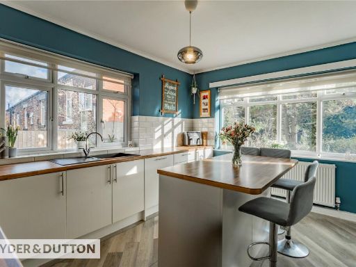 4 bedroom detached bungalow for sale in Rochdale Road, High Crompton, Shaw, Oldham, OL2 — £434,950 • 4 bed • 2 bath • 1025 ft²
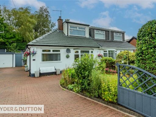 2 bedroom semi-detached bungalow for sale in Great Meadow, High Crompton, Shaw, Oldham, OL2 — £300,000 • 2 bed • 1 bath • 945 ft²
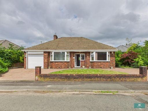 2 bedroom detached bungalow for sale in Manor Road, Shaw, OL2 — £339,950 • 2 bed • 1 bath • 814 ft²
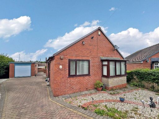 3 bedroom detached bungalow for sale in Clevelands Close, High Crompton, OL2 — £280,000 • 3 bed • 1 bath • 657 ft²
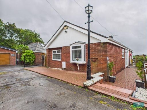 3 bedroom detached bungalow for sale in Orchard Grove, High Crompton ,Shaw, OL2 — £379,950 • 3 bed • 2 bath • 1642 ft²
Meta
- {
"@context": "https://schema.org",
"@type": "Residence",
"name": "3 bedroom semidetached bungalow for sale in Cotswold Avenue…",
"description": "",
"url": "https://propertypiper.co.uk/property/01db6859-40f1-43db-891d-ab29f6c1f78a",
"image": "https://image-a.propertypiper.co.uk/022488a1-8717-4f89-9351-2323224b5806-1024.jpeg",
"address": {
"@type": "PostalAddress",
"streetAddress": "Cotswold Avenue, High Crompton, Shaw, Oldham, OL2",
"postalCode": "OL2 7RF",
"addressLocality": "Oldham",
"addressRegion": "Oldham East and Saddleworth",
"addressCountry": "England"
},
"geo": {
"@type": "GeoCoordinates",
"latitude": 53.583650856465944,
"longitude": -2.1080976430889193
},
"numberOfRooms": 3,
"numberOfBathroomsTotal": 2,
"floorSize": {
"@type": "QuantitativeValue",
"value": 755,
"unitCode": "FTK"
},
"offers": {
"@type": "Offer",
"price": 299950,
"priceCurrency": "GBP",
"availability": "https://schema.org/InStock"
},
"additionalProperty": [
{
"@type": "PropertyValue",
"name": "Feature",
"value": "modern"
},
{
"@type": "PropertyValue",
"name": "Feature",
"value": "brick exterior"
},
{
"@type": "PropertyValue",
"name": "Feature",
"value": "landscaped driveway"
},
{
"@type": "PropertyValue",
"name": "Feature",
"value": "garage"
},
{
"@type": "PropertyValue",
"name": "Feature",
"value": "garden"
},
{
"@type": "PropertyValue",
"name": "Feature",
"value": "detached"
},
{
"@type": "PropertyValue",
"name": "Feature",
"value": "fenced backyard"
},
{
"@type": "PropertyValue",
"name": "Feature",
"value": "artificial lawn"
},
{
"@type": "PropertyValue",
"name": "Feature",
"value": "modern garden"
},
{
"@type": "PropertyValue",
"name": "Feature",
"value": "low maintenance"
},
{
"@type": "PropertyValue",
"name": "Feature",
"value": "sidewalk paving"
}
]
}
High Res Floorplan Images
Compatible Floorplan Images
FloorplanImages Thumbnail