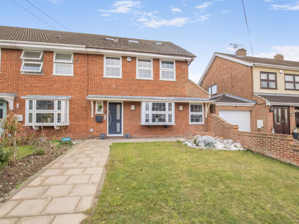
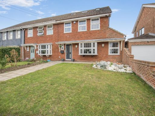
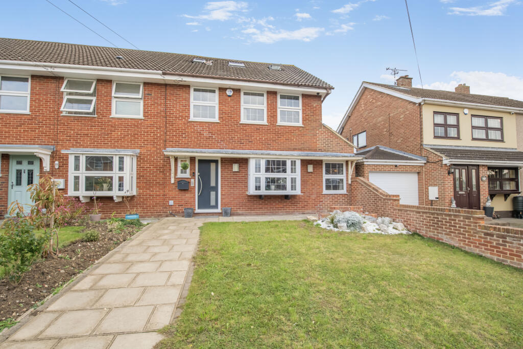
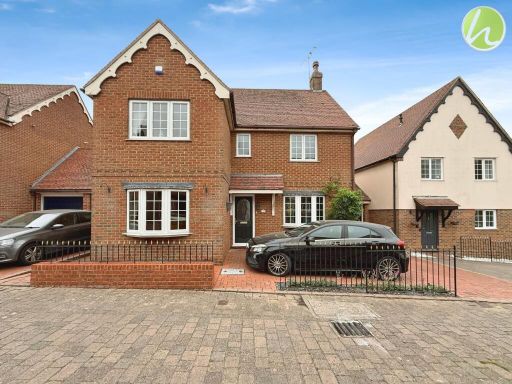
SS17 8NT - 5 bedroom end of terrace house for sale in Francis Close, S…
View on Property Piper
5 bedroom end of terrace house for sale in Francis Close, Stanford-le-hope, SS17
Property Details
- Price: £750000
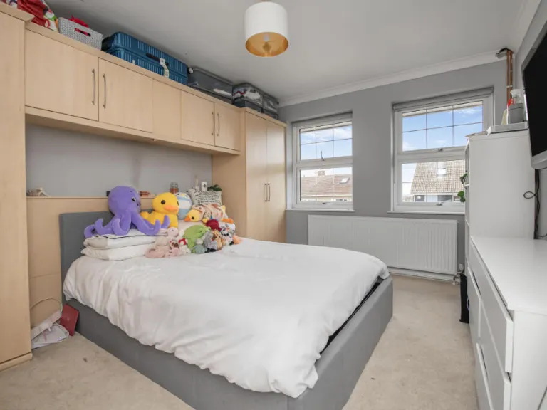
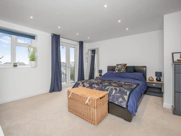
- Bedrooms: 5
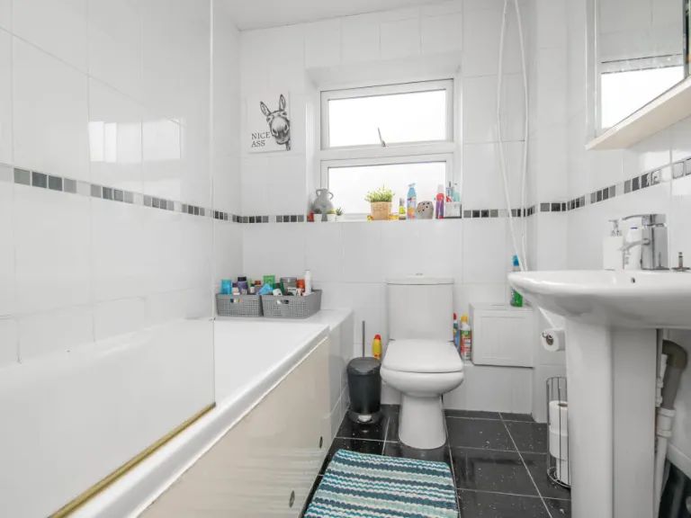
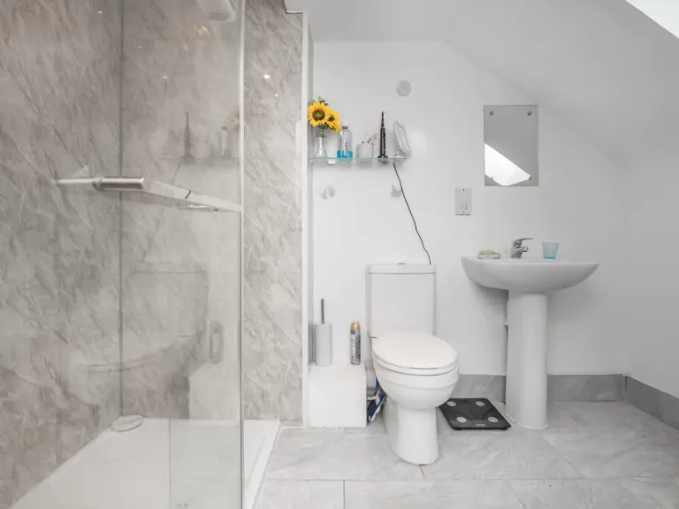
- Bathrooms: 2
- Property Type: undefined
- Property SubType: undefined
Image Descriptions
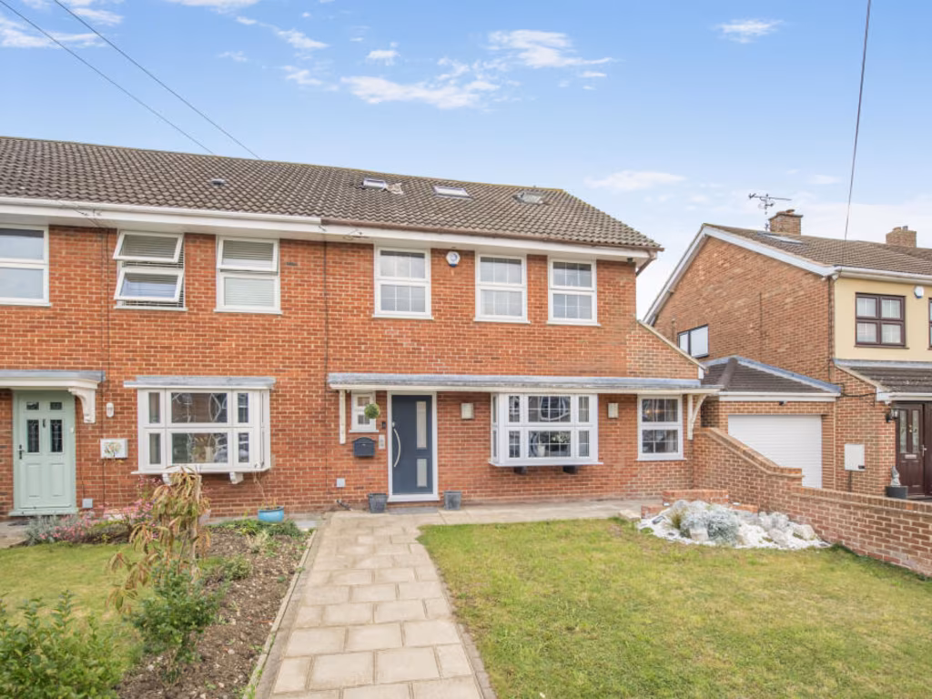
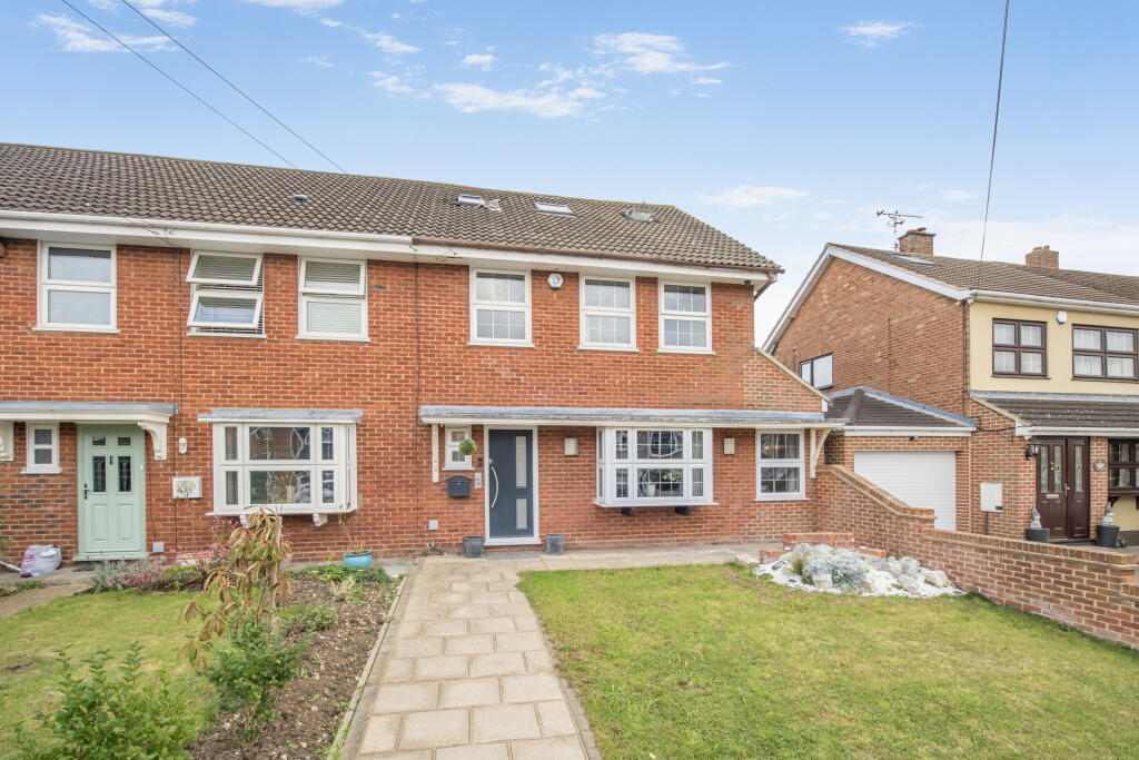
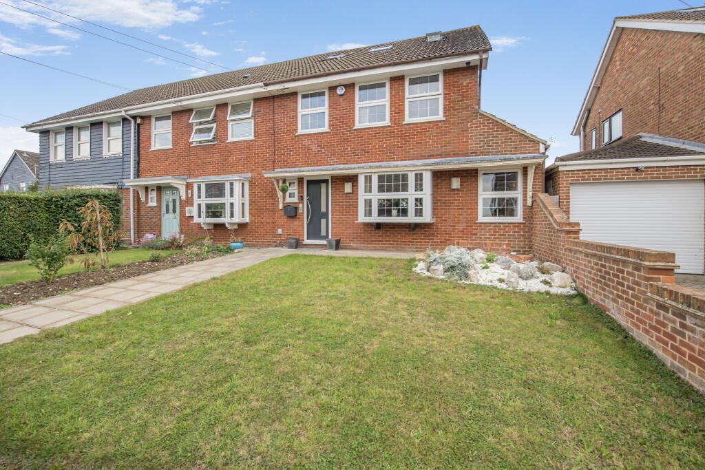
- semi-detached house Post-war
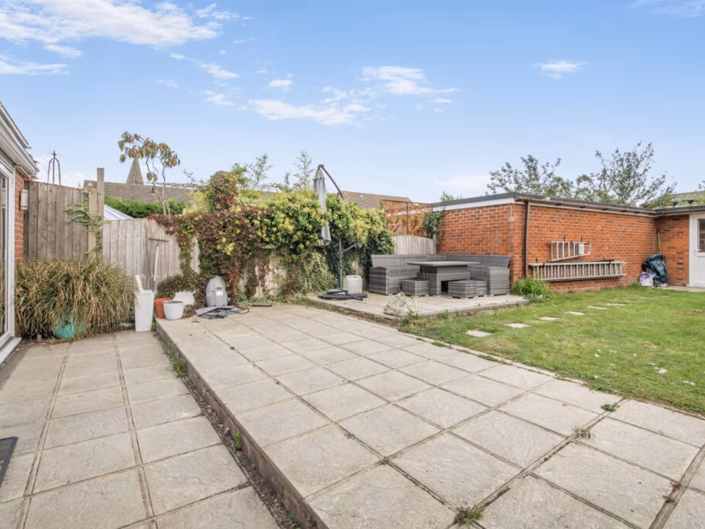
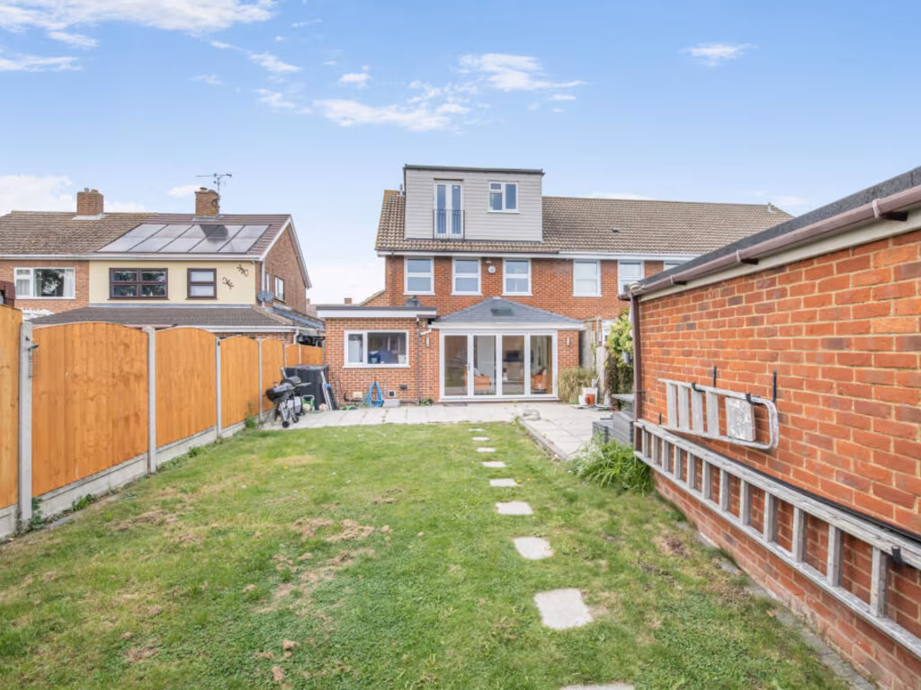
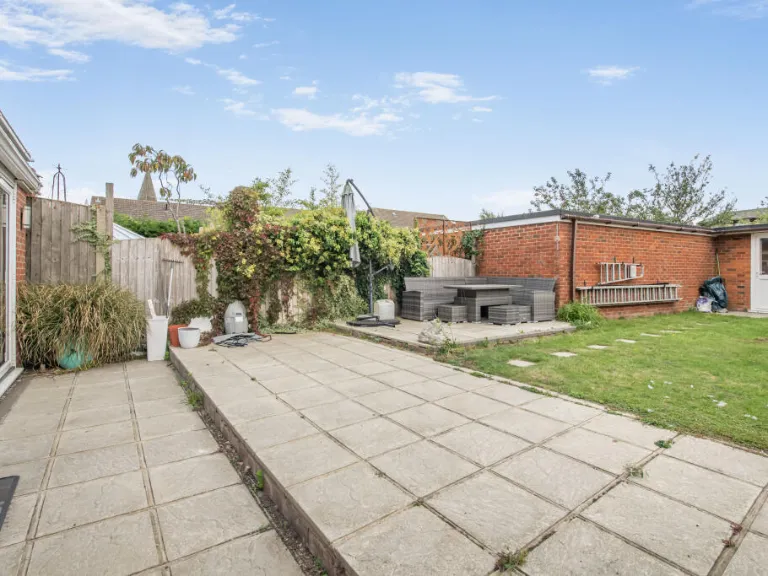
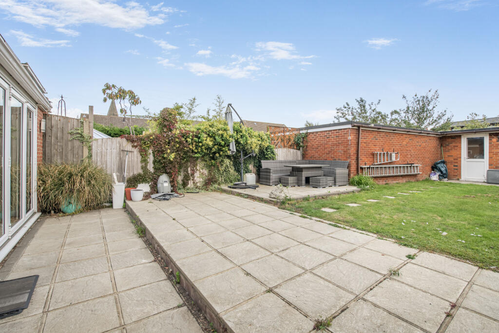
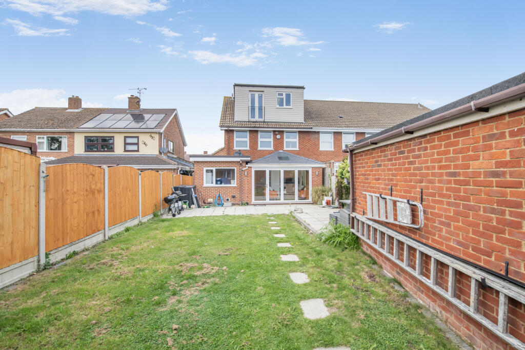
- backyard 1950s
Floorplan Description
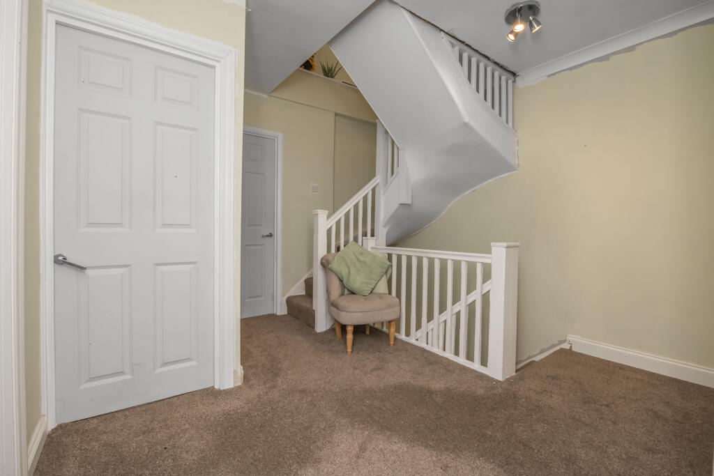
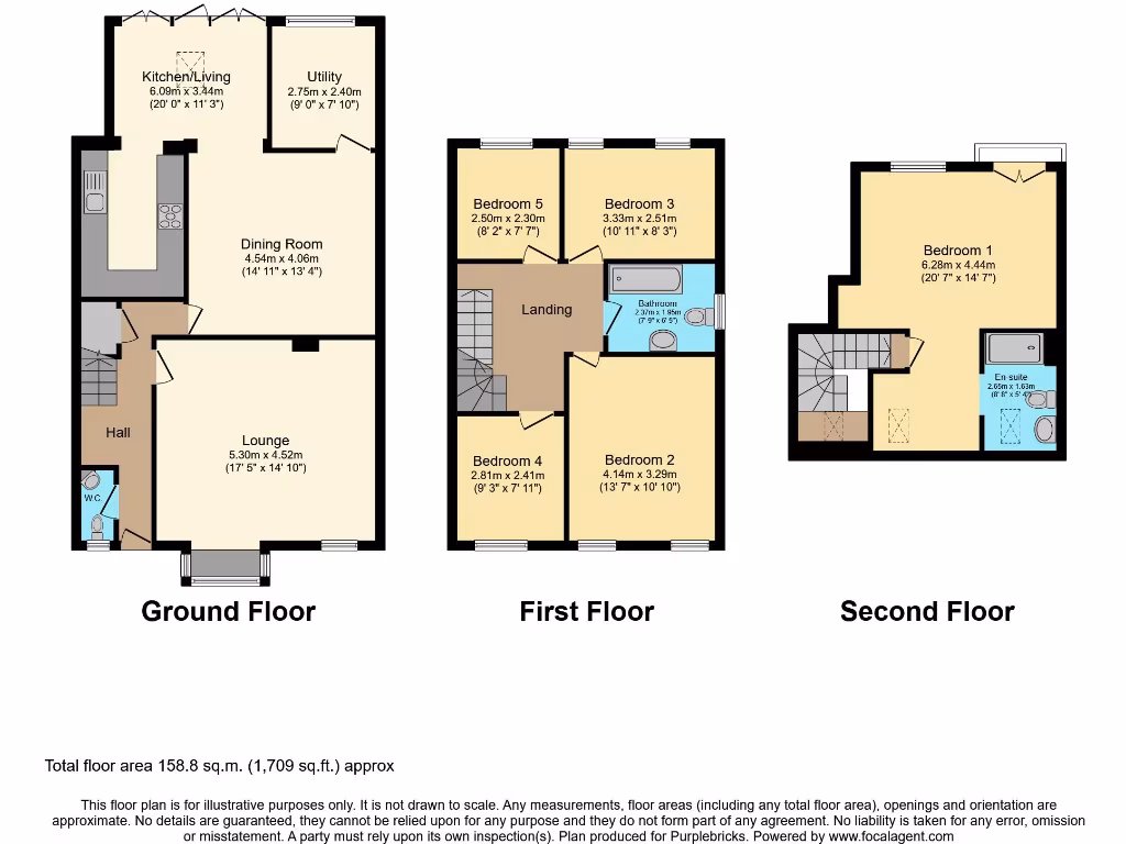
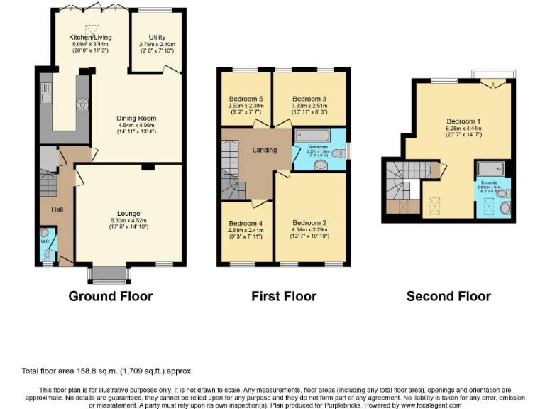
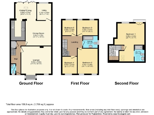
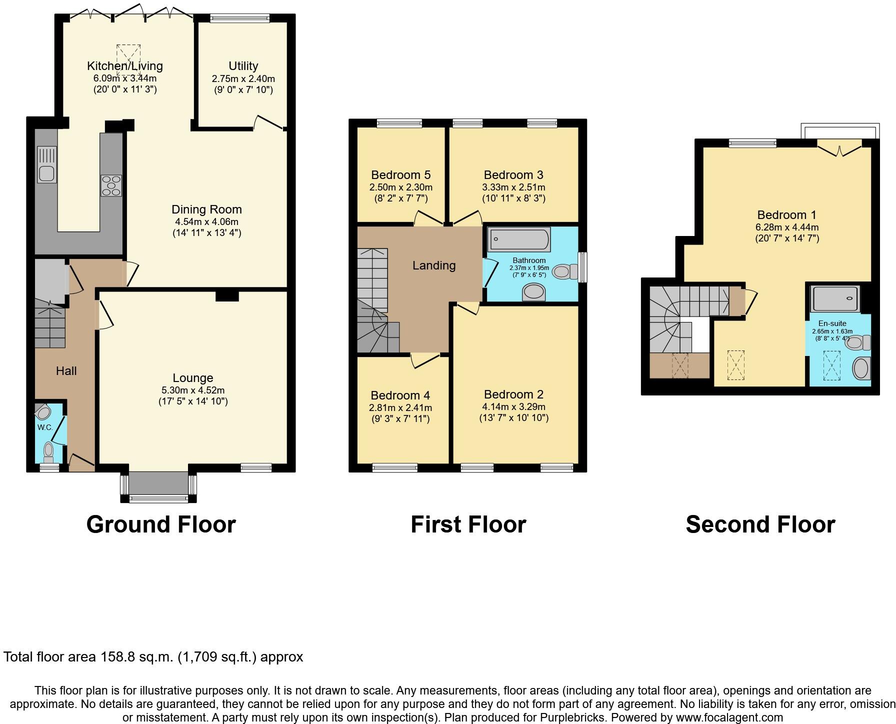
- Three-storey house with five bedrooms (floor labels and room dimensions shown on plan).
Rooms
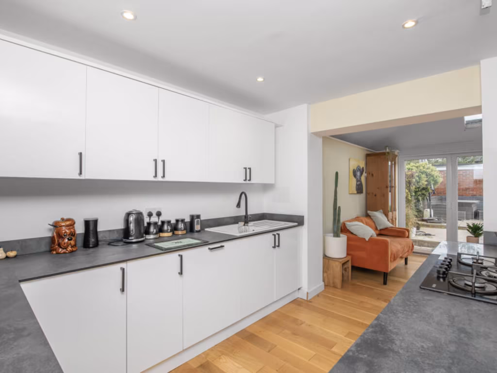
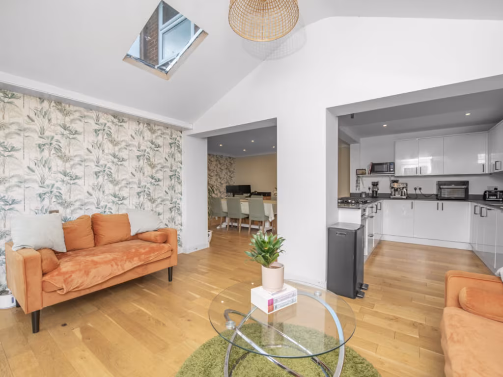
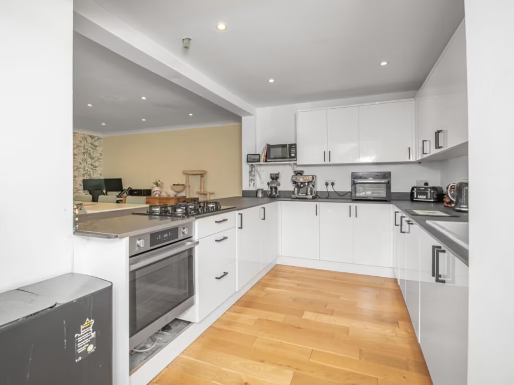
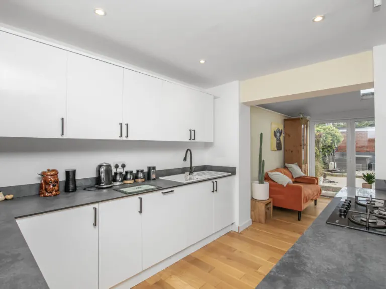
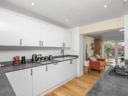
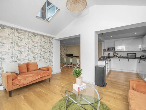
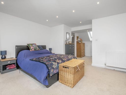
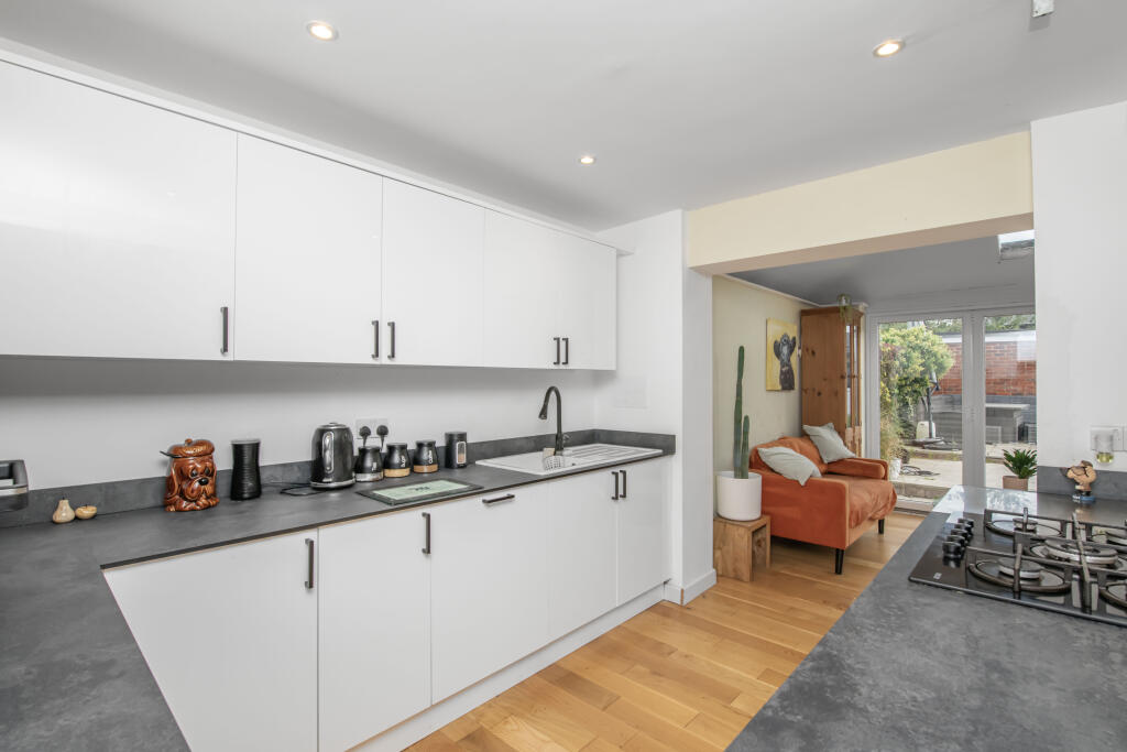
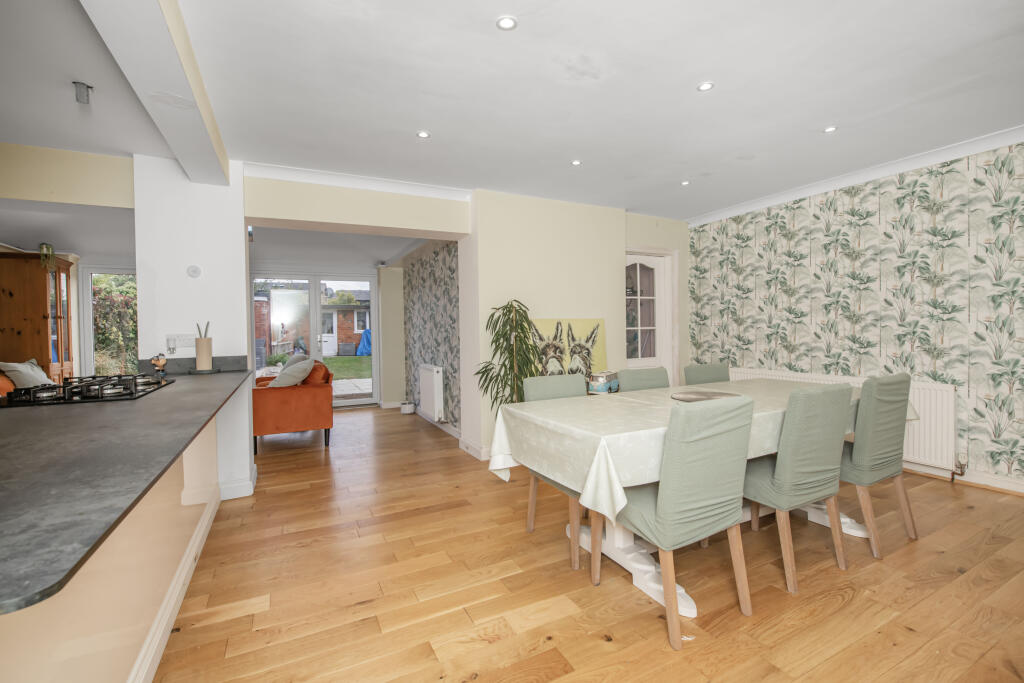
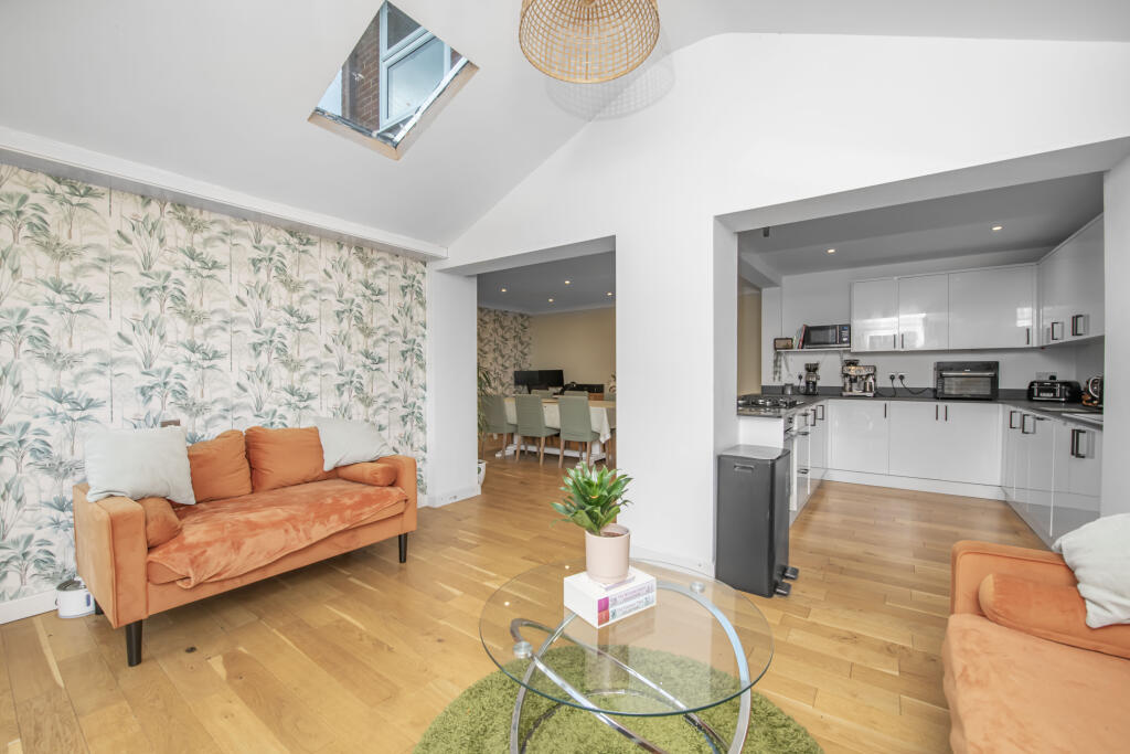
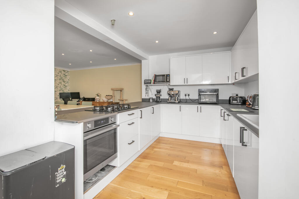
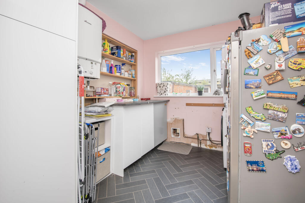
- Kitchen/Living:
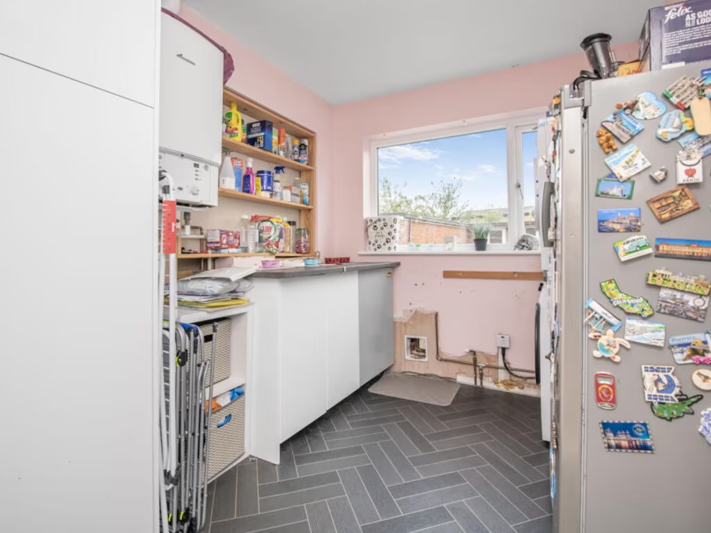
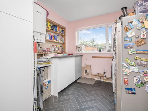
- Utility:
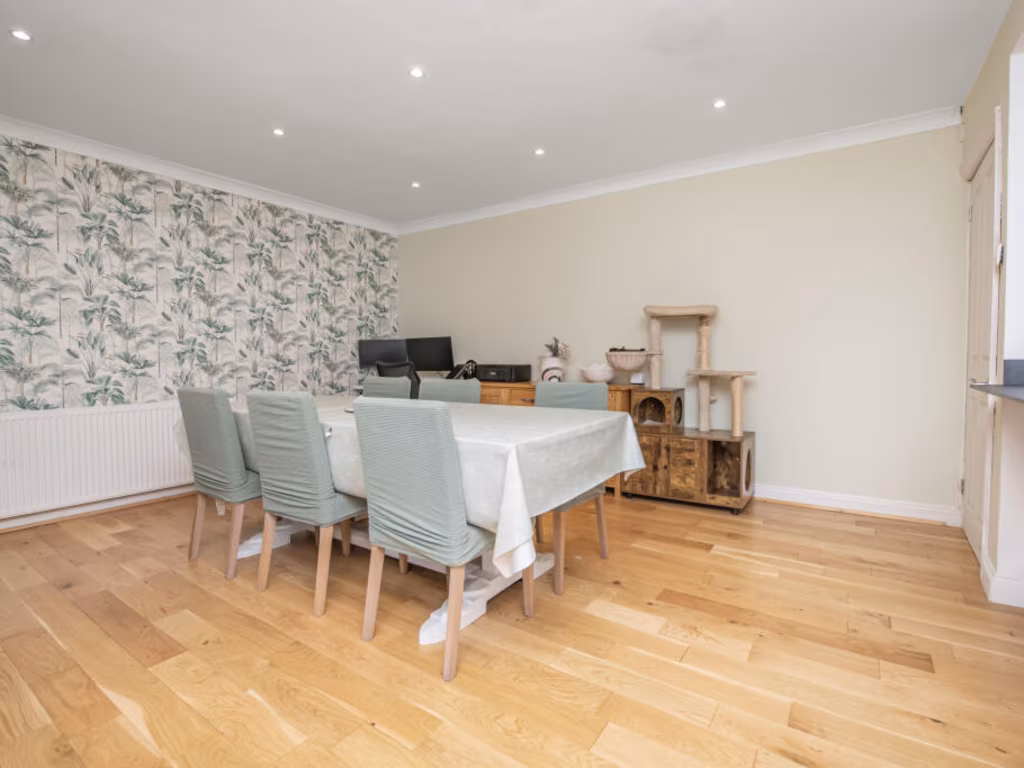
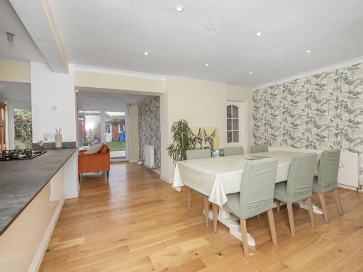
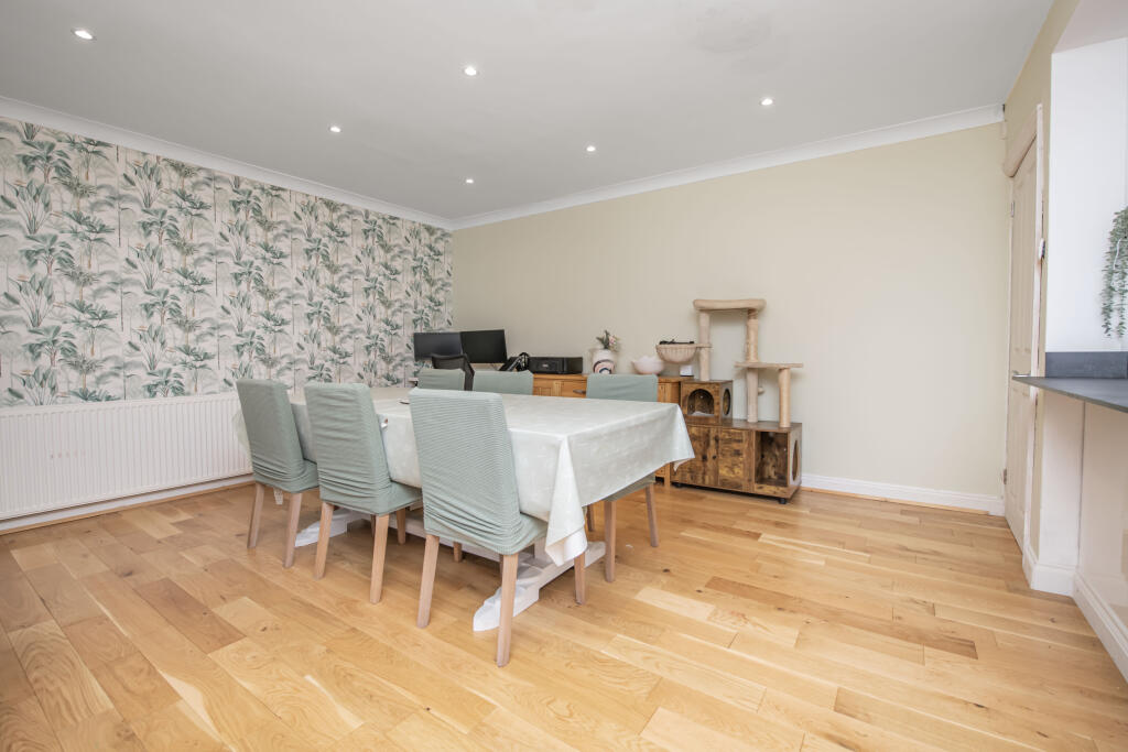
- Dining Room:
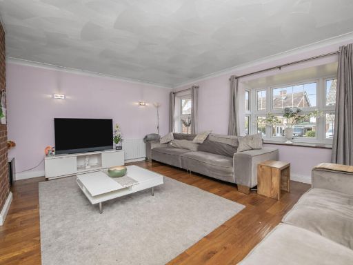
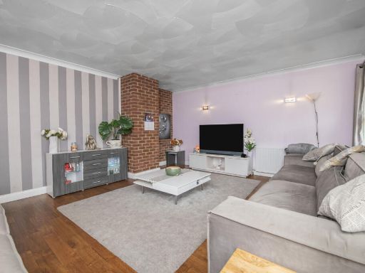
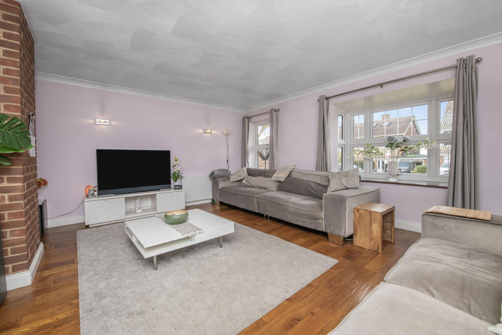
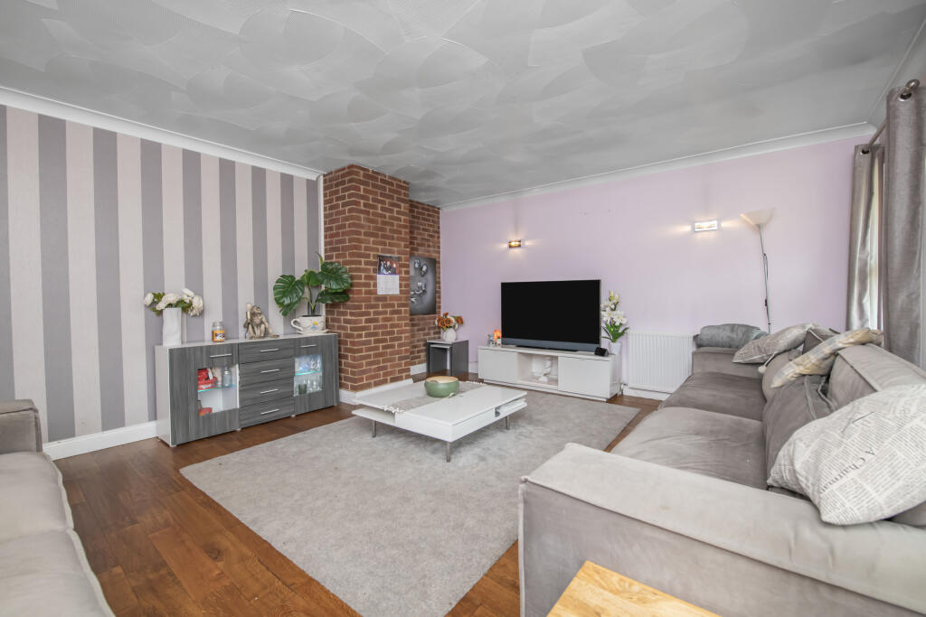
- Lounge:
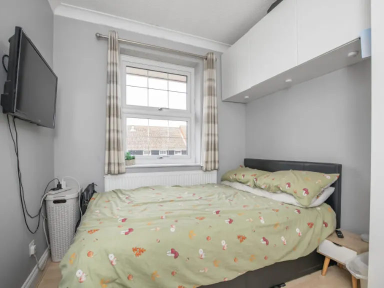
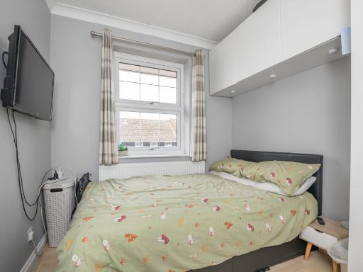
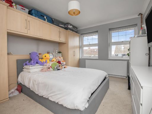
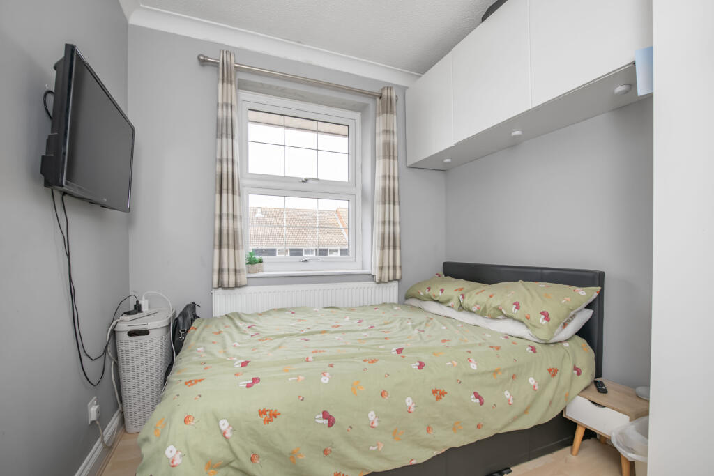
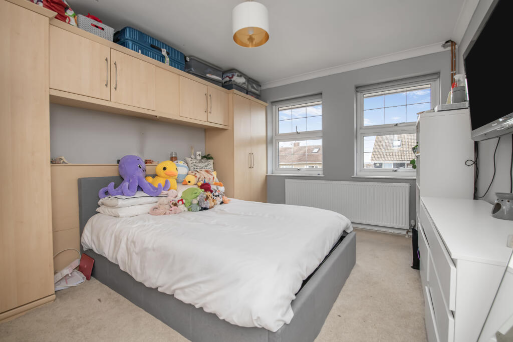
- Bedroom 5:
- Bedroom 3:
- Bedroom 4:
- Bedroom 2:
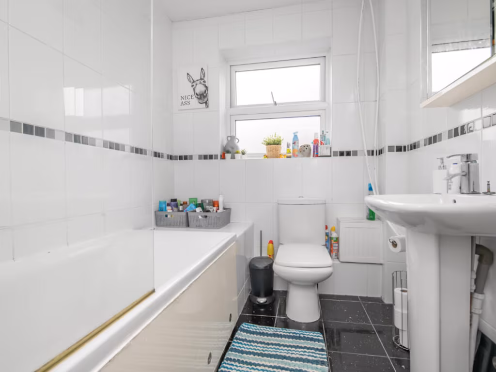
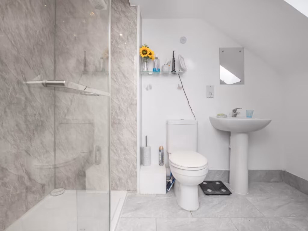
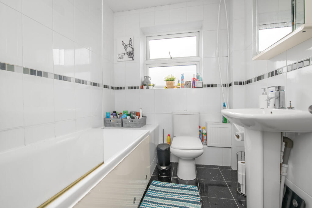
- Bathroom:
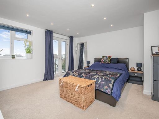
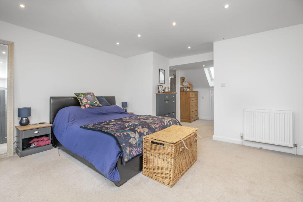
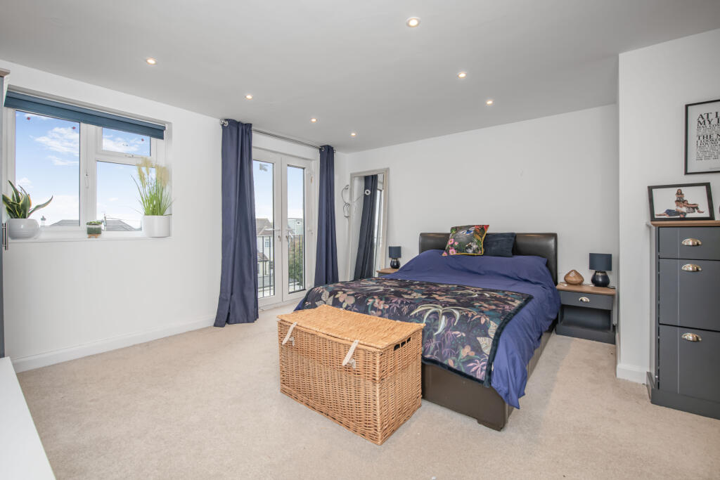
- Bedroom 1:
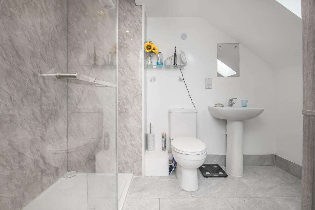
- En-suite:
Textual Property Features
Detected Visual Features
- semi-detached
- brick
- two-story
- post-war
- gable roof
- small garden
- modern windows
- suburban
- backyard
- garden
- patio
- brick building
- outdoor space
- mid-century
- 1950s
- lawn
- fences
- residential
- family home
Nearby Schools
- Orsett Church of England Primary School
- Horndon-On-the-Hill CofE Primary School
- Bulphan Church of England Academy
- Lee Chapel Primary School
- Merrylands Primary School
- East Tilbury Primary School
- Chadwell St Mary Primary School
- Orsett Heath Academy
- Ortu Hassenbrook Academy
- Arthur Bugler Primary School
- Graham James Primary Academy
- Giffards Primary School
- Ortu Gable Hall School
- Great Berry Primary School
- The James Hornsby School
- Stanford-Le-Hope Primary School
- St Joseph's Catholic Primary School
- Abbots Hall Primary School
- Millhouse Primary School
- The Gateway Primary Free School
- St Clere's School
- Janet Duke Primary School
- The Phoenix Primary School
- The Gateway Academy
- Herringham Primary Academy
- Woodside Academy
Nearest General Shops
- Id: 6622042277
- Tags:
- Name: Prime Cuts
- Shop: butcher
- TagsNormalized:
- Lat: 51.5153635
- Lon: 0.4251545
- FullGeoHash: u10m1djddzf1
- PartitionGeoHash: u10m
- Images:
- FoodStandards: null
- Distance: 1757.6
,- Id: 6622042274
- Tags:
- Name: Launderette
- Shop: laundry
- TagsNormalized:
- Lat: 51.5151701
- Lon: 0.4249538
- FullGeoHash: u10m1dj3w5sx
- PartitionGeoHash: u10m
- Images:
- FoodStandards: null
- Distance: 1757.4
,- Id: 6622042275
- Tags:
- TagsNormalized:
- Lat: 51.5152135
- Lon: 0.4249913
- FullGeoHash: u10m1dj3z5b6
- PartitionGeoHash: u10m
- Images:
- FoodStandards: null
- Distance: 1757
}
Nearest Grocery shops
- Id: 9624679333
- Tags:
- Brand: Londis
- Brand:wikidata: Q21008564
- Brand:wikipedia: en:Londis (United Kingdom)
- Name: Londis
- Shop: convenience
- TagsNormalized:
- Lat: 51.5137503
- Lon: 0.4198158
- FullGeoHash: u10m19c9q7j6
- PartitionGeoHash: u10m
- Images:
- FoodStandards: null
- Distance: 1578.1
,- Id: 254760429
- Tags:
- Addr:
- City: Orsett
- Postcode: RM16 3AY
- Street: A13 Eastbound
- Brand: M&S Simply Food
- Brand:wikidata: Q714491
- Brand:wikipedia: en:Marks & Spencer
- Building: yes
- Name: M&S Simply Food
- Opening_hours: 24/7
- Opening_hours:covid19: same
- Operator: Marks and Spencer PLC
- Payment:
- BP_mobile_app: yes
- Cash: yes
- Credit_cards: yes
- Debit_cards: yes
- Phone: +44 1375 678478
- Shop: convenience
- Source:
- Addr:
- Postcode: code-point_open
- Website: https://www.marksandspencer.com/
- TagsNormalized:
- m&s simply food
- food
- convenience
- shop
- Lat: 51.5116156
- Lon: 0.3999347
- FullGeoHash: u10m117hzjhu
- PartitionGeoHash: u10m
- Images:
- FoodStandards: null
- Distance: 1371.6
,- Id: 5987609379
- Tags:
- Name: Country Fayre
- Shop: convenience
- TagsNormalized:
- Lat: 51.5238464
- Lon: 0.4056801
- FullGeoHash: u10m15xkjj15
- PartitionGeoHash: u10m
- Images:
- FoodStandards: null
- Distance: 143.7
}
Nearest Supermarkets
- Id: 579547565
- Tags:
- Brand: Morrisons
- Brand:wikidata: Q922344
- Brand:wikipedia: en:Morrisons
- Building: yes
- Contact:
- Website: https://my.morrisons.com/storefinder/486
- Designation: WM Morrisons
- Name: Morrisons
- Shop: supermarket
- TagsNormalized:
- Lat: 51.5252972
- Lon: 0.4464716
- FullGeoHash: u10m45vhee93
- PartitionGeoHash: u10m
- Images:
- FoodStandards: null
- Distance: 2970.4
,- Id: 97973555
- Tags:
- Addr:
- City: Stanford Le Hope
- Postcode: SS17 7DZ
- Street: The Sorrells
- Brand: Co-op Food
- Brand:wikidata: Q3277439
- Brand:wikipedia: en:Co-op Food
- Name: Co-op Food
- Operator: Chelmsford Star Co-operative Society
- Shop: supermarket
- TagsNormalized:
- co-op
- co-op food
- food
- supermarket
- shop
- Lat: 51.5193435
- Lon: 0.4435799
- FullGeoHash: u10m44g1bjtn
- PartitionGeoHash: u10m
- Images:
- FoodStandards: null
- Distance: 2808.3
,- Id: 159639463
- Tags:
- Addr:
- City: Stanford-Le-Hope
- Housenumber: 9-15
- Postcode: SS17 0HD
- Street: High Street
- Brand: Co-op Food
- Brand:wikidata: Q3277439
- Brand:wikipedia: en:Co-op Food
- Building: yes
- Name: Co-op Food
- Opening_hours: Mo-Sa 07:00-22:00; Su 07:30-22:00
- Opening_hours:covid19: same
- Operator: The Co-operative Group
- Operator:wikidata: Q117202
- Phone: +44 1375 672733
- Shop: supermarket
- Website: https://www.coop.co.uk/
- TagsNormalized:
- co-op
- co-op food
- food
- supermarket
- shop
- Lat: 51.5151649
- Lon: 0.4266591
- FullGeoHash: u10m1dn9tfu0
- PartitionGeoHash: u10m
- Images:
- FoodStandards: null
- Distance: 1857.9
}
Nearest Religious buildings
- Id: 500205220
- Tags:
- Amenity: place_of_worship
- Building: yes
- Source: OS OpenMap Local
- TagsNormalized:
- Lat: 51.5186468
- Lon: 0.4272286
- FullGeoHash: u10m1dxjg5ud
- PartitionGeoHash: u10m
- Images:
- FoodStandards: null
- Distance: 1729.4
,- Id: 274269870
- Tags:
- Amenity: community_centre
- Name: Methodist Church Youth Hall
- TagsNormalized:
- community centre
- church
- methodist
- Lat: 51.5251017
- Lon: 0.4059626
- FullGeoHash: u10m15ze7x5e
- PartitionGeoHash: u10m
- Images:
- FoodStandards: null
- Distance: 222.5
,- Id: 145494222
- Tags:
- Amenity: place_of_worship
- Building: church
- Denomination: anglican
- Name: St Peter and St Paul, Horndon on the Hill
- Religion: christian
- Wikidata: Q17528013
- TagsNormalized:
- place of worship
- church
- anglican
- paul
- christian
- Lat: 51.5239237
- Lon: 0.4048068
- FullGeoHash: u10m15wu8etb
- PartitionGeoHash: u10m
- Images:
- FoodStandards: null
- Distance: 85.4
}
Nearest Medical buildings
- Id: 661612059
- Tags:
- Amenity: doctors
- Building: yes
- Healthcare: doctor
- Name: Hassengate Medical Centre
- TagsNormalized:
- doctor
- doctors
- health
- healthcare
- Lat: 51.5204243
- Lon: 0.4283247
- FullGeoHash: u10m1epbhxnn
- PartitionGeoHash: u10m
- Images:
- FoodStandards: null
- Distance: 1749.2
,- Id: 719938405
- Tags:
- Amenity: pharmacy
- Building: yes
- Dispensing: yes
- Healthcare: pharmacy
- Name: Hassengate Pharmacy
- TagsNormalized:
- Lat: 51.5205681
- Lon: 0.4283611
- FullGeoHash: u10m1epcj9cp
- PartitionGeoHash: u10m
- Images:
- FoodStandards: null
- Distance: 1748.3
,- Id: 891392592
- Tags:
- Addr:
- City: Orsett
- Postcode: RM16 3BH
- Street: Orsett Road
- Amenity: animal_shelter
- Animal_shelter: wildlife
- Building: yes
- Email: info@southessexwildlife.org.uk
- Facebook: https://www.facebook.com/southessexwildlife
- Name: South Essex Wildlife Hospital
- Note: Please phone the centre before turning up so they are prepared. Any animal injured, sick or trapped is AN EMERGENCY. Please phone for advice immediately, not the next day. They will tell you what to do and where to bring the animal.
- Opening_hours: 24/7
- Opening_hours:covid19: same
- Phone: +44 1375 893893
- Purpose: release
- Website: https://southessexwildlife.org/
- TagsNormalized:
- animal shelter
- shelter
- hospital
- Lat: 51.5157828
- Lon: 0.3859992
- FullGeoHash: u10m0f1j4mvy
- PartitionGeoHash: u10m
- Images:
- FoodStandards: null
- Distance: 1505.7
,- Id: 274269875
- Tags:
- Amenity: doctors
- Name: The Surgery
- TagsNormalized:
- Lat: 51.5234298
- Lon: 0.4059533
- FullGeoHash: u10m15x9erkw
- PartitionGeoHash: u10m
- Images:
- FoodStandards: null
- Distance: 165.7
}
Nearest Airports
- Id: 103894219
- Tags:
- Aerodrome: international
- Aeroway: aerodrome
- Iata: SEN
- Icao: EGMC
- Name: London Southend Airport
- Old_name: Southend Municipal Airport
- Ref: SEN
- Wikidata: Q1415441
- TagsNormalized:
- airport
- international airport
- Lat: 51.5701749
- Lon: 0.6924624
- FullGeoHash: u10mru04p937
- PartitionGeoHash: u10m
- Images:
- FoodStandards: null
- Distance: 20630.5
,- Id: 121158889
- Tags:
- Aerodrome: continental
- Aeroway: aerodrome
- Fhrs:
- Authority: City of London Corporation
- Iata: LCY
- Icao: EGLC
- Name: London City Airport
- Operator: London City Airport Limited
- Ref: LCY
- Website: https://www.londoncityairport.com/
- Wikidata: Q8982
- Wikipedia: en:London City Airport
- TagsNormalized:
- airport
- continental airport
- Lat: 51.5042658
- Lon: 0.0539987
- FullGeoHash: u10j10p64702
- PartitionGeoHash: u10j
- Images:
- FoodStandards: null
- Distance: 24289.5
}
Nearest Leisure Facilities
- Id: 1117949386
- Tags:
- TagsNormalized:
- swimming
- swimming pool
- pool
- leisure
- Lat: 51.5311348
- Lon: 0.3877632
- FullGeoHash: u10m0ufqeec0
- PartitionGeoHash: u10m
- Images:
- FoodStandards: null
- Distance: 1370.6
,- Id: 1103318051
- Tags:
- Leisure: pitch
- Sport: tennis
- TagsNormalized:
- Lat: 51.5191898
- Lon: 0.4065122
- FullGeoHash: u10m16b103j3
- PartitionGeoHash: u10m
- Images:
- FoodStandards: null
- Distance: 544
,- Id: 23110166
- Tags:
- Leisure: pitch
- Sport: tennis
- TagsNormalized:
- Lat: 51.5222751
- Lon: 0.3970199
- FullGeoHash: u10m153550pq
- PartitionGeoHash: u10m
- Images:
- FoodStandards: null
- Distance: 484
,- Id: 18721
- Tags:
- Leisure: park
- Name: Horndon
- Type: multipolygon
- TagsNormalized:
- Lat: 51.5231002
- Lon: 0.3972086
- FullGeoHash: u10m153pzdh0
- PartitionGeoHash: u10m
- Images:
- FoodStandards: null
- Distance: 448.5
,- Id: 25159791
- Tags:
- TagsNormalized:
- Lat: 51.5227096
- Lon: 0.3983853
- FullGeoHash: u10m156je11w
- PartitionGeoHash: u10m
- Images:
- FoodStandards: null
- Distance: 379.1
}
Nearest Tourist attractions
- Id: 343354569
- Tags:
- Amenity: cafe
- Information: office
- Name: Plotlands Visitor Centre
- Operator: Essex Wildlife Trust
- Tourism: information
- TagsNormalized:
- Lat: 51.5608417
- Lon: 0.3929624
- FullGeoHash: u10m2fq5stw1
- PartitionGeoHash: u10m
- Images:
- FoodStandards: null
- Distance: 4191.1
,- Id: 60874521
- Tags:
- Amenity: pub
- Name: Ye Olde Plough House
- Tourism: motel
- TagsNormalized:
- Lat: 51.553197
- Lon: 0.3667253
- FullGeoHash: u10m22gp1k6n
- PartitionGeoHash: u10m
- Images:
- FoodStandards: null
- Distance: 4151.9
,- Id: 4936961022
- Tags:
- Name: Walton Hall Farm
- Name:en: Walton Hall Farm
- Tourism: caravan_site
- TagsNormalized:
- Lat: 51.4950204
- Lon: 0.4132757
- FullGeoHash: u10kcqkunp89
- PartitionGeoHash: u10k
- Images:
- FoodStandards: null
- Distance: 3262.4
}
Nearest Train stations
- Id: 2008923738
- Tags:
- Name: West Horndon
- Naptan:
- Network: National Rail
- Public_transport: station
- Railway: station
- Ref:
- Wikidata: Q1808174
- Wikipedia: en:West Horndon railway station
- TagsNormalized:
- Lat: 51.5678537
- Lon: 0.3406801
- FullGeoHash: u10jrg8hd2tm
- PartitionGeoHash: u10j
- Images:
- FoodStandards: null
- Distance: 6557.5
,- Id: 2008917061
- Tags:
- Name: Basildon
- Name:lt: Bazildonas
- Naptan:
- Network: National Rail
- Public_transport: station
- Railway: station
- Ref:
- Wheelchair: yes
- Wikidata: Q2752701
- Wikipedia: en:Basildon railway station
- TagsNormalized:
- Lat: 51.5681417
- Lon: 0.4567961
- FullGeoHash: u10m67swhn7g
- PartitionGeoHash: u10m
- Images:
- FoodStandards: null
- Distance: 6156.8
,- Id: 6733268329
- Tags:
- Name: Laindon
- Naptan:
- Network: National Rail
- Public_transport: station
- Railway: station
- Ref:
- Source: NPE
- Wheelchair: yes
- Wikidata: Q2801845
- Wikipedia: en:Laindon railway station
- TagsNormalized:
- Lat: 51.5675954
- Lon: 0.4237157
- FullGeoHash: u10m3ese1292
- PartitionGeoHash: u10m
- Images:
- FoodStandards: null
- Distance: 5071.2
,- Id: 6735092345
- Tags:
- Name: East Tilbury
- Naptan:
- Network: National Rail
- Operator: c2c
- Public_transport: station
- Railway: station
- Ref:
- Wikidata: Q2487544
- Wikipedia: en:East Tilbury railway station
- TagsNormalized:
- Lat: 51.4845202
- Lon: 0.4127175
- FullGeoHash: u10kckkx140m
- PartitionGeoHash: u10k
- Images:
- FoodStandards: null
- Distance: 4406
,- Id: 6735092344
- Tags:
- Name: Stanford-le-Hope
- Naptan:
- Network: National Rail
- Operator: c2c
- Public_transport: station
- Railway: station
- Ref:
- Wikidata: Q2062756
- Wikipedia: en:Stanford-le-Hope railway station
- TagsNormalized:
- Lat: 51.5141935
- Lon: 0.4229093
- FullGeoHash: u10m19ggyt8j
- PartitionGeoHash: u10m
- Images:
- FoodStandards: null
- Distance: 1705.7
}
Nearest Hotels
- Id: 121238688
- Tags:
- Brand: Travelodge
- Brand:wikidata: Q9361374
- Brand:wikipedia: en:Travelodge UK
- Building: yes
- Name: Travelodge
- Tourism: hotel
- TagsNormalized:
- Lat: 51.5800253
- Lon: 0.3546221
- FullGeoHash: u10m2jf5rm97
- PartitionGeoHash: u10m
- Images:
- FoodStandards: null
- Distance: 7116.7
,- Id: 29998396
- Tags:
- Brand: Park Inn
- Brand:wikidata: Q60711675
- Brand:wikipedia: ru:Park Inn by Radisson
- Name: Park Inn
- Tourism: hotel
- TagsNormalized:
- Lat: 51.500477
- Lon: 0.3133362
- FullGeoHash: u10hzpkhj28r
- PartitionGeoHash: u10h
- Images:
- FoodStandards: null
- Distance: 6761.4
,- Id: 29012772
- Tags:
- Addr:
- City: Orsett
- Housename: Orsett Hall Hotel
- Postcode: RM16 3HS
- Street: Prince Charles Avenue
- Amenity: restaurant
- Amenity_1: spa
- Name: Orsett Hall
- Phone: +44 1375 891402
- Tourism: hotel
- Website: http://www.orsetthall.co.uk/
- Wikidata: Q15264369
- Wikipedia: en:Orsett Hall
- TagsNormalized:
- Lat: 51.5158749
- Lon: 0.3779297
- FullGeoHash: u10m0d5jwrhg
- PartitionGeoHash: u10m
- Images:
- FoodStandards: null
- Distance: 1980.2
}
Tags
- semi-detached
- brick
- two-story
- post-war
- gable roof
- small garden
- modern windows
- suburban
- backyard
- garden
- patio
- brick building
- outdoor space
- mid-century
- 1950s
- lawn
- fences
- residential
- family home
Local Market Stats
- Average Price/sqft: £378
- Avg Income: £46700
- Rental Yield: 4.1%
- Social Housing: 9%
- Planning Success Rate: 76%
Similar Properties
 4 bedroom detached house for sale in Romagne Close, Horndon-On-The-Hill, SS17 — £600,000 • 4 bed • 3 bath • 1432 ft²
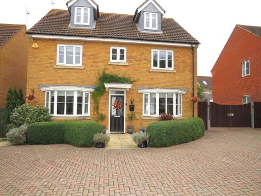 5 bedroom detached house for sale in Daltons Shaw, Orsett Village, RM16 — £795,000 • 5 bed • 3 bath • 2197 ft²
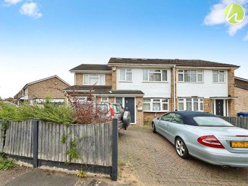 5 bedroom semi-detached house for sale in Northlands Close, Stanford-Le-Hope, SS17 — £500,000 • 5 bed • 4 bath
 4 bedroom detached house for sale in Rowan Close, Rayleigh, SS6 — £650,000 • 4 bed • 3 bath • 2272 ft²
 3 bedroom semi-detached house for sale in Mill Lane, Horndon-on-the-Hill, SS17 — £450,000 • 3 bed • 2 bath • 1037 ft²
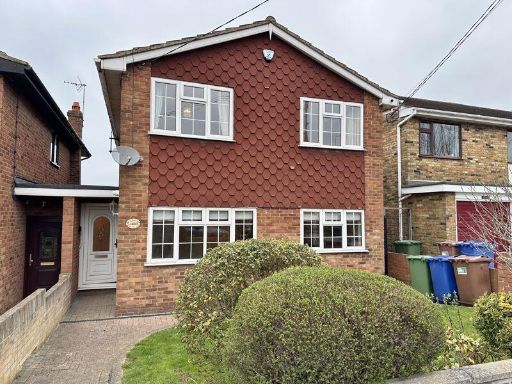 4 bedroom detached house for sale in Horndon-On-The-Hill, SS17 — £595,000 • 4 bed • 1 bath
Meta
- {
"@context": "https://schema.org",
"@type": "Residence",
"name": "5 bedroom end of terrace house for sale in Francis Close, S…",
"description": "",
"url": "https://propertypiper.co.uk/property/00386068-384d-496b-8cb1-2ce17c9116a8",
"image": "https://image-a.propertypiper.co.uk/bf5e4295-ff20-4823-9082-dfd427eaf68b-1024.jpeg",
"address": {
"@type": "PostalAddress",
"streetAddress": "14 FRANCIS CLOSE HORNDON ON THE HILL STANFORD-LE-HOPE",
"postalCode": "SS17 8NT",
"addressLocality": "Thurrock",
"addressRegion": "South Basildon and East Thurrock",
"addressCountry": "England"
},
"geo": {
"@type": "GeoCoordinates",
"latitude": 51.523736935527275,
"longitude": 0.40360987919026214
},
"numberOfRooms": 5,
"numberOfBathroomsTotal": 2,
"floorSize": {
"@type": "QuantitativeValue",
"value": 1709,
"unitCode": "FTK"
},
"offers": {
"@type": "Offer",
"price": 750000,
"priceCurrency": "GBP",
"availability": "https://schema.org/InStock"
},
"additionalProperty": [
{
"@type": "PropertyValue",
"name": "Feature",
"value": "semi-detached"
},
{
"@type": "PropertyValue",
"name": "Feature",
"value": "brick"
},
{
"@type": "PropertyValue",
"name": "Feature",
"value": "two-story"
},
{
"@type": "PropertyValue",
"name": "Feature",
"value": "post-war"
},
{
"@type": "PropertyValue",
"name": "Feature",
"value": "gable roof"
},
{
"@type": "PropertyValue",
"name": "Feature",
"value": "small garden"
},
{
"@type": "PropertyValue",
"name": "Feature",
"value": "modern windows"
},
{
"@type": "PropertyValue",
"name": "Feature",
"value": "suburban"
},
{
"@type": "PropertyValue",
"name": "Feature",
"value": "backyard"
},
{
"@type": "PropertyValue",
"name": "Feature",
"value": "garden"
},
{
"@type": "PropertyValue",
"name": "Feature",
"value": "patio"
},
{
"@type": "PropertyValue",
"name": "Feature",
"value": "brick building"
},
{
"@type": "PropertyValue",
"name": "Feature",
"value": "outdoor space"
},
{
"@type": "PropertyValue",
"name": "Feature",
"value": "mid-century"
},
{
"@type": "PropertyValue",
"name": "Feature",
"value": "1950s"
},
{
"@type": "PropertyValue",
"name": "Feature",
"value": "lawn"
},
{
"@type": "PropertyValue",
"name": "Feature",
"value": "fences"
},
{
"@type": "PropertyValue",
"name": "Feature",
"value": "residential"
},
{
"@type": "PropertyValue",
"name": "Feature",
"value": "family home"
}
]
}
High Res Floorplan Images
Compatible Floorplan Images
FloorplanImages Thumbnail