DT1 3SU - 2 bedroom apartment for sale in North East Quadrant, Poundb…
View on Property Piper
2 bedroom apartment for sale in North East Quadrant, Poundbury,
DT1 3SU, DT1
Property Details
- Price: £275000
- Bedrooms: 2
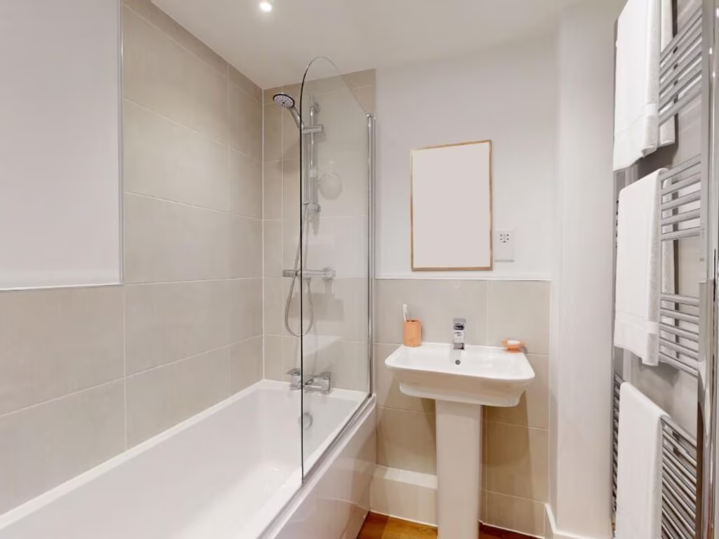
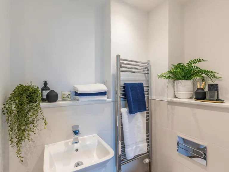
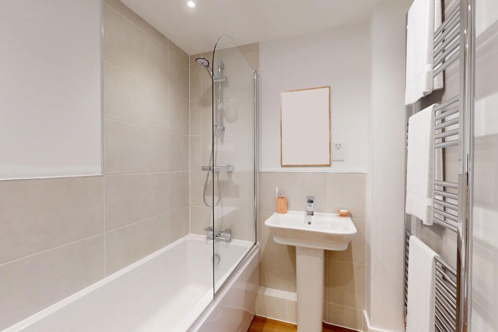
- Bathrooms: 2
- Property Type: undefined
- Property SubType: undefined
Brochure Descriptions
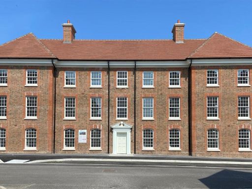
- The property is part of an exclusive collection of 31 contemporary apartments located in the North East Quadrant of a development in Poundbury. The apartments vary in size with options for 1, 2, and 3 bedrooms. The setting is described as vibrant and is part of an exceptional development on the outskirts of Dorchester, potentially offering expansive views depending on location within the development.
- A newly built, detached three-story home with a classic design, featuring a pale yellow exterior and multiple chimneys. The house has a symmetric, clean frontage with multiple windows and a central primary entrance. It is surrounded by a thoughtfully landscaped garden, enclosed in an ornate black metal fence, which gives it a formal and welcoming outlook. The garden size appears average, suitable for a family home, and the property is located in a suburban environment, as indicated by the presence of neighboring houses and shared architectural styles.
Image Descriptions
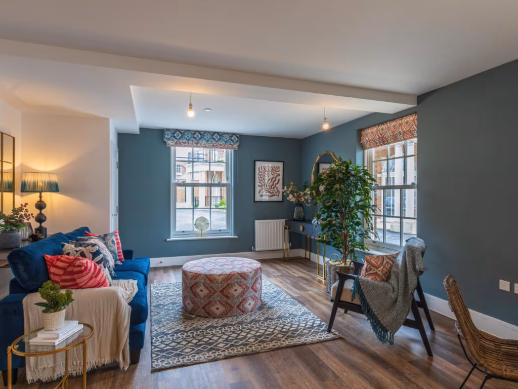
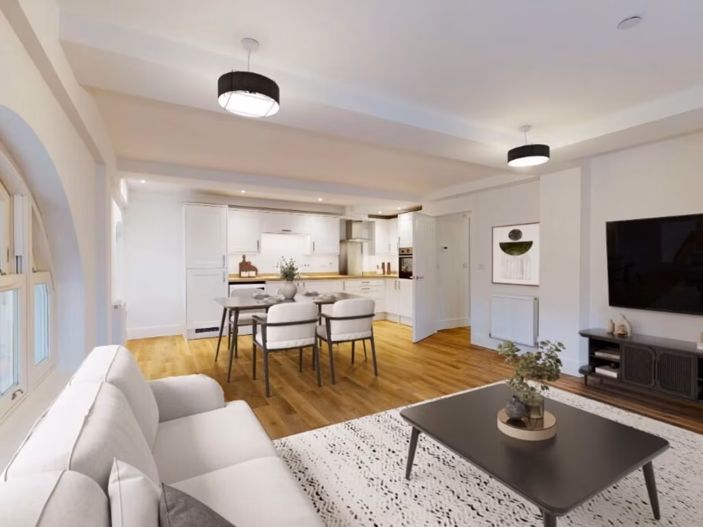
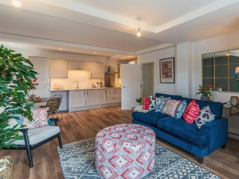
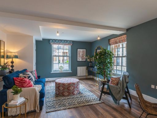
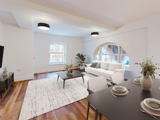
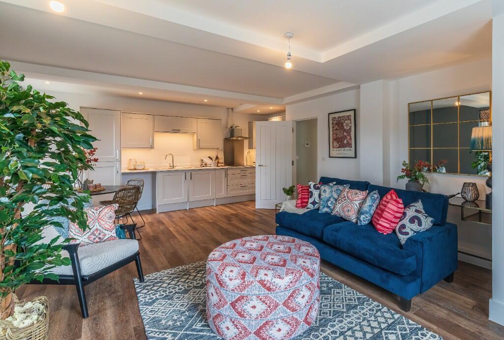
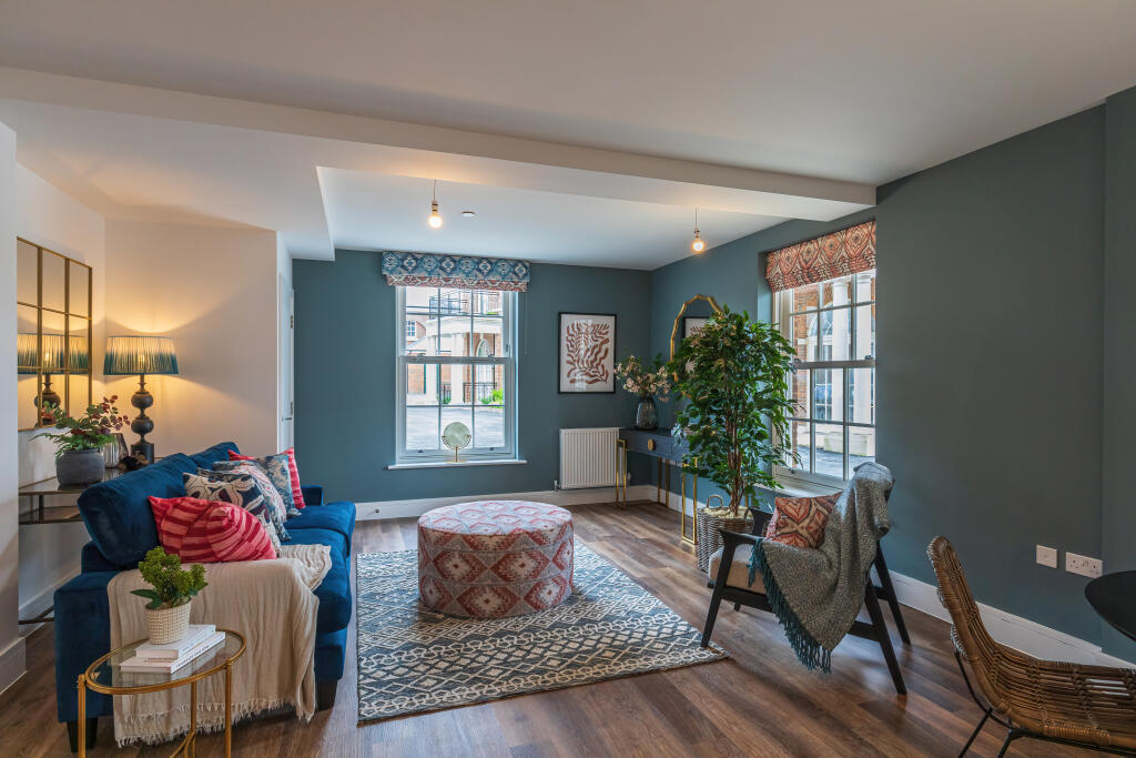
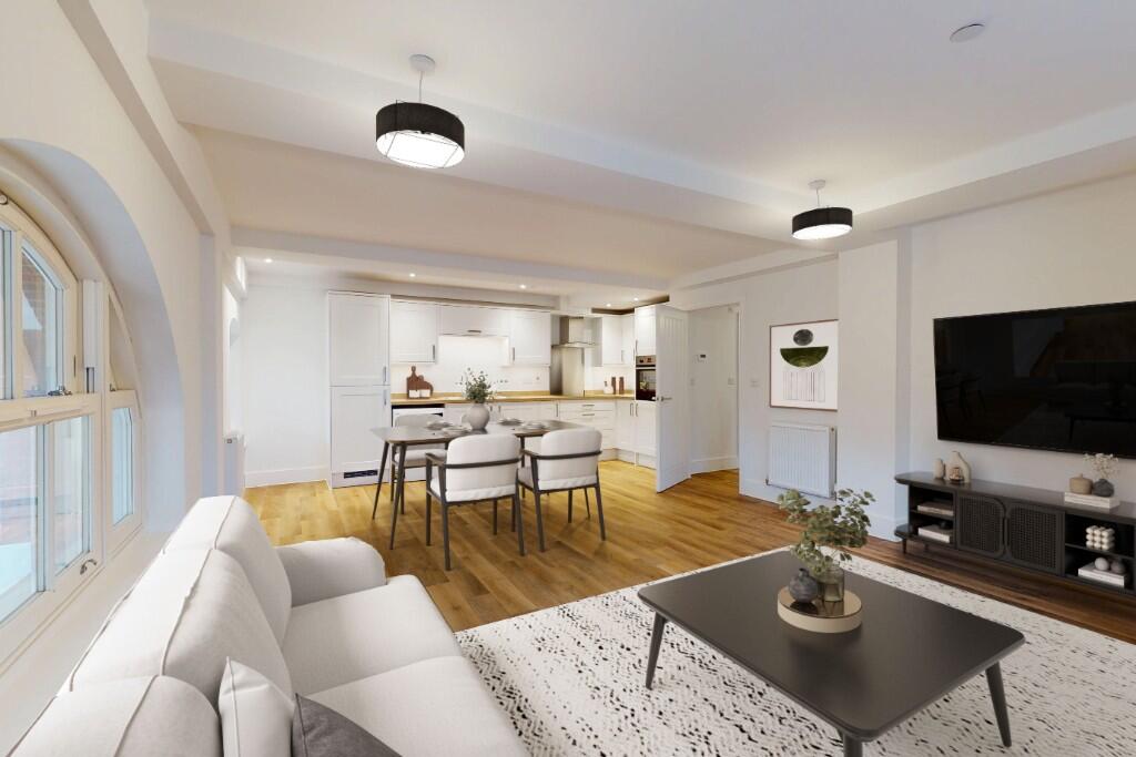
- open plan kitchen and living room modern
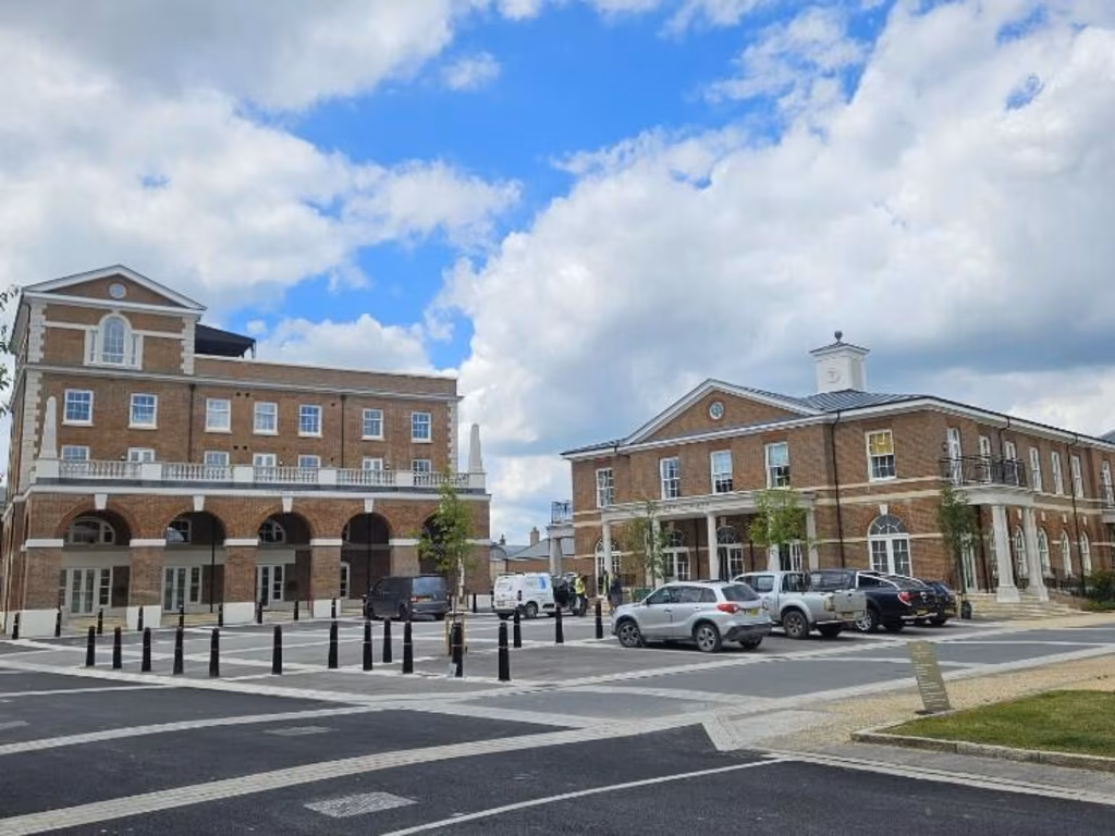
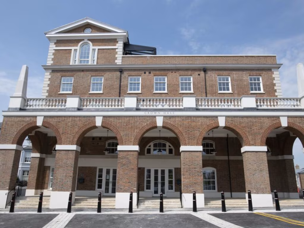
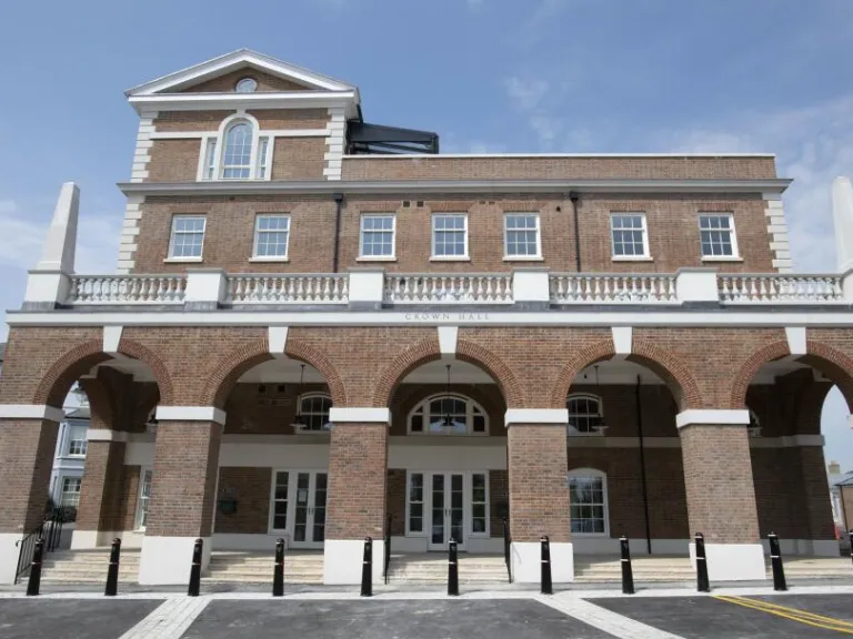
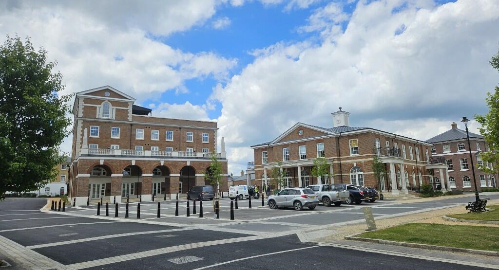
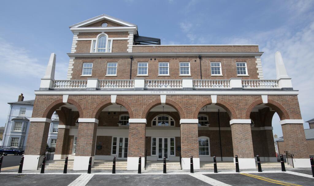
- commercial area Georgian-style
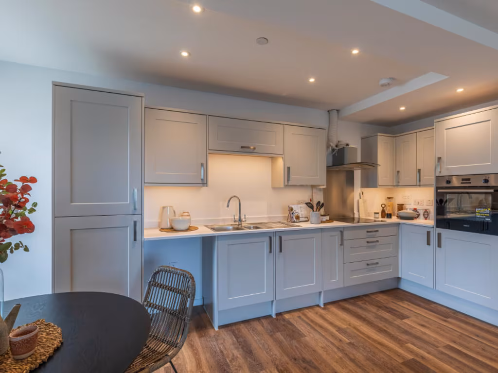
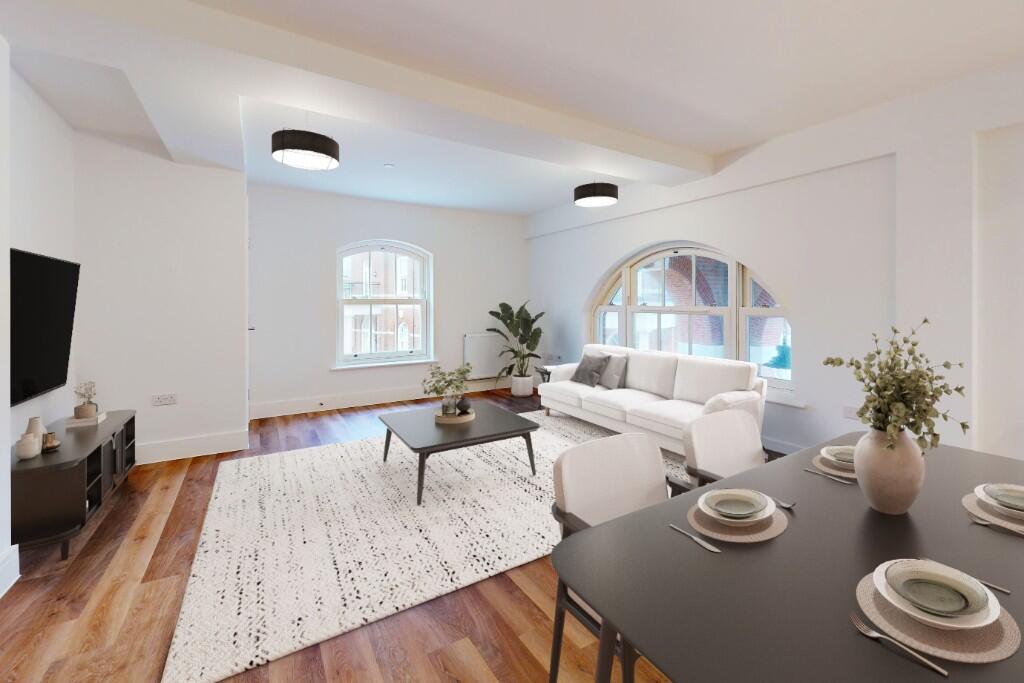
- kitchen contemporary
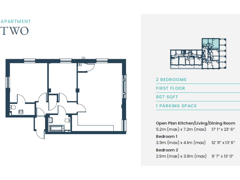
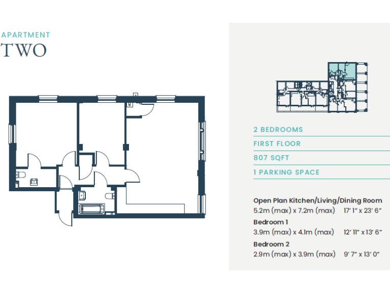
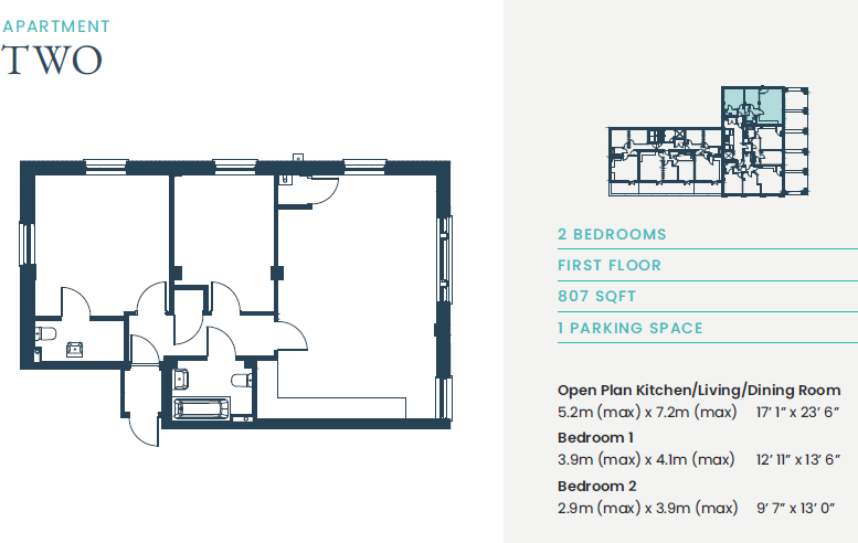
Floorplan Description
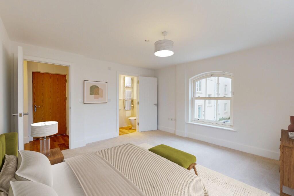
- A first-floor apartment with 2 bedrooms and an open plan kitchen/living/dining area.
Rooms
- Open Plan Kitchen/Living/Dining Room: large
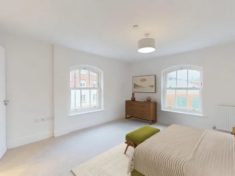
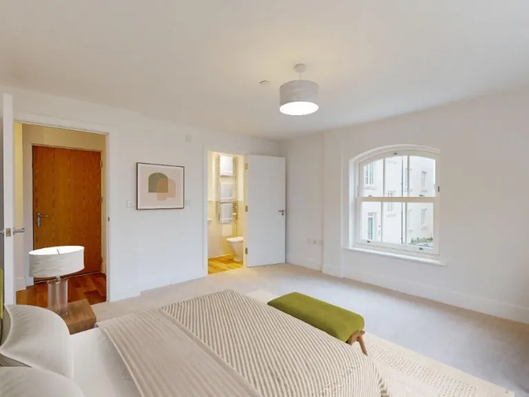
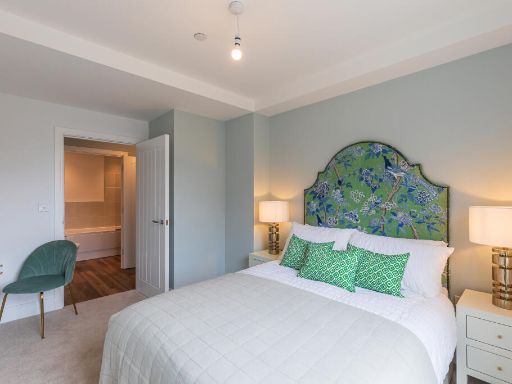
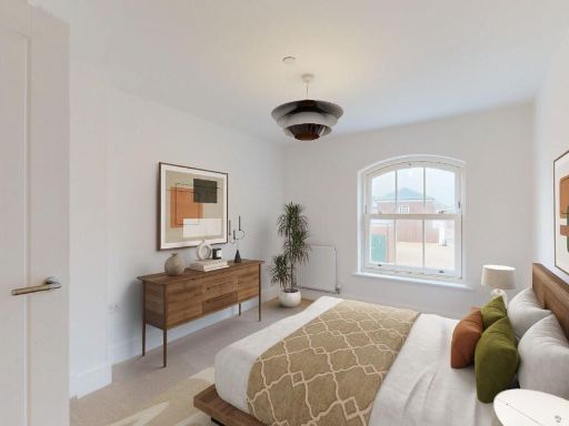
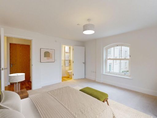
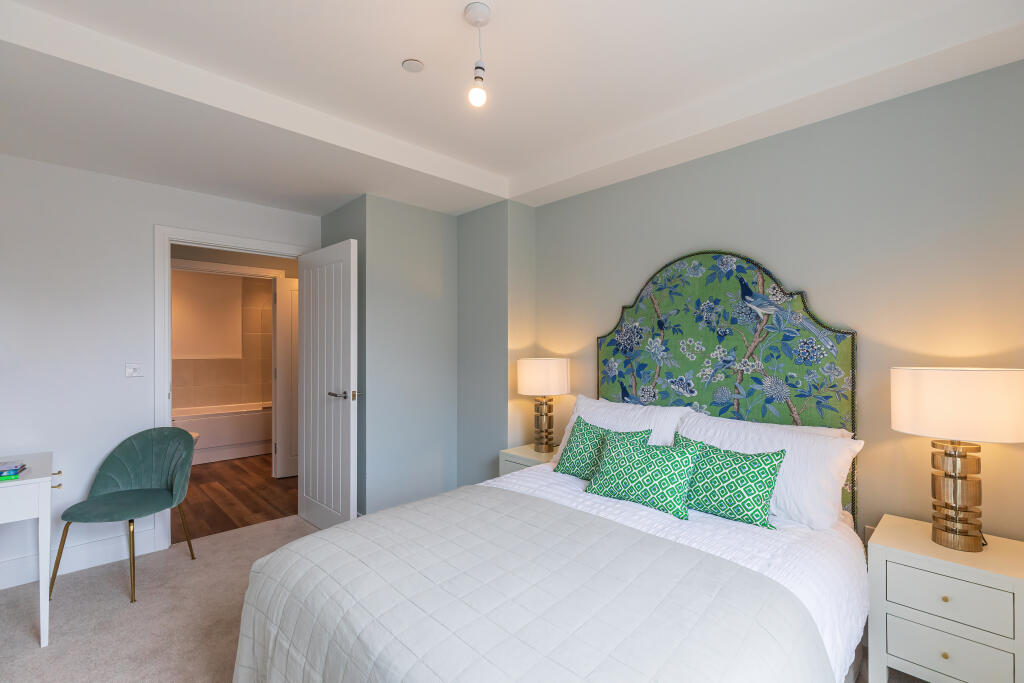
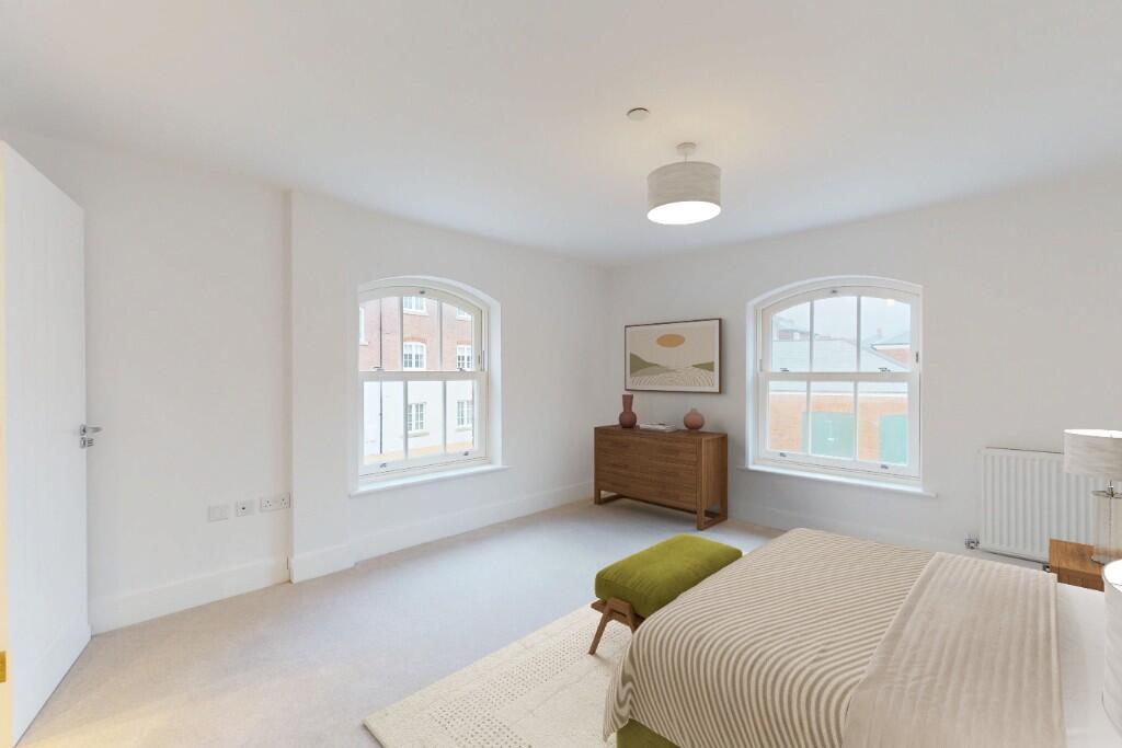
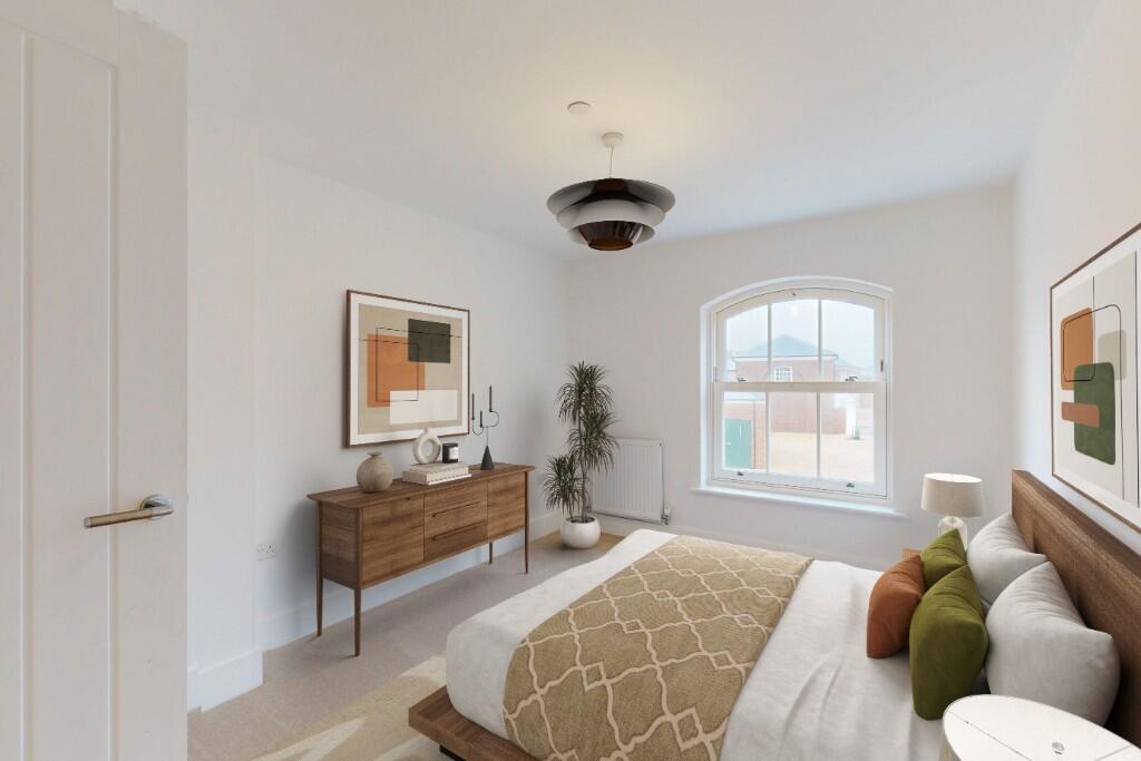
- Bedroom 1: average
- Bedroom 2: average
Textual Property Features
Detected Visual Features
- open plan
- kitchen
- living room
- modern
- wood flooring
- integrated appliances
- recessed lighting
- contemporary
- Georgian-style
- commercial area
- brick facade
- arched windows
- parking area
- balcony
- urban location
- modern cabinets
- LED lighting
- hardwood flooring
Nearby Schools
- St Nicholas and St Laurence Church of England Primary School
- Portesham Church of England Primary School
- Broadmayne First School
- The Prince of Wales School
- Manor Park Church of England First School
- Winterbourne Valley Church of England Aided First School
- Dorset Studio School
- The Thomas Hardye School
- Wey Valley Academy
- Bincombe Valley Primary School
- St Andrew's Church of England Primary School
- St Osmund's Church of England Middle School
- Dorchester Middle School
- St Mary's Catholic First School, Dorchester
- Sunninghill Preparatory School
- Damers First School
- St Mary's Church of England First School, Charminster
Nearest Bars And Restaurants
- Id: 592310336
- Tags:
- Addr:
- Housename: The Buttercross
- Amenity: cafe
- Building: yes
- Cuisine: coffee_shop
- Name: Finca
- TagsNormalized:
- Lat: 50.7122878
- Lon: -2.466019
- FullGeoHash: gcn0rzuk3xdu
- PartitionGeoHash: gcn0
- Images:
- FoodStandards: null
- Distance: 436.1
,- Id: 9471886350
- Tags:
- Amenity: cafe
- Name: Honey Bee Cafe
- TagsNormalized:
- Lat: 50.7117792
- Lon: -2.4662649
- FullGeoHash: gcn0rzu1ebgd
- PartitionGeoHash: gcn0
- Images:
- FoodStandards: null
- Distance: 435
,- Id: 9467372787
- Tags:
- Amenity: cafe
- Internet_access: yes
- Name: Store 6
- Website: https://www.store6.uk/
- TagsNormalized:
- Lat: 50.7123513
- Lon: -2.4666174
- FullGeoHash: gcn0rzgugeky
- PartitionGeoHash: gcn0
- Images:
- FoodStandards: null
- Distance: 393.5
,- Id: 9469674227
- Tags:
- Amenity: cafe
- Name: Bonjour Café
- TagsNormalized:
- Lat: 50.7127269
- Lon: -2.4669012
- FullGeoHash: gcn0rzgxj13p
- PartitionGeoHash: gcn0
- Images:
- FoodStandards: null
- Distance: 366.9
,- Id: 133022642
- Tags:
- Addr:
- City: Dorchester
- Postcode: DT2 9DL
- Street: Bridport Road
- Amenity: fast_food
- Brand: McDonald's
- Brand:wikidata: Q38076
- Brand:wikipedia: en:McDonald's
- Building: yes
- Contact:
- Website: https://www.mcdonalds.com/gb/en-gb/location/dorchester/dorchester/bridport-road/8261003.html
- Cuisine: burger
- Delivery: no
- Drive_through: no
- Name: McDonald's
- Opening_hours: 24/7
- Smoking: outside
- Takeaway: yes
- TagsNormalized:
- fast food
- food
- mcdonalds
- burgers
- takeaway
- Lat: 50.7117356
- Lon: -2.4744768
- FullGeoHash: gcn0rxy1k88q
- PartitionGeoHash: gcn0
- Images:
- FoodStandards: null
- Distance: 227.2
}
Nearest General Shops
- Id: 9469674222
- Tags:
- Name: Brace
- Shop: butcher
- Website: braceofbutchers.co.uk
- TagsNormalized:
- Lat: 50.7151044
- Lon: -2.4670666
- FullGeoHash: gcn0xb7schtv
- PartitionGeoHash: gcn0
- Images:
- FoodStandards: null
- Distance: 417.2
,- Id: 9471897496
- Tags:
- Name: Bella Kitchens
- Shop: kitchen
- TagsNormalized:
- Lat: 50.7123601
- Lon: -2.4663817
- FullGeoHash: gcn0rzuhcjhe
- PartitionGeoHash: gcn0
- Images:
- FoodStandards: null
- Distance: 409.5
,- Id: 9469674228
- Tags:
- Name: Hardy Barbers
- Shop: hairdresser
- TagsNormalized:
- Lat: 50.7126124
- Lon: -2.4668847
- FullGeoHash: gcn0rzgwmkjk
- PartitionGeoHash: gcn0
- Images:
- FoodStandards: null
- Distance: 369.7
}
Nearest Grocery shops
- Id: 2080554653
- Tags:
- Addr:
- Housename: St Martin's Place
- Housenumber: Unit A
- Postcode: DT1 2FB
- Street: Bridport Road
- Brand: Sainsbury's Local
- Brand:wikidata: Q13218434
- Brand:wikipedia: en:Sainsbury's Local
- Name: Sainsbury's Local
- Shop: convenience
- TagsNormalized:
- sainsburys
- sainsburys local
- convenience
- shop
- Lat: 50.7138808
- Lon: -2.4479045
- FullGeoHash: gcn2821mz8w4
- PartitionGeoHash: gcn2
- Images:
- FoodStandards: null
- Distance: 1704.2
,- Id: 538728569
- Tags:
- Brand: Spar
- Brand:wikidata: Q610492
- Brand:wikipedia: en:Spar (retailer)
- Building: yes
- Name: Poundbury Village Stores
- Operator: SPAR
- Shop: convenience
- TagsNormalized:
- Lat: 50.7105299
- Lon: -2.4573365
- FullGeoHash: gcn22pdd5zvj
- PartitionGeoHash: gcn2
- Images:
- FoodStandards: null
- Distance: 1076.7
,- Id: 812857012
- Tags:
- Brand: Little Waitrose
- Brand:wikidata: Q771734
- Brand:wikipedia: en:Waitrose & Partners
- Building: retail
- Name: Little Waitrose
- Shop: convenience
- TagsNormalized:
- little waitrose
- waitrose
- retail
- convenience
- shop
- Lat: 50.7153096
- Lon: -2.4667582
- FullGeoHash: gcn0xb7y06gv
- PartitionGeoHash: gcn0
- Images:
- FoodStandards: null
- Distance: 447.8
}
Nearest Supermarkets
- Id: 164180188
- Tags:
- Addr:
- City: Dorchester
- Postcode: DT1 1BN
- Street: Tudor Arcade, South Street
- Brand: Waitrose
- Brand:wikidata: Q771734
- Brand:wikipedia: en:Waitrose
- Building: yes
- Name: Waitrose
- Official_name: Waitrose & Partners
- Opening_hours: Mo-Sa 08:00-20:00; Su 10:00-16:00
- Operator: Waitrose & Partners
- Shop: supermarket
- TagsNormalized:
- Lat: 50.7143102
- Lon: -2.4355062
- FullGeoHash: gcn2886828du
- PartitionGeoHash: gcn2
- Images:
- FoodStandards: null
- Distance: 2578.5
,- Id: 120596053
- Tags:
- Addr:
- Postcode: DT1 2RY
- Street: Weymouth Avenue
- Brand: Tesco
- Brand:wikidata: Q487494
- Brand:wikipedia: en:Tesco
- Building: yes
- Contact:
- Website: https://www.tesco.com/store-locator/dorchester/weymouth-ave
- Name: Tesco
- Ref:
- Shop: supermarket
- TagsNormalized:
- Lat: 50.7016842
- Lon: -2.4439958
- FullGeoHash: gcn22muqdybx
- PartitionGeoHash: gcn2
- Images:
- FoodStandards: null
- Distance: 2350
,- Id: 197857808
- Tags:
- Addr:
- Country: GB
- Housenumber: 1
- Postcode: DT1 1XU
- Street: The Grove
- Brand: Lidl
- Brand:wikidata: Q151954
- Brand:wikipedia: en:Lidl
- Building: yes
- Fhrs:
- Name: Lidl
- Shop: supermarket
- TagsNormalized:
- Lat: 50.7182375
- Lon: -2.4409697
- FullGeoHash: gcn282yx1k9p
- PartitionGeoHash: gcn2
- Images:
- FoodStandards:
- Id: 319077
- FHRSID: 319077
- LocalAuthorityBusinessID: 3473
- BusinessName: LIDL UK
- BusinessType: Retailers - supermarkets/hypermarkets
- BusinessTypeID: 7840
- AddressLine1: Lidl The Grove
- AddressLine2: null
- AddressLine3: Dorchester
- AddressLine4: Dorset
- PostCode: DT1 1XU
- RatingValue: 5
- RatingKey: fhrs_5_en-GB
- RatingDate: 2021-05-10
- LocalAuthorityCode: 085
- LocalAuthorityName: Dorset
- LocalAuthorityWebSite: https://www.dorsetcouncil.gov.uk/
- LocalAuthorityEmailAddress: envhealthteamb@dorsetcouncil.gov.uk
- Scores:
- Hygiene: 0
- Structural: 5
- ConfidenceInManagement: 0
- NewRatingPending: false
- Geocode:
- Longitude: -2.44150805473328
- Latitude: 50.71895980834960
- Distance: 2263.4
}
Nearest Religious buildings
- Id: 4677043795
- Tags:
- Amenity: place_of_worship
- Name: The Storehouse Church
- Religion: christian
- TagsNormalized:
- place of worship
- church
- christian
- Lat: 50.7101632
- Lon: -2.4468883
- FullGeoHash: gcn22rd0p7ef
- PartitionGeoHash: gcn2
- Images:
- FoodStandards: null
- Distance: 1803.5
,- Id: 1026862809
- Tags:
- Amenity: place_of_worship
- Building: yes
- Name: Dorchester Community Church
- Religion: christian
- TagsNormalized:
- place of worship
- church
- christian
- Lat: 50.7145252
- Lon: -2.4619532
- FullGeoHash: gcn0xbr382dw
- PartitionGeoHash: gcn0
- Images:
- FoodStandards: null
- Distance: 730.2
,- Id: 532205670
- Tags:
- Amenity: place_of_worship
- Building: church
- Name: The Quiet Space
- Religion: christian
- TagsNormalized:
- place of worship
- church
- christian
- Lat: 50.7139583
- Lon: -2.4670384
- FullGeoHash: gcn0xb5w1z4b
- PartitionGeoHash: gcn0
- Images:
- FoodStandards: null
- Distance: 367.4
}
Nearest Medical buildings
- Id: 93402848
- Tags:
- Amenity: doctors
- Building: yes
- Healthcare: doctor
- Name: Frederick Treves House
- Source:
- Name: OS OpenData StreetView
- TagsNormalized:
- doctor
- doctors
- health
- healthcare
- Lat: 50.7135129
- Lon: -2.4575726
- FullGeoHash: gcn28047wkj0
- PartitionGeoHash: gcn2
- Images:
- FoodStandards: null
- Distance: 1022.4
,- Id: 5812081699
- Tags:
- Amenity: pharmacy
- Brand: Rowlands Pharmacy
- Brand:wikidata: Q62663235
- Dispensing: yes
- Healthcare: pharmacy
- Name: Rowlands Pharmacy
- TagsNormalized:
- pharmacy
- rowlands pharmacy
- health
- healthcare
- Lat: 50.7132667
- Lon: -2.4576673
- FullGeoHash: gcn28046hnn7
- PartitionGeoHash: gcn2
- Images:
- FoodStandards: null
- Distance: 1014.8
,- Id: 9469680737
- Tags:
- Amenity: veterinary
- Name: Castle Vetinary Clinic
- TagsNormalized:
- Lat: 50.7105146
- Lon: -2.4611311
- FullGeoHash: gcn0rzxf5mpd
- PartitionGeoHash: gcn0
- Images:
- FoodStandards: null
- Distance: 822.8
,- Id: 1026852478
- Tags:
- Amenity: dentist
- Brand: Bupa
- Brand:wikidata: Q931628
- Brand:wikipedia: en:Bupa
- Building: yes
- Healthcare: dentist
- Name: Bupa Dental Care
- Operator: Bupa
- TagsNormalized:
- dentist
- bupa
- health
- healthcare
- dental
- Lat: 50.7124471
- Lon: -2.4608422
- FullGeoHash: gcn22pbj6jr4
- PartitionGeoHash: gcn2
- Images:
- FoodStandards: null
- Distance: 794.5
}
Nearest Leisure Facilities
- Id: 1026804080
- Tags:
- TagsNormalized:
- outdoor
- outdoor seating
- leisure
- Lat: 50.71213
- Lon: -2.4660051
- FullGeoHash: gcn0rzu79fjq
- PartitionGeoHash: gcn0
- Images:
- FoodStandards: null
- Distance: 441.1
,- Id: 202984993
- Tags:
- Leisure: playground
- Source: bing
- TagsNormalized:
- Lat: 50.7137638
- Lon: -2.4659054
- FullGeoHash: gcn0xbhmh4z8
- PartitionGeoHash: gcn0
- Images:
- FoodStandards: null
- Distance: 440.8
,- Id: 532205665
- Tags:
- TagsNormalized:
- Lat: 50.713712
- Lon: -2.4661114
- FullGeoHash: gcn0xbhhz3n5
- PartitionGeoHash: gcn0
- Images:
- FoodStandards: null
- Distance: 425.6
,- Id: 9471886347
- Tags:
- Addr:
- Leisure: fitness_centre
- Name: Poundbury Pilates Studio
- Sport: yoga
- TagsNormalized:
- fitness
- fitness centre
- leisure
- pilates
- studio
- yoga
- sports
- Lat: 50.7120073
- Lon: -2.4663068
- FullGeoHash: gcn0rzu4fgk6
- PartitionGeoHash: gcn0
- Images:
- FoodStandards: null
- Distance: 424.2
,- Id: 1027481568
- Tags:
- Fee: no
- Leisure: garden
- Name: The Quiet Space Garden
- TagsNormalized:
- Lat: 50.7139212
- Lon: -2.4668792
- FullGeoHash: gcn0xb5wj81e
- PartitionGeoHash: gcn0
- Images:
- FoodStandards: null
- Distance: 377.2
}
Nearest Tourist attractions
- Id: 446736304
- Tags:
- Addr:
- Building: yes
- Email: Info@tutankhamun-exhibition.co.uk
- Name: The Tutankhamun Exhibition
- Phone: +44 1305 269571
- Tourism: museum
- Website: https://www.tutankhamun-exhibition.co.uk/
- TagsNormalized:
- Lat: 50.7149649
- Lon: -2.4396156
- FullGeoHash: gcn282rs0fdv
- PartitionGeoHash: gcn2
- Images:
- FoodStandards: null
- Distance: 2295
,- Id: 446736307
- Tags:
- Building: yes
- Name: Westwood House
- Tourism: guest_house
- TagsNormalized:
- Lat: 50.7149788
- Lon: -2.4400118
- FullGeoHash: gcn282rhpt72
- PartitionGeoHash: gcn2
- Images:
- FoodStandards: null
- Distance: 2267.4
,- Id: 13831551
- Tags:
- Building: yes
- Email: info@keepmilitarymuseum.org
- Museum: military
- Museum_type: regional
- Name: The Keep Military Museum
- Phone: +44 1305 264066
- Toilets: yes
- Tourism: museum
- Type: multipolygon
- Website: http://www.keepmilitarymuseum.org/
- Wheelchair: yes
- Wikidata: Q7744045
- TagsNormalized:
- Lat: 50.7147505
- Lon: -2.443589
- FullGeoHash: gcn282kdu4xy
- PartitionGeoHash: gcn2
- Images:
- FoodStandards: null
- Distance: 2014.2
}
Nearest Train stations
- Id: 75347421
- Tags:
- Name: Wareham
- Naptan:
- Network: National Rail
- Public_transport: station
- Railway: station
- Ref:
- Wikidata: Q2754705
- Wikipedia: en:Wareham railway station
- TagsNormalized:
- Lat: 50.6930546
- Lon: -2.1149086
- FullGeoHash: gcn2ru7urn3c
- PartitionGeoHash: gcn2
- Images:
- FoodStandards: null
- Distance: 25251.9
,- Id: 3018682209
- Tags:
- Name: Weymouth
- Naptan:
- Network: National Rail
- Public_transport: station
- Railway: station
- Ref:
- Wheelchair: yes
- Wikidata: Q2573733
- Wikipedia: en:Weymouth railway station
- TagsNormalized:
- Lat: 50.6159215
- Lon: -2.4548801
- FullGeoHash: gbyrbnk7j5ss
- PartitionGeoHash: gbyr
- Images:
- FoodStandards: null
- Distance: 10873.8
,- Id: 41954850
- Tags:
- Name: Maiden Newton
- Naptan:
- Network: National Rail
- Platforms: 2
- Public_transport: station
- Railway: station
- Ref:
- Train: yes
- Wikidata: Q2466692
- Wikipedia: en:Maiden Newton railway station
- TagsNormalized:
- Lat: 50.7802255
- Lon: -2.569663
- FullGeoHash: gcn0vs2b680k
- PartitionGeoHash: gcn0
- Images:
- FoodStandards: null
- Distance: 10141.4
,- Id: 7170562214
- Tags:
- Name: Dorchester South
- Naptan:
- Network: National Rail
- Operator: South West Trains
- Postal_code: DT1 1QX
- Public_transport: station
- Railway: station
- Ref:
- Source: NPE tracing
- Train: yes
- Wikidata: Q5297623
- Wikipedia: en:Dorchester South railway station
- TagsNormalized:
- Lat: 50.7091366
- Lon: -2.4374501
- FullGeoHash: gcn22x345k1q
- PartitionGeoHash: gcn2
- Images:
- FoodStandards: null
- Distance: 2477.8
,- Id: 7170519757
- Tags:
- Name: Dorchester West
- Naptan:
- Network: National Rail
- Operator: Great Western Railway
- Public_transport: station
- Railway: station
- Ref:
- Train: yes
- Wheelchair: yes
- Wikidata: Q5297625
- Wikipedia: en:Dorchester West railway station
- TagsNormalized:
- Lat: 50.7109324
- Lon: -2.4426484
- FullGeoHash: gcn22rtkd4vq
- PartitionGeoHash: gcn2
- Images:
- FoodStandards: null
- Distance: 2086.2
}
Nearest Hotels
- Id: 2546174422
- Tags:
- Brand: Premier Inn
- Brand:wikidata: Q2108626
- Brand:wikipedia: en:Premier Inn
- Internet_access: wlan
- Internet_access:fee: customers
- Internet_access:operator: Virgin Media
- Internet_access:ssid: Premier Inn Free Wi-Fi
- Name: Premier Inn
- Operator: Whitbread
- Tourism: hotel
- TagsNormalized:
- Lat: 50.7096083
- Lon: -2.4376851
- FullGeoHash: gcn22x2uvu4h
- PartitionGeoHash: gcn2
- Images:
- FoodStandards: null
- Distance: 2452.6
,- Id: 446736305
- Tags:
- Building: yes
- Name: The Wessex Royale Hotel
- Tourism: hotel
- TagsNormalized:
- Lat: 50.7149322
- Lon: -2.4404002
- FullGeoHash: gcn282qgys9d
- PartitionGeoHash: gcn2
- Images:
- FoodStandards: null
- Distance: 2239.6
,- Id: 4677043809
- Tags:
- Amenity: pub
- Name: Victoria Hotel
- TagsNormalized:
- Lat: 50.710209
- Lon: -2.4459093
- FullGeoHash: gcn22rdbqhjg
- PartitionGeoHash: gcn2
- Images:
- FoodStandards: null
- Distance: 1870.5
}
Tags
- open plan
- kitchen
- living room
- modern
- wood flooring
- integrated appliances
- recessed lighting
- contemporary
- Georgian-style
- commercial area
- brick facade
- arched windows
- parking area
- balcony
- urban location
- contemporary
- kitchen
- modern cabinets
- LED lighting
- hardwood flooring
- open plan
- integrated appliances
Local Market Stats
- Average Price/sqft: £336
- Avg Income: £47300
- Rental Yield: 4.3%
- Social Housing: 16%
- Planning Success Rate: 93%
Similar Properties
 2 bedroom apartment for sale in Great Cranford Street, Poundbury, Dorchester, DT1 — £330,000 • 2 bed • 2 bath • 716 ft²
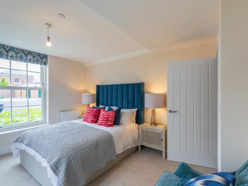 2 bedroom apartment for sale in North East Quadrant, Poundbury,
DT1 3SU, DT1 — £275,000 • 2 bed • 2 bath • 807 ft²
2 bedroom apartment for sale in North East Quadrant, Poundbury,
DT1 3SU, DT1 — £275,000 • 2 bed • 2 bath • 807 ft²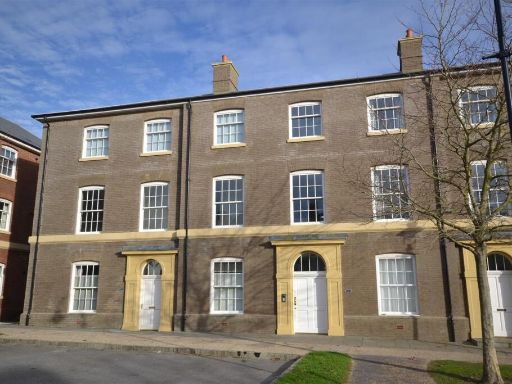 2 bedroom apartment for sale in Peverell Avenue East, Poundbury, Dorchester, DT1 — £250,000 • 2 bed • 2 bath • 759 ft²
 2 bedroom apartment for sale in Wadebridge Street, Poundbury, Dorchester, Dorset, DT1 — £350,000 • 2 bed • 2 bath • 1054 ft²
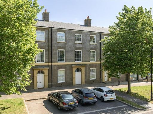 2 bedroom apartment for sale in Peverell Avenue East, Poundbury, Dorchester, DT1 — £265,000 • 2 bed • 2 bath • 812 ft²
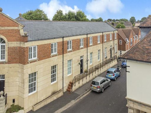 2 bedroom apartment for sale in Middlemarsh Street, Poundbury, DT1 — £279,950 • 2 bed • 2 bath • 1012 ft²
Meta
- {
"@context": "https://schema.org",
"@type": "Residence",
"name": "2 bedroom apartment for sale in North East Quadrant, Poundb…",
"description": "",
"url": "https://propertypiper.co.uk/property/ffa2750b-35b8-418f-bc1c-03f8c18bbe02",
"image": "https://image-a.propertypiper.co.uk/953af464-21a2-4d02-a4f5-64988814068a-1024.jpeg",
"address": {
"@type": "PostalAddress",
"streetAddress": "DORCHESTER COMMUNITY FIRE STATION, PEVERELL AVENUE WEST",
"postalCode": "DT1 3SU",
"addressLocality": "Dorset",
"addressRegion": "West Dorset",
"addressCountry": "England"
},
"geo": {
"@type": "GeoCoordinates",
"latitude": 50.71310205835561,
"longitude": -2.4720783385669716
},
"numberOfRooms": 2,
"numberOfBathroomsTotal": 2,
"floorSize": {
"@type": "QuantitativeValue",
"value": 807,
"unitCode": "FTK"
},
"offers": {
"@type": "Offer",
"price": 275000,
"priceCurrency": "GBP",
"availability": "https://schema.org/InStock"
},
"additionalProperty": [
{
"@type": "PropertyValue",
"name": "Feature",
"value": "open plan"
},
{
"@type": "PropertyValue",
"name": "Feature",
"value": "kitchen"
},
{
"@type": "PropertyValue",
"name": "Feature",
"value": "living room"
},
{
"@type": "PropertyValue",
"name": "Feature",
"value": "modern"
},
{
"@type": "PropertyValue",
"name": "Feature",
"value": "wood flooring"
},
{
"@type": "PropertyValue",
"name": "Feature",
"value": "integrated appliances"
},
{
"@type": "PropertyValue",
"name": "Feature",
"value": "recessed lighting"
},
{
"@type": "PropertyValue",
"name": "Feature",
"value": "contemporary"
},
{
"@type": "PropertyValue",
"name": "Feature",
"value": "Georgian-style"
},
{
"@type": "PropertyValue",
"name": "Feature",
"value": "commercial area"
},
{
"@type": "PropertyValue",
"name": "Feature",
"value": "brick facade"
},
{
"@type": "PropertyValue",
"name": "Feature",
"value": "arched windows"
},
{
"@type": "PropertyValue",
"name": "Feature",
"value": "parking area"
},
{
"@type": "PropertyValue",
"name": "Feature",
"value": "balcony"
},
{
"@type": "PropertyValue",
"name": "Feature",
"value": "urban location"
},
{
"@type": "PropertyValue",
"name": "Feature",
"value": "contemporary"
},
{
"@type": "PropertyValue",
"name": "Feature",
"value": "kitchen"
},
{
"@type": "PropertyValue",
"name": "Feature",
"value": "modern cabinets"
},
{
"@type": "PropertyValue",
"name": "Feature",
"value": "LED lighting"
},
{
"@type": "PropertyValue",
"name": "Feature",
"value": "hardwood flooring"
},
{
"@type": "PropertyValue",
"name": "Feature",
"value": "open plan"
},
{
"@type": "PropertyValue",
"name": "Feature",
"value": "integrated appliances"
}
]
}
High Res Floorplan Images
Compatible Floorplan Images
FloorplanImages Thumbnail