GL14 3GD - 4 bedroom detached house for sale in Sneyd Wood Road, Cinde…
View on Property Piper
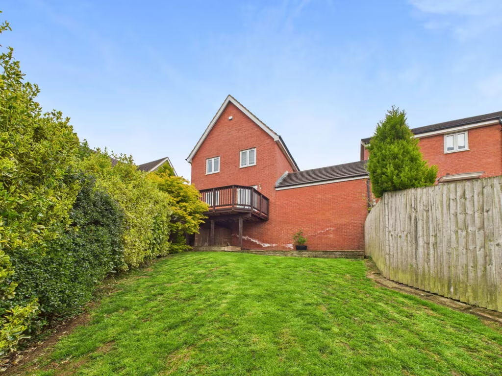
4 bedroom detached house for sale in Sneyd Wood Road, Cinderford, GL14
Property Details
- Price: £325000
- Bedrooms: 4
- Bathrooms: 2
- Property Type: undefined
- Property SubType: undefined
Image Descriptions
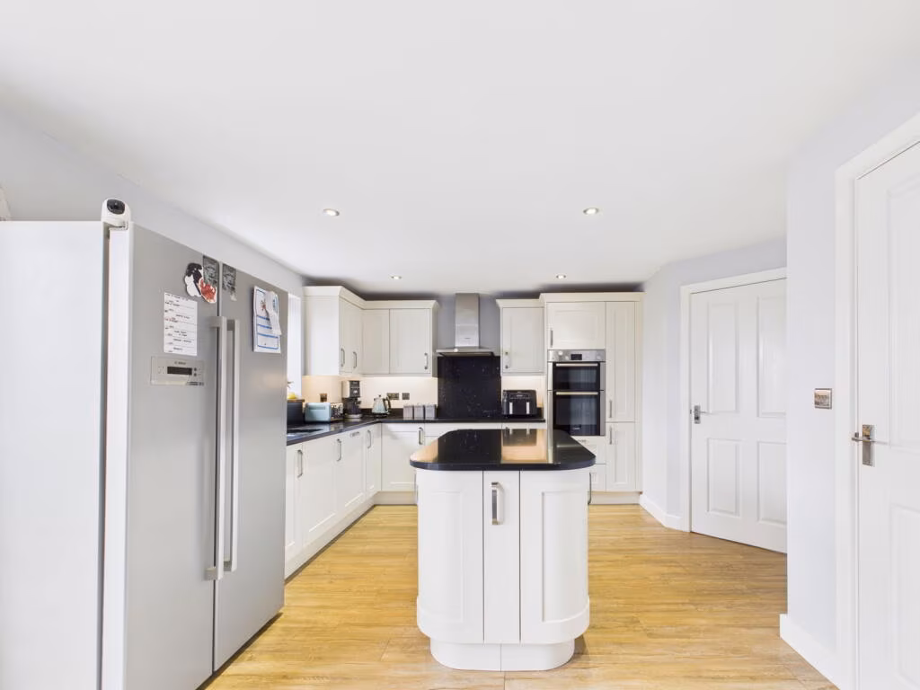
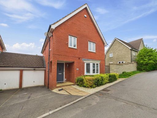
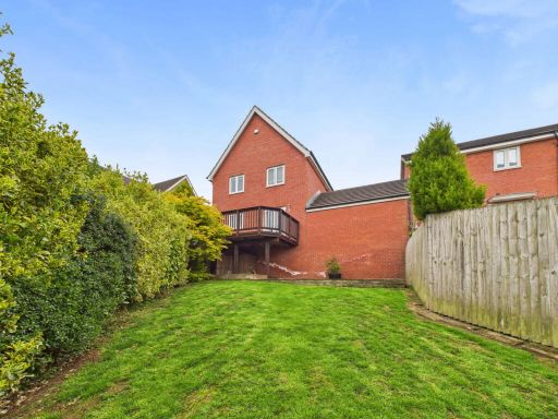
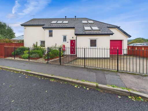
- detached house modern
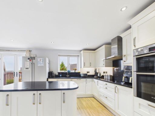
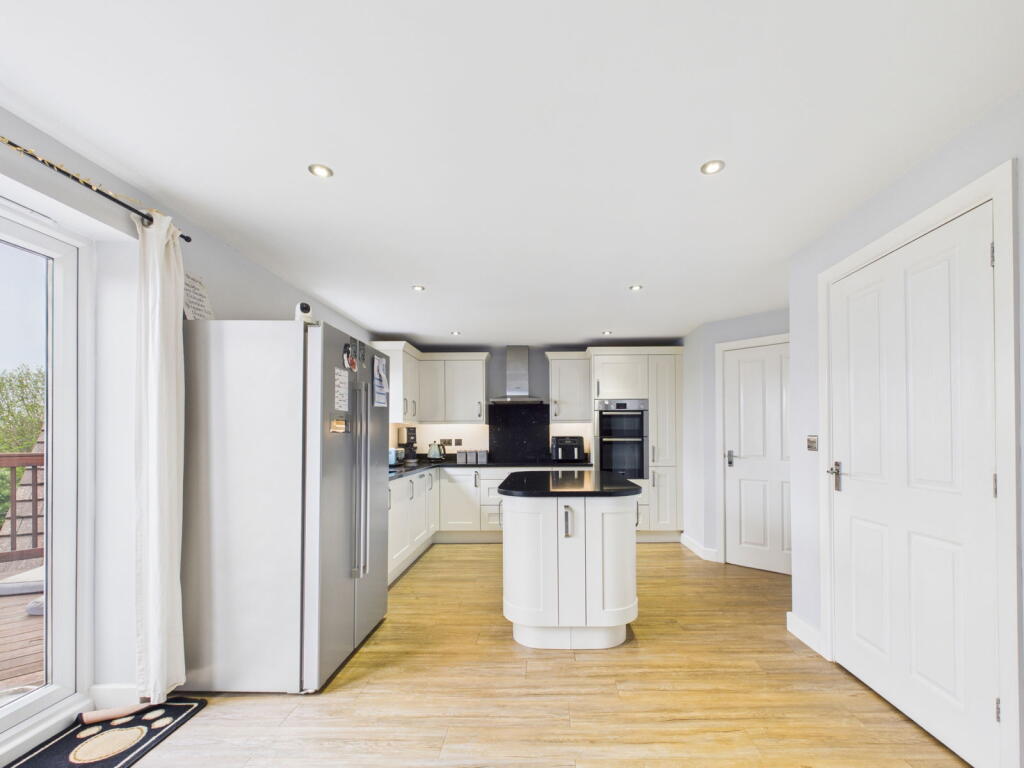
- kitchen contemporary
Floorplan Description
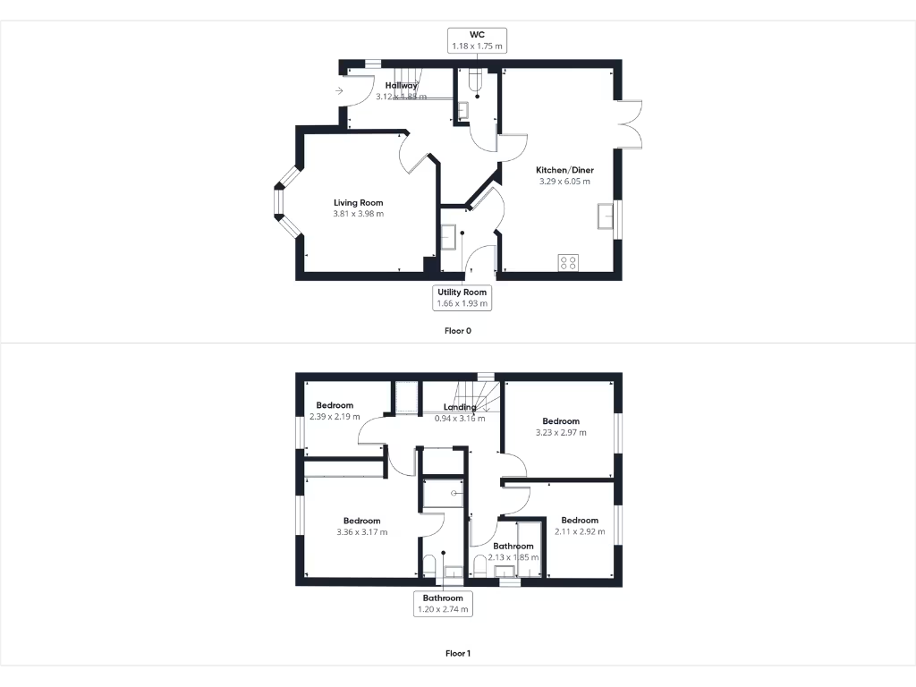
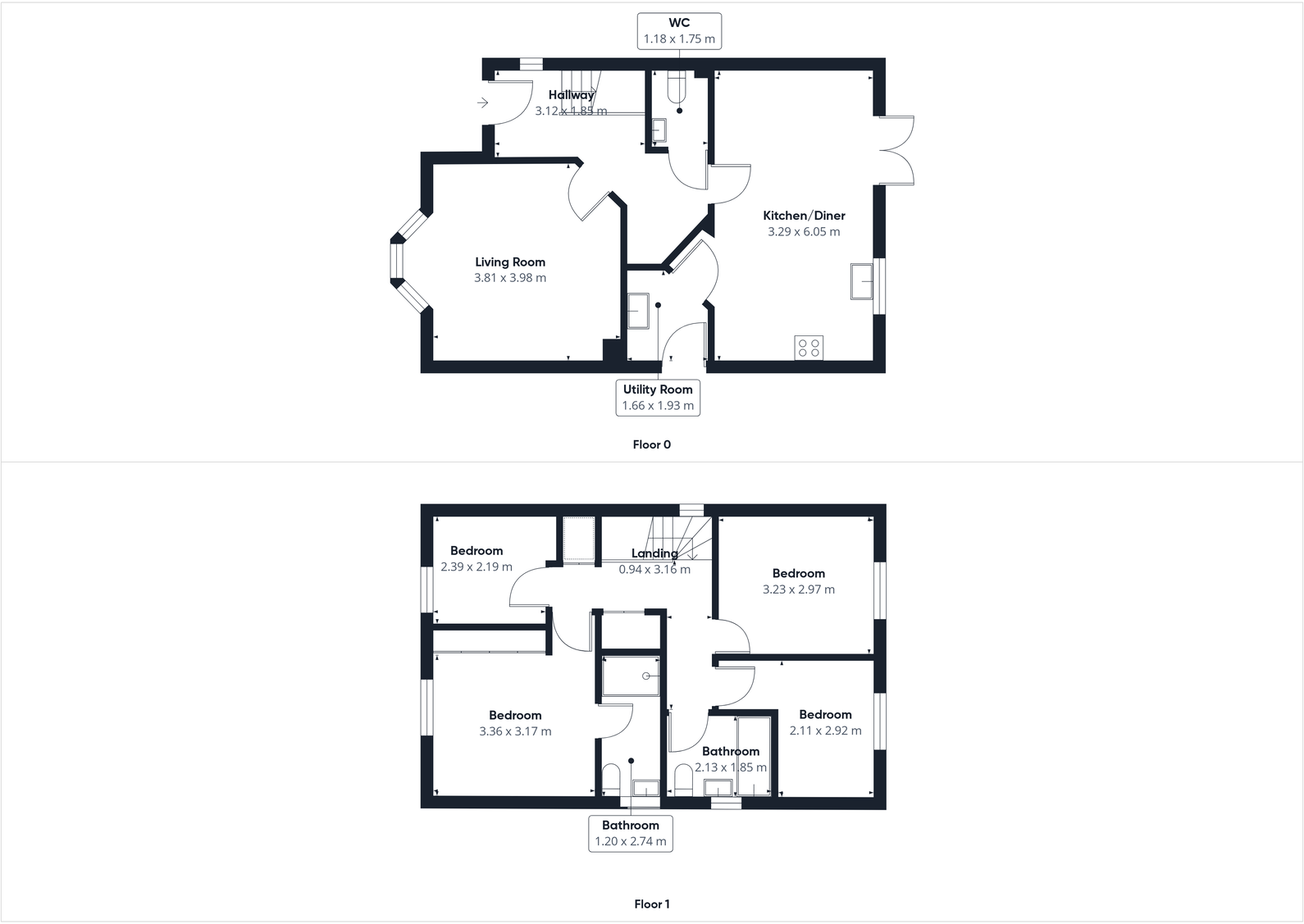
- A two-story property with a large kitchen/diner and multiple bedrooms.
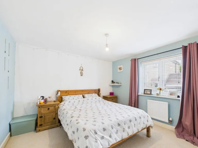
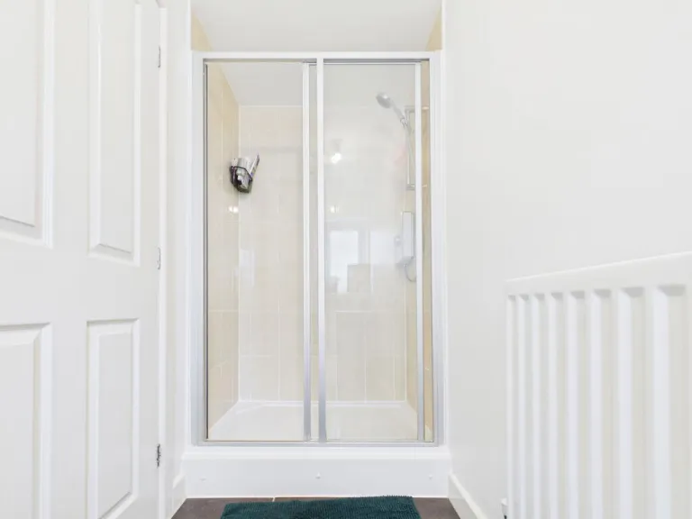
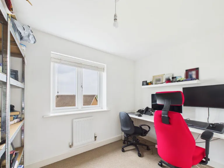
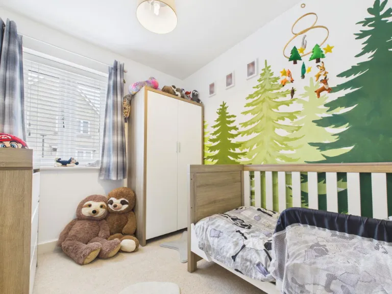
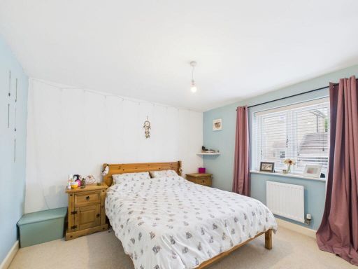
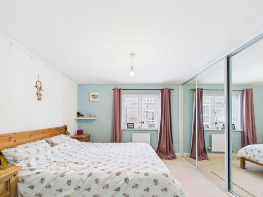
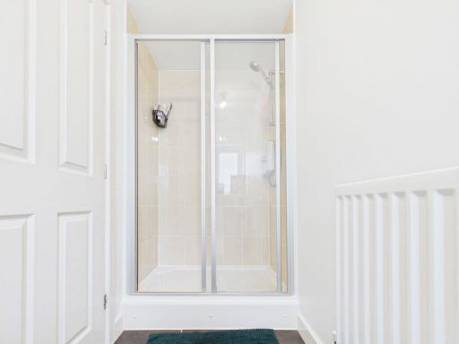
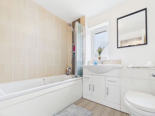
Rooms
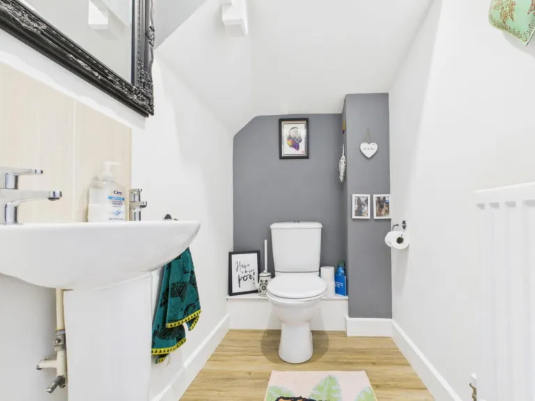
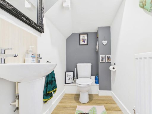
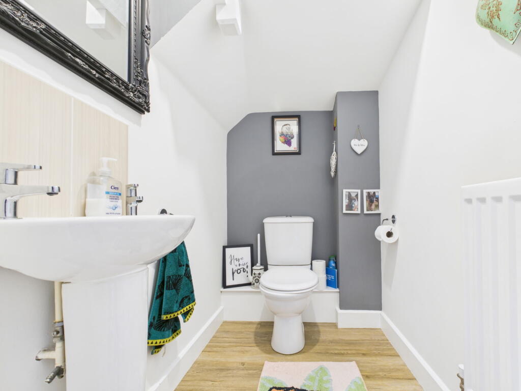
- WC: Small
- Hallway: Average
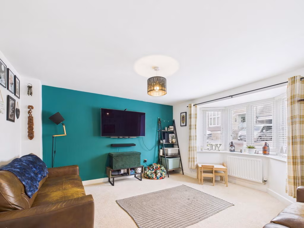
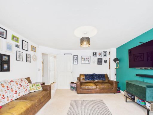
- Living Room: Average
- Kitchen/Diner: Large
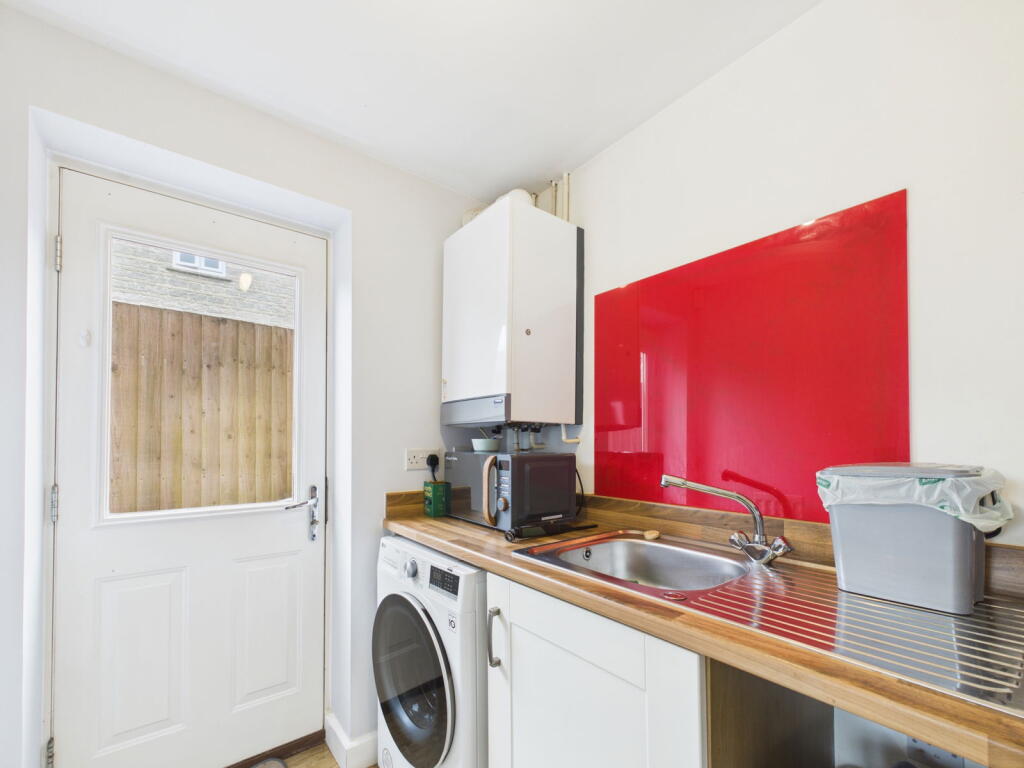
- Utility Room: Small
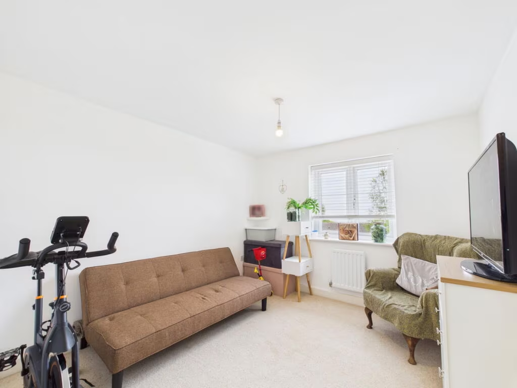
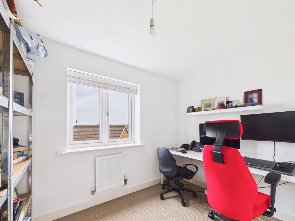
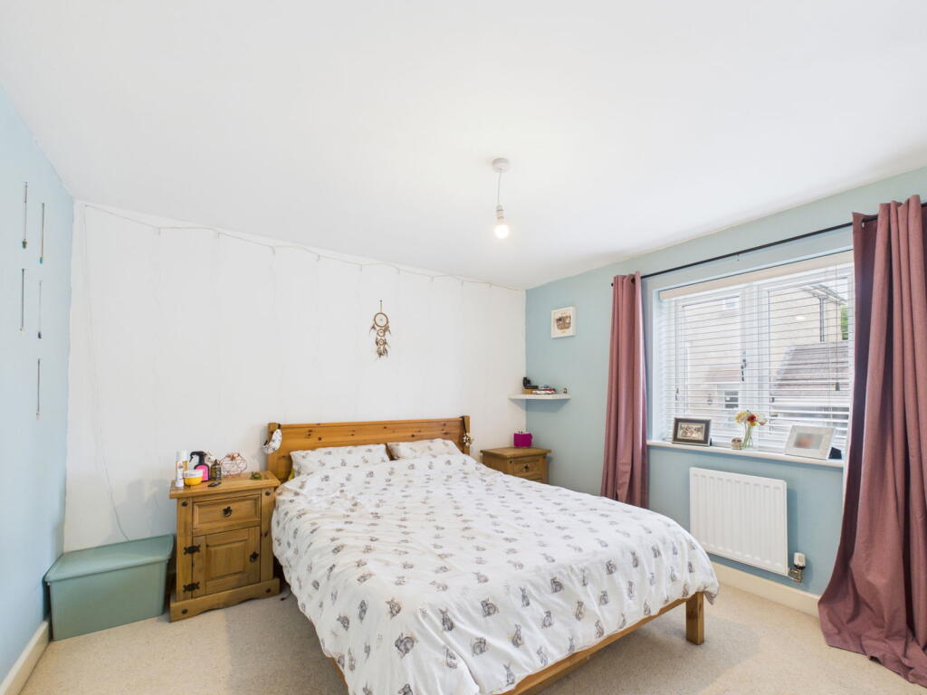
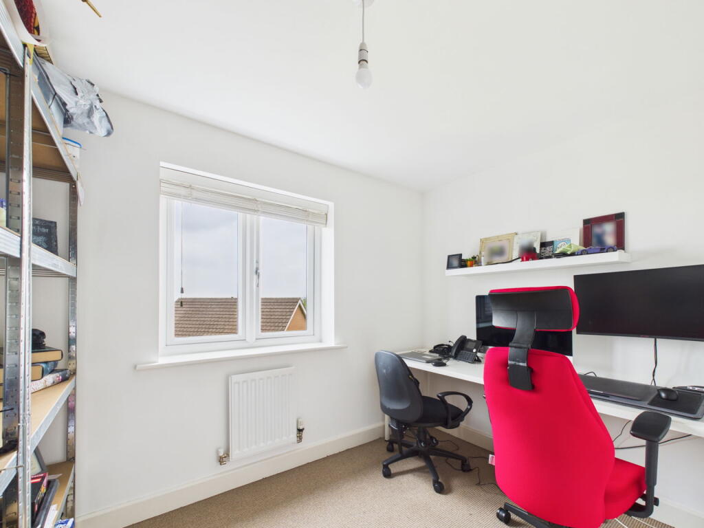
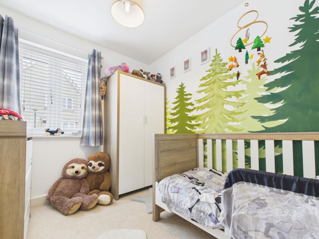
- Bedroom: Small
- Landing: Small
- Bedroom: Average
- Bedroom: Average
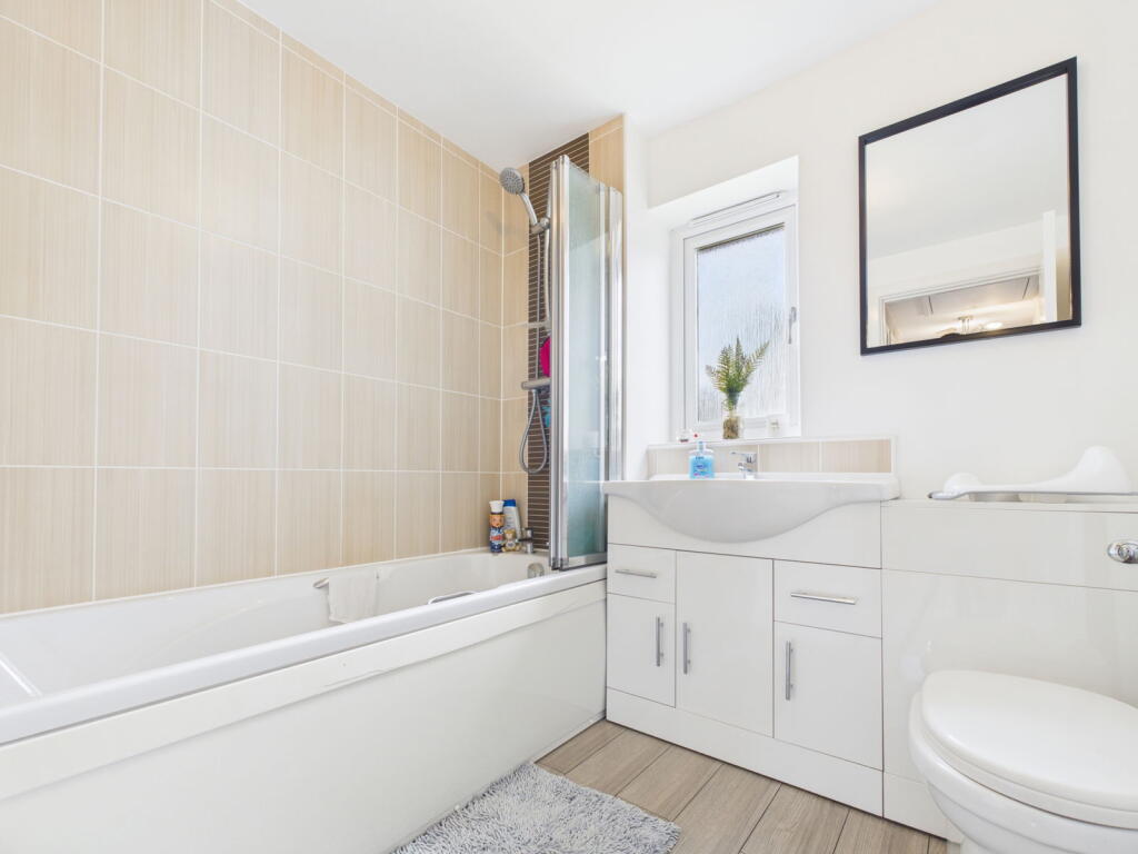
- Bathroom: Small
- Bathroom: Small
Textual Property Features
Detected Visual Features
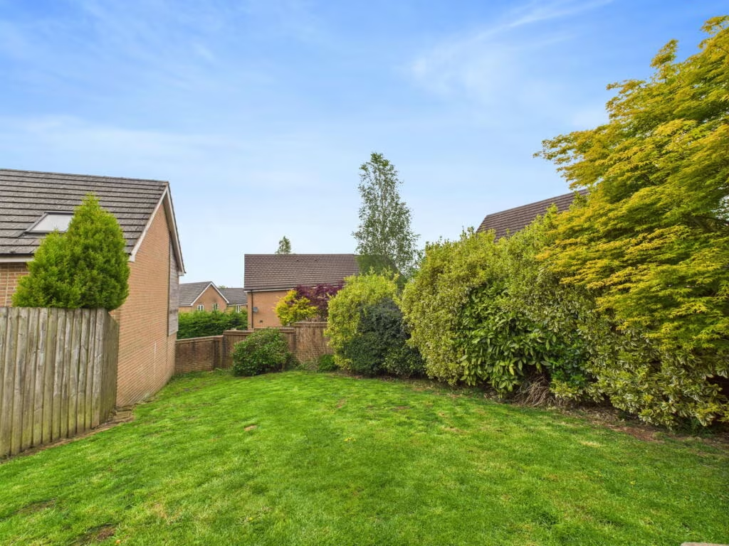
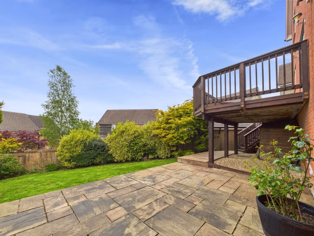
- detached
- modern
- garage
- driveway
- two-story
- brick
- bay window
- kitchen
- contemporary
- island
- integrated appliances
- wood flooring
- spotlights
EPC Details
- Fully double glazed
- Cavity wall, as built, insulated (assumed)
- Boiler and radiators, mains gas
- Low energy lighting in all fixed outlets
- Solid, insulated (assumed)
Nearby Schools
- Parkend Primary School
- Ellwood Primary School
- Soudley School
- Five Acres High School
- Steam Mills Primary School
- Woodside Primary School
- Pillowell Community Primary School
- Blakeney Primary School
- Littledean Church of England Primary School
- Westbury-on-Severn Church of England Primary School
- Forest View Primary School
- English Bicknor Church of England Primary School
- Ruardean Church of England Primary School
- Bream Church of England Primary School
- Newnham St Peter's Church of England Primary School
- Berry Hill Primary School
- St White's Primary School
- Yorkley Primary School
- Coalway Junior School
- Coalway Community Infant School
- SGS Forest High School
- Lydbrook Primary School
- Drybrook Primary School
- Dene Magna School
- Mitcheldean Endowed Primary School
- Huntley Church of England Primary School
Nearest General Shops
- Id: 8118271854
- Tags:
- Name: David Kear
- Shop: optician
- TagsNormalized:
- Lat: 51.82369
- Lon: -2.4985286
- FullGeoHash: gcnnz4hwuh40
- PartitionGeoHash: gcnn
- Images:
- FoodStandards: null
- Distance: 983.9
,- Id: 8120504135
- Tags:
- TagsNormalized:
- Lat: 51.8236823
- Lon: -2.4982156
- FullGeoHash: gcnnz4hyg6e6
- PartitionGeoHash: gcnn
- Images:
- FoodStandards: null
- Distance: 982.9
,- Id: 8120504136
- Tags:
- Name: The Locksmiths & Security Centre
- Shop: locksmith
- TagsNormalized:
- Lat: 51.8236198
- Lon: -2.4981521
- FullGeoHash: gcnnz4hykyfv
- PartitionGeoHash: gcnn
- Images:
- FoodStandards: null
- Distance: 976
}
Nearest Grocery shops
- Id: 8114967504
- Tags:
- Brand: Costcutter
- Brand:wikidata: Q5175072
- Name: Costcutter
- Shop: convenience
- TagsNormalized:
- costcutter
- convenience
- shop
- Lat: 51.8244542
- Lon: -2.4990593
- FullGeoHash: gcnnz4k5rdqr
- PartitionGeoHash: gcnn
- Images:
- FoodStandards: null
- Distance: 1070.2
,- Id: 8120504139
- Tags:
- Name: Cinderford Stores
- Operator: Premier
- Shop: convenience
- TagsNormalized:
- Lat: 51.8238407
- Lon: -2.4997719
- FullGeoHash: gcnnz45xz04g
- PartitionGeoHash: gcnn
- Images:
- FoodStandards: null
- Distance: 1006
,- Id: 2395315973
- Tags:
- Name: Corner Shop
- Shop: convenience
- TagsNormalized:
- Lat: 51.8202301
- Lon: -2.4978447
- FullGeoHash: gcnnz1t4ezpc
- PartitionGeoHash: gcnn
- Images:
- FoodStandards: null
- Distance: 599.7
}
Nearest Religious buildings
- Id: 856551989
- Tags:
- Amenity: place_of_worship
- Denomination: united_reformed
- Name: Littledean United Reformed Church
- Religion: christian
- TagsNormalized:
- place of worship
- united reformed
- church
- christian
- Lat: 51.8186634
- Lon: -2.4804643
- FullGeoHash: gcnnz93c8fzz
- PartitionGeoHash: gcnn
- Images:
- FoodStandards: null
- Distance: 1294.1
,- Id: 438522147
- Tags:
- Addr:
- City: Cinderford
- Housename: St Stephen's Church
- Postcode: GL14 2AA
- Street: Belle Vue Road
- Amenity: place_of_worship
- Building: church
- Denomination: anglican
- Name: St Stephen's Church
- Phone: +44 1594 822286
- Religion: christian
- Website: https://www.cinderford-churches.org.uk/
- Wheelchair: yes
- Wikidata: Q26416851
- TagsNormalized:
- place of worship
- church
- anglican
- christian
- Lat: 51.8221239
- Lon: -2.49598
- FullGeoHash: gcnnz1ymz2n6
- PartitionGeoHash: gcnn
- Images:
- FoodStandards: null
- Distance: 824.5
,- Id: 237744868
- Tags:
- Amenity: place_of_worship
- Building: church
- Denomination: anglican
- Name: St John's Church
- Phone: +44 1594 822286
- Religion: christian
- Website: https://www.cinderford-churches.org.uk/our-churches/st-johns-cinderford/
- Wheelchair: limited
- Wikidata: Q26481707
- TagsNormalized:
- place of worship
- church
- anglican
- christian
- Lat: 51.81259
- Lon: -2.5050307
- FullGeoHash: gcnnybpyhwcd
- PartitionGeoHash: gcnn
- Images:
- FoodStandards: null
- Distance: 529.4
}
Nearest Medical buildings
- Id: 660621502
- Tags:
- Addr:
- Postcode: GL14 3HX
- Street: Speech House Road
- Amenity: hospital
- Emergency: no
- Name: Dilke Memorial Hospital
- Note: Minor injuries department closed
- TagsNormalized:
- Lat: 51.8111022
- Lon: -2.5197939
- FullGeoHash: gcnnwxvjs93r
- PartitionGeoHash: gcnn
- Images:
- FoodStandards: null
- Distance: 1538.5
,- Id: 9666996596
- Tags:
- Addr:
- City: Cinderford
- Housename: Cinderford Medical Centre
- Postcode: GL14 2NX
- Street: Valley Road
- Amenity: doctors
- Contact:
- Phone: +44 1594 820820
- Website: https://www.foresthealthcentre.nhs.uk
- Healthcare: doctor
- Name: Forest Health Care
- Opening_hours: Mo-Fr 08:30-18:00
- TagsNormalized:
- doctor
- doctors
- health
- healthcare
- forest
- Lat: 51.8268485
- Lon: -2.5078889
- FullGeoHash: gcnnyfvc3by3
- PartitionGeoHash: gcnn
- Images:
- FoodStandards: null
- Distance: 1490.4
,- Id: 9666997458
- Tags:
- Addr:
- City: Cinderford
- Housename: Cinderford Medical Centre
- Postcode: GL14 2NX
- Street: Valley Road
- Amenity: doctors
- Contact:
- Fax: +44 1594 820017
- Phone: +44 1594 820010
- Website: https://dockhamsurgery.nhs.uk
- Healthcare: doctor
- Name: Dockham Surgery
- Opening_hours: Mo-Fr 08:30-18:00
- TagsNormalized:
- doctor
- doctors
- health
- healthcare
- surgery
- Lat: 51.8269402
- Lon: -2.5075611
- FullGeoHash: gcnnyfy1c9fu
- PartitionGeoHash: gcnn
- Images:
- FoodStandards: null
- Distance: 1489.7
,- Id: 8120504137
- Tags:
- Amenity: dentist
- Brand: My Dentist
- Brand:wikidata: Q65118035
- Contact:
- Website: https://www.mydentist.co.uk/dentists/practices/england/south-west-england/cinderford/26-market-street
- Healthcare: dentist
- Name: My Dentist
- TagsNormalized:
- dentist
- my dentist
- health
- healthcare
- Lat: 51.8237271
- Lon: -2.4997855
- FullGeoHash: gcnnz45xnfbv
- PartitionGeoHash: gcnn
- Images:
- FoodStandards: null
- Distance: 993.5
}
Nearest Leisure Facilities
- Id: 1064072688
- Tags:
- TagsNormalized:
- Lat: 51.8202173
- Lon: -2.5080102
- FullGeoHash: gcnnyctdxhsh
- PartitionGeoHash: gcnn
- Images:
- FoodStandards: null
- Distance: 898.6
,- Id: 675413101
- Tags:
- Access: private
- Leisure: garden
- TagsNormalized:
- Lat: 51.8157553
- Lon: -2.4915036
- FullGeoHash: gcnnz2c8xubk
- PartitionGeoHash: gcnn
- Images:
- FoodStandards: null
- Distance: 474.5
,- Id: 1052135554
- Tags:
- Leisure: pitch
- Sport: multi
- TagsNormalized:
- Lat: 51.8185267
- Lon: -2.4958496
- FullGeoHash: gcnnz1q8f3x8
- PartitionGeoHash: gcnn
- Images:
- FoodStandards: null
- Distance: 441.5
,- Id: 675413099
- Tags:
- Access: private
- Leisure: garden
- TagsNormalized:
- Lat: 51.8157052
- Lon: -2.4929826
- FullGeoHash: gcnnz2b8m793
- PartitionGeoHash: gcnn
- Images:
- FoodStandards: null
- Distance: 374.3
,- Id: 1052135563
- Tags:
- TagsNormalized:
- Lat: 51.8133688
- Lon: -2.5003629
- FullGeoHash: gcnnz076c242
- PartitionGeoHash: gcnn
- Images:
- FoodStandards: null
- Distance: 219.2
}
Nearest Tourist attractions
- Id: 691100484
- Tags:
- Name: Dean Heritage Museum
- Source: OS OpenData StreetView
- Source:name: NaPTAN
- Tourism: museum
- Wikidata: Q5246207
- Wikipedia: en:Dean Heritage Centre
- TagsNormalized:
- Lat: 51.7932555
- Lon: -2.4884804
- FullGeoHash: gcnnxkevw4we
- PartitionGeoHash: gcnn
- Images:
- FoodStandards: null
- Distance: 2492.6
,- Id: 42837447
- Tags:
- Historic: jail
- Name: Littledean Jail
- Tourism: attraction
- Url: http://www.littledeanjail.com/
- TagsNormalized:
- Lat: 51.8219695
- Lon: -2.4755594
- FullGeoHash: gcnnz9vkg731
- PartitionGeoHash: gcnn
- Images:
- FoodStandards: null
- Distance: 1749.2
,- Id: 677032482
- Tags:
- Name: Enfield Park
- Residential: mobile
- Tourism: caravan_site
- TagsNormalized:
- Lat: 51.8089226
- Lon: -2.5070675
- FullGeoHash: gcnnwzw2v54v
- PartitionGeoHash: gcnn
- Images:
- FoodStandards: null
- Distance: 895
}
Nearest Train stations
- Id: 262378723
- Tags:
- Name: Lydney Town
- Naptan:
- Operator: Dean Forest Railway
- Public_transport: station
- Railway: station
- Usage: tourism
- Wheelchair: no
- Wikidata: Q6707734
- TagsNormalized:
- Lat: 51.725442
- Lon: -2.5319837
- FullGeoHash: gcnnq2k68920
- PartitionGeoHash: gcnn
- Images:
- FoodStandards: null
- Distance: 10208.4
,- Id: 262378693
- Tags:
- Name: Norchard
- Public_transport: station
- Railway: station
- Usage: tourism
- Wikidata: Q7050477
- TagsNormalized:
- Lat: 51.7357697
- Lon: -2.5395674
- FullGeoHash: gcnnq4nwxy3r
- PartitionGeoHash: gcnn
- Images:
- FoodStandards: null
- Distance: 9240.7
,- Id: 7689205150
- Tags:
- Name: Perrygrove
- Public_transport: station
- Railway: station
- Train: yes
- Usage: tourism
- Wikidata: Q7169991
- Wikipedia: en:Perrygrove railway station
- TagsNormalized:
- Lat: 51.7825235
- Lon: -2.6111685
- FullGeoHash: gcnnsddx5658
- PartitionGeoHash: gcnn
- Images:
- FoodStandards: null
- Distance: 8556.4
,- Id: 8693763578
- Tags:
- Name: Rookwood
- Public_transport: station
- Railway: station
- Usage: tourism
- Wikidata: Q7366236
- Wikipedia: en:Rookwood railway station
- TagsNormalized:
- Lat: 51.7850193
- Lon: -2.6127976
- FullGeoHash: gcnnse1mt7kb
- PartitionGeoHash: gcnn
- Images:
- FoodStandards: null
- Distance: 8546.6
,- Id: 7689205151
- Tags:
- Name: Oakiron
- Public_transport: station
- Railway: station
- Train: yes
- Usage: tourism
- Wikidata: Q7073925
- Wikipedia: en:Oakiron railway station
- TagsNormalized:
- Lat: 51.7824969
- Lon: -2.6102566
- FullGeoHash: gcnnsdeqbt59
- PartitionGeoHash: gcnn
- Images:
- FoodStandards: null
- Distance: 8500.8
}
Nearest Hotels
- Id: 31221729
- Tags:
- Historic: manor
- Layer: 2
- Name: Speech House Hotel
- Source: NPE
- Tourism: hotel
- Url: https://www.thespeechhouse.co.uk/
- Wikidata: Q7575371
- Wikipedia: en:Speech House
- TagsNormalized:
- Lat: 51.806293
- Lon: -2.5520376
- FullGeoHash: gcnntzj9t0yz
- PartitionGeoHash: gcnn
- Images:
- FoodStandards: null
- Distance: 3818.3
,- Id: 675975334
- Tags:
- Building: yes
- Tourism: hotel
- TagsNormalized:
- Lat: 51.8197752
- Lon: -2.4816198
- FullGeoHash: gcnnz98bn44p
- PartitionGeoHash: gcnn
- Images:
- FoodStandards: null
- Distance: 1267.7
,- Id: 856986464
- Tags:
- Addr:
- Place: Littledean
- Postcode: GL14 3JZ
- Street: Broad Street
- Fhrs:
- Name: Littledean House Hotel
- Tourism: hotel
- TagsNormalized:
- Lat: 51.8205145
- Lon: -2.4830608
- FullGeoHash: gcnnz3xukkp9
- PartitionGeoHash: gcnn
- Images:
- FoodStandards: null
- Distance: 1219.6
}
Tags
- detached
- modern
- garage
- driveway
- two-story
- brick
- bay window
- kitchen
- modern
- contemporary
- island
- integrated appliances
- wood flooring
- spotlights
Local Market Stats
- Average Price/sqft: £249
- Avg Income: £41700
- Social Housing: 11%
- Planning Success Rate: 89%
AirBnB Data
- 1km average: £107/night
- Listings in 1km: 4
Similar Properties
 4 bedroom detached house for sale in Station Terrace, Cinderford, GL14 — £400,000 • 4 bed • 2 bath • 1217 ft²
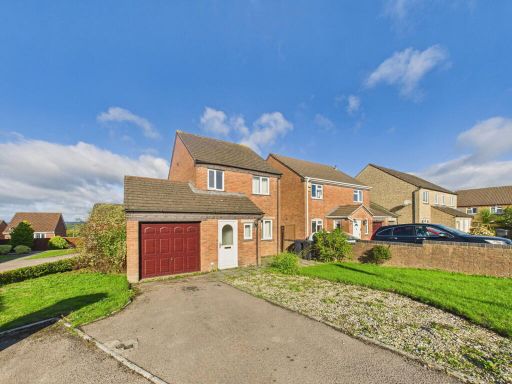 3 bedroom detached house for sale in Double View, Cinderford, GL14 — £250,000 • 3 bed • 1 bath • 747 ft²
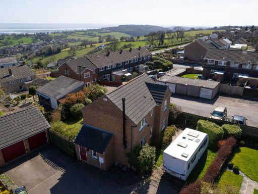 3 bedroom detached house for sale in Forest Rise, Cinderford, GL14 2BX, GL14 — £300,000 • 3 bed • 2 bath • 816 ft²
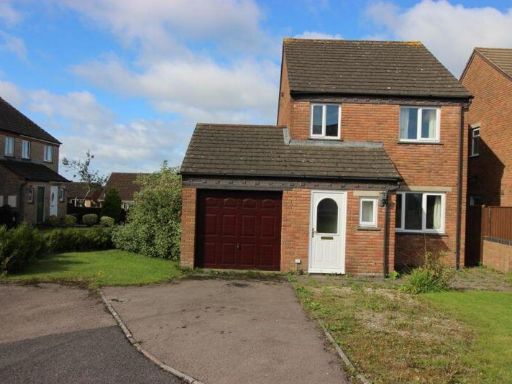 3 bedroom detached house for sale in Double View, Cinderford, GL14 — £250,000 • 3 bed • 1 bath • 819 ft²
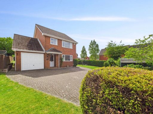 3 bedroom detached house for sale in St. Whites Road, Cinderford, GL14 — £340,000 • 3 bed • 1 bath • 1456 ft²
 3 bedroom detached house for sale in Cinderford, Gloucestershire, GL14 — £280,000 • 3 bed • 1 bath • 862 ft²
Meta
- {
"@context": "https://schema.org",
"@type": "Residence",
"name": "4 bedroom detached house for sale in Sneyd Wood Road, Cinde…",
"description": "",
"url": "https://propertypiper.co.uk/property/fe9bdd29-87cb-407f-b827-06019617ac0f",
"image": "https://image-a.propertypiper.co.uk/ed62330f-1d5b-4dfa-aa81-8b673b8f2798-1024.jpeg",
"address": {
"@type": "PostalAddress",
"streetAddress": "6 Sneyd Wood Road",
"postalCode": "GL14 3GD",
"addressLocality": "Forest of Dean",
"addressRegion": "Forest of Dean",
"addressCountry": "England"
},
"geo": {
"@type": "GeoCoordinates",
"latitude": 51.81484286256875,
"longitude": -2.49824672324494
},
"numberOfRooms": 4,
"numberOfBathroomsTotal": 2,
"floorSize": {
"@type": "QuantitativeValue",
"value": 892,
"unitCode": "FTK"
},
"offers": {
"@type": "Offer",
"price": 325000,
"priceCurrency": "GBP",
"availability": "https://schema.org/InStock"
},
"additionalProperty": [
{
"@type": "PropertyValue",
"name": "Feature",
"value": "detached"
},
{
"@type": "PropertyValue",
"name": "Feature",
"value": "modern"
},
{
"@type": "PropertyValue",
"name": "Feature",
"value": "garage"
},
{
"@type": "PropertyValue",
"name": "Feature",
"value": "driveway"
},
{
"@type": "PropertyValue",
"name": "Feature",
"value": "two-story"
},
{
"@type": "PropertyValue",
"name": "Feature",
"value": "brick"
},
{
"@type": "PropertyValue",
"name": "Feature",
"value": "bay window"
},
{
"@type": "PropertyValue",
"name": "Feature",
"value": "kitchen"
},
{
"@type": "PropertyValue",
"name": "Feature",
"value": "modern"
},
{
"@type": "PropertyValue",
"name": "Feature",
"value": "contemporary"
},
{
"@type": "PropertyValue",
"name": "Feature",
"value": "island"
},
{
"@type": "PropertyValue",
"name": "Feature",
"value": "integrated appliances"
},
{
"@type": "PropertyValue",
"name": "Feature",
"value": "wood flooring"
},
{
"@type": "PropertyValue",
"name": "Feature",
"value": "spotlights"
}
]
}
High Res Floorplan Images
Compatible Floorplan Images
FloorplanImages Thumbnail