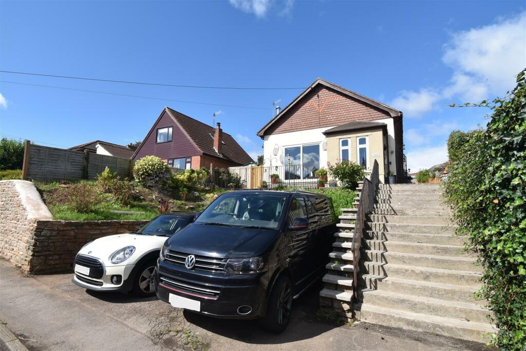
BS20 0DP - 5 bedroom detached house for sale in Springfield Road, Pill…
View on Property Piper
5 bedroom detached house for sale in Springfield Road, Pill., BS20
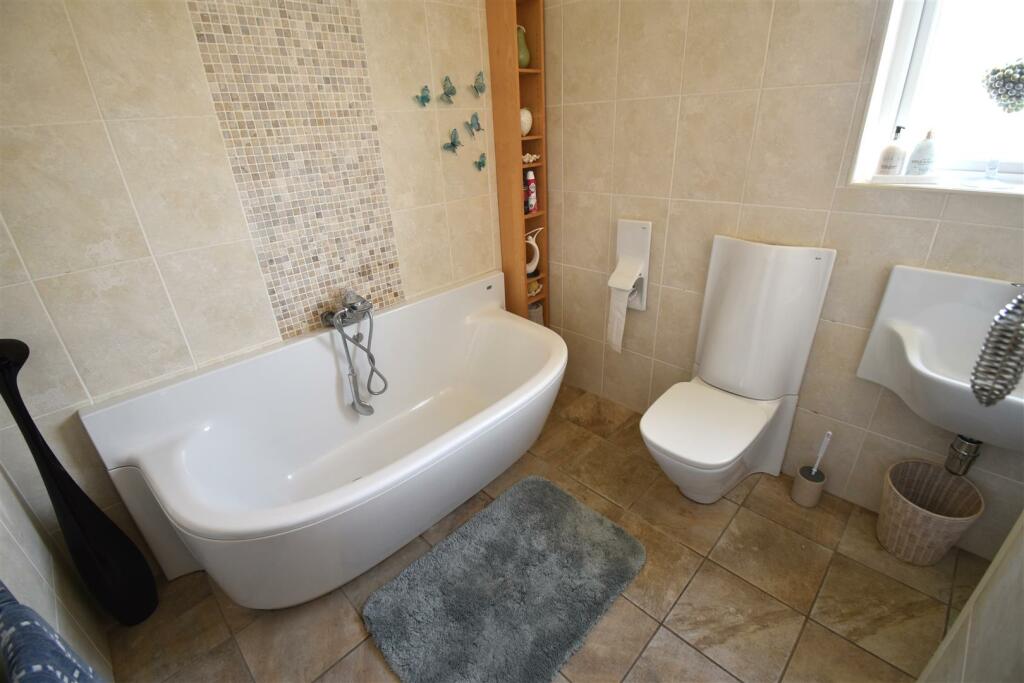
Property Details
- Price: £533000
- Bedrooms: 5
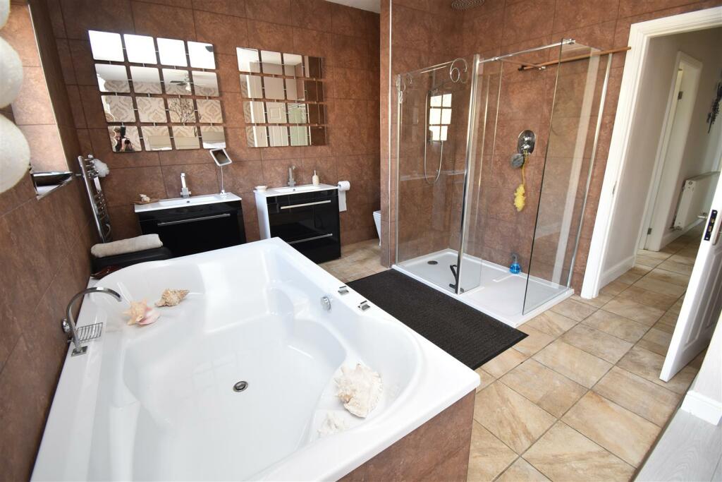
- Bathrooms: 3
- Property Type: undefined
- Property SubType: undefined
Brochure Descriptions
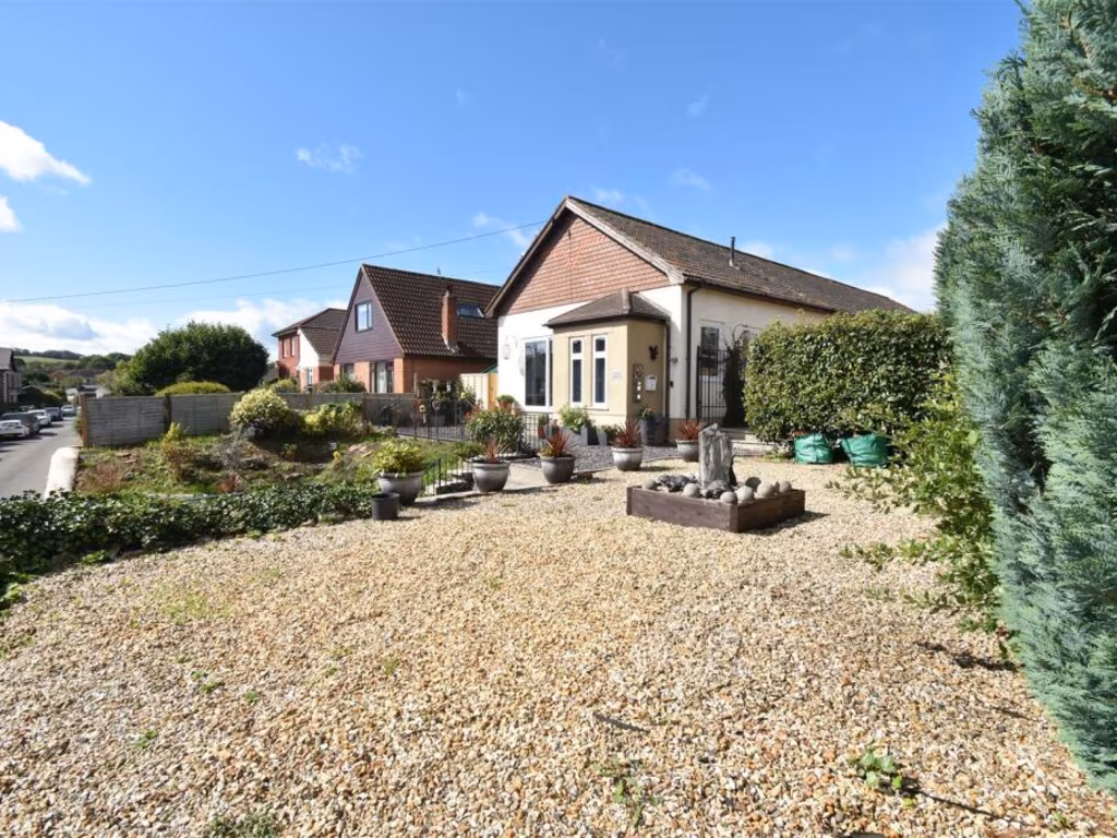
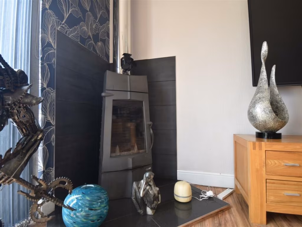
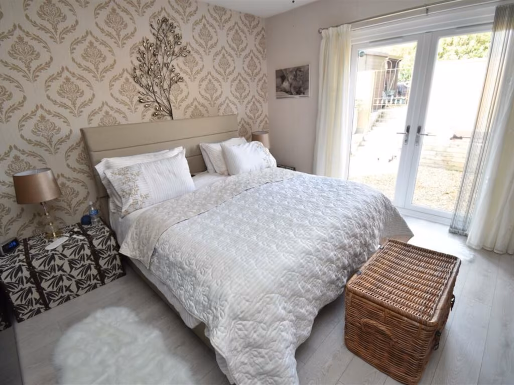
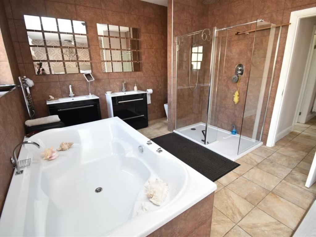
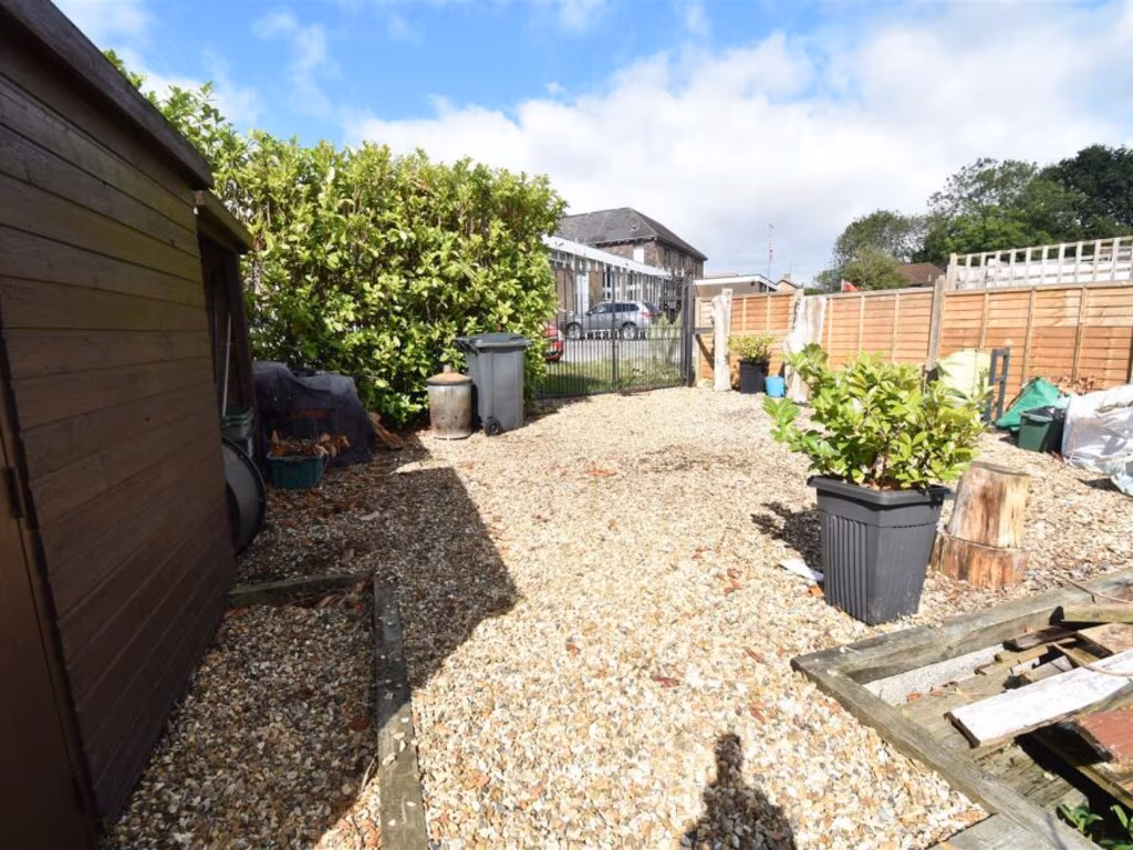
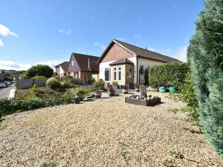
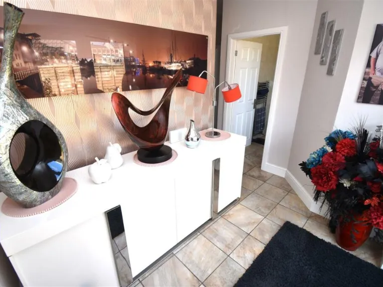
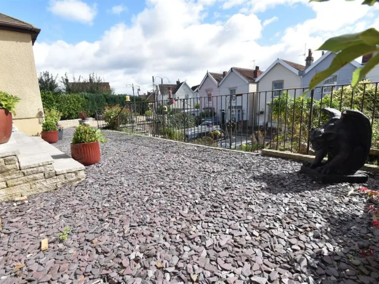
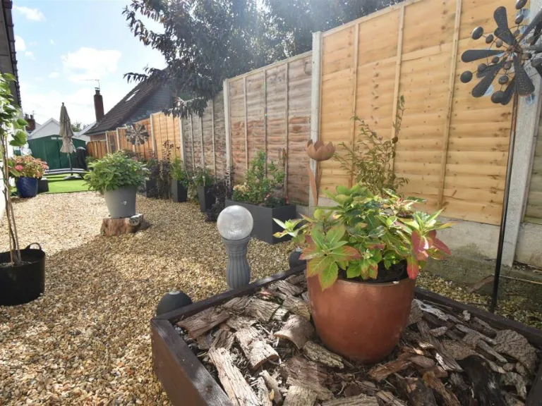
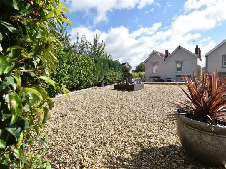
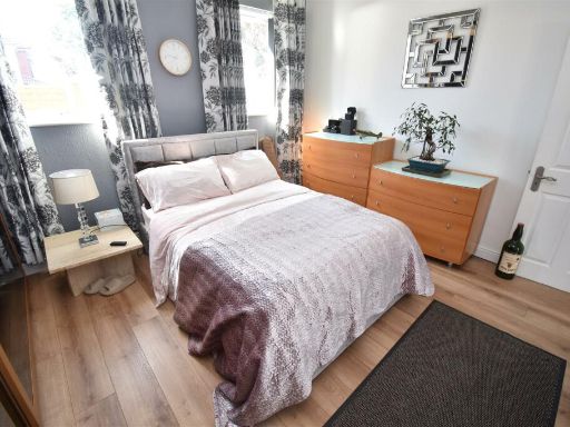
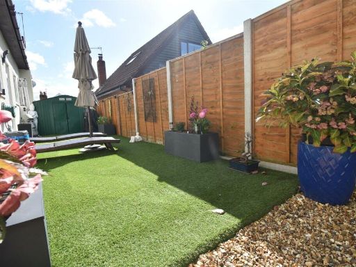
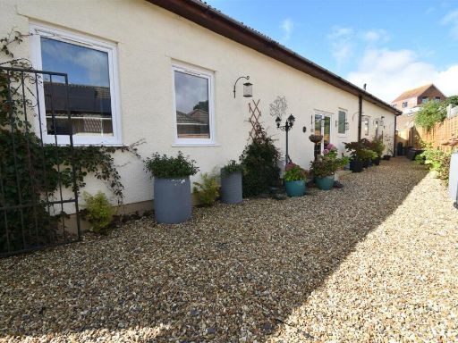
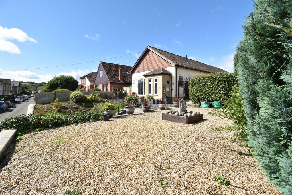
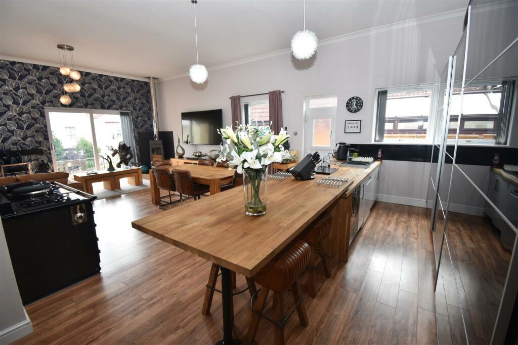
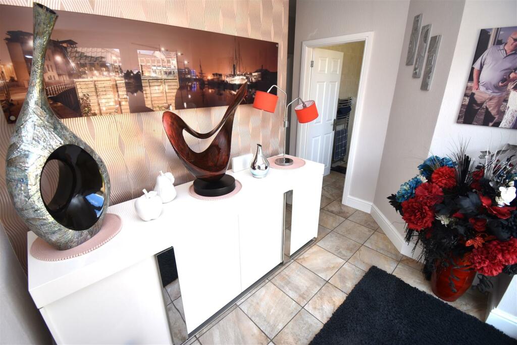
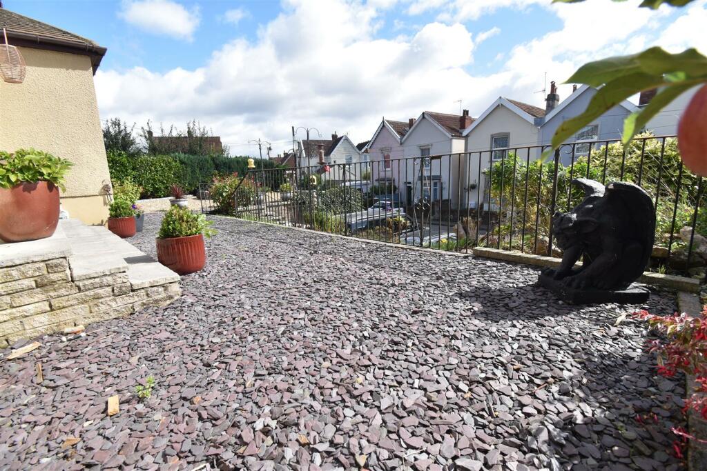
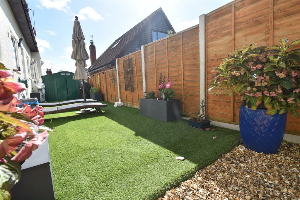
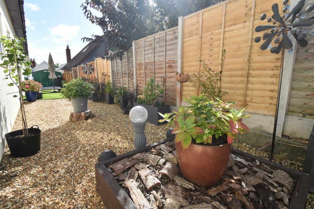
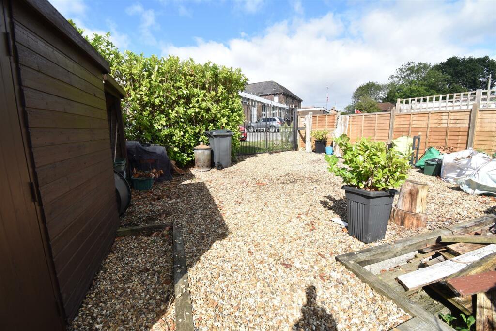
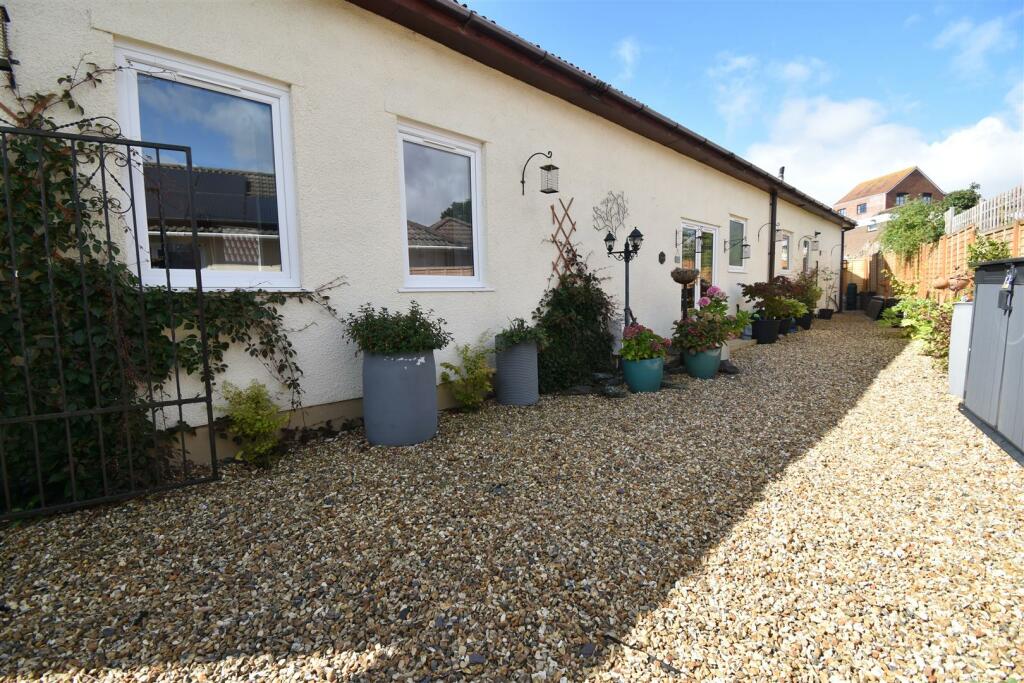
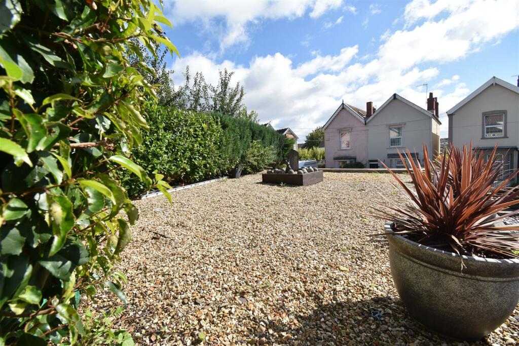
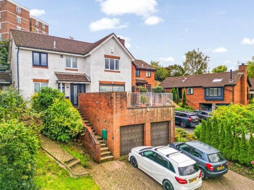
- This property is a charming detached home located in a serene neighborhood. The structure features a modern design with traditional elements, set within a spacious plot. The garden is large and landscaped with gravel and well-maintained shrubs, providing an attractive frontage. The surrounding area is residential, with paved streets and other individual homes. The property likely offers a good amount of natural light and privacy due to its positioning and the well-placed vegetation around it.
Image Descriptions
- bungalow Contemporary
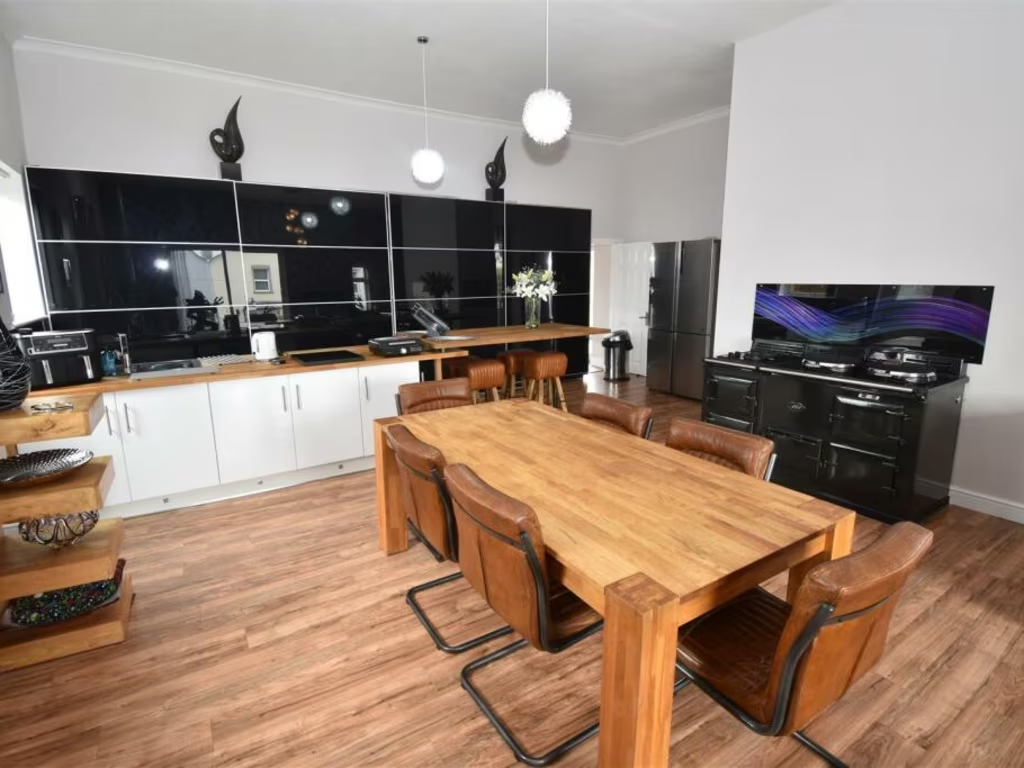
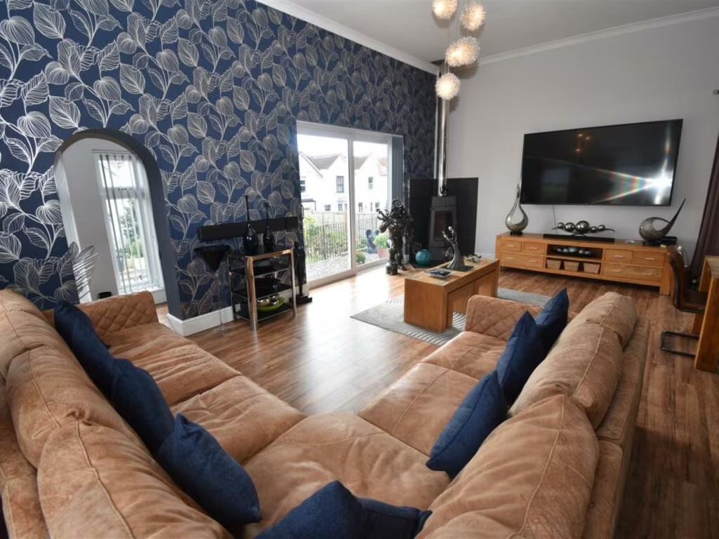
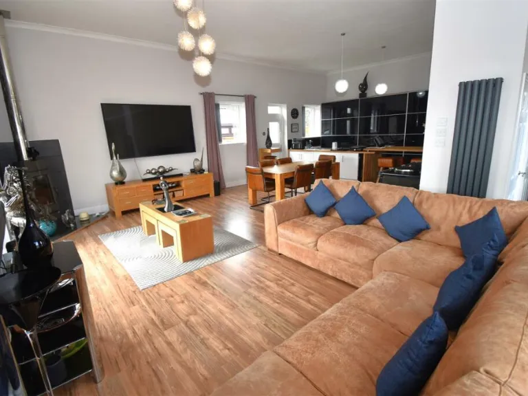
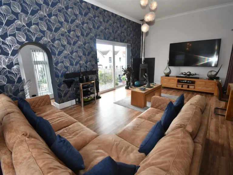
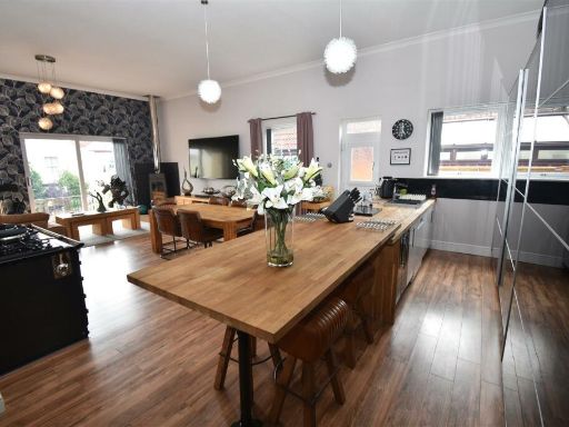
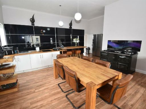
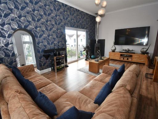
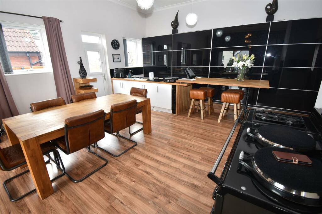
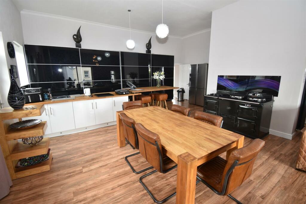
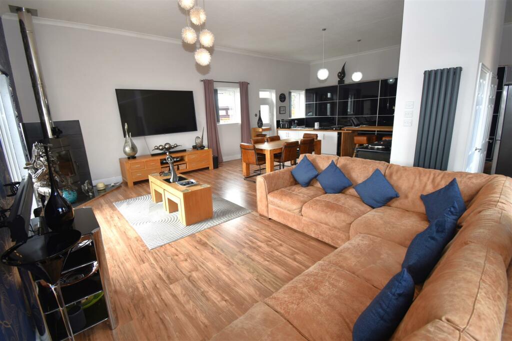
- open-plan living area modern
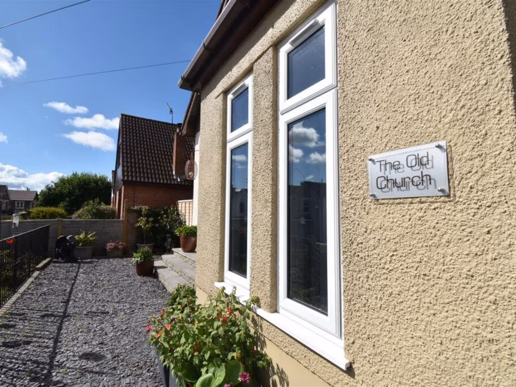
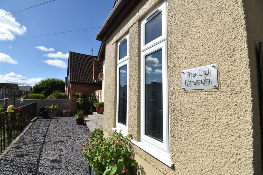
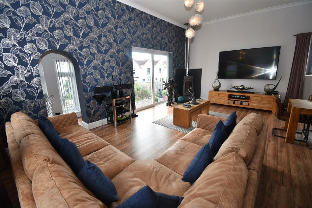
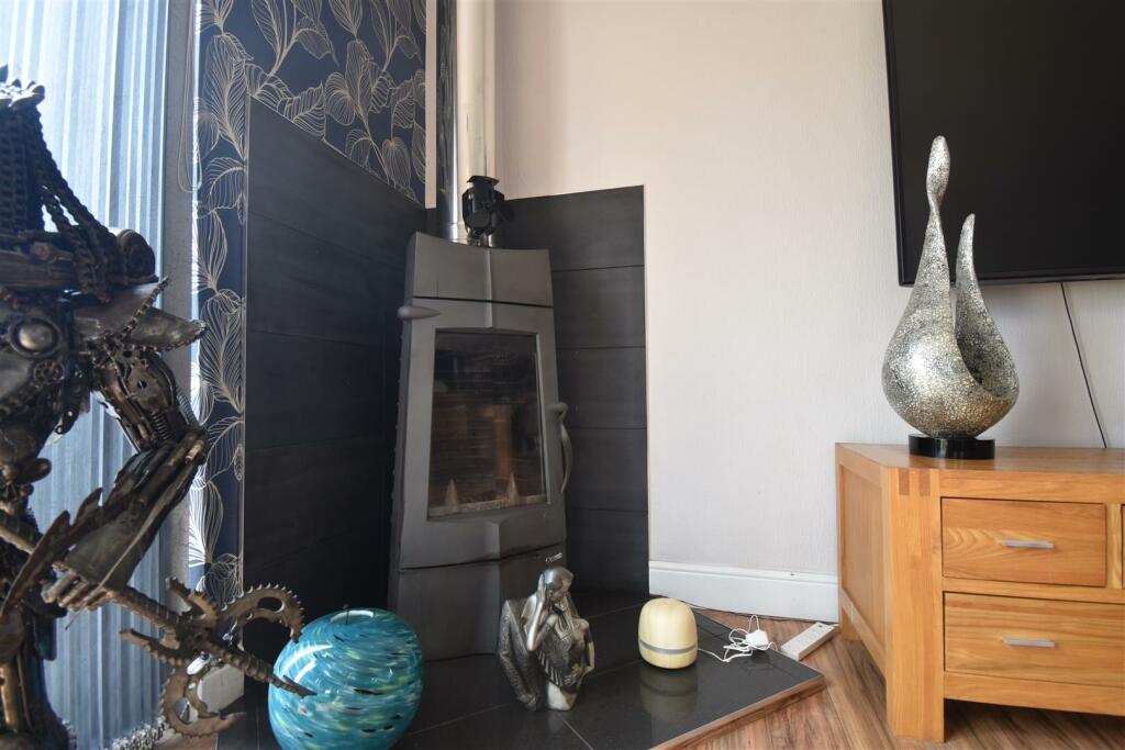
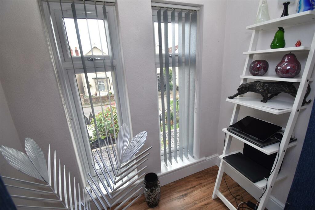
- converted church building early 20th century
Floorplan Description
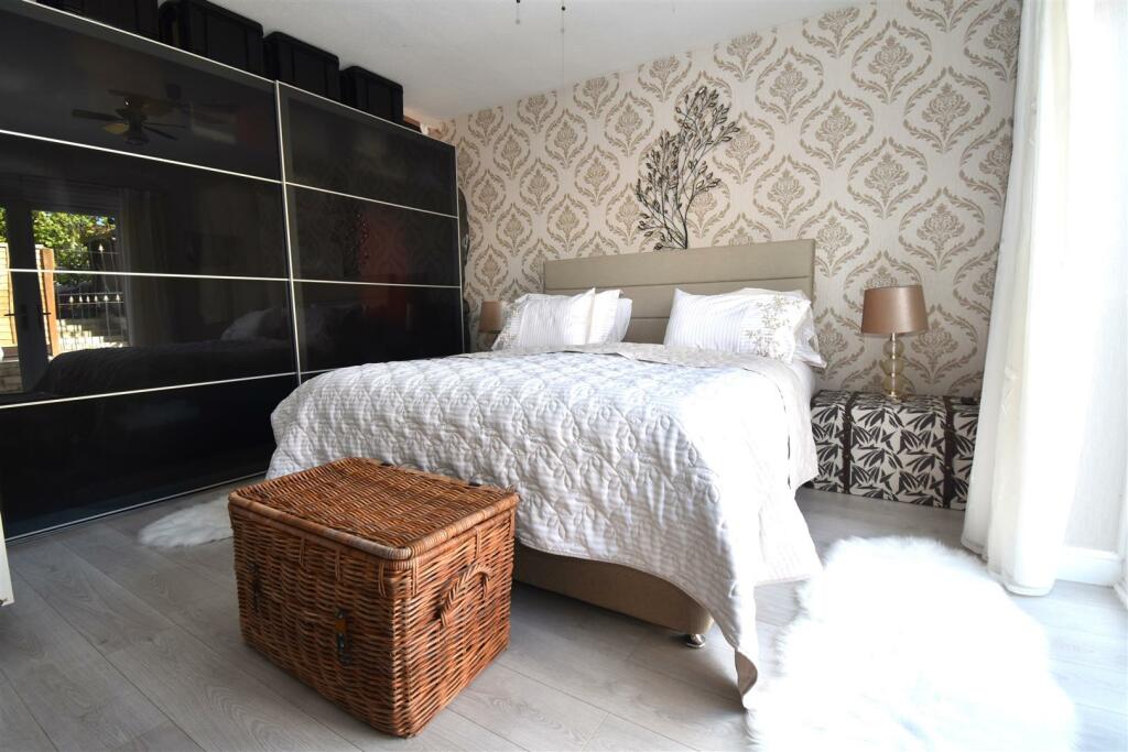
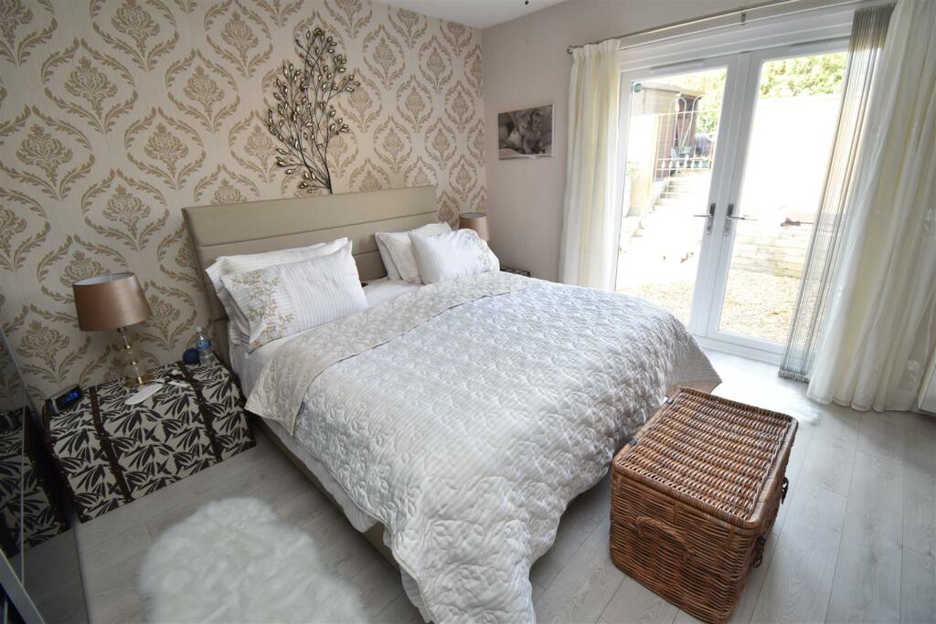
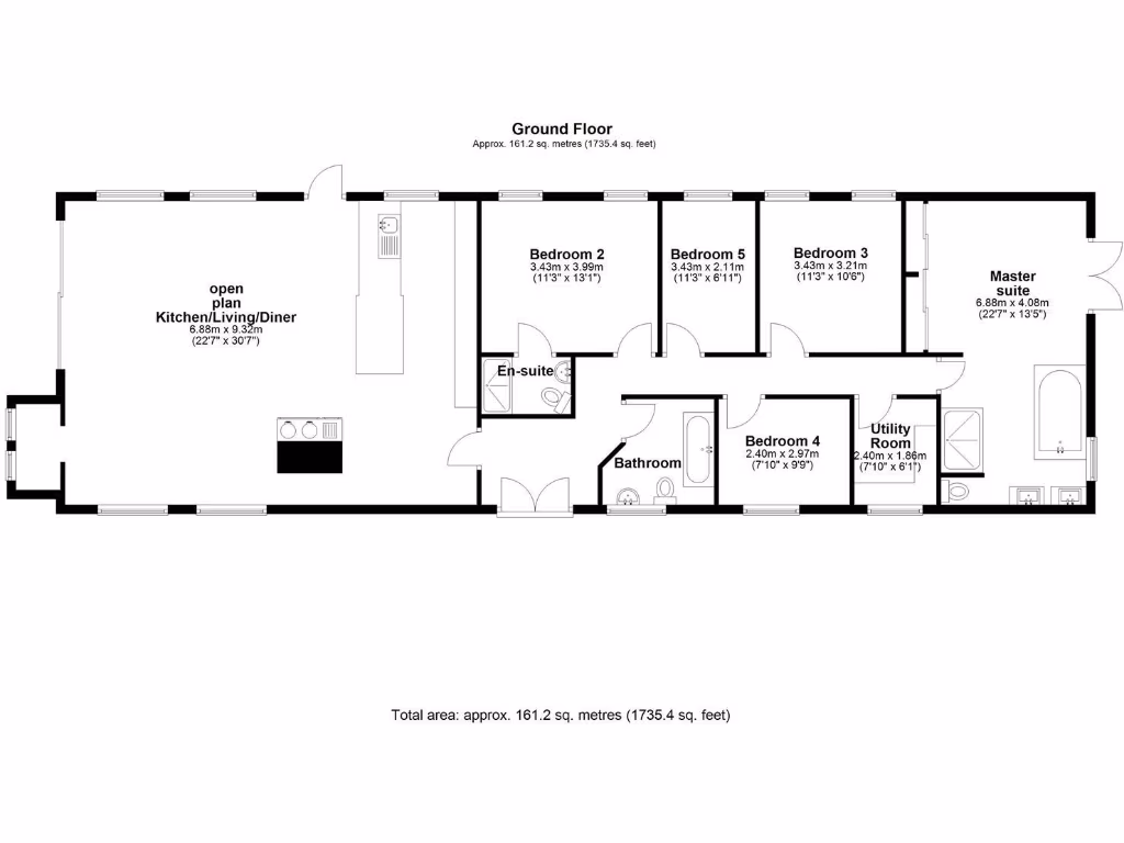
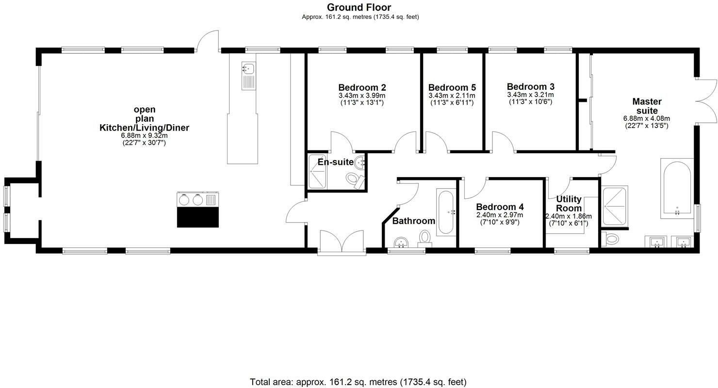
- A spacious open-plan property with multiple bedrooms and utility spaces.
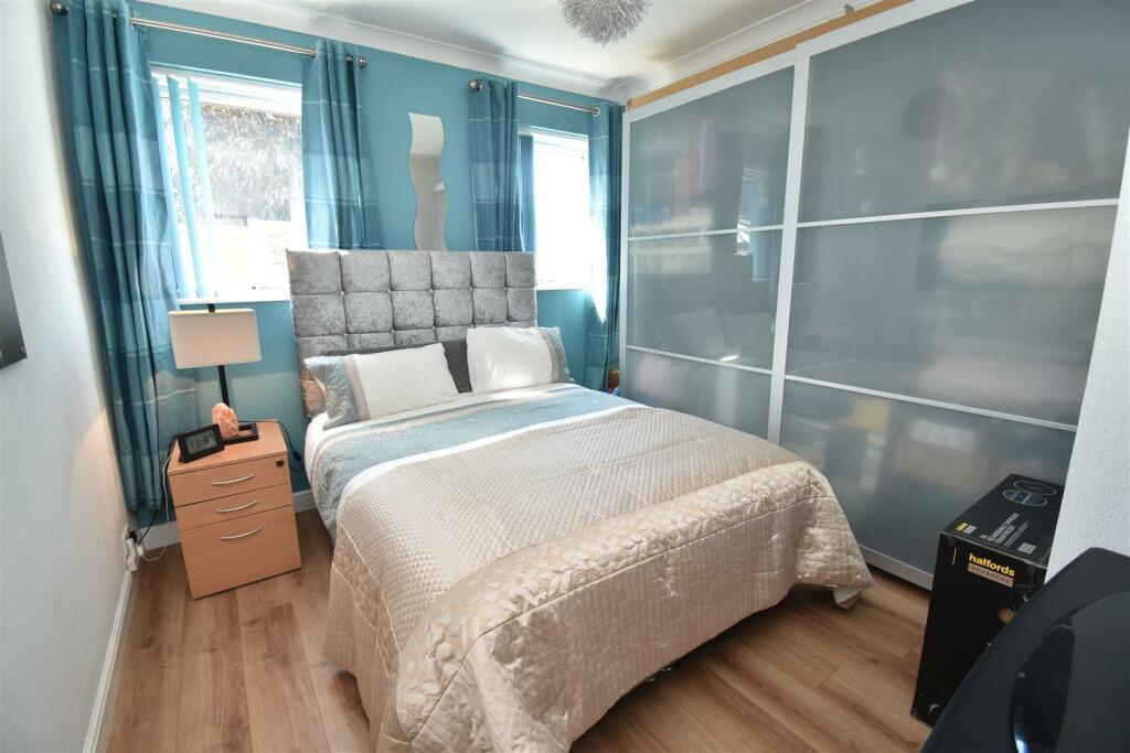
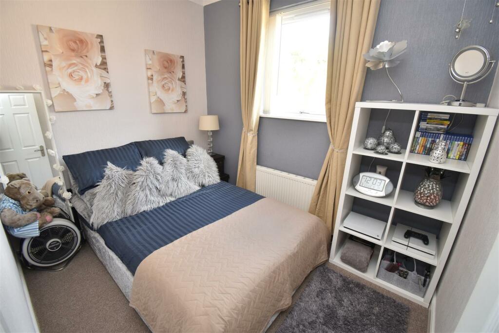
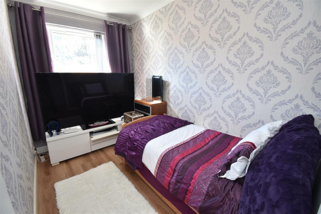
Rooms
- Kitchen/Living/Diner: large
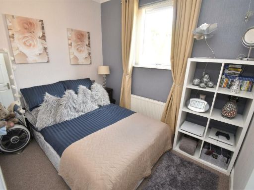
- Bedroom 2: average
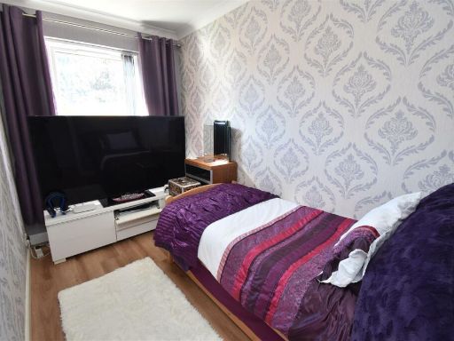
- Bedroom 5: small
- Bedroom 3: average
- Master suite: large
- Bedroom 4: small
- Utility Room: small
Textual Property Features
Detected Visual Features
- bungalow
- single-story
- front garden
- gravel landscaping
- detached
- modern
- well-maintained
- suburban
- residential area
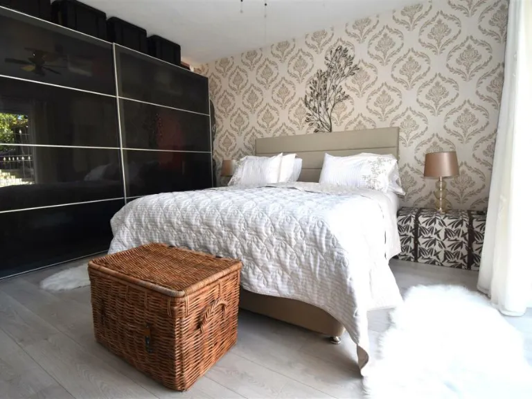
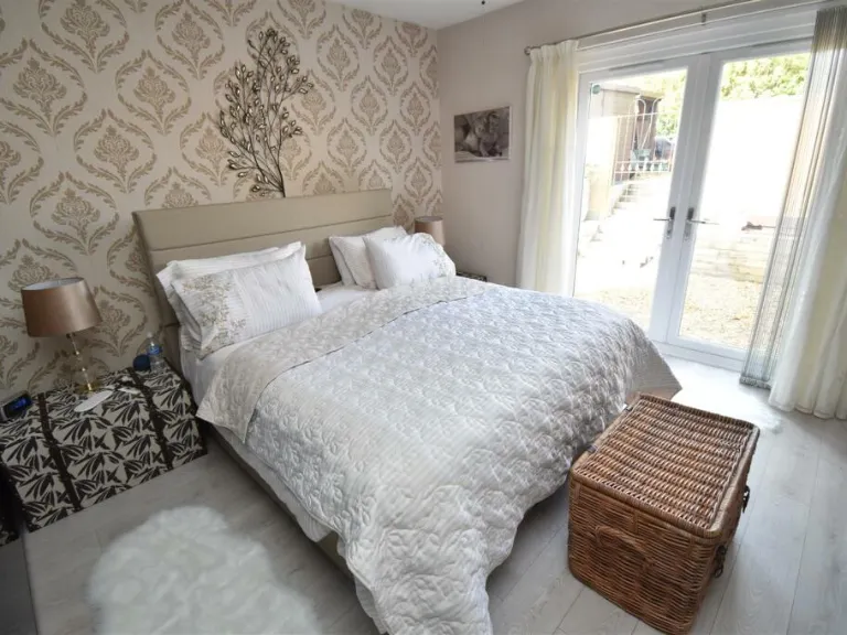
- open-plan
- living area
- kitchen
- dining
- tall ceilings
- large windows
- island counter
- wooden flooring
- contemporary lighting
- The Old Church
- converted church
- early 20th century
- high ceilings
- garden path
- historic building
- character property
EPC Details
- Fully double glazed
- Cavity wall, filled cavity
- Boiler and radiators, mains gas
- Low energy lighting in 63% of fixed outlets
- Solid, no insulation (assumed)
Nearby Schools
- Clifton College
- St Katherine's School
- Crockerne Church of England Primary School
- Stoke Bishop Church of England Primary School
- Nova Primary School
- Henbury Court Primary Academy
- Wraxall Church of England Primary School
- Sea Mills Primary School
- St Bede's Catholic College
- Northleaze Church of England Primary School
- The Downs Preparatory School
- St Mary's Church of England Primary School, Portbury
- Elmlea Infant School
- Shirehampton Primary School
- Avonmouth Church of England Primary School and Nursery
- Oasis Academy Long Cross
- Our Lady of the Rosary Catholic Primary School, Bristol
- Oasis Academy Bank Leaze
- Blaise High School
- Flax Bourton Church of England Primary School
- Birdwell Primary School
- Trinity Anglican-Methodist Primary School
- Elmlea Junior School
- St Bernard's Catholic Primary School
- Oasis Academy Brightstowe
Nearest General Shops
- Id: 275821481
- Tags:
- Addr:
- Housenumber: 13
- Street: Lodway
- Building: yes
- Name: Pill Hardware & DIY
- Shop: hardware
- TagsNormalized:
- Lat: 51.4800343
- Lon: -2.690158
- FullGeoHash: gcnhfg9hfvby
- PartitionGeoHash: gcnh
- Images:
- FoodStandards: null
- Distance: 187.4
,- Id: 356999905
- Tags:
- Addr:
- Housenumber: 4
- Street: Pill Street
- Building: yes
- Name: Dog Gym, Massage and Therapy
- Shop: pet_grooming
- TagsNormalized:
- gym
- massage
- therapy
- pet
- pet grooming
- shop
- Lat: 51.4789082
- Lon: -2.6855121
- FullGeoHash: gcnhfgkqrh10
- PartitionGeoHash: gcnh
- Images:
- FoodStandards: null
- Distance: 160.6
,- Id: 1000052831
- Tags:
- Building: yes
- Name: Bulldog Tattoo Studio
- Shop: tattoo
- TagsNormalized:
- Lat: 51.4788007
- Lon: -2.6862718
- FullGeoHash: gcnhfg7vtrfx
- PartitionGeoHash: gcnh
- Images:
- FoodStandards: null
- Distance: 114.7
}
Nearest Religious buildings
- Id: 746264548
- Tags:
- Amenity: place_of_worship
- Building: church
- Denomination: methodist
- Name: Pill Methodist Church
- Religion: christian
- TagsNormalized:
- place of worship
- church
- methodist
- christian
- Lat: 51.4792846
- Lon: -2.6840538
- FullGeoHash: gcnhfgt8940q
- PartitionGeoHash: gcnh
- Images:
- FoodStandards: null
- Distance: 257.2
,- Id: 356999896
- Tags:
- Addr:
- City: Pill
- Housenumber: 1
- Postcode: BS20 0HT
- Street: Heywood Road
- Amenity: place_of_worship
- Building: church
- Denomination: salvation_army
- Is_in: Pill
- Name: Worship & Community Church
- Religion: christian
- TagsNormalized:
- place of worship
- church
- salvation army
- christian
- Lat: 51.4785103
- Lon: -2.6845715
- FullGeoHash: gcnhfgmhhcy7
- PartitionGeoHash: gcnh
- Images:
- FoodStandards: null
- Distance: 235.9
,- Id: 843650281
- Tags:
- Addr:
- City: Pill
- Housenumber: 1
- Postcode: BS20 0AE
- Street: Church Place
- Amenity: place_of_worship
- Building: yes
- Denomination: anglican
- Name: Christ Church
- Religion: christian
- Wikidata: Q105091156
- TagsNormalized:
- place of worship
- anglican
- church
- christian
- Lat: 51.4795177
- Lon: -2.6861511
- FullGeoHash: gcnhfgs1bjss
- PartitionGeoHash: gcnh
- Images:
- FoodStandards: null
- Distance: 115.9
}
Nearest Airports
- Id: 47483196
- Tags:
- Aerodrome: international
- Aeroway: aerodrome
- Iata: BRS
- Icao: EGGD
- Internet_access: wlan
- Internet_access:fee: no
- Name: Bristol Airport
- Type: public
- Website: https://www.bristolairport.co.uk/
- Wikidata: Q8725
- Wikipedia: en:Bristol Airport
- TagsNormalized:
- airport
- international airport
- Lat: 51.3830799
- Lon: -2.7186615
- FullGeoHash: gcnh64h24s74
- PartitionGeoHash: gcnh
- Images:
- FoodStandards: null
- Distance: 10905.5
}
Nearest Leisure Facilities
- Id: 37369939
- Tags:
- Leisure: marina
- Name: Pill Marina
- Seamark:
- TagsNormalized:
- Lat: 51.481449
- Lon: -2.6843779
- FullGeoHash: gcnhfgvm1mwv
- PartitionGeoHash: gcnh
- Images:
- FoodStandards: null
- Distance: 339.3
,- Id: 972381895
- Tags:
- Leisure: pitch
- Sport: basketball
- TagsNormalized:
- pitch
- leisure
- basketball
- sports
- Lat: 51.4762558
- Lon: -2.6878421
- FullGeoHash: gcnhfffybtxd
- PartitionGeoHash: gcnh
- Images:
- FoodStandards: null
- Distance: 332.5
,- Id: 972381900
- Tags:
- TagsNormalized:
- Lat: 51.4767406
- Lon: -2.6887337
- FullGeoHash: gcnhfg41ezyy
- PartitionGeoHash: gcnh
- Images:
- FoodStandards: null
- Distance: 286.5
,- Id: 980632283
- Tags:
- Access: yes
- Leisure: playground
- TagsNormalized:
- Lat: 51.480303
- Lon: -2.6909624
- FullGeoHash: gcnhfg8w8011
- PartitionGeoHash: gcnh
- Images:
- FoodStandards: null
- Distance: 250.6
,- Id: 357810095
- Tags:
- TagsNormalized:
- Lat: 51.4783104
- Lon: -2.6851005
- FullGeoHash: gcnhfgkfbsef
- PartitionGeoHash: gcnh
- Images:
- FoodStandards: null
- Distance: 211.9
}
Nearest Tourist attractions
- Id: 692084796
- Tags:
- Addr:
- City: Bristol
- Housename: Oakham Farm
- Postcode: BS20 7SP
- Street: Portbury Lane
- Village: Wraxall
- Amenity: cafe
- Building: yes
- Fhrs:
- Name: Oakham Treasures
- Source:
- Tourism: museum
- Wikidata: Q113557045
- TagsNormalized:
- Lat: 51.4657479
- Lon: -2.7170436
- FullGeoHash: gcnhf1j98qc2
- PartitionGeoHash: gcnh
- Images:
- FoodStandards:
- Id: 159426
- FHRSID: 159426
- LocalAuthorityBusinessID: N99JPBPORT/1
- BusinessName: Oakham Treasures and Acorns Cafe
- BusinessType: Restaurant/Cafe/Canteen
- BusinessTypeID: 1
- AddressLine1: Oakham Farm
- AddressLine2: Portbury Lane
- AddressLine3: Wraxall
- AddressLine4: Bristol
- PostCode: BS20 7SP
- RatingValue: 5
- RatingKey: fhrs_5_en-GB
- RatingDate: 2022-01-28
- LocalAuthorityCode: 858
- LocalAuthorityName: North Somerset
- LocalAuthorityWebSite: http://www.n-somerset.gov.uk
- LocalAuthorityEmailAddress: foodandsafety@n-somerset.gov.uk
- Scores:
- Hygiene: 0
- Structural: 0
- ConfidenceInManagement: 0
- NewRatingPending: false
- Geocode:
- Longitude: -2.72008900000000
- Latitude: 51.46533900000000
- Distance: 2522.8
,- Id: 760410907
- Tags:
- Addr:
- Housenumber: 235
- Street: Avonmouth Road
- Building: yes
- Name: Avonmouth Guest House
- Tourism: guest_house
- TagsNormalized:
- Lat: 51.499769
- Lon: -2.6974091
- FullGeoHash: gcnhfx5zcucb
- PartitionGeoHash: gcnh
- Images:
- FoodStandards: null
- Distance: 2377.8
,- Id: 275827627
- Tags:
- Building: yes
- Tourism: museum
- TagsNormalized:
- Lat: 51.4949657
- Lon: -2.672912
- FullGeoHash: gcnhgnmeutk7
- PartitionGeoHash: gcnh
- Images:
- FoodStandards: null
- Distance: 2028.2
}
Nearest Train stations
- Id: 7167271113
- Tags:
- Addr:
- City: Bristol
- Postcode: BS1 6QF
- Alt_name: Temple Meads
- Name: Bristol Temple Meads
- Name:cy: Temple Meads Bryste
- Name:en: Bristol Temple Meads
- Naptan:
- Network: National Rail
- Operator: Network Rail
- Public_transport: station
- Railway: station
- Ref:
- Crs: BRI
- Stanox: 81700
- Tiploc: BRSTLTM
- Wikidata: Q800579
- Wikipedia: en:Bristol Temple Meads railway station
- TagsNormalized:
- Lat: 51.4490991
- Lon: -2.5804029
- FullGeoHash: gcnhtq108r0n
- PartitionGeoHash: gcnh
- Images:
- FoodStandards: null
- Distance: 8158.1
,- Id: 492098581
- Tags:
- Internet_access: no
- Name: Nailsea and Backwell
- Naptan:
- Network: National Rail
- Operator: GWR
- Public_transport: station
- Railway: station
- Ref:
- Source: GPX + NPE
- Wikidata: Q6959642
- Wikipedia: en:Nailsea and Backwell railway station
- TagsNormalized:
- Lat: 51.4196718
- Lon: -2.7496898
- FullGeoHash: gcnh92ttr9d9
- PartitionGeoHash: gcnh
- Images:
- FoodStandards: null
- Distance: 7892.7
,- Id: 151002947
- Tags:
- Name: SS Great Britain
- Public_transport: station
- Railway: station
- Usage: tourism
- Wheelchair: yes
- TagsNormalized:
- Lat: 51.4480613
- Lon: -2.605539
- FullGeoHash: gcnhstydwt9r
- PartitionGeoHash: gcnh
- Images:
- FoodStandards: null
- Distance: 6668.8
,- Id: 1097293785
- Tags:
- Name: Butterfly Junction
- Public_transport: station
- Railway: station
- Usage: tourism
- TagsNormalized:
- Lat: 51.4465304
- Lon: -2.6199792
- FullGeoHash: gcnhsms1y03g
- PartitionGeoHash: gcnh
- Images:
- FoodStandards: null
- Distance: 5940.3
,- Id: 7167219010
- Tags:
- Name: Sea Mills
- Naptan:
- Network: National Rail
- Public_transport: station
- Railway: station
- Ref:
- Toilets:
- Wheelchair: yes
- Wikidata: Q2672919
- Wikipedia: en:Sea Mills railway station
- TagsNormalized:
- Lat: 51.4795006
- Lon: -2.6496514
- FullGeoHash: gcnhgew9fdkw
- PartitionGeoHash: gcnh
- Images:
- FoodStandards: null
- Distance: 2639.7
}
Nearest Hotels
- Id: 372131591
- Tags:
- Addr:
- City: Bristol
- Housenumber: 28
- Postcode: BS11 9AD
- Street: Gloucester Road
- Suburb: Avonmouth
- Building: hotel
- Contact:
- Email: reception@theroyalhotelbristol.com
- Phone: +44 117 982 2847
- Website: http://www.theroyalhotelbristol.com/
- Fhrs:
- Name: Royal Hotel
- Pub: yes
- Rooms: 30
- Source:
- Tourism: hotel
- TagsNormalized:
- Lat: 51.5001891
- Lon: -2.7010233
- FullGeoHash: gcnhfx34me54
- PartitionGeoHash: gcnh
- Images:
- FoodStandards: null
- Distance: 2503.2
,- Id: 372131582
- Tags:
- Addr:
- City: Bristol
- Housenumber: 151
- Postcode: BS11 9LW
- Street: Avonmouth Road
- Suburb: Avonmouth
- Amenity: social_facility
- Building: yes
- Fhrs:
- Name: Bradford Lodge
- Social_facility: assisted_living
- Source:
- Tourism: hotel
- TagsNormalized:
- social facility
- hotel
- tourism
- Lat: 51.4978753
- Lon: -2.6915864
- FullGeoHash: gcnhfybhc7xx
- PartitionGeoHash: gcnh
- Images:
- FoodStandards: null
- Distance: 2088.4
,- Id: 121419387
- Tags:
- Addr:
- City: Bristol
- Place: Welcome Break Gordano Services
- Postcode: BS20 7XG
- Brand: Ramada
- Brand:wikidata: Q1502859
- Brand:wikipedia: en:Ramada
- Building: yes
- Name: Ramada by Wyndham Bristol West
- Operator: Wyndham Hotels
- Source:
- Tourism: hotel
- Website: https://www.wyndhamhotels.com/en-uk/ramada/bristol-united-kingdom/ramada-bristol-west/
- TagsNormalized:
- Lat: 51.4768969
- Lon: -2.7070178
- FullGeoHash: gcnhf7hf9vj4
- PartitionGeoHash: gcnh
- Images:
- FoodStandards: null
- Distance: 1358.5
}
Tags
- bungalow
- single-story
- front garden
- gravel landscaping
- detached
- modern
- well-maintained
- suburban
- residential area
- open-plan
- living area
- modern
- kitchen
- dining
- tall ceilings
- large windows
- island counter
- wooden flooring
- contemporary lighting
- The Old Church
- converted church
- early 20th century
- large windows
- high ceilings
- garden path
- historic building
- character property
Local Market Stats
- Average Price/sqft: £376
- Avg Income: £55400
- Rental Yield: 3.9%
- Social Housing: 11%
- Planning Success Rate: 90%
Similar Properties
 4 bedroom detached house for sale in Springfield Road, Portishead, Bristol, Somerset, BS20 — £720,000 • 4 bed • 2 bath • 2010 ft²
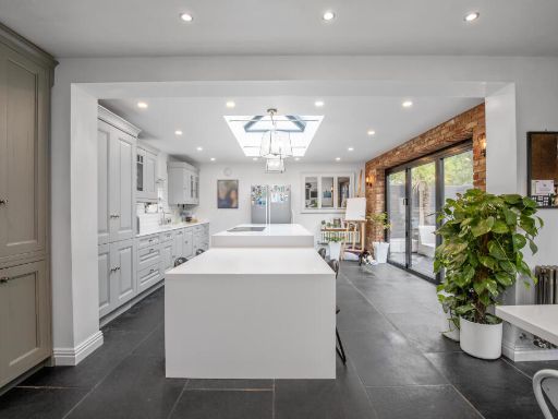 5 bedroom detached house for sale in Birchwood Road, Bristol, BS4 — £925,000 • 5 bed • 3 bath • 2140 ft²
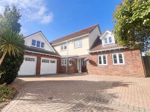 4 bedroom detached house for sale in Church Road North, Portishead, BS20 — £825,000 • 4 bed • 3 bath • 1900 ft²
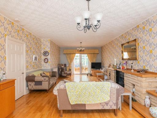 3 bedroom detached house for sale in Highridge Road, Bishopsworth, BS13 — £450,000 • 3 bed • 1 bath • 1541 ft²
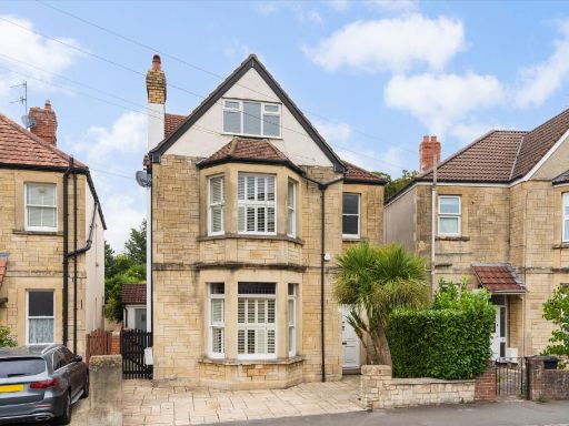 5 bedroom detached house for sale in Grange Court Road, Westbury On Trym, Bristol, BS9 — £1,350,000 • 5 bed • 3 bath • 2484 ft²
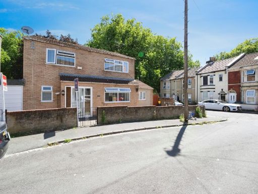 4 bedroom semi-detached house for sale in Brentry Avenue, Bristol, BS5 — £450,000 • 4 bed • 4 bath • 1162 ft²
Meta
- {
"@context": "https://schema.org",
"@type": "Residence",
"name": "5 bedroom detached house for sale in Springfield Road, Pill…",
"description": "",
"url": "https://propertypiper.co.uk/property/fd995916-8153-4137-a258-48eff4bda500",
"image": "https://image-a.propertypiper.co.uk/d004ea61-252f-4236-b08b-c34aff478f9c-1024.jpeg",
"address": {
"@type": "PostalAddress",
"streetAddress": "The Old Church, Springfield Road, Pill",
"postalCode": "BS20 0DP",
"addressLocality": "North Somerset",
"addressRegion": "North Somerset",
"addressCountry": "England"
},
"geo": {
"@type": "GeoCoordinates",
"latitude": 51.47924539439697,
"longitude": -2.6877670429352576
},
"numberOfRooms": 5,
"numberOfBathroomsTotal": 3,
"floorSize": {
"@type": "QuantitativeValue",
"value": 1700,
"unitCode": "FTK"
},
"offers": {
"@type": "Offer",
"price": 533000,
"priceCurrency": "GBP",
"availability": "https://schema.org/InStock"
},
"additionalProperty": [
{
"@type": "PropertyValue",
"name": "Feature",
"value": "bungalow"
},
{
"@type": "PropertyValue",
"name": "Feature",
"value": "single-story"
},
{
"@type": "PropertyValue",
"name": "Feature",
"value": "front garden"
},
{
"@type": "PropertyValue",
"name": "Feature",
"value": "gravel landscaping"
},
{
"@type": "PropertyValue",
"name": "Feature",
"value": "detached"
},
{
"@type": "PropertyValue",
"name": "Feature",
"value": "modern"
},
{
"@type": "PropertyValue",
"name": "Feature",
"value": "well-maintained"
},
{
"@type": "PropertyValue",
"name": "Feature",
"value": "suburban"
},
{
"@type": "PropertyValue",
"name": "Feature",
"value": "residential area"
},
{
"@type": "PropertyValue",
"name": "Feature",
"value": "open-plan"
},
{
"@type": "PropertyValue",
"name": "Feature",
"value": "living area"
},
{
"@type": "PropertyValue",
"name": "Feature",
"value": "modern"
},
{
"@type": "PropertyValue",
"name": "Feature",
"value": "kitchen"
},
{
"@type": "PropertyValue",
"name": "Feature",
"value": "dining"
},
{
"@type": "PropertyValue",
"name": "Feature",
"value": "tall ceilings"
},
{
"@type": "PropertyValue",
"name": "Feature",
"value": "large windows"
},
{
"@type": "PropertyValue",
"name": "Feature",
"value": "island counter"
},
{
"@type": "PropertyValue",
"name": "Feature",
"value": "wooden flooring"
},
{
"@type": "PropertyValue",
"name": "Feature",
"value": "contemporary lighting"
},
{
"@type": "PropertyValue",
"name": "Feature",
"value": "The Old Church"
},
{
"@type": "PropertyValue",
"name": "Feature",
"value": "converted church"
},
{
"@type": "PropertyValue",
"name": "Feature",
"value": "early 20th century"
},
{
"@type": "PropertyValue",
"name": "Feature",
"value": "large windows"
},
{
"@type": "PropertyValue",
"name": "Feature",
"value": "high ceilings"
},
{
"@type": "PropertyValue",
"name": "Feature",
"value": "garden path"
},
{
"@type": "PropertyValue",
"name": "Feature",
"value": "historic building"
},
{
"@type": "PropertyValue",
"name": "Feature",
"value": "character property"
}
]
}
High Res Floorplan Images
Compatible Floorplan Images
FloorplanImages Thumbnail