HR8 2FZ - 4 bedroom detached house for sale in Bronte Drive, Ledbury,…
View on Property Piper
4 bedroom detached house for sale in Bronte Drive, Ledbury, HR8
Property Details
- Price: £395000
- Bedrooms: 4
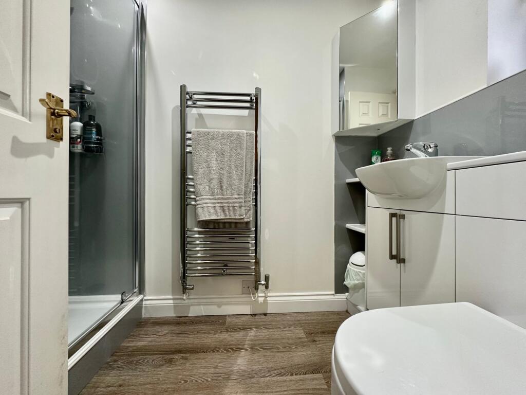
- Bathrooms: 2
- Property Type: undefined
- Property SubType: undefined
Brochure Descriptions
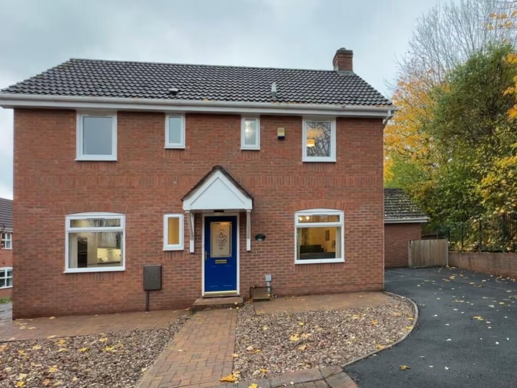
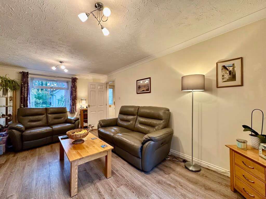
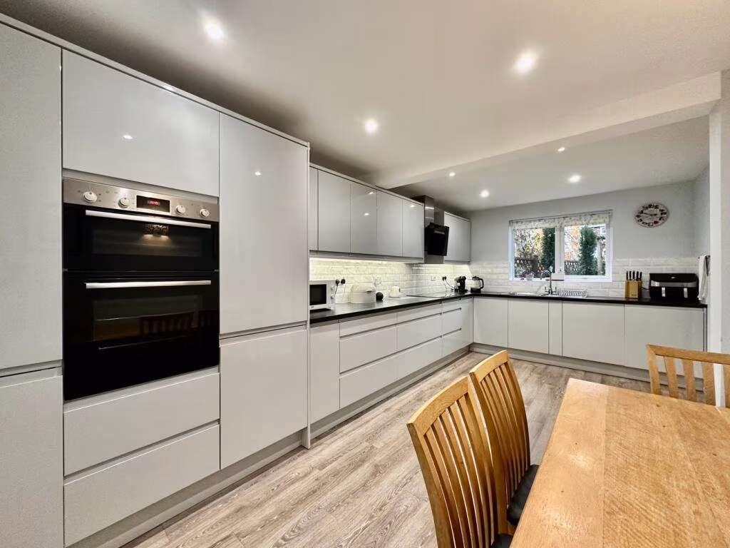
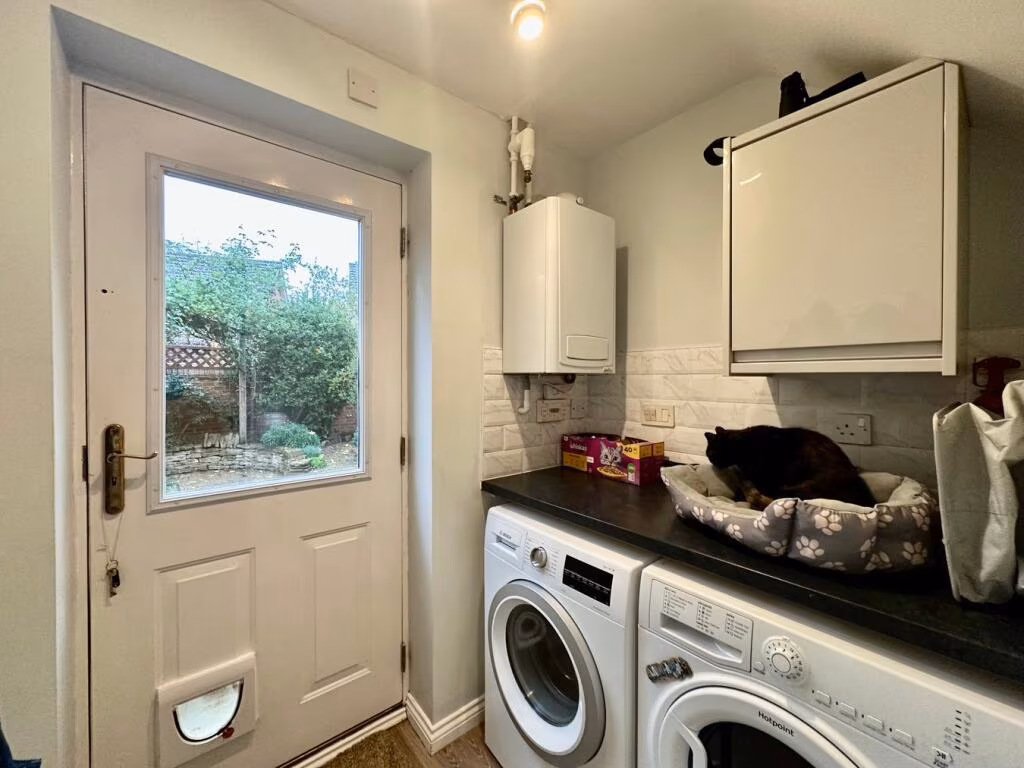
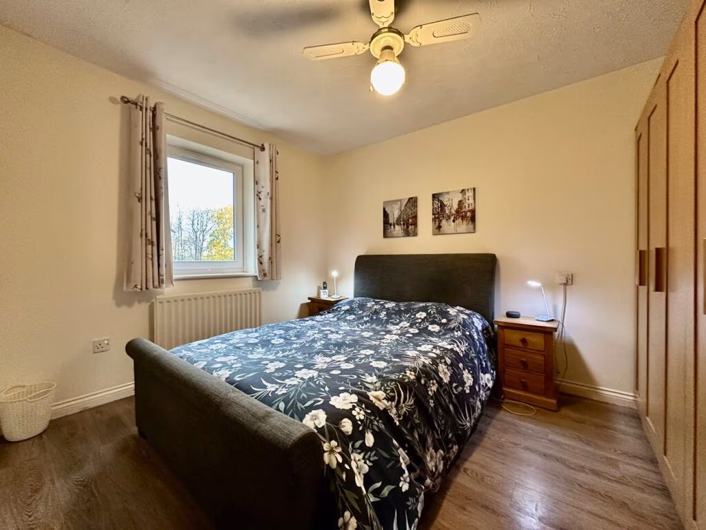
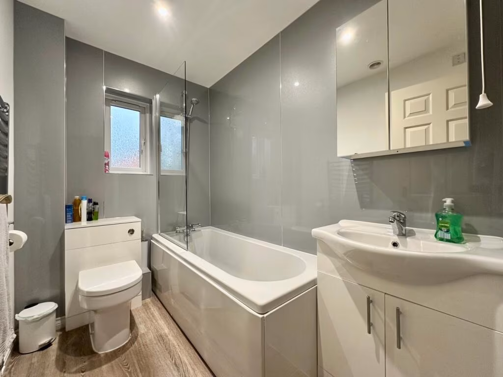
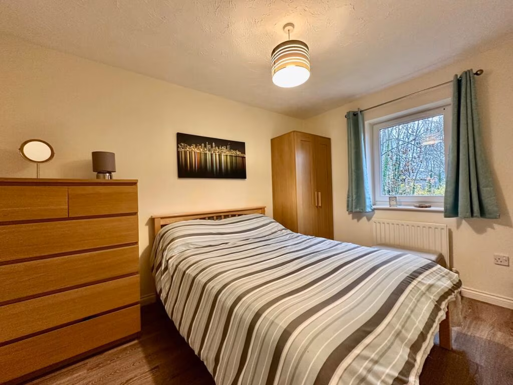
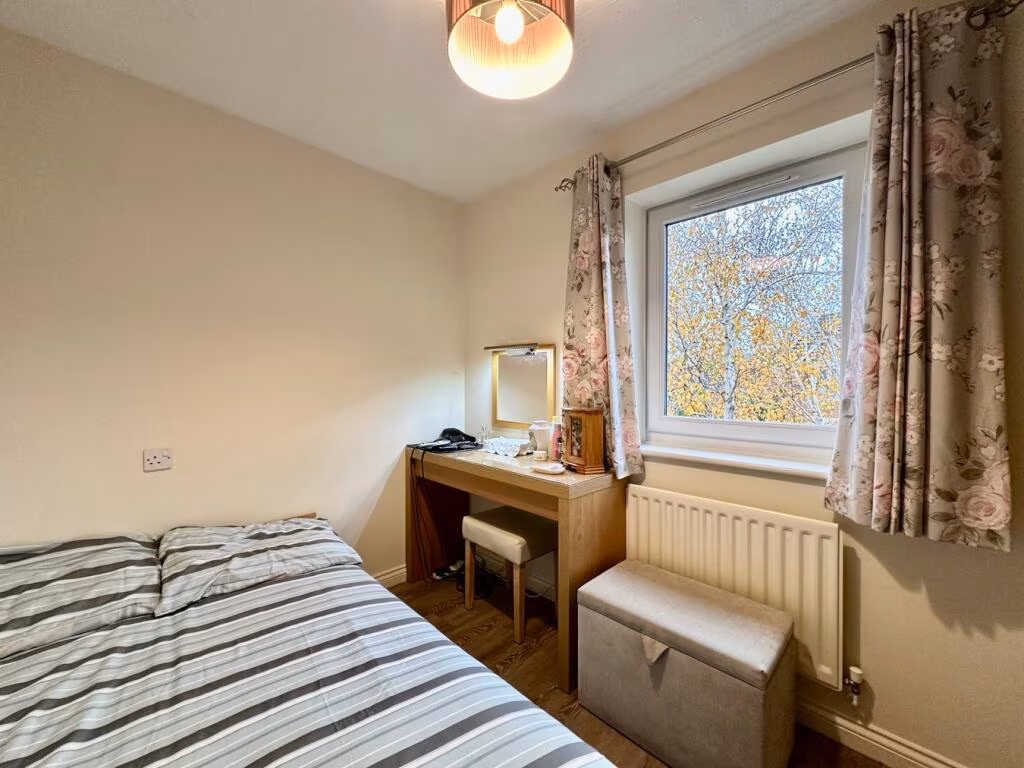
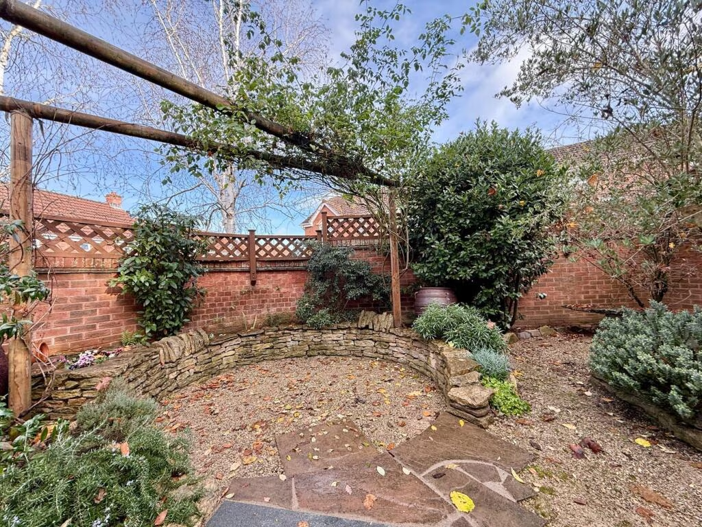
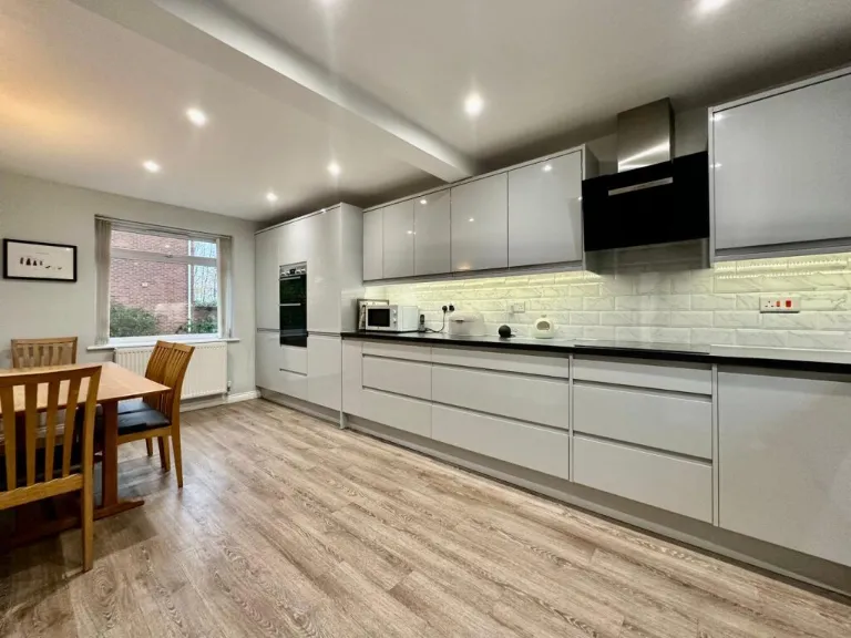
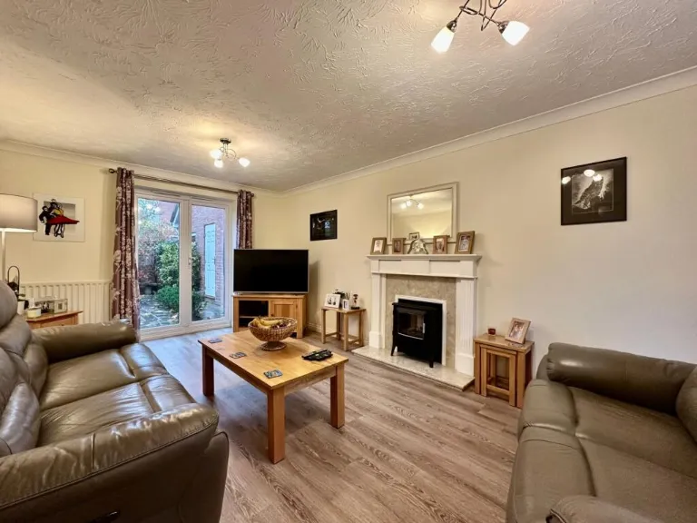
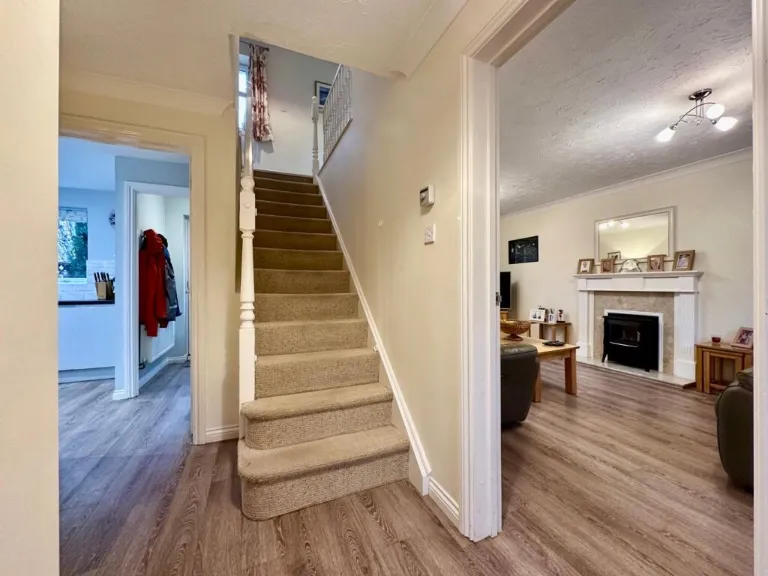
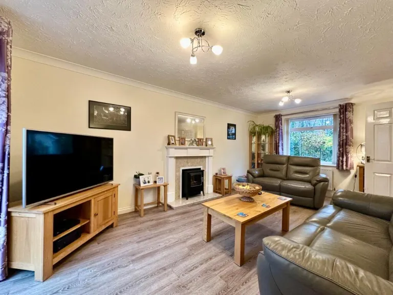
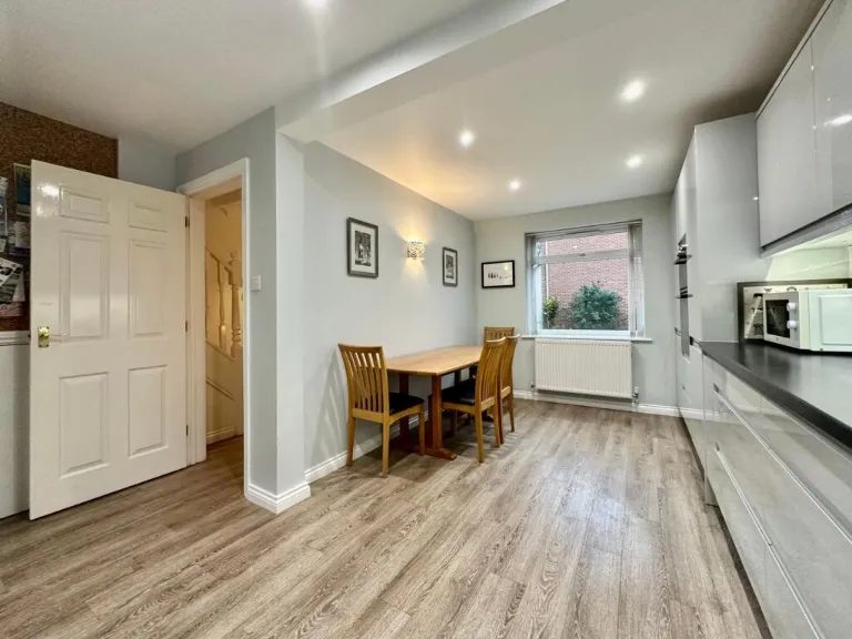
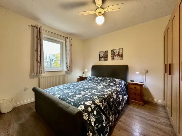
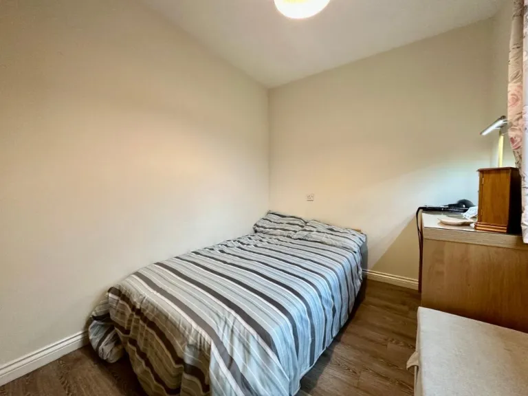
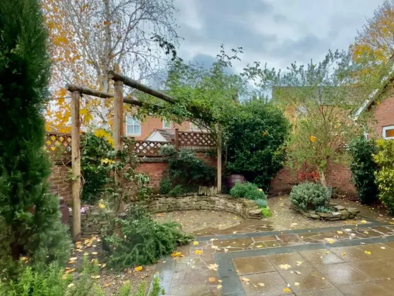
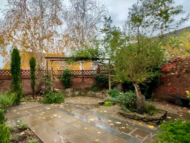
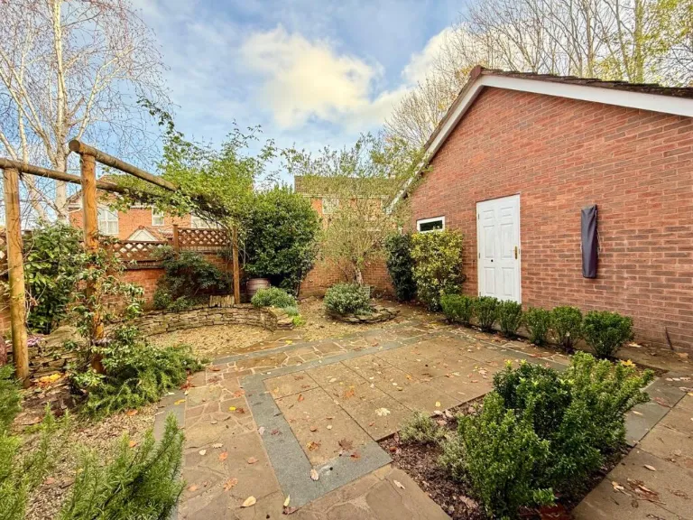
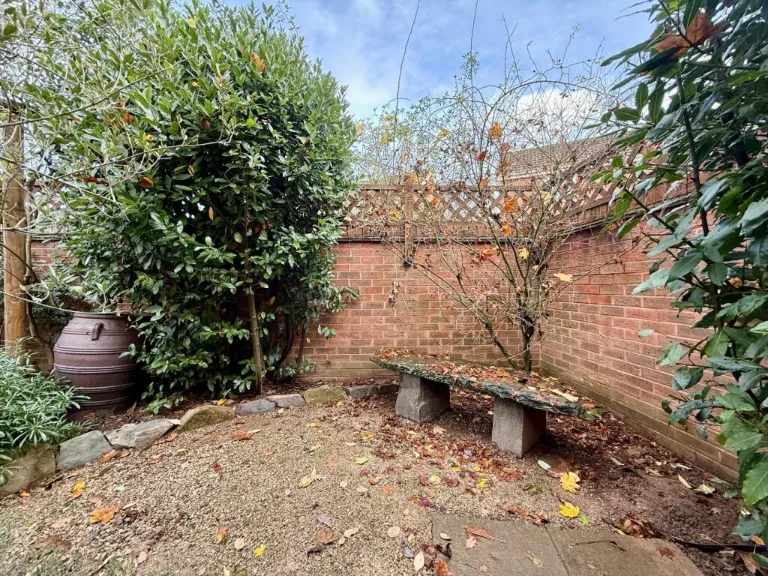
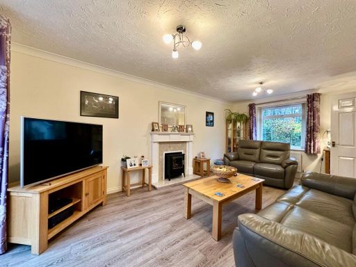
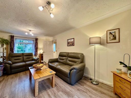
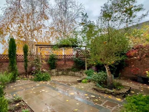
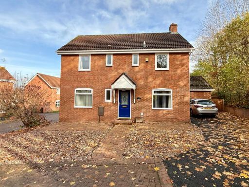
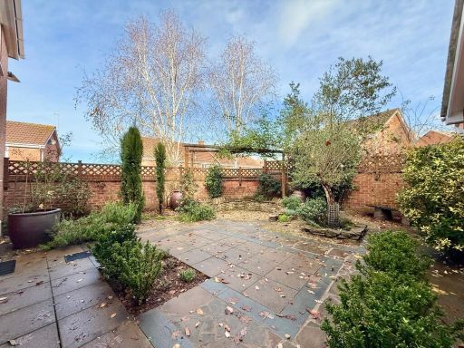
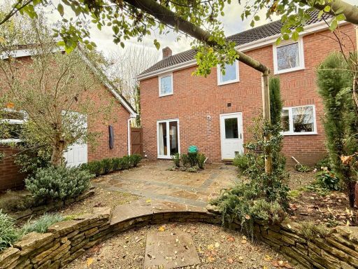
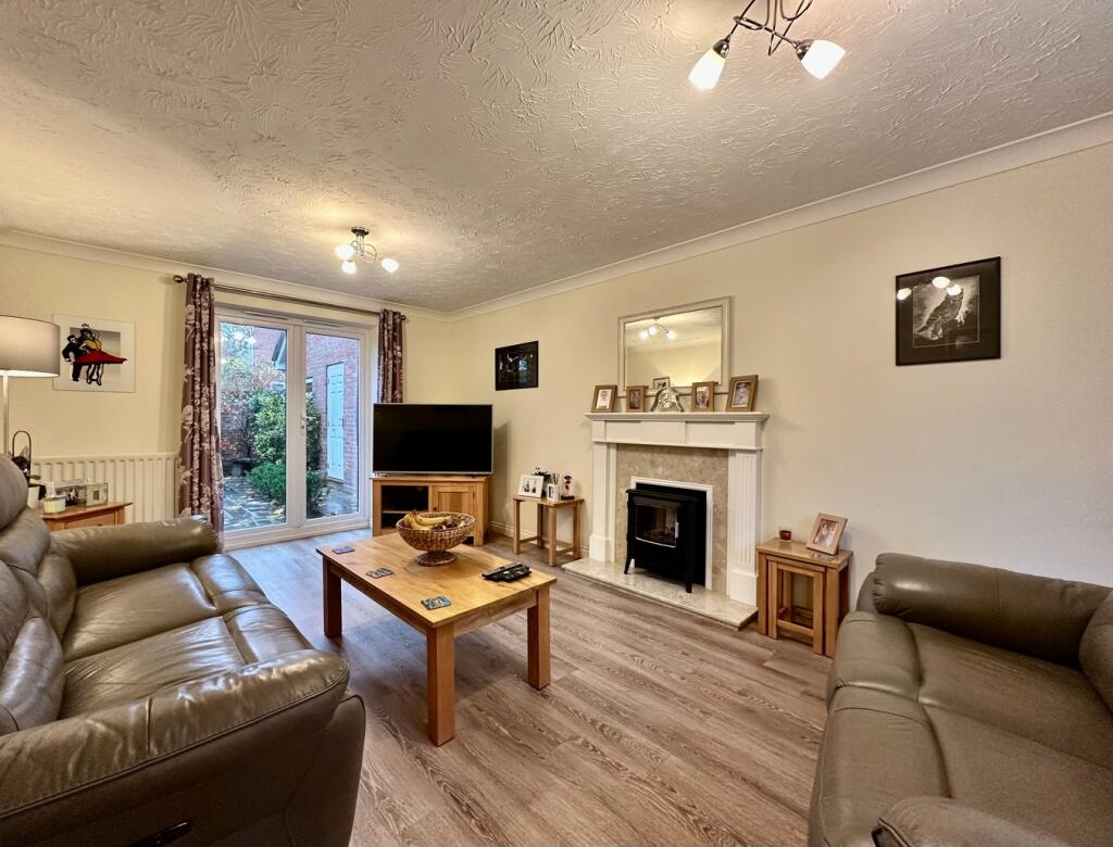
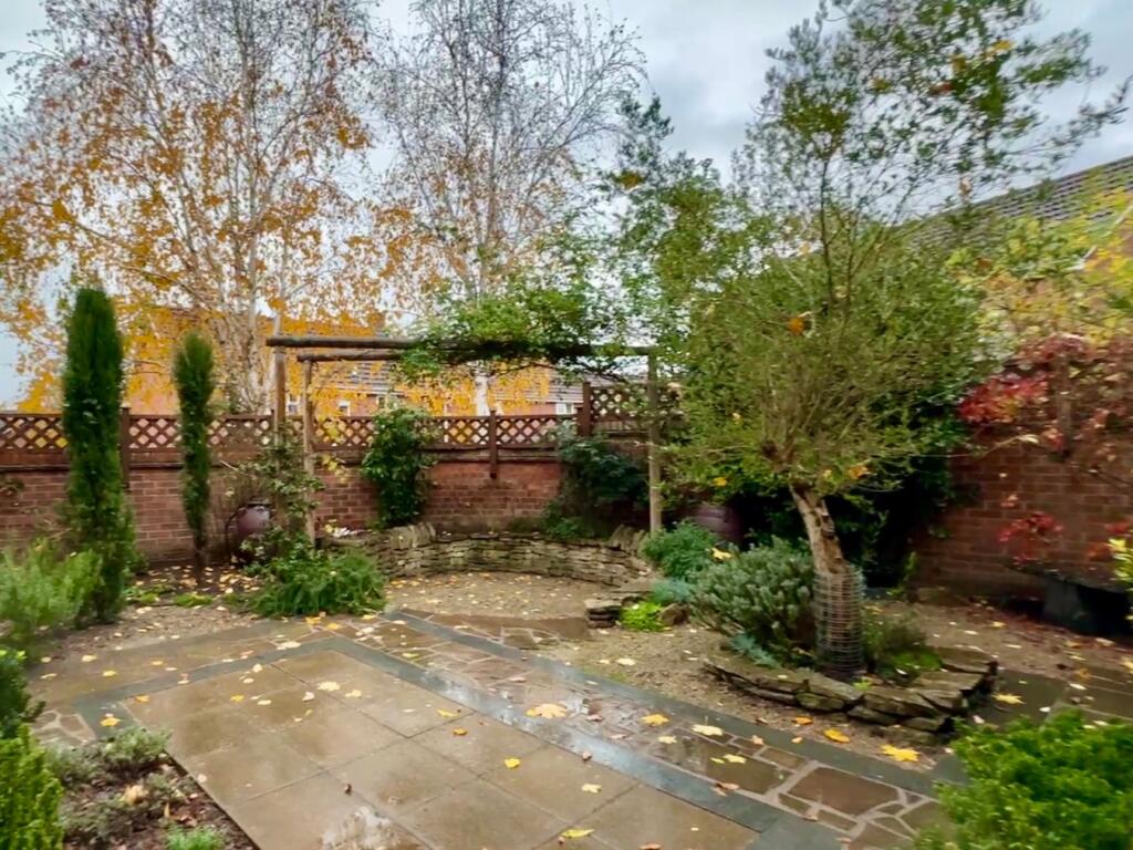
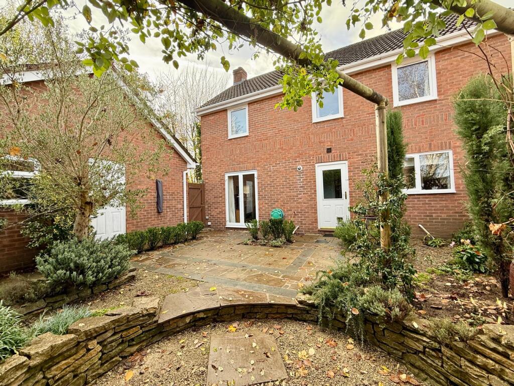
- Two-storey detached brick house located in a cul-de-sac within walking distance of Ledbury town centre. Appears to be a four-bedroom family home with a pitched tiled roof, single garage and ample off-street parking to the front (block-paved driveway). Interior photos show an open-plan kitchen/dining area with modern fitted units, a separate living room with fireplace, and a carpeted staircase to the first floor. Rear landscaped garden of medium size with paved patio and mature planting/trees. Overall property footprint and plot are medium/average for a suburban family house; condition appears well-presented and modernised (UPVC double glazing and gas central heating noted).
Image Descriptions
- two-story brick detached house Modern
- kitchen contemporary
Rooms
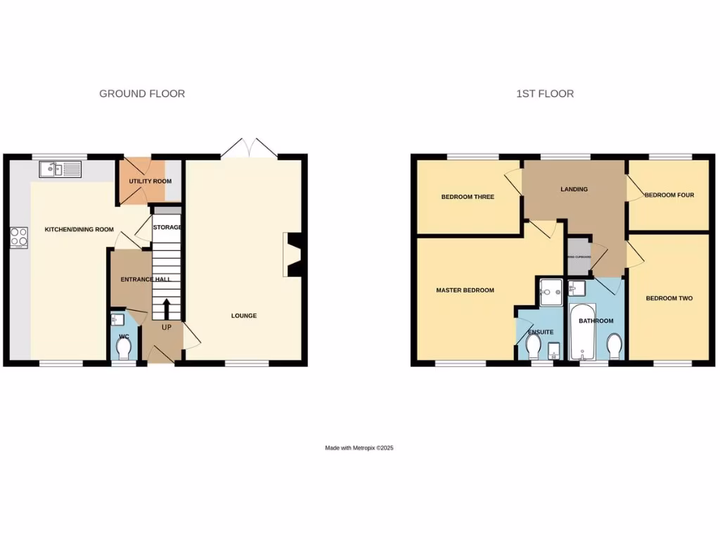
- KITCHEN/DINING ROOM:
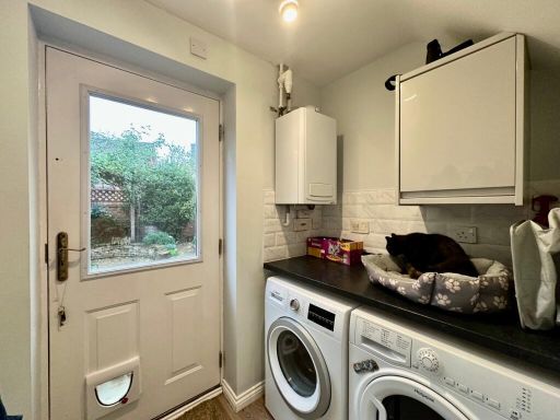
- UTILITY ROOM:
- STORAGE:
- ENTRANCE HALL:
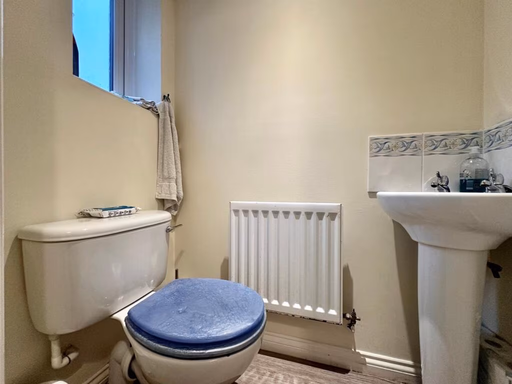
- WC:
- LOUNGE:
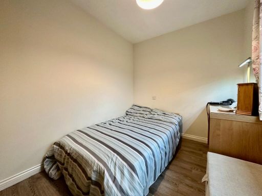
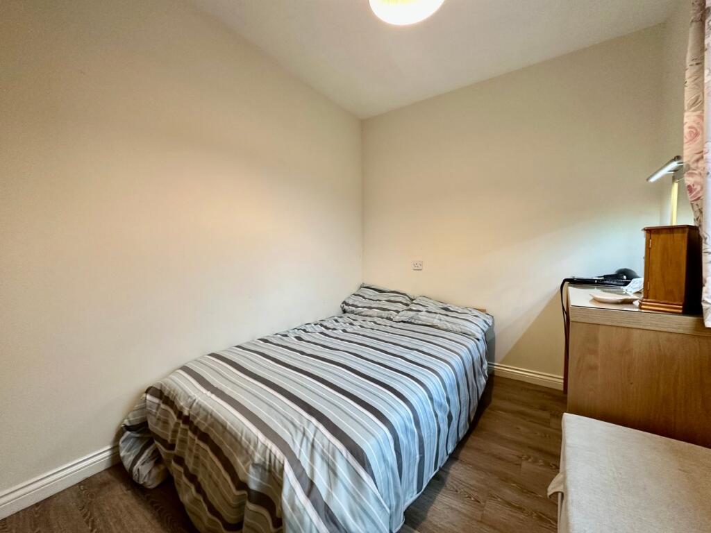
- BEDROOM THREE:
- MASTER BEDROOM:
- BEDROOM FOUR:
- LANDING:
- BEDROOM TWO:
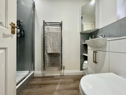
- ENSUITE:
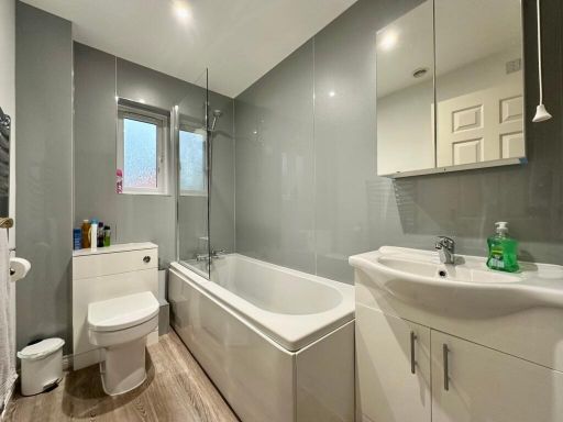
- BATHROOM:
Textual Property Features
Detected Visual Features
- modern
- two-story
- detached
- brick
- gabled roof
- driveway
- suburban
- residential
- contemporary kitchen
- modern design
- large kitchen
- open plan
- wood flooring
- high gloss cabinets
- recessed lighting
- under-cabinet lighting
EPC Details
- Fully double glazed
- Cavity wall, as built, insulated (assumed)
- Boiler and radiators, mains gas
- Low energy lighting in 64% of fixed outlets
- Solid, limited insulation (assumed)
Nearby Schools
- Ashperton Primary Academy
- The Elms School
- Much Marcle CofE Primary School
- Ledbury Primary School
- Malvern Wyche CofE Primary School
- Redmarley Church of England Primary School
- Abbey College in Malvern
- Colwall CofE Primary School and Nursery
- The Downs, Malvern College Prep School
- Bosbury CofE Primary School
- John Masefield High School
- Eastnor Parochial Primary School
- Malvern Wells CofE Primary School
- Ann Cam Church of England Primary School
Nearest General Shops
- Id: 315332417
- Tags:
- Building: yes
- Name: LDA Meats Ltd
- Shop: butcher
- Source: survey+Bing
- TagsNormalized:
- Lat: 52.0369915
- Lon: -2.4352706
- FullGeoHash: gcq20949qn69
- PartitionGeoHash: gcq2
- Images:
- FoodStandards: null
- Distance: 164.1
,- Id: 420902543
- Tags:
- Building: yes
- Name: Ledbury Tools & Fixings
- Shop: hardware
- TagsNormalized:
- Lat: 52.0369003
- Lon: -2.4339306
- FullGeoHash: gcq20958vm3c
- PartitionGeoHash: gcq2
- Images:
- FoodStandards: null
- Distance: 162
,- Id: 315332416
- Tags:
- Building: yes
- Name: Riverford Organic Farms wholesalers
- Organic: only
- Shop: supermarket
- Source: survey+Bing
- TagsNormalized:
- Lat: 52.0374372
- Lon: -2.4353696
- FullGeoHash: gcq2094s5c2u
- PartitionGeoHash: gcq2
- Images:
- FoodStandards: null
- Distance: 124.4
}
Nearest Grocery shops
- Id: 701085859
- Tags:
- Addr:
- Postcode: HR8 2EZ
- Street: New Street
- Alt_name: The Co-operative Food
- Brand: The Co-operative Food
- Brand:wikidata: Q107617274
- Landuse: commercial
- Name: The Co-operative Food
- Operator: Co-op
- Shop: supermarket
- TagsNormalized:
- the co-operative food
- food
- shop
- Lat: 52.0349142
- Lon: -2.4250596
- FullGeoHash: gcq20bdjk509
- PartitionGeoHash: gcq2
- Images:
- FoodStandards: null
- Distance: 737.6
,- Id: 589808545
- Tags:
- Brand: One Stop
- Brand:wikidata: Q65954217
- Building: retail
- Name: One Stop
- Shop: convenience
- Source: visual survey;bing
- TagsNormalized:
- one stop
- retail
- convenience
- shop
- Lat: 52.037423
- Lon: -2.4236311
- FullGeoHash: gcq20c55vq9x
- PartitionGeoHash: gcq2
- Images:
- FoodStandards: null
- Distance: 736.4
,- Id: 887511706
- Tags:
- Building: retail
- Name: The Fruit and Veg Shop
- Shop: greengrocer
- Source: survey
- TagsNormalized:
- retail
- shop
- greengrocer
- grocer
- Lat: 52.0367054
- Lon: -2.4247986
- FullGeoHash: gcq20bfrf0gn
- PartitionGeoHash: gcq2
- Images:
- FoodStandards: null
- Distance: 674.4
}
Nearest Religious buildings
- Id: 31437015
- Tags:
- Amenity: place_of_worship
- Building: yes
- Denomination: anglican
- Heritage: 2
- Heritage:operator: Historic England
- Listed_status: Grade I
- Name: St Michael and All Angels
- Note: Diocese of Hereford and Ledbury
- Religion: christian
- Source: bing
- Wikidata: Q17530276
- TagsNormalized:
- place of worship
- anglican
- christian
- church
- Lat: 52.0369612
- Lon: -2.4200872
- FullGeoHash: gcq20cj9rbsh
- PartitionGeoHash: gcq2
- Images:
- FoodStandards: null
- Distance: 983.8
,- Id: 427273424
- Tags:
- Amenity: place_of_worship
- Building: yes
- Denomination: catholic
- Name: Catholic Church of the Most Holy Trinity
- Religion: christian
- TagsNormalized:
- place of worship
- catholic
- church
- christian
- Lat: 52.0337118
- Lon: -2.4270274
- FullGeoHash: gcq20b2wq4vj
- PartitionGeoHash: gcq2
- Images:
- FoodStandards: null
- Distance: 715.5
,- Id: 590592221
- Tags:
- Amenity: place_of_worship
- Building: yes
- Denomination: baptist
- Name: Ledbury Baptist Church
- Religion: christian
- Source: survey
- TagsNormalized:
- place of worship
- baptist
- church
- christian
- Lat: 52.0402486
- Lon: -2.4251021
- FullGeoHash: gcq20cdh7j2y
- PartitionGeoHash: gcq2
- Images:
- FoodStandards: null
- Distance: 663.6
}
Nearest Medical buildings
- Id: 591857389
- Tags:
- Addr:
- City: Ledbury
- Street: High Street
- Amenity: pharmacy
- Brand: Boots
- Brand:wikidata: Q6123139
- Brand:wikipedia: en:Boots (company)
- Building: retail
- Healthcare: pharmacy
- Name: Boots
- Source: Bing+survey
- TagsNormalized:
- pharmacy
- boots
- retail
- health
- healthcare
- Lat: 52.03659
- Lon: -2.4223171
- FullGeoHash: gcq20bup5gmq
- PartitionGeoHash: gcq2
- Images:
- FoodStandards: null
- Distance: 842
,- Id: 617167356
- Tags:
- Amenity: dentist
- Building: yes
- Healthcare: dentist
- Name: Abbey Cottage Dental Practice
- TagsNormalized:
- dentist
- health
- healthcare
- dental
- Lat: 52.0383473
- Lon: -2.4236084
- FullGeoHash: gcq20c71mg49
- PartitionGeoHash: gcq2
- Images:
- FoodStandards: null
- Distance: 730.9
,- Id: 1068568779
- Tags:
- Amenity: doctors
- Building: yes
- Healthcare: doctor
- TagsNormalized:
- doctor
- doctors
- health
- healthcare
- Lat: 52.0361355
- Lon: -2.4249164
- FullGeoHash: gcq20bfhrqer
- PartitionGeoHash: gcq2
- Images:
- FoodStandards: null
- Distance: 686.7
,- Id: 440195086
- Tags:
- Amenity: hospital
- Healthcare: hospital
- Name: Ledbury Community Health and Care Centre
- TagsNormalized:
- Lat: 52.0362578
- Lon: -2.4249211
- FullGeoHash: gcq20bfjpjxb
- PartitionGeoHash: gcq2
- Images:
- FoodStandards: null
- Distance: 681.6
}
Nearest Leisure Facilities
- Id: 701283920
- Tags:
- TagsNormalized:
- Lat: 52.039619
- Lon: -2.4306963
- FullGeoHash: gcq209w0b8j7
- PartitionGeoHash: gcq2
- Images:
- FoodStandards: null
- Distance: 284.2
,- Id: 905782544
- Tags:
- TagsNormalized:
- Lat: 52.0392727
- Lon: -2.4376546
- FullGeoHash: gcq2092ywx8c
- PartitionGeoHash: gcq2
- Images:
- FoodStandards: null
- Distance: 252.2
,- Id: 701283921
- Tags:
- TagsNormalized:
- Lat: 52.0394503
- Lon: -2.4311399
- FullGeoHash: gcq209mxy2ds
- PartitionGeoHash: gcq2
- Images:
- FoodStandards: null
- Distance: 248.6
,- Id: 424193019
- Tags:
- Leisure: pitch
- Surface: grass
- TagsNormalized:
- Lat: 52.0390024
- Lon: -2.4316565
- FullGeoHash: gcq209mm4m1k
- PartitionGeoHash: gcq2
- Images:
- FoodStandards: null
- Distance: 194.9
,- Id: 95805232
- Tags:
- Fixme: approxmate area
- Leisure: playground
- TagsNormalized:
- Lat: 52.0377441
- Lon: -2.4331199
- FullGeoHash: gcq209hmb4w6
- PartitionGeoHash: gcq2
- Images:
- FoodStandards: null
- Distance: 104.1
}
Nearest Tourist attractions
- Id: 521232105
- Tags:
- Addr:
- City: Ledbury
- Postcode: HR8 1EE
- Street: Worcester Road
- Caravans: yes
- Fee: yes
- Name: The Elms Holiday Park
- Tents: yes
- Tourism: camp_site
- Website: https://www.theelmsledbury.co.uk/
- TagsNormalized:
- Lat: 52.0408355
- Lon: -2.411853
- FullGeoHash: gcq211exzfb5
- PartitionGeoHash: gcq2
- Images:
- FoodStandards: null
- Distance: 1559.8
,- Id: 291777054
- Tags:
- Addr:
- City: Ledbury
- Postcode: HR8 1DN
- Street: Church Lane
- Building: yes
- Name: Ledbury Heritage Centre
- Tourism: museum
- Wikidata: Q113379854
- TagsNormalized:
- Lat: 52.0372159
- Lon: -2.4216608
- FullGeoHash: gcq20chdg0ng
- PartitionGeoHash: gcq2
- Images:
- FoodStandards: null
- Distance: 873.1
,- Id: 299920722
- Tags:
- Addr:
- City: Ledbury
- Housename: Butcher Row House
- Postcode: HR8 1DW
- Street: Church Lane
- Building: yes
- Name: Butcher Row House Museum
- Operator: Ledbury & District Civic Society
- Tourism: museum
- Website: http://www.ledburycivicsociety.org/butcherrowhouse.html
- Wikidata: Q108381199
- TagsNormalized:
- Lat: 52.037081
- Lon: -2.4218924
- FullGeoHash: gcq20ch3vyfp
- PartitionGeoHash: gcq2
- Images:
- FoodStandards: null
- Distance: 859.7
}
Nearest Hotels
- Id: 472782820
- Tags:
- Addr:
- Place: Upper Colwall
- Postcode: WR13 6DW
- Street: Jubilee Drive
- Building: yes
- Fhrs:
- Name: Malvern Hills Hotel
- Pub: yes
- Source:
- Tourism: hotel
- Website: http://malvernhillshotel.co.uk/
- TagsNormalized:
- Lat: 52.0619228
- Lon: -2.3466547
- FullGeoHash: gcq24te4wvz6
- PartitionGeoHash: gcq2
- Images:
- FoodStandards: null
- Distance: 6541.5
,- Id: 188617360
- Tags:
- Addr:
- Housenumber: 14
- Postcode: HR8 2DX
- Street: New Street
- Building: yes
- Name: The Talbot Hotel
- Phone: +44 1531 632963
- Source: survey
- Tourism: hotel
- Website: https://www.talbotledbury.co.uk/
- TagsNormalized:
- Lat: 52.0355159
- Lon: -2.4231502
- FullGeoHash: gcq20bg8be0r
- PartitionGeoHash: gcq2
- Images:
- FoodStandards: null
- Distance: 824.4
,- Id: 593032380
- Tags:
- Addr:
- City: Ledbury
- Housenumber: 25
- Postcode: HR8 1DS
- Street: High Street
- Building: yes
- Fhrs:
- Heritage: 2
- Heritage:operator: Historic England
- Listed_status: Grade II*
- Name: The Feathers Hotel
- Source: survey+Bing
- Source:addr: FHRS Open Data
- Tourism: hotel
- TagsNormalized:
- Lat: 52.0362084
- Lon: -2.4231143
- FullGeoHash: gcq20bgsck74
- PartitionGeoHash: gcq2
- Images:
- FoodStandards: null
- Distance: 800.6
}
Tags
- modern
- two-story
- detached
- brick
- gabled roof
- driveway
- suburban
- residential
- contemporary kitchen
- modern design
- large kitchen
- open plan
- wood flooring
- high gloss cabinets
- recessed lighting
- under-cabinet lighting
Local Market Stats
- Average Price/sqft: £308
- Avg Income: £45000
- Rental Yield: 3.1%
- Social Housing: 5%
- Planning Success Rate: 88%
AirBnB Data
- 1km average: £95/night
- Listings in 1km: 1
Similar Properties
 4 bedroom detached house for sale in Progress Close, Ledbury, HR8 — £499,950 • 4 bed • 2 bath • 1339 ft²
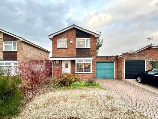 3 bedroom link detached house for sale in Biddulph Way, Ledbury, HR8 — £355,000 • 3 bed • 1 bath • 1217 ft²
 4 bedroom detached house for sale in Biddulph Way, Ledbury, HR8 — £390,000 • 4 bed • 2 bath • 1163 ft²
 4 bedroom detached house for sale in Masefield Avenue, Ledbury, HR8 — £399,950 • 4 bed • 3 bath • 1298 ft²
 4 bedroom detached house for sale in Farjeon Close, Ledbury, HR8 — £475,000 • 4 bed • 2 bath • 1068 ft²
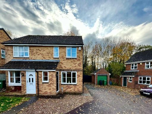 2 bedroom semi-detached house for sale in Target Close, Ledbury, HR8 — £224,950 • 2 bed • 1 bath • 593 ft²
Meta
- {
"@context": "https://schema.org",
"@type": "Residence",
"name": "4 bedroom detached house for sale in Bronte Drive, Ledbury,…",
"description": "",
"url": "https://propertypiper.co.uk/property/fd8ae4ef-28b4-4e30-8de0-802e03773e6c",
"image": "https://image-a.propertypiper.co.uk/5d2f293a-0b8e-4316-ba8f-d8db7c94bf66-1024.jpeg",
"address": {
"@type": "PostalAddress",
"streetAddress": "41, Bronte Drive",
"postalCode": "HR8 2FZ",
"addressLocality": "Herefordshire, County of",
"addressRegion": "North Herefordshire",
"addressCountry": "England"
},
"geo": {
"@type": "GeoCoordinates",
"latitude": 52.03833981168969,
"longitude": -2.434293951809793
},
"numberOfRooms": 4,
"numberOfBathroomsTotal": 2,
"floorSize": {
"@type": "QuantitativeValue",
"value": 1034,
"unitCode": "FTK"
},
"offers": {
"@type": "Offer",
"price": 395000,
"priceCurrency": "GBP",
"availability": "https://schema.org/InStock"
},
"additionalProperty": [
{
"@type": "PropertyValue",
"name": "Feature",
"value": "modern"
},
{
"@type": "PropertyValue",
"name": "Feature",
"value": "two-story"
},
{
"@type": "PropertyValue",
"name": "Feature",
"value": "detached"
},
{
"@type": "PropertyValue",
"name": "Feature",
"value": "brick"
},
{
"@type": "PropertyValue",
"name": "Feature",
"value": "gabled roof"
},
{
"@type": "PropertyValue",
"name": "Feature",
"value": "driveway"
},
{
"@type": "PropertyValue",
"name": "Feature",
"value": "suburban"
},
{
"@type": "PropertyValue",
"name": "Feature",
"value": "residential"
},
{
"@type": "PropertyValue",
"name": "Feature",
"value": "contemporary kitchen"
},
{
"@type": "PropertyValue",
"name": "Feature",
"value": "modern design"
},
{
"@type": "PropertyValue",
"name": "Feature",
"value": "large kitchen"
},
{
"@type": "PropertyValue",
"name": "Feature",
"value": "open plan"
},
{
"@type": "PropertyValue",
"name": "Feature",
"value": "wood flooring"
},
{
"@type": "PropertyValue",
"name": "Feature",
"value": "high gloss cabinets"
},
{
"@type": "PropertyValue",
"name": "Feature",
"value": "recessed lighting"
},
{
"@type": "PropertyValue",
"name": "Feature",
"value": "under-cabinet lighting"
}
]
}
High Res Floorplan Images
Compatible Floorplan Images
FloorplanImages Thumbnail