TN25 7AA - 2 bedroom semidetached house for sale in Nuthatch Drive, Fi…
View on Property Piper
2 bedroom semi-detached house for sale in Nuthatch Drive, Finberry, Ashford, Kent, TN25
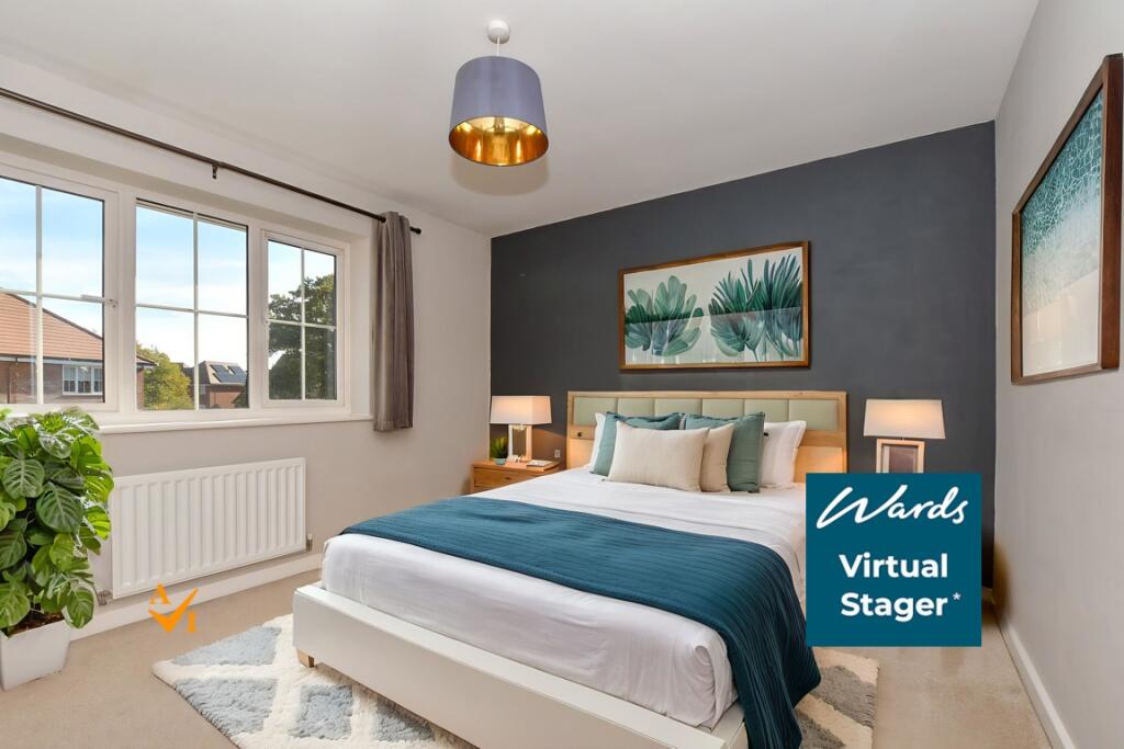
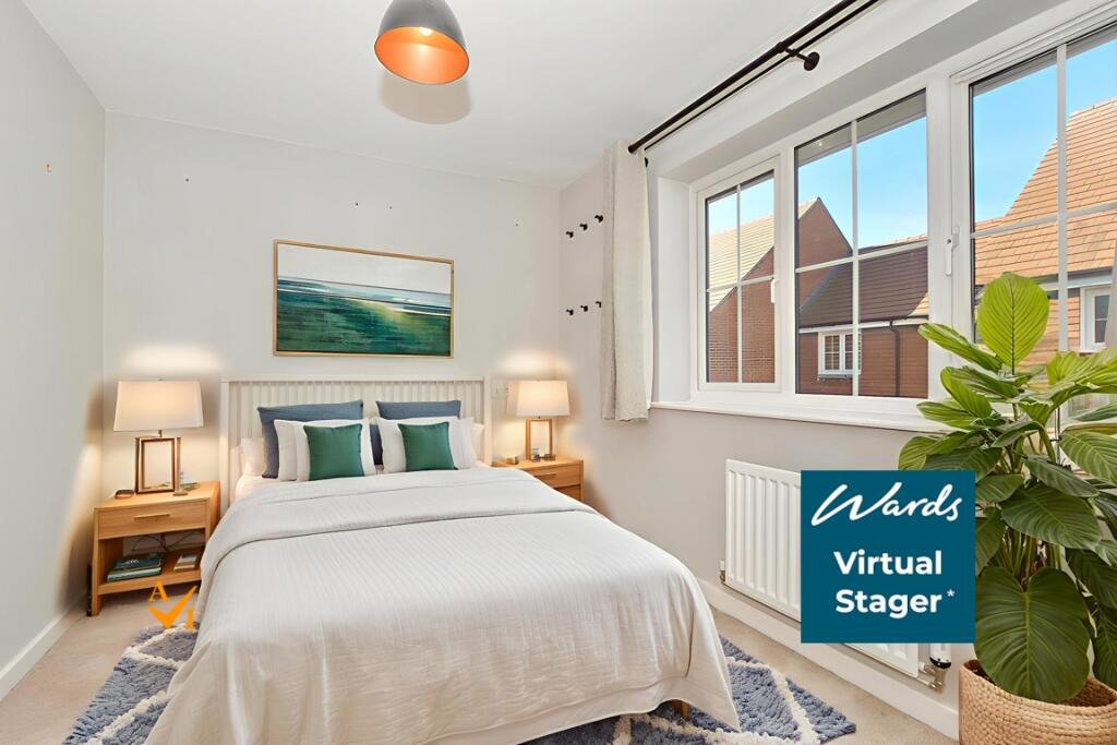
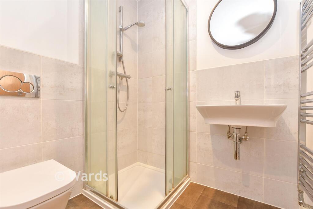
Property Details
- Price: £315000
- Bedrooms: 2
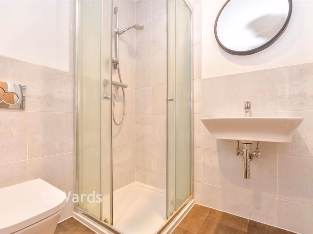
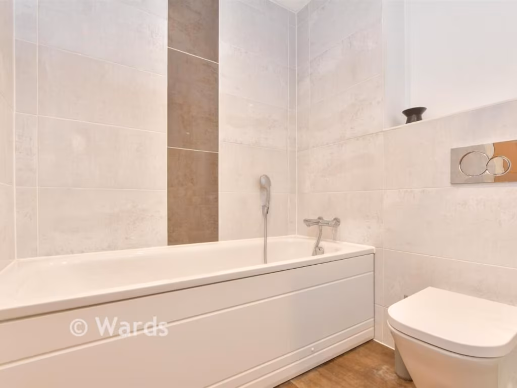
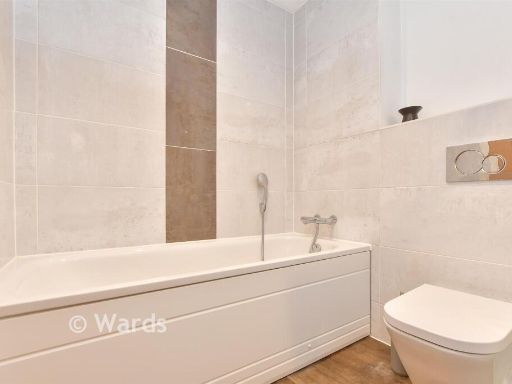
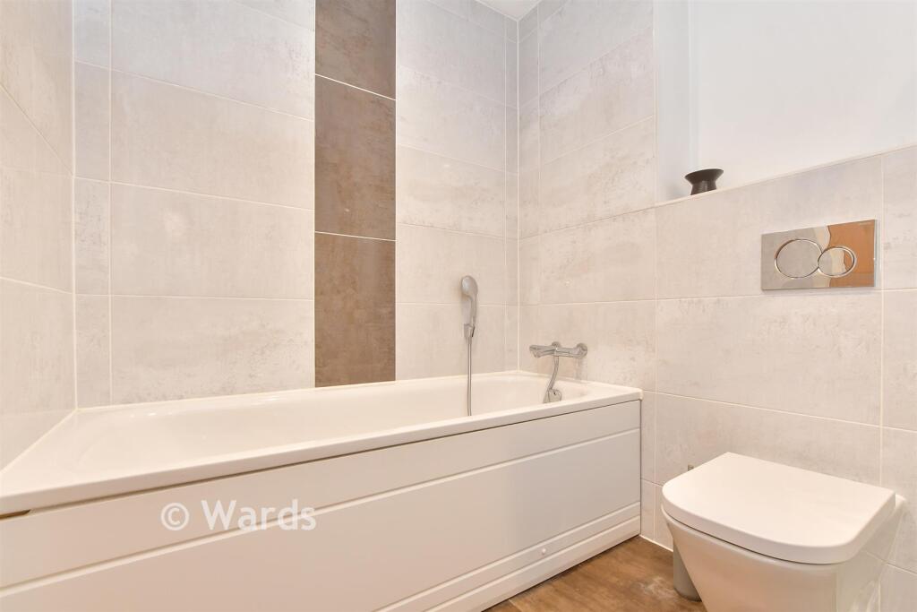
- Bathrooms: 1
- Property Type: undefined
- Property SubType: undefined
Image Descriptions
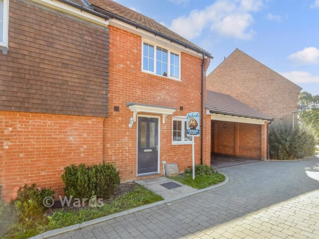
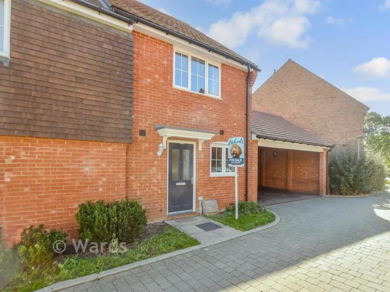
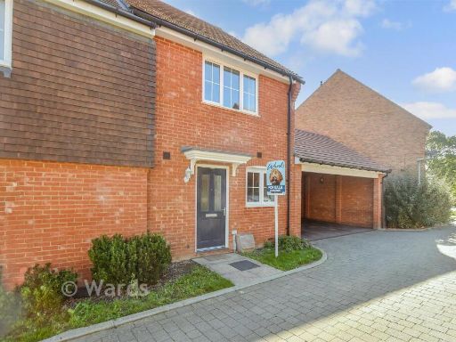
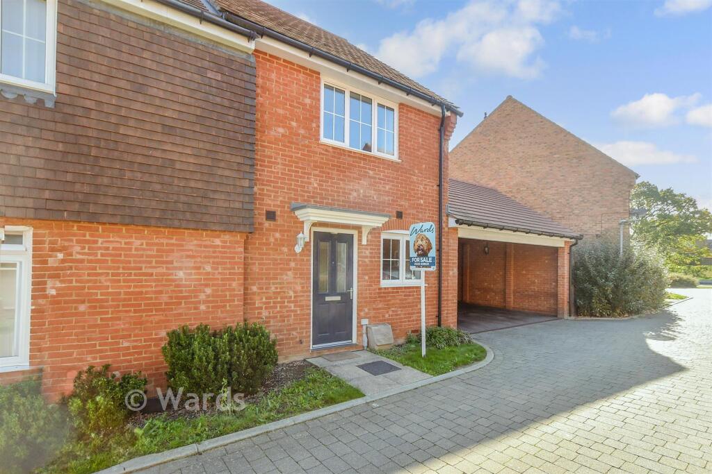
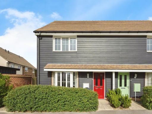
- modern house Modern
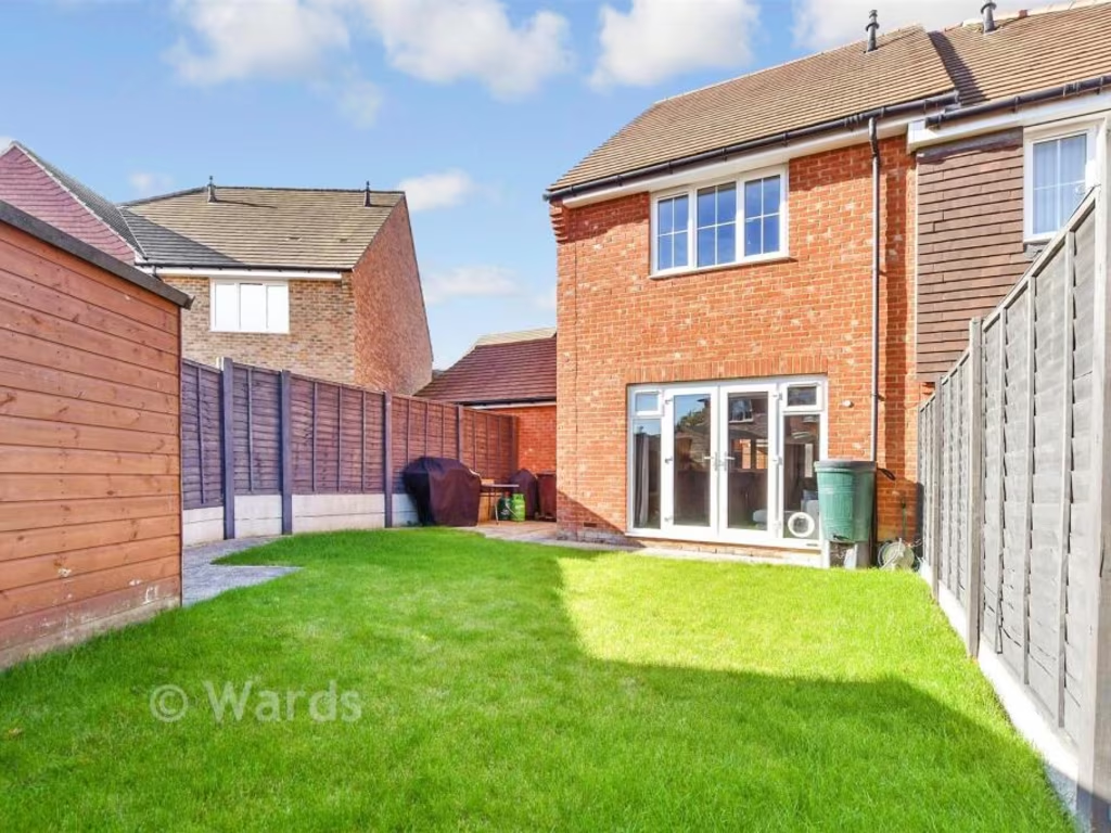
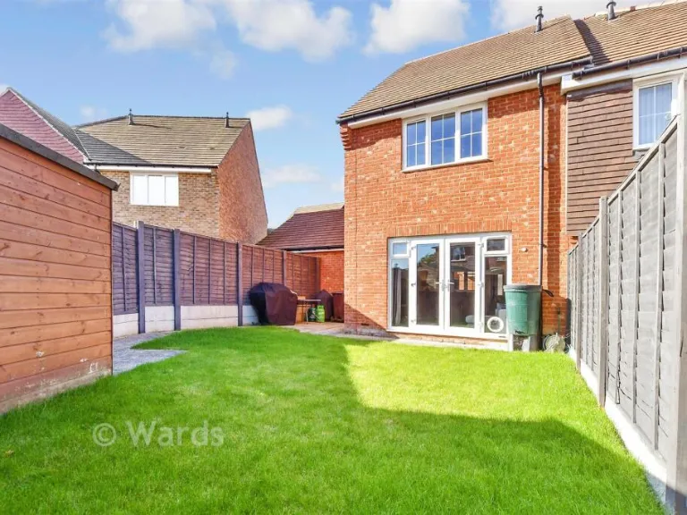
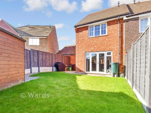
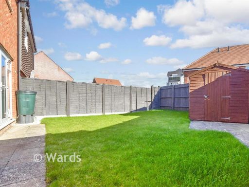
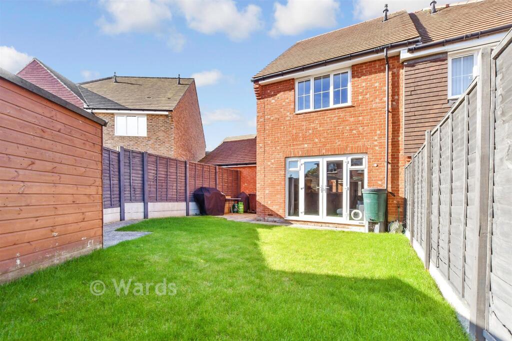
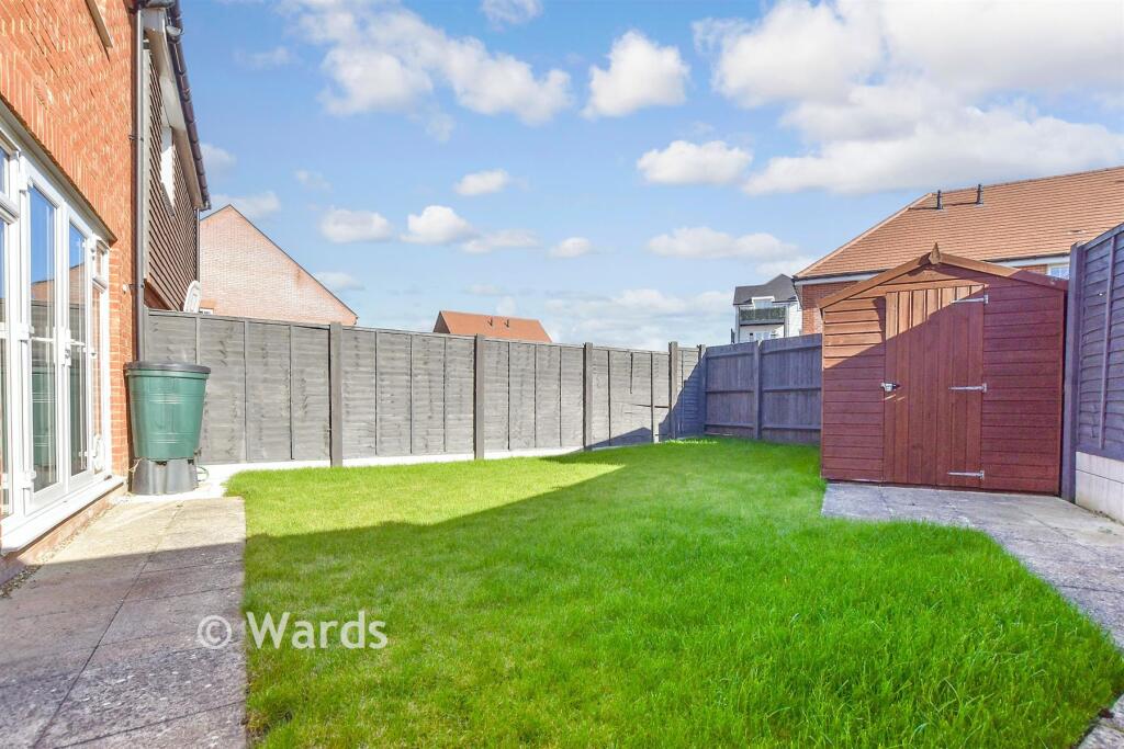
- backyard of a modern house modern
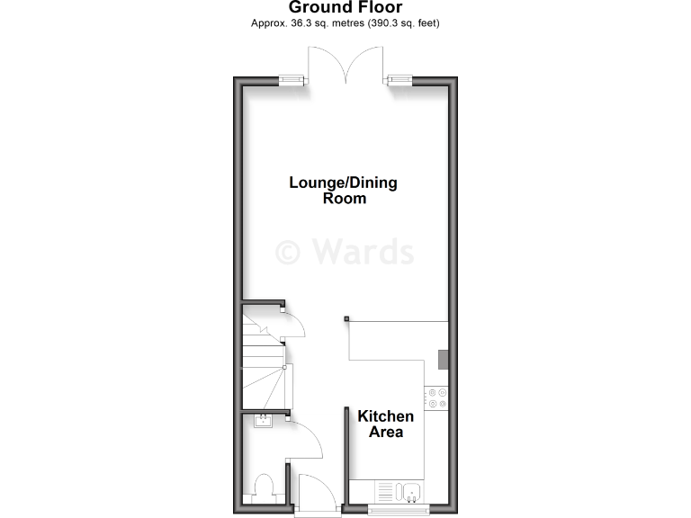
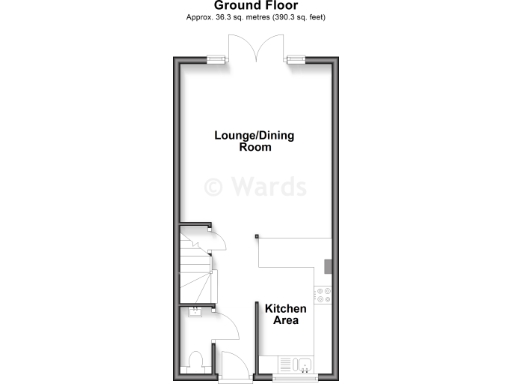
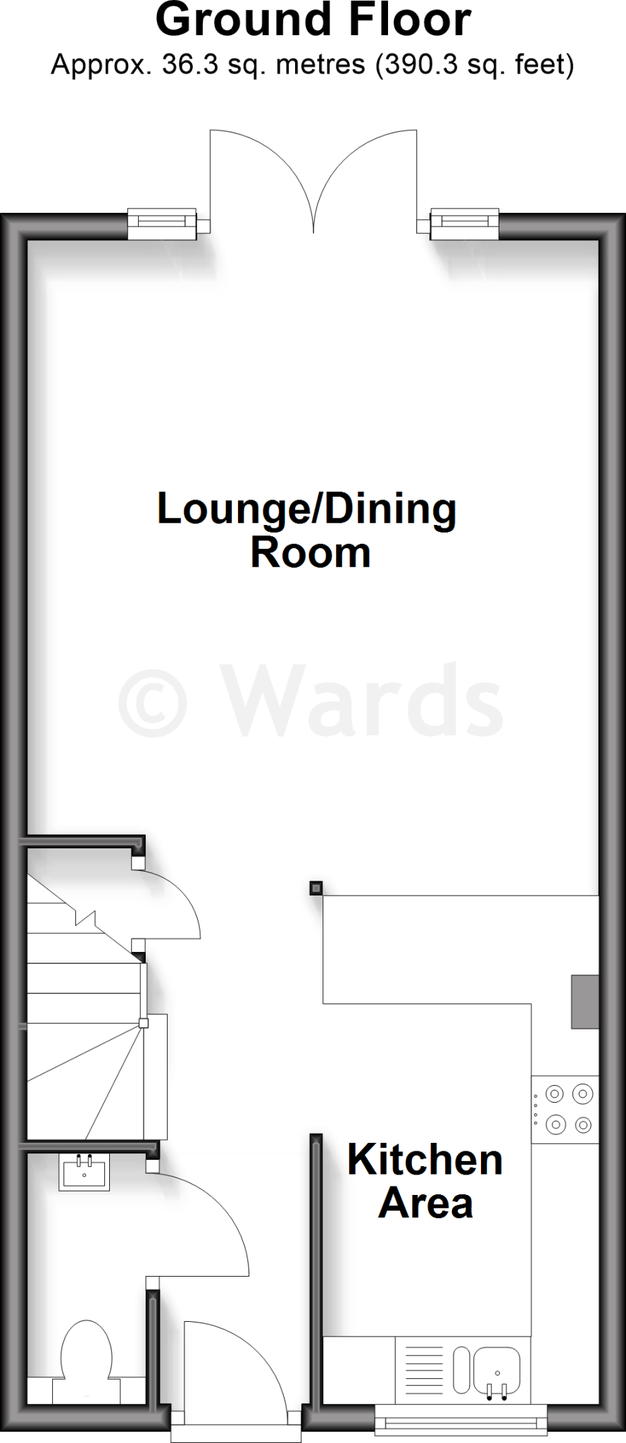
Floorplan Description
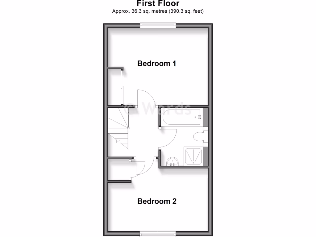
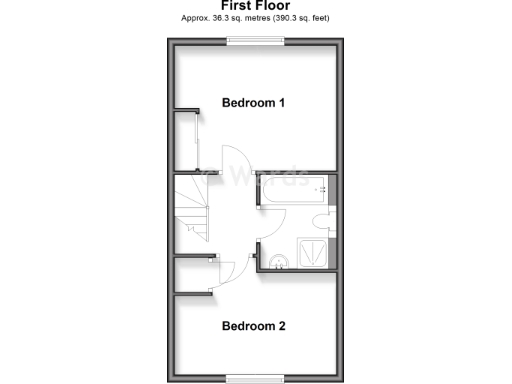
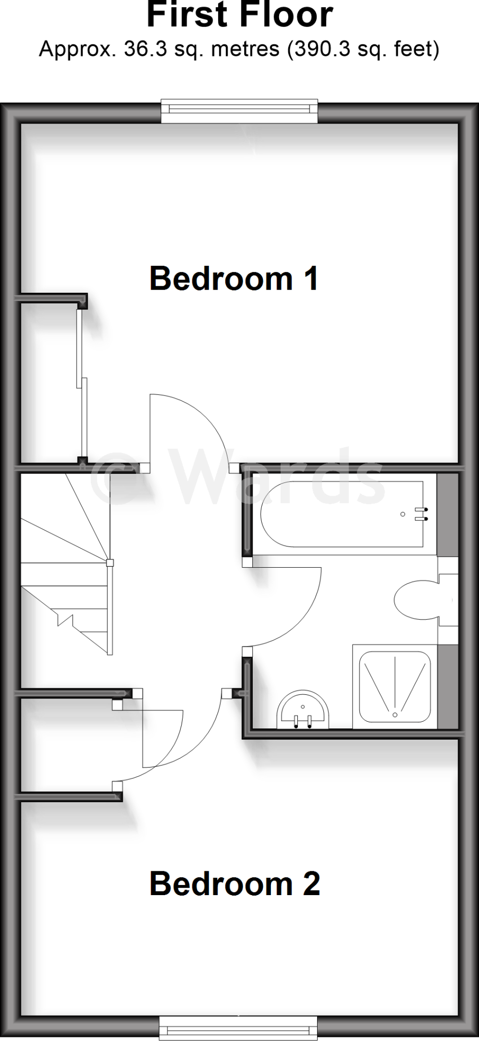
- Floorplan showing Bedroom 1, Bedroom 2 and a bathroom/landing area
Rooms
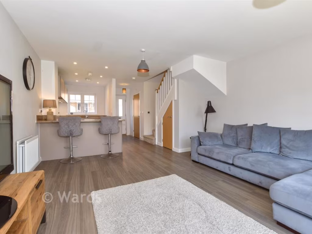
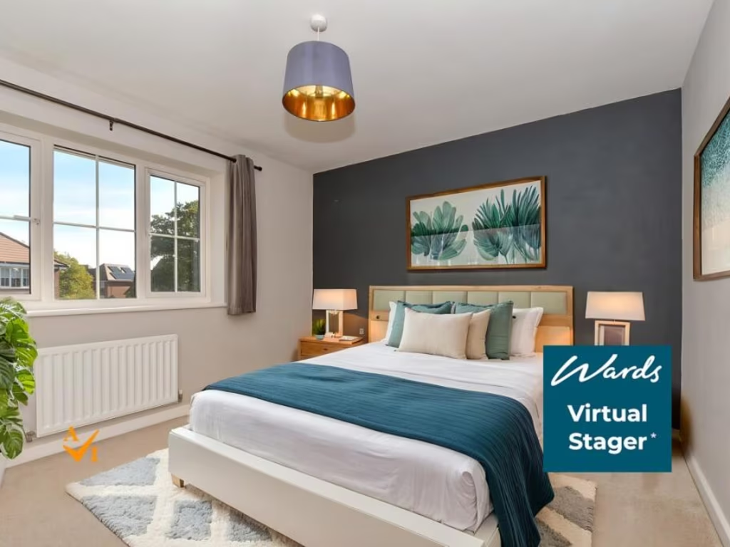
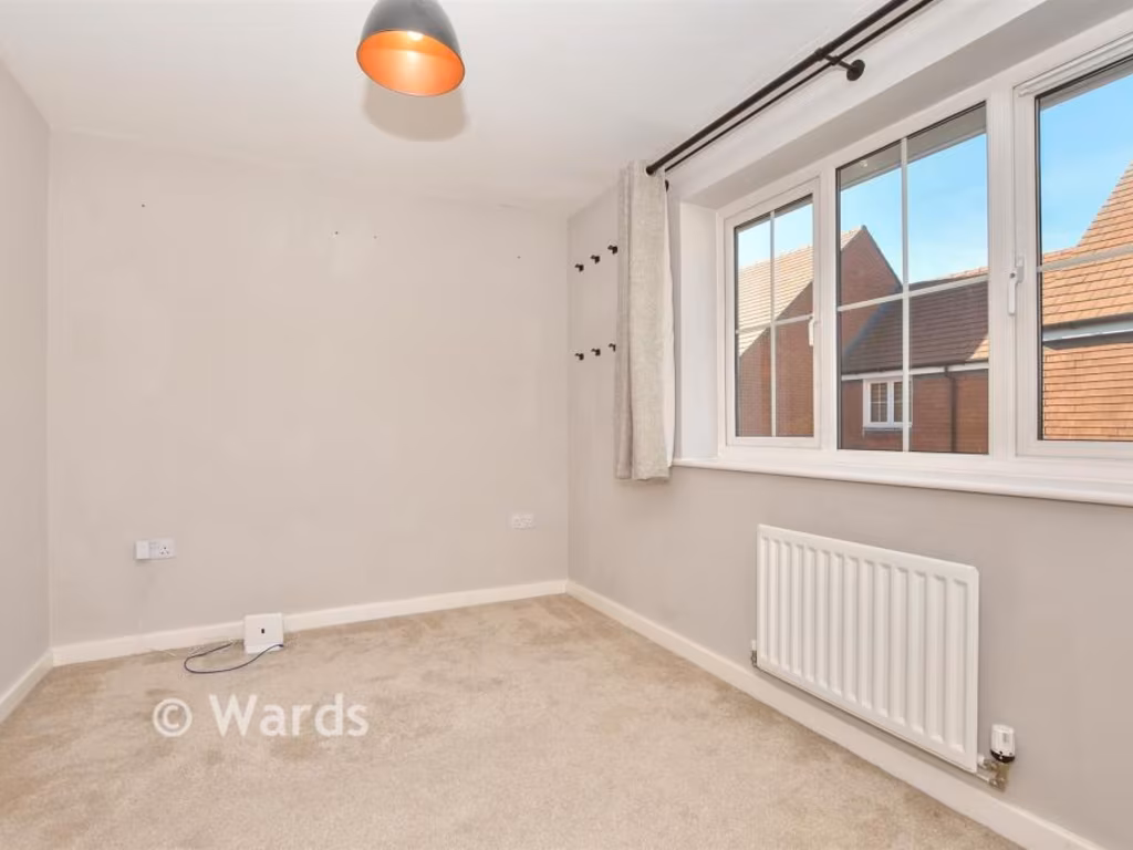
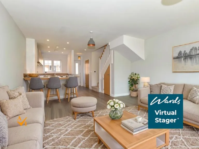
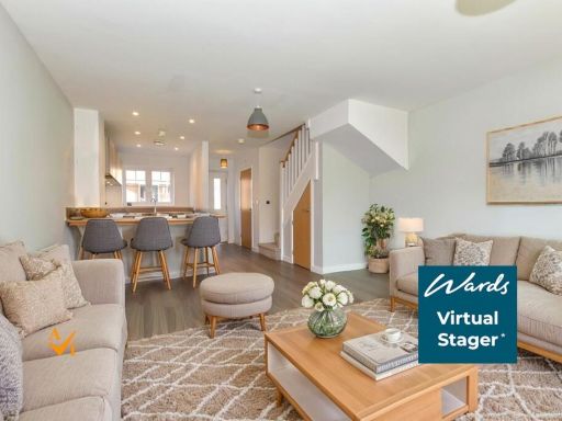
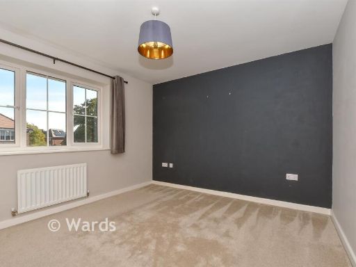
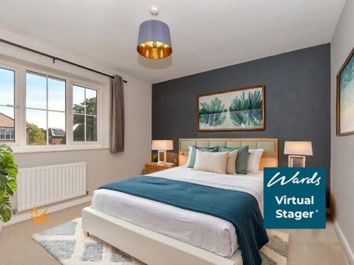
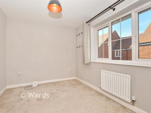
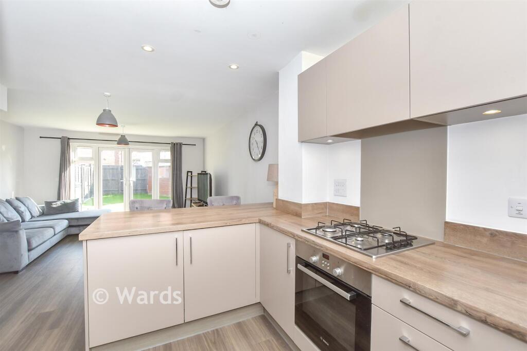
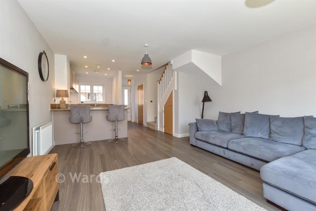
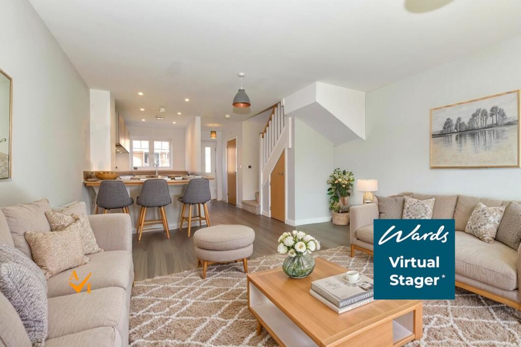
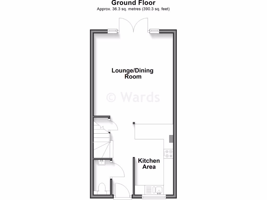
- Lounge/Dining Room:
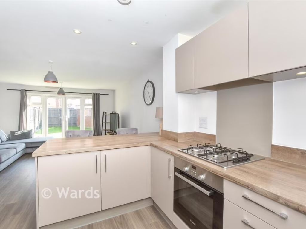
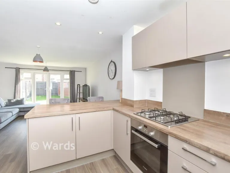
- Kitchen Area:
Textual Property Features
- Has Garden
- Chain Free
- Success
Detected Visual Features
- modern house
- two-story
- brick exterior
- attached garage
- driveway
- compact garden
- well-maintained
- suburban
- for sale
- modern
- brick
- semi-detached
- garden
- French doors
- double glazing
- residential
- family-friendly
EPC Details
- High performance glazing
- Average thermal transmittance 0.25 W/m-¦K
- Boiler and radiators, mains gas
- Low energy lighting in all fixed outlets
- Average thermal transmittance 0.17 W/m-¦K
Nearby Schools
- The John Wallis Church of England Academy
- Beaver Green Primary School
- Great Chart Primary School
- Chilmington Green School
- Ashford School
- Ashford, St Mary's Church of England Primary School
- Phoenix Community Primary School
- Kennington Church of England Academy
- Towers School and Sixth Form Centre
- Kingsnorth Church of England Primary School
- Willesborough Infant School
- Ashford Oaks Community Primary School
- Mersham Primary School
- The John Wesley Church of England Methodist Voluntary Aided Primary School
- St Simon of England Roman Catholic Primary School, Ashford
- The Norton Knatchbull School
- Furley Park Primary Academy
- Finberry Primary School
- East Stour Primary School
- Willesborough Junior School
- The North School
- Victoria Road Primary School
- Highworth Grammar School
- St Teresa's Catholic Primary School
- Repton Manor Primary School
- Downs View Infant School
- Goat Lees Primary School
Nearest Bars And Restaurants
- Id: 10252867891
- Tags:
- TagsNormalized:
- Lat: 51.1294836
- Lon: 0.9047134
- FullGeoHash: u10dueffc6e1
- PartitionGeoHash: u10d
- Images:
- FoodStandards: null
- Distance: 1453.5
,- Id: 323952634
- Tags:
- Amenity: restaurant
- Name: The French Connection
- Operator: Table Table
- TagsNormalized:
- Lat: 51.1275627
- Lon: 0.8995152
- FullGeoHash: u10du7rp8hrp
- PartitionGeoHash: u10d
- Images:
- FoodStandards: null
- Distance: 1094.9
,- Id: 737077171
- Tags:
- Amenity: restaurant
- Building: yes
- TagsNormalized:
- Lat: 51.1274808
- Lon: 0.8994886
- FullGeoHash: u10du7qzpt5q
- PartitionGeoHash: u10d
- Images:
- FoodStandards: null
- Distance: 1085.8
,- Id: 3754588635
- Tags:
- TagsNormalized:
- Lat: 51.1249868
- Lon: 0.9042295
- FullGeoHash: u10due42wh63
- PartitionGeoHash: u10d
- Images:
- FoodStandards: null
- Distance: 1042.3
,- Id: 1256989292
- Tags:
- Addr:
- City: Ashford
- Country: GB
- Postcode: TN24 0HT
- Street: The Parade
- Amenity: fast_food
- Brand: McDonald's
- Brand:wikidata: Q38076
- Brand:wikipedia: en:McDonald's
- Contact:
- Website: https://www.mcdonalds.com/gb/en-gb/location/ashford/ashford-orbital-park/the-parade/8260817.html
- Cuisine: burger
- Drive_through: yes
- Name: McDonald's
- Outdoor_seating: yes
- Takeaway: yes
- Wheelchair: yes
- TagsNormalized:
- fast food
- food
- mcdonalds
- burgers
- drive through
- takeaway
- Lat: 51.1271328
- Lon: 0.8975096
- FullGeoHash: u10du7mt1krd
- PartitionGeoHash: u10d
- Images:
- FoodStandards: null
- Distance: 1003.2
}
Nearest General Shops
- Id: 699077621
- Tags:
- Brand: Ford
- Brand:wikidata: Q44294
- Brand:wikipedia: en:Ford Motor Company
- Building: yes
- Name: Ford
- Shop: car
- TagsNormalized:
- Lat: 51.1269468
- Lon: 0.8939499
- FullGeoHash: u10du76un99m
- PartitionGeoHash: u10d
- Images:
- FoodStandards: null
- Distance: 943.1
,- Id: 1195542795
- Tags:
- Name: Barretts Land Rover
- Shop: car
- TagsNormalized:
- Lat: 51.126774
- Lon: 0.8960294
- FullGeoHash: u10du7k7ncry
- PartitionGeoHash: u10d
- Images:
- FoodStandards: null
- Distance: 940.1
,- Id: 1195542787
- Tags:
- Name: Ashford Orbital
- Shop: car
- TagsNormalized:
- Lat: 51.1268738
- Lon: 0.893047
- FullGeoHash: u10du7679s01
- PartitionGeoHash: u10d
- Images:
- FoodStandards: null
- Distance: 935
}
Nearest Grocery shops
- Id: 869740928
- Tags:
- Building: yes
- Shop: convenience
- TagsNormalized:
- Lat: 51.1334648
- Lon: 0.8908211
- FullGeoHash: u10duk8dj8sq
- PartitionGeoHash: u10d
- Images:
- FoodStandards: null
- Distance: 1677.7
,- Id: 3666485209
- Tags:
- Addr:
- City: Willesborough
- Country: GB
- Housenumber: 99
- Postcode: TN24 0GU
- Street: Earlsworth Road
- Fhrs:
- Name: Earls Supermarket
- Shop: convenience
- TagsNormalized:
- Lat: 51.1300315
- Lon: 0.8817993
- FullGeoHash: u10du5fn52tn
- PartitionGeoHash: u10d
- Images:
- FoodStandards:
- Id: 264800
- FHRSID: 264800
- LocalAuthorityBusinessID: PI/000033906
- BusinessName: Earls Supermarket
- BusinessType: Retailers - other
- BusinessTypeID: 4613
- AddressLine1: 99 Earlsworth Road
- AddressLine2: Willesborough
- AddressLine3: Kent
- AddressLine4: null
- PostCode: TN24 0GU
- RatingValue: 5
- RatingKey: fhrs_5_en-GB
- RatingDate: 2021-05-12
- LocalAuthorityCode: 179
- LocalAuthorityName: Ashford
- LocalAuthorityWebSite: http://www.ashford.gov.uk
- LocalAuthorityEmailAddress: envhealth@ashford.gov.uk
- Scores:
- Hygiene: 5
- Structural: 5
- ConfidenceInManagement: 0
- NewRatingPending: false
- Geocode:
- Longitude: 0.88176000000000
- Latitude: 51.12990600000000
- Distance: 1522.8
,- Id: 1195594885
- Tags:
- Shop: convenience
- Source: audio
- TagsNormalized:
- Lat: 51.1134938
- Lon: 0.8775481
- FullGeoHash: u10dgbzj8mg7
- PartitionGeoHash: u10d
- Images:
- FoodStandards: null
- Distance: 1243.1
}
Nearest Religious buildings
- Id: 183035439
- Tags:
- Addr:
- Amenity: place_of_worship
- Denomination: anglican
- Name: St Michael & All Angels, Kingsnorth
- Religion: christian
- Source: bing
- Wikidata: Q17529444
- TagsNormalized:
- place of worship
- anglican
- christian
- church
- Lat: 51.1173448
- Lon: 0.8650258
- FullGeoHash: u10dg9tuhe9z
- PartitionGeoHash: u10d
- Images:
- FoodStandards: null
- Distance: 1991.1
,- Id: 766302389
- Tags:
- Amenity: place_of_worship
- Building: church
- Denomination: anglican
- Name: St Mary
- Religion: christian
- Wikidata: Q17529405
- TagsNormalized:
- place of worship
- church
- anglican
- christian
- Lat: 51.1308929
- Lon: 0.910102
- FullGeoHash: u10dusnencm0
- PartitionGeoHash: u10d
- Images:
- FoodStandards: null
- Distance: 1803.2
,- Id: 3666489447
- Tags:
- Amenity: place_of_worship
- Name: The Salvation Army
- Religion: christian
- TagsNormalized:
- place of worship
- salvation army
- the salvation army
- christian
- church
- Lat: 51.1331811
- Lon: 0.8869211
- FullGeoHash: u10duhtb6gb6
- PartitionGeoHash: u10d
- Images:
- FoodStandards: null
- Distance: 1698.9
}
Nearest Medical buildings
- Id: 7623355215
- Tags:
- Amenity: pharmacy
- Dispensing: yes
- Healthcare: pharmacy
- Operator: Tesco
- TagsNormalized:
- Lat: 51.123371
- Lon: 0.8645822
- FullGeoHash: u10dgdtx4pp4
- PartitionGeoHash: u10d
- Images:
- FoodStandards: null
- Distance: 2090.2
,- Id: 243899483
- Tags:
- Amenity: doctors
- Building: yes
- Healthcare: doctor
- Name: Willesborough Health Centre
- Opening_hours: Mo-Fr 08:00-18:30
- TagsNormalized:
- doctor
- doctors
- health
- healthcare
- health centre
- Lat: 51.1367475
- Lon: 0.8988349
- FullGeoHash: u10dumnt0keu
- PartitionGeoHash: u10d
- Images:
- FoodStandards: null
- Distance: 2066.2
,- Id: 7508756099
- Tags:
- Amenity: pharmacy
- Brand: Asda
- Brand:wikidata: Q297410
- Brand:wikipedia: en:Asda
- Contact:
- Phone: +44 1233 655010
- Website: https://storelocator.asda.com/south-east/ashford/kimberley-way/pharmacy
- Fixme: Location not accurate
- Healthcare: pharmacy
- Operator: Asda Stores Ltd
- TagsNormalized:
- pharmacy
- asda
- health
- healthcare
- Lat: 51.1342012
- Lon: 0.8788902
- FullGeoHash: u10dguxyr9up
- PartitionGeoHash: u10d
- Images:
- FoodStandards: null
- Distance: 2024.5
,- Id: 109901239
- Tags:
- Amenity: pharmacy
- Brand: Boots
- Brand:wikidata: Q6123139
- Brand:wikipedia: en:Boots UK
- Building: yes
- Healthcare: pharmacy
- Name: Boots
- TagsNormalized:
- pharmacy
- boots
- health
- healthcare
- Lat: 51.1293845
- Lon: 0.9043271
- FullGeoHash: u10duefd2254
- PartitionGeoHash: u10d
- Images:
- FoodStandards: null
- Distance: 1429.8
}
Nearest Leisure Facilities
- Id: 639223619
- Tags:
- TagsNormalized:
- Lat: 51.1184619
- Lon: 0.8868712
- FullGeoHash: u10du1vf9egn
- PartitionGeoHash: u10d
- Images:
- FoodStandards: null
- Distance: 462.3
,- Id: 639223620
- Tags:
- TagsNormalized:
- Lat: 51.118595
- Lon: 0.8870648
- FullGeoHash: u10du1vgqhg2
- PartitionGeoHash: u10d
- Images:
- FoodStandards: null
- Distance: 449
,- Id: 915469813
- Tags:
- TagsNormalized:
- Lat: 51.118849
- Lon: 0.88945
- FullGeoHash: u10du1zsvsju
- PartitionGeoHash: u10d
- Images:
- FoodStandards: null
- Distance: 285.4
,- Id: 856929199
- Tags:
- TagsNormalized:
- Lat: 51.117103
- Lon: 0.8947529
- FullGeoHash: u10du3ed9q8h
- PartitionGeoHash: u10d
- Images:
- FoodStandards: null
- Distance: 175.6
,- Id: 940558163
- Tags:
- TagsNormalized:
- Lat: 51.1171594
- Lon: 0.8947601
- FullGeoHash: u10du3ee13jm
- PartitionGeoHash: u10d
- Images:
- FoodStandards: null
- Distance: 170.4
}
Nearest Tourist attractions
- Id: 8262182617
- Tags:
- Addr:
- Housenumber: 1-8
- Postcode: TN23 3NY
- Street: The Limes
- Name: Belgic Court
- Tourism: apartment
- TagsNormalized:
- Lat: 51.1280843
- Lon: 0.8592665
- FullGeoHash: u10dge9dwmew
- PartitionGeoHash: u10d
- Images:
- FoodStandards: null
- Distance: 2617.1
,- Id: 92347747
- Tags:
- Addr:
- City: Ashford
- Country: GB
- Postcode: TN26 1NQ
- Street: Steeds Lane
- Caravans: yes
- Dog: yes
- Dryer: yes
- Email: holidaypark@broadhembury.co.uk
- Internet_access: wlan
- Internet_access:fee: yes
- Kitchen: yes
- Name: Broadhembury Caravan & Camping Park
- Phone: +44 1233 620859
- Power_supply: yes
- Source: Bing
- Tents: yes
- Tourism: camp_site
- Washing_machine: yes
- Website: https://www.broadhembury.co.uk
- Wheelchair: yes
- TagsNormalized:
- Lat: 51.1066255
- Lon: 0.8679588
- FullGeoHash: u10dez8j8vsb
- PartitionGeoHash: u10d
- Images:
- FoodStandards: null
- Distance: 2216.4
,- Id: 8262192117
- Tags:
- Addr:
- Housenumber: 3
- Postcode: TN23 3ND
- Street: Roman Way
- Name: 3 Roman Way
- Name:en: Roman Way
- Tourism: apartment
- TagsNormalized:
- Lat: 51.1233982
- Lon: 0.8709613
- FullGeoHash: u10dgfdpqu5v
- PartitionGeoHash: u10d
- Images:
- FoodStandards: null
- Distance: 1665.5
}
Nearest Train stations
- Id: 6692612521
- Tags:
- Name: Charing
- Naptan:
- Network: National Rail
- Public_transport: station
- Railway: station
- Ref:
- Wikidata: Q2199062
- Wikipedia: en:Charing railway station
- TagsNormalized:
- Lat: 51.2082021
- Lon: 0.7898686
- FullGeoHash: u10e3fpjmkb8
- PartitionGeoHash: u10e
- Images:
- FoodStandards: null
- Distance: 12319.5
,- Id: 7610455916
- Tags:
- Name: Burmarsh Road
- Naptan:
- Public_transport: station
- Railway: station
- Usage: tourism
- Wikipedia: en:Burmarsh Road railway station
- TagsNormalized:
- Lat: 51.0360214
- Lon: 1.0041233
- FullGeoHash: u10dqfg4mgbw
- PartitionGeoHash: u10d
- Images:
- FoodStandards: null
- Distance: 11990.9
,- Id: 3518996541
- Tags:
- Name: Wye
- Naptan:
- Network: National Rail
- Platforms: 2
- Public_transport: station
- Railway: station
- Ref:
- Wikidata: Q2011884
- Wikipedia: en:Wye railway station
- TagsNormalized:
- Lat: 51.1853805
- Lon: 0.9294965
- FullGeoHash: u10ejnhb6y6z
- PartitionGeoHash: u10e
- Images:
- FoodStandards: null
- Distance: 7852.4
,- Id: 7158803343
- Tags:
- Name: Ham Street
- Naptan:
- Network: National Rail
- Public_transport: station
- Railway: station
- Ref:
- Wikidata: Q2453414
- Wikipedia: en:Ham Street railway station
- TagsNormalized:
- Lat: 51.0681986
- Lon: 0.8545851
- FullGeoHash: u10de2wmc60y
- PartitionGeoHash: u10d
- Images:
- FoodStandards: null
- Distance: 6215.4
,- Id: 7998566986
- Tags:
- Name: Ashford International
- Naptan:
- Network: National Rail
- Platforms: 6
- Postal_code: TN23 1EZ
- Public_transport: station
- Railway: station
- Ref:
- Crs: AFK
- Crs_Eurostar: ASI
- Toilets:
- Train: yes
- Wheelchair: yes
- Wikidata: Q800406
- Wikipedia: en:Ashford International railway station
- TagsNormalized:
- Lat: 51.143379
- Lon: 0.8752323
- FullGeoHash: u10dgym7f2ue
- PartitionGeoHash: u10d
- Images:
- FoodStandards: null
- Distance: 3048.8
}
Nearest Hotels
- Id: 350904866
- Tags:
- Building: yes
- Tourism: hotel
- TagsNormalized:
- Lat: 51.1276822
- Lon: 0.8986465
- FullGeoHash: u10du7w27fz2
- PartitionGeoHash: u10d
- Images:
- FoodStandards: null
- Distance: 1085.6
,- Id: 323952636
- Tags:
- Brand: Premier Inn
- Brand:wikidata: Q2108626
- Name: Premier Inn Ashford Central
- Tourism: hotel
- TagsNormalized:
- Lat: 51.1276777
- Lon: 0.8986226
- FullGeoHash: u10du7w273vt
- PartitionGeoHash: u10d
- Images:
- FoodStandards: null
- Distance: 1084.6
,- Id: 9781215362
- Tags:
- TagsNormalized:
- Lat: 51.1274064
- Lon: 0.8985904
- FullGeoHash: u10du7qqdxmd
- PartitionGeoHash: u10d
- Images:
- FoodStandards: null
- Distance: 1055.4
}
Tags
- modern house
- two-story
- brick exterior
- attached garage
- driveway
- compact garden
- well-maintained
- suburban
- for sale
- modern
- brick
- semi-detached
- garden
- French doors
- double glazing
- residential
- family-friendly
Local Market Stats
- Average Price/sqft: £352
- Avg Income: £52300
- Rental Yield: 3.4%
- Social Housing: 5%
- Planning Success Rate: 84%
Similar Properties
 2 bedroom semi-detached house for sale in Pipin Crescent, Finberry, Ashford, TN25 — £320,000 • 2 bed • 2 bath • 632 ft²
 3 bedroom semi-detached house for sale in Ryeland Way, Ashford, Kent, TN25 — £350,000 • 3 bed • 2 bath • 793 ft²
 3 bedroom terraced house for sale in Brambling Avenue, Finberry, TN25 — £330,000 • 3 bed • 2 bath • 980 ft²
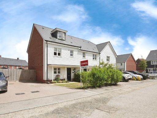 4 bedroom town house for sale in Shearwater Close, Finberry, Ashford, TN25 — £400,000 • 4 bed • 2 bath • 911 ft²
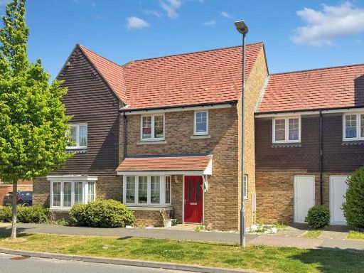 3 bedroom terraced house for sale in Brambling Avenue, Finberry, Ashford TN25 7FD, TN25 — £330,000 • 3 bed • 2 bath • 709 ft²
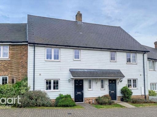 3 bedroom semi-detached house for sale in Avocet Way, Ashford, TN25 — £375,000 • 3 bed • 2 bath
Meta
- {
"@context": "https://schema.org",
"@type": "Residence",
"name": "2 bedroom semidetached house for sale in Nuthatch Drive, Fi…",
"description": "",
"url": "https://propertypiper.co.uk/property/fd04145e-1f6c-4c4c-8def-c1ffeb0c32c3",
"image": "https://image-a.propertypiper.co.uk/74ebdf83-2a39-4944-978b-aad2df7191bf-1024.jpeg",
"address": {
"@type": "PostalAddress",
"streetAddress": "Nuthatch Drive, Finberry, Ashford, Kent",
"postalCode": "TN25 7AA",
"addressLocality": "Ashford",
"addressRegion": "Ashford",
"addressCountry": "England"
},
"geo": {
"@type": "GeoCoordinates",
"latitude": 51.1184701,
"longitude": 0.8934948
},
"numberOfRooms": 2,
"numberOfBathroomsTotal": 1,
"floorSize": {
"@type": "QuantitativeValue",
"value": 8722,
"unitCode": "FTK"
},
"offers": {
"@type": "Offer",
"price": 315000,
"priceCurrency": "GBP",
"availability": "https://schema.org/InStock"
},
"additionalProperty": [
{
"@type": "PropertyValue",
"name": "Feature",
"value": "modern house"
},
{
"@type": "PropertyValue",
"name": "Feature",
"value": "two-story"
},
{
"@type": "PropertyValue",
"name": "Feature",
"value": "brick exterior"
},
{
"@type": "PropertyValue",
"name": "Feature",
"value": "attached garage"
},
{
"@type": "PropertyValue",
"name": "Feature",
"value": "driveway"
},
{
"@type": "PropertyValue",
"name": "Feature",
"value": "compact garden"
},
{
"@type": "PropertyValue",
"name": "Feature",
"value": "well-maintained"
},
{
"@type": "PropertyValue",
"name": "Feature",
"value": "suburban"
},
{
"@type": "PropertyValue",
"name": "Feature",
"value": "for sale"
},
{
"@type": "PropertyValue",
"name": "Feature",
"value": "modern"
},
{
"@type": "PropertyValue",
"name": "Feature",
"value": "brick"
},
{
"@type": "PropertyValue",
"name": "Feature",
"value": "semi-detached"
},
{
"@type": "PropertyValue",
"name": "Feature",
"value": "garden"
},
{
"@type": "PropertyValue",
"name": "Feature",
"value": "French doors"
},
{
"@type": "PropertyValue",
"name": "Feature",
"value": "double glazing"
},
{
"@type": "PropertyValue",
"name": "Feature",
"value": "residential"
},
{
"@type": "PropertyValue",
"name": "Feature",
"value": "family-friendly"
}
]
}
High Res Floorplan Images
Compatible Floorplan Images
FloorplanImages Thumbnail