SL5 7AF - 4 bedroom detached house for sale in Lower Village Road, Su…
View on Property Piper
4 bedroom detached house for sale in Lower Village Road, Sunninghill, Ascot, SL5
Property Details
- Price: £700000
- Bedrooms: 4
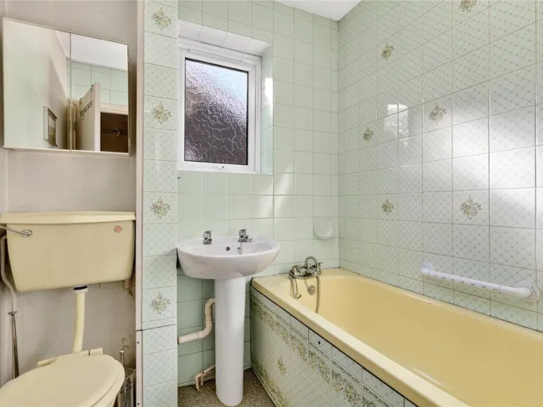
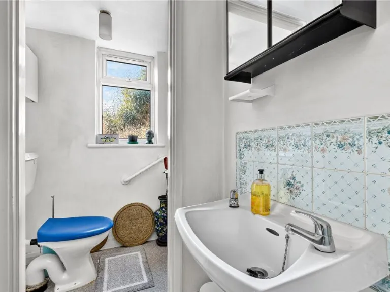
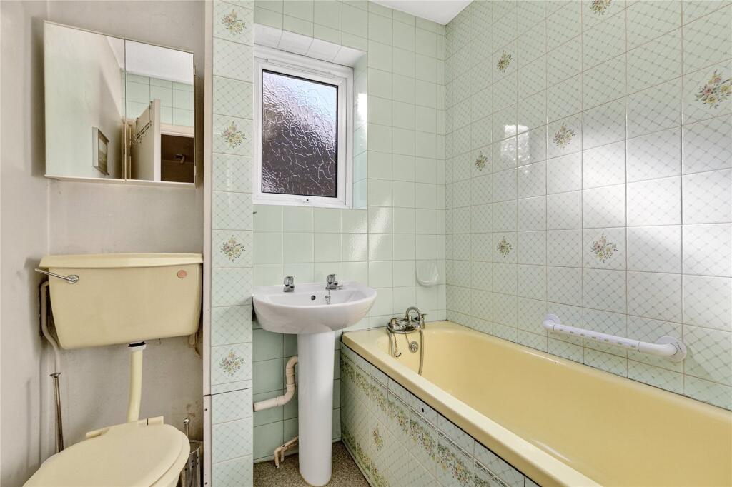
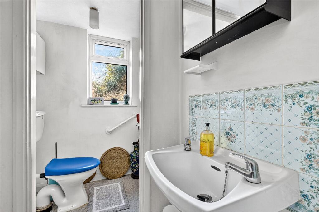
- Bathrooms: 2
- Property Type: undefined
- Property SubType: undefined
Brochure Descriptions
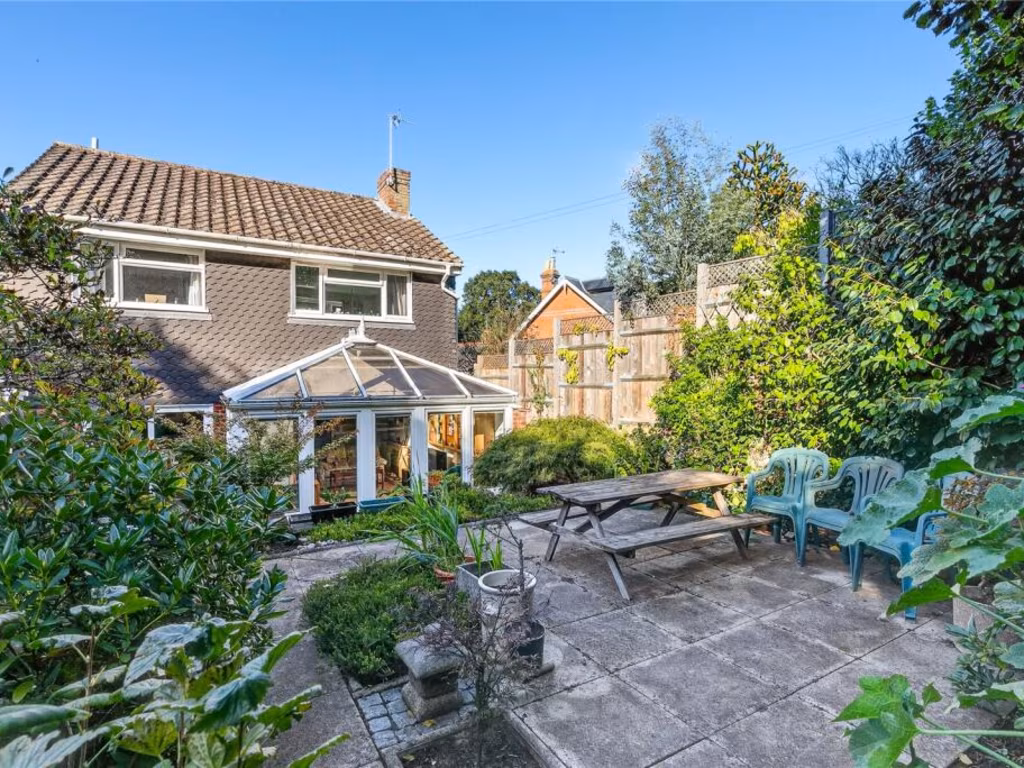
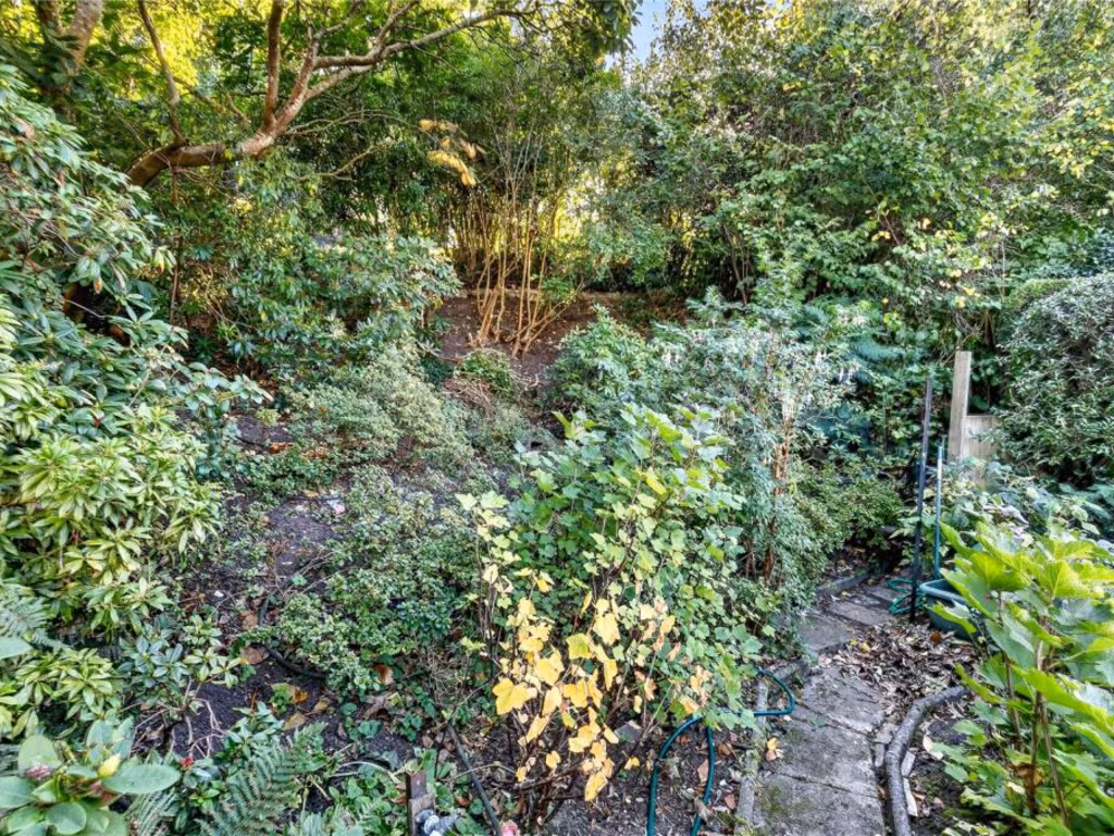
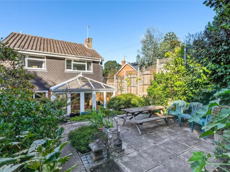
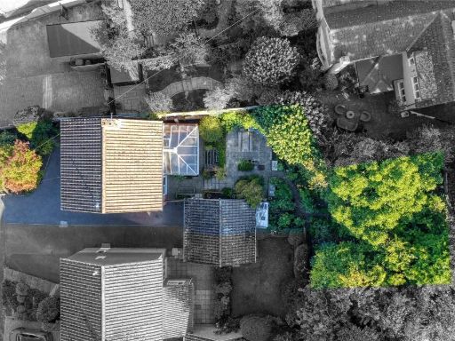
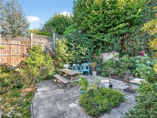
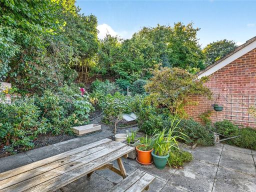
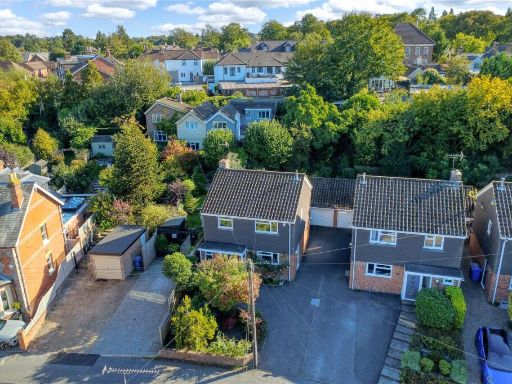
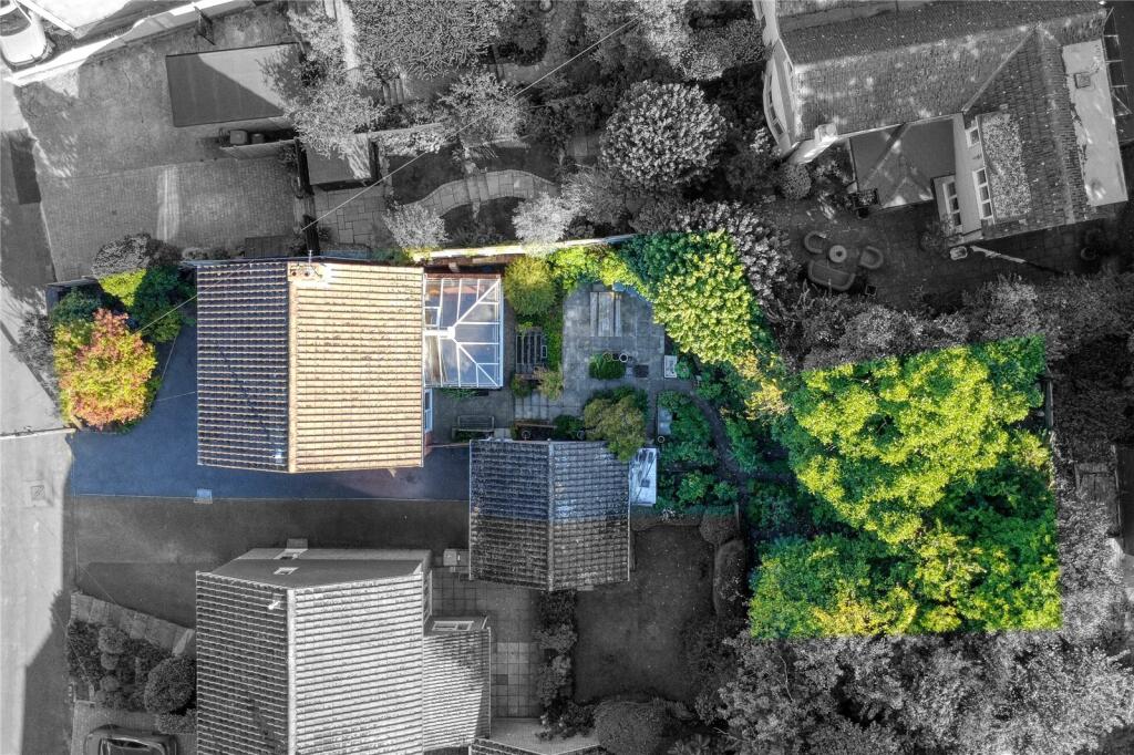
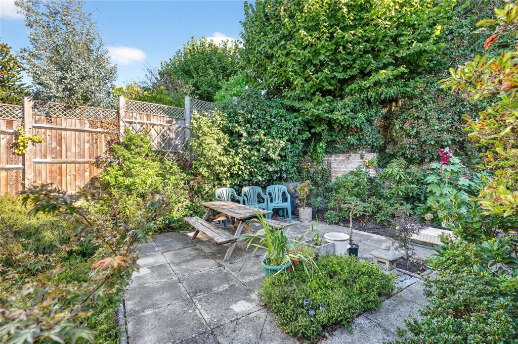
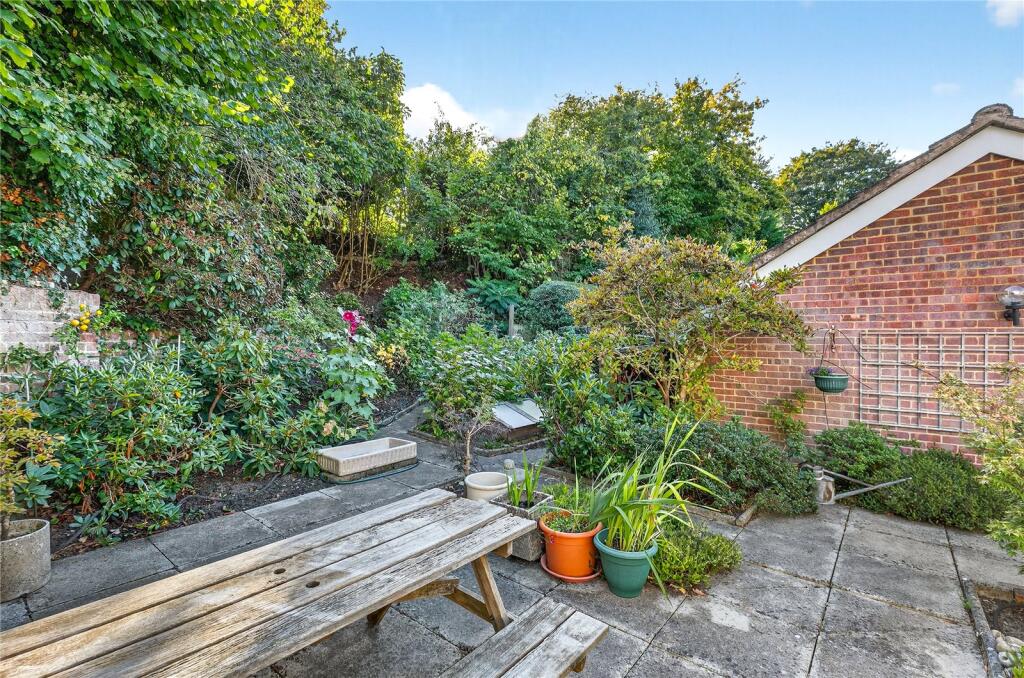
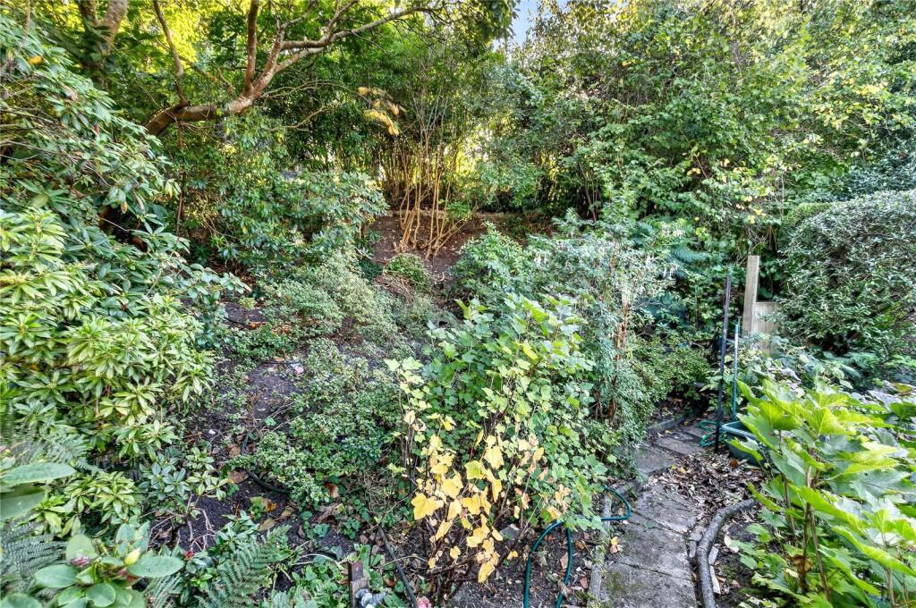
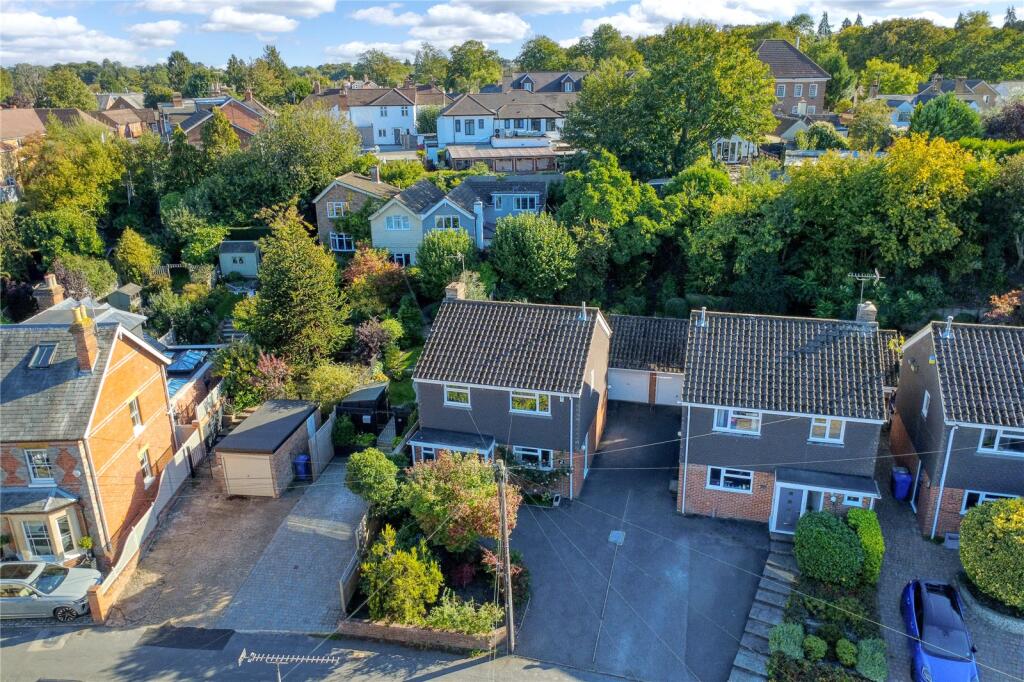
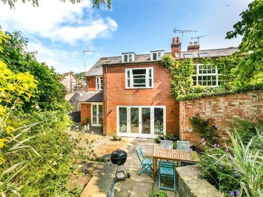
- Mid-terrace / semi‑detached style residential plot on Lower Village Road, Ascot (SL5). Aerial view shows a narrow frontage with a relatively deep rear garden backing onto mature greenery — garden size appears average-to-large for the street. Property footprint is modest (likely a small-to-average family house, commonly 2–3 bedrooms in this area) with potential for rear or loft extension subject to planning. Located on a quiet residential road with neighbouring gardens and green views to the rear; suitable for an owner-occupier seeking further improvement/refurbishment to add value.
Image Descriptions
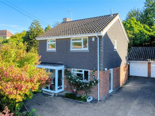
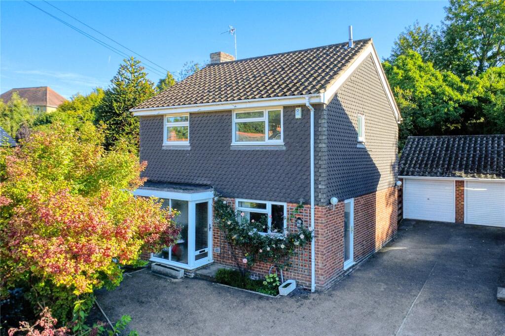
- modern detached house modern
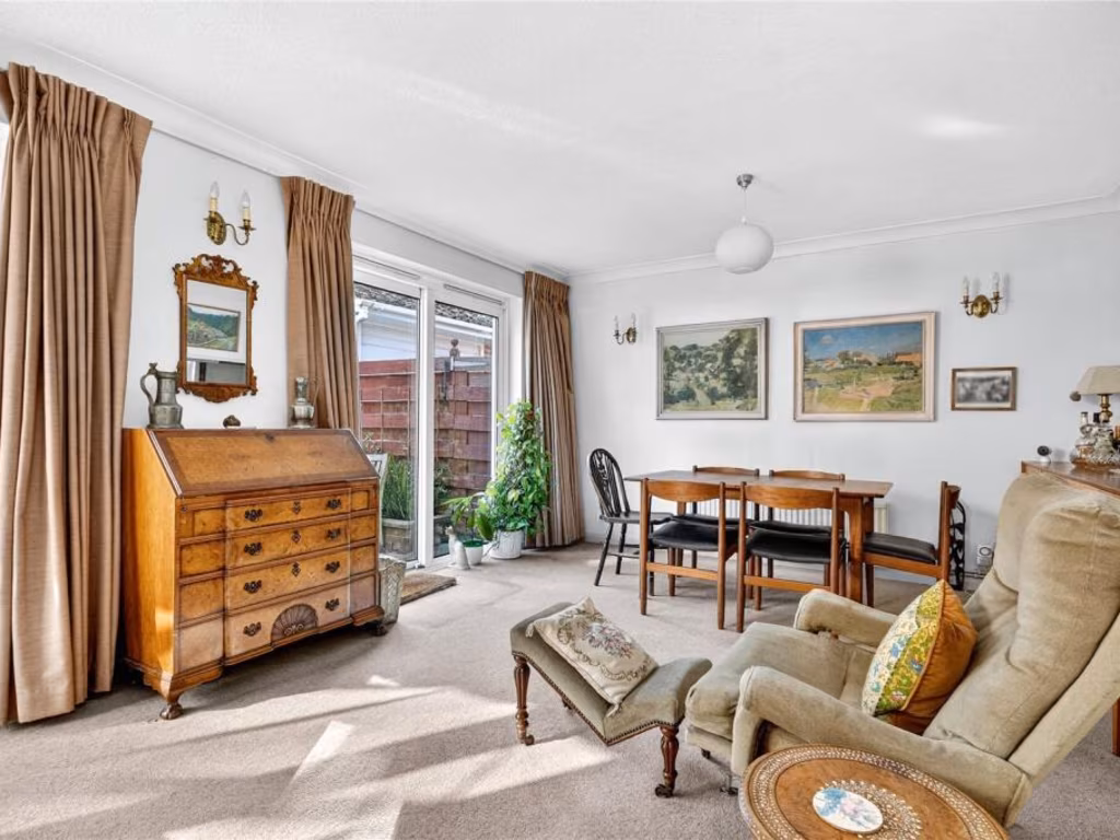
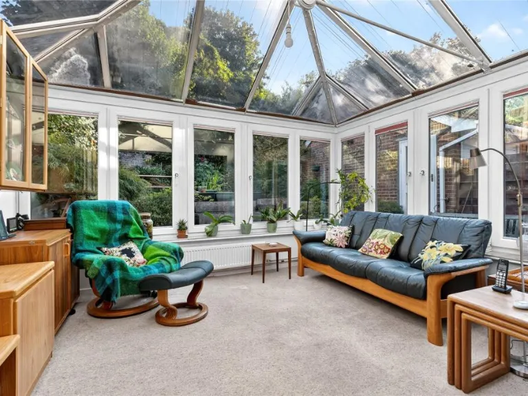
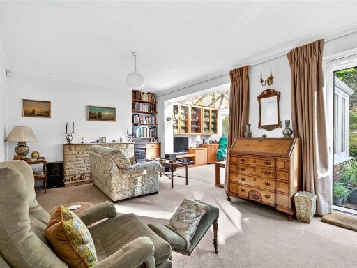
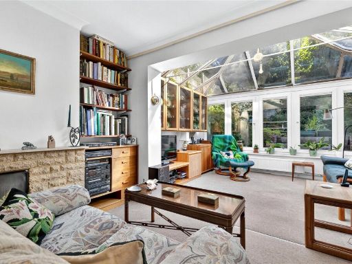
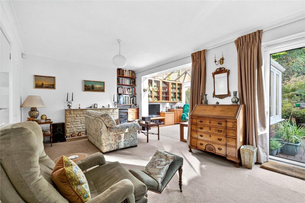
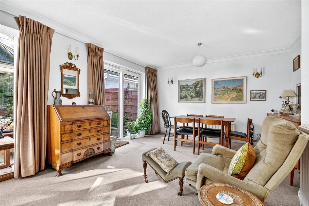
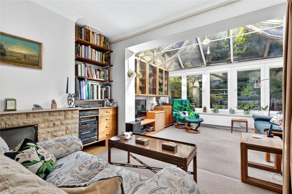
- living room mid-20th century
Floorplan Description
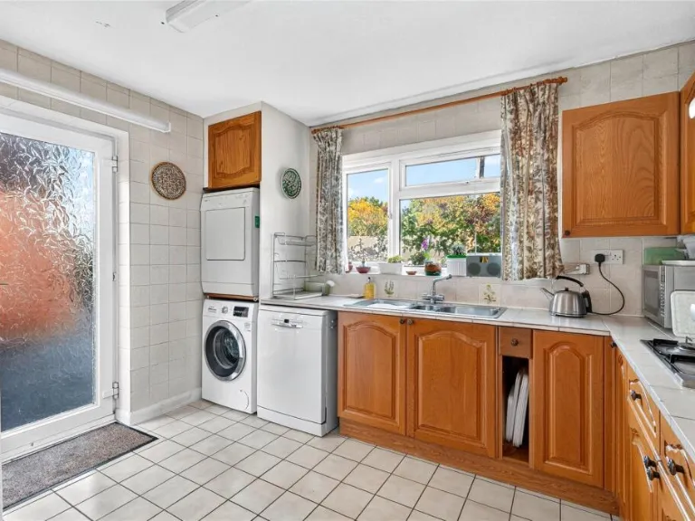
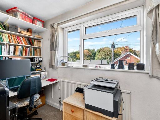
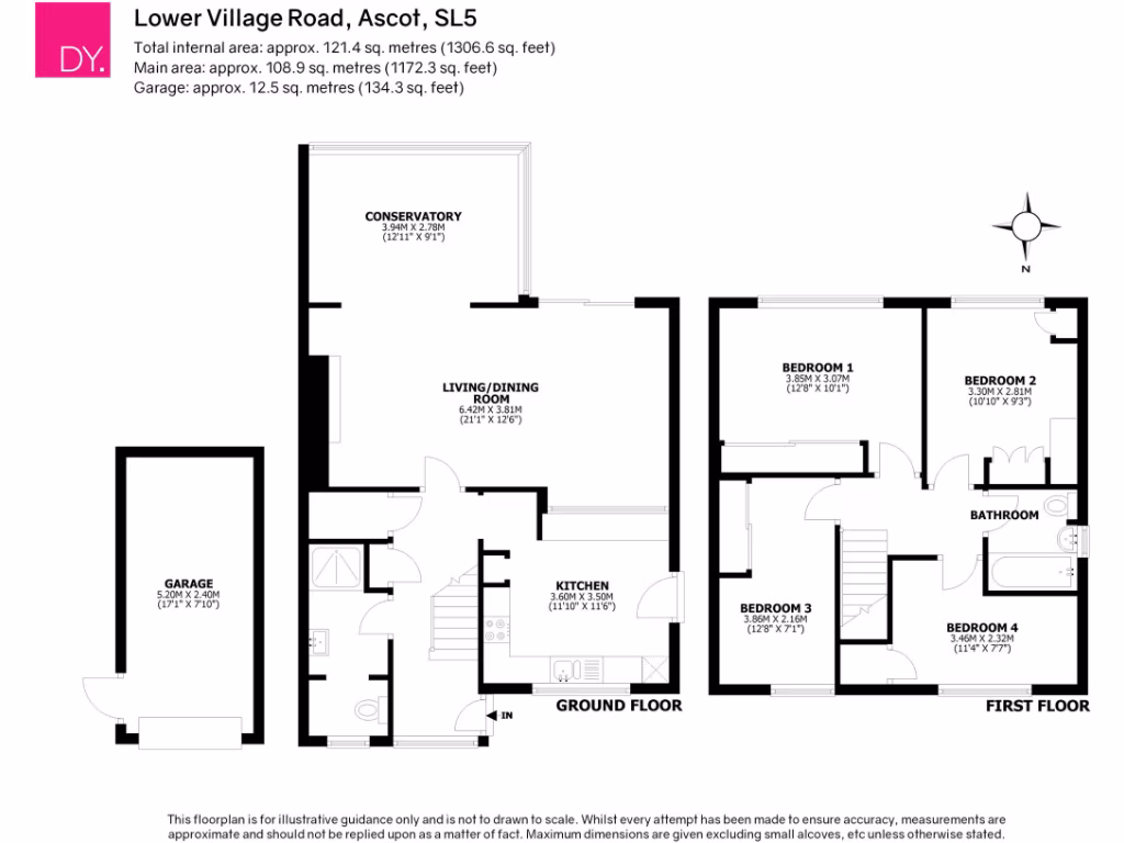
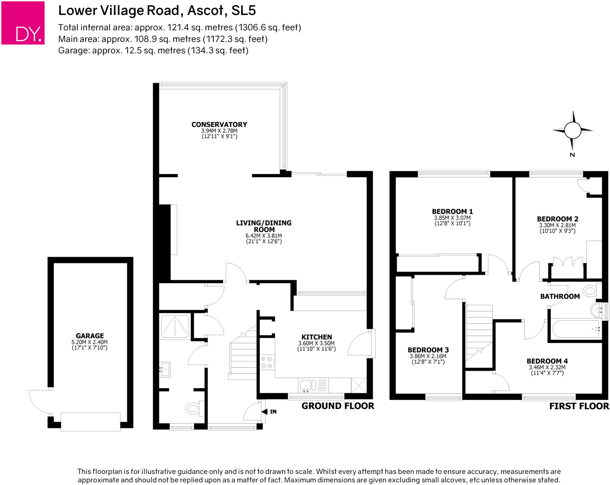
- Residential property with conservatory, living/dining room, kitchen and four bedrooms
Rooms
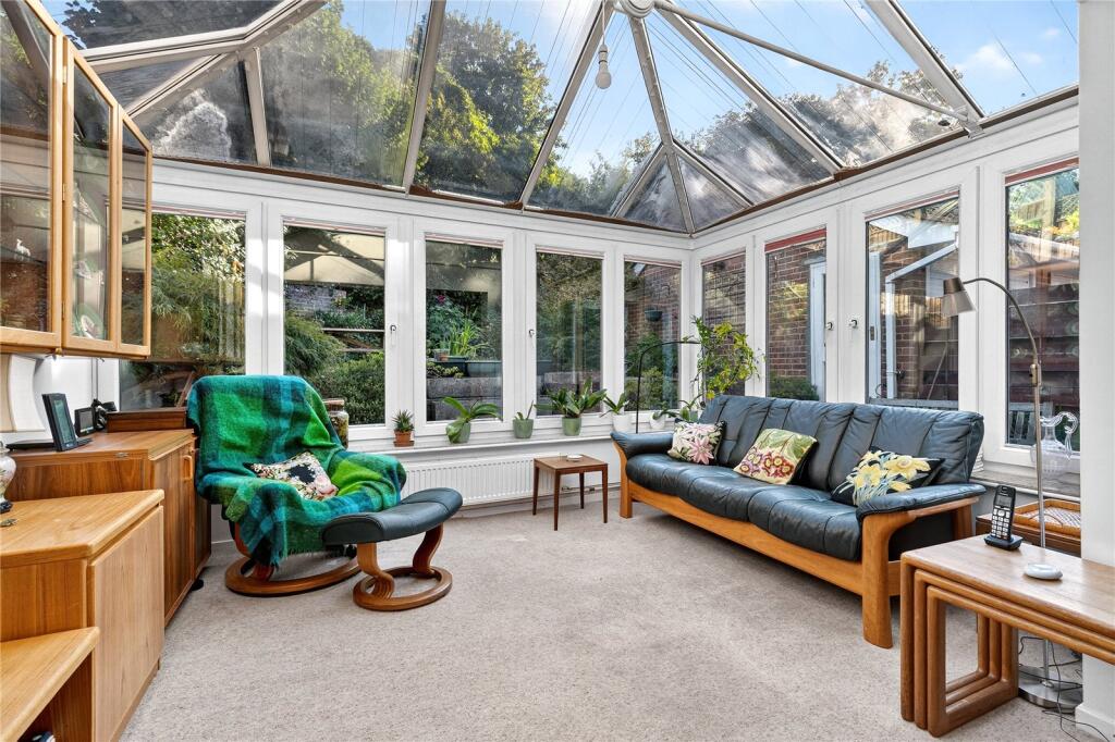
- CONSERVATORY:
- LIVING/DINING ROOM:
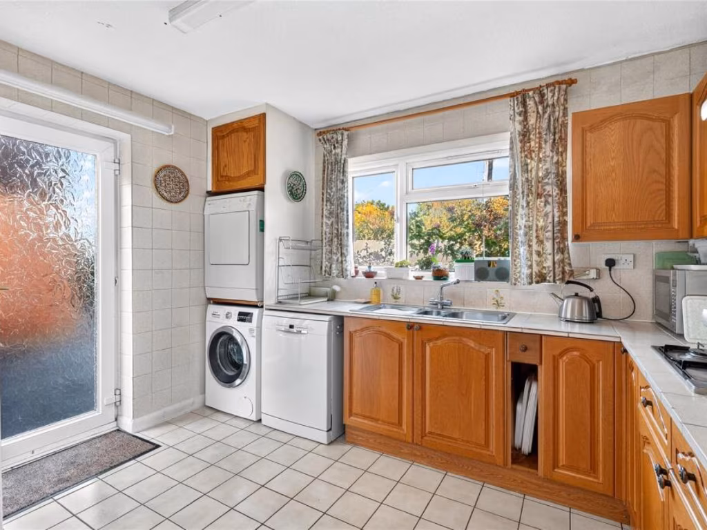
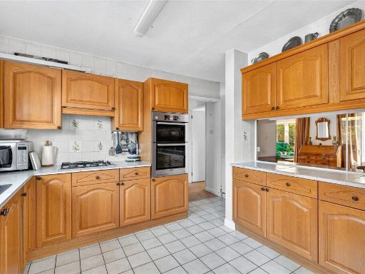
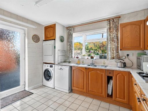
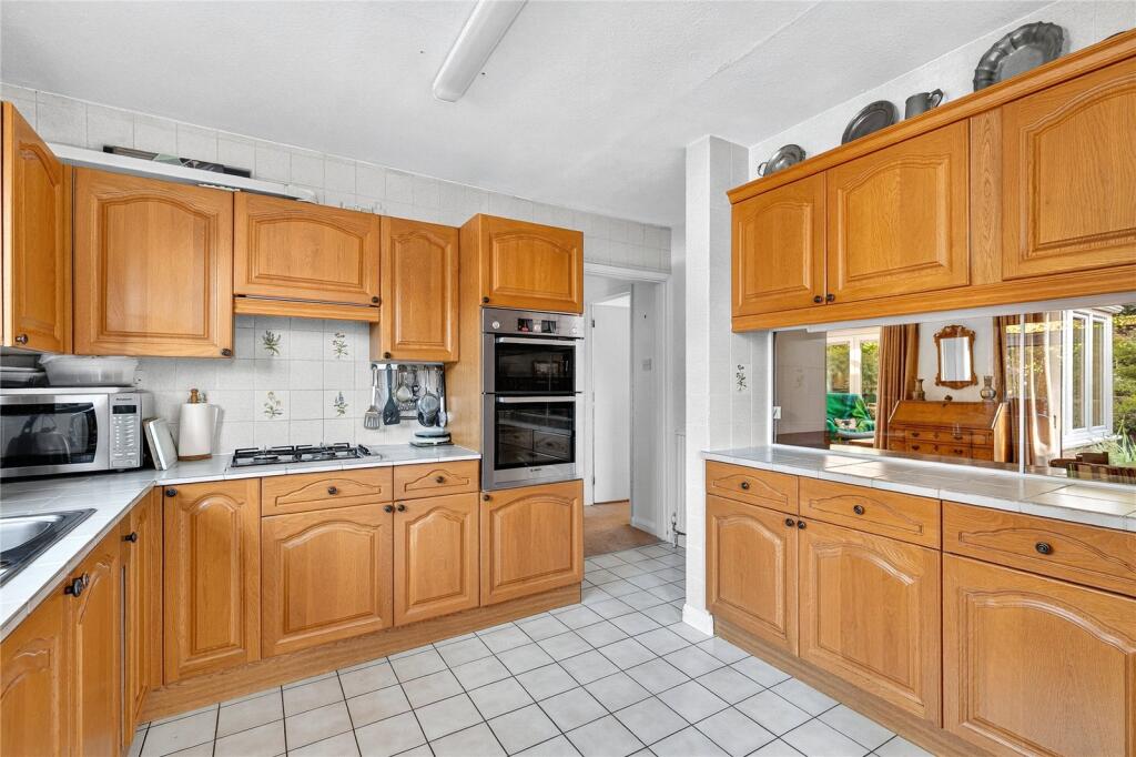
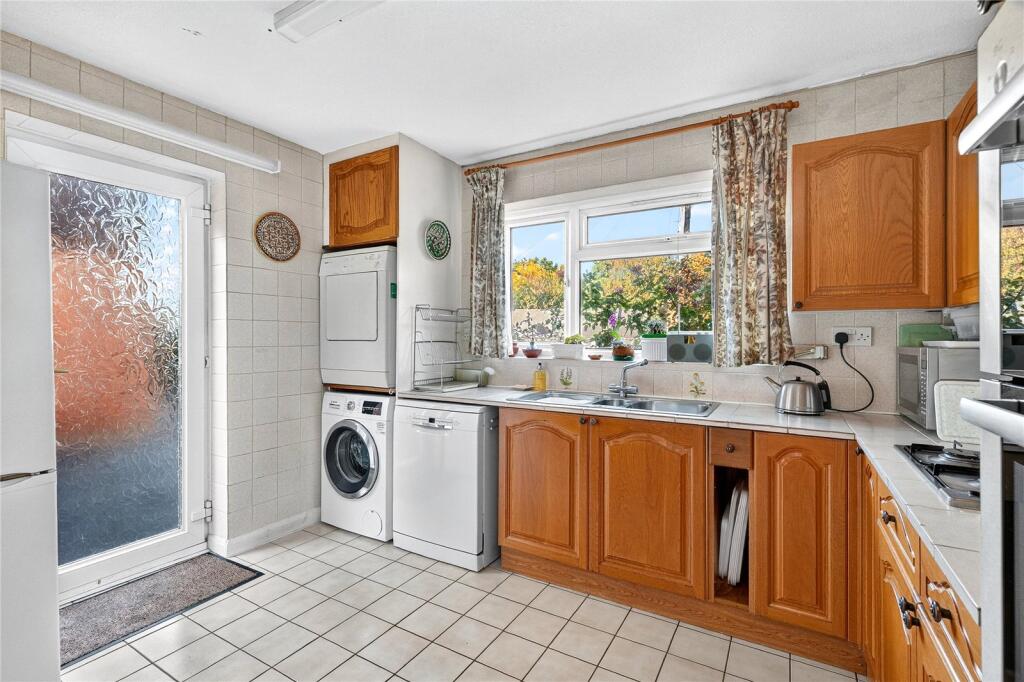
- KITCHEN:
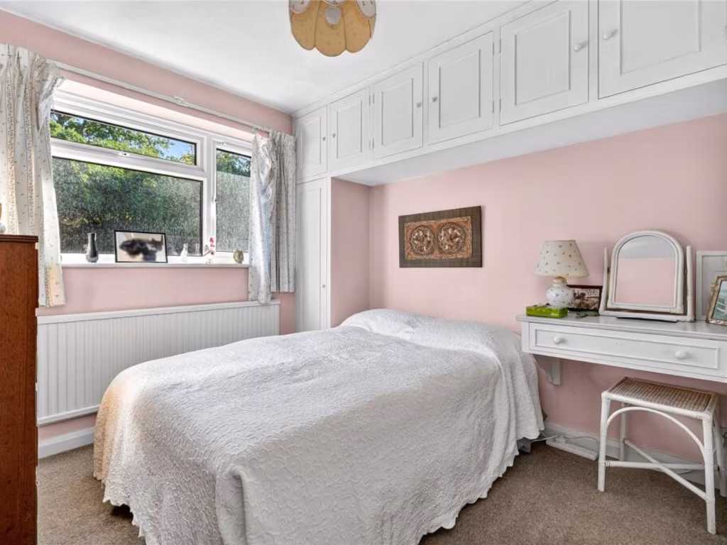
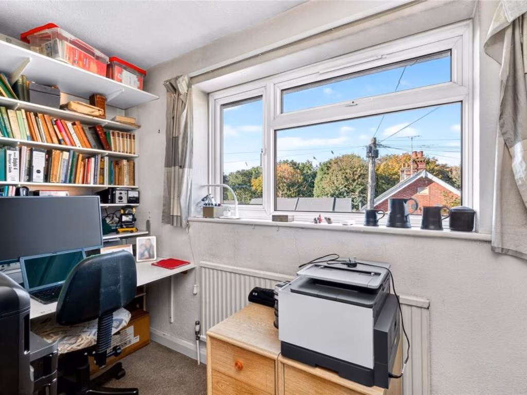
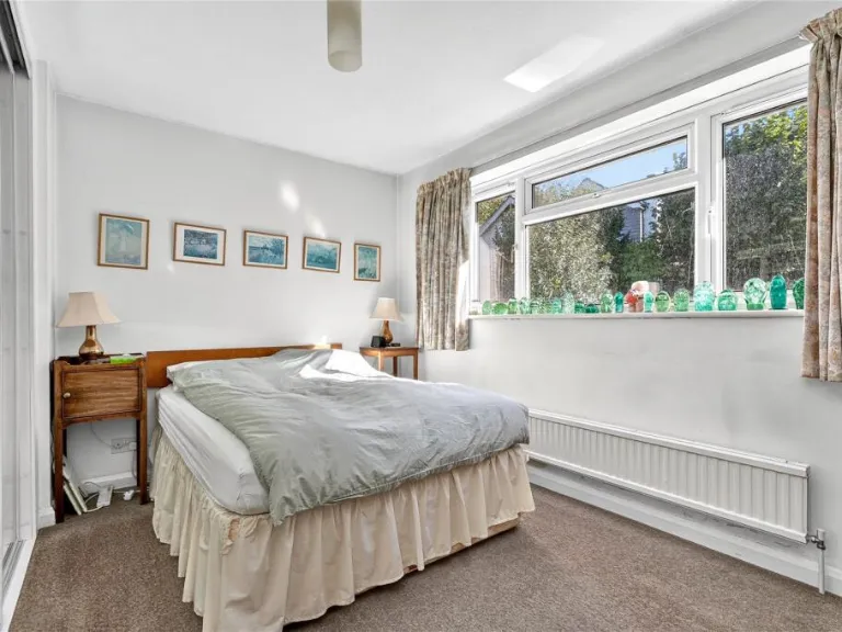
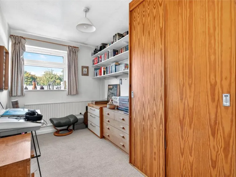
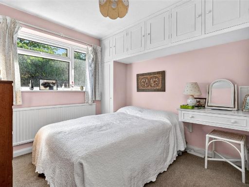
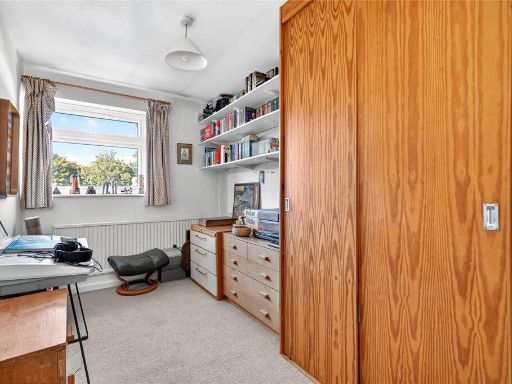
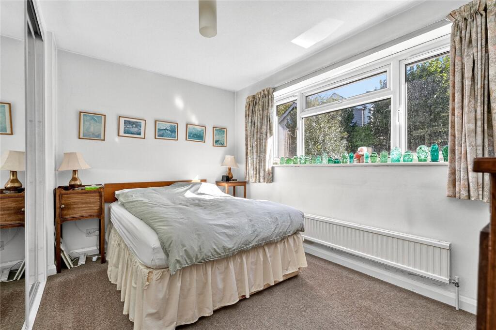
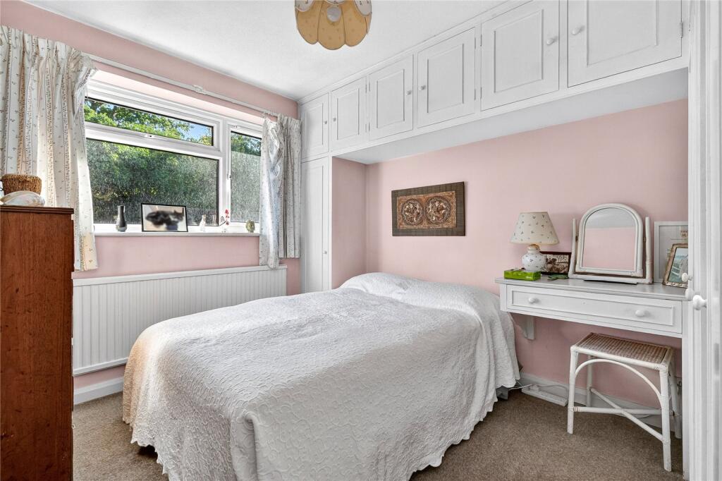
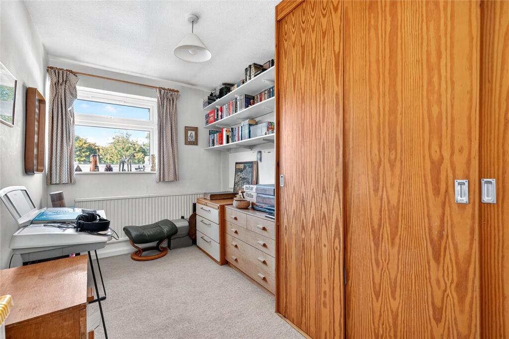
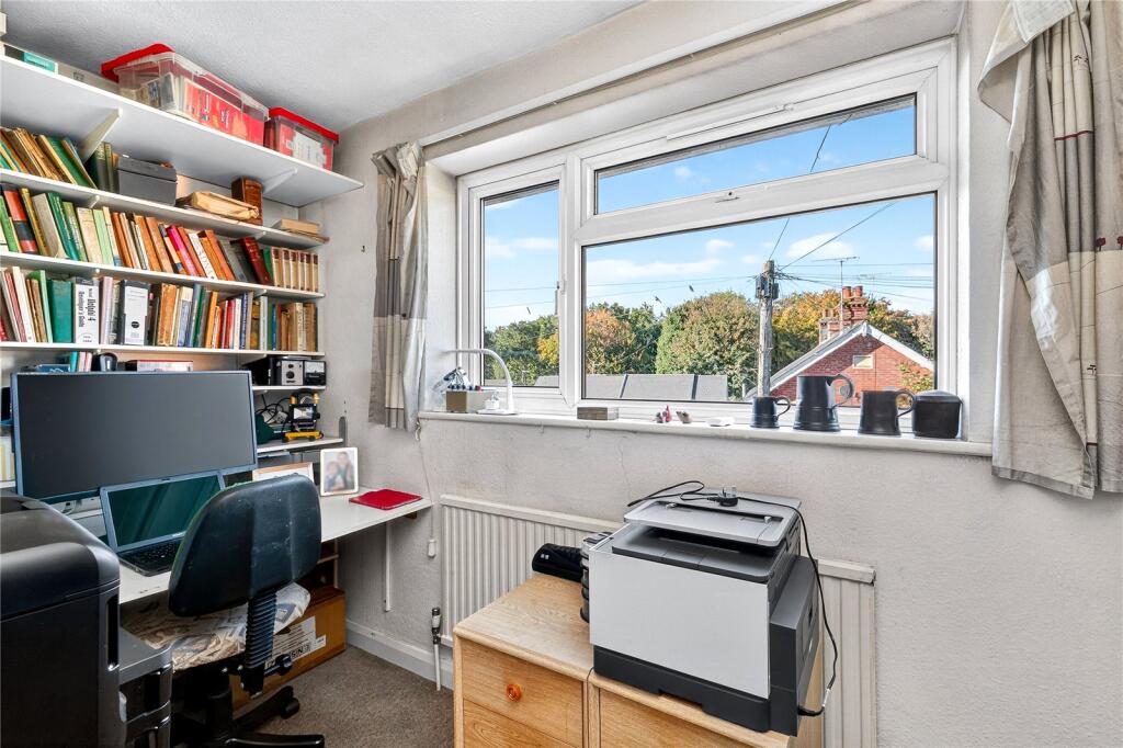
- BEDROOM 1:
- BEDROOM 2:
- BEDROOM 3:
- BEDROOM 4:
Textual Property Features
Detected Visual Features
- detached
- modern style
- brickwork
- garden
- driveway
- garage
- two-story
- residential
- family home
- living room
- mid-20th century
- fireplace
- conservatory
- natural light
- bookshelves
EPC Details
- Fully double glazed
- Solid brick, as built, no insulation (assumed)
- Boiler and radiators, mains gas
- Low energy lighting in 83% of fixed outlets
- Suspended, no insulation (assumed)
Nearby Schools
- Charters School
- St Michael's CofE Primary School, Sunninghill
- LVS Ascot
- Heathfield School
- Winkfield St Mary's CofE Primary School
- Gordon's School
- Bagshot Infant School
- Woodcote House School
- St Mary's School Ascot
- Sunningdale School
- St George's School
- Cheapside CofE Primary School
- Lambrook School
- Connaught Junior School
- Windlesham Village Infant School
- South Ascot Village Primary School
- Cranbourne Primary School
- Hammond School
- Lightwater Village School
- Valley End CofE Infant School
- Hall Grove School
- Coworth-Flexlands School
- St Francis Catholic Primary School, South Ascot
- Holy Trinity CofE Primary School, Sunningdale
- The Marist School
- Papplewick School
- Ascot Heath Primary School
- The Royal First School
Nearest Bars And Restaurants
- Id: 6165390472
- Tags:
- Addr:
- City: Ascot
- Postcode: SL5 7DL
- Street: London Road
- Amenity: restaurant
- Cuisine: italian
- Name: Zia Maria
- Outdoor_seating: yes
- Website: https://www.ziamariarestaurant.com/
- TagsNormalized:
- Lat: 51.4091839
- Lon: -0.6592417
- FullGeoHash: gcps2yzbnw3z
- PartitionGeoHash: gcps
- Images:
- FoodStandards: null
- Distance: 669.1
,- Id: 589081810
- Tags:
- Amenity: pub
- Building: yes
- Name: Sunninghill Comrades Club
- Website: http://www.sunninghillcomradesclub.co.uk
- Wheelchair: yes
- TagsNormalized:
- Lat: 51.399774
- Lon: -0.657167
- FullGeoHash: gcps3j13qukf
- PartitionGeoHash: gcps
- Images:
- FoodStandards: null
- Distance: 402.4
,- Id: 1104955915
- Tags:
- Amenity: pub
- Name: Dog & Partridge
- Wheelchair: yes
- TagsNormalized:
- Lat: 51.40225
- Lon: -0.6599445
- FullGeoHash: gcps2vrry1vs
- PartitionGeoHash: gcps
- Images:
- FoodStandards: null
- Distance: 258.1
,- Id: 1104955922
- Tags:
- Amenity: pub
- Name: The Carpenter's Arms
- Wheelchair: limited
- TagsNormalized:
- Lat: 51.4025278
- Lon: -0.6585283
- FullGeoHash: gcps3j83rjtt
- PartitionGeoHash: gcps
- Images:
- FoodStandards: null
- Distance: 158.7
,- Id: 175914967
- Tags:
- Amenity: pub
- Name: The Duke's Head
- Wheelchair: yes
- TagsNormalized:
- Lat: 51.4037763
- Lon: -0.6554858
- FullGeoHash: gcps3jf8wn6m
- PartitionGeoHash: gcps
- Images:
- FoodStandards: null
- Distance: 94.7
}
Nearest General Shops
- Id: 10700661442
- Tags:
- Name: Applewood Kitchens
- Shop: kitchen
- Source: Mapillary
- TagsNormalized:
- Lat: 51.4032623
- Lon: -0.6714757
- FullGeoHash: gcps2txj9qx7
- PartitionGeoHash: gcps
- Images:
- FoodStandards: null
- Distance: 1025.4
,- Id: 286277498
- Tags:
- Addr:
- City: Sunninghill
- Housenumber: 1
- Postcode: SL5 9NF
- Street: Chapmans Courtyard
- Building: yes
- Name: Treacle Cafe
- Opening_hours: 8:00-16:30
- Phone: +44 1344 627687
- Shop: bakery
- Website: http://treacle.me/
- Wheelchair: yes
- TagsNormalized:
- Lat: 51.4008263
- Lon: -0.6558421
- FullGeoHash: gcps3j4rtb88
- PartitionGeoHash: gcps
- Images:
- FoodStandards: null
- Distance: 290.1
,- Id: 4301914791
- Tags:
- Addr:
- Housenumber: 56
- Postcode: SL5 9NF
- Street: High Street
- Email: info@chapmansironmongers.co.uk
- Name: Chapmans the Ironmongers
- Opening_hours: Mo-Sa 09:00-17:30
- Phone: +44 1344622792
- Shop: hardware
- Website: https://www.chapmansironmongers.co.uk/
- Wheelchair: yes
- TagsNormalized:
- Lat: 51.4008358
- Lon: -0.6559523
- FullGeoHash: gcps3j4re4q8
- PartitionGeoHash: gcps
- Images:
- FoodStandards: null
- Distance: 287.6
}
Nearest Grocery shops
- Id: 5626786704
- Tags:
- Brand: Tesco Express
- Brand:wikidata: Q98456772
- Brand:wikipedia: en:Tesco
- Contact:
- Website: https://www.tesco.com/store-locator/ascot/50-51-high-st
- Name: Tesco Express
- Shop: convenience
- TagsNormalized:
- tesco
- tesco express
- convenience
- shop
- Lat: 51.4107337
- Lon: -0.6731278
- FullGeoHash: gcps2xjc4zrs
- PartitionGeoHash: gcps
- Images:
- FoodStandards: null
- Distance: 1402.8
,- Id: 236631993
- Tags:
- Addr:
- City: Ascot
- Housenumber: 3
- Parentstreet: High Street
- Postcode: SL5 7HD
- Street: The Hermitage
- Brand: Sainsbury's Local
- Brand:wikidata: Q13218434
- Brand:wikipedia: en:Sainsbury's Local
- Building: yes
- Fhrs:
- Name: Sainsbury's Local
- Shop: convenience
- Source:
- Website: https://stores.sainsburys.co.uk/6162/ascot-high-street-local
- TagsNormalized:
- sainsburys
- sainsburys local
- convenience
- shop
- Lat: 51.4100949
- Lon: -0.6724782
- FullGeoHash: gcps2wymd07c
- PartitionGeoHash: gcps
- Images:
- FoodStandards:
- Id: 1105025
- FHRSID: 1105025
- LocalAuthorityBusinessID: 19/00016/COM
- BusinessName: Sainsbury's Local
- BusinessType: Retailers - supermarkets/hypermarkets
- BusinessTypeID: 7840
- AddressLine1: 3 The Hermitage
- AddressLine2: High Street
- AddressLine3: Ascot
- AddressLine4: null
- PostCode: SL5 7HD
- RatingValue: 5
- RatingKey: fhrs_5_en-GB
- RatingDate: 2022-06-27
- LocalAuthorityCode: 886
- LocalAuthorityName: Windsor and Maidenhead
- LocalAuthorityWebSite: http://www.rbwm.gov.uk/
- LocalAuthorityEmailAddress: customer.service@rbwm.gov.uk
- Scores:
- Hygiene: 5
- Structural: 5
- ConfidenceInManagement: 5
- NewRatingPending: false
- Geocode:
- Longitude: -0.67262300000000
- Latitude: 51.41024360000000
- Distance: 1325.1
,- Id: 4053637850
- Tags:
- TagsNormalized:
- Lat: 51.4056628
- Lon: -0.6388057
- FullGeoHash: gcps3qngdwpf
- PartitionGeoHash: gcps
- Images:
- FoodStandards: null
- Distance: 1266.5
}
Nearest Religious buildings
- Id: 469420435
- Tags:
- Addr:
- City: Ascot
- Postcode: SL5 9HG
- Street: Coronation Road
- Amenity: place_of_worship
- Building: yes
- Denomination: roman_catholic
- Name: St Francis Church
- Religion: christian
- Website: http://www.stfrancisascot.co.uk/
- TagsNormalized:
- place of worship
- catholic
- roman catholic
- church
- christian
- Lat: 51.3970811
- Lon: -0.6731195
- FullGeoHash: gcps2stcenme
- PartitionGeoHash: gcps
- Images:
- FoodStandards: null
- Distance: 1337.5
,- Id: 826192794
- Tags:
- Amenity: place_of_worship
- Building: church
- Denomination: anglican
- Name: All Souls
- Religion: christian
- Wikidata: Q17546946
- TagsNormalized:
- place of worship
- church
- anglican
- christian
- Lat: 51.4035394
- Lon: -0.6746949
- FullGeoHash: gcps2tsxq6r0
- PartitionGeoHash: gcps
- Images:
- FoodStandards: null
- Distance: 1248.8
,- Id: 135110035
- Tags:
- Amenity: place_of_worship
- Building: yes
- Denomination: anglican
- Name: St.Michael and All Angels
- Religion: christian
- Wikidata: Q26413111
- TagsNormalized:
- place of worship
- anglican
- christian
- church
- Lat: 51.4088706
- Lon: -0.6501773
- FullGeoHash: gcps3nww3u0d
- PartitionGeoHash: gcps
- Images:
- FoodStandards: null
- Distance: 759.6
}
Nearest Medical buildings
- Id: 8715219757
- Tags:
- Amenity: pharmacy
- Brand: Lloyds Pharmacy
- Brand:wikidata: Q6662870
- Brand:wikipedia: en:LloydsPharmacy
- Dispensing: yes
- Healthcare: pharmacy
- Name: Lloyds Pharmacy
- TagsNormalized:
- pharmacy
- lloyds pharmacy
- health
- healthcare
- Lat: 51.3928565
- Lon: -0.6287367
- FullGeoHash: gcps3ey1j6gf
- PartitionGeoHash: gcps
- Images:
- FoodStandards: null
- Distance: 2265.2
,- Id: 1149292368
- Tags:
- Amenity: hospital
- Healthcare: hospital
- Name: Heatherwood Hospital
- Wikidata: Q14956784
- TagsNormalized:
- Lat: 51.4081173
- Lon: -0.6864328
- FullGeoHash: gcps2qs1uzws
- PartitionGeoHash: gcps
- Images:
- FoodStandards: null
- Distance: 2129
,- Id: 5626463085
- Tags:
- Amenity: pharmacy
- Brand: Boots
- Brand:wikidata: Q6123139
- Brand:wikipedia: en:Boots UK
- Dispensing: yes
- Drive_through: no
- Healthcare: pharmacy
- Name: Boots
- TagsNormalized:
- pharmacy
- boots
- health
- healthcare
- Lat: 51.4108415
- Lon: -0.6746727
- FullGeoHash: gcps2xh9ygrx
- PartitionGeoHash: gcps
- Images:
- FoodStandards: null
- Distance: 1497.8
,- Id: 2623128109
- Tags:
- Amenity: doctors
- Name: King's Corner Surgery
- TagsNormalized:
- Lat: 51.3996717
- Lon: -0.6503089
- FullGeoHash: gcps3jn2y9q8
- PartitionGeoHash: gcps
- Images:
- FoodStandards: null
- Distance: 605.2
}
Nearest Airports
- Id: 260720166
- Tags:
- Aerodrome: international
- Aeroway: aerodrome
- Alt_name: Gatwick Airport
- Ele: 62
- Iata: LGW
- Icao: EGKK
- Internet_access: wlan
- Internet_access:fee: no
- Internet_access:ssid: Gatwick FREE Wi-Fi
- Name: London Gatwick Airport
- Operator: Gatwick Airport Limited
- Ref: LGW
- Website: https://www.gatwickairport.com/
- Wikidata: Q8703
- Wikipedia: en:Gatwick Airport
- TagsNormalized:
- airport
- international airport
- Lat: 51.1540917
- Lon: -0.1883773
- FullGeoHash: gcpg58qf4mzd
- PartitionGeoHash: gcpg
- Images:
- FoodStandards: null
- Distance: 42772.1
,- Id: 14001268
- Tags:
- Access: yes
- Aerodrome: international
- Aerodrome:type: public
- Aeroway: aerodrome
- Alt_name: London Heathrow
- Alt_name_2: London Heathrow Airport
- Ele: 25
- Iata: LHR
- Icao: EGLL
- Int_name: Heathrow Airport
- Name: London Heathrow Airport
- Note: area still approx
- Old_name: London Airport
- Operator: Heathrow Airport Limited
- Rank_aci:
- Ref: LHR
- Short_name: Heathrow
- Type: multipolygon
- Website: https://www.heathrow.com/
- Wikidata: Q8691
- Wikipedia: en:Heathrow Airport
- TagsNormalized:
- airport
- international airport
- Lat: 51.4677522
- Lon: -0.4547736
- FullGeoHash: gcpsv9kv7h2h
- PartitionGeoHash: gcps
- Images:
- FoodStandards: null
- Distance: 15720.8
}
Nearest Leisure Facilities
- Id: 95435254
- Tags:
- Leisure: pitch
- Sport: basketball
- TagsNormalized:
- pitch
- leisure
- basketball
- sports
- Lat: 51.4058693
- Lon: -0.6566822
- FullGeoHash: gcps3n1ufhw6
- PartitionGeoHash: gcps
- Images:
- FoodStandards: null
- Distance: 276.7
,- Id: 486842424
- Tags:
- TagsNormalized:
- Lat: 51.4058139
- Lon: -0.6563345
- FullGeoHash: gcps3n4hd638
- PartitionGeoHash: gcps
- Images:
- FoodStandards: null
- Distance: 271.7
,- Id: 562906347
- Tags:
- Leisure: pitch
- Wheelchair: yes
- TagsNormalized:
- Lat: 51.4020403
- Lon: -0.6555815
- FullGeoHash: gcps3j6wefg1
- PartitionGeoHash: gcps
- Images:
- FoodStandards: null
- Distance: 167.8
,- Id: 562906346
- Tags:
- Leisure: pitch
- Wheelchair: yes
- TagsNormalized:
- Lat: 51.402244
- Lon: -0.6554071
- FullGeoHash: gcps3j6xzbv1
- PartitionGeoHash: gcps
- Images:
- FoodStandards: null
- Distance: 154.7
,- Id: 562906343
- Tags:
- TagsNormalized:
- swimming
- swimming pool
- pool
- leisure
- Lat: 51.4027662
- Lon: -0.6557146
- FullGeoHash: gcps3jddbdpu
- PartitionGeoHash: gcps
- Images:
- FoodStandards: null
- Distance: 96.4
}
Nearest Tourist attractions
- Id: 9060388029
- Tags:
- Addr:
- City: Ascot
- Country: GB
- Postcode: SL5 8RF
- Street: Birch Lane
- Fhrs:
- Name: Tanglewood
- Tourism: guest_house
- TagsNormalized:
- Lat: 51.4186432
- Lon: -0.7140404
- FullGeoHash: gcpkxb2p39uf
- PartitionGeoHash: gcpk
- Images:
- FoodStandards:
- Id: 986473
- FHRSID: 986473
- LocalAuthorityBusinessID: 94/03845/CP
- BusinessName: Tanglewood
- BusinessType: Hotel/bed & breakfast/guest house
- BusinessTypeID: 7842
- AddressLine1: Birch Lane
- AddressLine2: Ascot
- AddressLine3: null
- AddressLine4: null
- PostCode: SL5 8RF
- RatingValue: 5
- RatingKey: fhrs_5_en-GB
- RatingDate: 2019-09-25
- LocalAuthorityCode: 882
- LocalAuthorityName: Bracknell Forest
- LocalAuthorityWebSite: http://www.bracknell-forest.gov.uk
- LocalAuthorityEmailAddress: environmental.health@bracknell-forest.gov.uk
- Scores:
- Hygiene: 5
- Structural: 0
- ConfidenceInManagement: 0
- NewRatingPending: false
- Geocode:
- Longitude: -0.71473800000000
- Latitude: 51.41900400000000
- Distance: 4324.2
,- Id: 55394573
- Tags:
- Amenity: pub
- Name: The Winkfield
- Tourism: picnic_site
- TagsNormalized:
- bar
- pub
- picnic
- picnic site
- tourism
- Lat: 51.435903
- Lon: -0.6759388
- FullGeoHash: gcps8eegc7r2
- PartitionGeoHash: gcps
- Images:
- FoodStandards: null
- Distance: 3854.7
,- Id: 9118245704
- Tags:
- Addr:
- City: Ascot
- Postcode: SL5 8BD
- Street: Whitmoor Forest, Swinley Road, Winkfield Row
- Name: LaplandUK
- Smoking: no
- Tourism: theme_park
- Website: https://laplanduk.freshdesk.com/support/home
- TagsNormalized:
- Lat: 51.4083412
- Lon: -0.7083987
- FullGeoHash: gcpkrys5m17s
- PartitionGeoHash: gcpk
- Images:
- FoodStandards: null
- Distance: 3628.6
}
Nearest Train stations
- Id: 293531076
- Tags:
- Attraction: train
- Layer: 1
- Name: Sky Rider
- Public_transport: station
- Railway: station
- Tourism: attraction
- Usage: tourism
- TagsNormalized:
- station
- railway
- attraction
- tourism
- Lat: 51.4646093
- Lon: -0.6531323
- FullGeoHash: gcpsc0u7hft2
- PartitionGeoHash: gcps
- Images:
- FoodStandards: null
- Distance: 6812.8
,- Id: 1785378837
- Tags:
- Name: Virginia Water
- Naptan:
- Network: National Rail
- Public_transport: station
- Railway: station
- Ref:
- Source: Surrey aerial
- Wikidata: Q976686
- Wikipedia: en:Virginia Water railway station
- TagsNormalized:
- Lat: 51.4015235
- Lon: -0.5620827
- FullGeoHash: gcps7jqewd2z
- PartitionGeoHash: gcps
- Images:
- FoodStandards: null
- Distance: 6566.3
,- Id: 5967525977
- Tags:
- Name: Bagshot
- Naptan:
- Network: National Rail
- Operator: South Western Railway
- Public_transport: station
- Railway: station
- Ref:
- Wikidata: Q2480873
- Wikipedia: en:Bagshot railway station
- TagsNormalized:
- Lat: 51.3643336
- Lon: -0.6885039
- FullGeoHash: gcps0qdduty2
- PartitionGeoHash: gcps
- Images:
- FoodStandards: null
- Distance: 4870.8
,- Id: 3711871943
- Tags:
- Name: Longcross
- Naptan:
- Network: National Rail
- Old_name: Longcross Halt
- Public_transport: station
- Railway: station
- Ref:
- Wikidata: Q1925371
- Wikipedia: en:Longcross railway station
- TagsNormalized:
- Lat: 51.385277
- Lon: -0.5950836
- FullGeoHash: gcps66qsvtcs
- PartitionGeoHash: gcps
- Images:
- FoodStandards: null
- Distance: 4724.9
,- Id: 6022636079
- Tags:
- Name: Sunningdale
- Naptan:
- Network: National Rail
- Note: On this railway station customers have to show their rail ticket at the ticket office to get the code for using the toilets.
- Public_transport: station
- Railway: station
- Ref:
- Wikidata: Q2537626
- Wikipedia: en:Sunningdale railway station
- TagsNormalized:
- Lat: 51.3921459
- Lon: -0.6332427
- FullGeoHash: gcps3eduuqk5
- PartitionGeoHash: gcps
- Images:
- FoodStandards: null
- Distance: 2051.2
}
Nearest Hotels
- Id: 509024907
- Tags:
- Addr:
- City: Ascot
- Postcode: SL5 0PP
- Street: London Road
- Building: yes
- Internet_access: yes
- Name: Royal Berkshire
- Stars: 4
- Tourism: hotel
- Wikidata: Q7373808
- TagsNormalized:
- Lat: 51.4083161
- Lon: -0.6354209
- FullGeoHash: gcps3w971sey
- PartitionGeoHash: gcps
- Images:
- FoodStandards: null
- Distance: 1574.4
,- Id: 9616612626
- Tags:
- TagsNormalized:
- Lat: 51.3950899
- Lon: -0.6613046
- FullGeoHash: gcps2unqn7pt
- PartitionGeoHash: gcps
- Images:
- FoodStandards: null
- Distance: 975.8
,- Id: 135110025
- Tags:
- Building: yes
- Name: Highclere Hotel
- Source:
- Building: OS_OpenData_StreetView
- Tourism: hotel
- Wheelchair: limited
- TagsNormalized:
- Lat: 51.4014558
- Lon: -0.654019
- FullGeoHash: gcps3j7g0mb5
- PartitionGeoHash: gcps
- Images:
- FoodStandards: null
- Distance: 283.3
}
Tags
- detached
- modern style
- brickwork
- garden
- driveway
- garage
- two-story
- residential
- family home
- living room
- mid-20th century
- fireplace
- conservatory
- natural light
- bookshelves
Local Market Stats
- Average Price/sqft: £516
- Avg Income: £72800
- Rental Yield: 4.7%
- Social Housing: 4%
- Planning Success Rate: 80%
AirBnB Data
- 1km average: £90/night
- Listings in 1km: 2
Similar Properties
 4 bedroom semi-detached house for sale in Lower Village Road, Sunninghill, Ascot, Berkshire, SL5 — £800,000 • 4 bed • 2 bath • 1891 ft²
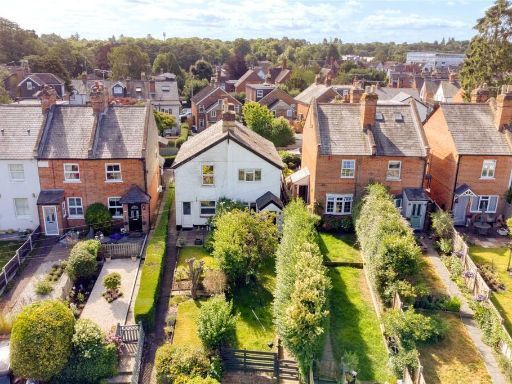 3 bedroom semi-detached house for sale in Lower Village Road, Sunninghill, Berkshire, SL5 — £550,000 • 3 bed • 2 bath • 870 ft²
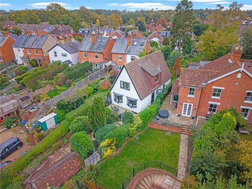 4 bedroom house for sale in Lower Village Road, Sunninghill, Berkshire, SL5 — £800,000 • 4 bed • 1 bath • 1359 ft²
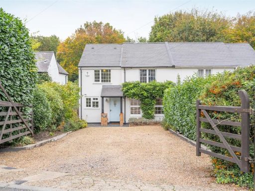 4 bedroom semi-detached house for sale in Lower Village Road, Sunninghill, SL5 — £1,000,000 • 4 bed • 2 bath • 1776 ft²
 4 bedroom detached house for sale in Gainsborough Drive, Ascot, Berkshire, SL5 — £650,000 • 4 bed • 1 bath • 1341 ft²
 4 bedroom terraced house for sale in Furzebank, Sunninghill, Ascot, Berkshire, SL5 — £600,000 • 4 bed • 1 bath • 1025 ft²
Meta
- {
"@context": "https://schema.org",
"@type": "Residence",
"name": "4 bedroom detached house for sale in Lower Village Road, Su…",
"description": "",
"url": "https://propertypiper.co.uk/property/fb477fb3-0bc0-440d-9247-6ff4ff3699f8",
"image": "https://image-a.propertypiper.co.uk/00b5506f-dc47-43b6-bc89-50e522b512dc-1024.jpeg",
"address": {
"@type": "PostalAddress",
"streetAddress": "19 LOWER VILLAGE ROAD, ASCOT",
"postalCode": "SL5 7AF",
"addressLocality": "Windsor and Maidenhead",
"addressRegion": "Windsor",
"addressCountry": "England"
},
"geo": {
"@type": "GeoCoordinates",
"latitude": 51.40338047678492,
"longitude": -0.656694295043564
},
"numberOfRooms": 4,
"numberOfBathroomsTotal": 2,
"floorSize": {
"@type": "QuantitativeValue",
"value": 1307,
"unitCode": "FTK"
},
"offers": {
"@type": "Offer",
"price": 700000,
"priceCurrency": "GBP",
"availability": "https://schema.org/InStock"
},
"additionalProperty": [
{
"@type": "PropertyValue",
"name": "Feature",
"value": "detached"
},
{
"@type": "PropertyValue",
"name": "Feature",
"value": "modern style"
},
{
"@type": "PropertyValue",
"name": "Feature",
"value": "brickwork"
},
{
"@type": "PropertyValue",
"name": "Feature",
"value": "garden"
},
{
"@type": "PropertyValue",
"name": "Feature",
"value": "driveway"
},
{
"@type": "PropertyValue",
"name": "Feature",
"value": "garage"
},
{
"@type": "PropertyValue",
"name": "Feature",
"value": "two-story"
},
{
"@type": "PropertyValue",
"name": "Feature",
"value": "residential"
},
{
"@type": "PropertyValue",
"name": "Feature",
"value": "family home"
},
{
"@type": "PropertyValue",
"name": "Feature",
"value": "living room"
},
{
"@type": "PropertyValue",
"name": "Feature",
"value": "mid-20th century"
},
{
"@type": "PropertyValue",
"name": "Feature",
"value": "fireplace"
},
{
"@type": "PropertyValue",
"name": "Feature",
"value": "conservatory"
},
{
"@type": "PropertyValue",
"name": "Feature",
"value": "natural light"
},
{
"@type": "PropertyValue",
"name": "Feature",
"value": "bookshelves"
}
]
}
High Res Floorplan Images
Compatible Floorplan Images
FloorplanImages Thumbnail