TN12 0SF - 3 bedroom link detached house for sale in Weavers Close, St…
View on Property Piper
3 bedroom link detached house for sale in Weavers Close, Staplehurst, Kent, TN12
Property Details
- Price: £264500
- Bedrooms: 3
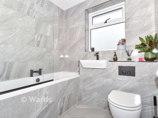
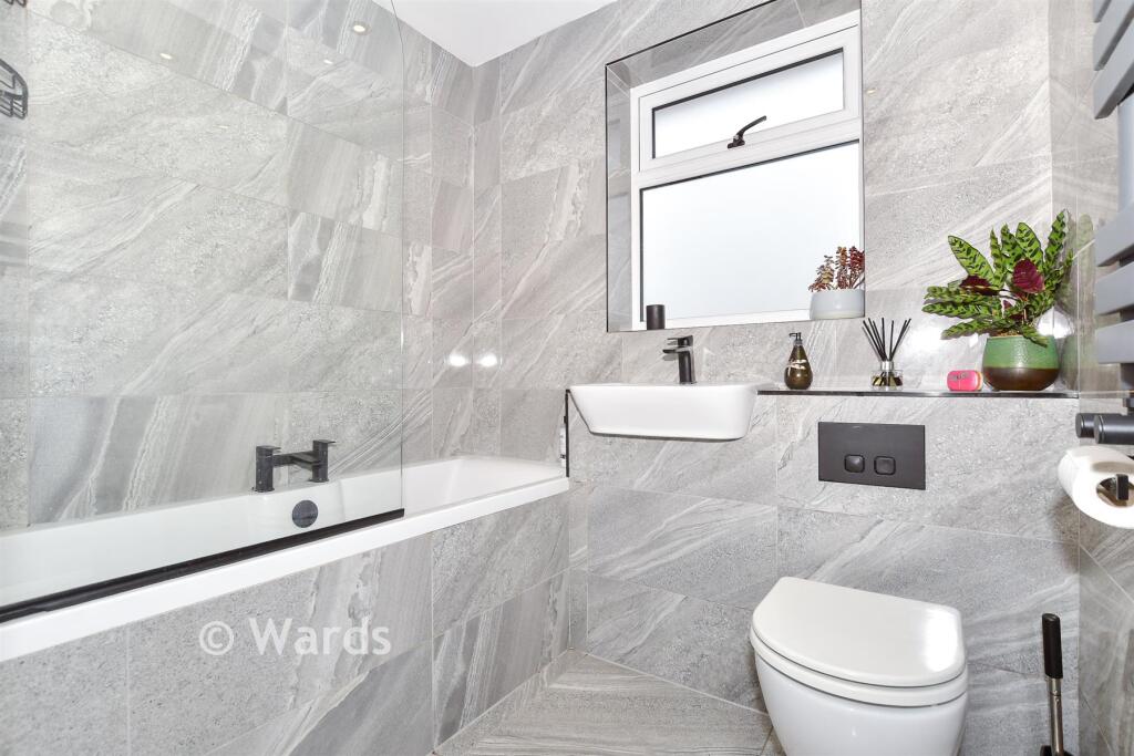
- Bathrooms: 1
- Property Type: undefined
- Property SubType: undefined
Image Descriptions
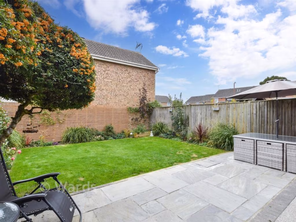
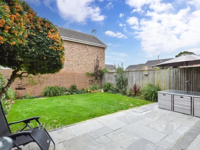
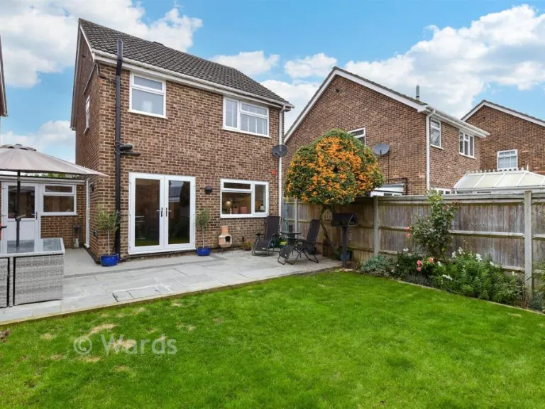
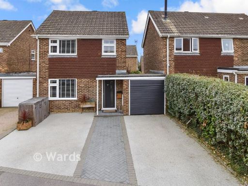
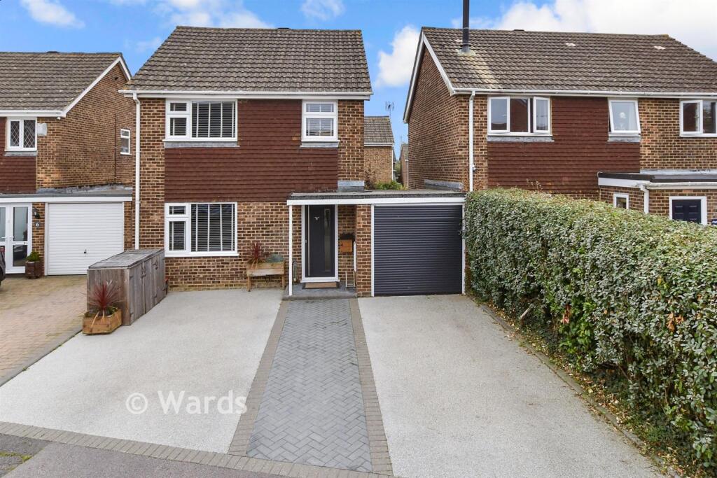
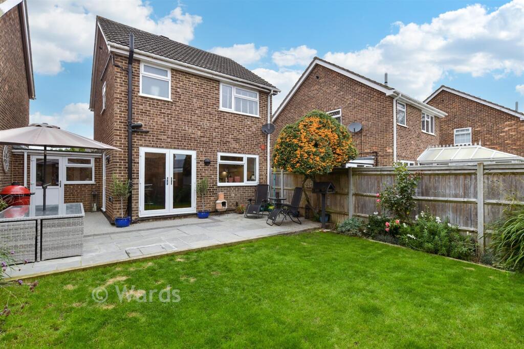
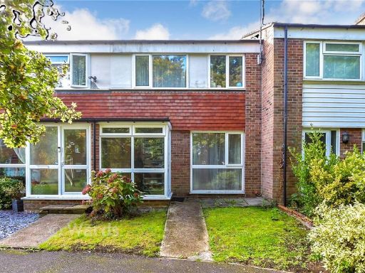
- 1970s semi-detached house Suburban
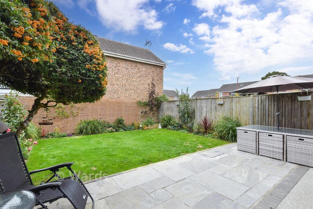
- backyard contemporary
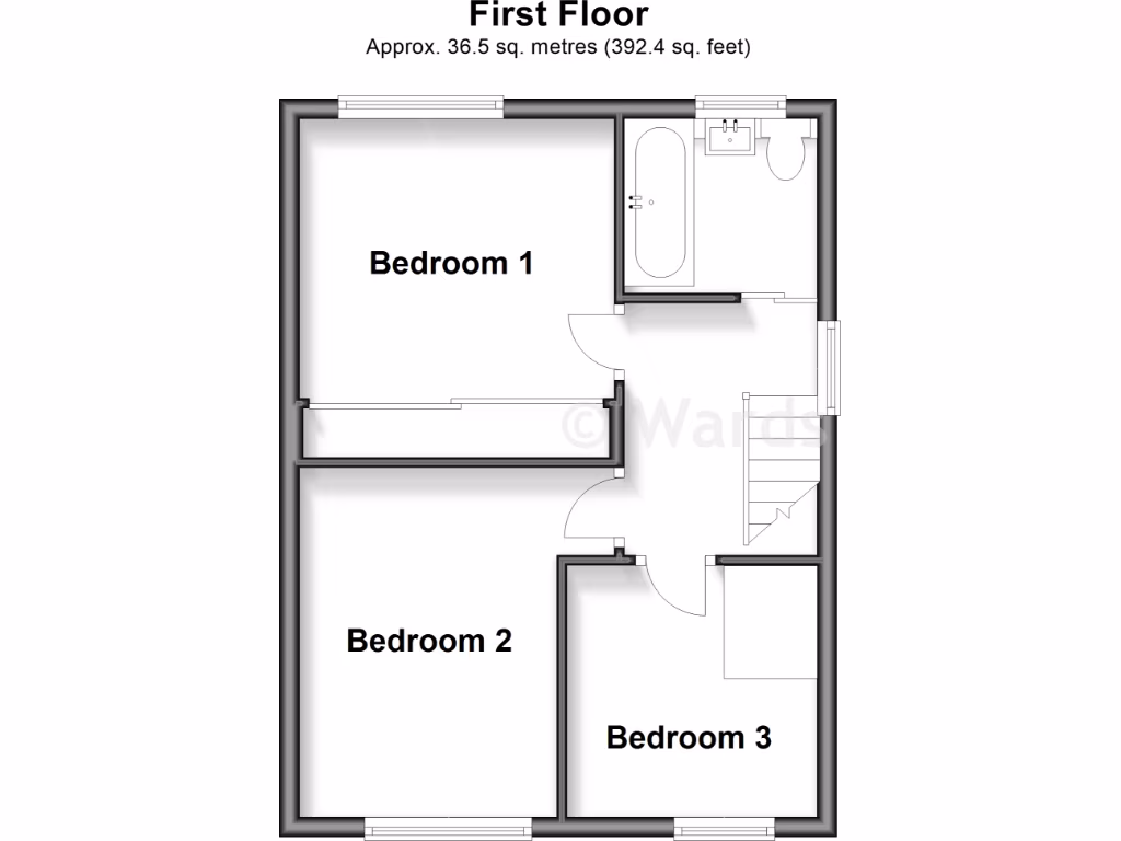
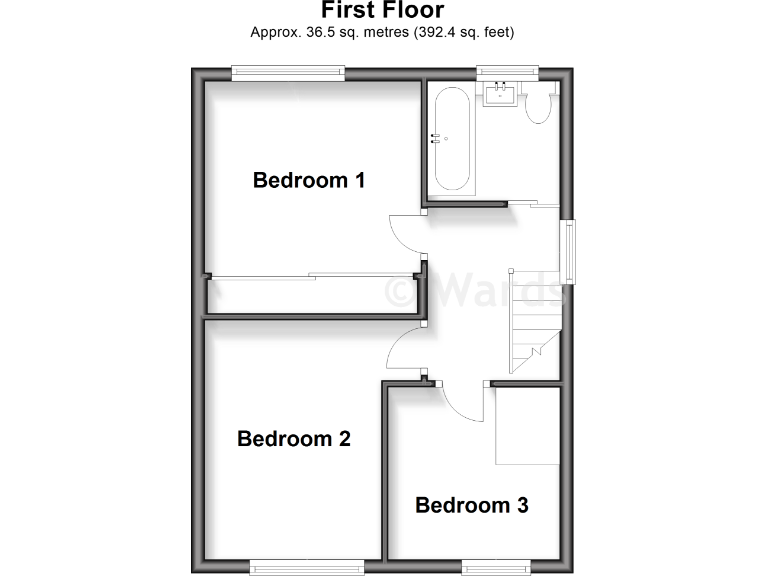
Rooms
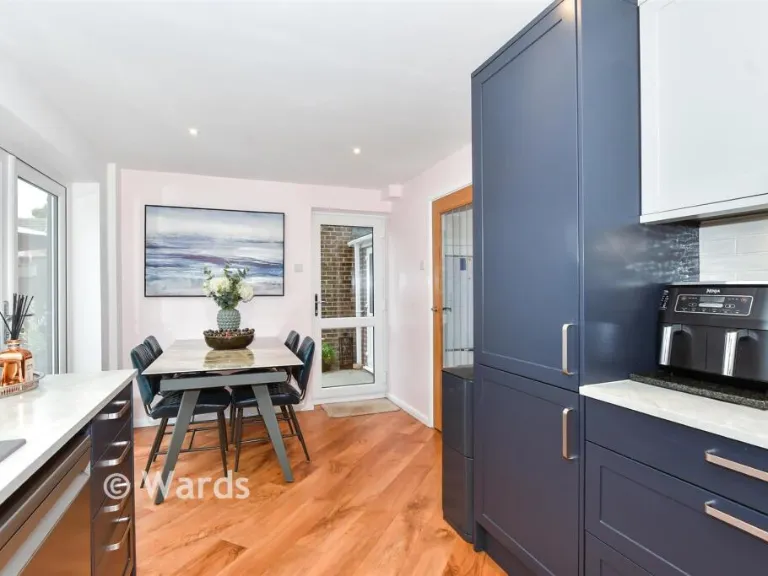
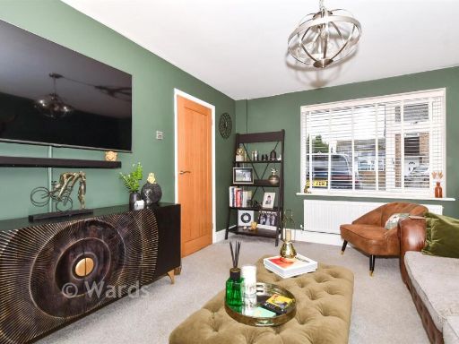
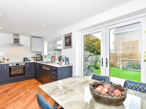
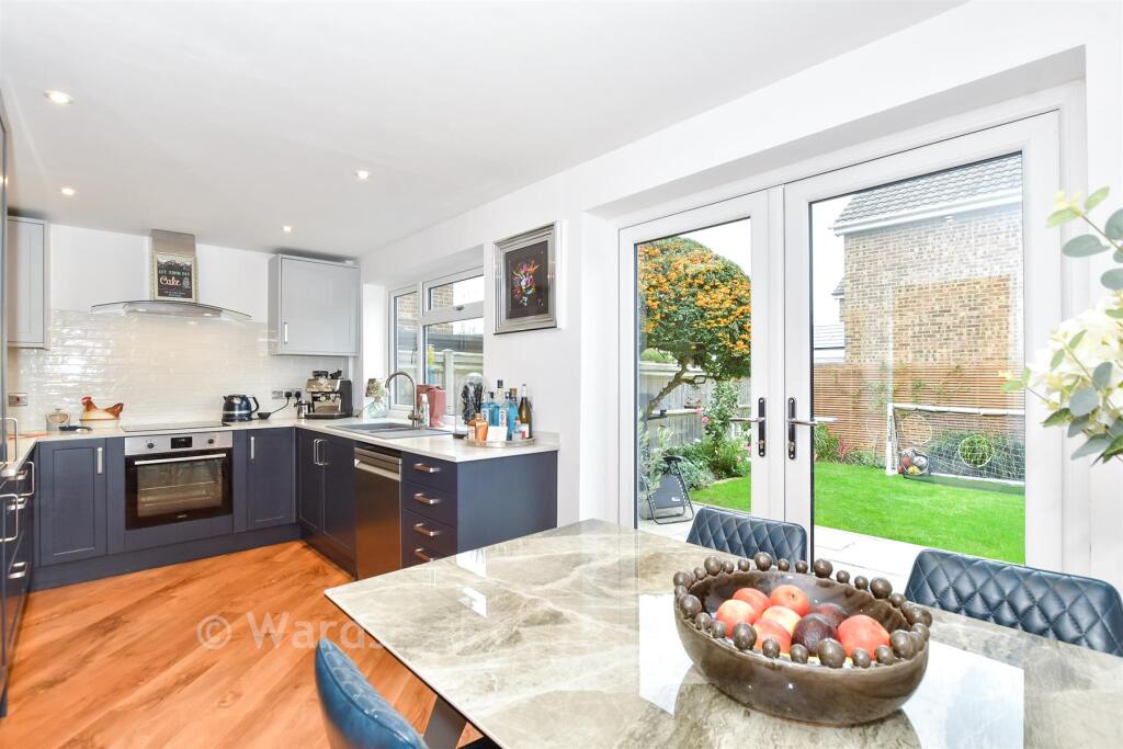
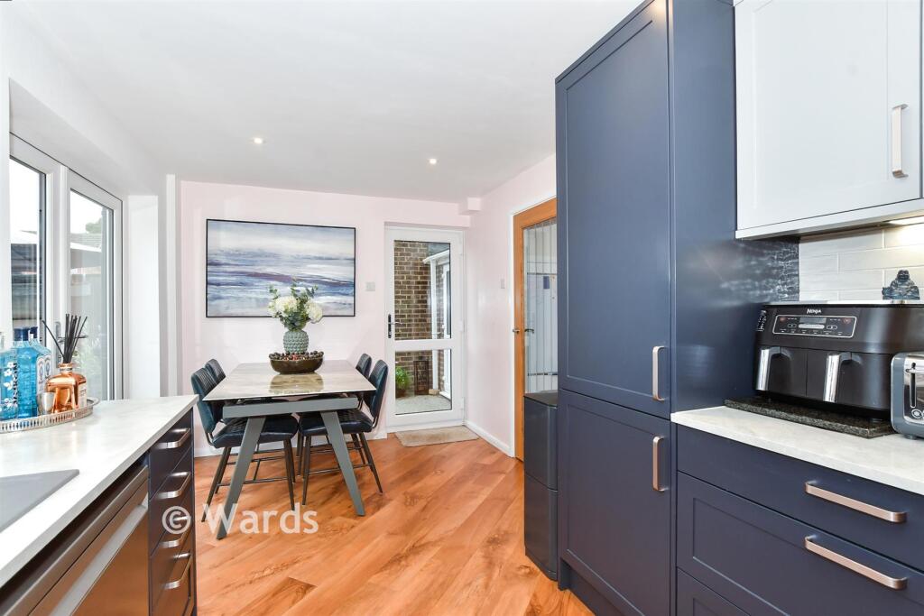
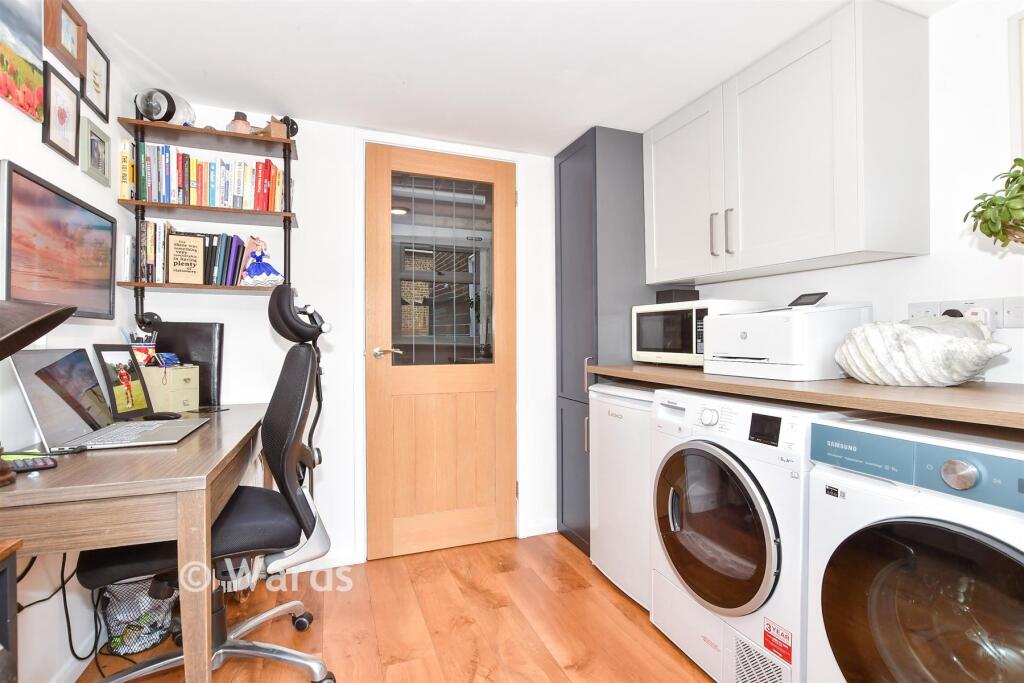
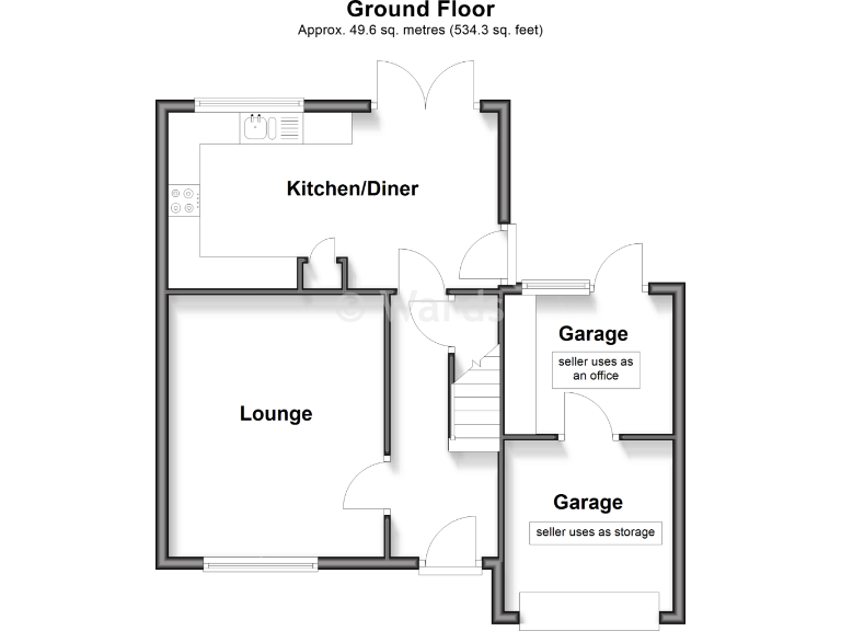
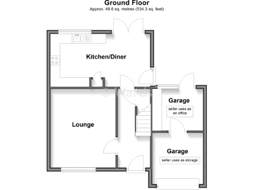
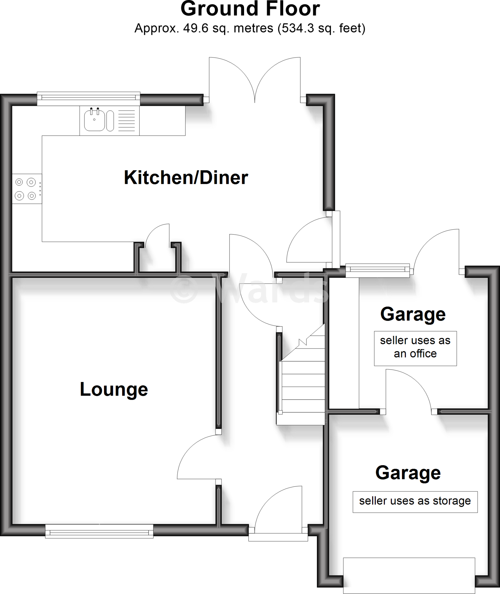
- Kitchen/Diner:
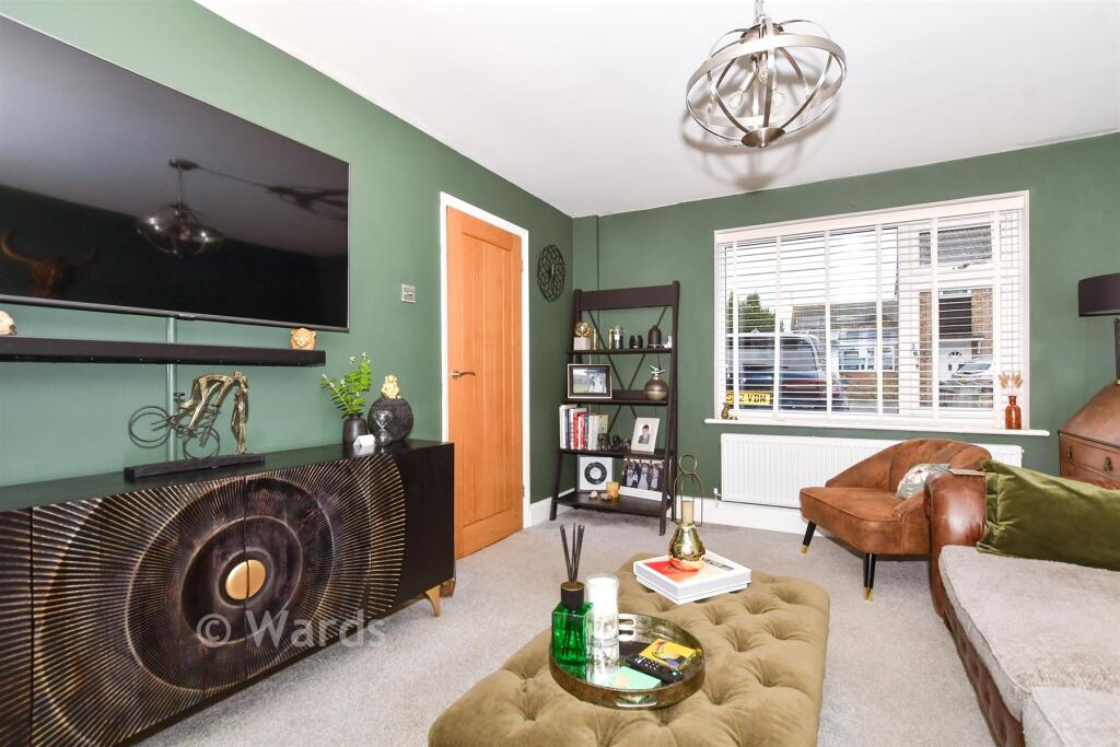
- Lounge:
- Garage:
- Garage:
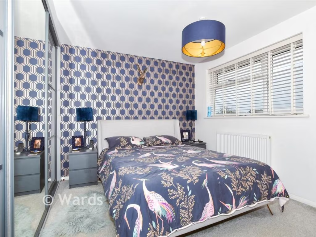
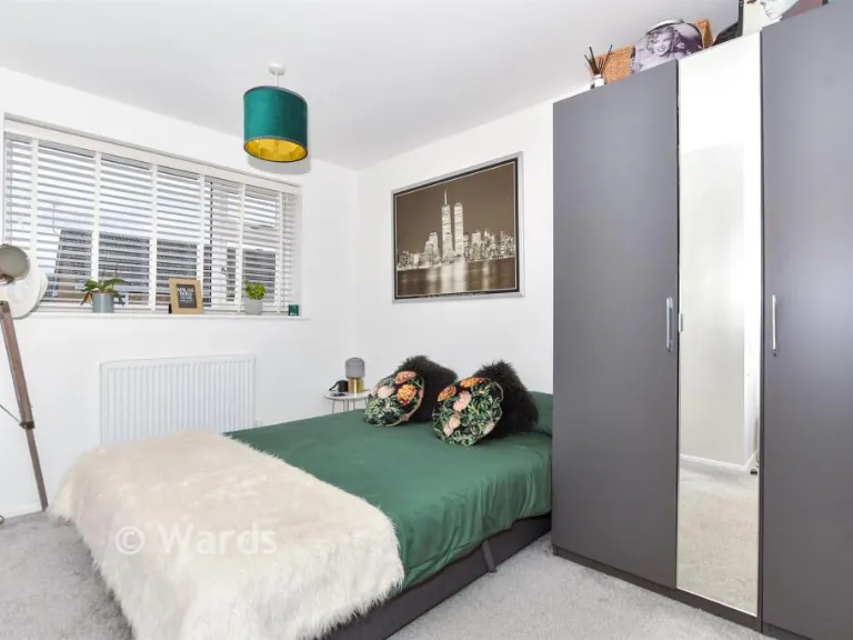
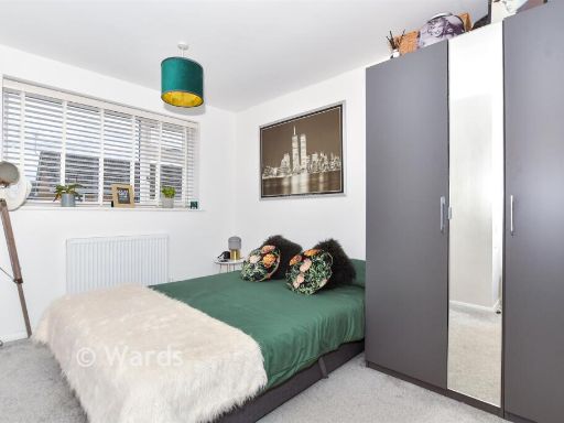
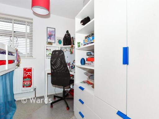
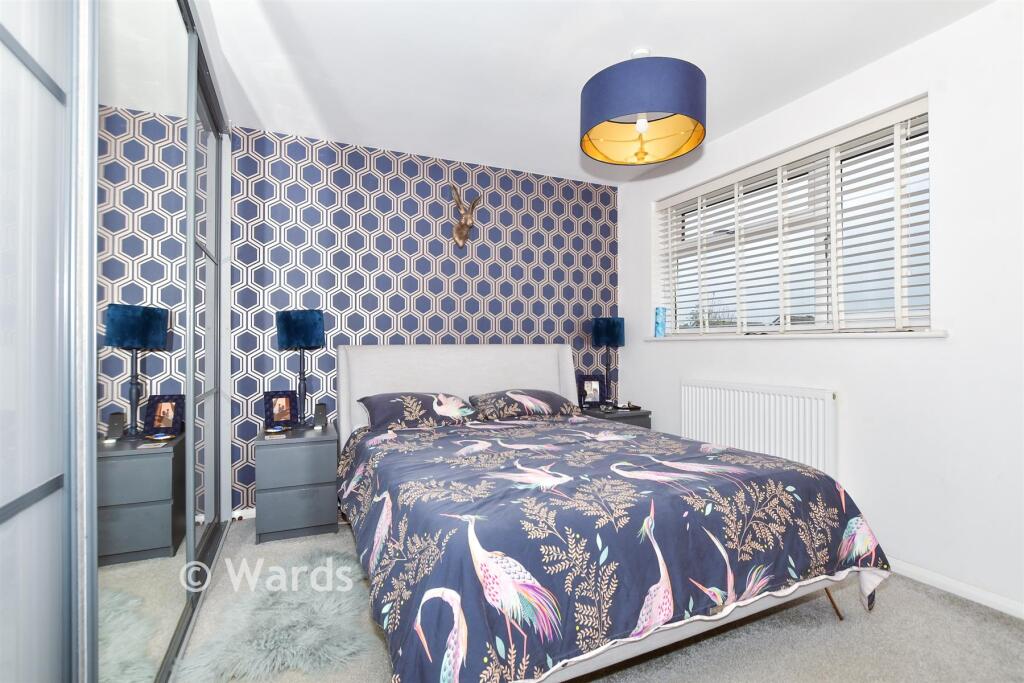
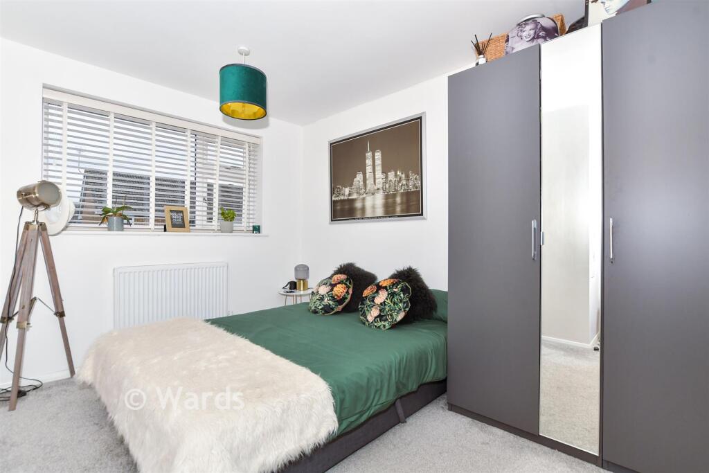
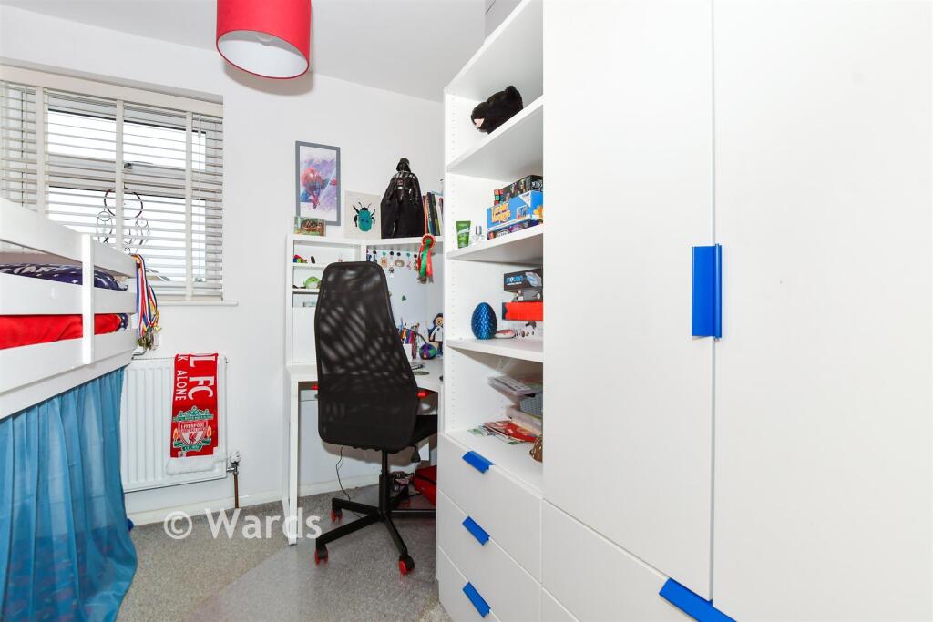
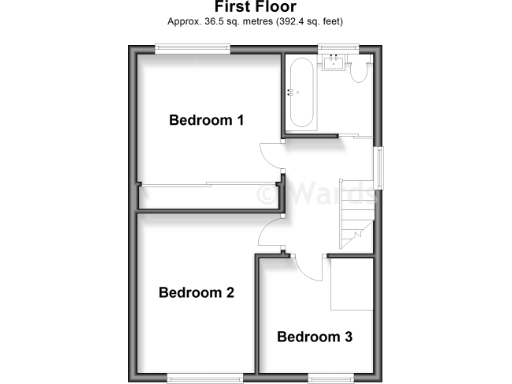
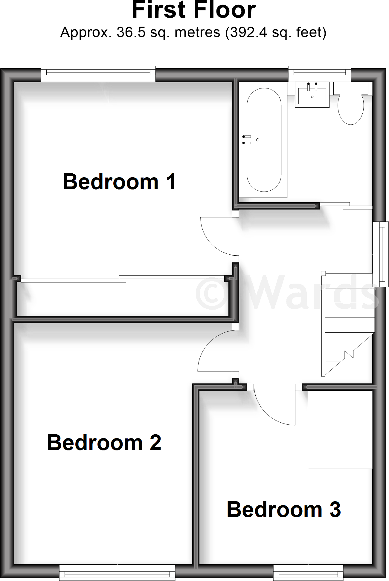
- Bedroom 1:
- Bedroom 2:
- Bedroom 3:
Textual Property Features
- Has Garden
- Is Retirement
- Success
Detected Visual Features
- 1970s
- semi-detached
- suburban
- residential
- garage
- driveway
- two-storey
- modern
- brickwork
- contemporary style
- backyard
- garden
- fencing
- patio
- lawn
- outdoor space
EPC Details
- Fully double glazed
- Cavity wall, as built, partial insulation (assumed)
- Warm air, mains gas
- No low energy lighting
- Solid, no insulation (assumed)
Nearby Schools
- Sissinghurst Voluntary Aided Church of England Primary School
- Headcorn Primary School
- Ulcombe Church of England Primary School
- Sutton Valence Primary School
- Kingswood Primary School
- Goudhurst and Kilndown Church of England Primary School
- St Margaret's, Collier Street Church of England Voluntary Controlled School
- Cranbrook School
- Boughton Monchelsea Primary School
- Cornwallis Academy
- Langley Park Primary Academy
- Coxheath Primary School
- The Dulwich School Cranbrook
- Cranbrook Church of England Primary School
- Frittenden Church of England Primary School
- Sutton Valence School
- OneSchool Global UK - Maidstone Campus
- Marden Primary Academy
- John Mayne Church of England Primary School
- Colliers Green Church of England Primary School
- Staplehurst School
- Bethany School
- Hunton Church of England Primary School
Nearest General Shops
- Id: 8564011603
- Tags:
- Name: Kiri Gardner
- Shop: beauty
- TagsNormalized:
- Lat: 51.16051
- Lon: 0.5525953
- FullGeoHash: u107h96rs6kc
- PartitionGeoHash: u107
- Images:
- FoodStandards: null
- Distance: 579.1
,- Id: 837437484
- Tags:
- Building: yes
- Operator: Murcatto Wines
- Shop: alcohol
- TagsNormalized:
- Lat: 51.1608419
- Lon: 0.551899
- FullGeoHash: u107h99cs0jt
- PartitionGeoHash: u107
- Images:
- FoodStandards: null
- Distance: 576.3
,- Id: 837437483
- Tags:
- Brand: Coral
- Brand:wikidata: Q54621344
- Brand:wikipedia: en:Coral (bookmaker)
- Building: yes
- Name: Coral
- Shop: bookmaker
- TagsNormalized:
- Lat: 51.1609068
- Lon: 0.5519604
- FullGeoHash: u107h99cvs78
- PartitionGeoHash: u107
- Images:
- FoodStandards: null
- Distance: 568
}
Nearest Grocery shops
- Id: 8631108464
- Tags:
- Branch: Daily
- Brand: Morrisons Daily
- Brand:wikidata: Q99752411
- Brand:wikipedia: en:Morrisons
- Name: Morrisons Daily
- Operator: Morrisons
- Shop: convenience
- Website: https://my.morrisons.com/storefinder/31335
- TagsNormalized:
- morrisons
- morrisons daily
- convenience
- shop
- Lat: 51.1550985
- Lon: 0.5527705
- FullGeoHash: u107h8d803x8
- PartitionGeoHash: u107
- Images:
- FoodStandards: null
- Distance: 1133.1
,- Id: 837437478
- Tags:
- Brand: McColl's
- Brand:wikidata: Q16997477
- Brand:wikipedia: en:McColl's
- Building: yes
- Contact:
- Website: https://www.mccolls.co.uk/storelocator/staplehurst-the-parade/
- Name: McColl's
- Shop: convenience
- TagsNormalized:
- Lat: 51.160336
- Lon: 0.551794
- FullGeoHash: u107h93y99z7
- PartitionGeoHash: u107
- Images:
- FoodStandards: null
- Distance: 626
,- Id: 1746254888
- Tags:
- Addr:
- County: Kent
- Place: Staplehurst
- Postcode: TN12 0QH
- Street: Station Road
- Fhrs:
- Authority: Maidstone
- Id: 720551
- Inspectiondate: 2015-08-04
- Rating: Exempt
- Name: Station Newsagents
- Shop: convenience
- TagsNormalized:
- Lat: 51.1698833
- Lon: 0.5526853
- FullGeoHash: u107he4qnt85
- PartitionGeoHash: u107
- Images:
- FoodStandards: null
- Distance: 624.1
}
Nearest Supermarkets
- Id: 55384078
- Tags:
- Addr:
- City: Maidstone
- Postcode: ME15 9NN
- Street: Sutton Road
- Alt_name: Morrisons Maidstone
- Brand: Morrisons
- Brand:wikidata: Q922344
- Brand:wikipedia: en:Morrisons
- Building: yes
- Contact:
- Website: https://my.morrisons.com/storefinder/315
- Dispensing: yes
- Name: Morrisons
- Opening_hours: Mo-Sa 07:00-23:00; Su 10:00-16:00
- Shop: supermarket
- TagsNormalized:
- Lat: 51.2463471
- Lon: 0.5471721
- FullGeoHash: u107s3n7w53p
- PartitionGeoHash: u107
- Images:
- FoodStandards: null
- Distance: 9076.9
,- Id: 5955630389
- Tags:
- Addr:
- City: Maidstone
- Postcode: ME17 3FW
- Street: Langley Park
- Brand: ALDI
- Brand:wikidata: Q41171672
- Brand:wikipedia: en:Aldi
- Contact:
- Website: https://stores.aldi.co.uk/maidstone/unit-6-langley-park-centre
- Name: ALDI
- Operator: Aldi
- Shop: supermarket
- TagsNormalized:
- Lat: 51.2398732
- Lon: 0.5689156
- FullGeoHash: u107kzymbswj
- PartitionGeoHash: u107
- Images:
- FoodStandards: null
- Distance: 8373.1
,- Id: 923136664
- Tags:
- Brand: Sainsbury's
- Brand:wikidata: Q152096
- Brand:wikipedia: en:Sainsbury's
- Building: yes
- Name: Sainsbury's
- Shop: supermarket
- TagsNormalized:
- sainsburys
- supermarket
- shop
- Lat: 51.1699197
- Lon: 0.5519129
- FullGeoHash: u107he1yks2h
- PartitionGeoHash: u107
- Images:
- FoodStandards: null
- Distance: 654.9
}
Nearest Religious buildings
- Id: 1115436062
- Tags:
- Amenity: place_of_worship
- Building: chapel
- Denomination: presbyterian
- Name: Staplehurst United Reformef Church
- Religion: christian
- Source: OS_OpenData_StreetView
- Source:name: bus stop 40 meters away
- TagsNormalized:
- place of worship
- chapel
- presbyterian
- church
- christian
- Lat: 51.1598697
- Lon: 0.5525675
- FullGeoHash: u107h967gfbn
- PartitionGeoHash: u107
- Images:
- FoodStandards: null
- Distance: 641.8
,- Id: 1115436066
- Tags:
- Amenity: place_of_worship
- Source: OS_OpenData_StreetView
- TagsNormalized:
- Lat: 51.1600799
- Lon: 0.5544578
- FullGeoHash: u107h97tpf1e
- PartitionGeoHash: u107
- Images:
- FoodStandards: null
- Distance: 568.3
,- Id: 1115436060
- Tags:
- Amenity: place_of_worship
- Name: Staplehurst Free Church
- Node_id: 1115436060
- Religion: christian
- Source: OS_OpenData_StreetView
- TagsNormalized:
- place of worship
- church
- christian
- Lat: 51.1672558
- Lon: 0.5532632
- FullGeoHash: u107hddyggyc
- PartitionGeoHash: u107
- Images:
- FoodStandards: null
- Distance: 363.1
}
Nearest Medical buildings
- Id: 528566900
- Tags:
- Addr:
- City: Staplehurst
- Street: Offens Drive
- Amenity: doctors
- Building: yes
- Building:levels: 2
- Healthcare: doctor
- Name: Staplehurst Health Centre
- Opening_hours: Mo-Fr 08:00-18:00
- Operator: Malling Health
- TagsNormalized:
- doctor
- doctors
- health
- healthcare
- health centre
- Lat: 51.1611099
- Lon: 0.5502629
- FullGeoHash: u107h98en41u
- PartitionGeoHash: u107
- Images:
- FoodStandards: null
- Distance: 631.8
,- Id: 8564002912
- Tags:
- Amenity: pharmacy
- Brand: Lloyds Pharmacy
- Brand:wikidata: Q6662870
- Brand:wikipedia: en:LloydsPharmacy
- Dispensing: yes
- Healthcare: pharmacy
- Name: Lloyds Pharmacy
- TagsNormalized:
- pharmacy
- lloyds pharmacy
- health
- healthcare
- Lat: 51.1602247
- Lon: 0.5522185
- FullGeoHash: u107h96jgt5g
- PartitionGeoHash: u107
- Images:
- FoodStandards: null
- Distance: 620
,- Id: 8564002895
- Tags:
- Amenity: dentist
- Healthcare: dentist
- Name: Forge House Dental
- TagsNormalized:
- dentist
- health
- healthcare
- dental
- Lat: 51.1601234
- Lon: 0.552546
- FullGeoHash: u107h96m760p
- PartitionGeoHash: u107
- Images:
- FoodStandards: null
- Distance: 617.9
,- Id: 5030801068
- Tags:
- Amenity: dentist
- Healthcare: dentist
- Name: Staplehurst Dental Practice
- TagsNormalized:
- dentist
- health
- healthcare
- dental
- Lat: 51.1691835
- Lon: 0.552414
- FullGeoHash: u107he4605jt
- PartitionGeoHash: u107
- Images:
- FoodStandards: null
- Distance: 567.2
}
Nearest Leisure Facilities
- Id: 107226855
- Tags:
- Leisure: park
- Source: Bing
- TagsNormalized:
- Lat: 51.1680296
- Lon: 0.5482847
- FullGeoHash: u107h6z5run9
- PartitionGeoHash: u107
- Images:
- FoodStandards: null
- Distance: 694.3
,- Id: 1095898911
- Tags:
- Leisure: pitch
- Lit: yes
- Name: Staplehurst Monachs FC
- Sport: soccer
- Surface: grass
- TagsNormalized:
- Lat: 51.1668642
- Lon: 0.5636002
- FullGeoHash: u107hfdksffc
- PartitionGeoHash: u107
- Images:
- FoodStandards: null
- Distance: 510.7
,- Id: 95810709
- Tags:
- TagsNormalized:
- Lat: 51.1629873
- Lon: 0.5503391
- FullGeoHash: u107h9bwpb4e
- PartitionGeoHash: u107
- Images:
- FoodStandards: null
- Distance: 509.6
,- Id: 6916204685
- Tags:
- Leisure: pitch
- Name: Staplehurst Skate Park
- Sport: skateboard
- TagsNormalized:
- pitch
- leisure
- skateboard
- sports
- Lat: 51.1656476
- Lon: 0.5633579
- FullGeoHash: u107hf6jx0n0
- PartitionGeoHash: u107
- Images:
- FoodStandards: null
- Distance: 453.9
,- Id: 107233009
- Tags:
- Leisure: track
- Source: Bing
- TagsNormalized:
- Lat: 51.1673827
- Lon: 0.5614633
- FullGeoHash: u107hf8ze53q
- PartitionGeoHash: u107
- Images:
- FoodStandards: null
- Distance: 415.5
}
Nearest Tourist attractions
- Id: 942709587
- Tags:
- Addr:
- Housename: 2 Bettenham Cottages
- Postcode: TN27 8LT
- Street: Dig Dog Lane
- Air_conditioning: no
- Building: yes
- Capacity: 4
- Internet_access: no
- Name: 2 Bettenham Cottages
- Name:en: 2 Bettenham Cottages
- Operator: National Trust
- Rooms: 2
- Smoking: no
- Tourism: chalet
- Website: https://www.nationaltrust.org.uk/holidays/2-bettenham-cottages-kent
- TagsNormalized:
- Lat: 51.1216743
- Lon: 0.5954835
- FullGeoHash: u106vd3t7fb9
- PartitionGeoHash: u106
- Images:
- FoodStandards: null
- Distance: 5511.8
,- Id: 287683376
- Tags:
- Area: yes
- Name: Waterside Oast
- Power_supply: yes
- Tourism: caravan_site
- TagsNormalized:
- Lat: 51.1621562
- Lon: 0.6083609
- FullGeoHash: u107jcfcpv4v
- PartitionGeoHash: u107
- Images:
- FoodStandards: null
- Distance: 3598.7
,- Id: 456809185
- Tags:
- Addr:
- City: Marden
- Postcode: TN12 9DH
- Street: Howland Road
- Area: yes
- Name: The South East Romany Museum
- Tourism: museum
- Website: http://www.mardenhistory.org.uk/home/?page_id=1338
- TagsNormalized:
- Lat: 51.1730215
- Lon: 0.5147803
- FullGeoHash: u1075eyb7q85
- PartitionGeoHash: u107
- Images:
- FoodStandards: null
- Distance: 3073.9
}
Nearest Train stations
- Id: 6688355480
- Tags:
- Name: Maidstone West
- Naptan:
- Network: National Rail
- Postal_code: ME16 8RJ
- Public_transport: station
- Railway: station
- Ref:
- Source: NPE
- Wikipedia: en:Maidstone West railway station
- TagsNormalized:
- Lat: 51.2703088
- Lon: 0.5157564
- FullGeoHash: u107etrx1yrb
- PartitionGeoHash: u107
- Images:
- FoodStandards: null
- Distance: 12061.8
,- Id: 6692612519
- Tags:
- Name: Harrietsham
- Naptan:
- Network: National Rail
- Public_transport: station
- Railway: station
- Ref:
- Wikidata: Q2683079
- Wikipedia: en:Harrietsham railway station
- TagsNormalized:
- Lat: 51.2449353
- Lon: 0.6726551
- FullGeoHash: u107x2cg3urf
- PartitionGeoHash: u107
- Images:
- FoodStandards: null
- Distance: 12003.9
,- Id: 6688355476
- Tags:
- Name: Beltring
- Naptan:
- Network: National Rail
- Public_transport: station
- Railway: station
- Ref:
- Source: NPE
- Train: yes
- Wikidata: Q2680767
- Wikipedia: en:Beltring railway station
- TagsNormalized:
- Lat: 51.2045463
- Lon: 0.4033747
- FullGeoHash: u10731t8p73b
- PartitionGeoHash: u107
- Images:
- FoodStandards: null
- Distance: 11573.9
,- Id: 6688355479
- Tags:
- Name: East Farleigh
- Naptan:
- Network: National Rail
- Public_transport: station
- Railway: station
- Ref:
- Source: NPE
- Train: yes
- Wikidata: Q3065808
- Wikipedia: en:East Farleigh railway station
- TagsNormalized:
- Lat: 51.2552513
- Lon: 0.4844783
- FullGeoHash: u107e48z3pm5
- PartitionGeoHash: u107
- Images:
- FoodStandards: null
- Distance: 11238.9
,- Id: 6688385724
- Tags:
- Name: Headcorn
- Naptan:
- Network: National Rail
- Public_transport: station
- Railway: station
- Ref:
- Wikidata: Q2482799
- Wikipedia: en:Headcorn railway station
- TagsNormalized:
- Lat: 51.1656292
- Lon: 0.6273669
- FullGeoHash: u107n62v6swd
- PartitionGeoHash: u107
- Images:
- FoodStandards: null
- Distance: 4910.9
}
Nearest Hotels
- Id: 627598949
- Tags:
- Addr:
- City: Bearsted
- Postcode: ME14 4NQ
- Street: Ashford Road
- Brand: Marriot
- Building: yes
- Name: Tudor Park Hotel
- Tourism: hotel
- TagsNormalized:
- Lat: 51.2665133
- Lon: 0.5875427
- FullGeoHash: u107tkgc4dxx
- PartitionGeoHash: u107
- Images:
- FoodStandards: null
- Distance: 11493
,- Id: 107624506
- Tags:
- Addr:
- City: Maidstone
- Country: GB
- Postcode: ME17 1RE
- Street: Ashford Road
- Brand: Mercure
- Brand:wikidata: Q1709809
- Brand:wikipedia: en:Mercure (hotel)
- Building: yes
- Name: Mercure Maidstone Great Danes
- Operator: Whitbread
- Source: Bing
- Source:shape: Bing
- Tourism: hotel
- TagsNormalized:
- Lat: 51.2582367
- Lon: 0.6168232
- FullGeoHash: u107w530v5bs
- PartitionGeoHash: u107
- Images:
- FoodStandards: null
- Distance: 11180.5
,- Id: 4958866627
- Tags:
- Addr:
- County: Kent
- Place: Grafty Green
- Postcode: ME17 2AR
- Street: Headcorn Road
- Amenity: pub
- Fhrs:
- Authority: Maidstone
- Id: 721226
- Inspectiondate: 2016-10-25
- Rating: 4
- Level: 0
- Name: Who'd A Thought It
- Outdoor_seating: yes
- Tourism: hotel
- TagsNormalized:
- Lat: 51.202797
- Lon: 0.6725533
- FullGeoHash: u107r31tzthj
- PartitionGeoHash: u107
- Images:
- FoodStandards: null
- Distance: 9090.8
}
Tags
- 1970s
- semi-detached
- suburban
- residential
- garage
- driveway
- two-storey
- modern
- brickwork
- contemporary style
- backyard
- garden
- fencing
- patio
- lawn
- modern
- outdoor space
Local Market Stats
- Average Price/sqft: £405
- Avg Income: £52500
- Rental Yield: 4%
- Social Housing: 4%
- Planning Success Rate: 80%
Similar Properties
 3 bedroom terraced house for sale in Knowles Walk, Staplehurst, Tonbridge, Kent, TN12 — £215,000 • 3 bed • 1 bath • 600 ft²
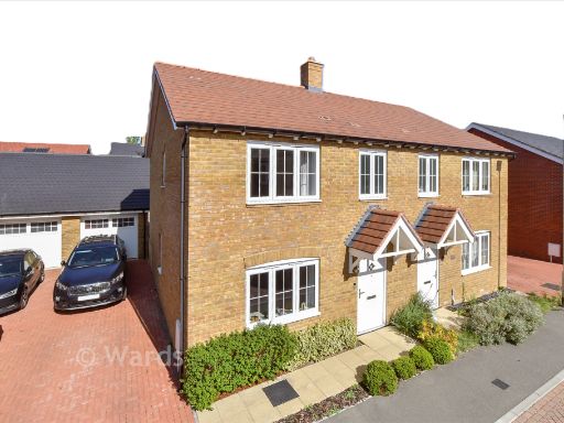 3 bedroom semi-detached house for sale in Tyler Road, Staplehurst, Tonbridge, Kent, TN12 — £271,000 • 3 bed • 2 bath • 578 ft²
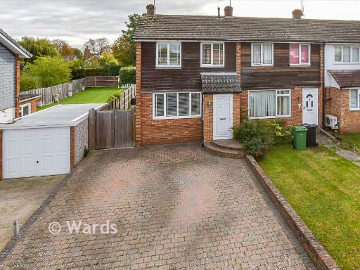 3 bedroom end of terrace house for sale in Thatcher Road, Staplehurst, Kent, TN12 — £281,000 • 3 bed • 2 bath • 948 ft²
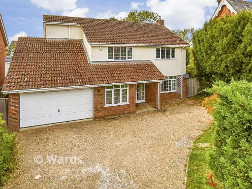 4 bedroom detached house for sale in Station Road, Staplehurst, Kent, TN12 — £495,500 • 4 bed • 2 bath • 862 ft²
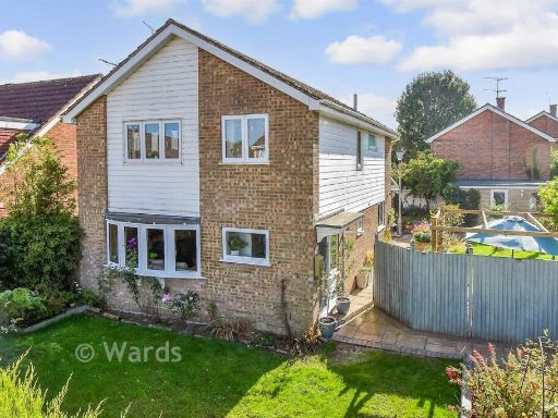 4 bedroom detached house for sale in Oliver Road, Staplehurst, Tonbridge, Kent, TN12 — £363,500 • 4 bed • 2 bath • 1109 ft²
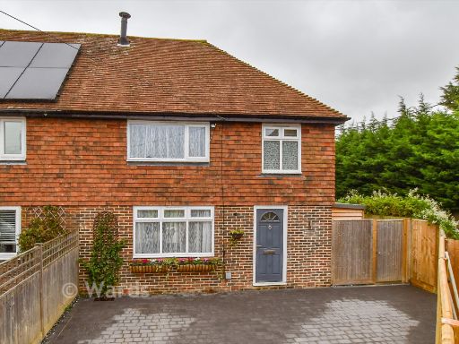 3 bedroom semi-detached house for sale in Dig Dog Lane, Frittenden, Cranbrook, Kent, TN17 — £363,500 • 3 bed • 1 bath • 819 ft²
Meta
- {
"@context": "https://schema.org",
"@type": "Residence",
"name": "3 bedroom link detached house for sale in Weavers Close, St…",
"description": "",
"url": "https://propertypiper.co.uk/property/fb41721b-95c2-47b4-a10d-8c129f6e4058",
"image": "https://image-a.propertypiper.co.uk/60d07959-b33e-4873-a376-7477fb3316a0-1024.jpeg",
"address": {
"@type": "PostalAddress",
"streetAddress": "4 WEAVERS CLOSE STAPLEHURST TONBRIDGE",
"postalCode": "TN12 0SF",
"addressLocality": "Maidstone",
"addressRegion": "Maidstone and The Weald",
"addressCountry": "England"
},
"geo": {
"@type": "GeoCoordinates",
"latitude": 51.16494694892322,
"longitude": 0.556944885568991
},
"numberOfRooms": 3,
"numberOfBathroomsTotal": 1,
"floorSize": {
"@type": "QuantitativeValue",
"value": 786,
"unitCode": "FTK"
},
"offers": {
"@type": "Offer",
"price": 264500,
"priceCurrency": "GBP",
"availability": "https://schema.org/InStock"
},
"additionalProperty": [
{
"@type": "PropertyValue",
"name": "Feature",
"value": "1970s"
},
{
"@type": "PropertyValue",
"name": "Feature",
"value": "semi-detached"
},
{
"@type": "PropertyValue",
"name": "Feature",
"value": "suburban"
},
{
"@type": "PropertyValue",
"name": "Feature",
"value": "residential"
},
{
"@type": "PropertyValue",
"name": "Feature",
"value": "garage"
},
{
"@type": "PropertyValue",
"name": "Feature",
"value": "driveway"
},
{
"@type": "PropertyValue",
"name": "Feature",
"value": "two-storey"
},
{
"@type": "PropertyValue",
"name": "Feature",
"value": "modern"
},
{
"@type": "PropertyValue",
"name": "Feature",
"value": "brickwork"
},
{
"@type": "PropertyValue",
"name": "Feature",
"value": "contemporary style"
},
{
"@type": "PropertyValue",
"name": "Feature",
"value": "backyard"
},
{
"@type": "PropertyValue",
"name": "Feature",
"value": "garden"
},
{
"@type": "PropertyValue",
"name": "Feature",
"value": "fencing"
},
{
"@type": "PropertyValue",
"name": "Feature",
"value": "patio"
},
{
"@type": "PropertyValue",
"name": "Feature",
"value": "lawn"
},
{
"@type": "PropertyValue",
"name": "Feature",
"value": "modern"
},
{
"@type": "PropertyValue",
"name": "Feature",
"value": "outdoor space"
}
]
}
High Res Floorplan Images
Compatible Floorplan Images
FloorplanImages Thumbnail