BR7 6JT - 4 bedroom semidetached house for sale in Gravelwood Close,…
View on Property Piper
4 bedroom semi-detached house for sale in Gravelwood Close, Chislehurst, Kent, BR7
Property Details
- Price: £625000
- Bedrooms: 4
- Bathrooms: 2
- Property Type: undefined
- Property SubType: undefined
Image Descriptions
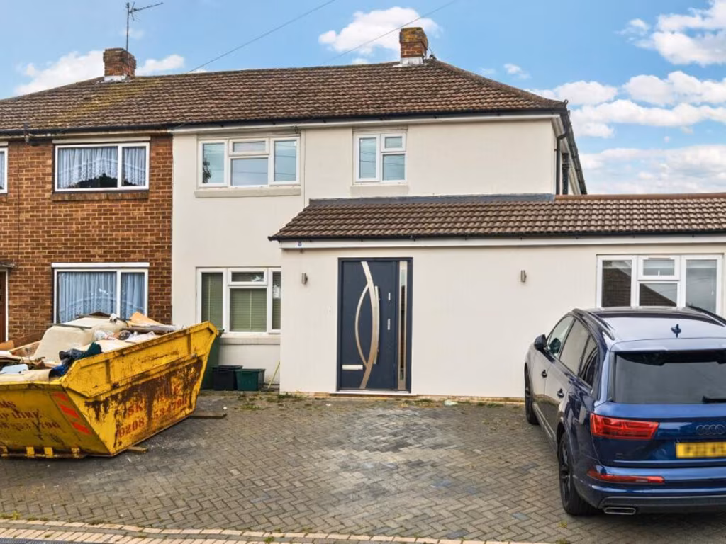
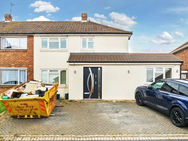
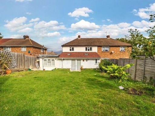
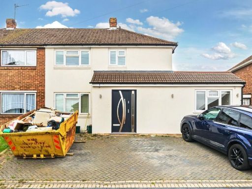
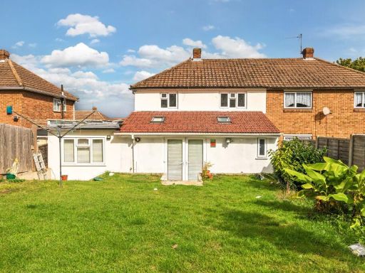
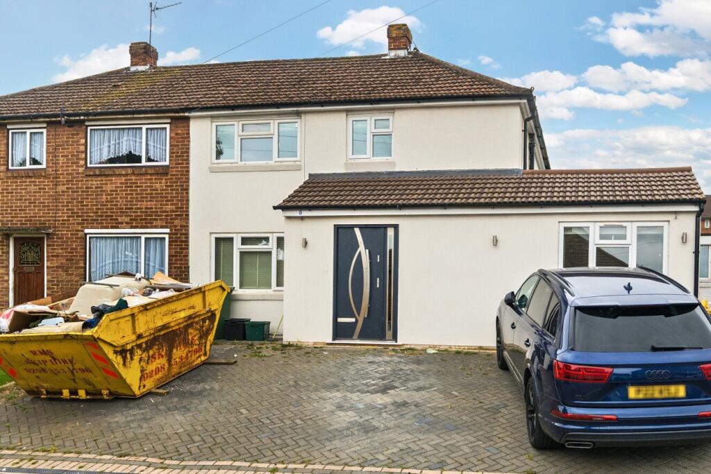
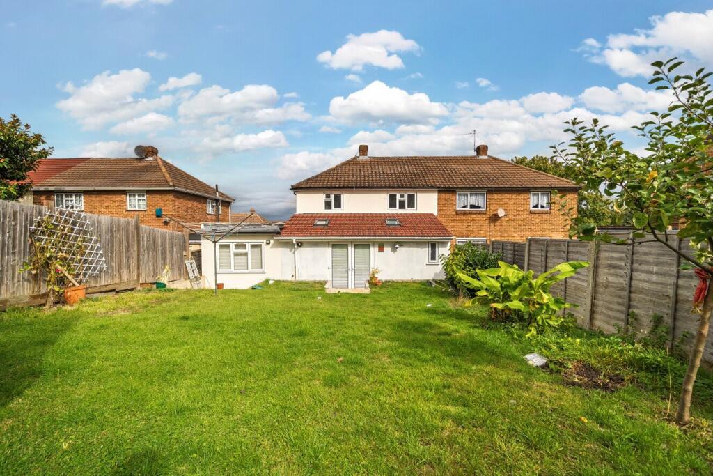
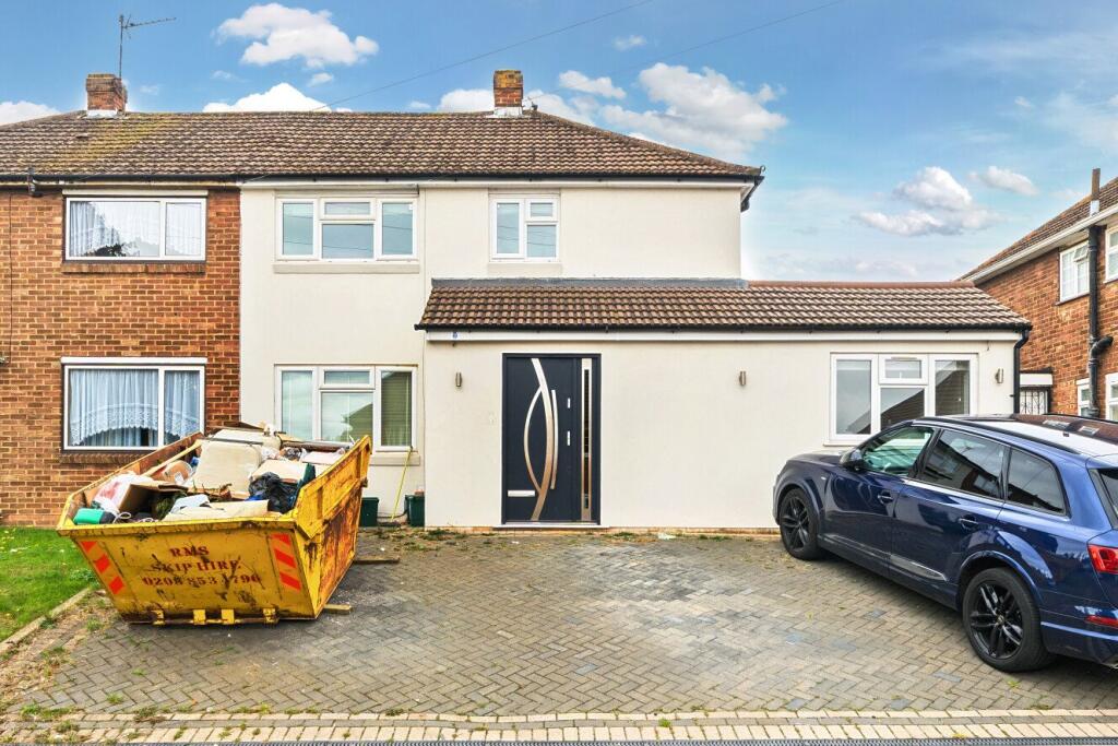
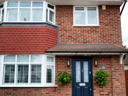
- house facade mid-20th century semi-detached
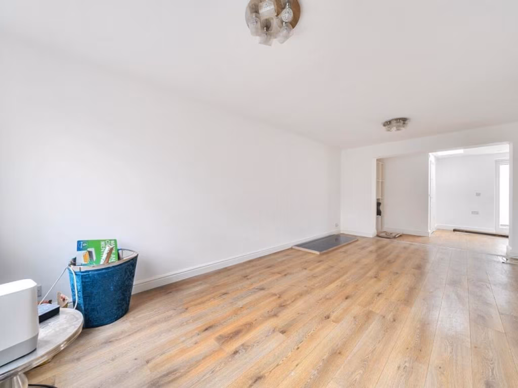
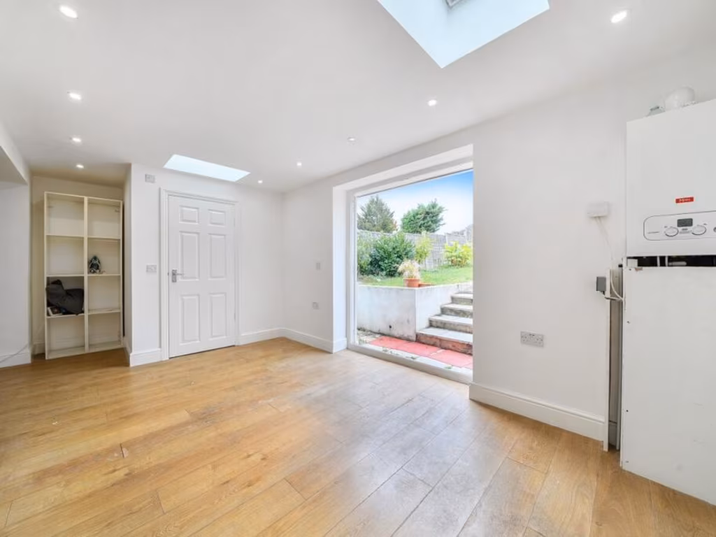
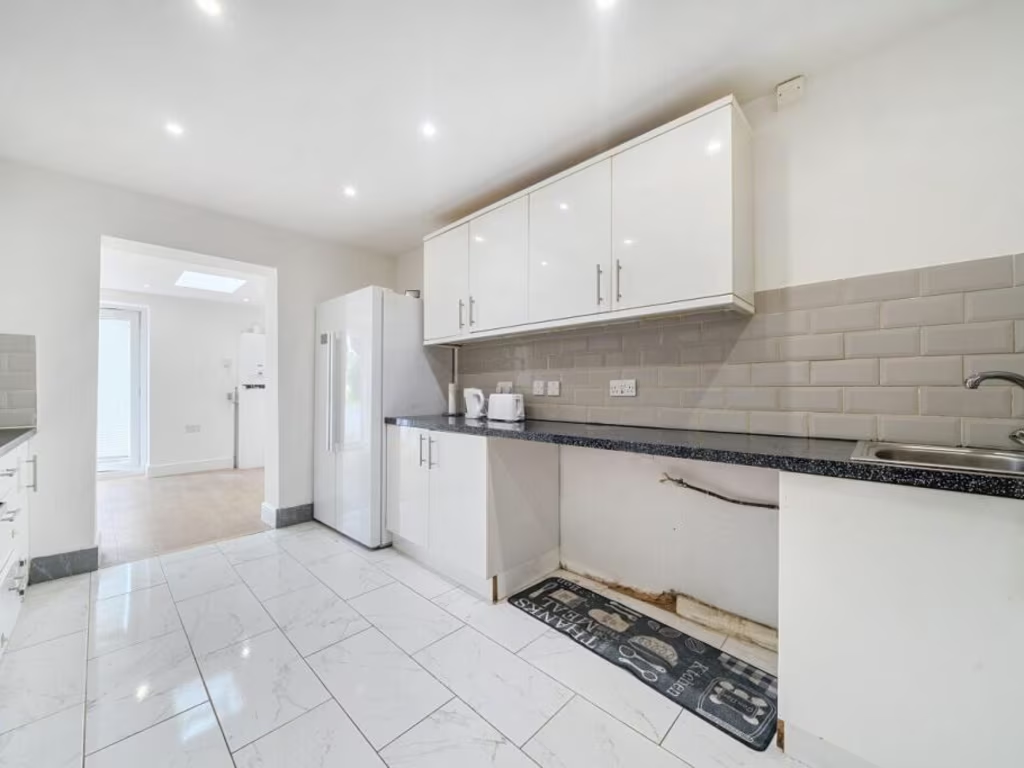
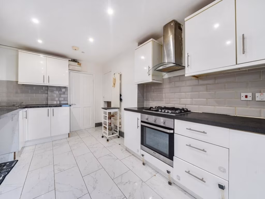
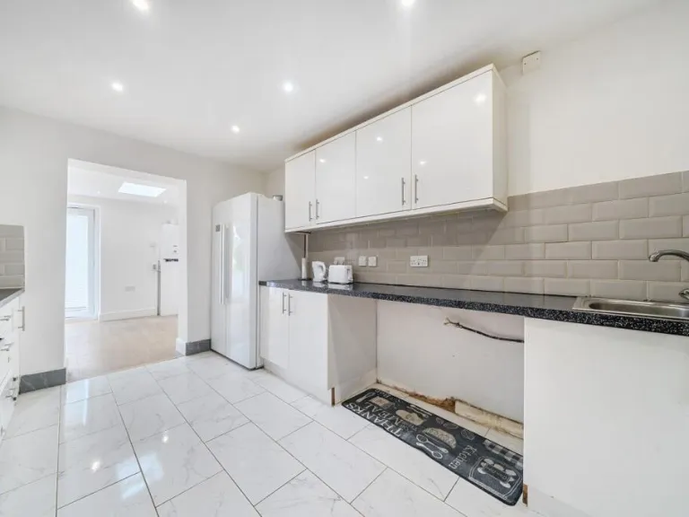
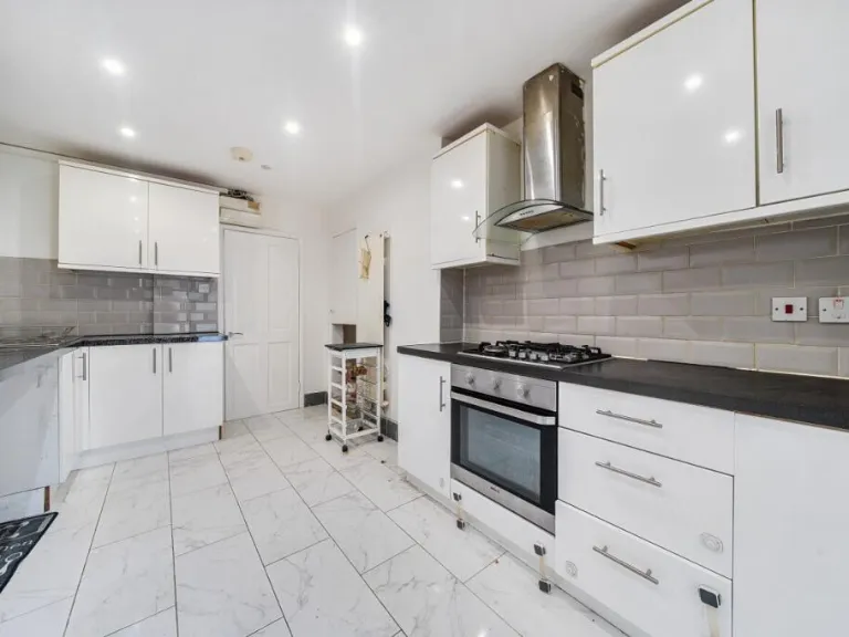
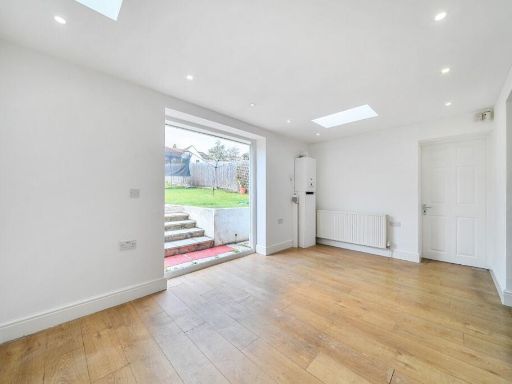
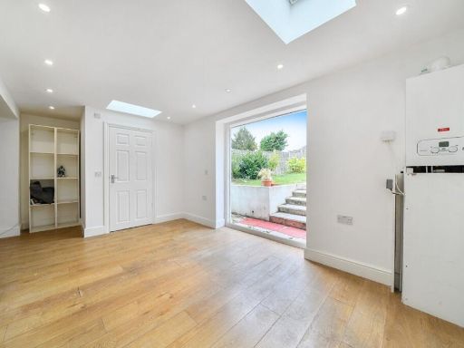
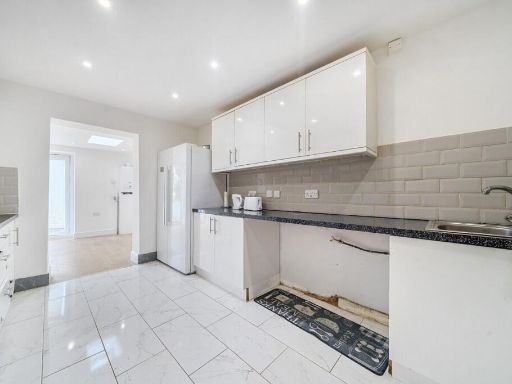
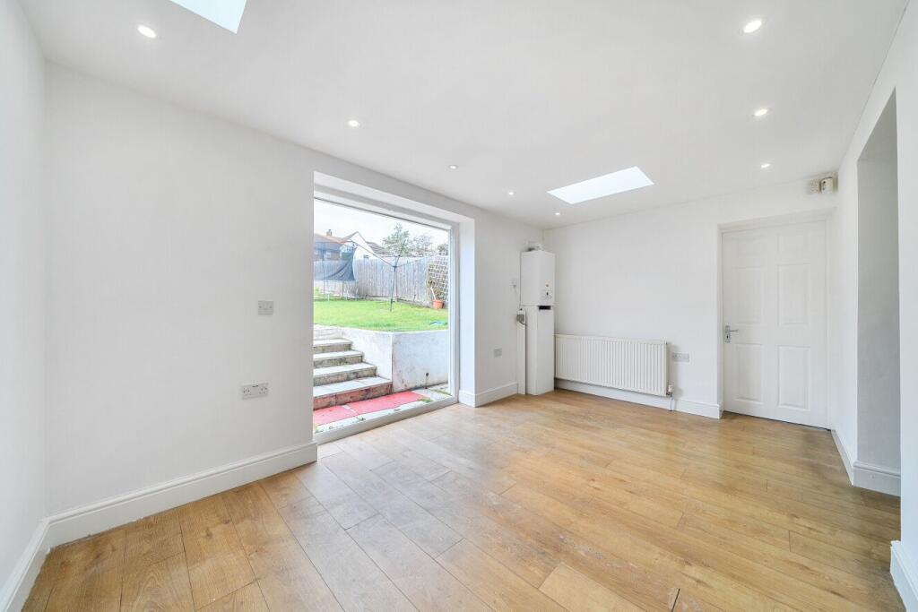
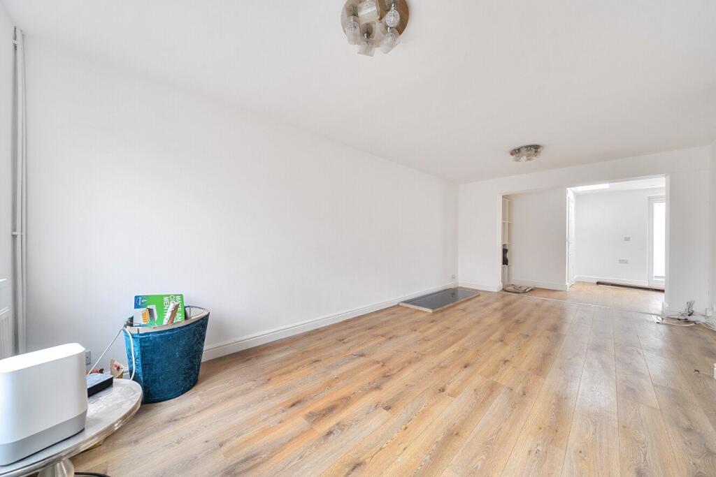
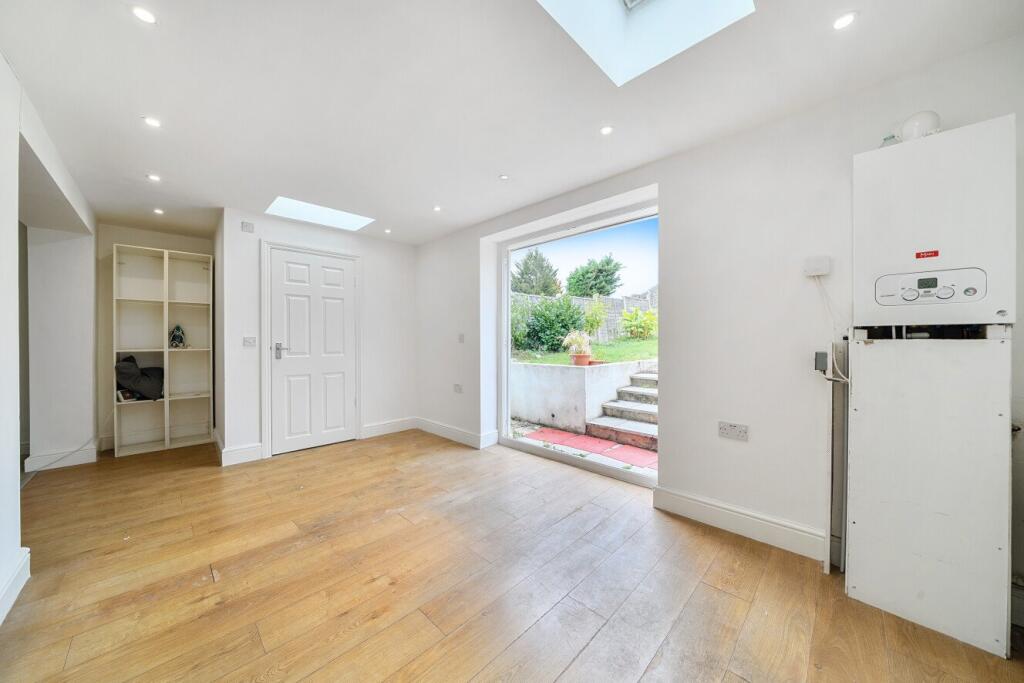
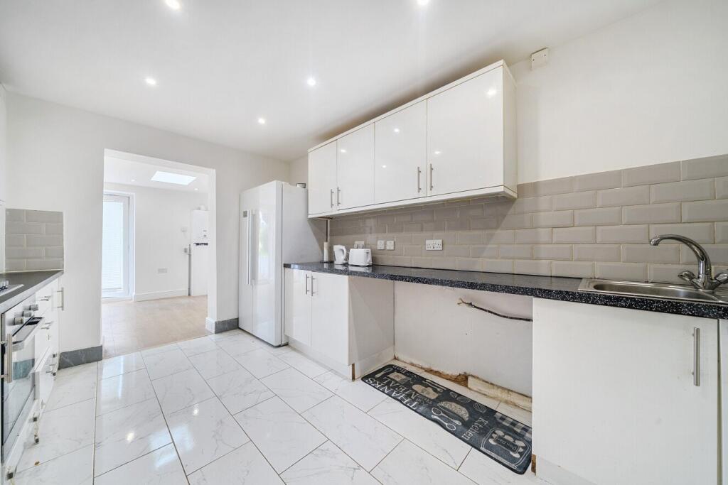
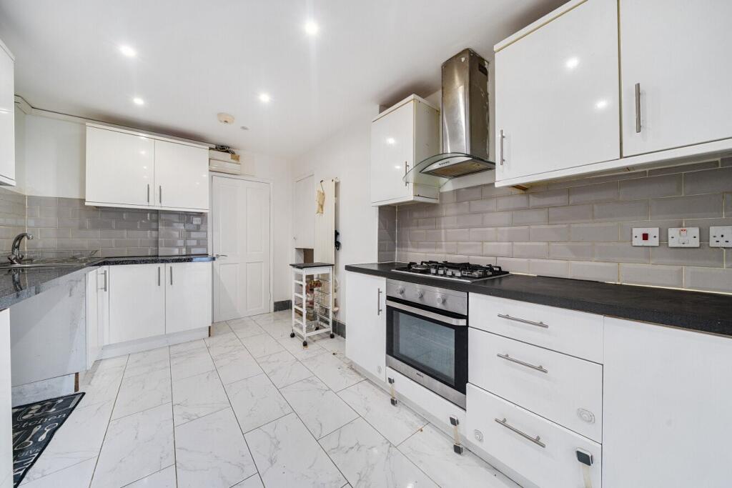
- kitchen/dining area contemporary
Floorplan Description
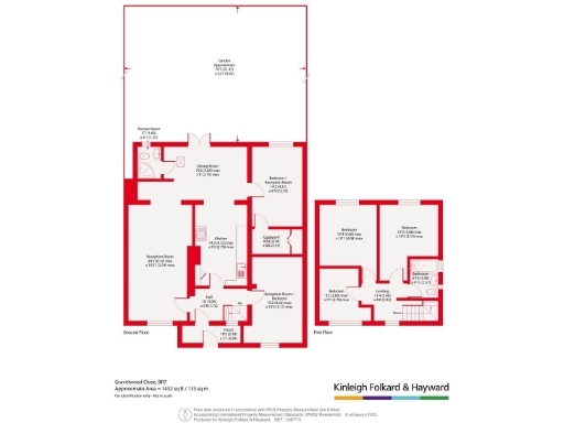
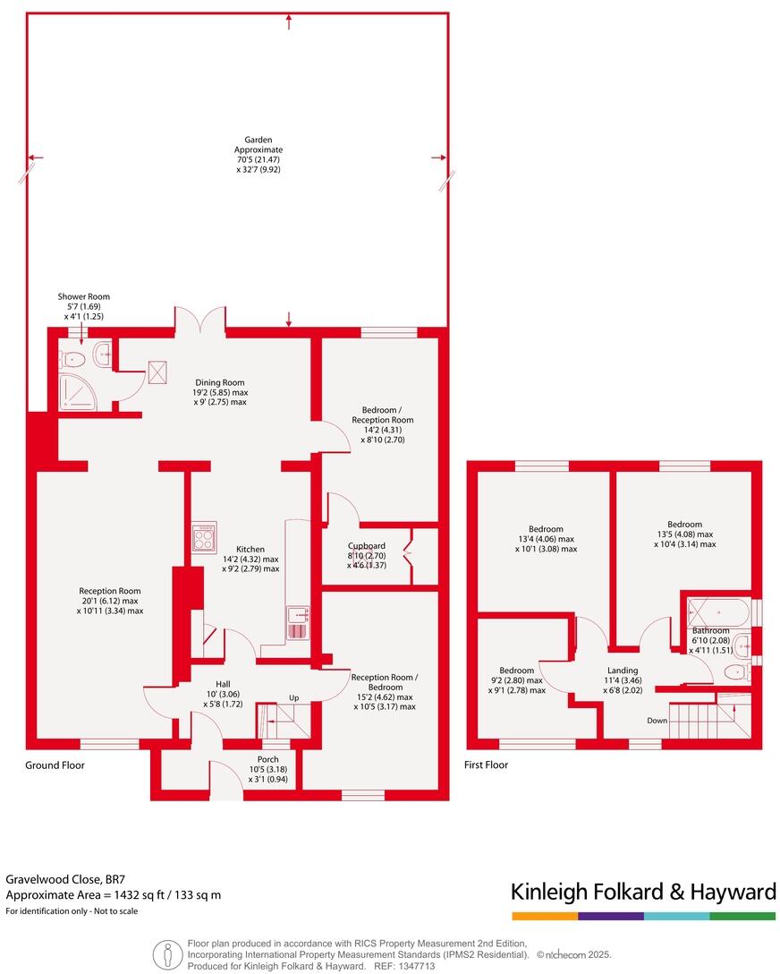
- Approximate Area = 1432 sq ft / 133 sq m
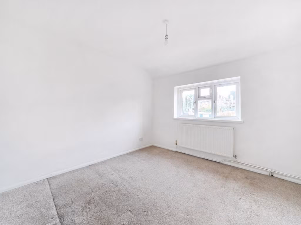
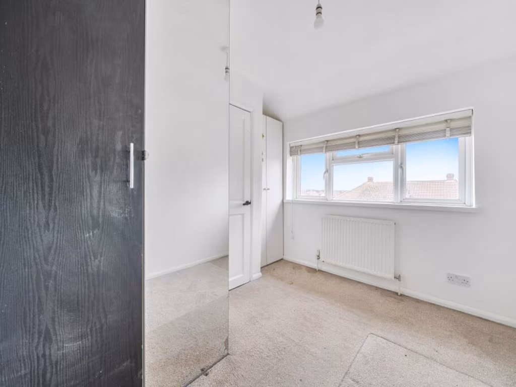
Rooms
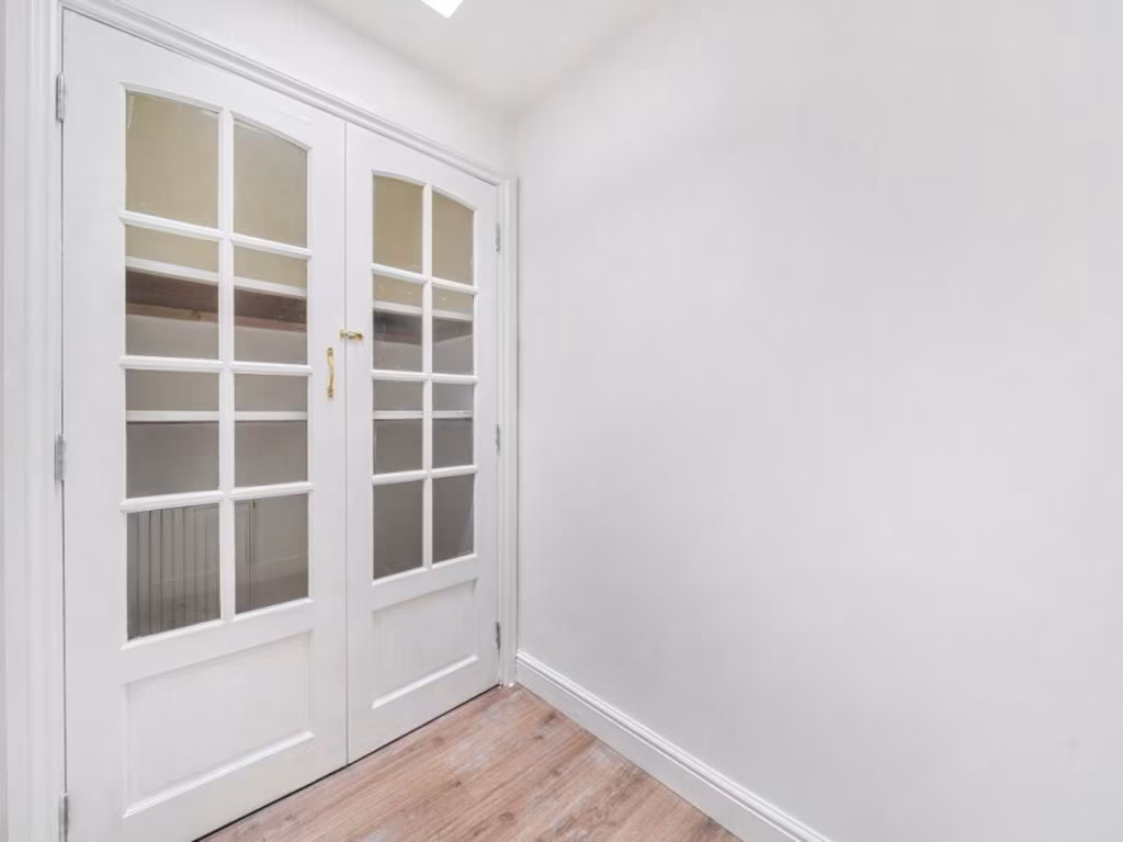
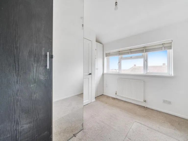
- Porch:
- Hall:
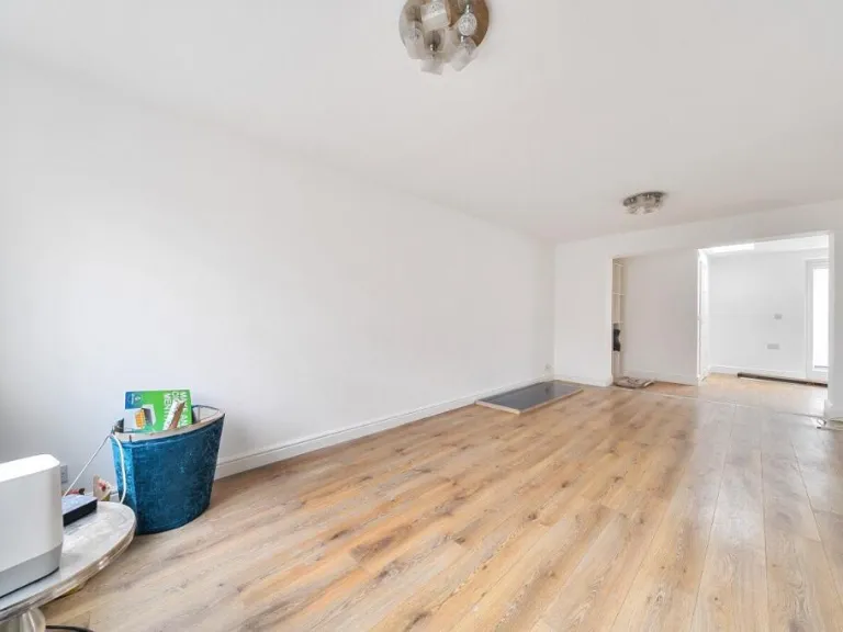
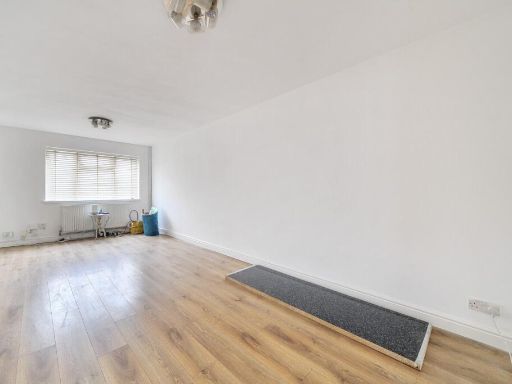
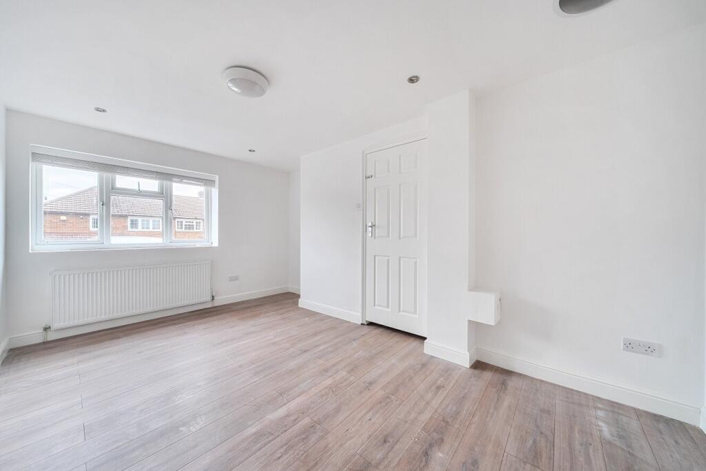
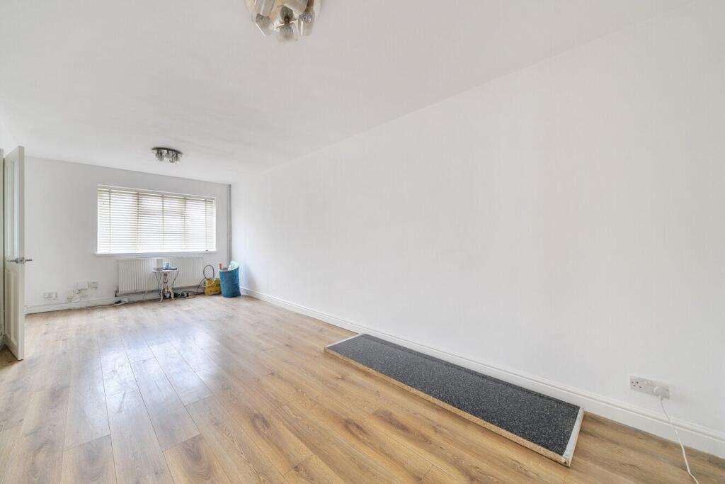
- Reception Room:
- Kitchen:
- Dining Room:
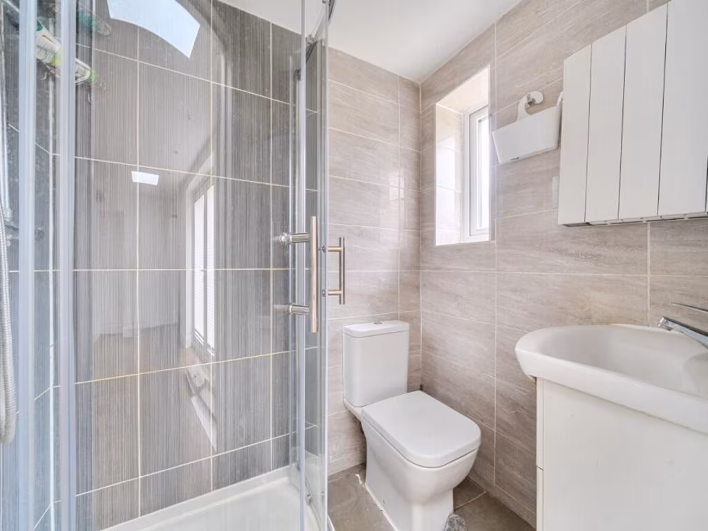
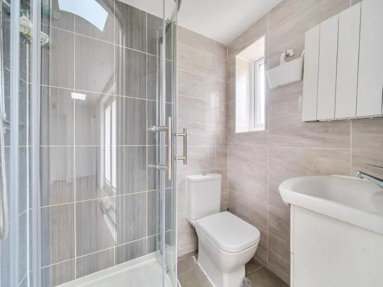
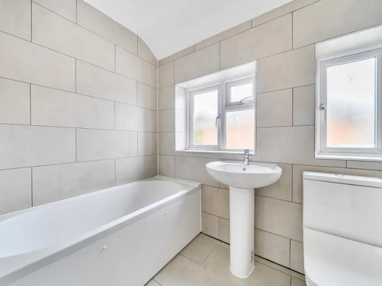
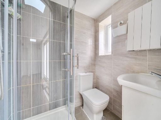
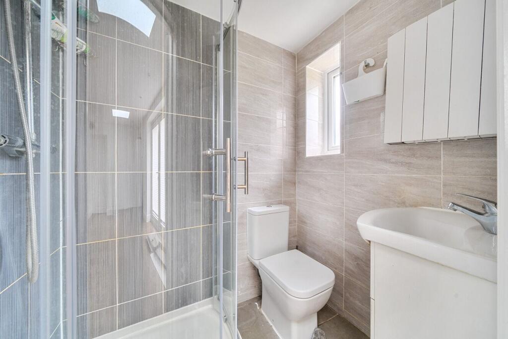
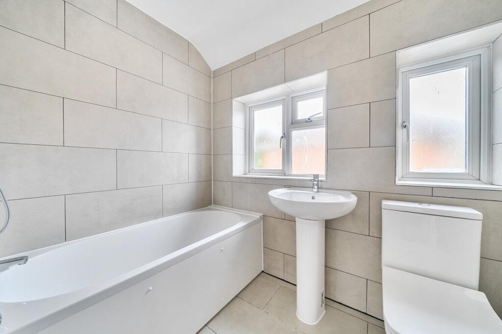
- Shower Room:
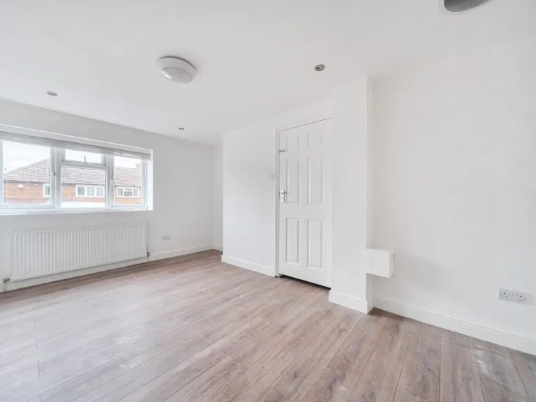
- Bedroom / Reception Room:
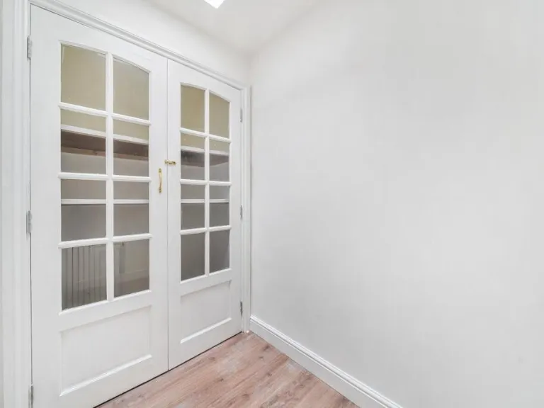
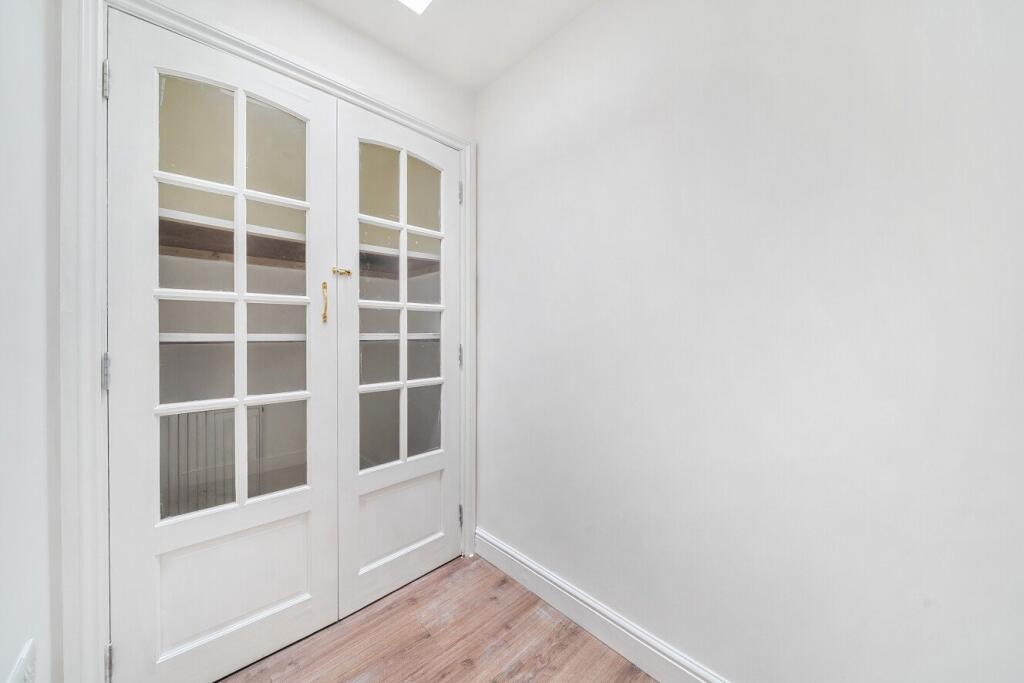
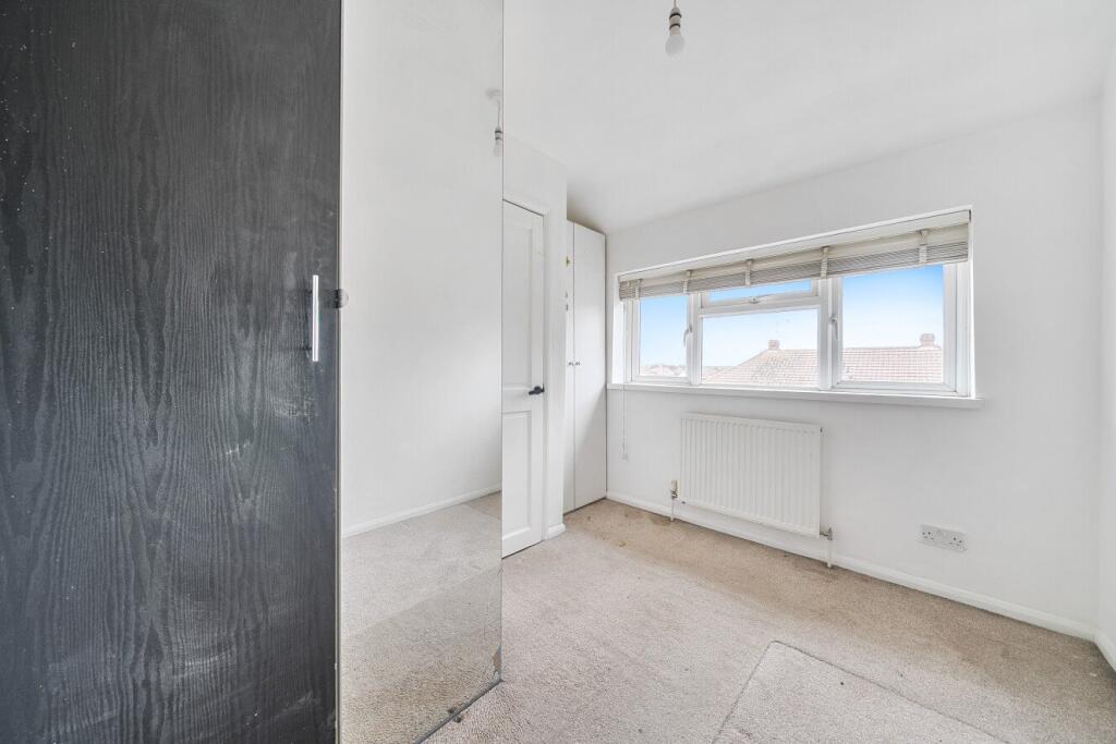
- Cupboard:
- Reception Room / Bedroom:
- Landing:
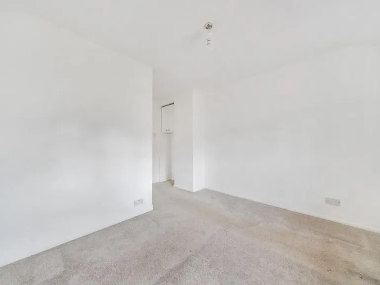
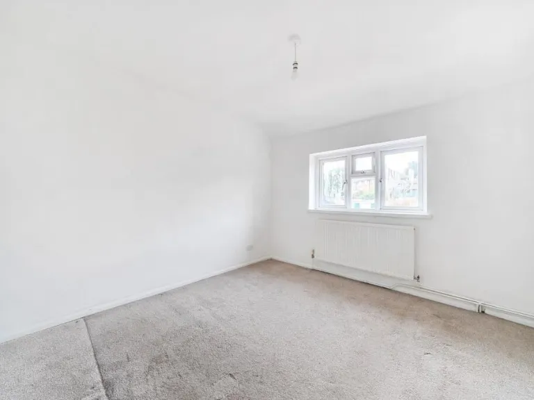
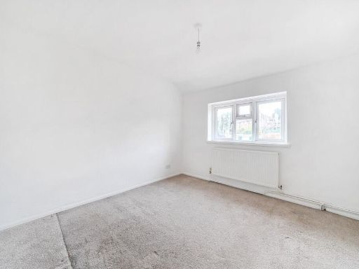
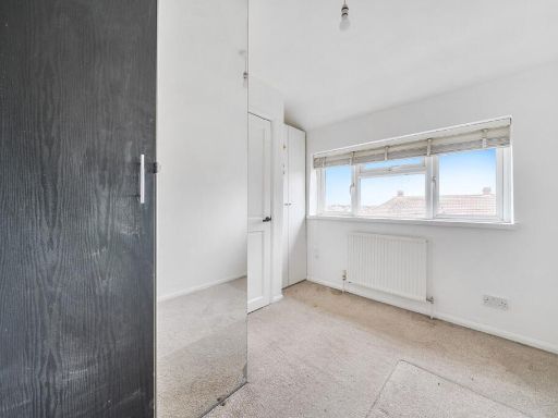
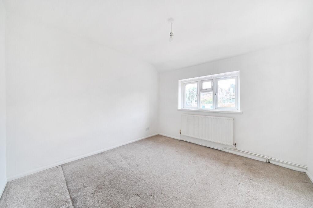
- Bedroom:
- Bedroom:
- Bedroom:
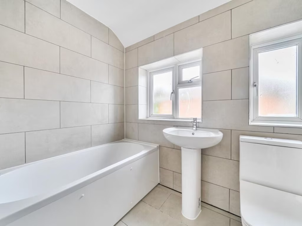
- Bathroom:
Textual Property Features
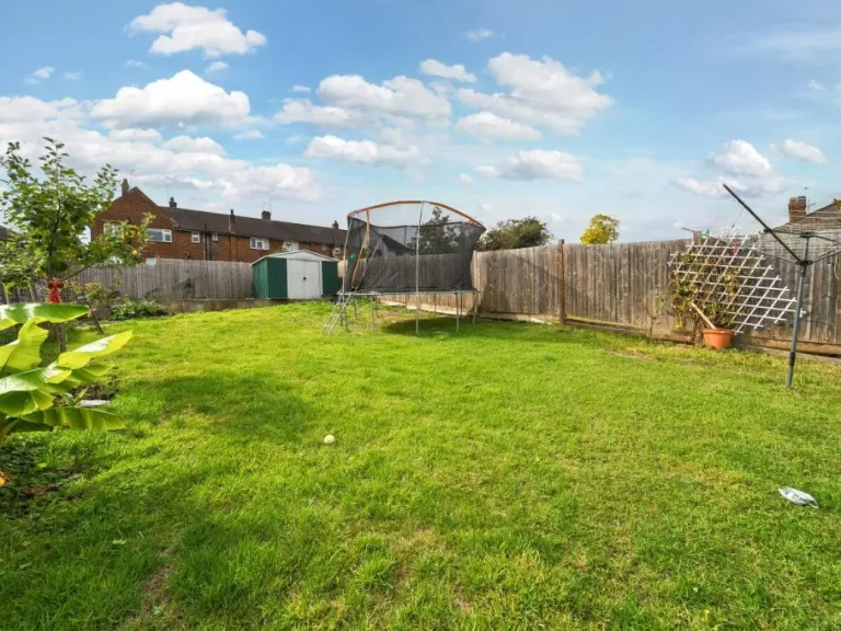
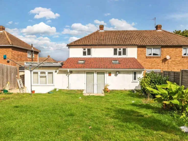
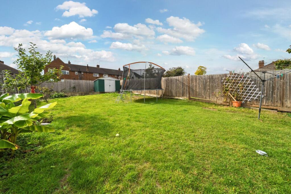
- Has Garden
- Chain Free
- Success
Detected Visual Features
- mid-20th century
- semi-detached
- two-storey
- brick
- rendered facade
- gabled roof
- large driveway
- garage
- garden
- investment
- modernization potential
- suburban
- contemporary
- modern
- open-plan
- kitchen
- dining area
- skylights
- laminate flooring
- garden access
- patio doors
EPC Details
- Fully double glazed
- Cavity wall, as built, no insulation (assumed)
- Boiler and radiators, mains gas
- Low energy lighting in 8% of fixed outlets
- Solid, no insulation (assumed)
Nearby Schools
- Montbelle Primary School
- Ravensworth Primary School
- St Olave's Prep School
- Dulverton Primary School
- Burnt Oak Junior School
- Our Lady of the Rosary Catholic Primary School
- Alderwood Primary School
- Eltham Church of England Primary School
- St Peter and St Paul Catholic Primary School
- St Nicholas Church of England Primary
- Farringtons School
- Chislehurst School for Girls
- Mead Road Infant School
- Edgebury Primary School
- Longlands Primary School
- West Lodge School
- St Thomas More Catholic Comprehensive School
- St Mary's Catholic Primary School
- Babington House School
- Red Hill Primary School
- Benedict House Preparatory School
- St Vincent's Catholic Primary School
- Stationers' Crown Woods Academy
- Coopers School
- Darul Uloom London School
- Elmstead Wood Primary School
- Wyborne Primary School
Nearest Bars And Restaurants
- Id: 947392188
- Tags:
- Addr:
- City: New Eltham
- Housenumber: 754
- Postcode: SE9 3NS
- Street: Sidcup Road
- Amenity: restaurant
- Building: yes
- Cuisine: asian
- Name: Katsu Shoku
- TagsNormalized:
- Lat: 51.4341246
- Lon: 0.0650833
- FullGeoHash: u10h97r3kxc8
- PartitionGeoHash: u10h
- Images:
- FoodStandards: null
- Distance: 734.4
,- Id: 957252447
- Tags:
- Addr:
- City: Sidcup
- Housenumber: 8-9
- Postcode: DA14 6QF
- Street: Marechal Niel Parade
- Amenity: restaurant
- Building: yes
- Cuisine: italian
- Name: Limoncello
- Website: https://www.limoncellorestaurant.co.uk/
- TagsNormalized:
- Lat: 51.4307067
- Lon: 0.0838122
- FullGeoHash: u10h9ftj8fwg
- PartitionGeoHash: u10h
- Images:
- FoodStandards: null
- Distance: 725.1
,- Id: 957252451
- Tags:
- Addr:
- City: Sidcup
- Postcode: DA14 6QF
- Street: Marechal Niel Parade
- Amenity: restaurant
- Building: yes
- Cuisine: bangladeshi
- Name: Rannah
- Website: https://rannah.co.uk/
- TagsNormalized:
- Lat: 51.4307367
- Lon: 0.0833432
- FullGeoHash: u10h9fsty01n
- PartitionGeoHash: u10h
- Images:
- FoodStandards: null
- Distance: 693.2
,- Id: 957252454
- Tags:
- Addr:
- City: Sidcup
- Housenumber: 1B
- Postcode: DA14 6QF
- Street: Marechal Niel Parade
- Amenity: cafe
- Building: yes
- Name: Richard's Cafe
- TagsNormalized:
- Lat: 51.430706
- Lon: 0.0831131
- FullGeoHash: u10h9fst8dmx
- PartitionGeoHash: u10h
- Images:
- FoodStandards: null
- Distance: 676.9
,- Id: 10695466782
- Tags:
- Addr:
- City: London
- Postcode: BR7 6LB
- Street: Edgehill Road
- Amenity: fast_food
- Cuisine: indian
- Name: Mountain View
- TagsNormalized:
- Lat: 51.428398
- Lon: 0.0738613
- FullGeoHash: u10h9dmb1h4z
- PartitionGeoHash: u10h
- Images:
- FoodStandards: null
- Distance: 185.2
}
Nearest General Shops
- Id: 957252449
- Tags:
- Addr:
- City: Sidcup
- Housenumber: 6
- Postcode: DA14 6QF
- Street: Marechal Niel Parade
- Building: yes
- Name: Tokyo Toys
- Shop: toys
- Website: https://www.tokyotoys.com/
- TagsNormalized:
- Lat: 51.4307175
- Lon: 0.0836019
- FullGeoHash: u10h9fsvshdh
- PartitionGeoHash: u10h
- Images:
- FoodStandards: null
- Distance: 710.7
,- Id: 957252455
- Tags:
- Addr:
- City: Sidcup
- Housenumber: 1
- Postcode: DA14 6QF
- Street: Marechal Niel Parade
- Building: yes
- Name: J'adore
- Shop: hairdresser
- Website: https://jadore-hair-beauty-and-laser-sidcup.business.site/?utm_source=gmb&utm_medium=referral
- TagsNormalized:
- Lat: 51.4307098
- Lon: 0.0830469
- FullGeoHash: u10h9fsmx5hq
- PartitionGeoHash: u10h
- Images:
- FoodStandards: null
- Distance: 672.4
,- Id: 10695466780
- Tags:
- Addr:
- City: London
- Housenumber: 108
- Postcode: BR7 6LB
- Street: Edgehill Road
- Name: Bluerose Tattoo
- Shop: tattoo
- TagsNormalized:
- Lat: 51.4287354
- Lon: 0.073124
- FullGeoHash: u10h9dm4pgjh
- PartitionGeoHash: u10h
- Images:
- FoodStandards: null
- Distance: 146.3
}
Nearest Grocery shops
- Id: 6913921539
- Tags:
- Addr:
- City: New Eltham
- Housenumber: 404
- Postcode: SE9 3TU
- Street: Footscray Road
- Name: Labam's
- Shop: convenience
- TagsNormalized:
- Lat: 51.4371699
- Lon: 0.0723308
- FullGeoHash: u10h9euejrmy
- PartitionGeoHash: u10h
- Images:
- FoodStandards: null
- Distance: 796.4
,- Id: 957252452
- Tags:
- Addr:
- City: Sidcup
- Housenumber: 2
- Postcode: DA14 6QF
- Street: Marechal Niel Parade
- Brand: Mace
- Brand:wikidata: Q75240338
- Brand:wikipedia: en:Mace (shop)
- Building: yes
- Name: Mace
- Shop: convenience
- TagsNormalized:
- Lat: 51.4307039
- Lon: 0.083254
- FullGeoHash: u10h9fstefnd
- PartitionGeoHash: u10h
- Images:
- FoodStandards: null
- Distance: 686.6
,- Id: 10695466781
- Tags:
- Addr:
- City: London
- Housenumber: 90
- Street: Edgehill Road
- Name: Edgehill Minimart
- Shop: convenience
- TagsNormalized:
- Lat: 51.4286353
- Lon: 0.0734656
- FullGeoHash: u10h9dm3xb7z
- PartitionGeoHash: u10h
- Images:
- FoodStandards: null
- Distance: 156.2
}
Nearest Supermarkets
- Id: 179319964
- Tags:
- Addr:
- Housenumber: 73
- Postcode: BR7 5AG
- Street: High Street
- Brand: Sainsbury's
- Brand:wikidata: Q152096
- Building: yes
- Fhrs:
- Name: Sainsbury's
- Shop: supermarket
- TagsNormalized:
- sainsburys
- supermarket
- shop
- Lat: 51.4188255
- Lon: 0.0664776
- FullGeoHash: u10h9882m5c3
- PartitionGeoHash: u10h
- Images:
- FoodStandards:
- Id: 357621
- FHRSID: 357621
- LocalAuthorityBusinessID: 00000/0000/8/793
- BusinessName: Sainsbury's
- BusinessType: Retailers - supermarkets/hypermarkets
- BusinessTypeID: 7840
- AddressLine1: J Sainsbury
- AddressLine2: 73 High Street
- AddressLine3: Chislehurst
- AddressLine4: null
- PostCode: BR7 5AG
- RatingValue: 5
- RatingKey: fhrs_5_en-GB
- RatingDate: 2018-06-14
- LocalAuthorityCode: 505
- LocalAuthorityName: Bromley
- LocalAuthorityWebSite: http://www.bromley.gov.uk
- LocalAuthorityEmailAddress: food@bromley.gov.uk
- Scores:
- Hygiene: 5
- Structural: 5
- ConfidenceInManagement: 5
- NewRatingPending: false
- Geocode:
- Longitude: 0.06580000000000
- Latitude: 51.41920400000000
- Distance: 1336.3
,- Id: 2530634771
- Tags:
- Name: Co-op
- Shop: supermarket
- Wheelchair: yes
- TagsNormalized:
- Lat: 51.4384069
- Lon: 0.070926
- FullGeoHash: u10h9s5dkwn3
- PartitionGeoHash: u10h
- Images:
- FoodStandards: null
- Distance: 946.2
,- Id: 431242856
- Tags:
- Addr:
- City: New Eltham
- Housenumber: 370-380
- Postcode: SE9 2AA
- Street: Footscray Road
- Building: yes
- Name: Co-op
- Operator: Co-Operative
- Shop: supermarket
- Wheelchair: yes
- TagsNormalized:
- Lat: 51.4384011
- Lon: 0.070893
- FullGeoHash: u10h9s5d7uvw
- PartitionGeoHash: u10h
- Images:
- FoodStandards: null
- Distance: 946
}
Nearest Religious buildings
- Id: 6919746159
- Tags:
- Addr:
- City: New Eltham
- Housenumber: 6
- Postcode: SE9 2DN
- Street: Novar Road
- Amenity: place_of_worship
- Name: Novar Christian Fellowship
- Religion: christian
- TagsNormalized:
- place of worship
- christian
- church
- Lat: 51.43814
- Lon: 0.07201
- FullGeoHash: u10h9sh2vuq9
- PartitionGeoHash: u10h
- Images:
- FoodStandards: null
- Distance: 905.9
,- Id: 739223730
- Tags:
- Addr:
- City: New Eltham
- Postcode: SE9 3UL
- Street: Footscray Road
- Amenity: place_of_worship
- Building: yes
- Denomination: methodist
- Name: New Eltham Methodist Church
- Religion: christian
- TagsNormalized:
- place of worship
- methodist
- church
- christian
- Lat: 51.4363909
- Lon: 0.073987
- FullGeoHash: u10h9etysn0x
- PartitionGeoHash: u10h
- Images:
- FoodStandards: null
- Distance: 707.4
,- Id: 881241614
- Tags:
- Amenity: place_of_worship
- Building: church
- Denomination: anglican
- Name: All Saints Church
- Religion: christian
- Wikidata: Q105076401
- TagsNormalized:
- place of worship
- church
- anglican
- christian
- Lat: 51.4360219
- Lon: 0.0720663
- FullGeoHash: u10h9eskx32w
- PartitionGeoHash: u10h
- Images:
- FoodStandards: null
- Distance: 671.7
}
Nearest Medical buildings
- Id: 738949922
- Tags:
- Addr:
- City: New Eltham
- Housenumber: 12
- Postcode: SE9 2BD
- Street: Avery Hill Road
- Amenity: doctors
- Building: yes
- Healthcare: doctor
- Name: Welling Medical Practice
- Website: https://www.wellingmedicalpractice.co.uk/
- TagsNormalized:
- doctor
- doctors
- health
- healthcare
- Lat: 51.4381842
- Lon: 0.0737172
- FullGeoHash: u10h9sj9jsx8
- PartitionGeoHash: u10h
- Images:
- FoodStandards: null
- Distance: 905.9
,- Id: 8731297121
- Tags:
- Addr:
- City: New Eltham
- Housenumber: 735
- Postcode: SE9 3SA
- Street: Sidcup Road
- Amenity: pharmacy
- Dispensing: yes
- Healthcare: pharmacy
- TagsNormalized:
- Lat: 51.4347165
- Lon: 0.0645105
- FullGeoHash: u10h97quznne
- PartitionGeoHash: u10h
- Images:
- FoodStandards: null
- Distance: 806.8
,- Id: 764638353
- Tags:
- Addr:
- City: New Eltham
- Housenumber: 431
- Postcode: SE9 3UL
- Street: Ellis Close
- Amenity: dentist
- Building: yes
- Healthcare: dentist
- Name: Pura Dental Surgery
- TagsNormalized:
- dentist
- health
- healthcare
- dental
- surgery
- Lat: 51.4365655
- Lon: 0.0736452
- FullGeoHash: u10h9etxsncb
- PartitionGeoHash: u10h
- Images:
- FoodStandards: null
- Distance: 725.9
,- Id: 935794645
- Tags:
- Addr:
- City: New Eltham
- Housenumber: 52
- Postcode: SE9 3PT
- Street: Thaxted Road
- Amenity: doctors
- Building: yes
- Healthcare: doctor
- Name: New Eltham Medical Centre
- TagsNormalized:
- doctor
- doctors
- health
- healthcare
- Lat: 51.4348494
- Lon: 0.0748731
- FullGeoHash: u10h9eqt8wv7
- PartitionGeoHash: u10h
- Images:
- FoodStandards: null
- Distance: 544.4
}
Nearest Airports
- Id: 260720166
- Tags:
- Aerodrome: international
- Aeroway: aerodrome
- Alt_name: Gatwick Airport
- Ele: 62
- Iata: LGW
- Icao: EGKK
- Internet_access: wlan
- Internet_access:fee: no
- Internet_access:ssid: Gatwick FREE Wi-Fi
- Name: London Gatwick Airport
- Operator: Gatwick Airport Limited
- Ref: LGW
- Website: https://www.gatwickairport.com/
- Wikidata: Q8703
- Wikipedia: en:Gatwick Airport
- TagsNormalized:
- airport
- international airport
- Lat: 51.1540917
- Lon: -0.1883773
- FullGeoHash: gcpg58qf4mzd
- PartitionGeoHash: gcpg
- Images:
- FoodStandards: null
- Distance: 35677.3
,- Id: 103894219
- Tags:
- Aerodrome: international
- Aeroway: aerodrome
- Iata: SEN
- Icao: EGMC
- Name: London Southend Airport
- Old_name: Southend Municipal Airport
- Ref: SEN
- Wikidata: Q1415441
- TagsNormalized:
- airport
- international airport
- Lat: 51.5701749
- Lon: 0.6924624
- FullGeoHash: u10mru04p937
- PartitionGeoHash: u10m
- Images:
- FoodStandards: null
- Distance: 45596.2
,- Id: 121158889
- Tags:
- Aerodrome: continental
- Aeroway: aerodrome
- Fhrs:
- Authority: City of London Corporation
- Iata: LCY
- Icao: EGLC
- Name: London City Airport
- Operator: London City Airport Limited
- Ref: LCY
- Website: https://www.londoncityairport.com/
- Wikidata: Q8982
- Wikipedia: en:London City Airport
- TagsNormalized:
- airport
- continental airport
- Lat: 51.5042658
- Lon: 0.0539987
- FullGeoHash: u10j10p64702
- PartitionGeoHash: u10j
- Images:
- FoodStandards: null
- Distance: 8362.4
}
Nearest Leisure Facilities
- Id: 9527478245
- Tags:
- TagsNormalized:
- picnic
- picnic table
- leisure
- Lat: 51.4313428
- Lon: 0.0759129
- FullGeoHash: u10h9dz32chy
- PartitionGeoHash: u10h
- Images:
- FoodStandards: null
- Distance: 226.2
,- Id: 9527478247
- Tags:
- TagsNormalized:
- picnic
- picnic table
- leisure
- Lat: 51.4312741
- Lon: 0.0757127
- FullGeoHash: u10h9dz0uhrk
- PartitionGeoHash: u10h
- Images:
- FoodStandards: null
- Distance: 210.7
,- Id: 9527478249
- Tags:
- TagsNormalized:
- picnic
- picnic table
- leisure
- Lat: 51.4312557
- Lon: 0.0757173
- FullGeoHash: u10h9dz0u2fy
- PartitionGeoHash: u10h
- Images:
- FoodStandards: null
- Distance: 209.6
,- Id: 9527478246
- Tags:
- TagsNormalized:
- picnic
- picnic table
- leisure
- Lat: 51.4312664
- Lon: 0.0756746
- FullGeoHash: u10h9dz0g6gn
- PartitionGeoHash: u10h
- Images:
- FoodStandards: null
- Distance: 208.1
,- Id: 9527478248
- Tags:
- TagsNormalized:
- picnic
- picnic table
- leisure
- Lat: 51.4312474
- Lon: 0.0756853
- FullGeoHash: u10h9dz0ex7j
- PartitionGeoHash: u10h
- Images:
- FoodStandards: null
- Distance: 207.3
}
Nearest Tourist attractions
- Id: 17110975
- Tags:
- Addr:
- City: London
- Postcode: SE9 5QE
- Street: Court Yard
- Building: yes
- Name: Eltham Palace
- Name:en: Eltham Palace
- Name:zh: 埃尔特姆宫
- Opening_hours: Su-Fr 10:00-18:00
- Operator: English Heritage
- Phone: +44 870 333 1181
- Tourism: attraction
- Website: https://www.english-heritage.org.uk/visit/places/eltham-palace-and-gardens
- Wheelchair: yes
- Wikidata: Q62397
- Wikipedia: en:Eltham Palace
- TagsNormalized:
- Lat: 51.4470858
- Lon: 0.0481774
- FullGeoHash: u10h9jehfxgs
- PartitionGeoHash: u10h
- Images:
- FoodStandards: null
- Distance: 2579
,- Id: 35997706
- Tags:
- TagsNormalized:
- Lat: 51.4149699
- Lon: 0.0915042
- FullGeoHash: u10h6pf9ujn6
- PartitionGeoHash: u10h
- Images:
- FoodStandards: null
- Distance: 2093.4
,- Id: 6028499493
- Tags:
- Addr:
- Name:
- Tourism: guest_house
- TagsNormalized:
- Lat: 51.4386289
- Lon: 0.0704133
- FullGeoHash: u10h9s578xrv
- PartitionGeoHash: u10h
- Images:
- FoodStandards: null
- Distance: 977.4
}
Nearest Bus stations and stops
- Id: 469772465
- Tags:
- Highway: bus_stop
- Local_ref: L
- Name: Kelby Path
- Naptan:
- AtcoCode: 490008608S
- Bearing: N
- CommonName: Kelby Path
- Verified: no
- Public_transport: platform
- TagsNormalized:
- Lat: 51.429681
- Lon: 0.0684848
- FullGeoHash: u10h9d3zeg3v
- PartitionGeoHash: u10h
- Images:
- FoodStandards: null
- Distance: 343.6
,- Id: 469780656
- Tags:
- Highway: bus_stop
- Name: Slades Drive
- Naptan:
- AtcoCode: 490012194S
- Bearing: N
- CommonName: Slades Drive
- Street: IMPERIAL WAY
- Verified: no
- Public_transport: platform
- TagsNormalized:
- Lat: 51.427744
- Lon: 0.0762175
- FullGeoHash: u10h9dpkrfrf
- PartitionGeoHash: u10h
- Images:
- FoodStandards: null
- Distance: 321.1
,- Id: 469780655
- Tags:
- Highway: bus_stop
- Name: Slades Drive
- Naptan:
- AtcoCode: 490012194N
- Bearing: N
- CommonName: Slades Drive
- Street: IMPERIAL WAY
- Verified: no
- Public_transport: platform
- TagsNormalized:
- Lat: 51.4276098
- Lon: 0.0758945
- FullGeoHash: u10h9dp783r1
- PartitionGeoHash: u10h
- Images:
- FoodStandards: null
- Distance: 320.5
,- Id: 469766040
- Tags:
- Highway: bus_stop
- Name: Brownspring Drive
- Naptan:
- AtcoCode: 490004516S
- Bearing: N
- CommonName: Edgebury Estate Molescroft
- Street: IMPERIAL WAY
- Verified: no
- Public_transport: platform
- TagsNormalized:
- Lat: 51.4313112
- Lon: 0.0733009
- FullGeoHash: u10h9dv3h531
- PartitionGeoHash: u10h
- Images:
- FoodStandards: null
- Distance: 141.6
,- Id: 469765122
- Tags:
- Highway: bus_stop
- Name: Brownspring Drive
- Naptan:
- AtcoCode: 490004516N
- Bearing: N
- CommonName: Edgebury Estate Molescroft
- Street: IMPERIAL WAY
- Verified: no
- Public_transport: platform
- TagsNormalized:
- Lat: 51.4311846
- Lon: 0.0733102
- FullGeoHash: u10h9dv2k78n
- PartitionGeoHash: u10h
- Images:
- FoodStandards: null
- Distance: 127.5
}
Nearest Hotels
- Id: 520719337
- Tags:
- Addr:
- Housenumber: 1-3
- Postcode: DA14 6EN
- Street: High Street
- Brand: Travelodge
- Brand:wikidata: Q9361374
- Building: yes
- Fhrs:
- Authority: Bexley
- Id: 701746
- Local_authority_id: 12/00084/CP
- Internet_access: wlan
- Internet_access:fee: customers
- Internet_access:ssid: Travelodge WiFi
- Name: Travelodge
- Source:
- Tourism: hotel
- TagsNormalized:
- Lat: 51.425381
- Lon: 0.1056336
- FullGeoHash: u10hd3syt3y4
- PartitionGeoHash: u10h
- Images:
- FoodStandards: null
- Distance: 2293.5
,- Id: 768642894
- Tags:
- Addr:
- City: Sidcup
- Housenumber: 101
- Postcode: DA15 7AJ
- Street: Station Road
- Alt_name: London Sidcup Premier Inn
- Branch: London Sidcup
- Brand: Premier Inn
- Brand:wikidata: Q2108626
- Brand:wikipedia: en:Premier Inn
- Building: yes
- Fhrs:
- Id: 930909
- Local_authority_id: 16/00312/CP
- Internet_access: wlan
- Internet_access:fee: customers
- Internet_access:operator: Virgin Media
- Internet_access:ssid: Premier Inn Free Wi-Fi
- Name: Premier Inn London Sidcup
- Operator: Premier Inn
- Tourism: hotel
- TagsNormalized:
- Lat: 51.4331411
- Lon: 0.1022904
- FullGeoHash: u10hd747z83m
- PartitionGeoHash: u10h
- Images:
- FoodStandards: null
- Distance: 2031.8
,- Id: 740024751
- Tags:
- Addr:
- City: New Eltham
- Housenumber: 738
- Postcode: SE9 3NS
- Street: Sidcup Road
- Brand: Premier Inn
- Brand:wikidata: Q2108626
- Brand:wikipedia: en:Premier Inn
- Building: yes
- Name: Premier Inn - London New Eltham
- Tourism: hotel
- TagsNormalized:
- Lat: 51.4343429
- Lon: 0.0640278
- FullGeoHash: u10h97qdgbqw
- PartitionGeoHash: u10h
- Images:
- FoodStandards: null
- Distance: 807.3
}
Tags
- mid-20th century
- semi-detached
- two-storey
- brick
- rendered facade
- gabled roof
- large driveway
- garage
- garden
- investment
- modernization potential
- suburban
- contemporary
- modern
- open-plan
- kitchen
- dining area
- skylights
- laminate flooring
- garden access
- patio doors
Local Market Stats
- Average Price/sqft: £556
- Avg Income: £64100
- Rental Yield: 3.4%
- Social Housing: 6%
- Planning Success Rate: 81%
AirBnB Data
- 1km average: £120/night
- Listings in 1km: 1
Similar Properties
 4 bedroom semi-detached house for sale in Edgebury, Chislehurst, Greater London, BR7 — £775,000 • 4 bed • 1 bath • 1274 ft²
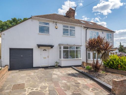 3 bedroom semi-detached house for sale in Cranmore Road, Chislehurst, BR7 — £595,000 • 3 bed • 2 bath • 1029 ft²
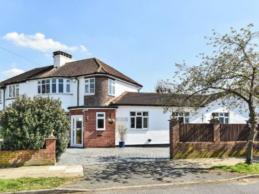 4 bedroom semi-detached house for sale in Holmdale Road, Chislehurst, BR7 — £850,000 • 4 bed • 2 bath • 2000 ft²
 4 bedroom semi-detached house for sale in Brownspring Drive, London, SE9 — £700,000 • 4 bed • 2 bath • 1274 ft²
 3 bedroom house for sale in Slades Drive, Chislehurst, BR7 — £575,000 • 3 bed • 1 bath • 1011 ft²
 4 bedroom end of terrace house for sale in Broadheath Drive, Chislehurst, BR7 — £580,000 • 4 bed • 2 bath • 1462 ft²
Meta
- {
"@context": "https://schema.org",
"@type": "Residence",
"name": "4 bedroom semidetached house for sale in Gravelwood Close,…",
"description": "",
"url": "https://propertypiper.co.uk/property/fb0eab28-d36a-4f1e-802f-d625bb919323",
"image": "https://image-a.propertypiper.co.uk/0588caa7-9800-446e-946e-e2af54b7b3d5-1024.jpeg",
"address": {
"@type": "PostalAddress",
"streetAddress": "7, Gravelwood Close",
"postalCode": "BR7 6JT",
"addressLocality": "Bromley",
"addressRegion": "Bromley and Chislehurst",
"addressCountry": "England"
},
"geo": {
"@type": "GeoCoordinates",
"latitude": 51.43003942307697,
"longitude": 0.07340751251170323
},
"numberOfRooms": 4,
"numberOfBathroomsTotal": 2,
"floorSize": {
"@type": "QuantitativeValue",
"value": 1500,
"unitCode": "FTK"
},
"offers": {
"@type": "Offer",
"price": 625000,
"priceCurrency": "GBP",
"availability": "https://schema.org/InStock"
},
"additionalProperty": [
{
"@type": "PropertyValue",
"name": "Feature",
"value": "mid-20th century"
},
{
"@type": "PropertyValue",
"name": "Feature",
"value": "semi-detached"
},
{
"@type": "PropertyValue",
"name": "Feature",
"value": "two-storey"
},
{
"@type": "PropertyValue",
"name": "Feature",
"value": "brick"
},
{
"@type": "PropertyValue",
"name": "Feature",
"value": "rendered facade"
},
{
"@type": "PropertyValue",
"name": "Feature",
"value": "gabled roof"
},
{
"@type": "PropertyValue",
"name": "Feature",
"value": "large driveway"
},
{
"@type": "PropertyValue",
"name": "Feature",
"value": "garage"
},
{
"@type": "PropertyValue",
"name": "Feature",
"value": "garden"
},
{
"@type": "PropertyValue",
"name": "Feature",
"value": "investment"
},
{
"@type": "PropertyValue",
"name": "Feature",
"value": "modernization potential"
},
{
"@type": "PropertyValue",
"name": "Feature",
"value": "suburban"
},
{
"@type": "PropertyValue",
"name": "Feature",
"value": "contemporary"
},
{
"@type": "PropertyValue",
"name": "Feature",
"value": "modern"
},
{
"@type": "PropertyValue",
"name": "Feature",
"value": "open-plan"
},
{
"@type": "PropertyValue",
"name": "Feature",
"value": "kitchen"
},
{
"@type": "PropertyValue",
"name": "Feature",
"value": "dining area"
},
{
"@type": "PropertyValue",
"name": "Feature",
"value": "skylights"
},
{
"@type": "PropertyValue",
"name": "Feature",
"value": "laminate flooring"
},
{
"@type": "PropertyValue",
"name": "Feature",
"value": "garden access"
},
{
"@type": "PropertyValue",
"name": "Feature",
"value": "patio doors"
}
]
}
High Res Floorplan Images
Compatible Floorplan Images
FloorplanImages Thumbnail