CO16 7PD - 2 bedroom bungalow for sale in Saxmundham Way, Clacton on S…
View on Property Piper
2 bedroom bungalow for sale in Saxmundham Way, Clacton on Sea, CO16
Property Details
- Price: £255000
- Bedrooms: 2
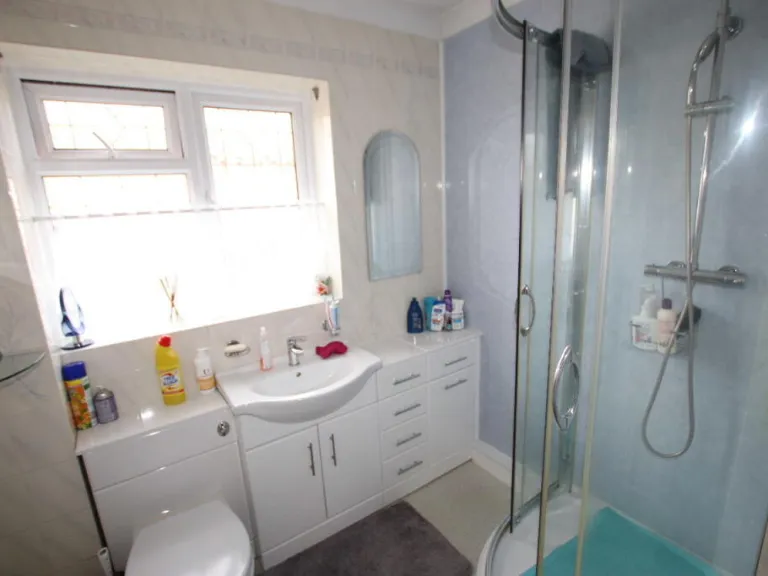
- Bathrooms: 1
- Property Type: undefined
- Property SubType: undefined
Image Descriptions
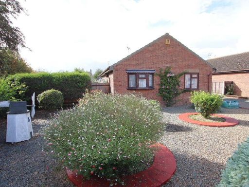
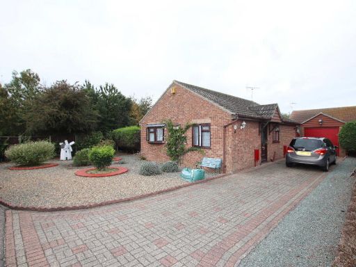
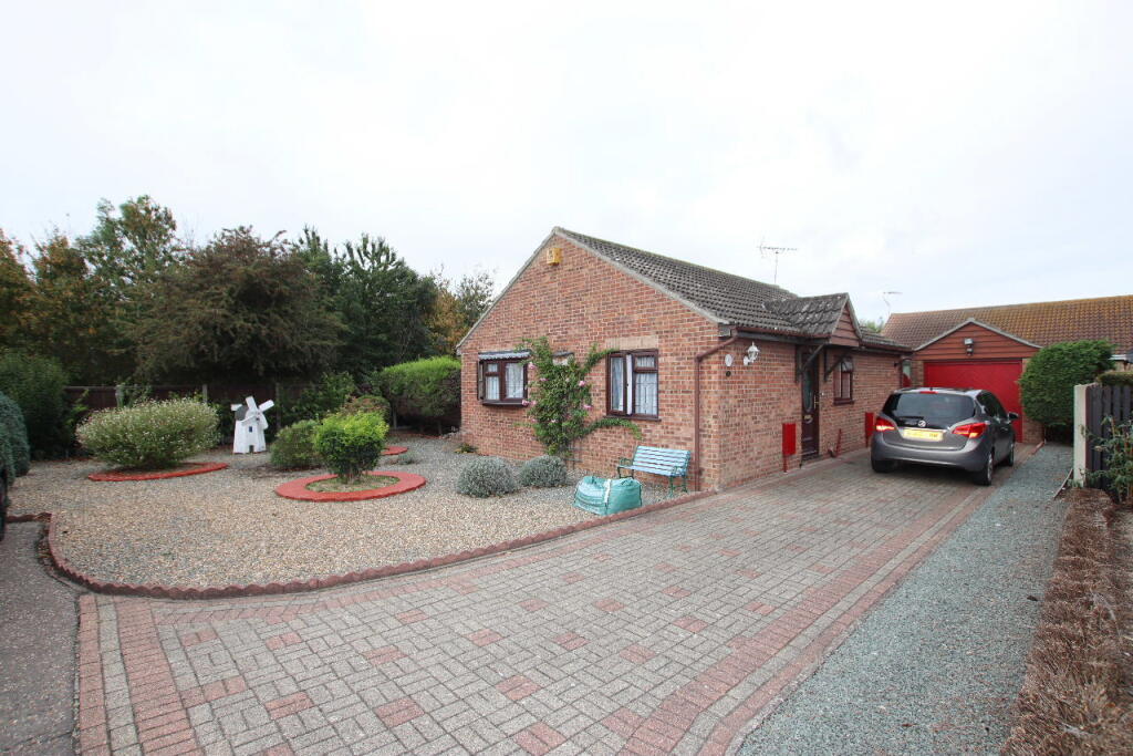
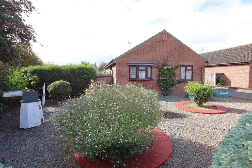
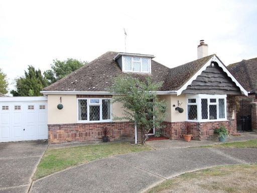
- bungalow single-story
- bungalow modern
Floorplan Description
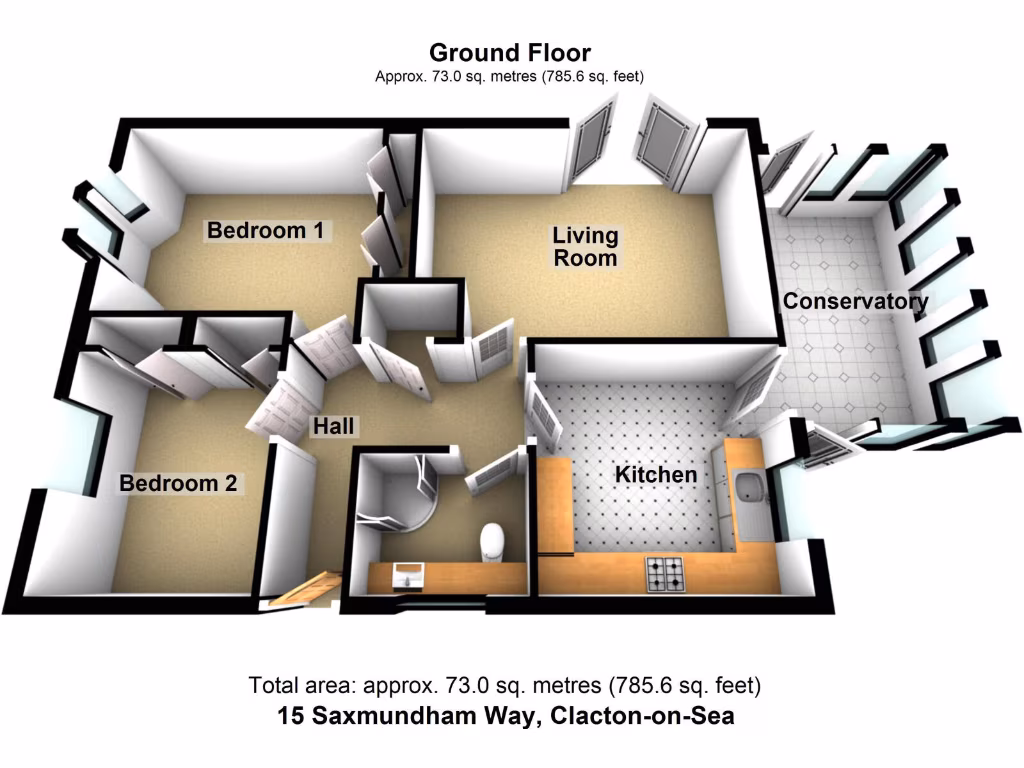
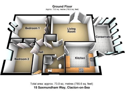
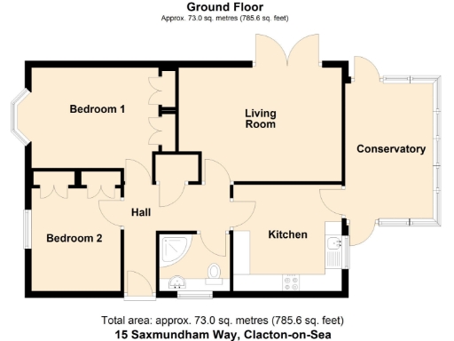
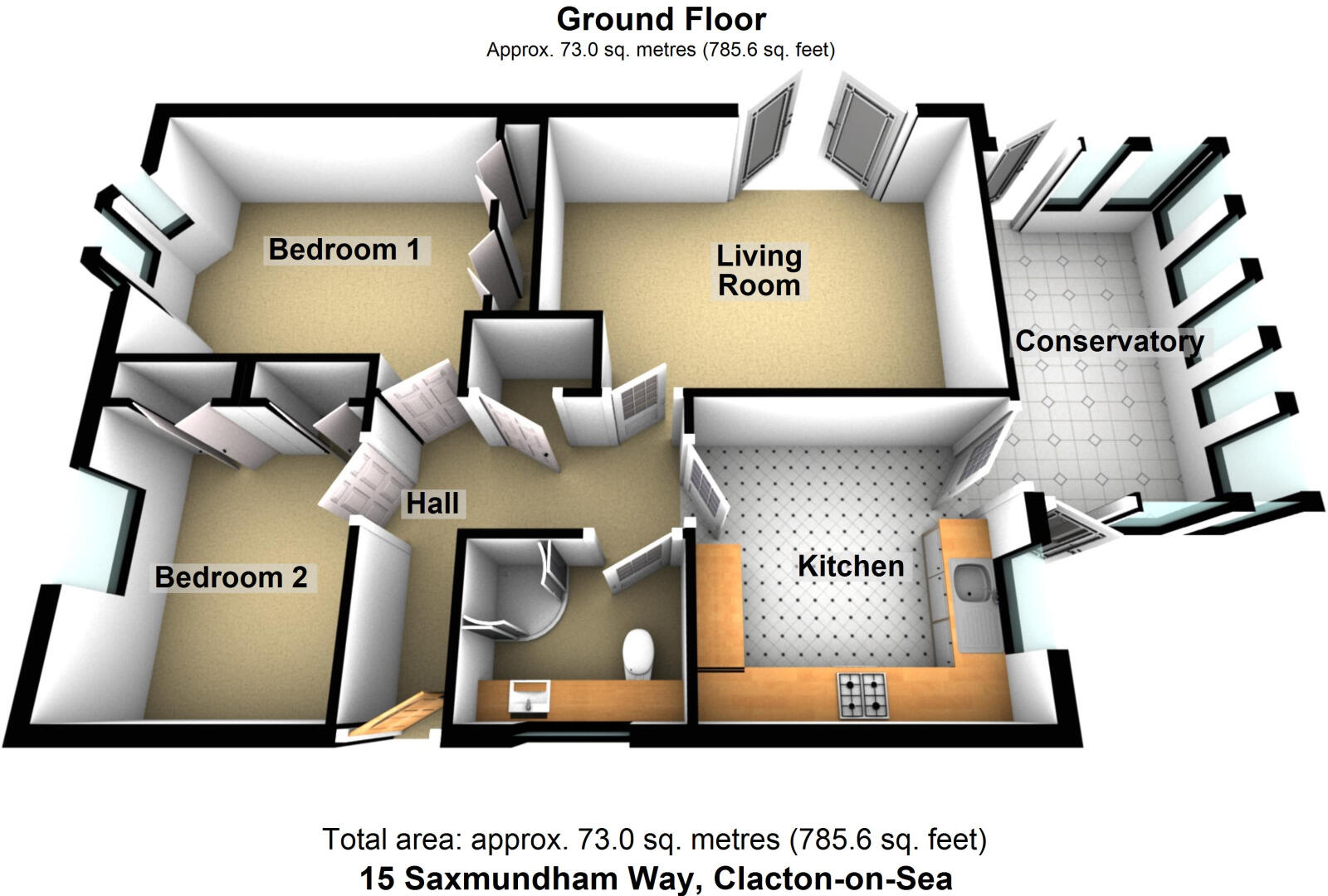
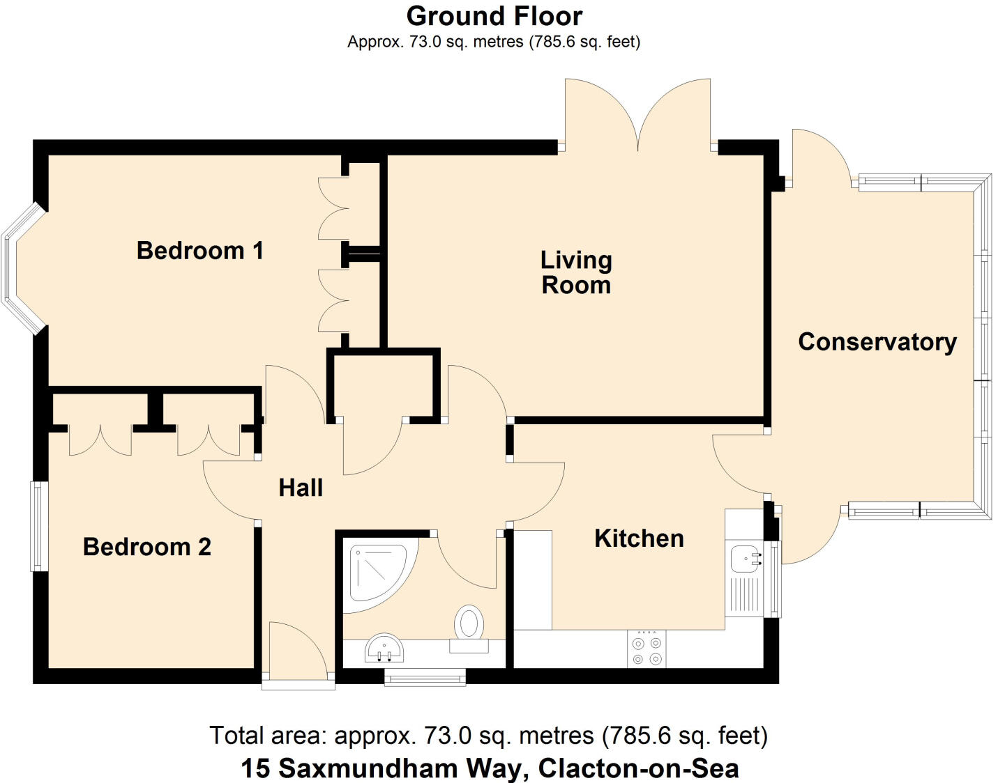
- Ground floor plan of a property at 15 Saxmundham Way, Clacton-on-Sea.
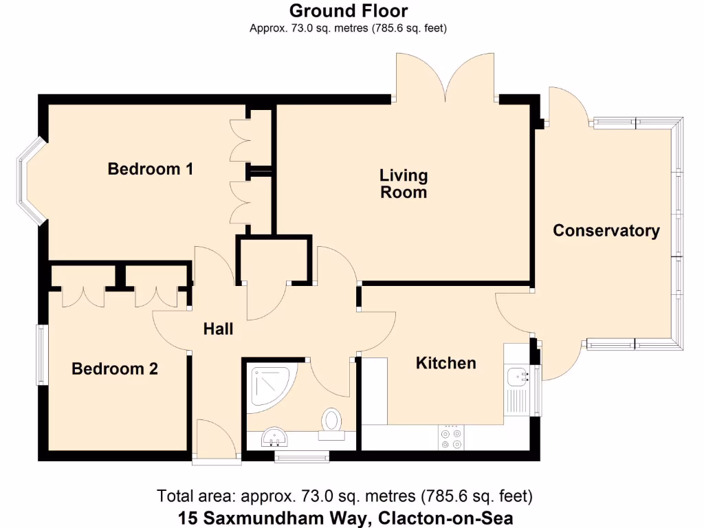
- Ground Floor plan of the property at 15 Saxmundham Way, Clacton-on-Sea
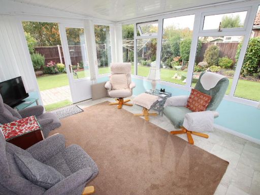
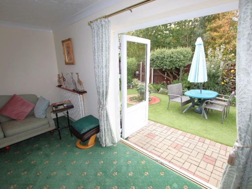
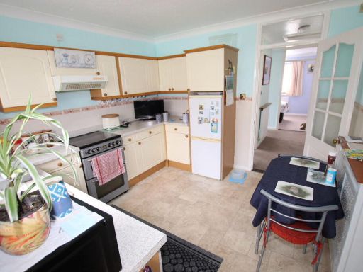
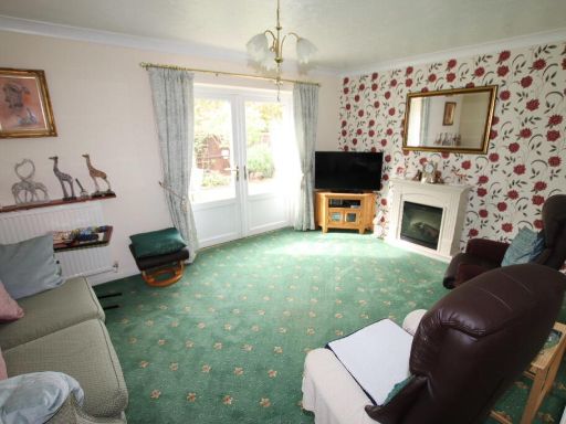
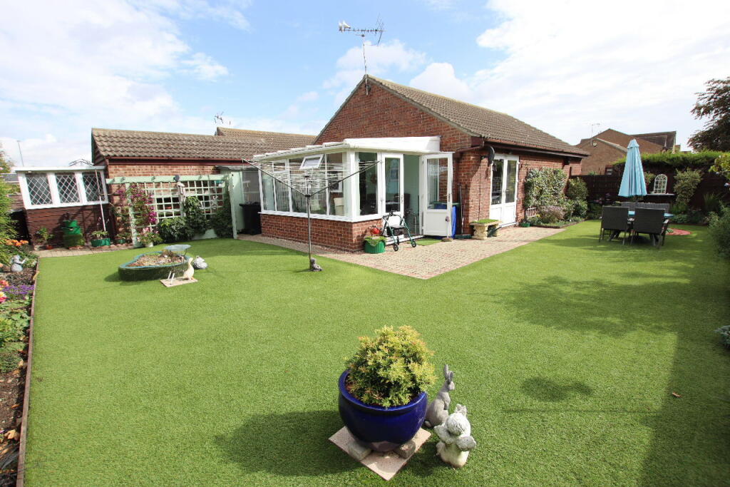
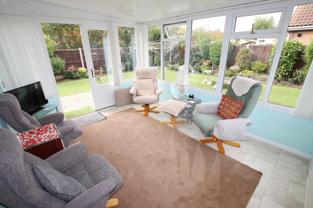
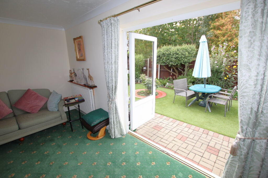
- Single-storey property with living room, kitchen, two bedrooms, hall and conservatory.
- Ground floor property with conservatory.
Rooms
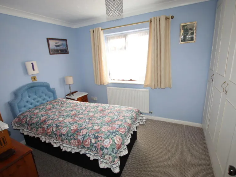
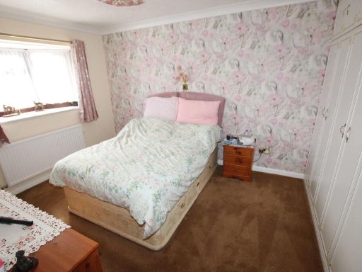
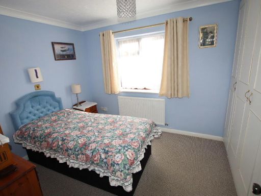
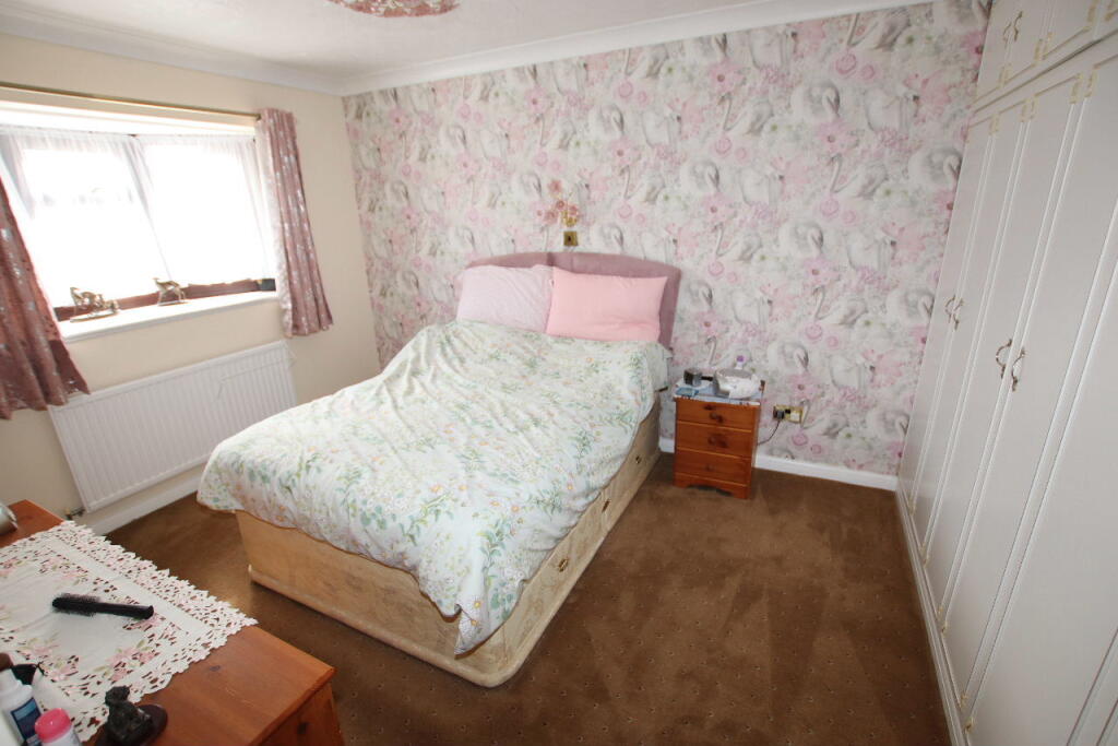
- Bedroom 1:
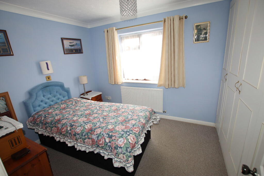
- Bedroom 2:
- Hall:
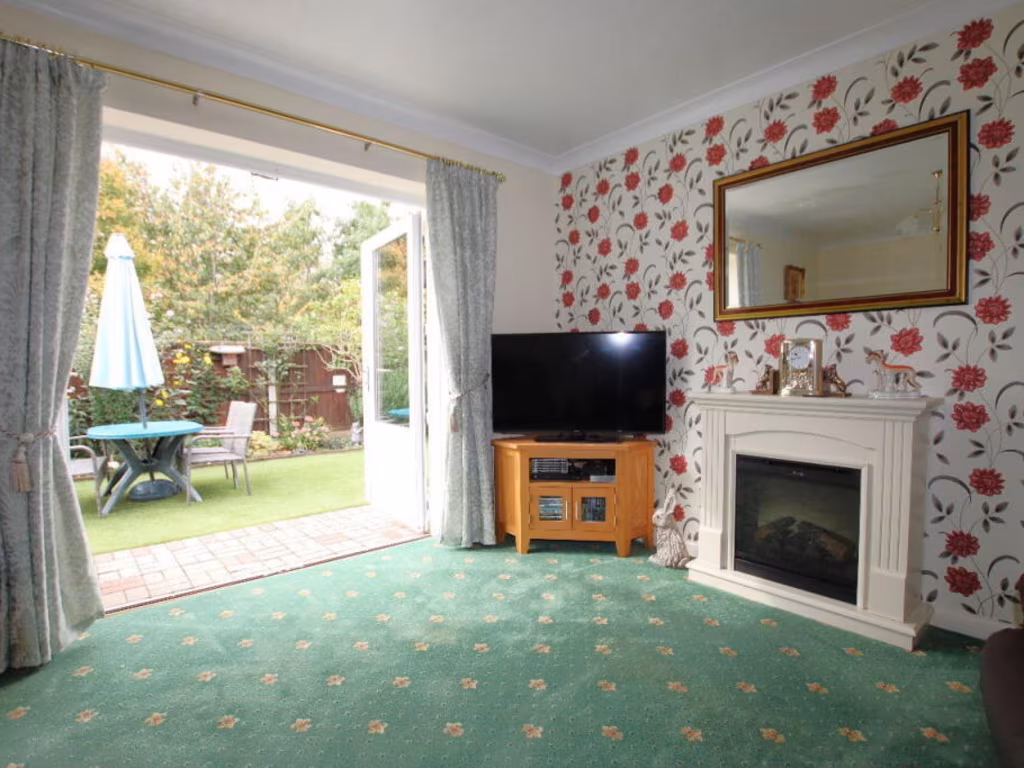
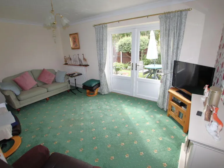
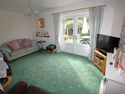
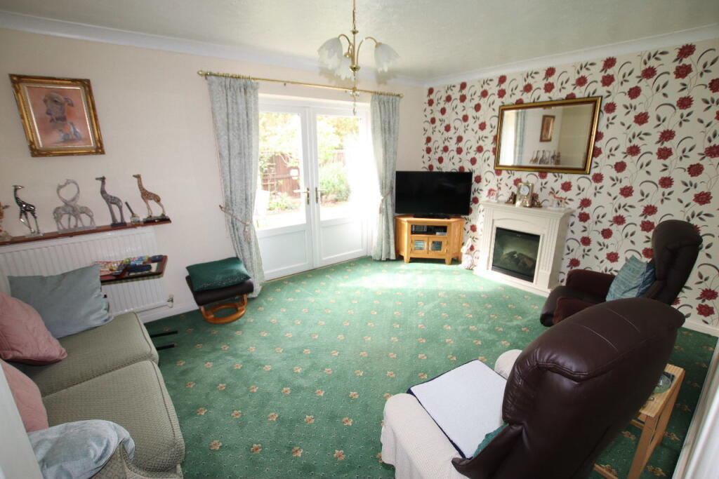
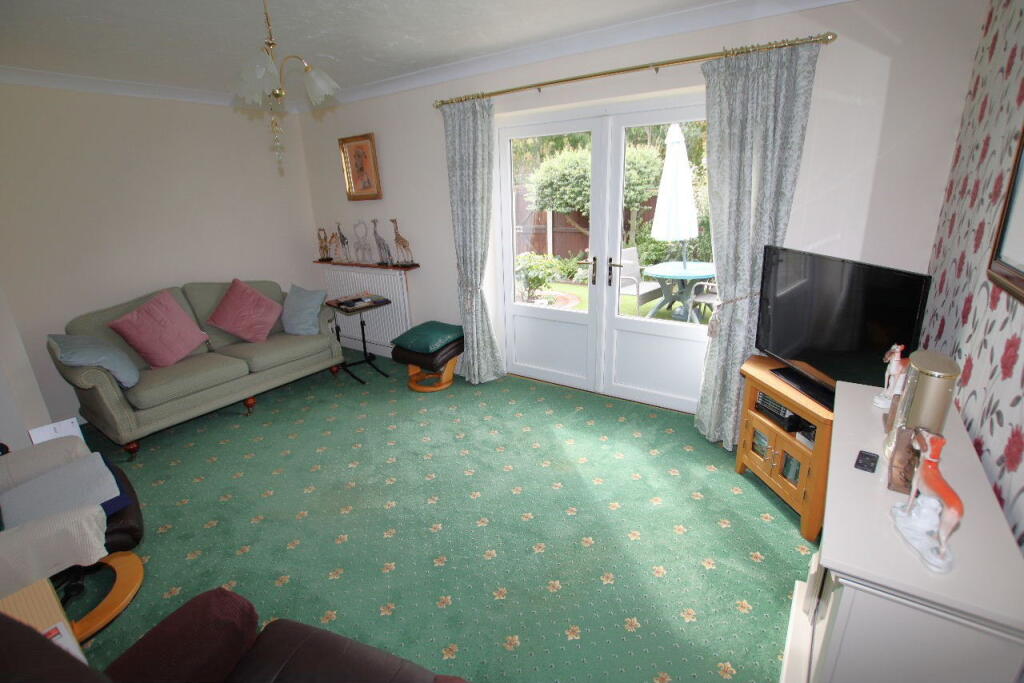
- Living Room:
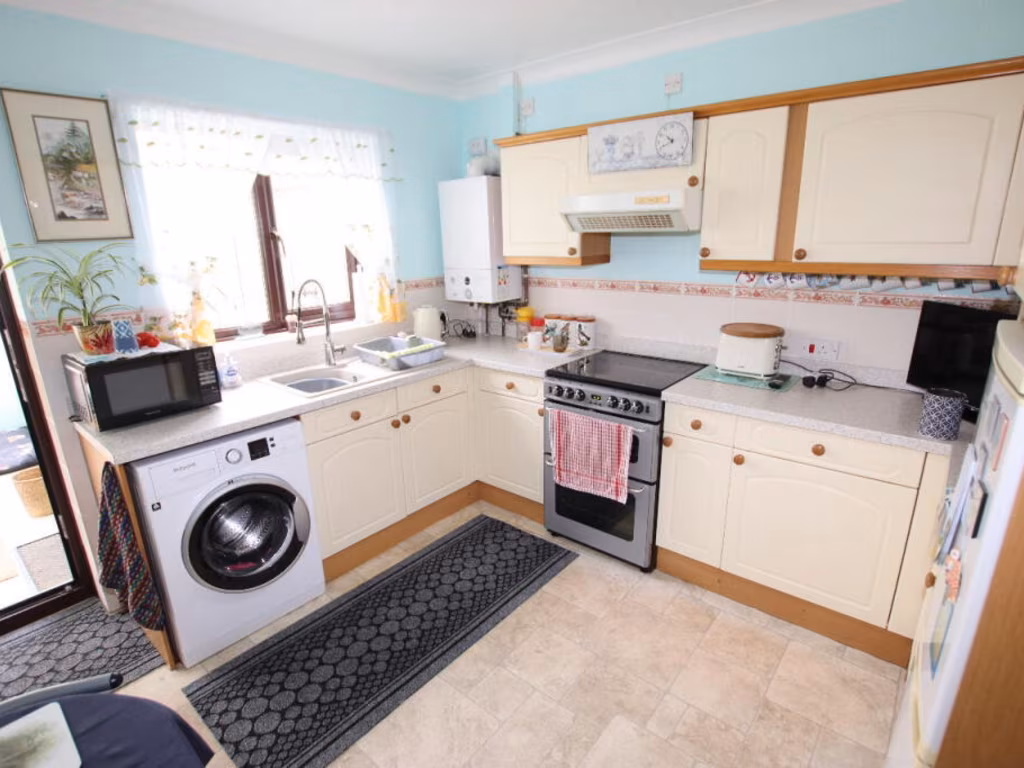
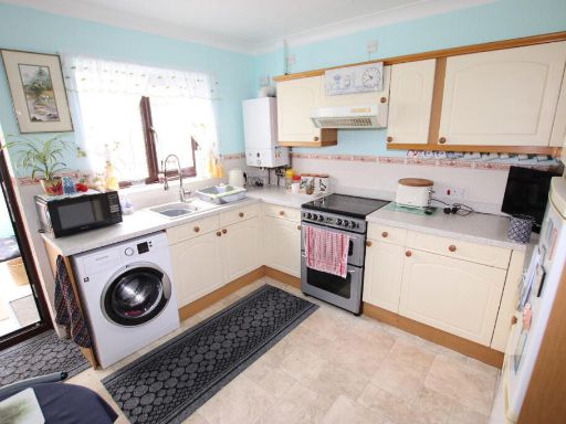
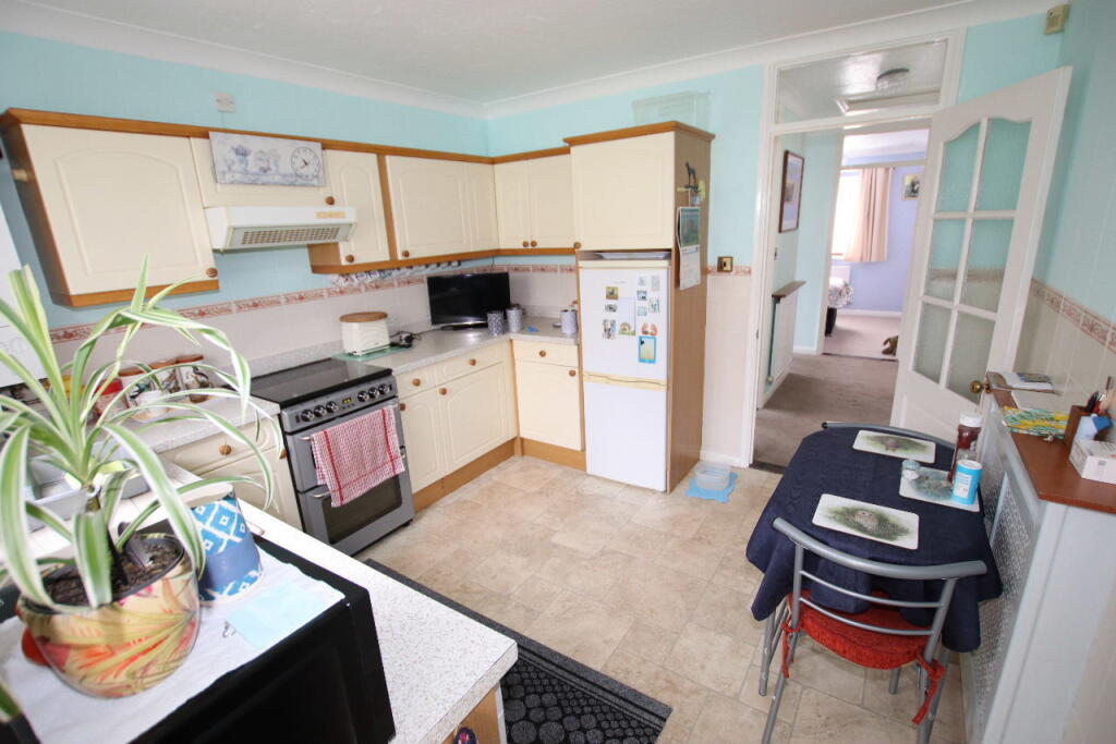
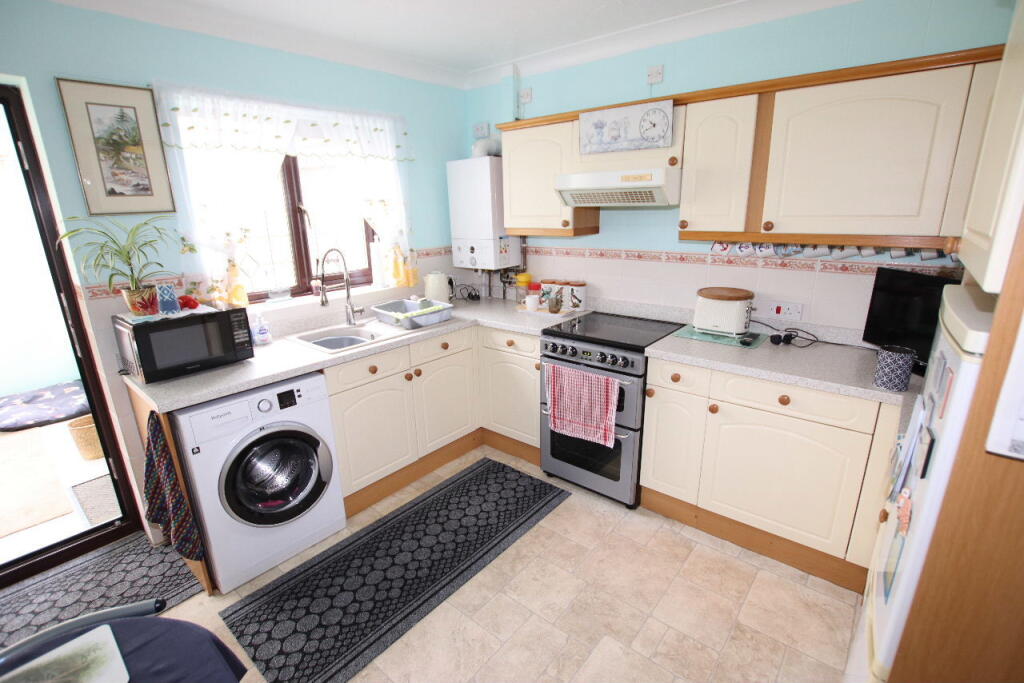
- Kitchen:
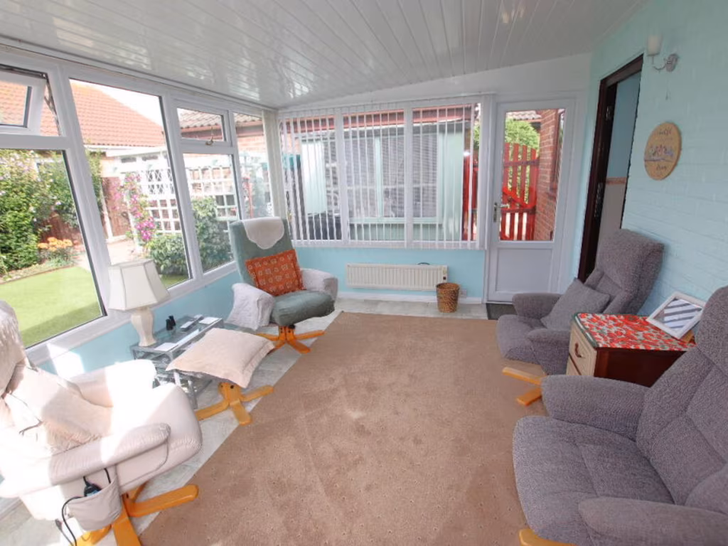
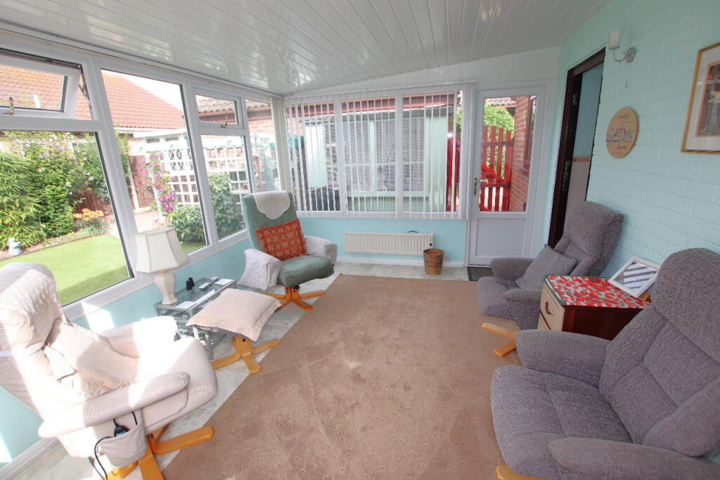
- Conservatory:
- Bedroom 1:
- Bedroom 2:
- Living Room:
- Hall:
- Kitchen:
- Conservatory:
- Bedroom 1:
- Bedroom 2:
- Living Room:
- Kitchen:
- Conservatory:
- Hall:
- Bedroom 1:
- Bedroom 2:
- Living Room:
- Conservatory:
- Hall:
- Kitchen:
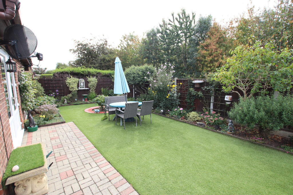
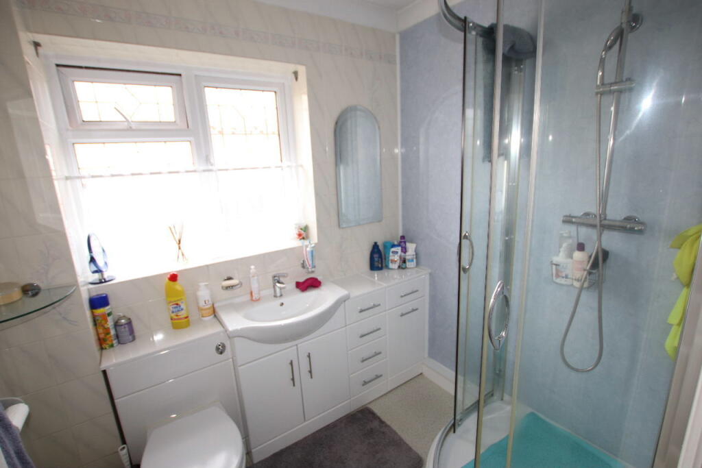
Textual Property Features
Detected Visual Features
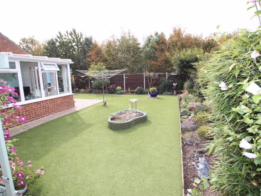
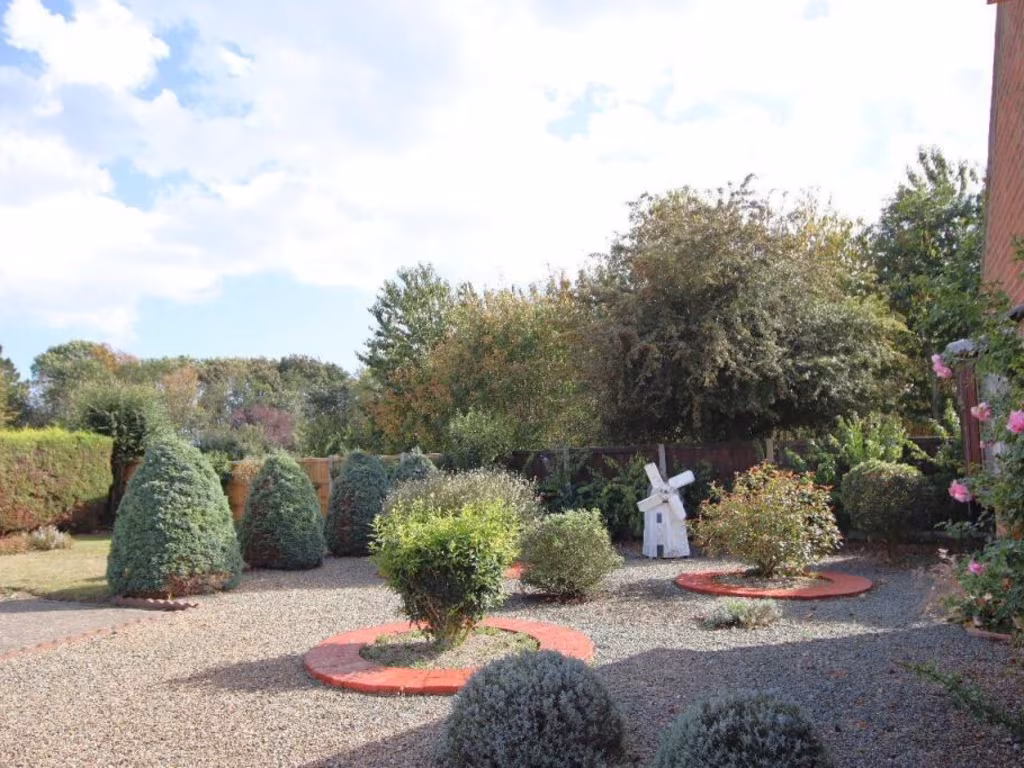
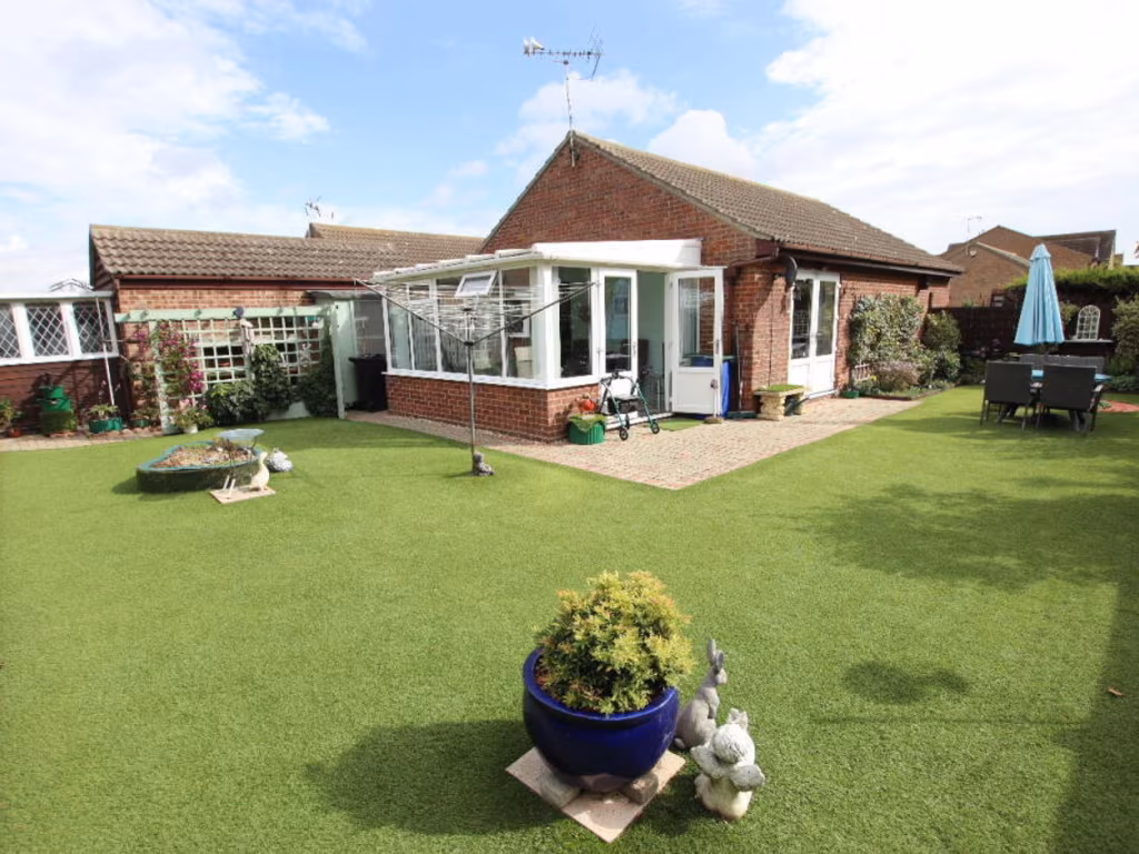
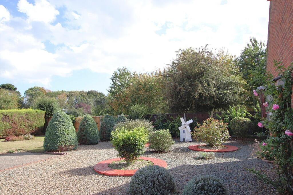
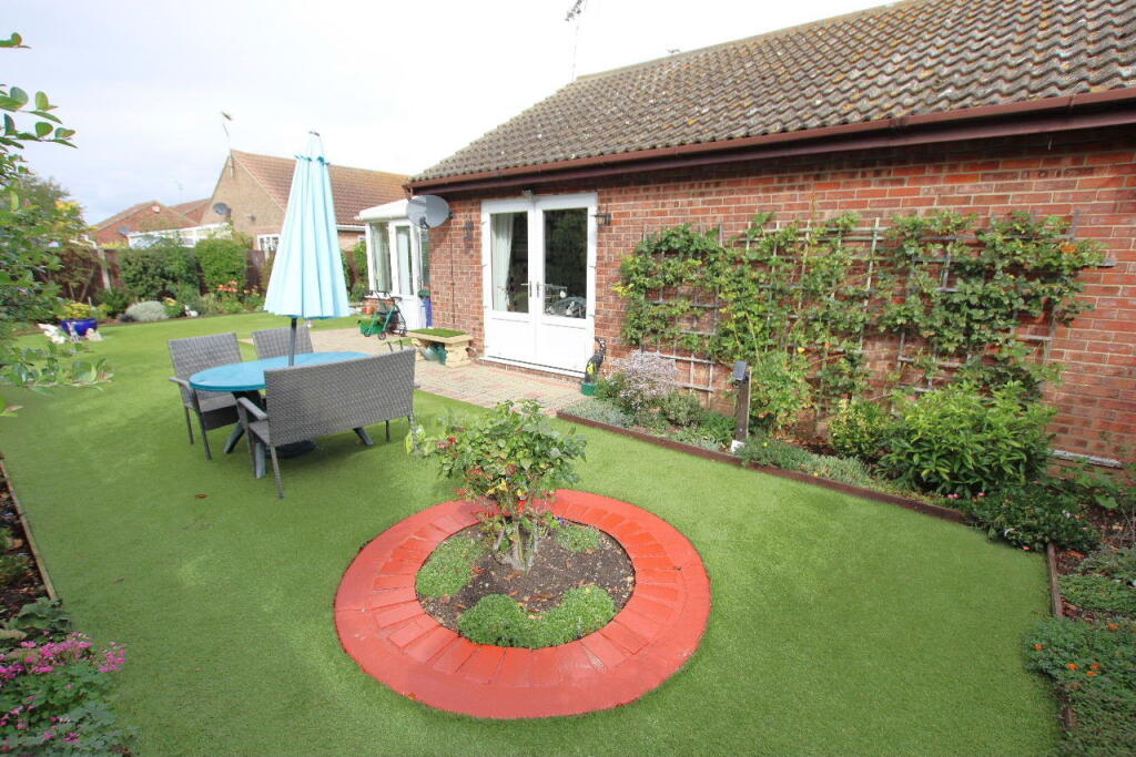
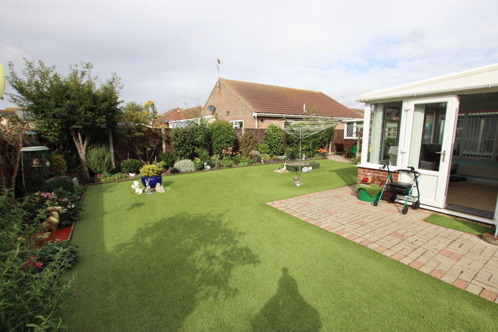
- bungalow
- single-story
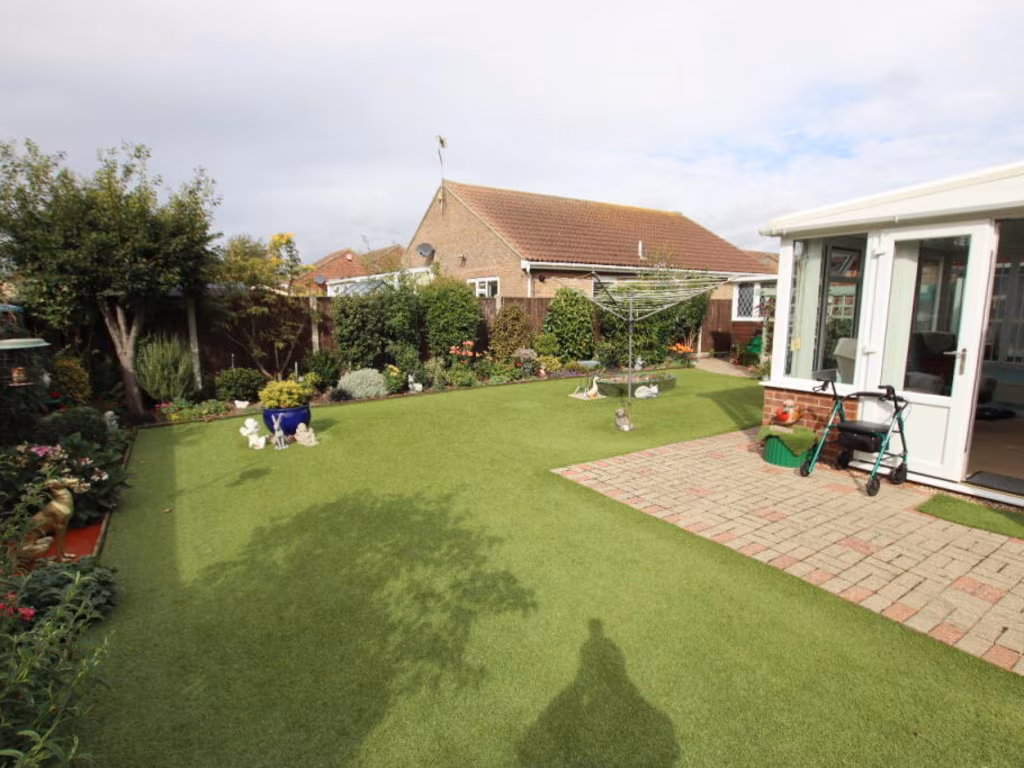
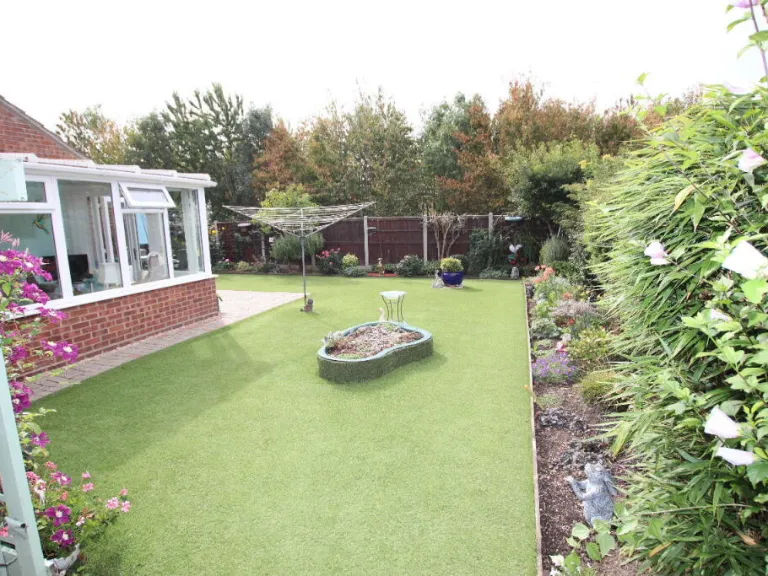
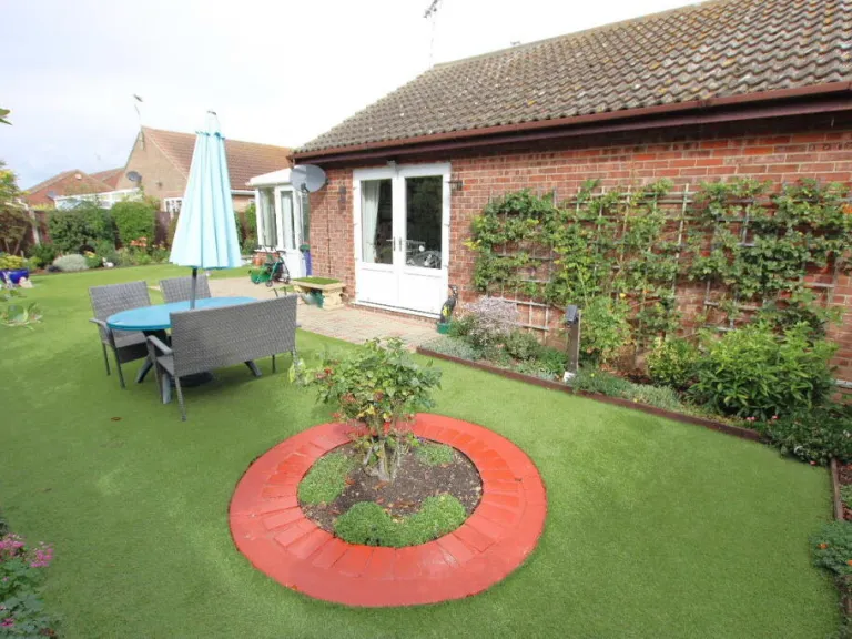
- garden
- flat roof
- brick exterior
- conservatory
- patio
- low maintenance
- artificial lawn
- brick
- driveway
- modern
- residential
- parking
Nearby Schools
- Sir Martin Frobisher Academy
- Clacton County High School
- Holland Haven Primary School
- Cann Hall Primary School
- Brightlingsea Primary School and Nursery
- Kirby Primary Academy
- Alton Park Junior School
- St Osyth Church of England Primary School
- Holland Park Primary School
- White Hall Academy and Nursery
- Burrsville Infant Academy
- Weeley St Andrew's CofE Primary School
- Ravens Academy
- Great Clacton Church of England Junior School
- Engaines Primary School and Nursery
- Great Bentley Primary School
- Rolph Church of England Primary School and Nursery
- Oakwood Infant and Nursery School
- St Clare's Catholic Primary School
- Clacton Coastal Academy
- Colne Community School and College (Secondary and 16 to 19 Provision)
Nearest General Shops
- Id: 115526827
- Tags:
- Addr:
- City: Clacton-on-Sea
- Postcode: CO16 7BA
- Building: shop
- Name: Bubbles
- Shop: laundry
- Source:
- TagsNormalized:
- Lat: 51.7987217
- Lon: 1.1249356
- FullGeoHash: u10y9tejkvsf
- PartitionGeoHash: u10y
- Images:
- FoodStandards: null
- Distance: 370.6
,- Id: 115526677
- Tags:
- Addr:
- City: Clacton-on-Sea
- Postcode: CO16 7BA
- Building: shop
- Name: Ahead Of Hair
- Shop: hairdresser
- Source:
- TagsNormalized:
- Lat: 51.7986652
- Lon: 1.1249936
- FullGeoHash: u10y9tejn701
- PartitionGeoHash: u10y
- Images:
- FoodStandards: null
- Distance: 365.6
,- Id: 115526640
- Tags:
- Addr:
- City: Clacton-on-Sea
- Postcode: CO16 7BA
- Building: shop
- Name: Ahead Of Hair 4 Men
- Shop: hairdresser
- Source:
- TagsNormalized:
- Lat: 51.7986276
- Lon: 1.1250323
- FullGeoHash: u10y9tehzhhc
- PartitionGeoHash: u10y
- Images:
- FoodStandards: null
- Distance: 362.4
}
Nearest Grocery shops
- Id: 130156151
- Tags:
- Addr:
- City: Clacton-on-Sea
- Housenumber: 77-79
- Postcode: CO15 2BX
- Street: Coopers Lane
- Brand: Co-op Daily
- Brand:wikidata: Q107589681
- Building: retail
- Fhrs:
- Name: CO-OP Daily
- Operator: East of England Co-operative Society
- Operator:wikidata: Q5329759
- Shop: convenience
- Source:
- TagsNormalized:
- co-op
- retail
- convenience
- shop
- Lat: 51.7925795
- Lon: 1.1347048
- FullGeoHash: u10y9ud38s95
- PartitionGeoHash: u10y
- Images:
- FoodStandards:
- Id: 658973
- FHRSID: 658973
- LocalAuthorityBusinessID: 1669/FOOD
- BusinessName: East of England Co-op
- BusinessType: Retailers - other
- BusinessTypeID: 4613
- AddressLine1: 77 - 79 Coopers Lane
- AddressLine2: Clacton-on-Sea
- AddressLine3: Essex
- AddressLine4: null
- PostCode: CO15 2BX
- RatingValue: 5
- RatingKey: fhrs_5_en-GB
- RatingDate: 2022-12-18
- LocalAuthorityCode: 120
- LocalAuthorityName: Tendring
- LocalAuthorityWebSite: http://www.tendringdc.gov.uk/
- LocalAuthorityEmailAddress: fhsadmin@tendringdc.gov.uk
- Scores:
- Hygiene: 0
- Structural: 0
- ConfidenceInManagement: 0
- NewRatingPending: false
- Geocode:
- Longitude: 1.13463200000000
- Latitude: 51.79259900000000
- Distance: 837.4
,- Id: 115526745
- Tags:
- Addr:
- City: Clacton-on-Sea
- Housenumber: 37
- Postcode: CO16 7BA
- Street: Bluehouse Avenue
- Amenity: fast_food
- Building: shop
- Cuisine: fish_and_chips
- Name: Happy Cod 2
- Not:
- Old:
- Source:
- Addr: FHRS Open Data
- Building: bing
- TagsNormalized:
- Lat: 51.7988724
- Lon: 1.124781
- FullGeoHash: u10y9ten339t
- PartitionGeoHash: u10y
- Images:
- FoodStandards: null
- Distance: 384.2
,- Id: 115526806
- Tags:
- Addr:
- City: Clacton-on-Sea
- Postcode: CO16 7BA
- Building: shop
- Name: Beano's
- Shop: convenience
- Source:
- TagsNormalized:
- Lat: 51.798797
- Lon: 1.1248583
- FullGeoHash: u10y9tejg5e5
- PartitionGeoHash: u10y
- Images:
- FoodStandards: null
- Distance: 377.3
}
Nearest Religious buildings
- Id: 265437338
- Tags:
- Addr:
- City: Jaywick
- Housename: All Saints Church
- Postcode: CO15 2RA
- Street: Union Road
- Amenity: place_of_worship
- Building: church
- Denomination: catholic
- Name: All Saints Church
- Religion: christian
- Source:
- TagsNormalized:
- place of worship
- church
- catholic
- christian
- Lat: 51.7814773
- Lon: 1.1195696
- FullGeoHash: u10y96x0zygx
- PartitionGeoHash: u10y
- Images:
- FoodStandards: null
- Distance: 1583.6
,- Id: 57869022
- Tags:
- Amenity: place_of_worship
- Building: yes
- Name: Jaywick Methodist Church
- Polling_station: 2010;2017
- Source:
- TagsNormalized:
- place of worship
- church
- methodist
- Lat: 51.7816585
- Lon: 1.119948
- FullGeoHash: u10y96xd08vb
- PartitionGeoHash: u10y
- Images:
- FoodStandards: null
- Distance: 1559.5
,- Id: 72700209
- Tags:
- Amenity: place_of_worship
- Building: church
- Denomination: methodist
- Name: Rush Green Methodist Church
- Religion: christian
- Source:
- TagsNormalized:
- place of worship
- church
- methodist
- christian
- Lat: 51.796362
- Lon: 1.1316122
- FullGeoHash: u10y9v0p8mxn
- PartitionGeoHash: u10y
- Images:
- FoodStandards: null
- Distance: 566.5
}
Nearest Medical buildings
- Id: 265525799
- Tags:
- Addr:
- City: Jaywick
- Housenumber: 32
- Postcode: CO15 2NB
- Street: Crossways
- Amenity: clinic
- Building: yes
- Name: Green Elms Health Centre
- Website: https://www.greenelms.co.uk/
- TagsNormalized:
- clinic
- health
- health centre
- Lat: 51.7811524
- Lon: 1.1172892
- FullGeoHash: u10y96mx4drj
- PartitionGeoHash: u10y
- Images:
- FoodStandards: null
- Distance: 1652.6
,- Id: 129852257
- Tags:
- Addr:
- City: Clacton-on-Sea
- Postcode: CO15 3BW
- Amenity: dentist
- Building: retail
- Healthcare: dentist
- Name: Clacton Dental Centre
- Source:
- TagsNormalized:
- dentist
- retail
- health
- healthcare
- dental
- Lat: 51.7932997
- Lon: 1.1455495
- FullGeoHash: u10ydhdjv4ze
- PartitionGeoHash: u10y
- Images:
- FoodStandards: null
- Distance: 1536.9
,- Id: 258482226
- Tags:
- Addr:
- City: Clacton-on-Sea
- Housename: 4a Newman Industrial Estate
- Postcode: CO15 3DS
- Street: Ford Road
- Amenity: dentist
- Building: yes
- Healthcare: dentist
- Name: Eric Tsang & Associates Dental Surgery
- Phone: +44 1255 474942
- Source:
- TagsNormalized:
- dentist
- health
- healthcare
- dental
- surgery
- Lat: 51.7934255
- Lon: 1.1405762
- FullGeoHash: u10y9uww9673
- PartitionGeoHash: u10y
- Images:
- FoodStandards: null
- Distance: 1197.8
,- Id: 116792682
- Tags:
- Addr:
- City: Clacton-on-Sea
- Housenumber: 2
- Postcode: CO16 8TJ
- Amenity: doctors
- Building: health_centre
- Name: Green Elms Medical Centre
- Source:
- TagsNormalized:
- doctor
- doctors
- health
- health centre
- Lat: 51.8003895
- Lon: 1.1285412
- FullGeoHash: u10y9tvz0umr
- PartitionGeoHash: u10y
- Images:
- FoodStandards: null
- Distance: 644.1
}
Nearest Leisure Facilities
- Id: 72449743
- Tags:
- Building: yes
- Leisure: sports_centre
- Name: FC Clacton
- Source:
- Sport: soccer
- Wikidata: Q5423680
- Wikipedia: en:F.C. Clacton
- TagsNormalized:
- sports
- sports centre
- leisure
- soccer
- Lat: 51.7925498
- Lon: 1.1258002
- FullGeoHash: u10y9sec3p13
- PartitionGeoHash: u10y
- Images:
- FoodStandards: null
- Distance: 365.6
,- Id: 423369006
- Tags:
- Leisure: pitch
- Sport: soccer
- TagsNormalized:
- Lat: 51.7931394
- Lon: 1.1263455
- FullGeoHash: u10y9sshvubn
- PartitionGeoHash: u10y
- Images:
- FoodStandards: null
- Distance: 328.8
,- Id: 423369005
- Tags:
- Leisure: pitch
- Sport: soccer
- TagsNormalized:
- Lat: 51.7935896
- Lon: 1.1246674
- FullGeoHash: u10y9sdzw8uu
- PartitionGeoHash: u10y
- Images:
- FoodStandards: null
- Distance: 228.5
,- Id: 423369003
- Tags:
- Leisure: pitch
- Sport: soccer
- TagsNormalized:
- Lat: 51.7943924
- Lon: 1.1251201
- FullGeoHash: u10y9sgk1nw3
- PartitionGeoHash: u10y
- Images:
- FoodStandards: null
- Distance: 167.5
,- Id: 987816312
- Tags:
- TagsNormalized:
- Lat: 51.7954149
- Lon: 1.1215764
- FullGeoHash: u10y9t0dnt5u
- PartitionGeoHash: u10y
- Images:
- FoodStandards: null
- Distance: 132
}
Nearest Tourist attractions
- Id: 169332866
- Tags:
- Building: farmhouse
- Name: Pond House
- Source:
- Tourism: guest_house
- Website: https://earlshallfarm.info/
- TagsNormalized:
- Lat: 51.8069612
- Lon: 1.106644
- FullGeoHash: u10y9pjv6tt9
- PartitionGeoHash: u10y
- Images:
- FoodStandards: null
- Distance: 1721.3
,- Id: 169332868
- Tags:
- Building: farmhouse
- Name: Pond Cottage
- Source:
- Tourism: guest_house
- TagsNormalized:
- Lat: 51.8069833
- Lon: 1.1067852
- FullGeoHash: u10y9pjvtcwv
- PartitionGeoHash: u10y
- Images:
- FoodStandards: null
- Distance: 1716.6
,- Id: 425762022
- Tags:
- Name: Hasty's Adventure Farm Park
- Tourism: attraction
- Website: http://www.hastys.co.uk
- TagsNormalized:
- Lat: 51.783775
- Lon: 1.125866
- FullGeoHash: u10y9dgy6e6d
- PartitionGeoHash: u10y
- Images:
- FoodStandards: null
- Distance: 1315.2
}
Nearest Train stations
- Id: 26579230
- Tags:
- Name: Colchester Town
- Naptan:
- Network: National Rail
- Old_name: St Botolph's
- Operator: Abellio Greater Anglia
- Platforms: 1
- Public_transport: station
- Railway: station
- Ref:
- Wikidata: Q4489756
- Wikipedia: en:Colchester Town railway station
- TagsNormalized:
- Lat: 51.8865086
- Lon: 0.9054279
- FullGeoHash: u10xhtekcfpz
- PartitionGeoHash: u10x
- Images:
- FoodStandards: null
- Distance: 18078.1
,- Id: 2006158761
- Tags:
- Name: Manningtree
- Naptan:
- Network: National Rail
- Public_transport: station
- Railway: station
- Ref:
- Start_date: 1846
- Wikidata: Q1938819
- Wikipedia: en:Manningtree railway station
- TagsNormalized:
- Lat: 51.9491435
- Lon: 1.0449277
- FullGeoHash: u10xxc0csw4x
- PartitionGeoHash: u10x
- Images:
- FoodStandards: null
- Distance: 17914.3
,- Id: 1643615541
- Tags:
- Name: Hythe (Colchester)
- Naptan:
- Network: National Rail
- Public_transport: station
- Railway: station
- Ref:
- Train: yes
- Wikidata: Q2552020
- Wikipedia: en:Hythe railway station (Essex)
- TagsNormalized:
- Lat: 51.8858134
- Lon: 0.9275278
- FullGeoHash: u10xjje2ubwu
- PartitionGeoHash: u10x
- Images:
- FoodStandards: null
- Distance: 16795.1
,- Id: 2393234119
- Tags:
- Name: Wrabness
- Naptan:
- Network: National Rail
- Public_transport: station
- Railway: station
- Ref:
- Wikidata: Q3284262
- Wikipedia: en:Wrabness railway station
- TagsNormalized:
- Lat: 51.9395281
- Lon: 1.1716892
- FullGeoHash: u10z6xm1wmfc
- PartitionGeoHash: u10z
- Images:
- FoodStandards: null
- Distance: 16352.3
,- Id: 687485406
- Tags:
- Name: Clacton-on-Sea
- Naptan:
- Network: National Rail
- Public_transport: station
- Railway: station
- Ref:
- Wikidata: Q5124903
- Wikipedia: en:Clacton-on-Sea railway station
- TagsNormalized:
- Lat: 51.7945324
- Lon: 1.1543273
- FullGeoHash: u10ydkbt1b8u
- PartitionGeoHash: u10y
- Images:
- FoodStandards: null
- Distance: 2123.5
}
Nearest Hotels
- Id: 72865161
- Tags:
- Addr:
- City: Clacton-on-Sea
- Housenumber: 22
- Postcode: CO15 1JN
- Building: tourism
- Name: Dudley's Hotel
- Source:
- Tourism: hotel
- TagsNormalized:
- Lat: 51.7879779
- Lon: 1.1510813
- FullGeoHash: u10yd5wny4u3
- PartitionGeoHash: u10y
- Images:
- FoodStandards: null
- Distance: 2074.3
,- Id: 72887786
- Tags:
- Addr:
- City: Clacton-on-Sea
- Housenumber: 45
- Postcode: CO15 1JA
- Street: Jackson Road
- Brand: Travelodge
- Brand:wikidata: Q9361374
- Brand:wikipedia: en:Travelodge UK
- Building: hotel
- Fhrs:
- Authority: Tendring
- Id: 611762
- Local_authority_id: 11/00178/COM
- Internet_access: wlan
- Internet_access:fee: customers
- Internet_access:ssid: Travelodge WiFi
- Name: Travelodge
- Source: OS_OpenData_StreetView
- Tourism: hotel
- TagsNormalized:
- Lat: 51.7896977
- Lon: 1.1503833
- FullGeoHash: u10ydhj8vg7u
- PartitionGeoHash: u10y
- Images:
- FoodStandards: null
- Distance: 1959.3
,- Id: 73550727
- Tags:
- Addr:
- City: Clacton-on-Sea
- Housename: Seawinds
- Housenumber: 8
- Postcode: CO15 1UL
- Street: Collingwood Road
- Building: yes
- Fhrs:
- Name: The Cabana
- Source:
- Tourism: hotel
- TagsNormalized:
- Lat: 51.7837124
- Lon: 1.1439265
- FullGeoHash: u10yd4bvzrtk
- PartitionGeoHash: u10y
- Images:
- FoodStandards: null
- Distance: 1922.8
}
Tags
- bungalow
- single-story
- garden
- flat roof
- brick exterior
- conservatory
- patio
- low maintenance
- artificial lawn
- bungalow
- brick
- driveway
- modern
- single-story
- residential
- garden
- parking
Local Market Stats
- Average Price/sqft: £308
- Avg Income: £35300
- Rental Yield: 4.7%
- Social Housing: 4%
- Planning Success Rate: 85%
Similar Properties
 3 bedroom bungalow for sale in The Green, Clacton on Sea, CO16 — £350,000 • 3 bed • 1 bath
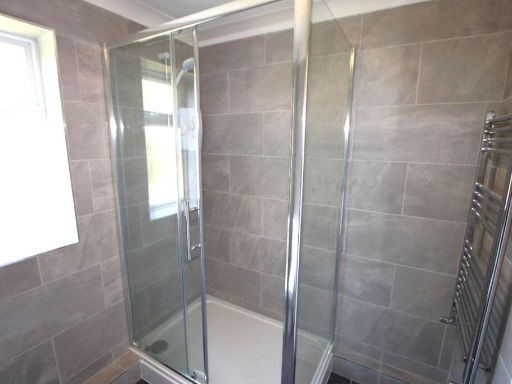 2 bedroom bungalow for sale in Abinger Close, Clacton on Sea, CO16 — £250,000 • 2 bed • 1 bath • 524 ft²
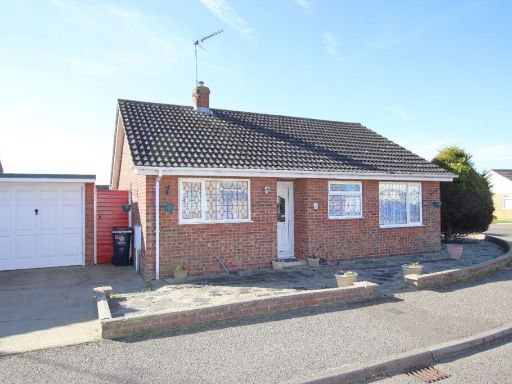 2 bedroom bungalow for sale in Crome Road, Clacton on Sea, CO16 — £250,000 • 2 bed • 1 bath • 826 ft²
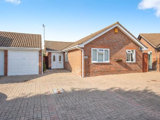 3 bedroom detached bungalow for sale in Holmwood Close, Clacton-On-Sea, CO16 — £350,000 • 3 bed • 1 bath • 776 ft²
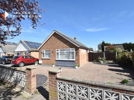 2 bedroom detached bungalow for sale in Cottage Grove, Clacton-on-Sea, CO16 — £290,000 • 2 bed • 1 bath
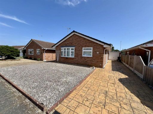 2 bedroom detached bungalow for sale in Munnings Drive, Clacton-On-Sea, CO16 — £270,000 • 2 bed • 1 bath • 958 ft²
Meta
- {
"@context": "https://schema.org",
"@type": "Residence",
"name": "2 bedroom bungalow for sale in Saxmundham Way, Clacton on S…",
"description": "",
"url": "https://propertypiper.co.uk/property/f9f67f32-2f74-41ef-b69c-8c77296adc0c",
"image": "https://image-a.propertypiper.co.uk/8eb04d59-97a7-4c98-b1b1-11f57e14fe78-1024.jpeg",
"address": {
"@type": "PostalAddress",
"streetAddress": "15 SAXMUNDHAM WAY CLACTON-ON-SEA",
"postalCode": "CO16 7PD",
"addressLocality": "Tendring",
"addressRegion": "Clacton",
"addressCountry": "England"
},
"geo": {
"@type": "GeoCoordinates",
"latitude": 51.79551123204034,
"longitude": 1.1234895670095586
},
"numberOfRooms": 2,
"numberOfBathroomsTotal": 1,
"floorSize": {
"@type": "QuantitativeValue",
"value": 785,
"unitCode": "FTK"
},
"offers": {
"@type": "Offer",
"price": 255000,
"priceCurrency": "GBP",
"availability": "https://schema.org/InStock"
},
"additionalProperty": [
{
"@type": "PropertyValue",
"name": "Feature",
"value": "bungalow"
},
{
"@type": "PropertyValue",
"name": "Feature",
"value": "single-story"
},
{
"@type": "PropertyValue",
"name": "Feature",
"value": "garden"
},
{
"@type": "PropertyValue",
"name": "Feature",
"value": "flat roof"
},
{
"@type": "PropertyValue",
"name": "Feature",
"value": "brick exterior"
},
{
"@type": "PropertyValue",
"name": "Feature",
"value": "conservatory"
},
{
"@type": "PropertyValue",
"name": "Feature",
"value": "patio"
},
{
"@type": "PropertyValue",
"name": "Feature",
"value": "low maintenance"
},
{
"@type": "PropertyValue",
"name": "Feature",
"value": "artificial lawn"
},
{
"@type": "PropertyValue",
"name": "Feature",
"value": "bungalow"
},
{
"@type": "PropertyValue",
"name": "Feature",
"value": "brick"
},
{
"@type": "PropertyValue",
"name": "Feature",
"value": "driveway"
},
{
"@type": "PropertyValue",
"name": "Feature",
"value": "modern"
},
{
"@type": "PropertyValue",
"name": "Feature",
"value": "single-story"
},
{
"@type": "PropertyValue",
"name": "Feature",
"value": "residential"
},
{
"@type": "PropertyValue",
"name": "Feature",
"value": "garden"
},
{
"@type": "PropertyValue",
"name": "Feature",
"value": "parking"
}
]
}
High Res Floorplan Images
Compatible Floorplan Images
FloorplanImages Thumbnail