SP11 6ZR - 1 bedroom flat for sale in Cashmere Drive, Andover, SP11
View on Property Piper
1 bedroom flat for sale in Cashmere Drive, Andover, SP11
Property Details
- Price: £172500
- Bedrooms: 1
- Bathrooms: 1
- Property Type: undefined
- Property SubType: undefined
Image Descriptions
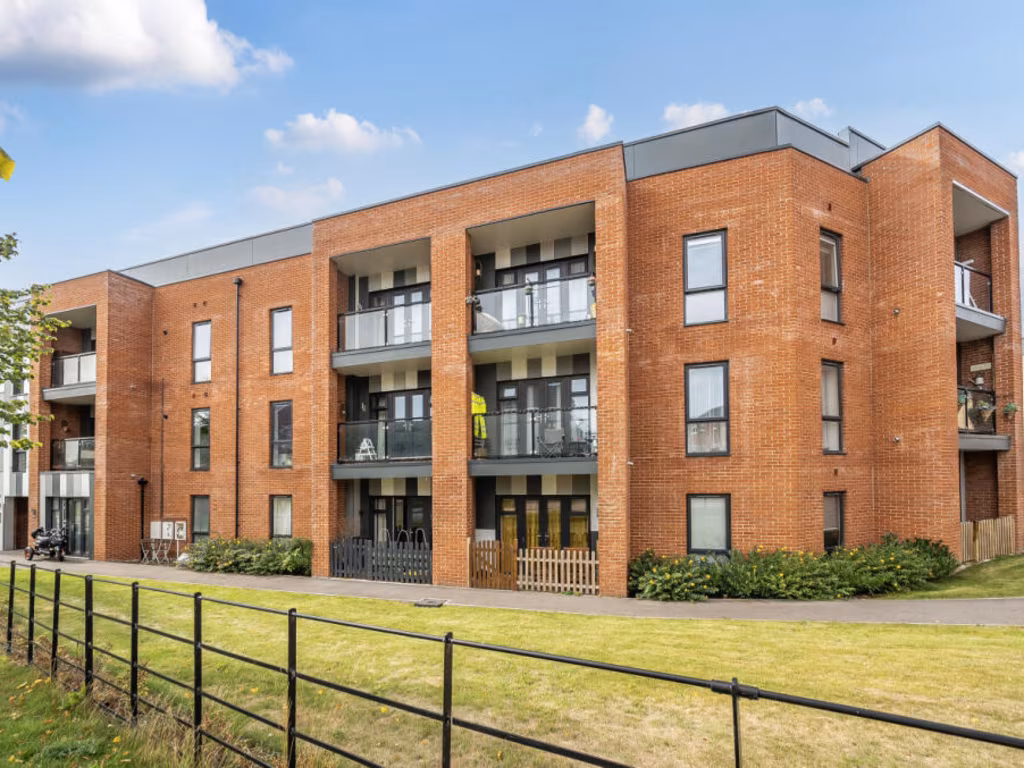
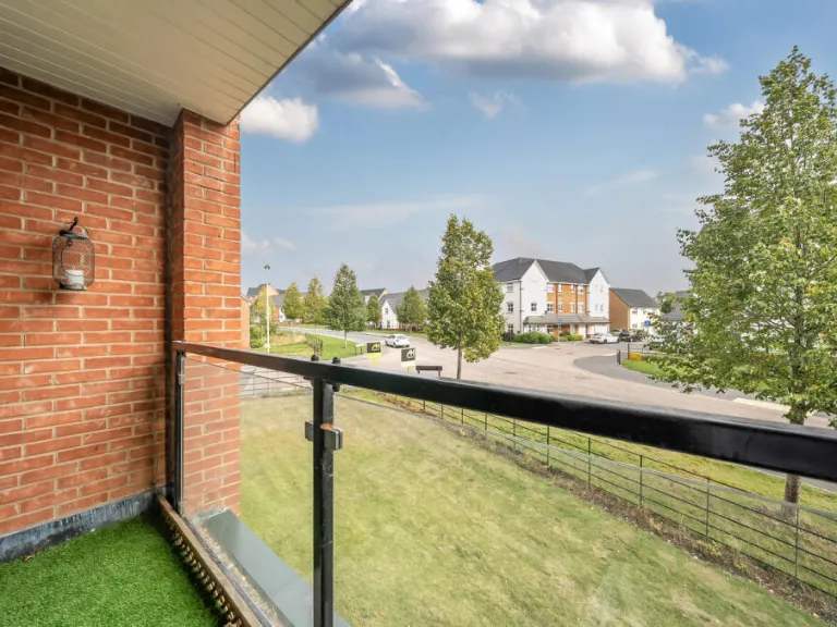
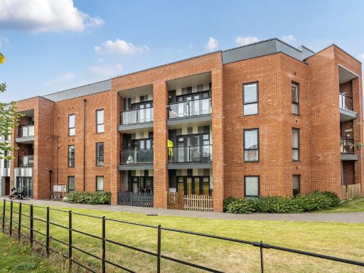
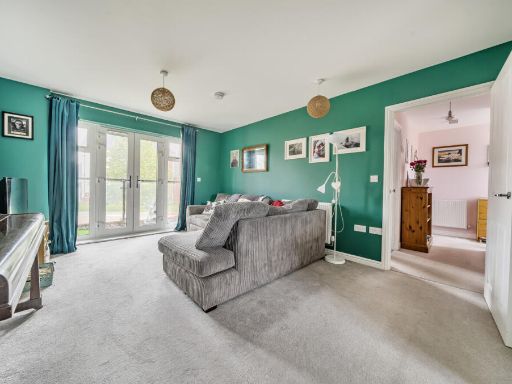
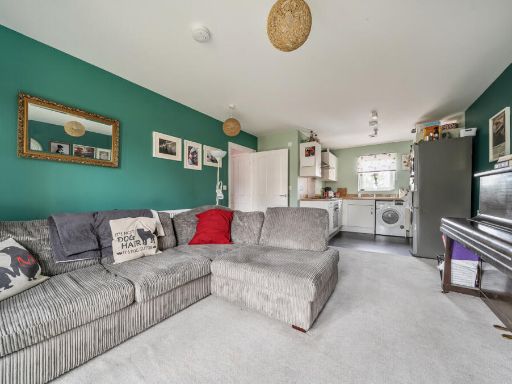
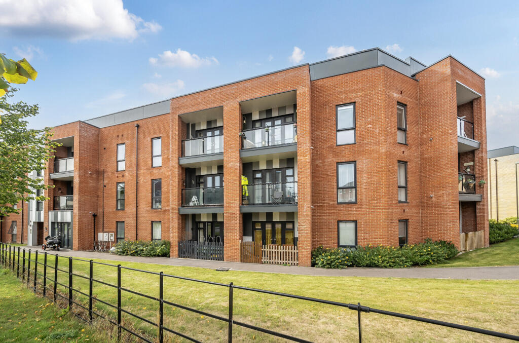
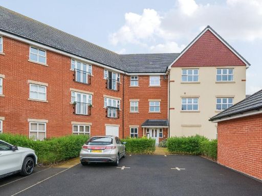
- apartment building Contemporary
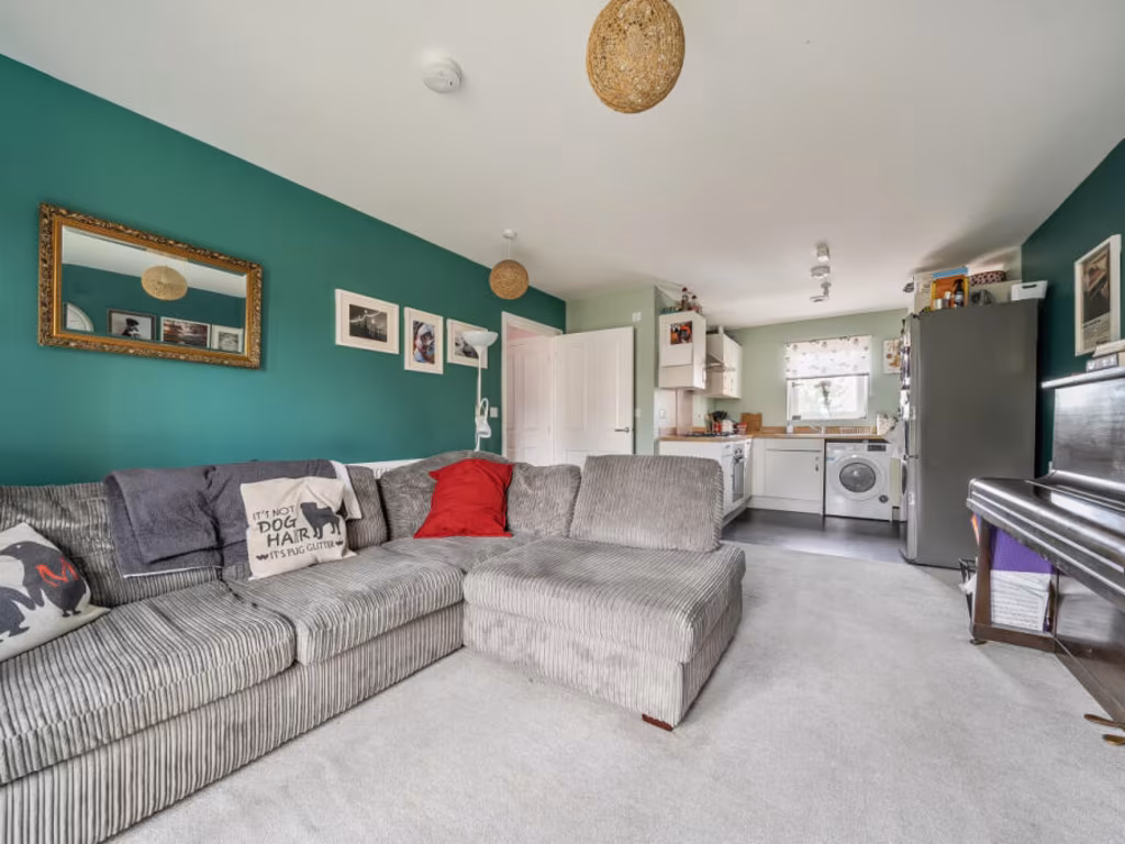
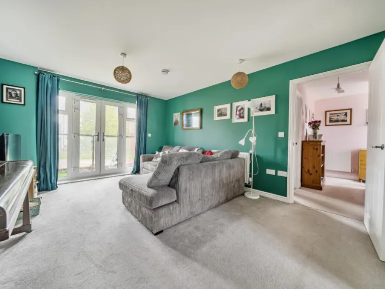
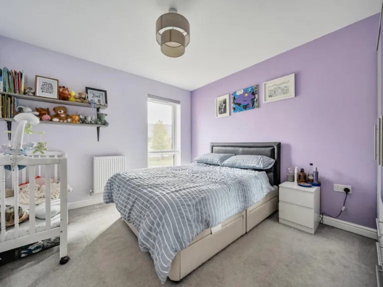
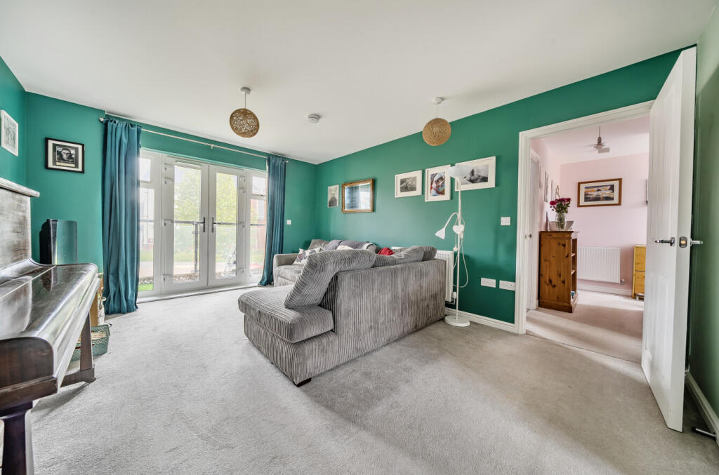
- living room contemporary
Floorplan Description
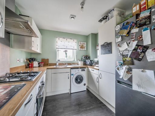
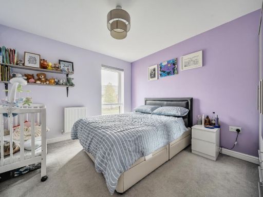
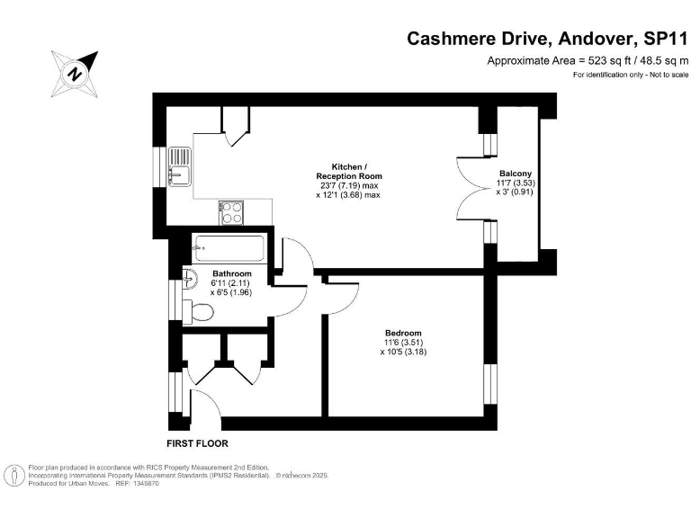
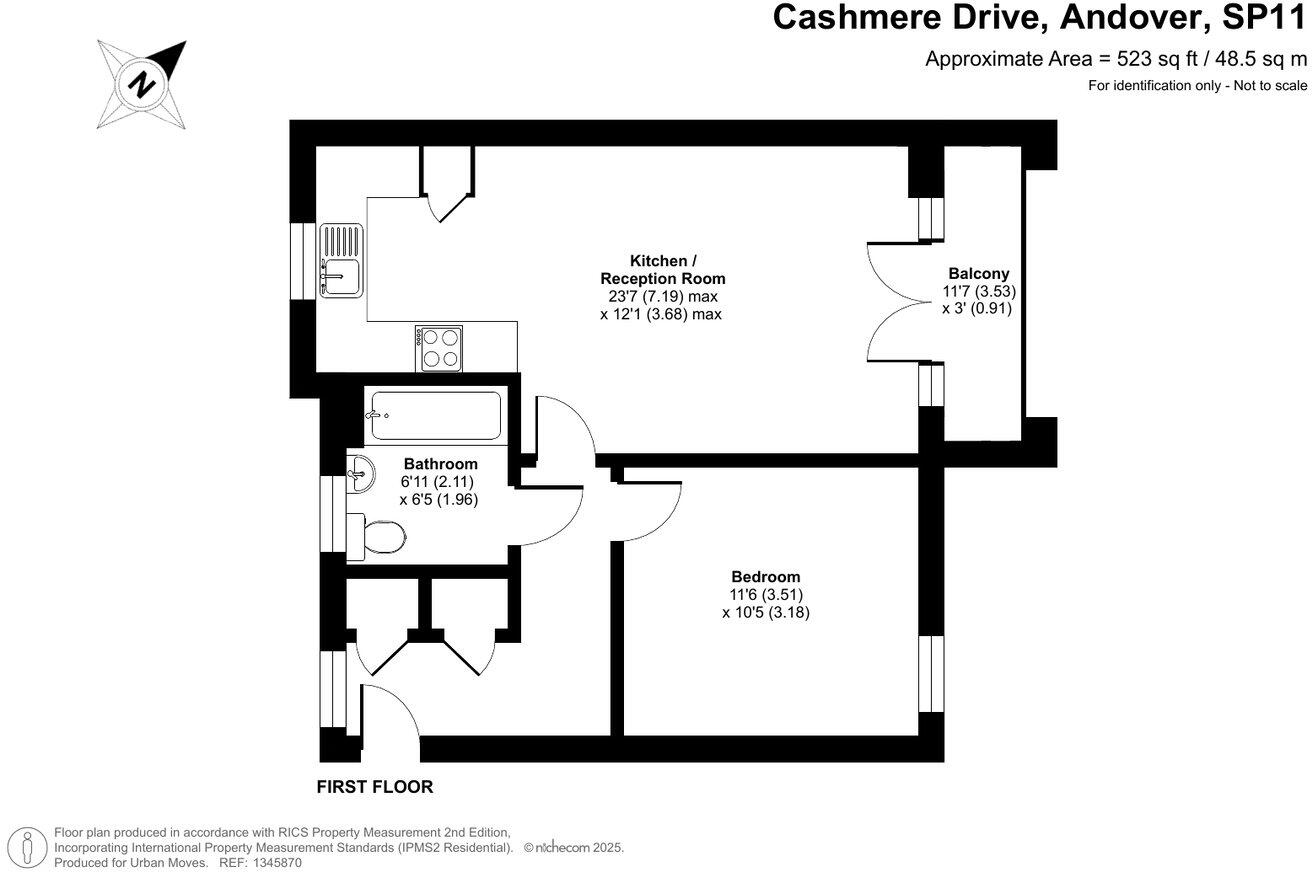
- Apartment with kitchen/reception room, bedroom and bathroom (balcony excluded).
Rooms
- Kitchen / Reception Room:
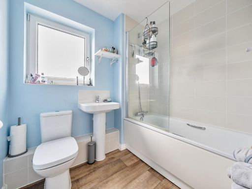
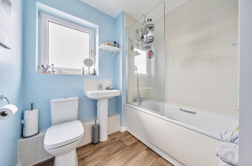
- Bathroom:
- Bedroom:
Textual Property Features
- Is Shared Ownership
- Success
Detected Visual Features
- contemporary
- modern
- apartment
- brick
- balcony
- communal area
- residential
- urban
- low-rise
- living room
- French doors
- garden access
- neutral decor
- natural light
EPC Details
- High performance glazing
- Average thermal transmittance 0.28 W/m-¦K
- Boiler and radiators, mains gas
- Low energy lighting in all fixed outlets
- (other premises below)
Nearby Schools
- Wherwell Primary School
- Anton Junior School
- Balksbury Junior School
- Vigo Primary School
- Knights Enham Nursery and Infant School
- Knight's Enham Junior School
- Farleigh School
- John Hanson Community School
- Rookwood School
- Andover Church of England Primary School
- Portway Junior School
- Harrow Way Community School
- St Mary Bourne Primary School
- Clatford Church of England Primary School
- Longparish Church of England Primary School
- Anton Infant School
- Balksbury Infant School
- Pilgrims' Cross CofE Aided Primary School
- Roman Way Primary School
- Hurstbourne Tarrant Church of England Primary School
- St John the Baptist Catholic Primary School, Andover
- Winton Community Academy
- Portway Infant School
- Endeavour Primary School
- Smannell and Enham Church of England (Aided) Primary School
Nearest Bars And Restaurants
- Id: 6818183066
- Tags:
- Amenity: fast_food
- Cuisine: pizza
- Drive_through: no
- Name: Pizza Time
- TagsNormalized:
- Lat: 51.2280923
- Lon: -1.4663491
- FullGeoHash: gcngqtu1r8dc
- PartitionGeoHash: gcng
- Images:
- FoodStandards: null
- Distance: 1095.2
,- Id: 6818183067
- Tags:
- Amenity: fast_food
- Cuisine: fish_and_chips
- Drive_through: no
- Name: Smart Fish Bar
- TagsNormalized:
- Lat: 51.2278521
- Lon: -1.4660228
- FullGeoHash: gcngqtsrz5y0
- PartitionGeoHash: gcng
- Images:
- FoodStandards: null
- Distance: 1060.1
,- Id: 802124504
- Tags:
- Amenity: cafe
- Brand: Starbucks
- Brand:wikidata: Q37158
- Brand:wikipedia: en:Starbucks
- Building: yes
- Cuisine: coffee_shop
- Name: Starbucks
- Official_name: Starbucks Coffee
- Takeaway: yes
- TagsNormalized:
- cafe
- starbucks
- coffee
- takeaway
- Lat: 51.2119456
- Lon: -1.4555884
- FullGeoHash: gcngqfu54qdd
- PartitionGeoHash: gcng
- Images:
- FoodStandards: null
- Distance: 993.1
,- Id: 802124503
- Tags:
- Amenity: fast_food
- Brand: Greggs
- Brand:wikidata: Q3403981
- Brand:wikipedia: en:Greggs
- Building: yes
- Cuisine: sandwich;bakery
- Name: Greggs
- Takeaway: yes
- TagsNormalized:
- fast food
- food
- greggs
- sandwich
- bakery
- takeaway
- Lat: 51.2121992
- Lon: -1.4551199
- FullGeoHash: gcngqfuktjzg
- PartitionGeoHash: gcng
- Images:
- FoodStandards: null
- Distance: 965.5
,- Id: 1891790061
- Tags:
- Amenity: pub
- Name: The Swallow
- TagsNormalized:
- Lat: 51.217188
- Lon: -1.4624392
- FullGeoHash: gcngqez1dxy7
- PartitionGeoHash: gcng
- Images:
- FoodStandards: null
- Distance: 626.2
}
Nearest General Shops
- Id: 1864888436
- Tags:
- Name: Coop Local
- Shop: supermarket
- Toilets:
- Wheelchair: yes
- TagsNormalized:
- Lat: 51.2099151
- Lon: -1.4599349
- FullGeoHash: gcngqf2zmh1d
- PartitionGeoHash: gcng
- Images:
- FoodStandards: null
- Distance: 1254.9
,- Id: 585450050
- Tags:
- Addr:
- City: Andover
- Postcode: SP11 6LQ
- Building: yes
- Name: Harewood Garage
- Opening_hours: Mo-Sa 08:00-18:00
- Payment:
- Cash: yes
- Credit_cards: yes
- Debit_cards: yes
- Service:
- Vehicle:
- Car_repair: yes
- Used_car_sales: yes
- Shop: car_repair
- TagsNormalized:
- garage
- car repair
- repair
- shop
- Lat: 51.2115424
- Lon: -1.4502585
- FullGeoHash: gcngqfzbye2v
- PartitionGeoHash: gcng
- Images:
- FoodStandards: null
- Distance: 1103.6
,- Id: 101312496
- Tags:
- Building: industrial
- Name: Le Creuset
- Operator: Le Creuset
- Shop: cookshop
- TagsNormalized:
- Lat: 51.2139137
- Lon: -1.4489865
- FullGeoHash: gcngr50ysjmr
- PartitionGeoHash: gcng
- Images:
- FoodStandards: null
- Distance: 902.5
}
Nearest Grocery shops
- Id: 4368489192
- Tags:
- Brand: McColl's
- Brand:wikidata: Q16997477
- Brand:wikipedia: en:McColl's
- Contact:
- Website: https://www.mccolls.co.uk/storelocator/andover-athol-court/
- Name: McColl's
- Shop: convenience
- TagsNormalized:
- Lat: 51.2222313
- Lon: -1.4801853
- FullGeoHash: gcngqkdpj5vz
- PartitionGeoHash: gcng
- Images:
- FoodStandards: null
- Distance: 1715.6
,- Id: 6818183065
- Tags:
- Brand: The Co-operative Food
- Brand:wikidata: Q3277439
- Brand:wikipedia: en:Co-op Food
- Name: The Co-operative Food
- Shop: convenience
- TagsNormalized:
- the co-operative food
- food
- convenience
- shop
- Lat: 51.2281875
- Lon: -1.4666004
- FullGeoHash: gcngqtu1cdr3
- PartitionGeoHash: gcng
- Images:
- FoodStandards: null
- Distance: 1114.8
,- Id: 263657849
- Tags:
- Brand: Tesco Express
- Brand:wikidata: Q98456772
- Building: yes
- Contact:
- Website: https://www.tesco.com/store-locator/andover/compton-square
- Name: Tesco Express
- Shop: convenience
- TagsNormalized:
- tesco
- tesco express
- convenience
- shop
- Lat: 51.2221131
- Lon: -1.4707239
- FullGeoHash: gcngqs9n3tuy
- PartitionGeoHash: gcng
- Images:
- FoodStandards: null
- Distance: 1059.1
}
Nearest Religious buildings
- Id: 809969912
- Tags:
- Amenity: place_of_worship
- Building: church
- Denomination: anglican
- Name: Christ Church
- Religion: christian
- Wikidata: Q26529794
- TagsNormalized:
- place of worship
- church
- anglican
- christian
- Lat: 51.2383031
- Lon: -1.4566611
- FullGeoHash: gcngqzek9rfz
- PartitionGeoHash: gcng
- Images:
- FoodStandards: null
- Distance: 1939.1
,- Id: 152932817
- Tags:
- Addr:
- City: Andover
- Housename: Kingdom Hall
- Postcode: SP10 1DX
- Street: River Way
- Amenity: place_of_worship
- Building: yes
- Contact:
- Denomination: jehovahs_witness
- Name: Kingdom Hall of Jehovah's Witnesses
- Religion: christian
- TagsNormalized:
- place of worship
- jehovah
- jehovahs witness
- christian
- church
- Lat: 51.2179278
- Lon: -1.4753855
- FullGeoHash: gcngq7vwj1bb
- PartitionGeoHash: gcng
- Images:
- FoodStandards: null
- Distance: 1413.4
,- Id: 257153873
- Tags:
- Amenity: place_of_worship
- Building: church
- Denomination: anglican
- Name: St Paul Church Centre
- Religion: christian
- Wikidata: Q105104431
- TagsNormalized:
- place of worship
- church
- anglican
- paul
- christian
- Lat: 51.2219789
- Lon: -1.4747538
- FullGeoHash: gcngqkwjeszv
- PartitionGeoHash: gcng
- Images:
- FoodStandards: null
- Distance: 1336.4
}
Nearest Medical buildings
- Id: 314422062
- Tags:
- Addr:
- City: Andover
- Housename: Adelaide Medical Centre
- Postcode: SP10 1HA
- Street: Adelaide Road
- Amenity: doctors
- Building: hospital
- Name: Adelaide Medical Centre
- Opening_hours: Mo-Th 08:30-18:00, Fr 08:30-12:30, Fr 13:30-18:00
- Phone: +44 1264 351144
- Source: Local knowledge, website
- Website: http://www.adelaidemedicalcentre.co.uk/
- Wheelchair: yes
- TagsNormalized:
- Lat: 51.2085798
- Lon: -1.4752544
- FullGeoHash: gcngq6jz854t
- PartitionGeoHash: gcng
- Images:
- FoodStandards: null
- Distance: 1932.6
,- Id: 5127097212
- Tags:
- Addr:
- City: Andover
- Housenumber: 6
- Postcode: SP10 2PH
- Street: London Road
- Amenity: veterinary
- Name: Strathmore Veterinary Clinic
- Wheelchair: limited
- TagsNormalized:
- Lat: 51.2068037
- Lon: -1.471482
- FullGeoHash: gcngq9bmrbp6
- PartitionGeoHash: gcng
- Images:
- FoodStandards: null
- Distance: 1914.5
,- Id: 9925927824
- Tags:
- Addr:
- City: Andover
- Postcode: SP10 1UZ
- Street: River Way
- Amenity: pharmacy
- Dispensing: yes
- Healthcare: pharmacy
- Name: Tesco Pharmacy
- Opening_hours: Mo 08:00-22:30; Tu-Fr 06:30-22:30; Sa 06:30-22:00; Su 10:00-16:00
- Operator: Tesco
- TagsNormalized:
- pharmacy
- health
- healthcare
- tesco
- Lat: 51.2161586
- Lon: -1.4741521
- FullGeoHash: gcngq7we9zbw
- PartitionGeoHash: gcng
- Images:
- FoodStandards: null
- Distance: 1391.6
,- Id: 1886663461
- Tags:
- TagsNormalized:
- Lat: 51.2213
- Lon: -1.4704296
- FullGeoHash: gcngqs938w2h
- PartitionGeoHash: gcng
- Images:
- FoodStandards: null
- Distance: 1030.7
}
Nearest Leisure Facilities
- Id: 592339291
- Tags:
- TagsNormalized:
- Lat: 51.2240053
- Lon: -1.4648589
- FullGeoHash: gcngqtj36qdj
- PartitionGeoHash: gcng
- Images:
- FoodStandards: null
- Distance: 729.9
,- Id: 592339287
- Tags:
- TagsNormalized:
- Lat: 51.2266115
- Lon: -1.4602004
- FullGeoHash: gcngqv88wue8
- PartitionGeoHash: gcng
- Images:
- FoodStandards: null
- Distance: 712.3
,- Id: 435973596
- Tags:
- Leisure: pitch
- Sport: basketball
- TagsNormalized:
- pitch
- leisure
- basketball
- sports
- Lat: 51.2252177
- Lon: -1.4624888
- FullGeoHash: gcngqtr0989q
- PartitionGeoHash: gcng
- Images:
- FoodStandards: null
- Distance: 678.3
,- Id: 6466038
- Tags:
- Leisure: playground
- Type: multipolygon
- TagsNormalized:
- Lat: 51.2250434
- Lon: -1.4624379
- FullGeoHash: gcngqtppd8pq
- PartitionGeoHash: gcng
- Images:
- FoodStandards: null
- Distance: 662.2
,- Id: 8922731801
- Tags:
- TagsNormalized:
- Lat: 51.2243286
- Lon: -1.4562993
- FullGeoHash: gcngqv5e3fbw
- PartitionGeoHash: gcng
- Images:
- FoodStandards: null
- Distance: 386.6
}
Nearest Tourist attractions
- Id: 280323860
- Tags:
- Addr:
- City: Picket Piece
- Postcode: SP11 6LX
- Street: Walworth Road
- Name: Wyke Down Caravan & Camping Park
- Operator: Wyke Down Ltd
- Source: http://www.wykedown.co.uk/
- Tourism: caravan_site
- TagsNormalized:
- Lat: 51.2265323
- Lon: -1.4257103
- FullGeoHash: gcngrt9b4t9r
- PartitionGeoHash: gcng
- Images:
- FoodStandards: null
- Distance: 2177.5
,- Id: 727693368
- Tags:
- Name: Andover Museum of the Iron Age
- Tourism: museum
- Wikidata: Q85741612
- TagsNormalized:
- Lat: 51.2101259
- Lon: -1.4772992
- FullGeoHash: gcngq6s287mg
- PartitionGeoHash: gcng
- Images:
- FoodStandards: null
- Distance: 1924.5
,- Id: 2557264
- Tags:
- Name: Finkley Down Farm
- Tourism: zoo
- Type: multipolygon
- TagsNormalized:
- Lat: 51.2219688
- Lon: -1.4518838
- FullGeoHash: gcngquwv8ehc
- PartitionGeoHash: gcng
- Images:
- FoodStandards: null
- Distance: 288.8
}
Nearest Bus stations and stops
- Id: 10195765447
- Tags:
- Bus: yes
- Highway: bus_stop
- Public_transport: platform
- TagsNormalized:
- Lat: 51.2123398
- Lon: -1.442392
- FullGeoHash: gcngr4vttb4d
- PartitionGeoHash: gcng
- Images:
- FoodStandards: null
- Distance: 1324.1
,- Id: 10195765448
- Tags:
- Bus: yes
- Highway: bus_stop
- Public_transport: platform
- TagsNormalized:
- Lat: 51.2122726
- Lon: -1.4425047
- FullGeoHash: gcngr4vt55w9
- PartitionGeoHash: gcng
- Images:
- FoodStandards: null
- Distance: 1324
,- Id: 503416005
- Tags:
- Bus: yes
- Highway: bus_stop
- Name: Ox Drove
- Naptan:
- AtcoCode: 1900HA100697
- Bearing: W
- CommonName: Ox Drove
- Crossing: Ox Drove
- NaptanCode: hamatdpa
- Street: London Road
- Verified: no
- Public_transport: platform
- Source: naptan_import
- TagsNormalized:
- Lat: 51.2114654
- Lon: -1.4485801
- FullGeoHash: gcngr4c0mth6
- PartitionGeoHash: gcng
- Images:
- FoodStandards: null
- Distance: 1156.4
,- Id: 503416004
- Tags:
- Bus: yes
- Highway: bus_stop
- Name: Ox Drove
- Naptan:
- AtcoCode: 1900HA100696
- Bearing: E
- CommonName: Ox Drove
- Crossing: Ox Drove
- NaptanCode: hamatdpg
- Street: London Road
- Verified: no
- Public_transport: platform
- Source: naptan_import
- TagsNormalized:
- Lat: 51.211573
- Lon: -1.44856
- FullGeoHash: gcngr4c1n15k
- PartitionGeoHash: gcng
- Images:
- FoodStandards: null
- Distance: 1146.2
,- Id: 503415995
- Tags:
- Bus: yes
- Highway: bus_stop
- Name: Walworth Est (pharmasol)
- Naptan:
- AtcoCode: 1900HA100692
- Bearing: W
- CommonName: Walworth Est (pharmasol)
- Crossing: Kingsway
- NaptanCode: hamatapg
- PlusbusZoneRef: ANDOVER
- Street: North Way
- Verified: no
- Public_transport: platform
- Source: naptan_import
- TagsNormalized:
- Lat: 51.2211819
- Lon: -1.4461174
- FullGeoHash: gcngrhdcp02e
- PartitionGeoHash: gcng
- Images:
- FoodStandards: null
- Distance: 664.4
}
Nearest Hotels
- Id: 492400037
- Tags:
- Addr:
- City: Andover
- Postcode: SP10 1PD
- Street: High Street
- Name: Star and Garter Hotel
- Operator: citylodge
- Toilets:
- Tourism: hotel
- Url: http://citylodge.co.uk/andover/contact/
- Wheelchair: yes
- Wikidata: Q17535455
- TagsNormalized:
- Lat: 51.2065235
- Lon: -1.4787371
- FullGeoHash: gcngq3g5wgvd
- PartitionGeoHash: gcng
- Images:
- FoodStandards: null
- Distance: 2265.9
,- Id: 101377153
- Tags:
- Amenity: parking
- Name: Star and Garter Hotel Car Park
- Parking: surface
- TagsNormalized:
- Lat: 51.2066032
- Lon: -1.4783777
- FullGeoHash: gcngq3gkp69w
- PartitionGeoHash: gcng
- Images:
- FoodStandards: null
- Distance: 2241.9
,- Id: 4423448305
- Tags:
- Addr:
- City: Andover
- Postcode: SP11 6LA
- Street: Micheldever Road
- Brand: Best Western
- Brand:wikidata: Q830334
- Brand:wikipedia: en:Best Western
- Internet_access: wlan
- Internet_access:fee: no
- Name: Best Western Andover Hotel
- Note: Previously "Quality Hotel, Andover"
- Operator: Best Western
- Phone: +44 333 0032 399
- Tourism: hotel
- Website: https://www.bestwestern.co.uk/hotels/best-western-andover-hotel-84223
- TagsNormalized:
- Lat: 51.2045704
- Lon: -1.465084
- FullGeoHash: gcngq9t0jpf0
- PartitionGeoHash: gcng
- Images:
- FoodStandards: null
- Distance: 1928.7
}
Tags
- contemporary
- modern
- apartment
- brick
- balcony
- communal area
- residential
- urban
- low-rise
- contemporary
- living room
- French doors
- garden access
- modern
- neutral decor
- natural light
Local Market Stats
- Average Price/sqft: £323
- Avg Income: £59100
- Rental Yield: 3.9%
- Social Housing: 10%
- Planning Success Rate: 94%
Similar Properties
 1 bedroom flat for sale in Draper Close, Andover, SP11 6YR, SP11 — £165,000 • 1 bed • 1 bath • 634 ft²
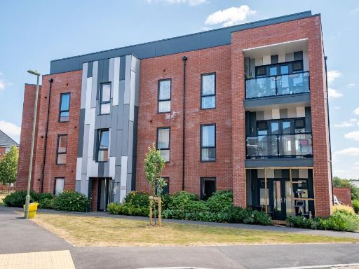 1 bedroom flat for sale in Cashmere Drive, Andover, SP11 6ZR, SP11 — £159,999 • 1 bed • 1 bath • 538 ft²
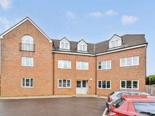 1 bedroom apartment for sale in Weyhill Road, Andover, SP10 3NN, SP10 — £170,000 • 1 bed • 1 bath • 682 ft²
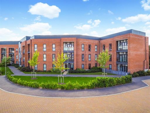 2 bedroom apartment for sale in Brocade Road, Andover, SP11 — £225,000 • 2 bed • 2 bath • 730 ft²
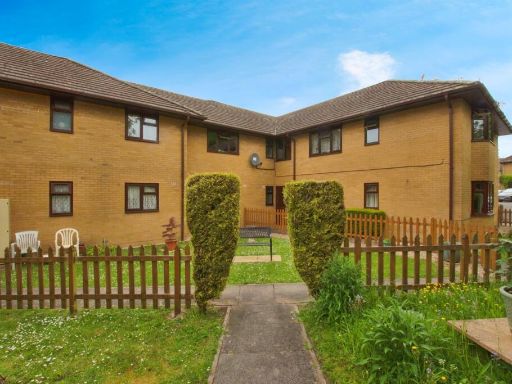 1 bedroom flat for sale in Micheldever Road, Andover, SP10 — £135,000 • 1 bed • 1 bath • 351 ft²
 2 bedroom flat for sale in Harebell Road, Andover, SP11 6ZA, SP11 — £175,000 • 2 bed • 1 bath • 730 ft²
Meta
- {
"@context": "https://schema.org",
"@type": "Residence",
"name": "1 bedroom flat for sale in Cashmere Drive, Andover, SP11",
"description": "",
"url": "https://propertypiper.co.uk/property/f7ca9514-b0eb-4879-bbc9-5a8882967a2d",
"image": "https://image-a.propertypiper.co.uk/5d8c8e1f-31a5-4ee9-a263-4b3218d0e2db-1024.jpeg",
"address": {
"@type": "PostalAddress",
"streetAddress": "Cashmere Drive, Andover, SP11",
"postalCode": "SP11 6ZR",
"addressLocality": "Test Valley",
"addressRegion": "North West Hampshire",
"addressCountry": "England"
},
"geo": {
"@type": "GeoCoordinates",
"latitude": 51.22087632321761,
"longitude": -1.4556455554575007
},
"numberOfRooms": 1,
"numberOfBathroomsTotal": 1,
"floorSize": {
"@type": "QuantitativeValue",
"value": 523,
"unitCode": "FTK"
},
"offers": {
"@type": "Offer",
"price": 172500,
"priceCurrency": "GBP",
"availability": "https://schema.org/InStock"
},
"additionalProperty": [
{
"@type": "PropertyValue",
"name": "Feature",
"value": "contemporary"
},
{
"@type": "PropertyValue",
"name": "Feature",
"value": "modern"
},
{
"@type": "PropertyValue",
"name": "Feature",
"value": "apartment"
},
{
"@type": "PropertyValue",
"name": "Feature",
"value": "brick"
},
{
"@type": "PropertyValue",
"name": "Feature",
"value": "balcony"
},
{
"@type": "PropertyValue",
"name": "Feature",
"value": "communal area"
},
{
"@type": "PropertyValue",
"name": "Feature",
"value": "residential"
},
{
"@type": "PropertyValue",
"name": "Feature",
"value": "urban"
},
{
"@type": "PropertyValue",
"name": "Feature",
"value": "low-rise"
},
{
"@type": "PropertyValue",
"name": "Feature",
"value": "contemporary"
},
{
"@type": "PropertyValue",
"name": "Feature",
"value": "living room"
},
{
"@type": "PropertyValue",
"name": "Feature",
"value": "French doors"
},
{
"@type": "PropertyValue",
"name": "Feature",
"value": "garden access"
},
{
"@type": "PropertyValue",
"name": "Feature",
"value": "modern"
},
{
"@type": "PropertyValue",
"name": "Feature",
"value": "neutral decor"
},
{
"@type": "PropertyValue",
"name": "Feature",
"value": "natural light"
}
]
}
High Res Floorplan Images
Compatible Floorplan Images
FloorplanImages Thumbnail