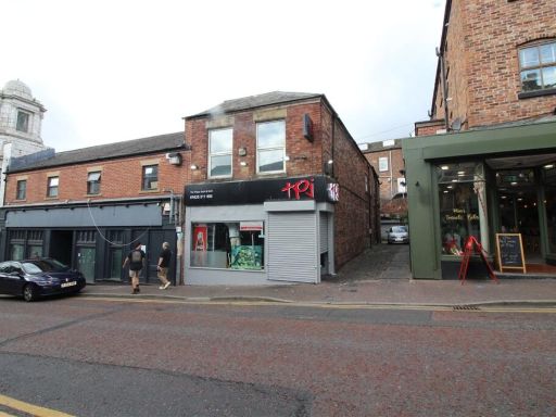
SK11 7NN - High street retail property for sale in Mill Lane, Macclesf…
View on Property Piper
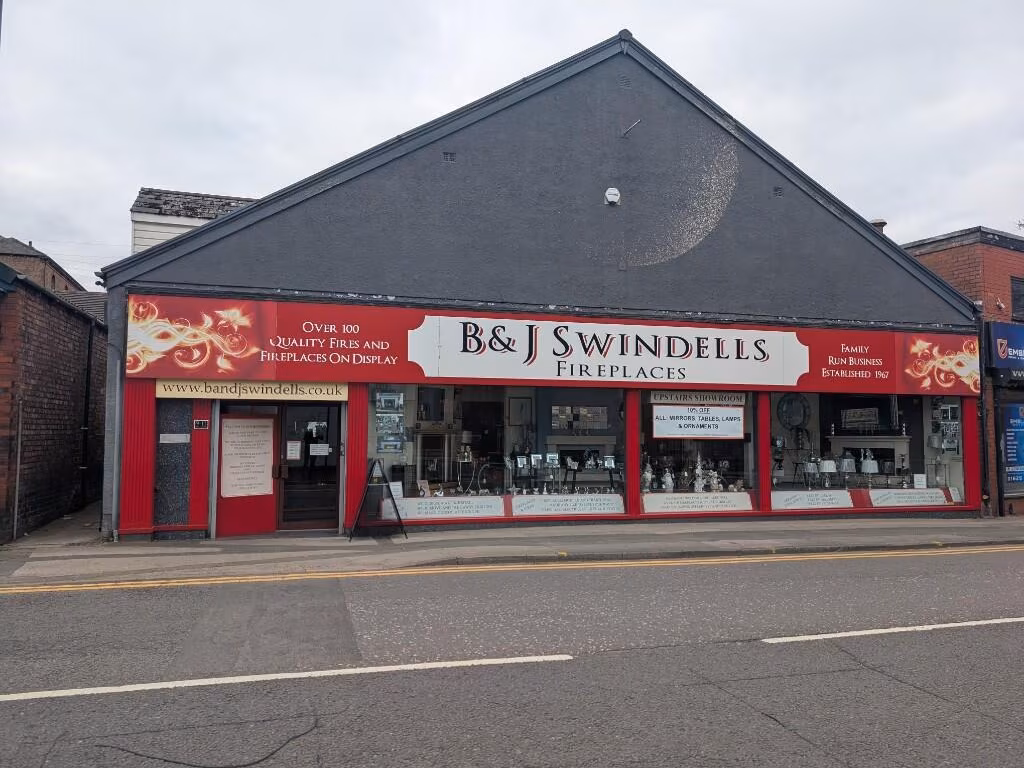
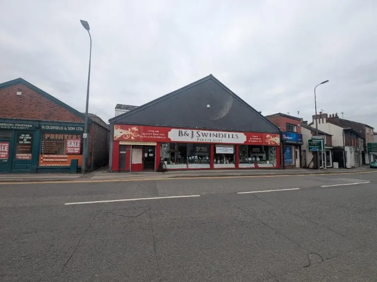
High street retail property for sale in Mill Lane, Macclesfield, Cheshire, SK11
Property Details
- Price: £370000
- Bedrooms: 1
- Bathrooms: 1
- Property Type: undefined
- Property SubType: undefined
Image Descriptions
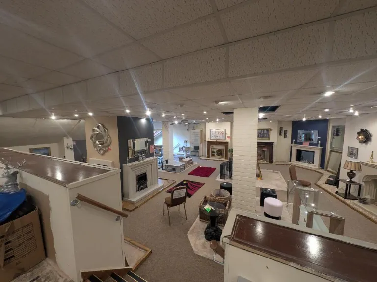
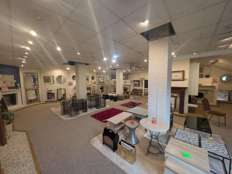
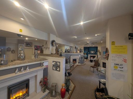
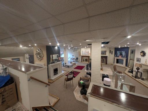
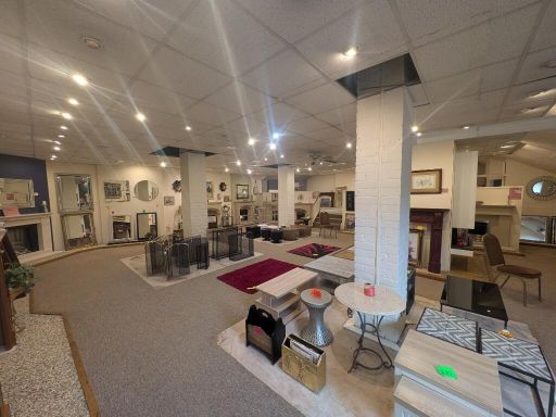
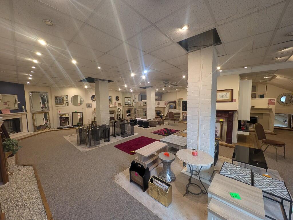
- retail store commercial
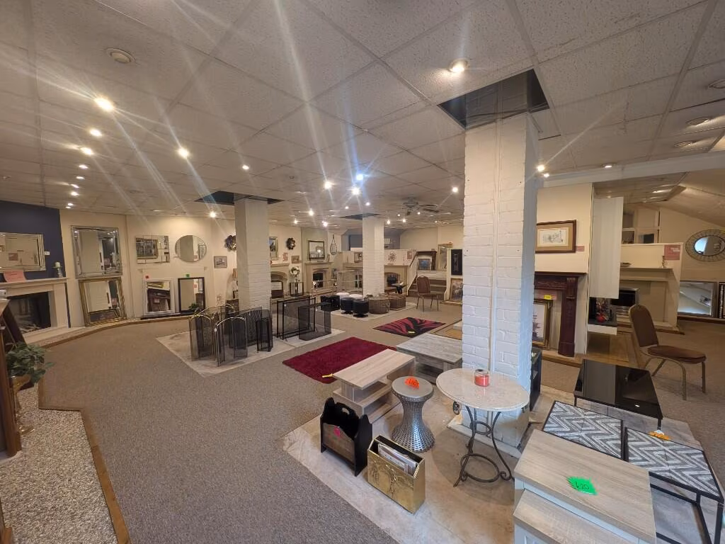
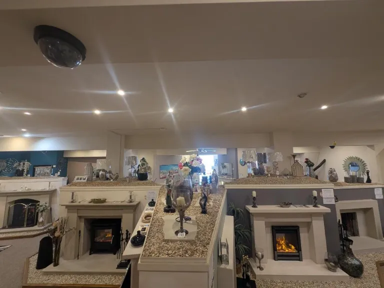
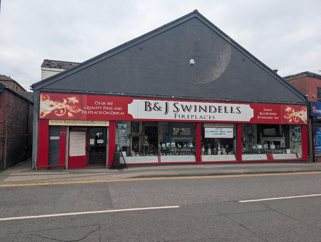
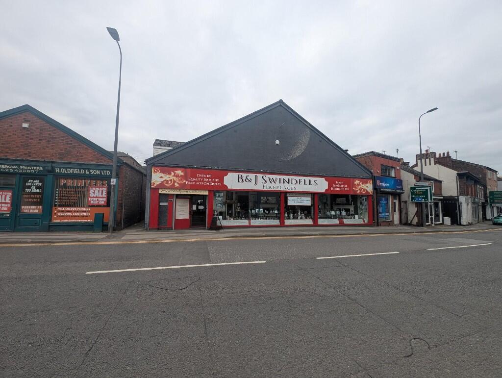
- commercial property modern industrial
Textual Property Features
Detected Visual Features
- commercial property
- retail store
- fireplace store
- triangular roof
- shop front
- urban location
- industrial style
- large space
- potential redevelopment
- main road
- high ceiling
- storefront
- renovation needed
- exterior wear
- industrial building
Nearby Schools
- Bosley St Mary's CofE Primary School
- Hollinhey Primary School
- Ash Grove Academy
- The Macclesfield Academy
- The King's School In Macclesfield
- Gawsworth Primary School
- Christ The King Catholic and Church of England Primary School
- Ivy Bank Primary School
- All Hallows Catholic College
- Hurdsfield Community Primary School
- Bollinbrook CofE (A) Primary School
- Upton Priory School
- Bollington Cross CofE Primary School
- Prestbury CofE Primary School
- St John the Evangelist CofE Primary School Macclesfield
- Broken Cross Primary Academy and Nursery
- Whirley Primary School
- Tytherington School
- Beech Hall School
- The Fallibroome Academy
- Marlborough Primary School
- Rainow Primary School
- Bollington St John's CofE Primary School
- Adlington Primary School
- The Fermain Academy
- Parkroyal Community School
- Puss Bank School and Nursery
- St Alban's Catholic Primary School, A Voluntary Academy
- Dean Valley Community Primary School
Nearest General Shops
- Id: 9067287527
- Tags:
- Name: Hair by Felix
- Shop: beauty
- TagsNormalized:
- Lat: 53.2570343
- Lon: -2.1259982
- FullGeoHash: gcqqzx5uswub
- PartitionGeoHash: gcqq
- Images:
- FoodStandards: null
- Distance: 100.8
,- Id: 2450231396
- Tags:
- Name: Days Ironmongers
- Shop: doityourself
- TagsNormalized:
- Lat: 53.257804
- Lon: -2.125377
- FullGeoHash: gcqqzxk35nhp
- PartitionGeoHash: gcqq
- Images:
- FoodStandards: null
- Distance: 63.3
,- Id: 5732719532
- Tags:
- Addr:
- City: Macclesfield
- Housename: Wood Street Mill
- Postcode: SK11 6JQ
- Street: Pickford Street
- Name: Peak Cyclesport
- Service:
- Shop: bicycle
- TagsNormalized:
- Lat: 53.2576075
- Lon: -2.1241653
- FullGeoHash: gcqqzxm0p3ee
- PartitionGeoHash: gcqq
- Images:
- FoodStandards: null
- Distance: 36.9
}
Nearest Religious buildings
- Id: 250911340
- Tags:
- Addr:
- City: Macclesfield
- Postcode: SK10 1HW
- Street: Market Place
- Amenity: place_of_worship
- Building: yes
- Denomination: anglican
- Fhrs:
- Name: St Michael's
- Phone: +44 1625 421984
- Religion: christian
- Wikidata: Q7594772
- Wikipedia: en:St Michael's Church, Macclesfield
- TagsNormalized:
- place of worship
- anglican
- christian
- church
- Lat: 53.2602701
- Lon: -2.1244598
- FullGeoHash: gcqqzxtp83zy
- PartitionGeoHash: gcqq
- Images:
- FoodStandards: null
- Distance: 314.8
,- Id: 25414758
- Tags:
- Access: yes
- Amenity: parking
- Fee: yes
- Layer: -1
- Name: Churchill Way Car Park
- Parking: surface
- TagsNormalized:
- Lat: 53.2588186
- Lon: -2.12859
- FullGeoHash: gcqqzx6p0727
- PartitionGeoHash: gcqq
- Images:
- FoodStandards: null
- Distance: 303.9
,- Id: 542544123
- Tags:
- Amenity: place_of_worship
- Building: church
- Denomination: united_reformed
- Name: Macclesfield United Reformed Church
- Religion: christian
- Source: Bing
- Wikidata: Q6722942
- Wikipedia: en:Macclesfield United Reformed Church
- TagsNormalized:
- place of worship
- church
- united reformed
- christian
- Lat: 53.2568992
- Lon: -2.1241115
- FullGeoHash: gcqqzxj7bted
- PartitionGeoHash: gcqq
- Images:
- FoodStandards: null
- Distance: 69.9
}
Nearest Medical buildings
- Id: 2089278802
- Tags:
- Amenity: pharmacy
- Brand: Cohens Chemist
- Brand:wikidata: Q107998495
- Dispensing: yes
- Healthcare: pharmacy
- Name: Cohens Chemist
- TagsNormalized:
- pharmacy
- chemist
- cohens chemist
- health
- healthcare
- Lat: 53.2583784
- Lon: -2.1226056
- FullGeoHash: gcqqzxqke9qd
- PartitionGeoHash: gcqq
- Images:
- FoodStandards: null
- Distance: 171.1
,- Id: 4566945989
- Tags:
- Addr:
- Street: Sunderland Street
- Amenity: doctors
- Healthcare: doctor
- Name: Cumberland House Surgery
- Phone: +44 1625 428081
- TagsNormalized:
- doctor
- doctors
- health
- healthcare
- surgery
- Lat: 53.2585666
- Lon: -2.1232239
- FullGeoHash: gcqqzxmvtk3s
- PartitionGeoHash: gcqq
- Images:
- FoodStandards: null
- Distance: 156.8
,- Id: 387652267
- Tags:
- Addr:
- City: Macclesfield
- Postcode: SK11 6LL
- Street: Sunderland Street
- Amenity: clinic
- Building: yes
- Healthcare: clinic
- Name: Waters Green Medical Centre
- TagsNormalized:
- Lat: 53.2584538
- Lon: -2.1230991
- FullGeoHash: gcqqzxqhbpqe
- PartitionGeoHash: gcqq
- Images:
- FoodStandards: null
- Distance: 152.5
,- Id: 2089281314
- Tags:
- Amenity: pharmacy
- Brand: Lloyds Pharmacy
- Brand:wikidata: Q6662870
- Brand:wikipedia: en:LloydsPharmacy
- Dispensing: yes
- Healthcare: pharmacy
- Name: Lloyds Pharmacy
- TagsNormalized:
- pharmacy
- lloyds pharmacy
- health
- healthcare
- Lat: 53.2581072
- Lon: -2.1229355
- FullGeoHash: gcqqzxq4unb8
- PartitionGeoHash: gcqq
- Images:
- FoodStandards: null
- Distance: 135.7
}
Nearest Airports
- Id: 1224469
- Tags:
- Addr:
- City: Manchester
- Country: GB
- Postcode: M90 1QX
- Aerodrome: international
- Aeroway: aerodrome
- Arp: yes
- Atis: 128.175
- Iata: MAN
- Icao: EGCC
- Name: Manchester Airport
- Note: rough sketched outline referring to Yahoo imagery - true boundary is where?
- Old_name: Ringway
- Operator: Manchester Airport PLC
- Size: 18720000
- Source:
- Tower_frequency: 118.625,119.400
- Type: multipolygon
- Website: https://www.manchesterairport.co.uk/
- Wikidata: Q8694
- Wikipedia: en:Manchester Airport
- TagsNormalized:
- airport
- international airport
- Lat: 53.3503197
- Lon: -2.2798822
- FullGeoHash: gcqrs05u4ukt
- PartitionGeoHash: gcqr
- Images:
- FoodStandards: null
- Distance: 14596.6
}
Nearest Leisure Facilities
- Id: 5965620993
- Tags:
- TagsNormalized:
- Lat: 53.253503
- Lon: -2.1243115
- FullGeoHash: gcqqzwt05uqx
- PartitionGeoHash: gcqq
- Images:
- FoodStandards: null
- Distance: 438.4
,- Id: 630950260
- Tags:
- Leisure: park
- Name: St George's Park
- TagsNormalized:
- Lat: 53.2535966
- Lon: -2.1245165
- FullGeoHash: gcqqzwsbxjvt
- PartitionGeoHash: gcqq
- Images:
- FoodStandards: null
- Distance: 427.6
,- Id: 630208386
- Tags:
- Leisure: park
- Name: Sparrow Park
- TagsNormalized:
- Lat: 53.2603788
- Lon: -2.1238662
- FullGeoHash: gcqqzxv2nq4w
- PartitionGeoHash: gcqq
- Images:
- FoodStandards: null
- Distance: 330.8
,- Id: 542708590
- Tags:
- Leisure: park
- Name: Macclesfield Cenotaph
- Wikidata: Q15979168
- Wikipedia: en:Macclesfield Cenotaph
- TagsNormalized:
- Lat: 53.2559342
- Lon: -2.1224961
- FullGeoHash: gcqqzwyqq38j
- PartitionGeoHash: gcqq
- Images:
- FoodStandards: null
- Distance: 220.2
,- Id: 2088657502
- Tags:
- Addr:
- City: Macclesfield
- Street: Pickford Street
- Alt_name: Everlast Fitness Club
- Brand: Everlast Gyms
- Brand:wikidata: Q112947134
- Leisure: fitness_centre
- Name: Everlast Gyms
- Opening_hours: Mo-Th 06:30-22:30; Sa-Su 08:00-21:00
- Phone: +44 1625 410641
- TagsNormalized:
- fitness
- fitness centre
- leisure
- Lat: 53.2581048
- Lon: -2.1239289
- FullGeoHash: gcqqzxm6uy7c
- PartitionGeoHash: gcqq
- Images:
- FoodStandards: null
- Distance: 87.8
}
Nearest Tourist attractions
- Id: 237161817
- Tags:
- Building: yes
- Fee: no
- Name: Macclesfield Heritage Centre
- Source: Bing
- Tourism: museum
- TagsNormalized:
- Lat: 53.2580352
- Lon: -2.1276997
- FullGeoHash: gcqqzx6dt124
- PartitionGeoHash: gcqq
- Images:
- FoodStandards: null
- Distance: 213.7
,- Id: 542544049
- Tags:
- Addr:
- City: Macclesfield
- Postcode: SK11 6TJ
- Street: Park Lane
- Building: yes
- Contact:
- Phone: +44 1645 612045
- Website: https://macclesfieldmuseums.co.uk/
- Name: Paradise Mill
- Operator: Macclesfield Museums
- Source: Bing
- Tourism: museum
- TagsNormalized:
- Lat: 53.2557329
- Lon: -2.1246984
- FullGeoHash: gcqqzwuv4unj
- PartitionGeoHash: gcqq
- Images:
- FoodStandards: null
- Distance: 190
,- Id: 864949519
- Tags:
- Addr:
- City: Macclesfield
- Postcode: SK11 6TJ
- Street: Park Lane
- Building: yes
- Contact:
- Phone: +44 1645 612045
- Website: https://macclesfieldmuseums.co.uk/
- Name: Macclesfield Silk Museum
- Operator: Macclesfield Museums
- Source: Bing
- Tourism: museum
- Wikidata: Q29563155
- TagsNormalized:
- Lat: 53.2561575
- Lon: -2.124744
- FullGeoHash: gcqqzwuz9gk1
- PartitionGeoHash: gcqq
- Images:
- FoodStandards: null
- Distance: 142.9
}
Nearest Train stations
- Id: 7153892445
- Tags:
- Name: Poynton
- Naptan:
- Network: National Rail
- Public_transport: station
- Railway: station
- Ref:
- Wheelchair: limited
- Wikipedia: en:Poynton railway station
- TagsNormalized:
- Lat: 53.3505513
- Lon: -2.134793
- FullGeoHash: gcqrx2jmrxwf
- PartitionGeoHash: gcqr
- Images:
- FoodStandards: null
- Distance: 10375.3
,- Id: 446375378
- Tags:
- Name: Wilmslow
- Naptan:
- Network: National Rail
- Public_transport: station
- Railway: station
- Ref:
- Wikipedia: en:Wilmslow railway station
- TagsNormalized:
- Lat: 53.3270993
- Lon: -2.2260089
- FullGeoHash: gcqrm7ghf5z6
- PartitionGeoHash: gcqr
- Images:
- FoodStandards: null
- Distance: 10265.7
,- Id: 6408750145
- Tags:
- Name: Adlington (Cheshire)
- Naptan:
- Network: National Rail
- Public_transport: station
- Railway: station
- Ref:
- Wikidata: Q2780857
- Wikipedia: en:Adlington railway station (Cheshire)
- TagsNormalized:
- Lat: 53.3197238
- Lon: -2.1336443
- FullGeoHash: gcqrr6w3fkzm
- PartitionGeoHash: gcqr
- Images:
- FoodStandards: null
- Distance: 6951.3
,- Id: 6408750143
- Tags:
- Name: Prestbury
- Naptan:
- Network: National Rail
- Operator: Northern Rail
- Public_transport: station
- Railway: station
- Ref:
- Wikipedia: en:Prestbury railway station
- TagsNormalized:
- Lat: 53.2931107
- Lon: -2.1453161
- FullGeoHash: gcqrpjtyfebk
- PartitionGeoHash: gcqr
- Images:
- FoodStandards: null
- Distance: 4197.7
,- Id: 7154282782
- Tags:
- Addr:
- Postcode: SK11 6JP
- Street: Watersgreen
- Name: Macclesfield
- Naptan:
- Network: National Rail
- Old_name: Macclesfield Central
- Public_transport: station
- Railway: station
- Ref:
- Wikipedia: en:Macclesfield railway station
- TagsNormalized:
- Lat: 53.2593665
- Lon: -2.1219368
- FullGeoHash: gcqqzxwf7390
- PartitionGeoHash: gcqq
- Images:
- FoodStandards: null
- Distance: 279.8
}
Nearest Bus stations and stops
- Id: 9248209568
- Tags:
- Bus: yes
- Highway: bus_stop
- Name: Macclesfield Bus Station (Stand 9)
- Network: Cheshire East Public Transport
- Operator: Transport Service Solutions
- Public_transport: platform
- Ref: 9
- TagsNormalized:
- Lat: 53.2579385
- Lon: -2.1255065
- FullGeoHash: gcqqzxk3bp73
- PartitionGeoHash: gcqq
- Images:
- FoodStandards: null
- Distance: 79.7
,- Id: 9248209564
- Tags:
- Bus: yes
- Highway: bus_stop
- Name: Macclesfield Bus Station (Stand 5)
- Network: Cheshire East Public Transport
- Operator: Transport Service Solutions
- Public_transport: platform
- Ref: 5
- TagsNormalized:
- Lat: 53.2581157
- Lon: -2.1250333
- FullGeoHash: gcqqzxke50k6
- PartitionGeoHash: gcqq
- Images:
- FoodStandards: null
- Distance: 79.4
,- Id: 9248209565
- Tags:
- Bus: yes
- Highway: bus_stop
- Name: Macclesfield Bus Station (Stand 6)
- Network: Cheshire East Public Transport
- Operator: Transport Service Solutions
- Public_transport: platform
- Ref: 6
- TagsNormalized:
- Lat: 53.2580561
- Lon: -2.1250698
- FullGeoHash: gcqqzxkddm1p
- PartitionGeoHash: gcqq
- Images:
- FoodStandards: null
- Distance: 74
,- Id: 9248209566
- Tags:
- Bus: yes
- Highway: bus_stop
- Name: Macclesfield Bus Station (Stand 7)
- Network: Cheshire East Public Transport
- Operator: Transport Service Solutions
- Public_transport: platform
- Ref: 7
- TagsNormalized:
- Lat: 53.2580069
- Lon: -2.1251451
- FullGeoHash: gcqqzxkd2s0c
- PartitionGeoHash: gcqq
- Images:
- FoodStandards: null
- Distance: 71.2
,- Id: 9248209567
- Tags:
- Bus: yes
- Highway: bus_stop
- Name: Macclesfield Bus Station (Stand 8)
- Network: Cheshire East Public Transport
- Operator: Transport Service Solutions
- Public_transport: platform
- Ref: 8
- TagsNormalized:
- Lat: 53.2579789
- Lon: -2.1252182
- FullGeoHash: gcqqzxk6nyf6
- PartitionGeoHash: gcqq
- Images:
- FoodStandards: null
- Distance: 71
}
Nearest Hotels
- Id: 198842247
- Tags:
- Addr:
- City: Macclesfield
- Housename: Castle House
- Postcode: SK11 6JS
- Street: Gas Road
- Brand: Travelodge
- Brand:wikidata: Q9361374
- Brand:wikipedia: en:Travelodge UK
- Building: yes
- Fhrs:
- Authority: Cheshire East
- Id: 1289525
- Local_authority_id: 38173
- Internet_access: wlan
- Internet_access:fee: customers
- Internet_access:ssid: Travelodge WiFi
- Name: Travelodge Hotel - Macclesfield Central
- Operator: Travelodge
- Tourism: hotel
- TagsNormalized:
- Lat: 53.2606029
- Lon: -2.1231457
- FullGeoHash: gcqqzxvcrpgz
- PartitionGeoHash: gcqq
- Images:
- FoodStandards: null
- Distance: 365.5
,- Id: 1239645045
- Tags:
- Addr:
- Housenumber: 40
- Postcode: SK10 1JH
- Street: Green Street
- Amenity: pub
- Fhrs:
- Name: The Baths Hotel
- Real_ale: yes
- Source:
- TagsNormalized:
- Lat: 53.2583322
- Lon: -2.1198106
- FullGeoHash: gcqqzz2kkbdw
- PartitionGeoHash: gcqq
- Images:
- FoodStandards: null
- Distance: 336.5
,- Id: 387652258
- Tags:
- Addr:
- City: Macclesfield
- Housenumber: 5
- Postcode: SK11 6JW
- Street: Albert Place
- Amenity: pub
- Building: yes
- Name: The Queens Hotel
- Phone: +44 1625 263522
- TagsNormalized:
- Lat: 53.2590066
- Lon: -2.1229599
- FullGeoHash: gcqqzxw05qqm
- PartitionGeoHash: gcqq
- Images:
- FoodStandards: null
- Distance: 207
}
Tags
- commercial property
- retail store
- fireplace store
- triangular roof
- shop front
- urban location
- commercial property
- industrial style
- large space
- potential redevelopment
- main road
- high ceiling
- storefront
- renovation needed
- exterior wear
- industrial building
Local Market Stats
- Average Price/sqft: £266
- Avg Income: £43700
- Rental Yield: 3.8%
- Social Housing: 5%
- Planning Success Rate: 88%
AirBnB Data
- 1km average: £100/night
- Listings in 1km: 9
Similar Properties
 Commercial property for sale in 89 Mill Street, Macclesfield SK11 6NN, SK11 — £155,000 • 1 bed • 1 bath • 2146 ft²
 High street retail property for sale in 64 Chestergate, Macclesfield, SK11 6DY, SK11 — £125,000 • 1 bed • 1 bath • 408 ft²
 High street retail property for sale in 33 Mill Street, Macclesfield, SK11 6NE, SK11 — £2,500,000 • 1 bed • 1 bath
 Commercial property for sale in Church Street, Macclesfield, SK11 — £220,000 • 1 bed • 4 bath • 1907 ft²
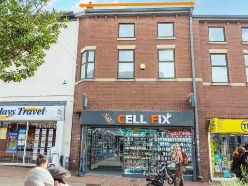 High street retail property for sale in 50 Mill Street, Macclesfield, Cheshire, SK11 6LT, SK11 — £250,000 • 1 bed • 1 bath • 3000 ft²
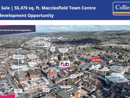 Commercial property for sale in The Hub Mill Street Macclesfield Cheshire SK11 6NE United Kingdom, SK11 — £2 • 1 bed • 1 bath
Meta
- {
"@context": "https://schema.org",
"@type": "Residence",
"name": "High street retail property for sale in Mill Lane, Macclesf…",
"description": "",
"url": "https://propertypiper.co.uk/property/f5f963d2-6edb-440e-b842-f56fcbdc778d",
"image": "https://image-a.propertypiper.co.uk/9427e09e-46ab-4b79-a9e3-9bd32c3479ff-1024.jpeg",
"address": {
"@type": "PostalAddress",
"streetAddress": "SILVERTOWN TAXIS, WOOD STREET",
"postalCode": "SK11 7NN",
"addressLocality": "Cheshire East",
"addressRegion": "Macclesfield",
"addressCountry": "England"
},
"geo": {
"@type": "GeoCoordinates",
"latitude": 53.25744090088615,
"longitude": -2.1246445215525407
},
"numberOfRooms": 1,
"numberOfBathroomsTotal": 1,
"floorSize": {
"@type": "QuantitativeValue",
"value": 4000,
"unitCode": "FTK"
},
"offers": {
"@type": "Offer",
"price": 370000,
"priceCurrency": "GBP",
"availability": "https://schema.org/InStock"
},
"additionalProperty": [
{
"@type": "PropertyValue",
"name": "Feature",
"value": "commercial property"
},
{
"@type": "PropertyValue",
"name": "Feature",
"value": "retail store"
},
{
"@type": "PropertyValue",
"name": "Feature",
"value": "fireplace store"
},
{
"@type": "PropertyValue",
"name": "Feature",
"value": "triangular roof"
},
{
"@type": "PropertyValue",
"name": "Feature",
"value": "shop front"
},
{
"@type": "PropertyValue",
"name": "Feature",
"value": "urban location"
},
{
"@type": "PropertyValue",
"name": "Feature",
"value": "commercial property"
},
{
"@type": "PropertyValue",
"name": "Feature",
"value": "industrial style"
},
{
"@type": "PropertyValue",
"name": "Feature",
"value": "large space"
},
{
"@type": "PropertyValue",
"name": "Feature",
"value": "potential redevelopment"
},
{
"@type": "PropertyValue",
"name": "Feature",
"value": "main road"
},
{
"@type": "PropertyValue",
"name": "Feature",
"value": "high ceiling"
},
{
"@type": "PropertyValue",
"name": "Feature",
"value": "storefront"
},
{
"@type": "PropertyValue",
"name": "Feature",
"value": "renovation needed"
},
{
"@type": "PropertyValue",
"name": "Feature",
"value": "exterior wear"
},
{
"@type": "PropertyValue",
"name": "Feature",
"value": "industrial building"
}
]
}