NR32 3NX - 2 bedroom terraced house for sale in Clarkson Road, Lowesto…
View on Property Piper
2 bedroom terraced house for sale in Clarkson Road, Lowestoft, NR32
Property Details
- Price: £190000
- Bedrooms: 2
- Bathrooms: 1
- Property Type: undefined
- Property SubType: undefined
Brochure Descriptions
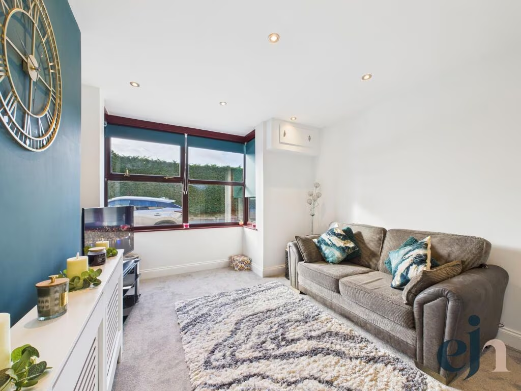
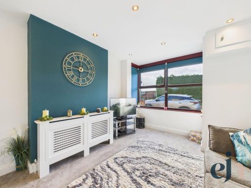
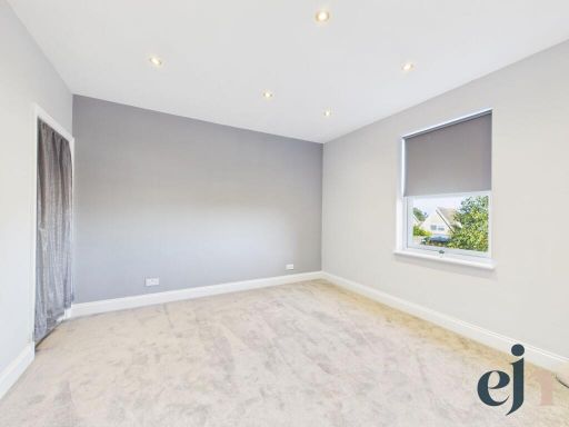
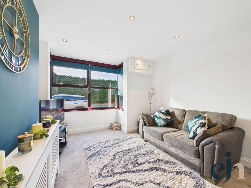
- Ground‑floor front reception room photographed as a well‑presented living area. The room features a deep bay window with large double‑glazed panes providing good natural light and views over a front driveway/parking area and mature hedging. Interior finish is modern and neutral: recessed ceiling downlights, contemporary painted accent wall, fitted radiator cover and light neutral carpet. The room appears compact to average in size and would suit use as a lounge or snug. Based on the visible frontage and driveway, the building is likely a semi‑detached or terraced family house with a small to average front garden/driveway. Overall presentation suggests a well maintained, mid‑sized residential property suitable for first‑time buyers or downsizers.
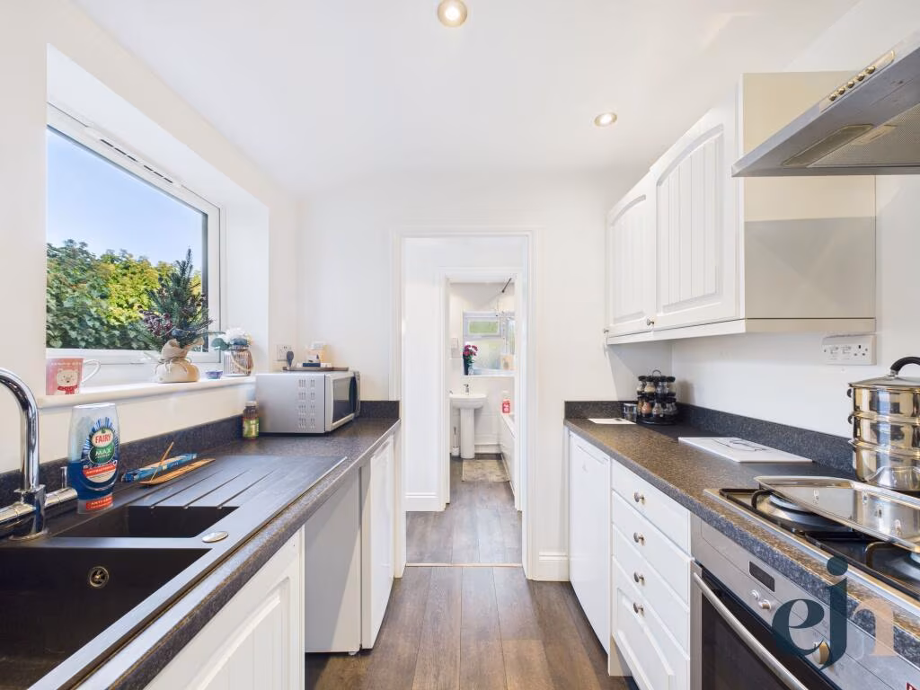
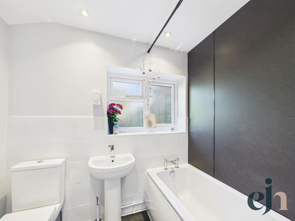
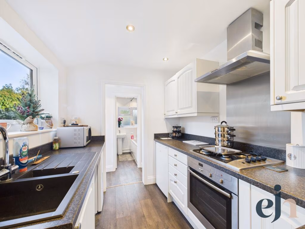
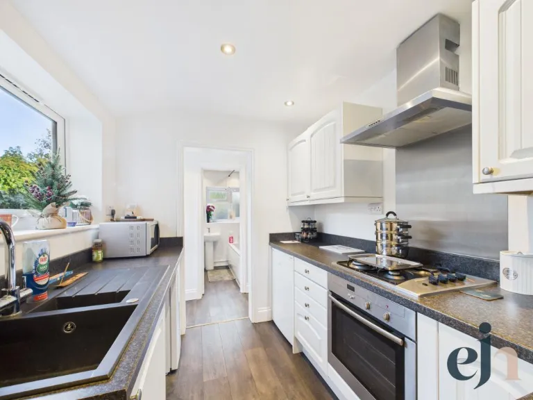
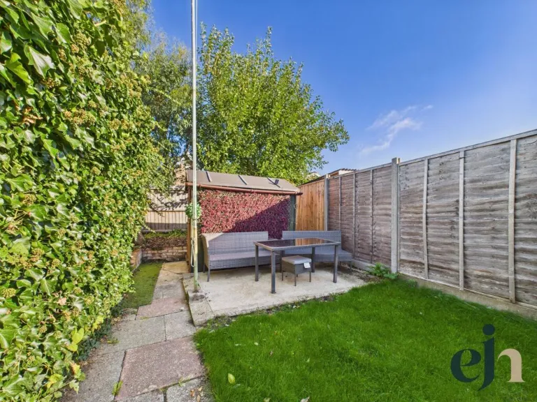
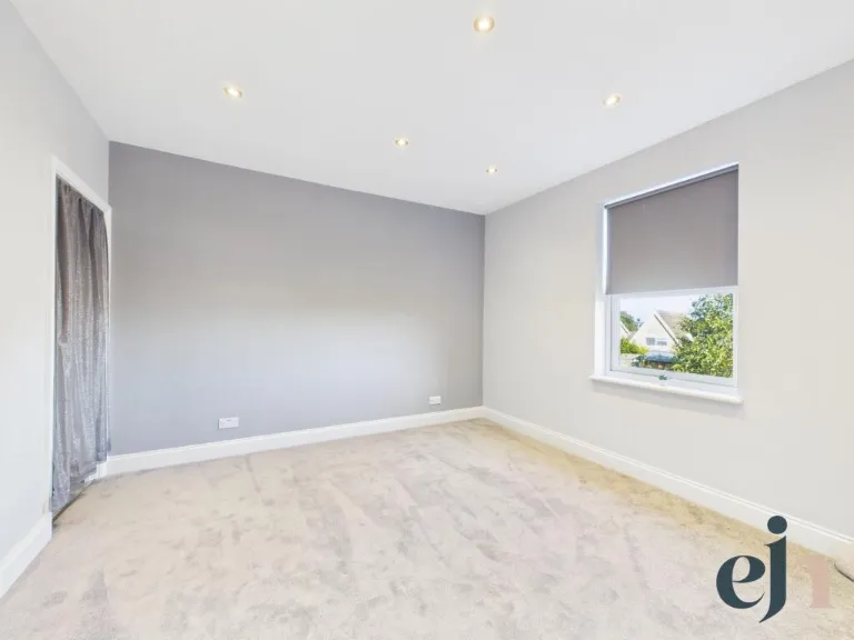
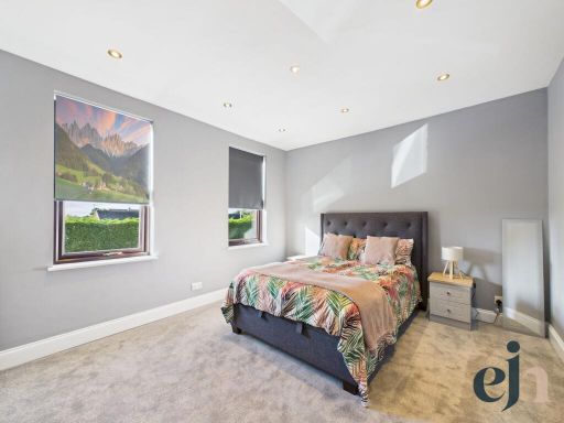
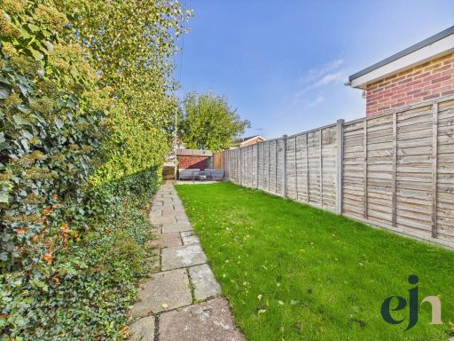
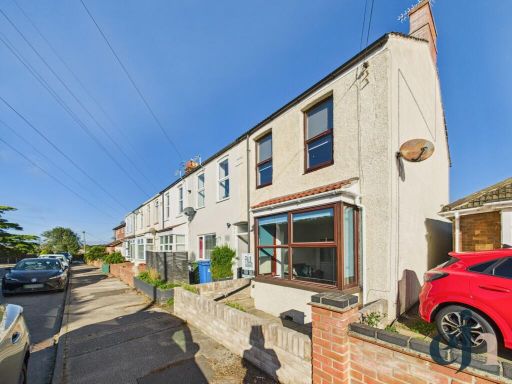
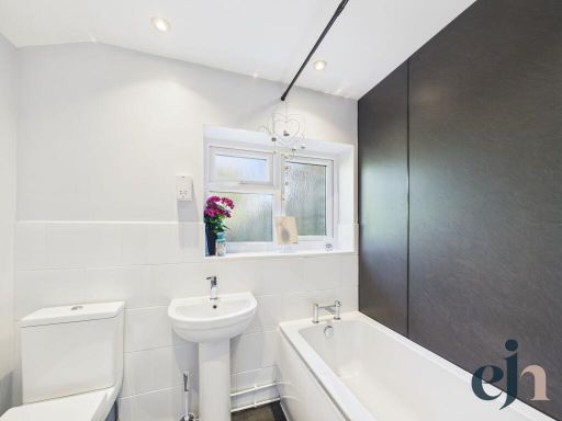
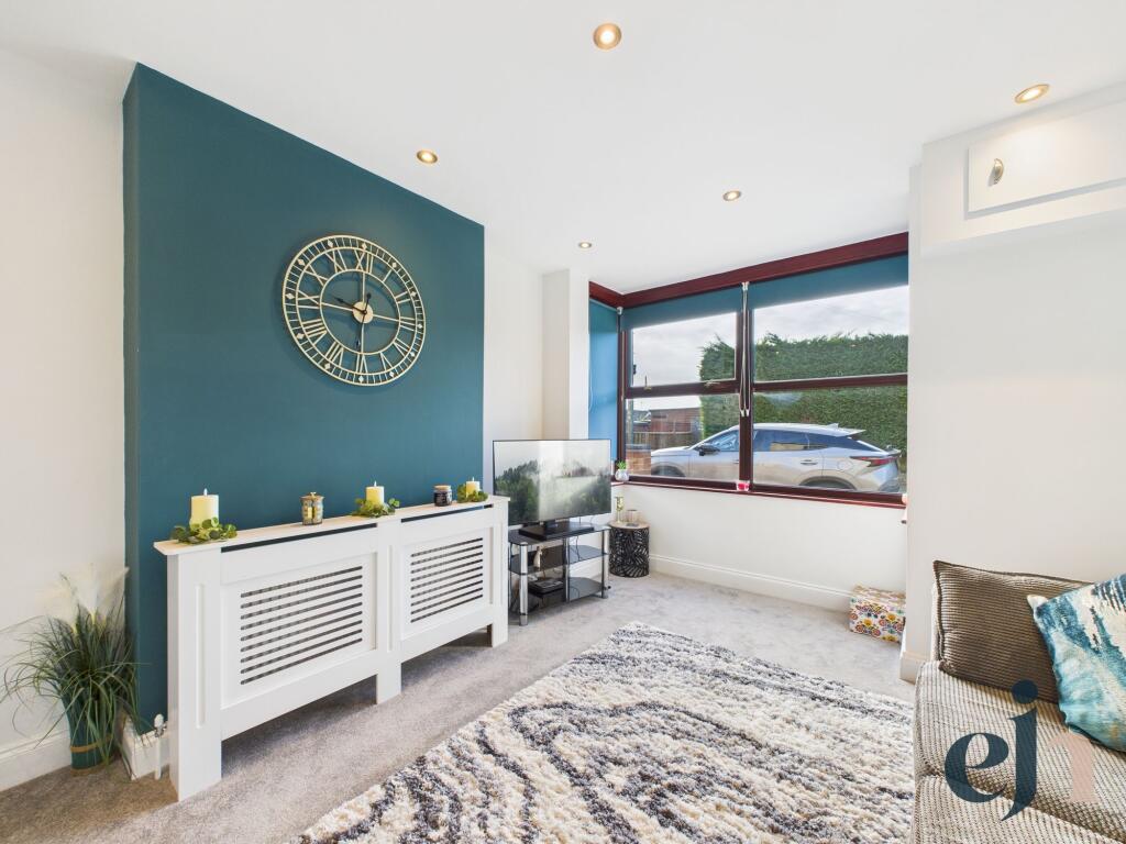
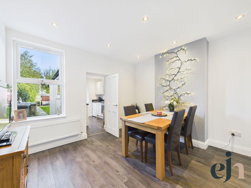
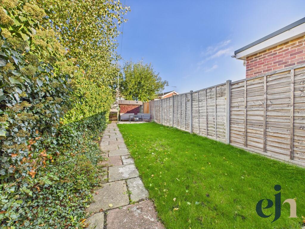
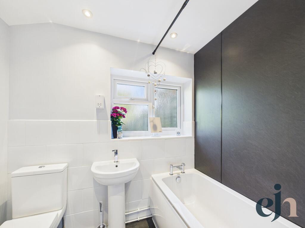
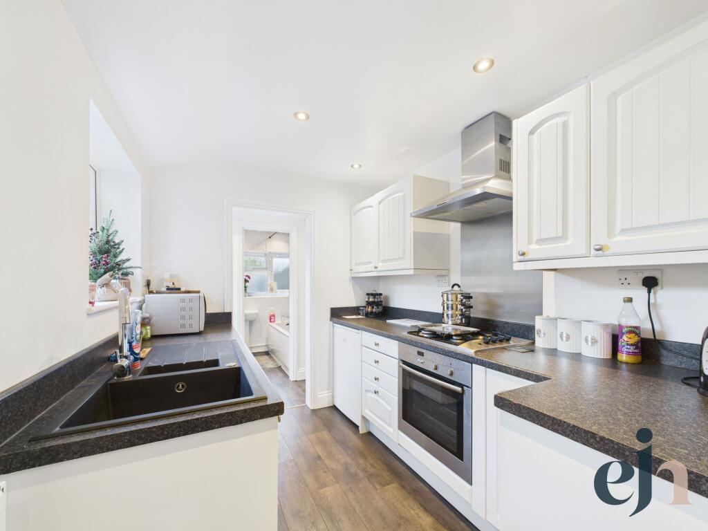
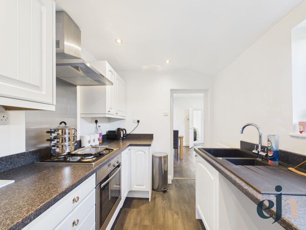
- Mid-terraced, two-storey residential property presented in good decorative order. Photographs show a galley-style kitchen with modern units and integrated hob, a main double bedroom, a fully tiled bathroom with white sanitaryware and a bright living area. Externally there is a long, narrow rear garden with paved path and lawn, and a paved frontage onto a residential street. Overall room proportions appear average for a small family or starter home; the plot and internal living area look small-to-average in size. An Energy Performance Certificate is shown with a current rating of 54 (E) and a potential rating of 84 (B).
Image Descriptions
- living room contemporary
- dining room modern
Rooms
- Utility Room:
- Bathroom:
- Kitchen:
- Dining Room:
- Living Room:
- Hallway:
- Landing:
- Bedroom:
- Bedroom:
Textual Property Features
- Has Garden
- Chain Free
- Success
Detected Visual Features
- contemporary design
- living room
- large windows
- natural light
- neutral decor
- modern
- corner windows
- dining room
- laminate flooring
- open plan
EPC Details
- Fully double glazed
- Solid brick, with internal insulation
- Boiler and radiators, mains gas
- Low energy lighting in all fixed outlets
- Suspended, no insulation (assumed)
Nearby Schools
- Grove Primary School
- Westwood Primary School
- St Mary's Roman Catholic Primary School
- East Point Academy
- Dell Primary School
- Roman Hill Primary School
- Northfield St Nicholas Primary Academy
- Blundeston Church of England Voluntary Controlled Primary School
- Carlton Colville Primary School
- Pakefield High School
- Pakefield Primary School
- Phoenix St Peter Academy
- Red Oak Primary School
- Oulton Broad Primary School
- St Margaret's Primary Academy
- Woods Loke Primary School
- Poplars Community Primary School
- The Limes Primary Academy
- Gunton Primary Academy
- Ormiston Denes Academy
- Elm Tree Primary School
- Include Suffolk
- Benjamin Britten Academy of Music and Mathematics
- Somerleyton Primary School
Nearest General Shops
- Id: 1091727745
- Tags:
- Addr:
- City: Lowestoft
- Parentstreet: Bridge Road
- Postcode: NR33 9JU
- Street: The Boulevard
- Amenity: cafe
- Building: retail
- Name: The Quays
- Phone: +44 1502 513087
- Shop: gift
- Website: http://www.thequaysob.co.uk/
- TagsNormalized:
- Lat: 52.4740165
- Lon: 1.7093351
- FullGeoHash: u134wbseq3st
- PartitionGeoHash: u134
- Images:
- FoodStandards: null
- Distance: 908.5
,- Id: 1055977236
- Tags:
- Addr:
- City: Lowestoft
- Parentstreet: Bridge Road
- Postcode: NR33 9JU
- Street: The Boulevard
- Building: retail
- Name: Lee's Oulton Broad Fishing Tackle
- Opening_hours: Tu-We,Sa 09:00-17:00; Th-Fr 09:00-17:30
- Phone: +44 1502 539593
- Shop: fishing
- TagsNormalized:
- Lat: 52.4740585
- Lon: 1.70914
- FullGeoHash: u134wbse9c7p
- PartitionGeoHash: u134
- Images:
- FoodStandards: null
- Distance: 897.2
,- Id: 1134383167
- Tags:
- Addr:
- City: Lowestoft
- Housenumber: 103
- Postcode: NR32 3LN
- Street: Bridge Road
- Building: yes
- Male: yes
- Name: Bloww
- Opening_hours: Mo,Th 09:00-19:00; Tu 09:00-21:00; We 09:00-17:30; Fr 09:00-18:00; Sa 08:00-16:00
- Phone: +44 1502 585848
- Shop: hairdresser
- TagsNormalized:
- Lat: 52.4756164
- Lon: 1.7116381
- FullGeoHash: u134wbyks5cu
- PartitionGeoHash: u134
- Images:
- FoodStandards: null
- Distance: 881.4
}
Nearest Grocery shops
- Id: 1134322207
- Tags:
- Addr:
- City: Lowestoft
- Housenumber: 48
- Postcode: NR32 3LR
- Street: Bridge Road
- Building: yes
- Name: Oulton Broad Mini Market
- Opening_hours: Mo-Su 08:00-23:00
- Shop: convenience
- TagsNormalized:
- Lat: 52.4766123
- Lon: 1.7141026
- FullGeoHash: u134x104mmx9
- PartitionGeoHash: u134
- Images:
- FoodStandards: null
- Distance: 956.9
,- Id: 370408651
- Tags:
- Addr:
- City: Lowestoft
- Postcode: NR32 3HS
- Street: Sands Lane
- Suburb: Oulton
- Brand: One Stop
- Brand:wikidata: Q65954217
- Building: yes
- Fhrs:
- Name: One Stop
- Opening_hours: 07:00-22:00
- Shop: convenience
- Source:
- TagsNormalized:
- Lat: 52.4839133
- Lon: 1.7056245
- FullGeoHash: u134wf3uzytc
- PartitionGeoHash: u134
- Images:
- FoodStandards:
- Id: 1074525
- FHRSID: 1074525
- LocalAuthorityBusinessID: 06/01871/CP
- BusinessName: One Stop Stores Limited
- BusinessType: Retailers - other
- BusinessTypeID: 4613
- AddressLine1: 78 Sands Lane
- AddressLine2: Oulton
- AddressLine3: Lowestoft
- AddressLine4: Suffolk
- PostCode: NR32 3HS
- RatingValue: 4
- RatingKey: fhrs_4_en-GB
- RatingDate: 2013-04-26
- LocalAuthorityCode: 302
- LocalAuthorityName: East Suffolk
- LocalAuthorityWebSite: http://www.eastsuffolk.gov.uk
- LocalAuthorityEmailAddress: environment@eastsuffolk.gov.uk
- Scores:
- Hygiene: 0
- Structural: 10
- ConfidenceInManagement: 0
- NewRatingPending: false
- Geocode:
- Longitude: 1.70607600000000
- Latitude: 52.48405400000000
- Distance: 442.1
,- Id: 370408662
- Tags:
- Addr:
- City: Lowestoft
- Country: GB
- Housenumber: 96-100
- Interpolation: even
- Postcode: NR32 3NN
- Street: Hall Road
- Brand: Spar
- Brand:wikidata: Q610492
- Brand:wikipedia: en:SPAR (retailer)
- Building: yes
- Name: Spar
- Opening_hours: Mo-Sa 07:00-20:30; Su 08:00-20:00
- Phone: +44 1502 587401
- Shop: convenience
- TagsNormalized:
- Lat: 52.47879
- Lon: 1.7061458
- FullGeoHash: u134wc6rh5d8
- PartitionGeoHash: u134
- Images:
- FoodStandards: null
- Distance: 370.7
}
Nearest Religious buildings
- Id: 881276014
- Tags:
- Addr:
- City: Lowestoft
- Housename: St Mark's Church
- Postcode: NR33 9JX
- Street: Bridge Road
- Amenity: place_of_worship
- Building: church
- Denomination: anglican
- Name: St Mark's Church
- Religion: christian
- Wikidata: Q105083021
- TagsNormalized:
- place of worship
- church
- anglican
- christian
- Lat: 52.4707526
- Lon: 1.7091627
- FullGeoHash: u134wbh863hp
- PartitionGeoHash: u134
- Images:
- FoodStandards: null
- Distance: 1219.6
,- Id: 1067888104
- Tags:
- Addr:
- City: Lowestoft
- Housenumber: 26
- Postcode: NR32 3AG
- Street: Gorleston Road
- Amenity: place_of_worship
- Building: yes
- Denomination: evangelical
- Email: info@cmission.org.uk
- Name: Commodore Mission
- Religion: christian
- Service_times: Su 11:00,18:00
- Website: http://commodoremission.org.uk/
- TagsNormalized:
- place of worship
- evangelical
- christian
- church
- Lat: 52.4790025
- Lon: 1.7155356
- FullGeoHash: u134x190qgh5
- PartitionGeoHash: u134
- Images:
- FoodStandards: null
- Distance: 956.5
,- Id: 468031796
- Tags:
- Amenity: place_of_worship
- Anglican: Church of England
- Building: church
- Denomination: anglican
- Name: Saint Michaels Church
- Religion: christian
- Wikidata: Q17527464
- TagsNormalized:
- place of worship
- church
- anglican
- christian
- Lat: 52.4823658
- Lon: 1.6952871
- FullGeoHash: u134wd47zn1d
- PartitionGeoHash: u134
- Images:
- FoodStandards: null
- Distance: 470.7
}
Nearest Medical buildings
- Id: 1067905508
- Tags:
- Addr:
- City: Lowestoft
- Housenumber: 1b
- Postcode: NR32 3LJ
- Street: Bridge Road
- Amenity: pharmacy
- Building: yes
- Dispensing: yes
- Drive_through: no
- Healthcare: pharmacy
- Name: Holly Pharmacy
- Opening_hours: Mo-Fr 08:30-13:00,14:00-18:00
- Phone: +44 1502 583200
- TagsNormalized:
- Lat: 52.4781829
- Lon: 1.7154272
- FullGeoHash: u134x135s674
- PartitionGeoHash: u134
- Images:
- FoodStandards: null
- Distance: 971.9
,- Id: 370408672
- Tags:
- Addr:
- City: Lowestoft
- Housenumber: 1a
- Postcode: NR32 3LJ
- Street: Bridge Road
- Amenity: doctors
- Building: yes
- Healthcare: doctor
- Name: Bridge Road Surgery
- Opening_hours: Mo-Fr 08:00-18:30; Sa 08:00-13:00; Su 08:00-12:00
- Phone: +44 1502 565936
- TagsNormalized:
- doctor
- doctors
- health
- healthcare
- surgery
- Lat: 52.4780605
- Lon: 1.7151859
- FullGeoHash: u134x12fyex2
- PartitionGeoHash: u134
- Images:
- FoodStandards: null
- Distance: 960.4
,- Id: 1134383203
- Tags:
- Addr:
- City: Lowestoft
- Housename: Hayden House
- Postcode: NR32 3LL
- Street: Bridge Road
- Amenity: pharmacy
- Building: yes
- Dispensing: yes
- Healthcare: pharmacy
- Name: Hayden Chemists
- Opening_hours: Mo-Fr 09:00-17:30; Sa 09:00-13:00
- TagsNormalized:
- pharmacy
- health
- healthcare
- chemist
- Lat: 52.4774548
- Lon: 1.7147102
- FullGeoHash: u134x10x7dse
- PartitionGeoHash: u134
- Images:
- FoodStandards: null
- Distance: 953.6
,- Id: 1064805810
- Tags:
- Amenity: doctors
- Building: yes
- Healthcare: doctor
- Name: The Atrium
- TagsNormalized:
- doctor
- doctors
- health
- healthcare
- Lat: 52.4778748
- Lon: 1.7143373
- FullGeoHash: u134x123fbys
- PartitionGeoHash: u134
- Images:
- FoodStandards: null
- Distance: 913
}
Nearest Leisure Facilities
- Id: 317188712
- Tags:
- Building: yes
- Leisure: bandstand
- TagsNormalized:
- Lat: 52.4741027
- Lon: 1.7070631
- FullGeoHash: u134wbe5c3wx
- PartitionGeoHash: u134
- Images:
- FoodStandards: null
- Distance: 822.1
,- Id: 1082679593
- Tags:
- TagsNormalized:
- Lat: 52.48481
- Lon: 1.7114752
- FullGeoHash: u134wfw60m8q
- PartitionGeoHash: u134
- Images:
- FoodStandards: null
- Distance: 802.1
,- Id: 1092743900
- Tags:
- Leisure: pitch
- Sport: bowls
- TagsNormalized:
- Lat: 52.4868127
- Lon: 1.6981125
- FullGeoHash: u134wdutbgh3
- PartitionGeoHash: u134
- Images:
- FoodStandards: null
- Distance: 718.2
,- Id: 370408613
- Tags:
- TagsNormalized:
- Lat: 52.4843664
- Lon: 1.7038941
- FullGeoHash: u134wf2xxe58
- PartitionGeoHash: u134
- Images:
- FoodStandards: null
- Distance: 430.2
,- Id: 933298969
- Tags:
- TagsNormalized:
- Lat: 52.4843951
- Lon: 1.7026097
- FullGeoHash: u134wdrzc8mg
- PartitionGeoHash: u134
- Images:
- FoodStandards: null
- Distance: 411.6
}
Nearest Tourist attractions
- Id: 1055977248
- Tags:
- Alt_name: Pets Corner Farm Park
- Name: Oulton Broad Mini Zoo
- Tourism: zoo
- Zoo: petting_zoo
- TagsNormalized:
- Lat: 52.4708431
- Lon: 1.707339
- FullGeoHash: u134wb50zfh4
- PartitionGeoHash: u134
- Images:
- FoodStandards: null
- Distance: 1164.3
,- Id: 1134383169
- Tags:
- Addr:
- City: Lowestoft
- Housenumber: 99
- Postcode: NR32 3LN
- Street: Bridge Road
- Building: yes
- Name: Wolf Inn Serviced Accommodation
- Phone: +44 1502 473310
- Tourism: apartment
- Website: https://www.wolfinns.co.uk/rooms
- TagsNormalized:
- inn
- service
- apartments
- tourism
- Lat: 52.4756709
- Lon: 1.7117525
- FullGeoHash: u134wbykywp1
- PartitionGeoHash: u134
- Images:
- FoodStandards: null
- Distance: 883.5
,- Id: 288774438
- Tags:
- Addr:
- Building: yes
- Name: Lowestoft Museum
- Tourism: museum
- Wikidata: Q113292368
- TagsNormalized:
- Lat: 52.473686
- Lon: 1.7068413
- FullGeoHash: u134wbdckk11
- PartitionGeoHash: u134
- Images:
- FoodStandards: null
- Distance: 857.7
}
Nearest Train stations
- Id: 252746160
- Tags:
- Name: Beccles
- Naptan:
- Network: National Rail
- Public_transport: station
- Railway: station
- Ref:
- Source: NPE
- Wikidata: Q2659206
- Wikipedia: en:Beccles railway station
- TagsNormalized:
- Lat: 52.4588262
- Lon: 1.5696314
- FullGeoHash: u1347tyfz1fp
- PartitionGeoHash: u134
- Images:
- FoodStandards: null
- Distance: 9271.9
,- Id: 263373156
- Tags:
- Name: Somerleyton
- Naptan:
- Network: National Rail
- Public_transport: station
- Railway: station
- Ref:
- Source: NPE
- Wikidata: Q1920909
- Wikipedia: en:Somerleyton railway station
- TagsNormalized:
- Lat: 52.5101587
- Lon: 1.6521998
- FullGeoHash: u134tx5jg513
- PartitionGeoHash: u134
- Images:
- FoodStandards: null
- Distance: 4683.4
,- Id: 252753813
- Tags:
- Name: Lowestoft
- Naptan:
- Network: National Rail
- Old_name: Lowestoft Central
- Public_transport: station
- Railway: station
- Ref:
- Wheelchair: yes
- Wikidata: Q2008297
- Wikipedia: en:Lowestoft railway station
- TagsNormalized:
- Lat: 52.47424
- Lon: 1.7499873
- FullGeoHash: u134xbdk9em4
- PartitionGeoHash: u134
- Images:
- FoodStandards: null
- Distance: 3349
,- Id: 263373872
- Tags:
- Name: Oulton Broad South
- Naptan:
- Network: National Rail
- Old_name: Carlton Colville
- Public_transport: station
- Railway: station
- Ref:
- Wikidata: Q1870239
- Wikipedia: en:Oulton Broad South railway station
- TagsNormalized:
- Lat: 52.4695869
- Lon: 1.7074886
- FullGeoHash: u134qzg37rgv
- PartitionGeoHash: u134
- Images:
- FoodStandards: null
- Distance: 1300.1
,- Id: 252745593
- Tags:
- Name: Oulton Broad North
- Naptan:
- Network: National Rail
- Public_transport: station
- Railway: station
- Ref:
- Source: NPE
- Wikidata: Q2854239
- Wikipedia: en:Oulton Broad North railway station
- TagsNormalized:
- Lat: 52.4777293
- Lon: 1.7161761
- FullGeoHash: u134x138vvc8
- PartitionGeoHash: u134
- Images:
- FoodStandards: null
- Distance: 1035.7
}
Nearest Hotels
- Id: 318262110
- Tags:
- Addr:
- City: Norwich
- Country: GB
- Postcode: NR32 4TZ
- Street: Leisure Way
- Brand: Travelodge
- Brand:wikidata: Q9361374
- Brand:wikipedia: en:Travelodge UK
- Building: yes
- Fax: +44 1502 733165
- Fhrs:
- Authority: East Suffolk
- Id: 1074729
- Local_authority_id: 09/00002/CP
- Internet_access: wlan
- Internet_access:fee: customers
- Internet_access:ssid: Travelodge WiFi
- Name: Travelodge
- Tourism: hotel
- Website: https://www.travelodge.co.uk/hotels/374/Lowestoft-hotel
- TagsNormalized:
- Lat: 52.5018414
- Lon: 1.7350344
- FullGeoHash: u134xmxmmhx7
- PartitionGeoHash: u134
- Images:
- FoodStandards: null
- Distance: 3256
,- Id: 937459242
- Tags:
- Addr:
- City: Lowestoft
- Housename: Premier Inn Lowestoft
- Housenumber: 249
- Postcode: NR32 4AA
- Street: Yarmouth Road
- Brand: Premier Inn
- Brand:wikidata: Q2108626
- Building: yes
- Internet_access: wlan
- Internet_access:fee: customers
- Internet_access:operator: Virgin Media
- Internet_access:ssid: Premier Inn Free Wi-Fi
- Name: Premier Inn
- Phone: +443333211281
- Tourism: hotel
- Website: https://www.premierinn.com/gb/en/hotels/england/suffolk/lowestoft/lowestoft.html?cid=GLBC_LOWFOX
- TagsNormalized:
- Lat: 52.4985559
- Lon: 1.7332027
- FullGeoHash: u134xmn4681s
- PartitionGeoHash: u134
- Images:
- FoodStandards: null
- Distance: 2911.3
,- Id: 181821124
- Tags:
- Addr:
- City: Norwich
- Country: GB
- Postcode: NR32 3LN
- Building: hotel
- Fax: +44 1502 501350
- Name: Wherry Hotel
- Phone: +44 1502 516845
- Source:
- Tourism: hotel
- Website: http://www.wherryhotel.com/
- TagsNormalized:
- Lat: 52.4753356
- Lon: 1.7107228
- FullGeoHash: u134wbvdyxx3
- PartitionGeoHash: u134
- Images:
- FoodStandards: null
- Distance: 856.6
}
Tags
- contemporary design
- living room
- large windows
- natural light
- neutral decor
- modern
- corner windows
- modern
- dining room
- laminate flooring
- natural light
- open plan
Local Market Stats
- Average Price/sqft: £233
- Avg Income: £34900
- Rental Yield: 4.2%
- Social Housing: 8%
- Planning Success Rate: 91%
AirBnB Data
- 1km average: £92/night
- Listings in 1km: 2
Similar Properties
 2 bedroom end of terrace house for sale in Clarkson Road, Oulton Broad, Suffolk, NR32 — £190,000 • 2 bed • 1 bath • 728 ft²
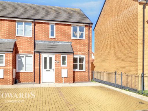 2 bedroom end of terrace house for sale in Dubordien Close, Lowestoft, NR32 — £200,000 • 2 bed • 1 bath • 1203 ft²
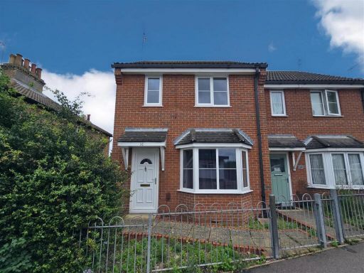 2 bedroom end of terrace house for sale in Commodore Road, Oulton Broad, Lowestoft, Suffolk, NR32 — £240,000 • 2 bed • 1 bath • 719 ft²
 3 bedroom semi-detached house for sale in Monckton Avenue, Lowestoft, NR32 — £315,000 • 3 bed • 1 bath • 991 ft²
 3 bedroom terraced house for sale in Lakeland Drive, Lowestoft, NR32 — £200,000 • 3 bed • 1 bath • 905 ft²
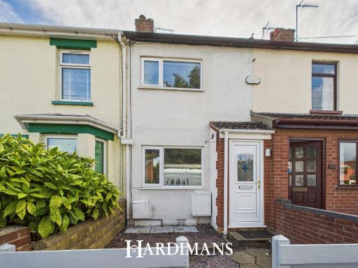 3 bedroom terraced house for sale in Oulton Road North, Lowestoft, NR32 — £160,000 • 3 bed • 1 bath • 694 ft²
Meta
- {
"@context": "https://schema.org",
"@type": "Residence",
"name": "2 bedroom terraced house for sale in Clarkson Road, Lowesto…",
"description": "",
"url": "https://propertypiper.co.uk/property/f46ef49c-c893-498e-9a22-b002421052d9",
"image": "https://image-a.propertypiper.co.uk/4ab9967c-b366-4c01-b5c6-a13e5f15457e-1024.jpeg",
"address": {
"@type": "PostalAddress",
"streetAddress": "Clarkson Road, Lowestoft",
"postalCode": "NR32 3NX",
"addressLocality": "East Suffolk",
"addressRegion": "Waveney",
"addressCountry": "England"
},
"geo": {
"@type": "GeoCoordinates",
"latitude": 52.48073507773507,
"longitude": 1.701700884835662
},
"numberOfRooms": 2,
"numberOfBathroomsTotal": 1,
"floorSize": {
"@type": "QuantitativeValue",
"value": 743,
"unitCode": "FTK"
},
"offers": {
"@type": "Offer",
"price": 190000,
"priceCurrency": "GBP",
"availability": "https://schema.org/InStock"
},
"additionalProperty": [
{
"@type": "PropertyValue",
"name": "Feature",
"value": "contemporary design"
},
{
"@type": "PropertyValue",
"name": "Feature",
"value": "living room"
},
{
"@type": "PropertyValue",
"name": "Feature",
"value": "large windows"
},
{
"@type": "PropertyValue",
"name": "Feature",
"value": "natural light"
},
{
"@type": "PropertyValue",
"name": "Feature",
"value": "neutral decor"
},
{
"@type": "PropertyValue",
"name": "Feature",
"value": "modern"
},
{
"@type": "PropertyValue",
"name": "Feature",
"value": "corner windows"
},
{
"@type": "PropertyValue",
"name": "Feature",
"value": "modern"
},
{
"@type": "PropertyValue",
"name": "Feature",
"value": "dining room"
},
{
"@type": "PropertyValue",
"name": "Feature",
"value": "laminate flooring"
},
{
"@type": "PropertyValue",
"name": "Feature",
"value": "natural light"
},
{
"@type": "PropertyValue",
"name": "Feature",
"value": "open plan"
}
]
}
High Res Floorplan Images
Compatible Floorplan Images
FloorplanImages Thumbnail