NG18 3JA - 3 bedroom semidetached bungalow for sale in Budby Avenue, M…
View on Property Piper
3 bedroom semi-detached bungalow for sale in Budby Avenue, Mansfield, NG18
Property Details
- Price: £190000
- Bedrooms: 3
- Bathrooms: 1
- Property Type: undefined
- Property SubType: undefined
Brochure Descriptions
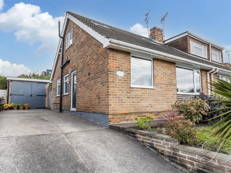
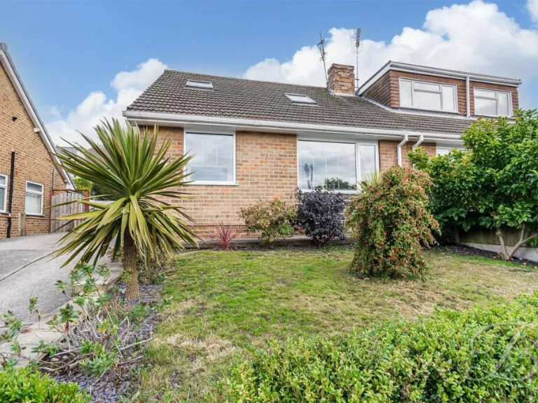
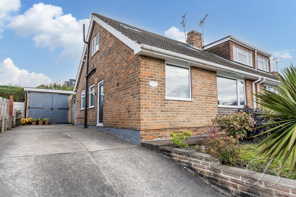
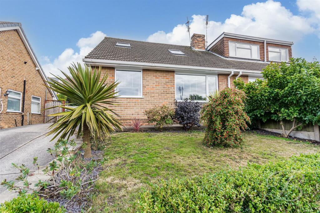
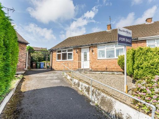
- Semi‑detached dormer/chalet bungalow constructed in brick with a pitched tiled roof. Property presents a single main entrance at ground level with a dormer/skylight to the upper slope indicating additional accommodation upstairs. Front hardstanding provides off‑street parking/driveway leading to a detached garage/store. Small, raised planted front garden with low retaining wall and mature shrubs. Overall impression: compact suburban family home (small-to-medium internal footprint) with useful external storage/garage and easy‑maintenance front garden. Likely suited to couples, small families or downsizers seeking a modest, low‑maintenance property in a residential street. No internal details or exact square footage visible in images.
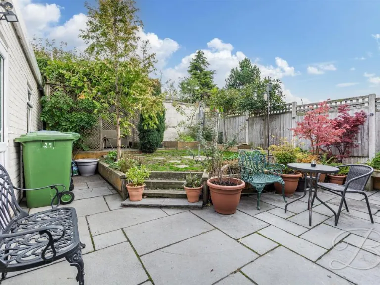
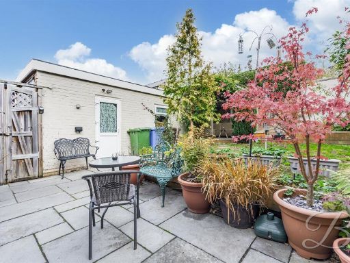
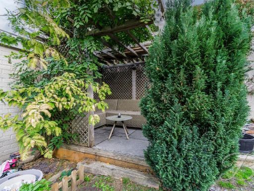
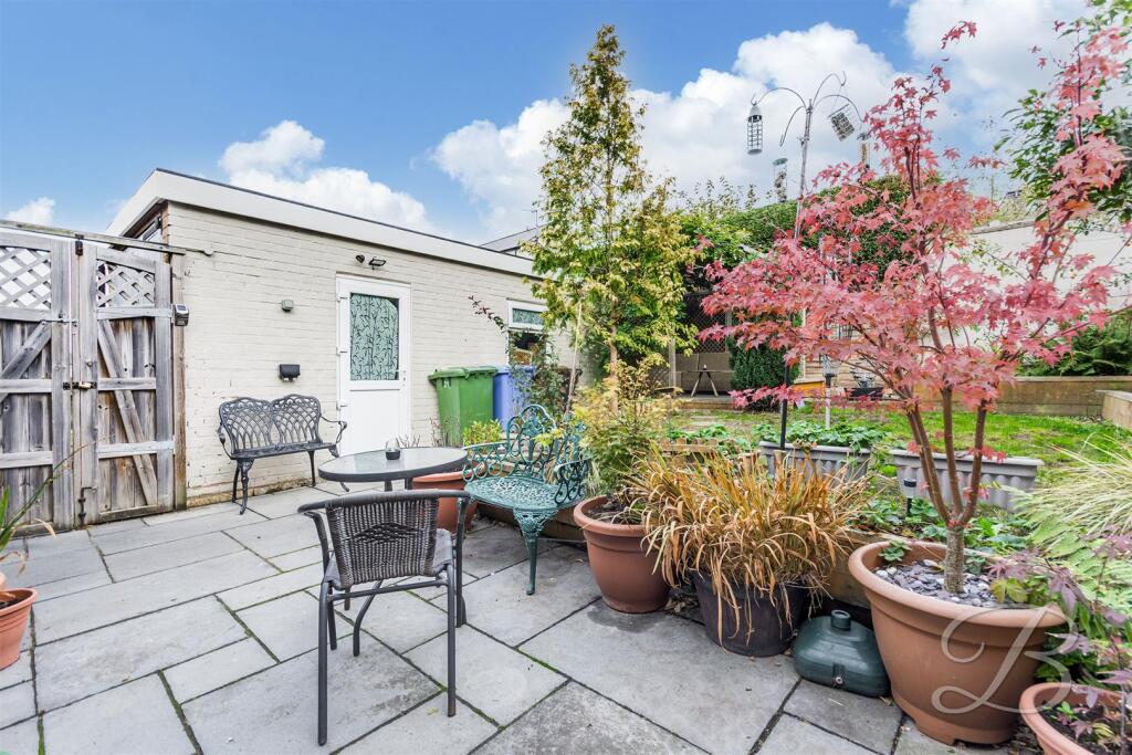
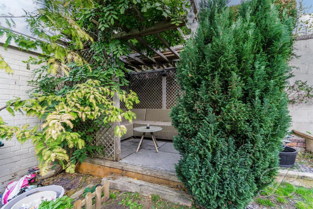
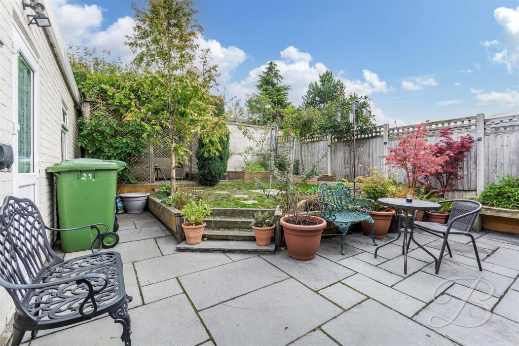
- Rear courtyard/garden area of a residential property. The space is an enclosed, low-maintenance yard with a paved patio and raised timber edging, complemented by a timber pergola or covered seating alcove. Mature evergreen screening (tall conifer) provides privacy from neighbours and there are white-painted boundary walls. The outdoor area appears small in size—suitable for light entertaining, container planting or a seating area rather than large-scale landscaping. Overall the plot suggests a modest urban/terraced property with a compact outdoor amenity space. Condition appears serviceable but would benefit from tidying and minor refurbishment to maximise appeal.
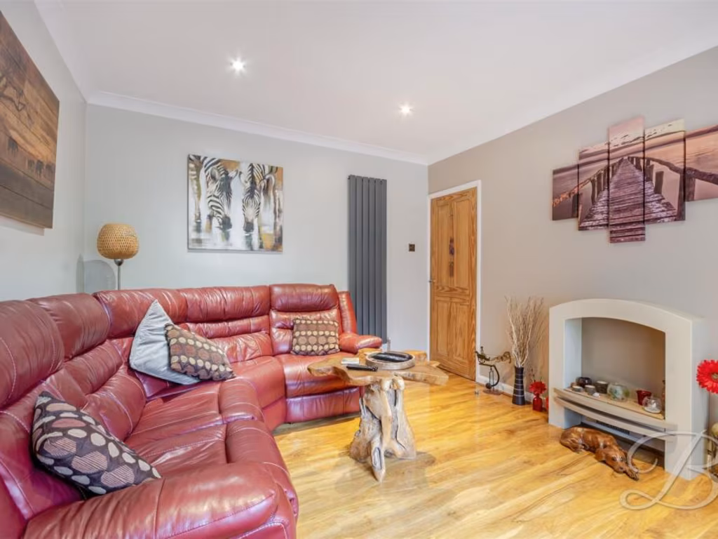
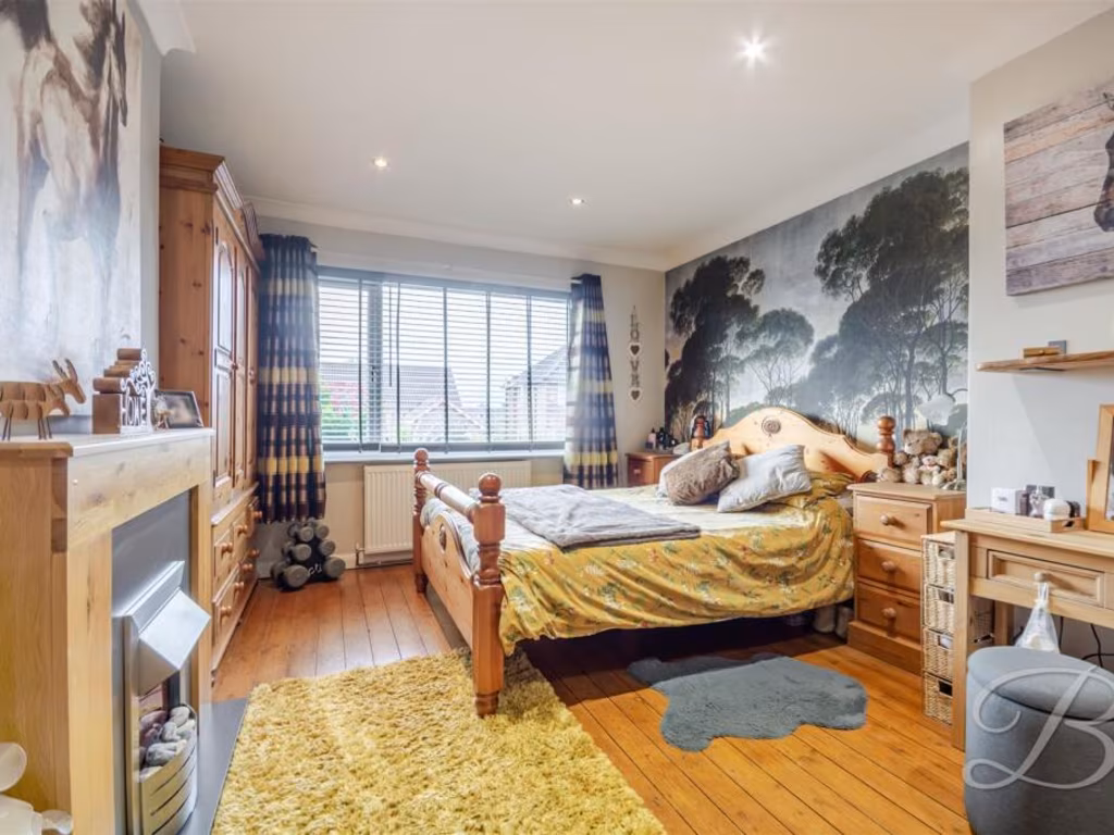
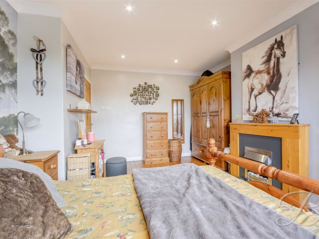
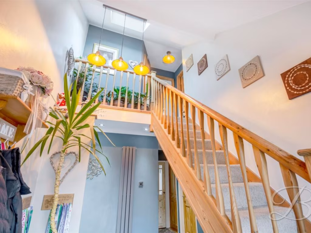
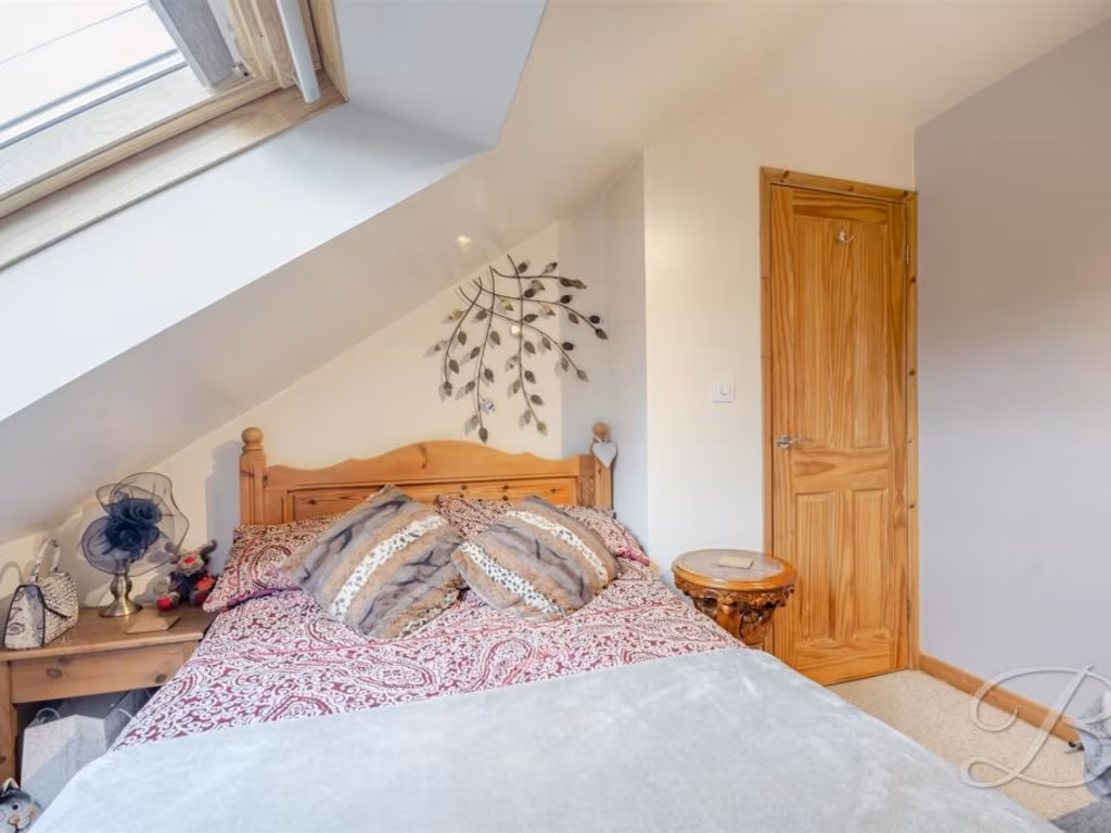
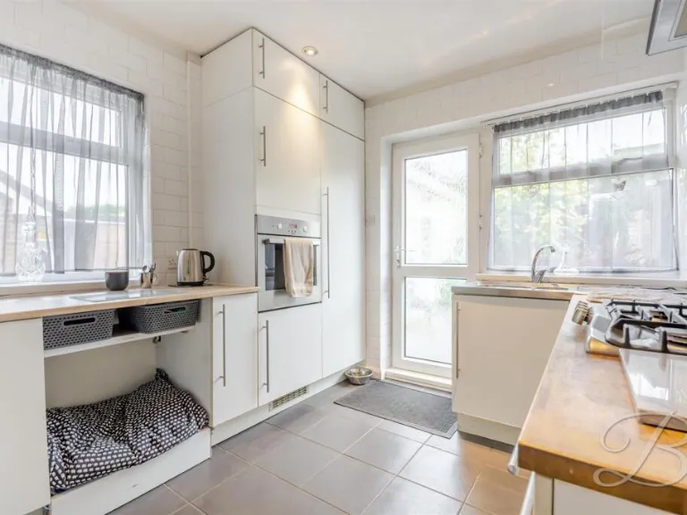
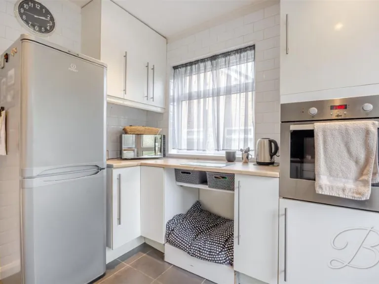
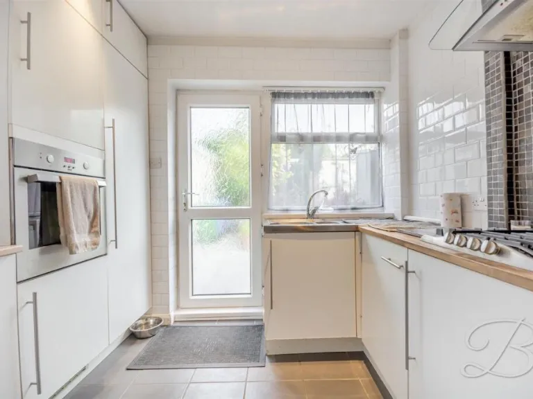
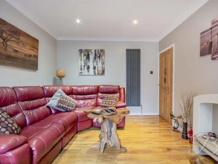
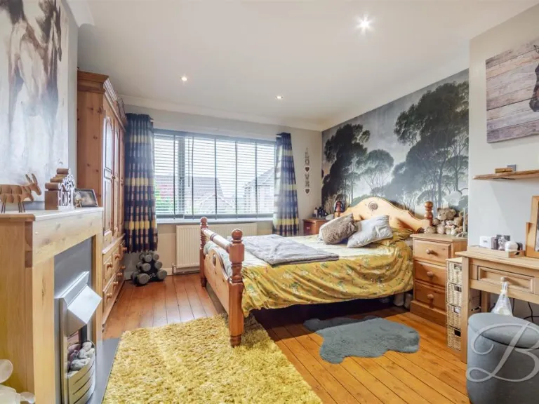
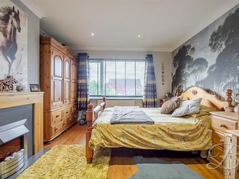
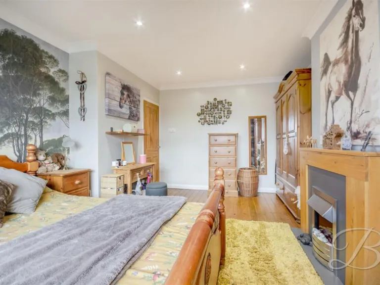
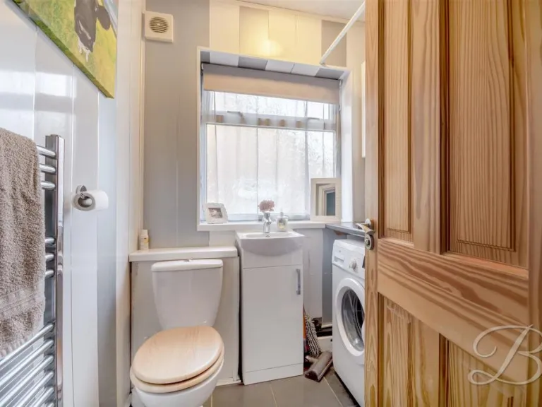
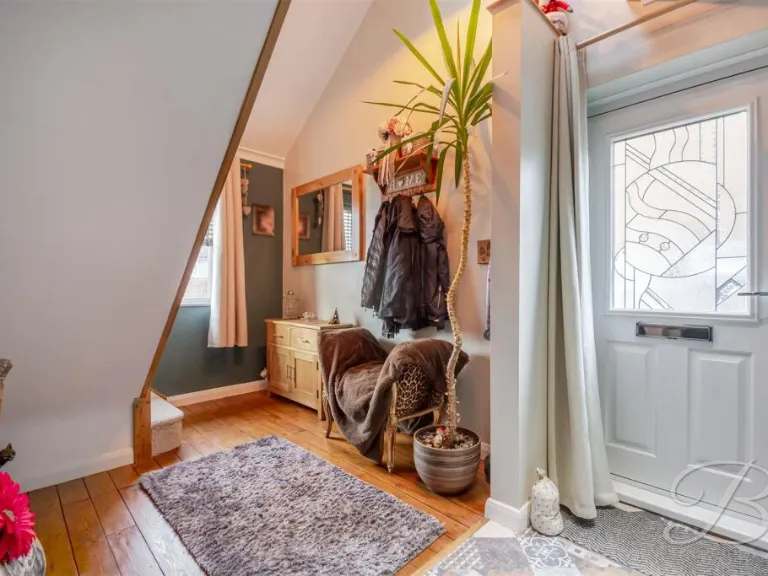
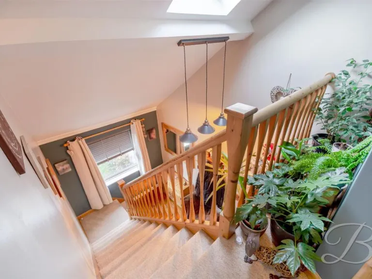
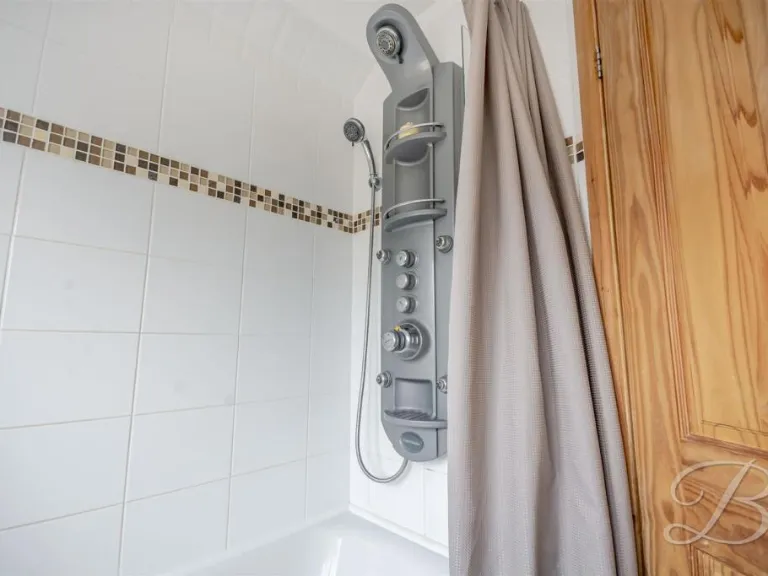
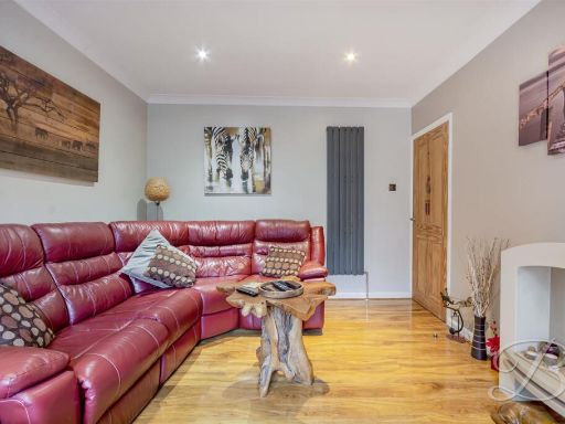
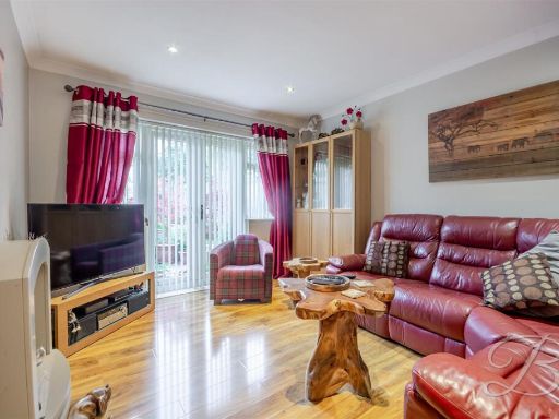
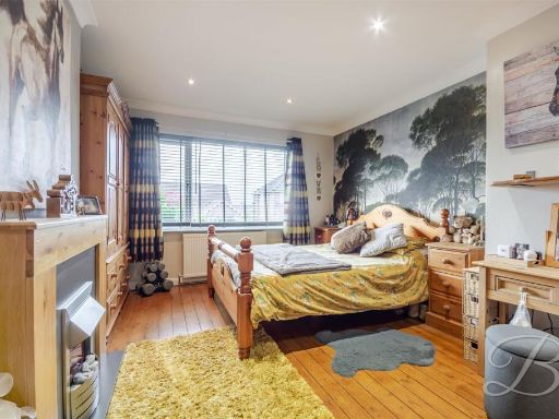
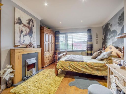
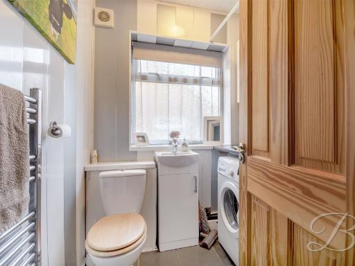
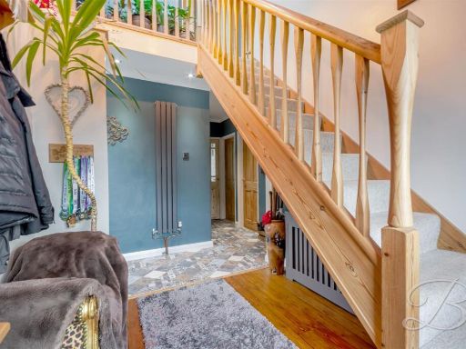
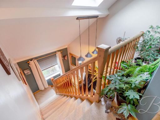
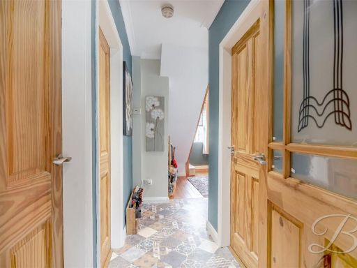
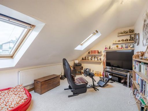
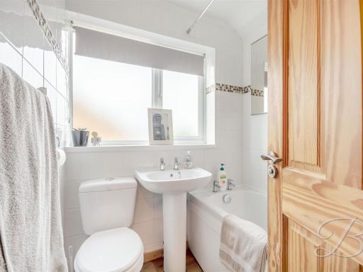
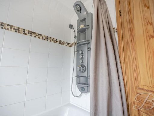
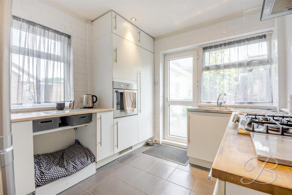
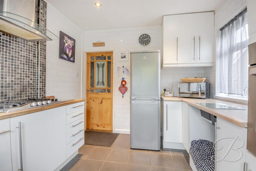
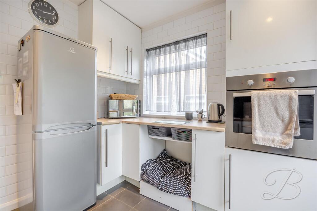
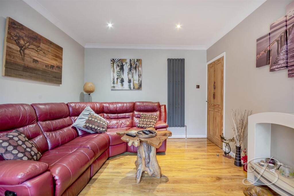
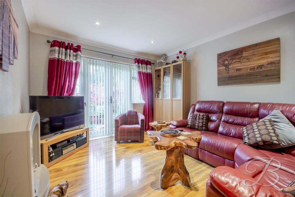
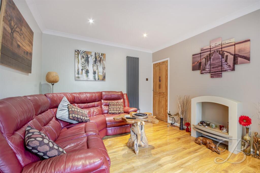
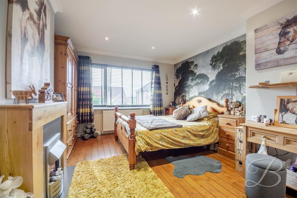
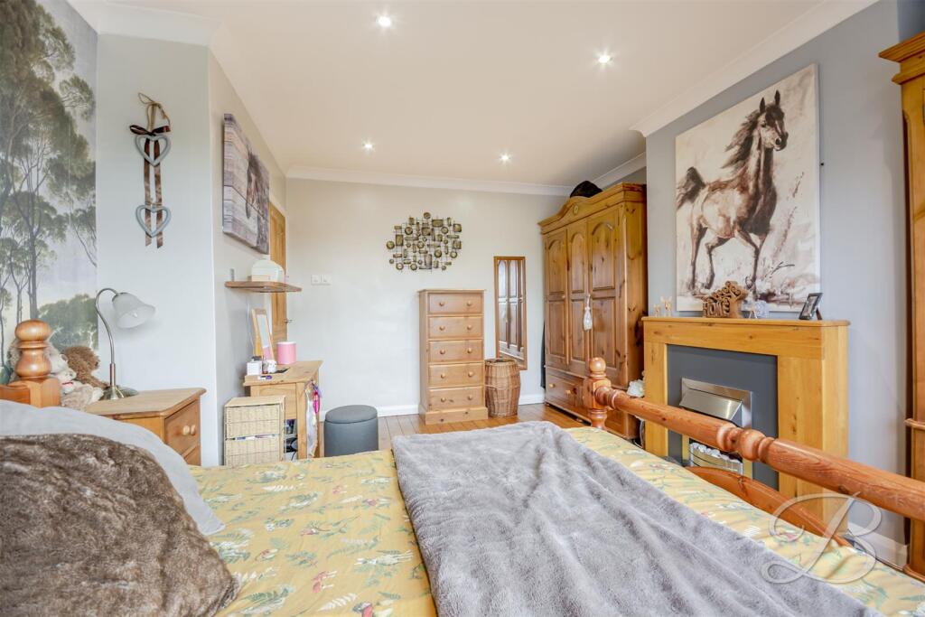
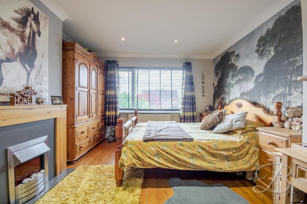
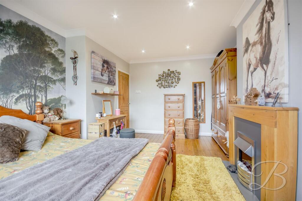
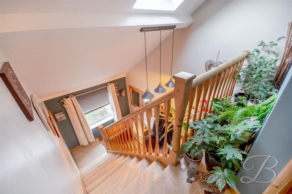
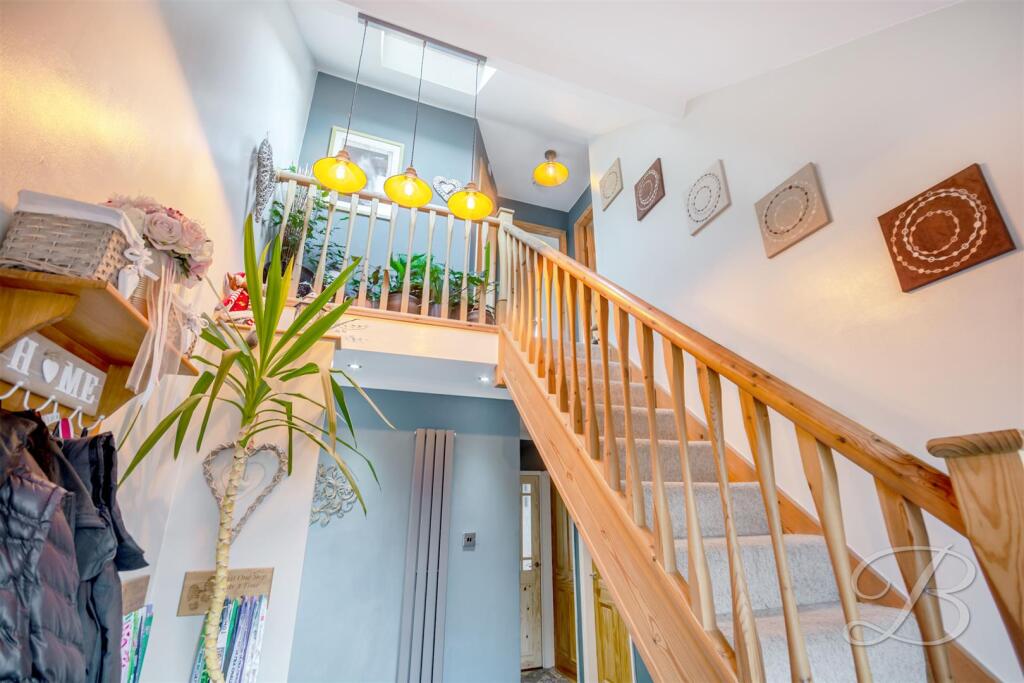
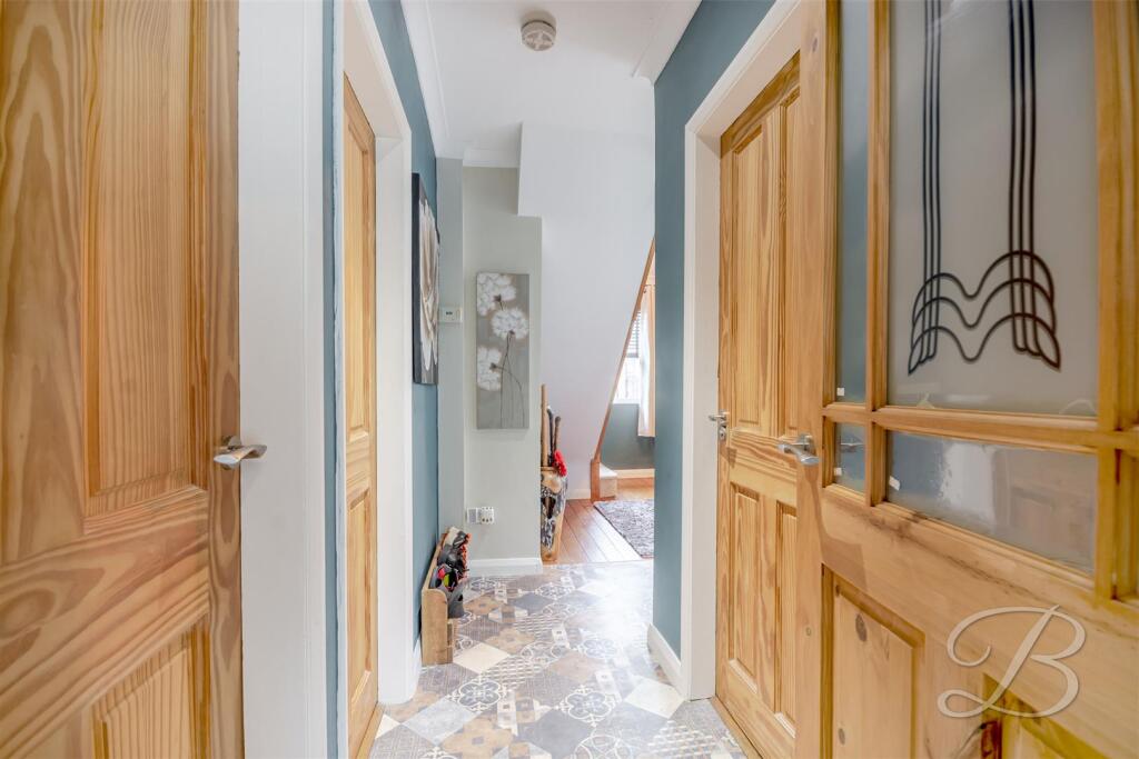
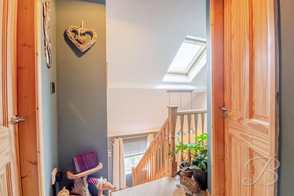
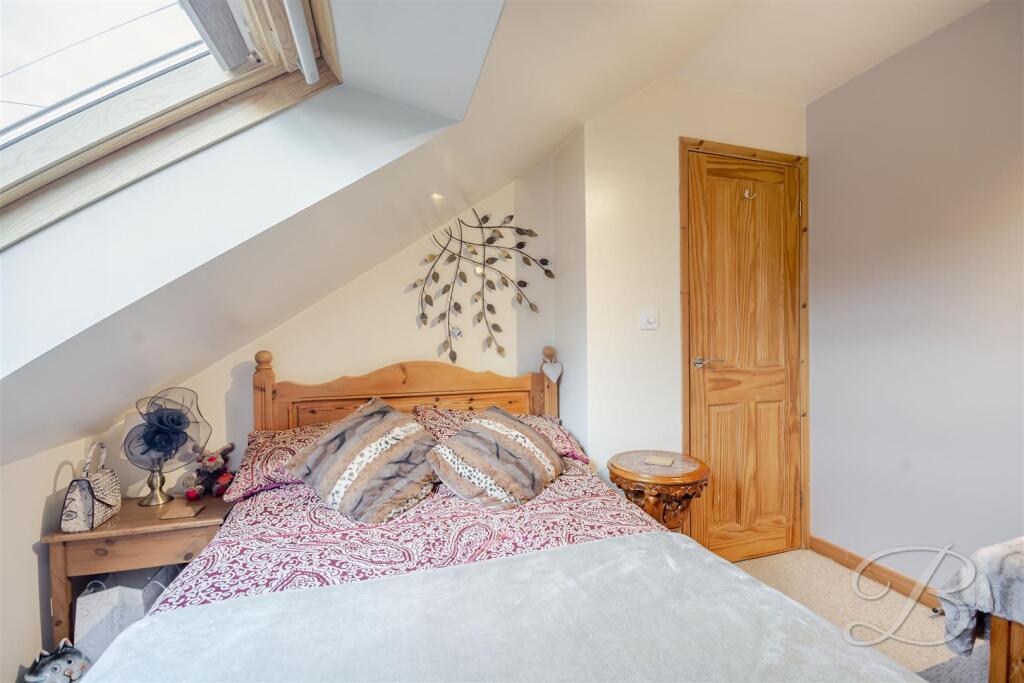
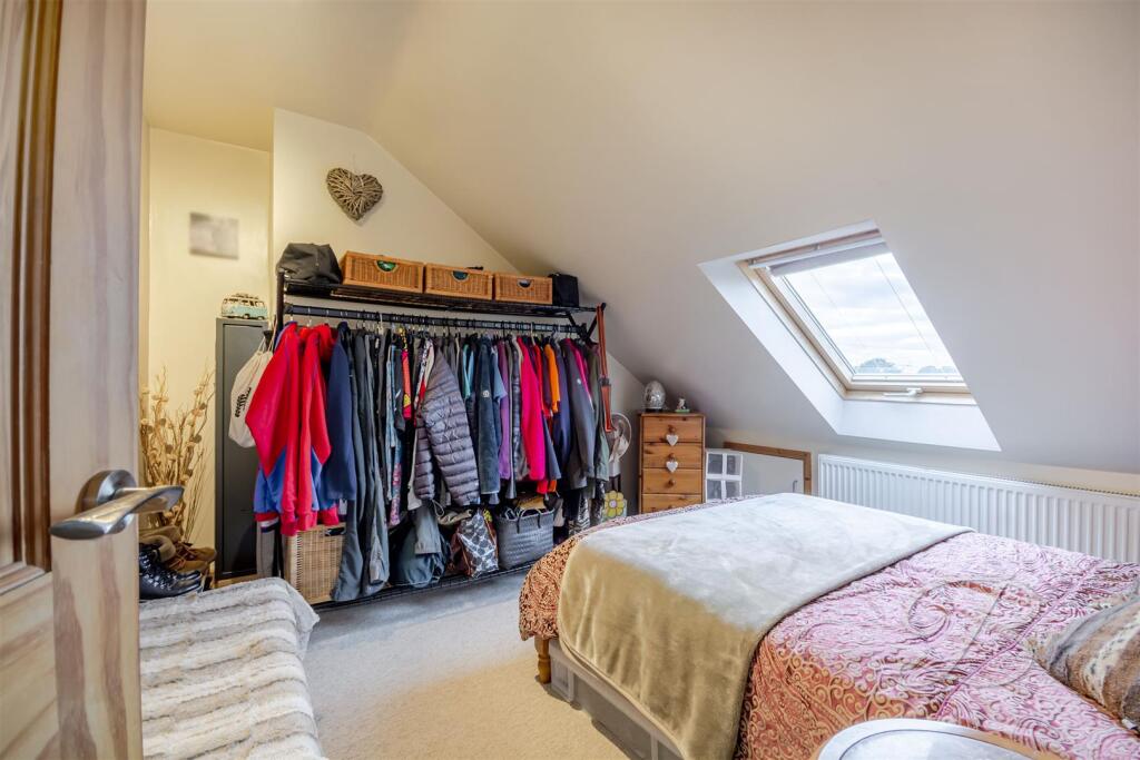
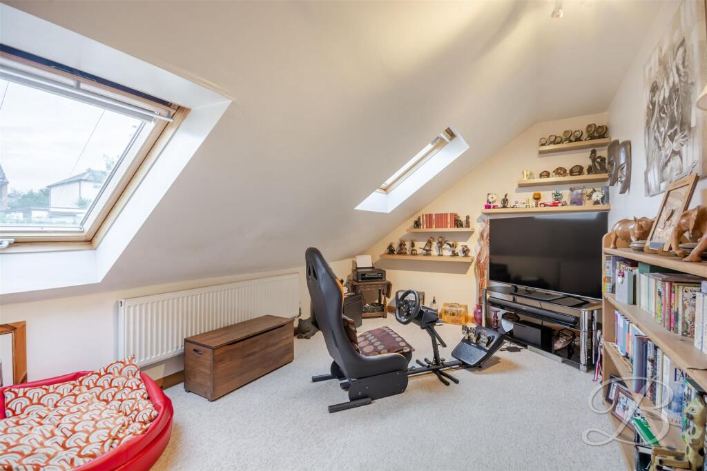
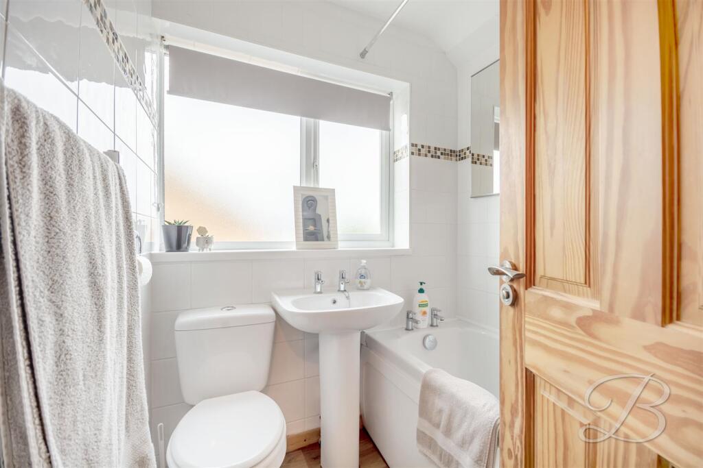
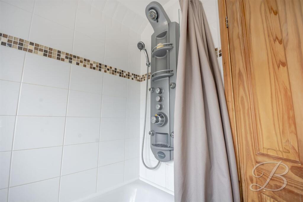
- Three-bedroom semi‑detached dormer bungalow located in a sought‑after area of Mansfield (no full street address shown). Property appears well maintained and offers a practical family layout: welcoming entrance hall leading to a bright, spacious living room with double doors opening onto the rear garden (good indoor–outdoor flow), a fitted kitchen with utility space and external door, and a ground‑floor bedroom with adjacent WC (useful for flexible ground‑floor accommodation). Upstairs are two further well‑proportioned bedrooms featuring Velux windows providing additional natural light, plus a family bathroom. Externally the plot includes a driveway providing off‑street parking, a garage and a neatly kept front lawn. The rear garden is a highlight with patio and pergola seating areas and mature shrub borders offering privacy — garden size appears average to slightly above average for this property type. Overall the property is a comfortable, mid‑sized family home with good outdoor amenity, practical room sizes and scope for cosmetic updating to maximise market value.
Image Descriptions
- exterior 1970s bungalow
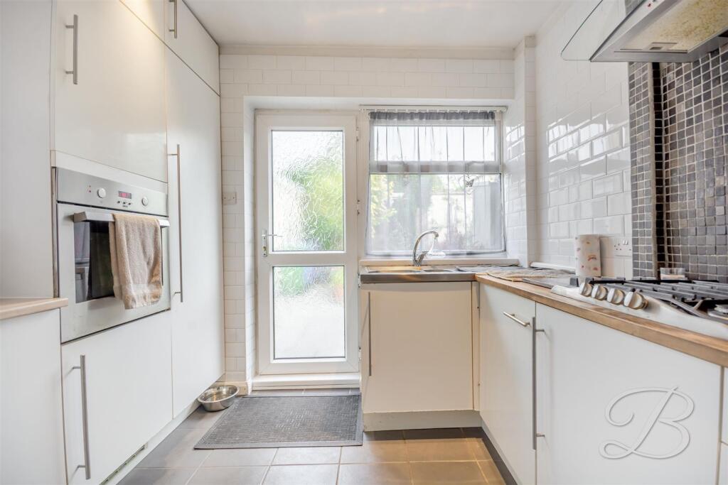
- kitchen modern
Floorplan Description
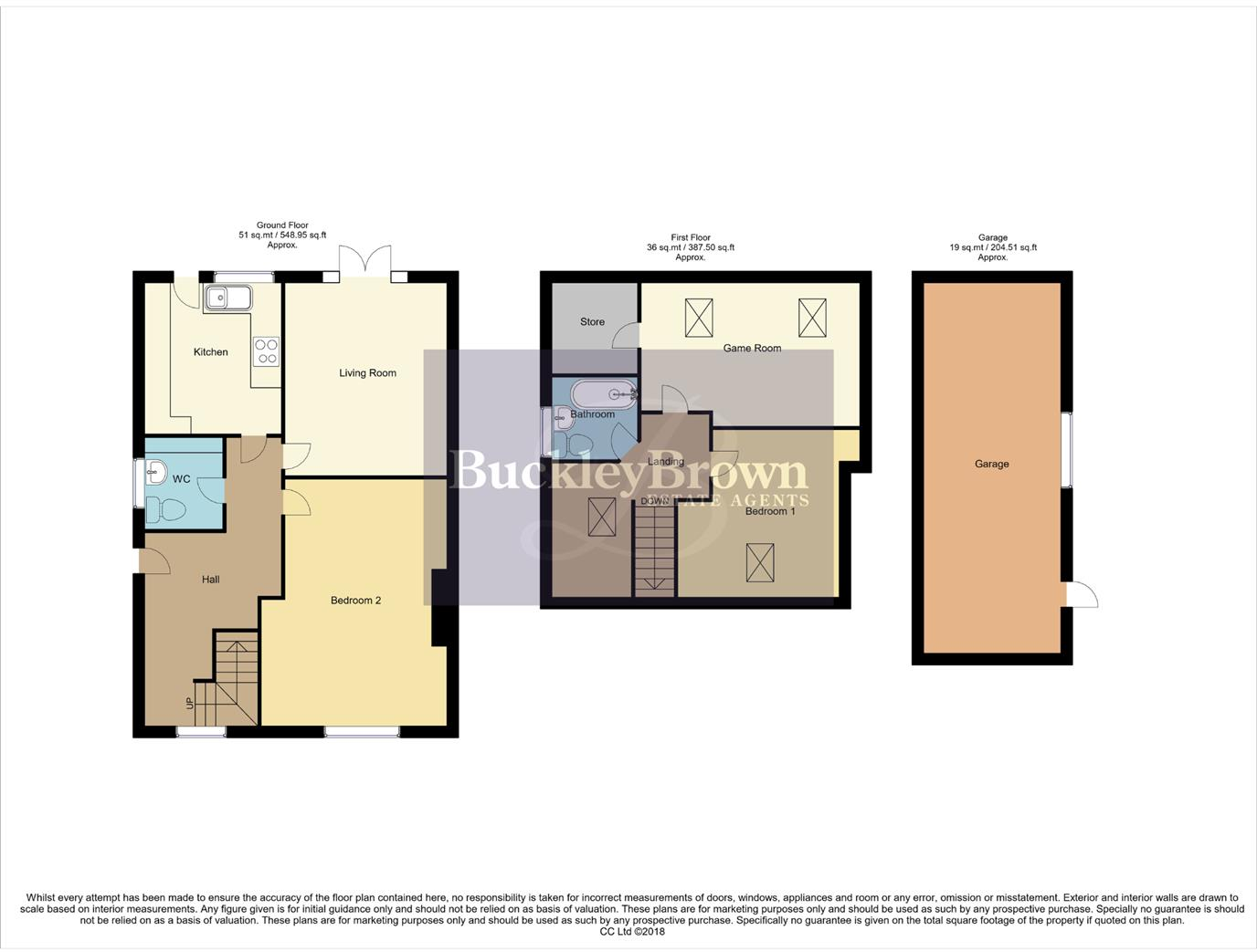
- Floorplan showing Ground and First floors with a detached Garage.
Rooms
- Kitchen:
- Living Room:
- WC:
- Hall:
- Bedroom 2:
- Store:
- Game Room:
- Bathroom:
- Landing:
- Bedroom 1:
Textual Property Features
Detected Visual Features
- 1970s
- bungalow
- brick
- single-story
- attached garage
- paved driveway
- small garden
- modern kitchen
- white cabinetry
- integrated appliances
- tile flooring
- natural light
EPC Details
- Fully double glazed
- Cavity wall, filled cavity
- Boiler and radiators, mains gas
- No low energy lighting
- Suspended, no insulation (assumed)
Nearby Schools
- St Patrick's Catholic Primary School, A Voluntary Academy
- The Brunts Academy
- Nettleworth Infant and Nursery School
- Oak Tree Primary School
- Abbey Primary School
- Heatherley Primary School
- Holly Primary School
- The Garibaldi School
- John T Rice Infant and Nursery School
- Peafield Lane Academy
- The Manor Academy
- Heathlands Primary School
- Berry Hill Primary School
- Wynndale Primary School
- Mansfield Primary Academy
- Samworth Church Academy
- Forest Town Primary School
- Crescent Primary School
- St Edmund's CofE (C) Primary School
- St Peter's CofE Primary Academy, Mansfield
- High Oakham Primary School
- Asquith Primary School
- St Philip Neri With St Bede Catholic Voluntary Academy
- Newlands Junior School
- Leas Park Junior School
Nearest Bars And Restaurants
- Id: 833661261
- Tags:
- Amenity: fast_food
- Building: yes
- Cuisine: chinese
- Takeaway: yes
- TagsNormalized:
- fast food
- food
- chinese
- takeaway
- Lat: 53.1375511
- Lon: -1.1582043
- FullGeoHash: gcrnm9ksevkr
- PartitionGeoHash: gcrn
- Images:
- FoodStandards: null
- Distance: 719.9
,- Id: 833661260
- Tags:
- Amenity: fast_food
- Building: yes
- Cuisine: pizza
- TagsNormalized:
- Lat: 53.1375382
- Lon: -1.1582861
- FullGeoHash: gcrnm9ks9gp6
- PartitionGeoHash: gcrn
- Images:
- FoodStandards: null
- Distance: 716.6
,- Id: 312006039
- Tags:
- Amenity: fast_food
- Building: yes
- Cuisine: fish_and_chips
- Name: Dave's Place
- TagsNormalized:
- Lat: 53.1457243
- Lon: -1.1584153
- FullGeoHash: gcrnmdukqcnf
- PartitionGeoHash: gcrn
- Images:
- FoodStandards: null
- Distance: 711.5
,- Id: 833661257
- Tags:
- Amenity: cafe
- Building: yes
- TagsNormalized:
- Lat: 53.1374876
- Lon: -1.1586022
- FullGeoHash: gcrnm9kk69es
- PartitionGeoHash: gcrn
- Images:
- FoodStandards: null
- Distance: 704.1
,- Id: 495934905
- Tags:
- Amenity: pub
- Building: pub
- Name: The Ling Forest
- Operator: Marston's
- Outdoor_seating: yes
- Parking: yes
- Real_ale: 2 from Marston's
- TagsNormalized:
- Lat: 53.1443974
- Lon: -1.1626953
- FullGeoHash: gcrnmd9ke1xw
- PartitionGeoHash: gcrn
- Images:
- FoodStandards: null
- Distance: 404
}
Nearest General Shops
- Id: 6988437285
- Tags:
- Addr:
- City: Mansfield
- Housename: The Centre
- Postcode: NG18 3AH
- Street: Eakring Road
- Name: Mansfield & District Garden Holders' Association
- Opening_hours: Sa,Su 10:00-24:00
- Operator: The Association
- Payment:
- Cash: yes
- Credit_cards: yes
- Shop: trade
- Trade: horticulturalsupplies_for_gardeners_and_allotment_holders
- TagsNormalized:
- Lat: 53.142762
- Lon: -1.1722414
- FullGeoHash: gcrnm667hbc7
- PartitionGeoHash: gcrn
- Images:
- FoodStandards: null
- Distance: 397.1
,- Id: 495934906
- Tags:
- Building: yes
- Name: Crown Farm Garage
- Shop: car_repair
- TagsNormalized:
- farm
- garage
- car repair
- repair
- shop
- Lat: 53.1436271
- Lon: -1.1629334
- FullGeoHash: gcrnmd90jdn5
- PartitionGeoHash: gcrn
- Images:
- FoodStandards: null
- Distance: 331.1
,- Id: 495934907
- Tags:
- Building: yes
- Name: Mansfield Car Sales
- Shop: car
- TagsNormalized:
- Lat: 53.1436323
- Lon: -1.1633984
- FullGeoHash: gcrnmd8b4g56
- PartitionGeoHash: gcrn
- Images:
- FoodStandards: null
- Distance: 309.3
}
Nearest Grocery shops
- Id: 4876482626
- Tags:
- Brand: Nisa
- Name: Pecks Hill
- Shop: convenience
- TagsNormalized:
- Lat: 53.1454406
- Lon: -1.1756003
- FullGeoHash: gcrnm4zfws0v
- PartitionGeoHash: gcrn
- Images:
- FoodStandards: null
- Distance: 735.4
,- Id: 833661259
- Tags:
- Building: yes
- Shop: convenience
- TagsNormalized:
- Lat: 53.1375189
- Lon: -1.1584041
- FullGeoHash: gcrnm9kkrprr
- PartitionGeoHash: gcrn
- Images:
- FoodStandards: null
- Distance: 711.9
,- Id: 312005729
- Tags:
- Brand: Farmfoods
- Brand:wikidata: Q5435841
- Brand:wikipedia: en:Farmfoods
- Building: yes
- Name: Farmfoods
- Opening_hours: Mo-Fr 07:00-22:00; Sa 08:00-20:00; Su 10:00-16:00
- Shop: frozen_food
- TagsNormalized:
- farmfoods
- frozen food
- food
- shop
- Lat: 53.1380619
- Lon: -1.157907
- FullGeoHash: gcrnm9kzdu9y
- PartitionGeoHash: gcrn
- Images:
- FoodStandards: null
- Distance: 702
}
Nearest Religious buildings
- Id: 245389713
- Tags:
- Amenity: place_of_worship
- Building: church
- Denomination: anglican
- Name: Saint Lawrences Church
- Operator: Church of England
- Religion: christian
- Short_name: St Lawrences
- Website: http://www.stlawrence-mansfield.co.uk
- Wikidata: Q26502351
- TagsNormalized:
- place of worship
- church
- anglican
- christian
- Lat: 53.1439528
- Lon: -1.1792813
- FullGeoHash: gcrnm4t3byb4
- PartitionGeoHash: gcrn
- Images:
- FoodStandards: null
- Distance: 884.7
,- Id: 310572577
- Tags:
- Addr:
- City: Mansfield
- County: Nottinghamshire
- Housename: Samworth Church Academy
- Postcode: NG18 2DY
- Street: Sherwood Hall Road
- Amenity: school
- Capacity: 900
- Denomination: anglican
- Diocese: Diocese of Southwell
- Email: enquiries@tscacademy.org.uk
- Isced:
- Max_age: 19
- Min_age: 11
- Name: Samworth Church Academy
- Operator: Diocese Of Southwell and Nottingham Multi-Academy Trust
- Phone: +44 1623 663 450
- Ref:
- Ref:edubase:group: 2925
- Religion: christian
- School:
- Boarding: no
- Gender: mixed
- Selective: no
- Trust: yes
- Type: academy
- School:trust:name: Diocese of Southwell and Nottingham Multi-Academy Trust
- School:trust:type: multi_academy
- Source:
- Area: Bing
- Name: survey
- Postcode: FHRS Open Data
- Website: https://www.samworthchurchacademy.co.uk/
- Wikidata: Q17017165
- TagsNormalized:
- school
- anglican
- church
- christian
- Lat: 53.1476051
- Lon: -1.168802
- FullGeoHash: gcrnm7hzhzwj
- PartitionGeoHash: gcrn
- Images:
- FoodStandards: null
- Distance: 681.5
,- Id: 1717531181
- Tags:
- Amenity: place_of_worship
- Name: Calvary Mansfield
- Religion: christian
- TagsNormalized:
- place of worship
- christian
- church
- Lat: 53.1435422
- Lon: -1.167232
- FullGeoHash: gcrnm6qp9d29
- PartitionGeoHash: gcrn
- Images:
- FoodStandards: null
- Distance: 217.8
}
Nearest Medical buildings
- Id: 4874877682
- Tags:
- Amenity: pharmacy
- Brand: Rowlands Pharmacy
- Brand:wikidata: Q62663235
- Healthcare: pharmacy
- Name: Rowlands Pharmacy
- TagsNormalized:
- pharmacy
- rowlands pharmacy
- health
- healthcare
- Lat: 53.1440378
- Lon: -1.1847414
- FullGeoHash: gcrnm4963w8v
- PartitionGeoHash: gcrn
- Images:
- FoodStandards: null
- Distance: 1239.5
,- Id: 6988437286
- Tags:
- Addr:
- City: Mansfield
- Housenumber: 77
- Street: Sandy Lane
- Amenity: doctors
- Healthcare: doctor
- Name: Sandy Lane Surgery
- Operator: GP Practice
- TagsNormalized:
- doctor
- doctors
- health
- healthcare
- surgery
- Lat: 53.1456712
- Lon: -1.181264
- FullGeoHash: gcrnm4ggfx1t
- PartitionGeoHash: gcrn
- Images:
- FoodStandards: null
- Distance: 1076.8
,- Id: 245389109
- Tags:
- Amenity: veterinary
- Building: yes
- Name: Bridge House Veterinery Surgery
- TagsNormalized:
- Lat: 53.1456824
- Lon: -1.1753597
- FullGeoHash: gcrnm6bhh1k2
- PartitionGeoHash: gcrn
- Images:
- FoodStandards: null
- Distance: 738.5
,- Id: 809927626
- Tags:
- Addr:
- Postcode: NG18 4XX
- Street: Southwell Road West
- Amenity: hospital
- Healthcare: hospital
- Healthcare:speciality: mental_health
- Name: Forest Independent Hospital
- Operator: Barchester Healthcare Ltd
- Website: https://www.barchestermentalhealth.com/find-a-facility/forest-independent-hospital
- TagsNormalized:
- hospital
- health
- healthcare
- forest
- Lat: 53.1361675
- Lon: -1.1693247
- FullGeoHash: gcrnm3hs8g83
- PartitionGeoHash: gcrn
- Images:
- FoodStandards: null
- Distance: 633
}
Nearest Leisure Facilities
- Id: 422925616
- Tags:
- Leisure: pitch
- Source: bing
- Sport: tennis
- TagsNormalized:
- Lat: 53.1408667
- Lon: -1.1701512
- FullGeoHash: gcrnm3gzvx81
- PartitionGeoHash: gcrn
- Images:
- FoodStandards: null
- Distance: 251.2
,- Id: 422925560
- Tags:
- Leisure: pitch
- Source: bing
- Sport: tennis
- TagsNormalized:
- Lat: 53.1407992
- Lon: -1.1699769
- FullGeoHash: gcrnm3up9dcy
- PartitionGeoHash: gcrn
- Images:
- FoodStandards: null
- Distance: 243
,- Id: 422925577
- Tags:
- Leisure: pitch
- Source: bing
- Sport: tennis
- TagsNormalized:
- Lat: 53.1407284
- Lon: -1.1698213
- FullGeoHash: gcrnm3upjjy0
- PartitionGeoHash: gcrn
- Images:
- FoodStandards: null
- Distance: 236.6
,- Id: 543860767
- Tags:
- Leisure: pitch
- Sport: football;basketball
- TagsNormalized:
- pitch
- leisure
- football
- basketball
- sports
- Lat: 53.141084
- Lon: -1.169757
- FullGeoHash: gcrnm6h1q8jc
- PartitionGeoHash: gcrn
- Images:
- FoodStandards: null
- Distance: 218.8
,- Id: 543860768
- Tags:
- Leisure: pitch
- Sport: bowls
- TagsNormalized:
- Lat: 53.1416133
- Lon: -1.169336
- FullGeoHash: gcrnm6hs26xz
- PartitionGeoHash: gcrn
- Images:
- FoodStandards: null
- Distance: 182.5
}
Nearest Tourist attractions
- Id: 7193653982
- Tags:
- Access: yes
- Description: Picnic Tables with wheelchair accessible space. Tables placed with funding by local conservation group.
- Tourism: picnic_site
- TagsNormalized:
- Lat: 53.1365411
- Lon: -1.20067
- FullGeoHash: gcrnk9jwy35w
- PartitionGeoHash: gcrn
- Images:
- FoodStandards: null
- Distance: 2341.7
,- Id: 300732443
- Tags:
- Fee: no
- Name: Mansfield Museum
- Opening_hours: Mo-Sa 10:00-17:00
- Tourism: museum
- Wheelchair: yes
- Wikidata: Q6751664
- Wikipedia: en:Mansfield Museum
- TagsNormalized:
- Lat: 53.1459844
- Lon: -1.1944258
- FullGeoHash: gcrnkffjzce9
- PartitionGeoHash: gcrn
- Images:
- FoodStandards: null
- Distance: 1918.3
,- Id: 311201483
- Tags:
- Building: yes
- Name: Making It! Discovery Centre
- Note: Former Mansfield Brewery
- Tourism: museum
- TagsNormalized:
- Lat: 53.1405856
- Lon: -1.1927284
- FullGeoHash: gcrnkcgqr7jh
- PartitionGeoHash: gcrn
- Images:
- FoodStandards: null
- Distance: 1746.6
}
Nearest Hotels
- Id: 7697551391
- Tags:
- Amenity: pub
- Name: Midland Hotel
- TagsNormalized:
- Lat: 53.1425663
- Lon: -1.1985962
- FullGeoHash: gcrnkdr1ysmg
- PartitionGeoHash: gcrn
- Images:
- FoodStandards: null
- Distance: 2136.7
,- Id: 310891313
- Tags:
- Name: Mansfield Lodge
- Tourism: hotel
- TagsNormalized:
- Lat: 53.1506828
- Lon: -1.193651
- FullGeoHash: gcrnkgfc1vmk
- PartitionGeoHash: gcrn
- Images:
- FoodStandards: null
- Distance: 2066.5
,- Id: 544279250
- Tags:
- Addr:
- City: Mansfield
- Housename: Mansfield Manor
- Postcode: NG18 2AL
- Street: Windmill Lane
- Building: house
- Name: Mansfield Manor
- Tourism: hotel
- TagsNormalized:
- Lat: 53.1495718
- Lon: -1.1901165
- FullGeoHash: gcrnkgt6sq2c
- PartitionGeoHash: gcrn
- Images:
- FoodStandards: null
- Distance: 1800.5
}
Tags
- 1970s
- bungalow
- brick
- single-story
- attached garage
- paved driveway
- small garden
- modern kitchen
- white cabinetry
- integrated appliances
- tile flooring
- natural light
Local Market Stats
- Average Price/sqft: £194
- Avg Income: £40600
- Rental Yield: 3.8%
- Social Housing: 26%
- Planning Success Rate: 74%
Similar Properties
 2 bedroom semi-detached bungalow for sale in Langley Close, Mansfield, NG19 — £180,000 • 2 bed • 1 bath • 1007 ft²
 2 bedroom detached bungalow for sale in Averham Close, Mansfield, NG19 — £270,000 • 2 bed • 2 bath • 1053 ft²
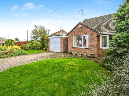 2 bedroom bungalow for sale in Chilton Crescent, Mansfield Woodhouse, Mansfield, Nottinghamshire, NG19 — £170,000 • 2 bed • 2 bath • 831 ft²
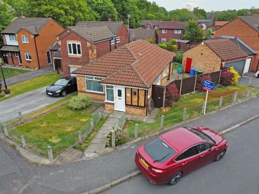 3 bedroom detached bungalow for sale in Ascot Drive, Mansfield, Nottinghamshire, NG18 — £220,000 • 3 bed • 1 bath • 771 ft²
 3 bedroom detached bungalow for sale in Oak Tree Lane, Mansfield, NG18 — £325,000 • 3 bed • 1 bath • 950 ft²
 2 bedroom detached bungalow for sale in Abbott Lea, Mansfield, NG19 — £285,000 • 2 bed • 1 bath • 1037 ft²
Meta
- {
"@context": "https://schema.org",
"@type": "Residence",
"name": "3 bedroom semidetached bungalow for sale in Budby Avenue, M…",
"description": "",
"url": "https://propertypiper.co.uk/property/f23f4d56-afdd-45a7-95a1-931889a3ecb4",
"image": "https://image-a.propertypiper.co.uk/c3e29425-696e-4cf2-8b68-dfab556b3e18-1024.jpeg",
"address": {
"@type": "PostalAddress",
"streetAddress": "29 BUDBY AVENUE MANSFIELD",
"postalCode": "NG18 3JA",
"addressLocality": "Mansfield",
"addressRegion": "Mansfield",
"addressCountry": "England"
},
"geo": {
"@type": "GeoCoordinates",
"latitude": 53.141620086366885,
"longitude": -1.16659997567582
},
"numberOfRooms": 3,
"numberOfBathroomsTotal": 1,
"floorSize": {
"@type": "QuantitativeValue",
"value": 936,
"unitCode": "FTK"
},
"offers": {
"@type": "Offer",
"price": 190000,
"priceCurrency": "GBP",
"availability": "https://schema.org/InStock"
},
"additionalProperty": [
{
"@type": "PropertyValue",
"name": "Feature",
"value": "1970s"
},
{
"@type": "PropertyValue",
"name": "Feature",
"value": "bungalow"
},
{
"@type": "PropertyValue",
"name": "Feature",
"value": "brick"
},
{
"@type": "PropertyValue",
"name": "Feature",
"value": "single-story"
},
{
"@type": "PropertyValue",
"name": "Feature",
"value": "attached garage"
},
{
"@type": "PropertyValue",
"name": "Feature",
"value": "paved driveway"
},
{
"@type": "PropertyValue",
"name": "Feature",
"value": "small garden"
},
{
"@type": "PropertyValue",
"name": "Feature",
"value": "modern kitchen"
},
{
"@type": "PropertyValue",
"name": "Feature",
"value": "white cabinetry"
},
{
"@type": "PropertyValue",
"name": "Feature",
"value": "integrated appliances"
},
{
"@type": "PropertyValue",
"name": "Feature",
"value": "tile flooring"
},
{
"@type": "PropertyValue",
"name": "Feature",
"value": "natural light"
}
]
}
High Res Floorplan Images
Compatible Floorplan Images
FloorplanImages Thumbnail