WS11 7GH - 4 bedroom detached house for sale in Hartlebury Close, Heat…
View on Property Piper
4 bedroom detached house for sale in Hartlebury Close, Heath Hayes, Cannock, WS11
Property Details
- Price: £400000
- Bedrooms: 4
- Bathrooms: 2
- Property Type: undefined
- Property SubType: undefined
Image Descriptions
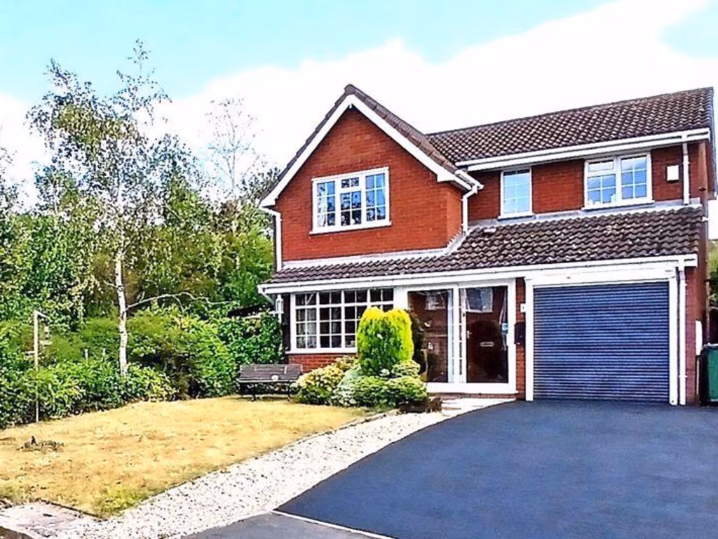
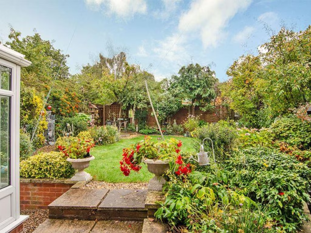
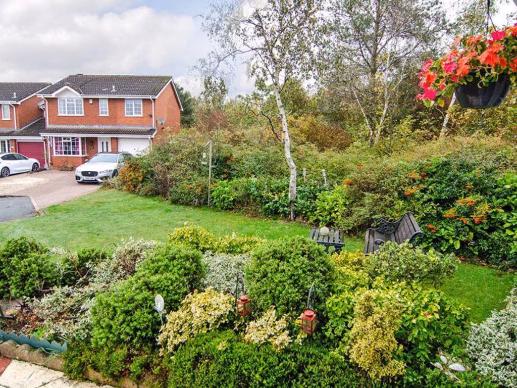
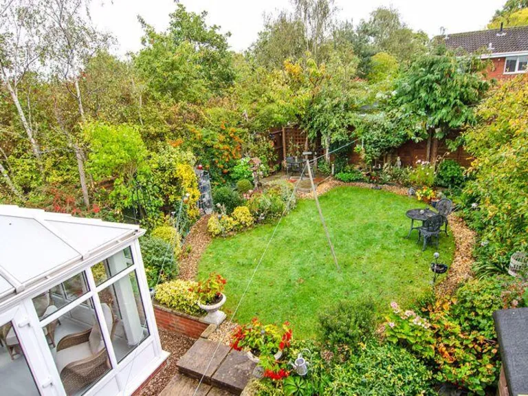
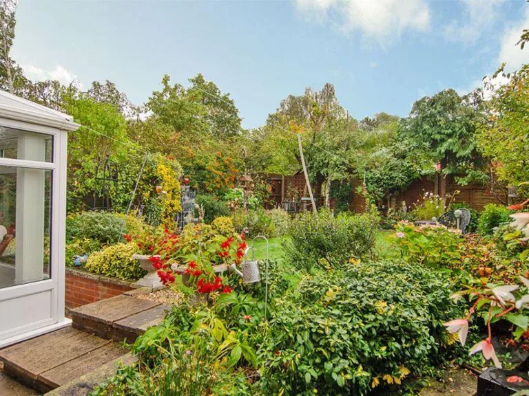
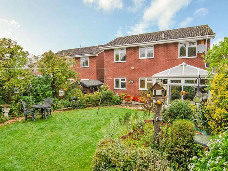
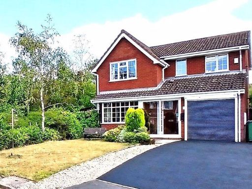
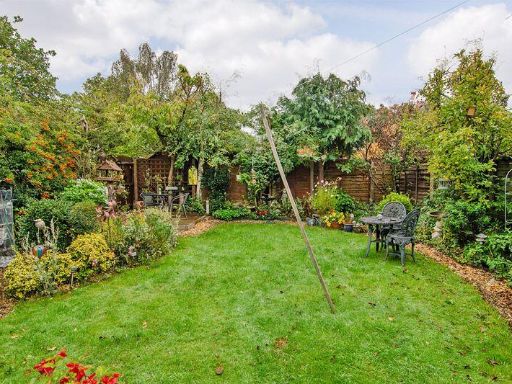
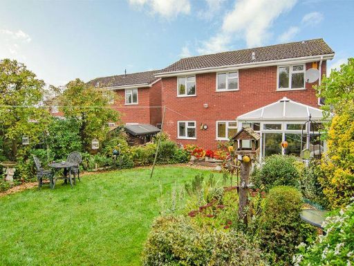
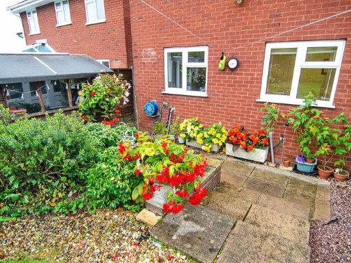
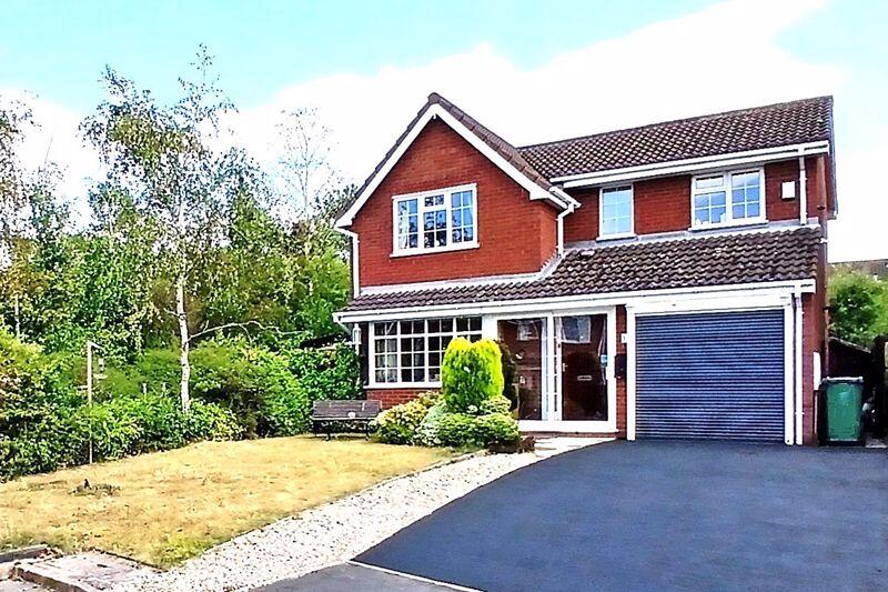
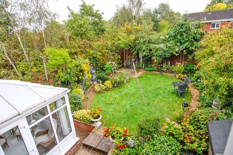
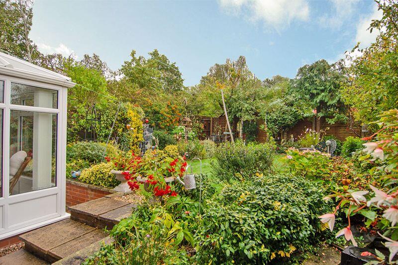
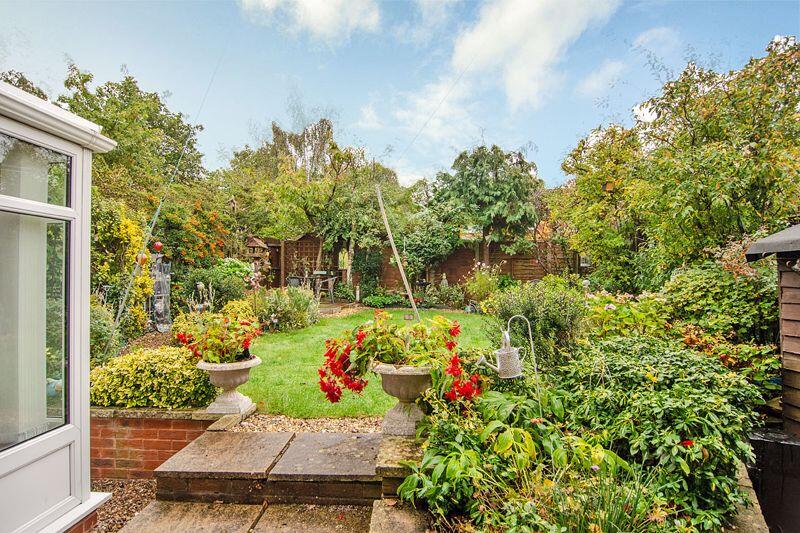
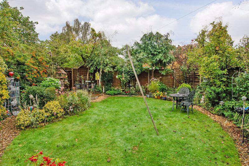
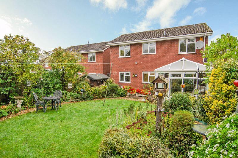
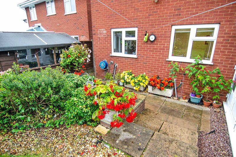
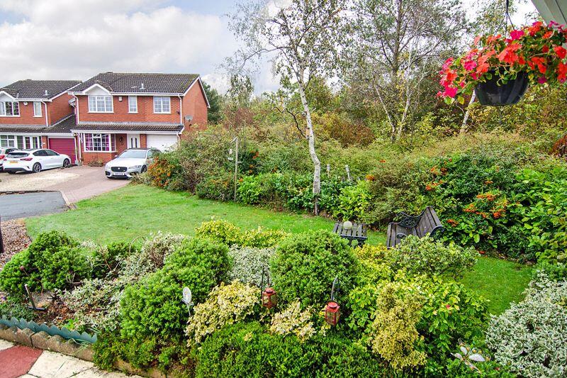
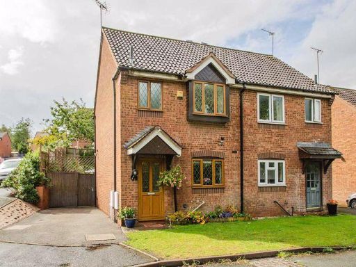
- exterior Modern Suburban
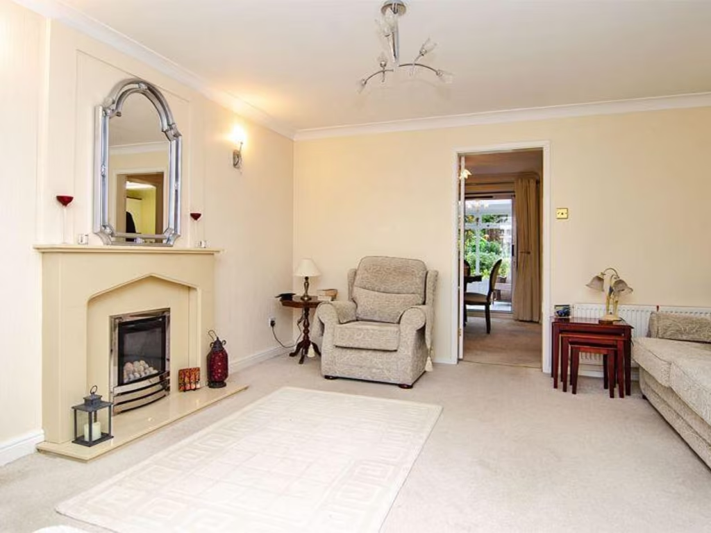
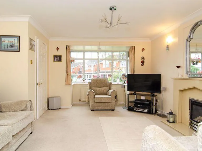
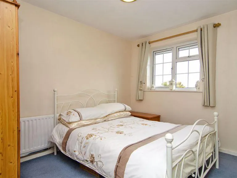
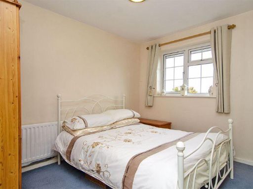
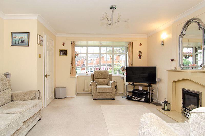
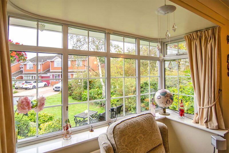
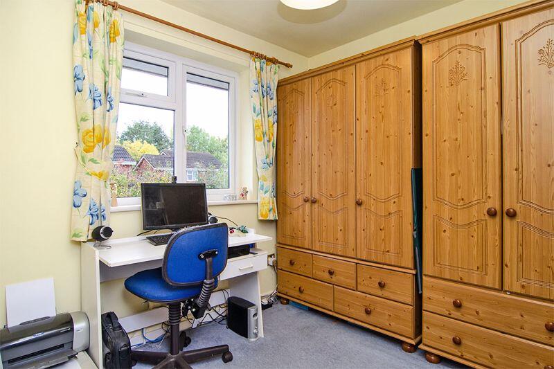
- living room modern
Floorplan Description
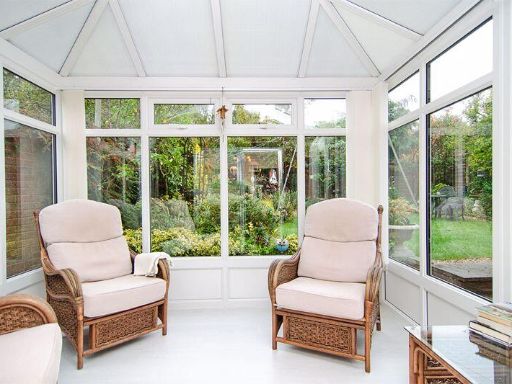
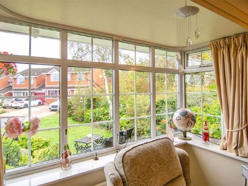
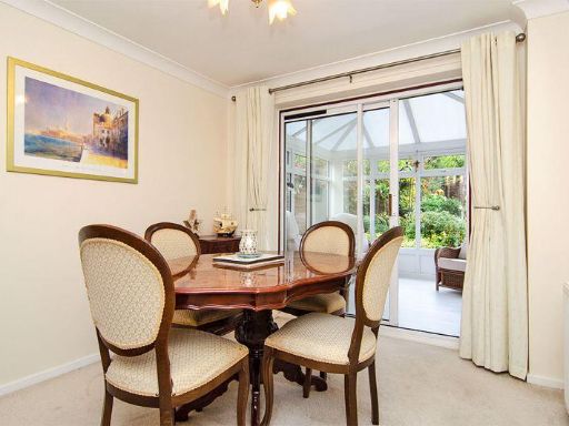
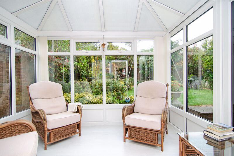
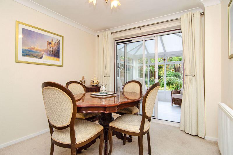
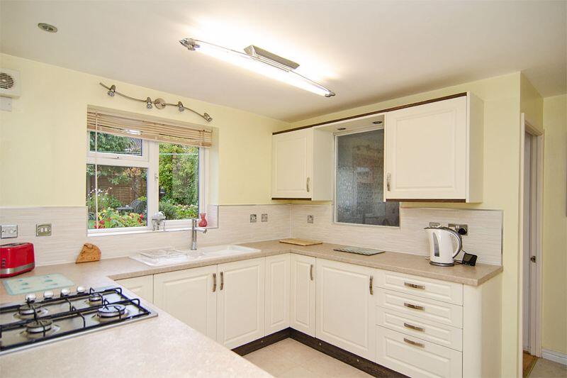
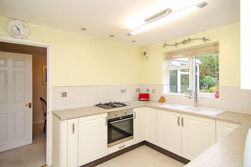
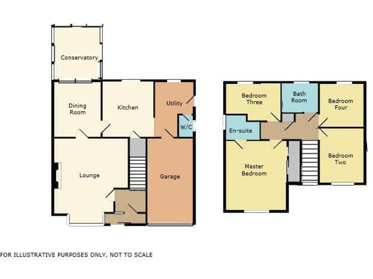
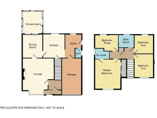
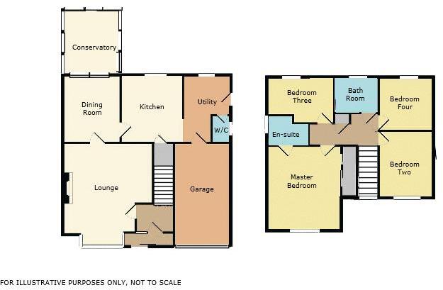
- Two-storey house floorplan with lounge, dining room, kitchen, conservatory, utility and garage on ground floor; four bedrooms and bathrooms on first floor.
Rooms
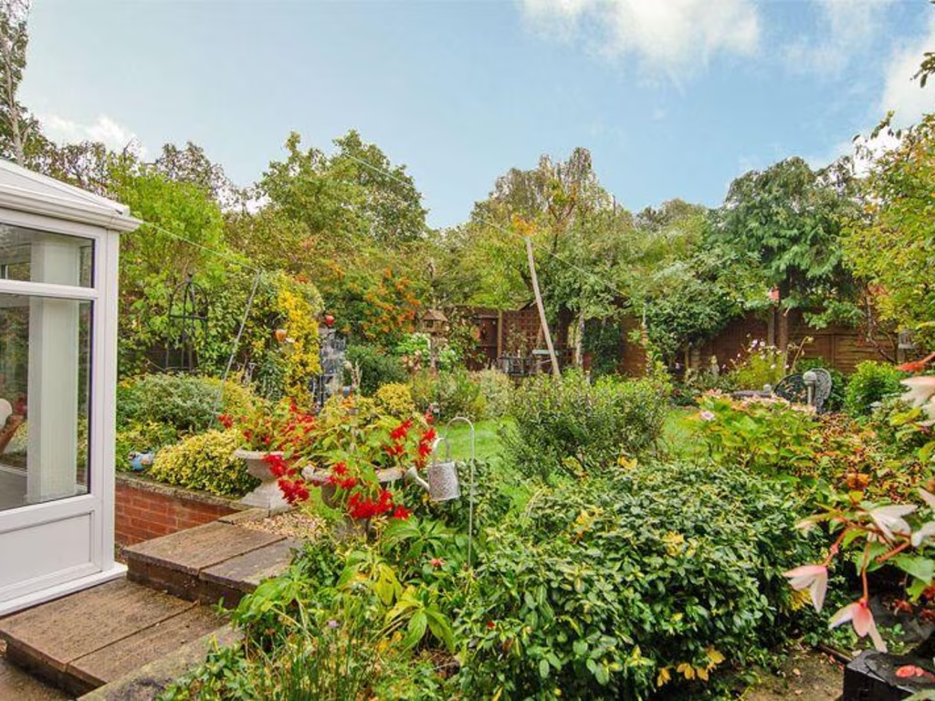
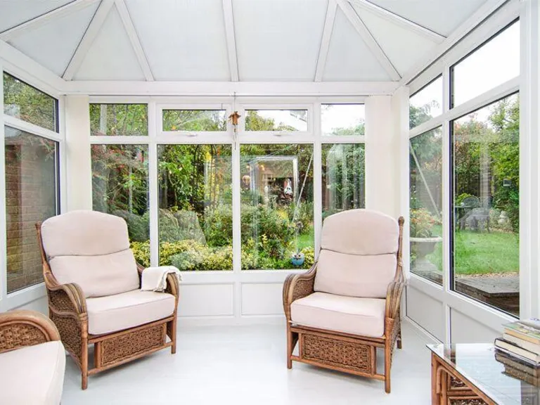
- Conservatory:
- Dining Room:
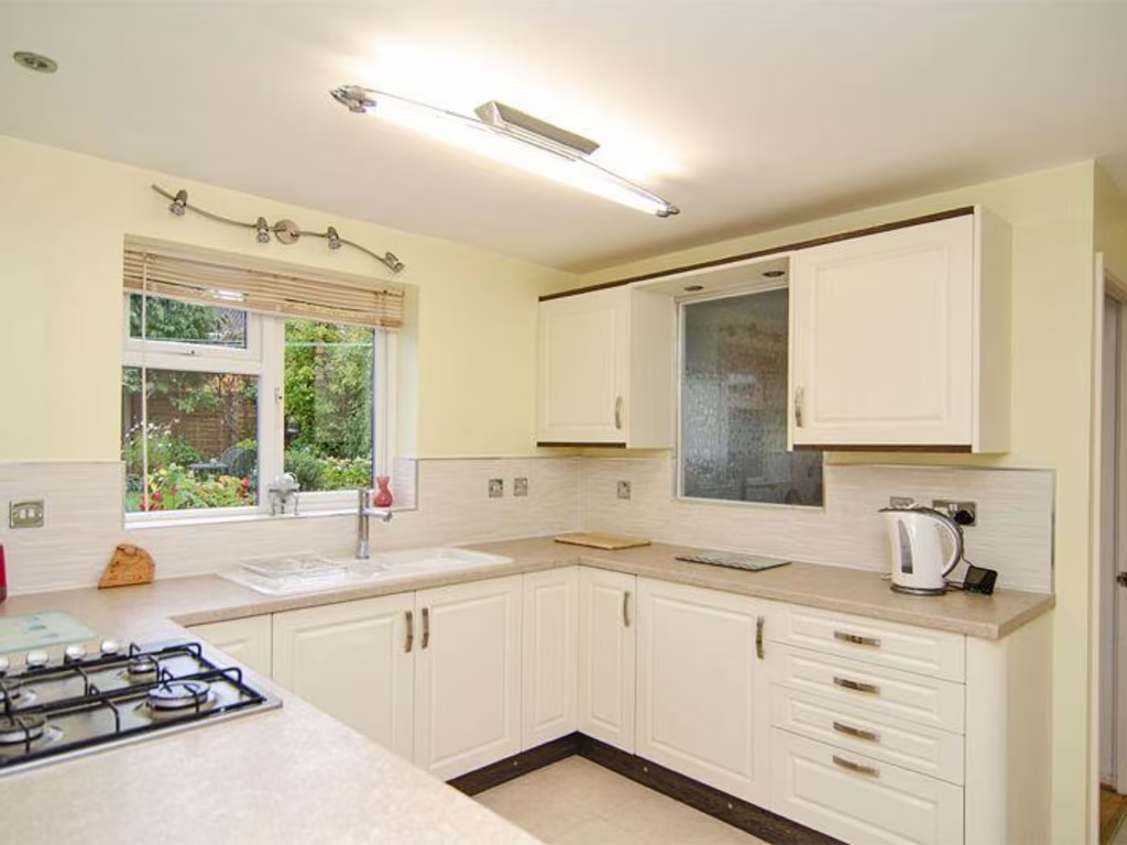
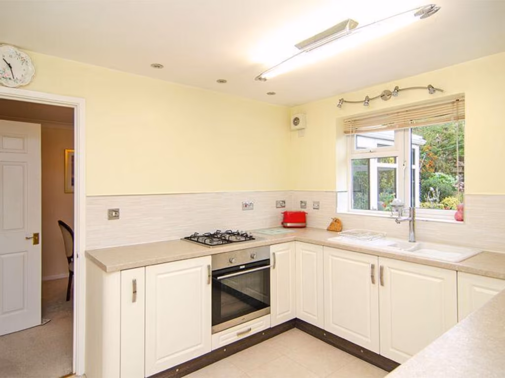
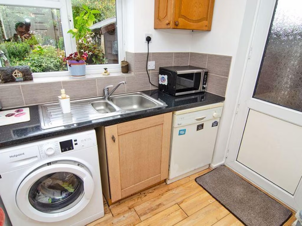
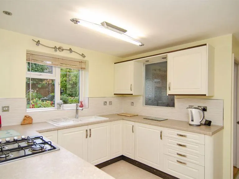
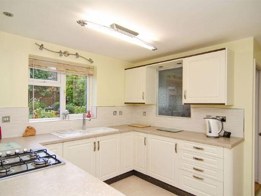
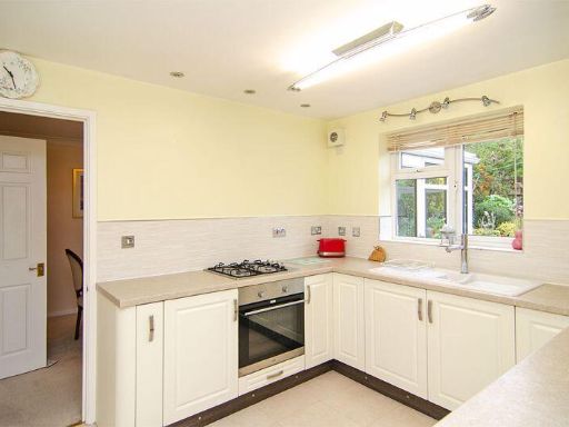
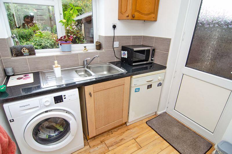
- Kitchen:
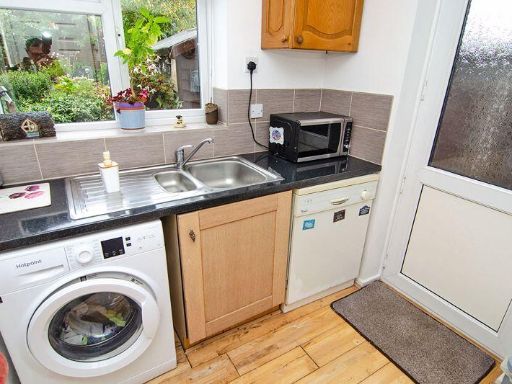
- Utility:
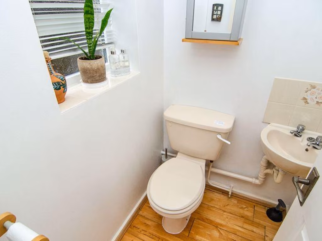
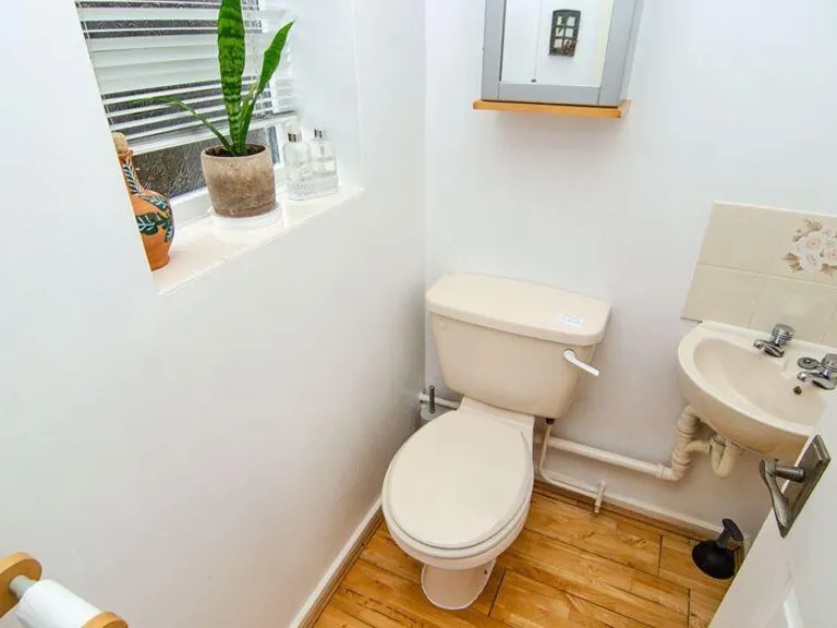
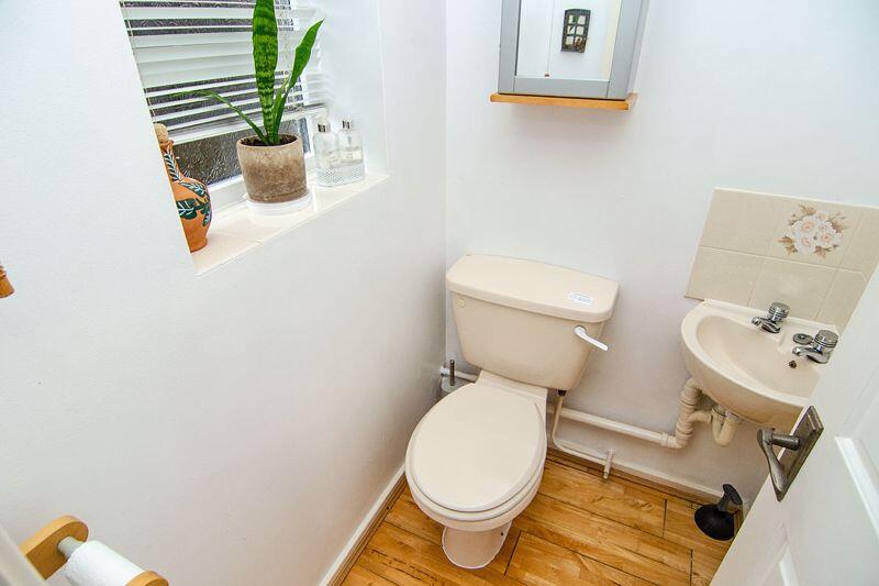
- W/C:
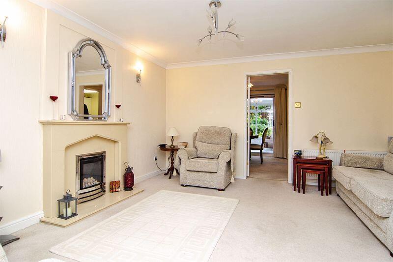
- Lounge:
- Garage:
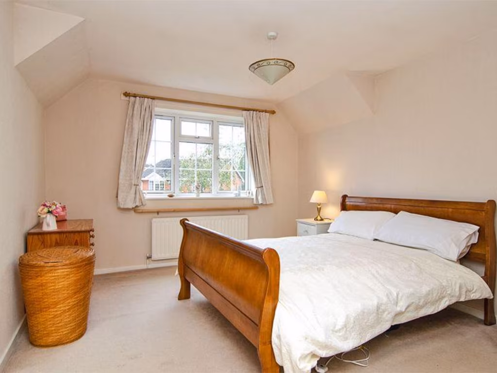
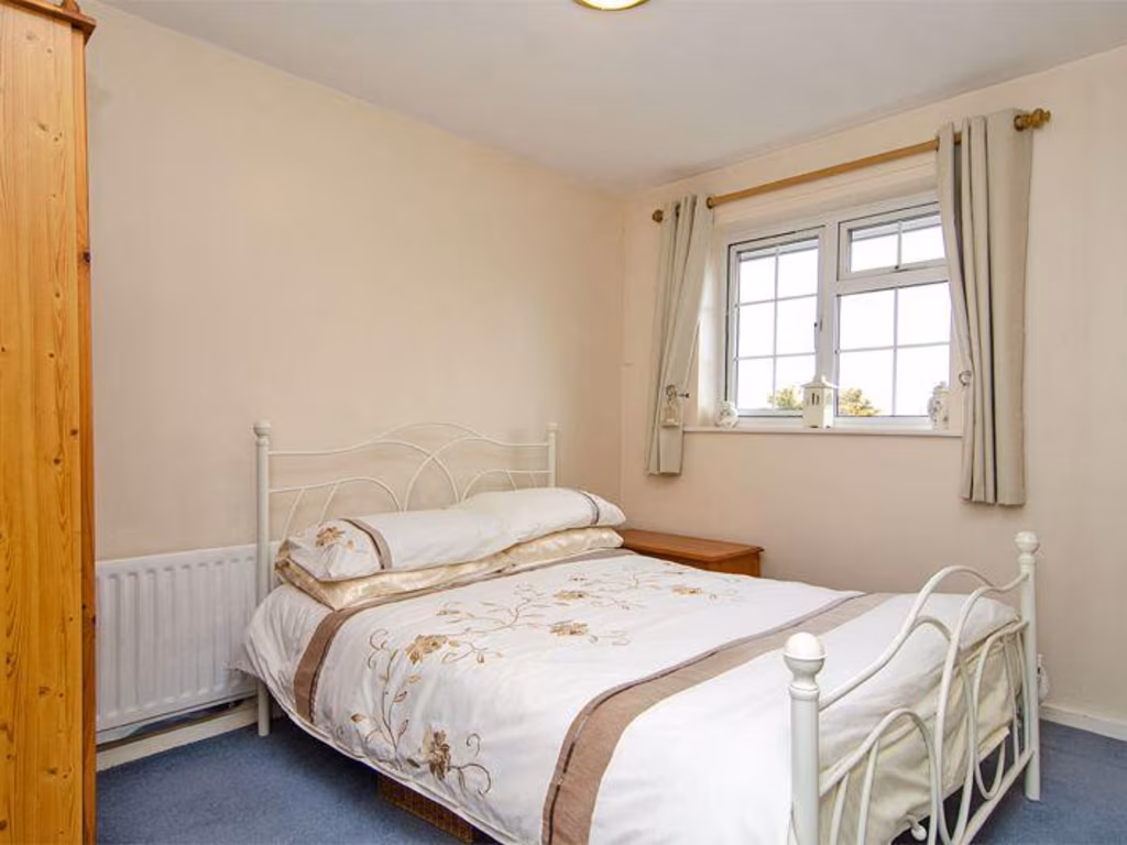
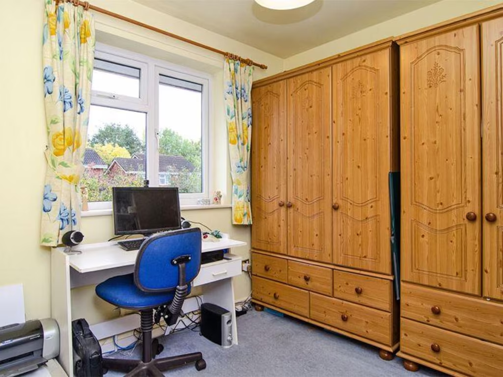
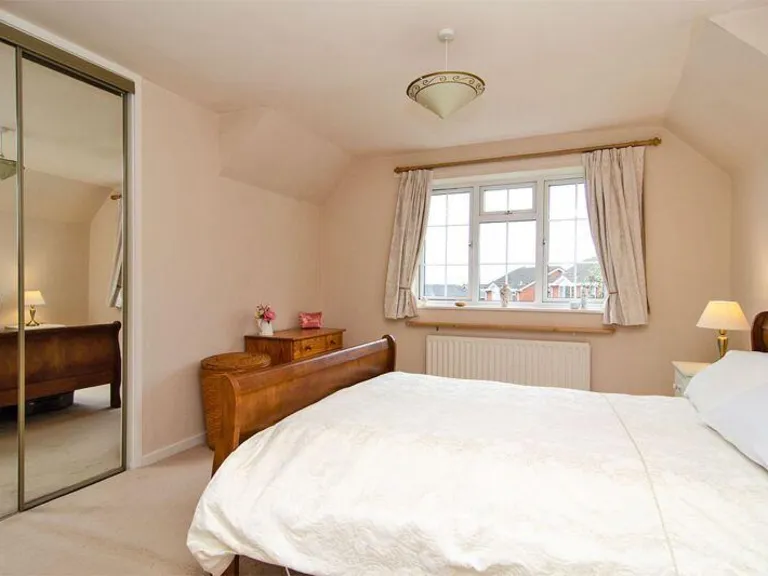
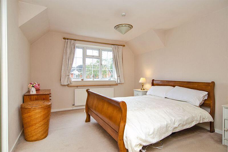
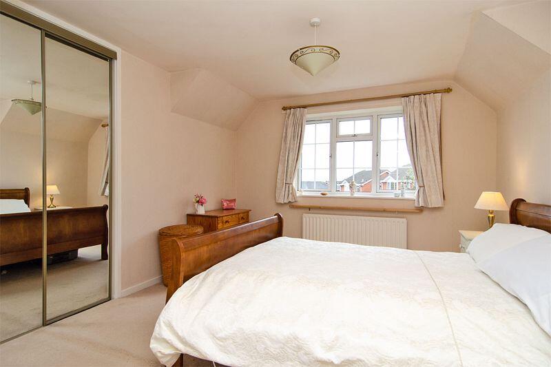
- Master Bedroom:
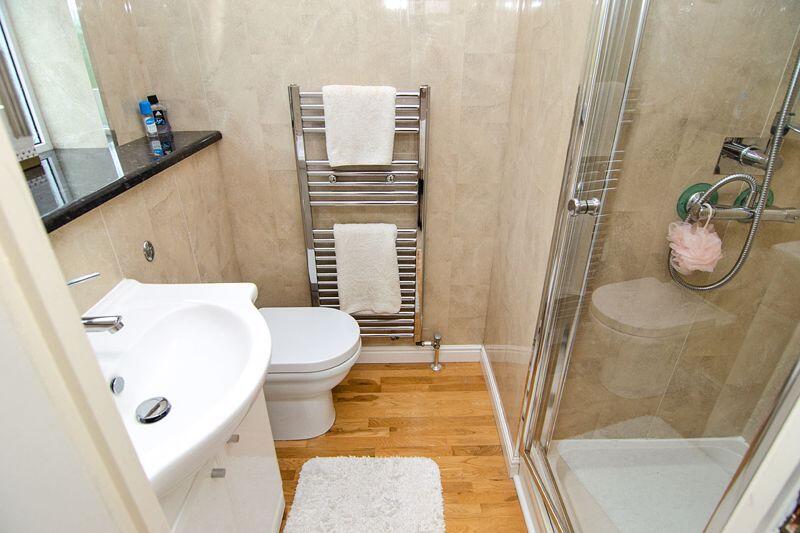
- En-suite:
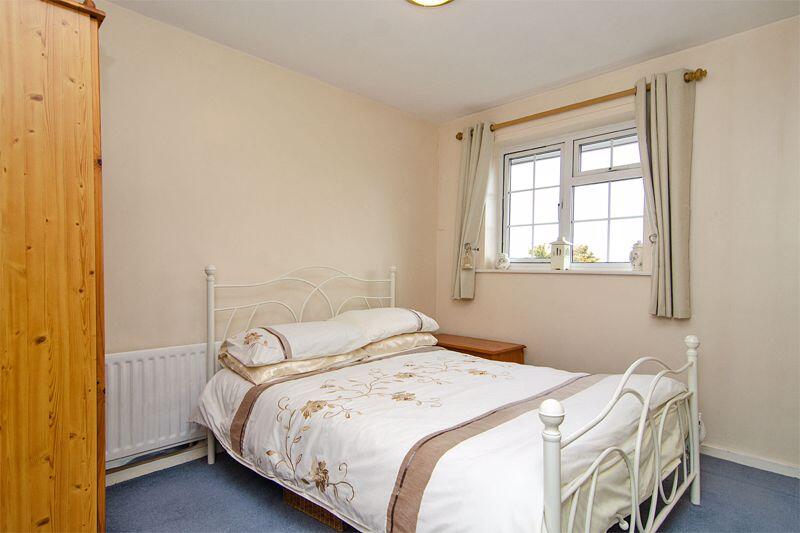
- Bedroom Three:
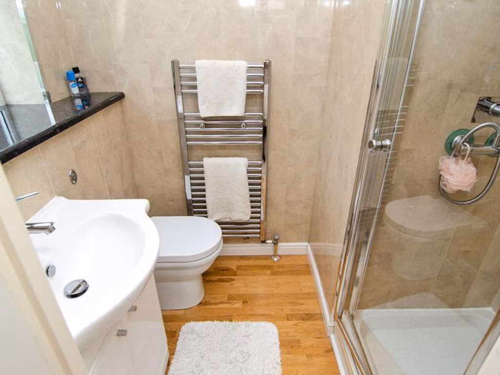
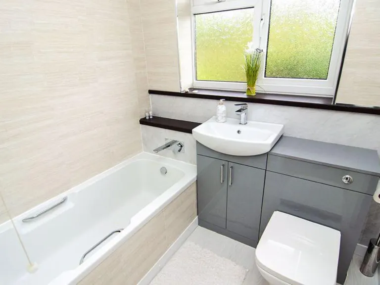
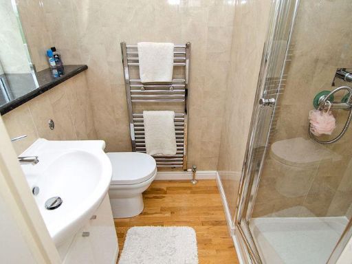
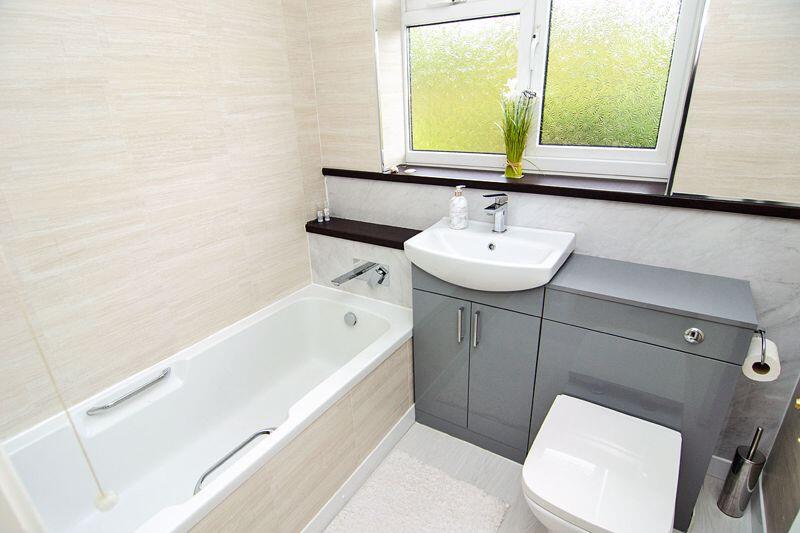
- Bath Room:
- Bedroom Four:
- Bedroom Two:
Textual Property Features
Detected Visual Features
- modern
- suburban
- semi-detached
- brick
- garage
- front garden
- driveway
- low-pitched roof
- bay windows
- modern style
- living room
- medium size
- average ceiling height
- natural light
- residential
Nearby Schools
- Jerome Primary School
- Norton Canes Primary Academy
- Heath Hayes Primary Academy
- Five Ways Primary School
- Cannock Chase High School
- Moorhill Primary School
- Kingsmead School
- St Joseph's Catholic Primary School
- Moat Hall Primary Academy
- Chase Grammar School International Study Centre
- Chase Grammar School
- Cardinal Griffin Catholic College
- Chadsmoor CofE (VC) Junior School
- Chadsmoor Community Infants and Nursery School
- Gorsemoor Primary School
- St Peter's CofE Primary Academy
- Great Wyrley Academy
- St Thomas More Catholic Primary School
- St Mary's Catholic Primary School
- West Hill Primary School
- Pye Green Academy
- Norton Canes High School
- Hazel Slade Primary Academy
- Bridgtown Primary School
- Redhill Primary School
- Poppyfield Primary Academy
- Staffordshire University Academy
Nearest General Shops
- Id: 404170617
- Tags:
- Building: yes
- Fixme: Check shop type and extent
- Name: The Lightworks
- Shop: mall
- TagsNormalized:
- Lat: 52.7089222
- Lon: -1.9996844
- FullGeoHash: gcqef7rgezr0
- PartitionGeoHash: gcqe
- Images:
- FoodStandards: null
- Distance: 1339.6
,- Id: 4064487672
- Tags:
- Name: Nickels and Dimes
- Shop: yes
- TagsNormalized:
- Lat: 52.7086078
- Lon: -1.9984391
- FullGeoHash: gcqefe2cbuxu
- PartitionGeoHash: gcqe
- Images:
- FoodStandards: null
- Distance: 1300.8
,- Id: 4064487651
- Tags:
- Brand: William Hill
- Brand:wikidata: Q4053147
- Brand:wikipedia: en:William Hill (bookmaker)
- Name: William Hill
- Shop: bookmaker
- TagsNormalized:
- william hill
- bookmaker
- shop
- Lat: 52.7085135
- Lon: -1.9987046
- FullGeoHash: gcqefe296g1f
- PartitionGeoHash: gcqe
- Images:
- FoodStandards: null
- Distance: 1290.7
}
Nearest Grocery shops
- Id: 1093874472
- Tags:
- Amenity: fast_food
- Name: Chip Shop
- TagsNormalized:
- Lat: 52.6896199
- Lon: -1.9823448
- FullGeoHash: gcqedzue2109
- PartitionGeoHash: gcqe
- Images:
- FoodStandards: null
- Distance: 1338.5
,- Id: 357827461
- Tags:
- Building: yes
- Name: The Co-operative Food
- Shop: convenience
- TagsNormalized:
- the co-operative food
- food
- convenience
- shop
- Lat: 52.7034622
- Lon: -1.9973363
- FullGeoHash: gcqefd3eftqj
- PartitionGeoHash: gcqe
- Images:
- FoodStandards: null
- Distance: 730.5
,- Id: 663634312
- Tags:
- Addr:
- Housenumber: 2-3
- Postcode: WS12 2NF
- Street: Sharon Way
- Brand: One Stop
- Brand:wikidata: Q65954217
- Building: yes
- Fhrs:
- Name: One Stop
- Opening_hours: 06:00-23:00
- Shop: convenience
- Source:
- TagsNormalized:
- Lat: 52.7007798
- Lon: -1.9963003
- FullGeoHash: gcqef9fk6c6s
- PartitionGeoHash: gcqe
- Images:
- FoodStandards:
- Id: 1254319
- FHRSID: 1254319
- LocalAuthorityBusinessID: 589
- BusinessName: One Stop
- BusinessType: Retailers - other
- BusinessTypeID: 4613
- AddressLine1: null
- AddressLine2: 2-3 Sharon Way
- AddressLine3: null
- AddressLine4: Littleworth
- PostCode: WS12
- RatingValue: 5
- RatingKey: fhrs_5_en-GB
- RatingDate: 2019-01-08
- LocalAuthorityCode: 287
- LocalAuthorityName: Cannock Chase
- LocalAuthorityWebSite: http://www.cannockchasedc.gov.uk
- LocalAuthorityEmailAddress: environmentalhealth@cannockchasedc.gov.uk
- Scores:
- Hygiene: 0
- Structural: 0
- ConfidenceInManagement: 5
- NewRatingPending: false
- Geocode:
- Longitude: -1.98961317164527
- Latitude: 52.70161669004520
- Distance: 447.8
}
Nearest Religious buildings
- Id: 1075799278
- Tags:
- Amenity: place_of_worship
- Building: church
- Denomination: catholic
- Name: Our Lady of Lourdes
- Religion: christian
- TagsNormalized:
- place of worship
- church
- catholic
- christian
- Lat: 52.7055224
- Lon: -1.9966058
- FullGeoHash: gcqefddpgtqz
- PartitionGeoHash: gcqe
- Images:
- FoodStandards: null
- Distance: 963.2
,- Id: 489123813
- Tags:
- Amenity: place_of_worship
- Building: yes
- Name: Hednesford Pentecostal Church
- Religion: christian
- TagsNormalized:
- place of worship
- church
- pentecostal
- christian
- Lat: 52.6941826
- Lon: -1.9893617
- FullGeoHash: gcqef8xmue86
- PartitionGeoHash: gcqe
- Images:
- FoodStandards: null
- Distance: 665.3
,- Id: 1077699473
- Tags:
- Amenity: place_of_worship
- Building: church
- Denomination: baptist
- Name: Kingsmead Independent Baptist Church
- Religion: christian
- Source: bing
- TagsNormalized:
- place of worship
- church
- baptist
- christian
- Lat: 52.702517
- Lon: -1.9971485
- FullGeoHash: gcqefd1wrj4p
- PartitionGeoHash: gcqe
- Images:
- FoodStandards: null
- Distance: 627
}
Nearest Medical buildings
- Id: 446825215
- Tags:
- Addr:
- City: Cannock
- Postcode: WS11 6DE
- Street: Moss Street
- Amenity: doctors
- Building: yes
- Healthcare: doctor
- Name: Moss Street Surgery
- Website: https://www.mossstreetsurgery.nhs.uk/
- TagsNormalized:
- doctor
- doctors
- health
- healthcare
- surgery
- Lat: 52.7033005
- Lon: -2.0133039
- FullGeoHash: gcqef4mfyx7c
- PartitionGeoHash: gcqe
- Images:
- FoodStandards: null
- Distance: 1244.1
,- Id: 4065576567
- Tags:
- Amenity: dentist
- Healthcare: dentist
- Name: The Valley
- TagsNormalized:
- Lat: 52.7074329
- Lon: -2.0012473
- FullGeoHash: gcqef7nep99u
- PartitionGeoHash: gcqe
- Images:
- FoodStandards: null
- Distance: 1188.5
,- Id: 1078236173
- Tags:
- Addr:
- City: Heath Hayes, Cannock
- Postcode: WS12 3TG
- Street: Gorsemoor Road
- Amenity: doctors
- Building: yes
- Healthcare: doctor
- Name: Heath Hayes Health Centre
- Source: bing
- Website: https://www.heathhayeshealthcentre.nhs.uk/
- TagsNormalized:
- doctor
- doctors
- health
- healthcare
- health centre
- heath
- Lat: 52.6916476
- Lon: -1.9863394
- FullGeoHash: gcqefb1x4gjc
- PartitionGeoHash: gcqe
- Images:
- FoodStandards: null
- Distance: 987.8
,- Id: 412529451
- Tags:
- Brand: Nuffield Health Fitness & Wellbeing
- Brand:wikidata: Q7068711
- Brand:wikipedia: en:Nuffield Health
- Building: yes
- Leisure: fitness_centre
- Name: Nuffield Health Fitness & Wellbeing
- Source: bing
- TagsNormalized:
- fitness
- health
- nuffield
- nuffield health fitness & wellbeing
- fitness centre
- leisure
- Lat: 52.699641
- Lon: -2.0084247
- FullGeoHash: gcqef39t8m1g
- PartitionGeoHash: gcqe
- Images:
- FoodStandards: null
- Distance: 756.2
}
Nearest Airports
- Id: 2437117
- Tags:
- Aerodrome: international
- Aerodrome:type: public
- Aeroway: aerodrome
- Ele: 104
- Iata: BHX
- Icao: EGBB
- Internet_access: wlan
- Is_in: Birmingham,England,UK
- Name: Birmingham Airport
- Ref: BHX
- Type: multipolygon
- Website: https://www.birminghamairport.co.uk/
- Wikidata: Q8719
- Wikipedia: en:Birmingham Airport
- TagsNormalized:
- airport
- international airport
- Lat: 52.4543817
- Lon: -1.7468974
- FullGeoHash: gcqf2jpbym6y
- PartitionGeoHash: gcqf
- Images:
- FoodStandards: null
- Distance: 31867.4
}
Nearest Leisure Facilities
- Id: 314906986
- Tags:
- Leisure: pitch
- Sport: soccer
- Surface: grass
- TagsNormalized:
- Lat: 52.6976315
- Lon: -1.9888236
- FullGeoHash: gcqef9rccn98
- PartitionGeoHash: gcqe
- Images:
- FoodStandards: null
- Distance: 633.4
,- Id: 444300846
- Tags:
- TagsNormalized:
- Lat: 52.6929406
- Lon: -1.9966169
- FullGeoHash: gcqef86neknd
- PartitionGeoHash: gcqe
- Images:
- FoodStandards: null
- Distance: 453.4
,- Id: 444316377
- Tags:
- TagsNormalized:
- Lat: 52.6941043
- Lon: -2.0010912
- FullGeoHash: gcqef2wv7hyr
- PartitionGeoHash: gcqe
- Images:
- FoodStandards: null
- Distance: 369.8
,- Id: 190237520
- Tags:
- TagsNormalized:
- Lat: 52.693896
- Lon: -1.9978047
- FullGeoHash: gcqef89hpy0v
- PartitionGeoHash: gcqe
- Images:
- FoodStandards: null
- Distance: 336
,- Id: 444300847
- Tags:
- TagsNormalized:
- Lat: 52.6970399
- Lon: -1.9971083
- FullGeoHash: gcqef91y800p
- PartitionGeoHash: gcqe
- Images:
- FoodStandards: null
- Distance: 71.5
}
Nearest Tourist attractions
- Id: 1472478315
- Tags:
- Name: Prospect Village Nature Reserve
- Tourism: sign
- TagsNormalized:
- Lat: 52.7044945
- Lon: -1.953458
- FullGeoHash: gcqegd99cju5
- PartitionGeoHash: gcqe
- Images:
- FoodStandards: null
- Distance: 3127.1
,- Id: 9880469079
- Tags:
- Museum: history
- Name: Museum of Cannock Chase
- Source: survey
- Tourism: museum
- Website: http://www.museumofcannockchase.org/
- TagsNormalized:
- Lat: 52.7123825
- Lon: -1.9906899
- FullGeoHash: gcqefeyrvs61
- PartitionGeoHash: gcqe
- Images:
- FoodStandards: null
- Distance: 1792.2
,- Id: 1777797542
- Tags:
- Name: The Joshua Tree
- Tourism: motel
- TagsNormalized:
- Lat: 52.7077188
- Lon: -1.9975965
- FullGeoHash: gcqefe1kswuj
- PartitionGeoHash: gcqe
- Images:
- FoodStandards: null
- Distance: 1202.3
}
Nearest Train stations
- Id: 1130257036
- Tags:
- Name: Chasetown (Church Street)
- Public_transport: station
- Railway: station
- Usage: tourism
- Wikidata: Q5087253
- TagsNormalized:
- Lat: 52.6726252
- Lon: -1.942884
- FullGeoHash: gcqeeuc0r908
- PartitionGeoHash: gcqe
- Images:
- FoodStandards: null
- Distance: 4601
,- Id: 259529072
- Tags:
- Name: Chasewater Heaths
- Public_transport: station
- Railway: station
- Usage: tourism
- Wikidata: Q5087257
- TagsNormalized:
- Lat: 52.6761138
- Lon: -1.9469988
- FullGeoHash: gcqeetqhxek6
- PartitionGeoHash: gcqe
- Images:
- FoodStandards: null
- Distance: 4151.4
,- Id: 503897837
- Tags:
- Name: Norton Lakeside Halt
- Public_transport: station
- Railway: station
- Usage: tourism
- Wikidata: Q15262595
- TagsNormalized:
- Lat: 52.6748556
- Lon: -1.9568567
- FullGeoHash: gcqeempj3bvb
- PartitionGeoHash: gcqe
- Images:
- FoodStandards: null
- Distance: 3709.5
,- Id: 7656865229
- Tags:
- Name: Cannock
- Naptan:
- Network: National Rail
- Public_transport: station
- Railway: station
- Ref:
- Source: NPE
- West_midlands_fare_zone: 5
- Wikidata: Q4016379
- Wikipedia: en:Cannock railway station
- TagsNormalized:
- Lat: 52.6860971
- Lon: -2.0223507
- FullGeoHash: gcqe9zpqgb65
- PartitionGeoHash: gcqe
- Images:
- FoodStandards: null
- Distance: 2026.5
,- Id: 3727341272
- Tags:
- Addr:
- Postcode: WS12 1AZ
- Street: Market Street
- Name: Hednesford
- Naptan:
- Network: National Rail
- Operator: London Midland
- Platforms: 2
- Public_transport: station
- Railway: station
- Ref:
- Source: NPE
- West_midlands_fare_zone: 5
- Wikidata: Q2128872
- Wikipedia: en:Hednesford railway station
- TagsNormalized:
- Lat: 52.7099433
- Lon: -2.0019759
- FullGeoHash: gcqef7w1wtde
- PartitionGeoHash: gcqe
- Images:
- FoodStandards: null
- Distance: 1471.9
}
Nearest Hotels
- Id: 550007711
- Tags:
- Addr:
- City: Cannock
- Postcode: WS11 0DQ
- Street: Bridge Street
- Brand: Holiday Inn
- Brand:wikidata: Q2717882
- Brand:wikipedia: en:Holiday Inn
- Building: yes
- Fhrs:
- Name: Holiday Inn
- Operator: Holiday Inn
- Tourism: hotel
- TagsNormalized:
- Lat: 52.6734988
- Lon: -2.0250822
- FullGeoHash: gcqe9uvmk5v7
- PartitionGeoHash: gcqe
- Images:
- FoodStandards: null
- Distance: 3173.9
,- Id: 476931140
- Tags:
- Brand: Premier Inn
- Brand:wikidata: Q2108626
- Brand:wikipedia: en:Premier Inn
- Building: yes
- Internet_access: wlan
- Internet_access:fee: customers
- Internet_access:operator: Virgin Media
- Internet_access:ssid: Premier Inn Free Wi-Fi
- Name: Premier Inn
- Tourism: hotel
- TagsNormalized:
- Lat: 52.6747361
- Lon: -2.0225533
- FullGeoHash: gcqe9vphx4db
- PartitionGeoHash: gcqe
- Images:
- FoodStandards: null
- Distance: 2964.1
,- Id: 903739761
- Tags:
- Addr:
- Postcode: WS12 2DN
- Street: Hill Street
- Fhrs:
- Name: Cross Keys
- Source:
- Tourism: hotel
- TagsNormalized:
- Lat: 52.7004482
- Lon: -1.9970455
- FullGeoHash: gcqef9cf37wf
- PartitionGeoHash: gcqe
- Images:
- FoodStandards: null
- Distance: 400.3
}
Tags
- modern
- suburban
- semi-detached
- brick
- garage
- front garden
- driveway
- low-pitched roof
- bay windows
- modern style
- living room
- medium size
- average ceiling height
- natural light
- suburban
- residential
Local Market Stats
- Average Price/sqft: £237
- Avg Income: £38800
- Rental Yield: 4.1%
- Social Housing: 13%
- Planning Success Rate: 91%
Similar Properties
 2 bedroom semi-detached house for sale in Almond Close, Heath Hayes, WS11 — £220,000 • 2 bed • 1 bath • 473 ft²
 3 bedroom detached house for sale in Stafford Street, Heath Hayes, Cannock, WS12 — £295,000 • 3 bed • 1 bath • 1152 ft²
 4 bedroom semi-detached house for sale in Miners Way, Hednesford, Cannock, WS12 — £320,000 • 4 bed • 2 bath • 1070 ft²
 4 bedroom detached house for sale in Meadowsweet Way, Cannock, Staffordshire, WS12 — £400,000 • 4 bed • 2 bath • 1341 ft²
 4 bedroom detached house for sale in Strauss Drive, Heath Hayes, Cannock, WS11 — £325,000 • 4 bed • 2 bath • 1088 ft²
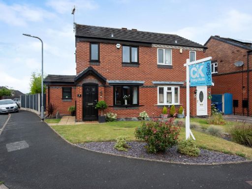 3 bedroom semi-detached house for sale in Mill Crescent, Heath Hayes, Cannock, WS11 — £270,000 • 3 bed • 2 bath • 851 ft²
Meta
- {
"@context": "https://schema.org",
"@type": "Residence",
"name": "4 bedroom detached house for sale in Hartlebury Close, Heat…",
"description": "",
"url": "https://propertypiper.co.uk/property/f1aac7b4-81ac-48e5-859d-b7734c3e5c1e",
"image": "https://image-a.propertypiper.co.uk/0d697825-4828-4505-81fb-90987cb884c4-1024.jpeg",
"address": {
"@type": "PostalAddress",
"streetAddress": "5, HARTLEBURY CLOSE, CANNOCK",
"postalCode": "WS11 7GH",
"addressLocality": "Cannock Chase",
"addressRegion": "Cannock Chase",
"addressCountry": "England"
},
"geo": {
"@type": "GeoCoordinates",
"latitude": 52.696911,
"longitude": -1.9981473
},
"numberOfRooms": 4,
"numberOfBathroomsTotal": 2,
"floorSize": {
"@type": "QuantitativeValue",
"value": 889,
"unitCode": "FTK"
},
"offers": {
"@type": "Offer",
"price": 400000,
"priceCurrency": "GBP",
"availability": "https://schema.org/InStock"
},
"additionalProperty": [
{
"@type": "PropertyValue",
"name": "Feature",
"value": "modern"
},
{
"@type": "PropertyValue",
"name": "Feature",
"value": "suburban"
},
{
"@type": "PropertyValue",
"name": "Feature",
"value": "semi-detached"
},
{
"@type": "PropertyValue",
"name": "Feature",
"value": "brick"
},
{
"@type": "PropertyValue",
"name": "Feature",
"value": "garage"
},
{
"@type": "PropertyValue",
"name": "Feature",
"value": "front garden"
},
{
"@type": "PropertyValue",
"name": "Feature",
"value": "driveway"
},
{
"@type": "PropertyValue",
"name": "Feature",
"value": "low-pitched roof"
},
{
"@type": "PropertyValue",
"name": "Feature",
"value": "bay windows"
},
{
"@type": "PropertyValue",
"name": "Feature",
"value": "modern style"
},
{
"@type": "PropertyValue",
"name": "Feature",
"value": "living room"
},
{
"@type": "PropertyValue",
"name": "Feature",
"value": "medium size"
},
{
"@type": "PropertyValue",
"name": "Feature",
"value": "average ceiling height"
},
{
"@type": "PropertyValue",
"name": "Feature",
"value": "natural light"
},
{
"@type": "PropertyValue",
"name": "Feature",
"value": "suburban"
},
{
"@type": "PropertyValue",
"name": "Feature",
"value": "residential"
}
]
}
High Res Floorplan Images
Compatible Floorplan Images
FloorplanImages Thumbnail