CH46 9QR - 3 bedroom semidetached house for sale in Carnsdale Road, Mo…
View on Property Piper
3 bedroom semi-detached house for sale in Carnsdale Road, Moreton, Wirral, CH46
Property Details
- Price: £200000
- Bedrooms: 3
- Bathrooms: 1
- Property Type: undefined
- Property SubType: undefined
Image Descriptions
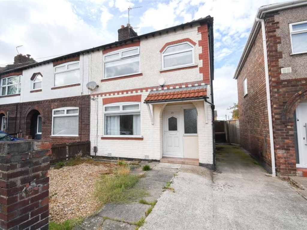
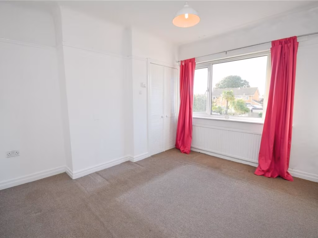
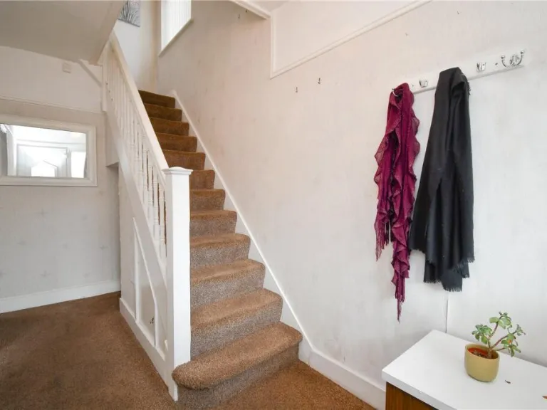
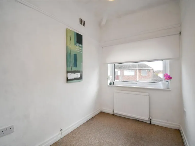
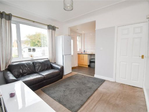
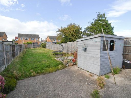
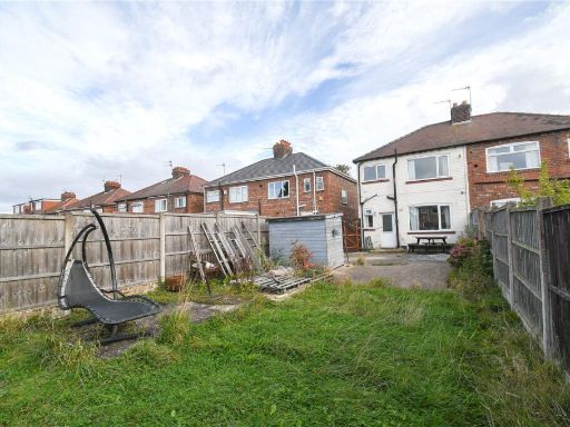
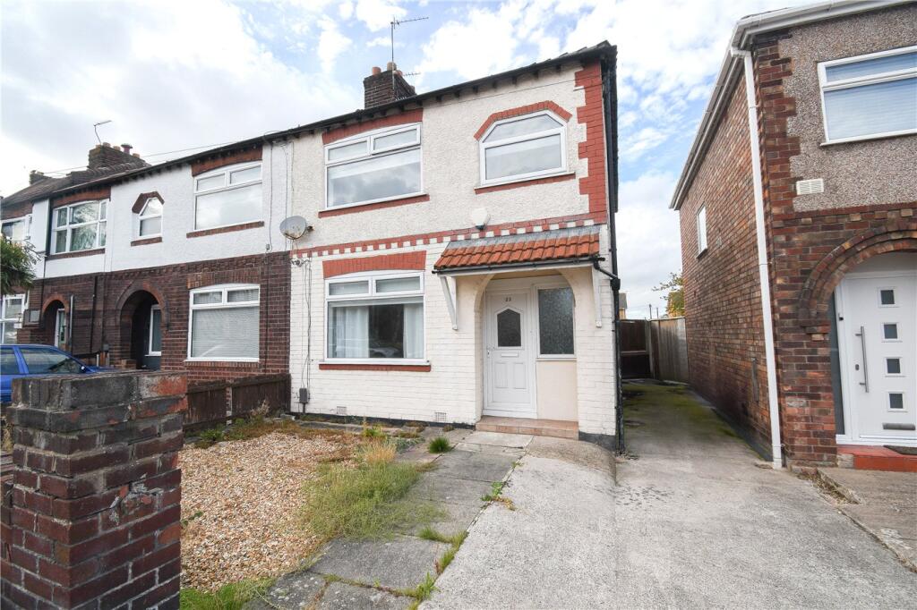
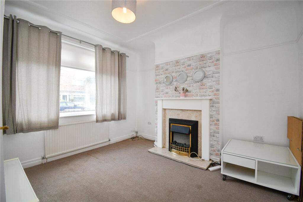
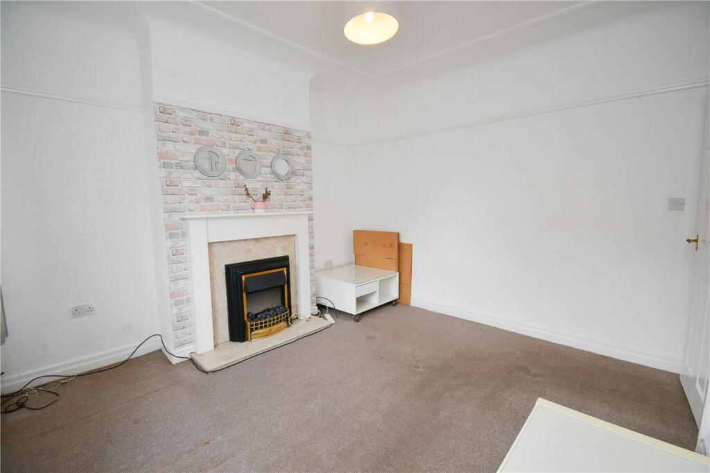
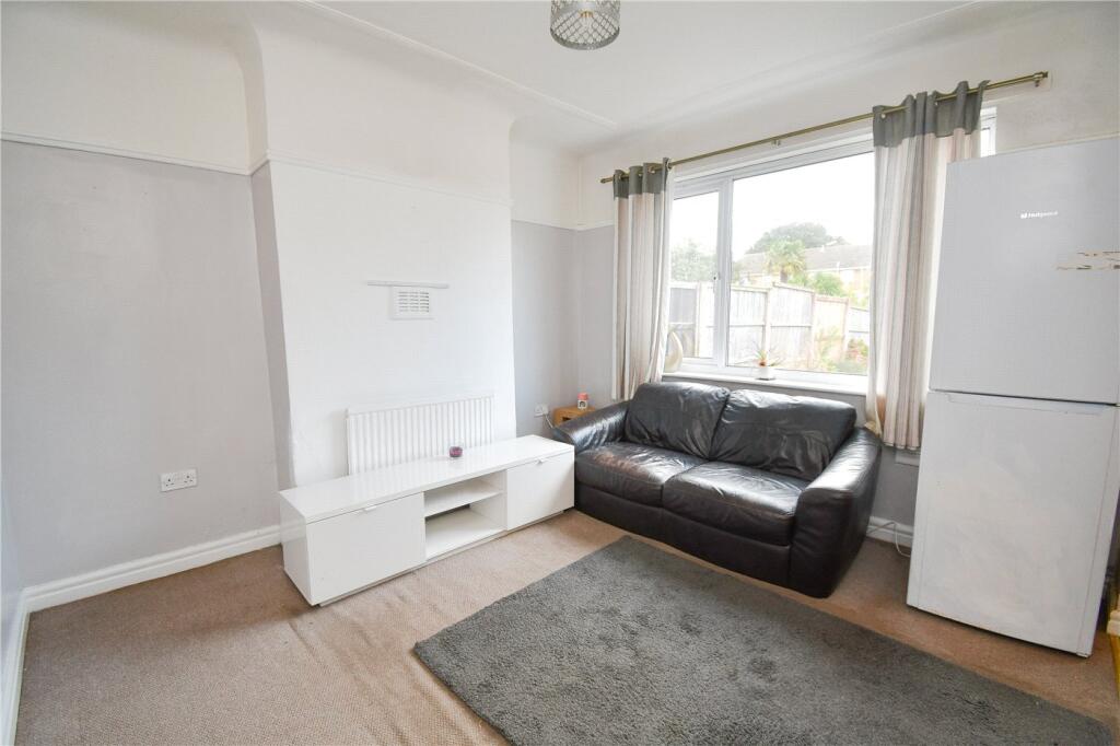
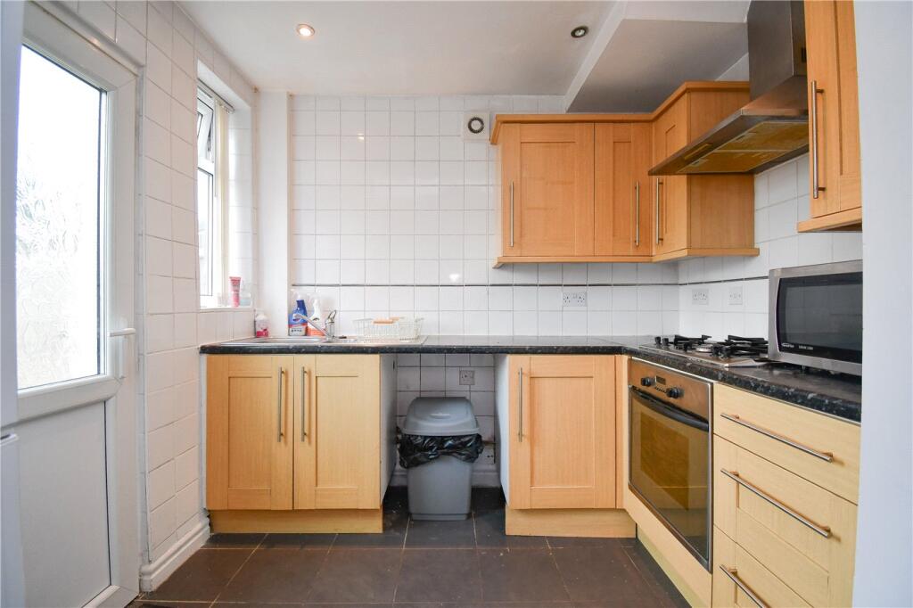
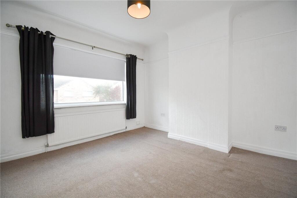
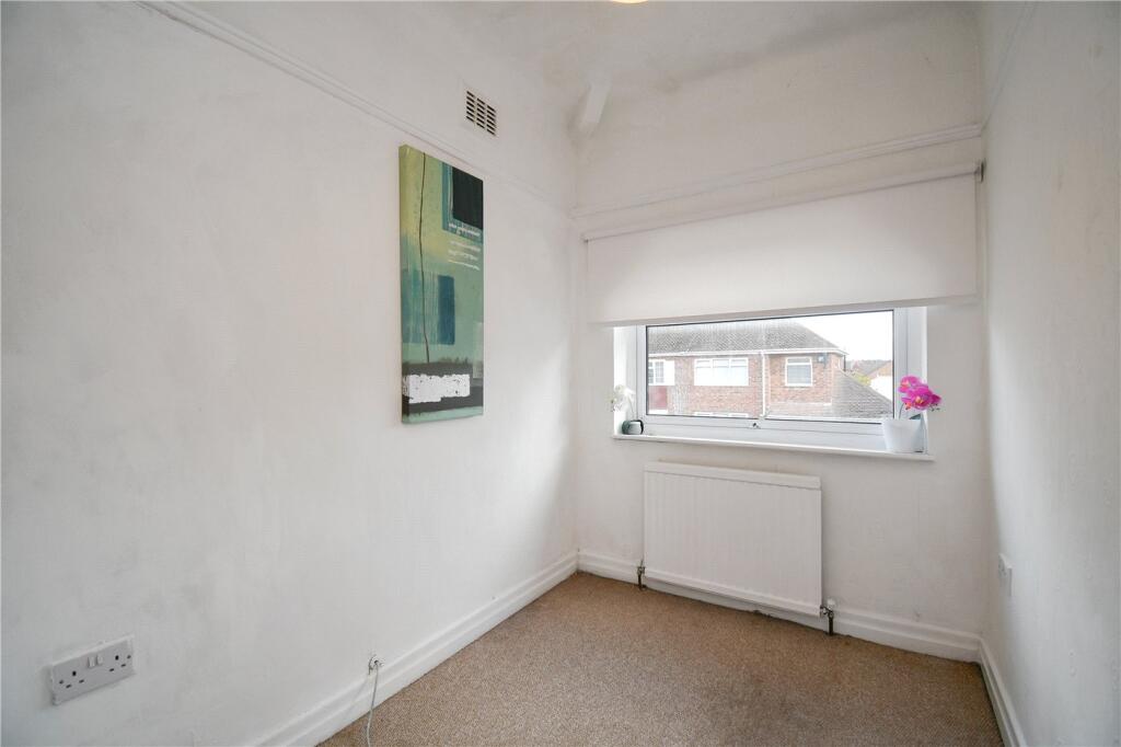
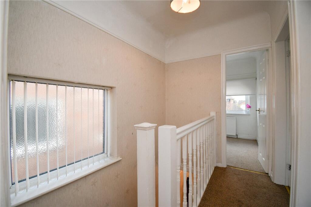
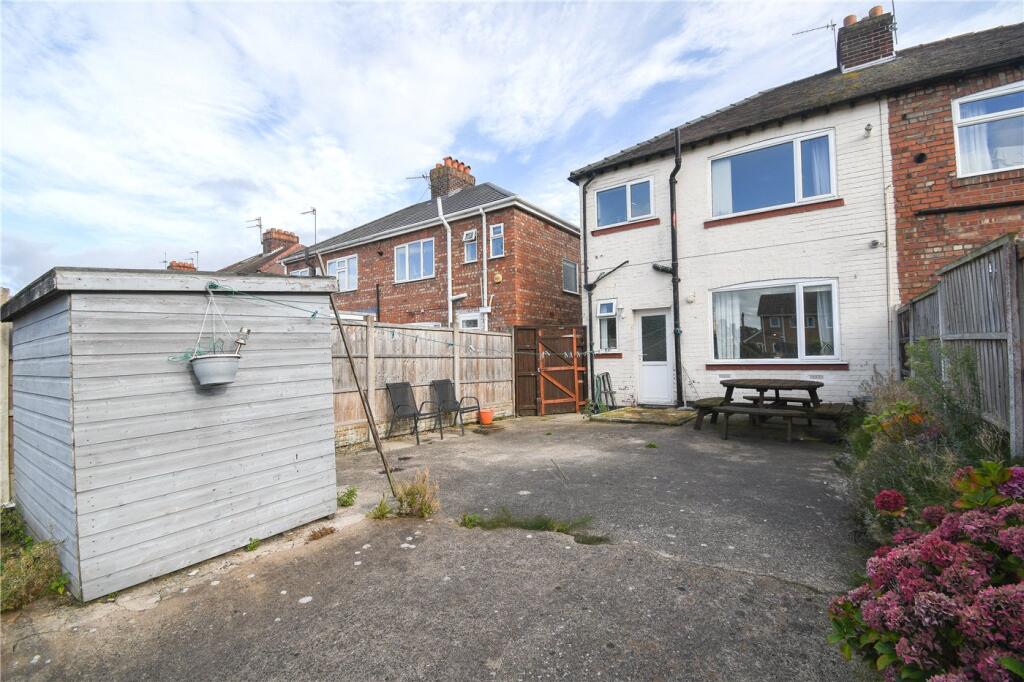
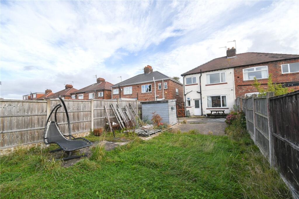
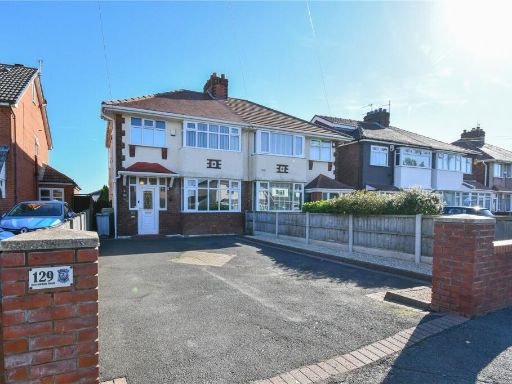
- duplex 20th-century semi-detached
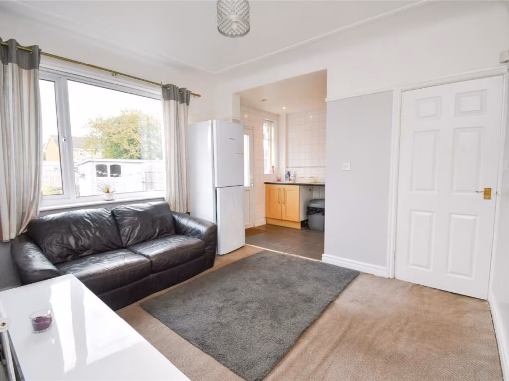
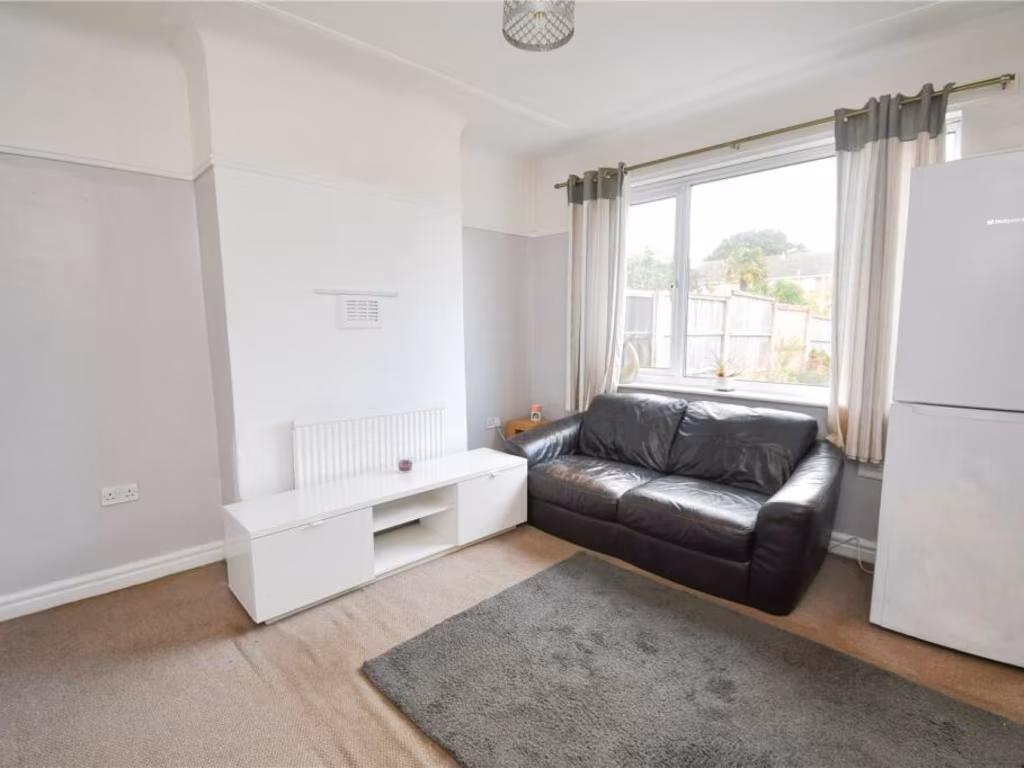
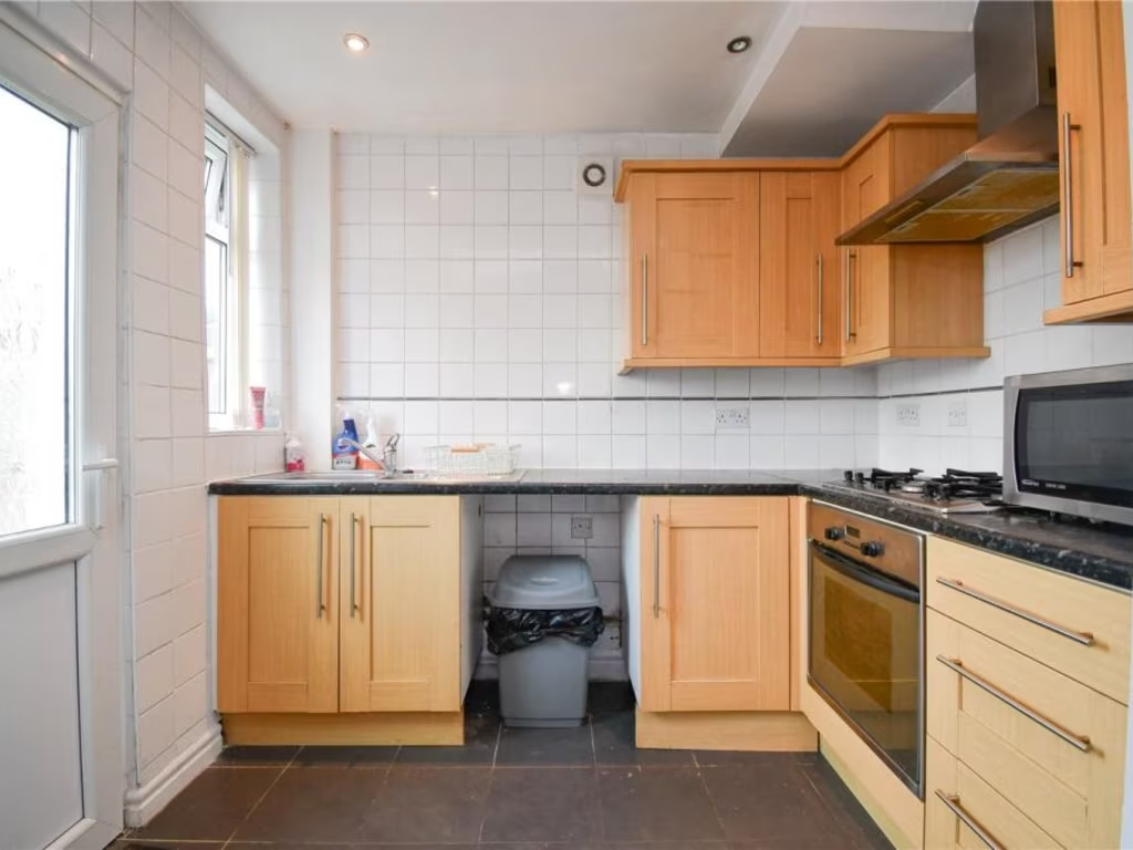
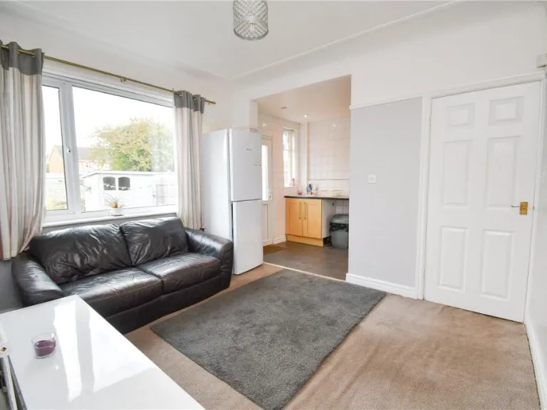
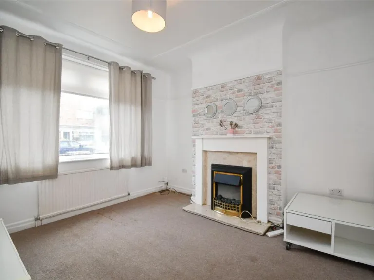
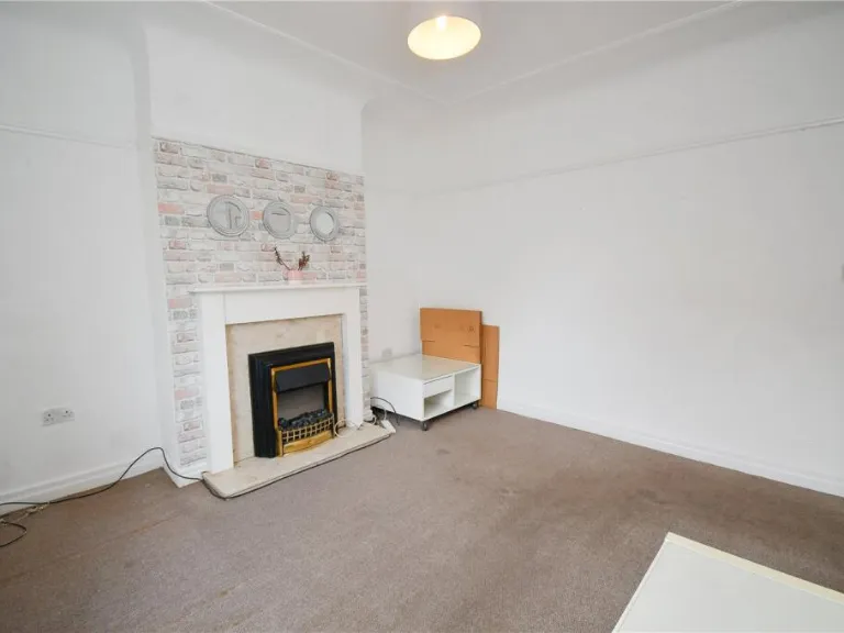
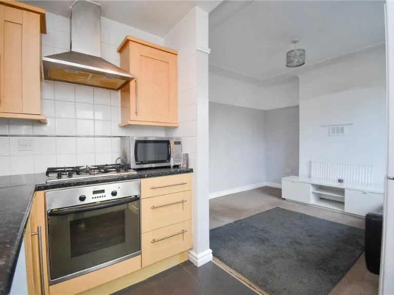
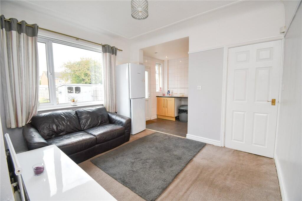
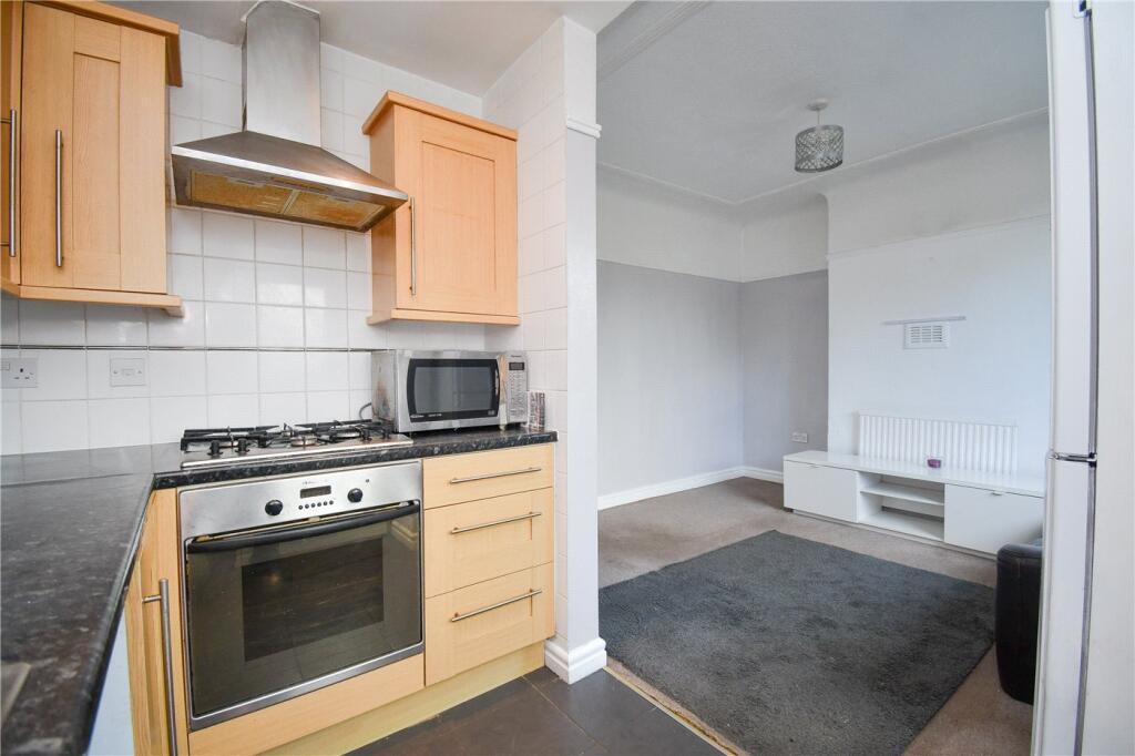
- small living room and partial kitchen view modern
Floorplan Description
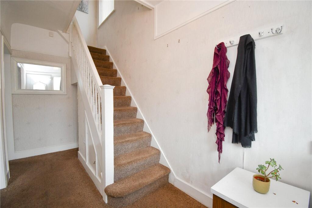
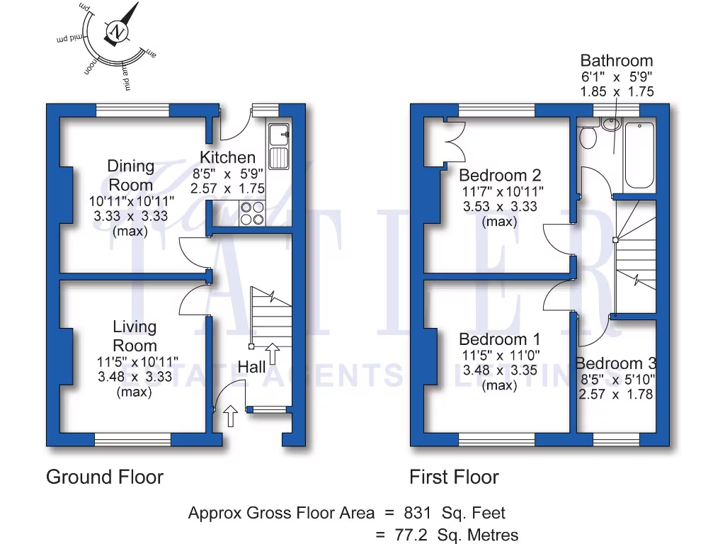
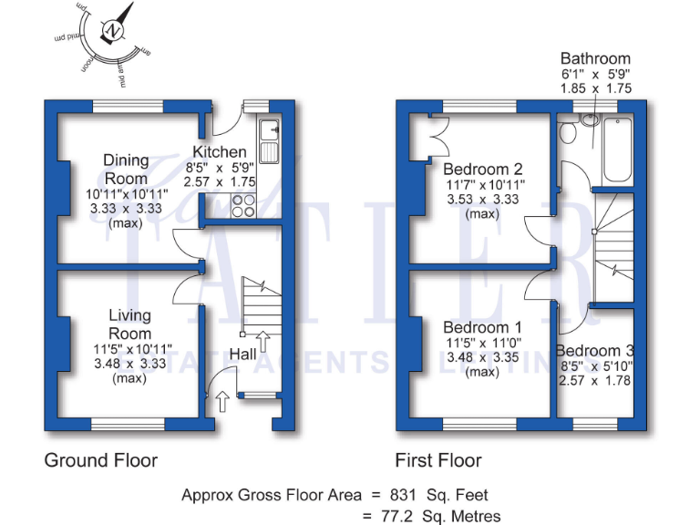
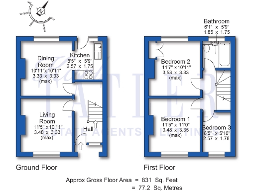
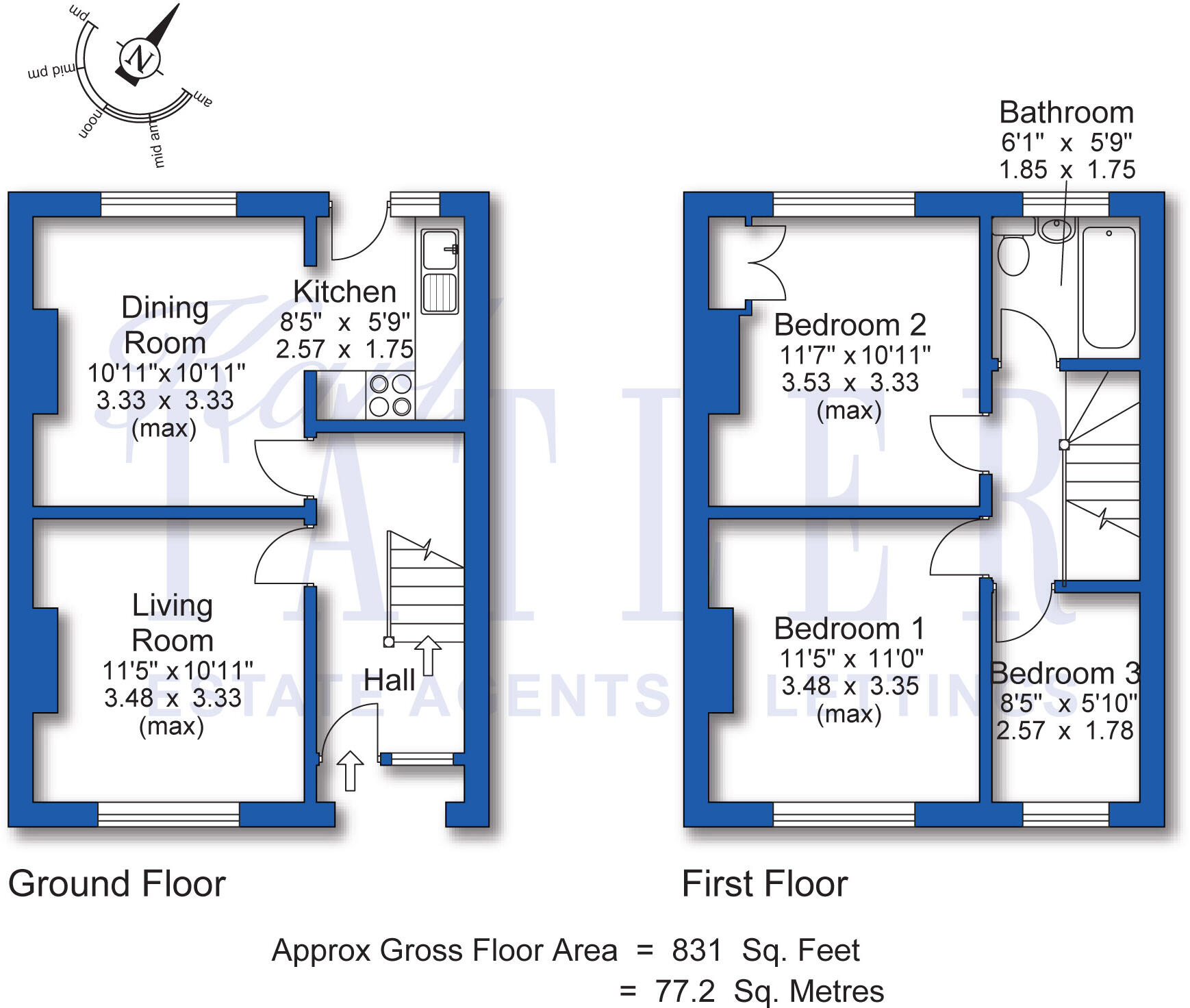
- Two-storey residential property plan with living, dining, kitchen on ground floor and three bedrooms plus bathroom on first floor.
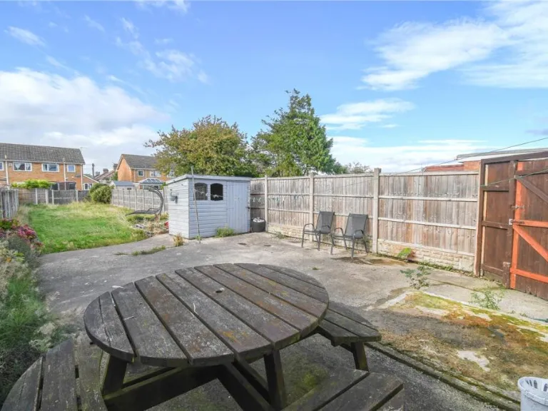
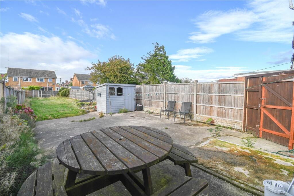
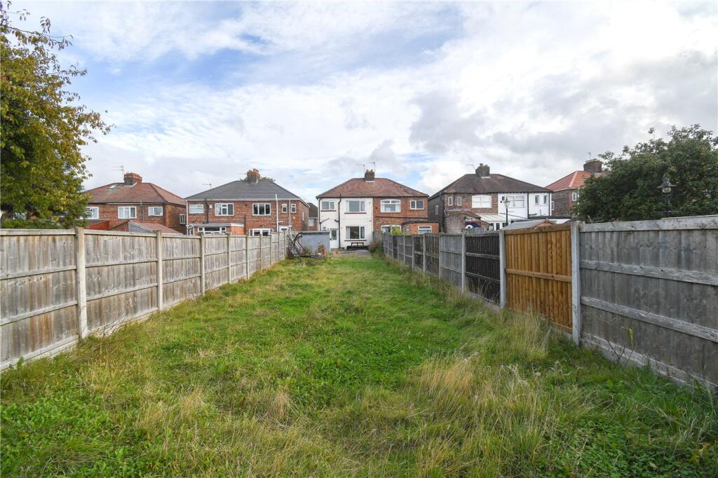
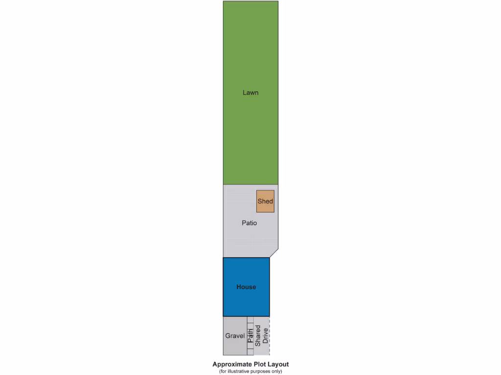
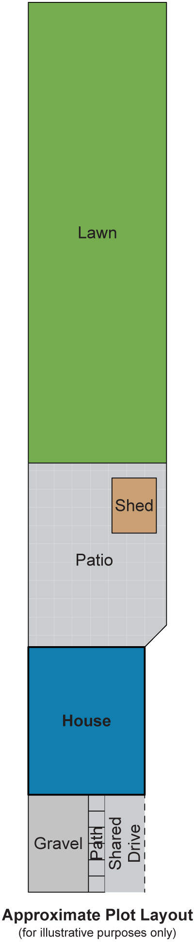
- Illustrative plot layout showing Lawn, Patio with Shed, House, Gravel, Path and Shared Drive.
Rooms
- Dining Room:
- Kitchen:
- Living Room:
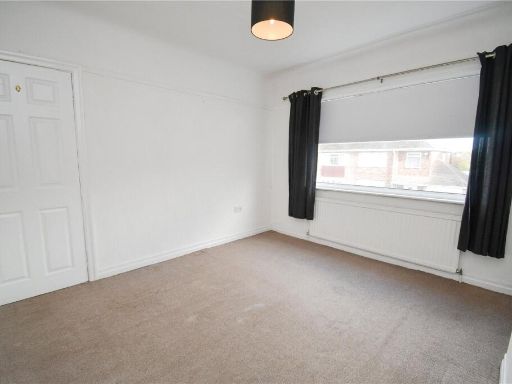
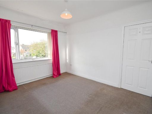
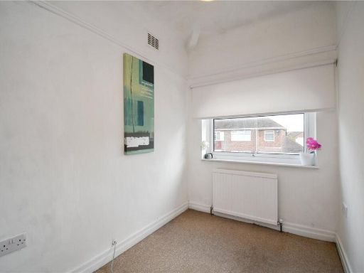
- Bedroom 2:
- Bedroom 1:
- Bedroom 3:
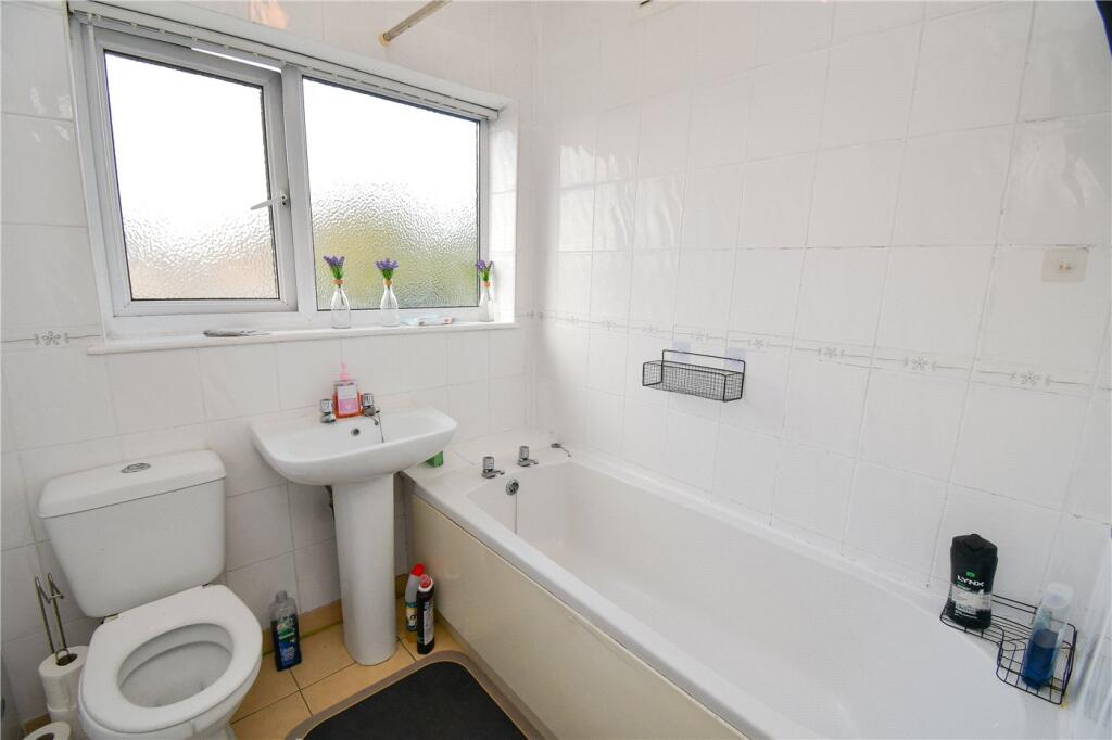
- Bathroom:
- Lawn:
- Patio:
- Shed:
- House:
- Gravel:
- Path:
- Shared Drive:
Textual Property Features
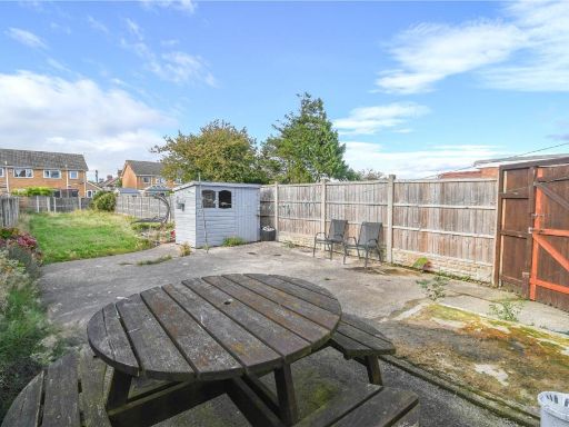
- Has Garden
- Chain Free
- Success
Detected Visual Features
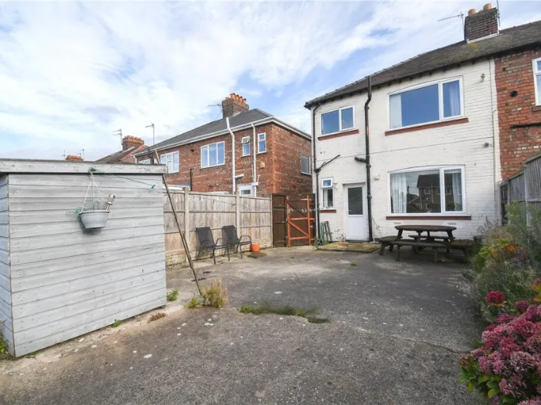
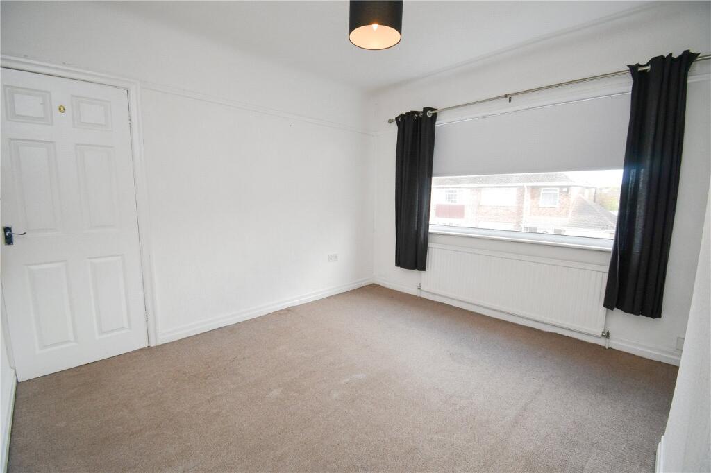
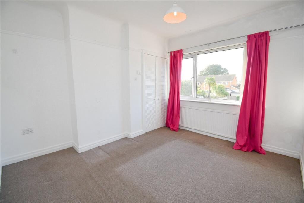
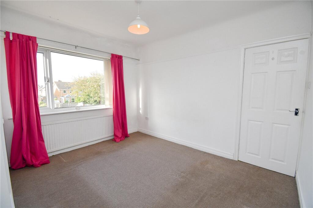
- 20th-century
- semi-detached
- duplex
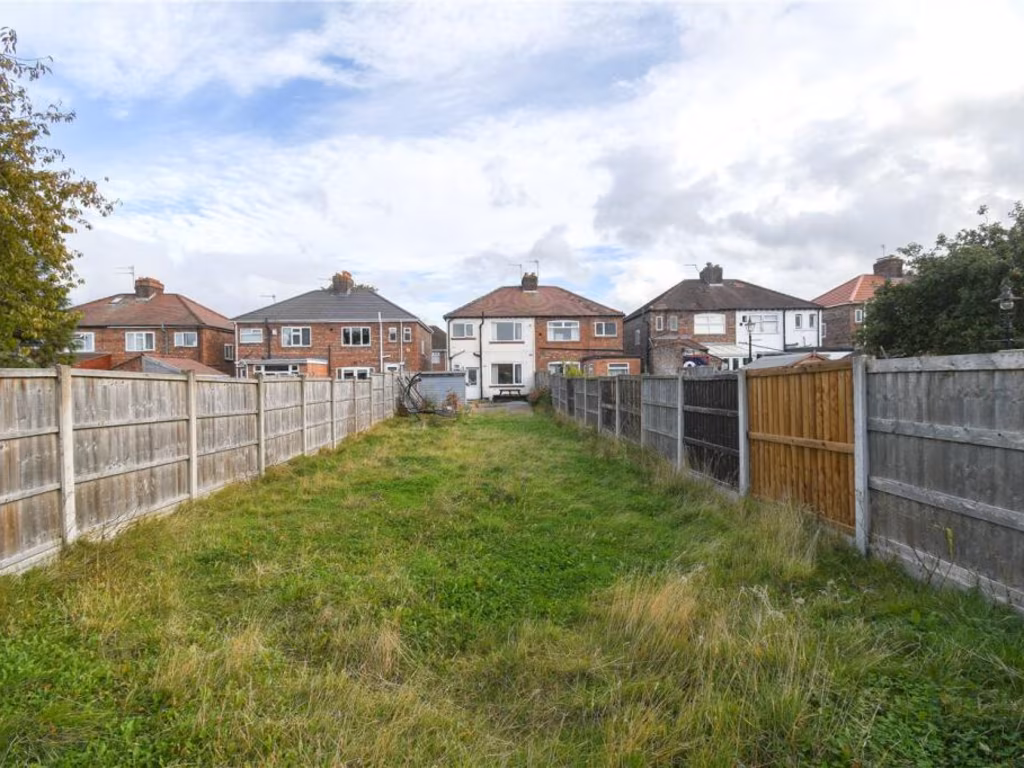
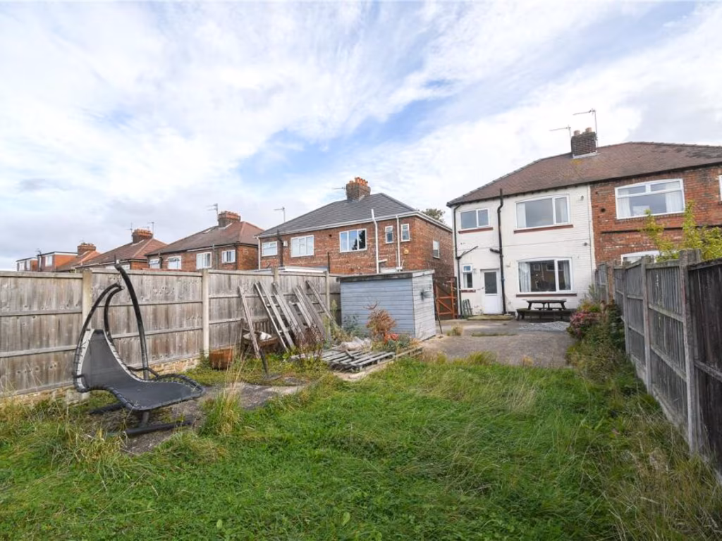
- gravel front garden
- off-street parking
- needs landscaping
- roof repair
- driveway
- suburban
- residential
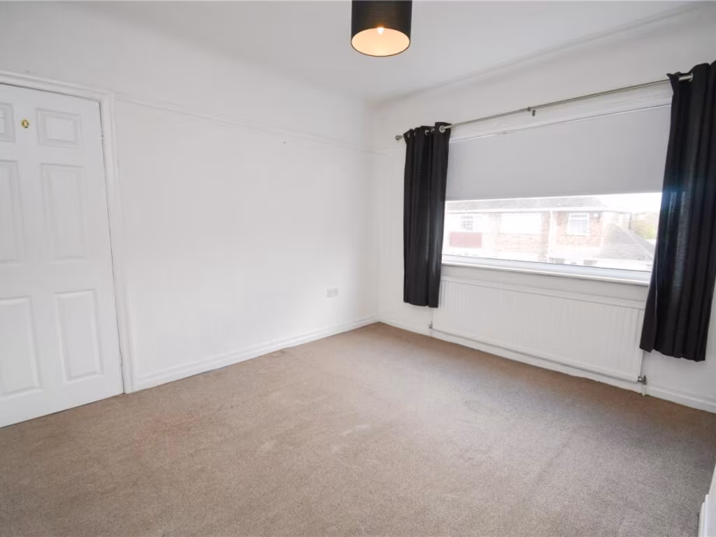
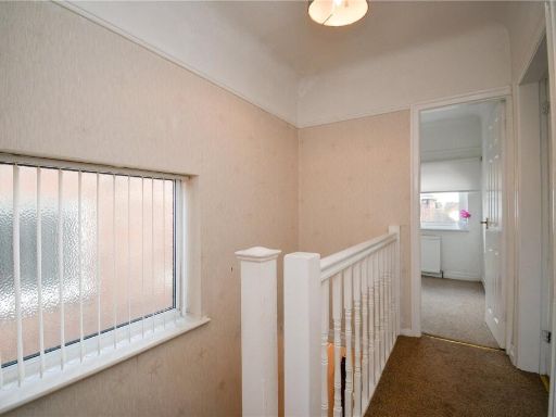
- two-story
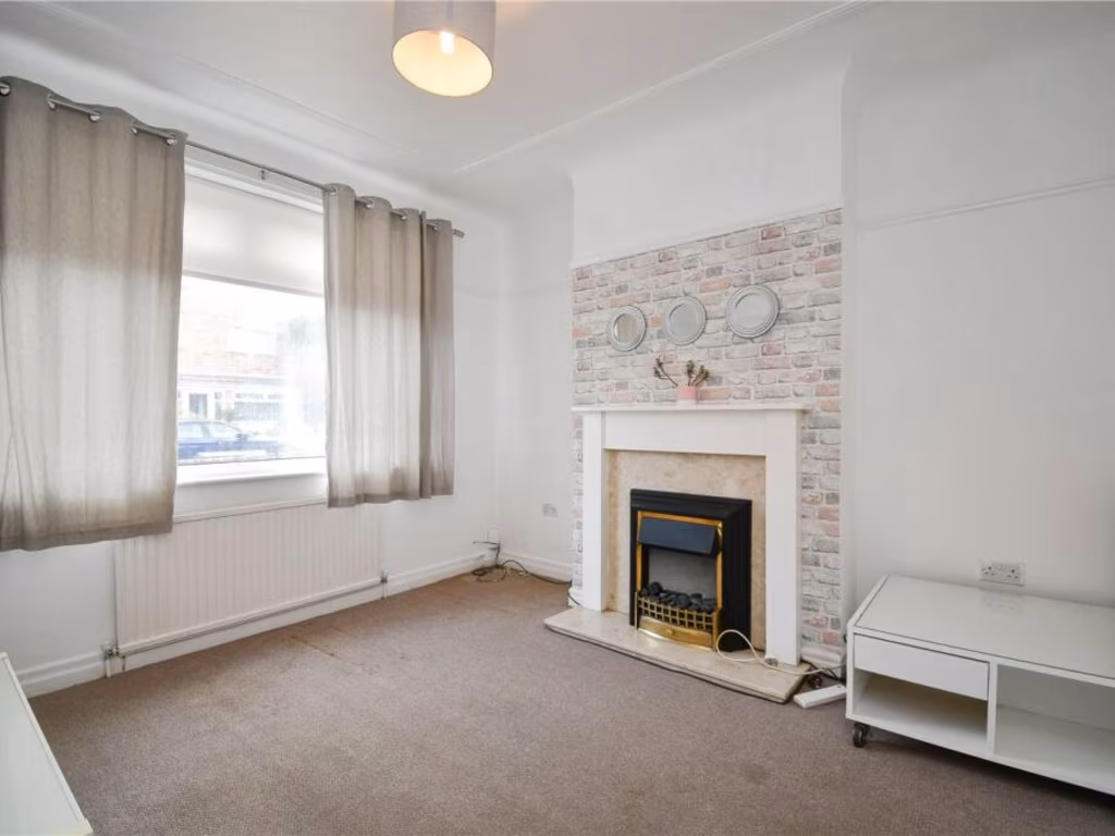
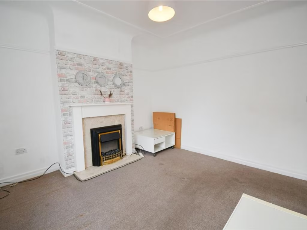
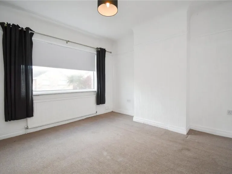
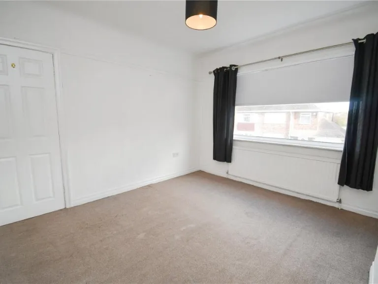
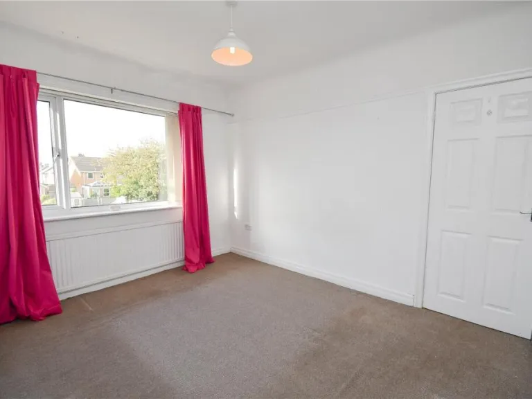
- modern style
- small living room
- partial kitchen
- standard ceiling
- natural light
- window view
- interior wall openings
- compact space
EPC Details
- Fully double glazed
- Solid brick, as built, no insulation (assumed)
- Electric storage heaters
- Low energy lighting in 44% of fixed outlets
- Suspended, no insulation (assumed)
Nearby Schools
- Greasby Infant School
- Fender Primary School
- Upton Hall School FCJ
- Manor Primary School
- Sandbrook Primary School
- Lingham Primary School
- Our Lady of Pity Catholic Primary School
- Bidston Village CofE (Controlled) Primary School
- St Peter's Catholic Primary School
- St Joseph's Catholic Primary School Upton
- Overchurch Infant School
- St Paul's Catholic Primary School
- Eastway Primary School
- Castleway Primary School
- Holy Spirit Catholic and Church of England Primary School
- Co-Op Academy Hillside
- Overchurch Junior School
- Moreton Christ Church CofE Primary School
- Sacred Heart Catholic Primary School
- Leasowe Primary School
Nearest General Shops
- Id: 247903220
- Tags:
- Addr:
- City: Wirral
- Country: GB
- Housenumber: 220
- Postcode: CH46 6AD
- Street: Hoylake Road
- Town: Moreton
- Brand: Heron Foods
- Brand:wikidata: Q5743472
- Brand:wikipedia: en:Heron Foods
- Building: yes
- Contact:
- Website: https://heronfoods.com/store/moreton/
- Fhrs:
- Name: Heron Foods
- Shop: supermarket
- Source: bing
- TagsNormalized:
- Lat: 53.4014825
- Lon: -3.1128053
- FullGeoHash: gcmzc1mq4mu5
- PartitionGeoHash: gcmz
- Images:
- FoodStandards:
- Id: 796388
- FHRSID: 796388
- LocalAuthorityBusinessID: PI/100044699
- BusinessName: Heron Foods
- BusinessType: Retailers - supermarkets/hypermarkets
- BusinessTypeID: 7840
- AddressLine1: 220 Hoylake Road
- AddressLine2: Moreton
- AddressLine3: Wirral
- AddressLine4: Merseyside
- PostCode: CH46 6AD
- RatingValue: 5
- RatingKey: fhrs_5_en-GB
- RatingDate: 2018-06-19
- LocalAuthorityCode: 435
- LocalAuthorityName: Wirral
- LocalAuthorityWebSite: http://www.wirral.gov.uk
- LocalAuthorityEmailAddress: environmentalhealth@wirral.gov.uk
- Scores:
- Hygiene: 5
- Structural: 0
- ConfidenceInManagement: 0
- NewRatingPending: false
- Geocode:
- Longitude: -3.11321000000000
- Latitude: 53.40121100000000
- Distance: 544.1
,- Id: 242184148
- Tags:
- Amenity: library
- Building: yes
- Name: Moreton Library One Stop Shop
- Source: bing;survey
- TagsNormalized:
- Lat: 53.4025658
- Lon: -3.1117366
- FullGeoHash: gcmzc1wh7rc1
- PartitionGeoHash: gcmz
- Images:
- FoodStandards: null
- Distance: 525.4
,- Id: 2617042510
- Tags:
- Name: Motor World
- Shop: car_parts
- TagsNormalized:
- Lat: 53.4014004
- Lon: -3.1099969
- FullGeoHash: gcmzc1rmeyd1
- PartitionGeoHash: gcmz
- Images:
- FoodStandards: null
- Distance: 364.4
}
Nearest Supermarkets
- Id: 2591695483
- Tags:
- Brand: Co-op Food
- Brand:wikidata: Q3277439
- Brand:wikipedia: en:Co-op Food
- Name: Co-op Food
- Shop: supermarket
- Wheelchair: yes
- TagsNormalized:
- co-op
- co-op food
- food
- supermarket
- shop
- Lat: 53.3865457
- Lon: -3.0836475
- FullGeoHash: gcmz9ydx1v3v
- PartitionGeoHash: gcmz
- Images:
- FoodStandards: null
- Distance: 2069.8
,- Id: 963856304
- Tags:
- Brand: Co-op Food
- Brand:wikidata: Q3277439
- Name: Co-op Food
- Operator: The Co-operative Group
- Operator:wikidata: Q117202
- Shop: supermarket
- TagsNormalized:
- co-op
- co-op food
- food
- supermarket
- shop
- Lat: 53.4001183
- Lon: -3.1154492
- FullGeoHash: gcmzc15qhz89
- PartitionGeoHash: gcmz
- Images:
- FoodStandards: null
- Distance: 699.8
,- Id: 2488248480
- Tags:
- Brand: ALDI
- Brand:wikidata: Q41171672
- Brand:wikipedia: en:Aldi
- Contact:
- Website: https://stores.aldi.co.uk/moreton/17-21-hoylake-road
- Name: ALDI
- Shop: supermarket
- TagsNormalized:
- Lat: 53.4040104
- Lon: -3.0995015
- FullGeoHash: gcmzc3zhbmh4
- PartitionGeoHash: gcmz
- Images:
- FoodStandards: null
- Distance: 555.8
}
Nearest Religious buildings
- Id: 245109084
- Tags:
- Amenity: place_of_worship
- Building: church
- Denomination: anglican
- Name: Christ Church
- Religion: christian
- Source: bing
- Wikidata: Q26647646
- TagsNormalized:
- place of worship
- church
- anglican
- christian
- Lat: 53.4000204
- Lon: -3.1115312
- FullGeoHash: gcmzc1nm8j61
- PartitionGeoHash: gcmz
- Images:
- FoodStandards: null
- Distance: 440.4
,- Id: 963621883
- Tags:
- Amenity: place_of_worship
- Denomination: catholic
- Name: Sacred Heart RC
- Religion: christian
- TagsNormalized:
- place of worship
- catholic
- christian
- church
- Lat: 53.4008711
- Lon: -3.1102461
- FullGeoHash: gcmzc1r4w5bk
- PartitionGeoHash: gcmz
- Images:
- FoodStandards: null
- Distance: 363
,- Id: 242219407
- Tags:
- Addr:
- Postcode: CH46 8TQ
- Street: Hoylake Road
- Amenity: place_of_worship
- Building: yes
- Denomination: presbyterian
- Fhrs:
- Name: Moreton Presbyterian Church
- Religion: christian
- Source: bing
- Source:addr: FHRS Open Data
- TagsNormalized:
- place of worship
- presbyterian
- church
- christian
- Lat: 53.401473
- Lon: -3.1090899
- FullGeoHash: gcmzc32n0und
- PartitionGeoHash: gcmz
- Images:
- FoodStandards: null
- Distance: 313
}
Nearest Medical buildings
- Id: 963611752
- Tags:
- Amenity: pharmacy
- Healthcare: pharmacy
- TagsNormalized:
- Lat: 53.4006513
- Lon: -3.1122761
- FullGeoHash: gcmzc1m9qdys
- PartitionGeoHash: gcmz
- Images:
- FoodStandards: null
- Distance: 492.2
,- Id: 2615981931
- Tags:
- Addr:
- Housenumber: 205-207
- Postcode: CH46 0SJ
- Street: Hoylake Road
- Amenity: pharmacy
- Fhrs:
- Healthcare: pharmacy
- Name: Moreton Pharmacy
- Operator: Manichem Group Ltd
- Source:
- TagsNormalized:
- Lat: 53.4011507
- Lon: -3.1117407
- FullGeoHash: gcmzc1qh5pvz
- PartitionGeoHash: gcmz
- Images:
- FoodStandards:
- Id: 975287
- FHRSID: 975287
- LocalAuthorityBusinessID: PI/010005055
- BusinessName: Moreton Pharmacy
- BusinessType: Retailers - other
- BusinessTypeID: 4613
- AddressLine1: 205-207 Hoylake Road
- AddressLine2: Moreton
- AddressLine3: Wirral
- AddressLine4: null
- PostCode: CH46 0SJ
- RatingValue: Exempt
- RatingKey: fhrs_exempt_en-GB
- RatingDate: 2020-07-30
- LocalAuthorityCode: 435
- LocalAuthorityName: Wirral
- LocalAuthorityWebSite: http://www.wirral.gov.uk
- LocalAuthorityEmailAddress: environmentalhealth@wirral.gov.uk
- Scores:
- Hygiene: null
- Structural: null
- ConfidenceInManagement: null
- NewRatingPending: false
- Geocode:
- Longitude: null
- Latitude: null
- Distance: 466.5
,- Id: 245109479
- Tags:
- Amenity: clinic
- Healthcare: clinic
- Name: Podiatry and Osteopathy
- Source: bing
- TagsNormalized:
- clinic
- health
- healthcare
- osteopathy
- Lat: 53.3997025
- Lon: -3.1103976
- FullGeoHash: gcmzc1p5f6p3
- PartitionGeoHash: gcmz
- Images:
- FoodStandards: null
- Distance: 368.8
,- Id: 245109474
- Tags:
- Amenity: doctors
- Healthcare: doctor
- Name: Moreton Medical Centre
- Source: bing
- TagsNormalized:
- doctor
- doctors
- health
- healthcare
- Lat: 53.3998279
- Lon: -3.1103999
- FullGeoHash: gcmzc1phd3mt
- PartitionGeoHash: gcmz
- Images:
- FoodStandards: null
- Distance: 367.2
}
Nearest Airports
- Id: 116737532
- Tags:
- Addr:
- City: Liverpool
- Country: GB
- Postcode: L24 1YD
- Street: Speke Hall Avenue
- Aerodrome: international
- Aerodrome:type: public
- Aeroway: aerodrome
- Iata: LPL
- Icao: EGGP
- Is_in: Liverpool,England,UK
- Name: Liverpool John Lennon Airport
- Old_name: Speke Airport
- Operator: Liverpool Airport plc
- Source: wikipedia
- Website: https://www.liverpoolairport.com/
- Wikidata: Q8727
- Wikipedia: en:Liverpool John Lennon Airport
- TagsNormalized:
- airport
- international airport
- Lat: 53.3357677
- Lon: -2.8518179
- FullGeoHash: gcmzrj7r7gdr
- PartitionGeoHash: gcmz
- Images:
- FoodStandards: null
- Distance: 18254.7
}
Nearest Leisure Facilities
- Id: 241124517
- Tags:
- Access: private
- Leisure: pitch
- TagsNormalized:
- Lat: 53.4044283
- Lon: -3.1029274
- FullGeoHash: gcmzc3ux2dcx
- PartitionGeoHash: gcmz
- Images:
- FoodStandards: null
- Distance: 489.7
,- Id: 242219579
- Tags:
- Access: private
- Leisure: playground
- Surface: concrete
- TagsNormalized:
- Lat: 53.399434
- Lon: -3.0983497
- FullGeoHash: gcmzc3pf5pzp
- PartitionGeoHash: gcmz
- Images:
- FoodStandards: null
- Distance: 441.8
,- Id: 242219570
- Tags:
- Access: private
- Leisure: playground
- Surface: concrete
- TagsNormalized:
- Lat: 53.3995429
- Lon: -3.098648
- FullGeoHash: gcmzc3pduk29
- PartitionGeoHash: gcmz
- Images:
- FoodStandards: null
- Distance: 420.1
,- Id: 2523582727
- Tags:
- TagsNormalized:
- Lat: 53.3974296
- Lon: -3.1079862
- FullGeoHash: gcmzc28yddmd
- PartitionGeoHash: gcmz
- Images:
- FoodStandards: null
- Distance: 368.5
,- Id: 242219613
- Tags:
- Access: private
- Leisure: playground
- Surface: concrete
- TagsNormalized:
- Lat: 53.3995097
- Lon: -3.0995199
- FullGeoHash: gcmzc3nfxyn7
- PartitionGeoHash: gcmz
- Images:
- FoodStandards: null
- Distance: 364
}
Nearest Tourist attractions
- Id: 328144548
- Tags:
- TagsNormalized:
- Lat: 53.4067621
- Lon: -3.1489373
- FullGeoHash: gcmzb67hbqn1
- PartitionGeoHash: gcmz
- Images:
- FoodStandards: null
- Distance: 3010
,- Id: 30822393
- Tags:
- Designation: Caravan Park
- Name: Park Lane Caravan Park
- Source: bing
- Tourism: caravan_site
- TagsNormalized:
- Lat: 53.4078159
- Lon: -3.1436405
- FullGeoHash: gcmzb6wg5f7x
- PartitionGeoHash: gcmz
- Images:
- FoodStandards: null
- Distance: 2705.2
,- Id: 250840855
- Tags:
- TagsNormalized:
- Lat: 53.4130208
- Lon: -3.1237709
- FullGeoHash: gcmzbgt36uex
- PartitionGeoHash: gcmz
- Images:
- FoodStandards: null
- Distance: 1898.3
}
Nearest Hotels
- Id: 2624855868
- Tags:
- Addr:
- Housenumber: 50-56
- Postcode: CH41 0DH
- Street: Upton Road
- Amenity: pub
- Fhrs:
- Fixme:
- Name: The Claughton Hotel
- Source:
- TagsNormalized:
- Lat: 53.3947807
- Lon: -3.0577745
- FullGeoHash: gcmzf2jrhsw1
- PartitionGeoHash: gcmz
- Images:
- FoodStandards: null
- Distance: 3181.3
,- Id: 243676782
- Tags:
- Addr:
- Postcode: CH46 3RF
- Street: Leasowe Road
- Fhrs:
- Name: Leasowe Castle Hotel
- Source:
- Tourism: hotel
- TagsNormalized:
- Lat: 53.418497
- Lon: -3.1080131
- FullGeoHash: gcmzck8c6196
- PartitionGeoHash: gcmz
- Images:
- FoodStandards: null
- Distance: 2046.9
,- Id: 2555922764
- Tags:
- Brand: Premier Inn
- Brand:wikidata: Q2108626
- Brand:wikipedia: en:Premier Inn
- Internet_access: wlan
- Internet_access:fee: customers
- Internet_access:operator: Virgin Media
- Internet_access:ssid: Premier Inn Free Wi-Fi
- Name: Premier Inn
- Operator: Premier Inn
- Tourism: hotel
- Website: https://www.premierinn.com/gb/en/hotels/england/merseyside/wirral/wirral-greasby.html
- TagsNormalized:
- Lat: 53.3825985
- Lon: -3.1085469
- FullGeoHash: gcmz9q02jte7
- PartitionGeoHash: gcmz
- Images:
- FoodStandards: null
- Distance: 1970.3
}
Tags
- 20th-century
- semi-detached
- duplex
- gravel front garden
- off-street parking
- needs landscaping
- roof repair
- driveway
- suburban
- residential
- two-story
- modern style
- small living room
- partial kitchen
- standard ceiling
- natural light
- window view
- interior wall openings
- compact space
Local Market Stats
- Average Price/sqft: £207
- Avg Income: £37400
- Social Housing: 20%
- Planning Success Rate: 92%
Similar Properties
 3 bedroom semi-detached house for sale in Borrowdale Road, Moreton, Wirral, CH46 — £280,000 • 3 bed • 1 bath • 1225 ft²
 3 bedroom semi-detached house for sale in MacDonald Road, Moreton, Wirral, CH46 — £200,000 • 3 bed • 1 bath • 800 ft²
 3 bedroom semi-detached house for sale in Rothbury Close, Moreton, Wirral, CH46 — £210,000 • 3 bed • 1 bath • 923 ft²
 3 bedroom semi-detached house for sale in Blundells Drive, Moreton, CH46 — £180,000 • 3 bed • 2 bath • 1007 ft²
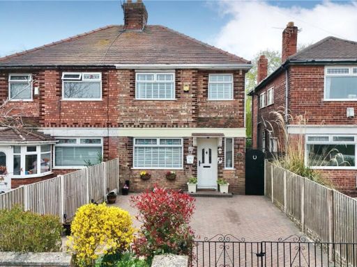 3 bedroom semi-detached house for sale in Pinetree Grove, Moreton, Wirral, CH46 — £220,000 • 3 bed • 1 bath • 749 ft²
 3 bedroom semi-detached house for sale in Hoylake Road, Moreton, Wirral, CH46 — £210,000 • 3 bed • 1 bath • 996 ft²
Meta
- {
"@context": "https://schema.org",
"@type": "Residence",
"name": "3 bedroom semidetached house for sale in Carnsdale Road, Mo…",
"description": "",
"url": "https://propertypiper.co.uk/property/f109471a-9224-4e26-b446-8000a9496f86",
"image": "https://image-a.propertypiper.co.uk/55cf94c1-890c-485d-aa1c-daae825f582f-1024.jpeg",
"address": {
"@type": "PostalAddress",
"streetAddress": "22, CARNSDALE ROAD, WIRRAL",
"postalCode": "CH46 9QR",
"addressLocality": "Wirral",
"addressRegion": "Wallasey",
"addressCountry": "England"
},
"geo": {
"@type": "GeoCoordinates",
"latitude": 53.400183,
"longitude": -3.1048936
},
"numberOfRooms": 3,
"numberOfBathroomsTotal": 1,
"floorSize": {
"@type": "QuantitativeValue",
"value": 831,
"unitCode": "FTK"
},
"offers": {
"@type": "Offer",
"price": 200000,
"priceCurrency": "GBP",
"availability": "https://schema.org/InStock"
},
"additionalProperty": [
{
"@type": "PropertyValue",
"name": "Feature",
"value": "20th-century"
},
{
"@type": "PropertyValue",
"name": "Feature",
"value": "semi-detached"
},
{
"@type": "PropertyValue",
"name": "Feature",
"value": "duplex"
},
{
"@type": "PropertyValue",
"name": "Feature",
"value": "gravel front garden"
},
{
"@type": "PropertyValue",
"name": "Feature",
"value": "off-street parking"
},
{
"@type": "PropertyValue",
"name": "Feature",
"value": "needs landscaping"
},
{
"@type": "PropertyValue",
"name": "Feature",
"value": "roof repair"
},
{
"@type": "PropertyValue",
"name": "Feature",
"value": "driveway"
},
{
"@type": "PropertyValue",
"name": "Feature",
"value": "suburban"
},
{
"@type": "PropertyValue",
"name": "Feature",
"value": "residential"
},
{
"@type": "PropertyValue",
"name": "Feature",
"value": "two-story"
},
{
"@type": "PropertyValue",
"name": "Feature",
"value": "modern style"
},
{
"@type": "PropertyValue",
"name": "Feature",
"value": "small living room"
},
{
"@type": "PropertyValue",
"name": "Feature",
"value": "partial kitchen"
},
{
"@type": "PropertyValue",
"name": "Feature",
"value": "standard ceiling"
},
{
"@type": "PropertyValue",
"name": "Feature",
"value": "natural light"
},
{
"@type": "PropertyValue",
"name": "Feature",
"value": "window view"
},
{
"@type": "PropertyValue",
"name": "Feature",
"value": "interior wall openings"
},
{
"@type": "PropertyValue",
"name": "Feature",
"value": "compact space"
}
]
}
High Res Floorplan Images
Compatible Floorplan Images
FloorplanImages Thumbnail