CH48 2HN - 1 bedroom ground floor flat for sale in Caldy Road, The Mou…
View on Property Piper
1 bedroom ground floor flat for sale in Caldy Road, The Mount, CH48
Property Details
- Price: £230000
- Bedrooms: 1
- Bathrooms: 1
- Property Type: undefined
- Property SubType: undefined
Image Descriptions
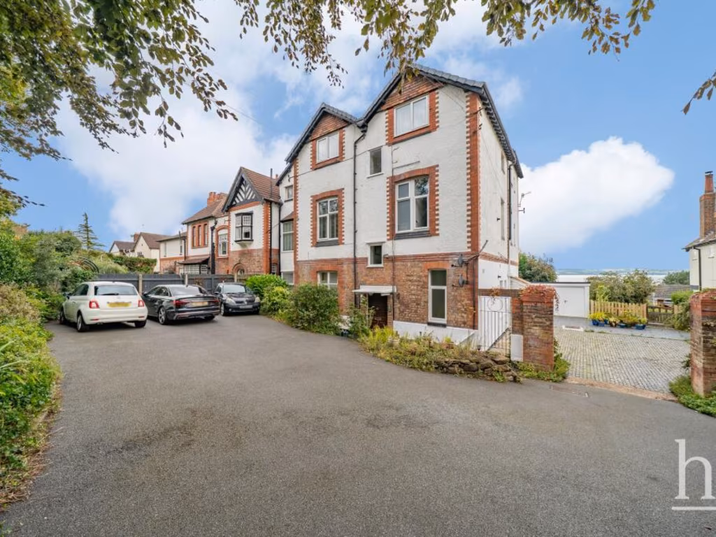
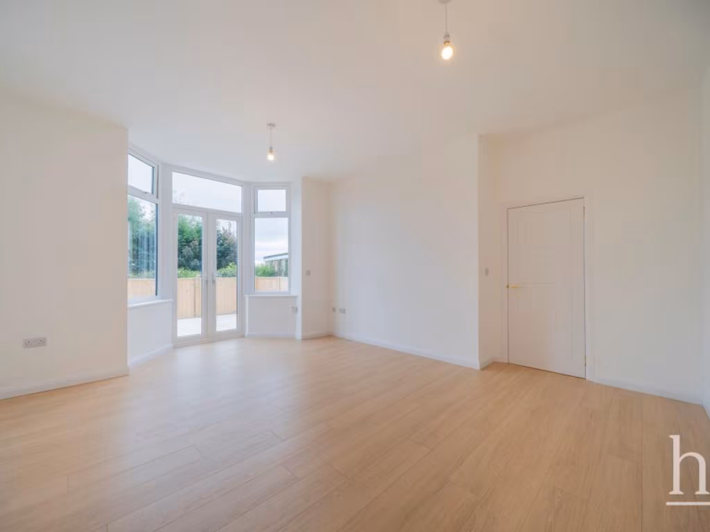
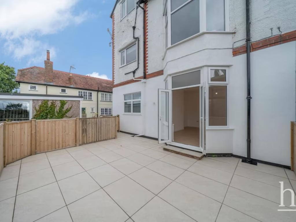
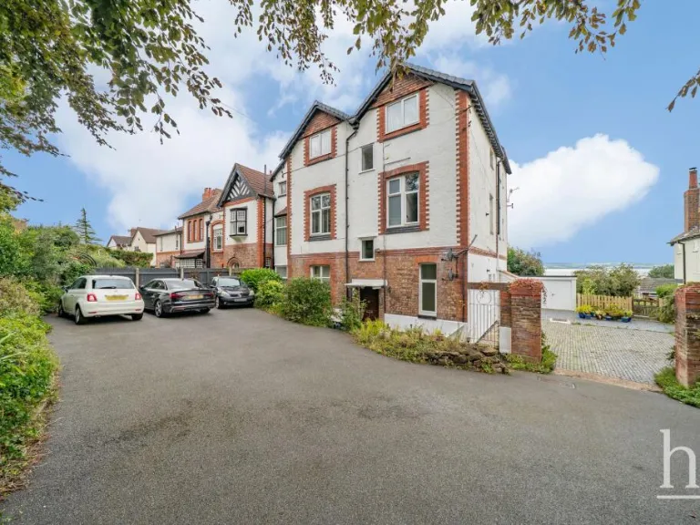
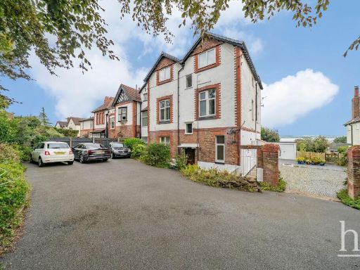
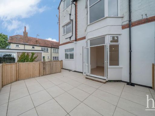
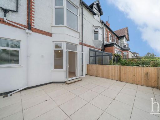
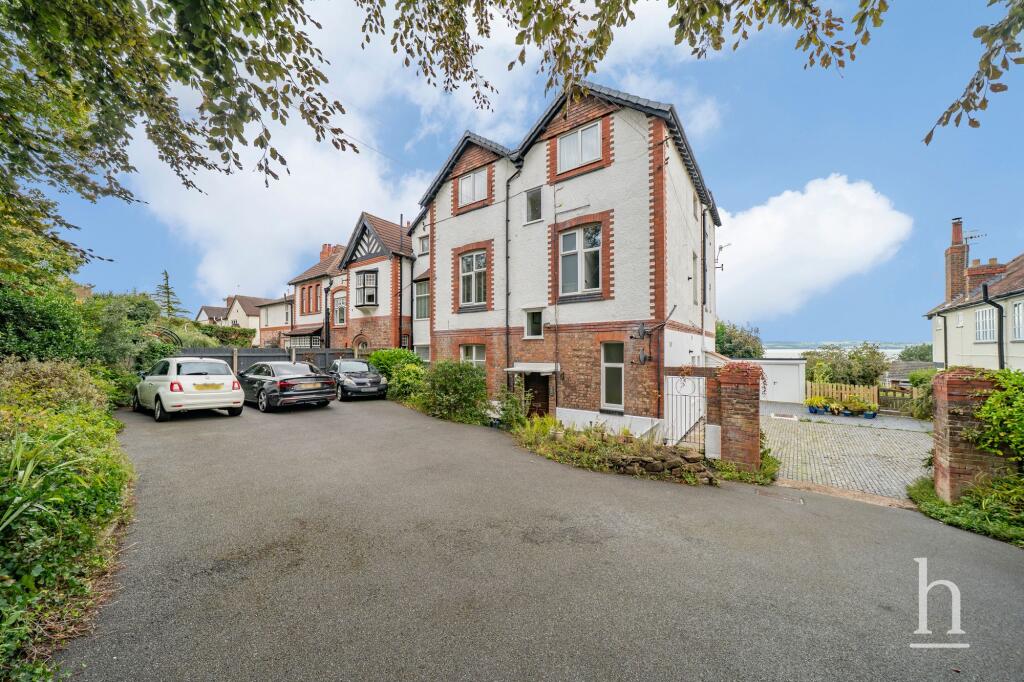
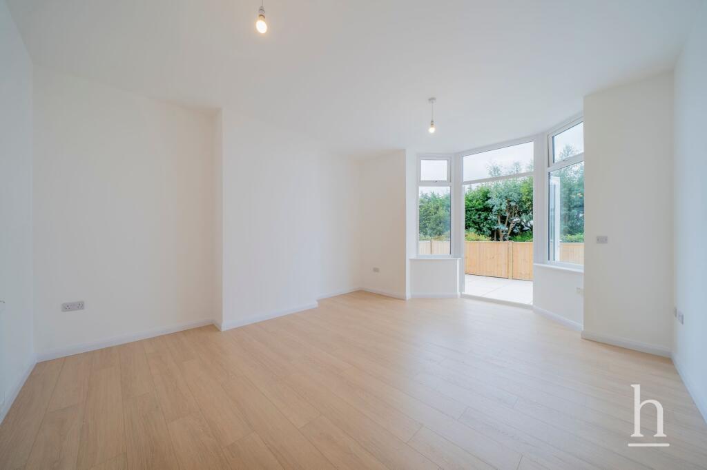
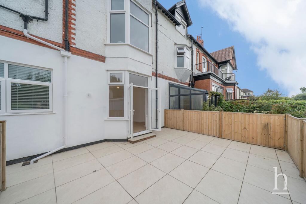
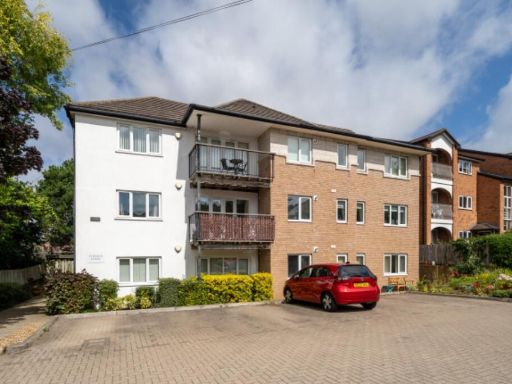
- multi-unit building Victorian
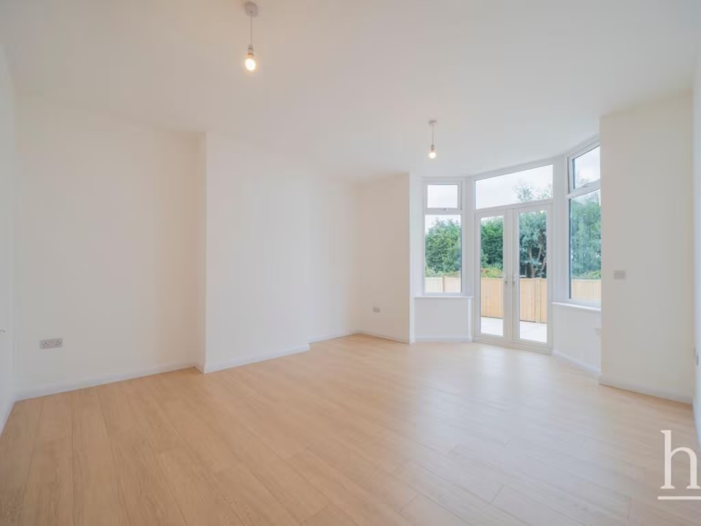
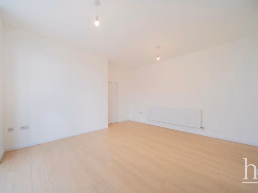
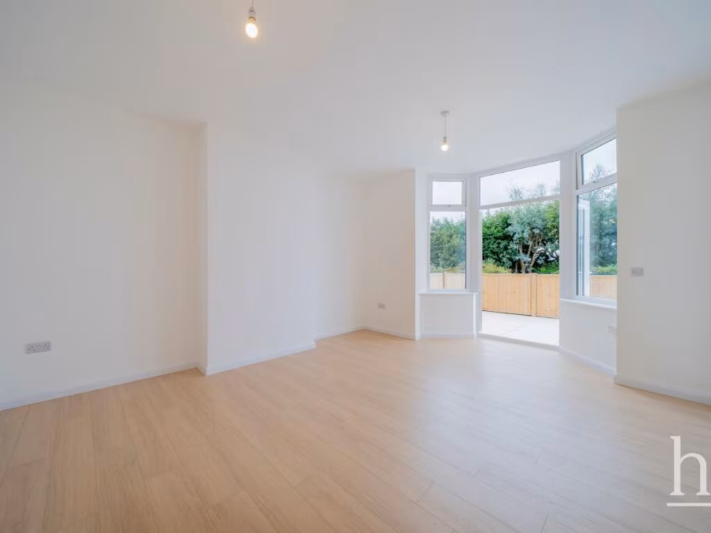
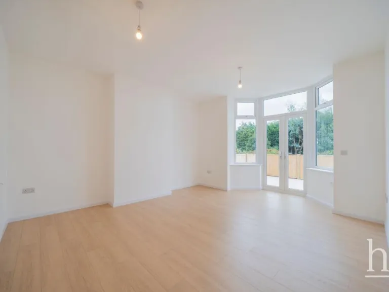
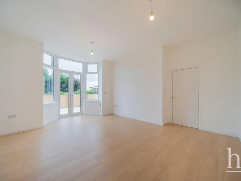
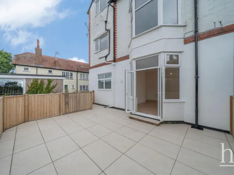
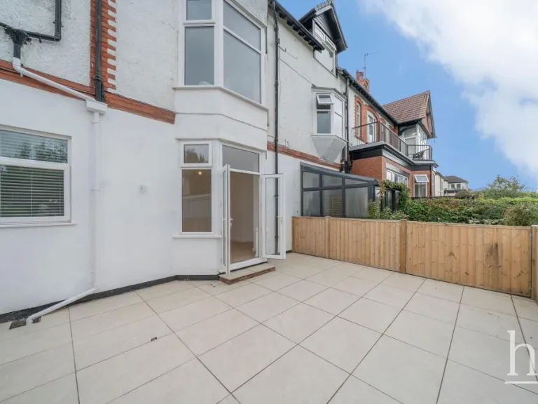
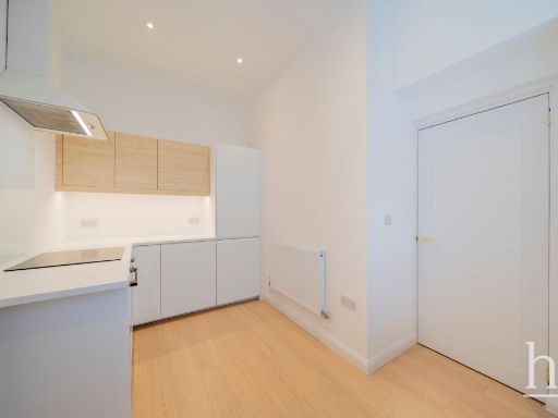
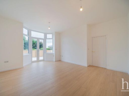
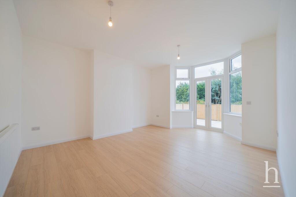
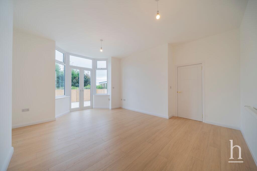
- living room modern
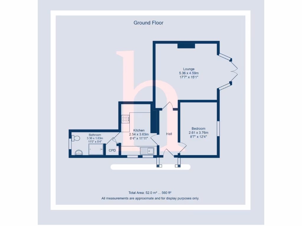
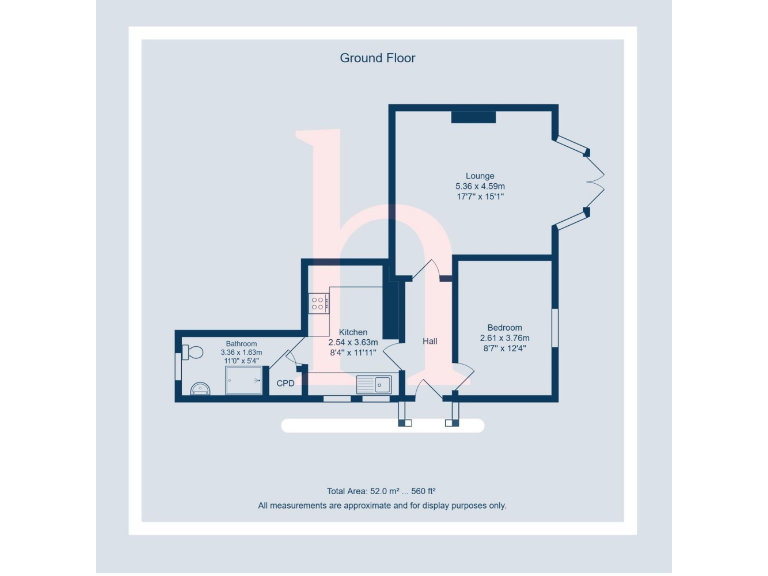
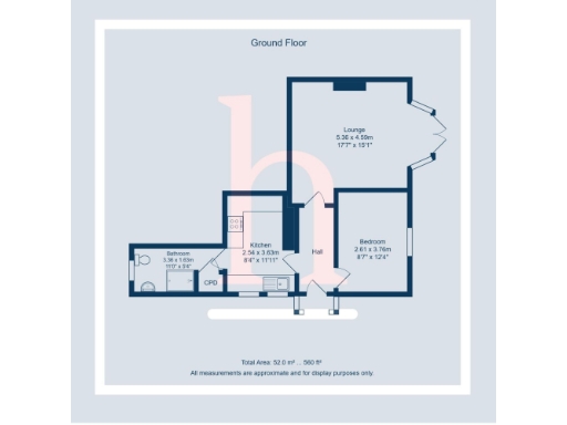
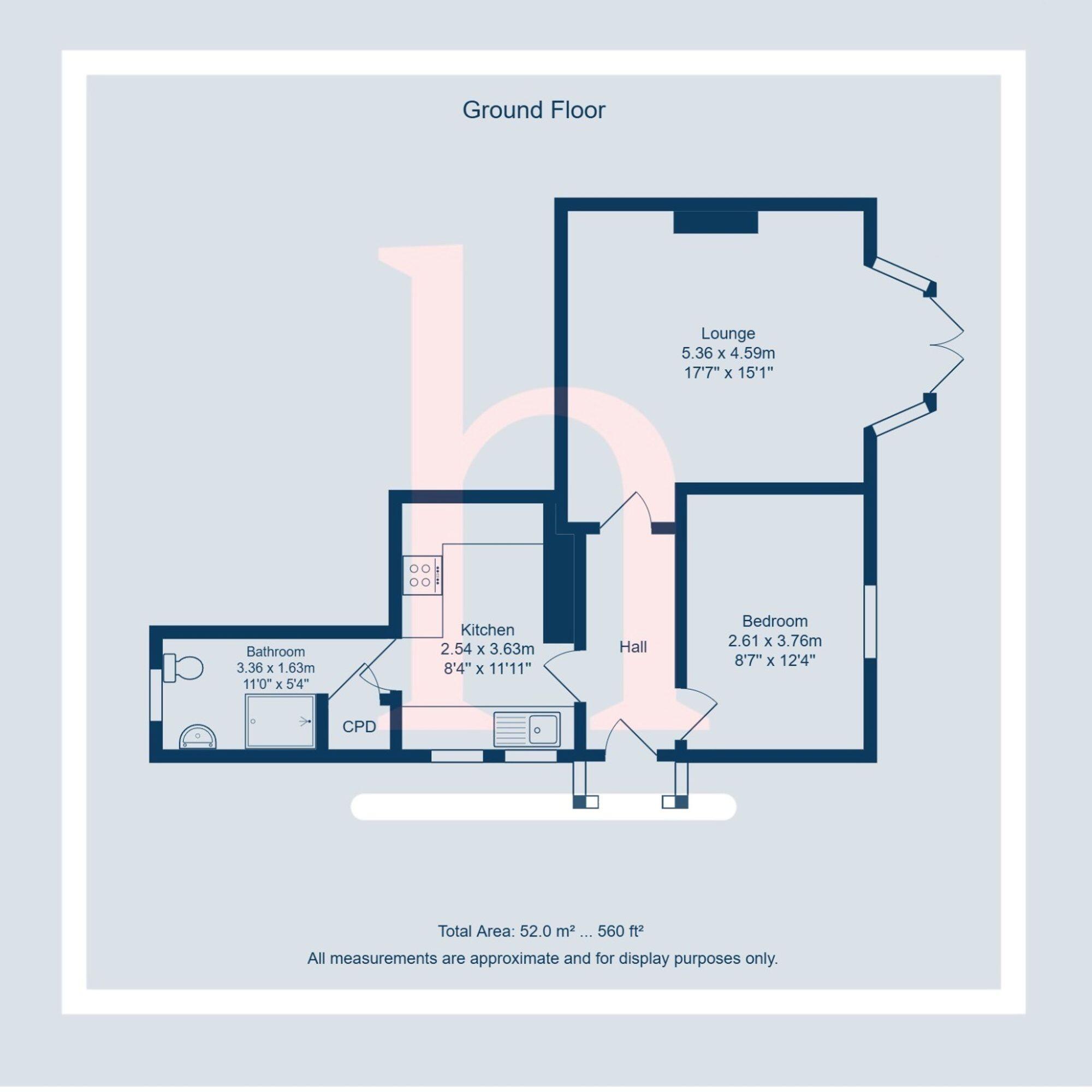
Rooms
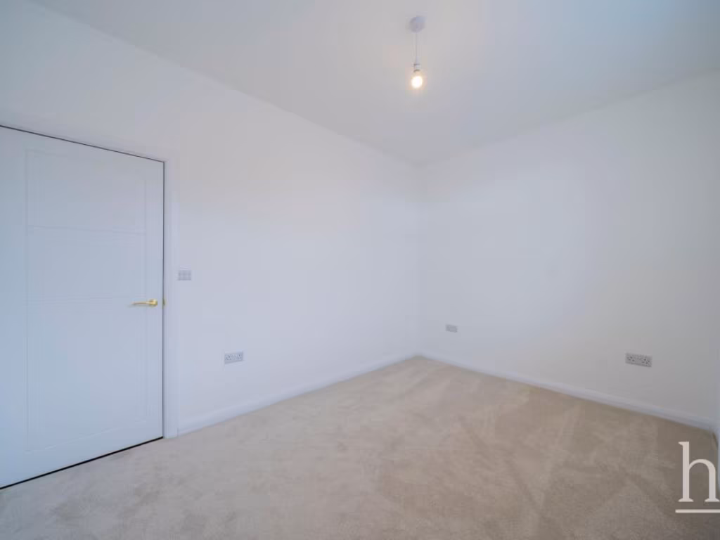
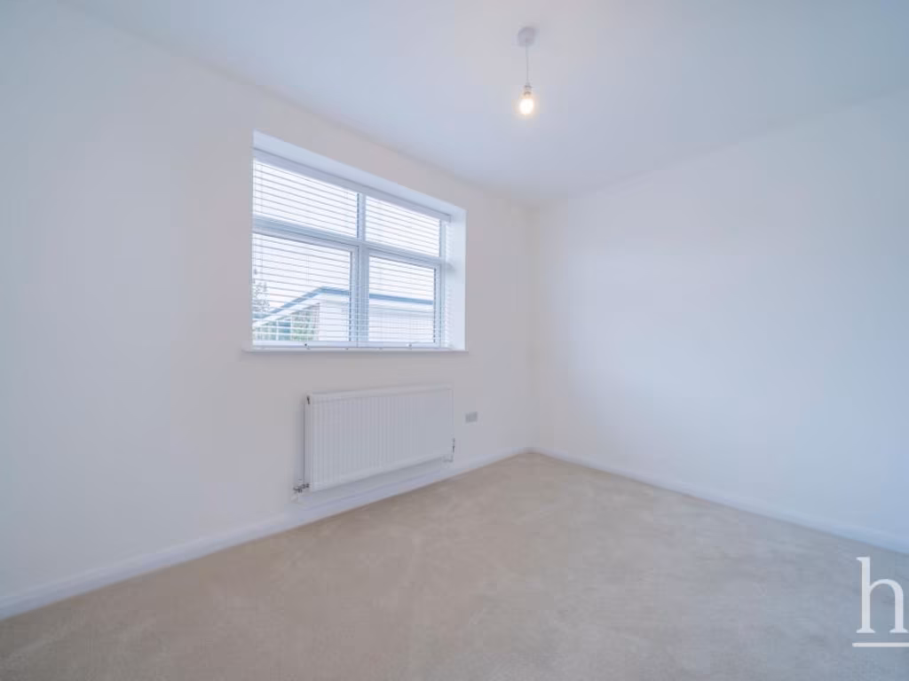
- Lounge:
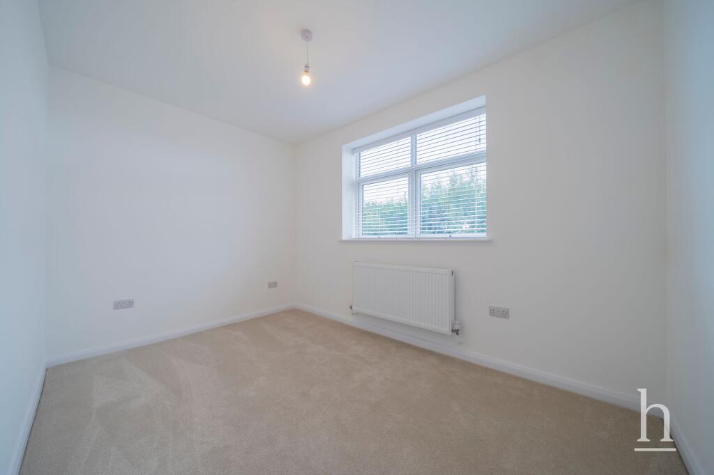
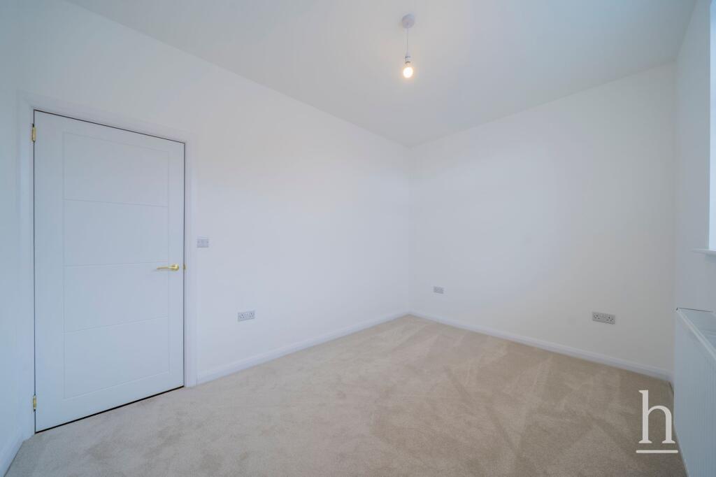
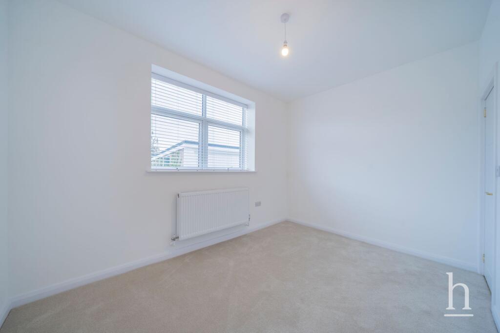
- Bedroom:
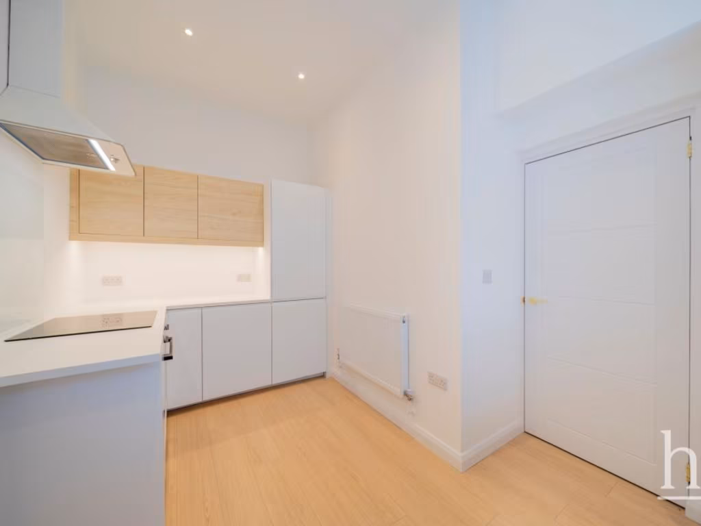
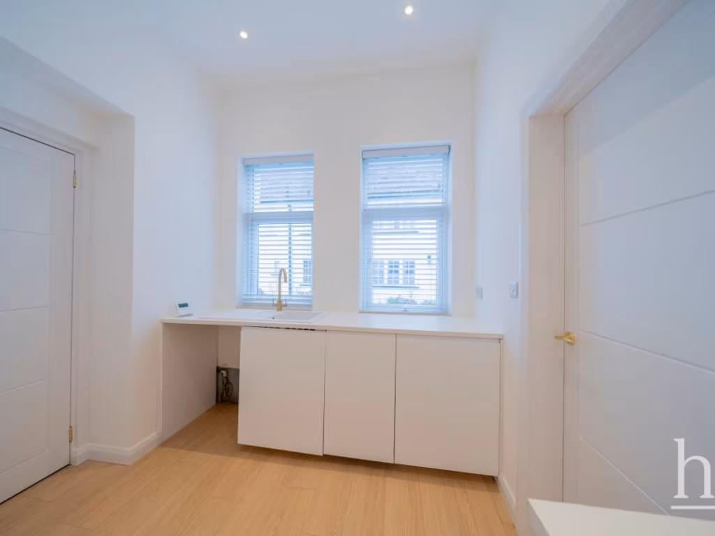
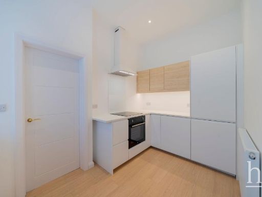
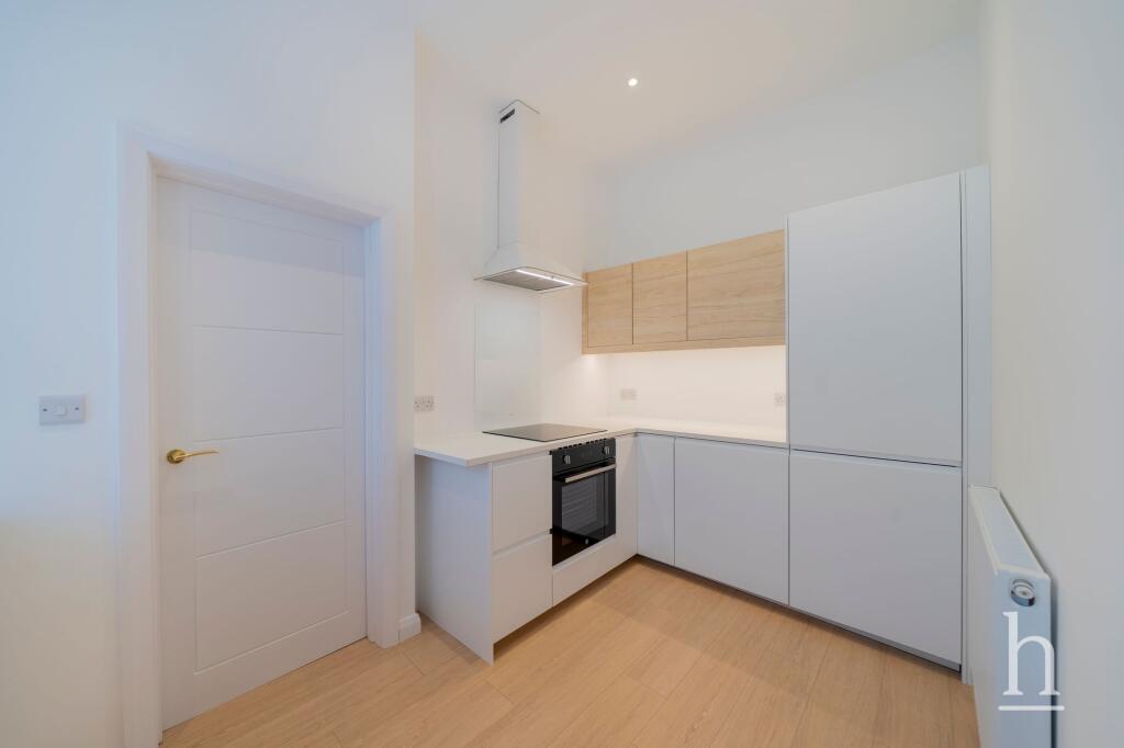
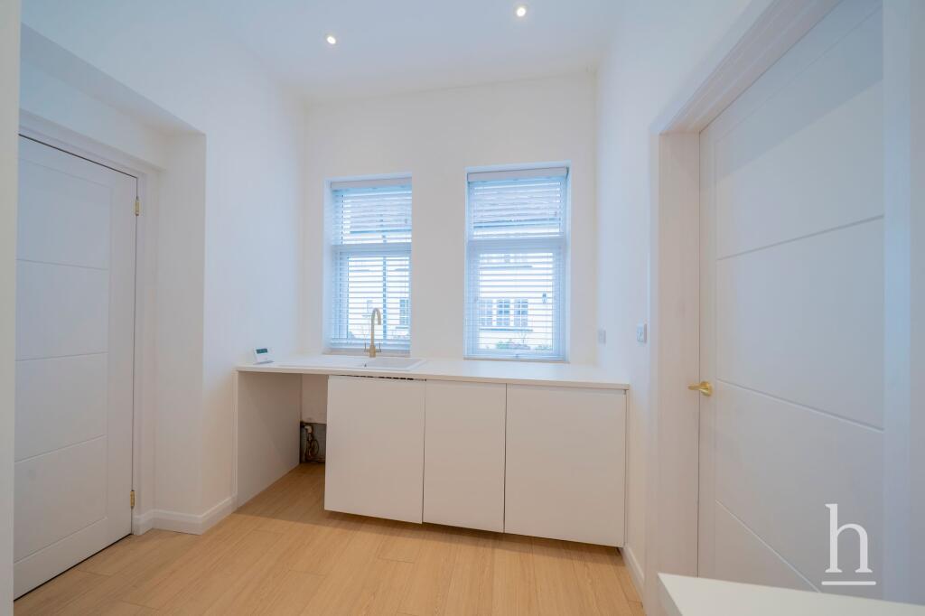
- Kitchen:
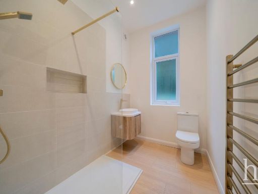
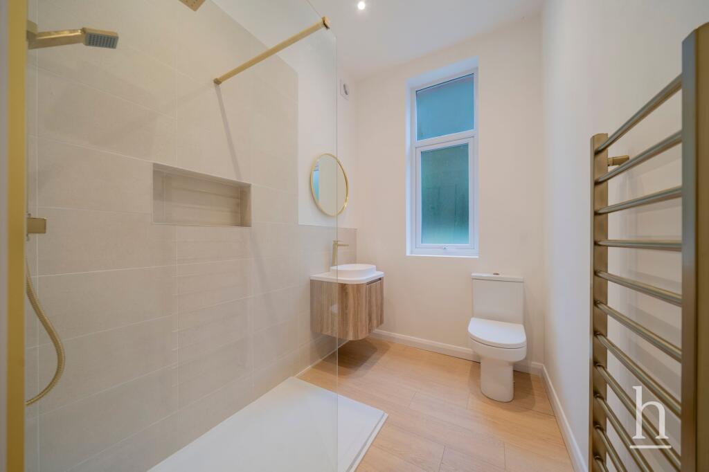
- Bathroom:
Textual Property Features
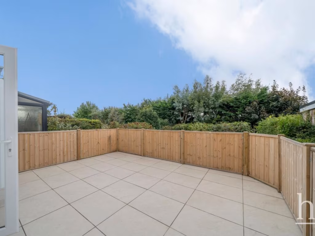
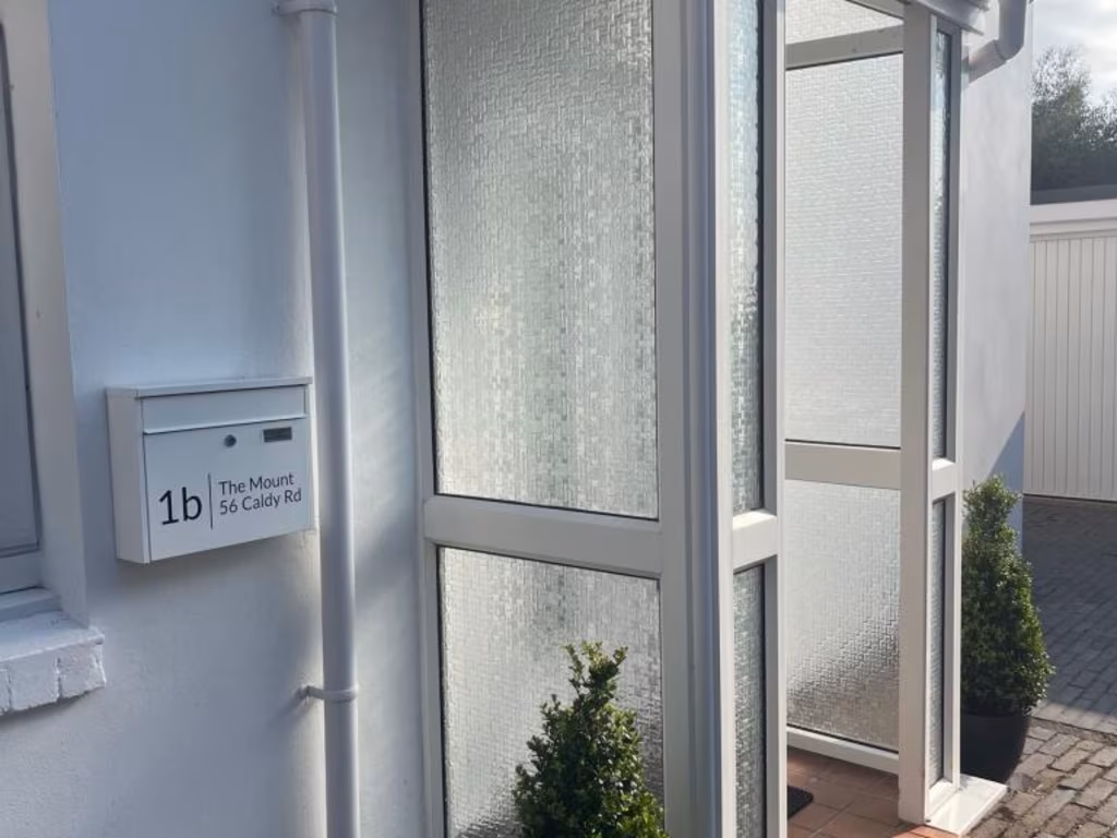
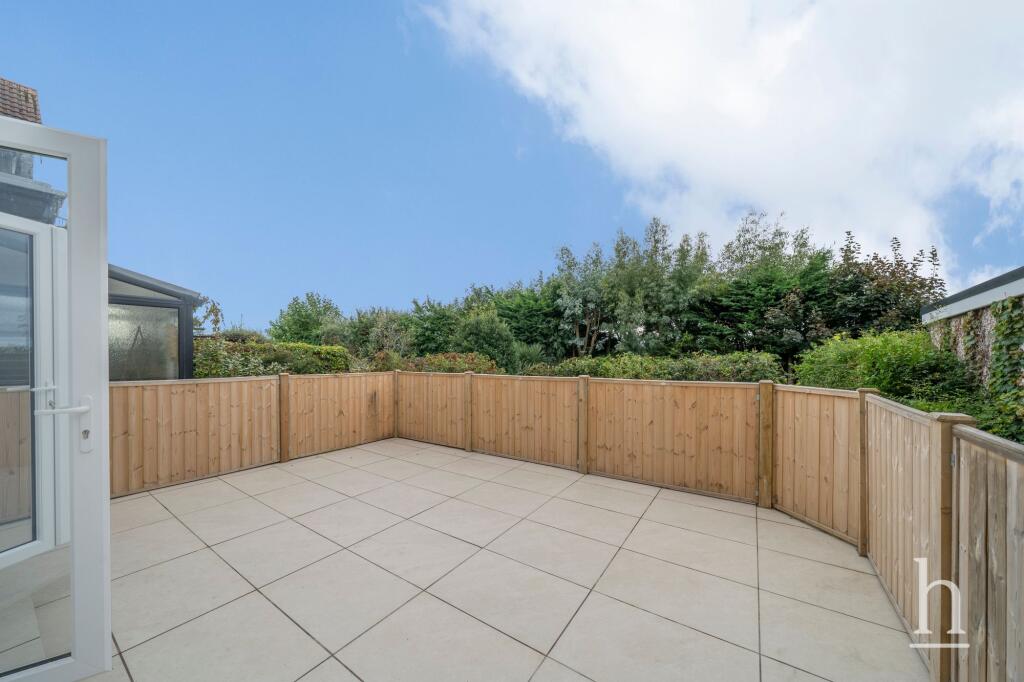
- Has Garden
- Chain Free
- Success
Detected Visual Features
- Victorian
- multi-unit
- investment property
- period features
- high ceilings
- off-street parking
- red brick
- gable roof
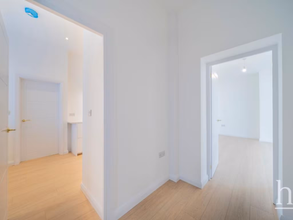
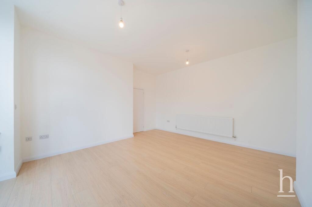
- modern
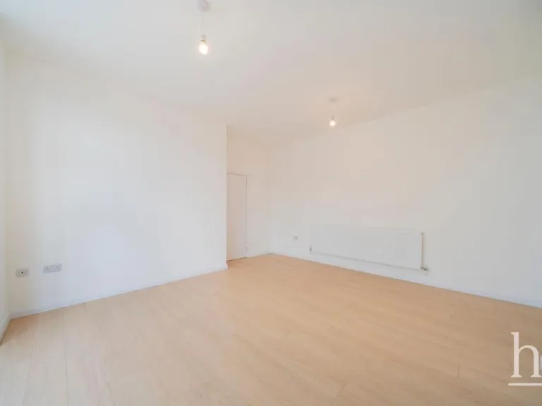
- living room
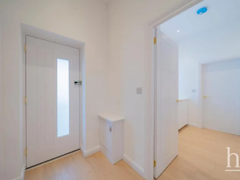
- laminate flooring
- bay window
- patio doors
- natural light
- neutral walls
EPC Details
- Fully double glazed
- Solid brick, as built, no insulation (assumed)
- Boiler and radiators, mains gas
- Low energy lighting in 60% of fixed outlets
- Solid, no insulation (assumed)
Nearby Schools
- Heswall St Peter's CofE Primary School
- Ladymount Catholic Primary School
- Thingwall Primary School
- Calday Grange Grammar School
- Greasby Junior School
- Greasby Infant School
- Hilbre High School
- Black Horse Hill Infant School
- Upton Hall School FCJ
- Hoylake Holy Trinity CofE Primary School
- Lingham Primary School
- Avalon School
- West Kirby St Bridget's CofE Primary School
- Our Lady of Pity Catholic Primary School
- West Kirby Primary School
- Thurstaston Dawpool CofE Primary School
- West Kirby Grammar School
- St Joseph's Catholic Primary School Upton
- Overchurch Infant School
- Eastway Primary School
- Pensby Primary School
- Pensby High School
- Overchurch Junior School
- Moreton Christ Church CofE Primary School
- Great Meols Primary School
Nearest Bars And Restaurants
- Id: 728246795
- Tags:
- Amenity: cafe
- Building: yes
- Name: Tanskeys
- TagsNormalized:
- Lat: 53.3663449
- Lon: -3.1831157
- FullGeoHash: gcmxxe41kp8z
- PartitionGeoHash: gcmx
- Images:
- FoodStandards: null
- Distance: 972.5
,- Id: 444571832
- Tags:
- Addr:
- City: West Kirby
- Postcode: CH48 3HU
- Street: Banks Road
- Amenity: pub
- Name: The Hilbre
- TagsNormalized:
- Lat: 53.3657366
- Lon: -3.1817181
- FullGeoHash: gcmxxdgjuw74
- PartitionGeoHash: gcmx
- Images:
- FoodStandards: null
- Distance: 857.7
,- Id: 323977067
- Tags:
- Amenity: pub
- Building: yes
- Name: Ring O'Bells
- Outdoor_seating: yes
- Smoking: outside
- TagsNormalized:
- Lat: 53.3684435
- Lon: -3.1735581
- FullGeoHash: gcmxxg3jdwzt
- PartitionGeoHash: gcmx
- Images:
- FoodStandards: null
- Distance: 809.2
,- Id: 443672278
- Tags:
- Amenity: restaurant
- Name: Ring O'Bells
- TagsNormalized:
- Lat: 53.3684068
- Lon: -3.1735425
- FullGeoHash: gcmxxg3je055
- PartitionGeoHash: gcmx
- Images:
- FoodStandards: null
- Distance: 805
,- Id: 323977038
- Tags:
- Addr:
- Postcode: CH48 3JN
- Street: Village Road
- Amenity: pub
- Building: yes
- Fhrs:
- Name: Hickory's Smokehouse
- Source:
- TagsNormalized:
- Lat: 53.3670828
- Lon: -3.1751119
- FullGeoHash: gcmxxepvy92c
- PartitionGeoHash: gcmx
- Images:
- FoodStandards:
- Id: 569896
- FHRSID: 569896
- LocalAuthorityBusinessID: PI/100044656
- BusinessName: Hickory's Smokehouse
- BusinessType: Restaurant/Cafe/Canteen
- BusinessTypeID: 1
- AddressLine1: 1 Village Road
- AddressLine2: West Kirby
- AddressLine3: Wirral
- AddressLine4: null
- PostCode: CH48 3JN
- RatingValue: 5
- RatingKey: fhrs_5_en-GB
- RatingDate: 2021-08-26
- LocalAuthorityCode: 435
- LocalAuthorityName: Wirral
- LocalAuthorityWebSite: http://www.wirral.gov.uk
- LocalAuthorityEmailAddress: environmentalhealth@wirral.gov.uk
- Scores:
- Hygiene: 5
- Structural: 5
- ConfidenceInManagement: 5
- NewRatingPending: false
- Geocode:
- Longitude: -3.17502040000000
- Latitude: 53.36710750000000
- Distance: 694
}
Nearest General Shops
- Id: 232936533
- Tags:
- Brand: Majestic
- Brand:wikidata: Q6737725
- Brand:wikipedia: en:Majestic Wine
- Building: yes
- Name: Majestic
- Shop: alcohol
- TagsNormalized:
- Lat: 53.3724319
- Lon: -3.1710015
- FullGeoHash: gcmxxu4uyq3v
- PartitionGeoHash: gcmx
- Images:
- FoodStandards: null
- Distance: 1236.6
,- Id: 7581307786
- Tags:
- Addr:
- City: West Kirby
- Housenumber: 103
- Postcode: CH48 0RB
- Street: Banks Road
- Name: Jennie Miles Photography Studio
- Phone: +441516250615
- Shop: photo
- TagsNormalized:
- Lat: 53.3680057
- Lon: -3.1827118
- FullGeoHash: gcmxxe67jmq4
- PartitionGeoHash: gcmx
- Images:
- FoodStandards: null
- Distance: 1069.9
,- Id: 443696028
- Tags:
- TagsNormalized:
- Lat: 53.3675822
- Lon: -3.182632
- FullGeoHash: gcmxxe62xq3s
- PartitionGeoHash: gcmx
- Images:
- FoodStandards: null
- Distance: 1033.8
}
Nearest Grocery shops
- Id: 444529021
- Tags:
- Amenity: post_office
- Brand: Premier Express
- Shop: convenience
- TagsNormalized:
- office
- post office
- premier
- convenience
- shop
- Lat: 53.372534
- Lon: -3.18368
- FullGeoHash: gcmxxs1twckn
- PartitionGeoHash: gcmx
- Images:
- FoodStandards: null
- Distance: 1500.2
,- Id: 2627336776
- Tags:
- Addr:
- Housenumber: 30
- Postcode: CH48 0RD
- Street: Banks Road
- Fhrs:
- Name: Colin Lunt
- Shop: greengrocer
- Source: survey
- Source:addr: FHRS Open Data
- TagsNormalized:
- Lat: 53.3717603
- Lon: -3.184671
- FullGeoHash: gcmxxs0cpc1p
- PartitionGeoHash: gcmx
- Images:
- FoodStandards:
- Id: 394085
- FHRSID: 394085
- LocalAuthorityBusinessID: PI/000006022
- BusinessName: Colin Lunt Greengrocer
- BusinessType: Retailers - other
- BusinessTypeID: 4613
- AddressLine1: 30 Banks Road
- AddressLine2: West Kirby
- AddressLine3: Wirral
- AddressLine4: null
- PostCode: CH48 0RD
- RatingValue: 5
- RatingKey: fhrs_5_en-GB
- RatingDate: 2021-03-19
- LocalAuthorityCode: 435
- LocalAuthorityName: Wirral
- LocalAuthorityWebSite: http://www.wirral.gov.uk
- LocalAuthorityEmailAddress: environmentalhealth@wirral.gov.uk
- Scores:
- Hygiene: 0
- Structural: 5
- ConfidenceInManagement: 0
- NewRatingPending: false
- Geocode:
- Longitude: -3.18470790000000
- Latitude: 53.37175810000000
- Distance: 1468.7
,- Id: 323977037
- Tags:
- Building: yes
- Name: Bridge Shop
- Shop: convenience
- Source:
- TagsNormalized:
- Lat: 53.3656322
- Lon: -3.1753615
- FullGeoHash: gcmxxdzv2dyg
- PartitionGeoHash: gcmx
- Images:
- FoodStandards: null
- Distance: 556.5
}
Nearest Supermarkets
- Id: 323240114
- Tags:
- Addr:
- City: Newton
- Street: Frankby Road
- Building: yes
- Name: Co-op
- Shop: supermarket
- TagsNormalized:
- Lat: 53.3724689
- Lon: -3.1514973
- FullGeoHash: gcmz8k1jhv36
- PartitionGeoHash: gcmz
- Images:
- FoodStandards: null
- Distance: 1798.9
,- Id: 444850799
- Tags:
- Brand: ALDI
- Brand:wikidata: Q41171672
- Brand:wikipedia: en:Aldi
- Contact:
- Website: https://stores.aldi.co.uk/west-kirby/bridge-road
- Name: ALDI
- Shop: supermarket
- TagsNormalized:
- Lat: 53.3742648
- Lon: -3.1844198
- FullGeoHash: gcmxxs3ptsh7
- PartitionGeoHash: gcmx
- Images:
- FoodStandards: null
- Distance: 1688.8
,- Id: 257130388
- Tags:
- Addr:
- Housenumber: 11
- Postcode: CH48 0QA
- Street: Dee Lane
- Brand: Morrisons
- Brand:wikidata: Q922344
- Brand:wikipedia: en:Morrisons
- Building: yes
- Contact:
- Website: https://my.morrisons.com/storefinder/220
- Fhrs:
- Name: Morrisons
- Shop: supermarket
- Source:
- TagsNormalized:
- Lat: 53.372156
- Lon: -3.1858166
- FullGeoHash: gcmxxs05m4fz
- PartitionGeoHash: gcmx
- Images:
- FoodStandards:
- Id: 394975
- FHRSID: 394975
- LocalAuthorityBusinessID: PI/100005784
- BusinessName: Morrisons
- BusinessType: Retailers - supermarkets/hypermarkets
- BusinessTypeID: 7840
- AddressLine1: Dee Lane
- AddressLine2: West Kirby
- AddressLine3: Wirral
- AddressLine4: null
- PostCode: CH48 0QA
- RatingValue: 5
- RatingKey: fhrs_5_en-GB
- RatingDate: 2020-03-17
- LocalAuthorityCode: 435
- LocalAuthorityName: Wirral
- LocalAuthorityWebSite: http://www.wirral.gov.uk
- LocalAuthorityEmailAddress: environmentalhealth@wirral.gov.uk
- Scores:
- Hygiene: 5
- Structural: 5
- ConfidenceInManagement: 5
- NewRatingPending: false
- Geocode:
- Longitude: -3.18548893928528
- Latitude: 53.37279510498050
- Distance: 1550.4
}
Nearest Religious buildings
- Id: 665874523
- Tags:
- Amenity: place_of_worship
- TagsNormalized:
- Lat: 53.3715677
- Lon: -3.1814093
- FullGeoHash: gcmxxegrgv36
- PartitionGeoHash: gcmx
- Images:
- FoodStandards: null
- Distance: 1328.8
,- Id: 323977041
- Tags:
- Amenity: place_of_worship
- Building: church
- Denomination: anglican
- Name: St Bridgets Church
- Religion: christian
- Wikidata: Q7592720
- TagsNormalized:
- place of worship
- church
- anglican
- christian
- Lat: 53.3687378
- Lon: -3.1763966
- FullGeoHash: gcmxxerp2tg1
- PartitionGeoHash: gcmx
- Images:
- FoodStandards: null
- Distance: 896.7
,- Id: 324028751
- Tags:
- Amenity: place_of_worship
- Building: yes
- Denomination: anglican
- Name: Caldy Church
- Religion: christian
- Wikidata: Q5118038
- Wikipedia: en:Church of the Resurrection and All Saints, Caldy
- TagsNormalized:
- place of worship
- anglican
- church
- christian
- Lat: 53.3584405
- Lon: -3.1640847
- FullGeoHash: gcmxxcxgrqpr
- PartitionGeoHash: gcmx
- Images:
- FoodStandards: null
- Distance: 566.1
}
Nearest Airports
- Id: 116737532
- Tags:
- Addr:
- City: Liverpool
- Country: GB
- Postcode: L24 1YD
- Street: Speke Hall Avenue
- Aerodrome: international
- Aerodrome:type: public
- Aeroway: aerodrome
- Iata: LPL
- Icao: EGGP
- Is_in: Liverpool,England,UK
- Name: Liverpool John Lennon Airport
- Old_name: Speke Airport
- Operator: Liverpool Airport plc
- Source: wikipedia
- Website: https://www.liverpoolairport.com/
- Wikidata: Q8727
- Wikipedia: en:Liverpool John Lennon Airport
- TagsNormalized:
- airport
- international airport
- Lat: 53.3357677
- Lon: -2.8518179
- FullGeoHash: gcmzrj7r7gdr
- PartitionGeoHash: gcmz
- Images:
- FoodStandards: null
- Distance: 21384.5
}
Nearest Leisure Facilities
- Id: 1295216487
- Tags:
- Leisure: slipway
- Seamark:
- Small_craft_facility:
- Type: small_craft_facility
- Source: bing
- TagsNormalized:
- Lat: 53.3638727
- Lon: -3.1814186
- FullGeoHash: gcmxxde75dfk
- PartitionGeoHash: gcmx
- Images:
- FoodStandards: null
- Distance: 739.7
,- Id: 37878307
- Tags:
- Leisure: pitch
- Sport: soccer
- TagsNormalized:
- Lat: 53.3675593
- Lon: -3.1722766
- FullGeoHash: gcmxxg608d55
- PartitionGeoHash: gcmx
- Images:
- FoodStandards: null
- Distance: 698.9
,- Id: 323273753
- Tags:
- Leisure: park
- Name: Cubbins Green
- TagsNormalized:
- Lat: 53.3574256
- Lon: -3.1713464
- FullGeoHash: gcmxxc6tw309
- PartitionGeoHash: gcmx
- Images:
- FoodStandards: null
- Distance: 432.3
,- Id: 59298959
- Tags:
- Leisure: park
- Name: Cubbins Green
- TagsNormalized:
- Lat: 53.3593302
- Lon: -3.1738785
- FullGeoHash: gcmxxcbbek0d
- PartitionGeoHash: gcmx
- Images:
- FoodStandards: null
- Distance: 286
,- Id: 323273737
- Tags:
- Leisure: park
- Name: Cubbins Green
- TagsNormalized:
- Lat: 53.3596933
- Lon: -3.1740179
- FullGeoHash: gcmxxcbf8pb8
- PartitionGeoHash: gcmx
- Images:
- FoodStandards: null
- Distance: 262.9
}
Nearest Tourist attractions
- Id: 2093633694
- Tags:
- TagsNormalized:
- Lat: 53.3426408
- Lon: -3.1459664
- FullGeoHash: gcmz2qtpmsvq
- PartitionGeoHash: gcmz
- Images:
- FoodStandards: null
- Distance: 2664.5
,- Id: 132855280
- Tags:
- TagsNormalized:
- Lat: 53.3446409
- Lon: -3.1511442
- FullGeoHash: gcmz2r17j1b9
- PartitionGeoHash: gcmz
- Images:
- FoodStandards: null
- Distance: 2279.4
,- Id: 665874524
- Tags:
- Name: 21 Park House Guest House
- Tourism: guest_house
- TagsNormalized:
- Lat: 53.3710389
- Lon: -3.1822551
- FullGeoHash: gcmxxefub4f8
- PartitionGeoHash: gcmx
- Images:
- FoodStandards: null
- Distance: 1309.5
}
Nearest Train stations
- Id: 10055803294
- Tags:
- Electrified: rail
- Internet_access: no
- Name: Meols
- Naptan:
- Network: National Rail
- Operator: Merseyrail
- Public_transport: station
- Railway: station
- Ref:
- Source: npe
- Website: https://www.merseyrail.org/plan-your-journey/stations/meols.aspx
- Wikidata: Q2574955
- Wikipedia: en:Meols railway station
- TagsNormalized:
- Lat: 53.3994382
- Lon: -3.1539246
- FullGeoHash: gcmzb1p6k0z2
- PartitionGeoHash: gcmz
- Images:
- FoodStandards: null
- Distance: 4390.4
,- Id: 10055803295
- Tags:
- Electrified: rail
- Name: Manor Road
- Naptan:
- Network: National Rail
- Operator: Merseyrail
- Platforms: 2
- Public_transport: station
- Railway: station
- Ref:
- Source: npe
- Wikidata: Q2216543
- Wikipedia: en:Manor Road railway station
- TagsNormalized:
- Lat: 53.3949574
- Lon: -3.1700493
- FullGeoHash: gcmxzb78hmrz
- PartitionGeoHash: gcmx
- Images:
- FoodStandards: null
- Distance: 3741.9
,- Id: 10055803296
- Tags:
- Electrified: rail
- Name: Hoylake
- Naptan:
- Network: National Rail
- Operator: Merseyrail
- Public_transport: station
- Railway: station
- Ref:
- Source: npe
- Wikidata: Q2196603
- Wikipedia: en:Hoylake railway station
- TagsNormalized:
- Lat: 53.3899025
- Lon: -3.1788231
- FullGeoHash: gcmxxxm68p1t
- PartitionGeoHash: gcmx
- Images:
- FoodStandards: null
- Distance: 3219.9
,- Id: 4911481464
- Tags:
- Name: Royden Park Minature Railway
- Public_transport: station
- Railway: station
- Usage: tourism
- TagsNormalized:
- Lat: 53.3630039
- Lon: -3.1330833
- FullGeoHash: gcmz8dqw1bgv
- PartitionGeoHash: gcmz
- Images:
- FoodStandards: null
- Distance: 2531.6
,- Id: 10055803298
- Tags:
- Electrified: rail
- Name: West Kirby
- Naptan:
- Network: National Rail
- Operator: Merseyrail
- Public_transport: station
- Railway: station
- Ref:
- Wikipedia: en:West Kirby railway station
- TagsNormalized:
- Lat: 53.3734193
- Lon: -3.1837893
- FullGeoHash: gcmxxs3dsq6x
- PartitionGeoHash: gcmx
- Images:
- FoodStandards: null
- Distance: 1586.8
}
Nearest Hotels
- Id: 415814187
- Tags:
- Addr:
- Postcode: CH47 1HE
- Street: The King's Gap
- Brand: Holiday Inn Express
- Brand:wikidata: Q5880423
- Brand:wikipedia: en:Holiday Inn Express
- Building: hotel
- Fhrs:
- Name: Holiday Inn Express Hoylake
- Operator: InterContinental Hotels Group PLC
- Source: local_knowledge
- Source:geometry: Bing
- Source:postcode: FHRS Open Data
- Tourism: hotel
- TagsNormalized:
- Lat: 53.391467
- Lon: -3.1825063
- FullGeoHash: gcmxxxdef4z6
- PartitionGeoHash: gcmx
- Images:
- FoodStandards: null
- Distance: 3437
,- Id: 249443213
- Tags:
- Building: yes
- Name: Peel Hey
- Source: bing
- Tourism: hotel
- TagsNormalized:
- Lat: 53.3733686
- Lon: -3.1345924
- FullGeoHash: gcmz8sm6qtn3
- PartitionGeoHash: gcmz
- Images:
- FoodStandards: null
- Distance: 2770.2
,- Id: 324044294
- Tags:
- Addr:
- City: Frankby
- Street: Royden Park
- Building: yes
- Name: Hillbark Hotel
- Tourism: hotel
- TagsNormalized:
- Lat: 53.3633581
- Lon: -3.1379715
- FullGeoHash: gcmz8ddbpfyy
- PartitionGeoHash: gcmz
- Images:
- FoodStandards: null
- Distance: 2212
}
Tags
- Victorian
- multi-unit
- investment property
- period features
- high ceilings
- off-street parking
- red brick
- gable roof
- modern
- living room
- laminate flooring
- bay window
- patio doors
- natural light
- neutral walls
Local Market Stats
- Average Price/sqft: £293
- Avg Income: £49500
- Social Housing: 7%
- Planning Success Rate: 88%
AirBnB Data
- 1km average: £93/night
- Listings in 1km: 3
Similar Properties
 1 bedroom ground floor flat for sale in Leigh Road, CH48 — £175,000 • 1 bed • 1 bath • 599 ft²
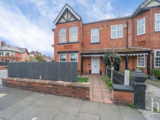 1 bedroom apartment for sale in Church Road, West Kirby, CH48 — £160,000 • 1 bed • 1 bath • 380 ft²
 2 bedroom apartment for sale in Greenbank Road, West Kirby, Wirral, Merseyside, CH48 — £175,000 • 2 bed • 1 bath • 609 ft²
 2 bedroom flat for sale in Hilbre Road, West Kirby, Wirral, CH48 — £250,000 • 2 bed • 2 bath • 804 ft²
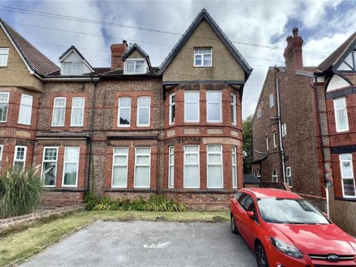 1 bedroom apartment for sale in Westbourne Grove, West Kirby, Wirral, Merseyside, CH48 — £270,000 • 1 bed • 1 bath • 896 ft²
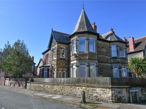 3 bedroom flat for sale in Hilbre Road, West Kirby, Wirral, CH48 — £375,000 • 3 bed • 1 bath • 1480 ft²
Meta
- {
"@context": "https://schema.org",
"@type": "Residence",
"name": "1 bedroom ground floor flat for sale in Caldy Road, The Mou…",
"description": "",
"url": "https://propertypiper.co.uk/property/f08af6c1-ba95-42a1-8ee7-1d8157364516",
"image": "https://image-a.propertypiper.co.uk/863616dc-24b5-4d5b-a6a9-3be6a54d88ef-1024.jpeg",
"address": {
"@type": "PostalAddress",
"streetAddress": "Caldy Road, The Mount, CH48",
"postalCode": "CH48 2HN",
"addressLocality": "Wirral",
"addressRegion": "Wirral West",
"addressCountry": "England"
},
"geo": {
"@type": "GeoCoordinates",
"latitude": 53.3613115,
"longitude": -3.1711297
},
"numberOfRooms": 1,
"numberOfBathroomsTotal": 1,
"floorSize": {
"@type": "QuantitativeValue",
"value": 560,
"unitCode": "FTK"
},
"offers": {
"@type": "Offer",
"price": 230000,
"priceCurrency": "GBP",
"availability": "https://schema.org/InStock"
},
"additionalProperty": [
{
"@type": "PropertyValue",
"name": "Feature",
"value": "Victorian"
},
{
"@type": "PropertyValue",
"name": "Feature",
"value": "multi-unit"
},
{
"@type": "PropertyValue",
"name": "Feature",
"value": "investment property"
},
{
"@type": "PropertyValue",
"name": "Feature",
"value": "period features"
},
{
"@type": "PropertyValue",
"name": "Feature",
"value": "high ceilings"
},
{
"@type": "PropertyValue",
"name": "Feature",
"value": "off-street parking"
},
{
"@type": "PropertyValue",
"name": "Feature",
"value": "red brick"
},
{
"@type": "PropertyValue",
"name": "Feature",
"value": "gable roof"
},
{
"@type": "PropertyValue",
"name": "Feature",
"value": "modern"
},
{
"@type": "PropertyValue",
"name": "Feature",
"value": "living room"
},
{
"@type": "PropertyValue",
"name": "Feature",
"value": "laminate flooring"
},
{
"@type": "PropertyValue",
"name": "Feature",
"value": "bay window"
},
{
"@type": "PropertyValue",
"name": "Feature",
"value": "patio doors"
},
{
"@type": "PropertyValue",
"name": "Feature",
"value": "natural light"
},
{
"@type": "PropertyValue",
"name": "Feature",
"value": "neutral walls"
}
]
}
High Res Floorplan Images
Compatible Floorplan Images
FloorplanImages Thumbnail