LU3 3JG - 2 bedroom semidetached house for sale in Lilac Grove, Luton…
View on Property Piper
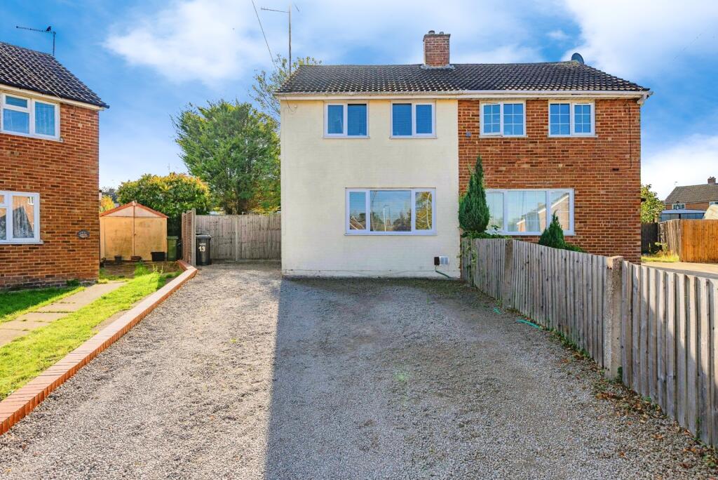
2 bedroom semi-detached house for sale in Lilac Grove, Luton, Bedfordshire, LU3
Property Details
- Price: £300000
- Bedrooms: 2
- Bathrooms: 2
- Property Type: undefined
- Property SubType: undefined
Image Descriptions
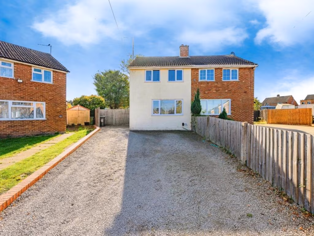
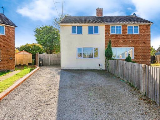
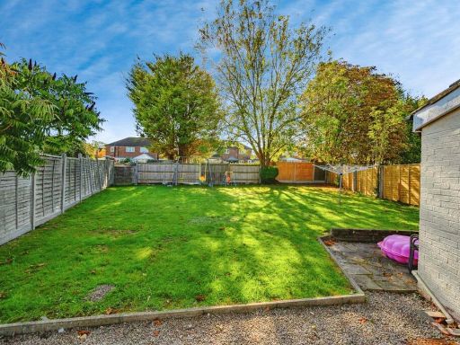
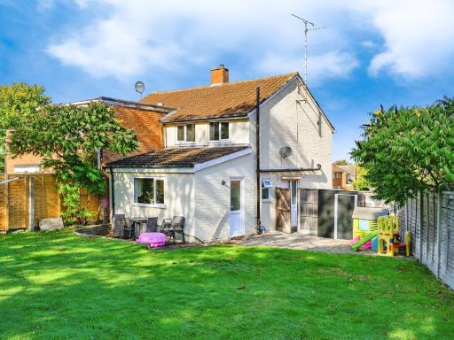
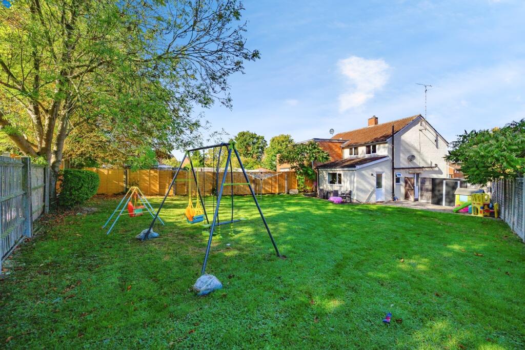
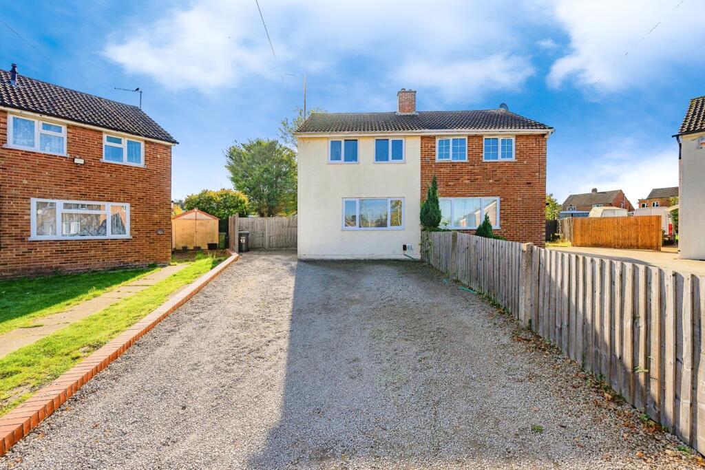
- semi-detached house mid-20th century
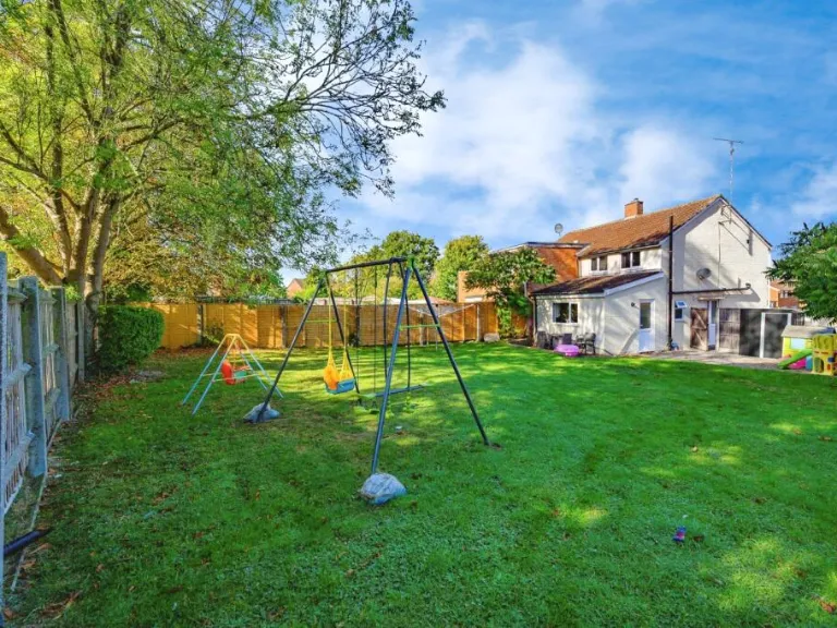
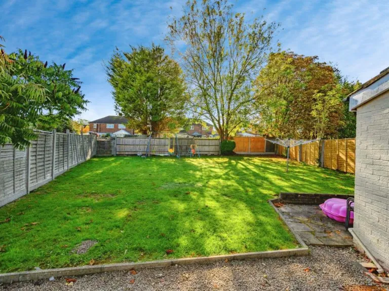
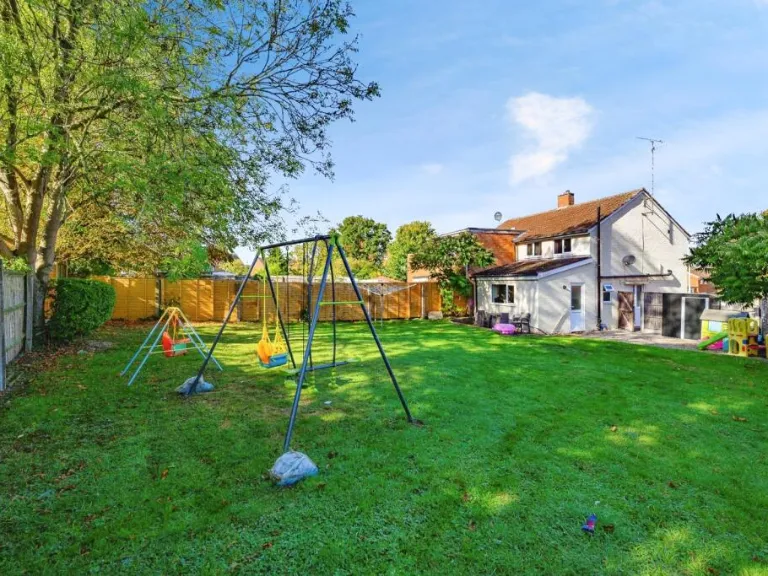
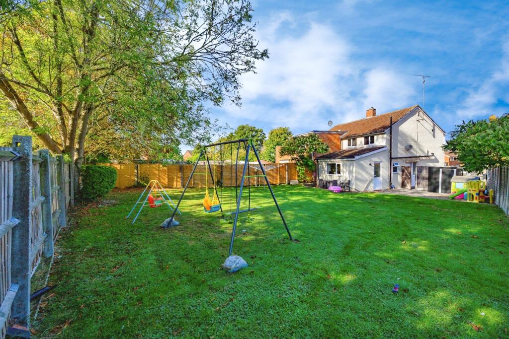
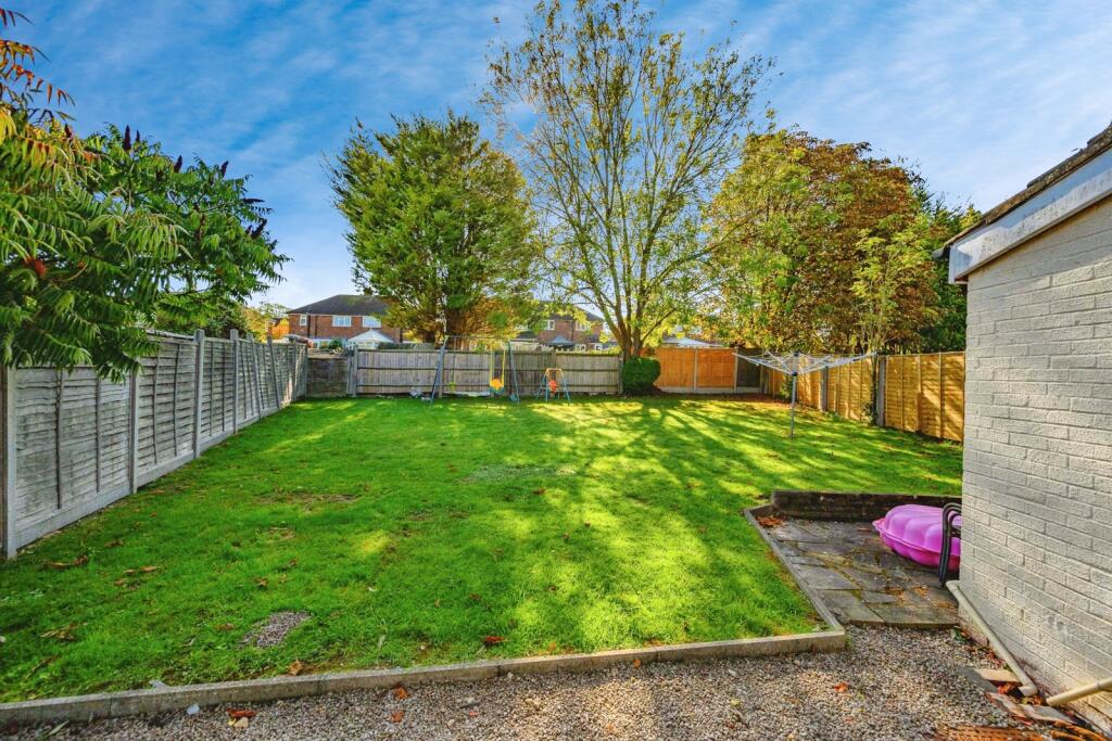
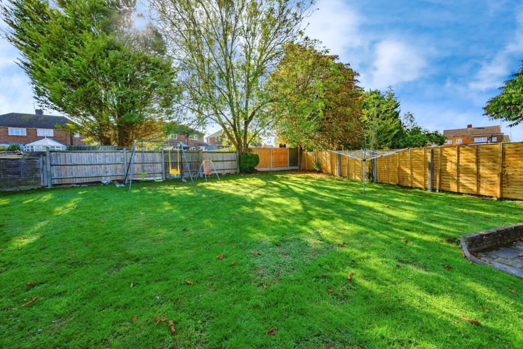
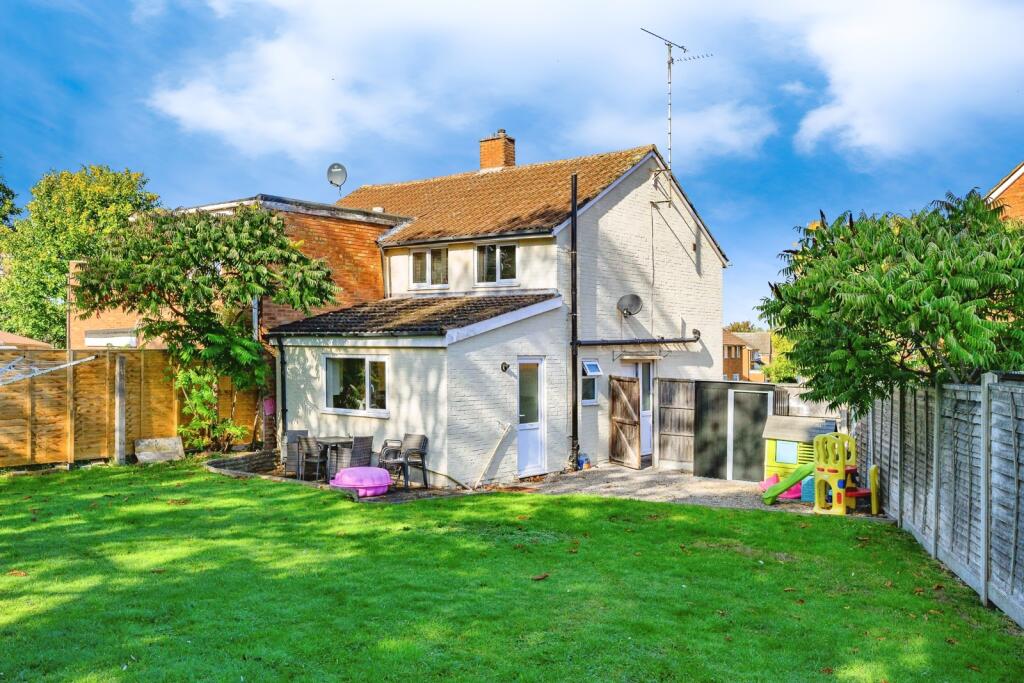
- rear of house and garden traditional family home
Floorplan Description
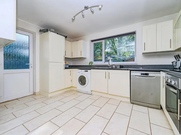
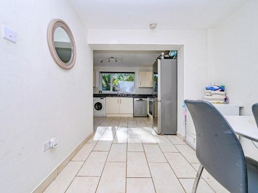
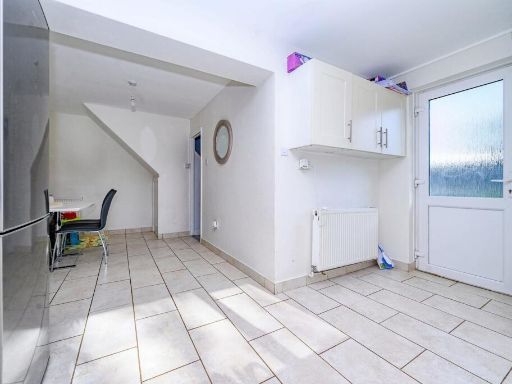
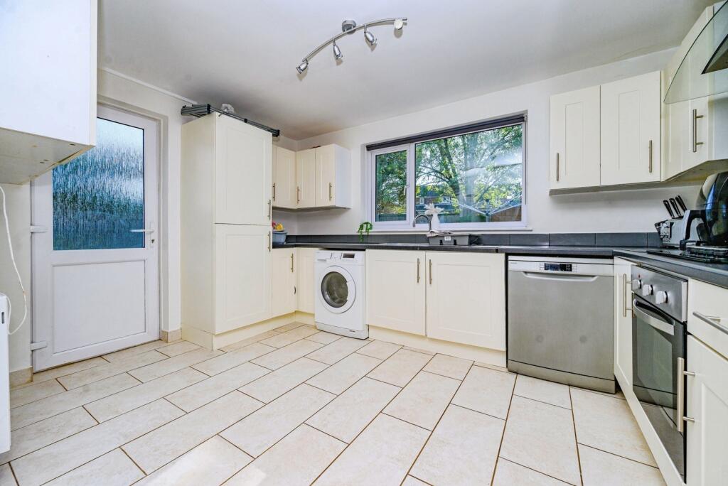
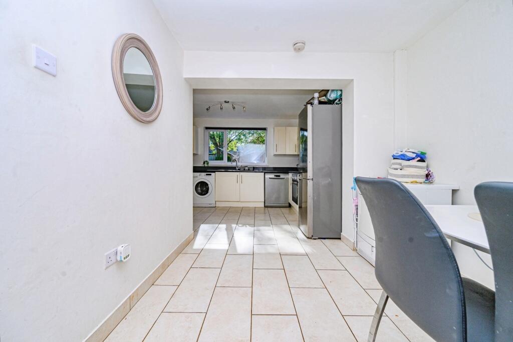
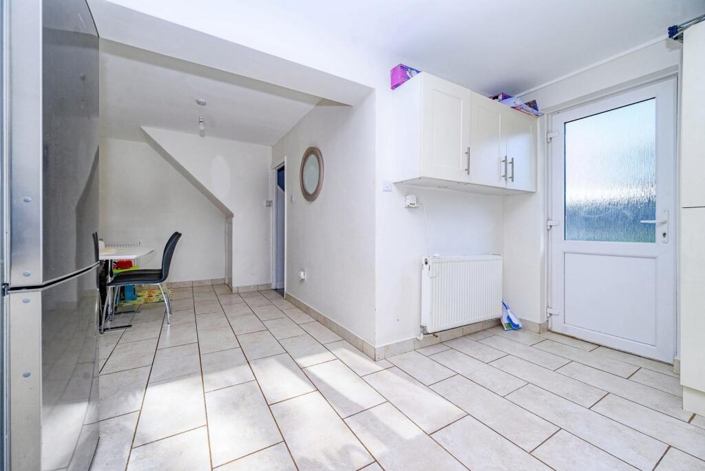
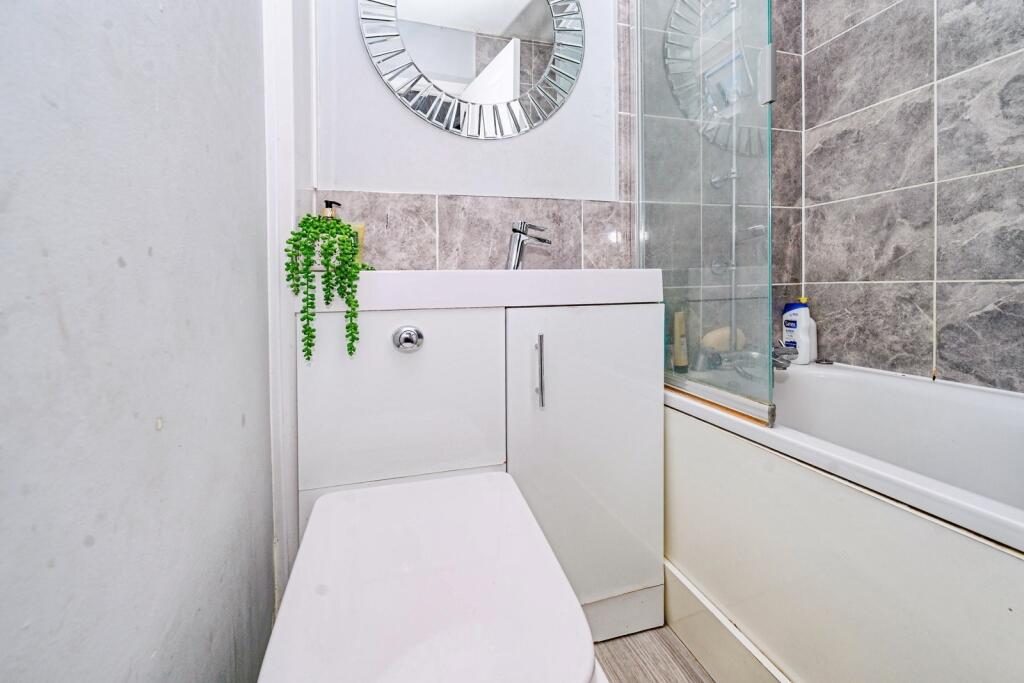
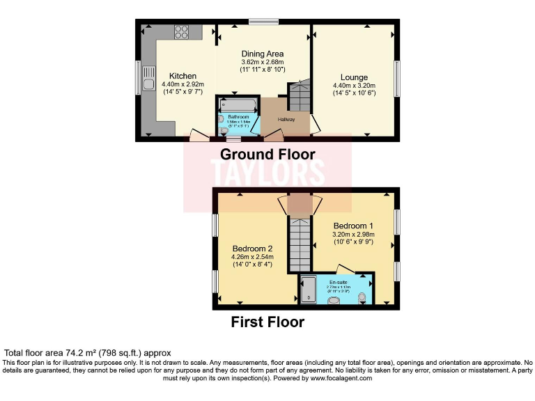
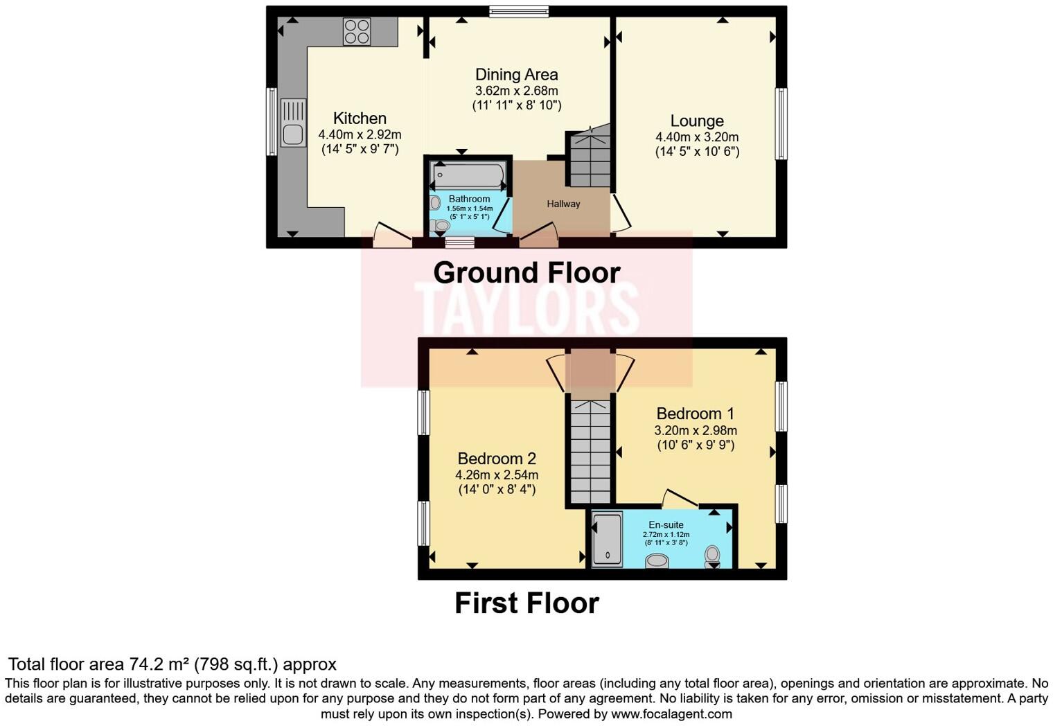
- Two-bedroom, two-bathroom house with kitchen, dining area and lounge over two floors.
Rooms
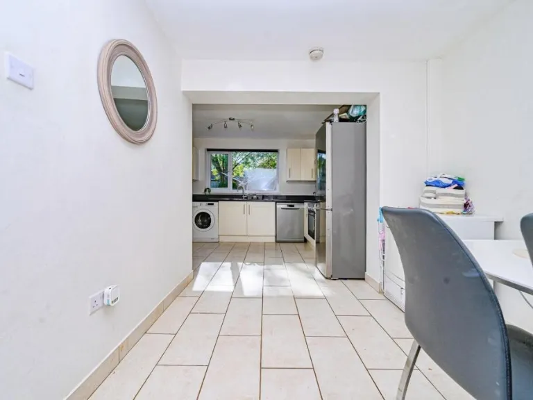
- Kitchen:
- Dining Area:
- Lounge:
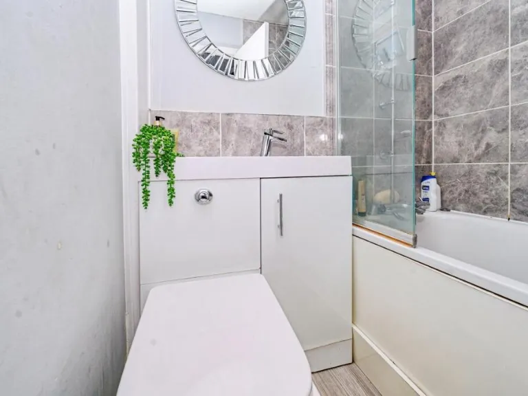
- Bathroom:
- Bedroom 2:
- Bedroom 1:
- En-suite:
Textual Property Features
Detected Visual Features
- semi-detached
- mid-20th century
- driveway
- off-street parking
- front garden
- side gate
- chimney
- two-story
- traditional
- family home
- large garden
- detached
- play area
- swing set
- fenced garden
- brick
- outdoor space
EPC Details
- Fully double glazed
- Cavity wall, as built, no insulation (assumed)
- Boiler and radiators, mains gas
- Low energy lighting in 30% of fixed outlets
- Solid, no insulation (assumed)
Nearby Schools
- The Ferrars Academy
- King's House Moorlands
- Norton Road Primary School
- Leagrave Primary School
- Southfield Primary Academy
- Bramingham Primary School
- The Academy of Central Bedfordshire
- Challney High School for Girls
- Waulud Primary School
- Sundon Lower School
- Houstone School
- Downside Primary School
- St Martin De Porres Catholic Primary School
- St Joseph's Catholic Primary School
- Chantry Primary Academy
- Lime Tree Primary Academy
- Challney High School for Boys
- The Chalk Hills Academy
- Al Hikmah Boys School
- Beechwood Primary School
- Pirton Hill Primary School
- The Meads Primary School
- Parklea Primary School
- Lealands High School
- Lea Manor High School Performing Arts College
- Whitefield Primary Academy
- Chalton Lower School
Nearest General Shops
- Id: 7212691325
- Tags:
- Name: Strand
- Shop: hairdresser
- TagsNormalized:
- Lat: 51.9163114
- Lon: -0.4703642
- FullGeoHash: gcpxm716rtzh
- PartitionGeoHash: gcpx
- Images:
- FoodStandards: null
- Distance: 671.3
,- Id: 7212880735
- Tags:
- Name: My Hair
- Shop: hairdresser
- TagsNormalized:
- Lat: 51.9198278
- Lon: -0.471759
- FullGeoHash: gcpxm78qzjqu
- PartitionGeoHash: gcpx
- Images:
- FoodStandards: null
- Distance: 289.9
,- Id: 7212880731
- Tags:
- Name: Party Paradise UK
- Shop: party
- TagsNormalized:
- Lat: 51.919889
- Lon: -0.4715082
- FullGeoHash: gcpxm78xm0f1
- PartitionGeoHash: gcpx
- Images:
- FoodStandards: null
- Distance: 279.2
}
Nearest Grocery shops
- Id: 7212691329
- Tags:
- Amenity: post_office
- Name: Sundon Superstore
- Shop: convenience
- TagsNormalized:
- office
- post office
- convenience
- shop
- Lat: 51.9148828
- Lon: -0.4693544
- FullGeoHash: gcpxm6f4p5xf
- PartitionGeoHash: gcpx
- Images:
- FoodStandards: null
- Distance: 834.8
,- Id: 10598686040
- Tags:
- Name: Al-Zaytoun
- Shop: convenience
- TagsNormalized:
- Lat: 51.9155837
- Lon: -0.4694454
- FullGeoHash: gcpxm6fnjnhp
- PartitionGeoHash: gcpx
- Images:
- FoodStandards: null
- Distance: 756.6
,- Id: 7212880733
- Tags:
- Name: SAS Food City
- Shop: convenience
- TagsNormalized:
- Lat: 51.9198592
- Lon: -0.4716343
- FullGeoHash: gcpxm78x455z
- PartitionGeoHash: gcpx
- Images:
- FoodStandards: null
- Distance: 284.4
}
Nearest Religious buildings
- Id: 505300892
- Tags:
- Addr:
- City: Luton
- Street: Sundon Park Road
- Suburb: Sundon Park
- Amenity: place_of_worship
- Building: yes
- Denomination: baptist
- Name: Sundon Baptist Church
- Religion: christian
- Source: OS OpenMap Local
- TagsNormalized:
- place of worship
- baptist
- church
- christian
- Lat: 51.9166441
- Lon: -0.4704031
- FullGeoHash: gcpxm71kqgfj
- PartitionGeoHash: gcpx
- Images:
- FoodStandards: null
- Distance: 634.3
,- Id: 505300896
- Tags:
- Amenity: community_centre
- Building: yes
- Name: Sundon Baptist Church Hall
- Source: OS OpenMap Local
- TagsNormalized:
- community centre
- baptist
- church
- church hall
- Lat: 51.9167765
- Lon: -0.4703383
- FullGeoHash: gcpxm71t0kd6
- PartitionGeoHash: gcpx
- Images:
- FoodStandards: null
- Distance: 619.7
,- Id: 505569952
- Tags:
- Amenity: place_of_worship
- Building: yes
- Denomination: catholic
- Name: St John The Apostle Catholic Church
- Religion: christian
- Source: OS OpenMap Local
- TagsNormalized:
- place of worship
- catholic
- church
- christian
- Lat: 51.9195055
- Lon: -0.4709526
- FullGeoHash: gcpxm79j4126
- PartitionGeoHash: gcpx
- Images:
- FoodStandards: null
- Distance: 316.5
}
Nearest Medical buildings
- Id: 7212691334
- Tags:
- Amenity: doctors
- Healthcare: doctor
- Name: Sundon Medical Centre
- TagsNormalized:
- doctor
- doctors
- health
- healthcare
- Lat: 51.9145883
- Lon: -0.4691291
- FullGeoHash: gcpxm6f2kkxv
- PartitionGeoHash: gcpx
- Images:
- FoodStandards: null
- Distance: 869.1
,- Id: 7212691333
- Tags:
- Amenity: clinic
- Healthcare: clinic
- Name: Luton Chiropratic Clinic
- TagsNormalized:
- Lat: 51.9146942
- Lon: -0.4692015
- FullGeoHash: gcpxm6f34b6j
- PartitionGeoHash: gcpx
- Images:
- FoodStandards: null
- Distance: 856.8
,- Id: 7212691330
- Tags:
- Amenity: pharmacy
- Brand: Rowlands Pharmacy
- Brand:wikidata: Q62663235
- Healthcare: pharmacy
- Name: Rowlands Pharmacy
- TagsNormalized:
- pharmacy
- rowlands pharmacy
- health
- healthcare
- Lat: 51.9148266
- Lon: -0.4693007
- FullGeoHash: gcpxm6f3b905
- PartitionGeoHash: gcpx
- Images:
- FoodStandards: null
- Distance: 841.4
,- Id: 7212880743
- Tags:
- Amenity: pharmacy
- Brand: Rowlands Pharmacy
- Brand:wikidata: Q62663235
- Healthcare: pharmacy
- Name: Rowlands Pharmacy
- TagsNormalized:
- pharmacy
- rowlands pharmacy
- health
- healthcare
- Lat: 51.9158027
- Lon: -0.4695717
- FullGeoHash: gcpxm6fp6pjf
- PartitionGeoHash: gcpx
- Images:
- FoodStandards: null
- Distance: 731.5
}
Nearest Airports
- Id: 110273499
- Tags:
- Addr:
- Country: GB
- Postcode: LU2 9LY
- Aerodrome: international
- Aerodrome:type: public
- Aeroway: aerodrome
- Alt_name: London Luton
- Iata: LTN
- Icao: EGGW
- Name: London Luton Airport
- Website: https://www.london-luton.co.uk/
- Wikidata: Q8712
- Wikipedia: en:Luton Airport
- TagsNormalized:
- airport
- international airport
- Lat: 51.8780363
- Lon: -0.3701408
- FullGeoHash: gcpxps47rngh
- PartitionGeoHash: gcpx
- Images:
- FoodStandards: null
- Distance: 8476.3
}
Nearest Tourist attractions
- Id: 747807434
- Tags:
- Addr:
- City: Streatley
- Country: GB
- Housenumber: 171
- Postcode: LU3 3PS
- Street: Sharpenhoe Road
- Fhrs:
- Authority: Central Bedfordshire
- Id: 450224
- Local_authority_id: 15437
- Guest_house: bed_and_breakfast
- Name: The Chequers
- Opening_hours: Mo-Su 12:00-23:00
- Operator: Free House
- Tourism: guest_house
- Website: https://www.thechequersstreatley.com/
- TagsNormalized:
- Lat: 51.9459518
- Lon: -0.4442369
- FullGeoHash: gcpxtbkx0e2b
- PartitionGeoHash: gcpx
- Images:
- FoodStandards:
- Id: 450224
- FHRSID: 450224
- LocalAuthorityBusinessID: 15437
- BusinessName: The Chequers
- BusinessType: Pub/bar/nightclub
- BusinessTypeID: 7843
- AddressLine1: 171 Sharpenhoe Road
- AddressLine2: Streatley
- AddressLine3: Bedfordshire
- AddressLine4: null
- PostCode: LU3 3PS
- RatingValue: 3
- RatingKey: fhrs_3_en-GB
- RatingDate: 2022-01-18
- LocalAuthorityCode: 702
- LocalAuthorityName: Central Bedfordshire
- LocalAuthorityWebSite: http://www.centralbedfordshire.gov.uk
- LocalAuthorityEmailAddress: env.health@centralbedfordshire.gov.uk
- Scores:
- Hygiene: 5
- Structural: 10
- ConfidenceInManagement: 10
- NewRatingPending: false
- Geocode:
- Longitude: -0.44178100000000
- Latitude: 51.94303500000000
- Distance: 3189.6
,- Id: 3888943098
- Tags:
- Addr:
- City: Streatley
- Country: GB
- Housenumber: 133
- Postcode: LU3 3PS
- Street: Sharpenhoe Road
- Fhrs:
- Authority: Central Bedfordshire
- Id: 451220
- Local_authority_id: 85429
- Name: The Old Forge
- Phone: +44 1582 882 145
- Tourism: guest_house
- Website: https://www.133theoldforge.co.uk/
- TagsNormalized:
- Lat: 51.944606
- Lon: -0.4425773
- FullGeoHash: gcpxtbjxr0qk
- PartitionGeoHash: gcpx
- Images:
- FoodStandards: null
- Distance: 3136.2
,- Id: 1113023311
- Tags:
- Access: yes
- Tourism: picnic_site
- TagsNormalized:
- Lat: 51.9280701
- Lon: -0.4997928
- FullGeoHash: gcpxkthncvz7
- PartitionGeoHash: gcpx
- Images:
- FoodStandards: null
- Distance: 2096.2
}
Nearest Train stations
- Id: 279405840
- Tags:
- Name: Page's Park
- Public_transport: station
- Railway: station
- Source: survey
- Tourism: narrow_gauge_railway
- Usage: tourism
- Wikidata: Q7124203
- TagsNormalized:
- Lat: 51.9087698
- Lon: -0.6514512
- FullGeoHash: gcpx31tws04c
- PartitionGeoHash: gcpx
- Images:
- FoodStandards: null
- Distance: 12491.1
,- Id: 9725567363
- Tags:
- Name: Whipsnade Central
- Public_transport: station
- Railway: station
- Train: yes
- Usage: tourism
- TagsNormalized:
- Lat: 51.8461109
- Lon: -0.5415762
- FullGeoHash: gcpwgwm9kred
- PartitionGeoHash: gcpw
- Images:
- FoodStandards: null
- Distance: 9774.7
,- Id: 6750291608
- Tags:
- Name: Luton Airport Parkway
- Naptan:
- Network: National Rail
- Public_transport: station
- Railway: station
- Ref:
- Train: yes
- Wheelchair: yes
- Wheelchair:description: Lifts from booking office to footbridge with lifts to all platforms. Step-free exit from platform 1 to Kimpton Road. Step-free from main entrance to shuttle bus to Airport. Toilets not checked on this visit. 10 blue badge spaces.
- Wikidata: Q801135
- Wikipedia: en:Luton Airport Parkway railway station
- TagsNormalized:
- Lat: 51.872845
- Lon: -0.3961244
- FullGeoHash: gcpxngpt1xhj
- PartitionGeoHash: gcpx
- Images:
- FoodStandards: null
- Distance: 7513.8
,- Id: 8399259717
- Tags:
- Name: Luton
- Naptan:
- Network: National Rail
- Public_transport: station
- Railway: station
- Ref:
- Wikidata: Q1809595
- Wikipedia: en:Luton railway station
- TagsNormalized:
- Lat: 51.8825271
- Lon: -0.4140848
- FullGeoHash: gcpxnsfmxh5c
- PartitionGeoHash: gcpx
- Images:
- FoodStandards: null
- Distance: 5888.5
,- Id: 21285573
- Tags:
- Name: Leagrave
- Naptan:
- Network: National Rail
- Public_transport: station
- Railway: station
- Ref:
- Wheelchair: no
- Wikidata: Q12061118
- Wikipedia: en:Leagrave railway station
- TagsNormalized:
- Lat: 51.9054737
- Lon: -0.4585987
- FullGeoHash: gcpxm9453cs5
- PartitionGeoHash: gcpx
- Images:
- FoodStandards: null
- Distance: 2050.6
}
Nearest Bus stations and stops
- Id: 8441436548
- Tags:
- Bus: yes
- Highway: bus_stop
- Public_transport: platform
- Shelter: yes
- TagsNormalized:
- Lat: 51.9189597
- Lon: -0.4594798
- FullGeoHash: gcpxme93v7e4
- PartitionGeoHash: gcpx
- Images:
- FoodStandards: null
- Distance: 854.7
,- Id: 8435952390
- Tags:
- Bus: yes
- Highway: bus_stop
- Public_transport: platform
- Shelter: yes
- TagsNormalized:
- Lat: 51.9217482
- Lon: -0.458293
- FullGeoHash: gcpxms460gru
- PartitionGeoHash: gcpx
- Images:
- FoodStandards: null
- Distance: 851.2
,- Id: 8420877039
- Tags:
- Bus: yes
- Highway: bus_stop
- Public_transport: platform
- Shelter: no
- TagsNormalized:
- Lat: 51.9173302
- Lon: -0.4640794
- FullGeoHash: gcpxm7q065v3
- PartitionGeoHash: gcpx
- Images:
- FoodStandards: null
- Distance: 717.8
,- Id: 8441441251
- Tags:
- Bus: yes
- Highway: bus_stop
- Public_transport: platform
- Shelter: no
- TagsNormalized:
- Lat: 51.9230588
- Lon: -0.4726698
- FullGeoHash: gcpxmhrc9zxy
- PartitionGeoHash: gcpx
- Images:
- FoodStandards: null
- Distance: 158.5
,- Id: 8420980140
- Tags:
- Bus: yes
- Highway: bus_stop
- Public_transport: platform
- Shelter: no
- TagsNormalized:
- Lat: 51.9215855
- Lon: -0.4709745
- FullGeoHash: gcpxmk111mpc
- PartitionGeoHash: gcpx
- Images:
- FoodStandards: null
- Distance: 87.2
}
Nearest Hotels
- Id: 110015194
- Tags:
- Addr:
- City: Toddington
- Postcode: LU5 6HR
- Brand: Travelodge
- Brand:wikidata: Q9361374
- Building: yes
- Internet_access: wlan
- Internet_access:fee: customers
- Internet_access:ssid: Travelodge WiFi
- Name: Travelodge Toddington M1 Southbound
- Tourism: hotel
- TagsNormalized:
- Lat: 51.9475061
- Lon: -0.4997094
- FullGeoHash: gcpxs8u05vj8
- PartitionGeoHash: gcpx
- Images:
- FoodStandards: null
- Distance: 3433.8
,- Id: 421046483
- Tags:
- Addr:
- City: Luton
- Housenumber: 641
- Postcode: LU4 8RQ
- Street: Dunstable Road
- Brand: Travelodge
- Brand:wikidata: Q9361374
- Brand:wikipedia: en:Travelodge UK
- Building: yes
- Fhrs:
- Authority: Luton
- Id: 359481
- Local_authority_id: 6227
- Name: Travelodge Luton
- Operator: Travelodge
- Tourism: hotel
- TagsNormalized:
- Lat: 51.8927143
- Lon: -0.4674221
- FullGeoHash: gcpxjqg8ur0f
- PartitionGeoHash: gcpx
- Images:
- FoodStandards: null
- Distance: 3302.4
,- Id: 3891983871
- Tags:
- Addr:
- City: Luton
- Housenumber: 10
- Postcode: LU3 2NH
- Street: Marsh Road
- Fhrs:
- Authority: Luton
- Id: 404565
- Local_authority_id: 10816
- Name: The Pines Hotel
- Phone: +44 1582 651 130
- Tourism: hotel
- Website: http://www.pineshotel.com/
- TagsNormalized:
- Lat: 51.89955
- Lon: -0.4469559
- FullGeoHash: gcpxmb48c1md
- PartitionGeoHash: gcpx
- Images:
- FoodStandards: null
- Distance: 3011.8
}
Tags
- semi-detached
- mid-20th century
- driveway
- off-street parking
- front garden
- side gate
- chimney
- two-story
- traditional
- family home
- large garden
- detached
- play area
- swing set
- fenced garden
- brick
- two-story
- outdoor space
Local Market Stats
- Average Price/sqft: £338
- Avg Income: £45400
- Rental Yield: 5%
- Social Housing: 18%
- Planning Success Rate: 76%
AirBnB Data
- 1km average: £86/night
- Listings in 1km: 2
Similar Properties
 2 bedroom semi-detached house for sale in Fourth Avenue, Luton, LU3 — £285,000 • 2 bed • 1 bath • 528 ft²
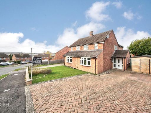 3 bedroom semi-detached house for sale in Redwood Drive, Luton, Bedfordshire, LU3 — £385,000 • 3 bed • 1 bath • 1027 ft²
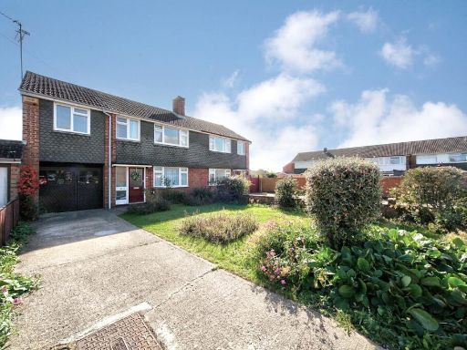 4 bedroom semi-detached house for sale in Galston Road, Luton, Bedfordshire, LU3 — £375,000 • 4 bed • 2 bath • 844 ft²
 5 bedroom semi-detached house for sale in Kinross Crescent, Luton, LU3 — £400,000 • 5 bed • 3 bath • 1740 ft²
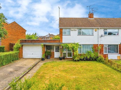 3 bedroom semi-detached house for sale in Watermead Road, LUTON, Bedfordshire, LU3 — £400,000 • 3 bed • 1 bath • 1294 ft²
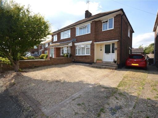 3 bedroom semi-detached house for sale in Uplands, Luton, Bedfordshire, LU3 — £375,000 • 3 bed • 2 bath • 1397 ft²
Meta
- {
"@context": "https://schema.org",
"@type": "Residence",
"name": "2 bedroom semidetached house for sale in Lilac Grove, Luton…",
"description": "",
"url": "https://propertypiper.co.uk/property/ef2e31e5-8905-4fd5-a6a1-e1e5c0bc7ccc",
"image": "https://image-a.propertypiper.co.uk/09141a49-c542-4240-bd1c-4349184af30d-1024.jpeg",
"address": {
"@type": "PostalAddress",
"streetAddress": "13 LILAC GROVE LUTON",
"postalCode": "LU3 3JG",
"addressLocality": "Luton",
"addressRegion": "Luton North",
"addressCountry": "England"
},
"geo": {
"@type": "GeoCoordinates",
"latitude": 51.92234607700121,
"longitude": -0.47066742655946286
},
"numberOfRooms": 2,
"numberOfBathroomsTotal": 2,
"floorSize": {
"@type": "QuantitativeValue",
"value": 798,
"unitCode": "FTK"
},
"offers": {
"@type": "Offer",
"price": 300000,
"priceCurrency": "GBP",
"availability": "https://schema.org/InStock"
},
"additionalProperty": [
{
"@type": "PropertyValue",
"name": "Feature",
"value": "semi-detached"
},
{
"@type": "PropertyValue",
"name": "Feature",
"value": "mid-20th century"
},
{
"@type": "PropertyValue",
"name": "Feature",
"value": "driveway"
},
{
"@type": "PropertyValue",
"name": "Feature",
"value": "off-street parking"
},
{
"@type": "PropertyValue",
"name": "Feature",
"value": "front garden"
},
{
"@type": "PropertyValue",
"name": "Feature",
"value": "side gate"
},
{
"@type": "PropertyValue",
"name": "Feature",
"value": "chimney"
},
{
"@type": "PropertyValue",
"name": "Feature",
"value": "two-story"
},
{
"@type": "PropertyValue",
"name": "Feature",
"value": "traditional"
},
{
"@type": "PropertyValue",
"name": "Feature",
"value": "family home"
},
{
"@type": "PropertyValue",
"name": "Feature",
"value": "large garden"
},
{
"@type": "PropertyValue",
"name": "Feature",
"value": "detached"
},
{
"@type": "PropertyValue",
"name": "Feature",
"value": "play area"
},
{
"@type": "PropertyValue",
"name": "Feature",
"value": "swing set"
},
{
"@type": "PropertyValue",
"name": "Feature",
"value": "fenced garden"
},
{
"@type": "PropertyValue",
"name": "Feature",
"value": "brick"
},
{
"@type": "PropertyValue",
"name": "Feature",
"value": "two-story"
},
{
"@type": "PropertyValue",
"name": "Feature",
"value": "outdoor space"
}
]
}
High Res Floorplan Images
Compatible Floorplan Images
FloorplanImages Thumbnail