NN15 6DX - 3 bedroom end of terrace house for sale in London Road, Ket…
View on Property Piper
3 bedroom end of terrace house for sale in London Road, Kettering, NN15
Property Details
- Price: £229995
- Bedrooms: 3
- Bathrooms: 1
- Property Type: undefined
- Property SubType: undefined
Brochure Descriptions
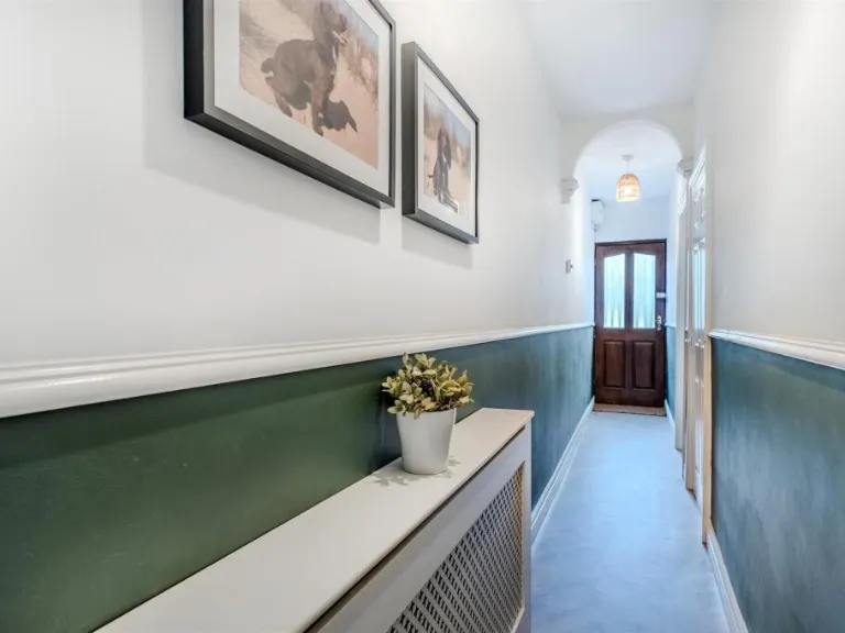
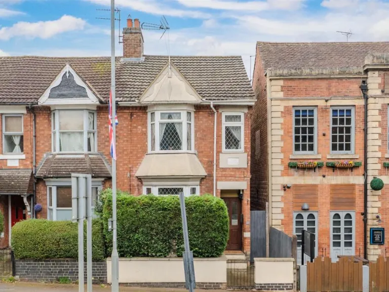
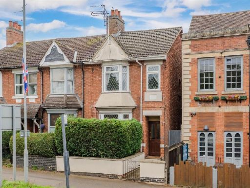
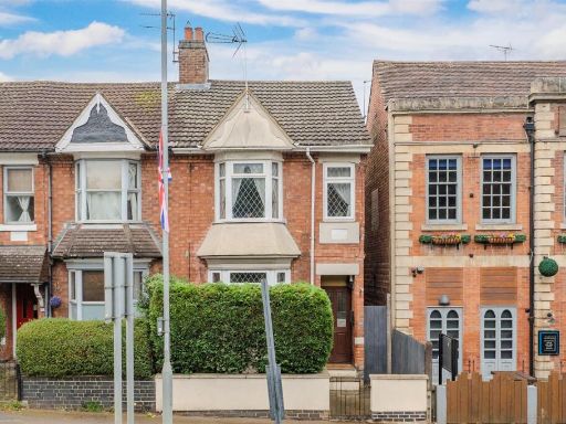
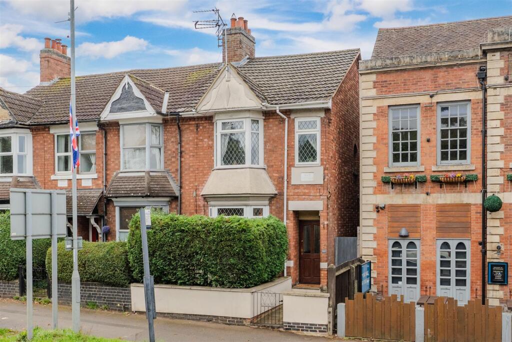
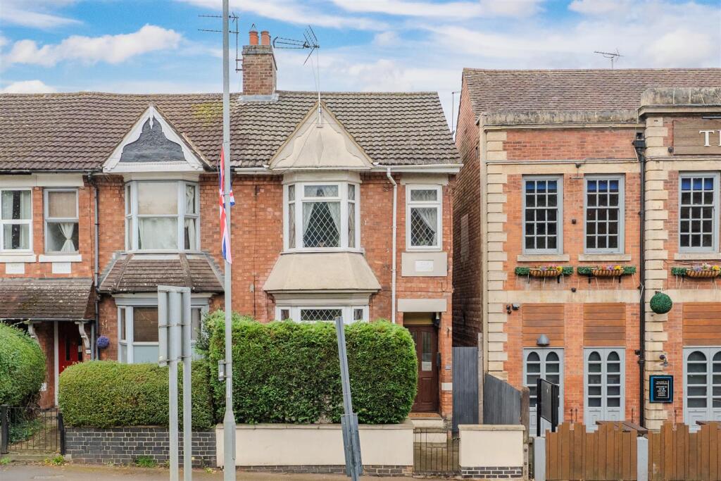
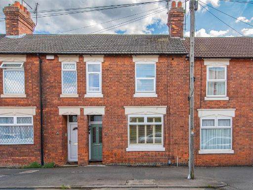
- Mid-terraced two-storey period townhouse (likely late-Victorian/Edwardian) constructed in red brick with bay windows to the ground and first floors. The property sits at street level behind a small walled forecourt with mature hedging providing privacy. A narrow side passage is visible to the right, suggesting rear access. Windows feature leaded glazing; the entrance is recessed beneath a small canopy. Overall the property appears to be a standard mid-terrace urban family house with a small front garden/forecourt and likely modest rear garden (not visible). The building footprint and proportions indicate an average-sized dwelling for an urban terraced street — suitable for a small family or buy-to-let investment.
- No residential property is shown. The image is a branded estate‑agent promotional page for Simpson & Partners depicting an office/waiting area: modern reception/lounge seating, low coffee table, soft ambient lighting and branded graphics. As a valuator, there is no external or internal residential property information (no rooms, layout, plot, or location details for a house) to assess; therefore no valuation or accurate size estimate can be provided from this image alone.
Image Descriptions
- exterior of terraced house Edwardian
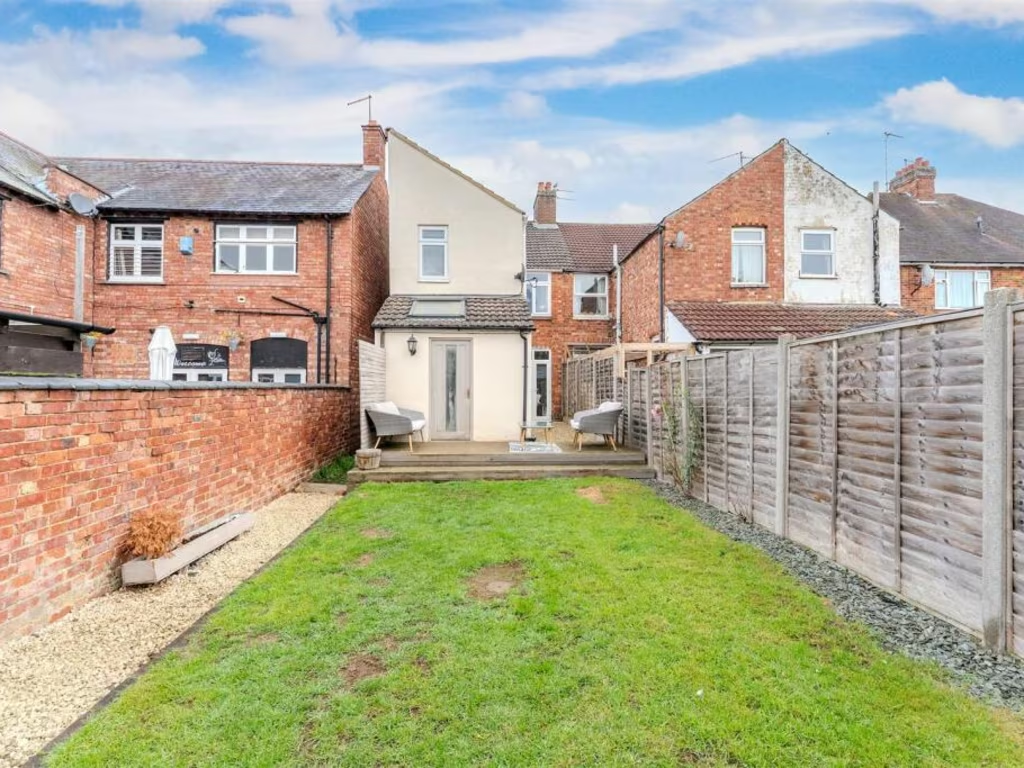
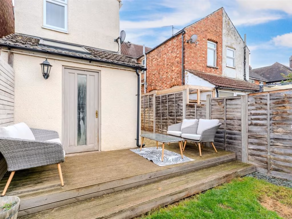
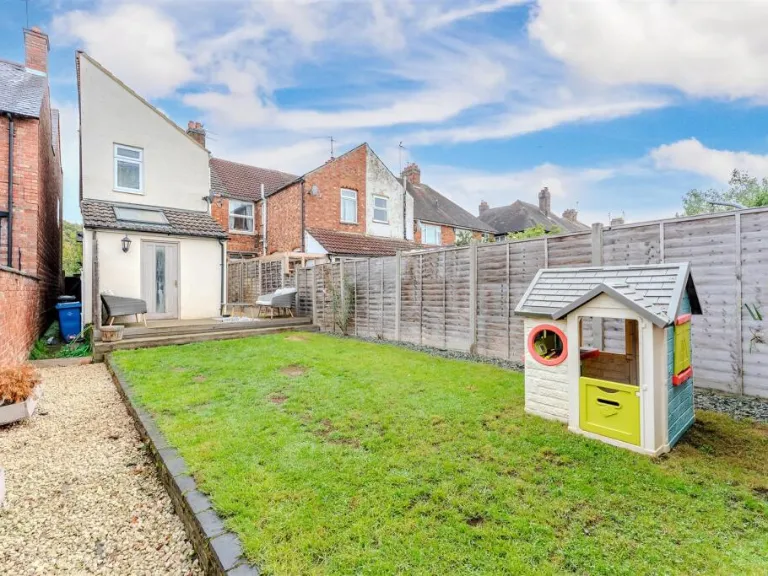
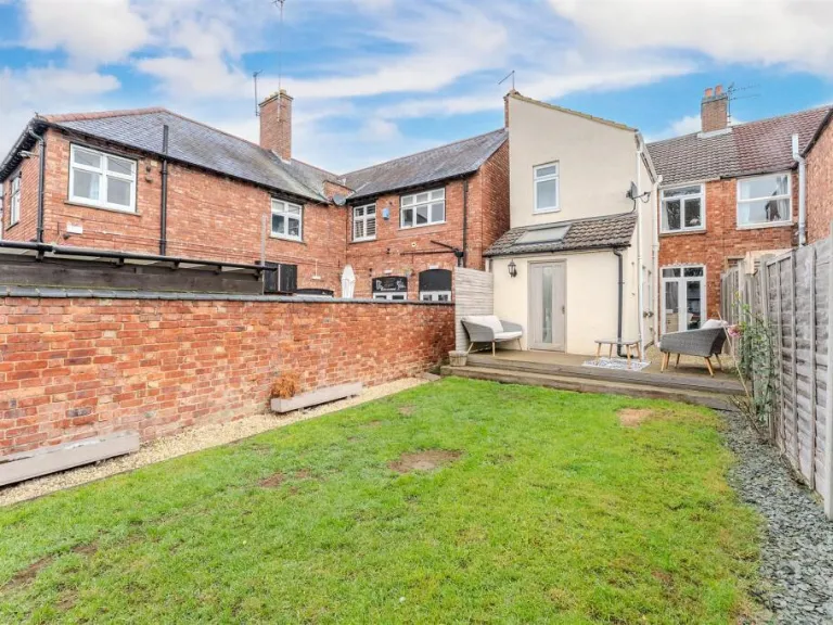
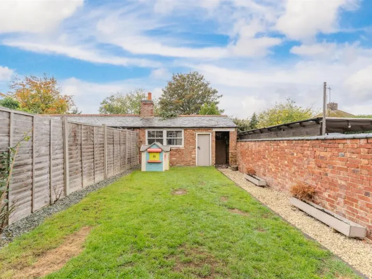
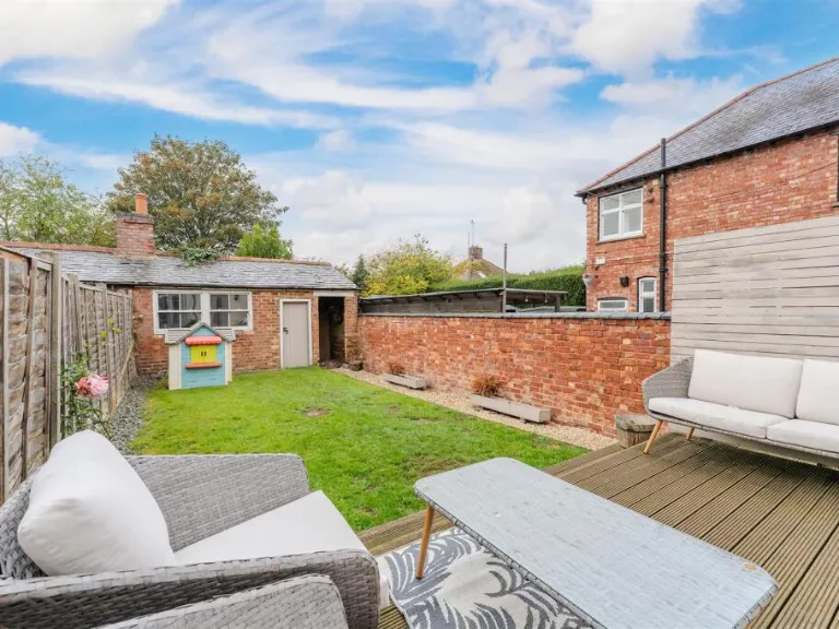
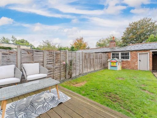
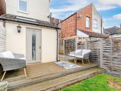
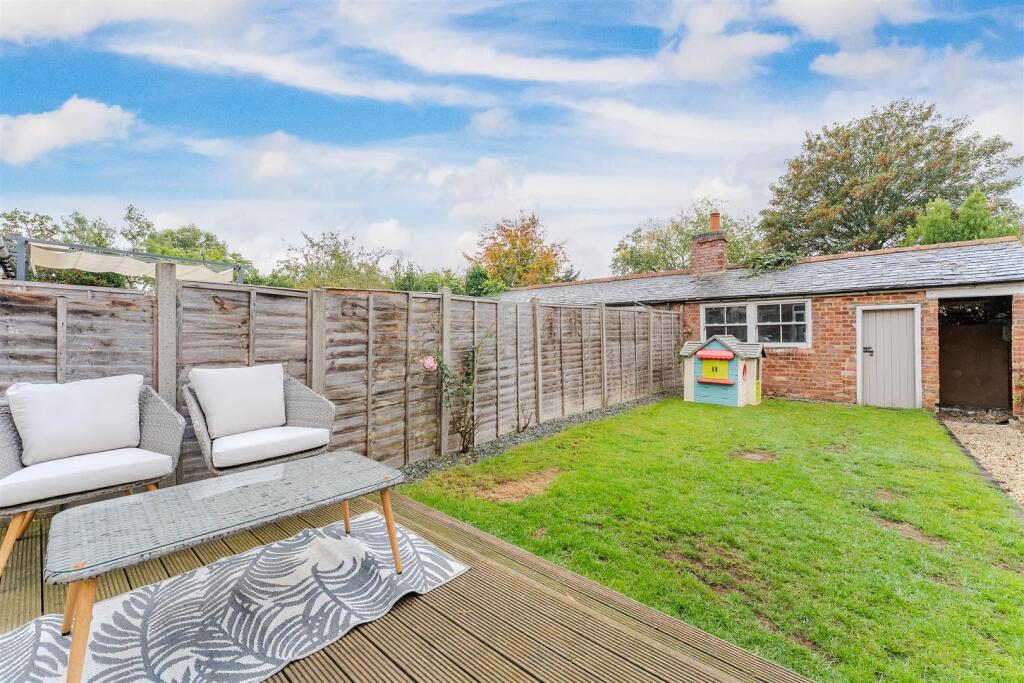
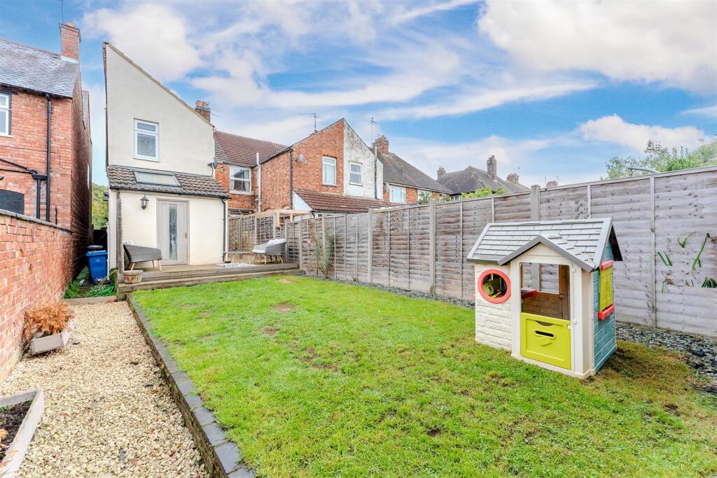
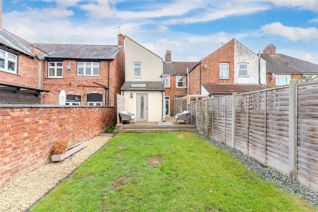
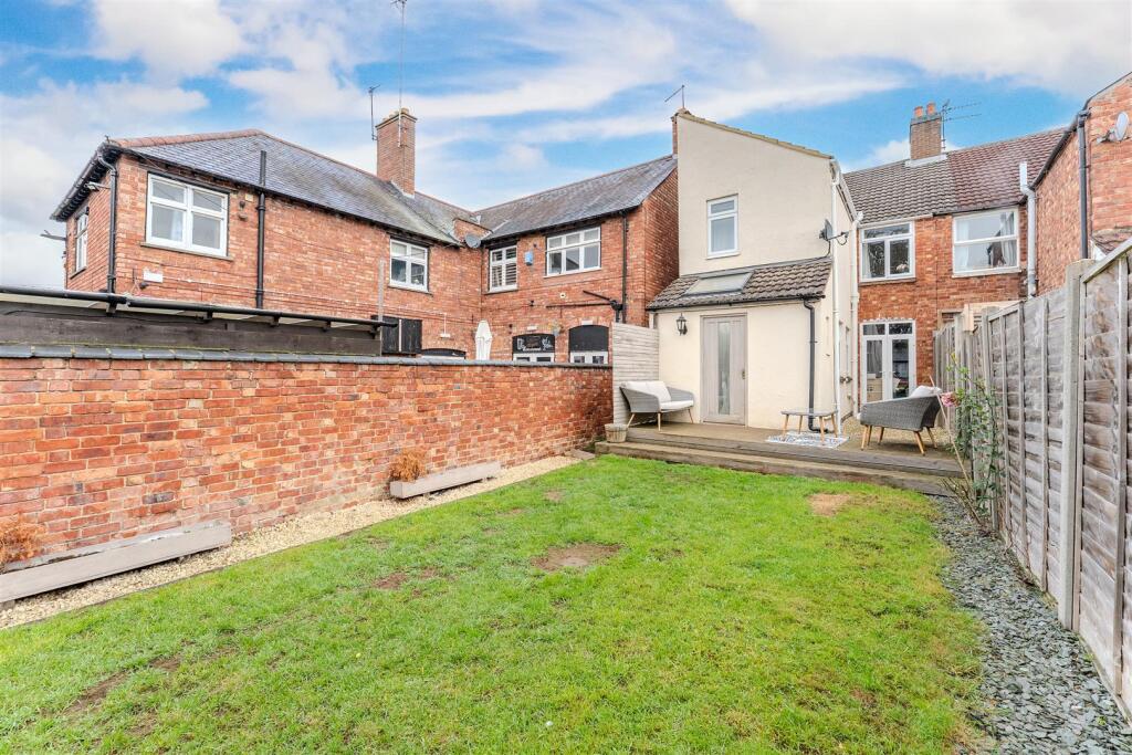
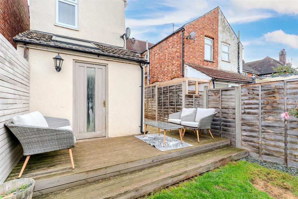
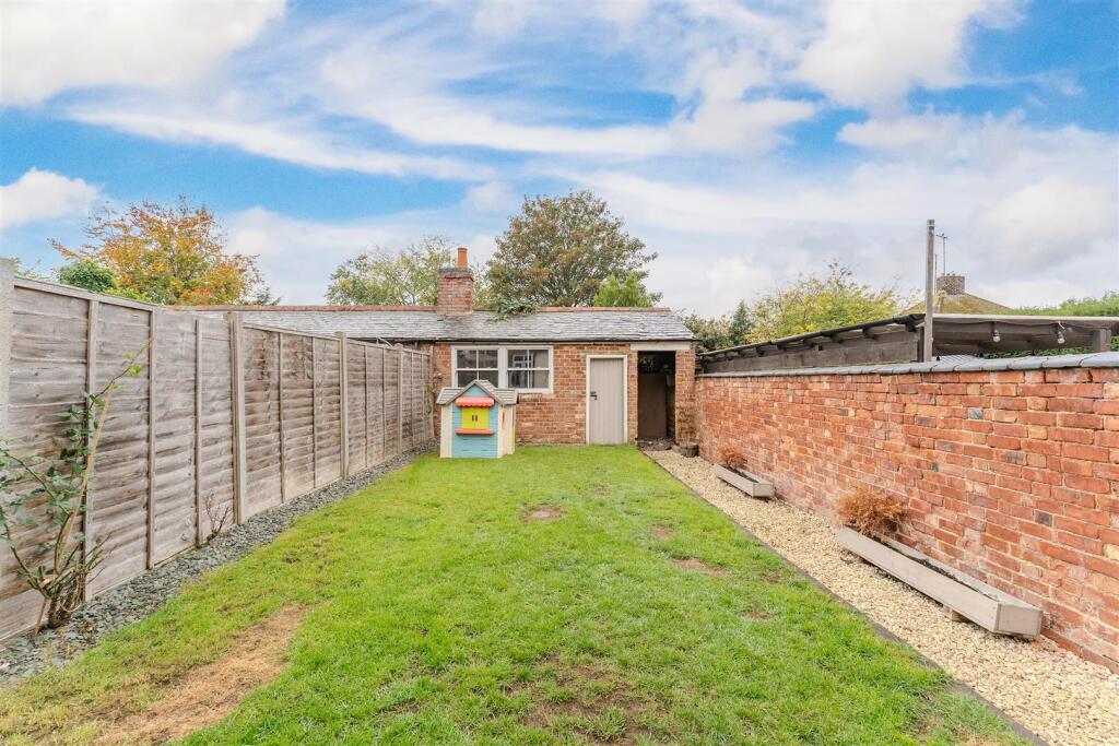
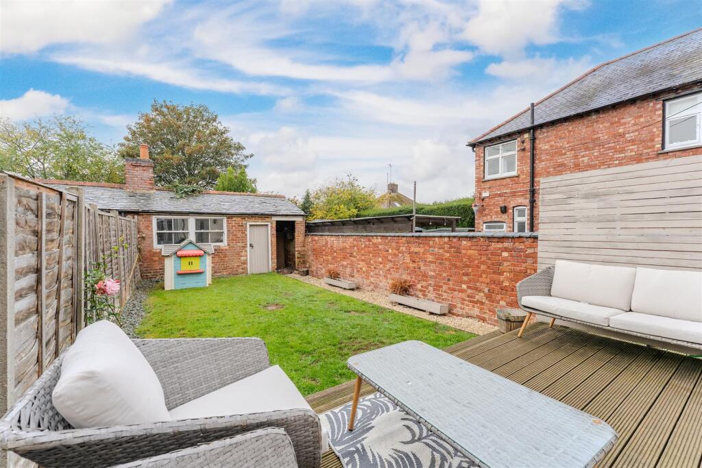
- backyard and garden contemporary
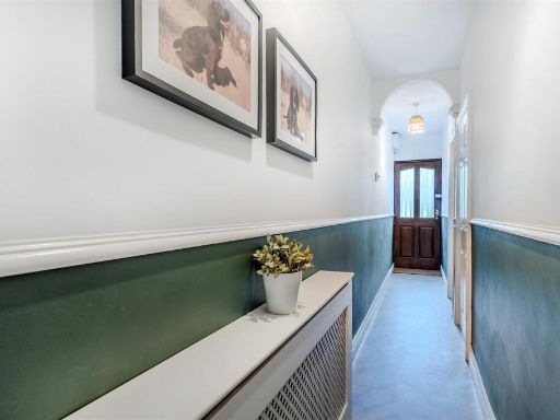
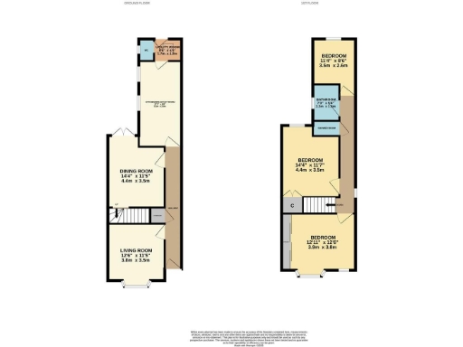
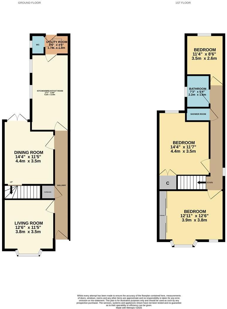
Rooms
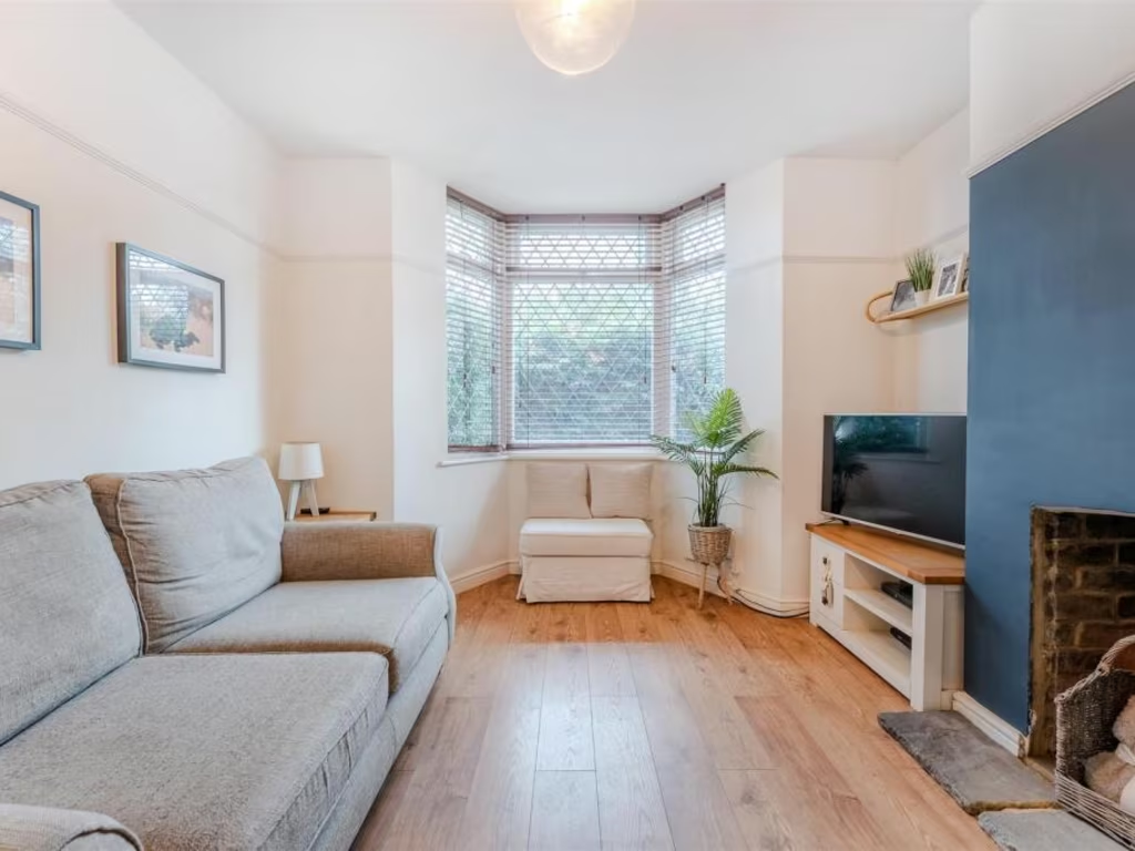
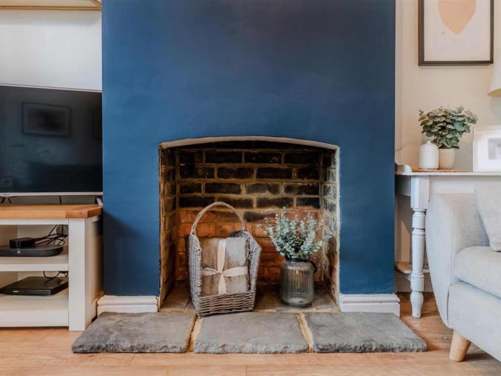
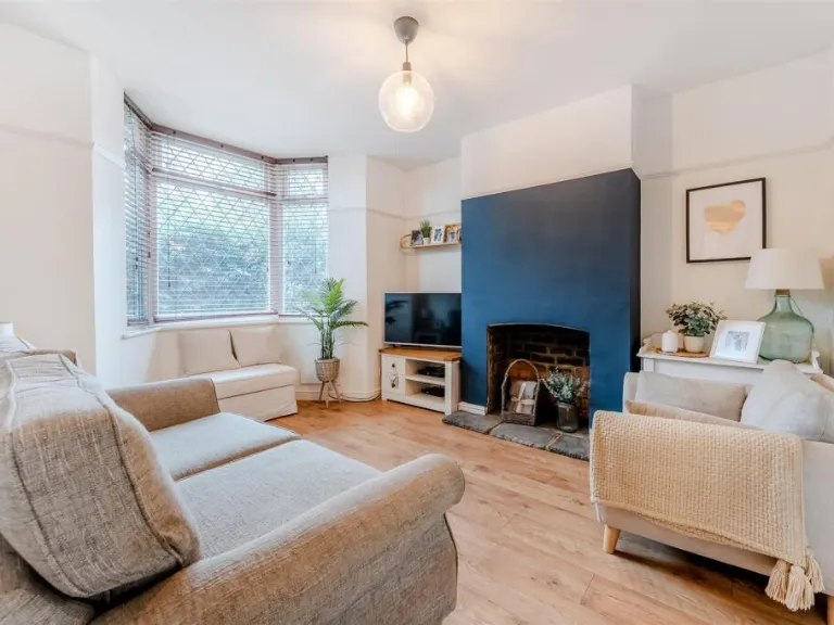
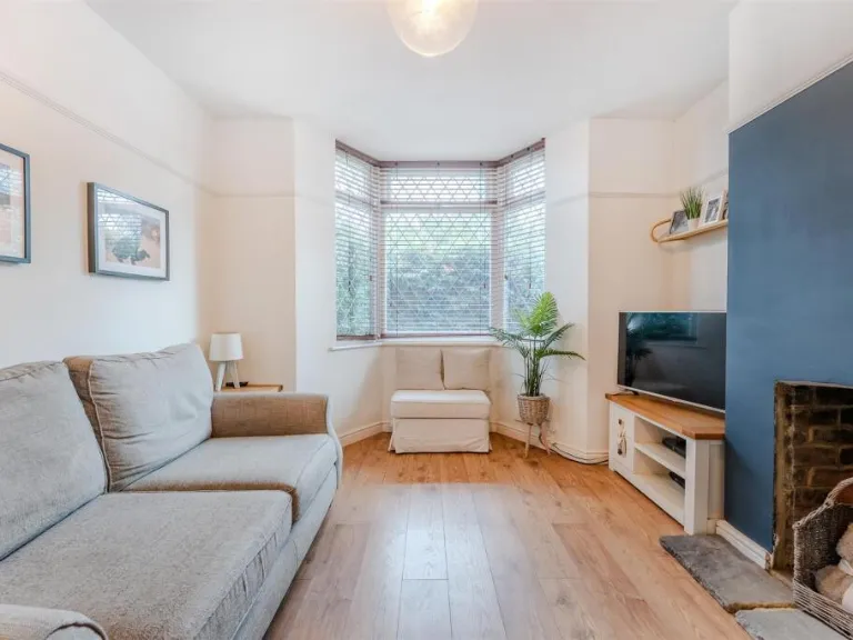
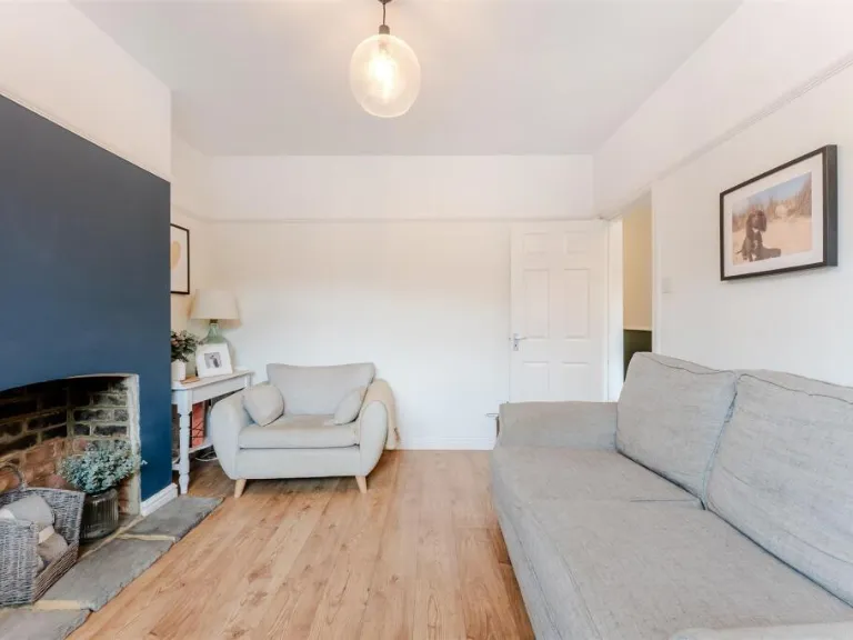
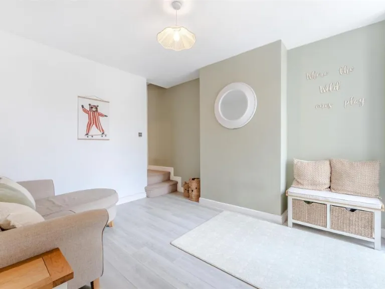
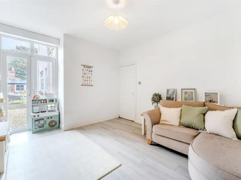
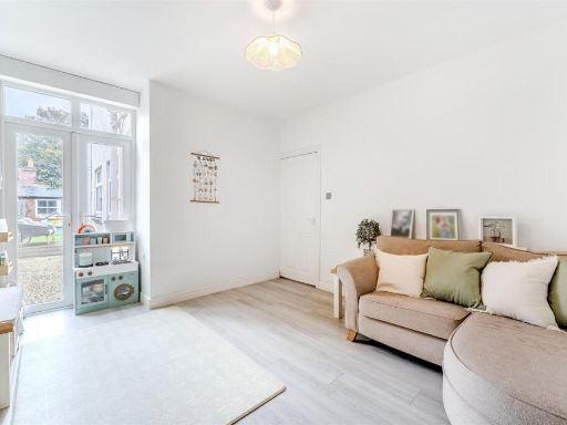
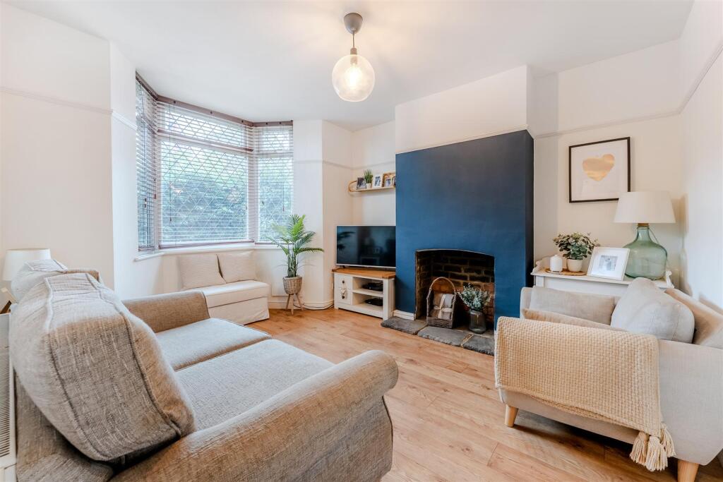
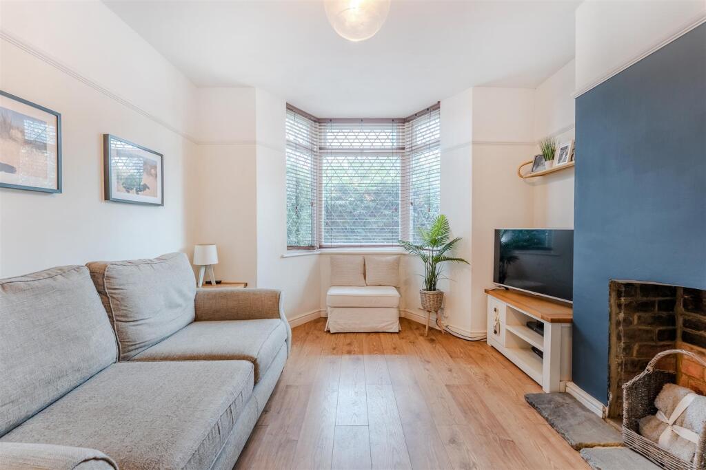
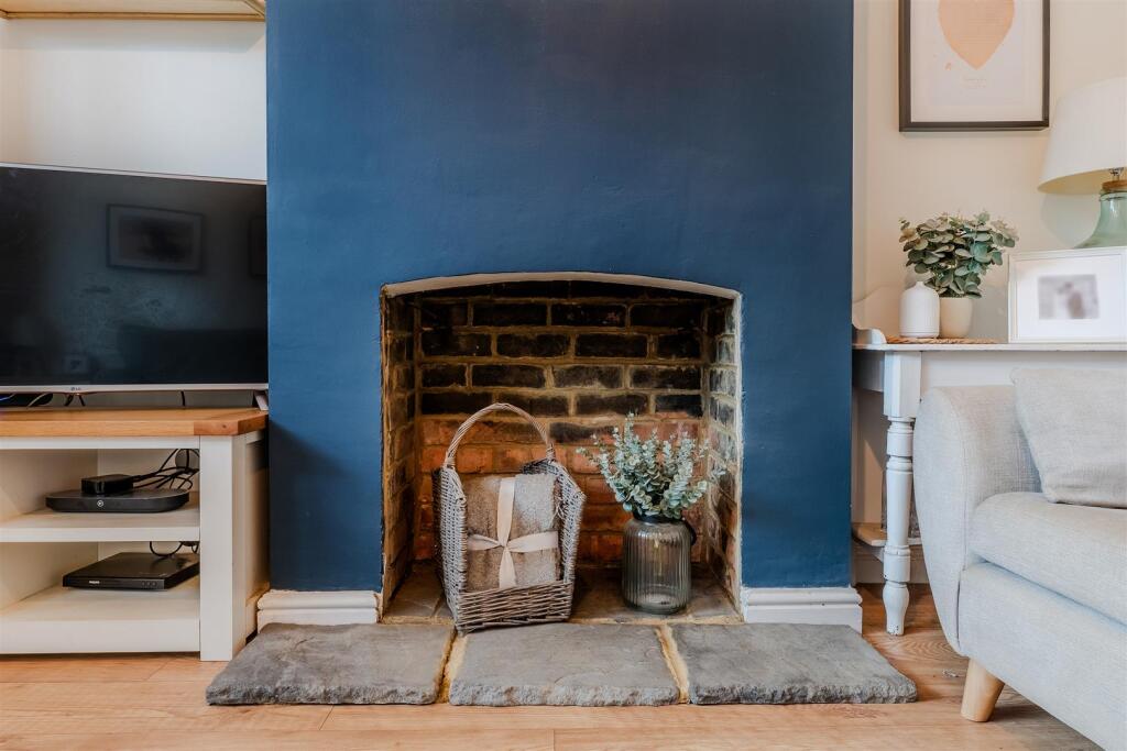
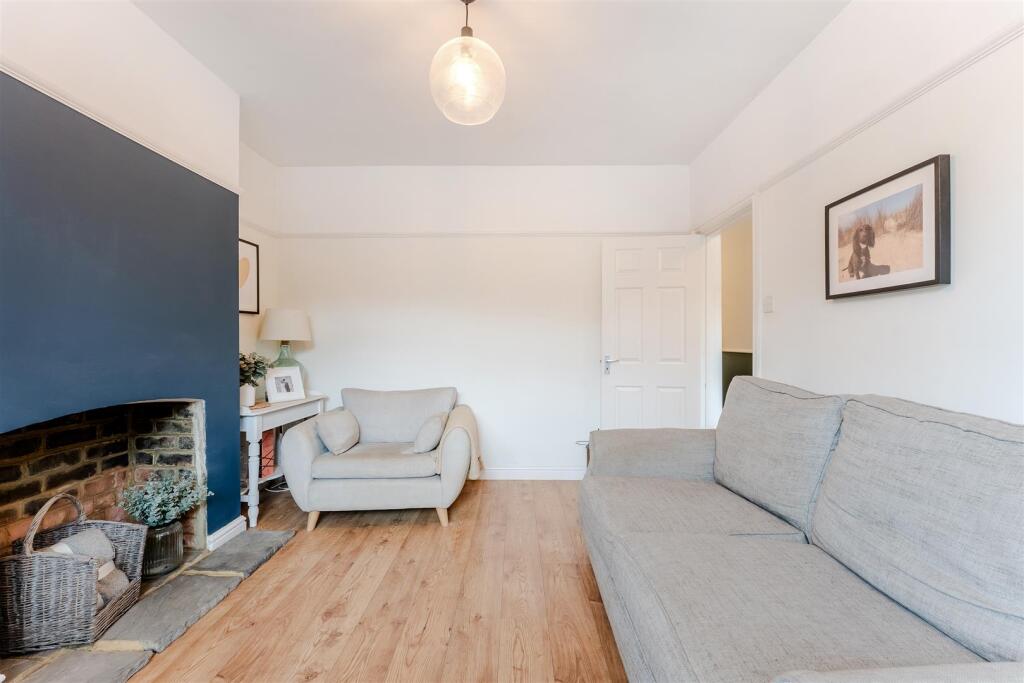
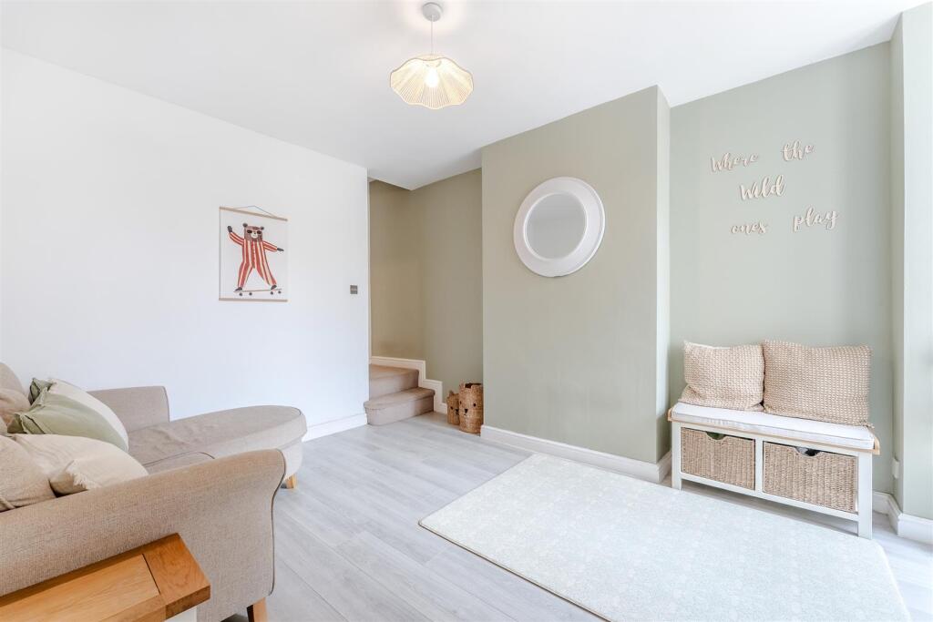
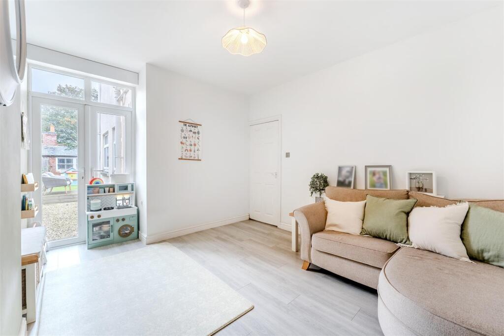
- LIVING ROOM:
- DINING ROOM:
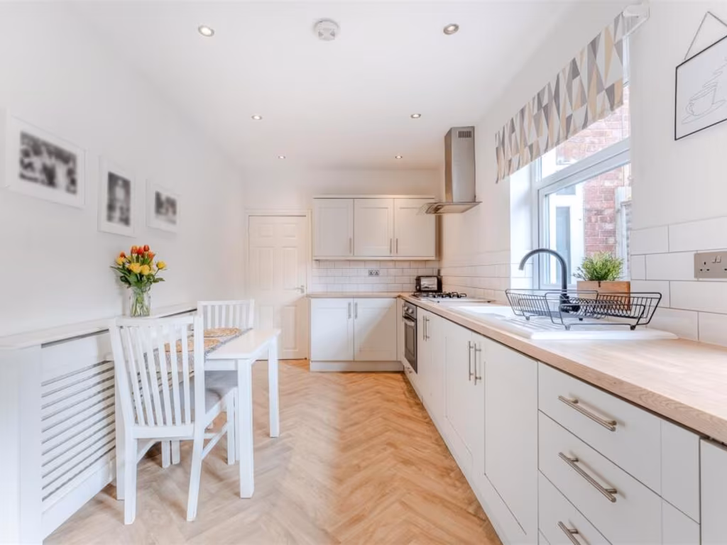
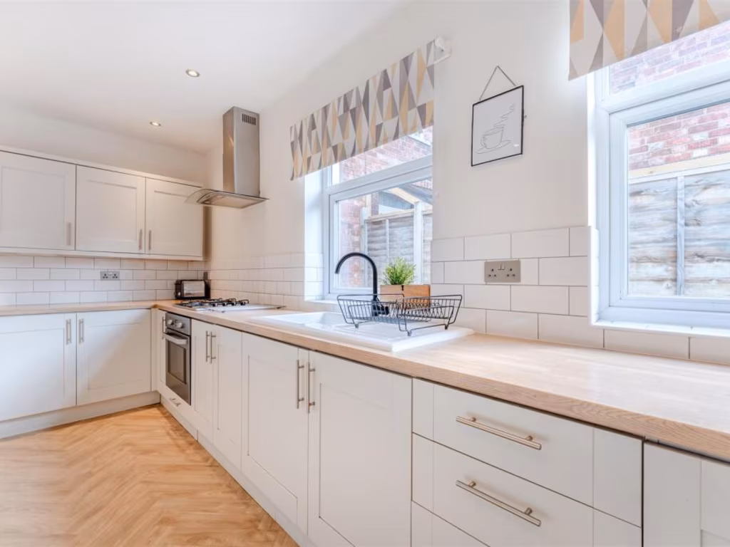
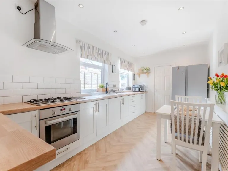
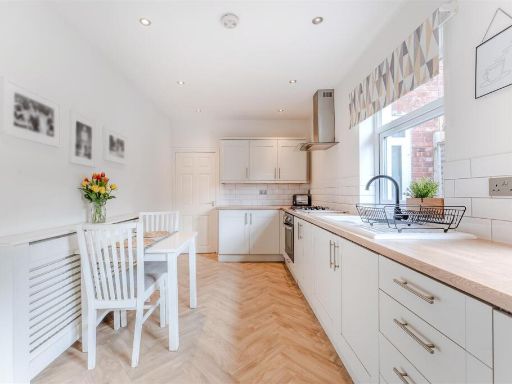
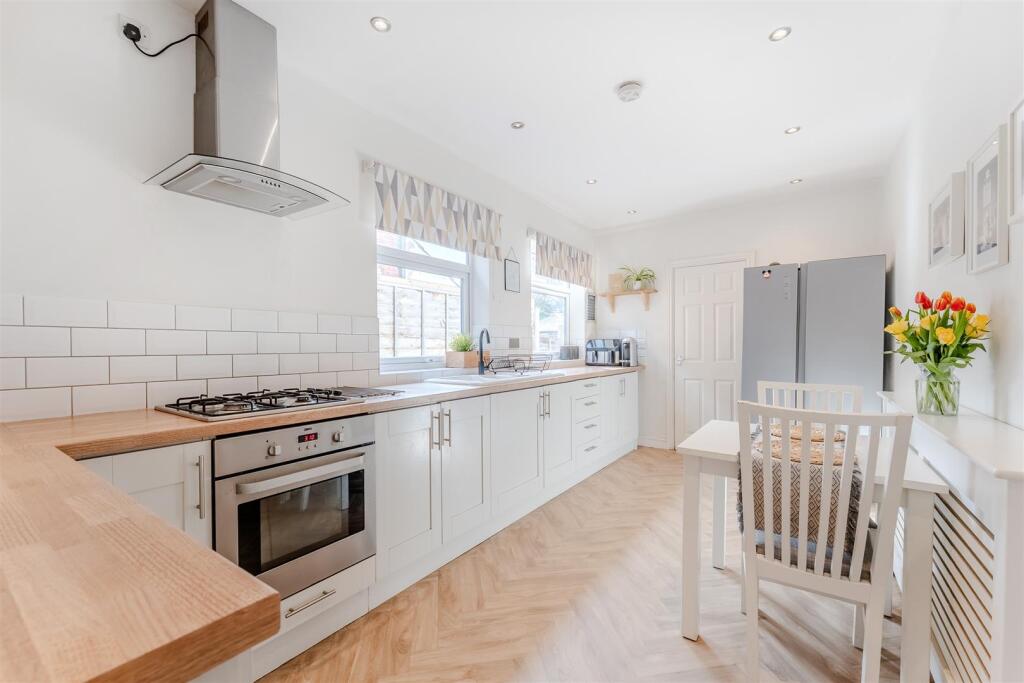
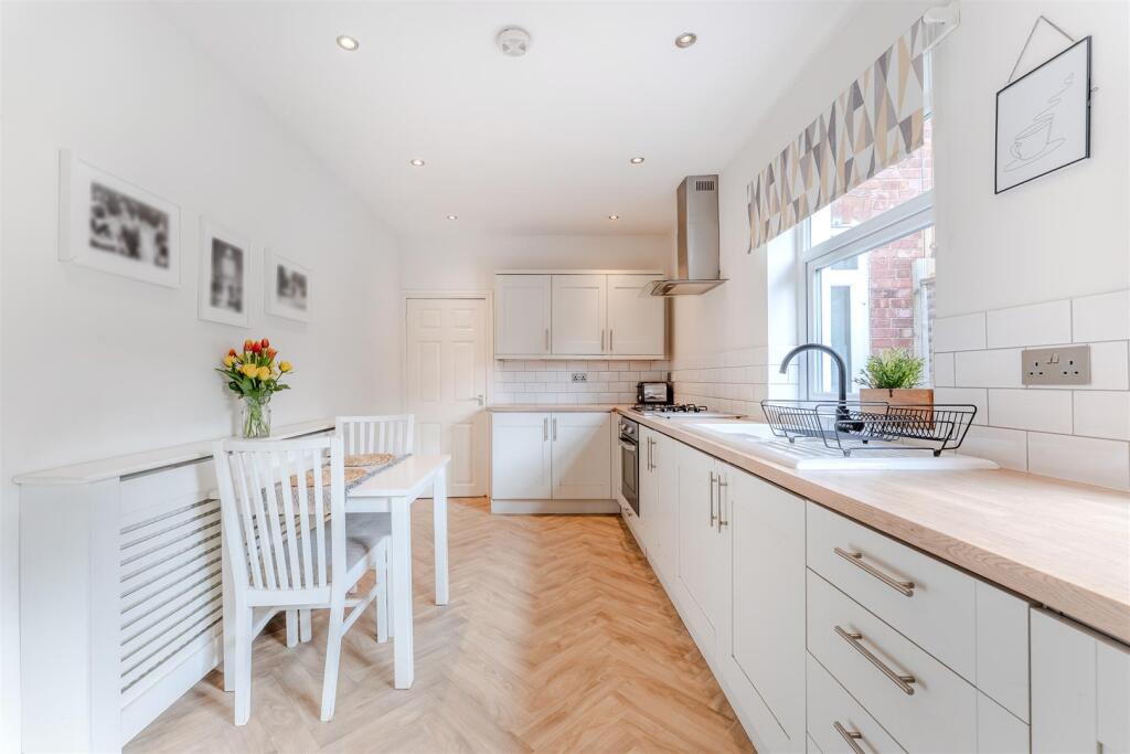
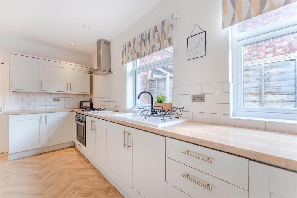
- KITCHEN/BREAKFAST ROOM:
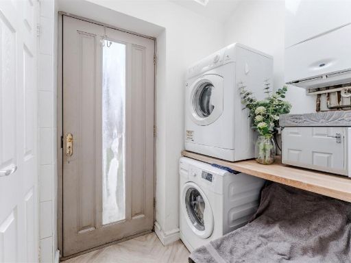
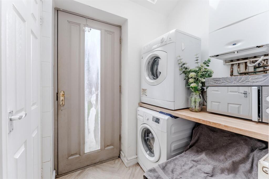
- UTILITY ROOM:
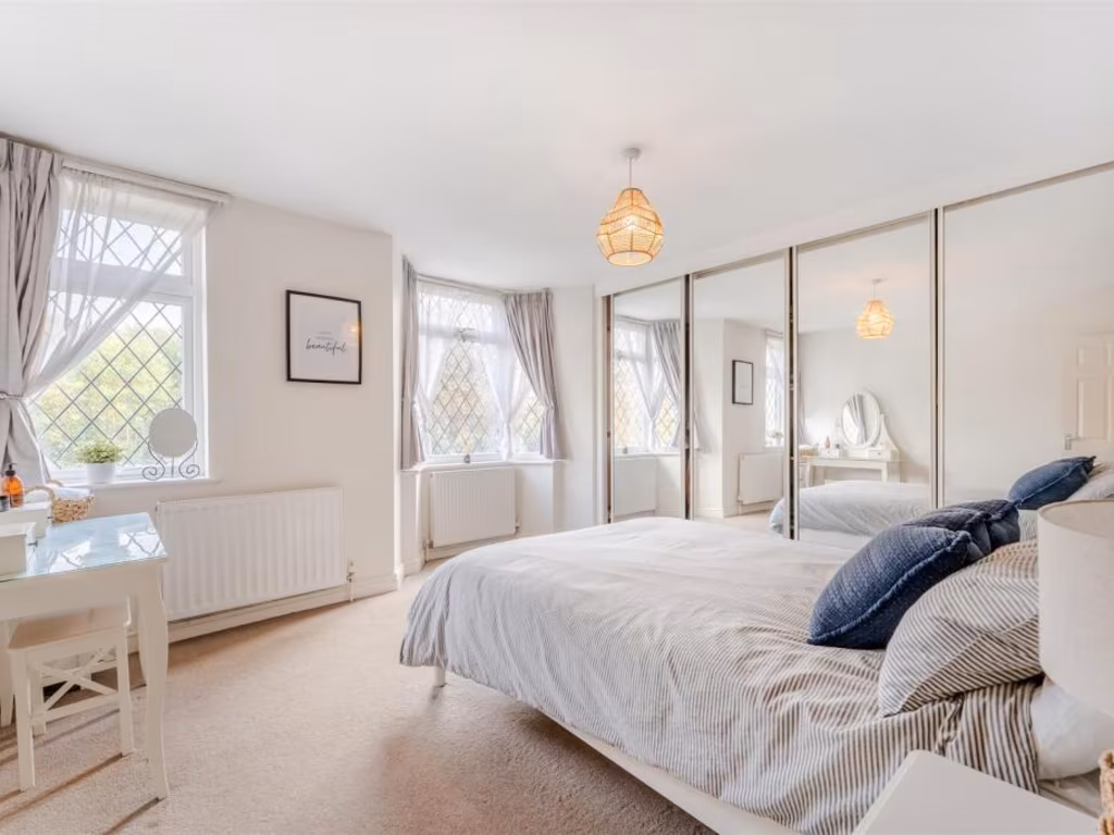
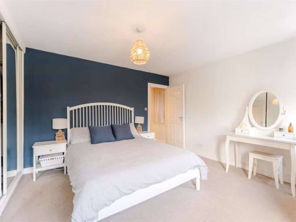
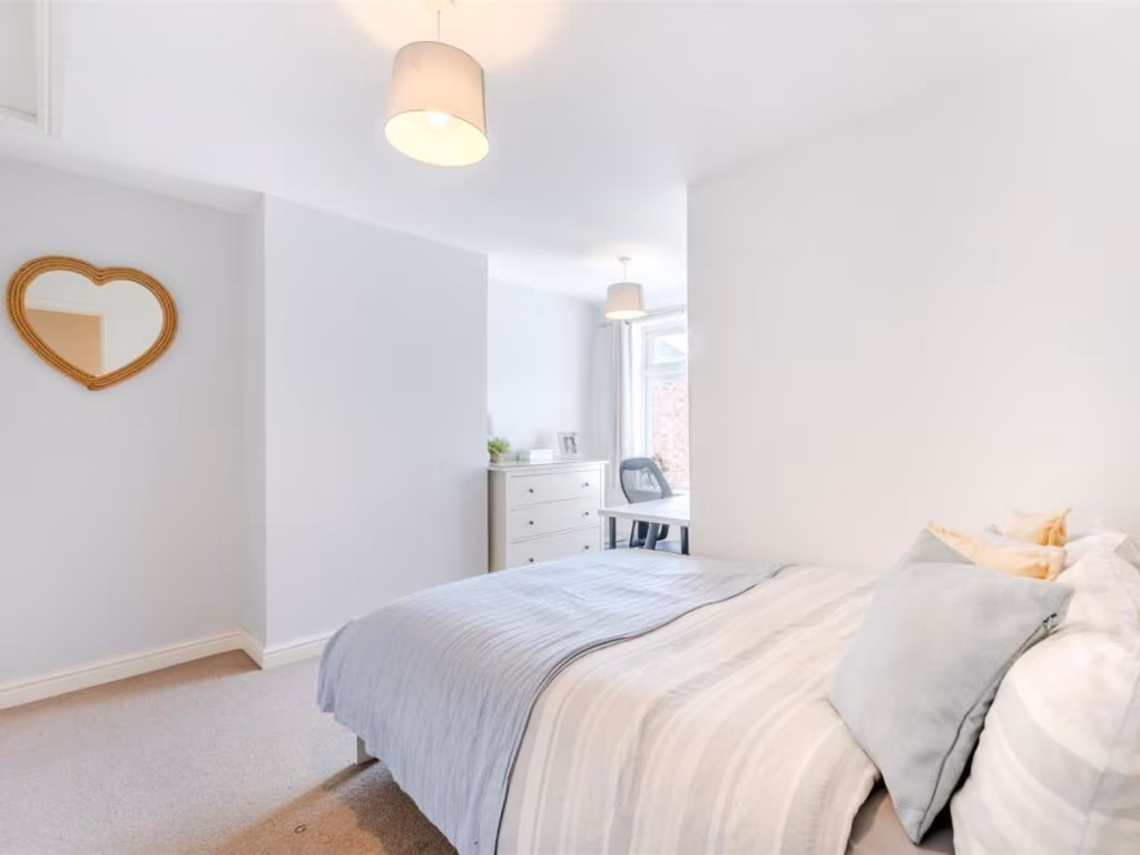
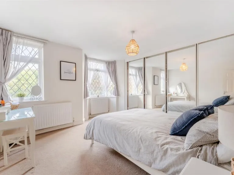
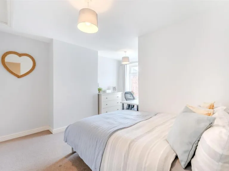
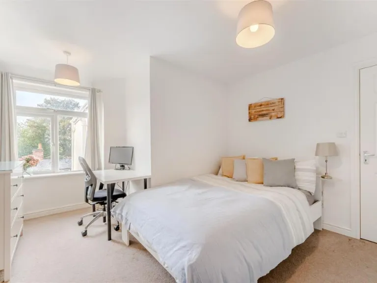
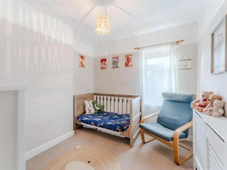
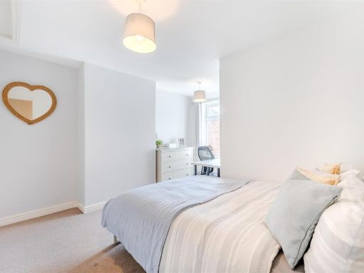
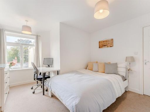
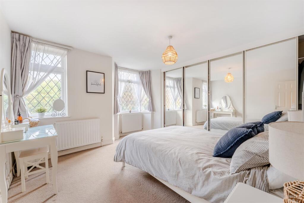
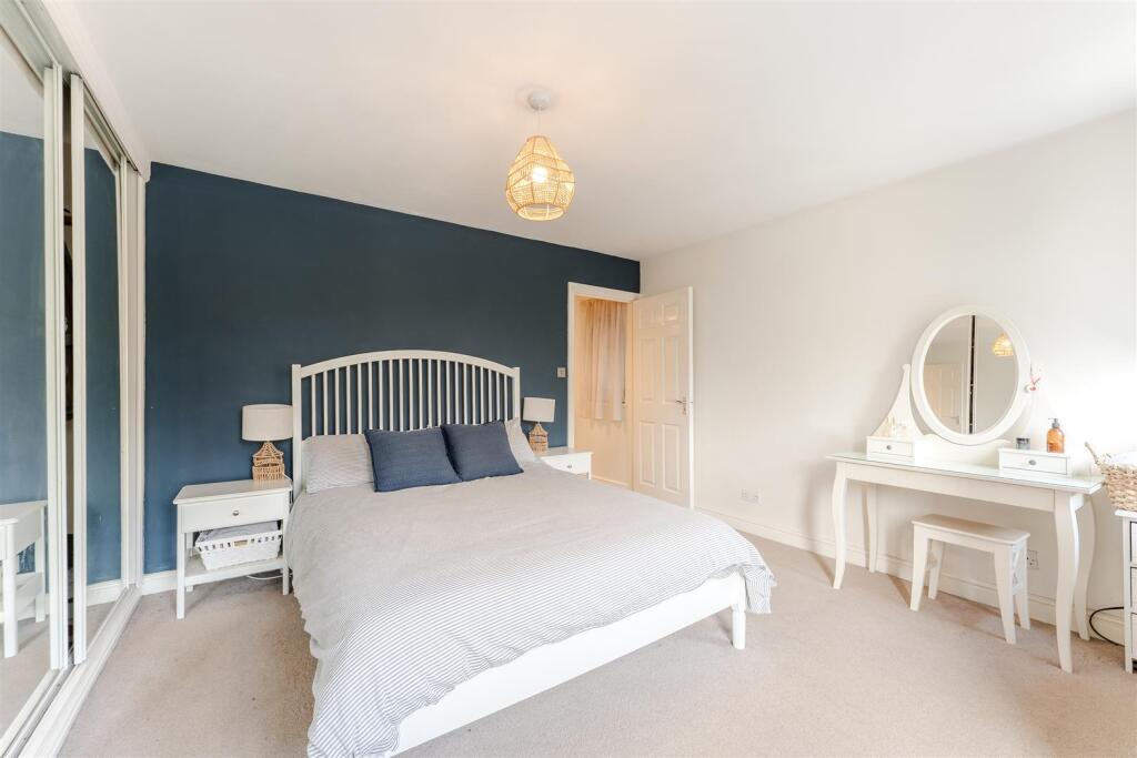
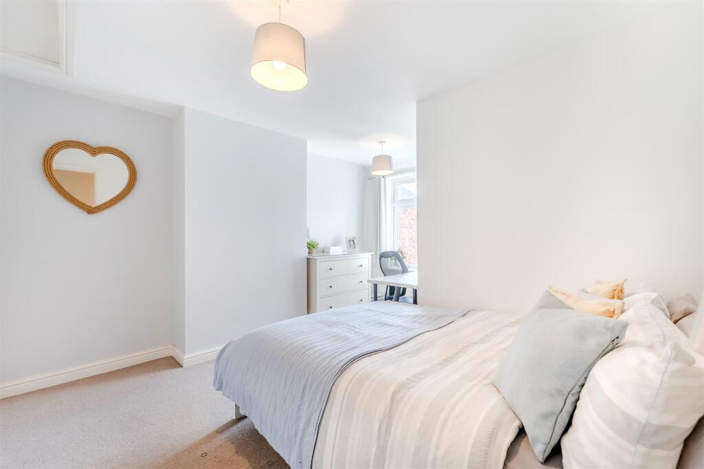
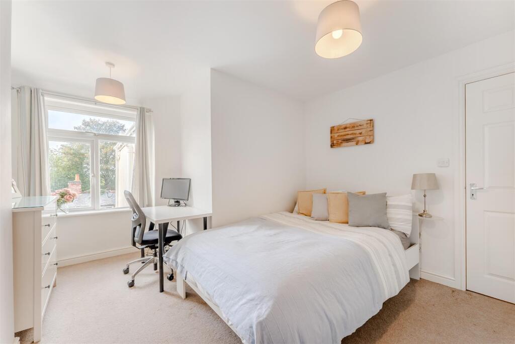
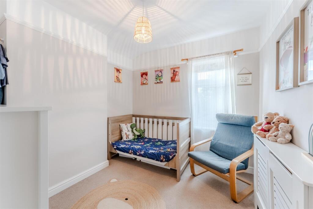
- BEDROOM:
- BEDROOM:
- BEDROOM:
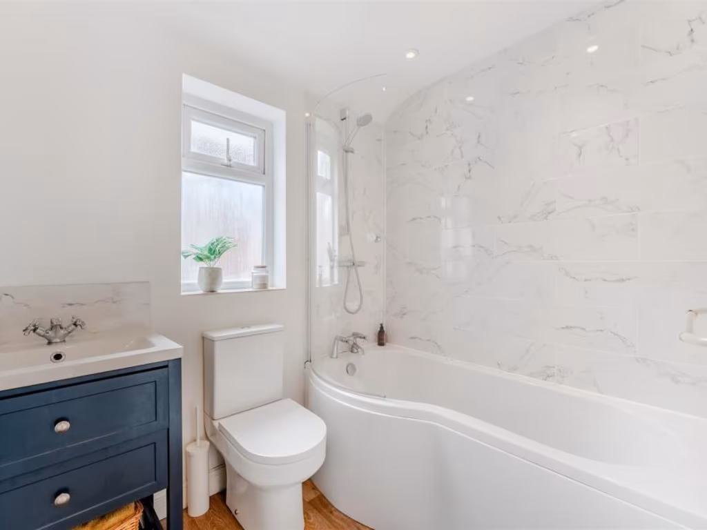
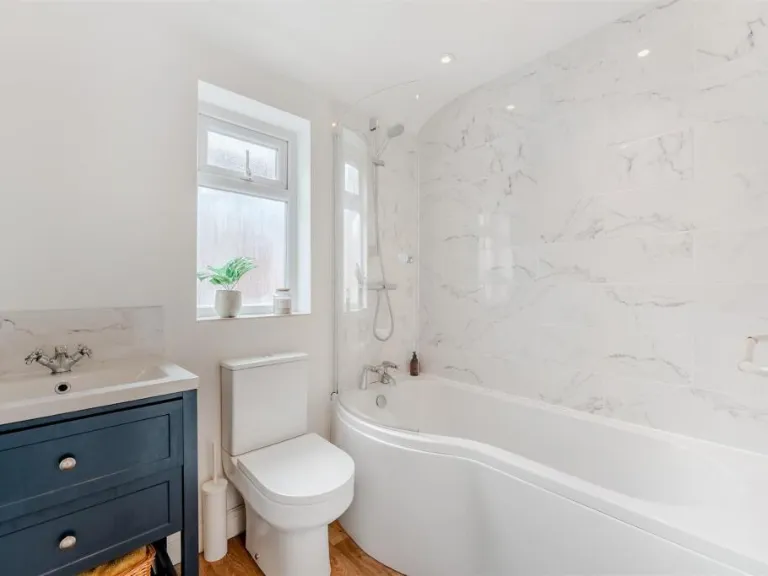
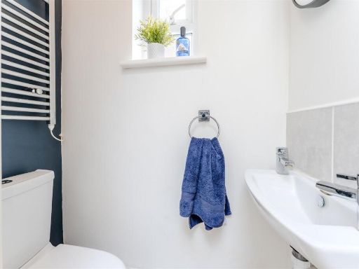
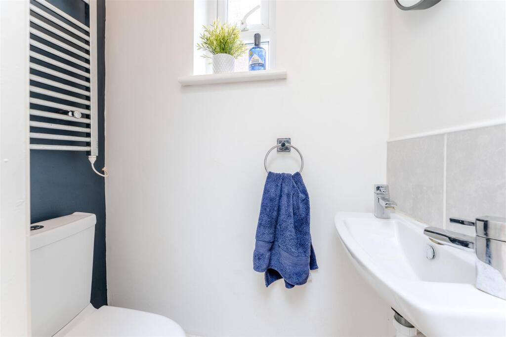
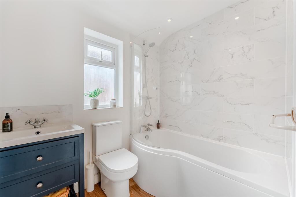
- BATHROOM:
Textual Property Features
Detected Visual Features
- Edwardian
- terraced
- brick facade
- bay window
- chimney
- period property
- Victorian features
- roof tiles
- historic architecture
- garden
- backyard
- contemporary
- decking
- outdoor space
- privacy fence
- brick exterior
EPC Details
- Fully double glazed
- Cavity wall, as built, no insulation (assumed)
- Boiler and radiators, mains gas
- Low energy lighting in 60% of fixed outlets
- Suspended, no insulation (assumed)
Nearby Schools
- Pytchley Endowed Church of England Primary School
- St Edward's Catholic Primary School
- Hall Meadow Primary School
- Hawthorn Community Primary School
- Compass Primary Academy
- The Latimer Arts College
- Hayfield Cross CofE School
- Southfield School for Girls
- Youth Works Community College
- Kettering Park Junior Academy
- Isham Church of England Primary School
- St. Marys CofE Primary School
- Bishop Stopford School
- St Peter's School
- Millbrook Junior School
- St Thomas More Catholic Primary School
- Kettering Science Academy
- Grange Primary Academy
- Brambleside Primary School
- Meadowside Primary School
- Barton Seagrave Primary School
- Greenfields Primary School and Nursery
- Millbrook Infant School
- St Mary's Church of England Voluntary Aided Primary School
- St Andrew's Church of England Primary School
- Kettering Park Infant Academy
- Kettering Buccleuch Academy
Nearest Religious buildings
- Id: 2016224016
- Tags:
- Addr:
- City: Kettering
- Country: GB
- Housenumber: 2
- Postcode: NN15 7QQ
- Street: The Grove
- Amenity: place_of_worship
- Denomination: catholic
- Name: St Edward's
- Religion: christian
- Source: OS_OpenData_StreetView
- TagsNormalized:
- place of worship
- catholic
- christian
- church
- Lat: 52.395035
- Lon: -0.7246648
- FullGeoHash: gcr6pd0r4n6y
- PartitionGeoHash: gcr6
- Images:
- FoodStandards: null
- Distance: 929.4
,- Id: 2016223985
- Tags:
- Addr:
- City: Kettering
- Country: GB
- Postcode: NN15 7QB
- Street: London Road
- Amenity: place_of_worship
- Name: Pollard Evangelical Church
- Religion: christian
- Source: OS_OpenData_StreetView
- TagsNormalized:
- place of worship
- church
- evangelical
- christian
- Lat: 52.3933848
- Lon: -0.7230769
- FullGeoHash: gcr6p9cmx4ff
- PartitionGeoHash: gcr6
- Images:
- FoodStandards: null
- Distance: 720.2
,- Id: 777259901
- Tags:
- Addr:
- City: Kettering
- Country: GB
- Postcode: NN15 6BU
- Street: Roundhill Road
- Amenity: place_of_worship
- Building: church
- Denomination: anglican
- Name: St Michael & All Angels
- Polling_station: 2021
- Religion: christian
- Wikidata: Q105102152
- TagsNormalized:
- place of worship
- church
- anglican
- christian
- Lat: 52.3908251
- Lon: -0.7249288
- FullGeoHash: gcr6p92nevtv
- PartitionGeoHash: gcr6
- Images:
- FoodStandards: null
- Distance: 659.3
}
Nearest Leisure Facilities
- Id: 171280983
- Tags:
- Addr:
- City: Kettering
- Country: GB
- Postcode: NN15 6NT
- Street: Waverley Road
- Fhrs:
- Authority: North Northamptonshire
- Id: 77693
- Local_authority_id: 183
- Leisure: sports_centre
- Name: Kettering Rugby Football Club
- Polling_station: 2021
- Sport: rugby_union
- TagsNormalized:
- sports
- sports centre
- leisure
- football
- rugby
- club
- rugby union
- Lat: 52.390604
- Lon: -0.7139755
- FullGeoHash: gcr6pc2j7hmq
- PartitionGeoHash: gcr6
- Images:
- FoodStandards:
- Id: 77693
- FHRSID: 77693
- LocalAuthorityBusinessID: 183
- BusinessName: Kettering Rugby Football Club
- BusinessType: Pub/bar/nightclub
- BusinessTypeID: 7843
- AddressLine1: Kettering Rugby Club
- AddressLine2: Waverley Road
- AddressLine3: Kettering
- AddressLine4: Northamptonshire
- PostCode: NN15 6NT
- RatingValue: 5
- RatingKey: fhrs_5_en-GB
- RatingDate: 2022-03-23
- LocalAuthorityCode: 235
- LocalAuthorityName: North Northamptonshire
- LocalAuthorityWebSite: https://www.corby.gov.uk/home/business/food-businesses
- LocalAuthorityEmailAddress: envhealth.cbc@northnorthants.gov.uk
- Scores:
- Hygiene: 0
- Structural: 5
- ConfidenceInManagement: 0
- NewRatingPending: false
- Geocode:
- Longitude: -0.71460300000000
- Latitude: 52.39200400000000
- Distance: 258.9
,- Id: 1035332836
- Tags:
- Leisure: pitch
- Sport: rugby
- TagsNormalized:
- Lat: 52.3906762
- Lon: -0.7147925
- FullGeoHash: gcr6p9rtb1uh
- PartitionGeoHash: gcr6
- Images:
- FoodStandards: null
- Distance: 243.1
,- Id: 1035332839
- Tags:
- TagsNormalized:
- Lat: 52.3901528
- Lon: -0.7133981
- FullGeoHash: gcr6pc2db87f
- PartitionGeoHash: gcr6
- Images:
- FoodStandards: null
- Distance: 243.1
,- Id: 171056418
- Tags:
- TagsNormalized:
- Lat: 52.3887064
- Lon: -0.7131536
- FullGeoHash: gcr6pc0dq6dn
- PartitionGeoHash: gcr6
- Images:
- FoodStandards: null
- Distance: 188.2
,- Id: 1035332835
- Tags:
- Leisure: pitch
- Sport: rugby
- TagsNormalized:
- Lat: 52.3900113
- Lon: -0.7147632
- FullGeoHash: gcr6p9r9bvcy
- PartitionGeoHash: gcr6
- Images:
- FoodStandards: null
- Distance: 175.4
}
Nearest Tourist attractions
- Id: 598026209
- Tags:
- Name: Wicksteed Park Camping
- Tourism: camp_site
- TagsNormalized:
- Lat: 52.3796947
- Lon: -0.7100842
- FullGeoHash: gcr3zz6vvffc
- PartitionGeoHash: gcr3
- Images:
- FoodStandards: null
- Distance: 1066.7
,- Id: 1363122636
- Tags:
- Name: Wicksteed Park
- Tourism: theme_park
- TagsNormalized:
- Lat: 52.3834744
- Lon: -0.7090768
- FullGeoHash: gcr6pb5ev76h
- PartitionGeoHash: gcr6
- Images:
- FoodStandards: null
- Distance: 735.4
,- Id: 8702563619
- Tags:
- Addr:
- City: Kettering
- Housename: Wicksteed Park
- Postcode: NN15 6NJ
- Street: Barton Road
- Name: Wicksteed Park Main Entrance
- Operator: Wicksteed Charitable Trust
- Tourism: theme_park
- Website: https://wicksteedpark.org/
- TagsNormalized:
- Lat: 52.3863836
- Lon: -0.7088451
- FullGeoHash: gcr6pbeuf9wy
- PartitionGeoHash: gcr6
- Images:
- FoodStandards: null
- Distance: 539.9
}
Nearest Hotels
- Id: 463992352
- Tags:
- Addr:
- City: Kettering
- Country: GB
- Housename: Barton Hall
- Postcode: NN15 6SG
- Street: Barton Road
- Village: Barton Seagrave
- Fhrs:
- Authority: North Northamptonshire
- Id: 494269
- Local_authority_id: 18566
- Name: Barton Hall
- Tourism: hotel
- TagsNormalized:
- Lat: 52.386703
- Lon: -0.6975062
- FullGeoHash: gcrd00sndvjx
- PartitionGeoHash: gcrd
- Images:
- FoodStandards: null
- Distance: 1267.5
,- Id: 465794527
- Tags:
- Addr:
- City: Kettering
- Country: GB
- Postcode: NN16 0AN
- Street: Sheep Street
- Building: yes
- Name: Naseby Hotel
- Tourism: hotel
- TagsNormalized:
- Lat: 52.3965887
- Lon: -0.7283015
- FullGeoHash: gcr6p6t8m254
- PartitionGeoHash: gcr6
- Images:
- FoodStandards: null
- Distance: 1222.5
,- Id: 464811200
- Tags:
- Addr:
- City: Kettering
- Country: GB
- Housenumber: 2
- Postcode: NN15 7HS
- Street: Hawthorn Road
- Fhrs:
- Authority: North Northamptonshire
- Id: 106845
- Local_authority_id: 374
- Name: Hawthorn Guest House
- Tourism: hotel
- TagsNormalized:
- Lat: 52.3922656
- Lon: -0.7217759
- FullGeoHash: gcr6p9drj6hv
- PartitionGeoHash: gcr6
- Images:
- FoodStandards: null
- Distance: 569
}
Tags
- Edwardian
- terraced
- brick facade
- bay window
- chimney
- period property
- Victorian features
- roof tiles
- historic architecture
- garden
- backyard
- contemporary
- decking
- outdoor space
- privacy fence
- brick exterior
Local Market Stats
- Average Price/sqft: £272
- Avg Income: £42900
- Rental Yield: 4.4%
- Social Housing: 14%
- Planning Success Rate: 87%
Similar Properties
 3 bedroom terraced house for sale in Boddington Road, Kettering, NN15 — £200,000 • 3 bed • 1 bath • 889 ft²
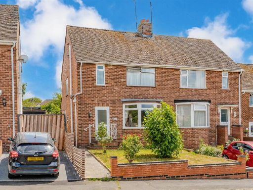 3 bedroom semi-detached house for sale in Edward Close, Kettering, NN15 — £234,995 • 3 bed • 1 bath • 675 ft²
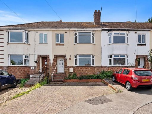 3 bedroom terraced house for sale in Springfield Close, Kettering, NN15 — £220,000 • 3 bed • 1 bath • 909 ft²
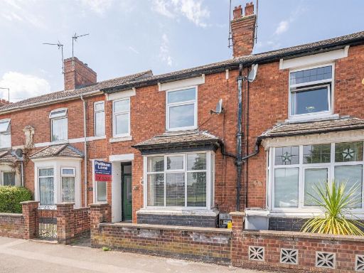 3 bedroom terraced house for sale in Bath Road, Kettering, NN16 — £215,000 • 3 bed • 1 bath • 1108 ft²
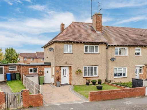 3 bedroom end of terrace house for sale in Centre Parade, Kettering, NN16 — £260,000 • 3 bed • 1 bath • 811 ft²
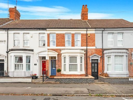 3 bedroom terraced house for sale in Hawthorn Road, Kettering, Northamptonshire, NN15 — £325,000 • 3 bed • 1 bath • 1653 ft²
Meta
- {
"@context": "https://schema.org",
"@type": "Residence",
"name": "3 bedroom end of terrace house for sale in London Road, Ket…",
"description": "",
"url": "https://propertypiper.co.uk/property/eeda1165-662d-43bc-a640-ddb9509144d2",
"image": "https://image-a.propertypiper.co.uk/65d2a21a-af79-4176-958d-75e81f57f068-1024.jpeg",
"address": {
"@type": "PostalAddress",
"streetAddress": "302 LONDON ROAD KETTERING",
"postalCode": "NN15 6DX",
"addressLocality": "North Northamptonshire",
"addressRegion": "Kettering",
"addressCountry": "England"
},
"geo": {
"@type": "GeoCoordinates",
"latitude": 52.38860145915105,
"longitude": -0.7159221921860209
},
"numberOfRooms": 3,
"numberOfBathroomsTotal": 1,
"floorSize": {
"@type": "QuantitativeValue",
"value": 1227,
"unitCode": "FTK"
},
"offers": {
"@type": "Offer",
"price": 229995,
"priceCurrency": "GBP",
"availability": "https://schema.org/InStock"
},
"additionalProperty": [
{
"@type": "PropertyValue",
"name": "Feature",
"value": "Edwardian"
},
{
"@type": "PropertyValue",
"name": "Feature",
"value": "terraced"
},
{
"@type": "PropertyValue",
"name": "Feature",
"value": "brick facade"
},
{
"@type": "PropertyValue",
"name": "Feature",
"value": "bay window"
},
{
"@type": "PropertyValue",
"name": "Feature",
"value": "chimney"
},
{
"@type": "PropertyValue",
"name": "Feature",
"value": "period property"
},
{
"@type": "PropertyValue",
"name": "Feature",
"value": "Victorian features"
},
{
"@type": "PropertyValue",
"name": "Feature",
"value": "roof tiles"
},
{
"@type": "PropertyValue",
"name": "Feature",
"value": "historic architecture"
},
{
"@type": "PropertyValue",
"name": "Feature",
"value": "garden"
},
{
"@type": "PropertyValue",
"name": "Feature",
"value": "backyard"
},
{
"@type": "PropertyValue",
"name": "Feature",
"value": "contemporary"
},
{
"@type": "PropertyValue",
"name": "Feature",
"value": "decking"
},
{
"@type": "PropertyValue",
"name": "Feature",
"value": "outdoor space"
},
{
"@type": "PropertyValue",
"name": "Feature",
"value": "privacy fence"
},
{
"@type": "PropertyValue",
"name": "Feature",
"value": "brick exterior"
}
]
}
High Res Floorplan Images
Compatible Floorplan Images
FloorplanImages Thumbnail