DN36 4DE - 3 bedroom bungalow for sale in Queen Elizabeth Road, Humber…
View on Property Piper
3 bedroom bungalow for sale in Queen Elizabeth Road, Humberston, DN36
Property Details
- Price: £269950
- Bedrooms: 3
- Bathrooms: 1
- Property Type: undefined
- Property SubType: undefined
Image Descriptions
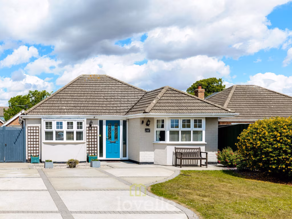
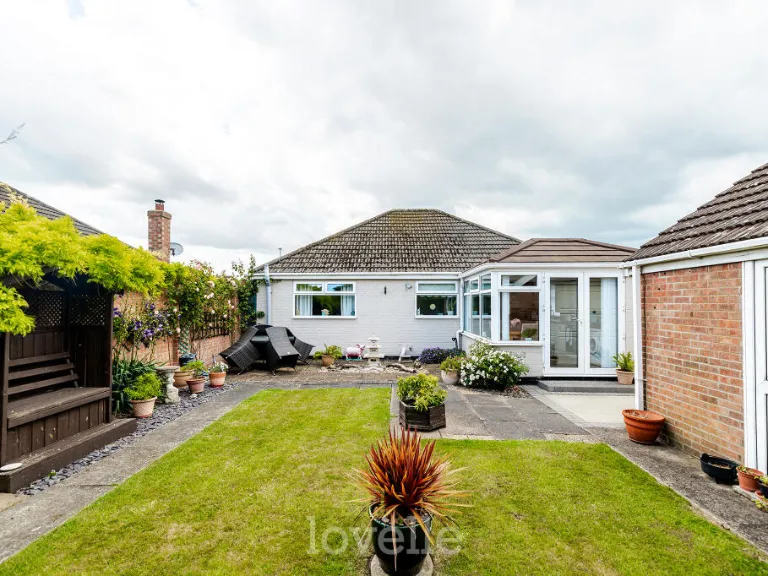
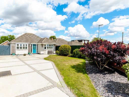
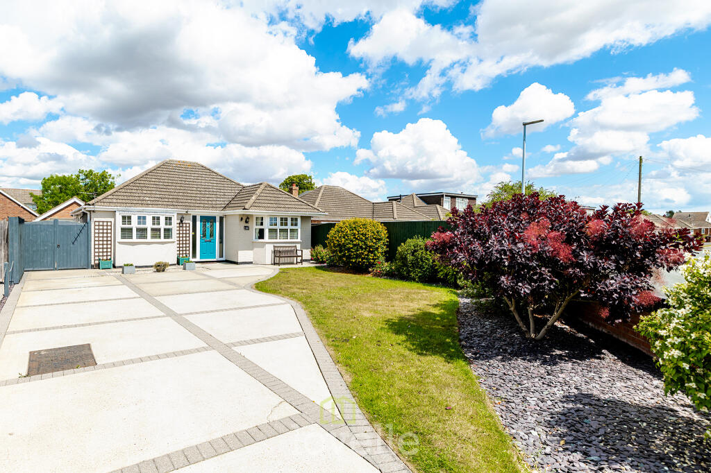
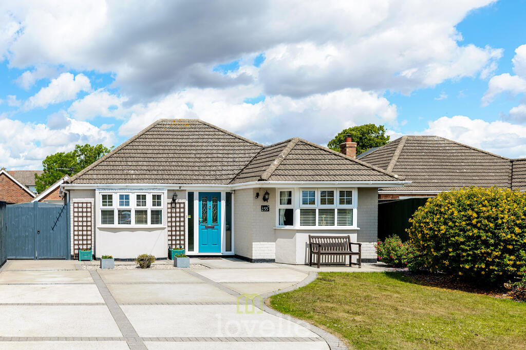
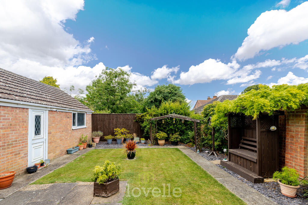
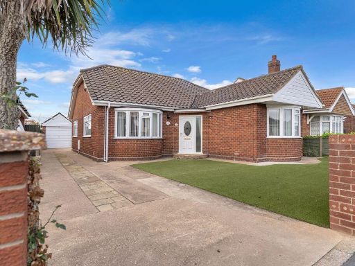
- single-family home modern bungalow
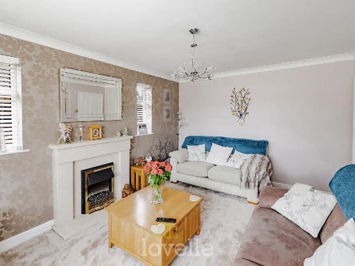
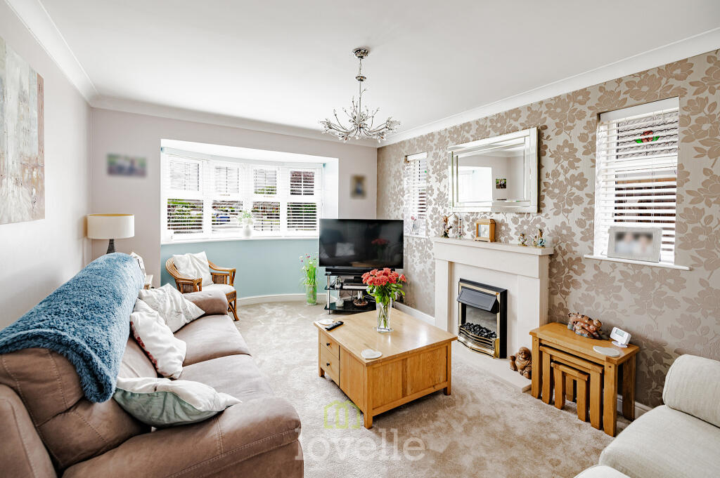
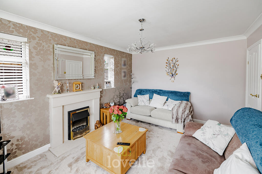
- living room modern
Floorplan Description
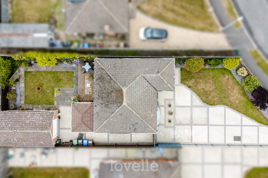
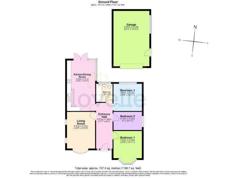
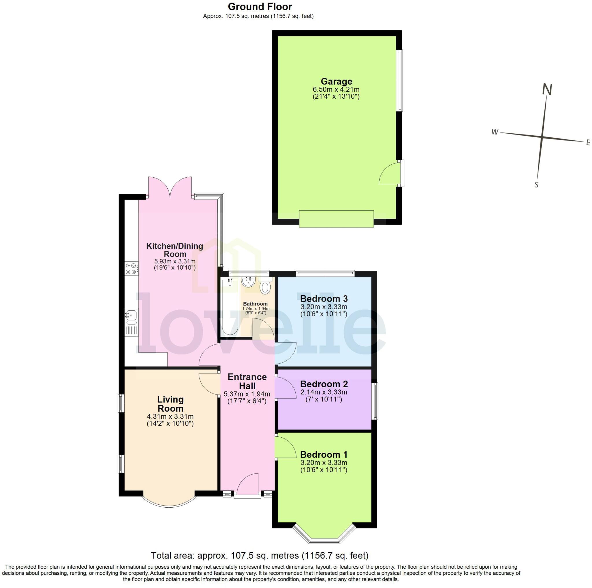
- Ground Floor plan with internal rooms and a detached garage shown.
Rooms
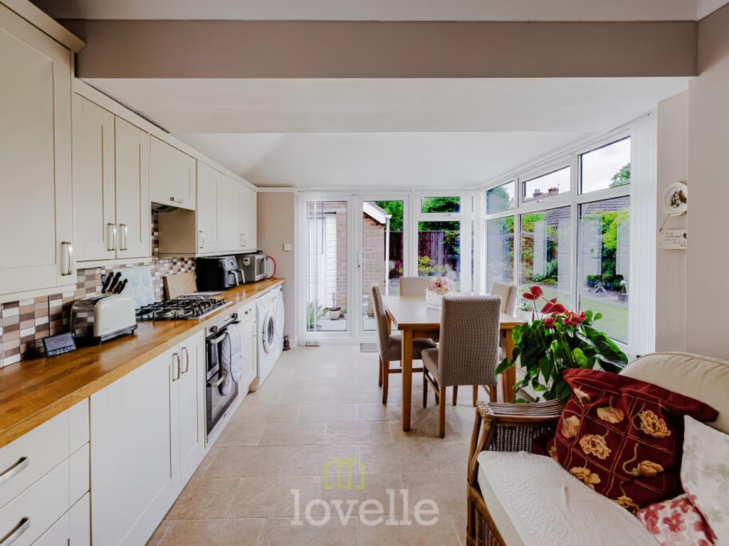
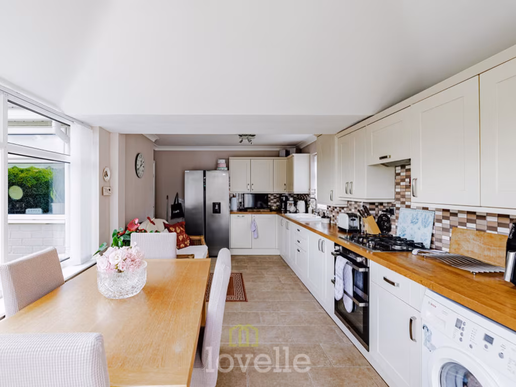
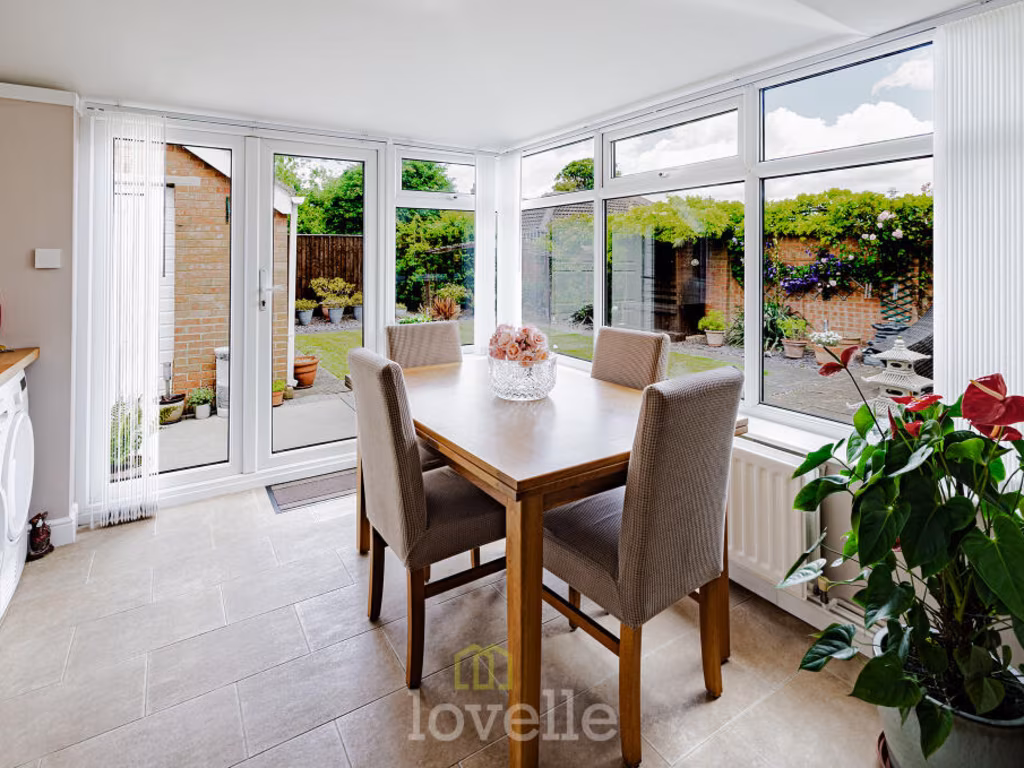
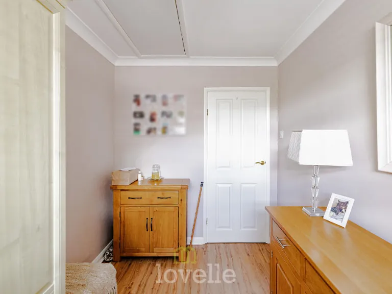
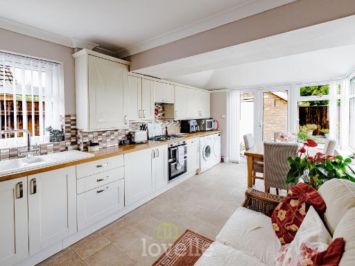
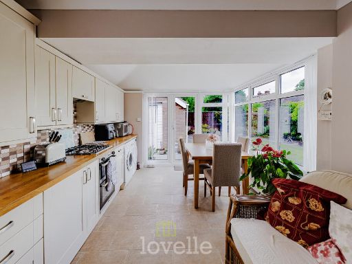
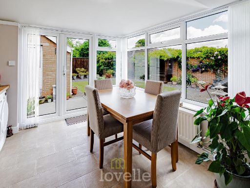
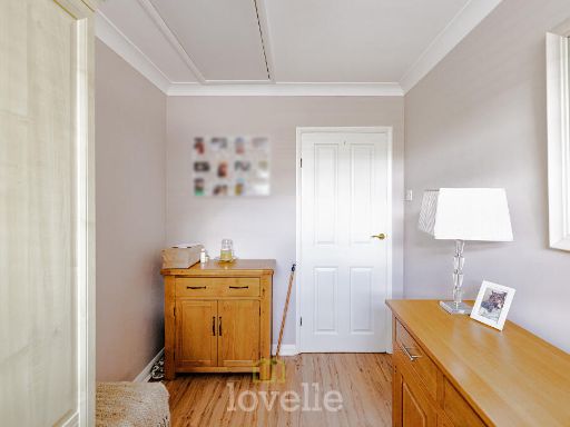
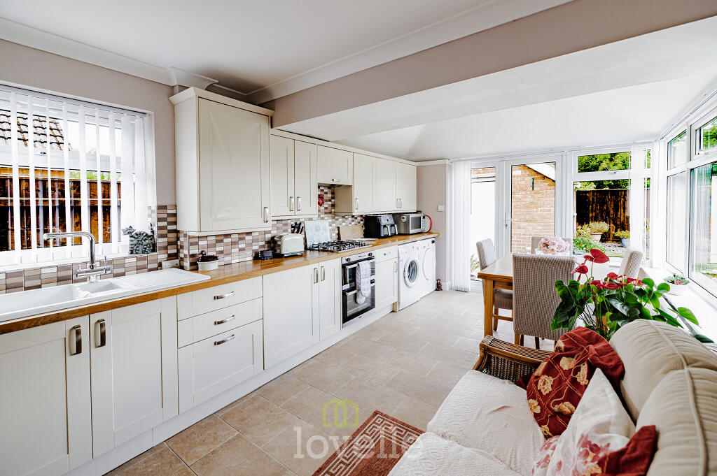
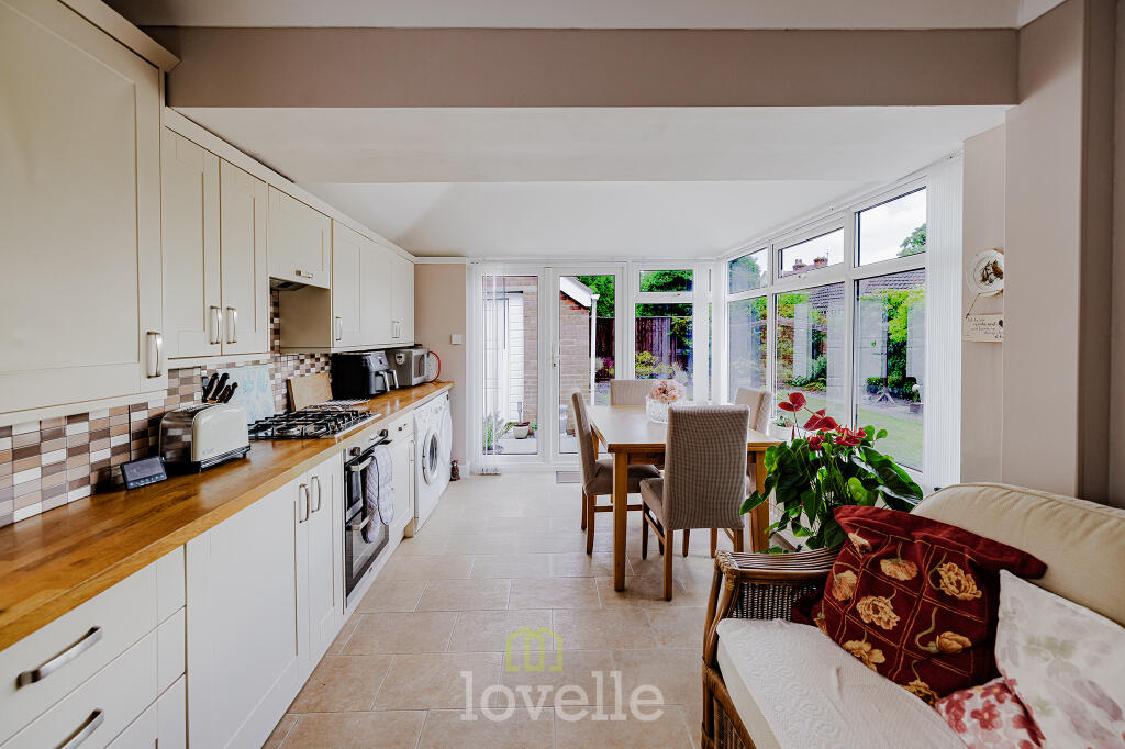
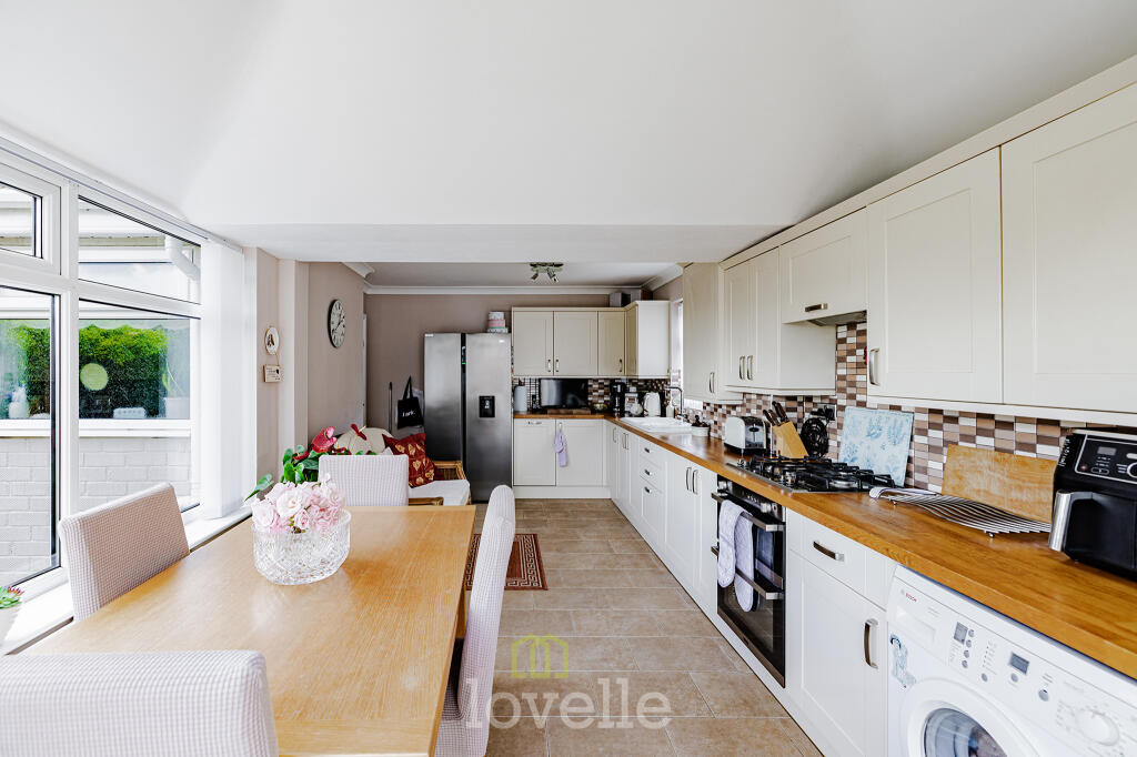
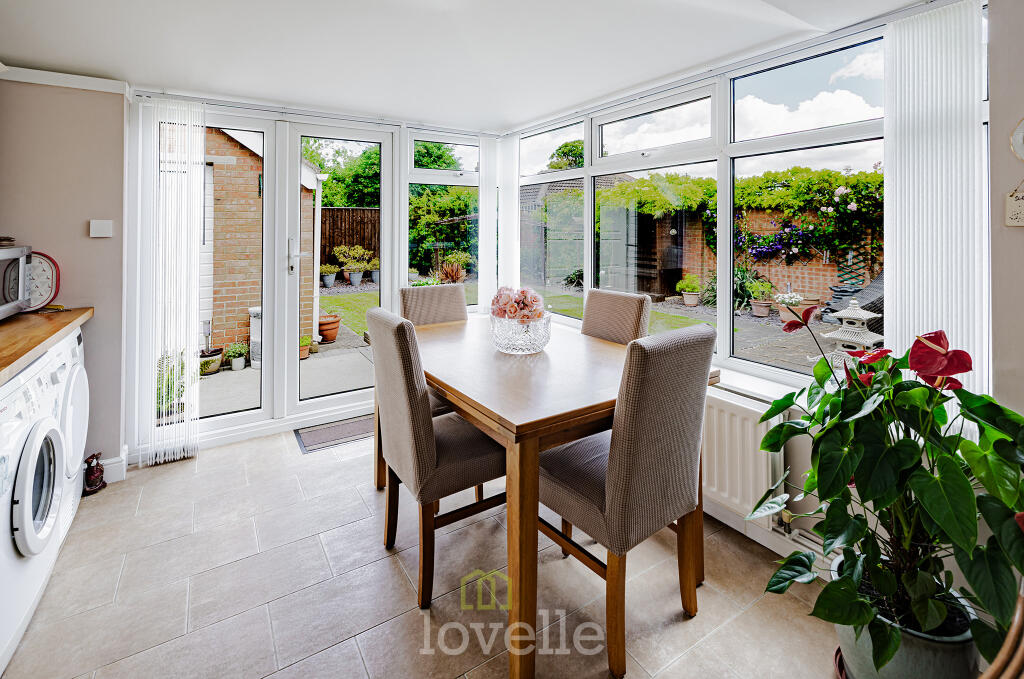
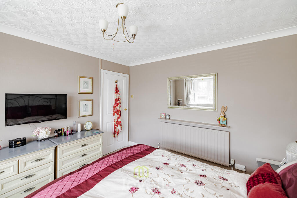
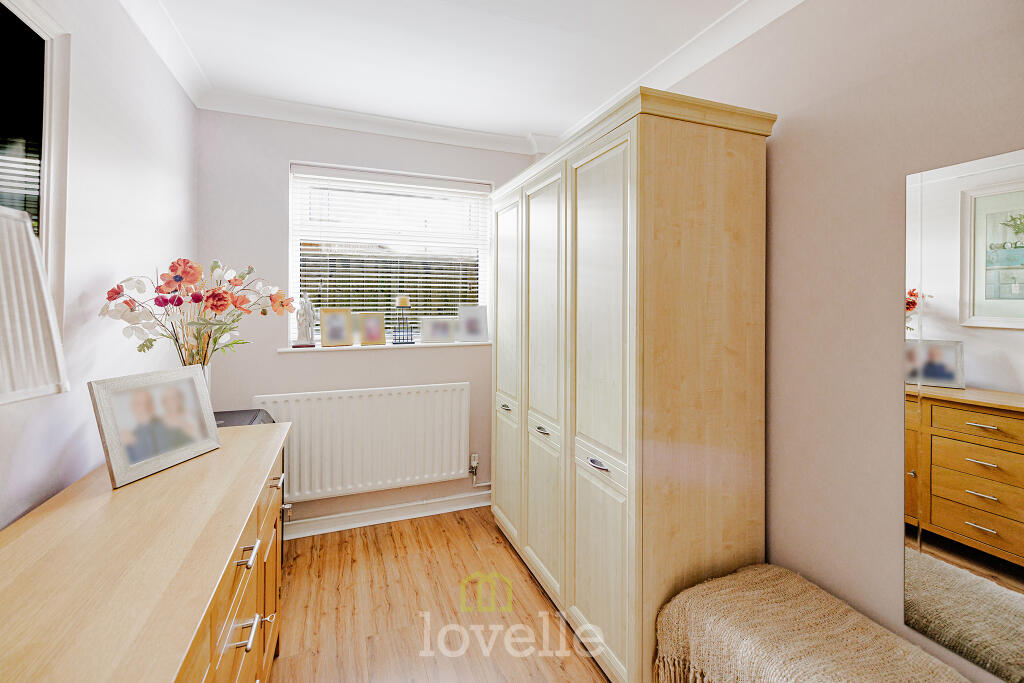
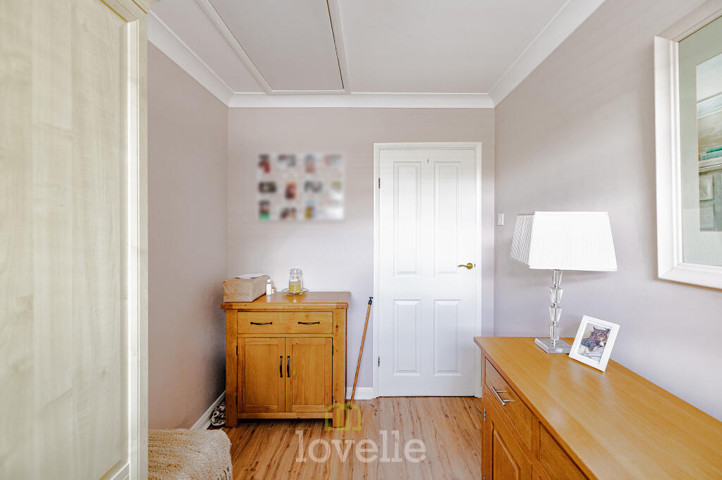
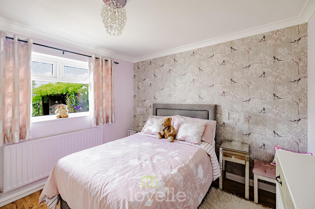
- Kitchen/Dining Room:
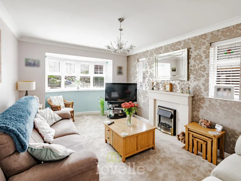
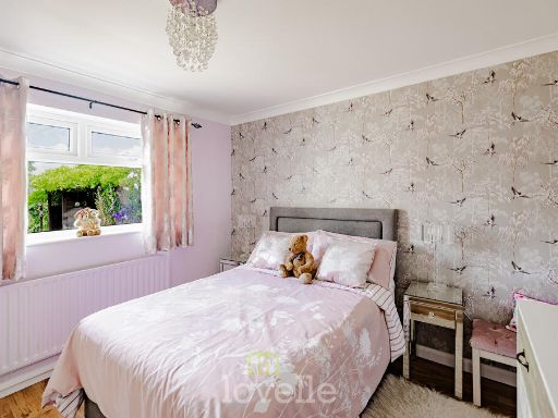
- Living Room:
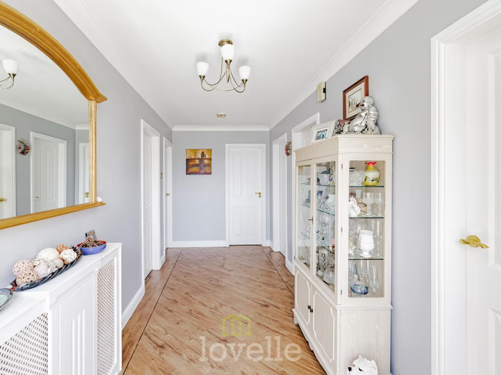
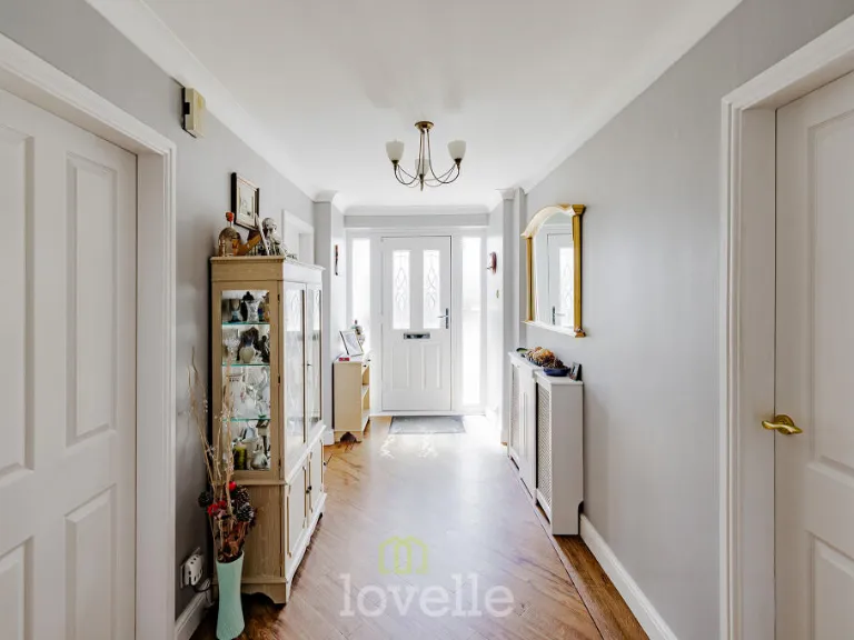
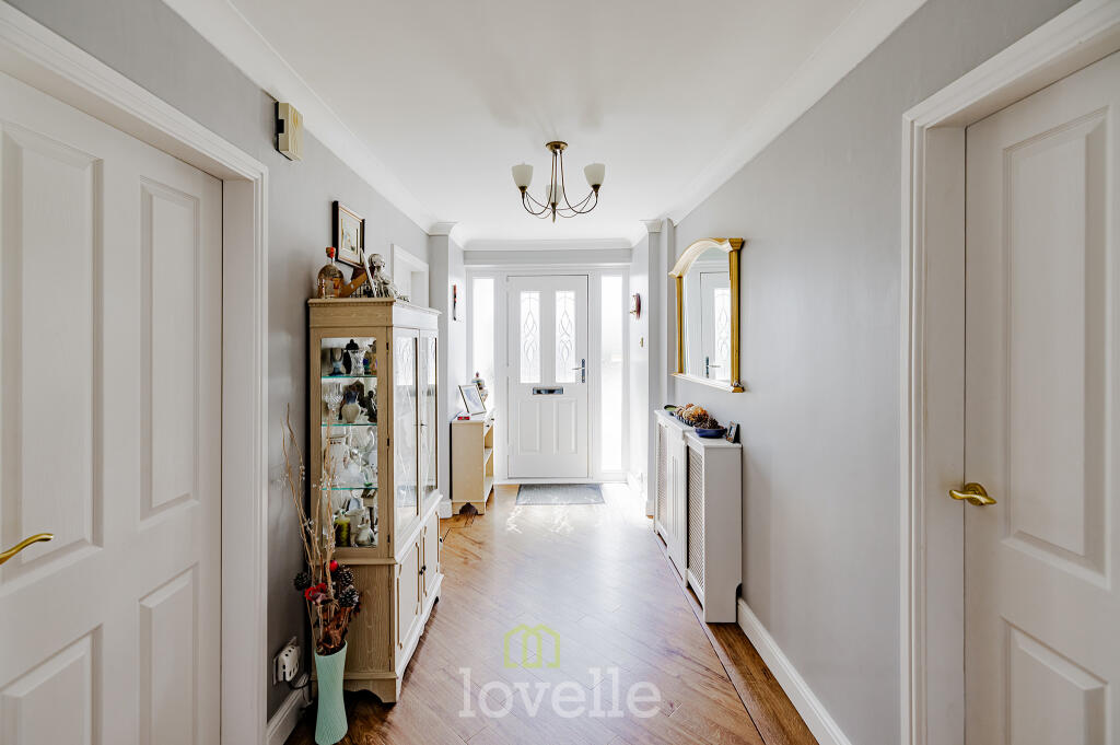
- Entrance Hall:
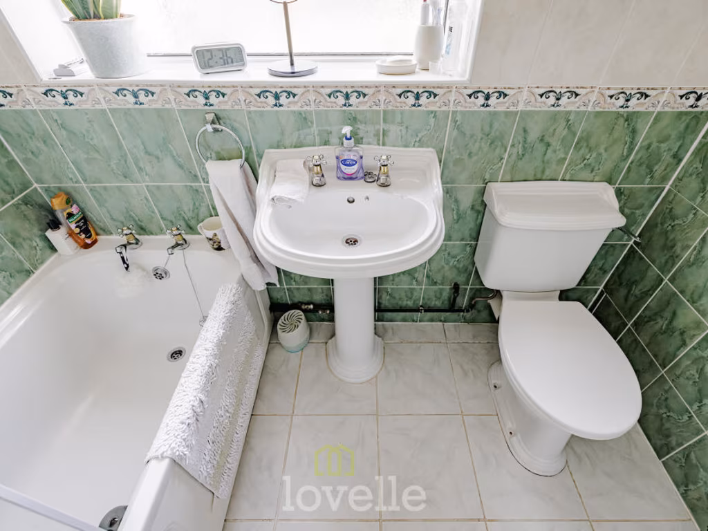
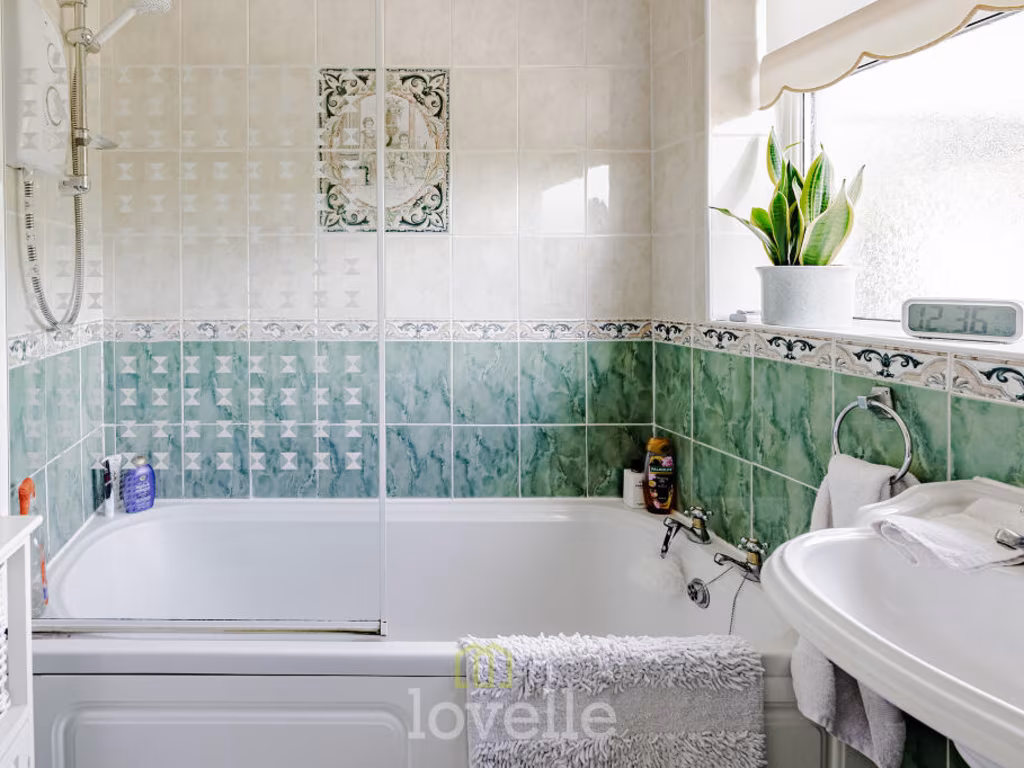
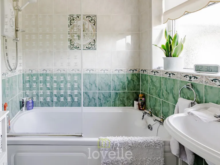
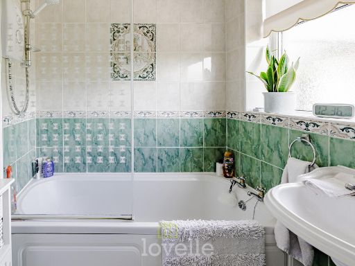
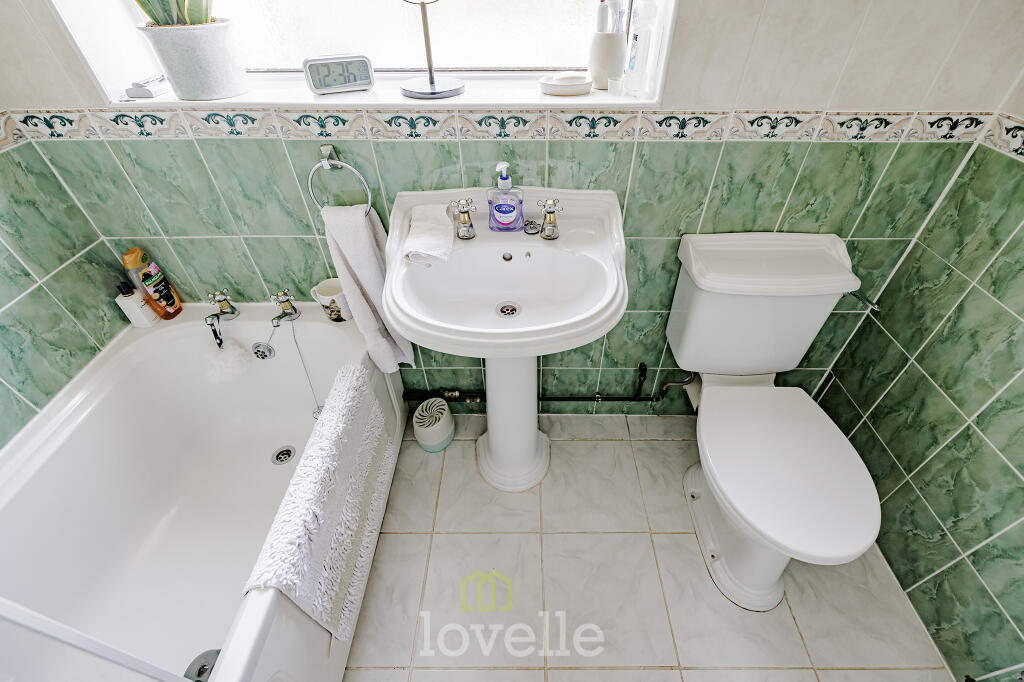
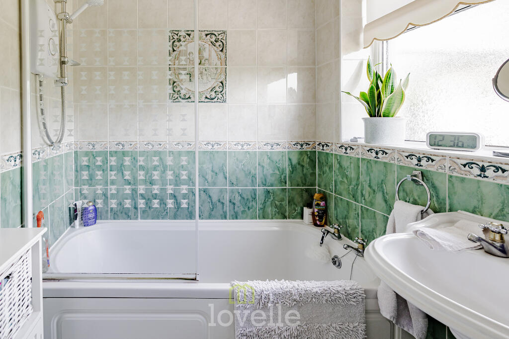
- Bathroom:
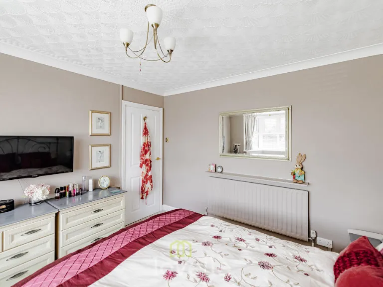
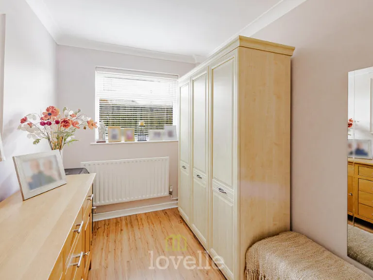
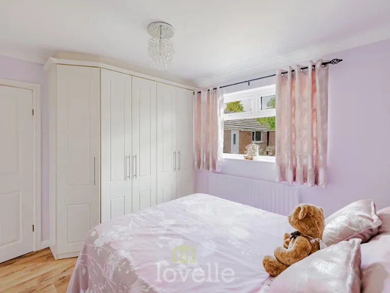
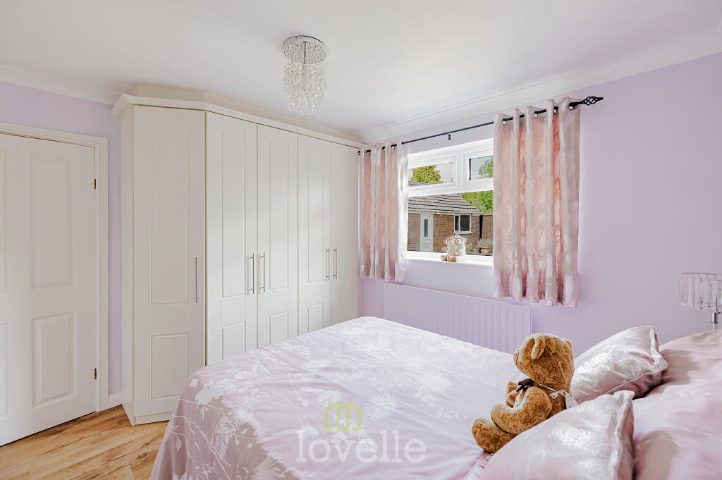
- Bedroom 3:
- Bedroom 2:
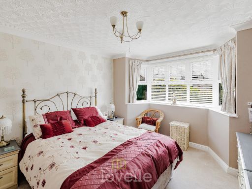
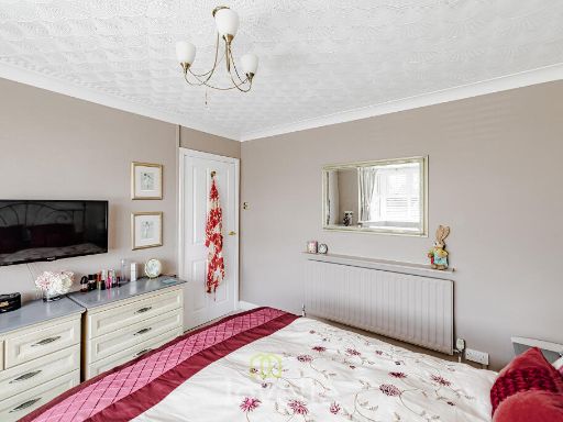
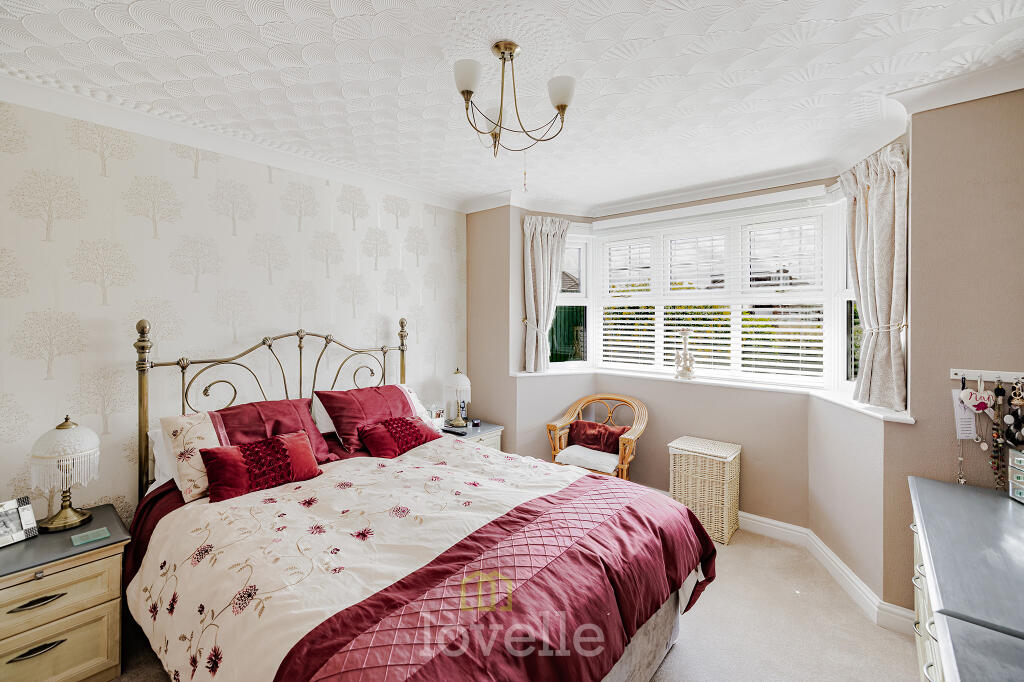
- Bedroom 1:
Textual Property Features
Detected Visual Features
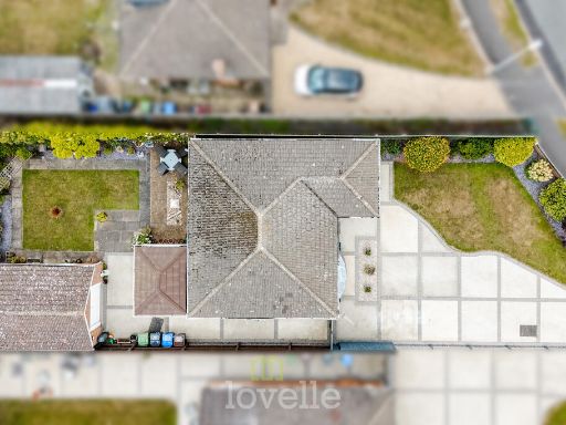
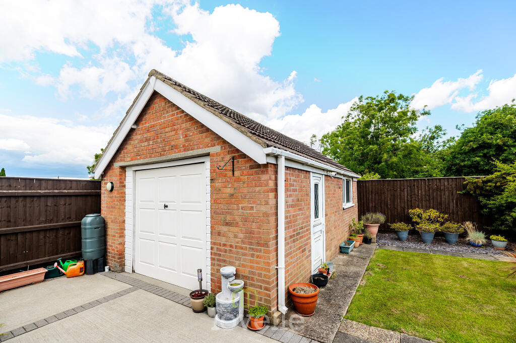
- modern bungalow
- single-family home
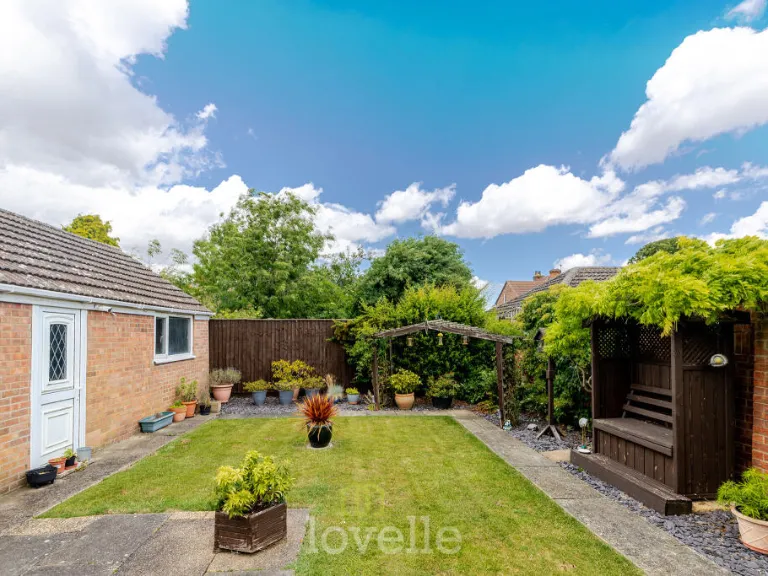
- driveway
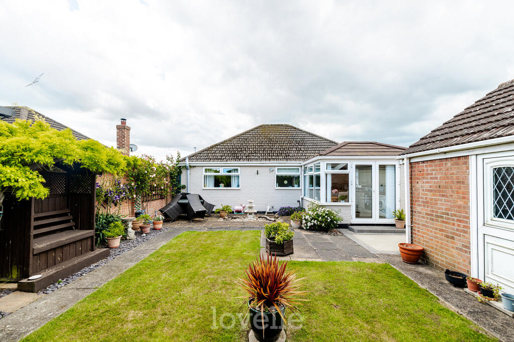
- landscaped garden
- garage
- modern
- living room
- bay window
- feature wallpaper
- fireplace
- chandelier
- natural light
- spacious
EPC Details
- Fully double glazed
- Cavity wall, as built, no insulation (assumed)
- Boiler and radiators, mains gas
- Low energy lighting in all fixed outlets
- Suspended, no insulation (assumed)
Nearby Schools
- Humberston Academy
- Oasis Academy Wintringham
- Saint Joseph's Catholic Primary Voluntary Academy
- Old Clee Primary Academy
- Reynolds Primary Academy
- Queen Mary Avenue Infant School
- Waltham Toll Bar Academy
- Enfield Academy of New Waltham
- Humberston Cloverfields Academy
- Bursar Primary Academy
- Tetney Primary School
- New Waltham Academy
- Middlethorpe Primary Academy
- Beacon Academy
- Thrunscoe Primary and Nursery Academy
- St Peter's CofE Primary School
- Welholme Academy
- Elliston Primary Academy
- Phoenix Park Academy
- Weelsby Academy
- Holton-le-Clay Junior School
- Holton Le Clay Infant School
- Cleethorpes Academy
- Signhills Infant Academy
- Signhills Academy
- Havelock Academy
- William Barcroft Junior School
- Saint Mary's Catholic Voluntary Academy
Nearest General Shops
- Id: 331118477
- Tags:
- Building: yes
- Name: Pavers
- Shop: clothes
- TagsNormalized:
- Lat: 53.5453878
- Lon: -0.0141557
- FullGeoHash: gcxbxetsqpsx
- PartitionGeoHash: gcxb
- Images:
- FoodStandards: null
- Distance: 1666.7
,- Id: 204833354
- Tags:
- Building: yes
- Name: Pets At Home
- Shop: pet
- TagsNormalized:
- Lat: 53.5397576
- Lon: -0.0469326
- FullGeoHash: gcxbwftgdqhw
- PartitionGeoHash: gcxb
- Images:
- FoodStandards: null
- Distance: 1236.6
,- Id: 204833357
- Tags:
- TagsNormalized:
- Lat: 53.5388594
- Lon: -0.045858
- FullGeoHash: gcxbwfqw7qvb
- PartitionGeoHash: gcxb
- Images:
- FoodStandards: null
- Distance: 1125.9
}
Nearest Grocery shops
- Id: 204124917
- Tags:
- Building: yes
- Shop: convenience
- TagsNormalized:
- Lat: 53.5525812
- Lon: -0.0342813
- FullGeoHash: gcxbxhzn3hwn
- PartitionGeoHash: gcxb
- Images:
- FoodStandards: null
- Distance: 2065.1
,- Id: 209272878
- Tags:
- Brand: Spar
- Brand:wikidata: Q610492
- Brand:wikipedia: en:SPAR (retailer)
- Building: yes
- Name: Spar
- Shop: convenience
- TagsNormalized:
- Lat: 53.5523853
- Lon: -0.0340032
- FullGeoHash: gcxbxhzjr8jm
- PartitionGeoHash: gcxb
- Images:
- FoodStandards: null
- Distance: 2041.5
,- Id: 204588812
- Tags:
- Name: Hardys Road Shops
- Shop: convenience
- TagsNormalized:
- Lat: 53.5480282
- Lon: -0.023862
- FullGeoHash: gcxbxkneggzn
- PartitionGeoHash: gcxb
- Images:
- FoodStandards: null
- Distance: 1612.5
}
Nearest Supermarkets
- Id: 216245130
- Tags:
- Brand: Co-op Food
- Brand:wikidata: Q3277439
- Brand:wikipedia: en:Co-op Food
- Building: yes
- Name: Co-op Food
- Operator: The Co-operative Group
- Operator:wikidata: Q117202
- Shop: supermarket
- TagsNormalized:
- co-op
- co-op food
- food
- supermarket
- shop
- Lat: 53.5585395
- Lon: -0.0311065
- FullGeoHash: gcxbxq1355mk
- PartitionGeoHash: gcxb
- Images:
- FoodStandards: null
- Distance: 2714.9
,- Id: 9621364348
- Tags:
- Name: New Waltham Co-op
- Shop: supermarket
- TagsNormalized:
- Lat: 53.5231565
- Lon: -0.0650838
- FullGeoHash: gcxbqx8dgrw0
- PartitionGeoHash: gcxb
- Images:
- FoodStandards: null
- Distance: 2573.5
,- Id: 204833355
- Tags:
- Addr:
- City: Cleethorpes
- Postcode: DN35 9QR
- Street: Hewitts Avenue
- Brand: Tesco Extra
- Brand:wikidata: Q25172225
- Brand:wikipedia: en:Tesco Extra
- Building: yes
- Contact:
- Website: https://www.tesco.com/store-locator/cleethorpes/hewitts-circus-retail-park
- Fhrs:
- Name: Tesco Extra
- Shop: supermarket
- Source:
- TagsNormalized:
- tesco
- tesco extra
- supermarket
- shop
- Lat: 53.5392806
- Lon: -0.0449646
- FullGeoHash: gcxbwfx2bjrb
- PartitionGeoHash: gcxb
- Images:
- FoodStandards:
- Id: 676075
- FHRSID: 676075
- LocalAuthorityBusinessID: 4518
- BusinessName: Tesco Extra
- BusinessType: Retailers - supermarkets/hypermarkets
- BusinessTypeID: 7840
- AddressLine1: Tesco Extra
- AddressLine2: Hewitts Avenue
- AddressLine3: null
- AddressLine4: New Waltham
- PostCode: DN35 9QR
- RatingValue: 5
- RatingKey: fhrs_5_en-GB
- RatingDate: 2018-08-20
- LocalAuthorityCode: 865
- LocalAuthorityName: North East Lincolnshire
- LocalAuthorityWebSite: http://www.nelincs.gov.uk
- LocalAuthorityEmailAddress: environmental.health@nelincs.gov.uk
- Scores:
- Hygiene: 0
- Structural: 0
- ConfidenceInManagement: 0
- NewRatingPending: false
- Geocode:
- Longitude: -0.04619100000000
- Latitude: 53.53870200000000
- Distance: 1097.8
}
Nearest Religious buildings
- Id: 882868480
- Tags:
- Addr:
- Amenity: place_of_worship
- Building: church
- Denomination: anglican
- Name: St Matthew, New Waltham
- Religion: christian
- Wikidata: Q105098395
- TagsNormalized:
- place of worship
- church
- anglican
- christian
- Lat: 53.5262475
- Lon: -0.0620909
- FullGeoHash: gcxbw84ucptx
- PartitionGeoHash: gcxb
- Images:
- FoodStandards: null
- Distance: 2246.1
,- Id: 879758461
- Tags:
- Amenity: place_of_worship
- Building: church
- Denomination: anglican
- Name: St Peter
- Religion: christian
- Wikidata: Q17533322
- TagsNormalized:
- place of worship
- church
- anglican
- christian
- Lat: 53.5278308
- Lon: -0.0238045
- FullGeoHash: gcxbx2qwjqfh
- PartitionGeoHash: gcxb
- Images:
- FoodStandards: null
- Distance: 838.7
,- Id: 4105298952
- Tags:
- Amenity: place_of_worship
- Name: Humberston Methodist Church
- Religion: christian
- TagsNormalized:
- place of worship
- church
- methodist
- christian
- Lat: 53.5280152
- Lon: -0.0268858
- FullGeoHash: gcxbx2krm922
- PartitionGeoHash: gcxb
- Images:
- FoodStandards: null
- Distance: 726.9
}
Nearest Medical buildings
- Id: 11726731
- Tags:
- Amenity: doctors
- Building: yes
- Healthcare: doctor
- Name: Beacon Medical
- Type: multipolygon
- TagsNormalized:
- doctor
- doctors
- health
- healthcare
- Lat: 53.556994
- Lon: -0.0368203
- FullGeoHash: gcxbxjv0n52c
- PartitionGeoHash: gcxb
- Images:
- FoodStandards: null
- Distance: 2573.9
,- Id: 9713882751
- Tags:
- Addr:
- City: Cleethorpes
- Country: GB
- Housenumber: 86
- Postcode: DN35 0DW
- Street: Hardys Road
- Amenity: veterinary
- Fax: +44 1472 291 902
- Name: Eastfield Veterinary Clinic
- Opening_hours: Mo-Fr 09:00-18:00
- Phone: +44 1472 694 721
- Website: https://eastfieldvets.co.uk/our-practices/cleethorpes-clinic/
- TagsNormalized:
- Lat: 53.5478978
- Lon: -0.0239508
- FullGeoHash: gcxbxkne1gsu
- PartitionGeoHash: gcxb
- Images:
- FoodStandards: null
- Distance: 1596.9
,- Id: 9714044496
- Tags:
- Addr:
- City: Humberston
- Hamlet: Hewitts Business Park
- Postcode: DN36 4RU
- Street: Altyre Way
- Unit: 7
- Amenity: veterinary
- Email: info@woldsvets.com
- Name: Wolds Veterinary Clinic
- Opening_hours: Mo-Fr 08:30-18:30; Sa 08:30-11:00
- Phone: +44 1472 695 979
- Website: https://www.woldsvets.com/
- Wheelchair: yes
- TagsNormalized:
- Lat: 53.5378543
- Lon: -0.0469668
- FullGeoHash: gcxbwfmb9e7h
- PartitionGeoHash: gcxb
- Images:
- FoodStandards: null
- Distance: 1146.2
,- Id: 326219087
- Tags:
- Addr:
- City: Grimsby
- Postcode: DN36 4SX
- Street: Humberston Avenue
- Brand: Bannatyne Health Club
- Brand:wikidata: Q24993691
- Email: sales.humberston@bannatyne.co.uk
- Leisure: fitness_centre
- Name: Bannatyne Health Club
- Phone: +44 1472 211 151
- TagsNormalized:
- health
- club
- fitness
- fitness centre
- leisure
- Lat: 53.5272415
- Lon: -0.0346898
- FullGeoHash: gcxbx0qdz9j2
- PartitionGeoHash: gcxb
- Images:
- FoodStandards: null
- Distance: 807.4
}
Nearest Leisure Facilities
- Id: 68993206
- Tags:
- Addr:
- City: Humberston, Grimsby
- Postcode: DN36 4SX
- Street: Humberston Avenue
- Description: 9 hole Par 34
- Golf:
- Leisure: golf_course
- Name: Humberston Country Club Golf Course
- Phone: +44 1472 211151
- Website: https://www.virginactive.co.uk/clubs/humberston
- TagsNormalized:
- golf
- golf course
- leisure
- club
- Lat: 53.5301717
- Lon: -0.035623
- FullGeoHash: gcxbx0y5cgm8
- PartitionGeoHash: gcxb
- Images:
- FoodStandards: null
- Distance: 543
,- Id: 1036394671
- Tags:
- Leisure: pitch
- Lit: no
- Sport: soccer
- Surface: grass
- TagsNormalized:
- Lat: 53.5314247
- Lon: -0.0335179
- FullGeoHash: gcxbx1pe4uz4
- PartitionGeoHash: gcxb
- Images:
- FoodStandards: null
- Distance: 349.9
,- Id: 1036394672
- Tags:
- Leisure: pitch
- Lit: no
- Sport: soccer
- Surface: grass
- TagsNormalized:
- Lat: 53.5316485
- Lon: -0.0323246
- FullGeoHash: gcxbx30kqy91
- PartitionGeoHash: gcxb
- Images:
- FoodStandards: null
- Distance: 293.3
,- Id: 1036394675
- Tags:
- Leisure: pitch
- Sport: basketball
- TagsNormalized:
- pitch
- leisure
- basketball
- sports
- Lat: 53.5318312
- Lon: -0.0315638
- FullGeoHash: gcxbx31j8887
- PartitionGeoHash: gcxb
- Images:
- FoodStandards: null
- Distance: 260
,- Id: 1036394674
- Tags:
- TagsNormalized:
- Lat: 53.5318104
- Lon: -0.0311963
- FullGeoHash: gcxbx31m3hdr
- PartitionGeoHash: gcxb
- Images:
- FoodStandards: null
- Distance: 258.7
}
Nearest Tourist attractions
- Id: 299009630
- Tags:
- Name: Cleethorpes Showground Caravan Park (Camping)
- Tourism: camp_site
- TagsNormalized:
- Lat: 53.5438739
- Lon: -0.0070437
- FullGeoHash: gcxbxg6gevec
- PartitionGeoHash: gcxb
- Images:
- FoodStandards: null
- Distance: 1907.6
,- Id: 147521613
- Tags:
- TagsNormalized:
- Lat: 53.5348222
- Lon: -0.0048455
- FullGeoHash: gcxbxcsqzn4v
- PartitionGeoHash: gcxb
- Images:
- FoodStandards: null
- Distance: 1716.9
,- Id: 66967911
- Tags:
- Name: Epperstone Residential Caravan Park
- Tourism: camp_site
- TagsNormalized:
- caravan
- residential
- tourism
- Lat: 53.5349942
- Lon: -0.0087159
- FullGeoHash: gcxbxc9xuyhz
- PartitionGeoHash: gcxb
- Images:
- FoodStandards: null
- Distance: 1462.6
}
Nearest Train stations
- Id: 7156689696
- Tags:
- Name: Grimsby Town
- Naptan:
- Network: National Rail
- Operator: First TransPennine Express
- Platforms: 3
- Public_transport: station
- Railway: station
- Ref:
- Source: npe
- Toilets:
- Wheelchair: yes
- Wikidata: Q5609334
- Wikipedia: en:Grimsby Town railway station
- TagsNormalized:
- Lat: 53.5634567
- Lon: -0.0868507
- FullGeoHash: gcxbwnbvb0p2
- PartitionGeoHash: gcxb
- Images:
- FoodStandards: null
- Distance: 4934.7
,- Id: 3152616511
- Tags:
- Name: New Clee
- Naptan:
- Network: National Rail
- Operator: Northern Rail
- Public_transport: station
- Railway: station
- Ref:
- Wikidata: Q4877746
- Wikipedia: en:New Clee railway station
- TagsNormalized:
- Lat: 53.5743075
- Lon: -0.0604648
- FullGeoHash: gcxby8guznf0
- PartitionGeoHash: gcxb
- Images:
- FoodStandards: null
- Distance: 4879
,- Id: 7156679945
- Tags:
- Name: Cleethorpes
- Naptan:
- Network: National Rail
- Operator: First TransPennine Express
- Public_transport: station
- Railway: station
- Ref:
- Source: npe
- Wikidata: Q1959432
- Wikipedia: en:Cleethorpes railway station
- TagsNormalized:
- Lat: 53.5629155
- Lon: -0.0300034
- FullGeoHash: gcxbxqf4sg5u
- PartitionGeoHash: gcxb
- Images:
- FoodStandards: null
- Distance: 3201.8
,- Id: 4901466089
- Tags:
- Public_transport: station
- Railway: station
- Usage: tourism
- TagsNormalized:
- Lat: 53.538884
- Lon: -0.0053134
- FullGeoHash: gcxbxfkns5q5
- PartitionGeoHash: gcxb
- Images:
- FoodStandards: null
- Distance: 1765.3
,- Id: 7354595305
- Tags:
- Name: Lakeside Central
- Public_transport: station
- Railway: station
- Source: wikipedia
- Usage: tourism
- TagsNormalized:
- Lat: 53.5437348
- Lon: -0.0095532
- FullGeoHash: gcxbxg34c7se
- PartitionGeoHash: gcxb
- Images:
- FoodStandards: null
- Distance: 1764.3
}
Nearest Hotels
- Id: 331119923
- Tags:
- Name: Wellow Hotel
- Tourism: hotel
- TagsNormalized:
- Lat: 53.5477912
- Lon: -0.0156959
- FullGeoHash: gcxbxshd6rb2
- PartitionGeoHash: gcxb
- Images:
- FoodStandards: null
- Distance: 1818
,- Id: 1198863229
- Tags:
- Amenity: pub
- Name: Wellow Hotel
- TagsNormalized:
- Lat: 53.5477934
- Lon: -0.0158114
- FullGeoHash: gcxbxsh6x84j
- PartitionGeoHash: gcxb
- Images:
- FoodStandards: null
- Distance: 1814
,- Id: 9642584227
- Tags:
- Addr:
- City: Cleethorpes
- Country: GB
- Postcode: DN35 0PN
- Street: Kings Road
- Brand: Premier Inn
- Brand:wikidata: Q2108626
- Internet_access: wlan
- Internet_access:fee: customers
- Internet_access:operator: Virgin Media
- Internet_access:ssid: Premier Inn Free Wi-Fi
- Name: Premier Inn Cleethorpes
- Source: survey
- Tourism: hotel
- Website: https://www.premierinn.com/gb/en/hotels/england/lincolnshire/cleethorpes/cleethorpes.html
- TagsNormalized:
- Lat: 53.5434234
- Lon: -0.0117025
- FullGeoHash: gcxbxer3p39c
- PartitionGeoHash: gcxb
- Images:
- FoodStandards: null
- Distance: 1631.4
}
Tags
- modern bungalow
- single-family home
- driveway
- landscaped garden
- garage
- modern
- living room
- bay window
- feature wallpaper
- fireplace
- chandelier
- natural light
- spacious
Local Market Stats
- Average Price/sqft: £211
- Avg Income: £40600
- Rental Yield: 4.9%
- Social Housing: 6%
- Planning Success Rate: 94%
AirBnB Data
- 1km average: £115/night
- Listings in 1km: 1
Similar Properties
 3 bedroom detached bungalow for sale in Coniston Crescent, Humberston, DN36 — £230,000 • 3 bed • 1 bath • 879 ft²
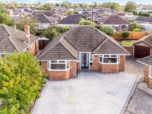 3 bedroom bungalow for sale in Queen Elizabeth Road, Humberston, DN36 — £275,000 • 3 bed • 1 bath • 1129 ft²
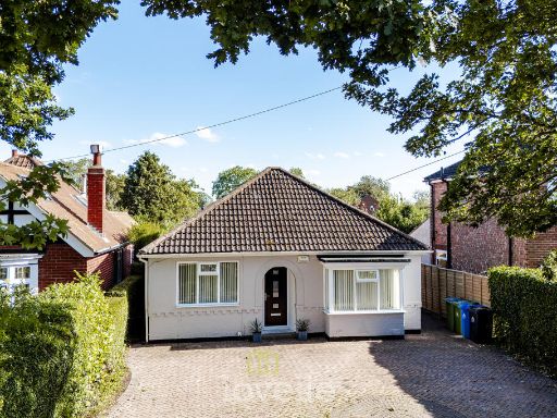 3 bedroom bungalow for sale in Humberston Avenue, Humberston, DN36 — £365,000 • 3 bed • 3 bath • 1023 ft²
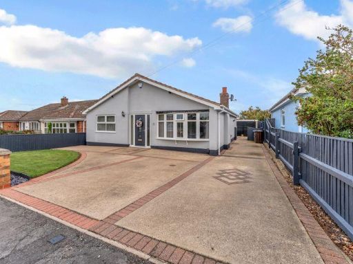 3 bedroom detached bungalow for sale in Andrew Road, Humberston, DN36 — £292,500 • 3 bed • 1 bath • 719 ft²
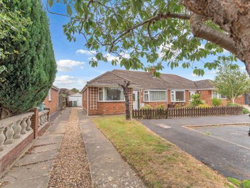 3 bedroom semi-detached bungalow for sale in St. Peters Crescent, Humberston, DN36 — £175,000 • 3 bed • 1 bath • 830 ft²
 3 bedroom semi-detached bungalow for sale in Fieldhouse Road, Humberston , DN36 — £249,950 • 3 bed • 1 bath • 1092 ft²
Meta
- {
"@context": "https://schema.org",
"@type": "Residence",
"name": "3 bedroom bungalow for sale in Queen Elizabeth Road, Humber…",
"description": "",
"url": "https://propertypiper.co.uk/property/ee78f7e2-7394-464b-b7da-6737f650bebf",
"image": "https://image-a.propertypiper.co.uk/0663662c-0555-4588-b354-69e988e932b5-1024.jpeg",
"address": {
"@type": "PostalAddress",
"streetAddress": "55 QUEEN ELIZABETH ROAD HUMBERSTON GRIMSBY",
"postalCode": "DN36 4DE",
"addressLocality": "North East Lincolnshire",
"addressRegion": "Cleethorpes",
"addressCountry": "England"
},
"geo": {
"@type": "GeoCoordinates",
"latitude": 53.5341247729038,
"longitude": -0.03079806140422843
},
"numberOfRooms": 3,
"numberOfBathroomsTotal": 1,
"floorSize": {
"@type": "QuantitativeValue",
"value": 1156,
"unitCode": "FTK"
},
"offers": {
"@type": "Offer",
"price": 269950,
"priceCurrency": "GBP",
"availability": "https://schema.org/InStock"
},
"additionalProperty": [
{
"@type": "PropertyValue",
"name": "Feature",
"value": "modern bungalow"
},
{
"@type": "PropertyValue",
"name": "Feature",
"value": "single-family home"
},
{
"@type": "PropertyValue",
"name": "Feature",
"value": "driveway"
},
{
"@type": "PropertyValue",
"name": "Feature",
"value": "landscaped garden"
},
{
"@type": "PropertyValue",
"name": "Feature",
"value": "garage"
},
{
"@type": "PropertyValue",
"name": "Feature",
"value": "modern"
},
{
"@type": "PropertyValue",
"name": "Feature",
"value": "living room"
},
{
"@type": "PropertyValue",
"name": "Feature",
"value": "bay window"
},
{
"@type": "PropertyValue",
"name": "Feature",
"value": "feature wallpaper"
},
{
"@type": "PropertyValue",
"name": "Feature",
"value": "fireplace"
},
{
"@type": "PropertyValue",
"name": "Feature",
"value": "chandelier"
},
{
"@type": "PropertyValue",
"name": "Feature",
"value": "natural light"
},
{
"@type": "PropertyValue",
"name": "Feature",
"value": "spacious"
}
]
}
High Res Floorplan Images
Compatible Floorplan Images
FloorplanImages Thumbnail