RM10 8QB - 4 bedroom terraced house for sale in Sterry Crescent, Dagen…
View on Property Piper
4 bedroom terraced house for sale in Sterry Crescent, Dagenham, RM10
Property Details
- Price: £525000
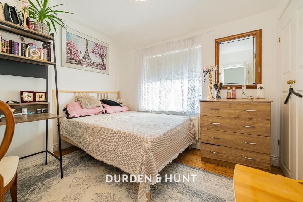
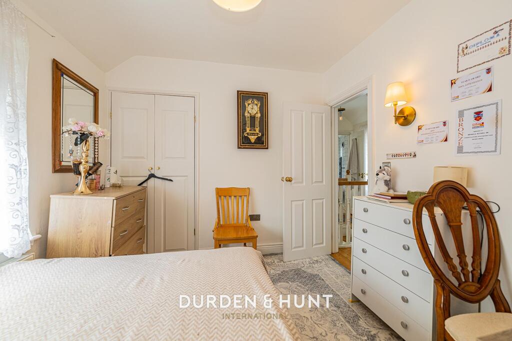
- Bedrooms: 4
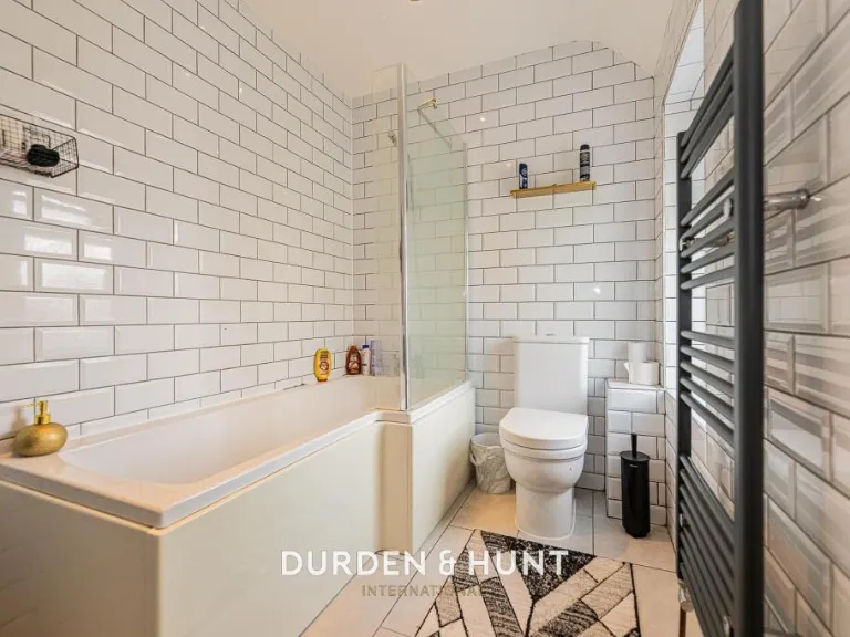
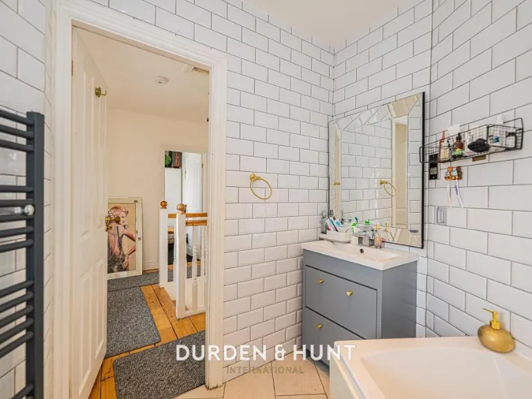
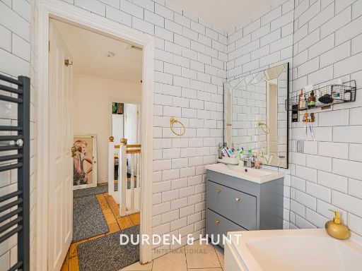
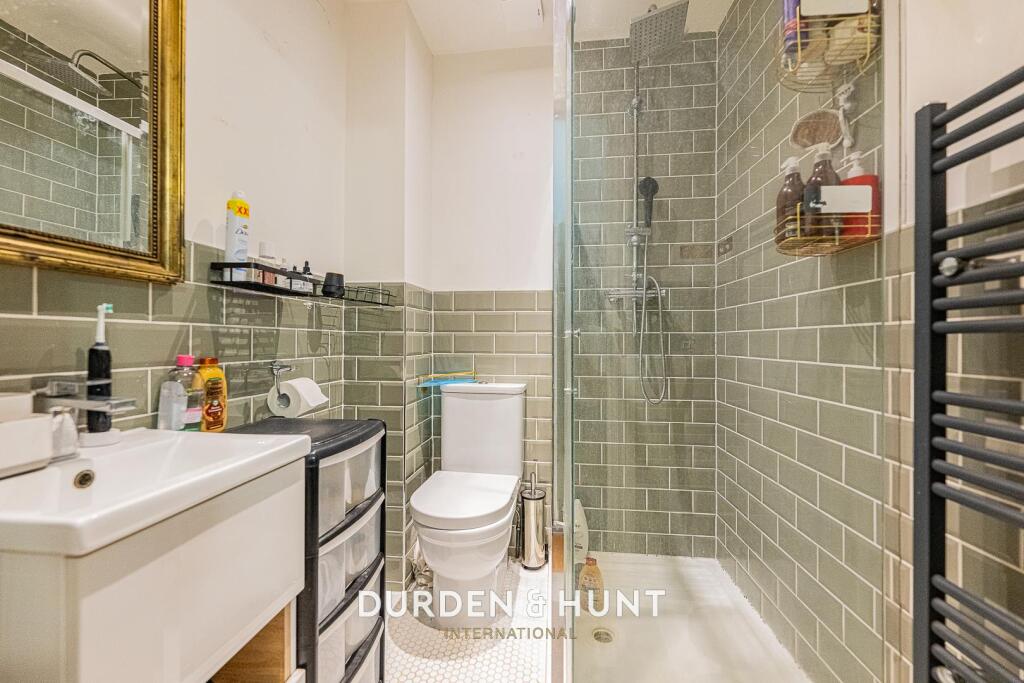
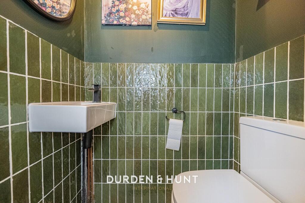
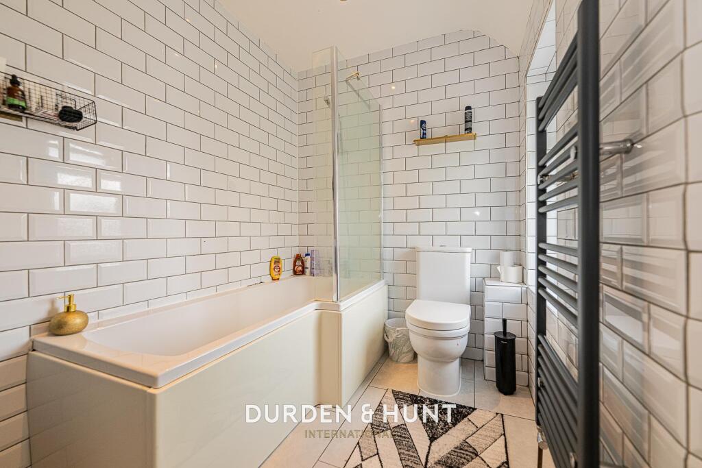
- Bathrooms: 2
- Property Type: undefined
- Property SubType: undefined
Brochure Descriptions
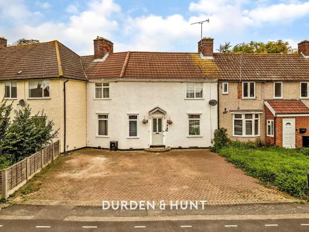
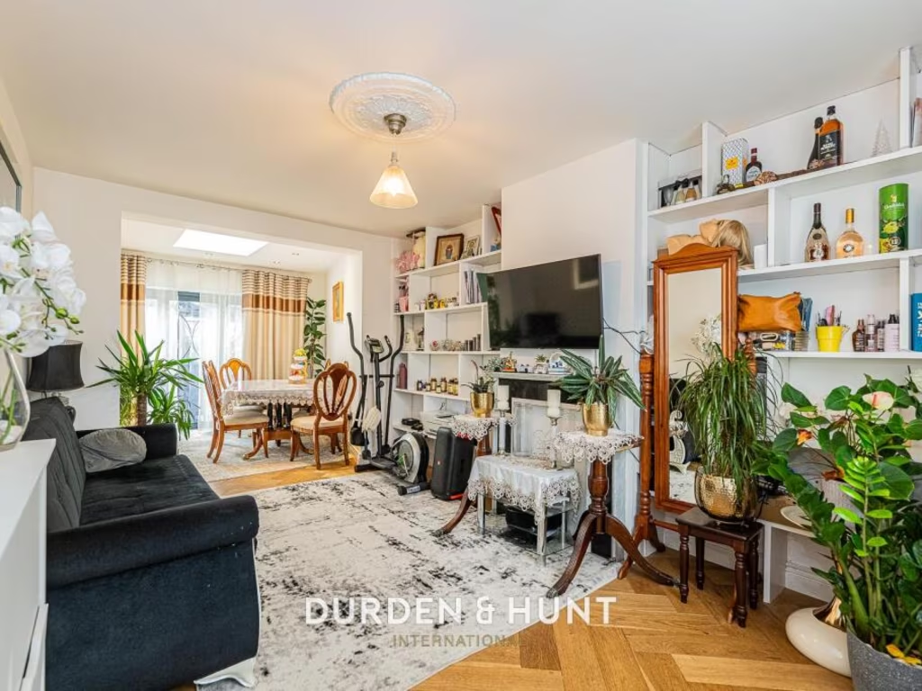
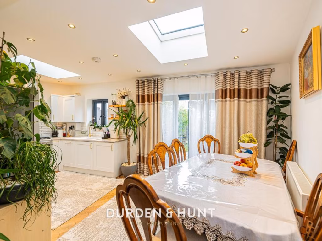
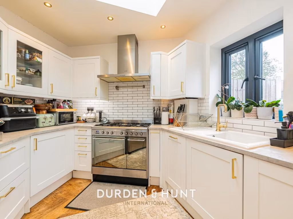
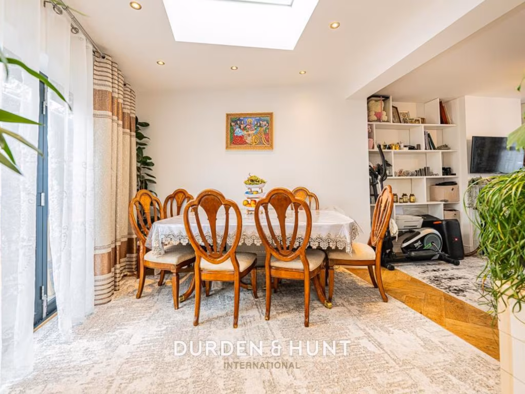
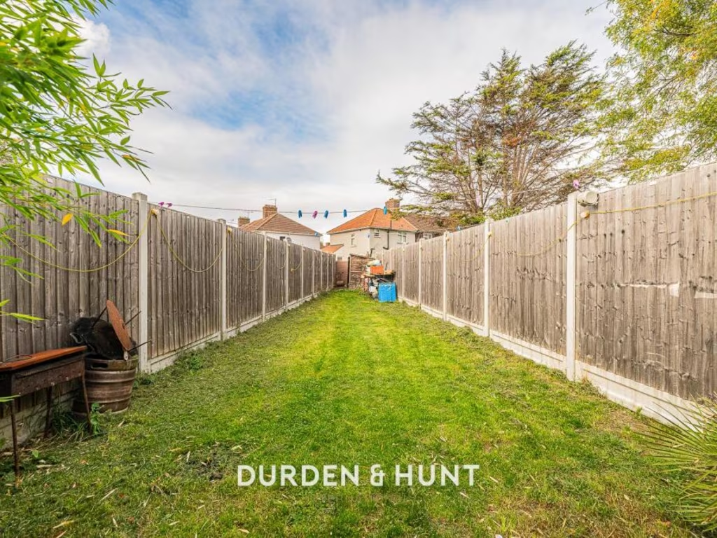
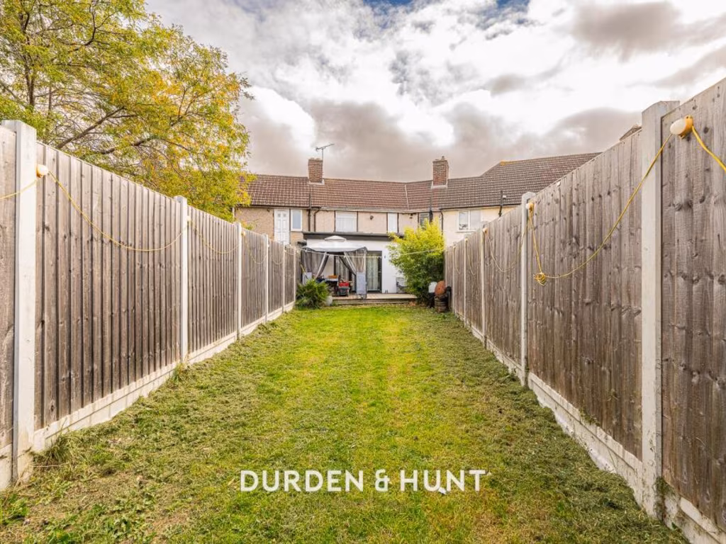
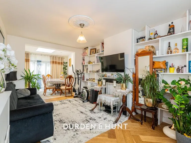
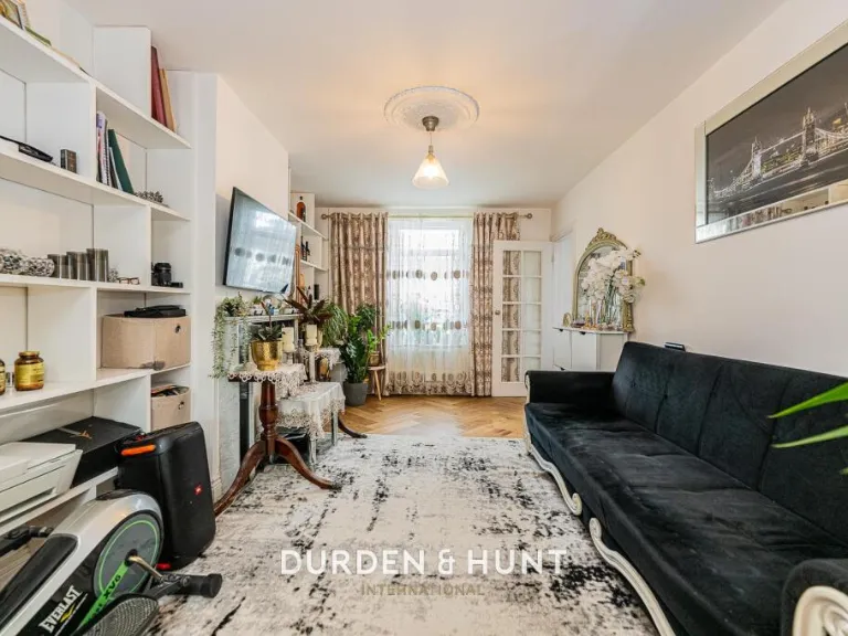
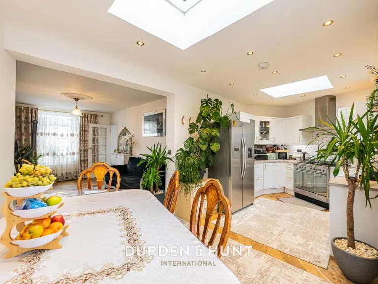
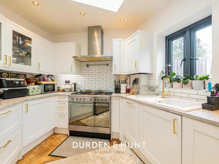
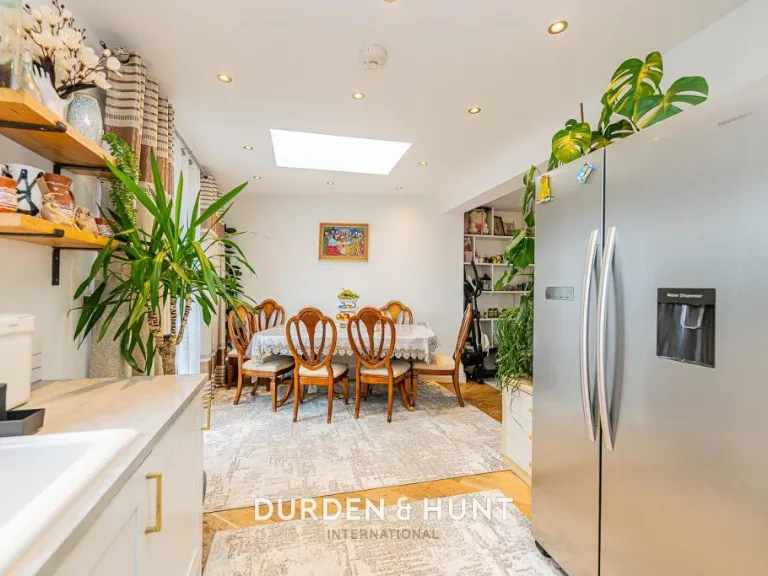
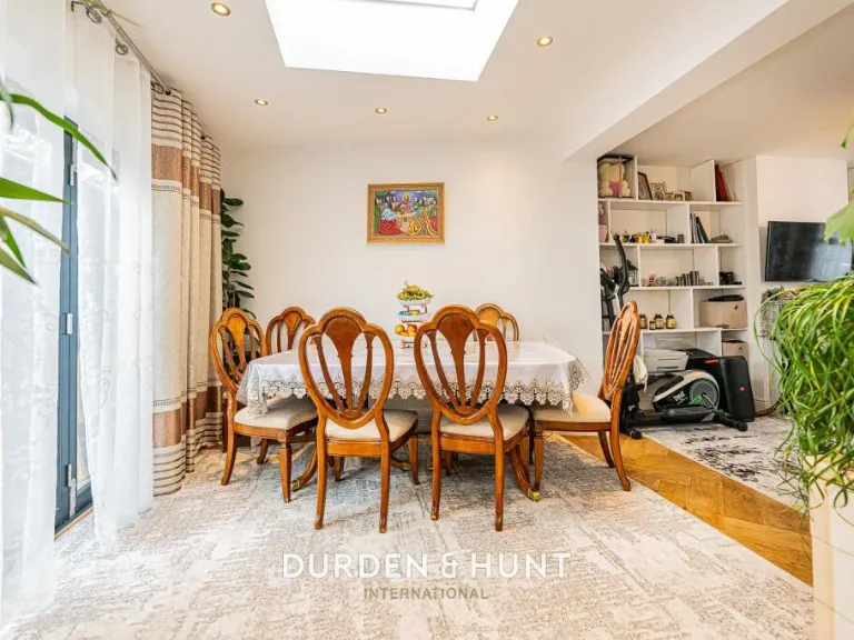
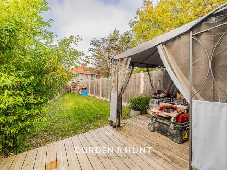
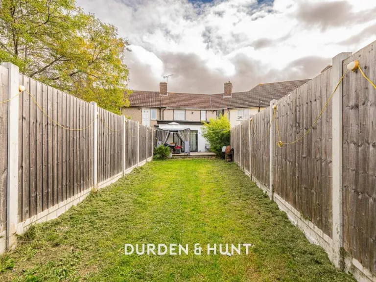
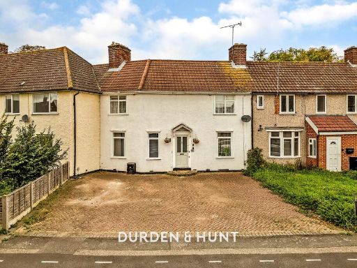
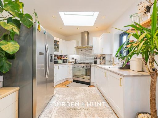
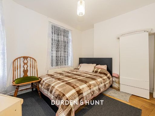
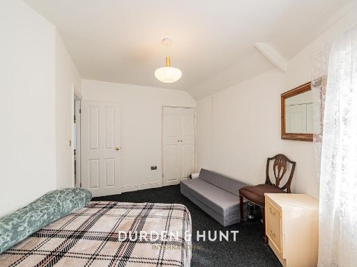
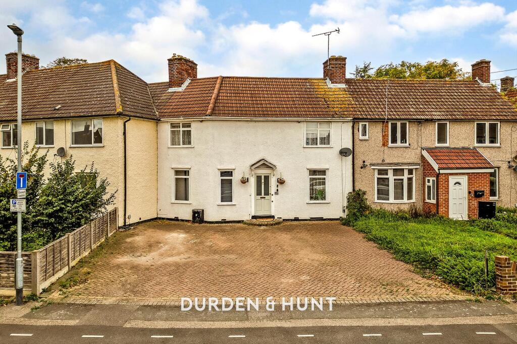
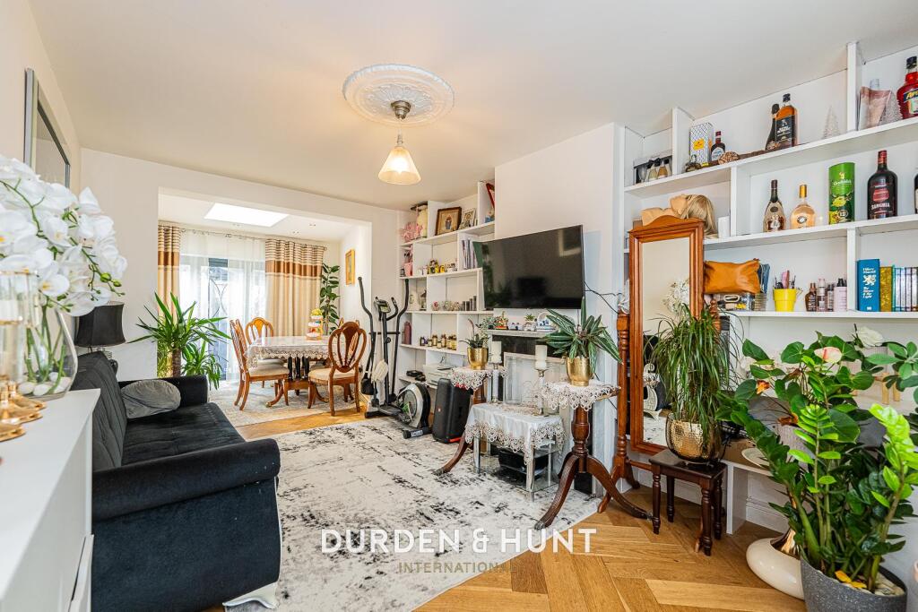
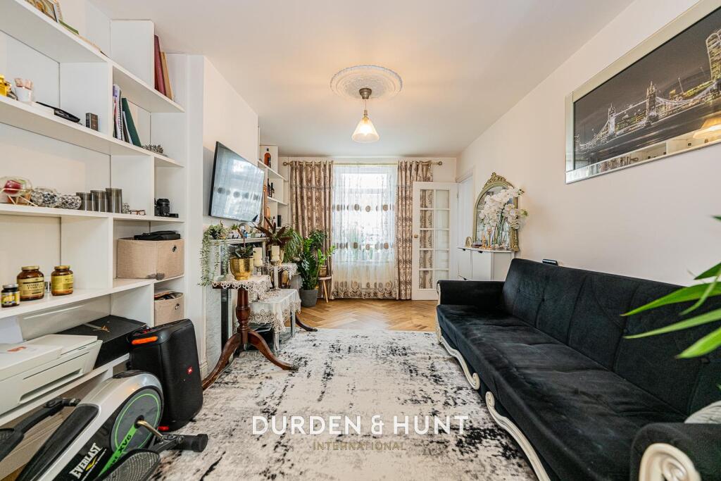
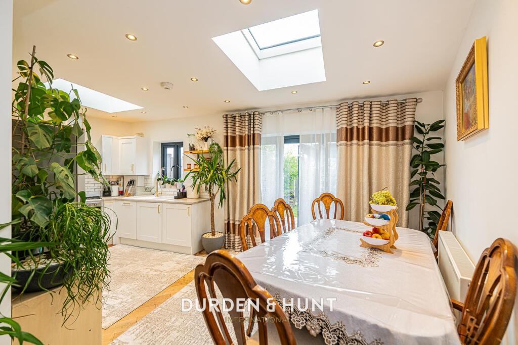
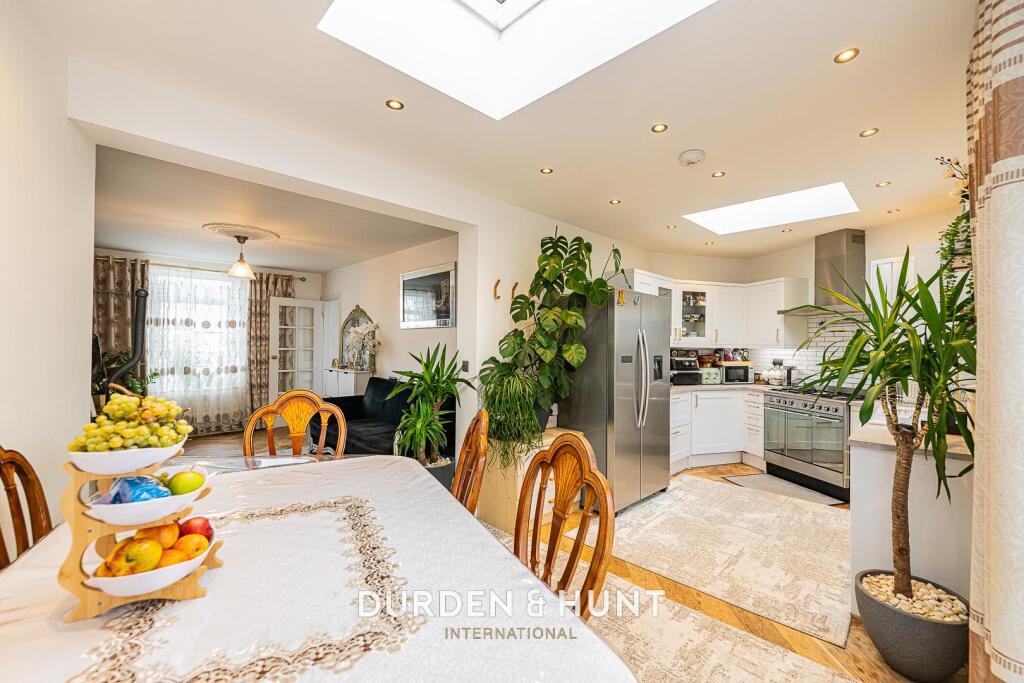
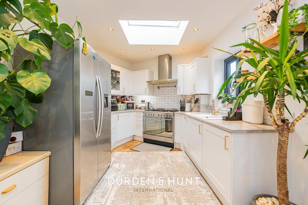
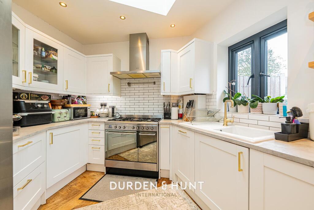
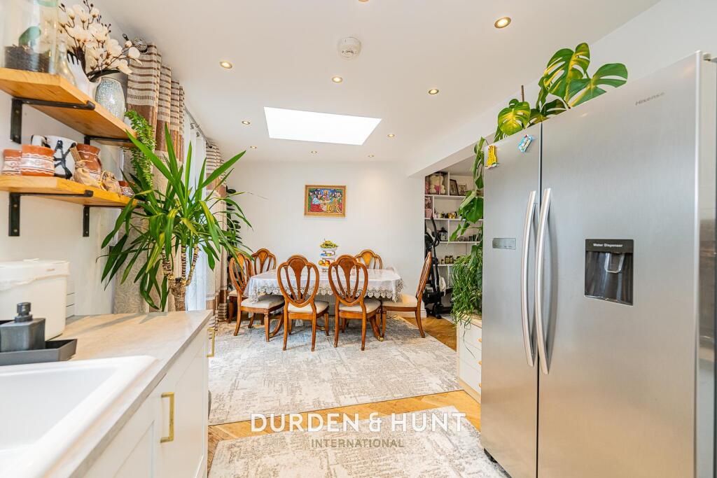
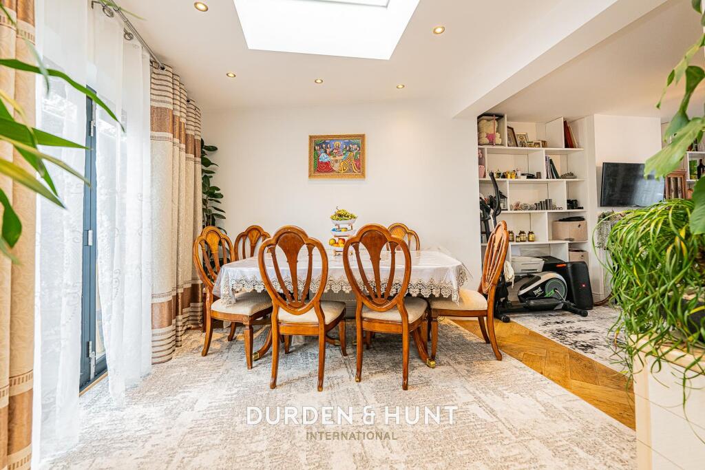
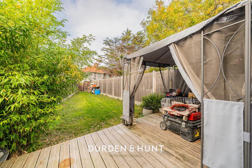
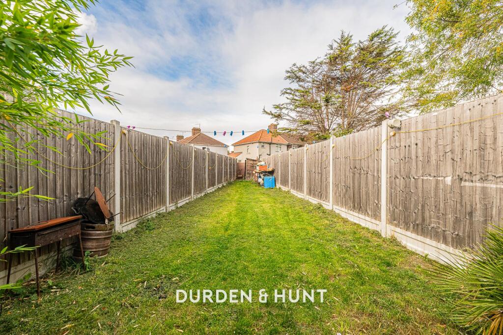
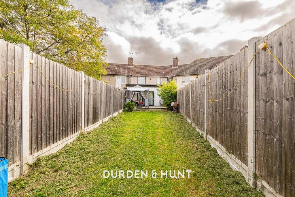
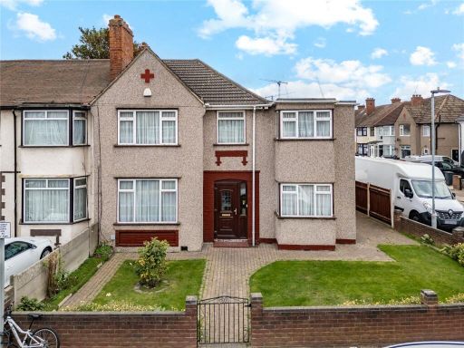
- Mid-terraced two-storey residential property located on Sterry Crescent, Dagenham. Exterior shows a rendered façade with a wide block‑paved forecourt providing ample off‑road parking for multiple vehicles and a small planted area to one side. Interior images show open-plan living/dining space with contemporary finishes, light timber flooring, built-in shelving and good natural light. Rooms appear average in size for a family home; overall the plot frontage is large due to the paved parking area while the rear garden (partly visible) appears to be of a good/medium size. The presentation and layout are consistent with a family house offering practical off‑street parking and modernised reception space.
Image Descriptions
- exterior Post-war
- living room and dining area contemporary
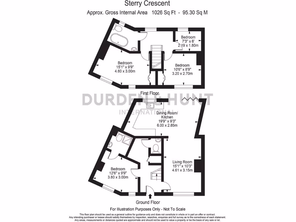
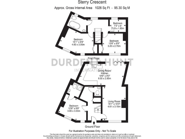
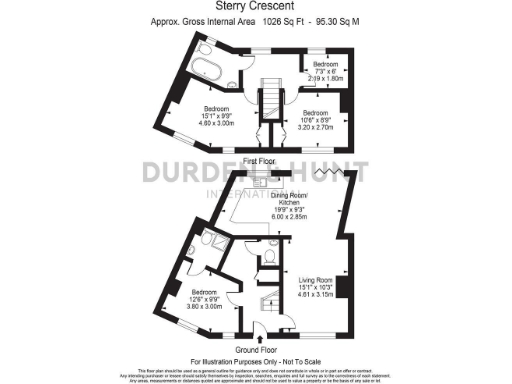
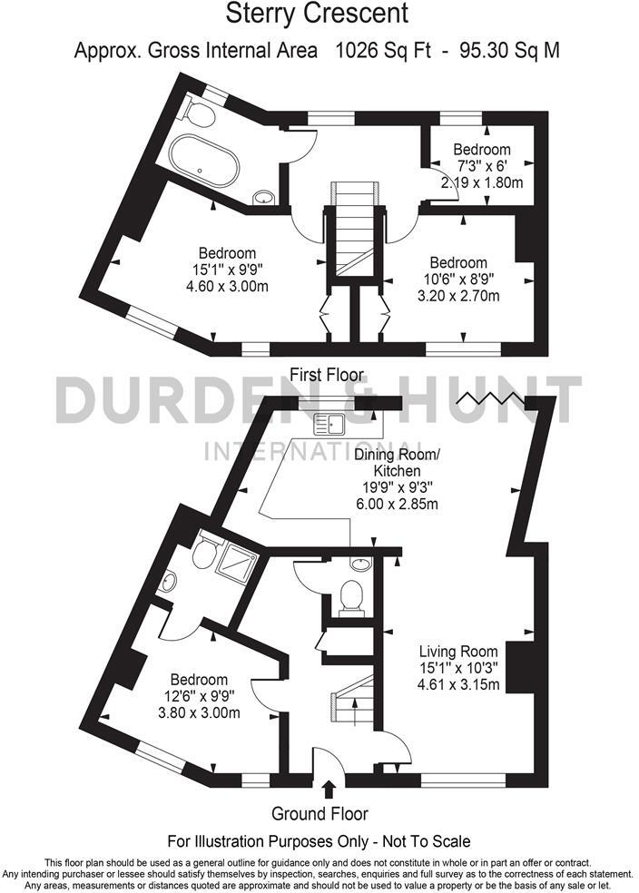
Floorplan Description
- Residential property on Sterry Crescent
Rooms
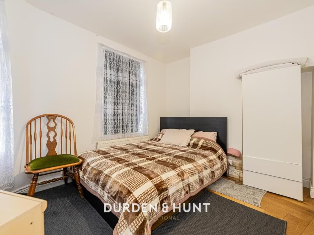
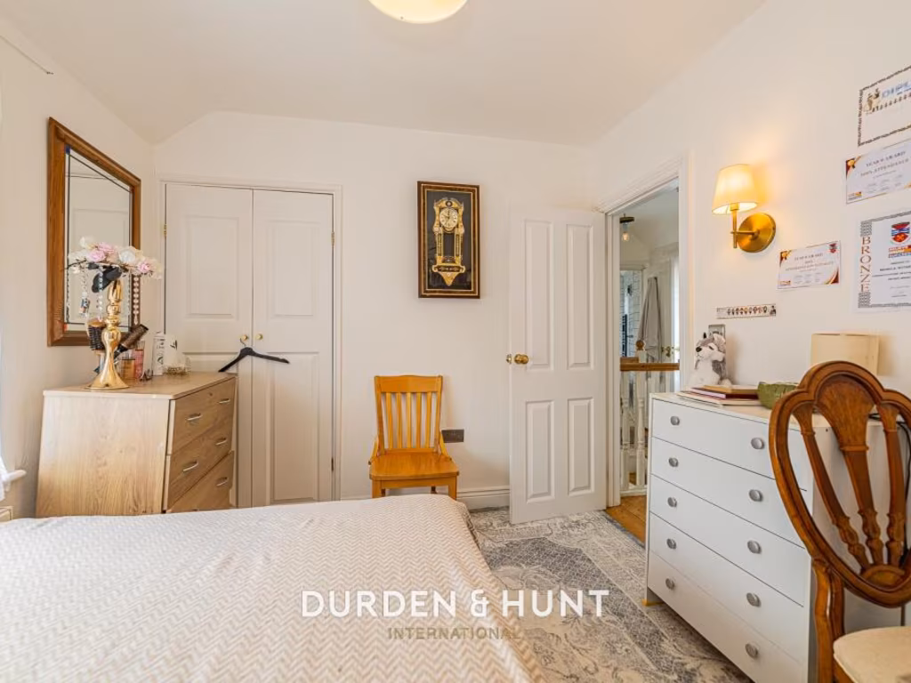
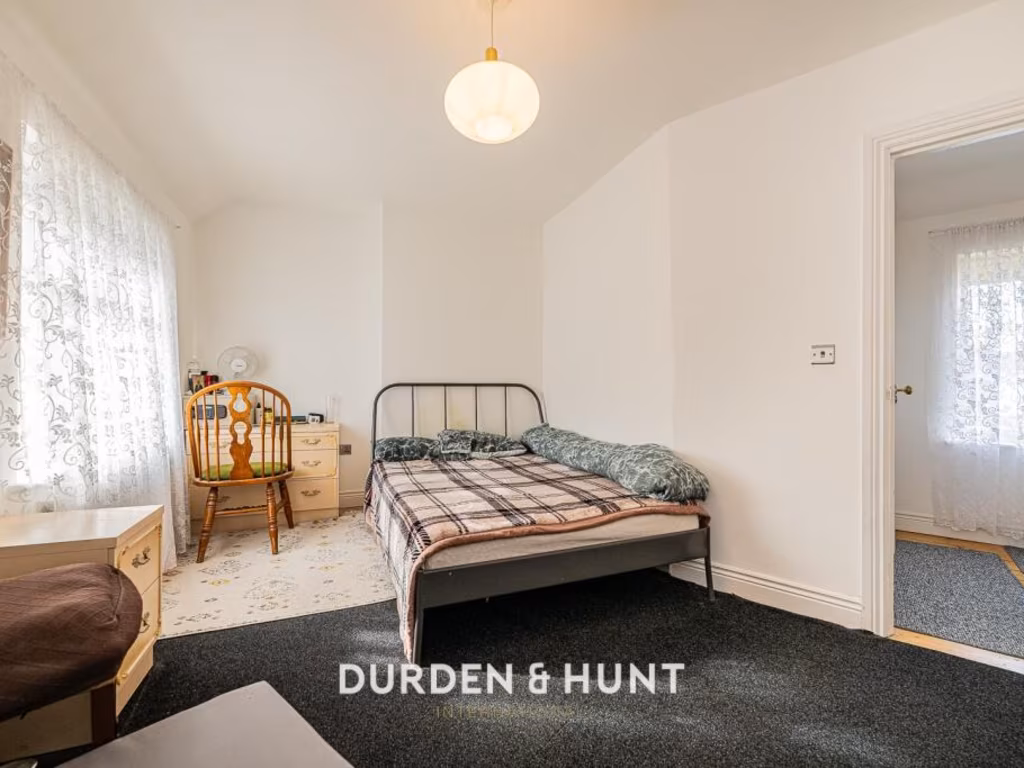
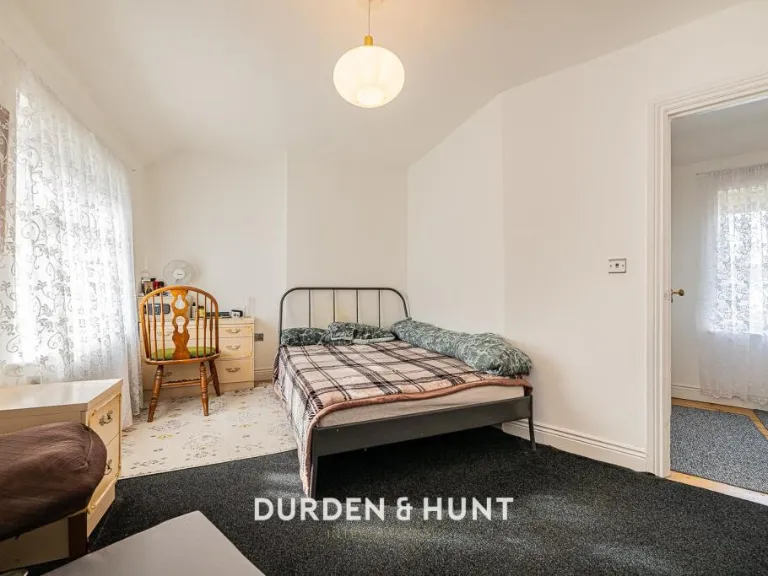
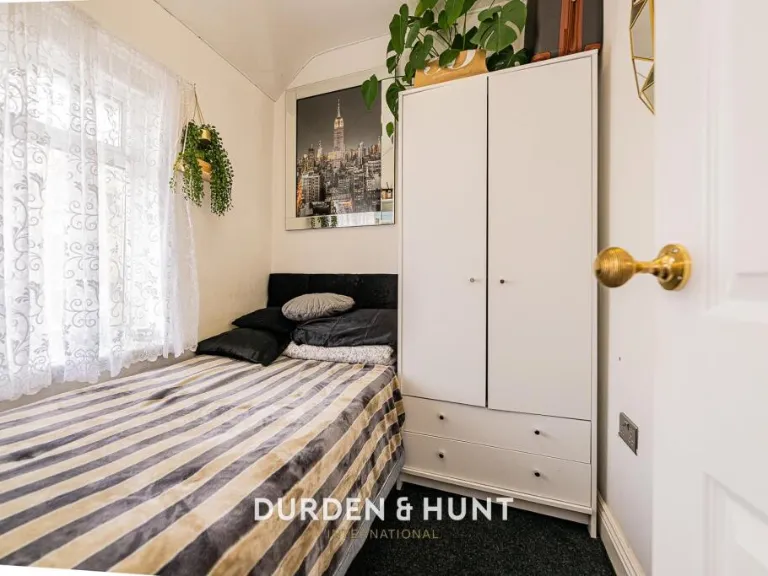
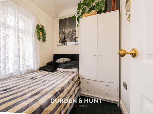
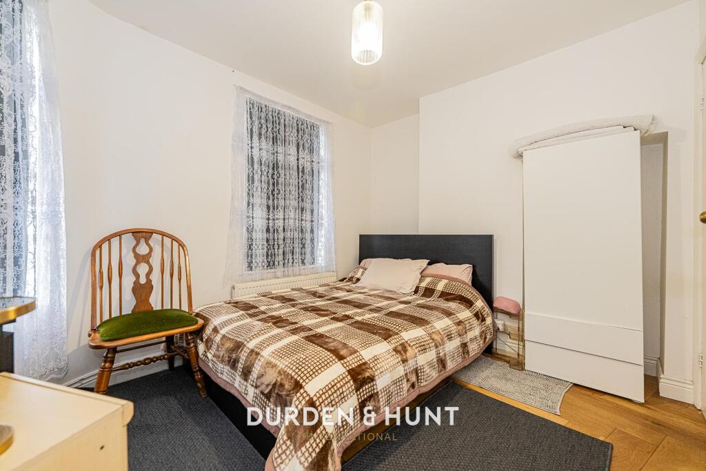
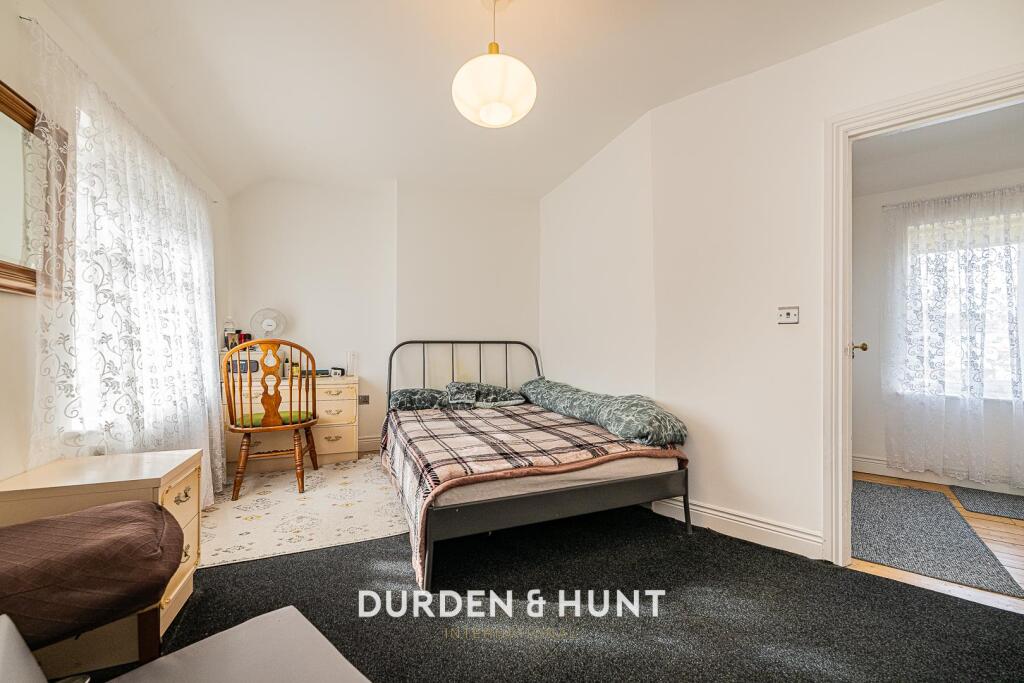
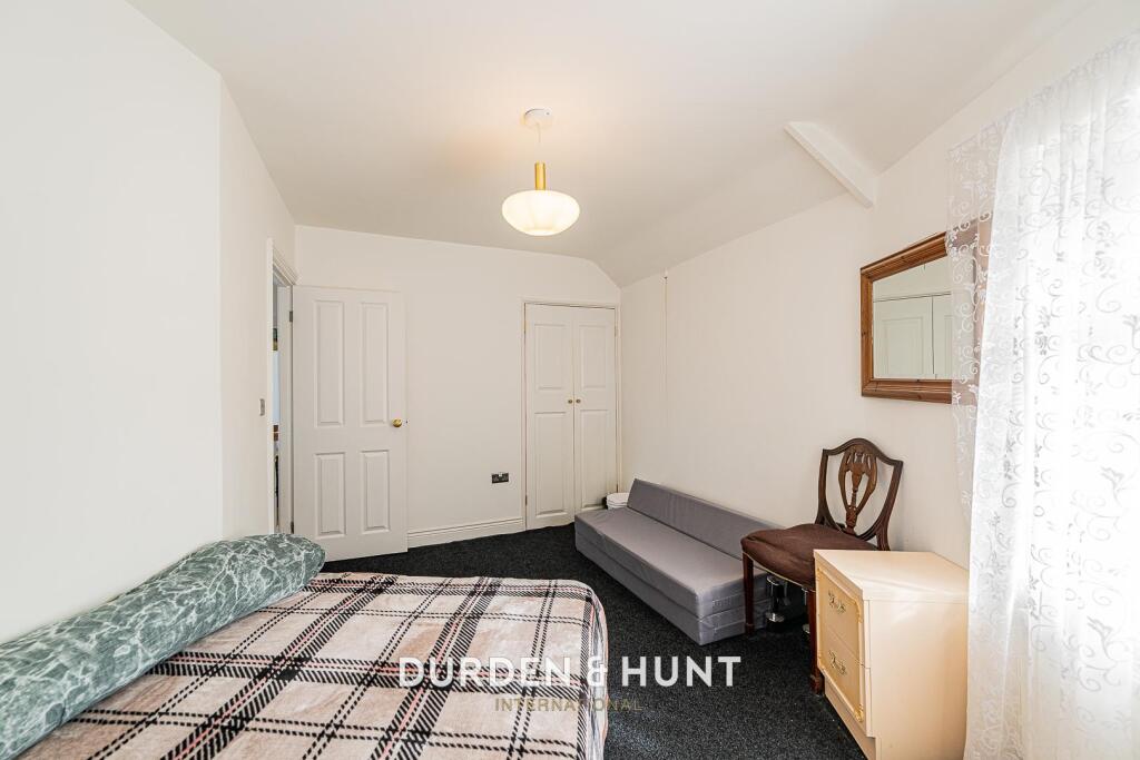
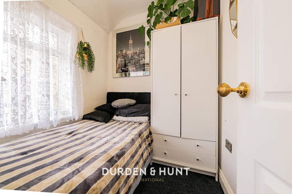
- Bedroom:
- Bedroom:
- Bedroom:
- Dining Room/ Kitchen:
- Living Room:
- Bedroom:
Textual Property Features
- Has Garden
- Chain Free
- Success
Detected Visual Features
- exterior
- semi-detached
- post-war
- pebbledash
- garage potential
- driveway
- fiber cement
- spacious
- contemporary
- open plan
- living room
- dining area
- wood flooring
- light fixtures
- standard ceiling
- built-in shelves
- natural light
EPC Details
- Fully double glazed
- Cavity wall, as built, no insulation (assumed)
- Boiler and underfloor heating, mains gas
- Low energy lighting in all fixed outlets
- Suspended, no insulation (assumed)
Nearby Schools
- The Leys Primary School
- Thomas Arnold Primary School, Rowdowns Road
- Village Infants' School
- Hunters Hall Primary School
- Southwood Primary School
- Five Elms Primary School
- William Bellamy Primary School
- Marsh Green Primary School
- The Sydney Russell School
- Roding Primary School
- St Joseph's Catholic Primary School
- Goresbrook School
- Godwin Primary School
- William Ford CofE Junior School
- John Perry Primary School
- Brook Sixth Form and Academy
- Richard Alibon Primary School with ARP for Cognitive and Learning Difficulties : SEN Base
- Eastbrook School
- Grafton Primary School
- Robert Clack School
- St Peter's Catholic Primary School
- Dagenham Park CofE School
- Parsloes Primary School
- Valence Primary School
- All Saints Catholic School and Technology College
Nearest Bars And Restaurants
- Id: 122597479
- Tags:
- Addr:
- Housenumber: 280
- Street: Heathway
- Amenity: fast_food
- Building: yes
- Cuisine: chinese
- Name: Ho-Ho
- TagsNormalized:
- Lat: 51.5426105
- Lon: 0.1481224
- FullGeoHash: u10j5r5c7wbp
- PartitionGeoHash: u10j
- Images:
- FoodStandards: null
- Distance: 627.3
,- Id: 122596595
- Tags:
- Addr:
- Housenumber: 301
- Street: Heathway
- Amenity: fast_food
- Brand: Red Rooster
- Brand:wikidata: Q376466
- Brand:wikipedia: en:Red Rooster
- Building: yes
- Cuisine: chicken
- Name: Red Rooster
- Takeaway: yes
- TagsNormalized:
- fast food
- food
- chicken
- takeaway
- Lat: 51.5427352
- Lon: 0.1476361
- FullGeoHash: u10j5r5d0njr
- PartitionGeoHash: u10j
- Images:
- FoodStandards: null
- Distance: 619.3
,- Id: 122597482
- Tags:
- Addr:
- Housenumber: 6
- Street: Reede Road
- Alt_name: Mo's Seafood & Chowder
- Amenity: restaurant
- Branch: Fish Bar
- Brand: Mo's
- Brand:wikidata: Q17022303
- Brand:wikipedia: en:Mo's Restaurants
- Building: yes
- Cuisine: seafood
- Name: Mo's
- TagsNormalized:
- Lat: 51.5427924
- Lon: 0.1483484
- FullGeoHash: u10j5rh48bbs
- PartitionGeoHash: u10j
- Images:
- FoodStandards: null
- Distance: 605.2
,- Id: 122596582
- Tags:
- Addr:
- Housenumber: 7
- Street: Parsloes Avenue
- Amenity: restaurant
- Building: yes
- Cuisine: indian
- Name: Royal Bengal
- TagsNormalized:
- Lat: 51.5430332
- Lon: 0.1473552
- FullGeoHash: u10j5r57ctu1
- PartitionGeoHash: u10j
- Images:
- FoodStandards: null
- Distance: 591.2
,- Id: 122596592
- Tags:
- Addr:
- Housenumber: 5
- Street: Parsloes Avenue
- Amenity: fast_food
- Building: yes
- Cuisine: chicken
- Name: Dixie Chicken
- TagsNormalized:
- Lat: 51.543023
- Lon: 0.1474387
- FullGeoHash: u10j5r57gefk
- PartitionGeoHash: u10j
- Images:
- FoodStandards: null
- Distance: 591
}
Nearest General Shops
- Id: 122599111
- Tags:
- Addr:
- Housenumber: 298
- Street: Heathway
- Building: yes
- Shop: yes
- TagsNormalized:
- Lat: 51.5433228
- Lon: 0.1482289
- FullGeoHash: u10j5r5vtgz2
- PartitionGeoHash: u10j
- Images:
- FoodStandards: null
- Distance: 547.8
,- Id: 122876948
- Tags:
- Addr:
- Housenumber: 254-256
- Street: Oxlow Lane
- Building: yes
- Shop: vacant
- TagsNormalized:
- Lat: 51.5508902
- Lon: 0.1552745
- FullGeoHash: u10j7891dnmn
- PartitionGeoHash: u10j
- Images:
- FoodStandards: null
- Distance: 504.4
,- Id: 122885334
- Tags:
- Addr:
- Building: yes
- Name: B Wallis & Son
- Shop: funeral_directors
- TagsNormalized:
- funeral
- funeral directors
- shop
- Lat: 51.5514989
- Lon: 0.1538148
- FullGeoHash: u10j788j0put
- PartitionGeoHash: u10j
- Images:
- FoodStandards: null
- Distance: 477.3
}
Nearest Grocery shops
- Id: 7952748156
- Tags:
- Brand: Iceland
- Brand:wikidata: Q721810
- Brand:wikipedia: en:Iceland (supermarket)
- Contact:
- Website: https://www.iceland.co.uk/store-finder/store?StoreID=668&StoreName=DAGENHAM
- Name: Iceland
- Shop: frozen_food
- TagsNormalized:
- iceland
- frozen food
- food
- shop
- Lat: 51.5421594
- Lon: 0.1487918
- FullGeoHash: u10j5quqg4gh
- PartitionGeoHash: u10j
- Images:
- FoodStandards: null
- Distance: 672.5
,- Id: 122596589
- Tags:
- Addr:
- Housenumber: 1
- Street: Parsloes Avenue
- Building: yes
- Name: Variety Fruit and Veg
- Shop: greengrocer
- TagsNormalized:
- Lat: 51.5429776
- Lon: 0.1475841
- FullGeoHash: u10j5r57wgqt
- PartitionGeoHash: u10j
- Images:
- FoodStandards: null
- Distance: 593.7
,- Id: 122885827
- Tags:
- Addr:
- City: Dagenham
- Housenumber: 201
- Postcode: RM10 7YA
- Street: Oxlow Lane
- Brand: Tesco Express
- Brand:wikidata: Q98456772
- Brand:wikipedia: en:Tesco
- Building: yes
- Contact:
- Website: https://www.tesco.com/store-locator/dagenham/201-oxlow-ln
- Fhrs:
- Id: 595255
- Local_authority_id: 61932
- Name: Tesco Express
- Shop: convenience
- TagsNormalized:
- tesco
- tesco express
- convenience
- shop
- Lat: 51.551598
- Lon: 0.1527117
- FullGeoHash: u10j72xjy6qh
- PartitionGeoHash: u10j
- Images:
- FoodStandards:
- Id: 595255
- FHRSID: 595255
- LocalAuthorityBusinessID: 61932
- BusinessName: Tesco
- BusinessType: Retailers - supermarkets/hypermarkets
- BusinessTypeID: 7840
- AddressLine1: null
- AddressLine2: 201 Oxlow Lane
- AddressLine3: null
- AddressLine4: Dagenham
- PostCode: RM10 7YA
- RatingValue: 4
- RatingKey: fhrs_4_en-GB
- RatingDate: 2020-09-18
- LocalAuthorityCode: 501
- LocalAuthorityName: Barking and Dagenham
- LocalAuthorityWebSite: http://www.lbbd.gov.uk/Pages/Home.aspx
- LocalAuthorityEmailAddress: foodsafety@lbbd.gov.uk
- Scores:
- Hygiene: 5
- Structural: 5
- ConfidenceInManagement: 10
- NewRatingPending: false
- Geocode:
- Longitude: 0.15363700000000
- Latitude: 51.55159000000000
- Distance: 442
}
Nearest Religious buildings
- Id: 124124042
- Tags:
- Amenity: place_of_worship
- Building: yes
- Denomination: evangelical
- Name: Dagenham Congregational Evangelical Church
- Religion: christian
- TagsNormalized:
- place of worship
- evangelical
- church
- congregational
- christian
- Lat: 51.5493871
- Lon: 0.1450993
- FullGeoHash: u10j7238vn1z
- PartitionGeoHash: u10j
- Images:
- FoodStandards: null
- Distance: 326.1
,- Id: 124124041
- Tags:
- Amenity: community_hall
- Building: yes
- Name: St George's Church Hall
- TagsNormalized:
- community hall
- church
- church hall
- Lat: 51.5458956
- Lon: 0.1518004
- FullGeoHash: u10j5rws95qs
- PartitionGeoHash: u10j
- Images:
- FoodStandards: null
- Distance: 304.5
,- Id: 124124043
- Tags:
- Amenity: place_of_worship
- Building: church
- Denomination: anglican
- Name: St George's, Becontree
- Religion: christian
- Wikidata: Q105083445
- TagsNormalized:
- place of worship
- church
- anglican
- christian
- Lat: 51.5460429
- Lon: 0.1519428
- FullGeoHash: u10j5rwtkwbf
- PartitionGeoHash: u10j
- Images:
- FoodStandards: null
- Distance: 296.6
}
Nearest Medical buildings
- Id: 8972234720
- Tags:
- Amenity: pharmacy
- Brand: Lloyds Pharmacy
- Brand:wikidata: Q6662870
- Brand:wikipedia: en:LloydsPharmacy
- Dispensing: yes
- Healthcare: pharmacy
- Name: Lloyds Pharmacy
- TagsNormalized:
- pharmacy
- lloyds pharmacy
- health
- healthcare
- Lat: 51.5544037
- Lon: 0.1421718
- FullGeoHash: u10j71pw0v6v
- PartitionGeoHash: u10j
- Images:
- FoodStandards: null
- Distance: 852.6
,- Id: 969561760
- Tags:
- Amenity: doctors
- Building: yes
- Healthcare: doctor
- Name: Five Elms Health Centre
- TagsNormalized:
- doctor
- doctors
- health
- healthcare
- health centre
- Lat: 51.5536691
- Lon: 0.14278
- FullGeoHash: u10j71pczh2q
- PartitionGeoHash: u10j
- Images:
- FoodStandards: null
- Distance: 761.9
,- Id: 122593823
- Tags:
- Addr:
- Housenumber: 279
- Street: Heathway
- Amenity: pharmacy
- Building: yes
- Dispensing: yes
- Healthcare: pharmacy
- Name: Waller Pharmacy
- TagsNormalized:
- Lat: 51.5421573
- Lon: 0.1476298
- FullGeoHash: u10j5qgwb48b
- PartitionGeoHash: u10j
- Images:
- FoodStandards: null
- Distance: 682.5
,- Id: 122597478
- Tags:
- Addr:
- Housenumber: 282
- Street: Heathway
- Amenity: pharmacy
- Building: yes
- Dispensing: yes
- Healthcare: pharmacy
- Name: Talati Pharmacy
- TagsNormalized:
- Lat: 51.5426612
- Lon: 0.1481279
- FullGeoHash: u10j5r5cg8kn
- PartitionGeoHash: u10j
- Images:
- FoodStandards: null
- Distance: 621.6
}
Nearest Airports
- Id: 121158889
- Tags:
- Aerodrome: continental
- Aeroway: aerodrome
- Fhrs:
- Authority: City of London Corporation
- Iata: LCY
- Icao: EGLC
- Name: London City Airport
- Operator: London City Airport Limited
- Ref: LCY
- Website: https://www.londoncityairport.com/
- Wikidata: Q8982
- Wikipedia: en:London City Airport
- TagsNormalized:
- airport
- continental airport
- Lat: 51.5042658
- Lon: 0.0539987
- FullGeoHash: u10j10p64702
- PartitionGeoHash: u10j
- Images:
- FoodStandards: null
- Distance: 8211.3
,- Id: 103894219
- Tags:
- Aerodrome: international
- Aeroway: aerodrome
- Iata: SEN
- Icao: EGMC
- Name: London Southend Airport
- Old_name: Southend Municipal Airport
- Ref: SEN
- Wikidata: Q1415441
- TagsNormalized:
- airport
- international airport
- Lat: 51.5701749
- Lon: 0.6924624
- FullGeoHash: u10mru04p937
- PartitionGeoHash: u10m
- Images:
- FoodStandards: null
- Distance: 37621.1
}
Nearest Leisure Facilities
- Id: 119005922
- Tags:
- TagsNormalized:
- Lat: 51.5410504
- Lon: 0.1516325
- FullGeoHash: u10j5qy2mk1m
- PartitionGeoHash: u10j
- Images:
- FoodStandards: null
- Distance: 809.2
,- Id: 122597778
- Tags:
- Addr:
- Housenumber: 248
- Street: Heathway
- Building: yes
- Layer: 1
- Leisure: adult_gaming_centre
- Name: Adult Gaming Cenrew
- TagsNormalized:
- adult
- adult gaming centre
- gaming
- leisure
- Lat: 51.5416427
- Lon: 0.1481655
- FullGeoHash: u10j5qggud84
- PartitionGeoHash: u10j
- Images:
- FoodStandards: null
- Distance: 733.6
,- Id: 23143068
- Tags:
- Leisure: stadium
- Name: Victoria Road
- Operator: Dagenham & Redbridge
- Source: Bing;survey
- Sport: soccer
- Wikidata: Q1121922
- Wikipedia: en:Victoria Road, Dagenham
- TagsNormalized:
- stadium
- leisure
- soccer
- sports
- Lat: 51.5476644
- Lon: 0.1598952
- FullGeoHash: u10j5xuqvv4e
- PartitionGeoHash: u10j
- Images:
- FoodStandards: null
- Distance: 727.6
,- Id: 314137290
- Tags:
- Leisure: pitch
- Lit: yes
- Name: Dagenham & Redbridge Football Club
- Sport: soccer
- Surface: grass
- TagsNormalized:
- pitch
- leisure
- football
- club
- soccer
- sports
- Lat: 51.5477889
- Lon: 0.1599006
- FullGeoHash: u10j5xurtuqd
- PartitionGeoHash: u10j
- Images:
- FoodStandards: null
- Distance: 727
,- Id: 23143066
- Tags:
- Leisure: park
- Source: yahoo
- TagsNormalized:
- Lat: 51.5459255
- Lon: 0.1586576
- FullGeoHash: u10j5xesbbzw
- PartitionGeoHash: u10j
- Images:
- FoodStandards: null
- Distance: 687.6
}
Nearest Tourist attractions
- Id: 865382603
- Tags:
- Building: yes
- Name: Ford Heritage Centre
- Tourism: museum
- TagsNormalized:
- Lat: 51.5209131
- Lon: 0.1508832
- FullGeoHash: u10j57jg5f69
- PartitionGeoHash: u10j
- Images:
- FoodStandards: null
- Distance: 3035.3
,- Id: 371156655
- Tags:
- Addr:
- City: Dagenham
- Housename: Valence House Museum
- Postcode: RM8 3HT
- Street: Becontree Avenue
- Building: yes
- Email: valencehousemuseum@lbbd.gov.uk
- Museum: history
- Name: Valence House
- Opening_hours: Tu-Sa 10:00-16:00
- Operator: London Borough of Barking and Dagenham
- Operator:type: government
- Phone: +44 20 8227 2034
- Source: bing
- Tourism: museum
- Wikidata: Q7910630
- Wikipedia: en:Valence House Museum
- TagsNormalized:
- Lat: 51.5582384
- Lon: 0.1342924
- FullGeoHash: u10j71cu90px
- PartitionGeoHash: u10j
- Images:
- FoodStandards: null
- Distance: 1529.5
,- Id: 6239276386
- Tags:
- Name: Igor
- Tourism: apartment
- TagsNormalized:
- Lat: 51.5434984
- Lon: 0.1468202
- FullGeoHash: u10j5r4ytht0
- PartitionGeoHash: u10j
- Images:
- FoodStandards: null
- Distance: 552
}
Nearest Hotels
- Id: 1118341939
- Tags:
- Addr:
- City: Dagenham
- Housename: hotel
- Housenumber: 8
- Postcode: RM9 6UQ
- Street: Cook Road
- Description: um lugar grande
- Smoking: no
- Tourism: hotel
- TagsNormalized:
- Lat: 51.5322197
- Lon: 0.1338612
- FullGeoHash: u10j5j1kznn0
- PartitionGeoHash: u10j
- Images:
- FoodStandards: null
- Distance: 2076.4
,- Id: 676486619
- Tags:
- Addr:
- City: Dagenham
- Postcode: RM9 6YS
- Street: Chequers Lane
- Brand: Premier Inn
- Brand:wikidata: Q2108626
- Brand:wikipedia: en:Premier Inn
- Building: hotel
- Internet_access: wlan
- Internet_access:fee: customers
- Internet_access:operator: Virgin Media
- Internet_access:ssid: Premier Inn Free Wi-Fi
- Name: Premier Inn
- Source:
- Tourism: hotel
- TagsNormalized:
- Lat: 51.5311711
- Lon: 0.1489535
- FullGeoHash: u10j5kuqyfec
- PartitionGeoHash: u10j
- Images:
- FoodStandards: null
- Distance: 1893.2
,- Id: 860397933
- Tags:
- Addr:
- City: Dagenham
- Postcode: RM10 7FN
- Street: Yew Tree Avenue
- Alt_name: Travelodge London Dagenham East
- Branch: London Dagenham East
- Brand: Travelodge
- Brand:wikidata: Q9361374
- Brand:wikipedia: en:Travelodge UK
- Building: yes
- Internet_access: wlan
- Internet_access:fee: customers
- Internet_access:ssid: Travelodge WiFi
- Name: Travelodge
- Tourism: hotel
- Wheelchair: yes
- TagsNormalized:
- Lat: 51.5459415
- Lon: 0.1665858
- FullGeoHash: u10j5z9kcezq
- PartitionGeoHash: u10j
- Images:
- FoodStandards: null
- Distance: 1214
}
Tags
- exterior
- semi-detached
- post-war
- pebbledash
- garage potential
- driveway
- fiber cement
- spacious
- contemporary
- open plan
- living room
- dining area
- wood flooring
- light fixtures
- standard ceiling
- built-in shelves
- natural light
Local Market Stats
- Average Price/sqft: £425
- Avg Income: £42300
- Rental Yield: 6.5%
- Social Housing: 28%
- Planning Success Rate: 72%
AirBnB Data
- 1km average: £124/night
- Listings in 1km: 3
Similar Properties
 5 bedroom end of terrace house for sale in Second Avenue, Dagenham, RM10 — £550,000 • 5 bed • 2 bath • 1465 ft²
 4 bedroom terraced house for sale in Hunters Hall Road, Dagenham, RM10 — £550,000 • 4 bed • 2 bath • 978 ft²
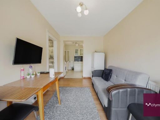 2 bedroom end of terrace house for sale in Easebourne Road, Dagenham, RM8 — £375,000 • 2 bed • 2 bath • 911 ft²
 2 bedroom terraced house for sale in Hunters Square, Dagenham, Essex, RM10 — £425,000 • 2 bed • 1 bath • 622 ft²
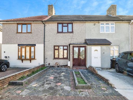 2 bedroom terraced house for sale in Haresfield Road, Dagenham, RM10 — £400,000 • 2 bed • 1 bath • 748 ft²
 3 bedroom end of terrace house for sale in Gay Gardens, Dagenham, RM10 — £475,000 • 3 bed • 1 bath • 773 ft²
Meta
- {
"@context": "https://schema.org",
"@type": "Residence",
"name": "4 bedroom terraced house for sale in Sterry Crescent, Dagen…",
"description": "",
"url": "https://propertypiper.co.uk/property/ee6ad935-2b84-4e46-9fcf-48b129150f91",
"image": "https://image-a.propertypiper.co.uk/76243bb0-26d4-4ee1-a662-e9982624e97a-1024.jpeg",
"address": {
"@type": "PostalAddress",
"streetAddress": "9 STERRY CRESCENT DAGENHAM",
"postalCode": "RM10 8QB",
"addressLocality": "Barking and Dagenham",
"addressRegion": "Barking",
"addressCountry": "England"
},
"geo": {
"@type": "GeoCoordinates",
"latitude": 51.5481947862968,
"longitude": 0.14940768230308618
},
"numberOfRooms": 4,
"numberOfBathroomsTotal": 2,
"floorSize": {
"@type": "QuantitativeValue",
"value": 1026,
"unitCode": "FTK"
},
"offers": {
"@type": "Offer",
"price": 525000,
"priceCurrency": "GBP",
"availability": "https://schema.org/InStock"
},
"additionalProperty": [
{
"@type": "PropertyValue",
"name": "Feature",
"value": "exterior"
},
{
"@type": "PropertyValue",
"name": "Feature",
"value": "semi-detached"
},
{
"@type": "PropertyValue",
"name": "Feature",
"value": "post-war"
},
{
"@type": "PropertyValue",
"name": "Feature",
"value": "pebbledash"
},
{
"@type": "PropertyValue",
"name": "Feature",
"value": "garage potential"
},
{
"@type": "PropertyValue",
"name": "Feature",
"value": "driveway"
},
{
"@type": "PropertyValue",
"name": "Feature",
"value": "fiber cement"
},
{
"@type": "PropertyValue",
"name": "Feature",
"value": "spacious"
},
{
"@type": "PropertyValue",
"name": "Feature",
"value": "contemporary"
},
{
"@type": "PropertyValue",
"name": "Feature",
"value": "open plan"
},
{
"@type": "PropertyValue",
"name": "Feature",
"value": "living room"
},
{
"@type": "PropertyValue",
"name": "Feature",
"value": "dining area"
},
{
"@type": "PropertyValue",
"name": "Feature",
"value": "wood flooring"
},
{
"@type": "PropertyValue",
"name": "Feature",
"value": "light fixtures"
},
{
"@type": "PropertyValue",
"name": "Feature",
"value": "standard ceiling"
},
{
"@type": "PropertyValue",
"name": "Feature",
"value": "built-in shelves"
},
{
"@type": "PropertyValue",
"name": "Feature",
"value": "natural light"
}
]
}
High Res Floorplan Images
Compatible Floorplan Images
FloorplanImages Thumbnail