SE23 3UL - 2 bedroom apartment for sale in Taymount Mansion, Forest Hi…
View on Property Piper
2 bedroom apartment for sale in Taymount Mansion, Forest Hill, London, SE23
Property Details
- Price: £600000
- Bedrooms: 2
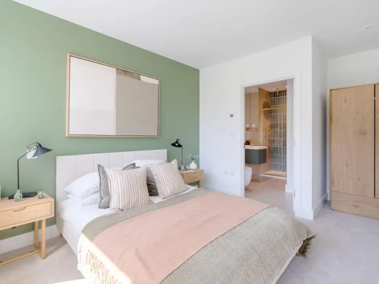
- Bathrooms: 2
- Property Type: undefined
- Property SubType: undefined
Brochure Descriptions
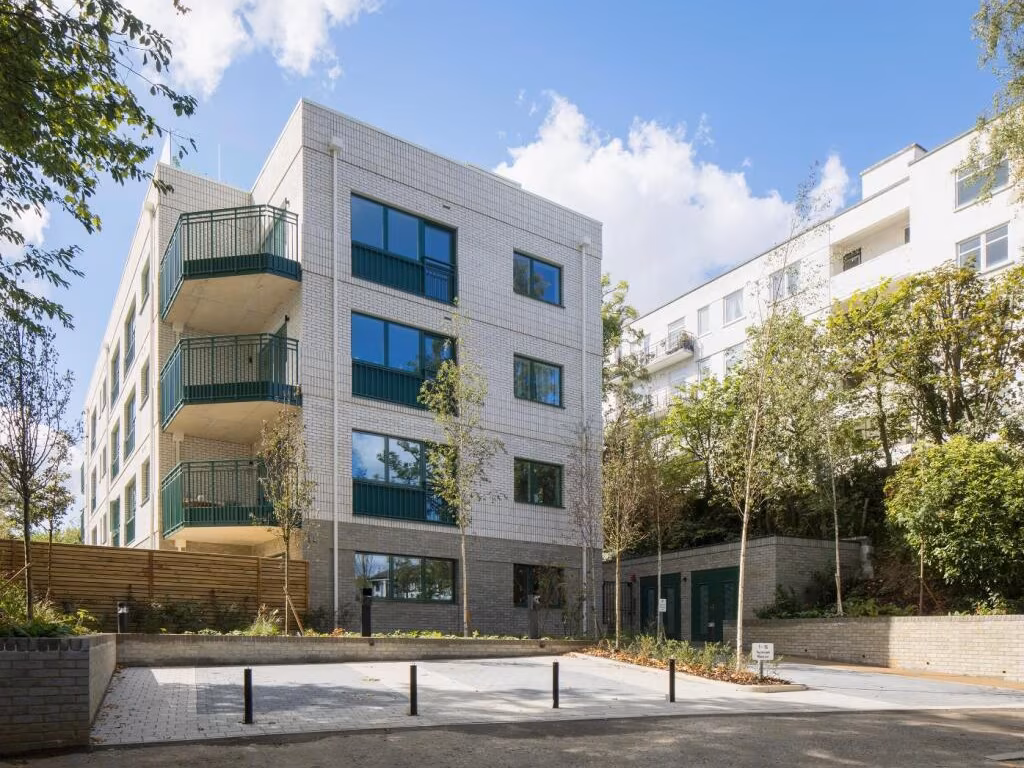
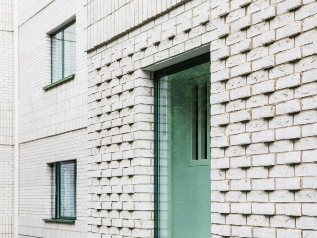
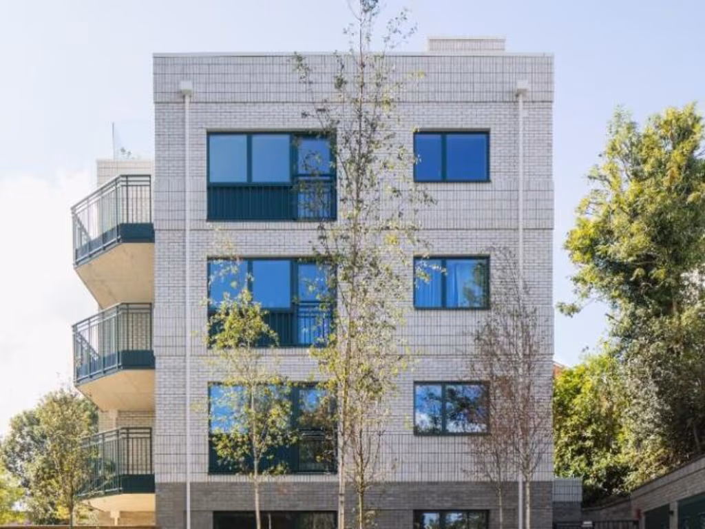
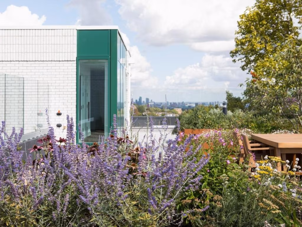
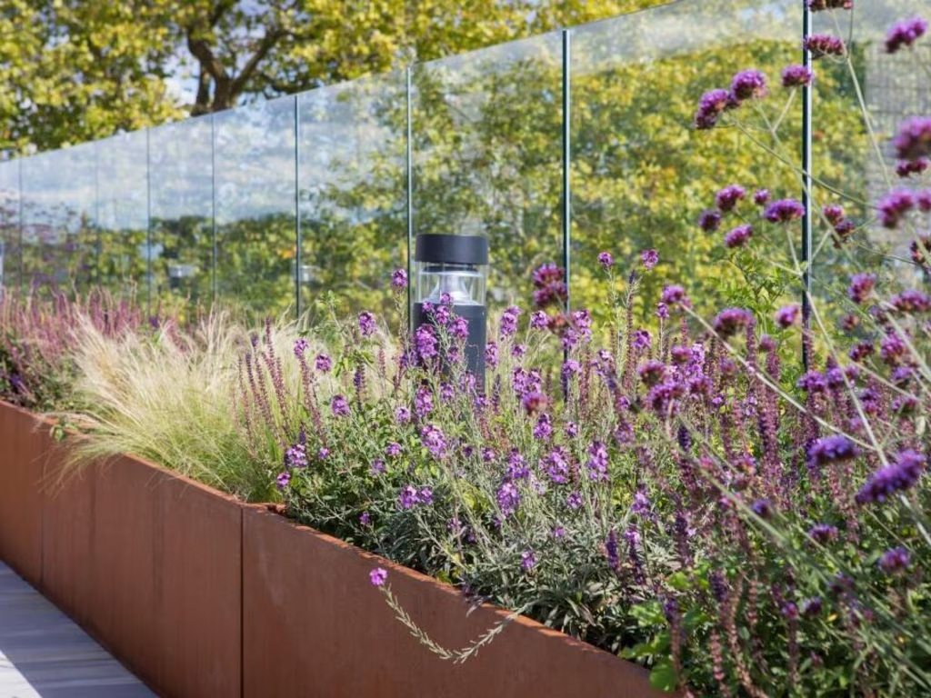
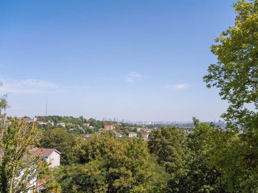
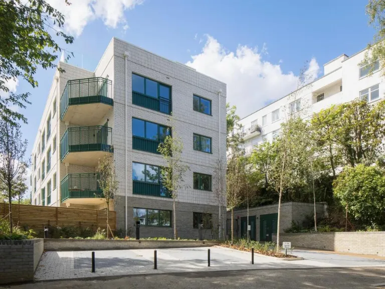
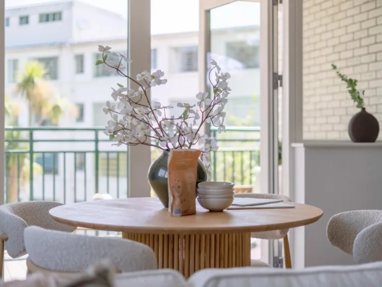
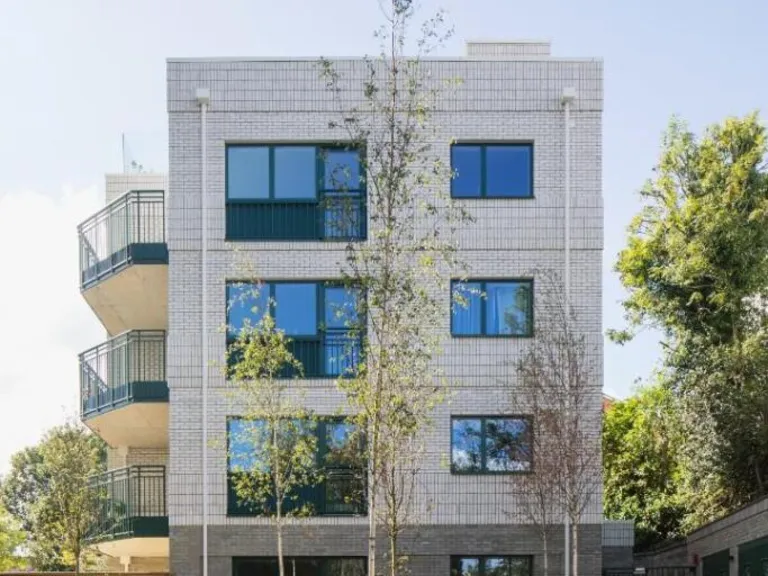
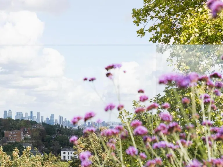
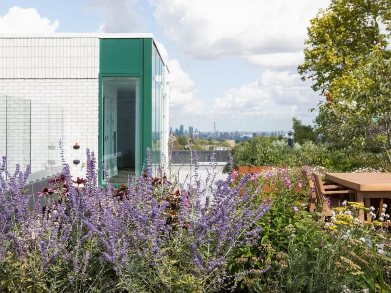
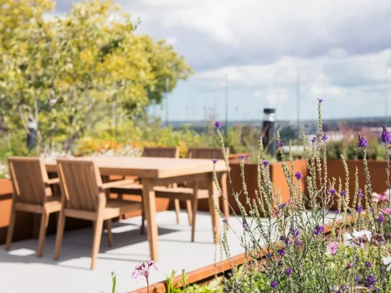
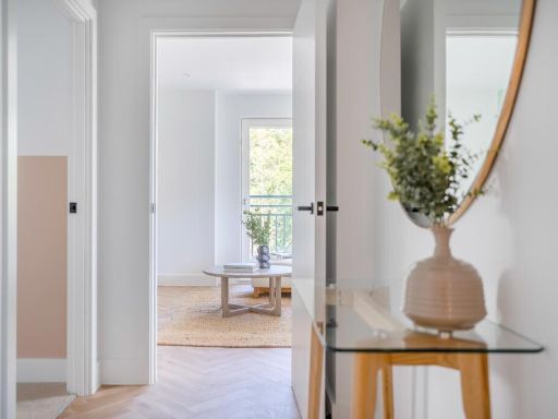
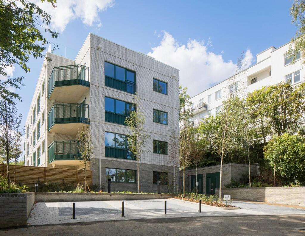
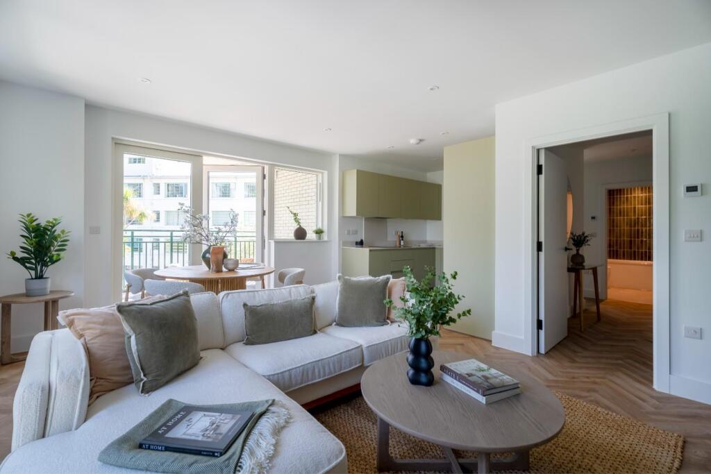
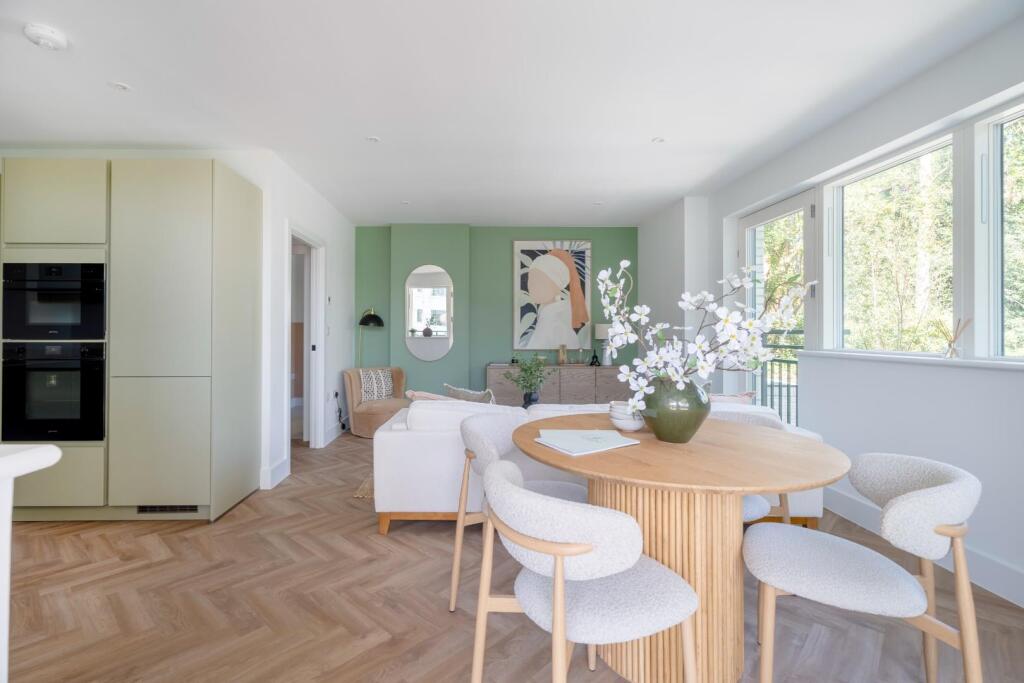
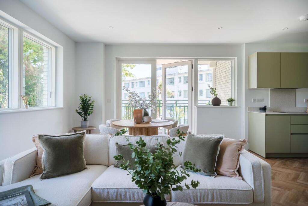
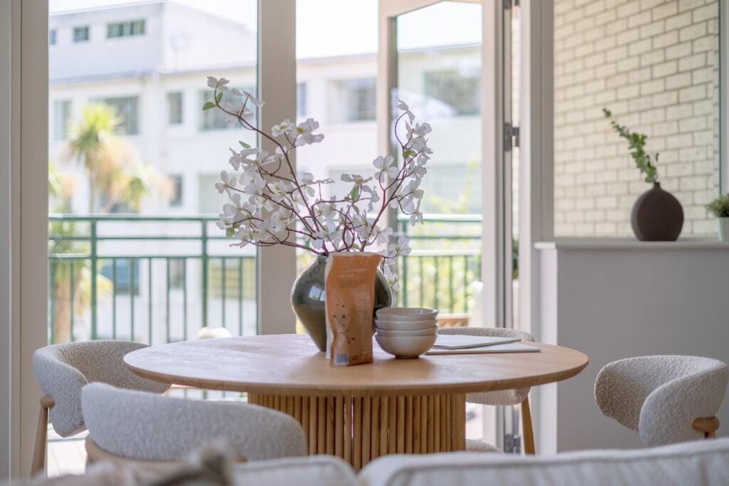
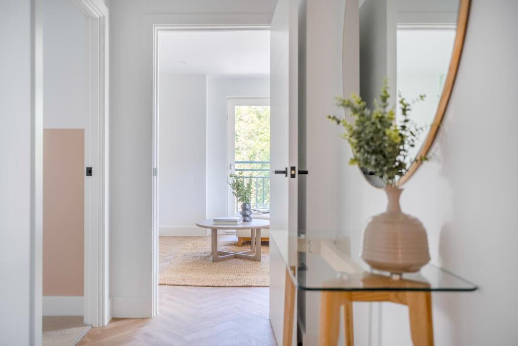
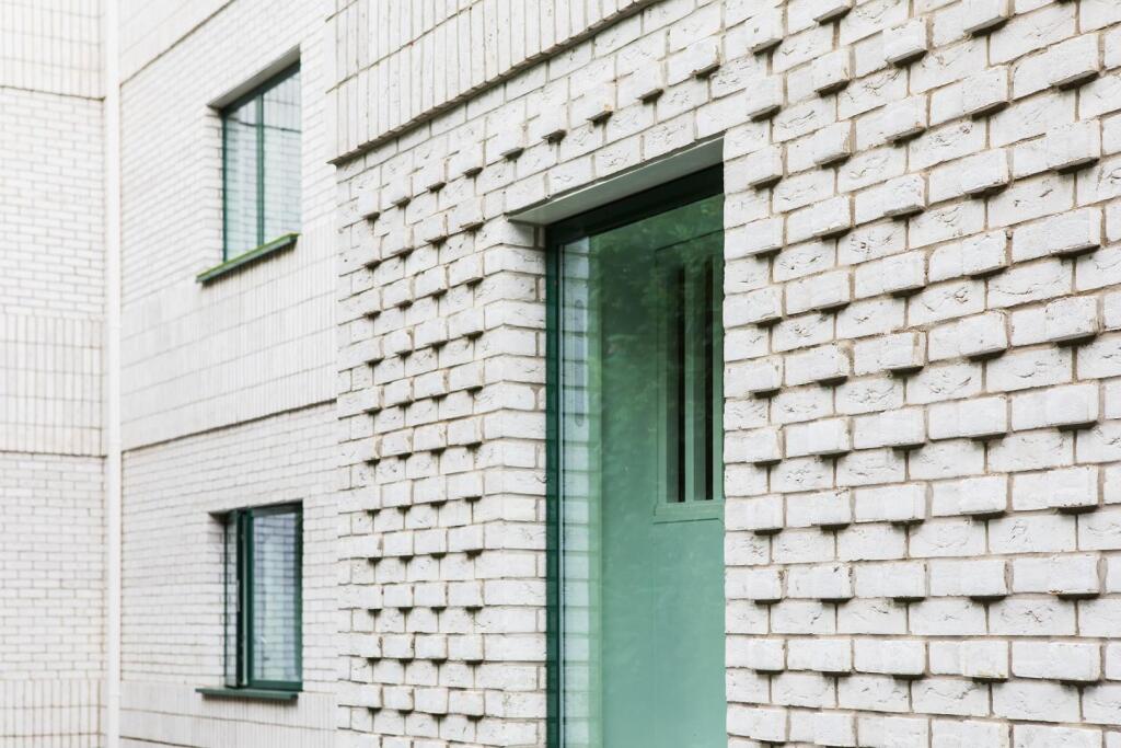
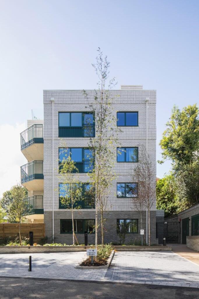
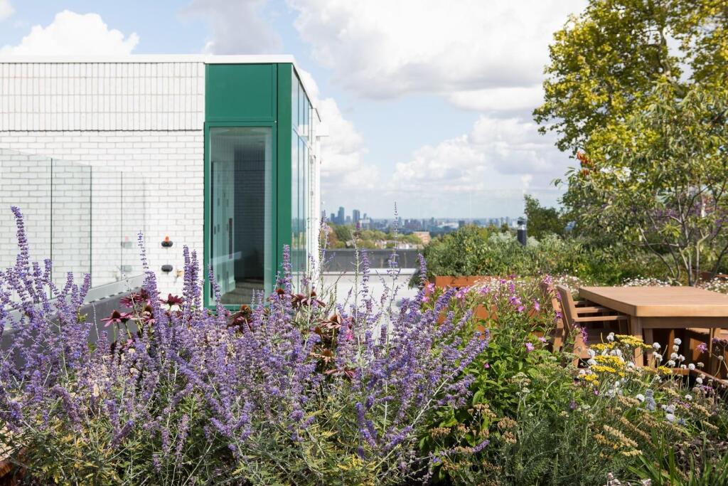
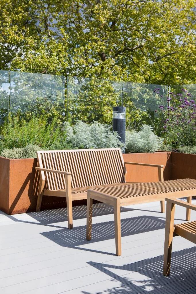
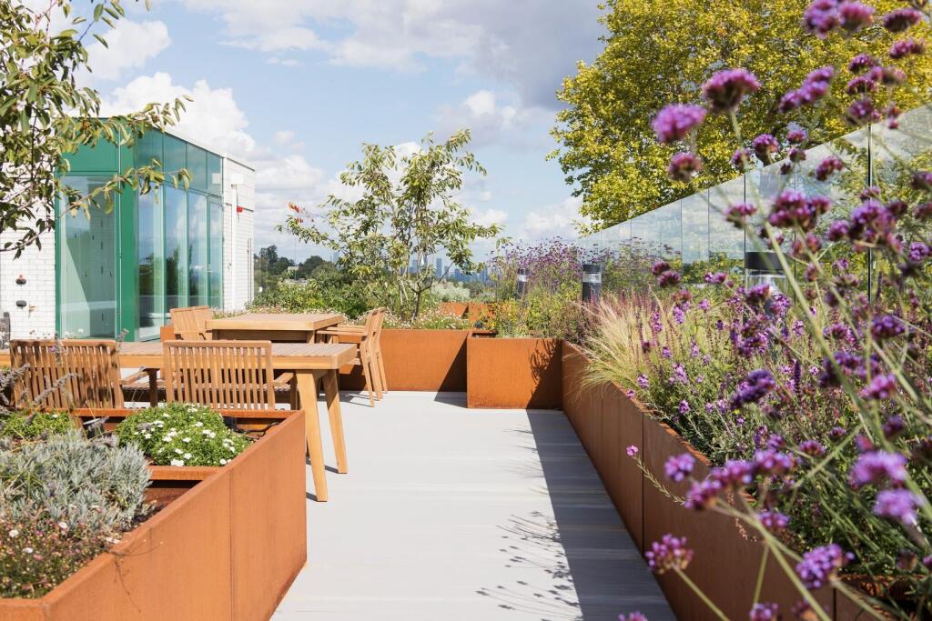
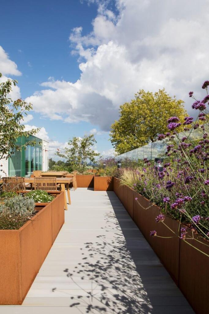
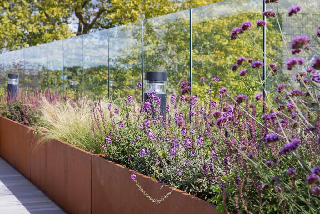
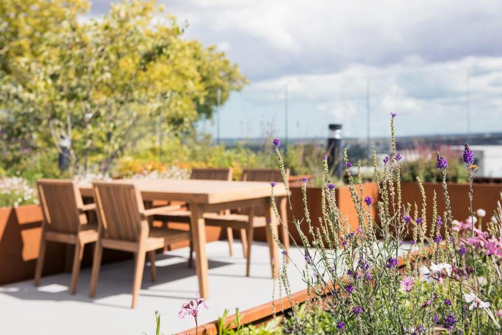
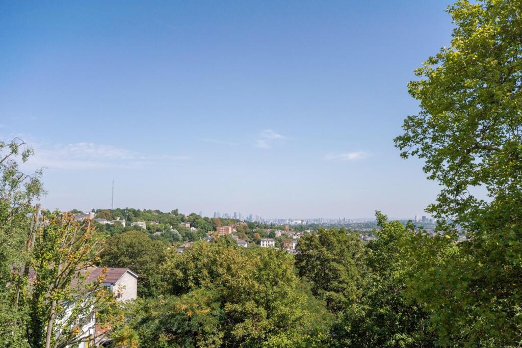
- Contemporary low-rise apartment block set into a sloping, treed site. The building is a modern 3–4 storey masonry structure with balconies to some flats and large double-glazed windows providing good natural light. Grounds are compact to medium in scale with paved parking/forecourt and planted beds, and mature vegetation/woodland immediately to the rear offering a private, green outlook. Overall the property presents as a newly constructed or recently refurbished residential block suitable for flats; external communal areas and limited on-plot parking are provided. Site topography is sloping which may afford elevated views from upper floors but limits large private gardens — external amenity space is therefore small-to-average.
Image Descriptions
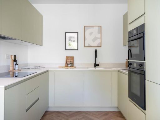
- apartment building Contemporary
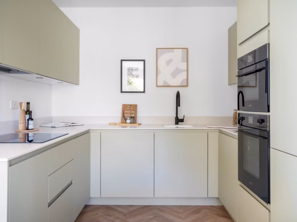
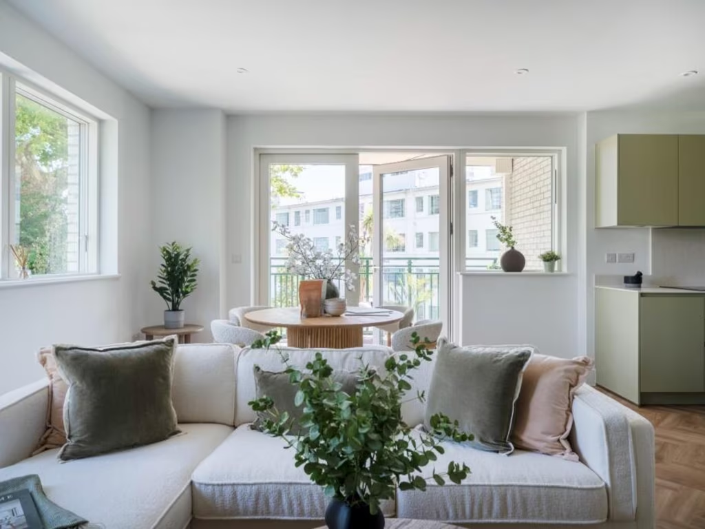
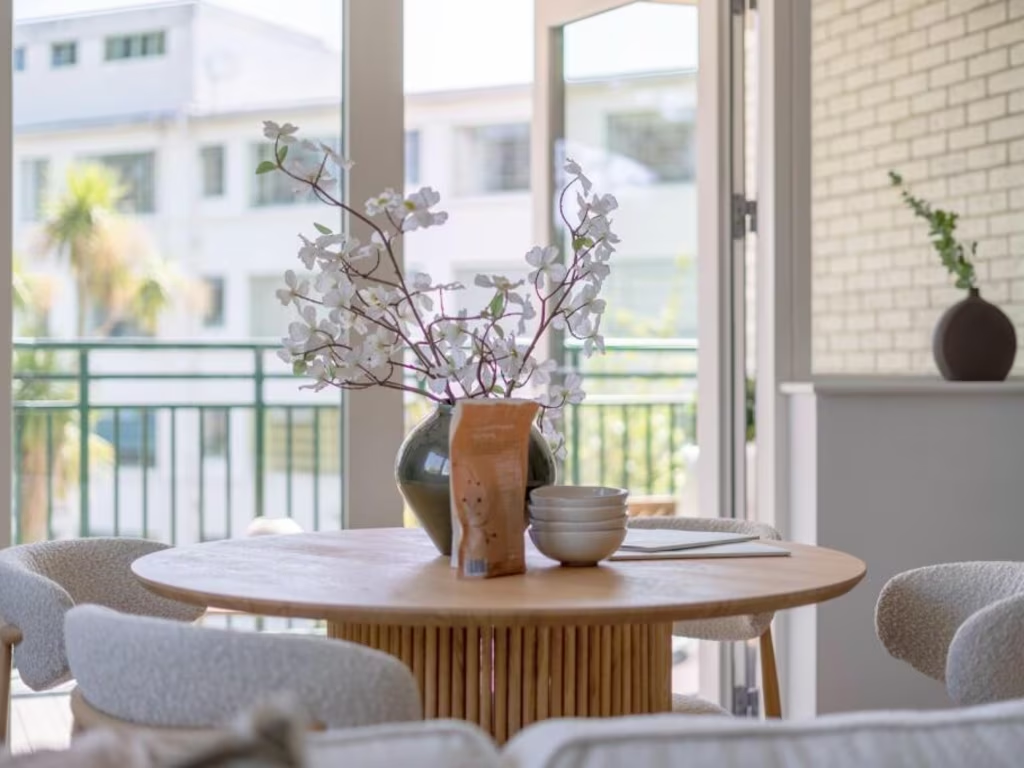
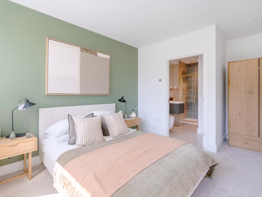
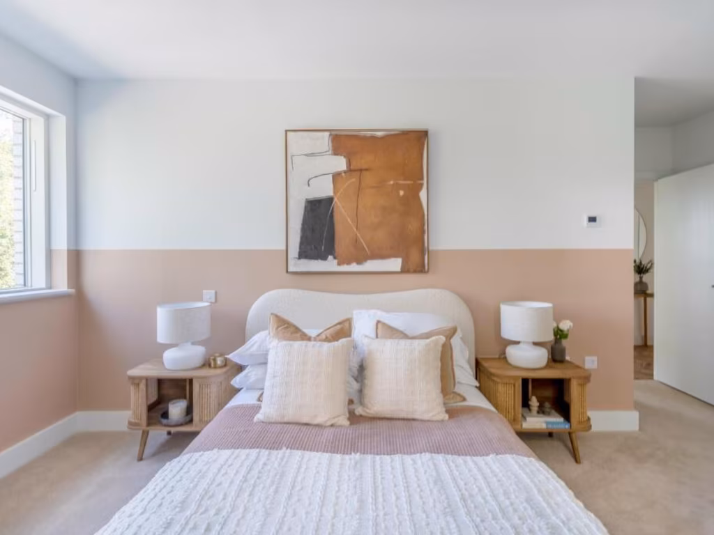
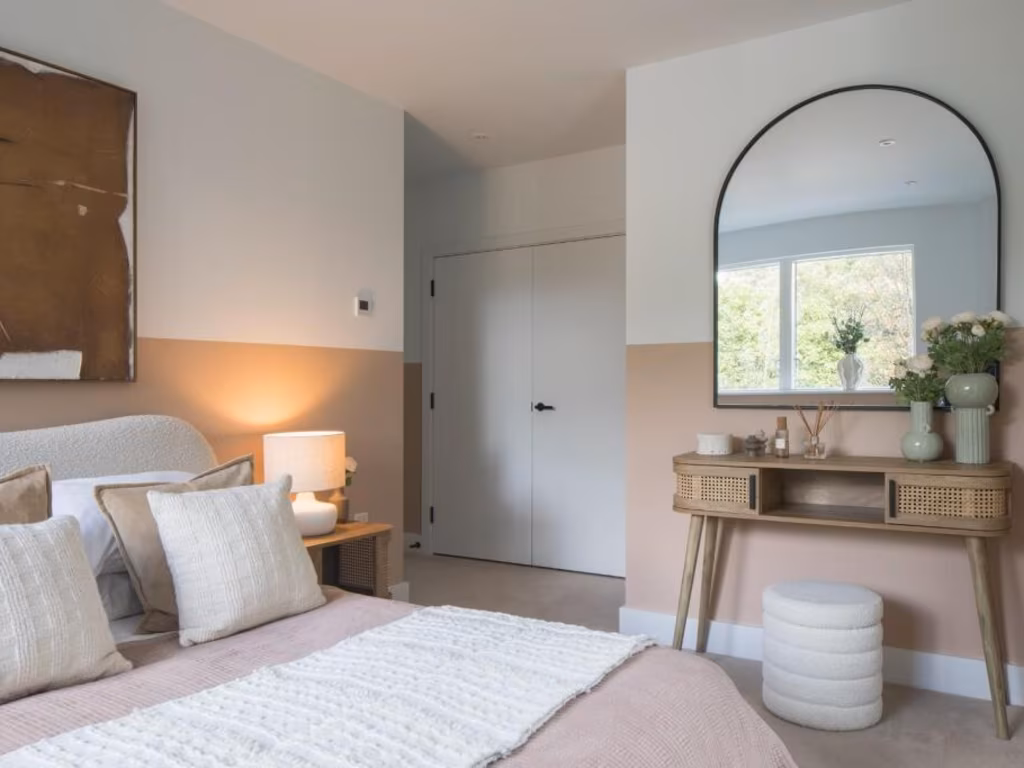
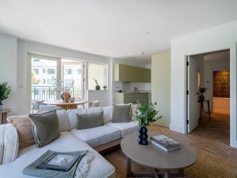
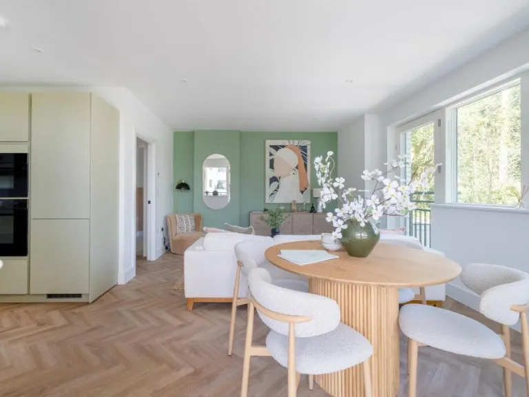
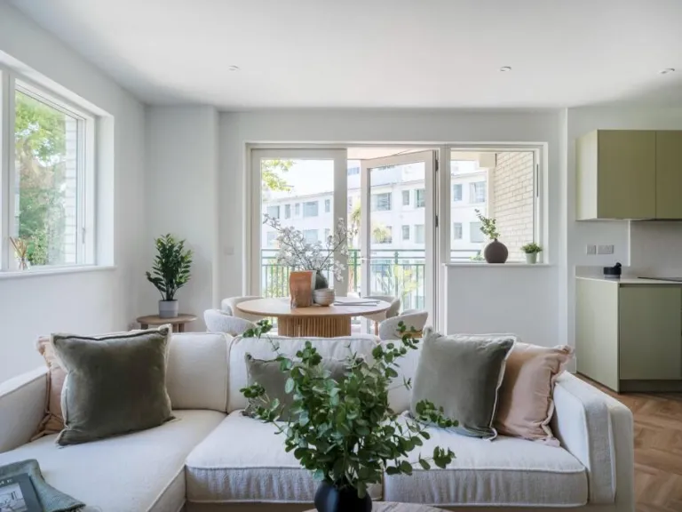
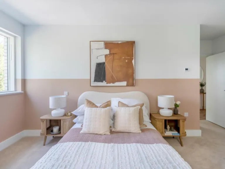
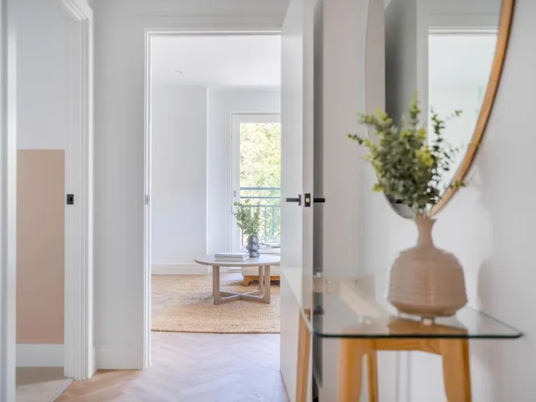
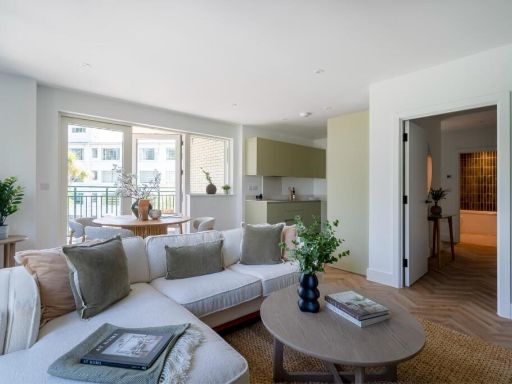
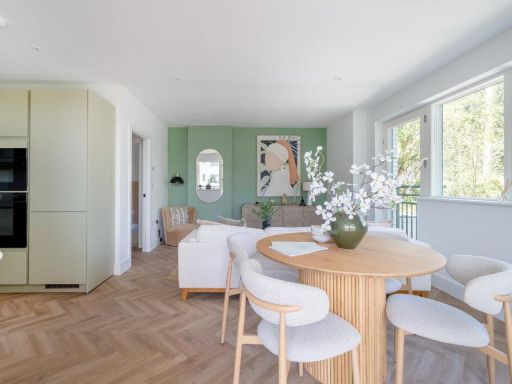
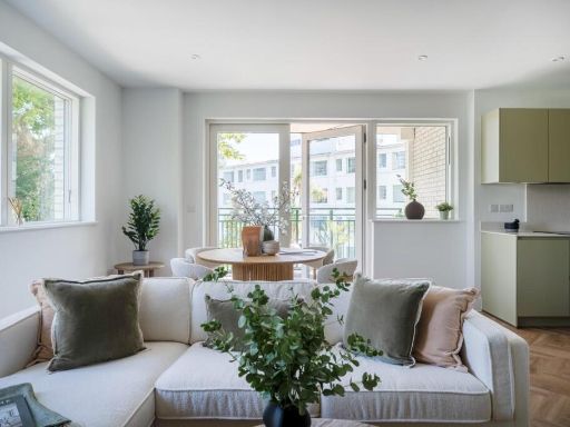
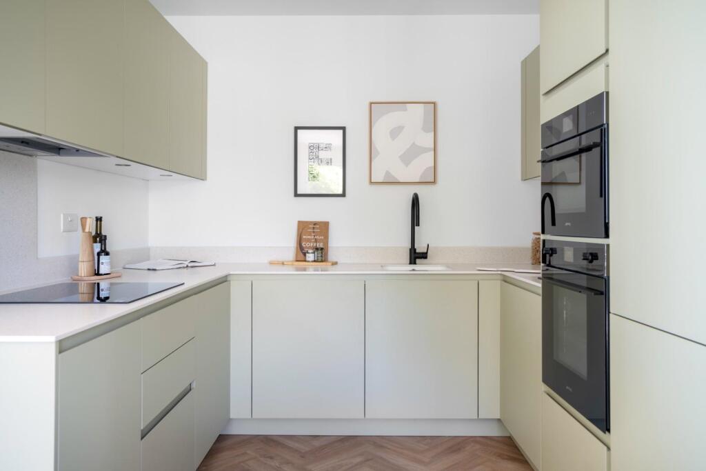
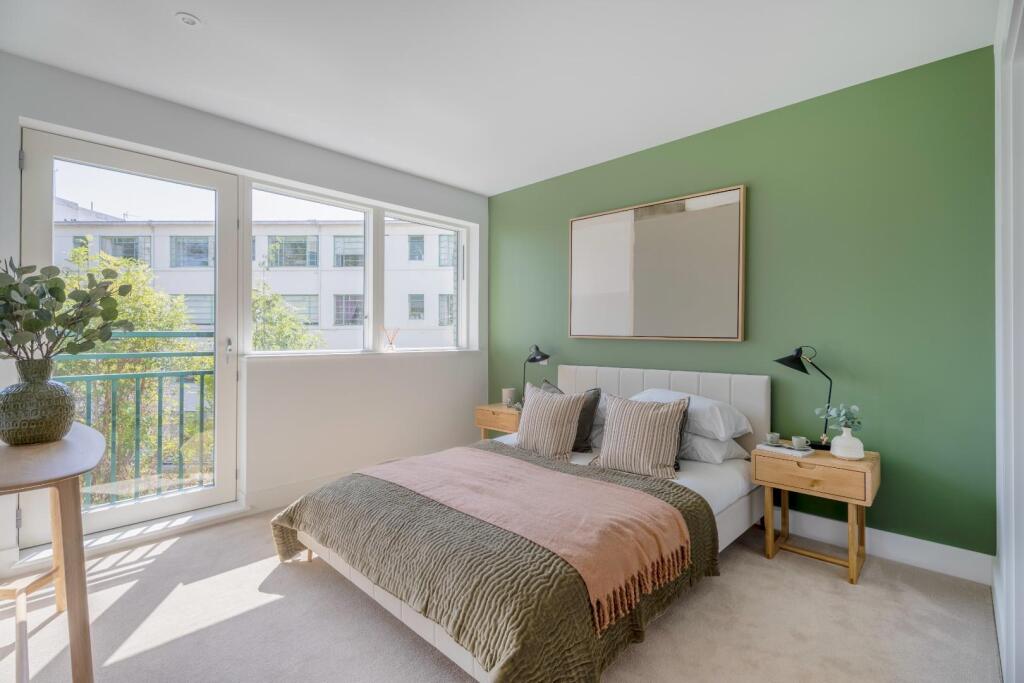
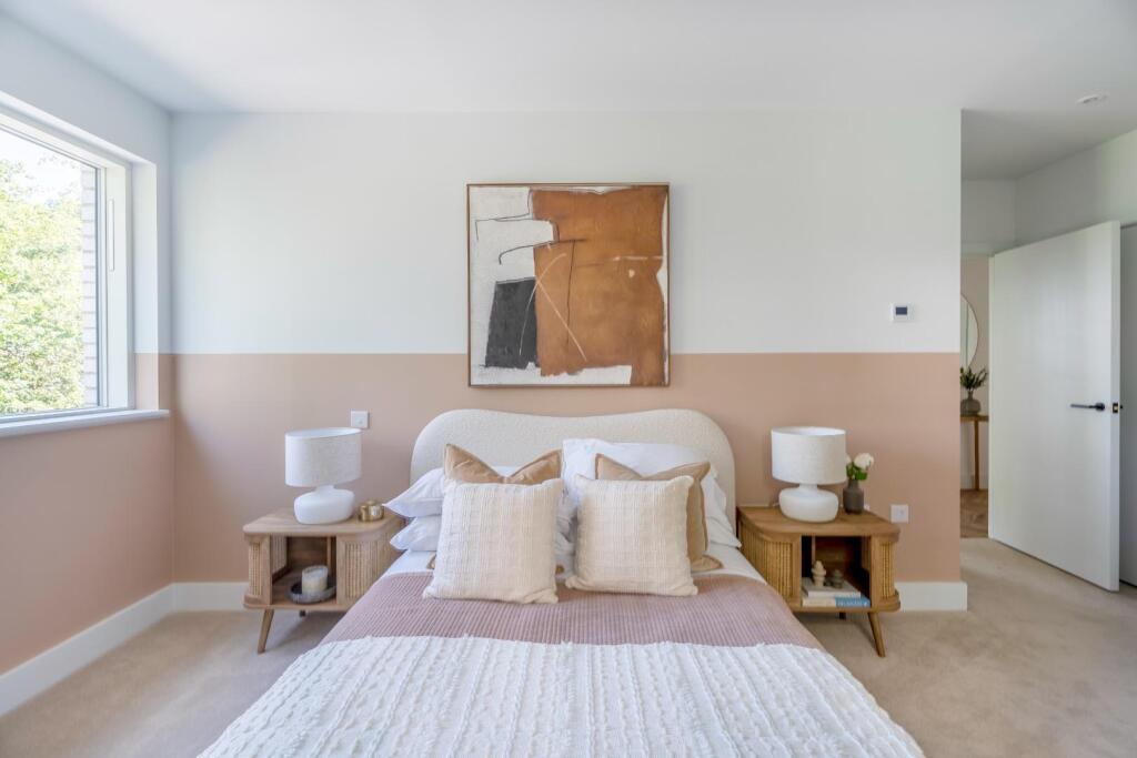
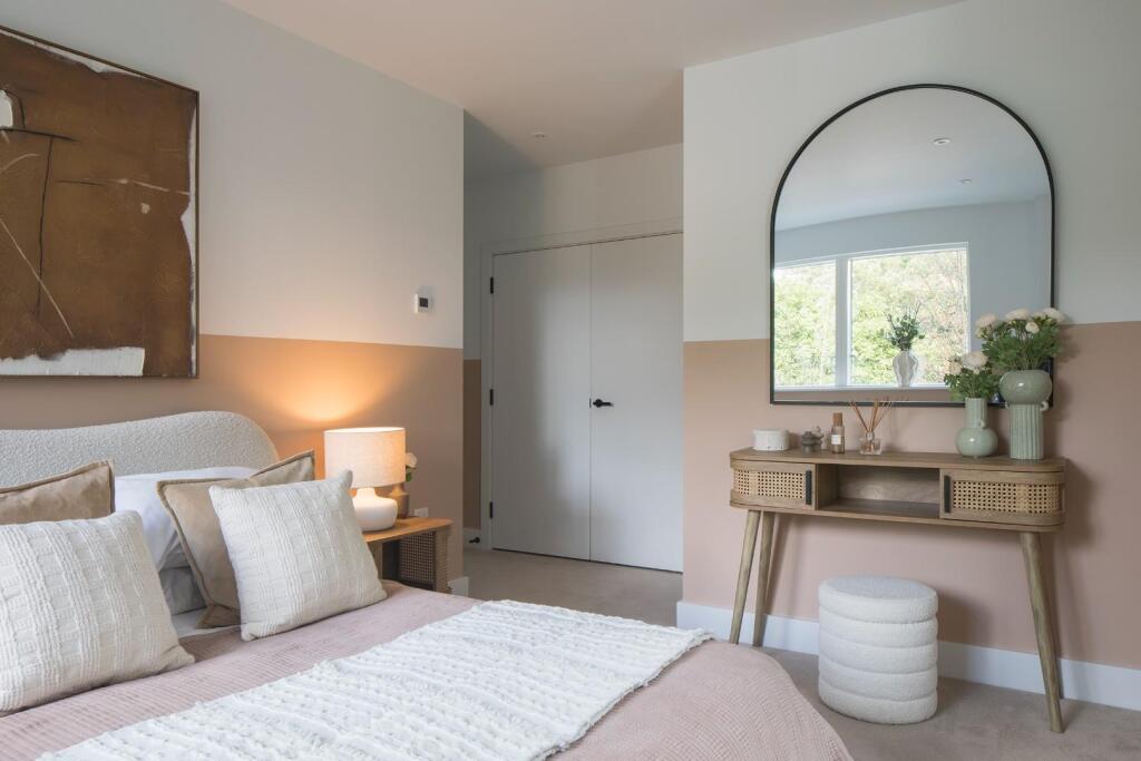
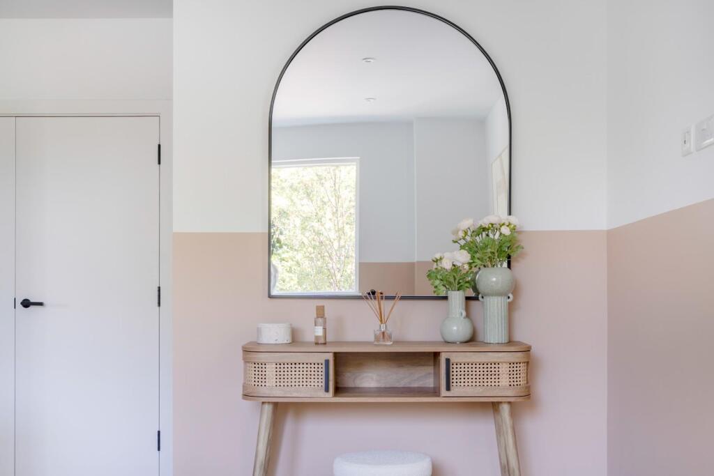
- apartment living and dining area contemporary
Floorplan Description
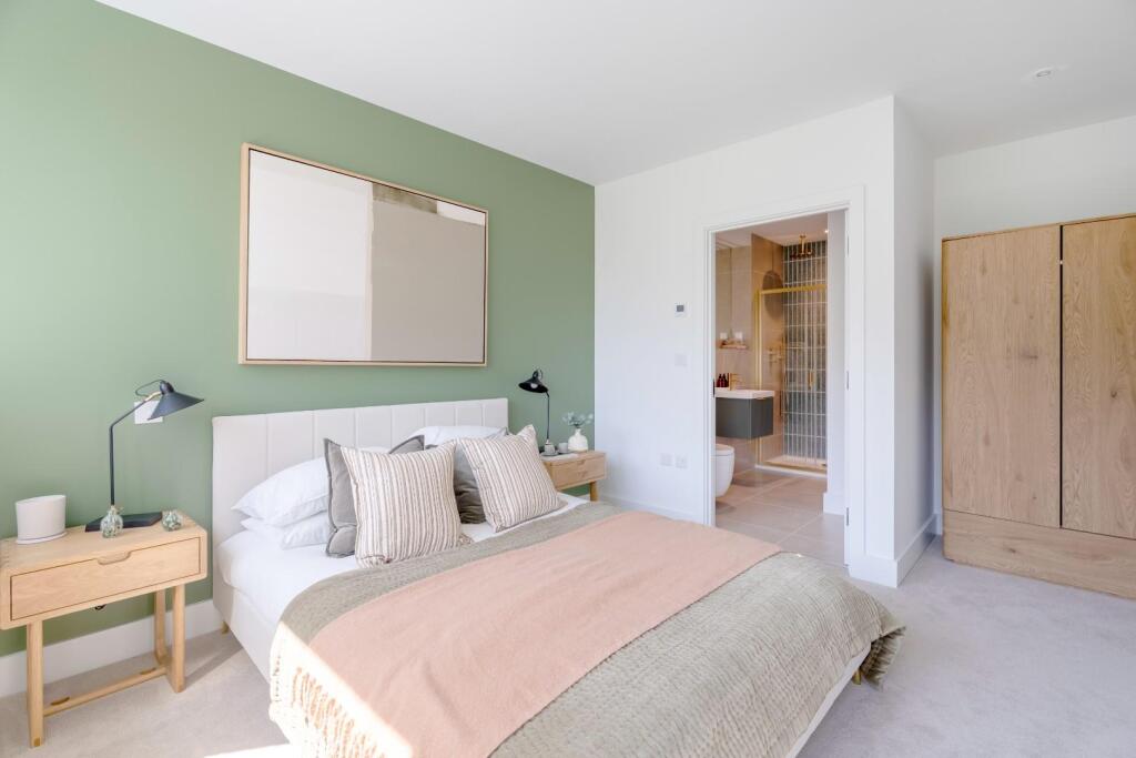
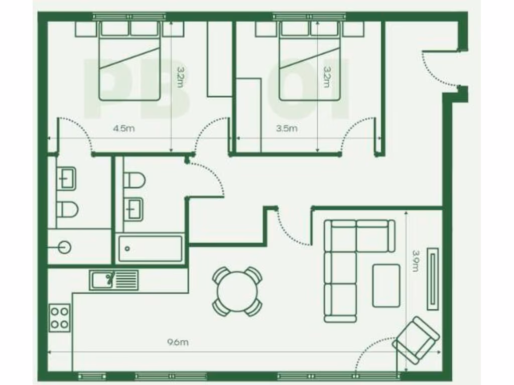
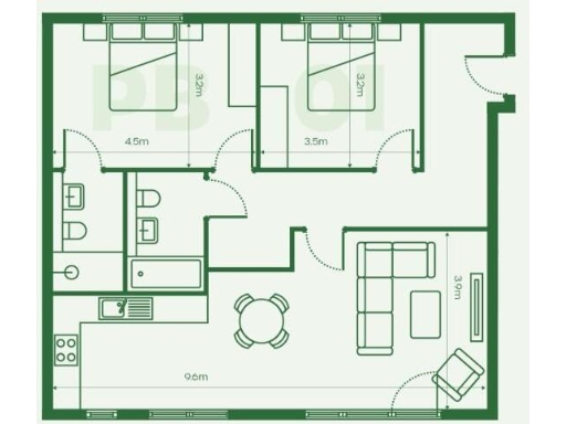
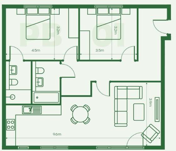
- Single-floor apartment plan with two bedrooms and an open living/kitchen area.
Textual Property Features
Detected Visual Features
- modern apartment
- new development
- contemporary architecture
- urban living
- low maintenance
- apartment
- contemporary
- modern
- open-plan
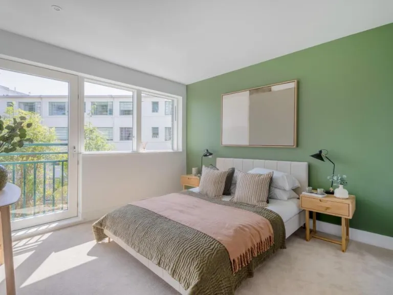
- large windows
- natural light
- balcony
- central heating
EPC Details
- Mostly double glazing
- Solid brick, as built, no insulation (assumed)
- Boiler and radiators, mains gas
- Low energy lighting in 73% of fixed outlets
- Solid, no insulation (assumed)
Nearby Schools
- Alexandra Junior School
- St Bartholomews's Church of England Primary School
- Kelvin Grove Primary School
- Sydenham School
- Perrymount Primary School
- Dalmain Primary School
- Horniman Primary School
- St John's Church of England Primary School
- Harris Primary Academy Crystal Palace
- Sydenham High School, GDST
- Adamsrill Primary School
- Holy Trinity Church of England Primary School
- Kilmorie Primary School
- Heber Primary School
- Harris Boys' Academy East Dulwich
- Fairlawn Primary School
- Stillness Infant School
- Stillness Junior School
- Goodrich Community Primary School
- Harris Girls' Academy East Dulwich
- Forest Hill School
- Eliot Bank Primary School
- St George's CofE Primary School
- St William of York Catholic Primary School
Nearest General Shops
- Id: 289557861
- Tags:
- Addr:
- City: London
- Housenumber: 49
- Postcode: SE23 3TY
- Street: London Road
- Building: yes
- Fhrs:
- Name: The Butchery
- Opening_hours: Tu-Sa 09:30-18:00, Su 11:00-15:00
- Operator: THE BUTCHERY LIMITED
- Shop: butcher
- Source:
- Start_date: 2011
- Wheelchair: yes
- TagsNormalized:
- Lat: 51.4397106
- Lon: -0.0562427
- FullGeoHash: gcpuwsr413n6
- PartitionGeoHash: gcpu
- Images:
- FoodStandards:
- Id: 553308
- FHRSID: 553308
- LocalAuthorityBusinessID: PI/000187613
- BusinessName: The Butchery Limited
- BusinessType: Retailers - other
- BusinessTypeID: 4613
- AddressLine1: 49 London Road
- AddressLine2: London
- AddressLine3: null
- AddressLine4: null
- PostCode: SE23 3TY
- RatingValue: 4
- RatingKey: fhrs_4_en-GB
- RatingDate: 2019-08-08
- LocalAuthorityCode: 523
- LocalAuthorityName: Lewisham
- LocalAuthorityWebSite: http://www.lewisham.gov.uk/myservices/business/food-safety/Pages/default.aspx
- LocalAuthorityEmailAddress: david.edwards@lewisham.gov.uk
- Scores:
- Hygiene: 10
- Structural: 5
- ConfidenceInManagement: 5
- NewRatingPending: false
- Geocode:
- Longitude: -0.05673700000000
- Latitude: 51.43964500000000
- Distance: 276.1
,- Id: 289557860
- Tags:
- Addr:
- Building: yes
- Name: Bolans
- Shop: yes
- TagsNormalized:
- Lat: 51.4397346
- Lon: -0.0563121
- FullGeoHash: gcpuwsqfpvd9
- PartitionGeoHash: gcpu
- Images:
- FoodStandards: null
- Distance: 274.1
,- Id: 289557865
- Tags:
- Addr:
- Building: yes
- Name: Erdis Hairdresser
- Shop: hairdresser
- Wheelchair: limited
- TagsNormalized:
- Lat: 51.4397689
- Lon: -0.0564106
- FullGeoHash: gcpuwsqfmecj
- PartitionGeoHash: gcpu
- Images:
- FoodStandards: null
- Distance: 271.3
}
Nearest Religious buildings
- Id: 158481613
- Tags:
- Amenity: school
- Name: Christ Church C of E Primary School
- TagsNormalized:
- Lat: 51.4375223
- Lon: -0.0514197
- FullGeoHash: gcpuwgft3c4s
- PartitionGeoHash: gcpu
- Images:
- FoodStandards: null
- Distance: 554.3
,- Id: 289754944
- Tags:
- Addr:
- Housenumber: 8-10
- Street: Devonshire Road
- Amenity: place_of_worship
- Building: yes
- Name: Living Springs International Church
- Religion: christian
- TagsNormalized:
- place of worship
- church
- christian
- Lat: 51.4398148
- Lon: -0.0534268
- FullGeoHash: gcpuwu34eh6p
- PartitionGeoHash: gcpu
- Images:
- FoodStandards: null
- Distance: 450.1
,- Id: 291748432
- Tags:
- Amenity: place_of_worship
- Building: yes
- Religion: christian
- TagsNormalized:
- place of worship
- christian
- church
- Lat: 51.4399157
- Lon: -0.0542703
- FullGeoHash: gcpuwu27prm1
- PartitionGeoHash: gcpu
- Images:
- FoodStandards: null
- Distance: 402.8
}
Nearest Airports
- Id: 260720166
- Tags:
- Aerodrome: international
- Aeroway: aerodrome
- Alt_name: Gatwick Airport
- Ele: 62
- Iata: LGW
- Icao: EGKK
- Internet_access: wlan
- Internet_access:fee: no
- Internet_access:ssid: Gatwick FREE Wi-Fi
- Name: London Gatwick Airport
- Operator: Gatwick Airport Limited
- Ref: LGW
- Website: https://www.gatwickairport.com/
- Wikidata: Q8703
- Wikipedia: en:Gatwick Airport
- TagsNormalized:
- airport
- international airport
- Lat: 51.1540917
- Lon: -0.1883773
- FullGeoHash: gcpg58qf4mzd
- PartitionGeoHash: gcpg
- Images:
- FoodStandards: null
- Distance: 32836
,- Id: 121158889
- Tags:
- Aerodrome: continental
- Aeroway: aerodrome
- Fhrs:
- Authority: City of London Corporation
- Iata: LCY
- Icao: EGLC
- Name: London City Airport
- Operator: London City Airport Limited
- Ref: LCY
- Website: https://www.londoncityairport.com/
- Wikidata: Q8982
- Wikipedia: en:London City Airport
- TagsNormalized:
- airport
- continental airport
- Lat: 51.5042658
- Lon: 0.0539987
- FullGeoHash: u10j10p64702
- PartitionGeoHash: u10j
- Images:
- FoodStandards: null
- Distance: 10755.2
,- Id: 14001268
- Tags:
- Access: yes
- Aerodrome: international
- Aerodrome:type: public
- Aeroway: aerodrome
- Alt_name: London Heathrow
- Alt_name_2: London Heathrow Airport
- Ele: 25
- Iata: LHR
- Icao: EGLL
- Int_name: Heathrow Airport
- Name: London Heathrow Airport
- Note: area still approx
- Old_name: London Airport
- Operator: Heathrow Airport Limited
- Rank_aci:
- Ref: LHR
- Short_name: Heathrow
- Type: multipolygon
- Website: https://www.heathrow.com/
- Wikidata: Q8691
- Wikipedia: en:Heathrow Airport
- TagsNormalized:
- airport
- international airport
- Lat: 51.4677522
- Lon: -0.4547736
- FullGeoHash: gcpsv9kv7h2h
- PartitionGeoHash: gcps
- Images:
- FoodStandards: null
- Distance: 27596.4
}
Nearest Leisure Facilities
- Id: 289995162
- Tags:
- TagsNormalized:
- Lat: 51.4366632
- Lon: -0.0612434
- FullGeoHash: gcpuweg2kbvx
- PartitionGeoHash: gcpu
- Images:
- FoodStandards: null
- Distance: 211.7
,- Id: 896165225
- Tags:
- TagsNormalized:
- Lat: 51.437048
- Lon: -0.0603678
- FullGeoHash: gcpuweu492dx
- PartitionGeoHash: gcpu
- Images:
- FoodStandards: null
- Distance: 142.1
,- Id: 289995163
- Tags:
- TagsNormalized:
- Lat: 51.4372071
- Lon: -0.0607085
- FullGeoHash: gcpuwegg3qkk
- PartitionGeoHash: gcpu
- Images:
- FoodStandards: null
- Distance: 141.5
,- Id: 289339708
- Tags:
- TagsNormalized:
- Lat: 51.4387009
- Lon: -0.0595623
- FullGeoHash: gcpuwshshhg4
- PartitionGeoHash: gcpu
- Images:
- FoodStandards: null
- Distance: 62.1
,- Id: 289339707
- Tags:
- Leisure: garden
- Name: Grassmount Roundabout
- TagsNormalized:
- Lat: 51.438406
- Lon: -0.0589543
- FullGeoHash: gcpuwsj46mb7
- PartitionGeoHash: gcpu
- Images:
- FoodStandards: null
- Distance: 38.9
}
Nearest Tourist attractions
- Id: 5095289
- Tags:
- Name: Menagerie
- Tourism: zoo
- Wheelchair: yes
- TagsNormalized:
- Lat: 51.4425313
- Lon: -0.0607007
- FullGeoHash: gcpuwsgf3wfk
- PartitionGeoHash: gcpu
- Images:
- FoodStandards: null
- Distance: 495.2
,- Id: 2411003122
- Tags:
- TagsNormalized:
- Lat: 51.442451
- Lon: -0.0612277
- FullGeoHash: gcpuwsg3vrcm
- PartitionGeoHash: gcpu
- Images:
- FoodStandards: null
- Distance: 494.7
,- Id: 210442848
- Tags:
- Addr:
- City: Forest Hill
- Country: GB
- Housenumber: 100
- Postcode: SE23 3PQ
- Street: London Road
- Building: yes
- Building:material: brick
- Check_date: 2023-02-13
- Contact:
- Phone: +44 20 8699 1872
- Website: http://www.horniman.ac.uk/
- Fhrs:
- Name: Horniman Museum
- Tourism: museum
- Wikidata: Q1628487
- Wikipedia: en:Horniman Museum
- TagsNormalized:
- Lat: 51.4410292
- Lon: -0.060993
- FullGeoHash: gcpuwse9dyb7
- PartitionGeoHash: gcpu
- Images:
- FoodStandards:
- Id: 255177
- FHRSID: 255177
- LocalAuthorityBusinessID: PI/000098066
- BusinessName: Horniman Museum (Cafe)
- BusinessType: Restaurant/Cafe/Canteen
- BusinessTypeID: 1
- AddressLine1: Horniman Museum
- AddressLine2: 100 London Road
- AddressLine3: London
- AddressLine4: null
- PostCode: SE23 3PQ
- RatingValue: 5
- RatingKey: fhrs_5_en-GB
- RatingDate: 2019-02-27
- LocalAuthorityCode: 523
- LocalAuthorityName: Lewisham
- LocalAuthorityWebSite: http://www.lewisham.gov.uk/myservices/business/food-safety/Pages/default.aspx
- LocalAuthorityEmailAddress: david.edwards@lewisham.gov.uk
- Scores:
- Hygiene: 5
- Structural: 5
- ConfidenceInManagement: 5
- NewRatingPending: false
- Geocode:
- Longitude: -0.06077400000000
- Latitude: 51.44114100000000
- Distance: 338.9
}
Nearest Hotels
- Id: 273456496
- Tags:
- Accommodation: yes
- Addr:
- Housenumber: 150
- Postcode: SE24 9AY
- Street: Norwood Road
- Amenity: pub
- Fhrs:
- Name: Tulse Hill Hotel
- Source: survey
- TagsNormalized:
- Lat: 51.4411644
- Lon: -0.1065931
- FullGeoHash: gcputsd6s0n6
- PartitionGeoHash: gcpu
- Images:
- FoodStandards: null
- Distance: 3291.4
,- Id: 1084648842
- Tags:
- Brand: Travelodge
- Brand:wikidata: Q9361374
- Building: yes
- Internet_access: wlan
- Internet_access:fee: customers
- Internet_access:ssid: Travelodge WiFi
- Name: Travelodge
- Tourism: hotel
- TagsNormalized:
- Lat: 51.4106898
- Lon: -0.0551484
- FullGeoHash: gcpuqxpbfznq
- PartitionGeoHash: gcpu
- Images:
- FoodStandards: null
- Distance: 3068.2
,- Id: 32349145
- Tags:
- Addr:
- City: London
- Housenumber: 122
- Postcode: SE19 2UG
- Street: Church Road
- Suburb: Upper Norwood
- Building: yes
- Building:levels: 1
- Fhrs:
- Authority: Croydon
- Id: 1867
- Name: Queens Hotel
- Phone: +44 20 8653 6622
- Tourism: hotel
- Website: www.euroqueenshotel.com
- TagsNormalized:
- Lat: 51.415216
- Lon: -0.0835473
- FullGeoHash: gcpuqpg5m4yw
- PartitionGeoHash: gcpu
- Images:
- FoodStandards: null
- Distance: 3053.2
}
Tags
- modern apartment
- new development
- contemporary architecture
- urban living
- low maintenance
- apartment
- contemporary
- modern
- open-plan
- large windows
- natural light
- balcony
- central heating
- urban living
Local Market Stats
- Average Price/sqft: £610
- Avg Income: £62500
- Rental Yield: 4.5%
- Social Housing: 21%
- Planning Success Rate: 78%
AirBnB Data
- 1km average: £119/night
- Listings in 1km: 20
Similar Properties
 3 bedroom apartment for sale in Taymount Mansion, Forest Hill, London, SE23 — £675,000 • 3 bed • 2 bath • 957 ft²
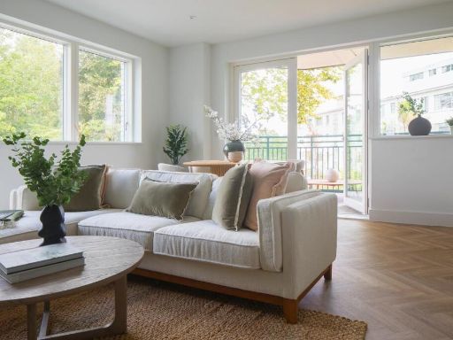 1 bedroom apartment for sale in Taymount Mansion, Forest Hill, London, SE23 — £425,000 • 1 bed • 1 bath • 610 ft²
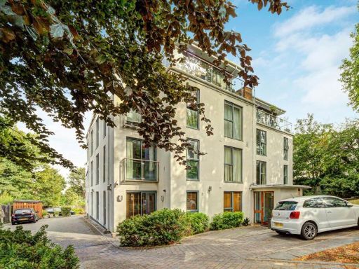 2 bedroom flat for sale in Taymount Rise, Honor Oak, SE23 — £550,000 • 2 bed • 2 bath • 779 ft²
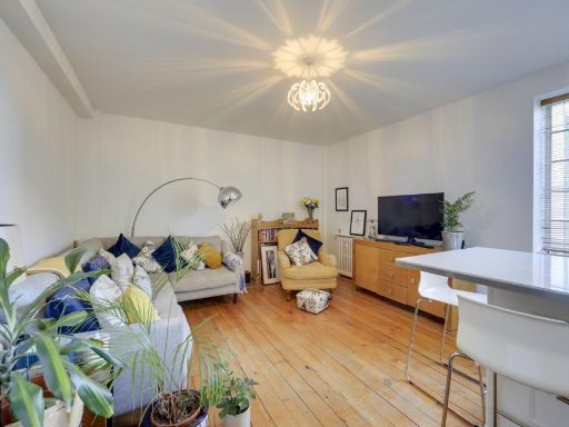 1 bedroom flat for sale in Taymount Rise, Forest Hill, London, SE23 — £325,000 • 1 bed • 1 bath • 423 ft²
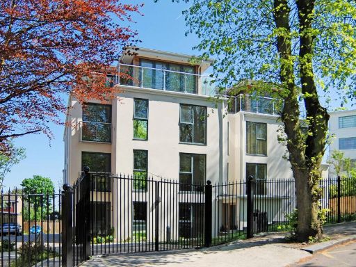 2 bedroom flat for sale in Taymount Rise, Forest Hill, London, SE23 — £550,000 • 2 bed • 2 bath • 775 ft²
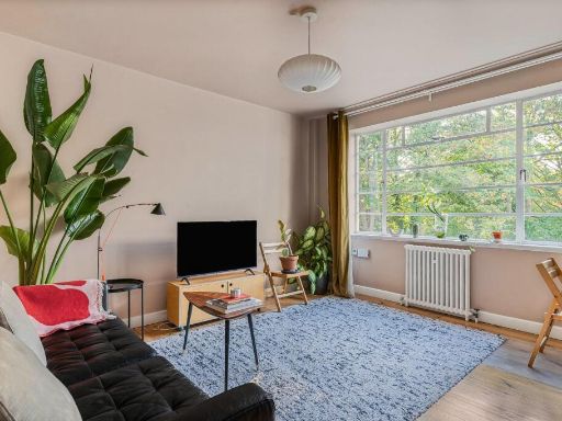 1 bedroom apartment for sale in Taymount Grange, Taymount Rise, SE23 — £325,000 • 1 bed • 1 bath • 479 ft²
Meta
- {
"@context": "https://schema.org",
"@type": "Residence",
"name": "2 bedroom apartment for sale in Taymount Mansion, Forest Hi…",
"description": "",
"url": "https://propertypiper.co.uk/property/e9ee611d-6d37-48e5-be68-08bcc0c0200a",
"image": "https://image-a.propertypiper.co.uk/d46bdfed-7461-4a01-af73-bf34e60f8c9d-1024.jpeg",
"address": {
"@type": "PostalAddress",
"streetAddress": "Taymount Lodge, Taymount Rise",
"postalCode": "SE23 3UL",
"addressLocality": "Lewisham",
"addressRegion": "Lewisham West and Penge",
"addressCountry": "England"
},
"geo": {
"@type": "GeoCoordinates",
"latitude": 51.4381583,
"longitude": -0.0593515
},
"numberOfRooms": 2,
"numberOfBathroomsTotal": 2,
"floorSize": {
"@type": "QuantitativeValue",
"value": 850,
"unitCode": "FTK"
},
"offers": {
"@type": "Offer",
"price": 600000,
"priceCurrency": "GBP",
"availability": "https://schema.org/InStock"
},
"additionalProperty": [
{
"@type": "PropertyValue",
"name": "Feature",
"value": "modern apartment"
},
{
"@type": "PropertyValue",
"name": "Feature",
"value": "new development"
},
{
"@type": "PropertyValue",
"name": "Feature",
"value": "contemporary architecture"
},
{
"@type": "PropertyValue",
"name": "Feature",
"value": "urban living"
},
{
"@type": "PropertyValue",
"name": "Feature",
"value": "low maintenance"
},
{
"@type": "PropertyValue",
"name": "Feature",
"value": "apartment"
},
{
"@type": "PropertyValue",
"name": "Feature",
"value": "contemporary"
},
{
"@type": "PropertyValue",
"name": "Feature",
"value": "modern"
},
{
"@type": "PropertyValue",
"name": "Feature",
"value": "open-plan"
},
{
"@type": "PropertyValue",
"name": "Feature",
"value": "large windows"
},
{
"@type": "PropertyValue",
"name": "Feature",
"value": "natural light"
},
{
"@type": "PropertyValue",
"name": "Feature",
"value": "balcony"
},
{
"@type": "PropertyValue",
"name": "Feature",
"value": "central heating"
},
{
"@type": "PropertyValue",
"name": "Feature",
"value": "urban living"
}
]
}
High Res Floorplan Images
Compatible Floorplan Images
FloorplanImages Thumbnail