DE75 7QG - 4 bedroom detached house for sale in Derby Road Heanor DE75…
View on Property Piper
4 bedroom detached house for sale in Derby Road Heanor DE75 7QG, DE75
Property Details
- Price: £250000
- Bedrooms: 4
- Bathrooms: 3
- Property Type: undefined
- Property SubType: undefined
Brochure Descriptions
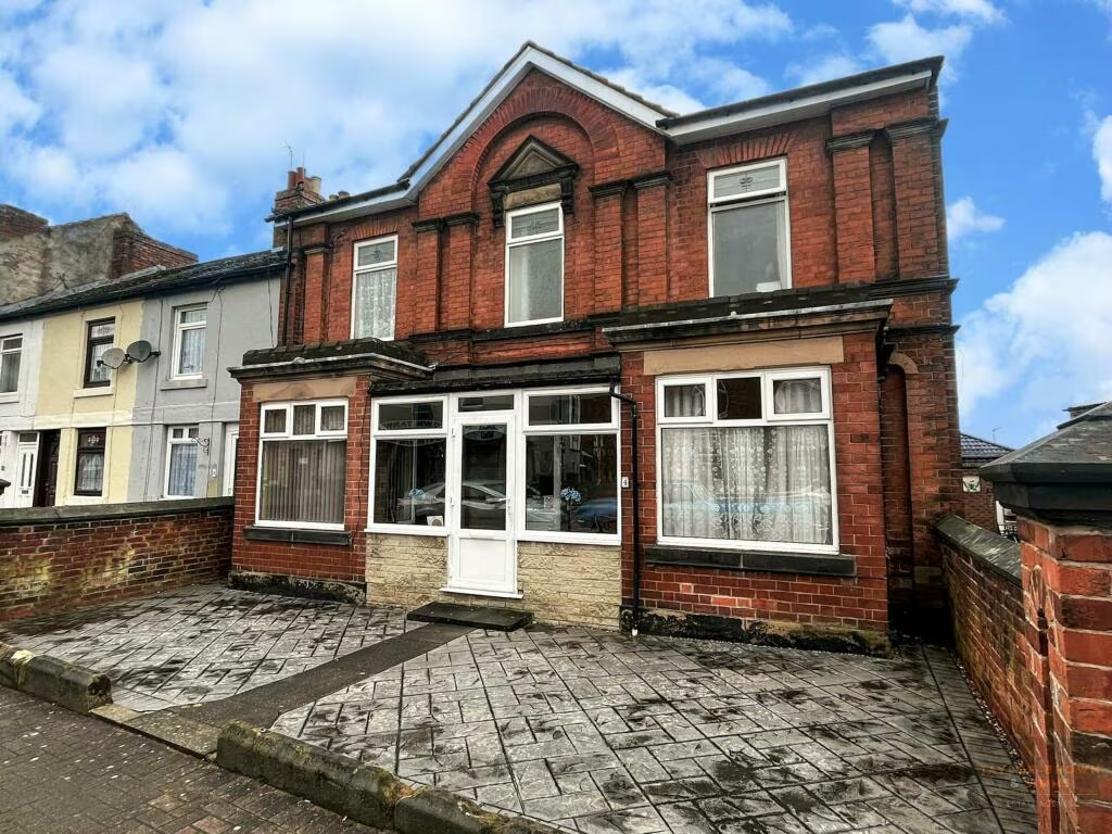
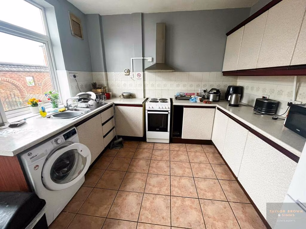
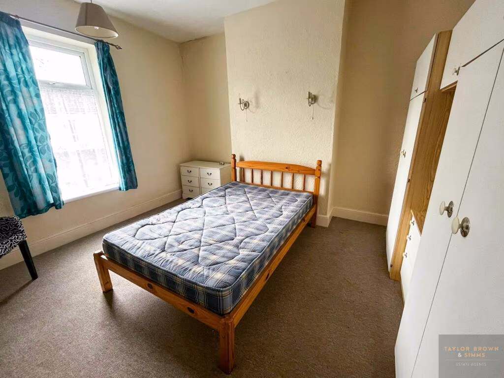
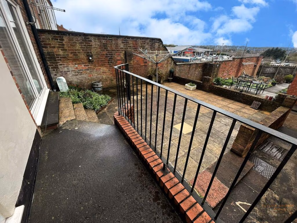
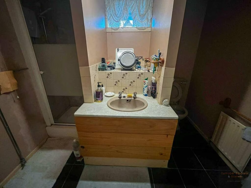
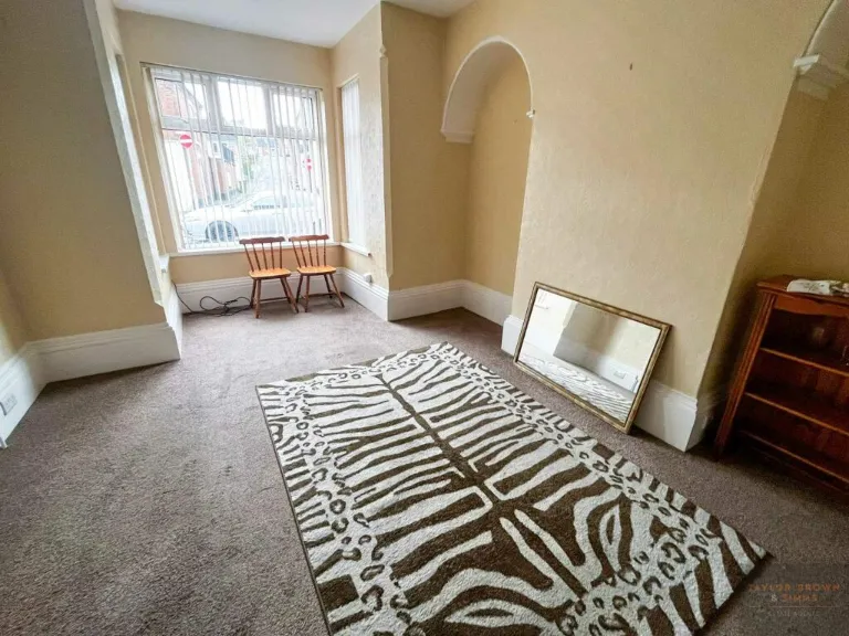
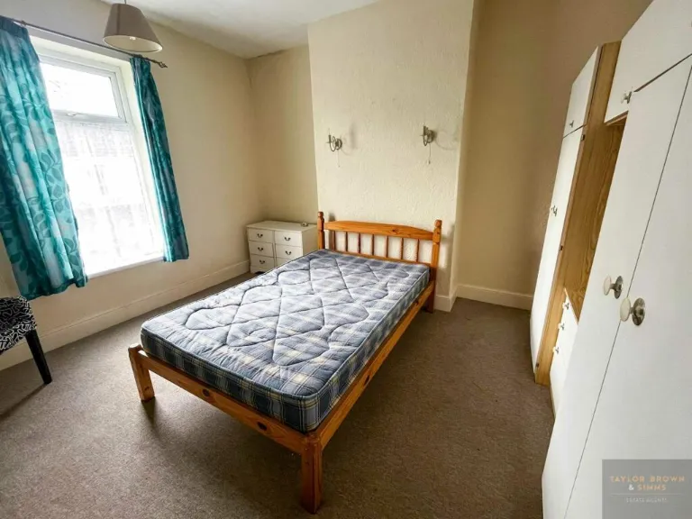
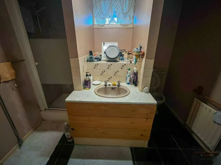
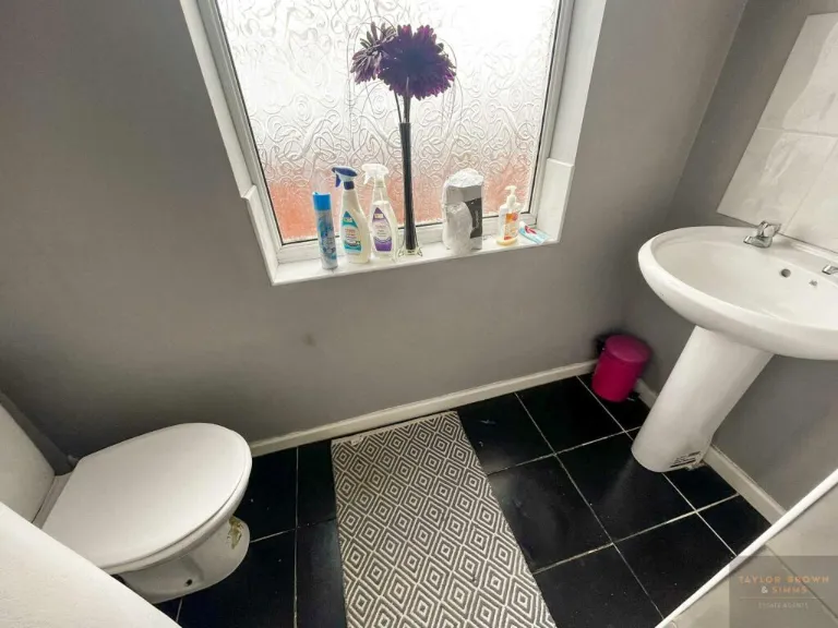
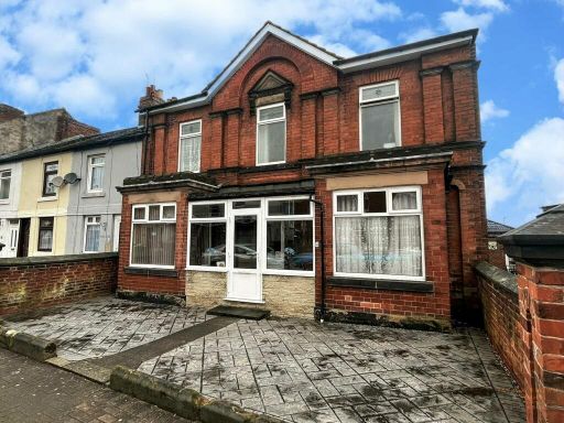
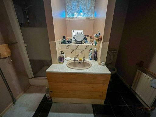
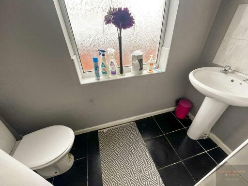
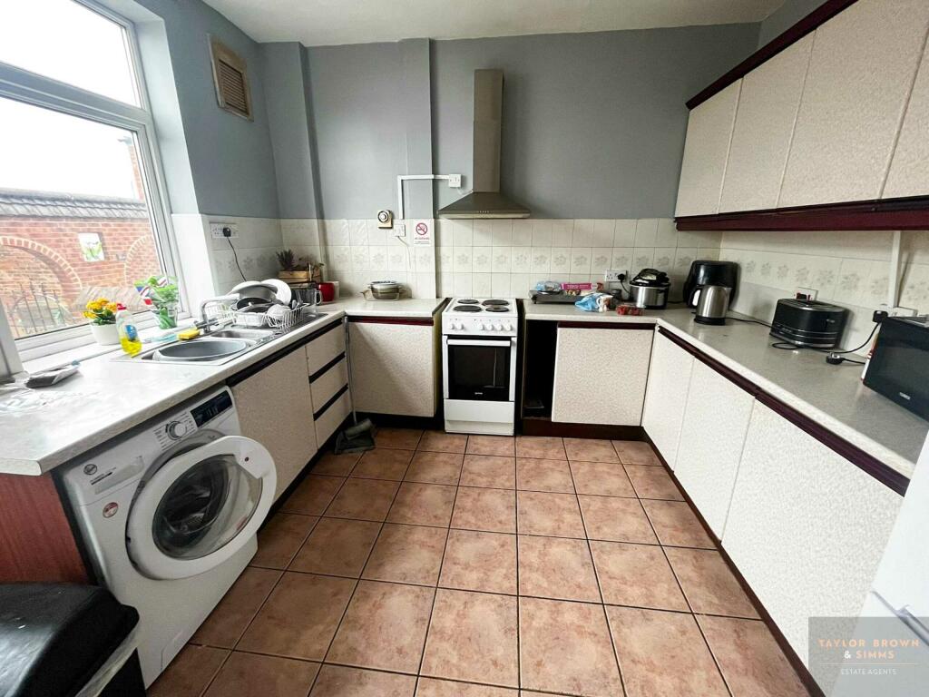
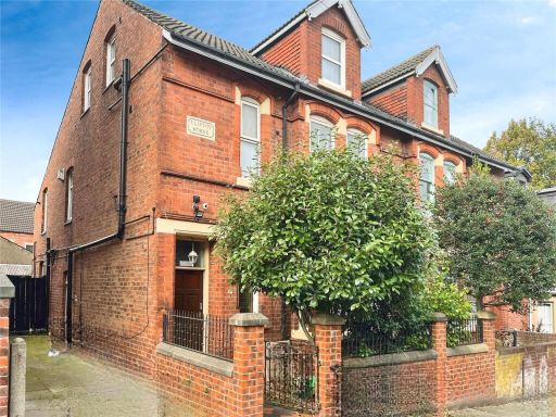
- The property for sale is a detached former guest house located in a central town location. It features six or seven bedrooms spread across three floors, indicating a large overall property size suitable for a high-occupancy use such as an HMO. The exterior reflects traditional styling with a small front paved area. Inside, the rooms present average size spaces, suitable for individual rental per the property's current usage. The kitchen is communal, providing shared amenities consistent with multi-user usage. The overall impression is of a substantial residential space targeting rental income, with easy access to local amenities and transport links.
Image Descriptions
- front exterior Victorian
- living room Victorian
Floorplan Description
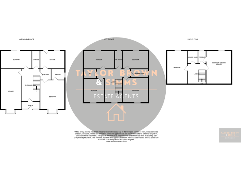
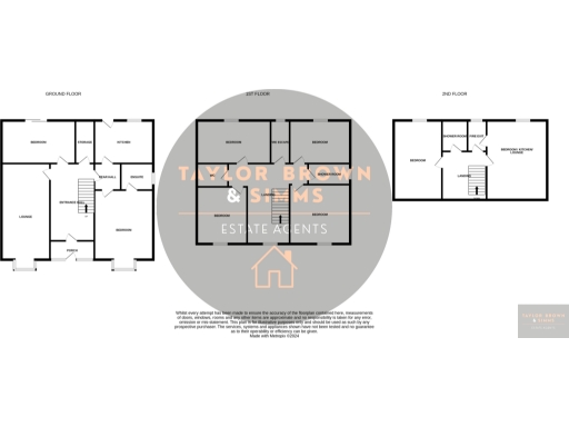
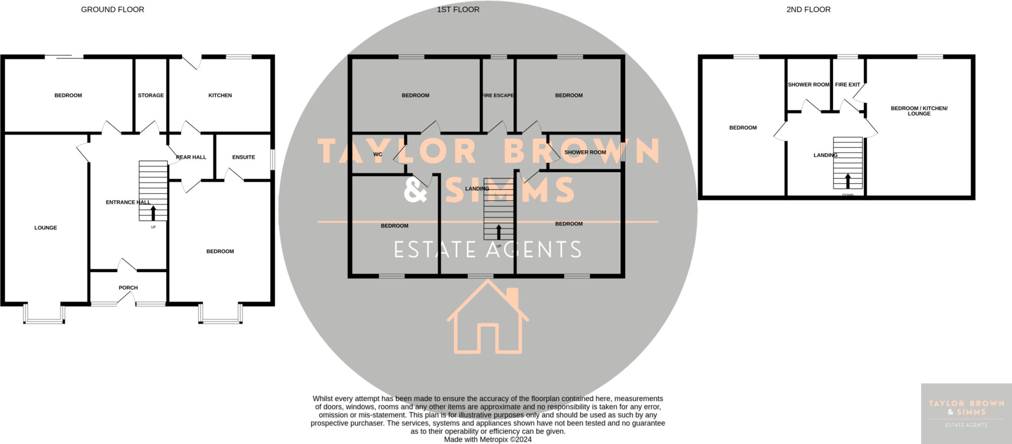
- A multi-story property with multiple bedrooms, bathrooms, and shared spaces.
Rooms
- Bedroom:
- Storage:
- Kitchen:
- Rear Hall:
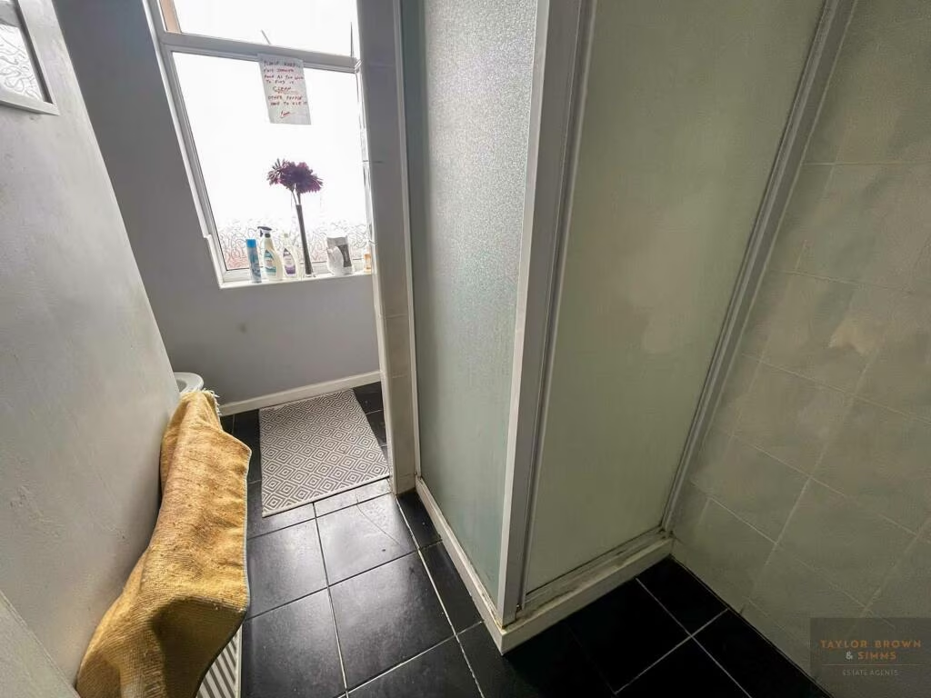
- Ensuite:
- Bedroom:
- Lounge:
- Porch:
- Bedroom:
- WC:
- Shower Room:
- Bedroom:
- Bedroom / Kitchen / Lounge:
Textual Property Features
Detected Visual Features
- Victorian
- detached
- brick
- double glazed
- gable roof
- period property
- driveway
- brickwork
- bay window
- medium ceiling height
- bright
- potential
- dated
- needs modernization
- living room
- arched alcove
EPC Details
- Fully double glazed
- Solid brick, as built, no insulation (assumed)
- Boiler and radiators, mains gas
- Low energy lighting in 57% of fixed outlets
- Suspended, no insulation (assumed)
Nearby Schools
- Coppice Primary School
- Heanor Gate Spencer Academy
- Waingroves Primary School
- Codnor Community Primary School Church of England Controlled
- The Ripley Academy
- Jacksdale Primary and Nursery School
- Richardson Endowed Primary School
- Mundy CofE Junior School
- Marlpool Junior School
- Corfield CofE Infant School
- Denby Free CofE VA Primary School
- Howitt Primary Community School
- Hall Park Academy
- Loscoe CofE Primary School and Nursery
- Aldercar High School
- Scargill CofE Primary School
- Mapperley CofE Controlled Primary School
- Cotmanhay Infant and Nursery School
- Marlpool Infant School
- Springbank Academy
- Langley Mill Church of England Infant School and Nursery
- Ironville and Codnor Park Primary School
- Cotmanhay Junior School
- Laceyfields Academy
- Langley Mill Academy
- Aldercar Infant School
- Brinsley Primary and Nursery School
- Ripley St John's Church of England Primary School and Nursery
Nearest General Shops
- Id: 389814553
- Tags:
- Addr:
- Name: County Shoe Care
- Shop: cobbler
- Source: survey
- Wheelchair: no
- TagsNormalized:
- Lat: 53.0139506
- Lon: -1.3579651
- FullGeoHash: gcrj94ghthev
- PartitionGeoHash: gcrj
- Images:
- FoodStandards: null
- Distance: 41.7
,- Id: 389814625
- Tags:
- Addr:
- Housenumber: 17
- Street: Derby Road
- Name: Your Style
- Shop: hairdresser
- Source: survey
- Wheelchair: no
- TagsNormalized:
- Lat: 53.0139586
- Lon: -1.3579256
- FullGeoHash: gcrj94ghwn1m
- PartitionGeoHash: gcrj
- Images:
- FoodStandards: null
- Distance: 39.9
,- Id: 389814610
- Tags:
- Addr:
- Building: yes
- Name: Red Lion Garage
- Shop: car_repair
- TagsNormalized:
- garage
- car repair
- repair
- shop
- Lat: 53.0143664
- Lon: -1.3574462
- FullGeoHash: gcrj94gx14nv
- PartitionGeoHash: gcrj
- Images:
- FoodStandards: null
- Distance: 19.7
}
Nearest Grocery shops
- Id: 389628877
- Tags:
- Addr:
- City: Heanor
- Housenumber: 4A
- Postcode: DE75 7GE
- Street: Ray Street
- Amenity: fast_food
- Building: retail
- Cuisine: sandwich
- Name: The Cob Shop & More
- Old_fhrs:
- Source:
- Addr: FHRS open data
- Building: survey;Bing
- TagsNormalized:
- fast food
- food
- retail
- sandwich
- shop
- Lat: 53.0138812
- Lon: -1.3554519
- FullGeoHash: gcrj94uupxtz
- PartitionGeoHash: gcrj
- Images:
- FoodStandards: null
- Distance: 158.2
,- Id: 389628878
- Tags:
- Addr:
- City: Heanor
- Housenumber: 8
- Postcode: DE75 7GE
- Street: Ray Street
- Cuisine: polish
- Name: Vitave
- Old_fhrs:
- Shop: grocery
- Source:
- TagsNormalized:
- Lat: 53.0137932
- Lon: -1.3556643
- FullGeoHash: gcrj94ugdxr6
- PartitionGeoHash: gcrj
- Images:
- FoodStandards: null
- Distance: 148.1
,- Id: 389814555
- Tags:
- Addr:
- City: Heanor
- Housenumber: 26
- Postcode: DE75 7NR
- Street: Market Street
- Fhrs:
- Name: Derbyshire Convenience Store
- Shop: convenience
- Source: survey
- Source:addr: extrapolation
- TagsNormalized:
- Lat: 53.0143593
- Lon: -1.3557034
- FullGeoHash: gcrj94uz1bf7
- PartitionGeoHash: gcrj
- Images:
- FoodStandards:
- Id: 1391914
- FHRSID: 1391914
- LocalAuthorityBusinessID: 0000295/FH
- BusinessName: Derbyshire Convenience Store
- BusinessType: Retailers - other
- BusinessTypeID: 4613
- AddressLine1: Derbyshire Convenience Store 26 Market Street Heanor Derbyshire
- AddressLine2: null
- AddressLine3: null
- AddressLine4: null
- PostCode: DE75 7NR
- RatingValue: 1
- RatingKey: fhrs_1_en-GB
- RatingDate: 2022-07-04
- LocalAuthorityCode: 062
- LocalAuthorityName: Amber Valley
- LocalAuthorityWebSite: http://www.ambervalley.gov.uk
- LocalAuthorityEmailAddress: envhealth@ambervalley.gov.uk
- Scores:
- Hygiene: 5
- Structural: 15
- ConfidenceInManagement: 20
- NewRatingPending: false
- Geocode:
- Longitude: -1.35572850000000
- Latitude: 53.01436540000000
- Distance: 134.8
}
Nearest Religious buildings
- Id: 543210995
- Tags:
- Addr:
- City: Heanor
- Postcode: DE75 7PN
- Amenity: place_of_worship
- Building: church
- Name: Heanor Free Church
- Religion: christian
- TagsNormalized:
- place of worship
- church
- christian
- Lat: 53.0167157
- Lon: -1.3594403
- FullGeoHash: gcrj956hf8pg
- PartitionGeoHash: gcrj
- Images:
- FoodStandards: null
- Distance: 292.9
,- Id: 64733088
- Tags:
- Addr:
- City: Heanor
- Postcode: DE75 7QJ
- Amenity: place_of_worship
- Building: church
- Denomination: christadelphian
- Name: Christadelphian Hall
- Note: Rebulit since Bing imagery (2015-12-27)
- Religion: christian
- Source: survey
- Source:building: survey
- TagsNormalized:
- place of worship
- church
- christian
- Lat: 53.0132445
- Lon: -1.3606741
- FullGeoHash: gcrj94c0tcpc
- PartitionGeoHash: gcrj
- Images:
- FoodStandards: null
- Distance: 229.8
,- Id: 389814570
- Tags:
- Addr:
- City: Heanor
- Postcode: DE75 7NR
- Street: Market Street
- Amenity: place_of_worship
- Building: church
- Denomination: methodist
- Name: Heanor Methodist Church
- Religion: christian
- Source: survey
- Source:building: Bing
- TagsNormalized:
- place of worship
- church
- methodist
- christian
- Lat: 53.0143509
- Lon: -1.3548031
- FullGeoHash: gcrj94vqyz39
- PartitionGeoHash: gcrj
- Images:
- FoodStandards: null
- Distance: 194.9
}
Nearest Airports
- Id: 11359528
- Tags:
- Aerodrome: international
- Aerodrome:type: public
- Aeroway: aerodrome
- Iata: EMA
- Icao: EGNX
- Is_in: Castle Donington,England,UK
- Name: East Midlands Airport
- Old_name: RAF Castle Donington
- Operator: Manchester Airports Holdings Limited
- Operator:type: private
- Ref: EMA
- Type: multipolygon
- Website: https://www.eastmidlandsairport.com/
- Wikidata: Q8977
- Wikipedia: en:East Midlands Airport
- TagsNormalized:
- airport
- international airport
- Lat: 52.8281122
- Lon: -1.3322143
- FullGeoHash: gcrh99jfj1vh
- PartitionGeoHash: gcrh
- Images:
- FoodStandards: null
- Distance: 20773
}
Nearest Tourist attractions
- Id: 1025223336
- Tags:
- TagsNormalized:
- Lat: 53.042056
- Lon: -1.3741064
- FullGeoHash: gcrjb8p2m5bh
- PartitionGeoHash: gcrj
- Images:
- FoodStandards: null
- Distance: 3275.8
,- Id: 7683358285
- Tags:
- Addr:
- City: Nottingham
- Housenumber: 2
- Postcode: NG16 4GH
- Street: Castle View
- Name: Home
- Tourism: guest_house
- TagsNormalized:
- Lat: 53.0243738
- Lon: -1.3412035
- FullGeoHash: gcrj9kz37ewn
- PartitionGeoHash: gcrj
- Images:
- FoodStandards: null
- Distance: 1573.5
,- Id: 389814600
- Tags:
- Addr:
- City: Heanor
- Housename: 23 Market St
- Housenumber: 23
- Postcode: DE75 7NR
- Street: Market Street
- Building: yes
- Description: "Museum, Sales and Repairs"
- Name: Vacuum Cleaner Museum and Repairer
- Operator: Mr Vacuum Cleaner
- Source:
- Addr:
- Postcode: OS Opendata Codepoint;interpolation
- Tourism: museum
- Website: http://www.mrvacuumcleaner.co.uk/
- TagsNormalized:
- museum
- repair
- vacuum cleaner
- tourism
- Lat: 53.0140485
- Lon: -1.3555268
- FullGeoHash: gcrj94uvjyvv
- PartitionGeoHash: gcrj
- Images:
- FoodStandards: null
- Distance: 148.9
}
Nearest Train stations
- Id: 6415346590
- Tags:
- Name: Belper
- Naptan:
- Network: National Rail
- Public_transport: station
- Railway: station
- Ref:
- Source: NPE
- Train: yes
- Wikidata: Q3148981
- Wikipedia: en:Belper railway station
- TagsNormalized:
- Lat: 53.0242729
- Lon: -1.4825631
- FullGeoHash: gcqvwkb2vbbu
- PartitionGeoHash: gcqv
- Images:
- FoodStandards: null
- Distance: 8424.3
,- Id: 4106699329
- Tags:
- Name: Hammersmith
- Public_transport: station
- Railway: station
- Train: yes
- Usage: tourism
- Wikidata: Q5645767
- Wikipedia: en:Hammersmith railway station
- TagsNormalized:
- Lat: 53.0629839
- Lon: -1.4090029
- FullGeoHash: gcqvzgvfrc5k
- PartitionGeoHash: gcqv
- Images:
- FoodStandards: null
- Distance: 6408.6
,- Id: 7352840325
- Tags:
- Addr:
- City: Ripley
- Postcode: DE5 3QZ
- Street: Butterley Hill
- Name: Butterley
- Public_transport: station
- Railway: station
- Train: yes
- Usage: tourism
- Website: https://www.midlandrailway-butterley.co.uk/
- Wikidata: Q5002997
- Wikipedia: en:Butterley railway station
- TagsNormalized:
- Lat: 53.0633087
- Lon: -1.401268
- FullGeoHash: gcrjb5gshjdv
- PartitionGeoHash: gcrj
- Images:
- FoodStandards: null
- Distance: 6179.3
,- Id: 7170589239
- Tags:
- Name: Ilkeston
- Naptan:
- Network: National Rail
- Public_transport: station
- Railway: station
- Ref:
- Wikidata: Q15228309
- Wikipedia: en:Ilkeston railway station
- TagsNormalized:
- Lat: 52.9790983
- Lon: -1.2950397
- FullGeoHash: gcrj6s8cx7sr
- PartitionGeoHash: gcrj
- Images:
- FoodStandards: null
- Distance: 5736.7
,- Id: 3727407363
- Tags:
- Name: Langley Mill
- Naptan:
- Network: National Rail
- Public_transport: station
- Railway: station
- Ref:
- Source: NPE
- Wikidata: Q2145892
- Wikipedia: en:Langley Mill railway station
- TagsNormalized:
- Lat: 53.018474
- Lon: -1.3311974
- FullGeoHash: gcrj9ewwuzgk
- PartitionGeoHash: gcrj
- Images:
- FoodStandards: null
- Distance: 1833.7
}
Nearest Bus stations and stops
- Id: 4044878332
- Tags:
- Bus: yes
- Highway: bus_stop
- Name: Broadway
- Public_transport: platform
- Shelter: no
- Source: survey
- TagsNormalized:
- Lat: 53.0119845
- Lon: -1.3574325
- FullGeoHash: gcrj94e91w0v
- PartitionGeoHash: gcrj
- Images:
- FoodStandards: null
- Distance: 257.5
,- Id: 3929741306
- Tags:
- Bus: yes
- Highway: bus_stop
- Name: Retail Park
- Public_transport: platform
- Shelter: no
- TagsNormalized:
- Lat: 53.0156601
- Lon: -1.358955
- FullGeoHash: gcrj954qw53d
- PartitionGeoHash: gcrj
- Images:
- FoodStandards: null
- Distance: 173.1
,- Id: 1365043717
- Tags:
- Bus: yes
- Highway: bus_stop
- Name: Retail Park
- Public_transport: platform
- Shelter: yes
- TagsNormalized:
- Lat: 53.0151738
- Lon: -1.3580242
- FullGeoHash: gcrj9555g8xy
- PartitionGeoHash: gcrj
- Images:
- FoodStandards: null
- Distance: 100
,- Id: 3929747629
- Tags:
- Bus: yes
- Highway: bus_stop
- Name: Tesco
- Public_transport: platform
- Shelter: no
- TagsNormalized:
- Lat: 53.0142735
- Lon: -1.3582532
- FullGeoHash: gcrj94fyw2v5
- PartitionGeoHash: gcrj
- Images:
- FoodStandards: null
- Distance: 36.1
,- Id: 3929747652
- Tags:
- Bus: yes
- Highway: bus_stop
- Name: Tesco
- Public_transport: platform
- Shelter: no
- TagsNormalized:
- Lat: 53.0143246
- Lon: -1.3580939
- FullGeoHash: gcrj94gnf47u
- PartitionGeoHash: gcrj
- Images:
- FoodStandards: null
- Distance: 25.6
}
Nearest Hotels
- Id: 764625378
- Tags:
- Addr:
- City: Ilkeston
- Postcode: DE7 6DG
- Street: Ilkeston Road
- Amenity: animal_boarding
- Animal_boarding: cat;dog
- Name: Caesars Animal Hotel
- Source: survey
- Website: http://www.caesarsanimalhotellimited.co.uk/
- TagsNormalized:
- Lat: 52.9808531
- Lon: -1.3993822
- FullGeoHash: gcrj2hv5b4c5
- PartitionGeoHash: gcrj
- Images:
- FoodStandards: null
- Distance: 4647.9
,- Id: 3699146515
- Tags:
- Amenity: animal_boarding
- Animal_boarding: cat;dog
- Name: Bed & Biscuit Pet Hotel
- Source: survey
- TagsNormalized:
- animal boarding
- bed
- pet
- hotel
- Lat: 53.0270799
- Lon: -1.3074568
- FullGeoHash: gcrjdjrcnh1s
- PartitionGeoHash: gcrj
- Images:
- FoodStandards: null
- Distance: 3649.9
,- Id: 363530010
- Tags:
- Addr:
- City: Nottingham
- Postcode: NG16 3SS
- Street: Mansfield Road
- Suburb: Eastwood
- Events_venue: yes
- Fhrs:
- Name: Eastwood Hall
- Source:
- Addr: FSA Food Hygiene Open Data Broxtowe
- Tourism: hotel
- Website: http://www.eastwoodhallnottingham.co.uk/
- TagsNormalized:
- Lat: 53.0245433
- Lon: -1.311206
- FullGeoHash: gcrjdhv4qemc
- PartitionGeoHash: gcrj
- Images:
- FoodStandards: null
- Distance: 3313.1
}
Tags
- Victorian
- detached
- brick
- double glazed
- gable roof
- period property
- driveway
- brickwork
- Victorian
- bay window
- medium ceiling height
- bright
- potential
- dated
- needs modernization
- living room
- arched alcove
Local Market Stats
- Average Price/sqft: £193
- Avg Income: £37300
- Rental Yield: 4.6%
- Social Housing: 5%
- Planning Success Rate: 93%
Similar Properties
 6 bedroom semi-detached house for sale in Gregory Street, Ilkeston, Derbyshire, DE7 — £305,000 • 6 bed • 5 bath • 1798 ft²
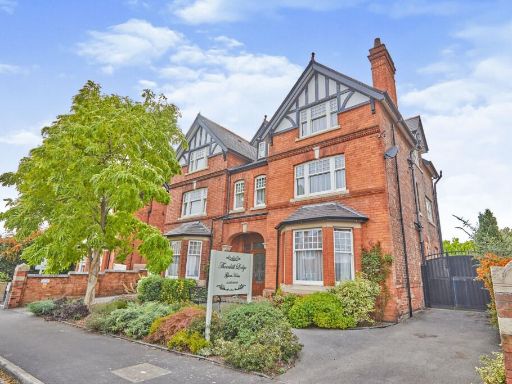 12 bedroom detached house for sale in Thornhill Road, Derby, DE22 — £825,000 • 12 bed • 12 bath • 4769 ft²
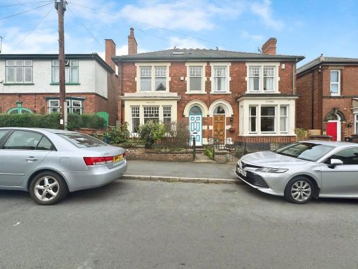 6 bedroom semi-detached house for sale in Breedon Hill Road, Derby, DE23 — £300,000 • 6 bed • 1 bath • 1533 ft²
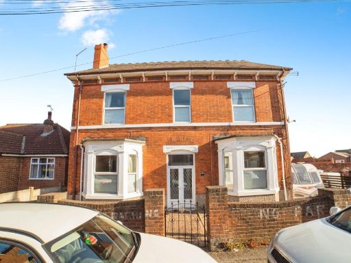 6 bedroom detached house for sale in Watkinson Street, Heanor, DE75 — £350,000 • 6 bed • 1 bath • 2724 ft²
 22 bedroom detached house for sale in Burton Road, Derby, Derbyshire, DE23 — £2,250,000 • 22 bed • 6 bath • 10000 ft²
 Semi-detached house for sale in Mundy Street, Heanor, DE75 — £275,000 • 1 bed • 1 bath • 2131 ft²
Meta
- {
"@context": "https://schema.org",
"@type": "Residence",
"name": "4 bedroom detached house for sale in Derby Road Heanor DE75…",
"description": "",
"url": "https://propertypiper.co.uk/property/e9a7716f-6677-41aa-8161-08d54e2b059d",
"image": "https://image-a.propertypiper.co.uk/f3ea5108-452d-47dd-bb51-c51263f179d4-1024.jpeg",
"address": {
"@type": "PostalAddress",
"streetAddress": "4 Derby Road",
"postalCode": "DE75 7QG",
"addressLocality": "Amber Valley",
"addressRegion": "Amber Valley",
"addressCountry": "England"
},
"geo": {
"@type": "GeoCoordinates",
"latitude": 53.01429416802592,
"longitude": -1.357715262988912
},
"numberOfRooms": 4,
"numberOfBathroomsTotal": 3,
"floorSize": {
"@type": "QuantitativeValue",
"value": 2218,
"unitCode": "FTK"
},
"offers": {
"@type": "Offer",
"price": 250000,
"priceCurrency": "GBP",
"availability": "https://schema.org/InStock"
},
"additionalProperty": [
{
"@type": "PropertyValue",
"name": "Feature",
"value": "Victorian"
},
{
"@type": "PropertyValue",
"name": "Feature",
"value": "detached"
},
{
"@type": "PropertyValue",
"name": "Feature",
"value": "brick"
},
{
"@type": "PropertyValue",
"name": "Feature",
"value": "double glazed"
},
{
"@type": "PropertyValue",
"name": "Feature",
"value": "gable roof"
},
{
"@type": "PropertyValue",
"name": "Feature",
"value": "period property"
},
{
"@type": "PropertyValue",
"name": "Feature",
"value": "driveway"
},
{
"@type": "PropertyValue",
"name": "Feature",
"value": "brickwork"
},
{
"@type": "PropertyValue",
"name": "Feature",
"value": "Victorian"
},
{
"@type": "PropertyValue",
"name": "Feature",
"value": "bay window"
},
{
"@type": "PropertyValue",
"name": "Feature",
"value": "medium ceiling height"
},
{
"@type": "PropertyValue",
"name": "Feature",
"value": "bright"
},
{
"@type": "PropertyValue",
"name": "Feature",
"value": "potential"
},
{
"@type": "PropertyValue",
"name": "Feature",
"value": "dated"
},
{
"@type": "PropertyValue",
"name": "Feature",
"value": "needs modernization"
},
{
"@type": "PropertyValue",
"name": "Feature",
"value": "living room"
},
{
"@type": "PropertyValue",
"name": "Feature",
"value": "arched alcove"
}
]
}
High Res Floorplan Images
Compatible Floorplan Images
FloorplanImages Thumbnail