UB7 7NH - 5 bedroom semidetached house for sale in Frays Close, West…
View on Property Piper
5 bedroom semi-detached house for sale in Frays Close, West Drayton, UB7
Property Details
- Price: £680000
- Bedrooms: 5
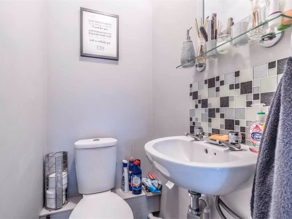
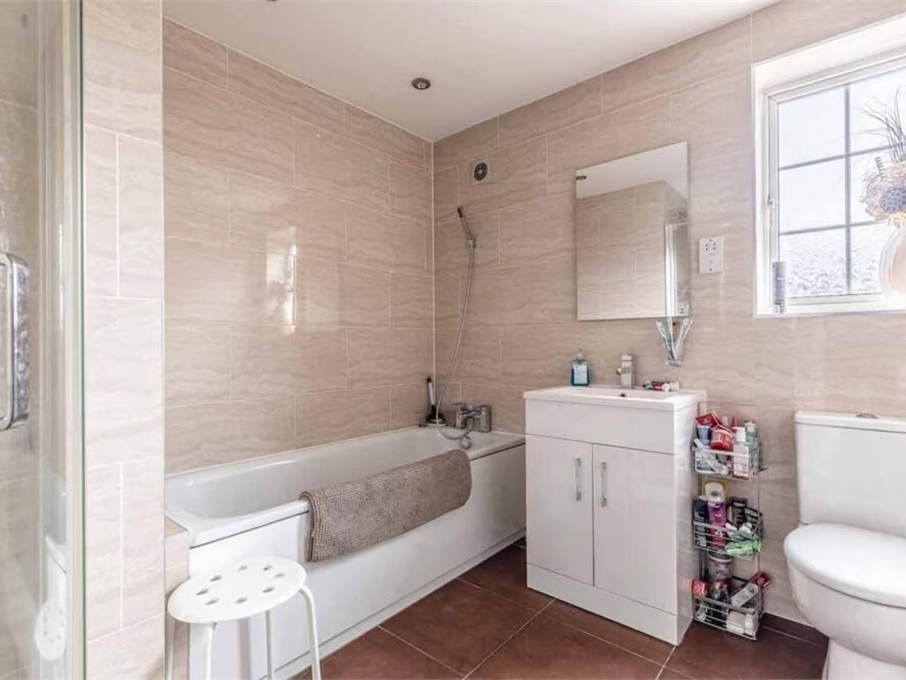
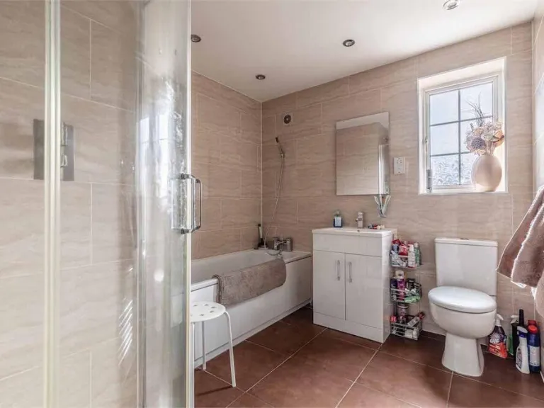
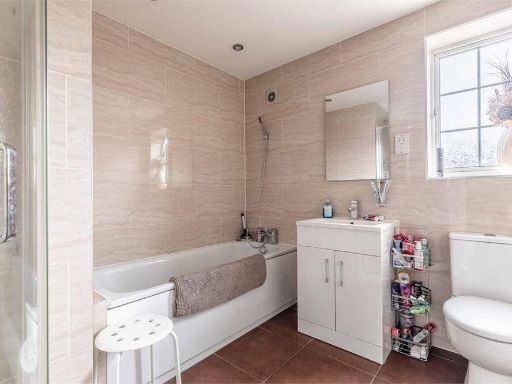
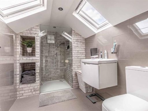
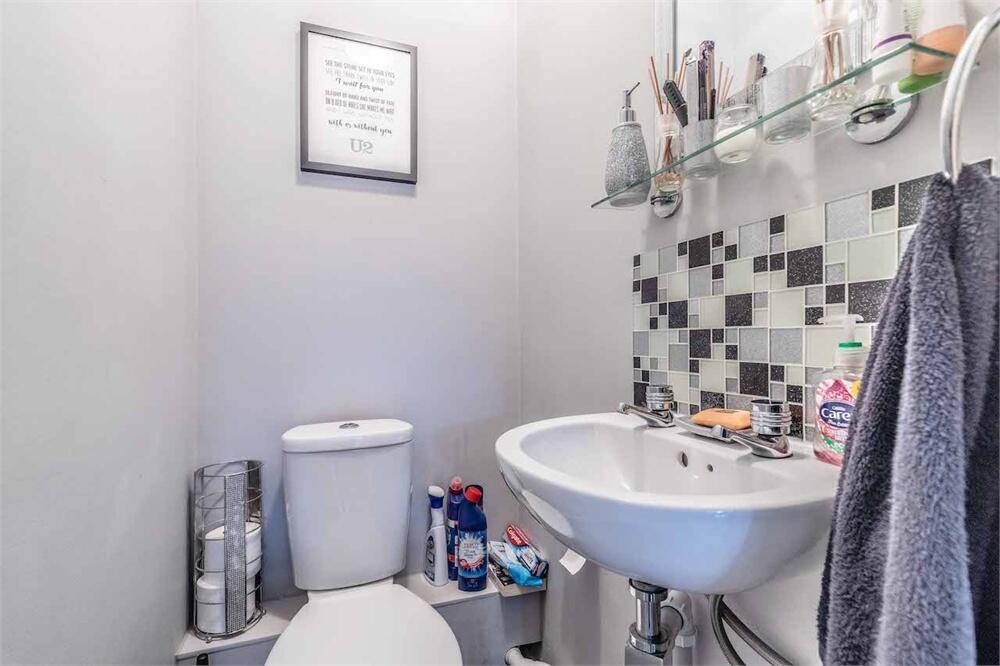
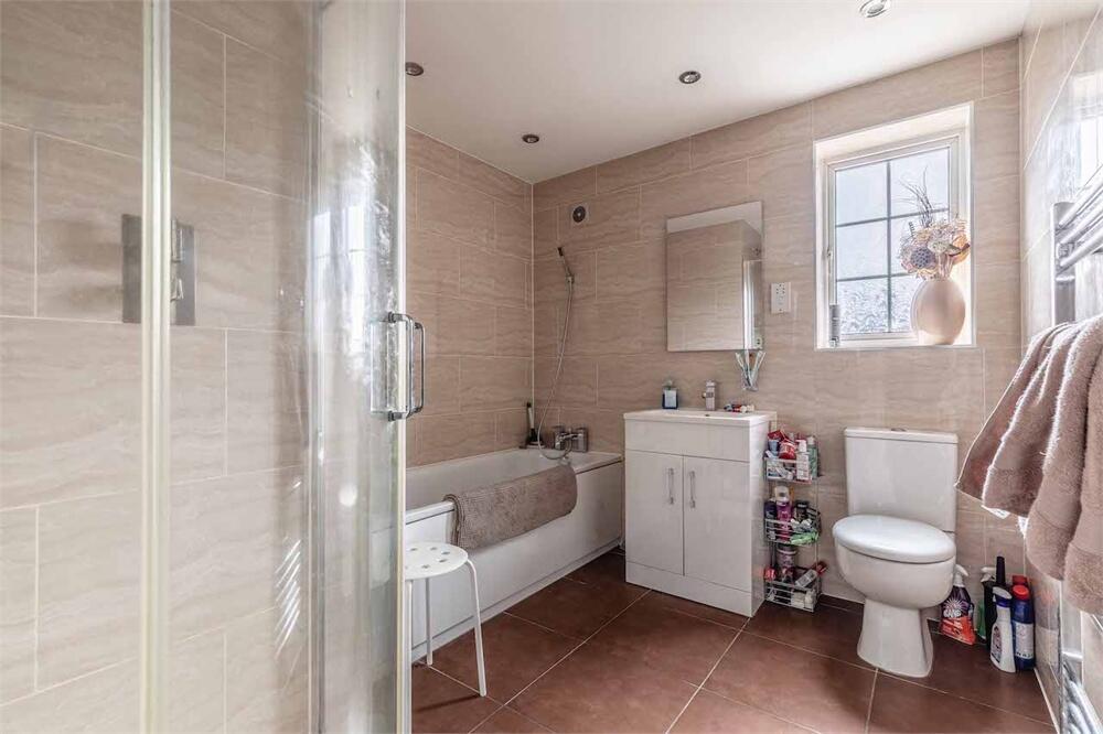
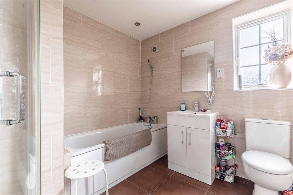
- Bathrooms: 3
- Property Type: undefined
- Property SubType: undefined
Brochure Descriptions
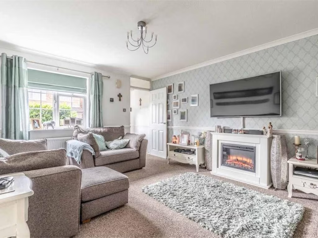
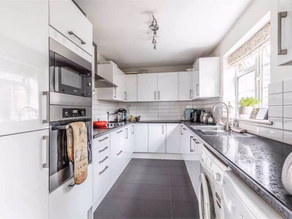
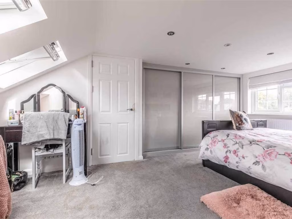
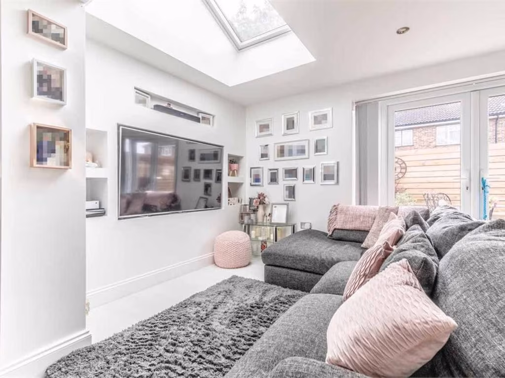
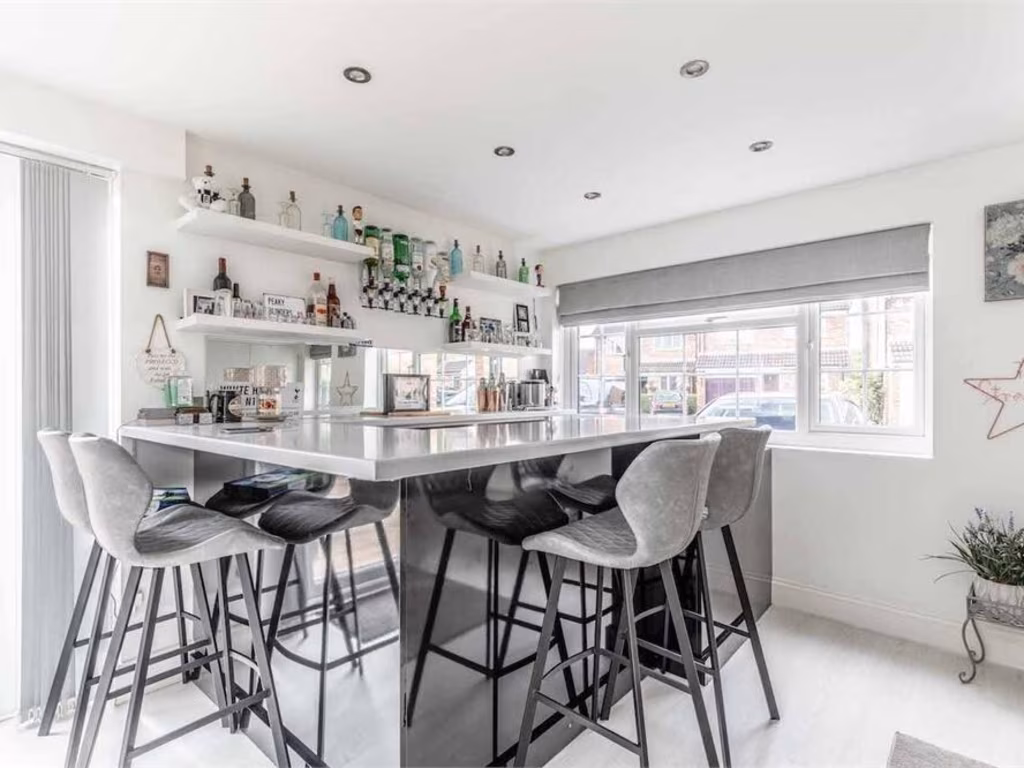
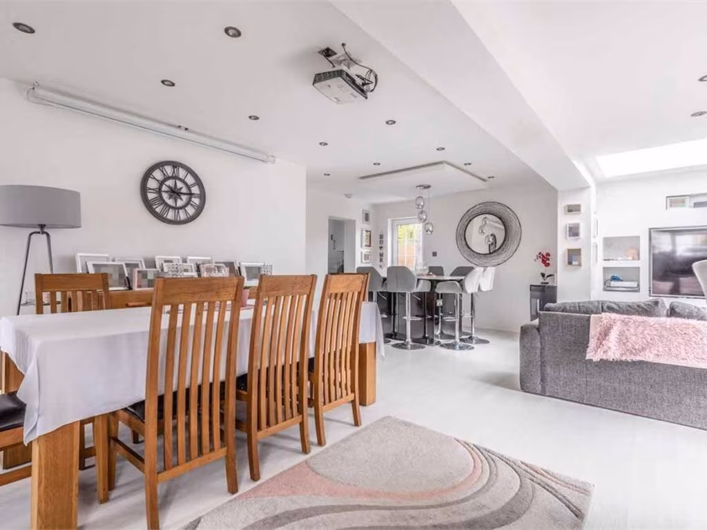
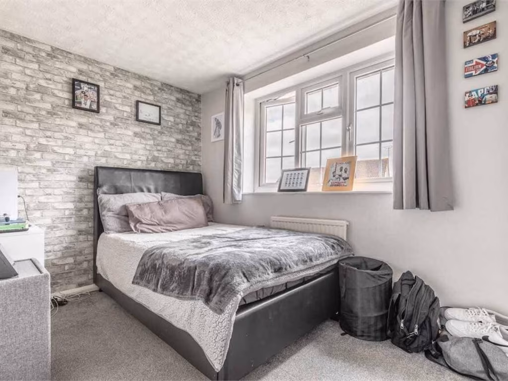
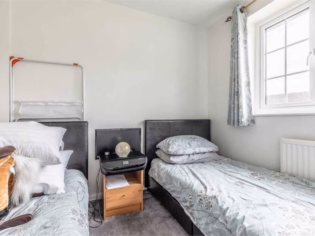
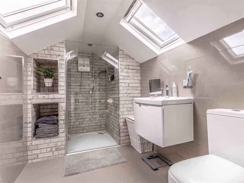
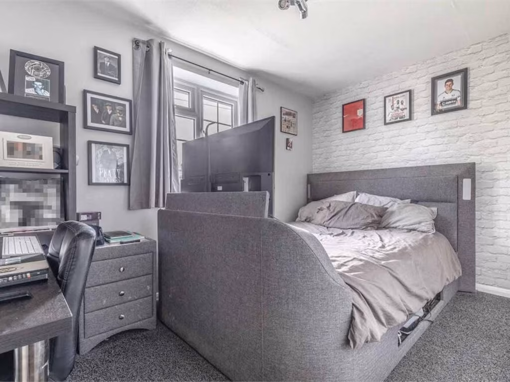
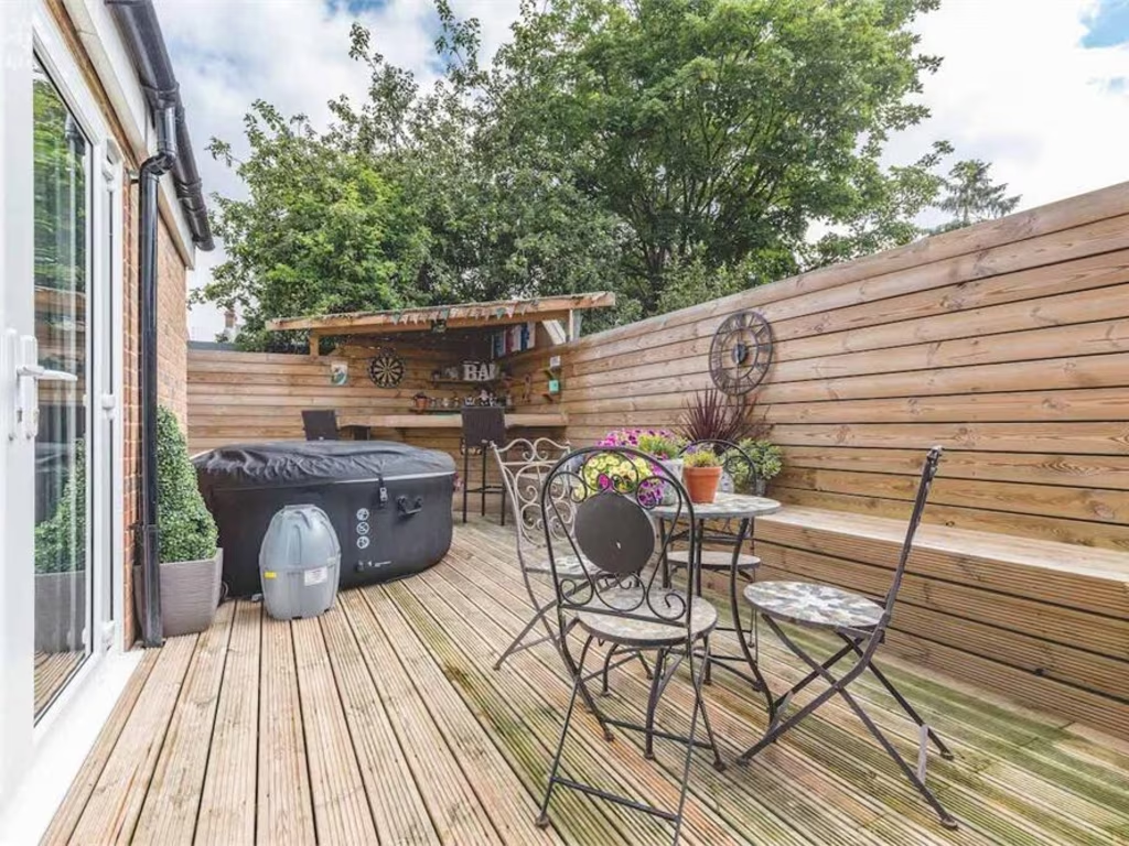
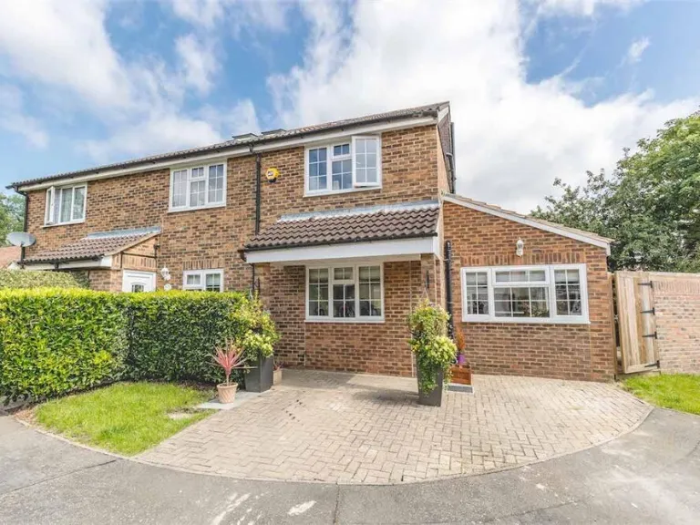
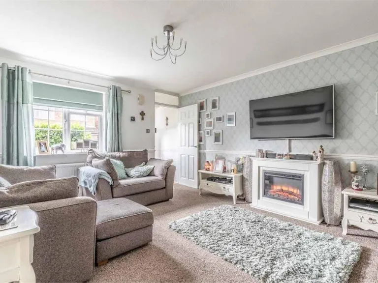
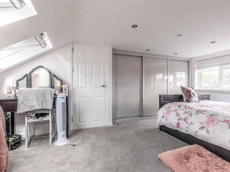
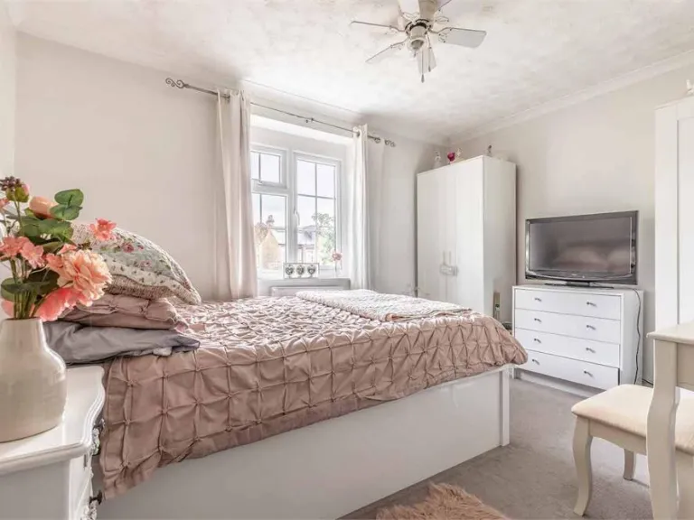
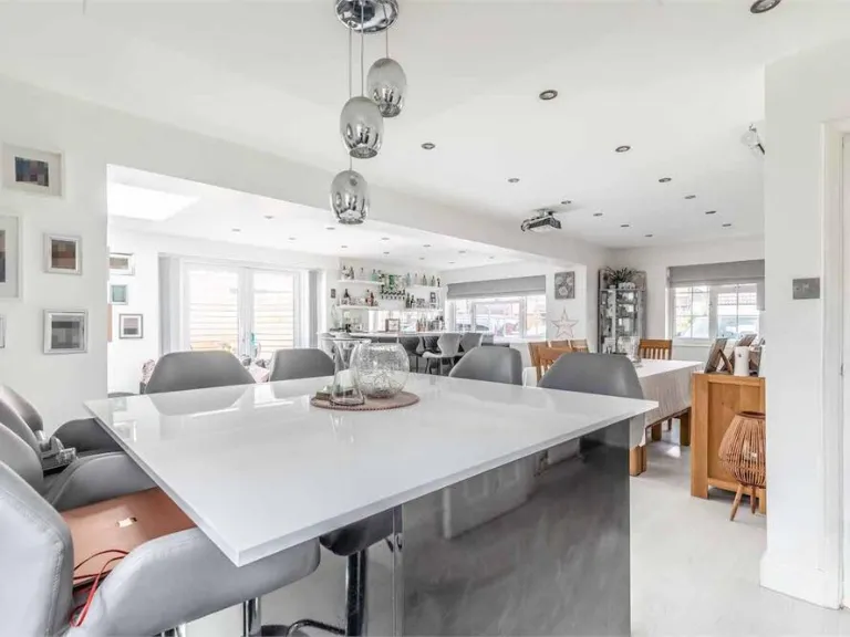
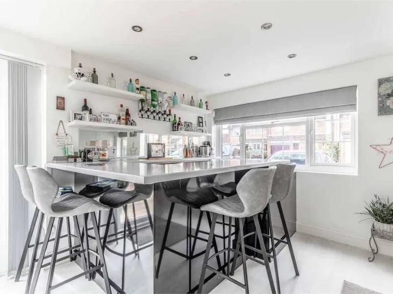
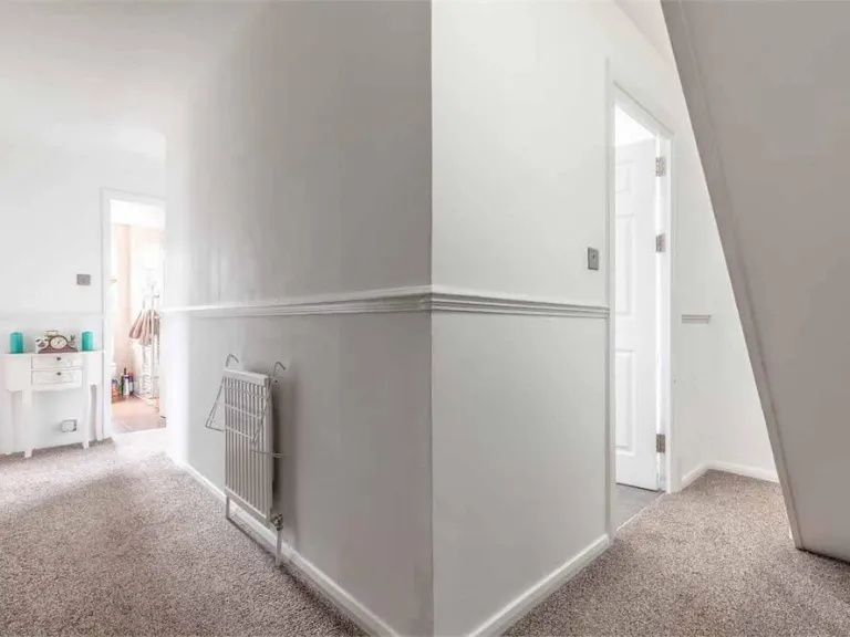
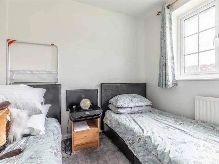
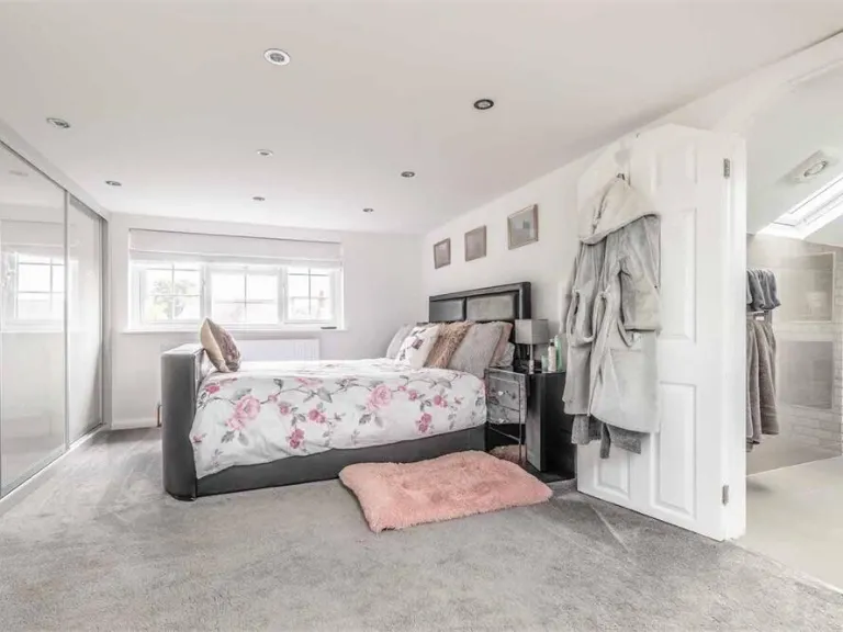
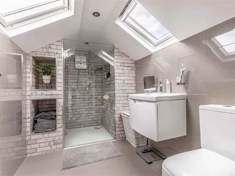
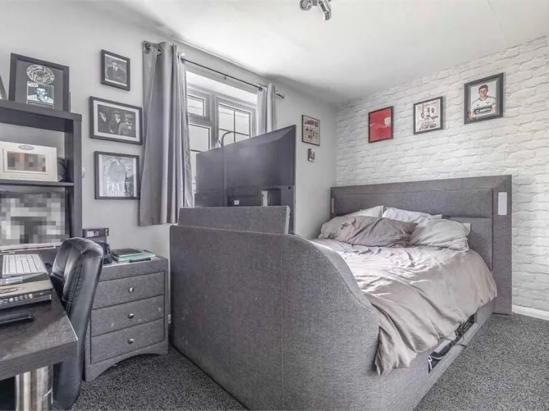
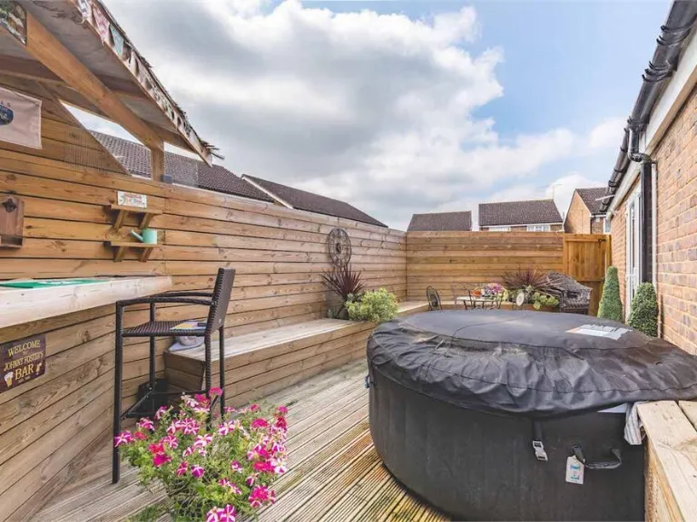
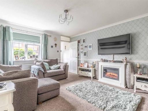
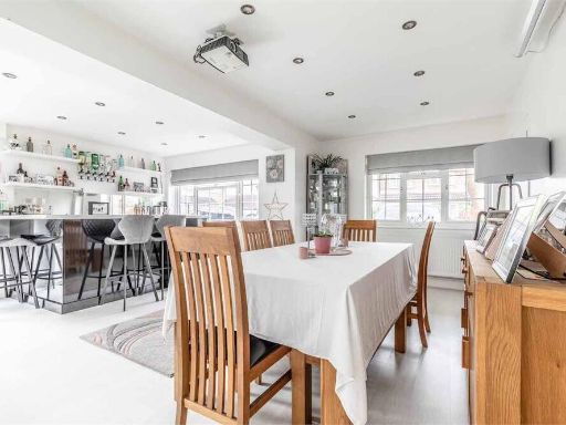
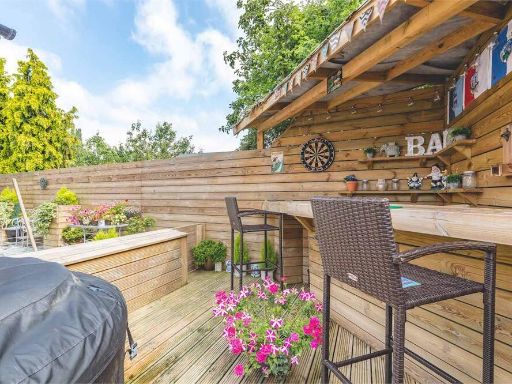
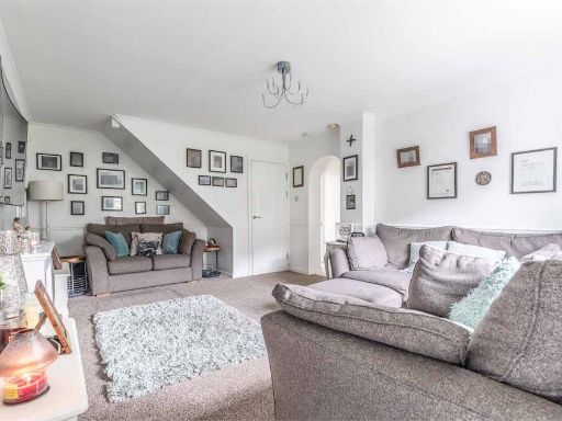
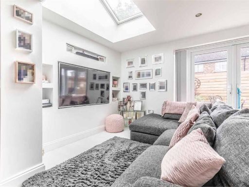
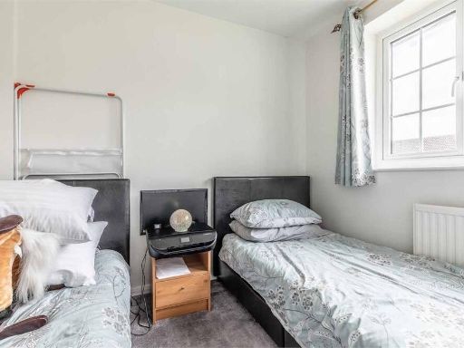
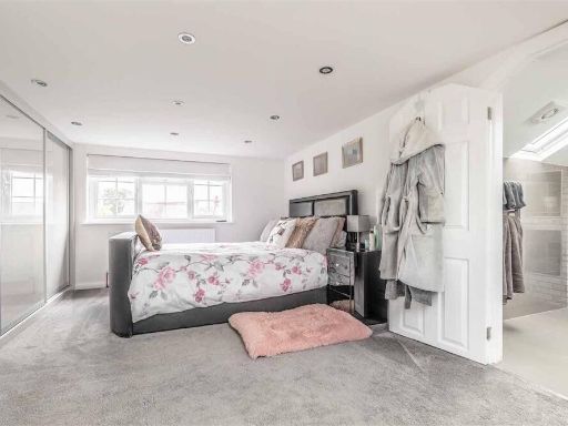
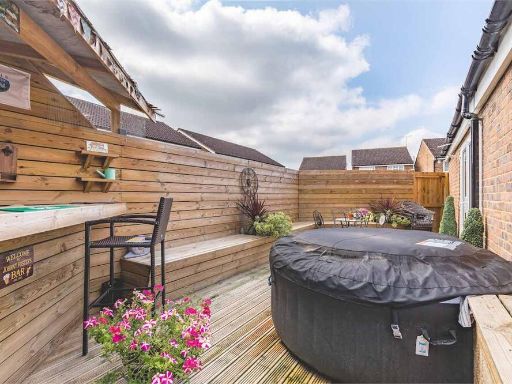
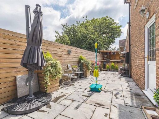
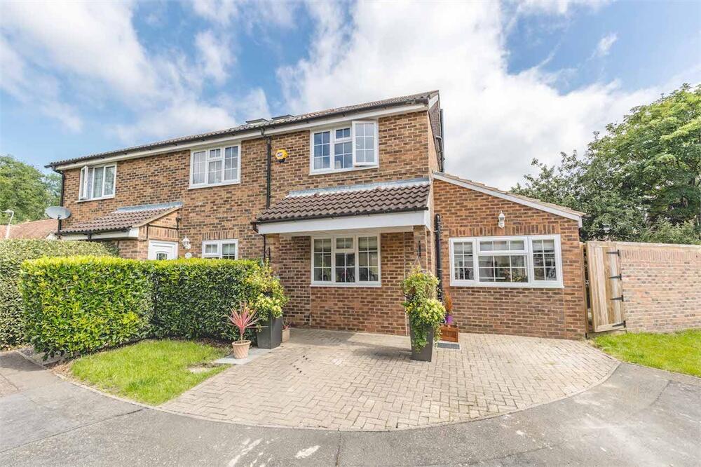
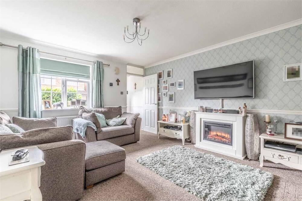
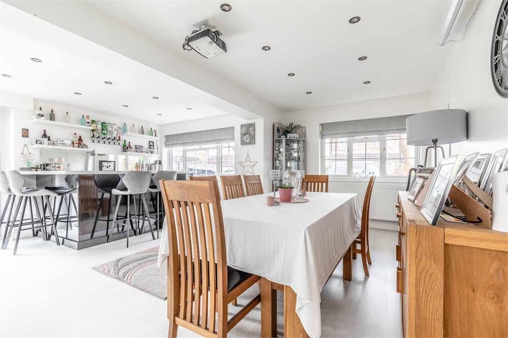
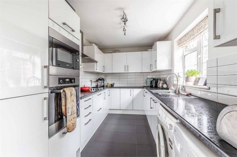
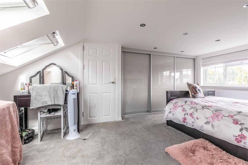
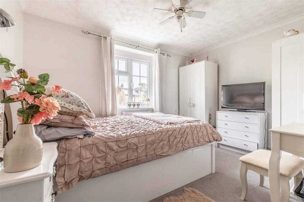
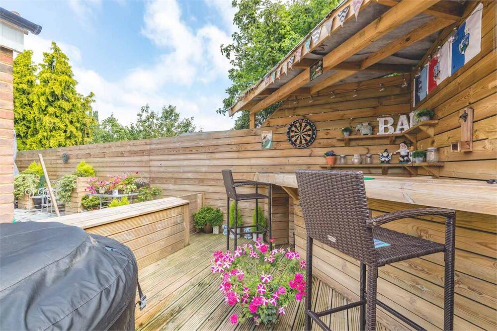
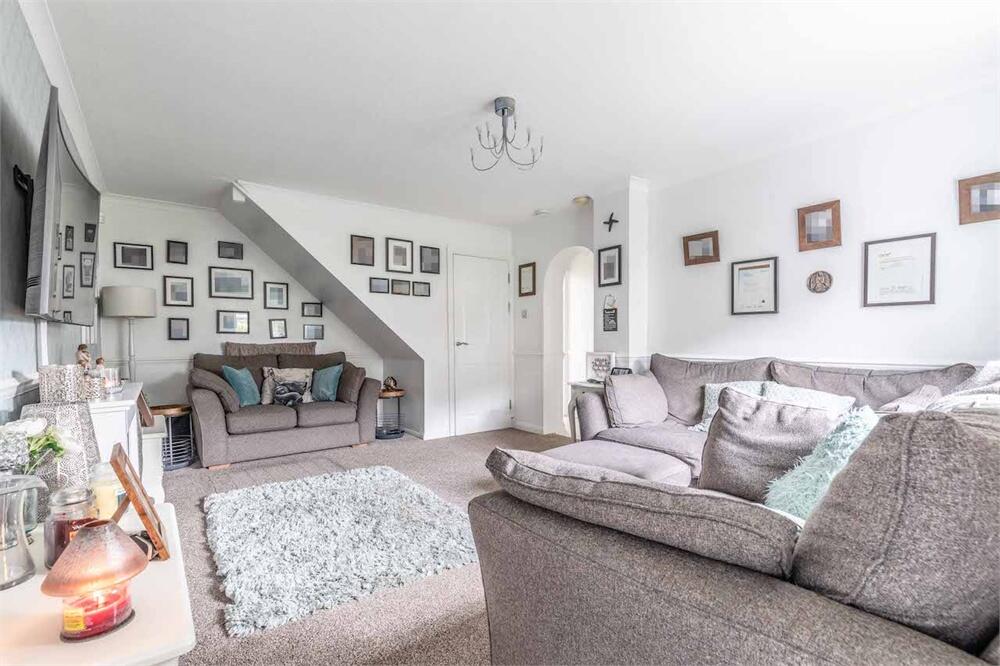
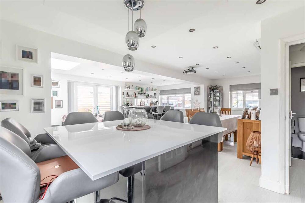
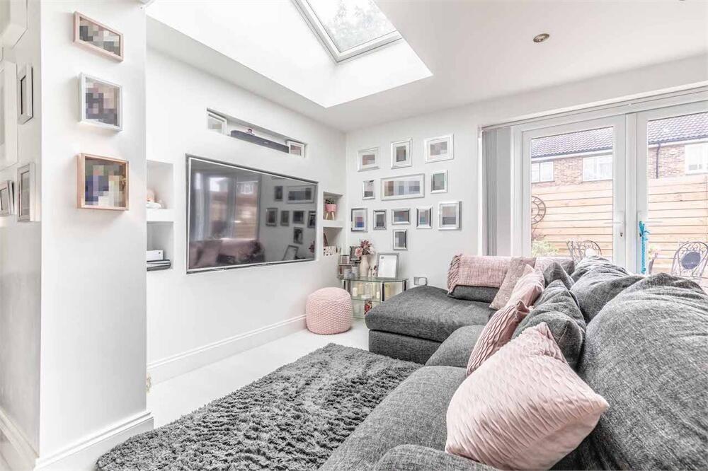
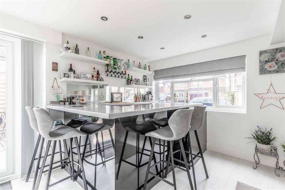
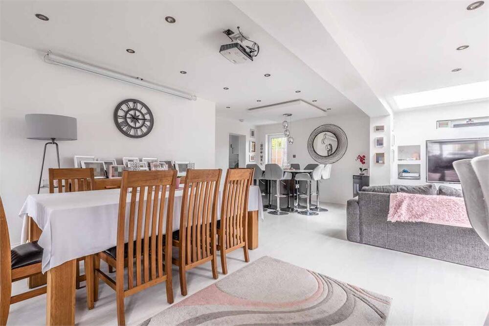
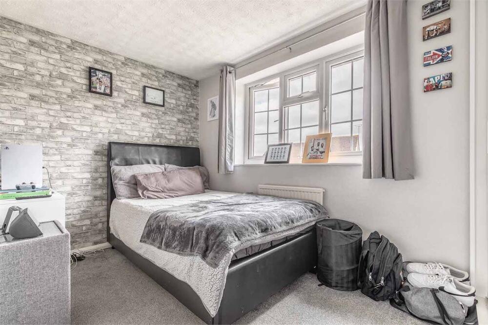
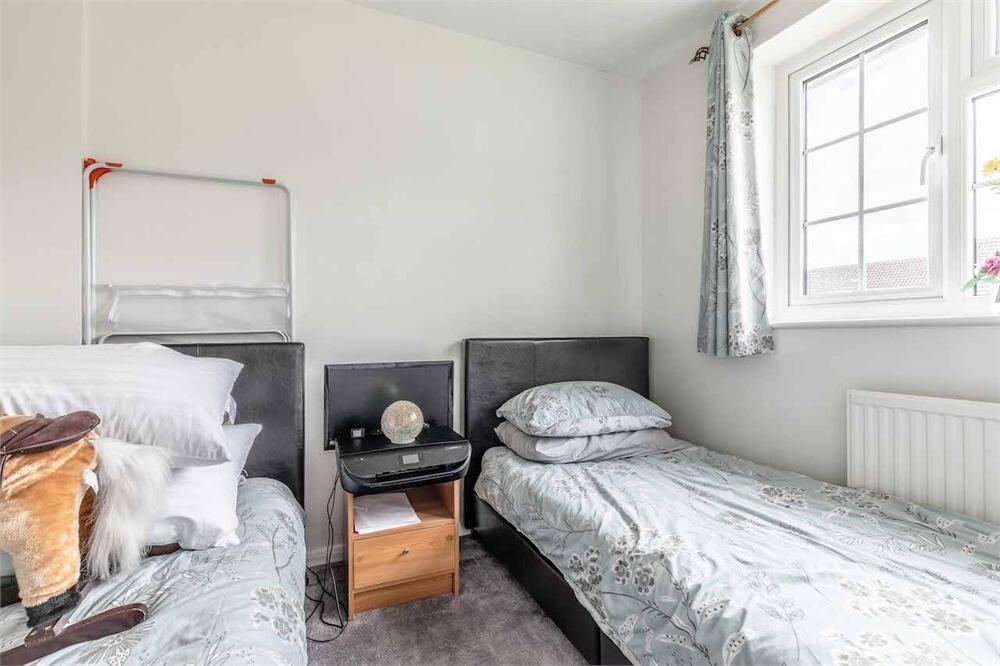
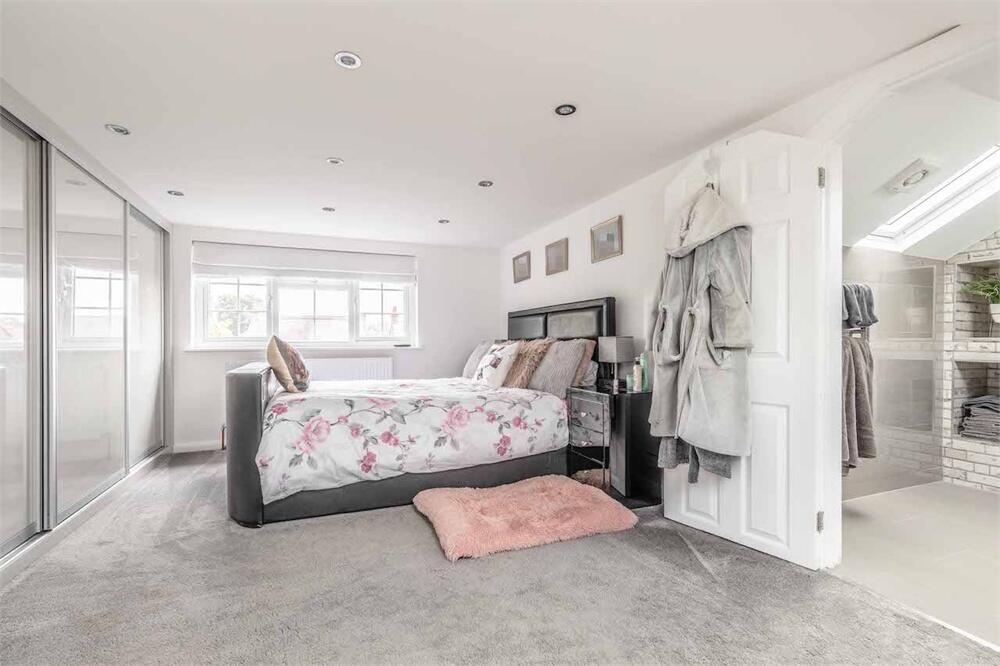
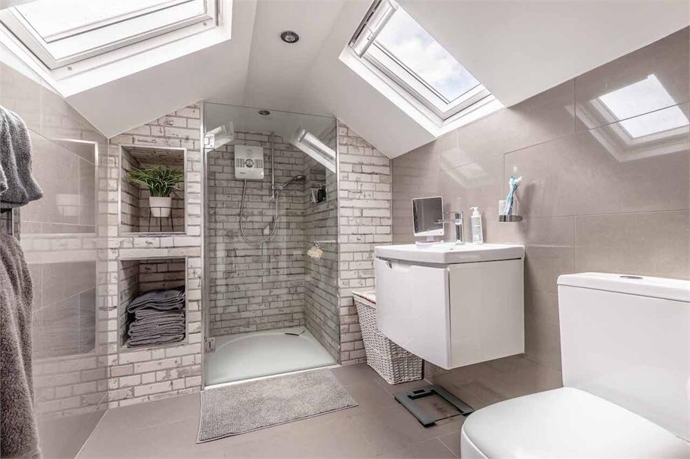
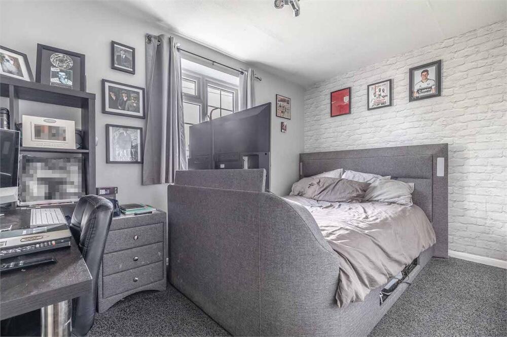
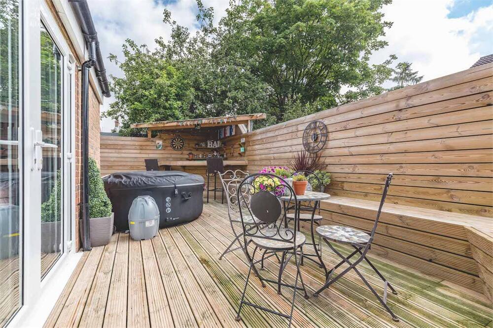
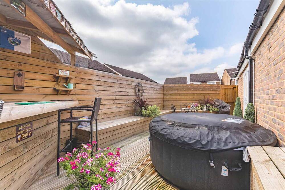
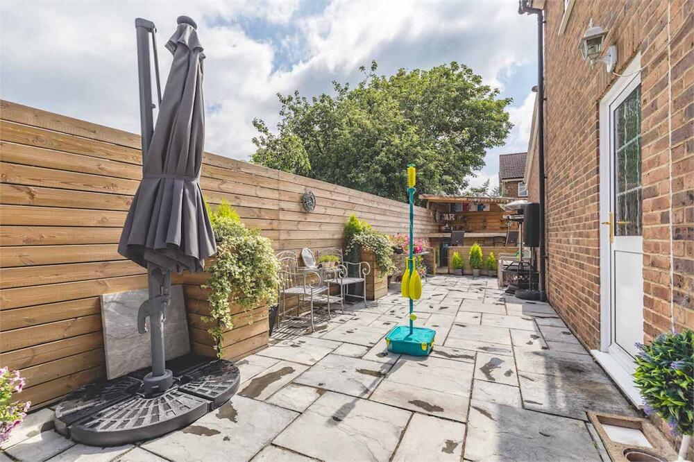
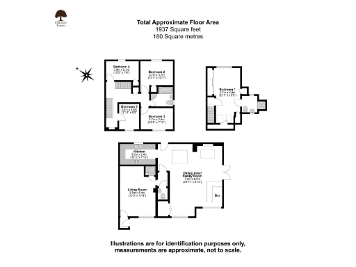
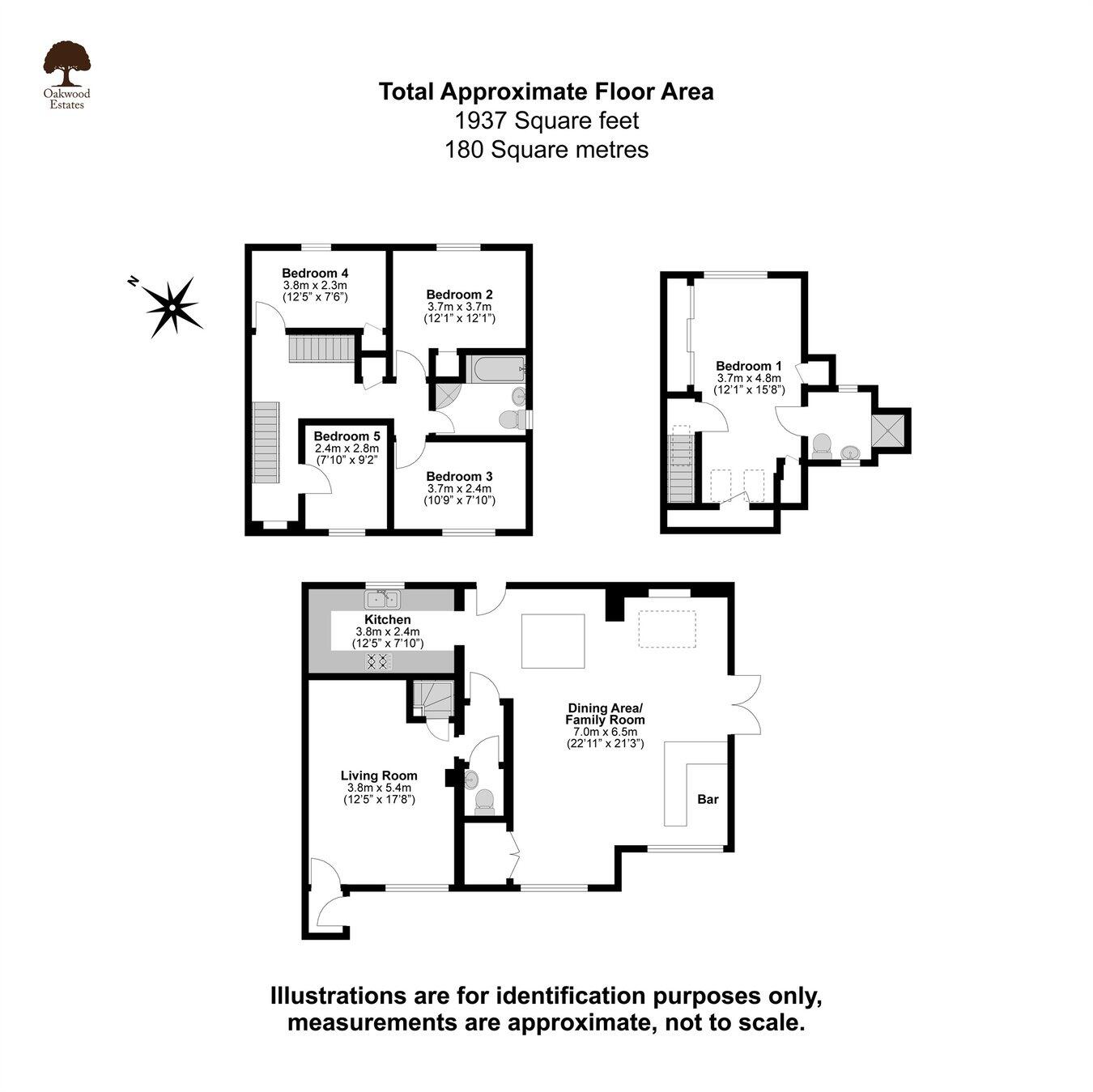
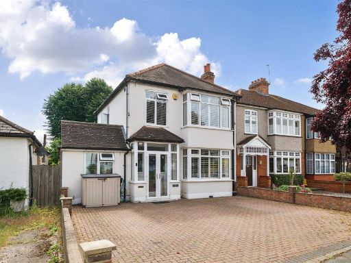
- A well-presented, extended 5-bedroom family house located in a quiet close within West Drayton's conservation area. The property has been finished to a high standard and benefits from a large open-plan ground-floor family living space (extended in 2019) incorporating a breakfast bar, dining area and snug, plus a separate cosy living room accessed via the front porch. The galley-style fitted kitchen is in excellent condition with good preparation and storage space. To the first floor there are three double bedrooms and one single bedroom served by a generously sized family bathroom. A loft conversion provides an impressive master suite with built-in wardrobes, eaves storage and a substantial en-suite shower room. Externally the rear garden is decked and includes a notable outside bar area and a neat patio section. A paved driveway to the front provides parking for two cars. Overall the plot and accommodation are consistent with a medium-sized family property in a desirable, quiet location; garden size is small-to-average and internal living space is medium-to-large due to the extension and loft conversion.
- Extended five-bedroom semi-detached family house arranged over three floors, offered at approximately 1,937 sq ft. The accommodation includes a large 22 ft family/dining area, a 17 ft living room, two bathrooms and a loft conversion (master suite). The property benefits from brand new windows throughout, a decked garden with an outside bar, driveway parking for two cars and is located within a conservation area. Overall the house presents as a spacious family home of medium/large internal size with a modest decked garden to the rear. High specification finishes are noted and the layout is suited to family living and entertaining.
Image Descriptions
- semi-detached house modern suburban
- living room contemporary
Rooms
- Kitchen:
- Living Room:
- Dining Area/ Family Room:
- Bedroom 4:
- Bedroom 2:
- Bedroom 5:
- Bedroom 3:
- Bedroom 1:
Textual Property Features
Detected Visual Features
- semi-detached
- brickwork
- modern
- suburban
- double glazing
- driveway
- residential area
- two-story
- living room
- contemporary
- standard ceiling height
- patterned wallpaper
- electric fireplace
- medium room
- interior modern
- neutral colors
EPC Details
- Fully double glazed
- Cavity wall, as built, partial insulation (assumed)
- Boiler and radiators, mains gas
- Low energy lighting in 88% of fixed outlets
- Solid, no insulation (assumed)
Nearby Schools
- Rabbsfarm Primary School
- Park Academy West London
- Colham Manor Primary School
- Cowley St Laurence CofE Primary School
- Bishopshalt School
- St Andrew's C of E Primary School
- Harmondsworth Primary School
- Lady Nafisa School
- St Catherine Catholic Primary School
- Hillingdon Primary School
- Whitehall Junior School
- Iver Village Infant Academy
- St Matthew's CofE Primary School
- The Skills Hub
- Uxbridge High School
- Whitehall Infant School
- The Eden SDA School
- Heathrow Primary School
- St Martin's Church of England Primary School
- Pippins School
- Laurel Lane Primary School
- West Drayton Academy
- Cherry Lane Primary School
- The Iver Village Junior School
Nearest Bars And Restaurants
- Id: 3259057393
- Tags:
- Amenity: fast_food
- Name: Fish & Chips
- TagsNormalized:
- Lat: 51.5071638
- Lon: -0.4709508
- FullGeoHash: gcptj294fp38
- PartitionGeoHash: gcpt
- Images:
- FoodStandards: null
- Distance: 816.1
,- Id: 8995650060
- Tags:
- Amenity: restaurant
- Cuisine: chinese
- Name: Go Sing
- TagsNormalized:
- Lat: 51.5088992
- Lon: -0.4740603
- FullGeoHash: gcptj0yv1dg0
- PartitionGeoHash: gcpt
- Images:
- FoodStandards: null
- Distance: 811.9
,- Id: 3297347669
- Tags:
- Addr:
- Housenumber: 162
- Postcode: UB7 7UF
- Street: Rowan Road
- Amenity: pub
- Name: The Cat & Fiddle
- Opening_hours: Mo-Tu 12:00-22:00; We-Th 14:00-22:00; Fr 14:00-00:00; Sa 10:00-00:00; Su 10:00-22:00
- Phone: +44 1895 438228
- Website: https://the-cat-fiddle.business.site/
- TagsNormalized:
- Lat: 51.4971838
- Lon: -0.4728242
- FullGeoHash: gcpsvnz8y6ue
- PartitionGeoHash: gcps
- Images:
- FoodStandards: null
- Distance: 808.6
,- Id: 3259057394
- Tags:
- Addr:
- Housenumber: 67
- Postcode: UB7 7LR
- Street: Station Road
- Amenity: fast_food
- Cuisine: burger
- Name: Smokin Patty
- Opening_hours: Mo-Su 16:00-00:00
- Phone: +44 1895 742235
- Website: https://smokinpatty.com/
- TagsNormalized:
- Lat: 51.5077525
- Lon: -0.4723387
- FullGeoHash: gcptj28n3syx
- PartitionGeoHash: gcpt
- Images:
- FoodStandards: null
- Distance: 786.7
,- Id: 3260845564
- Tags:
- Addr:
- Housenumber: 50
- Postcode: UB7 7DD
- Street: Station Road
- Amenity: cafe
- Name: The Griddle Diner
- Opening_hours: Mo-Sa 07:00-21:00; Su 07:30-20:00
- Phone: +44 1895 472307
- TagsNormalized:
- Lat: 51.508216
- Lon: -0.47341
- FullGeoHash: gcptj0z30eru
- PartitionGeoHash: gcpt
- Images:
- FoodStandards: null
- Distance: 776
}
Nearest General Shops
- Id: 3297347667
- Tags:
- TagsNormalized:
- Lat: 51.4976869
- Lon: -0.4725419
- FullGeoHash: gcpsvnzgubxh
- PartitionGeoHash: gcps
- Images:
- FoodStandards: null
- Distance: 780.1
,- Id: 9759339534
- Tags:
- Name: Kay's Kitchen
- Phone: +44 1895 348497
- Shop: bakery
- TagsNormalized:
- Lat: 51.5044015
- Lon: -0.4759836
- FullGeoHash: gcptj0j6uu2f
- PartitionGeoHash: gcpt
- Images:
- FoodStandards: null
- Distance: 354.8
,- Id: 9759402771
- Tags:
- Name: The Craft House
- Shop: craft
- TagsNormalized:
- Lat: 51.5045115
- Lon: -0.4763125
- FullGeoHash: gcptj0j5t0gd
- PartitionGeoHash: gcpt
- Images:
- FoodStandards: null
- Distance: 342.5
}
Nearest Grocery shops
- Id: 3297347668
- Tags:
- TagsNormalized:
- Lat: 51.4978028
- Lon: -0.4725227
- FullGeoHash: gcpsvnzumqjx
- PartitionGeoHash: gcps
- Images:
- FoodStandards: null
- Distance: 771.8
,- Id: 3267254648
- Tags:
- Name: Danes Convenience Store
- Shop: convenience
- TagsNormalized:
- Lat: 51.5050012
- Lon: -0.4751096
- FullGeoHash: gcptj0nn3hhe
- PartitionGeoHash: gcpt
- Images:
- FoodStandards: null
- Distance: 441.9
,- Id: 5504595415
- Tags:
- Addr:
- City: West Drayton
- Country: GB
- Postcode: UB7 7EQ
- Street: Mill Road
- Amenity: fuel
- Brand: Esso
- Brand:wikidata: Q867662
- Fhrs:
- Name: Esso Mill Road Service Station
- Shop: convenience
- TagsNormalized:
- Lat: 51.5018023
- Lon: -0.4794756
- FullGeoHash: gcpsvpdgerv1
- PartitionGeoHash: gcps
- Images:
- FoodStandards: null
- Distance: 120.9
}
Nearest Supermarkets
- Id: 4621453392
- Tags:
- Name: Co-op
- Name:en: Co-op
- Shop: supermarket
- TagsNormalized:
- Lat: 51.4875928
- Lon: -0.436119
- FullGeoHash: gcpsyj42vwyn
- PartitionGeoHash: gcps
- Images:
- FoodStandards: null
- Distance: 3495.3
,- Id: 253758447
- Tags:
- Addr:
- City: Yiewsley
- Postcode: UB7 7FP
- Street: Chantry Close
- Brand: Tesco
- Brand:wikidata: Q487494
- Brand:wikipedia: en:Tesco
- Building: retail
- Building:levels: 3
- Contact:
- Website: https://www.tesco.com/store-locator/west-drayton/high-st
- Name: Tesco Yiewsley
- Opening_hours: Mo-Sa 07:00-23:00; Su 11:00-17:00
- Shop: supermarket
- TagsNormalized:
- tesco
- retail
- supermarket
- shop
- Lat: 51.5156917
- Lon: -0.4772837
- FullGeoHash: gcptj4hkwkzq
- PartitionGeoHash: gcpt
- Images:
- FoodStandards: null
- Distance: 1455.8
,- Id: 1183415035
- Tags:
- Addr:
- City: West Drayton
- Country: GB
- Housenumber: 141-161
- Postcode: UB7 7QN
- Street: High Street
- Suburb: Yiewsley
- Brand: ALDI
- Brand:wikidata: Q41171672
- Brand:wikipedia: en:Aldi
- Contact:
- Website: https://stores.aldi.co.uk/west-drayton/high-street
- Fhrs:
- Name: Aldi
- Name:fa: آلدی
- Opening_hours: Mo-Sa 08:00-22:00;Su 10:00-16:00
- Shop: supermarket
- Source: survey
- Source:addr: FHRS Open Data
- TagsNormalized:
- Lat: 51.5145616
- Lon: -0.4742683
- FullGeoHash: gcptj1ywhdrc
- PartitionGeoHash: gcpt
- Images:
- FoodStandards:
- Id: 518714
- FHRSID: 518714
- LocalAuthorityBusinessID: 39088
- BusinessName: Aldi Stores Ltd
- BusinessType: Retailers - supermarkets/hypermarkets
- BusinessTypeID: 7840
- AddressLine1: null
- AddressLine2: 141-161 High Street
- AddressLine3: null
- AddressLine4: Yiewsley
- PostCode: UB7 7QN
- RatingValue: 5
- RatingKey: fhrs_5_en-GB
- RatingDate: 2020-01-29
- LocalAuthorityCode: 517
- LocalAuthorityName: Hillingdon
- LocalAuthorityWebSite: http://www.hillingdon.gov.uk/foodsafety
- LocalAuthorityEmailAddress: foodhealthandsafety@hillingdon.gov.uk
- Scores:
- Hygiene: 0
- Structural: 0
- ConfidenceInManagement: 5
- NewRatingPending: false
- Geocode:
- Longitude: -0.47461900000000
- Latitude: 51.51452700000000
- Distance: 1380.4
}
Nearest Religious buildings
- Id: 921992318
- Tags:
- Amenity: place_of_worship
- Building: yes
- Name: West Drayton Baptist Church
- Religion: christian
- TagsNormalized:
- place of worship
- baptist
- church
- christian
- Lat: 51.5069288
- Lon: -0.4739836
- FullGeoHash: gcptj0wce7kn
- PartitionGeoHash: gcpt
- Images:
- FoodStandards: null
- Distance: 641.6
,- Id: 858986851
- Tags:
- Amenity: place_of_worship
- Building: church
- Denomination: anglican
- Name: St Martin's
- Religion: christian
- TagsNormalized:
- place of worship
- church
- anglican
- martins
- christian
- Lat: 51.5048628
- Lon: -0.4717816
- FullGeoHash: gcptj20mwdq4
- PartitionGeoHash: gcpt
- Images:
- FoodStandards: null
- Distance: 638.9
,- Id: 921987310
- Tags:
- Amenity: place_of_worship
- Building: yes
- Denomination: roman_catholic
- Name: St Catherine
- Religion: christian
- TagsNormalized:
- place of worship
- catholic
- roman catholic
- christian
- church
- Lat: 51.5042886
- Lon: -0.4762722
- FullGeoHash: gcptj0j4np38
- PartitionGeoHash: gcpt
- Images:
- FoodStandards: null
- Distance: 331.2
}
Nearest Medical buildings
- Id: 6601991364
- Tags:
- Amenity: pharmacy
- Dispensing: yes
- Healthcare: pharmacy
- Name: Yiewsley Pharmacy
- TagsNormalized:
- Lat: 51.5119257
- Lon: -0.4725323
- FullGeoHash: gcptj1rytnym
- PartitionGeoHash: gcpt
- Images:
- FoodStandards: null
- Distance: 1156.2
,- Id: 9028780542
- Tags:
- Amenity: clinic
- Healthcare: clinic
- Name: Yiewsley Health Centre
- TagsNormalized:
- clinic
- health
- healthcare
- health centre
- Lat: 51.5114805
- Lon: -0.4725255
- FullGeoHash: gcptj1ruj7gq
- PartitionGeoHash: gcpt
- Images:
- FoodStandards: null
- Distance: 1112.9
,- Id: 3259057403
- Tags:
- Addr:
- Housenumber: 14,16
- Postcode: UB7 7BY
- Street: Station Road
- Amenity: pharmacy
- Brand: Boots
- Brand:wikidata: Q6123139
- Brand:wikipedia: en:Boots (company)
- Contact:
- Website: https://www.boots.com/stores/6030-west-drayton-station-road-ub7-7by
- Healthcare: pharmacy
- Name: Boots
- Opening_hours: Mo-Tu, Th-Fr 09:00-13:30, 14:45-18:00; We, Sa 09:00-13:30, 14:45-17:00
- Phone: +44 1895 442589
- TagsNormalized:
- pharmacy
- boots
- health
- healthcare
- Lat: 51.5091056
- Lon: -0.4742024
- FullGeoHash: gcptj0ywq31p
- PartitionGeoHash: gcpt
- Images:
- FoodStandards: null
- Distance: 826.2
,- Id: 320226972
- Tags:
- Amenity: doctors
- Healthcare: doctor
- Name: West Drayton Medical Centre
- TagsNormalized:
- doctor
- doctors
- health
- healthcare
- Lat: 51.5047461
- Lon: -0.4760588
- FullGeoHash: gcptj0jkgh8c
- PartitionGeoHash: gcpt
- Images:
- FoodStandards: null
- Distance: 372
}
Nearest Airports
- Id: 260720166
- Tags:
- Aerodrome: international
- Aeroway: aerodrome
- Alt_name: Gatwick Airport
- Ele: 62
- Iata: LGW
- Icao: EGKK
- Internet_access: wlan
- Internet_access:fee: no
- Internet_access:ssid: Gatwick FREE Wi-Fi
- Name: London Gatwick Airport
- Operator: Gatwick Airport Limited
- Ref: LGW
- Website: https://www.gatwickairport.com/
- Wikidata: Q8703
- Wikipedia: en:Gatwick Airport
- TagsNormalized:
- airport
- international airport
- Lat: 51.1540917
- Lon: -0.1883773
- FullGeoHash: gcpg58qf4mzd
- PartitionGeoHash: gcpg
- Images:
- FoodStandards: null
- Distance: 43755.2
,- Id: 14001268
- Tags:
- Access: yes
- Aerodrome: international
- Aerodrome:type: public
- Aeroway: aerodrome
- Alt_name: London Heathrow
- Alt_name_2: London Heathrow Airport
- Ele: 25
- Iata: LHR
- Icao: EGLL
- Int_name: Heathrow Airport
- Name: London Heathrow Airport
- Note: area still approx
- Old_name: London Airport
- Operator: Heathrow Airport Limited
- Rank_aci:
- Ref: LHR
- Short_name: Heathrow
- Type: multipolygon
- Website: https://www.heathrow.com/
- Wikidata: Q8691
- Wikipedia: en:Heathrow Airport
- TagsNormalized:
- airport
- international airport
- Lat: 51.4677522
- Lon: -0.4547736
- FullGeoHash: gcpsv9kv7h2h
- PartitionGeoHash: gcps
- Images:
- FoodStandards: null
- Distance: 4274.9
}
Nearest Leisure Facilities
- Id: 320226976
- Tags:
- TagsNormalized:
- Lat: 51.5027844
- Lon: -0.4724791
- FullGeoHash: gcpsvpzcqqy5
- PartitionGeoHash: gcps
- Images:
- FoodStandards: null
- Distance: 545.5
,- Id: 956242954
- Tags:
- Leisure: pitch
- Name: Multi use ball court
- TagsNormalized:
- Lat: 51.5021948
- Lon: -0.4727332
- FullGeoHash: gcpsvpxy08bw
- PartitionGeoHash: gcps
- Images:
- FoodStandards: null
- Distance: 531.4
,- Id: 114200472
- Tags:
- Leisure: park
- Name: The Closes Recreation Ground
- TagsNormalized:
- Lat: 51.5016765
- Lon: -0.4734156
- FullGeoHash: gcpsvpx7087e
- PartitionGeoHash: gcps
- Images:
- FoodStandards: null
- Distance: 495
,- Id: 967596005
- Tags:
- TagsNormalized:
- Lat: 51.5016807
- Lon: -0.4756014
- FullGeoHash: gcpsvptej9ju
- PartitionGeoHash: gcps
- Images:
- FoodStandards: null
- Distance: 349.8
,- Id: 969599999
- Tags:
- Leisure: nature_reserve
- Name: Frays Island & Mabey's Meadow Nature Reserve
- Operator: London Wildlife Trust
- Operator:wikidata: Q6671026
- Website: https://www.wildlondon.org.uk/nature-reserves/frays-island-and-mabeys-meadow
- TagsNormalized:
- nature reserve
- leisure
- meadow
- Lat: 51.5044782
- Lon: -0.4829198
- FullGeoHash: gcptj00774sg
- PartitionGeoHash: gcpt
- Images:
- FoodStandards: null
- Distance: 262.2
}
Nearest Tourist attractions
- Id: 913251587
- Tags:
- TagsNormalized:
- Lat: 51.522814
- Lon: -0.4895385
- FullGeoHash: gcpthg7w0utt
- PartitionGeoHash: gcpt
- Images:
- FoodStandards: null
- Distance: 2320.7
,- Id: 148054007
- Tags:
- Building: barn
- Listed_status: Grade I
- Name: Harmondsworth Great Barn
- Tourism: attraction
- Website: https://www.english-heritage.org.uk/visit/places/harmondsworth-barn/
- Wikidata: Q5659195
- Wikipedia: en:Harmondsworth Great Barn
- TagsNormalized:
- Lat: 51.4897207
- Lon: -0.4799402
- FullGeoHash: gcpsvj6t2ede
- PartitionGeoHash: gcps
- Images:
- FoodStandards: null
- Distance: 1448
,- Id: 4921147190
- Tags:
- Name: B&B Oakwood
- Phone: +44 7720 074800
- Tourism: guest_house
- TagsNormalized:
- Lat: 51.5068391
- Lon: -0.4701673
- FullGeoHash: gcptj299h69z
- PartitionGeoHash: gcpt
- Images:
- FoodStandards: null
- Distance: 839.9
}
Nearest Train stations
- Id: 5182384972
- Tags:
- Fare_zone: 6
- Line: Piccadilly
- Name: Heathrow Terminal 5
- Naptan:
- Network: London Underground
- Operator: Heathrow Airport Holdings
- Public_transport: station
- Railway: station
- Station: subway
- Subway: yes
- Wheelchair: yes
- Wheelchair:description: Step-free access street to train
- Wikipedia: en:Heathrow Terminal 5 station
- TagsNormalized:
- Lat: 51.472515
- Lon: -0.4877331
- FullGeoHash: gcpsufkc4upz
- PartitionGeoHash: gcps
- Images:
- FoodStandards: null
- Distance: 3399.4
,- Id: 7351554622
- Tags:
- Light_rail: yes
- Name: Station A
- Network: Heathrow Airport
- Public_transport: station
- Railway: station
- Station: light_rail
- TagsNormalized:
- Lat: 51.4797899
- Lon: -0.4882479
- FullGeoHash: gcpsugs7wbru
- PartitionGeoHash: gcps
- Images:
- FoodStandards: null
- Distance: 2609.7
,- Id: 7351551721
- Tags:
- Light_rail: yes
- Name: Station B
- Network: Heathrow Airport
- Public_transport: station
- Railway: station
- Station: light_rail
- TagsNormalized:
- Lat: 51.4798719
- Lon: -0.4857886
- FullGeoHash: gcpsugw7br9v
- PartitionGeoHash: gcps
- Images:
- FoodStandards: null
- Distance: 2570.5
,- Id: 25532362
- Tags:
- Name: Iver
- Naptan:
- Network: National Rail;Elizabeth Line
- Operator: TfL Rail
- Public_transport: station
- Railway: station
- Ref:
- Wheelchair: yes
- Wheelchair:description: Access from platform to train by manual boarding ramp.
- Wikidata: Q6098724
- Wikipedia: en:Iver railway station
- TagsNormalized:
- Lat: 51.5086086
- Lon: -0.5068108
- FullGeoHash: gcpth2ygqkw6
- PartitionGeoHash: gcpt
- Images:
- FoodStandards: null
- Distance: 1943.5
,- Id: 1256794
- Tags:
- Fare_zone: 6
- Name: West Drayton
- Naptan:
- Network: National Rail;Elizabeth Line
- Operator: TfL Rail
- Public_transport: station
- Railway: station
- Ref:
- Source_ref: http://en.wikipedia.org/wiki/List_of_London_railway tions
- Wheelchair: yes
- Wheelchair:description: Access from platform to train by manual boarding ramp.
- Wikidata: Q2033143
- Wikipedia: en:West Drayton railway station
- TagsNormalized:
- Lat: 51.5097364
- Lon: -0.4718293
- FullGeoHash: gcptj303vwfd
- PartitionGeoHash: gcpt
- Images:
- FoodStandards: null
- Distance: 976.6
}
Nearest Bus stations and stops
- Id: 469782692
- Tags:
- Highway: bus_stop
- Name: Swan Road
- Naptan:
- AtcoCode: 490013111S
- Bearing: S
- CommonName: Swan Road
- Street: SWAN ROAD
- Verified: no
- Public_transport: platform
- TagsNormalized:
- Lat: 51.5050246
- Lon: -0.4752376
- FullGeoHash: gcptj0jyw0mp
- PartitionGeoHash: gcpt
- Images:
- FoodStandards: null
- Distance: 436.2
,- Id: 469788768
- Tags:
- Highway: bus_stop
- Name: The Green
- Naptan:
- AtcoCode: 490013392N
- Bearing: N
- CommonName: The Green Money Lane
- Street: THE GREEN
- Verified: no
- Public_transport: platform
- TagsNormalized:
- Lat: 51.5029216
- Lon: -0.4772466
- FullGeoHash: gcpsvpu6r27n
- PartitionGeoHash: gcps
- Images:
- FoodStandards: null
- Distance: 216.4
,- Id: 469789276
- Tags:
- Highway: bus_stop
- Name: Mill Road
- Naptan:
- AtcoCode: 490015484W
- Bearing: W
- CommonName: Wise Lane Mill Road
- Indicator: Stop
- Street: WISE LANE
- Verified: no
- Public_transport: platform
- TagsNormalized:
- Lat: 51.5008893
- Lon: -0.4799615
- FullGeoHash: gcpsvp6w2jdg
- PartitionGeoHash: gcps
- Images:
- FoodStandards: null
- Distance: 207.7
,- Id: 469788769
- Tags:
- Highway: bus_stop
- Name: The Green
- Naptan:
- AtcoCode: 490013392S
- Bearing: S
- CommonName: The Green Money Lane
- Street: THE GREEN
- Verified: no
- Public_transport: platform
- TagsNormalized:
- Lat: 51.5025247
- Lon: -0.4774693
- FullGeoHash: gcpsvpsrfnmn
- PartitionGeoHash: gcps
- Images:
- FoodStandards: null
- Distance: 201.5
,- Id: 469775165
- Tags:
- Highway: bus_stop
- Name: Mill Road
- Naptan:
- AtcoCode: 490009920S
- Bearing: N
- CommonName: Mill Road Wise Lane
- Street: MILL ROAD
- Verified: no
- Public_transport: platform
- TagsNormalized:
- Lat: 51.5014461
- Lon: -0.4794004
- FullGeoHash: gcpsvpdctjmh
- PartitionGeoHash: gcps
- Images:
- FoodStandards: null
- Distance: 158.5
}
Nearest Hotels
- Id: 8395534387
- Tags:
- Name: Riverside Hotel
- Tourism: hotel
- TagsNormalized:
- Lat: 51.5148185
- Lon: -0.4814215
- FullGeoHash: gcptj1crw44n
- PartitionGeoHash: gcpt
- Images:
- FoodStandards: null
- Distance: 1345
,- Id: 4921147192
- Tags:
- Addr:
- Housenumber: 171
- Street: Station Road
- Name: King Paget Hotel
- Phone: +44 1895 442266
- Tourism: hotel
- TagsNormalized:
- Lat: 51.5051411
- Lon: -0.4688639
- FullGeoHash: gcptj24x4wjw
- PartitionGeoHash: gcpt
- Images:
- FoodStandards: null
- Distance: 839.3
,- Id: 8790951968
- Tags:
- Name: Sky Nights Hotel
- Tourism: hotel
- TagsNormalized:
- Lat: 51.5064792
- Lon: -0.4698672
- FullGeoHash: gcptj23ygr9s
- PartitionGeoHash: gcpt
- Images:
- FoodStandards: null
- Distance: 836.8
}
Tags
- semi-detached
- brickwork
- modern
- suburban
- double glazing
- driveway
- residential area
- two-story
- living room
- contemporary
- standard ceiling height
- patterned wallpaper
- electric fireplace
- medium room
- interior modern
- neutral colors
Local Market Stats
- Average Price/sqft: £488
- Avg Income: £54500
- Rental Yield: 5%
- Social Housing: 17%
- Planning Success Rate: 71%
AirBnB Data
- 1km average: £81/night
- Listings in 1km: 3
Similar Properties
 5 bedroom detached house for sale in Ferrers Avenue, West Drayton, UB7 — £800,000 • 5 bed • 2 bath • 1707 ft²
 4 bedroom semi-detached house for sale in Thornton Close, West Drayton, UB7 — £568,000 • 4 bed • 2 bath • 1294 ft²
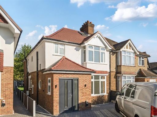 4 bedroom semi-detached house for sale in West Drayton Park Avenue, West Drayton, UB7 — £740,000 • 4 bed • 2 bath • 1424 ft²
 3 bedroom semi-detached house for sale in The Brambles, West Drayton, UB7 — £515,000 • 3 bed • 1 bath • 780 ft²
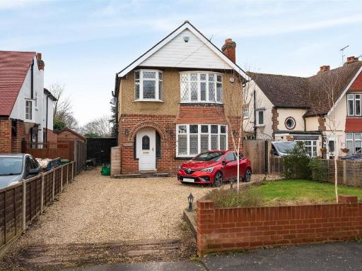 3 bedroom detached house for sale in West Drayton Park Avenue, West Drayton, UB7 — £740,000 • 3 bed • 1 bath • 1104 ft²
 3 bedroom semi-detached house for sale in Providence Road, Yiewsley, West Drayton, UB7 — £519,000 • 3 bed • 1 bath • 1106 ft²
Meta
- {
"@context": "https://schema.org",
"@type": "Residence",
"name": "5 bedroom semidetached house for sale in Frays Close, West…",
"description": "",
"url": "https://propertypiper.co.uk/property/e8b5b34d-fce3-437a-b89b-83f96a7d22bb",
"image": "https://image-a.propertypiper.co.uk/13cb39bd-35b8-4ff8-b5e0-4d5ece579d49-1024.jpeg",
"address": {
"@type": "PostalAddress",
"streetAddress": "1A FRAYS CLOSE WEST DRAYTON ",
"postalCode": "UB7 7NH",
"addressLocality": "Hillingdon",
"addressRegion": "Hayes and Harlington",
"addressCountry": "England"
},
"geo": {
"@type": "GeoCoordinates",
"latitude": 51.50274023699639,
"longitude": -0.4803601186583431
},
"numberOfRooms": 5,
"numberOfBathroomsTotal": 3,
"floorSize": {
"@type": "QuantitativeValue",
"value": 1937,
"unitCode": "FTK"
},
"offers": {
"@type": "Offer",
"price": 680000,
"priceCurrency": "GBP",
"availability": "https://schema.org/InStock"
},
"additionalProperty": [
{
"@type": "PropertyValue",
"name": "Feature",
"value": "semi-detached"
},
{
"@type": "PropertyValue",
"name": "Feature",
"value": "brickwork"
},
{
"@type": "PropertyValue",
"name": "Feature",
"value": "modern"
},
{
"@type": "PropertyValue",
"name": "Feature",
"value": "suburban"
},
{
"@type": "PropertyValue",
"name": "Feature",
"value": "double glazing"
},
{
"@type": "PropertyValue",
"name": "Feature",
"value": "driveway"
},
{
"@type": "PropertyValue",
"name": "Feature",
"value": "residential area"
},
{
"@type": "PropertyValue",
"name": "Feature",
"value": "two-story"
},
{
"@type": "PropertyValue",
"name": "Feature",
"value": "living room"
},
{
"@type": "PropertyValue",
"name": "Feature",
"value": "contemporary"
},
{
"@type": "PropertyValue",
"name": "Feature",
"value": "standard ceiling height"
},
{
"@type": "PropertyValue",
"name": "Feature",
"value": "patterned wallpaper"
},
{
"@type": "PropertyValue",
"name": "Feature",
"value": "electric fireplace"
},
{
"@type": "PropertyValue",
"name": "Feature",
"value": "medium room"
},
{
"@type": "PropertyValue",
"name": "Feature",
"value": "interior modern"
},
{
"@type": "PropertyValue",
"name": "Feature",
"value": "neutral colors"
}
]
}
High Res Floorplan Images
Compatible Floorplan Images
FloorplanImages Thumbnail