KT1 2LH - 1 bedroom apartment for sale in Uxbridge Road, Kingston Upo…
View on Property Piper
1 bedroom apartment for sale in Uxbridge Road, Kingston Upon Thames, KT1
Property Details
- Price: £325000
- Bedrooms: 1
- Bathrooms: 1
- Property Type: undefined
- Property SubType: undefined
Brochure Descriptions
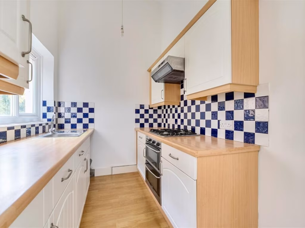
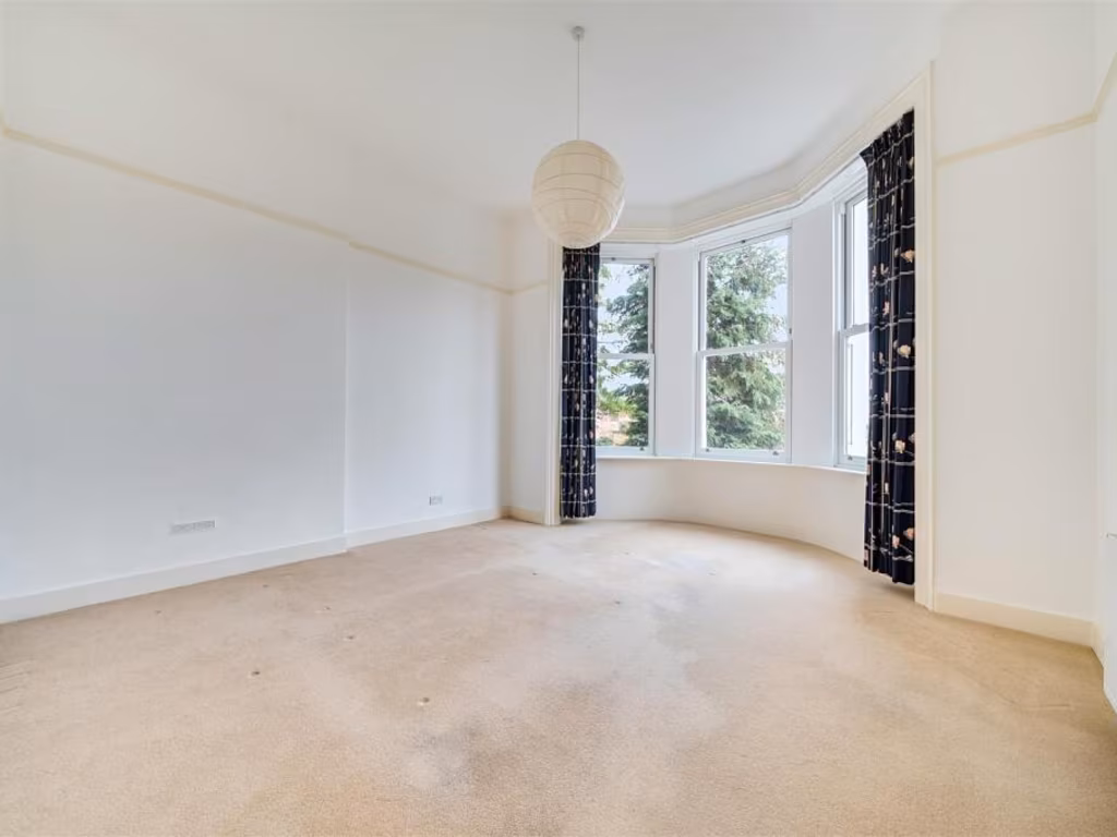
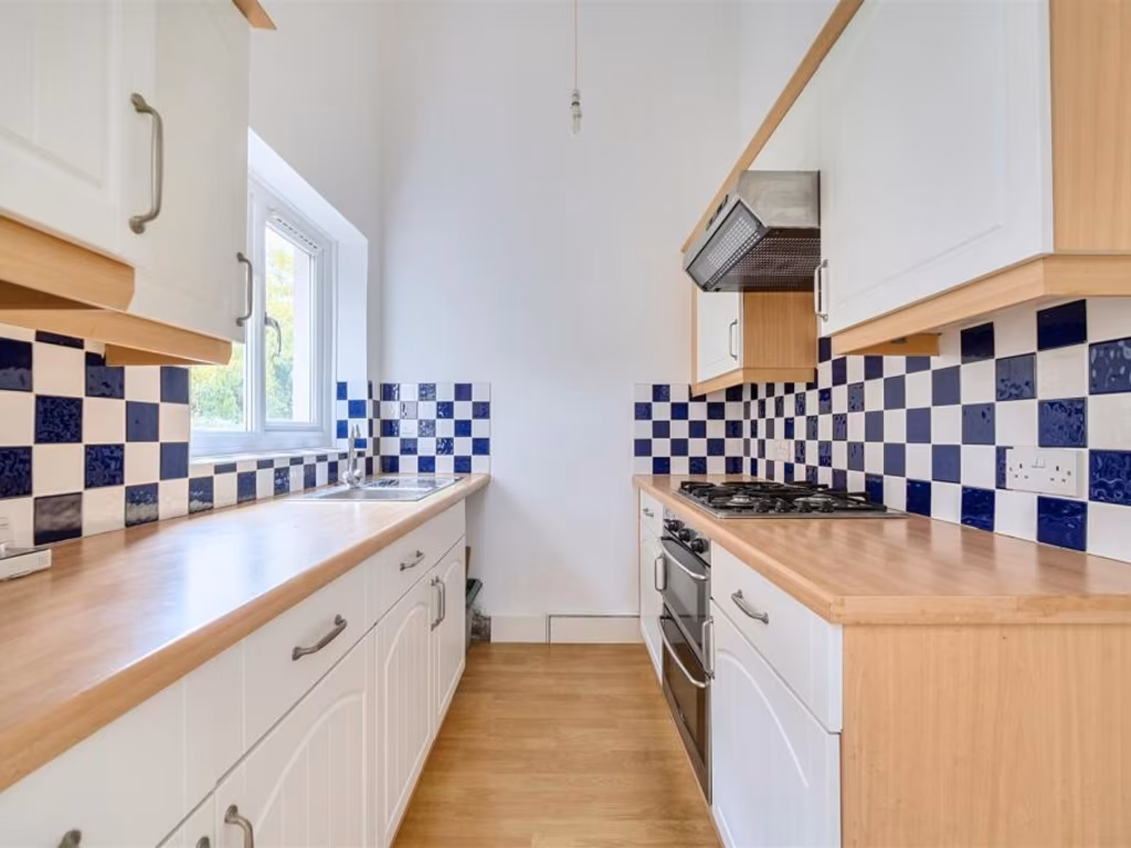
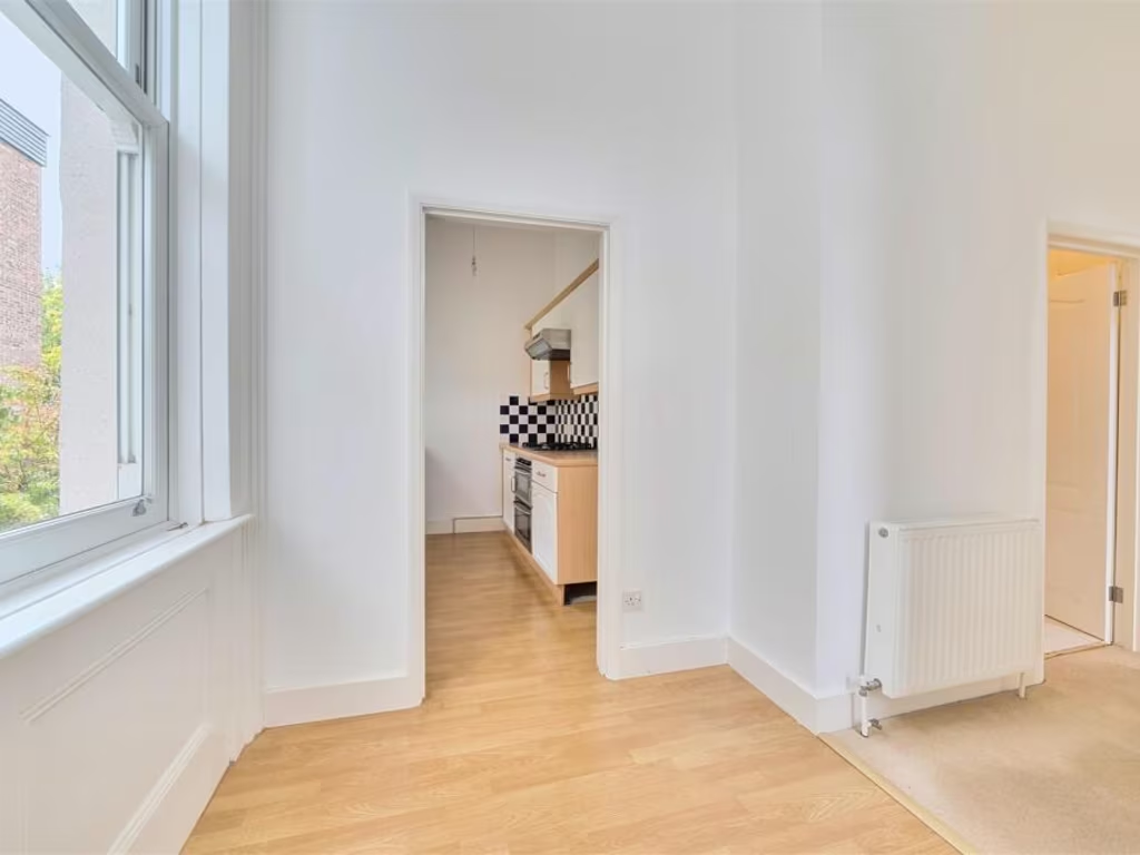
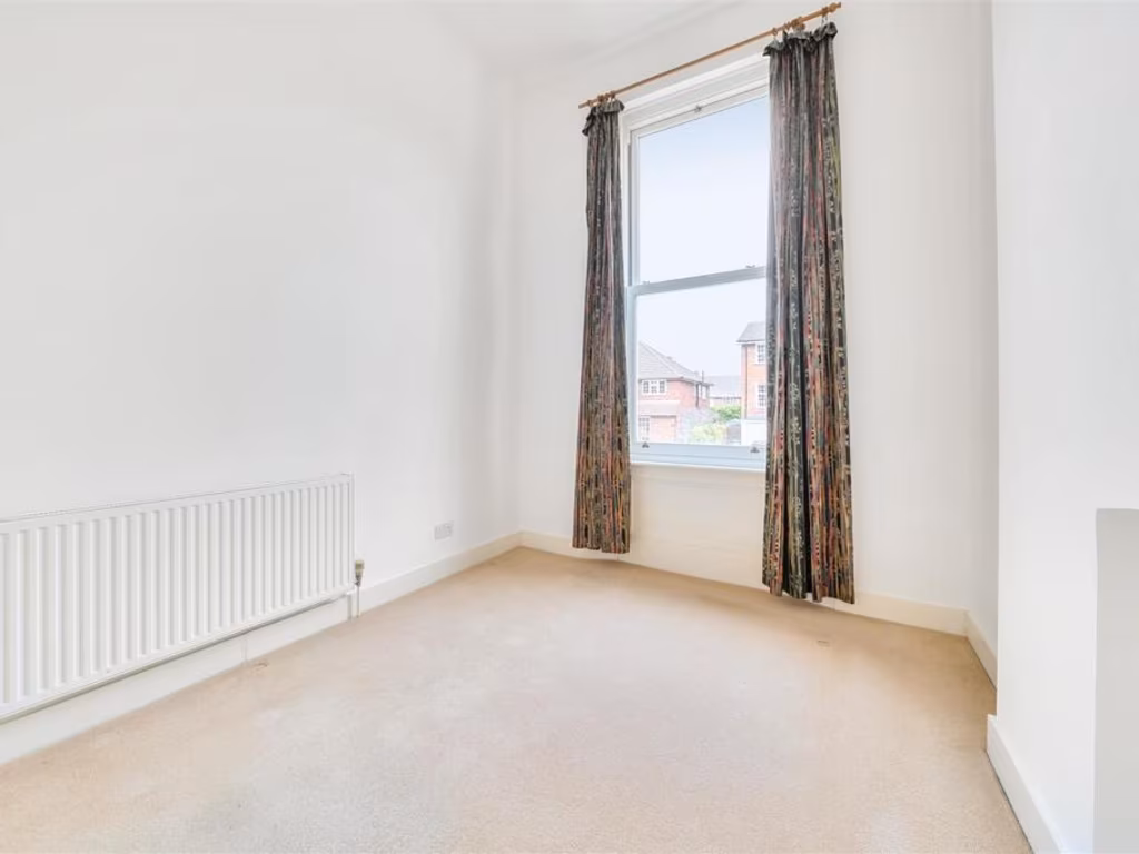
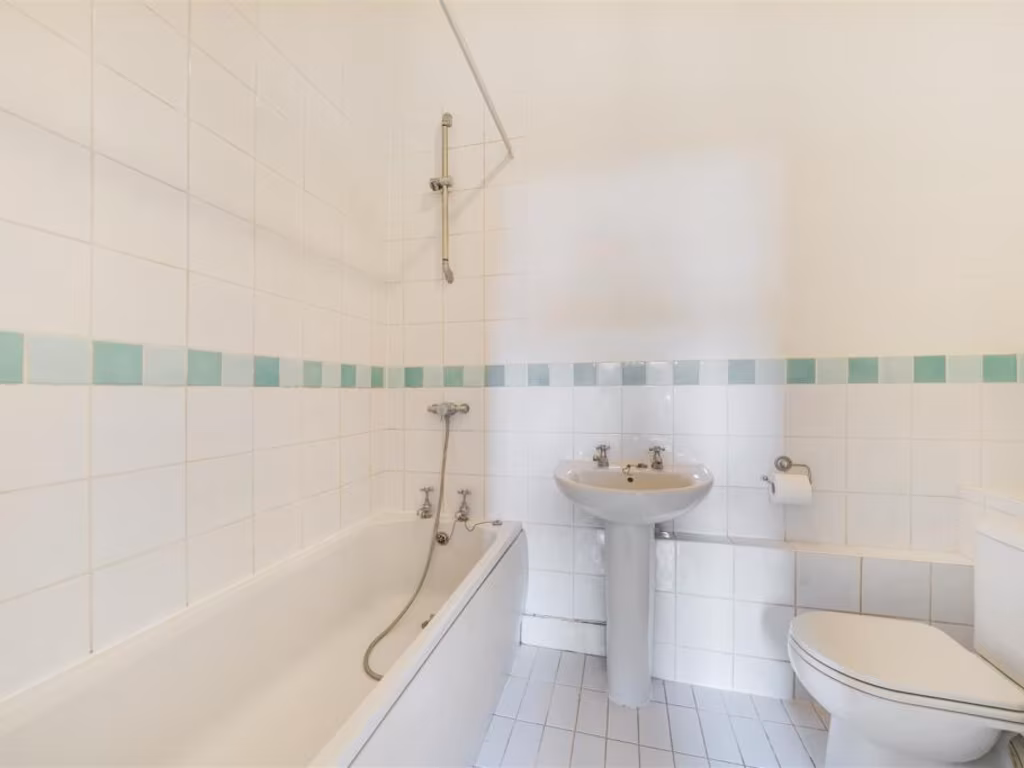
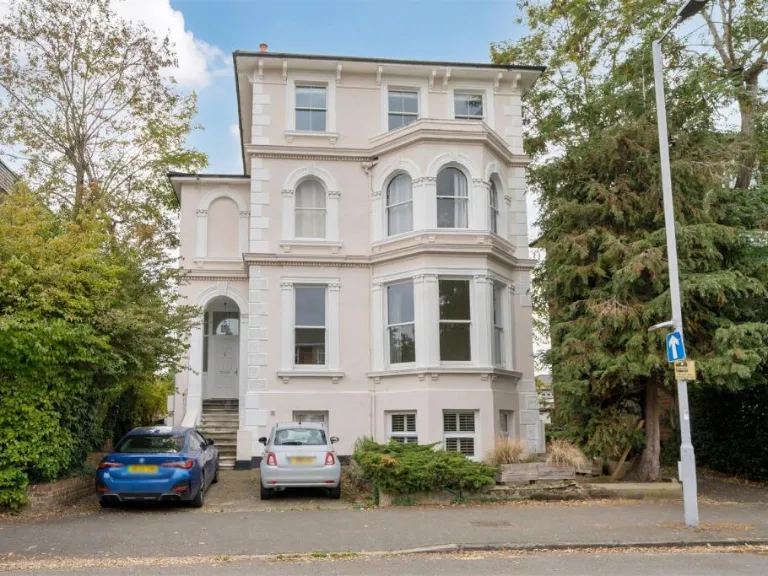
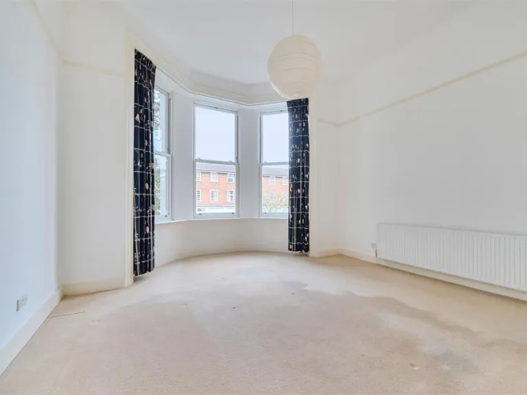
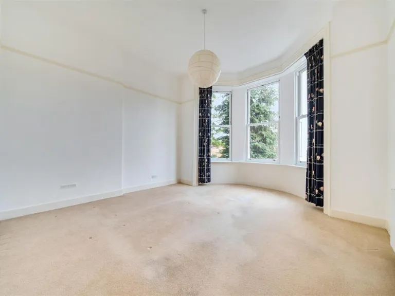
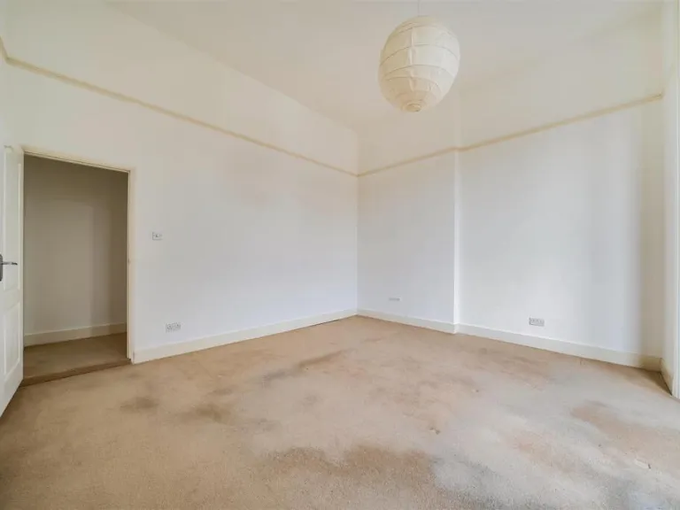
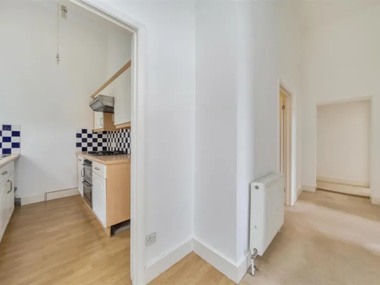
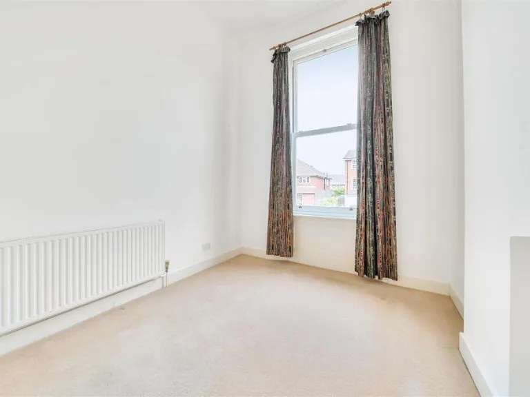
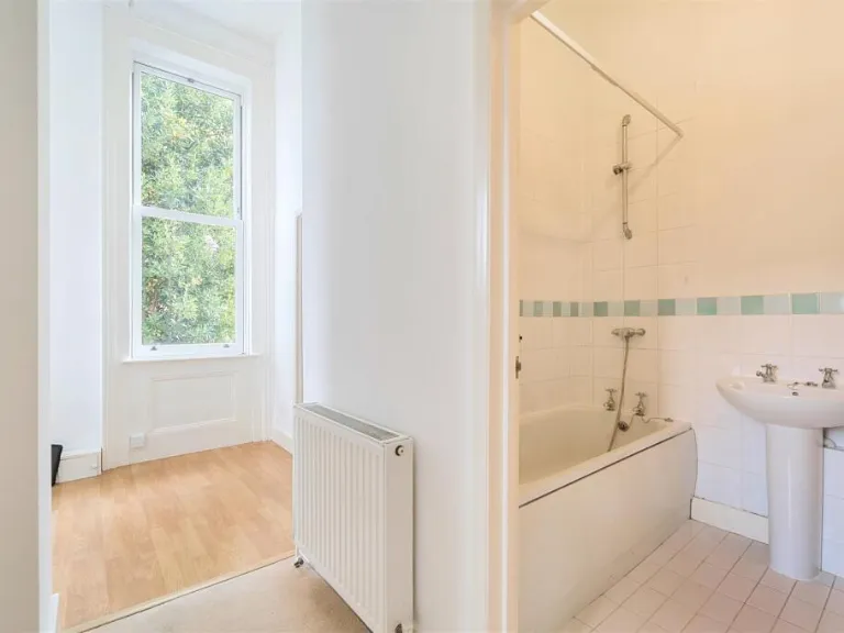
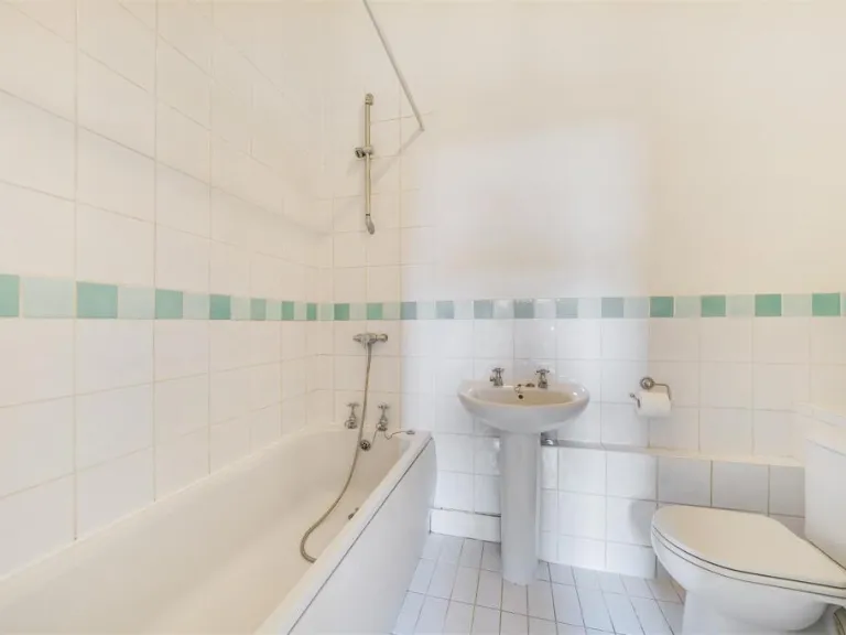
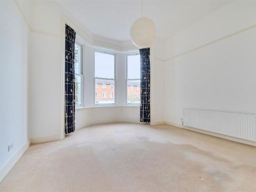
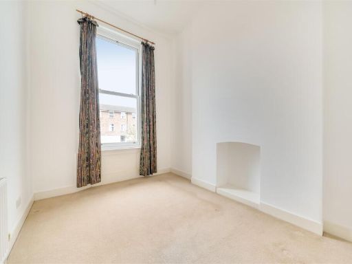
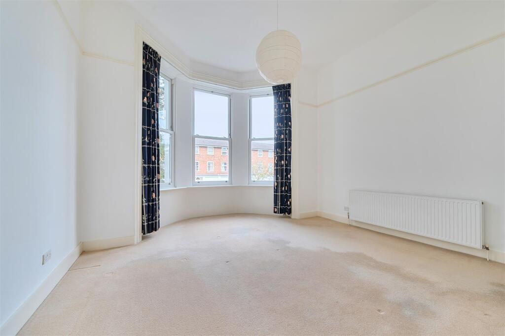
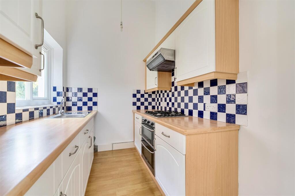
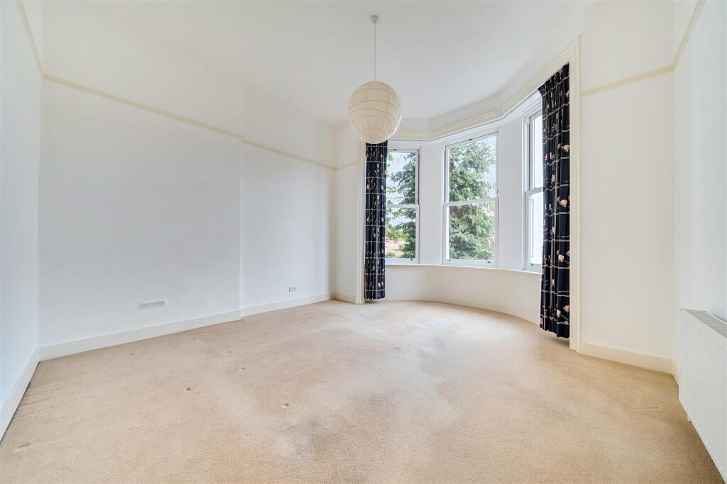
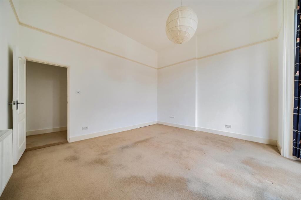
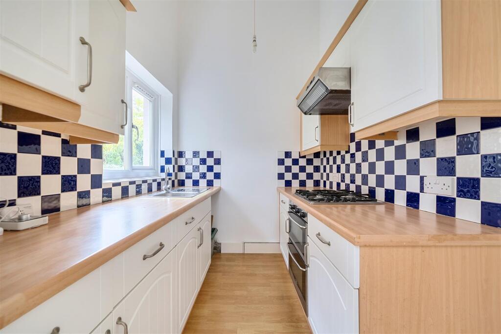
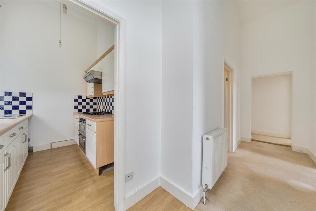
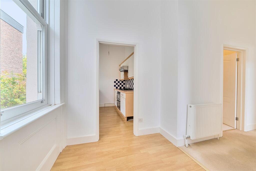
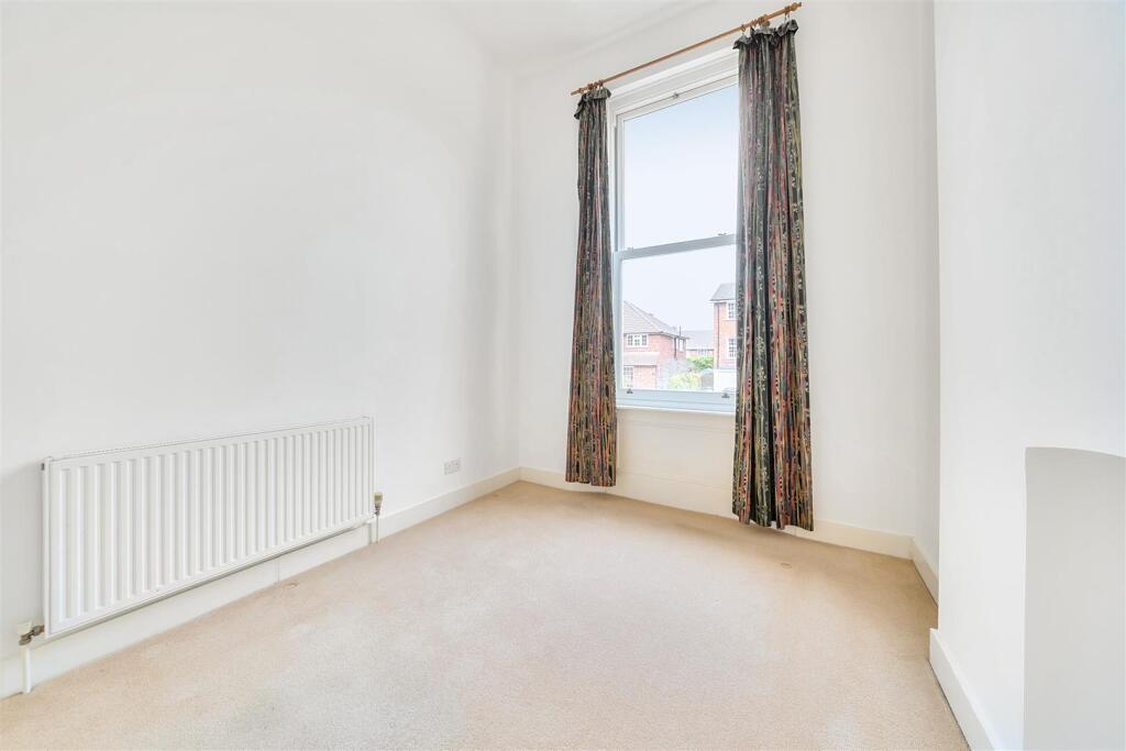
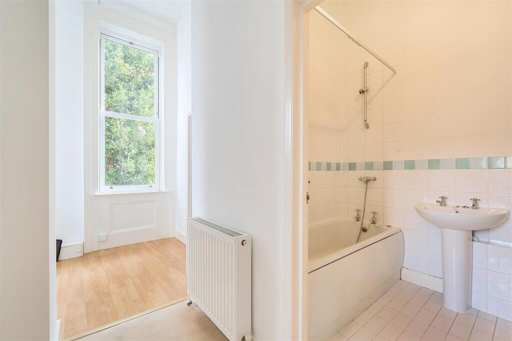
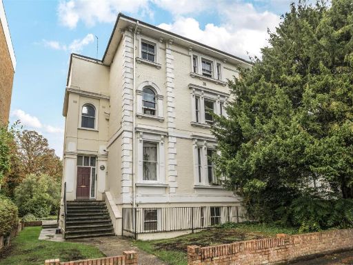
- One-bedroom upper ground floor conversion apartment within a grand detached Victorian house. The apartment benefits from its own private entrance and on‑site parking at the front of the property. Accommodation includes a large reception room with tall ceilings and a sash bay window, a separate modern fitted kitchen with built-in oven and hood, a good-sized double bedroom and a modern white bathroom with shower over the bath. Gas central heating is installed. The building is set on a desirable road within walking distance of the Thames and local high street amenities and Surbiton mainline station. Overall the flat is a small one‑bedroom unit in a large period property; the block and location add significant appeal. Share of freehold with a long lease (circa 148 years) and council tax band C.
Image Descriptions
- Victorian building Victorian
- living room Victorian
Floorplan Description
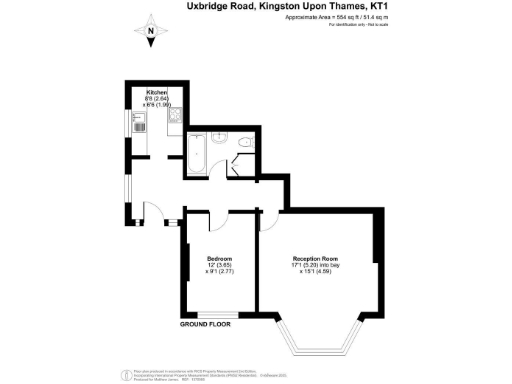
- Ground floor flat with kitchen, bedroom, reception room and bathroom (approx. 554 sq ft).
Rooms
- Kitchen:
- Bedroom:
- Reception Room:
Textual Property Features
Detected Visual Features
- Victorian
- period property
- bay windows
- high ceilings
- large rooms
- stucco facade
- multi-story
- residential
- detached property
- landscaping light
- large windows
- bay window
- fixer-upper
- natural light
- carpet wear
- modernization
EPC Details
- Single glazed
- Solid brick, as built, no insulation (assumed)
- Boiler and radiators, mains gas
- Low energy lighting in all fixed outlets
- (another dwelling below)
Nearby Schools
- The Hollyfield School and Sixth Form Centre
- St John's C of E Primary School
- King Athelstan Primary School
- St Joseph's Catholic Primary School
- Kingston Grammar School
- Fern Hill Primary School
- Southborough High School
- Shrewsbury House School
- Long Ditton St Mary's CofE (Aided) Junior School
- Christ Church CofE Primary School
- Hampton Wick Infant and Nursery School
- Sacred Heart Roman Catholic Primary School
- The Kingston Academy
- Tolworth Infant and Nursery School
- Tolworth Junior School
- St Matthew's CofE Primary School
- Lime Tree Primary School
- St Andrew's and St Mark's CofE Junior School
- Maple Infants' School
- Surbiton High School
- Tiffin School
- Educare Small School
- Teddington School
- Long Ditton Infant and Nursery School
- St Luke's CofE Primary School
- St John the Baptist Church of England Junior School
Nearest General Shops
- Id: 7812767169
- Tags:
- Addr:
- City: Surbiton
- Housenumber: 79
- Postcode: KT6 4AW
- Street: Maple Road
- Email: info@archies-surbiton.co.uk
- Name: Archie's Surbiton
- Opening_hours: Mo off; Tu-We 09:00-17:00; Th 09:00-19:00; Fr 09:00-18:00; Sa 09:00-16:00; Su off
- Phone: +44 20 8339 9939
- Shop: hairdresser
- TagsNormalized:
- Lat: 51.3949353
- Lon: -0.3079329
- FullGeoHash: gcpu2upv0wkd
- PartitionGeoHash: gcpu
- Images:
- FoodStandards: null
- Distance: 424.2
,- Id: 7812767170
- Tags:
- Addr:
- City: Surbiton
- Housenumber: 81
- Postcode: KT6 4AW
- Street: Maple Road
- Email: sarah@shoesatlast.com
- Name: Shoes at last
- Opening_hours: Mo-Fr 10:30-19:00; Sa 10:00-18:00; Su 11:00-17:00
- Payment:
- Phone: +44 20 8390 5673
- Shop: clothes
- TagsNormalized:
- Lat: 51.3949893
- Lon: -0.3079061
- FullGeoHash: gcpu2upv922t
- PartitionGeoHash: gcpu
- Images:
- FoodStandards: null
- Distance: 418
,- Id: 8090790612
- Tags:
- Name: Tattoo Crew
- Shop: tattoo
- TagsNormalized:
- Lat: 51.4012836
- Lon: -0.3037994
- FullGeoHash: gcpu3j6f0vy8
- PartitionGeoHash: gcpu
- Images:
- FoodStandards: null
- Distance: 378.7
}
Nearest Grocery shops
- Id: 554242059
- Tags:
- Addr:
- Brand: Sainsbury's Local
- Brand:wikidata: Q13218434
- Brand:wikipedia: en:Sainsbury's Local
- Building: yes
- Landuse: retail
- Name: Sainsbury's Local
- Shop: convenience
- Website: https://www.sainsburys.co.uk/
- TagsNormalized:
- sainsburys
- sainsburys local
- retail
- convenience
- shop
- Lat: 51.402225
- Lon: -0.3042536
- FullGeoHash: gcpu3j6rwmhp
- PartitionGeoHash: gcpu
- Images:
- FoodStandards: null
- Distance: 445.9
,- Id: 1692910103
- Tags:
- Name: Londis - Maples
- Shop: convenience
- TagsNormalized:
- Lat: 51.3952531
- Lon: -0.3077286
- FullGeoHash: gcpu2upzj3sf
- PartitionGeoHash: gcpu
- Images:
- FoodStandards: null
- Distance: 387.9
,- Id: 1711679248
- Tags:
- Addr:
- Housenumber: 67
- Postcode: KT1 2HG
- Street: Surbiton Road
- Brand: Londis
- Brand:wikidata: Q21008564
- Fhrs:
- Name: Londis
- Shop: convenience
- Source:
- TagsNormalized:
- Lat: 51.4011867
- Lon: -0.3036962
- FullGeoHash: gcpu3j6ce7ew
- PartitionGeoHash: gcpu
- Images:
- FoodStandards: null
- Distance: 375.6
}
Nearest Supermarkets
- Id: 632550029
- Tags:
- Addr:
- City: Kingston Upon Thames
- Housenumber: 6-12
- Postcode: KT1 1BU
- Street: Eden Walk
- Alt_name: Sainsbury's Kingston Superstore
- Brand: Sainsbury's
- Brand:wikidata: Q152096
- Brand:wikipedia: en:Sainsbury's
- Fhrs:
- Name: Sainsbury's
- Opening_hours: Mo-Sa 07:00-21:00; Su 11:00-17:00
- Phone: +44 20 8549 1072
- Shop: supermarket
- Website: https://stores.sainsburys.co.uk/0329/kingston
- TagsNormalized:
- sainsburys
- supermarket
- shop
- Lat: 51.4097308
- Lon: -0.303411
- FullGeoHash: gcpu3ng56h2m
- PartitionGeoHash: gcpu
- Images:
- FoodStandards: null
- Distance: 1253.8
,- Id: 157052411
- Tags:
- Addr:
- City: Surbiton
- Housenumber: 50-58
- Postcode: KT6 4NG
- Street: Victoria Road
- Branch: Surbiton
- Brand: Sainsbury's
- Brand:wikidata: Q152096
- Brand:wikipedia: en:Sainsbury's
- Building: retail
- Building:levels: 3
- Building:material: brick
- Fhrs:
- Name: Sainsbury's
- Opening_hours: Mo-Sa 08:00-20:00; Th,Fr 08:00-21:00; Su 10:00-16:00
- Payment:
- Cash: yes
- Credit_cards: yes
- Debit_cards: yes
- Shop: supermarket
- Source:
- TagsNormalized:
- sainsburys
- retail
- supermarket
- shop
- Lat: 51.3914448
- Lon: -0.3077996
- FullGeoHash: gcpu2gxbgexv
- PartitionGeoHash: gcpu
- Images:
- FoodStandards: null
- Distance: 811.2
,- Id: 22742509
- Tags:
- Addr:
- Housenumber: 15a
- Postcode: KT6 4QR
- Street: Claremont Road
- Brand: Waitrose
- Brand:wikidata: Q771734
- Brand:wikipedia: en:Waitrose & Partners
- Building: yes
- Fhrs:
- Name: Waitrose
- Official_name: Waitrose & Partners
- Operator: Waitrose & Partners
- Shop: supermarket
- Source:
- Wheelchair: yes
- TagsNormalized:
- Lat: 51.393852
- Lon: -0.3051755
- FullGeoHash: gcpu35cybuks
- PartitionGeoHash: gcpu
- Images:
- FoodStandards: null
- Distance: 565.1
}
Nearest Religious buildings
- Id: 33739816
- Tags:
- Amenity: place_of_worship
- Building: yes
- Denomination: anglican
- Name: St Mark's Church
- Religion: christian
- Wikidata: Q28020010
- TagsNormalized:
- place of worship
- anglican
- church
- christian
- Lat: 51.3952146
- Lon: -0.300598
- FullGeoHash: gcpu3hjngd3v
- PartitionGeoHash: gcpu
- Images:
- FoodStandards: null
- Distance: 614.4
,- Id: 157050641
- Tags:
- Addr:
- Amenity: school
- Name: St. Andrew's and St. Mark's Church of England Junior School
- Ref:
- Source:
- Addr:
- Postcode: get-information-schools.service.gov.uk
- TagsNormalized:
- Lat: 51.3951313
- Lon: -0.3067647
- FullGeoHash: gcpu3h0w7fgs
- PartitionGeoHash: gcpu
- Images:
- FoodStandards: null
- Distance: 403.5
,- Id: 492138967
- Tags:
- Amenity: place_of_worship
- Building: church
- Denomination: roman_catholic
- Name: St. Raphael's Church
- Religion: christian
- Wikidata: Q17552706
- TagsNormalized:
- place of worship
- church
- catholic
- roman catholic
- christian
- Lat: 51.4020737
- Lon: -0.3076385
- FullGeoHash: gcpu2vryz901
- PartitionGeoHash: gcpu
- Images:
- FoodStandards: null
- Distance: 371.4
}
Nearest Medical buildings
- Id: 7602530395
- Tags:
- Addr:
- City: Surbiton
- Housenumber: 8
- Postcode: KT6 4PJ
- Street: Central Parade
- Amenity: clinic
- Healthcare: clinic
- Healthcare:speciality: orthodontics
- Name: Invisibrace
- TagsNormalized:
- clinic
- health
- healthcare
- orthodontics
- Lat: 51.3935079
- Lon: -0.3030023
- FullGeoHash: gcpu35gkgs30
- PartitionGeoHash: gcpu
- Images:
- FoodStandards: null
- Distance: 657.3
,- Id: 964672559
- Tags:
- Amenity: dentist
- Building: yes
- Healthcare: dentist
- TagsNormalized:
- Lat: 51.4035583
- Lon: -0.3074192
- FullGeoHash: gcpu3j8pktg9
- PartitionGeoHash: gcpu
- Images:
- FoodStandards: null
- Distance: 536.2
,- Id: 4729418827
- Tags:
- Amenity: dentist
- Healthcare: dentist
- Name: Maple Dental Practice
- TagsNormalized:
- dentist
- health
- healthcare
- dental
- Lat: 51.3945854
- Lon: -0.3082832
- FullGeoHash: gcpu2upe0mp7
- PartitionGeoHash: gcpu
- Images:
- FoodStandards: null
- Distance: 465.4
,- Id: 5348987112
- Tags:
- Addr:
- City: Kingston upon Thames
- Housenumber: 53
- Postcode: KT1 2HG
- Street: Surbiton Road
- Amenity: pharmacy
- Healthcare: pharmacy
- Name: Pharmacy;The Pharmacy
- TagsNormalized:
- Lat: 51.4014558
- Lon: -0.3040302
- FullGeoHash: gcpu3j6e5tfe
- PartitionGeoHash: gcpu
- Images:
- FoodStandards: null
- Distance: 383.2
}
Nearest Airports
- Id: 260720166
- Tags:
- Aerodrome: international
- Aeroway: aerodrome
- Alt_name: Gatwick Airport
- Ele: 62
- Iata: LGW
- Icao: EGKK
- Internet_access: wlan
- Internet_access:fee: no
- Internet_access:ssid: Gatwick FREE Wi-Fi
- Name: London Gatwick Airport
- Operator: Gatwick Airport Limited
- Ref: LGW
- Website: https://www.gatwickairport.com/
- Wikidata: Q8703
- Wikipedia: en:Gatwick Airport
- TagsNormalized:
- airport
- international airport
- Lat: 51.1540917
- Lon: -0.1883773
- FullGeoHash: gcpg58qf4mzd
- PartitionGeoHash: gcpg
- Images:
- FoodStandards: null
- Distance: 28435.7
,- Id: 121158889
- Tags:
- Aerodrome: continental
- Aeroway: aerodrome
- Fhrs:
- Authority: City of London Corporation
- Iata: LCY
- Icao: EGLC
- Name: London City Airport
- Operator: London City Airport Limited
- Ref: LCY
- Website: https://www.londoncityairport.com/
- Wikidata: Q8982
- Wikipedia: en:London City Airport
- TagsNormalized:
- airport
- continental airport
- Lat: 51.5042658
- Lon: 0.0539987
- FullGeoHash: u10j10p64702
- PartitionGeoHash: u10j
- Images:
- FoodStandards: null
- Distance: 27657
,- Id: 14001268
- Tags:
- Access: yes
- Aerodrome: international
- Aerodrome:type: public
- Aeroway: aerodrome
- Alt_name: London Heathrow
- Alt_name_2: London Heathrow Airport
- Ele: 25
- Iata: LHR
- Icao: EGLL
- Int_name: Heathrow Airport
- Name: London Heathrow Airport
- Note: area still approx
- Old_name: London Airport
- Operator: Heathrow Airport Limited
- Rank_aci:
- Ref: LHR
- Short_name: Heathrow
- Type: multipolygon
- Website: https://www.heathrow.com/
- Wikidata: Q8691
- Wikipedia: en:Heathrow Airport
- TagsNormalized:
- airport
- international airport
- Lat: 51.4677522
- Lon: -0.4547736
- FullGeoHash: gcpsv9kv7h2h
- PartitionGeoHash: gcps
- Images:
- FoodStandards: null
- Distance: 12776.2
}
Nearest Leisure Facilities
- Id: 33743209
- Tags:
- Leisure: park
- Name: Claremont Gardens
- TagsNormalized:
- Lat: 51.3955177
- Lon: -0.3044583
- FullGeoHash: gcpu3h629dgm
- PartitionGeoHash: gcpu
- Images:
- FoodStandards: null
- Distance: 412.8
,- Id: 384968735
- Tags:
- TagsNormalized:
- Lat: 51.4016247
- Lon: -0.3093751
- FullGeoHash: gcpu2vqspj34
- PartitionGeoHash: gcpu
- Images:
- FoodStandards: null
- Distance: 348.6
,- Id: 539750587
- Tags:
- TagsNormalized:
- Lat: 51.3983194
- Lon: -0.3036451
- FullGeoHash: gcpu3hfbut1v
- PartitionGeoHash: gcpu
- Images:
- FoodStandards: null
- Distance: 266.1
,- Id: 159063835
- Tags:
- TagsNormalized:
- Lat: 51.3991122
- Lon: -0.3036962
- FullGeoHash: gcpu3hfve2gx
- PartitionGeoHash: gcpu
- Images:
- FoodStandards: null
- Distance: 261.9
,- Id: 48274365
- Tags:
- Is_in: Kingston upon Thames
- Leisure: sports_centre
- Name: Raven's Ait
- Note: River Thames multipolygon relation inner
- Place: island
- Sport: sailing
- Wikidata: Q7296373
- Wikipedia: en:Raven's Ait
- TagsNormalized:
- sports
- sports centre
- leisure
- sailing
- Lat: 51.3986704
- Lon: -0.3110546
- FullGeoHash: gcpu2uv6zysg
- PartitionGeoHash: gcpu
- Images:
- FoodStandards: null
- Distance: 252.1
}
Nearest Tourist attractions
- Id: 632558518
- Tags:
- Name: Kingston Museum
- Tourism: museum
- Wheelchair: limited
- Wikidata: Q6413566
- TagsNormalized:
- Lat: 51.4095825
- Lon: -0.30031
- FullGeoHash: gcpu3nv6d2b8
- PartitionGeoHash: gcpu
- Images:
- FoodStandards: null
- Distance: 1303
,- Id: 285518383
- Tags:
- Addr:
- City: Surbiton
- Housenumber: 5
- Postcode: KT5 8SA
- Street: Howard Road
- Disused: yes
- Name: Angel Inn
- Rooms: 8
- Toilets: yes
- Toilets:access: customers
- Tourism: guest_house
- TagsNormalized:
- Lat: 51.3926517
- Lon: -0.2965769
- FullGeoHash: gcpu378pck8h
- PartitionGeoHash: gcpu
- Images:
- FoodStandards: null
- Distance: 1011.9
,- Id: 117290658
- Tags:
- Building: yes
- Name: Stanley Picker Gallery
- Operator: Kingston University London
- Tourism: gallery
- Website: https://www.stanleypickergallery.org/
- TagsNormalized:
- Lat: 51.4050196
- Lon: -0.298255
- FullGeoHash: gcpu3jyzfnhy
- PartitionGeoHash: gcpu
- Images:
- FoodStandards: null
- Distance: 944.7
}
Nearest Hotels
- Id: 5955546285
- Tags:
- Addr:
- City: Kingston upon Thames
- Postcode: KT1 3JB
- Street: Washington Road
- Email: info@thebullandbush.net
- Name: The Bull and Bush Hotel Kingston
- Tourism: hotel
- Website: http://thebullandbush.net/
- TagsNormalized:
- Lat: 51.408213
- Lon: -0.289757
- FullGeoHash: gcpu3qt481mx
- PartitionGeoHash: gcpu
- Images:
- FoodStandards: null
- Distance: 1616.2
,- Id: 4002880204
- Tags:
- Addr:
- City: Kingston Upon Thames
- Housename: Combined House
- Housenumber: 15
- Postcode: KT1 2PD
- Street: Wheatfield Way
- Brand: Premier Inn
- Brand:wikidata: Q2108626
- Brand:wikipedia: en:Premier Inn
- Fhrs:
- Id: 1385402
- Local_authority_id: 15/26779/RBK
- Internet_access: wlan
- Internet_access:fee: customers
- Internet_access:operator: Virgin Media
- Internet_access:ssid: Premier Inn Free Wi-Fi
- Name: Premier Inn
- Tourism: hotel
- TagsNormalized:
- Lat: 51.4097316
- Lon: -0.3011433
- FullGeoHash: gcpu3nueque6
- PartitionGeoHash: gcpu
- Images:
- FoodStandards: null
- Distance: 1297.9
,- Id: 387544035
- Tags:
- Addr:
- City: Surbiton
- Housenumber: 9
- Postcode: KT6 4LQ
- Street: St. Mark's Hill
- Internet_access: yes
- Internet_access:fee: customers
- Name: Bosco Hotel & Lounge
- Rooms: 20
- Tourism: hotel
- TagsNormalized:
- Lat: 51.3936981
- Lon: -0.3034458
- FullGeoHash: gcpu35gjcpwq
- PartitionGeoHash: gcpu
- Images:
- FoodStandards: null
- Distance: 624.5
}
Tags
- Victorian
- period property
- bay windows
- high ceilings
- large rooms
- stucco facade
- multi-story
- residential
- detached property
- landscaping light
- Victorian
- high ceilings
- large windows
- period property
- bay window
- fixer-upper
- natural light
- carpet wear
- modernization
Local Market Stats
- Average Price/sqft: £646
- Avg Income: £60700
- Rental Yield: 4.9%
- Social Housing: 16%
- Planning Success Rate: 48%
AirBnB Data
- 1km average: £140/night
- Listings in 1km: 6
Similar Properties
 1 bedroom apartment for sale in Uxbridge Road, Kingston Upon Thames, KT1 — £310,000 • 1 bed • 1 bath • 392 ft²
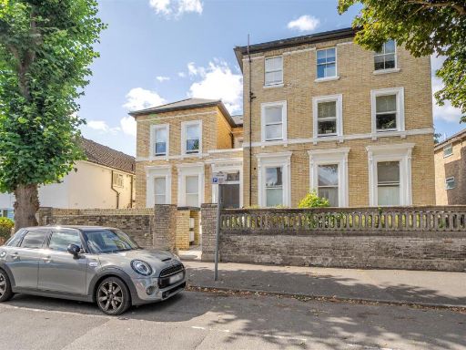 1 bedroom apartment for sale in Catherine Road, Surbiton, KT6 — £315,000 • 1 bed • 1 bath • 381 ft²
 1 bedroom apartment for sale in Grove Road, Surbiton, KT6 — £375,000 • 1 bed • 1 bath • 597 ft²
 1 bedroom apartment for sale in Claremont Gardens, Surbiton, KT6 — £349,950 • 1 bed • 1 bath • 821 ft²
 1 bedroom flat for sale in Uxbridge Road, Kingston Upon Thames, KT1 — £350,000 • 1 bed • 1 bath • 430 ft²
 2 bedroom apartment for sale in Uxbridge Road, Kingston upon Thames, KT1 — £575,000 • 2 bed • 1 bath • 904 ft²
Meta
- {
"@context": "https://schema.org",
"@type": "Residence",
"name": "1 bedroom apartment for sale in Uxbridge Road, Kingston Upo…",
"description": "",
"url": "https://propertypiper.co.uk/property/e862251e-265a-4490-9c72-acd2f8b4b2a1",
"image": "https://image-a.propertypiper.co.uk/805b16f2-cfe3-4b97-82a6-6f7c56c1b44f-1024.jpeg",
"address": {
"@type": "PostalAddress",
"streetAddress": "25 FLAT 1 UXBRIDGE ROAD KINGSTON UPON THAMES ",
"postalCode": "KT1 2LH",
"addressLocality": "Kingston upon Thames",
"addressRegion": "Kingston and Surbiton",
"addressCountry": "England"
},
"geo": {
"@type": "GeoCoordinates",
"latitude": 51.3987365,
"longitude": -0.3074224
},
"numberOfRooms": 1,
"numberOfBathroomsTotal": 1,
"floorSize": {
"@type": "QuantitativeValue",
"value": 554,
"unitCode": "FTK"
},
"offers": {
"@type": "Offer",
"price": 325000,
"priceCurrency": "GBP",
"availability": "https://schema.org/InStock"
},
"additionalProperty": [
{
"@type": "PropertyValue",
"name": "Feature",
"value": "Victorian"
},
{
"@type": "PropertyValue",
"name": "Feature",
"value": "period property"
},
{
"@type": "PropertyValue",
"name": "Feature",
"value": "bay windows"
},
{
"@type": "PropertyValue",
"name": "Feature",
"value": "high ceilings"
},
{
"@type": "PropertyValue",
"name": "Feature",
"value": "large rooms"
},
{
"@type": "PropertyValue",
"name": "Feature",
"value": "stucco facade"
},
{
"@type": "PropertyValue",
"name": "Feature",
"value": "multi-story"
},
{
"@type": "PropertyValue",
"name": "Feature",
"value": "residential"
},
{
"@type": "PropertyValue",
"name": "Feature",
"value": "detached property"
},
{
"@type": "PropertyValue",
"name": "Feature",
"value": "landscaping light"
},
{
"@type": "PropertyValue",
"name": "Feature",
"value": "Victorian"
},
{
"@type": "PropertyValue",
"name": "Feature",
"value": "high ceilings"
},
{
"@type": "PropertyValue",
"name": "Feature",
"value": "large windows"
},
{
"@type": "PropertyValue",
"name": "Feature",
"value": "period property"
},
{
"@type": "PropertyValue",
"name": "Feature",
"value": "bay window"
},
{
"@type": "PropertyValue",
"name": "Feature",
"value": "fixer-upper"
},
{
"@type": "PropertyValue",
"name": "Feature",
"value": "natural light"
},
{
"@type": "PropertyValue",
"name": "Feature",
"value": "carpet wear"
},
{
"@type": "PropertyValue",
"name": "Feature",
"value": "modernization"
}
]
}
High Res Floorplan Images
Compatible Floorplan Images
FloorplanImages Thumbnail