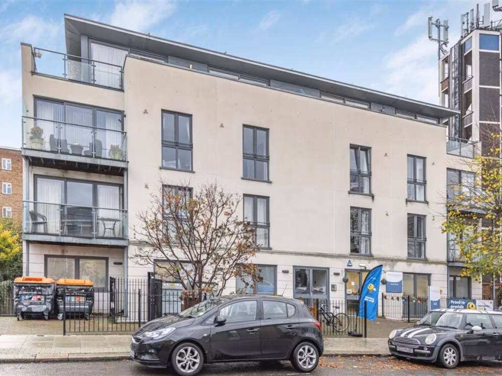
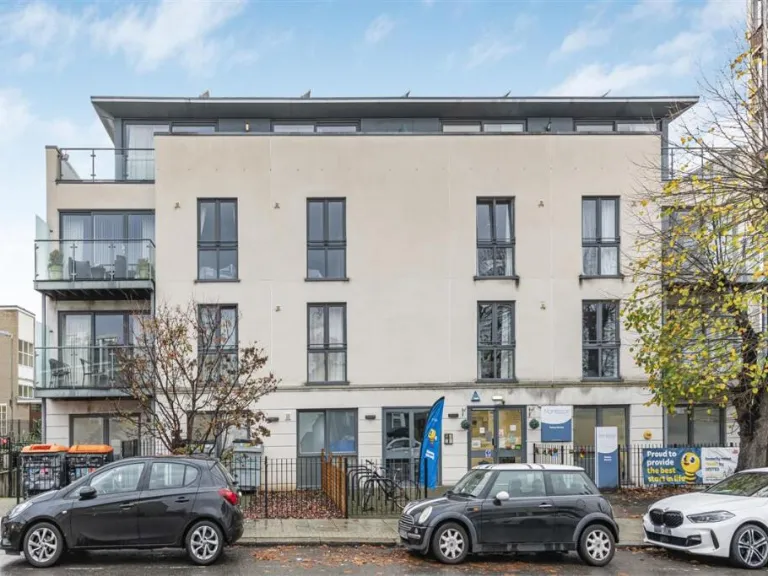
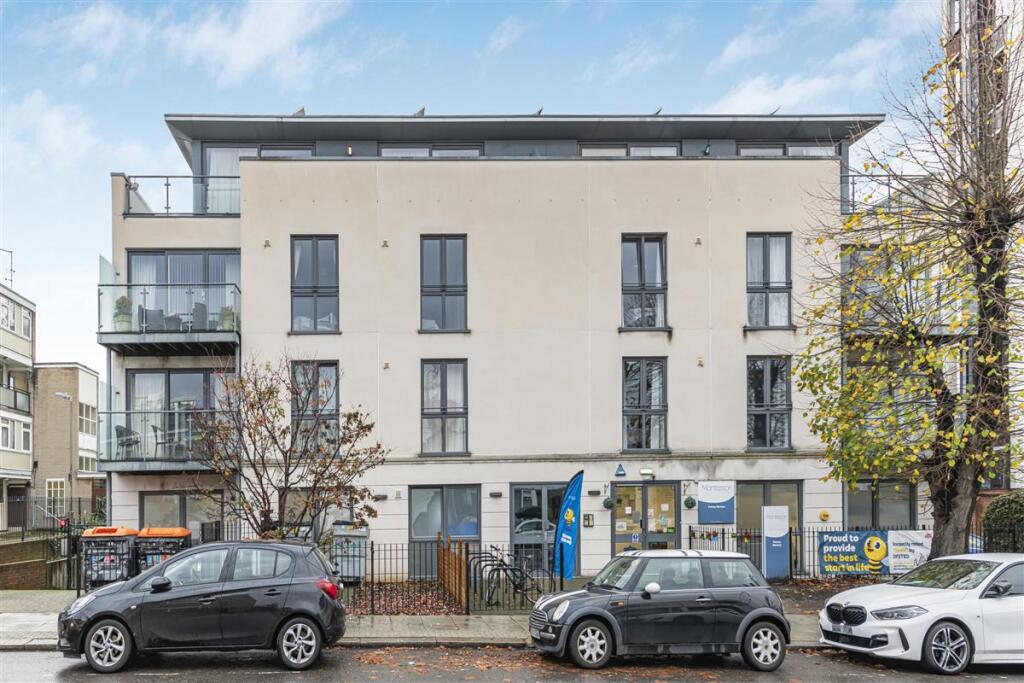
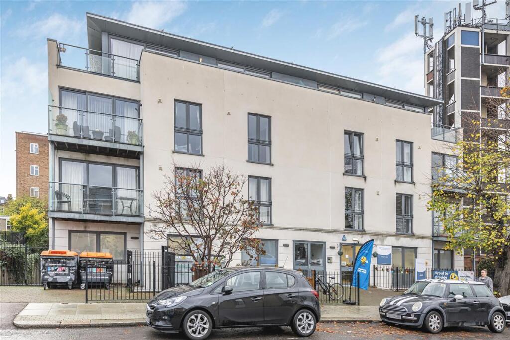
SW18 1RE - 2 bedroom flat for sale in Lebanon Road, SW18
View on Property Piper
2 bedroom flat for sale in Lebanon Road, SW18
Property Details
- Price: £565000
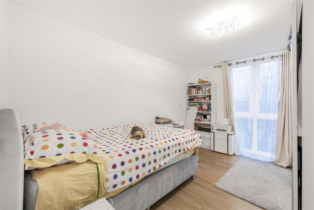
- Bedrooms: 2
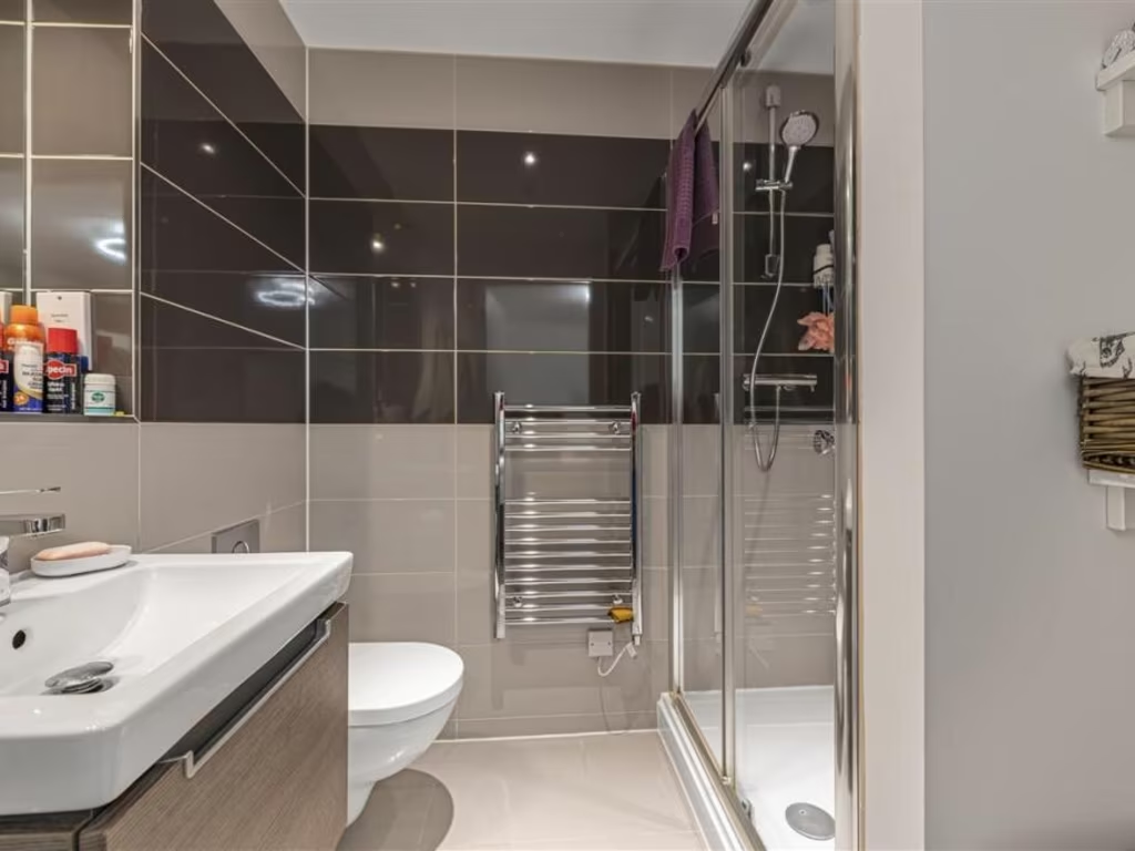
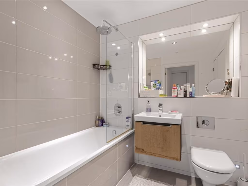
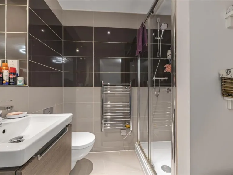
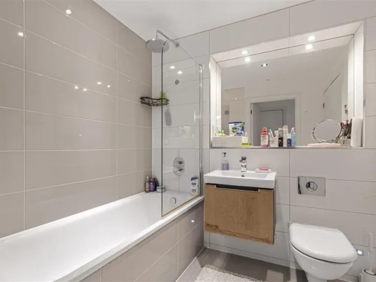
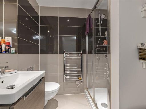
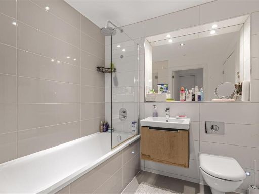
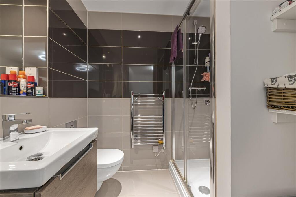
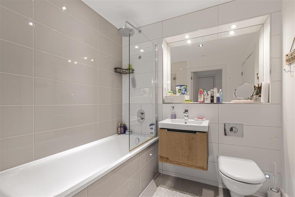
- Bathrooms: 2
- Property Type: undefined
- Property SubType: undefined
Image Descriptions
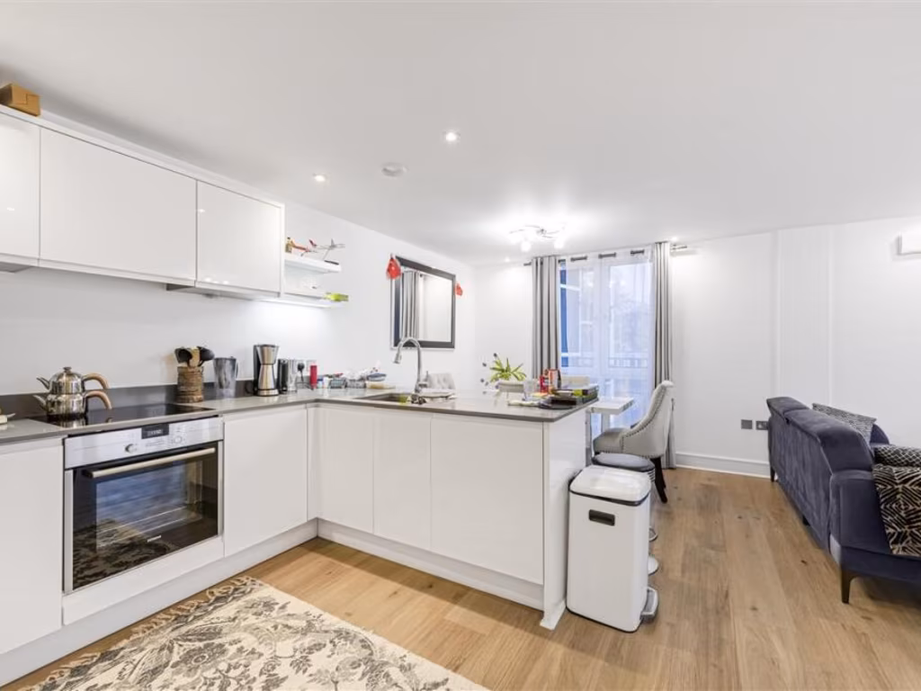
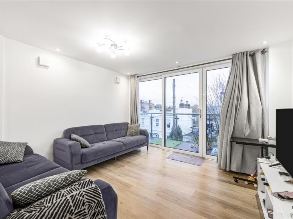
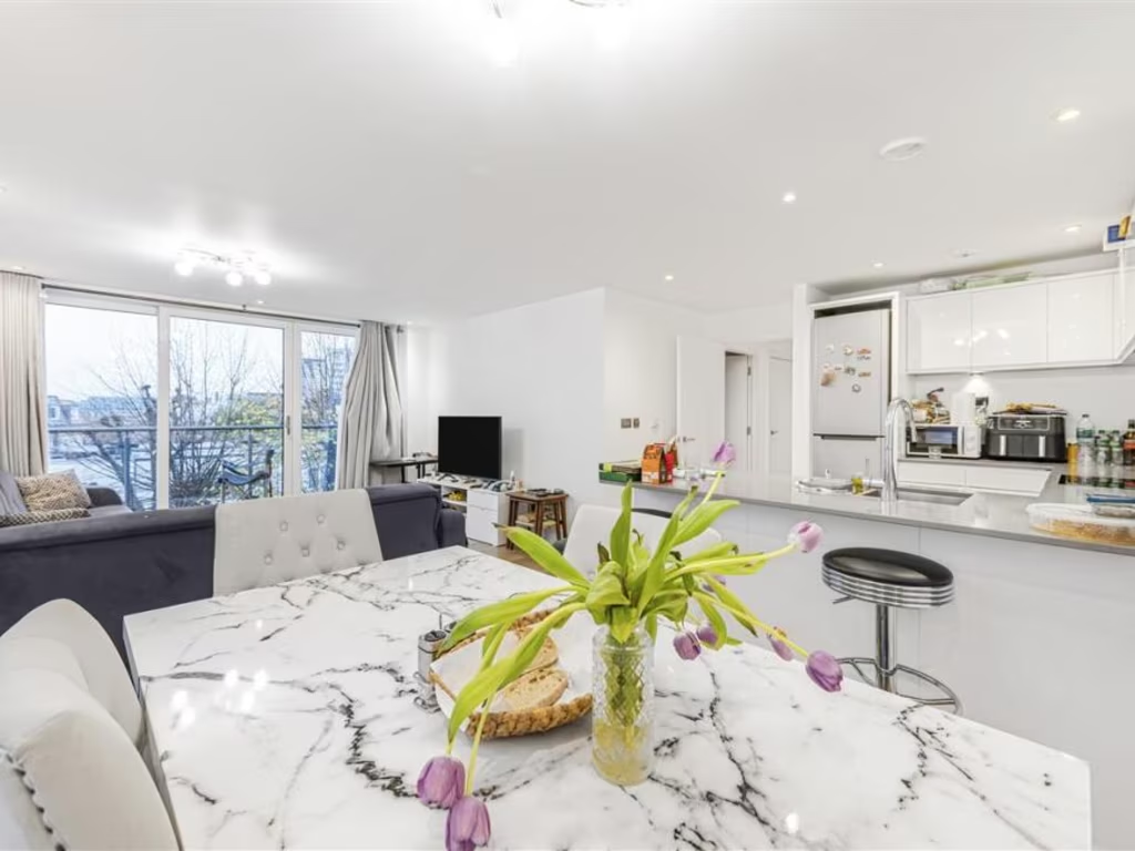
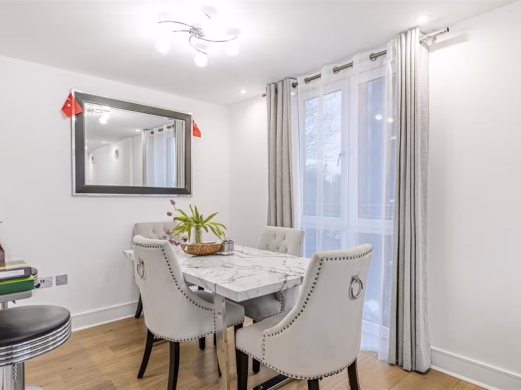
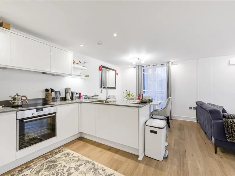
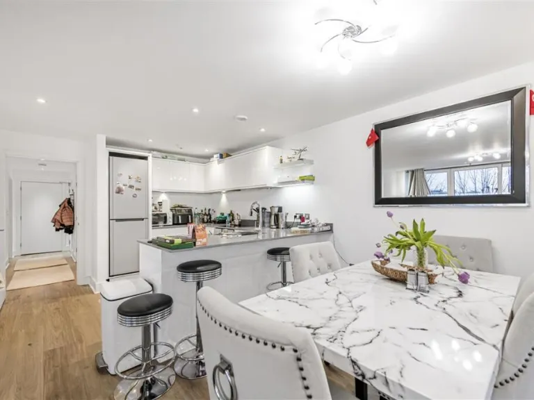
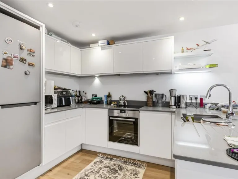
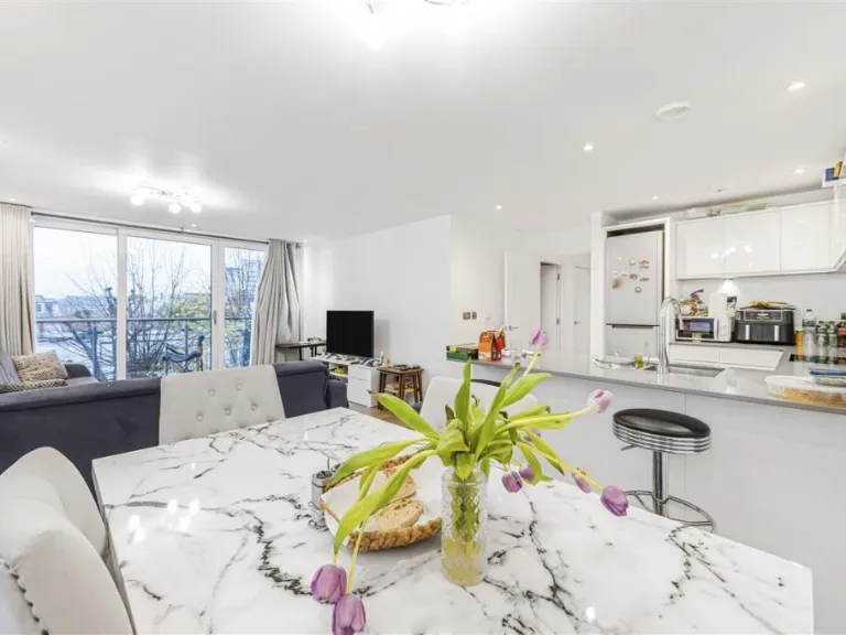
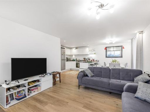
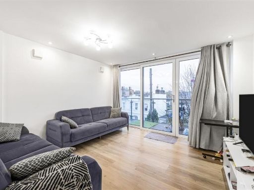
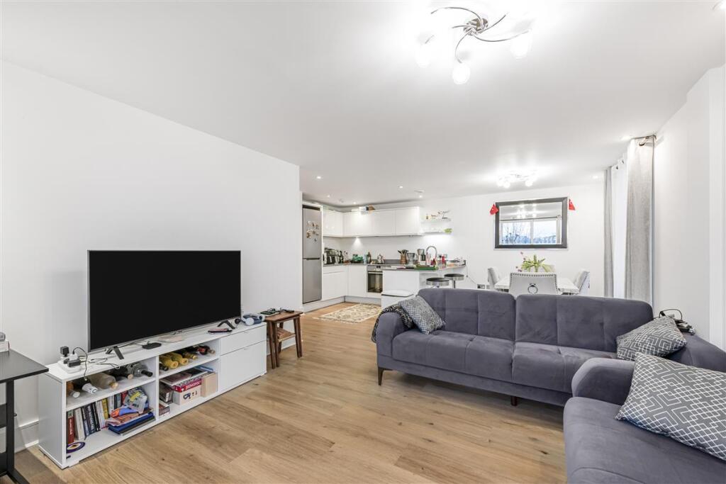
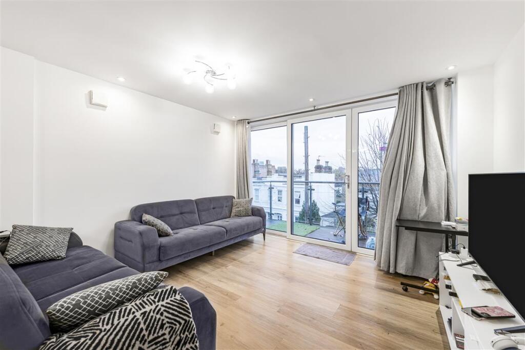
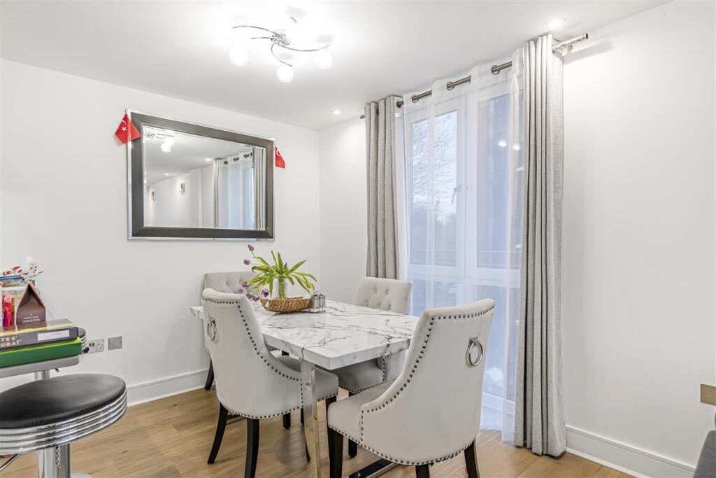
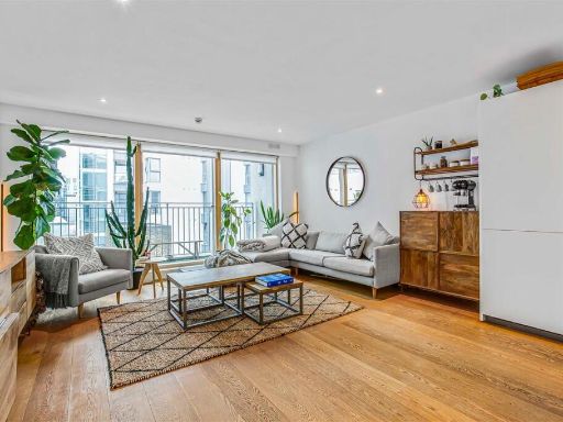
- open plan living room and kitchen contemporary
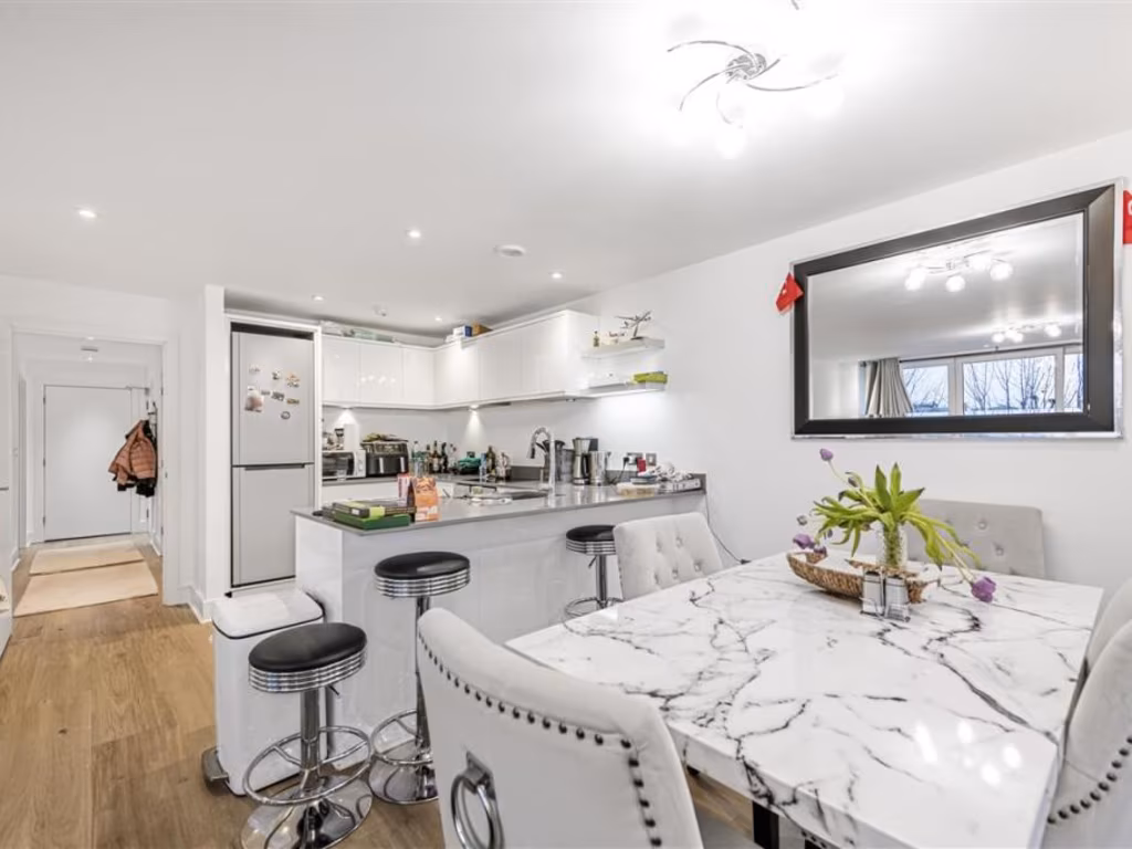
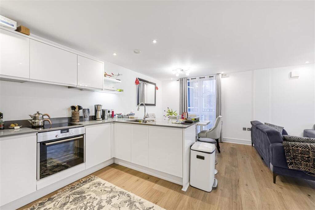
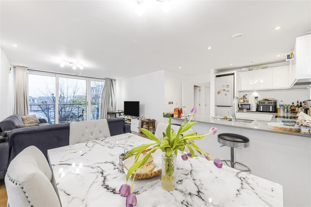
- kitchen and dining area contemporary
Floorplan Description
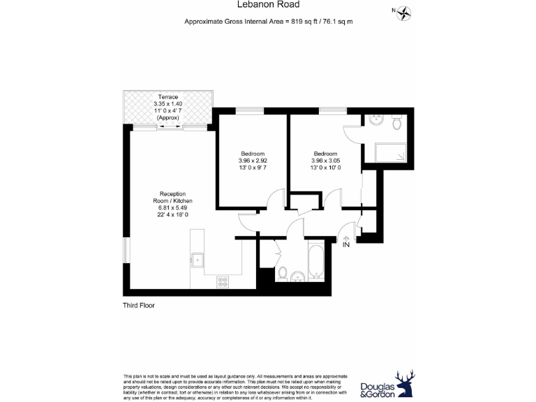
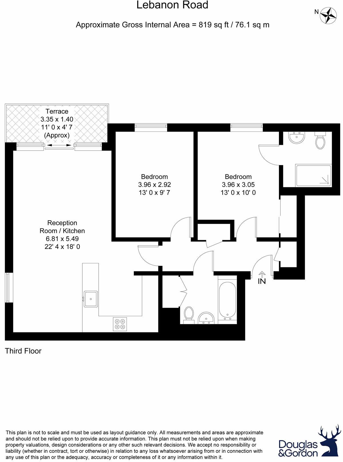
- Third Floor apartment on Lebanon Road with reception/kitchen and two bedrooms
Rooms
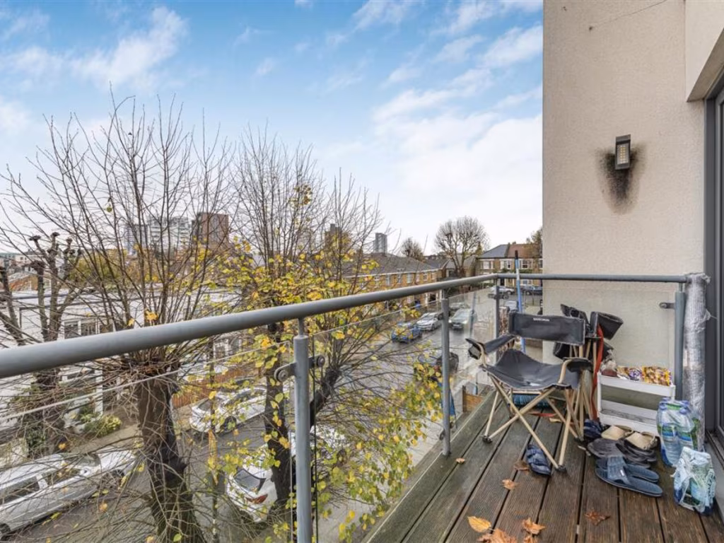
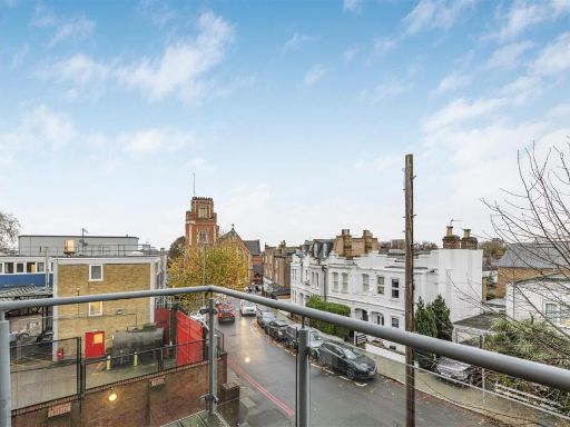
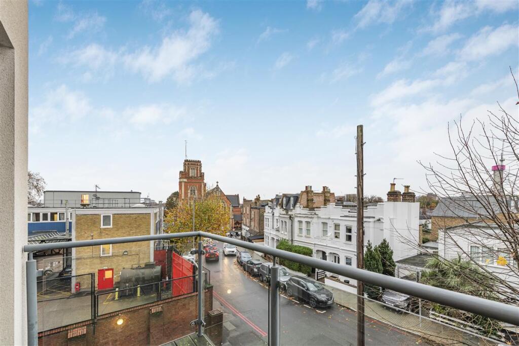
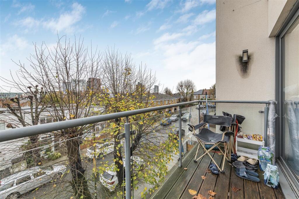
- Terrace:
- Reception Room / Kitchen:
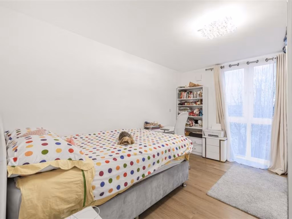
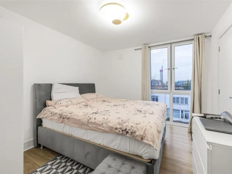
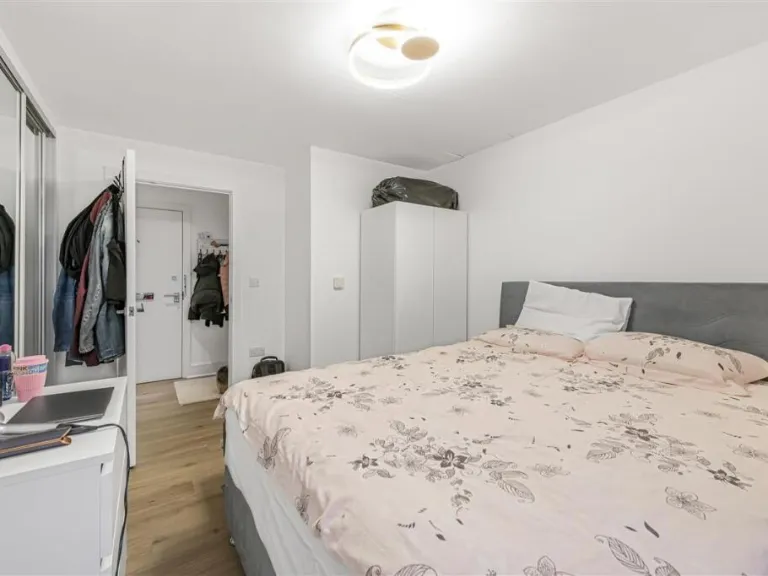
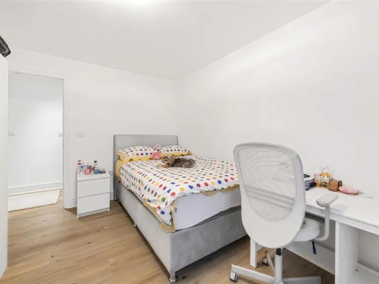
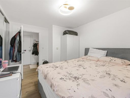
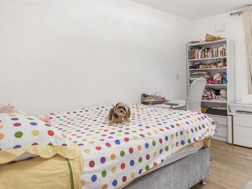
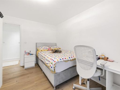
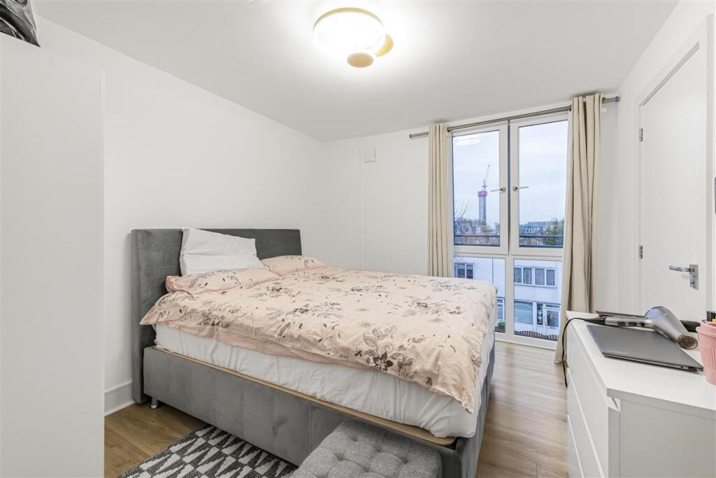
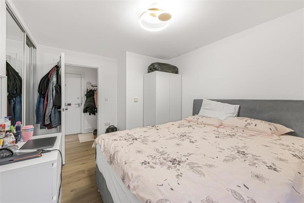
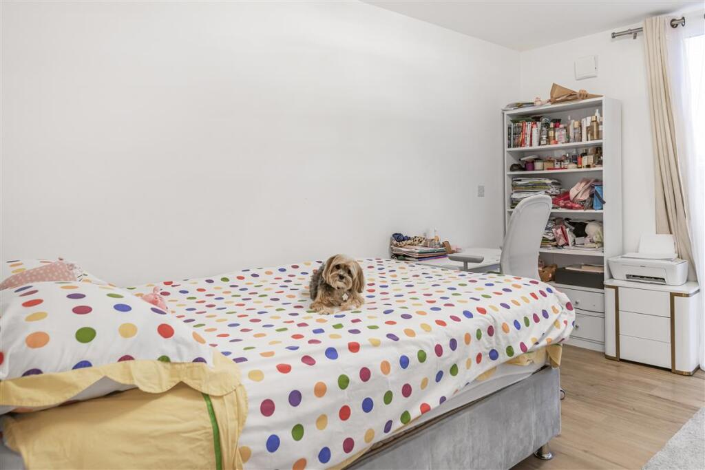
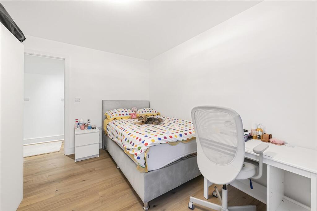
- Bedroom:
- Bedroom:
Textual Property Features
Detected Visual Features
- contemporary
- open plan
- living room
- kitchen
- hardwood floors
- modern
- bright
- light fixtures
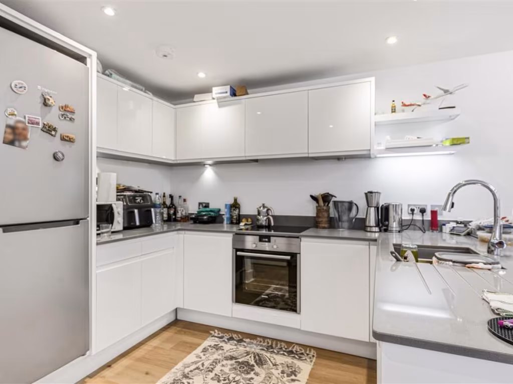
- contemporary style
- modern kitchen
- open-plan
- integrated appliances
- compact dining space
- laminate flooring
- under-cabinet lighting
EPC Details
- Fully double glazed
- System built, as built, insulated (assumed)
- Air source heat pump, underfloor, electric
- Low energy lighting in all fixed outlets
- (another dwelling below)
Nearby Schools
- Southfields Academy
- Saint Cecilia's Church of England School
- Floreat Wandsworth Primary School
- Ronald Ross Primary School
- Anglo Portuguese School of London
- Merlin School
- Parsons Green Prep School
- Putney High School
- St Joseph's Catholic Primary and Nursery School
- St Faith's CofE Primary School
- The Hurlingham Academy
- Sulivan Primary School
- Lady Margaret School
- Southmead Primary School
- Riversdale Primary School
- Sheringdale Primary School
- St Michael's CofE Primary School
- Allfarthing Primary School
- St Anne's CofE Primary School
- Ashcroft Technology Academy
- The Roche School
- Brandlehow Primary School
- Hurlingham School
- Thomas's Fulham
- Swaffield School
- Wandsworth Preparatory School
- West Hill Primary School
- Thomas's Academy
Nearest General Shops
- Id: 821683849
- Tags:
- Addr:
- City: London
- Housenumber: 40-42
- Postcode: SW18 1RX
- Street: West Hill
- Building: commercial
- Name: Autotech of Wandsworth Ltd
- Shop: car_repair
- TagsNormalized:
- Lat: 51.4570703
- Lon: -0.2015178
- FullGeoHash: gcpuermr0m1k
- PartitionGeoHash: gcpu
- Images:
- FoodStandards: null
- Distance: 119.6
,- Id: 793608671
- Tags:
- Addr:
- City: London
- Housenumber: 56
- Street: West Hill
- Amenity: plumber
- Building: retail
- Name: Alpha Heating
- Shop: plumber
- TagsNormalized:
- Lat: 51.4568867
- Lon: -0.2021454
- FullGeoHash: gcpuerky1dvm
- PartitionGeoHash: gcpu
- Images:
- FoodStandards: null
- Distance: 117.4
,- Id: 821683850
- Tags:
- Addr:
- City: London
- Housenumber: 38A
- Postcode: SW18 1RX
- Street: West Hill
- Building: commercial
- Name: HNI MOTORS LTD
- Shop: car
- Website: https://www.hnimotors.co.uk/
- TagsNormalized:
- Lat: 51.4569031
- Lon: -0.2013769
- FullGeoHash: gcpuermq5tfx
- PartitionGeoHash: gcpu
- Images:
- FoodStandards: null
- Distance: 99.7
}
Nearest Grocery shops
- Id: 7623890783
- Tags:
- Addr:
- City: London
- Housename: Frogmore House
- Housenumber: 1-3
- Postcode: SW18 1HX
- Street: Putney Bridge Road
- Fhrs:
- Name: Local Express
- Shop: convenience
- Source:
- TagsNormalized:
- Lat: 51.4587559
- Lon: -0.1981131
- FullGeoHash: gcpuerz8zxk5
- PartitionGeoHash: gcpu
- Images:
- FoodStandards: null
- Distance: 372.2
,- Id: 168335236
- Tags:
- Addr:
- City: London
- Housenumber: 209
- Postcode: SW18 4JE
- Street: Wandsworth High Street
- Building: retail
- Building:levels: 3
- Fhrs:
- Name: Wandsworth Grocers & Halal Meat
- Shop: convenience
- Source: Bing;photographic_survey
- Source:addr: FHRS Open Data
- TagsNormalized:
- retail
- grocer
- halal
- meat
- convenience
- shop
- Lat: 51.4568867
- Lon: -0.1980536
- FullGeoHash: gcpuerry14bt
- PartitionGeoHash: gcpu
- Images:
- FoodStandards: null
- Distance: 238.2
,- Id: 793608678
- Tags:
- Addr:
- City: London
- Housenumber: 6
- Postcode: SW15 2SD
- Street: Upper Richmond Road
- Brand: Costcutter
- Brand:wikidata: Q5175072
- Brand:wikipedia: en:Costcutter
- Building: retail
- Check_date: 2022-11-20
- Contact:
- Website: https://store-locator.costcutter.co.uk/costcutter-e39a4299263c
- Fhrs:
- Name: Costcutter
- Opening_hours: Su-Th 06:00-23:00, Fr,Sa 06:00-01:00
- Payment:
- Shop: convenience
- TagsNormalized:
- costcutter
- retail
- convenience
- shop
- Lat: 51.4568178
- Lon: -0.2030257
- FullGeoHash: gcpuerkjtnj4
- PartitionGeoHash: gcpu
- Images:
- FoodStandards: null
- Distance: 155.3
}
Nearest Supermarkets
- Id: 330953401
- Tags:
- Addr:
- City: London
- Housenumber: 190-194
- Postcode: SW18 4ED
- Street: Garratt Lane
- Alt_name: Tesco Earlsfield Garratt Lane Express
- Brand: Tesco Express
- Brand:wikidata: Q98456772
- Brand:wikipedia: en:Tesco
- Building: yes
- Contact:
- Website: https://www.tesco.com/store-locator/london/190-194-garratt-ln
- Fhrs:
- Name: Tesco Express
- Name:fa: تسکو اکسپرس
- Shop: supermarket
- TagsNormalized:
- tesco
- tesco express
- supermarket
- shop
- Lat: 51.4482735
- Lon: -0.1899576
- FullGeoHash: gcpuetvevtm3
- PartitionGeoHash: gcpu
- Images:
- FoodStandards: null
- Distance: 1160.5
,- Id: 679237767
- Tags:
- Addr:
- City: London
- Housenumber: 45
- Postcode: SW18 4AD
- Street: Garratt Lane
- Alt_name: Sainsbury's Wandsworth Superstore
- Brand: Sainsbury's
- Brand:wikidata: Q152096
- Brand:wikipedia: en:Sainsbury's
- Contact:
- Website: https://stores.sainsburys.co.uk/0069/wandsworth
- Fhrs:
- Name: Sainsbury's
- Opening_hours: Mo-Sa 07:00-22:00; PH,Su 11:00-17:00
- Shop: supermarket
- Toilets: yes
- Toilets:wheelchair: yes
- Wheelchair: yes
- TagsNormalized:
- sainsburys
- supermarket
- shop
- Lat: 51.4543621
- Lon: -0.1917191
- FullGeoHash: gcpuewurks7c
- PartitionGeoHash: gcpu
- Images:
- FoodStandards: null
- Distance: 681.6
,- Id: 416381278
- Tags:
- Addr:
- City: London
- Housename: Southside Shopping Centre
- Housenumber: 66-67
- Postcode: SW18 4TG
- Alt_name: Waitrose Wandsworth
- Brand: Waitrose
- Brand:wikidata: Q771734
- Brand:wikipedia: en:Waitrose
- Fhrs:
- Level: 0
- Name: Waitrose
- Official_name: Waitrose & Partners
- Opening_hours: Mo-Sa 08:00-20:00; Su 11:00-17:00
- Operator: Waitrose & Partners
- Shop: supermarket
- Toilets: yes
- Toilets:wheelchair: yes
- Website: https://www.waitrose.com/bf_home/bf/673.html
- Wheelchair: yes
- TagsNormalized:
- Lat: 51.4543524
- Lon: -0.1937717
- FullGeoHash: gcpuewfzkf3r
- PartitionGeoHash: gcpu
- Images:
- FoodStandards: null
- Distance: 546.4
}
Nearest Religious buildings
- Id: 346286132
- Tags:
- Addr:
- City: London
- Postcode: SW18 4LA
- Street: Wandsworth High Street
- Amenity: place_of_worship
- Building: church
- Denomination: anglican;evangelical
- Name: All Saints
- Religion: christian
- Wikidata: Q15978866
- TagsNormalized:
- place of worship
- church
- anglican
- evangelical
- christian
- Lat: 51.4575665
- Lon: -0.1953341
- FullGeoHash: gcpuex9f03sk
- PartitionGeoHash: gcpu
- Images:
- FoodStandards: null
- Distance: 441.1
,- Id: 33923910
- Tags:
- Addr:
- City: London
- Postcode: SW18 1QG
- Street: Haldon Road
- Amenity: place_of_worship
- Building: church
- Denomination: baptist
- Fhrs:
- Name: West Hill Baptist Church
- Religion: christian
- Source:
- TagsNormalized:
- place of worship
- church
- baptist
- christian
- Lat: 51.4559558
- Lon: -0.2036972
- FullGeoHash: gcpuer78tt2k
- PartitionGeoHash: gcpu
- Images:
- FoodStandards: null
- Distance: 173.6
,- Id: 30839235
- Tags:
- Amenity: place_of_worship
- Building: church
- Denomination: catholic
- Name: St. Thomas a Becket
- Religion: christian
- Wikidata: Q18392734
- TagsNormalized:
- place of worship
- church
- catholic
- christian
- Lat: 51.4570394
- Lon: -0.2011225
- FullGeoHash: gcpuermwcx2h
- PartitionGeoHash: gcpu
- Images:
- FoodStandards: null
- Distance: 114.2
}
Nearest Medical buildings
- Id: 4566929650
- Tags:
- Addr:
- City: Wandsworth
- Street: Southside Shopping Centre
- Amenity: pharmacy
- Brand: Boots
- Brand:wikidata: Q6123139
- Brand:wikipedia: en:Boots (company)
- Healthcare: pharmacy
- Level: 0
- Name: Boots
- Opening_hours: Mo-Sa 09:00-19:00, Su 11:00-17:00, Mo-Sa 09:00-18:00, Su 11:00-17:00
- Wheelchair: yes
- TagsNormalized:
- pharmacy
- boots
- health
- healthcare
- Lat: 51.4558402
- Lon: -0.1944123
- FullGeoHash: gcpuex4rvzgd
- PartitionGeoHash: gcpu
- Images:
- FoodStandards: null
- Distance: 470.2
,- Id: 2175185019
- Tags:
- Leisure: sports_centre
- Name: Nuffield Health Wandsworth Fitness & Wellbeing Gym
- Website: https://www.nuffieldhealth.com/gyms/wandsworth
- TagsNormalized:
- sports
- sports centre
- leisure
- fitness
- health
- nuffield
- gym
- Lat: 51.4563514
- Lon: -0.1947233
- FullGeoHash: gcpuex64yx5u
- PartitionGeoHash: gcpu
- Images:
- FoodStandards: null
- Distance: 449.8
,- Id: 168335239
- Tags:
- Addr:
- City: London
- Housenumber: 195
- Postcode: SW18 4JE
- Street: Wandsworth High Street
- Amenity: pharmacy
- Building: retail
- Building:levels: 2
- Dispensing: yes
- Fhrs:
- Healthcare: pharmacy
- Name: Mansons
- Source: Bing;photographic_survey
- Source:addr: FHRS Open Data
- TagsNormalized:
- pharmacy
- retail
- health
- healthcare
- Lat: 51.4569025
- Lon: -0.1975484
- FullGeoHash: gcpuex2nhvc5
- PartitionGeoHash: gcpu
- Images:
- FoodStandards: null
- Distance: 271.2
,- Id: 4006233831
- Tags:
- Amenity: clinic
- Name: Triangle Surgery
- TagsNormalized:
- Lat: 51.4567613
- Lon: -0.1983169
- FullGeoHash: gcpuerrt6gs1
- PartitionGeoHash: gcpu
- Images:
- FoodStandards: null
- Distance: 215.9
}
Nearest Airports
- Id: 260720166
- Tags:
- Aerodrome: international
- Aeroway: aerodrome
- Alt_name: Gatwick Airport
- Ele: 62
- Iata: LGW
- Icao: EGKK
- Internet_access: wlan
- Internet_access:fee: no
- Internet_access:ssid: Gatwick FREE Wi-Fi
- Name: London Gatwick Airport
- Operator: Gatwick Airport Limited
- Ref: LGW
- Website: https://www.gatwickairport.com/
- Wikidata: Q8703
- Wikipedia: en:Gatwick Airport
- TagsNormalized:
- airport
- international airport
- Lat: 51.1540917
- Lon: -0.1883773
- FullGeoHash: gcpg58qf4mzd
- PartitionGeoHash: gcpg
- Images:
- FoodStandards: null
- Distance: 33584
,- Id: 121158889
- Tags:
- Aerodrome: continental
- Aeroway: aerodrome
- Fhrs:
- Authority: City of London Corporation
- Iata: LCY
- Icao: EGLC
- Name: London City Airport
- Operator: London City Airport Limited
- Ref: LCY
- Website: https://www.londoncityairport.com/
- Wikidata: Q8982
- Wikipedia: en:London City Airport
- TagsNormalized:
- airport
- continental airport
- Lat: 51.5042658
- Lon: 0.0539987
- FullGeoHash: u10j10p64702
- PartitionGeoHash: u10j
- Images:
- FoodStandards: null
- Distance: 18468.7
,- Id: 14001268
- Tags:
- Access: yes
- Aerodrome: international
- Aerodrome:type: public
- Aeroway: aerodrome
- Alt_name: London Heathrow
- Alt_name_2: London Heathrow Airport
- Ele: 25
- Iata: LHR
- Icao: EGLL
- Int_name: Heathrow Airport
- Name: London Heathrow Airport
- Note: area still approx
- Old_name: London Airport
- Operator: Heathrow Airport Limited
- Rank_aci:
- Ref: LHR
- Short_name: Heathrow
- Type: multipolygon
- Website: https://www.heathrow.com/
- Wikidata: Q8691
- Wikipedia: en:Heathrow Airport
- TagsNormalized:
- airport
- international airport
- Lat: 51.4677522
- Lon: -0.4547736
- FullGeoHash: gcpsv9kv7h2h
- PartitionGeoHash: gcps
- Images:
- FoodStandards: null
- Distance: 17616.1
}
Nearest Leisure Facilities
- Id: 796327739
- Tags:
- TagsNormalized:
- Lat: 51.4559057
- Lon: -0.19716
- FullGeoHash: gcpuex22mu4c
- PartitionGeoHash: gcpu
- Images:
- FoodStandards: null
- Distance: 279.7
,- Id: 796327742
- Tags:
- TagsNormalized:
- Lat: 51.4560055
- Lon: -0.1972739
- FullGeoHash: gcpuex22gntu
- PartitionGeoHash: gcpu
- Images:
- FoodStandards: null
- Distance: 271.5
,- Id: 796327741
- Tags:
- TagsNormalized:
- Lat: 51.4560007
- Lon: -0.1973841
- FullGeoHash: gcpuex22btg8
- PartitionGeoHash: gcpu
- Images:
- FoodStandards: null
- Distance: 263.9
,- Id: 334866589
- Tags:
- TagsNormalized:
- Lat: 51.4565719
- Lon: -0.2033471
- FullGeoHash: gcpuer7um8jr
- PartitionGeoHash: gcpu
- Images:
- FoodStandards: null
- Distance: 161.7
,- Id: 1040663403
- Tags:
- TagsNormalized:
- Lat: 51.4557636
- Lon: -0.2020561
- FullGeoHash: gcpuerhzec81
- PartitionGeoHash: gcpu
- Images:
- FoodStandards: null
- Distance: 66
}
Nearest Tourist attractions
- Id: 1011068989
- Tags:
- Addr:
- City: London
- Housenumber: 158
- Postcode: SW15 1RS
- Street: Putney High Street
- Building: yes
- Name: Liliya Art Gallery
- Tourism: gallery
- TagsNormalized:
- Lat: 51.4615786
- Lon: -0.2170931
- FullGeoHash: gcpug03cmme9
- PartitionGeoHash: gcpu
- Images:
- FoodStandards: null
- Distance: 1263.5
,- Id: 30239549
- Tags:
- Addr:
- City: London
- Housenumber: 11
- Postcode: SW15 2EP
- Street: Lytton Grove
- Suburb: Putney
- Building: yes
- Description: A small, friendly bed and breakfast situated in a quiet part of south-west London.
- Email: stay@putneybedandbreakfast.com
- Internet_access: yes
- Name: Putney Bed and Breakfast
- Phone: +44 20 8780 1255
- Rooms: 3
- Smoking: no
- Tourism: guest_house
- Website: http://www.putneybedandbreakfast.com/
- TagsNormalized:
- Lat: 51.4560719
- Lon: -0.2155123
- FullGeoHash: gcpuep7165n2
- PartitionGeoHash: gcpu
- Images:
- FoodStandards: null
- Distance: 992.2
,- Id: 1540527319
- Tags:
- TagsNormalized:
- Lat: 51.4541585
- Lon: -0.1960164
- FullGeoHash: gcpuewcq0qre
- PartitionGeoHash: gcpu
- Images:
- FoodStandards: null
- Distance: 413.8
}
Nearest Hotels
- Id: 1090534311
- Tags:
- Addr:
- City: London
- Housenumber: 499
- Postcode: SW18 1TF
- Street: Old York Road
- Air_conditioning: yes
- Bar: yes
- Brand: Young's
- Brand:wikidata: Q8057802
- Building: commercial
- Email: alma@youngs.co.uk
- Internet_access: wlan
- Internet_access:fee: no
- Name: The Alma
- Phone: +44 20 8870 2537
- Rooms: 25
- Tourism: hotel
- Website: https://www.almawandsworth.com/our-bedrooms/
- TagsNormalized:
- Lat: 51.4604276
- Lon: -0.1875839
- FullGeoHash: gcpug8p6syzr
- PartitionGeoHash: gcpu
- Images:
- FoodStandards: null
- Distance: 1063
,- Id: 6360376963
- Tags:
- Addr:
- City: London
- Housenumber: 33-45
- Postcode: SW18 4AD
- Street: Garratt Lane
- Brand: Premier Inn
- Brand:wikidata: Q2108626
- Brand:wikipedia: en:Premier Inn
- Fhrs:
- Internet_access: wlan
- Internet_access:fee: customers
- Internet_access:operator: Virgin Media
- Internet_access:ssid: Premier Inn Free Wi-Fi
- Name: Premier Inn Wandsworth
- Operator: Premier Inn
- Phone: +44 871 527 9486
- Source:
- Tourism: hotel
- Website: https://www.premierinn.com/gb/en/hotels/england/greater-london/london/london-wandsworth.html
- TagsNormalized:
- Lat: 51.455094
- Lon: -0.1924957
- FullGeoHash: gcpuex5gds8z
- PartitionGeoHash: gcpu
- Images:
- FoodStandards: null
- Distance: 611.2
,- Id: 30838094
- Tags:
- Addr:
- City: London
- Housenumber: 52-54
- Postcode: SW15 2RN
- Street: Upper Richmond Road
- Building: hotel
- Fhrs:
- Name: The Lodge Hotel
- Phone: +44 20 8874 1598
- Source:
- Tourism: hotel
- Website: https://www.thelodgehotellondon.com/
- TagsNormalized:
- Lat: 51.4575995
- Lon: -0.2057727
- FullGeoHash: gcpuerd4jpuc
- PartitionGeoHash: gcpu
- Images:
- FoodStandards: null
- Distance: 363
}
Tags
- contemporary
- open plan
- living room
- kitchen
- hardwood floors
- modern
- bright
- light fixtures
- contemporary style
- modern kitchen
- open-plan
- integrated appliances
- compact dining space
- laminate flooring
- under-cabinet lighting
Local Market Stats
- Average Price/sqft: £783
- Avg Income: £80800
- Rental Yield: 4.8%
- Social Housing: 13%
- Planning Success Rate: 89%
AirBnB Data
- 1km average: £130/night
- Listings in 1km: 38
Similar Properties
 2 bedroom flat for sale in Hardwicks Square, SW18 — £525,000 • 2 bed • 2 bath • 817 ft²
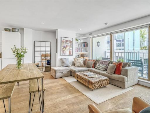 2 bedroom flat for sale in Hardwicks Square, SW18 — £600,000 • 2 bed • 2 bath • 929 ft²
 2 bedroom apartment for sale in Knaresborough Drive, London, SW18 — £675,000 • 2 bed • 2 bath • 938 ft²
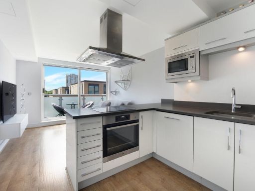 2 bedroom apartment for sale in Charterhouse Apartments, London, SW18 — £480,000 • 2 bed • 2 bath • 681 ft²
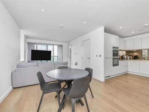 2 bedroom block of apartments for sale in Buckhold Road, SW18 — £650,000 • 2 bed • 2 bath • 821 ft²
 2 bedroom flat for sale in North Side Wandsworth Common, Wandsworth, London, SW18 — £550,000 • 2 bed • 2 bath • 943 ft²
Meta
- {
"@context": "https://schema.org",
"@type": "Residence",
"name": "2 bedroom flat for sale in Lebanon Road, SW18",
"description": "",
"url": "https://propertypiper.co.uk/property/e6bbfd2a-18c1-4df1-b9bb-1247f3197597",
"image": "https://image-a.propertypiper.co.uk/ebd84675-3910-413a-aea3-a157e6da5b08-1024.jpeg",
"address": {
"@type": "PostalAddress",
"streetAddress": "Flat 8, 25 Lebanon Road",
"postalCode": "SW18 1RE",
"addressLocality": "Wandsworth",
"addressRegion": "Putney",
"addressCountry": "England"
},
"geo": {
"@type": "GeoCoordinates",
"latitude": 51.456013667141235,
"longitude": -0.2011928923635253
},
"numberOfRooms": 2,
"numberOfBathroomsTotal": 2,
"floorSize": {
"@type": "QuantitativeValue",
"value": 819,
"unitCode": "FTK"
},
"offers": {
"@type": "Offer",
"price": 565000,
"priceCurrency": "GBP",
"availability": "https://schema.org/InStock"
},
"additionalProperty": [
{
"@type": "PropertyValue",
"name": "Feature",
"value": "contemporary"
},
{
"@type": "PropertyValue",
"name": "Feature",
"value": "open plan"
},
{
"@type": "PropertyValue",
"name": "Feature",
"value": "living room"
},
{
"@type": "PropertyValue",
"name": "Feature",
"value": "kitchen"
},
{
"@type": "PropertyValue",
"name": "Feature",
"value": "hardwood floors"
},
{
"@type": "PropertyValue",
"name": "Feature",
"value": "modern"
},
{
"@type": "PropertyValue",
"name": "Feature",
"value": "bright"
},
{
"@type": "PropertyValue",
"name": "Feature",
"value": "light fixtures"
},
{
"@type": "PropertyValue",
"name": "Feature",
"value": "contemporary style"
},
{
"@type": "PropertyValue",
"name": "Feature",
"value": "modern kitchen"
},
{
"@type": "PropertyValue",
"name": "Feature",
"value": "open-plan"
},
{
"@type": "PropertyValue",
"name": "Feature",
"value": "integrated appliances"
},
{
"@type": "PropertyValue",
"name": "Feature",
"value": "compact dining space"
},
{
"@type": "PropertyValue",
"name": "Feature",
"value": "laminate flooring"
},
{
"@type": "PropertyValue",
"name": "Feature",
"value": "under-cabinet lighting"
}
]
}
High Res Floorplan Images
Compatible Floorplan Images
FloorplanImages Thumbnail