YO12 5RA - 3 bedroom detached house for sale in Lady Ediths Avenue, Ne…
View on Property Piper
3 bedroom detached house for sale in Lady Ediths Avenue, Newby, Scarborough, YO12
Property Details
- Price: £345000
- Bedrooms: 3
- Bathrooms: 1
- Property Type: undefined
- Property SubType: undefined
Image Descriptions
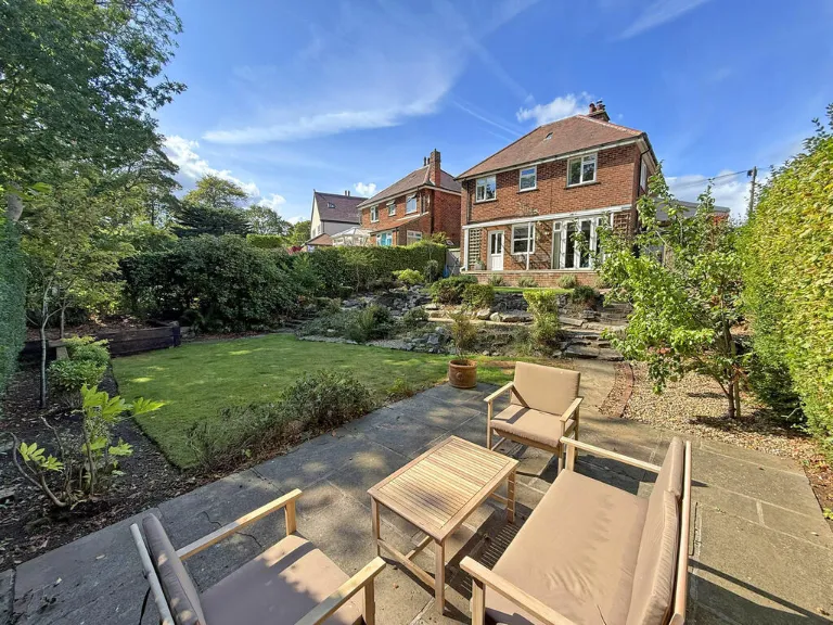
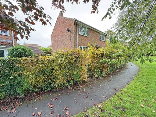
- exterior view of a semi-detached house Early 20th Century
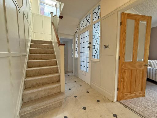
- hallway Edwardian
Floorplan Description
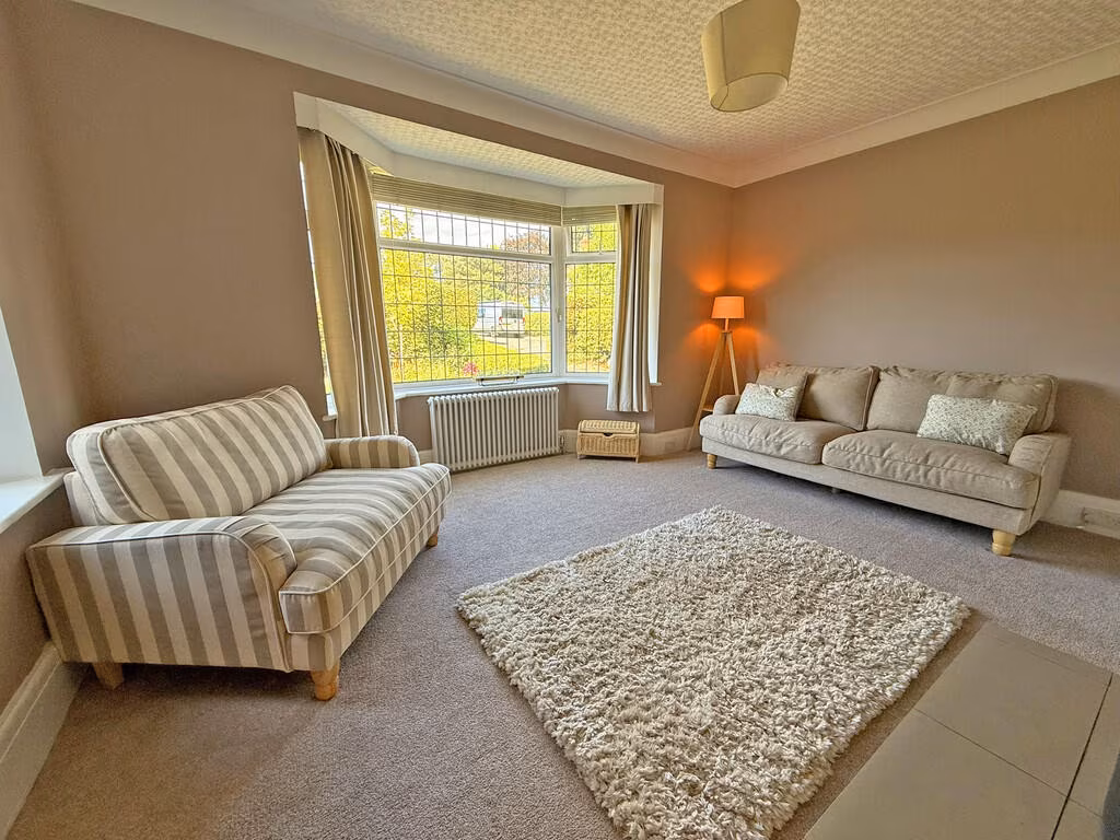
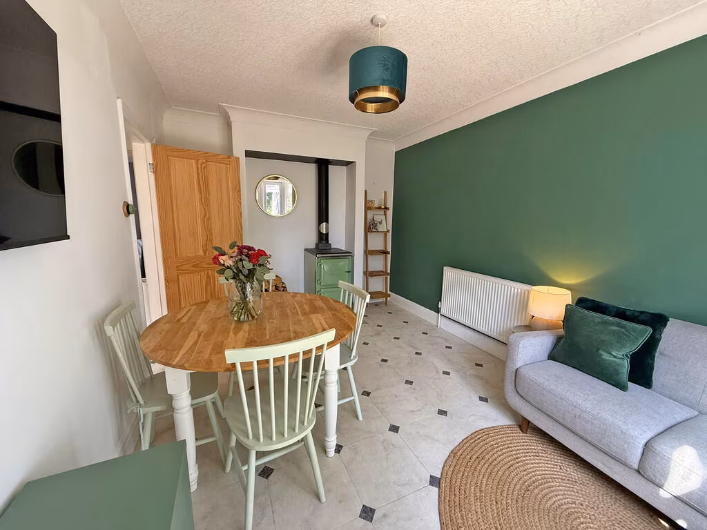
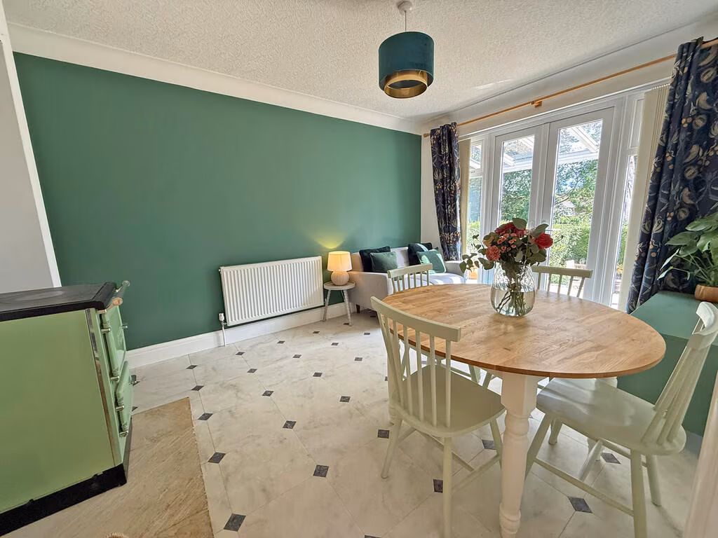
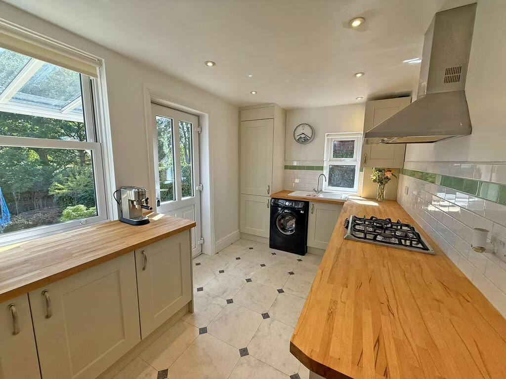
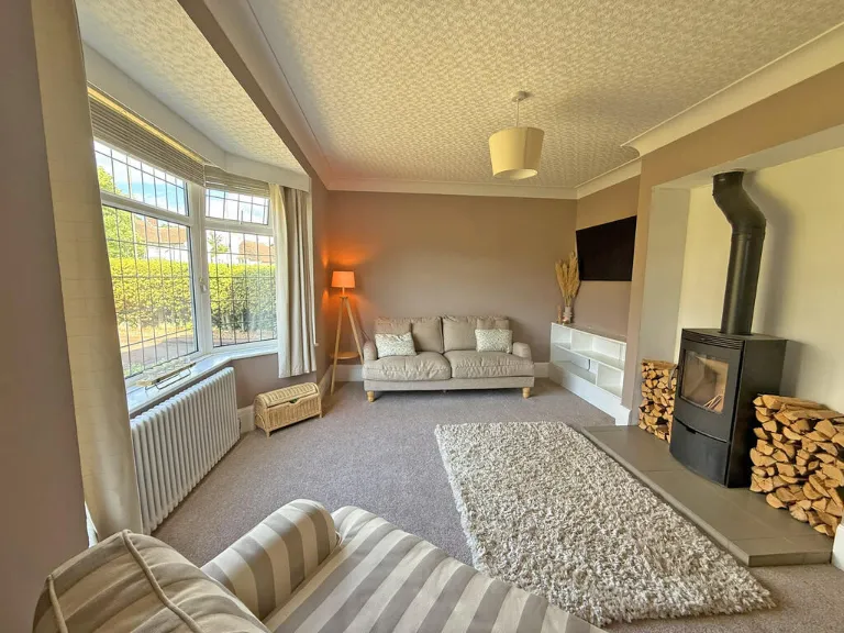
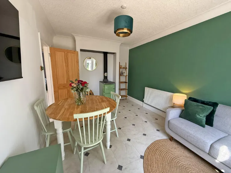
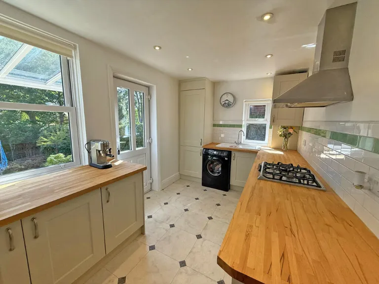
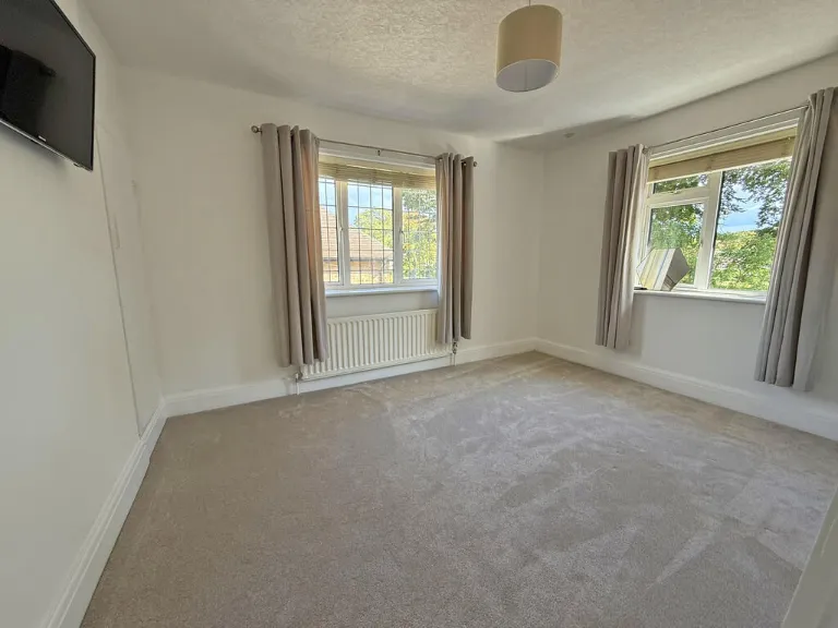
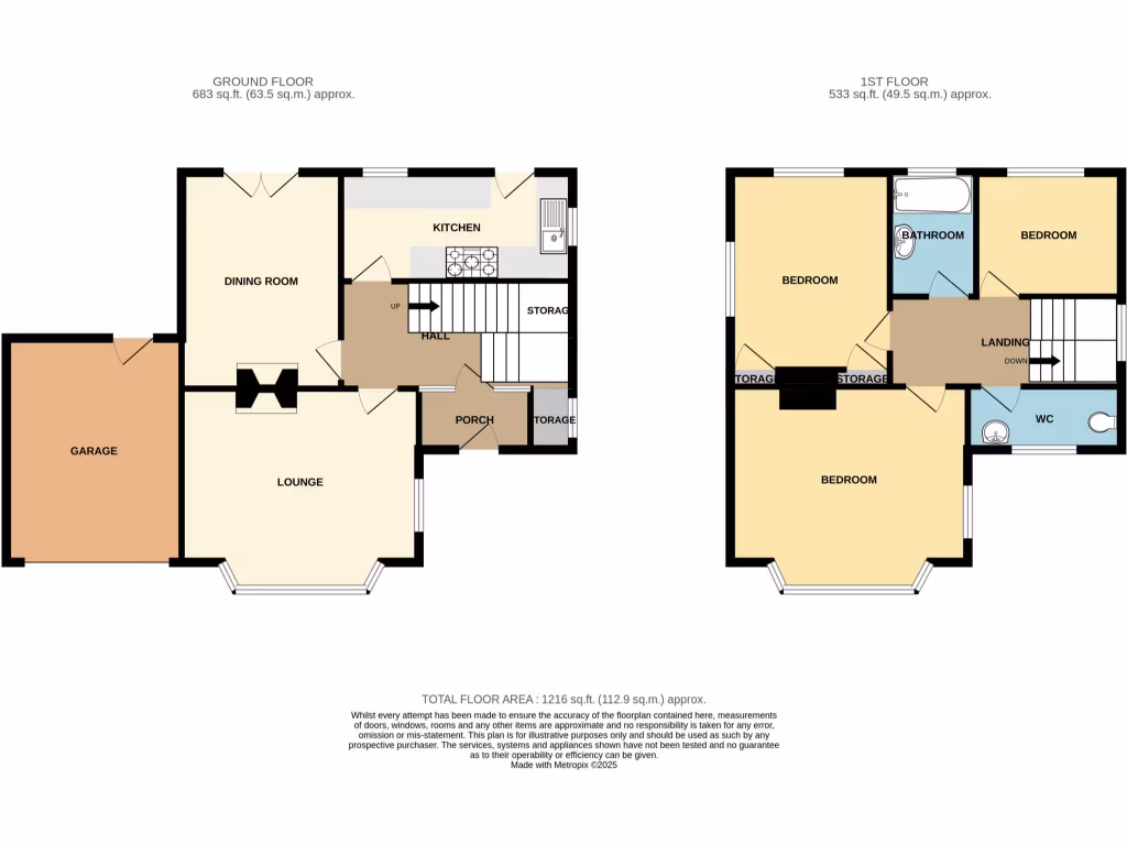
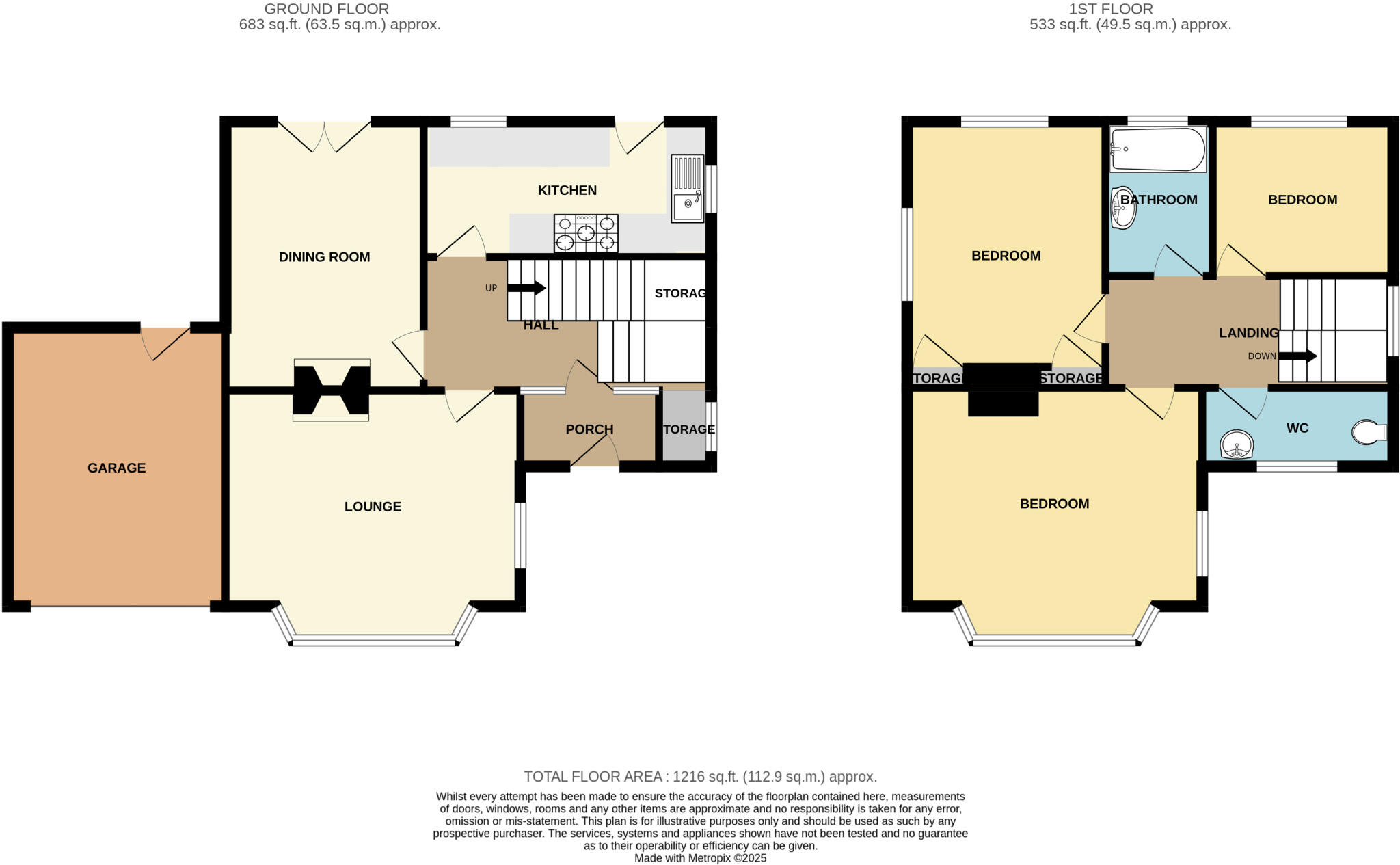
- Two-storey house with lounge, dining room, kitchen and garage on the ground floor and three bedrooms plus bathroom/WC on the first floor.
Rooms
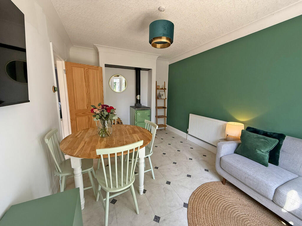
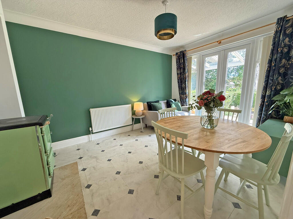
- DINING ROOM:
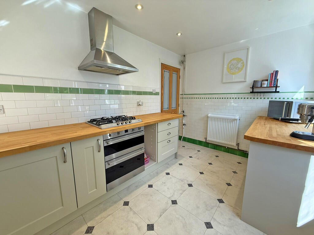
- KITCHEN:
- HALL:
- STORAG:
- PORCH:
- STORAGE:
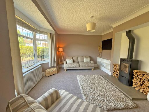
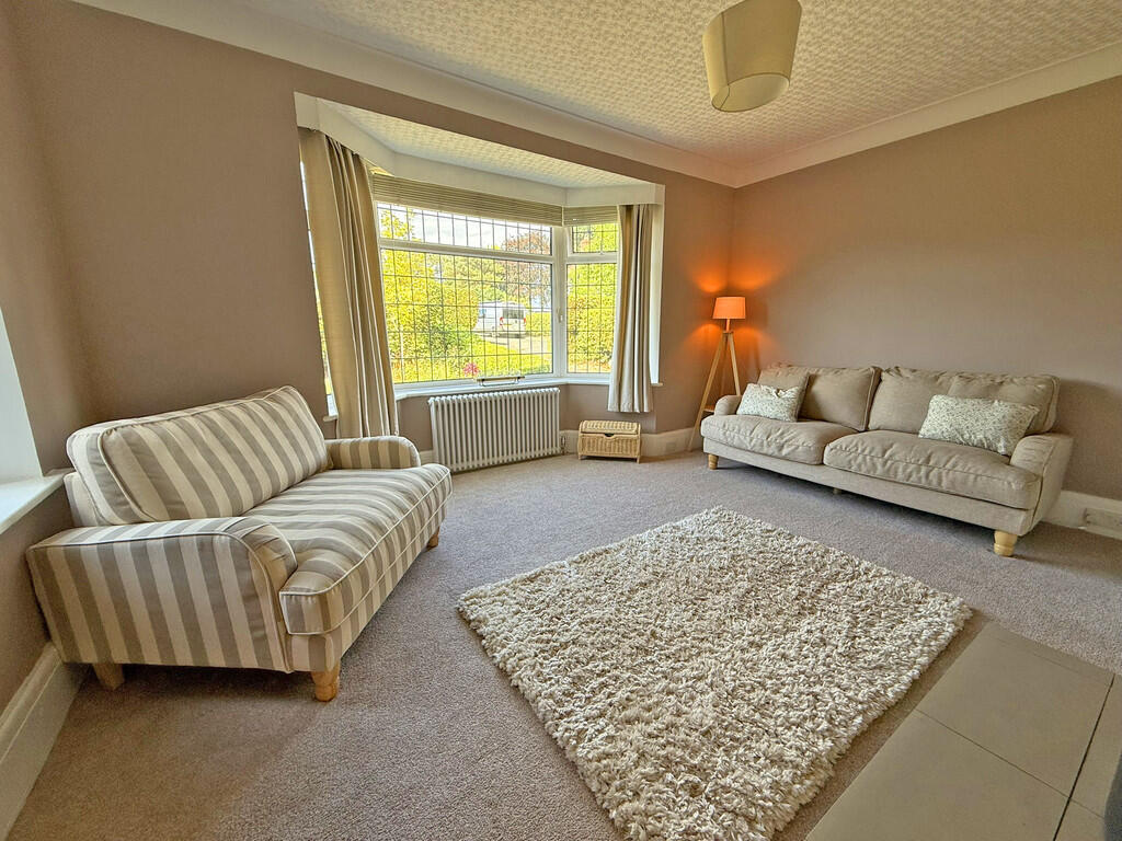
- LOUNGE:
- GARAGE:
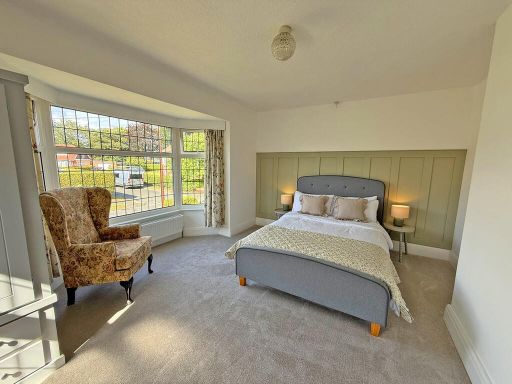
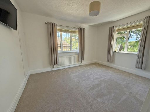
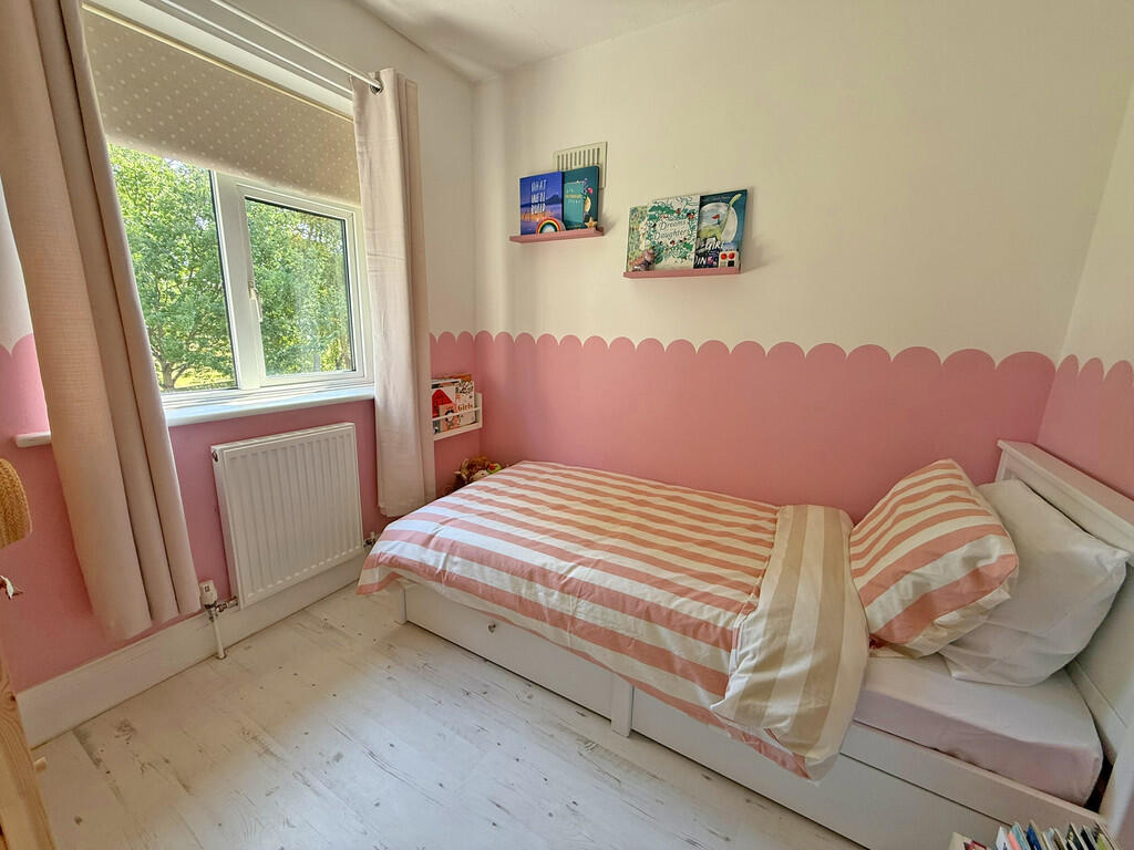
- BEDROOM:
- BEDROOM:
- BEDROOM:
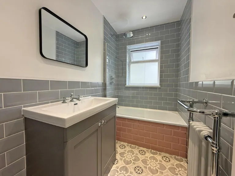
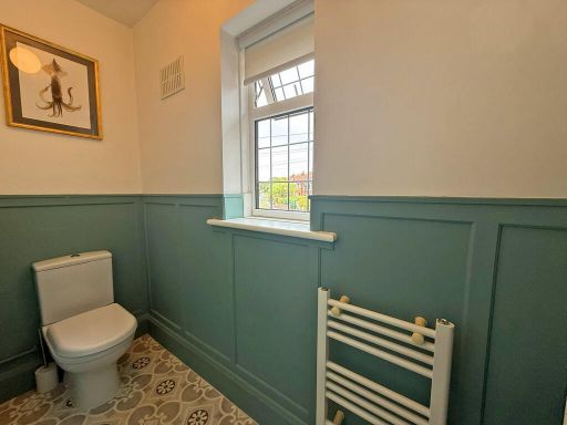
- BATHROOM:
- LANDING:
- WC:
- STORAGE:
- STORAGE:
Textual Property Features
Detected Visual Features
- semi-detached
- early 20th century
- bay windows
- brick exterior
- pitched roof
- garage
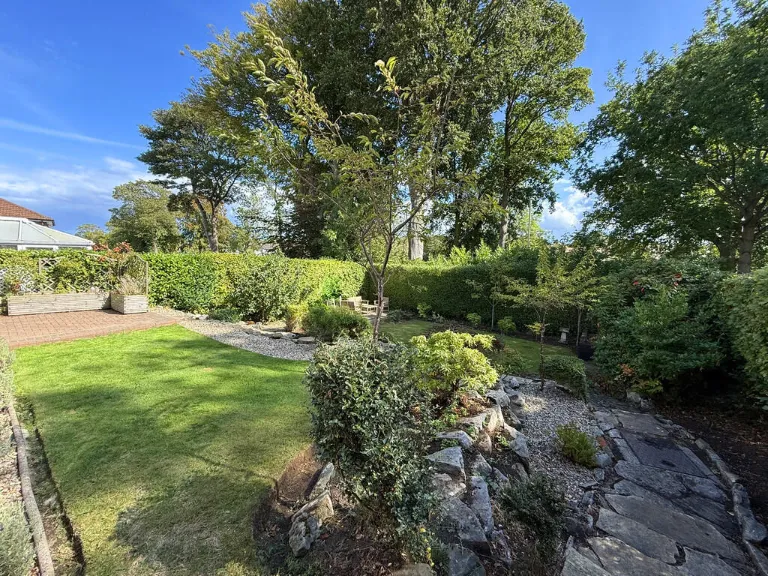
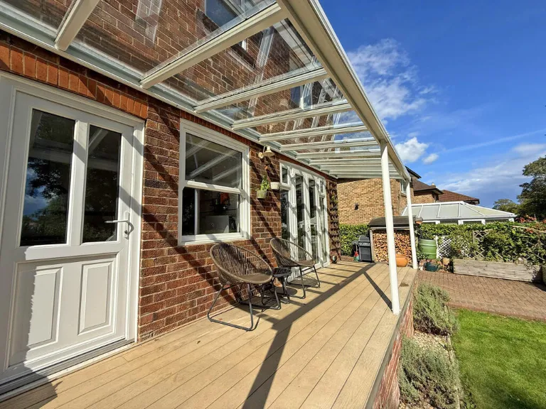
- well-maintained
- garden
- Edwardian
- stained glass
- tiled floor
- wood paneling
- banister
- staircase
- hallway
Nearby Schools
- George Pindar School
- St George's Catholic Primary School - a Catholic voluntary academy
- St Augustine's Catholic School - a Catholic voluntary academy
- Graham School
- Gladstone Road Primary School
- Friarage Community Primary School
- Cayton Community Primary School
- Braeburn Primary and Nursery Academy
- East Ayton Community Primary School
- St Martin's Church of England Voluntary Aided Primary School, Scarborough
- Scarborough College
- Scarborough University Technical College
- Newby and Scalby Primary School
- Lindhead School
- Wheatcroft Community Primary School
- St Peter's Catholic Primary School - a Catholic voluntary academy
- Scalby School
- Seamer and Irton Community Primary School
- Scarborough, Overdale Community Primary School
- Thomas Hinderwell Primary Academy
- Barrowcliff School
- Scarborough, Northstead Community Primary School
Nearest General Shops
- Id: 3256791304
- Tags:
- Addr:
- City: Scarborough
- Housenumber: 52
- Postcode: YO12 6DJ
- Street: Newlands Park Drive
- Brand: Cooplands
- Brand:wikidata: Q5167971
- Name: Cooplands
- Shop: bakery
- TagsNormalized:
- Lat: 54.2935164
- Lon: -0.4224323
- FullGeoHash: gcxsy7u6st58
- PartitionGeoHash: gcxs
- Images:
- FoodStandards: null
- Distance: 1244
,- Id: 204189661
- Tags:
- Addr:
- City: Scarborough
- Housenumber: 401
- Postcode: YO12 6TQ
- Street: Scalby Road
- Building: yes
- Name: Proudfoot
- Shop: supermarket
- TagsNormalized:
- Lat: 54.2946701
- Lon: -0.4392916
- FullGeoHash: gcxsyh017u06
- PartitionGeoHash: gcxs
- Images:
- FoodStandards: null
- Distance: 1087.5
,- Id: 4176424418
- Tags:
- Brand: Cooplands
- Brand:wikidata: Q5167971
- Brand:wikipedia: en:Cooplands
- Name: Cooplands
- Shop: bakery
- TagsNormalized:
- Lat: 54.2894523
- Lon: -0.4311544
- FullGeoHash: gcxsy5n4cr7v
- PartitionGeoHash: gcxs
- Images:
- FoodStandards: null
- Distance: 543.1
}
Nearest Grocery shops
- Id: 957545747
- Tags:
- Building: yes
- Shop: convenience
- TagsNormalized:
- Lat: 54.2950824
- Lon: -0.4400661
- FullGeoHash: gcxsvupec8yy
- PartitionGeoHash: gcxs
- Images:
- FoodStandards: null
- Distance: 1144.8
,- Id: 4962879796
- Tags:
- TagsNormalized:
- Lat: 54.2911812
- Lon: -0.426302
- FullGeoHash: gcxsy73t43wn
- PartitionGeoHash: gcxs
- Images:
- FoodStandards: null
- Distance: 883.1
,- Id: 4176424415
- Tags:
- Name: Premier Westwood General Stores
- Shop: convenience
- TagsNormalized:
- general
- premier
- convenience
- shop
- Lat: 54.2894086
- Lon: -0.4312429
- FullGeoHash: gcxsy5jfxr3b
- PartitionGeoHash: gcxs
- Images:
- FoodStandards: null
- Distance: 536.1
}
Nearest Supermarkets
- Id: 174929005
- Tags:
- Addr:
- City: Scarborough
- Postcode: YO12 7AJ
- Street: Northway
- Branch: Scarborough
- Brand: ALDI
- Brand:wikidata: Q41171672
- Brand:wikipedia: en:Aldi
- Building: yes
- Contact:
- Website: https://stores.aldi.co.uk/scarborough/northway
- Name: ALDI
- Opening_hours: Mo-Sa 08:00-22:00; Su 10:00-16:00
- Shop: supermarket
- Toilets:
- Wheelchair: yes
- TagsNormalized:
- Lat: 54.2821975
- Lon: -0.4073563
- FullGeoHash: gcxsy9z2ezj0
- PartitionGeoHash: gcxs
- Images:
- FoodStandards: null
- Distance: 1839
,- Id: 664938180
- Tags:
- Addr:
- City: Scarborough
- Postcode: YO12 5EA
- Street: Falsgrave Road
- Branch: Scarborough Superstore
- Brand: Sainsbury's
- Brand:wikidata: Q152096
- Building: supermarket
- Cafe: yes
- Name: Sainsbury's
- Opening_hours: Mo-Sa 07:00-22:00; Su 10:00-16:00
- Pharmacy: yes
- Shop: supermarket
- Toilets: yes
- Toilets:wheelchair: yes
- Wheelchair: yes
- TagsNormalized:
- sainsburys
- supermarket
- shop
- Lat: 54.2791282
- Lon: -0.4127178
- FullGeoHash: gcxsy95qyfz7
- PartitionGeoHash: gcxs
- Images:
- FoodStandards: null
- Distance: 1608.5
,- Id: 3256791305
- Tags:
- Addr:
- City: Scarborough
- Housenumber: 42-46
- Postcode: YO12 6DJ
- Street: Newlands Park Drive
- Brand: Co-op Food
- Brand:wikidata: Q3277439
- Brand:wikipedia: en:Co-op Food
- Name: Co-op Food
- Operator: The Co-operative Group
- Shop: supermarket
- TagsNormalized:
- co-op
- co-op food
- food
- supermarket
- shop
- Lat: 54.2937105
- Lon: -0.4226281
- FullGeoHash: gcxsy7u7b11w
- PartitionGeoHash: gcxs
- Images:
- FoodStandards: null
- Distance: 1251.8
}
Nearest Religious buildings
- Id: 4811849367
- Tags:
- Amenity: place_of_worship
- Denomination: mormon
- Name: The Church of Jesus Christ of Latter-day Saints
- Religion: christian
- Service_times: Su 10:00
- TagsNormalized:
- place of worship
- mormon
- church
- christian
- Lat: 54.2766262
- Lon: -0.4308805
- FullGeoHash: gcxsy0y0rb2n
- PartitionGeoHash: gcxs
- Images:
- FoodStandards: null
- Distance: 992.4
,- Id: 593890087
- Tags:
- Addr:
- City: Scarborough
- Postcode: YO12 6NP
- Street: Wreyfield Drive
- Amenity: place_of_worship
- Building: church
- Denomination: methodist
- Name: Wreyfield Drive Methodist
- Phone: +441723361214
- Religion: christian
- Service_times: Su 10:30
- Website: http://northsteadmethodist.churchsite.org.uk/
- TagsNormalized:
- place of worship
- church
- methodist
- christian
- Lat: 54.2903205
- Lon: -0.4311544
- FullGeoHash: gcxsy5q0137b
- PartitionGeoHash: gcxs
- Images:
- FoodStandards: null
- Distance: 629.2
,- Id: 884665471
- Tags:
- Amenity: place_of_worship
- Building: church
- Denomination: anglican
- Name: St Luke
- Religion: christian
- Wikidata: Q105106385
- TagsNormalized:
- place of worship
- church
- anglican
- christian
- Lat: 54.2813939
- Lon: -0.432101
- FullGeoHash: gcxsy1tk534p
- PartitionGeoHash: gcxs
- Images:
- FoodStandards: null
- Distance: 467.5
}
Nearest Medical buildings
- Id: 4176440707
- Tags:
- Addr:
- City: Scarborough
- Postcode: YO12 6JG
- Street: North Leas Avenue
- Amenity: pharmacy
- Dispensing: yes
- Name: Northstead Pharmacy
- TagsNormalized:
- Lat: 54.2893197
- Lon: -0.4181307
- FullGeoHash: gcxsy7pd0yen
- PartitionGeoHash: gcxs
- Images:
- FoodStandards: null
- Distance: 1200.8
,- Id: 7477312299
- Tags:
- Addr:
- City: Scarborough
- Housenumber: 5
- Postcode: YO12 6SF
- Street: Coldyhill Lane
- Suburb: Newby
- Amenity: dentist
- Healthcare: dentist
- Name: Solis Dental Studio
- TagsNormalized:
- dentist
- health
- healthcare
- dental
- studio
- Lat: 54.2948918
- Lon: -0.4399297
- FullGeoHash: gcxsvupdsvkt
- PartitionGeoHash: gcxs
- Images:
- FoodStandards: null
- Distance: 1122
,- Id: 4176424416
- Tags:
- Addr:
- City: Scarborough
- Postcode: YO12 6NN
- Street: Wreyfield Drive
- Amenity: pharmacy
- Dispensing: yes
- Healthcare: pharmacy
- Name: Barrowcliff Pharmacy
- TagsNormalized:
- Lat: 54.2893507
- Lon: -0.4313636
- FullGeoHash: gcxsy5jfkkrz
- PartitionGeoHash: gcxs
- Images:
- FoodStandards: null
- Distance: 526.7
,- Id: 229554411
- Tags:
- Addr:
- City: Scarborough
- Country: GB
- Postcode: YO12 6QL
- Street: Woodlands Drive
- Amenity: hospital
- Designation: Scarborough & North East Yorkshire NHS Hospital
- Emergency: yes
- Internet_access: wlan
- Name: Scarborough Hospital
- Opening_hours: 24/7
- Phone: +44 1723 368111
- Short_name: Scarborough Hospital
- Toilets:
- Website: https://www.yorkhospitals.nhs.uk/our-hospitals/scarborough-hospital
- Wheelchair: yes
- TagsNormalized:
- Lat: 54.2821821
- Lon: -0.4360362
- FullGeoHash: gcxsy1f2xs5u
- PartitionGeoHash: gcxs
- Images:
- FoodStandards: null
- Distance: 337.9
}
Nearest Leisure Facilities
- Id: 285877657
- Tags:
- TagsNormalized:
- Lat: 54.2921693
- Lon: -0.4391523
- FullGeoHash: gcxsy584z1bk
- PartitionGeoHash: gcxs
- Images:
- FoodStandards: null
- Distance: 817.6
,- Id: 267888850
- Tags:
- Building: yes
- Leisure: sports_centre
- Name: Scarborough Table Tennis Centre
- TagsNormalized:
- sports
- sports centre
- leisure
- table tennis
- tennis
- Lat: 54.2787867
- Lon: -0.440974
- FullGeoHash: gcxsvcnuue1y
- PartitionGeoHash: gcxs
- Images:
- FoodStandards: null
- Distance: 803.4
,- Id: 1085579987
- Tags:
- TagsNormalized:
- Lat: 54.2910018
- Lon: -0.4285869
- FullGeoHash: gcxsy5ruj0q2
- PartitionGeoHash: gcxs
- Images:
- FoodStandards: null
- Distance: 777.2
,- Id: 185657656
- Tags:
- Leisure: pitch
- Source: Bing
- Sport: soccer
- TagsNormalized:
- Lat: 54.2808202
- Lon: -0.4349526
- FullGeoHash: gcxsy1e28y7b
- PartitionGeoHash: gcxs
- Images:
- FoodStandards: null
- Distance: 485.5
,- Id: 593869046
- Tags:
- TagsNormalized:
- Lat: 54.2870794
- Lon: -0.4288595
- FullGeoHash: gcxsy4xtnv54
- PartitionGeoHash: gcxs
- Images:
- FoodStandards: null
- Distance: 463.6
}
Nearest Tourist attractions
- Id: 5372846705
- Tags:
- Name: Peasolm Park Historic Naval Battle
- Tourism: attraction
- Wheelchair: yes
- TagsNormalized:
- Lat: 54.2899543
- Lon: -0.4098554
- FullGeoHash: gcxsyejtcsvx
- PartitionGeoHash: gcxs
- Images:
- FoodStandards: null
- Distance: 1729.7
,- Id: 260386087
- Tags:
- Created_by: Potlatch 0.8b
- Tourism: attraction
- TagsNormalized:
- Lat: 54.2848569
- Lon: -0.4507793
- FullGeoHash: gcxsvdrb0nf8
- PartitionGeoHash: gcxs
- Images:
- FoodStandards: null
- Distance: 1010.6
,- Id: 9006883344
- Tags:
- Fixme: New caravan park requires survey
- Tourism: caravan_site
- TagsNormalized:
- Lat: 54.2810085
- Lon: -0.4475886
- FullGeoHash: gcxsvcd1f3mu
- PartitionGeoHash: gcxs
- Images:
- FoodStandards: null
- Distance: 927.4
}
Nearest Train stations
- Id: 12709995
- Tags:
- Name: Newton Dale
- Public_transport: station
- Railway: station
- Usage: tourism
- Wikidata: Q7020211
- Wikipedia: en:Newton Dale Halt railway station
- TagsNormalized:
- Lat: 54.3424545
- Lon: -0.7177548
- FullGeoHash: gcxmpstrepep
- PartitionGeoHash: gcxm
- Images:
- FoodStandards: null
- Distance: 19401.5
,- Id: 3711894543
- Tags:
- Name: Filey
- Naptan:
- Network: National Rail
- Operator: Northern
- Platforms: 2
- Public_transport: station
- Railway: station
- Ref:
- Source: npe
- Wikipedia: en:Filey railway station
- TagsNormalized:
- Lat: 54.2098083
- Lon: -0.2938604
- FullGeoHash: gcxu3kd5089y
- PartitionGeoHash: gcxu
- Images:
- FoodStandards: null
- Distance: 12433.6
,- Id: 2865967713
- Tags:
- Name: Scalby Mills
- Public_transport: station
- Railway: station
- Usage: tourism
- Wheelchair: limited
- TagsNormalized:
- Lat: 54.3009398
- Lon: -0.410949
- FullGeoHash: gcxsythvbhy5
- PartitionGeoHash: gcxs
- Images:
- FoodStandards: null
- Distance: 2356
,- Id: 73054111
- Tags:
- Name: Scarborough
- Naptan:
- Network: National Rail
- Operator: First Transpennine Express
- Public_transport: station
- Railway: station
- Ref:
- Toilets:
- Train: yes
- Wheelchair: yes
- Wikipedia: en:Scarborough railway station
- TagsNormalized:
- Lat: 54.2799474
- Lon: -0.4056223
- FullGeoHash: gcxsyc2es7d4
- PartitionGeoHash: gcxs
- Images:
- FoodStandards: null
- Distance: 2007.6
,- Id: 2865970573
- Tags:
- Name: Peasholm
- Public_transport: station
- Railway: station
- Usage: tourism
- TagsNormalized:
- Lat: 54.2929426
- Lon: -0.4113865
- FullGeoHash: gcxsyesrmfpc
- PartitionGeoHash: gcxs
- Images:
- FoodStandards: null
- Distance: 1771.3
}
Nearest Bus stations and stops
- Id: 4977707910
- Tags:
- Bus: yes
- Highway: bus_stop
- Public_transport: platform
- Shelter: yes
- TagsNormalized:
- Lat: 54.2741788
- Lon: -0.4255059
- FullGeoHash: gcxsy264hbpz
- PartitionGeoHash: gcxs
- Images:
- FoodStandards: null
- Distance: 1376.6
,- Id: 4962476909
- Tags:
- Bus: yes
- Highway: bus_stop
- Public_transport: platform
- Shelter: yes
- TagsNormalized:
- Lat: 54.2889319
- Lon: -0.4172536
- FullGeoHash: gcxsydbpvq3j
- PartitionGeoHash: gcxs
- Images:
- FoodStandards: null
- Distance: 1238.4
,- Id: 4962879799
- Tags:
- Bus: yes
- Highway: bus_stop
- Public_transport: platform
- TagsNormalized:
- Lat: 54.2912783
- Lon: -0.4266694
- FullGeoHash: gcxsy73m9gu1
- PartitionGeoHash: gcxs
- Images:
- FoodStandards: null
- Distance: 876
,- Id: 4962881424
- Tags:
- Bus: yes
- Highway: bus_stop
- Public_transport: platform
- TagsNormalized:
- Lat: 54.2911734
- Lon: -0.4264549
- FullGeoHash: gcxsy73mnbk0
- PartitionGeoHash: gcxs
- Images:
- FoodStandards: null
- Distance: 876
,- Id: 7881857388
- Tags:
- Bench: yes
- Bin: yes
- Bus: yes
- Highway: bus_stop
- Public_transport: platform
- Shelter: yes
- TagsNormalized:
- Lat: 54.2808422
- Lon: -0.4283323
- FullGeoHash: gcxsy380g4kk
- PartitionGeoHash: gcxs
- Images:
- FoodStandards: null
- Distance: 658
}
Nearest Hotels
- Id: 988036618
- Tags:
- Brand: Premier Inn
- Brand:wikidata: Q2108626
- Brand:wikipedia: en:Premier Inn
- Building: yes
- Internet_access: wlan
- Internet_access:fee: customers
- Internet_access:operator: Virgin Media
- Internet_access:ssid: Premier Inn Free Wi-Fi
- Name: Premier Inn
- Tourism: hotel
- TagsNormalized:
- Lat: 54.2956645
- Lon: -0.4151204
- FullGeoHash: gcxsys1xnvry
- PartitionGeoHash: gcxs
- Images:
- FoodStandards: null
- Distance: 1749.3
,- Id: 6262434219
- Tags:
- Addr:
- City: Scarborough
- Postcode: YO12 4DX
- Street: West Bank
- Name: Green Gables
- Tourism: hotel
- TagsNormalized:
- Lat: 54.2736115
- Lon: -0.4186134
- FullGeoHash: gcxsy2pntw7p
- PartitionGeoHash: gcxs
- Images:
- FoodStandards: null
- Distance: 1678.7
,- Id: 7474115810
- Tags:
- Addr:
- City: Scarborough
- Housenumber: 45-47
- Postcode: YO12 6AF
- Street: Northstead Manor Drive
- Name: Ryndle Court Hotel
- Tourism: hotel
- TagsNormalized:
- Lat: 54.2902894
- Lon: -0.4158476
- FullGeoHash: gcxsye1py53w
- PartitionGeoHash: gcxs
- Images:
- FoodStandards: null
- Distance: 1379.7
}
Tags
- semi-detached
- early 20th century
- bay windows
- brick exterior
- pitched roof
- garage
- well-maintained
- garden
- Edwardian
- stained glass
- tiled floor
- wood paneling
- banister
- staircase
- hallway
Local Market Stats
- Average Price/sqft: £184
- Avg Income: £34700
- Rental Yield: 4%
- Social Housing: 5%
- Planning Success Rate: 63%
Similar Properties
 4 bedroom detached house for sale in Skiplam Close, Scarborough, YO12 — £300,000 • 4 bed • 1 bath • 1195 ft²
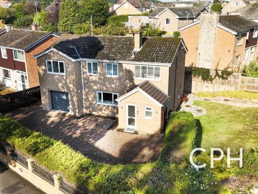 5 bedroom detached house for sale in Stepney Road, Scarborough, YO12 — £450,000 • 5 bed • 2 bath • 1797 ft²
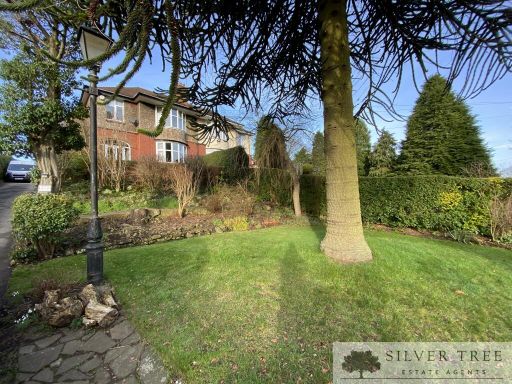 3 bedroom semi-detached house for sale in Scalby Road, Scarborough, North Yorkshire, YO12 — £335,000 • 3 bed • 1 bath • 1464 ft²
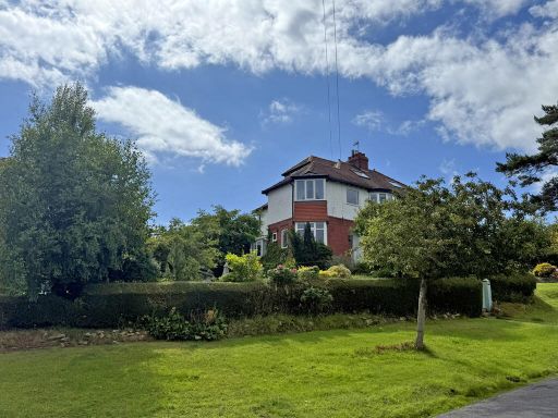 4 bedroom semi-detached house for sale in Red Scar Lane, Newby, Scarborough, YO12 — £410,000 • 4 bed • 1 bath • 1464 ft²
 3 bedroom semi-detached house for sale in Throxenby Lane, Scarborough, YO12 — £274,400 • 3 bed • 1 bath • 891 ft²
 3 bedroom detached house for sale in Glynndale Drive, Newby, Scarborough, North Yorkshire, YO12 — £380,000 • 3 bed • 1 bath • 1389 ft²
Meta
- {
"@context": "https://schema.org",
"@type": "Residence",
"name": "3 bedroom detached house for sale in Lady Ediths Avenue, Ne…",
"description": "",
"url": "https://propertypiper.co.uk/property/e4238da9-8598-4ec6-8bdf-84b77c855fb4",
"image": "https://image-a.propertypiper.co.uk/048ba98c-ac02-47b3-880c-56c749f05766-1024.jpeg",
"address": {
"@type": "PostalAddress",
"streetAddress": "23 LADY EDITHS AVENUE SCARBOROUGH",
"postalCode": "YO12 5RA",
"addressLocality": "Scarborough",
"addressRegion": "Scarborough and Whitby",
"addressCountry": "England"
},
"geo": {
"@type": "GeoCoordinates",
"latitude": 54.28518339919689,
"longitude": -0.43522067867548464
},
"numberOfRooms": 3,
"numberOfBathroomsTotal": 1,
"floorSize": {
"@type": "QuantitativeValue",
"value": 1216,
"unitCode": "FTK"
},
"offers": {
"@type": "Offer",
"price": 345000,
"priceCurrency": "GBP",
"availability": "https://schema.org/InStock"
},
"additionalProperty": [
{
"@type": "PropertyValue",
"name": "Feature",
"value": "semi-detached"
},
{
"@type": "PropertyValue",
"name": "Feature",
"value": "early 20th century"
},
{
"@type": "PropertyValue",
"name": "Feature",
"value": "bay windows"
},
{
"@type": "PropertyValue",
"name": "Feature",
"value": "brick exterior"
},
{
"@type": "PropertyValue",
"name": "Feature",
"value": "pitched roof"
},
{
"@type": "PropertyValue",
"name": "Feature",
"value": "garage"
},
{
"@type": "PropertyValue",
"name": "Feature",
"value": "well-maintained"
},
{
"@type": "PropertyValue",
"name": "Feature",
"value": "garden"
},
{
"@type": "PropertyValue",
"name": "Feature",
"value": "Edwardian"
},
{
"@type": "PropertyValue",
"name": "Feature",
"value": "stained glass"
},
{
"@type": "PropertyValue",
"name": "Feature",
"value": "tiled floor"
},
{
"@type": "PropertyValue",
"name": "Feature",
"value": "wood paneling"
},
{
"@type": "PropertyValue",
"name": "Feature",
"value": "banister"
},
{
"@type": "PropertyValue",
"name": "Feature",
"value": "staircase"
},
{
"@type": "PropertyValue",
"name": "Feature",
"value": "hallway"
}
]
}
High Res Floorplan Images
Compatible Floorplan Images
FloorplanImages Thumbnail