B74 3PF - 4 bedroom semidetached house for sale in Bracken Way, Stree…
View on Property Piper
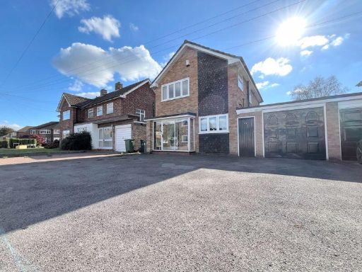
4 bedroom semi-detached house for sale in Bracken Way, Streetly, Sutton Coldfield, B74
Property Details
- Price: £425000
- Bedrooms: 4
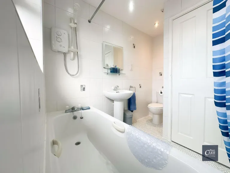
- Bathrooms: 2
- Property Type: undefined
- Property SubType: undefined
Image Descriptions
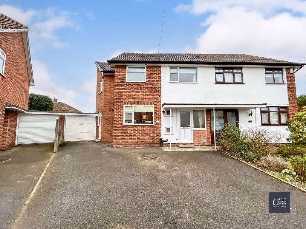
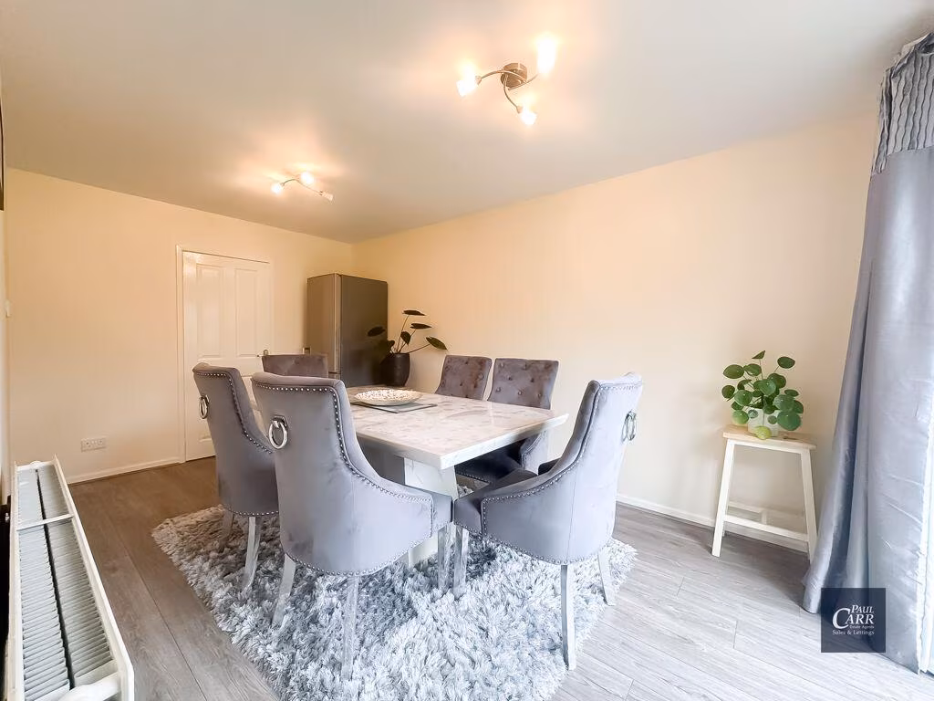
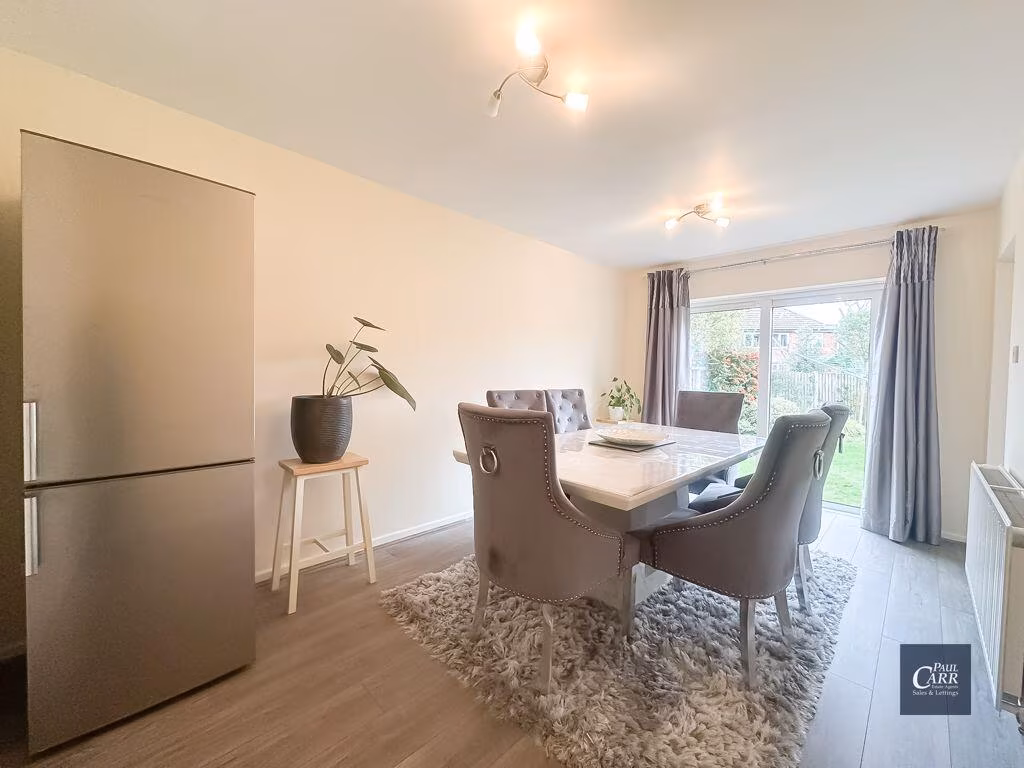
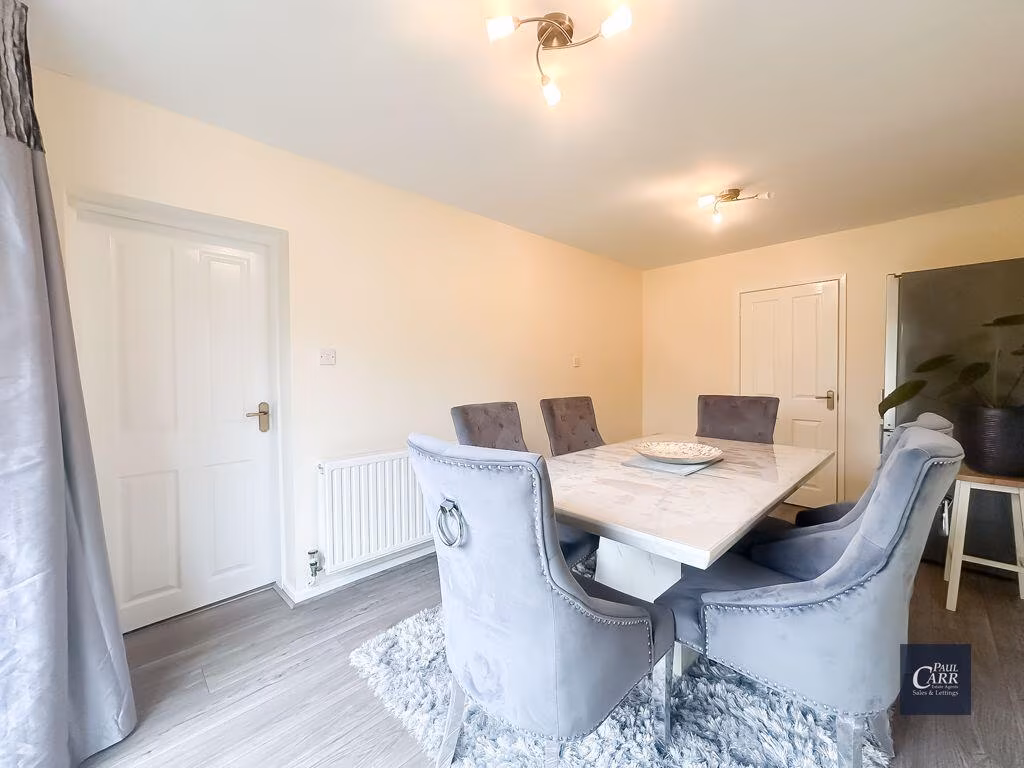
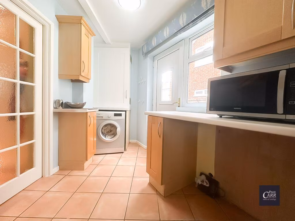
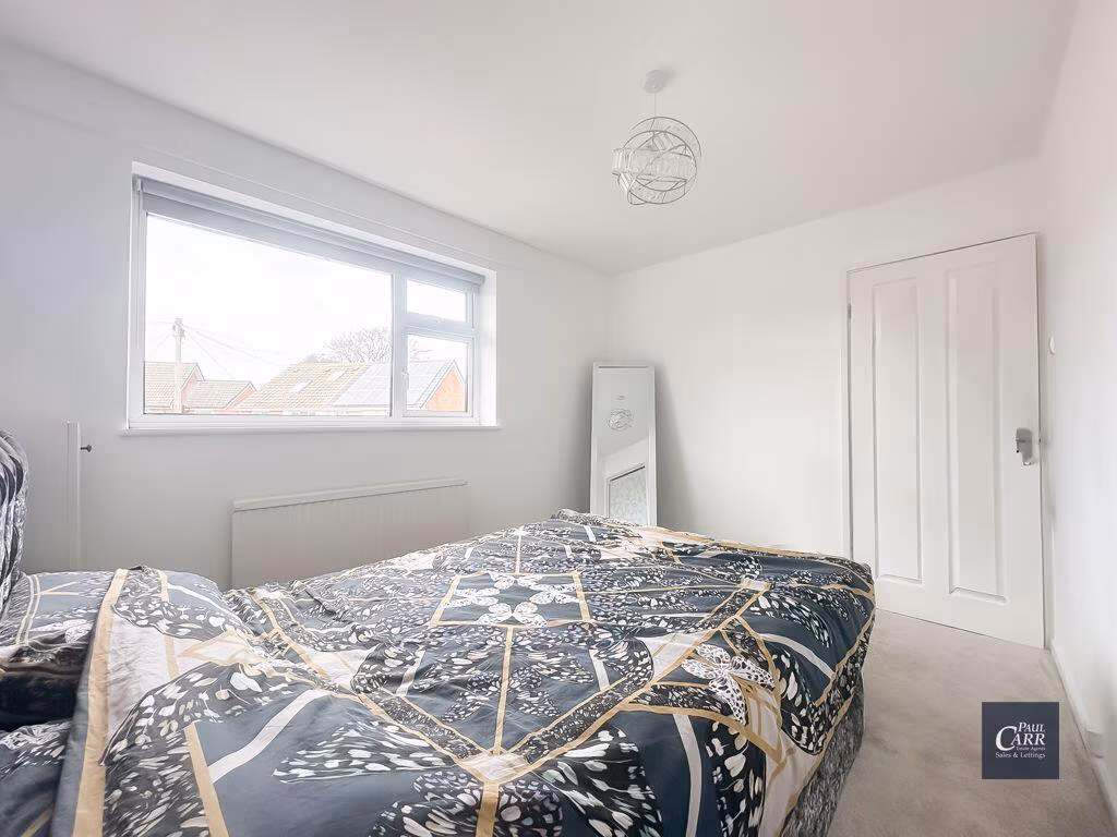
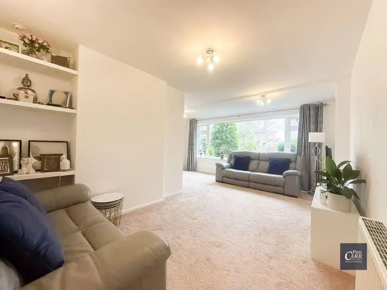
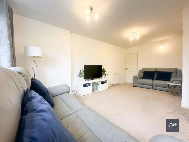
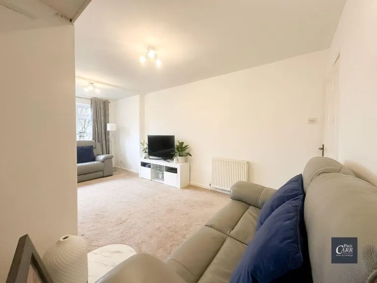
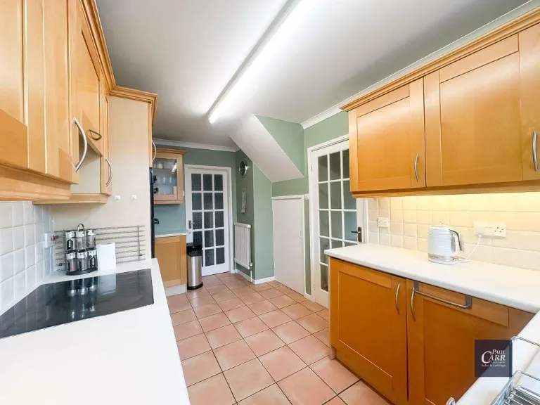
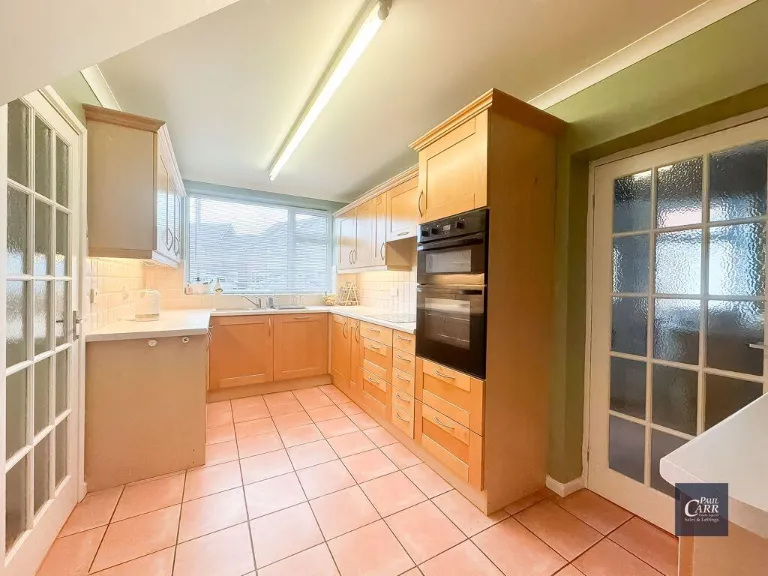
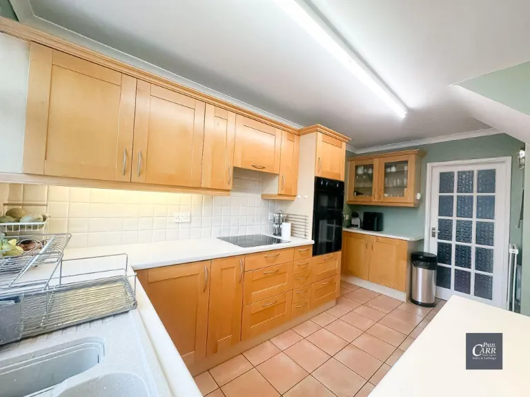
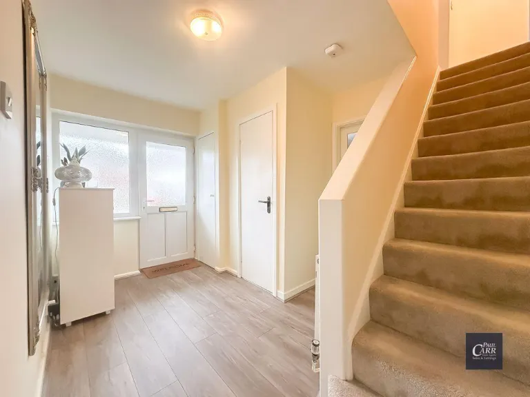
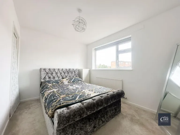
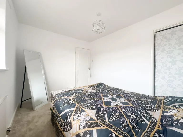
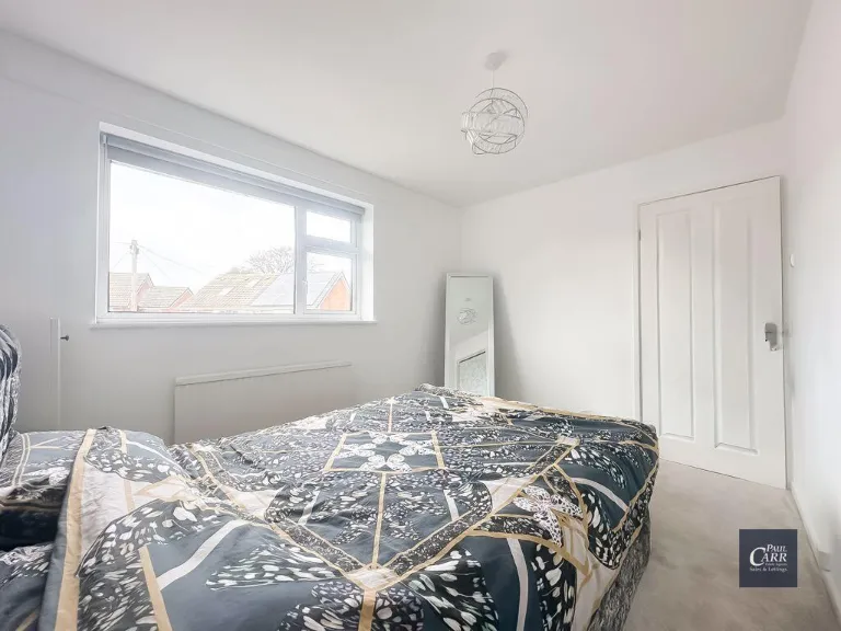
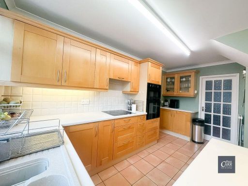
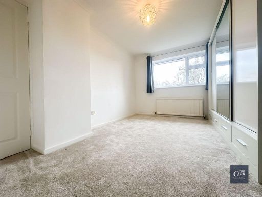
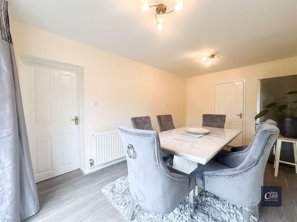
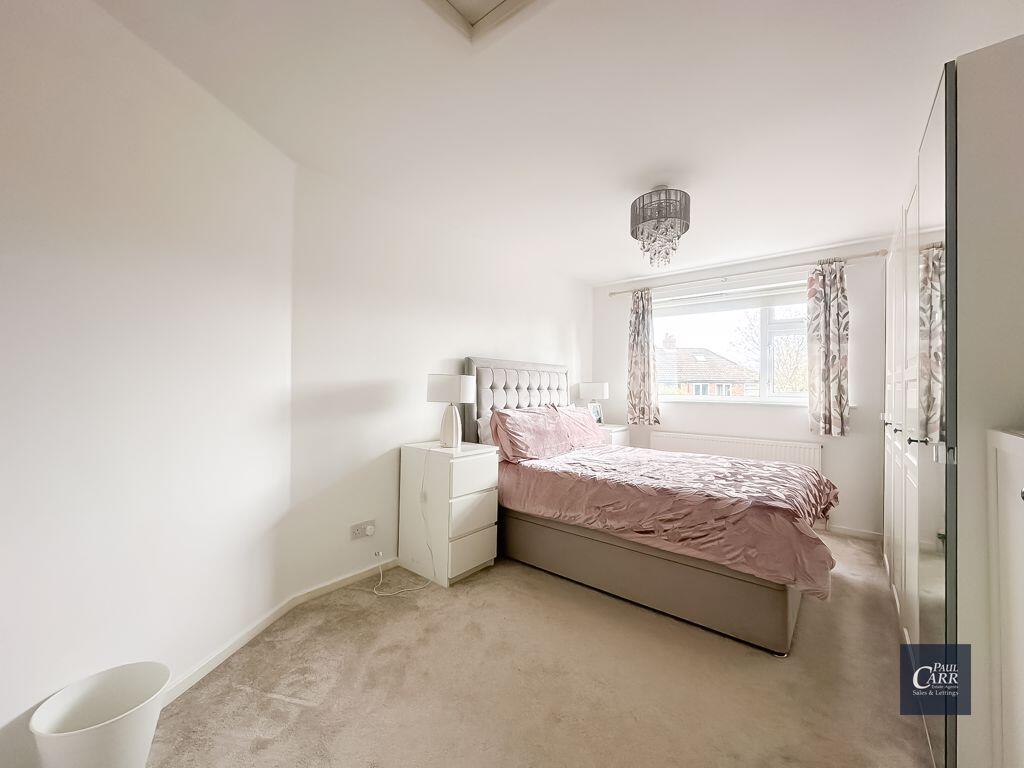
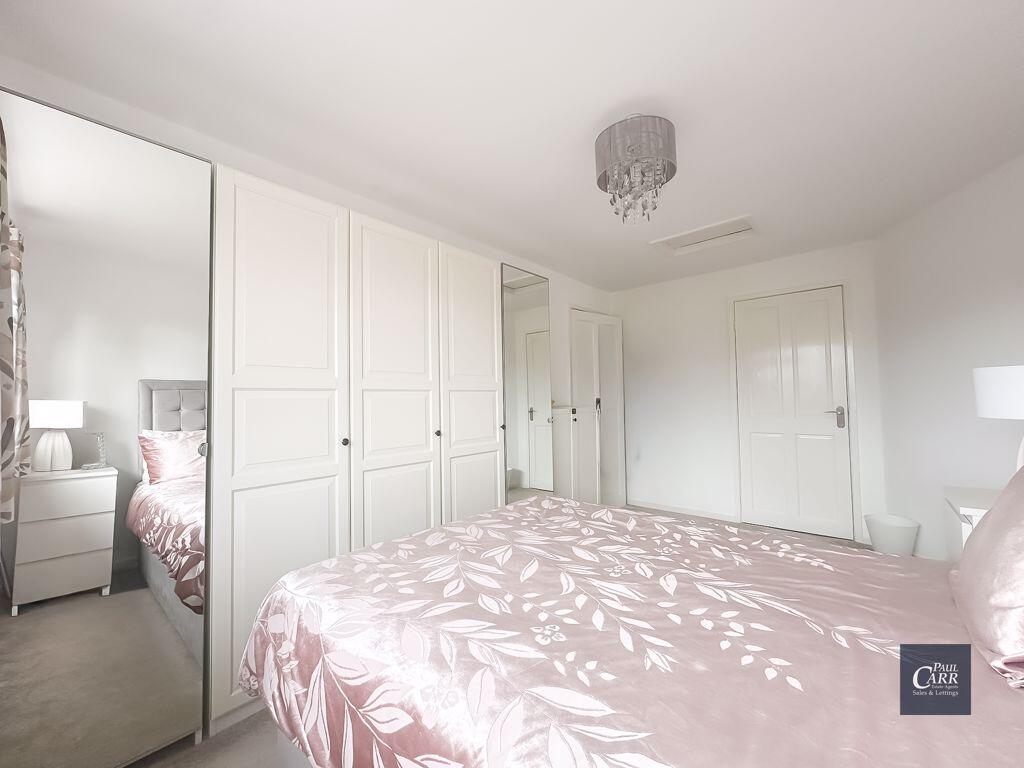
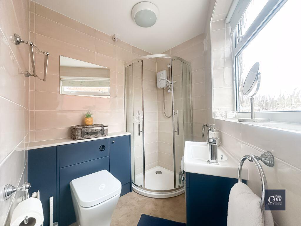
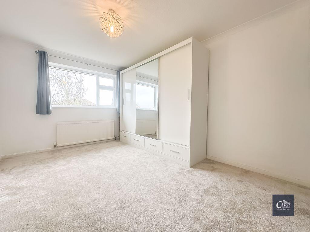
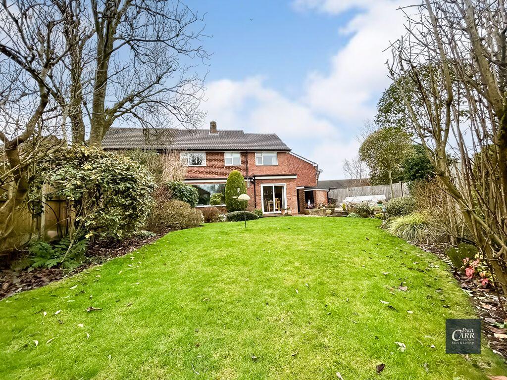
- semi-detached house Mid-20th Century
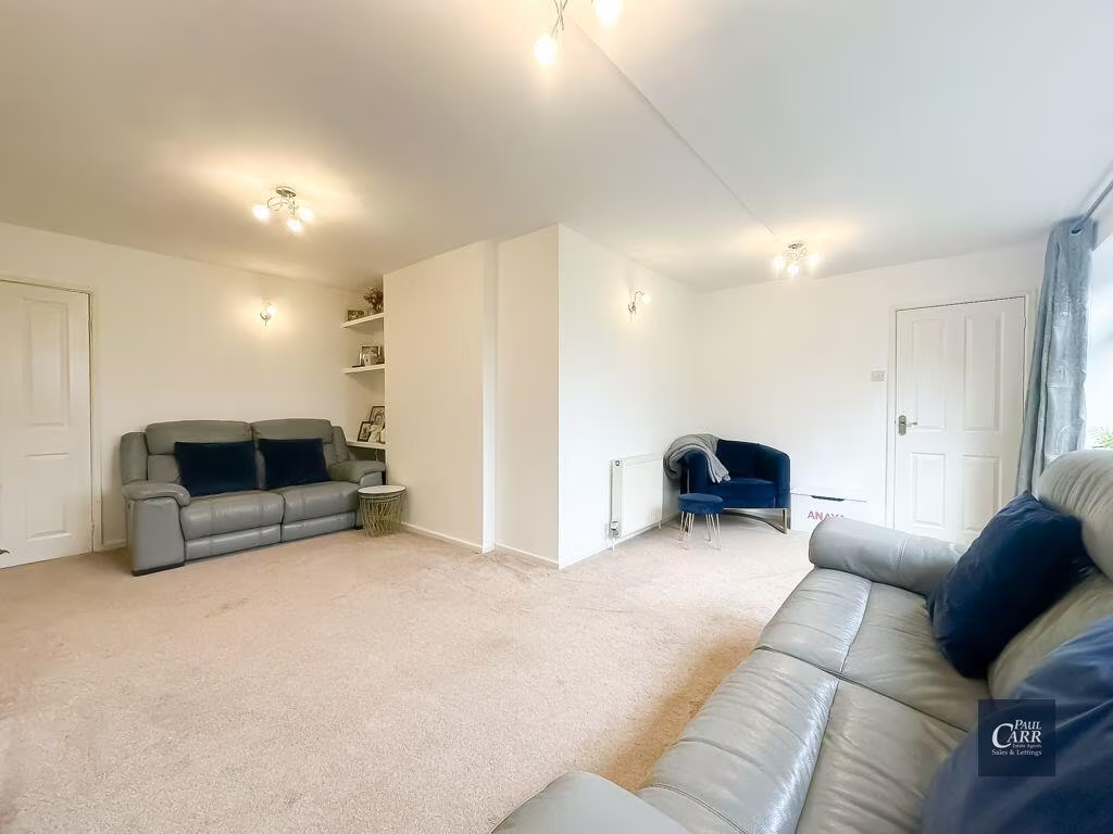
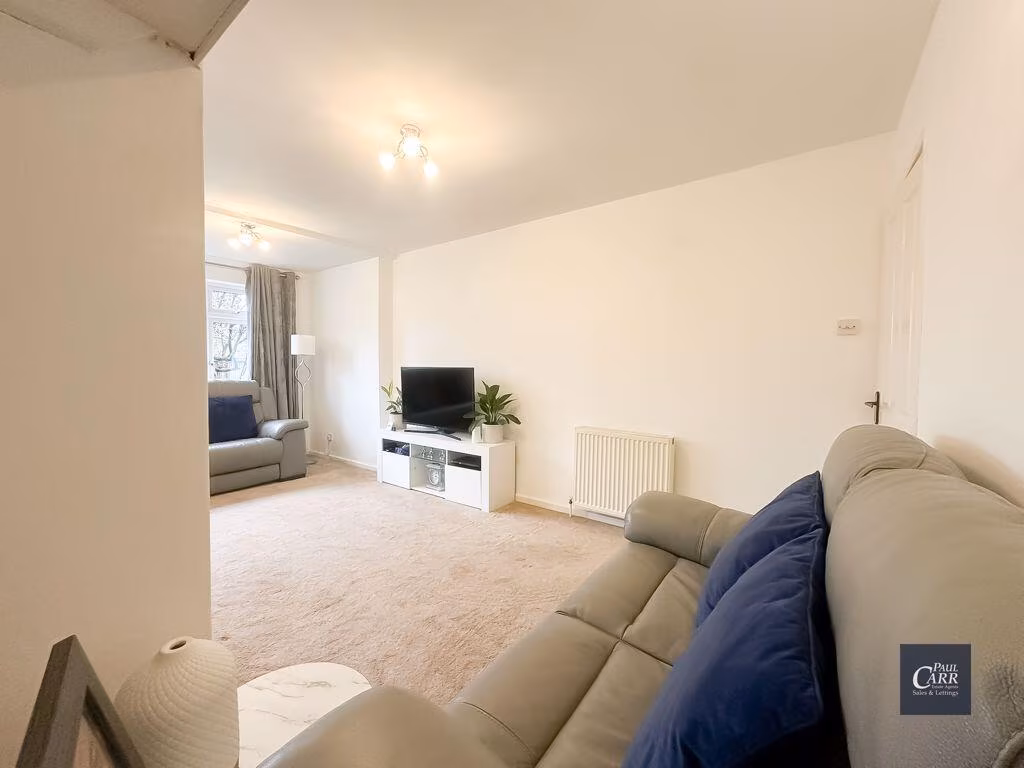
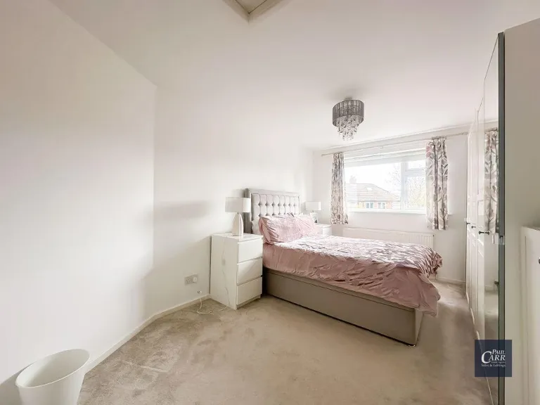
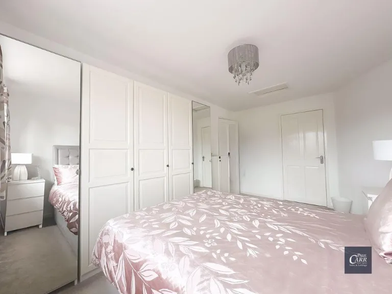
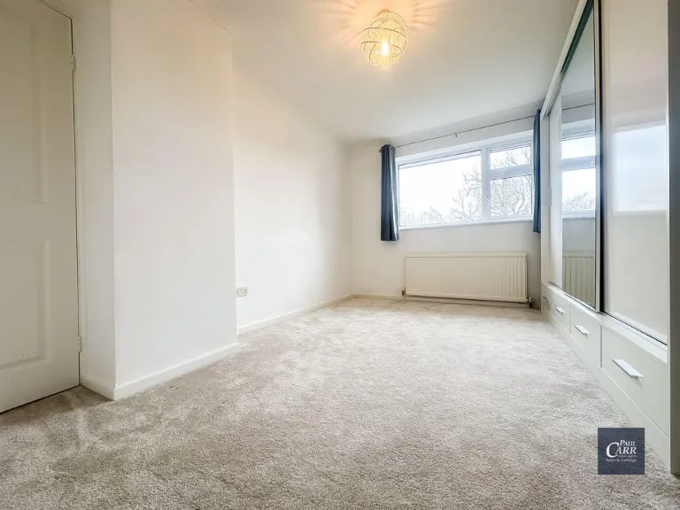
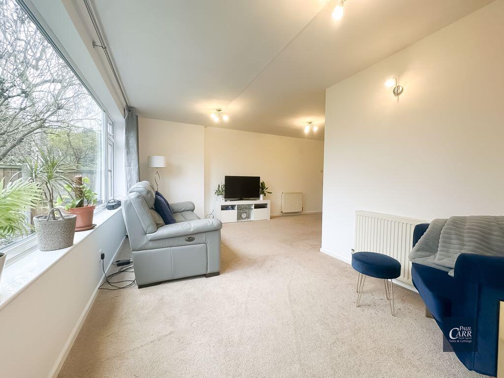
- living room mid-century modern
Textual Property Features
Detected Visual Features
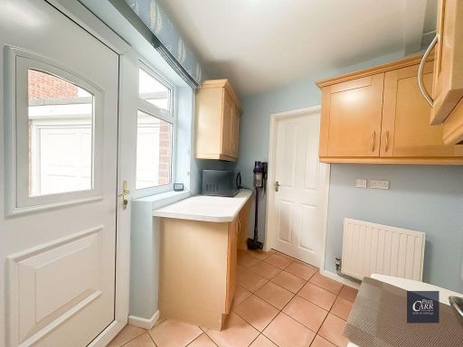
- semi-detached
- garage
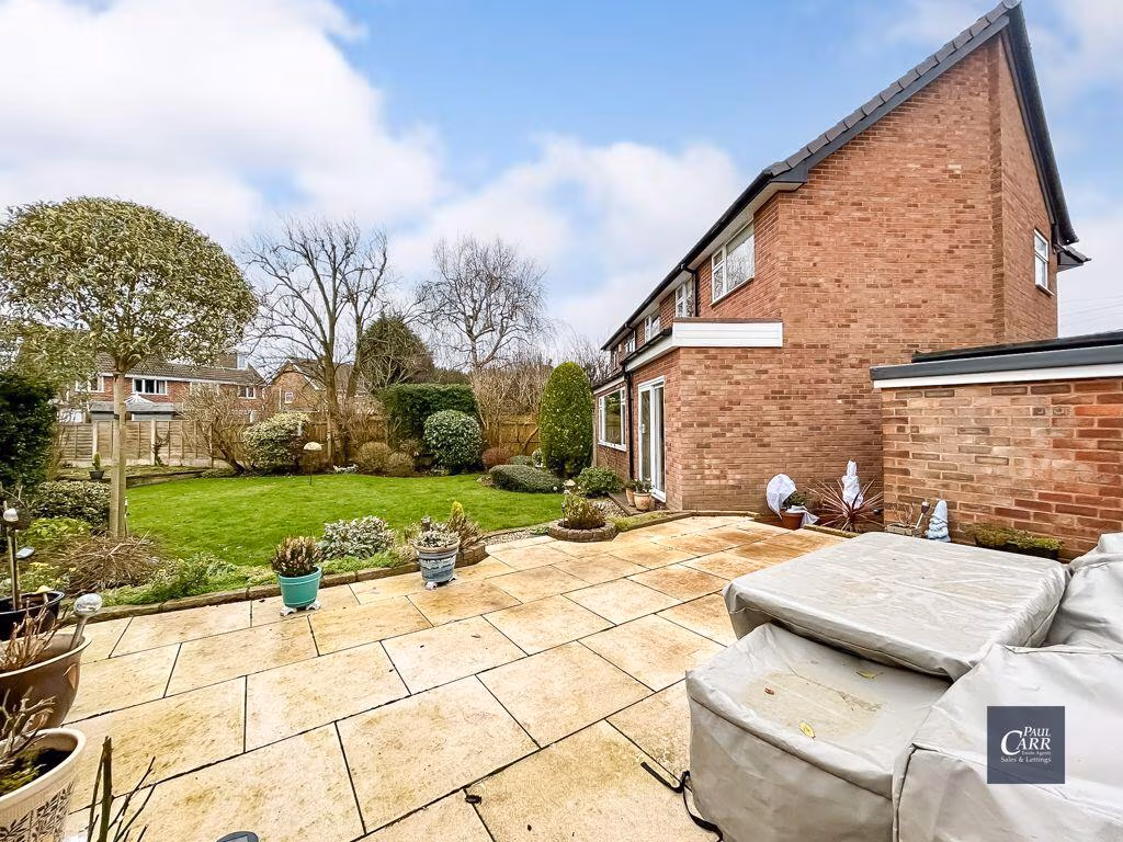
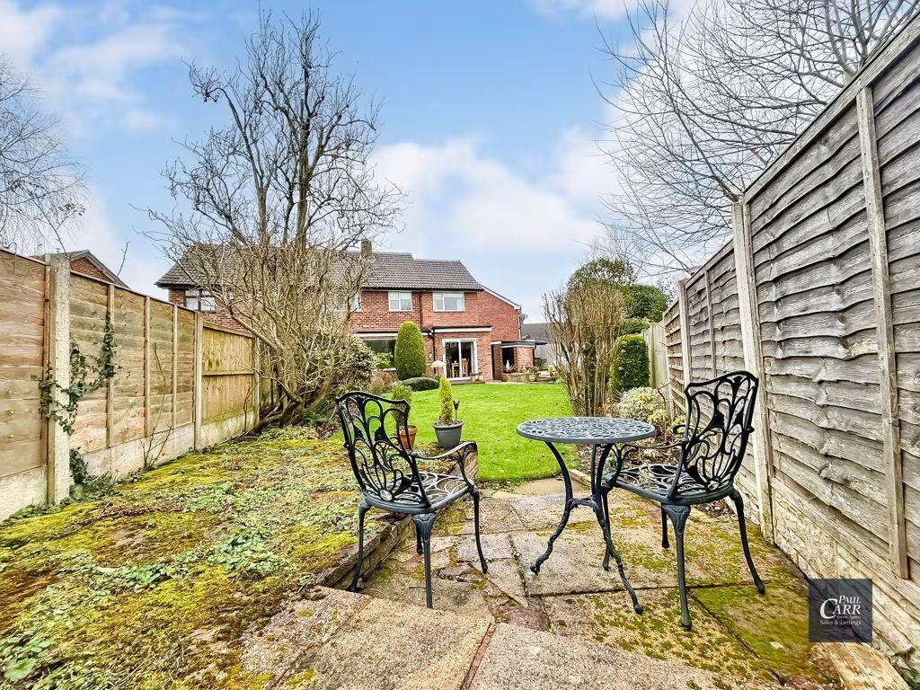
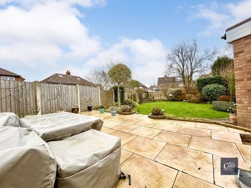
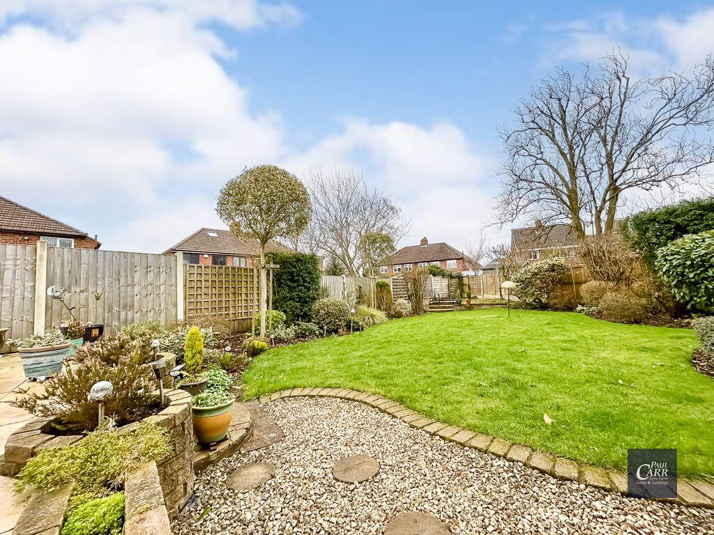
- garden
- driveway
- brick exterior
- bay window
- fixer-upper
- needs modernization
- comfortable size
- quiet street
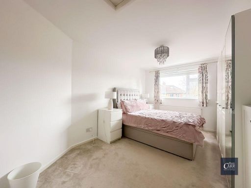
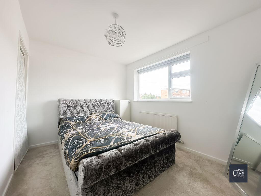
- mid-century modern
- living room
- large window
- natural light
- built-in shelves
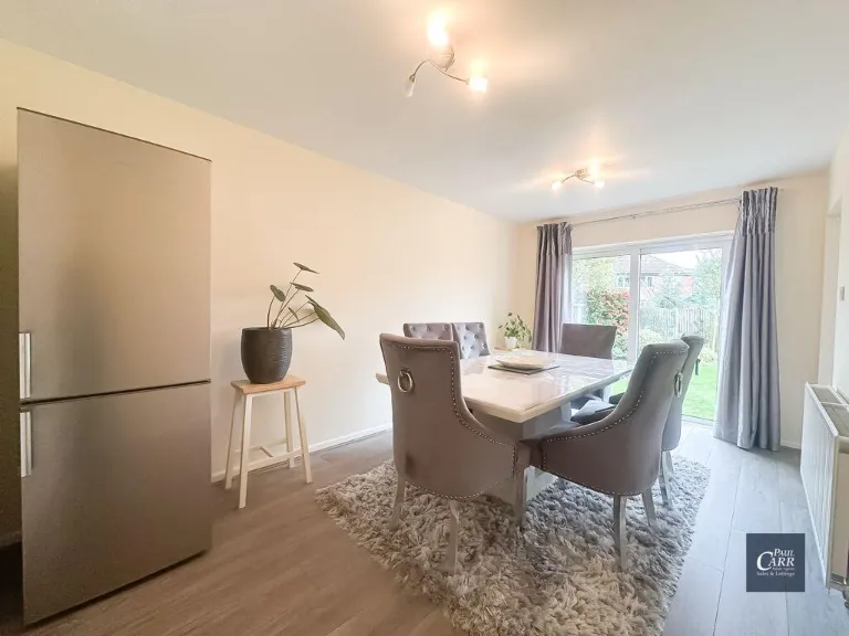
- open plan
- neutral decor
EPC Details
- Fully double glazed
- Cavity wall, filled cavity
- Boiler and radiators, mains gas
- Low energy lighting in all fixed outlets
- Suspended, no insulation (assumed)
Nearby Schools
- Glenmead Primary School
- Kingsthorne Primary School
- Cardinal Wiseman Catholic School
- Kingsland Primary School (NC)
- Sundridge Primary School
- St Anne's Catholic Primary School, Streetly
- Blackwood School
- St Francis of Assisi Catholic College
- Little Aston Primary Academy
- Warren Farm Primary School
- Twickenham Primary School
- Kings Rise Academy
- New Oscott Primary School
- Sutton Park Primary
- Pheasey Park Farm Primary School and Early Years Centre
- Aldridge School - A Science College
- Barr View Primary & Nursery Academy
- Fortis Academy
- Maryvale Catholic Primary School
- Meadow View JMI School
- Lindens Primary School
- Manor Primary School
- Whetstone Field Primary School
- Four Oaks Primary School
- St Mary of the Angels Catholic Primary School
- Christ The King Catholic Primary School
- Barr Beacon School
- The Streetly Academy
- Cooper and Jordan Church of England Primary School
Nearest General Shops
- Id: 186045862
- Tags:
- Addr:
- City: Sutton Coldfield
- Postcode: B74 2HE
- Street: Chester Road
- Brand: Nissan
- Brand:wikidata: Q20165
- Brand:wikipedia: ja:日産自動車
- Building: retail
- Name: Nissan
- Shop: car
- Source: bing
- TagsNormalized:
- Lat: 52.5771869
- Lon: -1.8834997
- FullGeoHash: gcqej5kkr60b
- PartitionGeoHash: gcqe
- Images:
- FoodStandards: null
- Distance: 430.7
,- Id: 7815117770
- Tags:
- Addr:
- City: Sutton Coldfield
- Housenumber: 131
- Postcode: B74 2HE
- Street: Chester Road
- Name: Sutton Mobility Centre
- Shop: hearing_aids
- Website: https://suttonmobility.co.uk/
- Wheelchair: yes
- TagsNormalized:
- Lat: 52.5774238
- Lon: -1.8839389
- FullGeoHash: gcqej5kjtn1m
- PartitionGeoHash: gcqe
- Images:
- FoodStandards: null
- Distance: 391.4
,- Id: 190390430
- Tags:
- Addr:
- Postcode: B74 3PW
- Street: Blackwood Road
- Building: yes
- Fhrs:
- Name: Taylor's News
- Shop: newsagent
- Source: bing, local knowledge
- Source:addr: FHRS Open Data
- TagsNormalized:
- Lat: 52.5795221
- Lon: -1.8904838
- FullGeoHash: gcqehgz3ut34
- PartitionGeoHash: gcqe
- Images:
- FoodStandards:
- Id: 184755
- FHRSID: 184755
- LocalAuthorityBusinessID: PI/000203274
- BusinessName: Taylors News
- BusinessType: Retailers - other
- BusinessTypeID: 4613
- AddressLine1: 65 Blackwood Road
- AddressLine2: Streetly
- AddressLine3: Walsall
- AddressLine4: West Midlands
- PostCode: B74 3PW
- RatingValue: Exempt
- RatingKey: fhrs_exempt_en-GB
- RatingDate: 2011-12-07
- LocalAuthorityCode: 433
- LocalAuthorityName: Walsall
- LocalAuthorityWebSite: http://www.walsall.gov.uk/index/environment/food_production_and_quality.htm
- LocalAuthorityEmailAddress: environmentalhealth@walsall.gov.uk
- Scores:
- Hygiene: null
- Structural: null
- ConfidenceInManagement: null
- NewRatingPending: false
- Geocode:
- Longitude: -1.88992500000000
- Latitude: 52.57937500000000
- Distance: 116.1
}
Nearest Religious buildings
- Id: 186045766
- Tags:
- Addr:
- Postcode: B74 3HB
- Street: Bridle Lane
- Amenity: place_of_worship
- Building: yes
- Denomination: roman_catholic
- Fhrs:
- Name: St. Anne's R.C. Church
- Religion: christian
- Source: bing
- TagsNormalized:
- place of worship
- catholic
- roman catholic
- church
- christian
- Lat: 52.5764426
- Lon: -1.8867641
- FullGeoHash: gcqej54pgpq8
- PartitionGeoHash: gcqe
- Images:
- FoodStandards:
- Id: 708853
- FHRSID: 708853
- LocalAuthorityBusinessID: PI/000203298
- BusinessName: St Annes Catholic Church
- BusinessType: Other catering premises
- BusinessTypeID: 7841
- AddressLine1: Bridle Lane
- AddressLine2: Streetly
- AddressLine3: Walsall
- AddressLine4: West Midlands
- PostCode: B74 3HB
- RatingValue: 5
- RatingKey: fhrs_5_en-GB
- RatingDate: 2015-12-21
- LocalAuthorityCode: 433
- LocalAuthorityName: Walsall
- LocalAuthorityWebSite: http://www.walsall.gov.uk/index/environment/food_production_and_quality.htm
- LocalAuthorityEmailAddress: environmentalhealth@walsall.gov.uk
- Scores:
- Hygiene: 5
- Structural: 5
- ConfidenceInManagement: 5
- NewRatingPending: false
- Geocode:
- Longitude: -1.88636000000000
- Latitude: 52.57670100000000
- Distance: 350.8
,- Id: 190390410
- Tags:
- Addr:
- Amenity: place_of_worship
- Building: yes
- Denomination: methodist
- Name: Blackwood Methodist Church
- Religion: christian
- TagsNormalized:
- place of worship
- methodist
- church
- christian
- Lat: 52.579679
- Lon: -1.8923673
- FullGeoHash: gcqehgy4bdsd
- PartitionGeoHash: gcqe
- Images:
- FoodStandards: null
- Distance: 244.5
,- Id: 190390423
- Tags:
- Addr:
- Amenity: place_of_worship
- Building: yes
- Name: Streetly Evangelical Church
- Religion: christian
- Source: bing, local knowledge
- TagsNormalized:
- place of worship
- church
- evangelical
- christian
- Lat: 52.5796816
- Lon: -1.8902661
- FullGeoHash: gcqehgzdce53
- PartitionGeoHash: gcqe
- Images:
- FoodStandards: null
- Distance: 106.5
}
Nearest Airports
- Id: 2437117
- Tags:
- Aerodrome: international
- Aerodrome:type: public
- Aeroway: aerodrome
- Ele: 104
- Iata: BHX
- Icao: EGBB
- Internet_access: wlan
- Is_in: Birmingham,England,UK
- Name: Birmingham Airport
- Ref: BHX
- Type: multipolygon
- Website: https://www.birminghamairport.co.uk/
- Wikidata: Q8719
- Wikipedia: en:Birmingham Airport
- TagsNormalized:
- airport
- international airport
- Lat: 52.4543817
- Lon: -1.7468974
- FullGeoHash: gcqf2jpbym6y
- PartitionGeoHash: gcqf
- Images:
- FoodStandards: null
- Distance: 16889.9
}
Nearest Leisure Facilities
- Id: 708341505
- Tags:
- Leisure: pitch
- Name: Blackwood Park
- Sport: bowls
- TagsNormalized:
- Lat: 52.5797386
- Lon: -1.8965924
- FullGeoHash: gcqehgfgnjwj
- PartitionGeoHash: gcqe
- Images:
- FoodStandards: null
- Distance: 529
,- Id: 50741204
- Tags:
- Created_by: JOSM
- Leisure: playground
- Name: Blackwood Park Play Area
- TagsNormalized:
- Lat: 52.5802668
- Lon: -1.89627
- FullGeoHash: gcqehggnm8ns
- PartitionGeoHash: gcqe
- Images:
- FoodStandards: null
- Distance: 515.7
,- Id: 6167497
- Tags:
- Leisure: park
- Name: Blackwood Park
- TagsNormalized:
- Lat: 52.5799913
- Lon: -1.8963118
- FullGeoHash: gcqehgghssz3
- PartitionGeoHash: gcqe
- Images:
- FoodStandards: null
- Distance: 513.3
,- Id: 6167498
- Tags:
- Leisure: park
- Name: Blackwood Park
- Natural: wood
- TagsNormalized:
- Lat: 52.5793542
- Lon: -1.8941114
- FullGeoHash: gcqehgubbn00
- PartitionGeoHash: gcqe
- Images:
- FoodStandards: null
- Distance: 359.6
,- Id: 392331986
- Tags:
- TagsNormalized:
- Lat: 52.5794672
- Lon: -1.8921988
- FullGeoHash: gcqehgy1se46
- PartitionGeoHash: gcqe
- Images:
- FoodStandards: null
- Distance: 230.7
}
Nearest Tourist attractions
- Id: 828841667
- Tags:
- Building: ruins
- Historic: ruins
- Name: Booth's Farm farmhouse
- Operator: Birmingham City Council
- Tourism: attraction
- Wheelchair: no
- Wikidata: Q97599963
- TagsNormalized:
- booths
- farm
- attraction
- tourism
- Lat: 52.5441468
- Lon: -1.9113922
- FullGeoHash: gcqdut25v6fs
- PartitionGeoHash: gcqd
- Images:
- FoodStandards: null
- Distance: 4201.7
,- Id: 2299815275
- Tags:
- Name: Eating Area
- Operator: Aldridge School
- Tourism: picnic_site
- TagsNormalized:
- Lat: 52.5973925
- Lon: -1.9240165
- FullGeoHash: gcqehpnfp0t7
- PartitionGeoHash: gcqe
- Images:
- FoodStandards: null
- Distance: 3112.8
,- Id: 796325902
- Tags:
- Access: private
- Caravans: yes
- Fee: yes
- Name: The Paddock Certificated Site
- Tents: yes
- Toilets: no
- Tourism: camp_site
- TagsNormalized:
- Lat: 52.6039736
- Lon: -1.8958028
- FullGeoHash: gcqekb782e6v
- PartitionGeoHash: gcqe
- Images:
- FoodStandards: null
- Distance: 2779
}
Nearest Train stations
- Id: 27181044
- Tags:
- Name: Wylde Green
- Naptan:
- Network: National Rail
- Public_transport: station
- Railway: station
- Ref:
- West_midlands_fare_zone: 4
- Wheelchair: yes
- Wheelchair:description: Book ramps before travelling.
- Wikidata: Q1840659
- Wikipedia: en:Wylde Green railway station
- TagsNormalized:
- Lat: 52.545628
- Lon: -1.8314247
- FullGeoHash: gcqdymdkkxnb
- PartitionGeoHash: gcqd
- Images:
- FoodStandards: null
- Distance: 5393.9
,- Id: 653041
- Tags:
- Name: Sutton Coldfield
- Naptan:
- Network: National Rail
- Public_transport: station
- Railway: station
- Ref:
- West_midlands_fare_zone: 4
- Wikidata: Q525739
- Wikipedia: en:Sutton Coldfield railway station
- TagsNormalized:
- Lat: 52.5647207
- Lon: -1.8252548
- FullGeoHash: gcqen3ngsqpk
- PartitionGeoHash: gcqe
- Images:
- FoodStandards: null
- Distance: 4591.4
,- Id: 8437795006
- Tags:
- Name: Four Oaks
- Naptan:
- Network: National Rail
- Public_transport: station
- Railway: station
- Ref:
- West_midlands_fare_zone: 5
- Wikidata: Q2230176
- Wikipedia: en:Four Oaks railway station
- TagsNormalized:
- Lat: 52.5795454
- Lon: -1.8280314
- FullGeoHash: gcqen7uf5c8v
- PartitionGeoHash: gcqe
- Images:
- FoodStandards: null
- Distance: 4105.4
,- Id: 7916457716
- Tags:
- Name: Blake Street
- Naptan:
- Network: National Rail
- Public_transport: station
- Railway: station
- Ref:
- West_midlands_fare_zone: 5
- Wikidata: Q2454578
- Wikipedia: en:Blake Street railway station
- TagsNormalized:
- Lat: 52.6043776
- Lon: -1.8446597
- FullGeoHash: gcqeq02f8qdp
- PartitionGeoHash: gcqe
- Images:
- FoodStandards: null
- Distance: 4078.3
,- Id: 2502617
- Tags:
- Name: Butlers Lane
- Naptan:
- Network: National Rail
- Public_transport: station
- Railway: station
- Ref:
- West_midlands_fare_zone: 5
- Wikidata: Q5002705
- Wikipedia: en:Butlers Lane railway station
- TagsNormalized:
- Lat: 52.5925882
- Lon: -1.8383384
- FullGeoHash: gcqennjq5958
- PartitionGeoHash: gcqe
- Images:
- FoodStandards: null
- Distance: 3712.8
}
Nearest Hotels
- Id: 308834717
- Tags:
- Addr:
- City: Birmingham
- Postcode: B43 7BG
- Street: Chapel Lane
- Brand: Holiday Inn
- Brand:wikidata: Q2717882
- Brand:wikipedia: en:Holiday Inn
- Building: hotel
- Building:levels: 1
- Fhrs:
- Name: Holiday Inn
- Nohousenumber: yes
- Source: visual survey;bing
- Tourism: hotel
- Wheelchair: yes
- TagsNormalized:
- Lat: 52.555796
- Lon: -1.9336229
- FullGeoHash: gcqdgzrzxq6q
- PartitionGeoHash: gcqd
- Images:
- FoodStandards: null
- Distance: 4005
,- Id: 343561024
- Tags:
- Addr:
- Housenumber: 178
- Postcode: WS9 0NU
- Street: Little Aston
- Building: yes
- Fhrs:
- Name: Fairlawns Hotel & Spa
- Tourism: hotel
- TagsNormalized:
- Lat: 52.6030581
- Lon: -1.8976255
- FullGeoHash: gcqekb45n0gb
- PartitionGeoHash: gcqe
- Images:
- FoodStandards: null
- Distance: 2703.2
,- Id: 6848092
- Tags:
- Addr:
- City: Sutton Coldfield
- Postcode: B73 6SP
- Street: Chester Road North
- Brand: Travelodge
- Brand:wikidata: Q9361374
- Brand:wikipedia: en:Travelodge UK
- Building: hotel
- Contact:
- Website: http://www.tobycarvery.co.uk/restaurants/midlands/streetlysuttoncoldfield
- Fhrs:
- Authority: Birmingham
- Id: 604190
- Local_authority_id: PI/000507150
- Internet_access: wlan
- Internet_access:fee: customers
- Internet_access:ssid: Travelodge WiFi
- Name: Birmingham Streetly Travelodge
- Old_name: Parson and Clark
- Operator: Travelodge
- Source: bing, local knowledge, Travelodge website
- Source:addr: FHRS Open Data
- Tourism: hotel
- Type: multipolygon
- TagsNormalized:
- Lat: 52.5652715
- Lon: -1.8790117
- FullGeoHash: gcqej1pwzug6
- PartitionGeoHash: gcqe
- Images:
- FoodStandards: null
- Distance: 1698.9
}
Tags
- semi-detached
- garage
- garden
- driveway
- brick exterior
- bay window
- fixer-upper
- needs modernization
- comfortable size
- quiet street
- mid-century modern
- living room
- large window
- natural light
- built-in shelves
- open plan
- neutral decor
Local Market Stats
- Average Price/sqft: £345
- Avg Income: £52500
- Rental Yield: 3.4%
- Social Housing: 6%
- Planning Success Rate: 90%
Similar Properties
 3 bedroom detached house for sale in Blackwood Road, Streetly, Sutton Coldfield, B74 — £375,000 • 3 bed • 1 bath • 958 ft²
 4 bedroom detached house for sale in Bushey Close, Streetly, Sutton Coldfield, B74 — £490,000 • 4 bed • 1 bath • 1174 ft²
 4 bedroom semi-detached house for sale in Thorney Road Streetly, Sutton Coldfield, West Midlands, B74 3HT, B74 — £475,000 • 4 bed • 1 bath • 1312 ft²
 3 bedroom semi-detached house for sale in Yewtree Road, Streetly, B74 3SL, B74 — £375,000 • 3 bed • 1 bath • 980 ft²
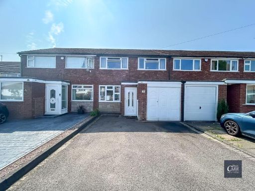 3 bedroom terraced house for sale in Lowlands Avenue, Streetly, Sutton Coldfield, B74 3RF, B74 — £290,000 • 3 bed • 1 bath • 797 ft²
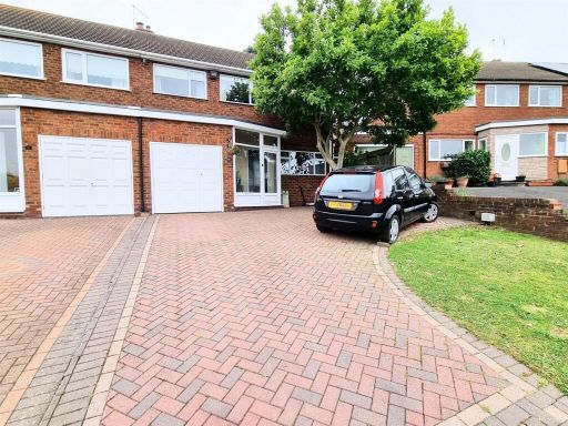 3 bedroom semi-detached house for sale in Grove Way, Streetly, Sutton Coldfield, B74 — £385,000 • 3 bed • 1 bath • 991 ft²
Meta
- {
"@context": "https://schema.org",
"@type": "Residence",
"name": "4 bedroom semidetached house for sale in Bracken Way, Stree…",
"description": "",
"url": "https://propertypiper.co.uk/property/e4118e54-dfb8-4976-b954-fdbeee7548ee",
"image": "https://image-a.propertypiper.co.uk/677f882f-70f9-46e1-be16-8cc932e46fe0-1024.jpeg",
"address": {
"@type": "PostalAddress",
"streetAddress": "9 Bracken Way",
"postalCode": "B74 3PF",
"addressLocality": "Walsall",
"addressRegion": "Aldridge-Brownhills",
"addressCountry": "England"
},
"geo": {
"@type": "GeoCoordinates",
"latitude": 52.57934735629092,
"longitude": -1.8887894890392767
},
"numberOfRooms": 4,
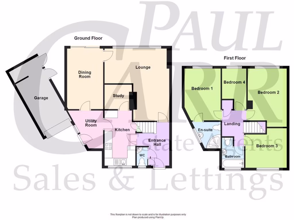
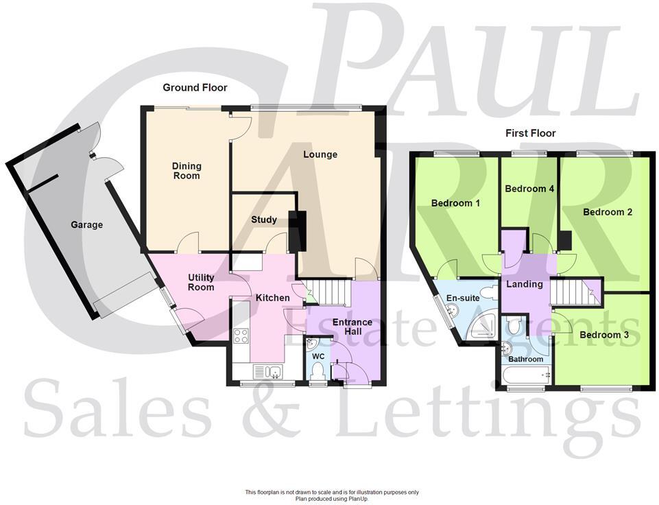
"numberOfBathroomsTotal": 2,
"floorSize": {
"@type": "QuantitativeValue",
"value": 1497,
"unitCode": "FTK"
},
"offers": {
"@type": "Offer",
"price": 425000,
"priceCurrency": "GBP",
"availability": "https://schema.org/InStock"
},
"additionalProperty": [
{
"@type": "PropertyValue",
"name": "Feature",
"value": "semi-detached"
},
{
"@type": "PropertyValue",
"name": "Feature",
"value": "garage"
},
{
"@type": "PropertyValue",
"name": "Feature",
"value": "garden"
},
{
"@type": "PropertyValue",
"name": "Feature",
"value": "driveway"
},
{
"@type": "PropertyValue",
"name": "Feature",
"value": "brick exterior"
},
{
"@type": "PropertyValue",
"name": "Feature",
"value": "bay window"
},
{
"@type": "PropertyValue",
"name": "Feature",
"value": "fixer-upper"
},
{
"@type": "PropertyValue",
"name": "Feature",
"value": "needs modernization"
},
{
"@type": "PropertyValue",
"name": "Feature",
"value": "comfortable size"
},
{
"@type": "PropertyValue",
"name": "Feature",
"value": "quiet street"
},
{
"@type": "PropertyValue",
"name": "Feature",
"value": "mid-century modern"
},
{
"@type": "PropertyValue",
"name": "Feature",
"value": "living room"
},
{
"@type": "PropertyValue",
"name": "Feature",
"value": "large window"
},
{
"@type": "PropertyValue",
"name": "Feature",
"value": "natural light"
},
{
"@type": "PropertyValue",
"name": "Feature",
"value": "built-in shelves"
},
{
"@type": "PropertyValue",
"name": "Feature",
"value": "open plan"
},
{
"@type": "PropertyValue",
"name": "Feature",
"value": "neutral decor"
}
]
}
High Res Floorplan Images
Compatible Floorplan Images
FloorplanImages Thumbnail