SA1 7FH - 2 bedroom apartment for sale in Phoebe Road, Pentrechwyth,…
View on Property Piper
2 bedroom apartment for sale in Phoebe Road, Pentrechwyth, SA1
Property Details
- Price: £155000
- Bedrooms: 2
- Bathrooms: 1
- Property Type: undefined
- Property SubType: undefined
Image Descriptions
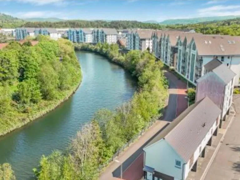
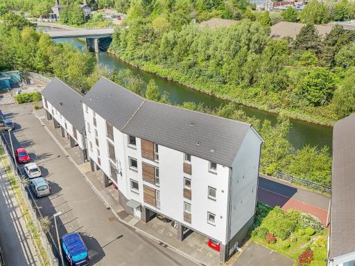
- apartment complex modern
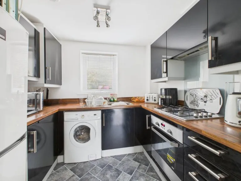
- kitchen modern
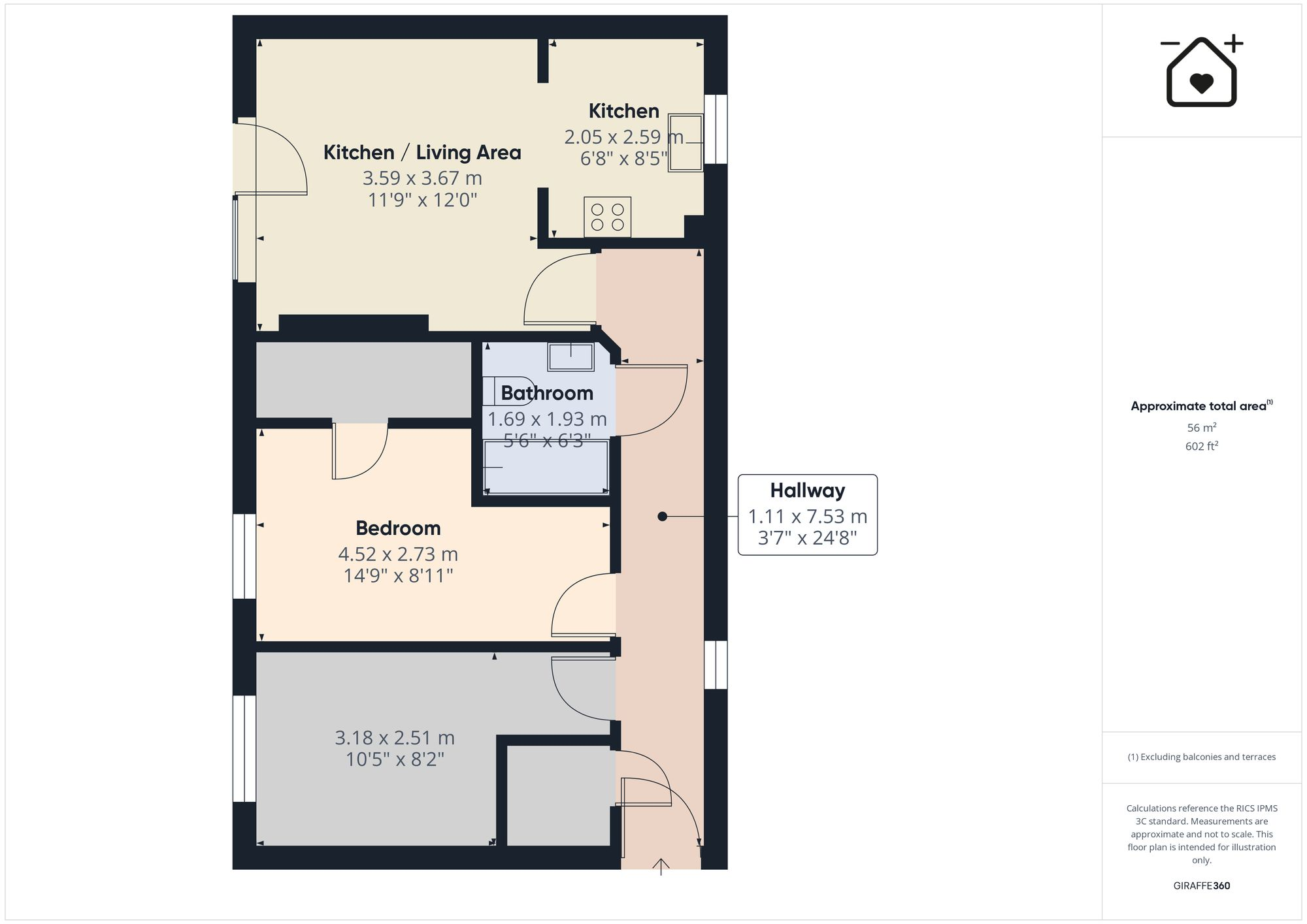
Rooms
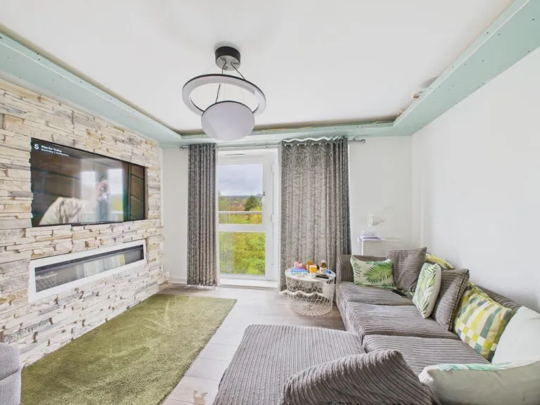
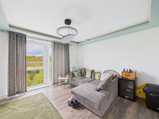
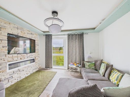
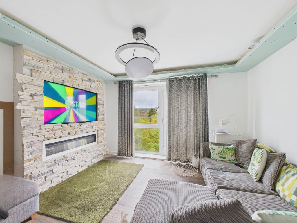
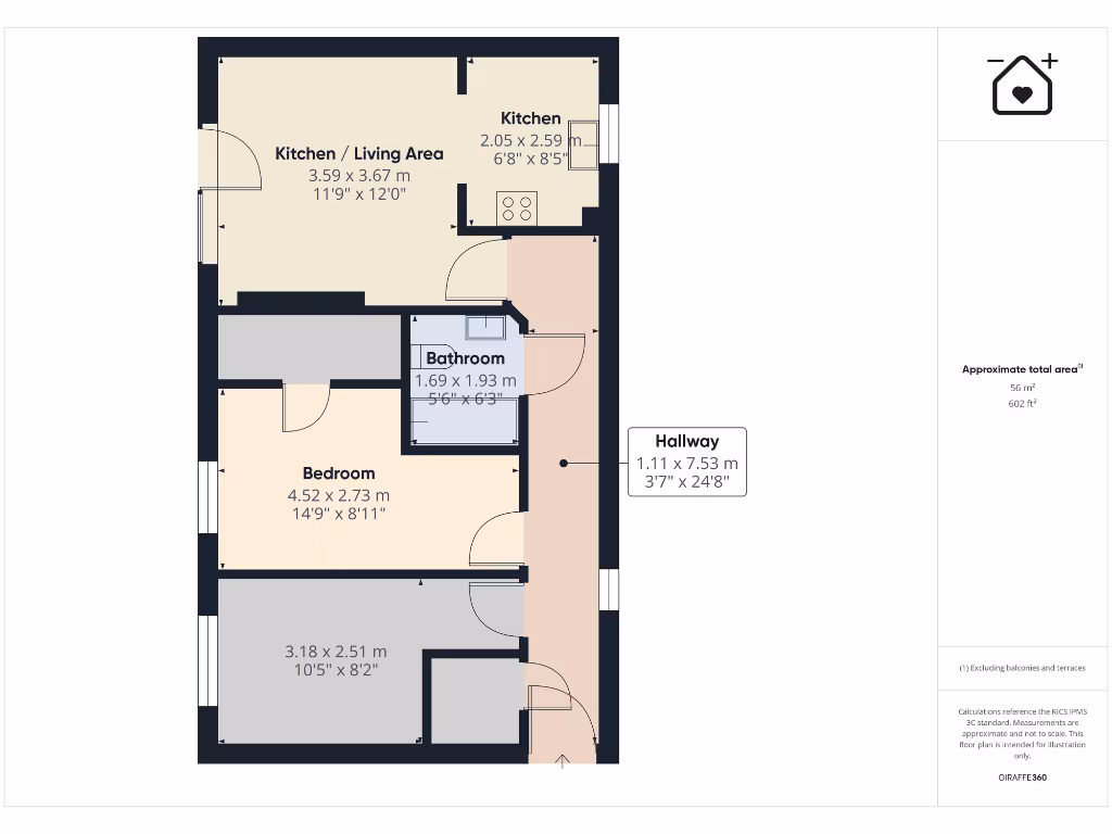
- Kitchen / Living Area:
- Kitchen:
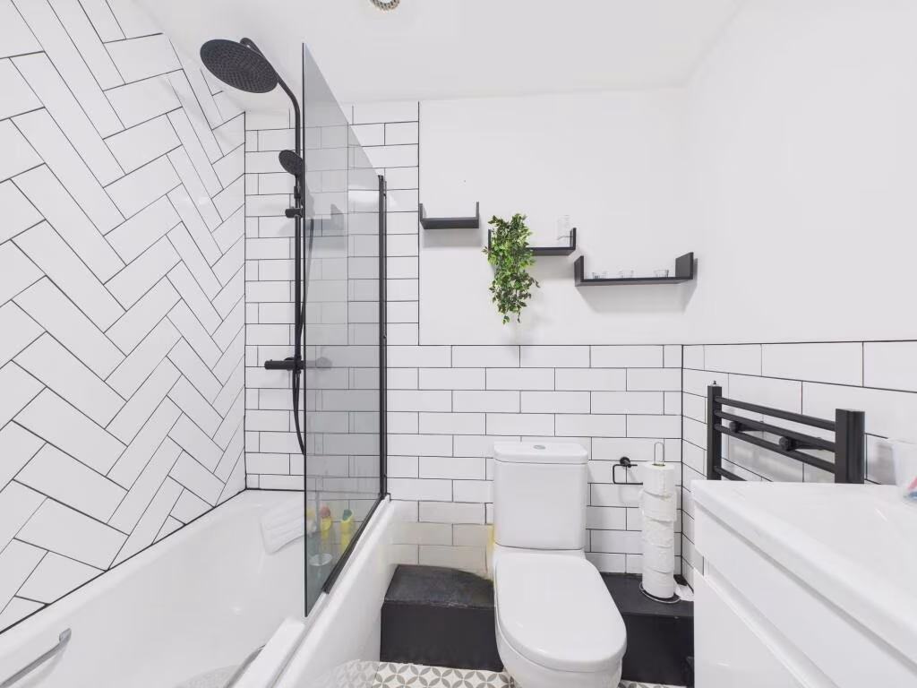
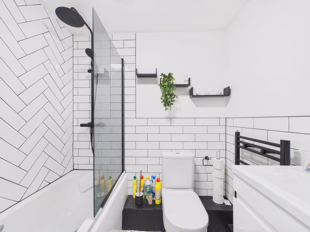
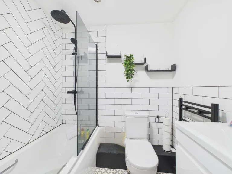
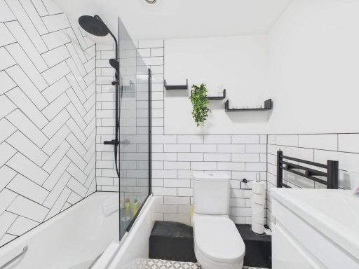
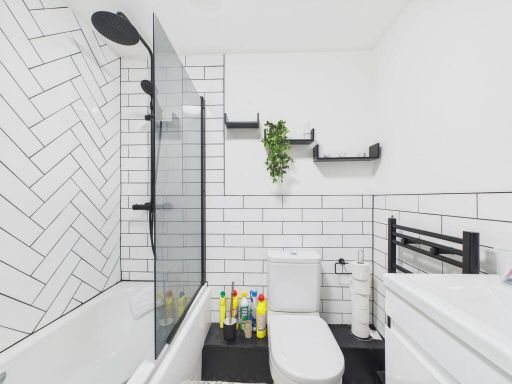
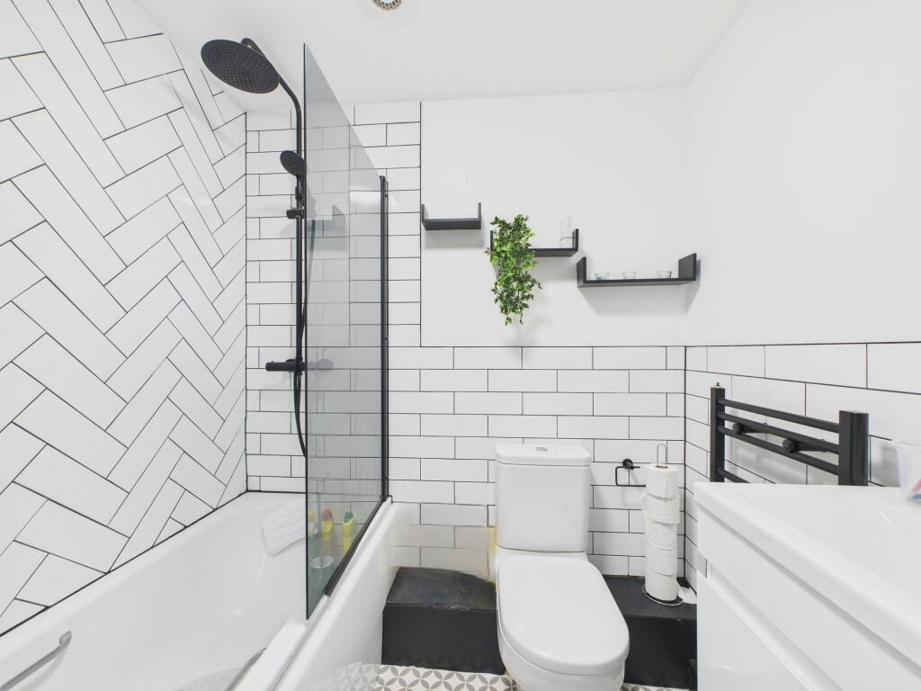
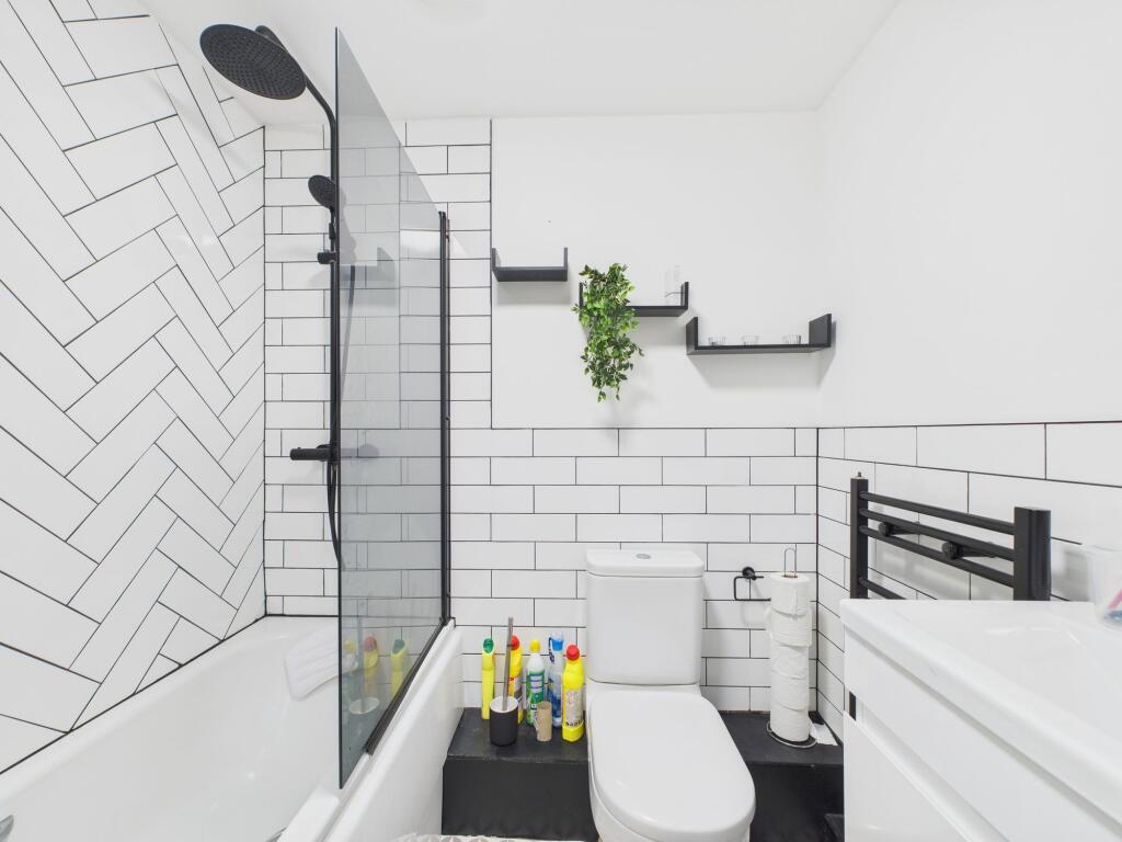
- Bathroom:
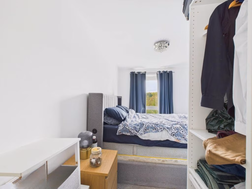
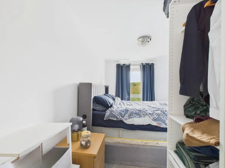
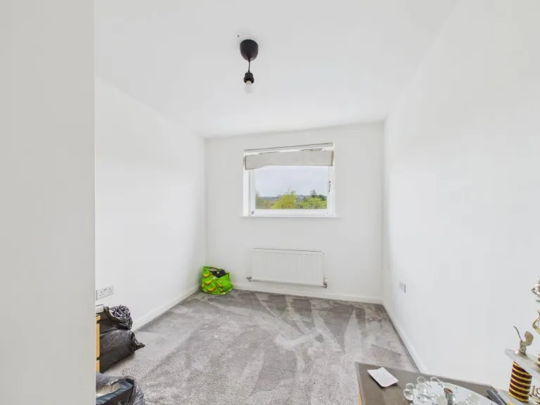
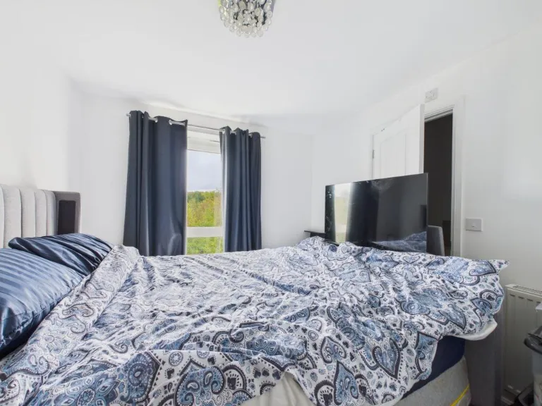
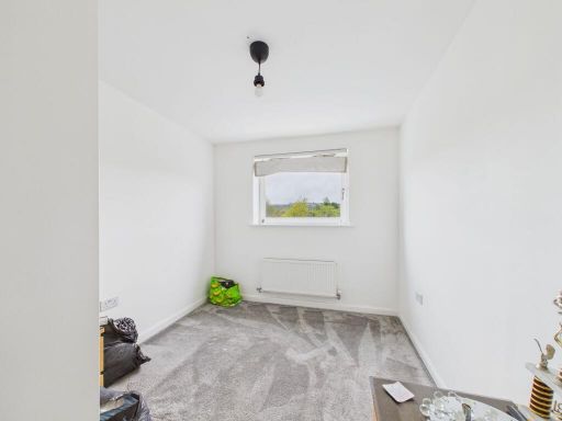
- Bedroom:
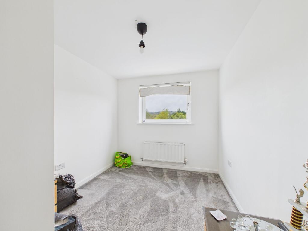
- :
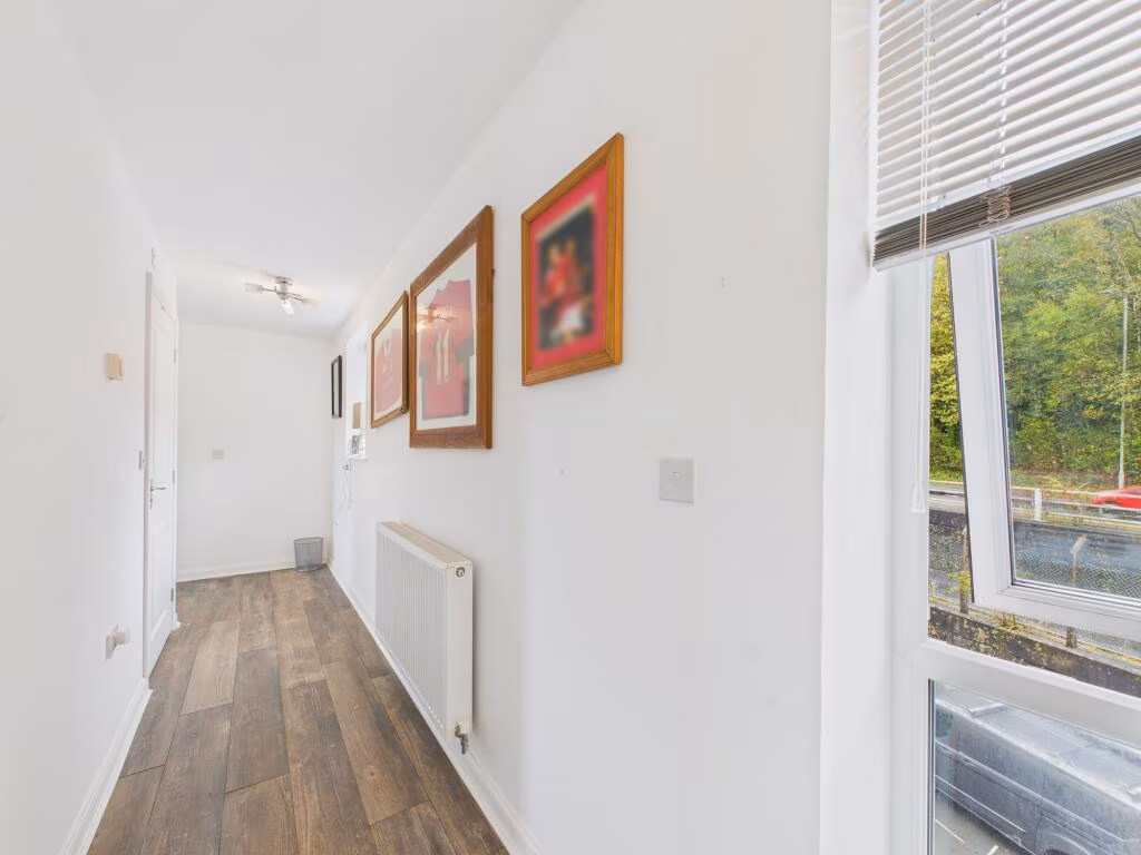
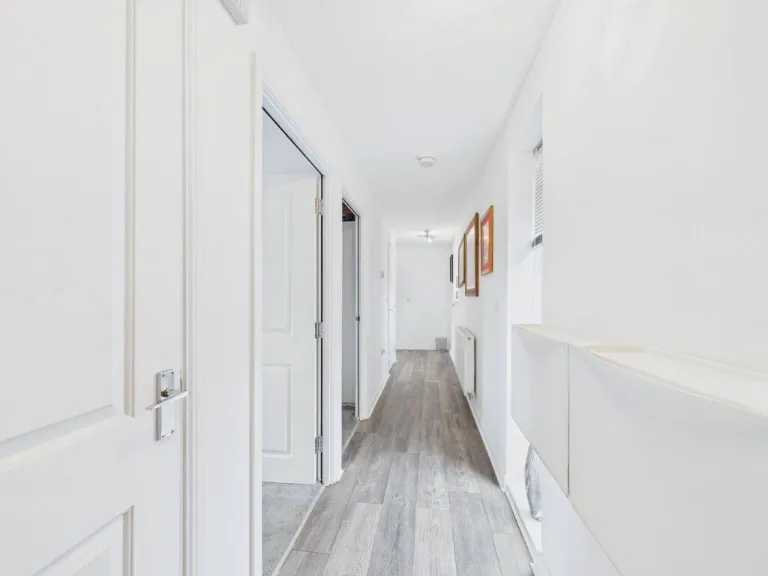
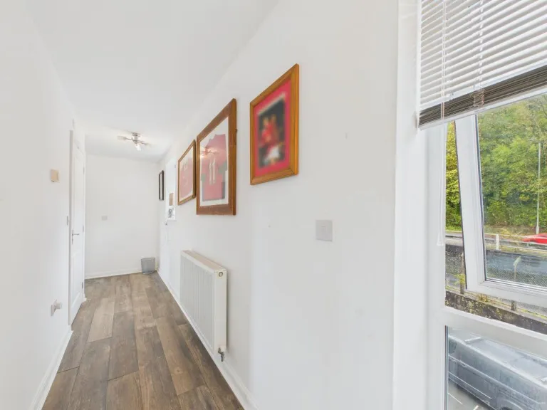
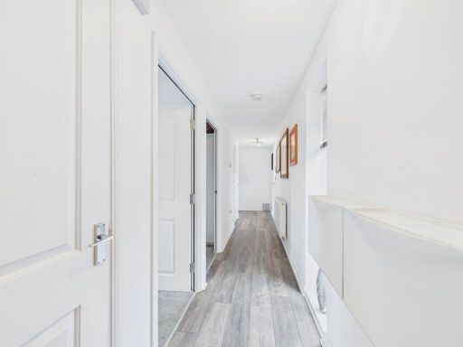
- Hallway:
Textual Property Features
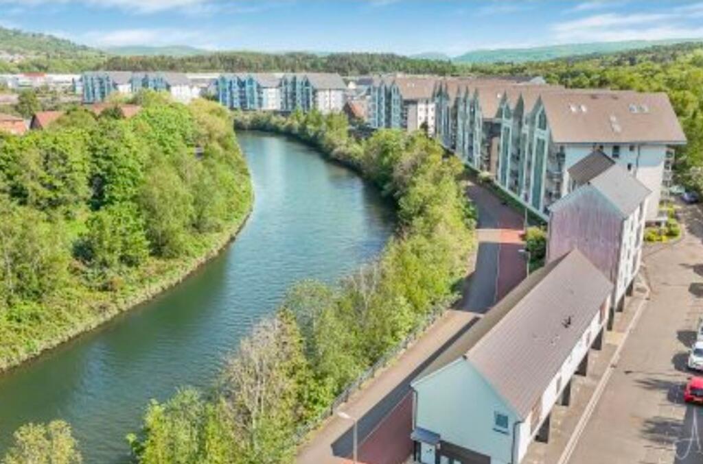
Detected Visual Features
- modern apartment complex
- riverside apartments
- waterfront property
- multi-story buildings
- residential estate
- green surroundings
- modern kitchen
- black cabinets
- corner layout
- compact
- appliances included
- laminate countertop
- bright
- natural light
EPC Details
- Fully double glazed
- System built, as built, insulated (assumed)
- Room heaters, electric
- Low energy lighting in 71% of fixed outlets
- (another dwelling below)
Nearest Bars And Restaurants
- Id: 47492774
- Tags:
- Addr:
- Postcode: SA1 7BP
- Street: Brunel Way
- Unit: 19b, Morfa Shopping Park
- Amenity: restaurant
- Brand: Frankie & Benny's
- Brand:wikidata: Q5490892
- Brand:wikipedia: en:Frankie & Benny's
- Building: yes
- Cuisine: italian
- Fhrs:
- Name: Frankie & Benny's
- Opening_hours: Th-Su 09:00-22:00, Fr,Sa 09:00-23:00
- Source:
- Wheelchair: yes
- TagsNormalized:
- restaurant
- frankie & bennys
- italian
- Lat: 51.6412287
- Lon: -3.9356999
- FullGeoHash: gcjjy2ypgwc2
- PartitionGeoHash: gcjj
- Images:
- FoodStandards: null
- Distance: 462.7
,- Id: 622930298
- Tags:
- Addr:
- Postcode: SA1 2LE
- Street: Neath Road
- Amenity: pub
- Building: yes
- Fhrs:
- Name: Lanndore Social Club
- Source:
- TagsNormalized:
- Lat: 51.6370134
- Lon: -3.9364748
- FullGeoHash: gcjjy2jx3kzx
- PartitionGeoHash: gcjj
- Images:
- FoodStandards:
- Id: 115091
- FHRSID: 115091
- LocalAuthorityBusinessID: 442
- BusinessName: Landore Social Club
- BusinessType: Pub/bar/nightclub
- BusinessTypeID: 7843
- AddressLine1: Landore Social Club
- AddressLine2: Neath Road
- AddressLine3: null
- AddressLine4: Hafod
- PostCode: SA1 2LE
- RatingValue: 4
- RatingKey: fhrs_4_en-GB
- RatingDate: 2014-03-26
- LocalAuthorityCode: 568
- LocalAuthorityName: Swansea
- LocalAuthorityWebSite: http://www.swansea.gov.uk
- LocalAuthorityEmailAddress: FoodandSafety@swansea.gov.uk
- Scores:
- Hygiene: 0
- Structural: 10
- ConfidenceInManagement: 0
- NewRatingPending: false
- Geocode:
- Longitude: -3.93638600000000
- Latitude: 51.63703500000000
- Distance: 455.2
,- Id: 47493455
- Tags:
- Addr:
- Postcode: SA1 7BP
- Street: Brunel Way
- Unit: 19a, Morfa Shopping Park
- Amenity: restaurant
- Brand: Harvester
- Brand:wikidata: Q5676915
- Brand:wikipedia: en:Harvester (restaurant)
- Building: yes
- Contact:
- Website: https://www.harvester.co.uk/restaurants/wales/themorfaparcswansea
- Cuisine: american
- Fhrs:
- Name: Morfa Parc
- Opening_hours: Th-Su 09:00-22:00, Fr,Sa 09:00-23:00
- Operator: Mitchells & Butlers
- Source:
- Wheelchair: yes
- Wikidata: Q80585428
- TagsNormalized:
- Lat: 51.6413024
- Lon: -3.9352291
- FullGeoHash: gcjjy3n2qs2x
- PartitionGeoHash: gcjj
- Images:
- FoodStandards:
- Id: 64514
- FHRSID: 64514
- LocalAuthorityBusinessID: 143519
- BusinessName: Harvester
- BusinessType: Restaurant/Cafe/Canteen
- BusinessTypeID: 1
- AddressLine1: Unit 19a, Morfa Shopping Park
- AddressLine2: Brunel Way
- AddressLine3: null
- AddressLine4: Landore
- PostCode: SA1 2FB
- RatingValue: 5
- RatingKey: fhrs_5_en-GB
- RatingDate: 2022-06-14
- LocalAuthorityCode: 568
- LocalAuthorityName: Swansea
- LocalAuthorityWebSite: http://www.swansea.gov.uk
- LocalAuthorityEmailAddress: FoodandSafety@swansea.gov.uk
- Scores:
- Hygiene: 0
- Structural: 5
- ConfidenceInManagement: 0
- NewRatingPending: false
- Geocode:
- Longitude: -3.93559694290161
- Latitude: 51.64123153686520
- Distance: 443.1
,- Id: 121746811
- Tags:
- Addr:
- Country: GB
- Housename: Morfa Shopping Park
- Postcode: SA1 7BP
- Street: Brunel Way
- Unit: 17B
- Amenity: restaurant
- Brand: Pizza Hut
- Brand:wikidata: Q191615
- Brand:wikipedia: en:Pizza Hut
- Building: yes
- Cuisine: pizza
- Fhrs:
- Name: Pizza Hut
- Source:
- Wheelchair: yes
- TagsNormalized:
- restaurant
- pizza
- pizza hut
- hut
- Lat: 51.6425678
- Lon: -3.9313693
- FullGeoHash: gcjjy91rb2qs
- PartitionGeoHash: gcjj
- Images:
- FoodStandards: null
- Distance: 440
,- Id: 121746762
- Tags:
- Addr:
- Country: GB
- Housename: Morfa Shopping Park
- Postcode: SA1 7BP
- Street: Brunel Way
- Unit: 17A
- Alt_name: Kentucky Fried Chicken
- Amenity: fast_food
- Brand: KFC
- Brand:wikidata: Q524757
- Brand:wikipedia: en:KFC
- Building: yes
- Contact:
- Website: https://www.kfc.co.uk/kfc-near-me/swansea-morfa-shopping-park
- Cuisine: chicken
- Drive_through: yes
- Fhrs:
- Name: KFC
- Source:
- Takeaway: yes
- Wheelchair: yes
- TagsNormalized:
- fast food
- food
- kfc
- chicken
- drive through
- takeaway
- Lat: 51.6425201
- Lon: -3.9316376
- FullGeoHash: gcjjy91p6pqx
- PartitionGeoHash: gcjj
- Images:
- FoodStandards:
- Id: 60599
- FHRSID: 60599
- LocalAuthorityBusinessID: 132357
- BusinessName: KFC
- BusinessType: Restaurant/Cafe/Canteen
- BusinessTypeID: 1
- AddressLine1: Unit 17a, Morfa Shopping Park
- AddressLine2: Brunel Way
- AddressLine3: null
- AddressLine4: Landore
- PostCode: SA1 7BP
- RatingValue: 5
- RatingKey: fhrs_5_en-GB
- RatingDate: 2022-09-02
- LocalAuthorityCode: 568
- LocalAuthorityName: Swansea
- LocalAuthorityWebSite: http://www.swansea.gov.uk
- LocalAuthorityEmailAddress: FoodandSafety@swansea.gov.uk
- Scores:
- Hygiene: 0
- Structural: 5
- ConfidenceInManagement: 5
- NewRatingPending: false
- Geocode:
- Longitude: -3.92995100000000
- Latitude: 51.64340000000000
- Distance: 437.8
}
Nearest General Shops
- Id: 6790696571
- Tags:
- Brand: Game
- Brand:wikidata: Q5519813
- Brand:wikipedia: en:Game (retailer)
- Name: Game
- Shop: video_games
- TagsNormalized:
- games
- game
- video
- video games
- shop
- Lat: 51.6429071
- Lon: -3.9317274
- FullGeoHash: gcjjy9318pes
- PartitionGeoHash: gcjj
- Images:
- FoodStandards: null
- Distance: 481.3
,- Id: 431304889
- Tags:
- Building: yes
- Name: Morfa Shopping
- Shop: mall
- TagsNormalized:
- Lat: 51.6428582
- Lon: -3.9318035
- FullGeoHash: gcjjy92cqqdb
- PartitionGeoHash: gcjj
- Images:
- FoodStandards: null
- Distance: 476.9
,- Id: 6790696569
- Tags:
- Brand: EE
- Brand:wikidata: Q5322942
- Brand:wikipedia: en:EE Limited
- Name: EE
- Shop: mobile_phone
- TagsNormalized:
- Lat: 51.642848
- Lon: -3.9316936
- FullGeoHash: gcjjy9312usg
- PartitionGeoHash: gcjj
- Images:
- FoodStandards: null
- Distance: 474.4
}
Nearest Grocery shops
- Id: 125787666
- Tags:
- Building: yes
- Name: Mace's
- Shop: convenience
- TagsNormalized:
- Lat: 51.6396429
- Lon: -3.9526646
- FullGeoHash: gcjjy09y8pps
- PartitionGeoHash: gcjj
- Images:
- FoodStandards: null
- Distance: 1538.2
,- Id: 470658346
- Tags:
- Addr:
- Housenumber: 460
- Postcode: SA5 9LR
- Street: Llangyfelach Road
- Building: yes
- Fhrs:
- Name: CK Foodstores (Nisa)
- Opening_hours: Mo-Su 07:00-22:00
- Shop: convenience
- Source:
- TagsNormalized:
- Lat: 51.6439724
- Lon: -3.9452535
- FullGeoHash: gcjjy1rpuyjz
- PartitionGeoHash: gcjj
- Images:
- FoodStandards: null
- Distance: 1181.4
,- Id: 9982947143
- Tags:
- Addr:
- Housenumber: 35
- Street: Wern Road
- Description: UPS Access Point
- Name: Brown's Convenience Store
- Opening_hours: Mo-Sa 07:00-20:00; Su 08:00-19:00
- Phone: +44 1792 654734
- Shop: convenience
- Website: https://www.premier-stores.co.uk/our-stores/browns-convenience-store
- TagsNormalized:
- Lat: 51.6441421
- Lon: -3.941461
- FullGeoHash: gcjjy39bvmce
- PartitionGeoHash: gcjj
- Images:
- FoodStandards: null
- Distance: 975.5
}
Nearest Religious buildings
- Id: 260763099
- Tags:
- Amenity: place_of_worship
- Created_by: Potlatch 0.8b
- Name: Siloam
- Religion: christian
- TagsNormalized:
- place of worship
- christian
- church
- Lat: 51.6362866
- Lon: -3.9441282
- FullGeoHash: gcjjy0pgpjkz
- PartitionGeoHash: gcjj
- Images:
- FoodStandards: null
- Distance: 981.2
,- Id: 264492503
- Tags:
- Amenity: place_of_worship
- Created_by: Potlatch 0.9a
- Denomination: baptist
- Name: Hafod Baptist Church
- Religion: christian
- TagsNormalized:
- place of worship
- baptist
- church
- christian
- Lat: 51.6323479
- Lon: -3.939805
- FullGeoHash: gcjjwr7h5zk2
- PartitionGeoHash: gcjj
- Images:
- FoodStandards: null
- Distance: 954.1
,- Id: 1664934
- Tags:
- Amenity: place_of_worship
- Name: Saint John's
- Religion: christian
- Type: multipolygon
- Wikidata: Q29490004
- TagsNormalized:
- place of worship
- christian
- church
- Lat: 51.6347079
- Lon: -3.9416949
- FullGeoHash: gcjjwrc9zz5q
- PartitionGeoHash: gcjj
- Images:
- FoodStandards: null
- Distance: 892.6
}
Nearest Medical buildings
- Id: 125806297
- Tags:
- Amenity: pharmacy
- Building: yes
- Dispensing: yes
- Healthcare: pharmacy
- Name: Co-operative
- TagsNormalized:
- Lat: 51.6394995
- Lon: -3.9525864
- FullGeoHash: gcjjy09vfh3v
- PartitionGeoHash: gcjj
- Images:
- FoodStandards: null
- Distance: 1531.8
,- Id: 510795883
- Tags:
- Amenity: pharmacy
- Building: yes
- Healthcare: pharmacy
- Name: Cwmfelin Pharmacy
- TagsNormalized:
- Lat: 51.633888
- Lon: -3.9493109
- FullGeoHash: gcjjwpsjnqk7
- PartitionGeoHash: gcjj
- Images:
- FoodStandards: null
- Distance: 1406.6
,- Id: 99025087
- Tags:
- Addr:
- Amenity: pharmacy
- Building: yes
- Healthcare: pharmacy
- TagsNormalized:
- Lat: 51.6294448
- Lon: -3.9415729
- FullGeoHash: gcjjwqcg6dn4
- PartitionGeoHash: gcjj
- Images:
- FoodStandards: null
- Distance: 1280.6
,- Id: 99025094
- Tags:
- Addr:
- Amenity: doctors
- Building: yes
- Healthcare: doctor
- TagsNormalized:
- doctor
- doctors
- health
- healthcare
- Lat: 51.6295656
- Lon: -3.941574
- FullGeoHash: gcjjwqcu48t7
- PartitionGeoHash: gcjj
- Images:
- FoodStandards: null
- Distance: 1269.9
}
Nearest Leisure Facilities
- Id: 121746797
- Tags:
- Leisure: pitch
- Sport: tennis
- TagsNormalized:
- Lat: 51.6417228
- Lon: -3.9270451
- FullGeoHash: gcjjy9h6v4yg
- PartitionGeoHash: gcjj
- Images:
- FoodStandards: null
- Distance: 413.6
,- Id: 121746801
- Tags:
- Leisure: pitch
- Sport: tennis
- TagsNormalized:
- Lat: 51.6415842
- Lon: -3.9269258
- FullGeoHash: gcjjy9h6pcpb
- PartitionGeoHash: gcjj
- Images:
- FoodStandards: null
- Distance: 405.8
,- Id: 303247146
- Tags:
- Leisure: park
- Name: White Rock Park
- TagsNormalized:
- Lat: 51.6356384
- Lon: -3.9336588
- FullGeoHash: gcjjwrzx7hek
- PartitionGeoHash: gcjj
- Images:
- FoodStandards: null
- Distance: 402.6
,- Id: 121746792
- Tags:
- Leisure: pitch
- Sport: tennis
- TagsNormalized:
- Lat: 51.6414458
- Lon: -3.9268064
- FullGeoHash: gcjjy9h94z0z
- PartitionGeoHash: gcjj
- Images:
- FoodStandards: null
- Distance: 398.7
,- Id: 121746809
- Tags:
- Building: yes
- Leisure: fitness_centre
- Name: Swansea Tennis Centre
- TagsNormalized:
- fitness
- fitness centre
- leisure
- tennis
- Lat: 51.6414791
- Lon: -3.9274984
- FullGeoHash: gcjjy9h16tky
- PartitionGeoHash: gcjj
- Images:
- FoodStandards: null
- Distance: 373.7
}
Nearest Tourist attractions
- Id: 340367600
- Tags:
- TagsNormalized:
- Lat: 51.6291086
- Lon: -3.9454309
- FullGeoHash: gcjjwnz12g3m
- PartitionGeoHash: gcjj
- Images:
- FoodStandards: null
- Distance: 1482.7
,- Id: 390659204
- Tags:
- Building: yes
- Name: Swansea Museum Collections Centre
- Tourism: museum
- Website: http://www.swanseamuseum.co.uk/visit-swansea-museum/collections-centre
- TagsNormalized:
- Lat: 51.6401027
- Lon: -3.9369754
- FullGeoHash: gcjjy2v1muf7
- PartitionGeoHash: gcjj
- Images:
- FoodStandards: null
- Distance: 479.4
,- Id: 303244602
- Tags:
- TagsNormalized:
- Lat: 51.6378428
- Lon: -3.9355258
- FullGeoHash: gcjjy2qhpxe6
- PartitionGeoHash: gcjj
- Images:
- FoodStandards: null
- Distance: 363
}
Nearest Hotels
- Id: 146337814
- Tags:
- Addr:
- City: Swansea
- Housename: The Waterfront Development
- Postcode: SA1 8PL
- Street: Langdon Road
- Brand: Premier Inn
- Brand:wikidata: Q2108626
- Building: yes
- Building:levels: 6
- Building:use: hotel
- Internet_access: wlan
- Internet_access:fee: customers
- Internet_access:operator: Virgin Media
- Internet_access:ssid: Premier Inn Free Wi-Fi
- Name: Premier Inn Swansea Waterfront
- Tourism: hotel
- TagsNormalized:
- Lat: 51.6201918
- Lon: -3.9286153
- FullGeoHash: gcjjwt5m2thn
- PartitionGeoHash: gcjj
- Images:
- FoodStandards: null
- Distance: 2056.8
,- Id: 40350205
- Tags:
- Addr:
- Postcode: SA1 8QY
- Street: Langdon Road
- Building: yes
- Building:levels: 6
- Fhrs:
- Name: The Village
- Tourism: hotel
- Wheelchair: yes
- TagsNormalized:
- Lat: 51.6212899
- Lon: -3.9224398
- FullGeoHash: gcjjwtrgb9bu
- PartitionGeoHash: gcjj
- Images:
- FoodStandards: null
- Distance: 2008.1
,- Id: 250549866
- Tags:
- Addr:
- Postcode: SA1 1NX
- Street: Ivey Place
- Fhrs:
- Name: Grand Hotel
- Source:
- Tourism: hotel
- TagsNormalized:
- Lat: 51.6247677
- Lon: -3.9412041
- FullGeoHash: gcjjwq40561n
- PartitionGeoHash: gcjj
- Images:
- FoodStandards: null
- Distance: 1713.8
}
Tags
- modern apartment complex
- riverside apartments
- waterfront property
- multi-story buildings
- residential estate
- green surroundings
- modern kitchen
- black cabinets
- corner layout
- compact
- appliances included
- laminate countertop
- bright
- natural light
Local Market Stats
- Average Price/sqft: £149
- Avg Income: £33400
- Rental Yield: 7.2%
- Social Housing: 24%
- Planning Success Rate: 77%
AirBnB Data
- 1km average: £46/night
- Listings in 1km: 9
Similar Properties
 2 bedroom apartment for sale in Phoebe Road, Pentrechwyth, Swansea, SA1 — £155,000 • 2 bed • 2 bath • 636 ft²
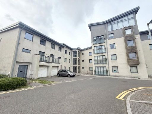 2 bedroom flat for sale in St. Catherines Court, Maritime Quarter, Swansea, SA1 — £170,000 • 2 bed • 1 bath • 722 ft²
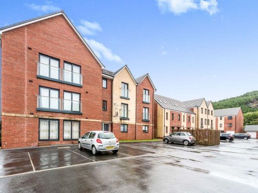 2 bedroom flat for sale in Golwg Y Garreg Wen, SA1 — £145,000 • 2 bed • 1 bath • 663 ft²
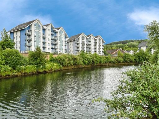 1 bedroom flat for sale in Phoebe Road, Pentrechwyth, Swansea, SA1 — £90,000 • 1 bed • 1 bath • 399 ft²
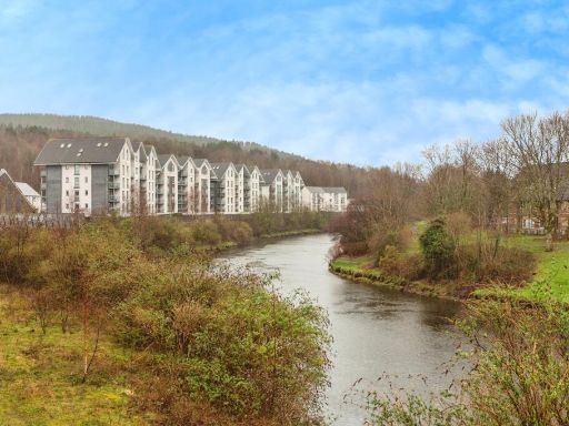 1 bedroom flat for sale in Phoebe Road, Copper Quarter, Pentrechwyth, Swansea, SA1 — £80,000 • 1 bed • 1 bath • 403 ft²
 2 bedroom apartment for sale in Princess Way, Excelsior, SA1 — £140,000 • 2 bed • 1 bath • 764 ft²
Meta
- {
"@context": "https://schema.org",
"@type": "Residence",
"name": "2 bedroom apartment for sale in Phoebe Road, Pentrechwyth,…",
"description": "",
"url": "https://propertypiper.co.uk/property/e2acadb0-651f-432a-85a8-df9f6b81988c",
"image": "https://image-a.propertypiper.co.uk/f038a651-1c20-479d-af6e-cb3ffd4e8440-1024.jpeg",
"address": {
"@type": "PostalAddress",
"streetAddress": "Phoebe Road, Pentrechwyth, SA1",
"postalCode": "SA1 7FH",
"addressLocality": "Swansea",
"addressRegion": "Swansea East",
"addressCountry": "Wales"
},
"geo": {
"@type": "GeoCoordinates",
"latitude": 51.63865424981469,
"longitude": -3.930431524861007
},
"numberOfRooms": 2,
"numberOfBathroomsTotal": 1,
"floorSize": {
"@type": "QuantitativeValue",
"value": 398,
"unitCode": "FTK"
},
"offers": {
"@type": "Offer",
"price": 155000,
"priceCurrency": "GBP",
"availability": "https://schema.org/InStock"
},
"additionalProperty": [
{
"@type": "PropertyValue",
"name": "Feature",
"value": "modern apartment complex"
},
{
"@type": "PropertyValue",
"name": "Feature",
"value": "riverside apartments"
},
{
"@type": "PropertyValue",
"name": "Feature",
"value": "waterfront property"
},
{
"@type": "PropertyValue",
"name": "Feature",
"value": "multi-story buildings"
},
{
"@type": "PropertyValue",
"name": "Feature",
"value": "residential estate"
},
{
"@type": "PropertyValue",
"name": "Feature",
"value": "green surroundings"
},
{
"@type": "PropertyValue",
"name": "Feature",
"value": "modern kitchen"
},
{
"@type": "PropertyValue",
"name": "Feature",
"value": "black cabinets"
},
{
"@type": "PropertyValue",
"name": "Feature",
"value": "corner layout"
},
{
"@type": "PropertyValue",
"name": "Feature",
"value": "compact"
},
{
"@type": "PropertyValue",
"name": "Feature",
"value": "appliances included"
},
{
"@type": "PropertyValue",
"name": "Feature",
"value": "laminate countertop"
},
{
"@type": "PropertyValue",
"name": "Feature",
"value": "bright"
},
{
"@type": "PropertyValue",
"name": "Feature",
"value": "natural light"
}
]
}
High Res Floorplan Images
Compatible Floorplan Images
FloorplanImages Thumbnail