PO11 9BP - 3 bedroom detached bungalow for sale in St Margarets Road,…
View on Property Piper
3 bedroom detached bungalow for sale in St Margarets Road, Hayling Island, PO11
Property Details
- Price: £375000
- Bedrooms: 3
- Bathrooms: 1
- Property Type: undefined
- Property SubType: undefined
Image Descriptions
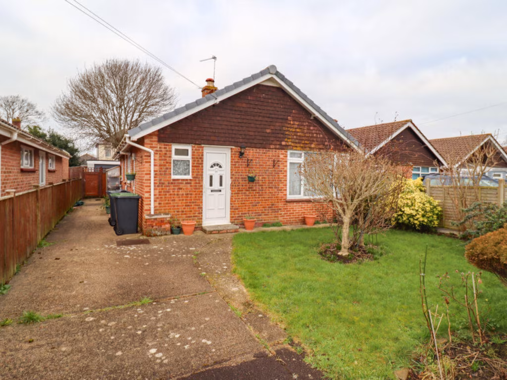
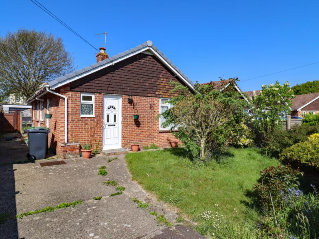
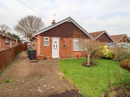
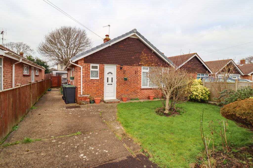
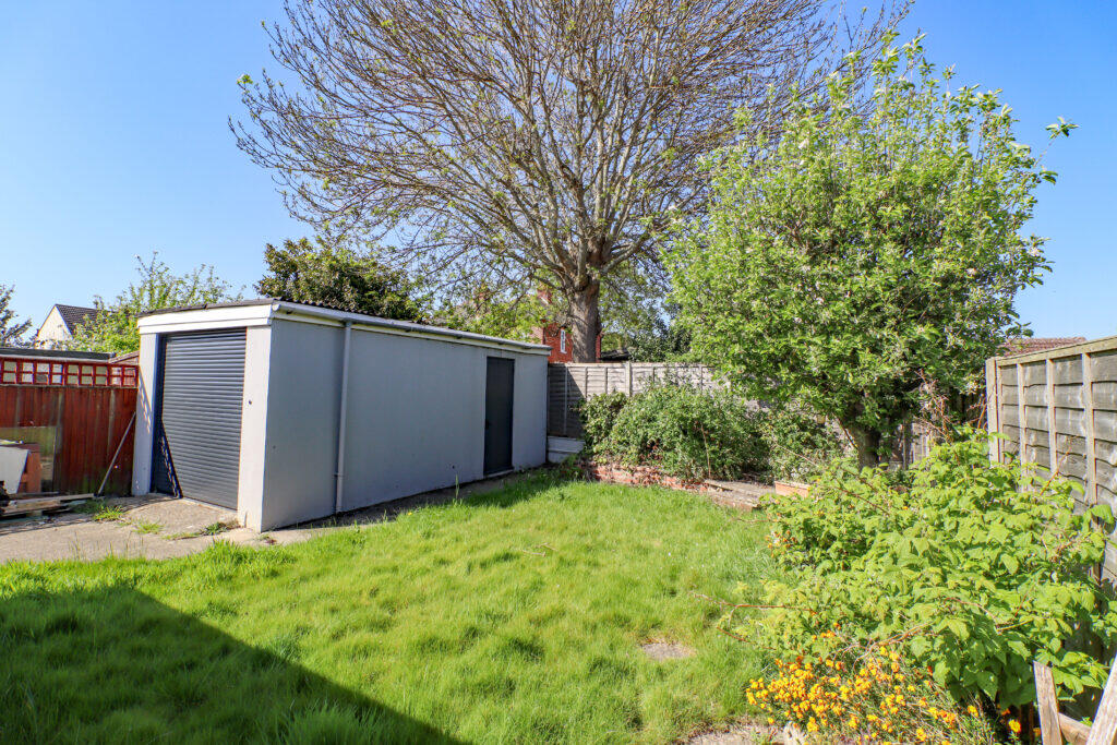
- single-story house mid-20th century bungalow
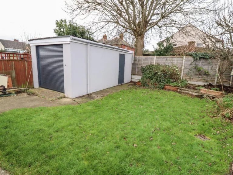
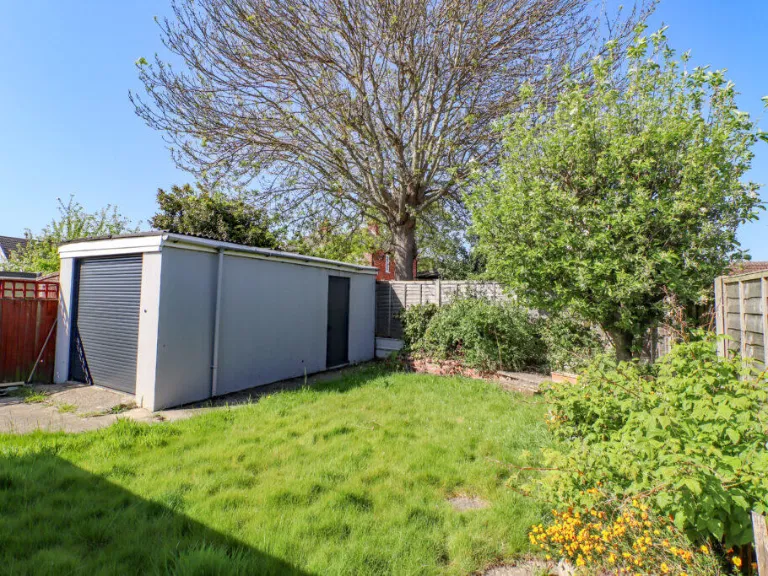
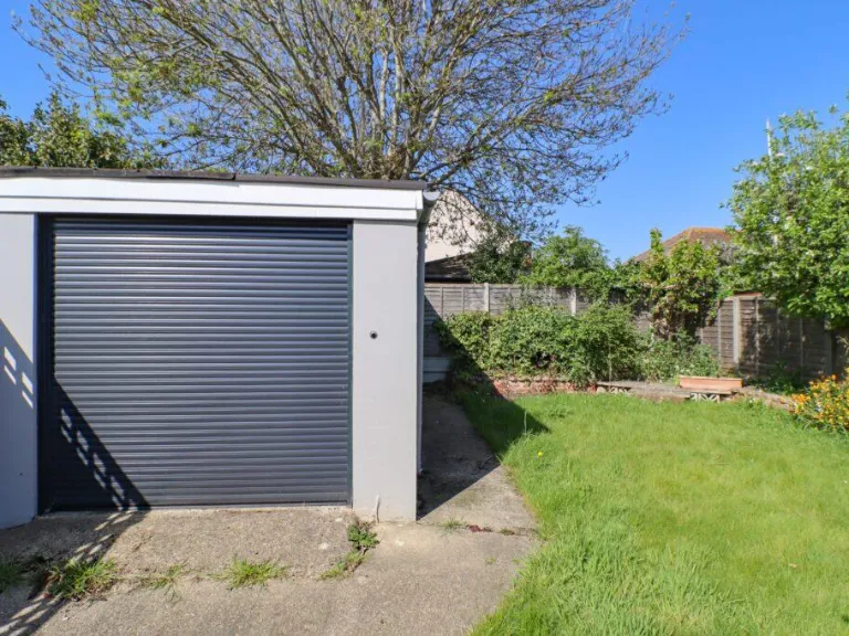
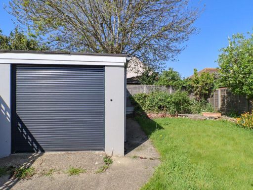
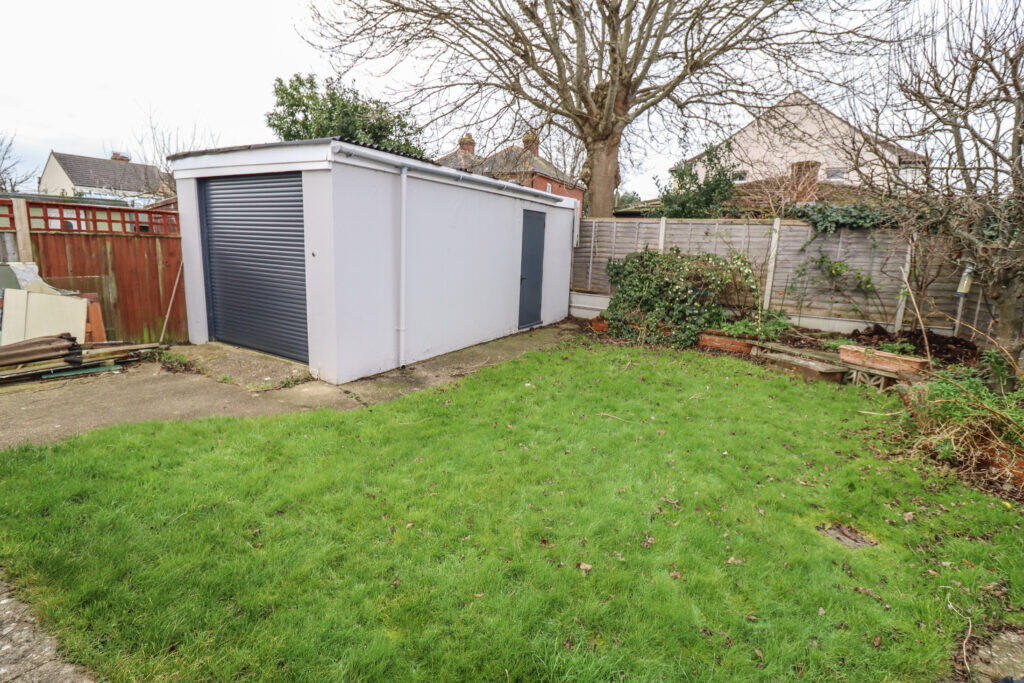
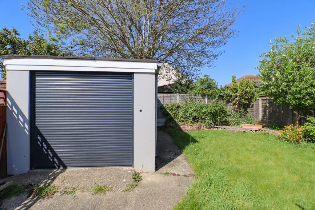
- outdoor garage and garden area contemporary
Floorplan Description
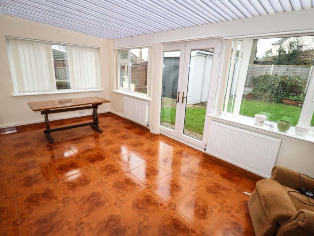
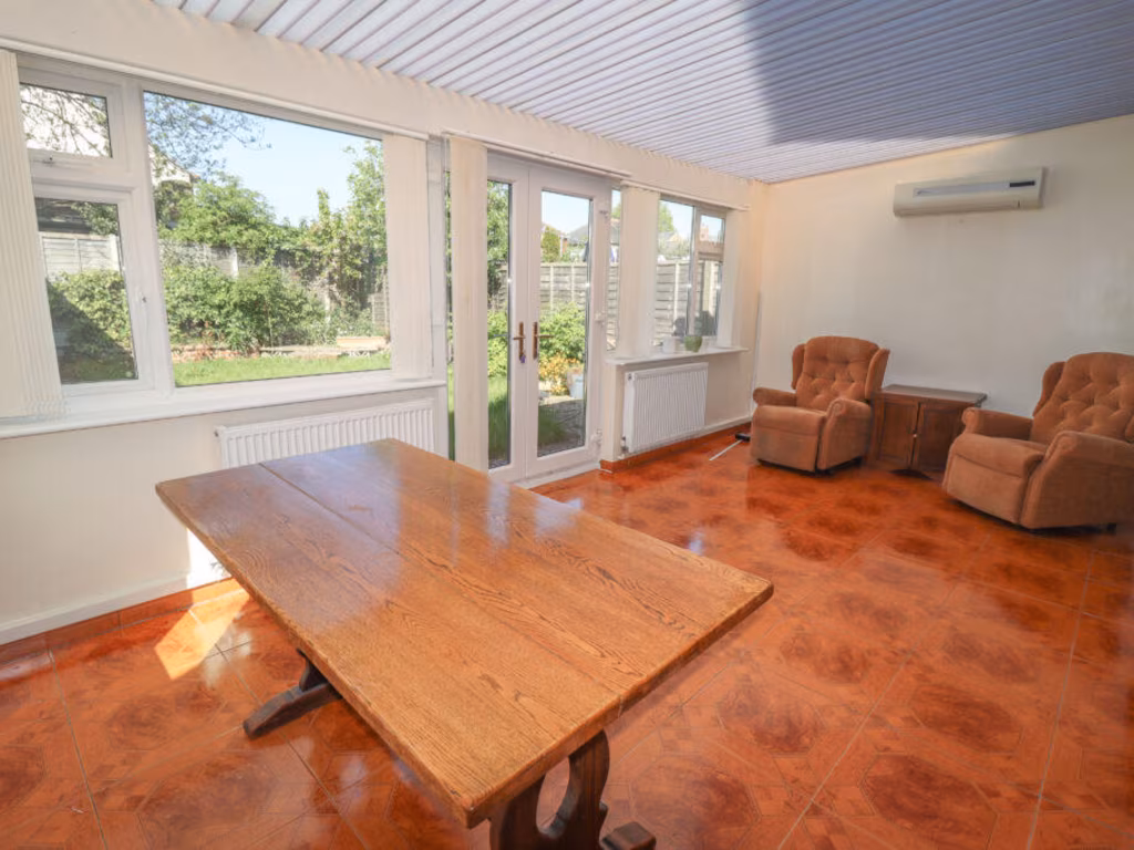
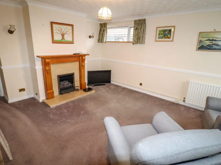
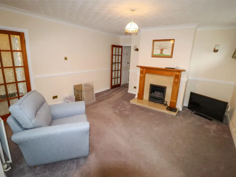
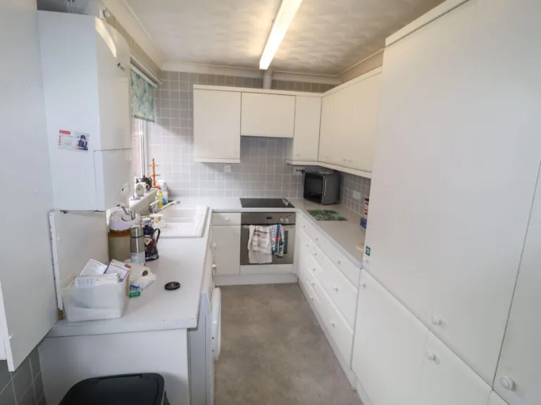
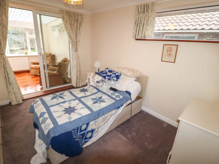
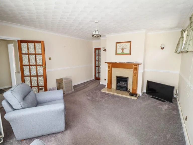
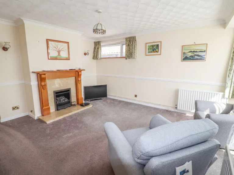
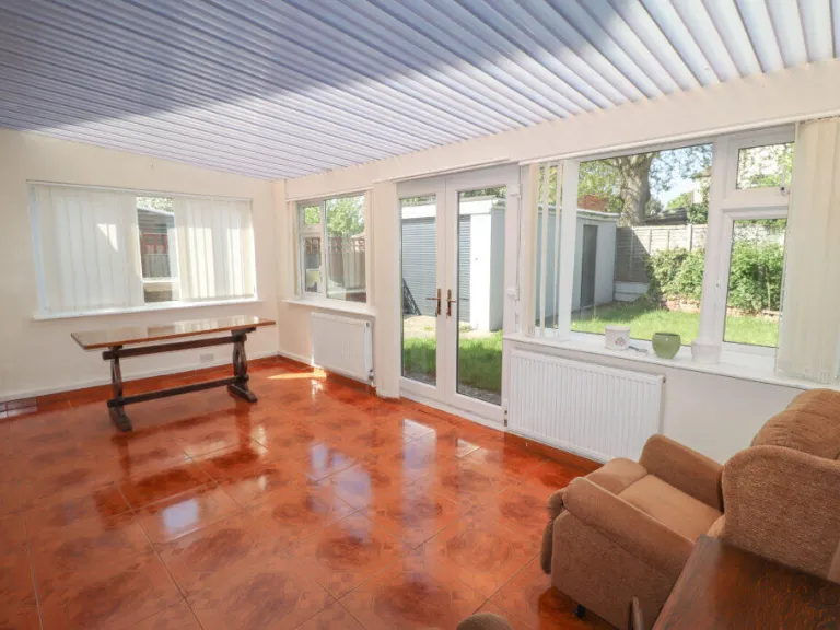
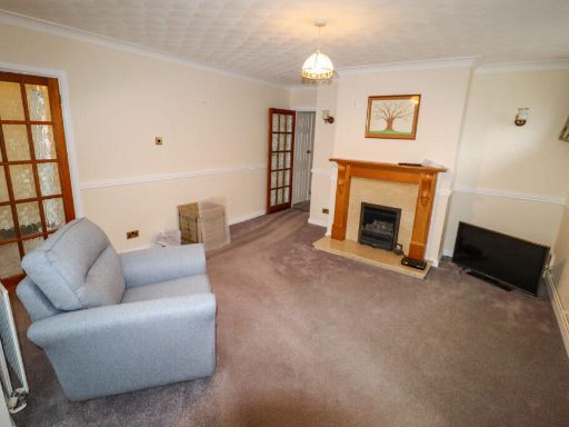
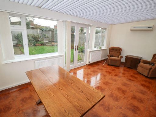
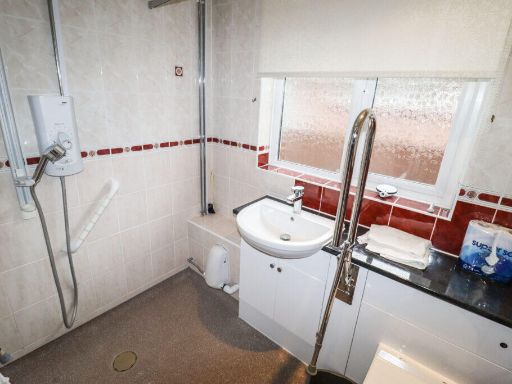
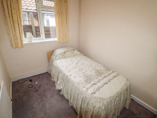
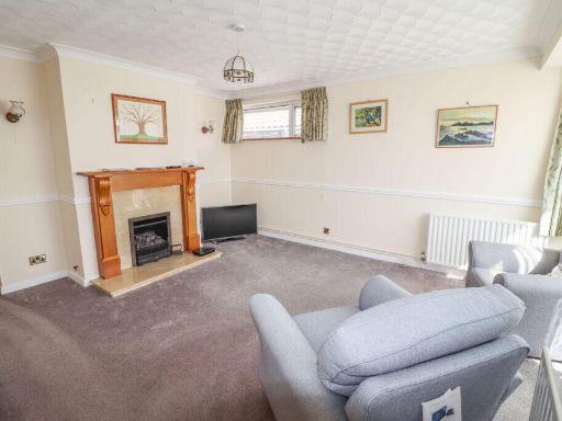
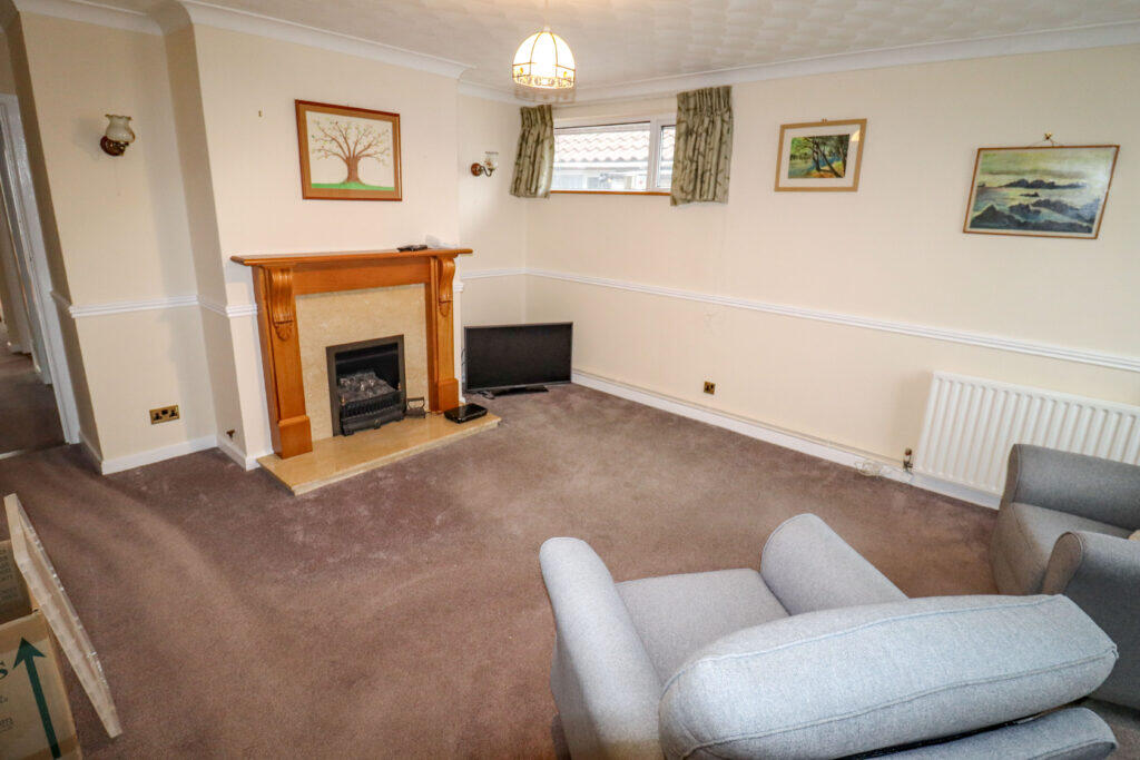
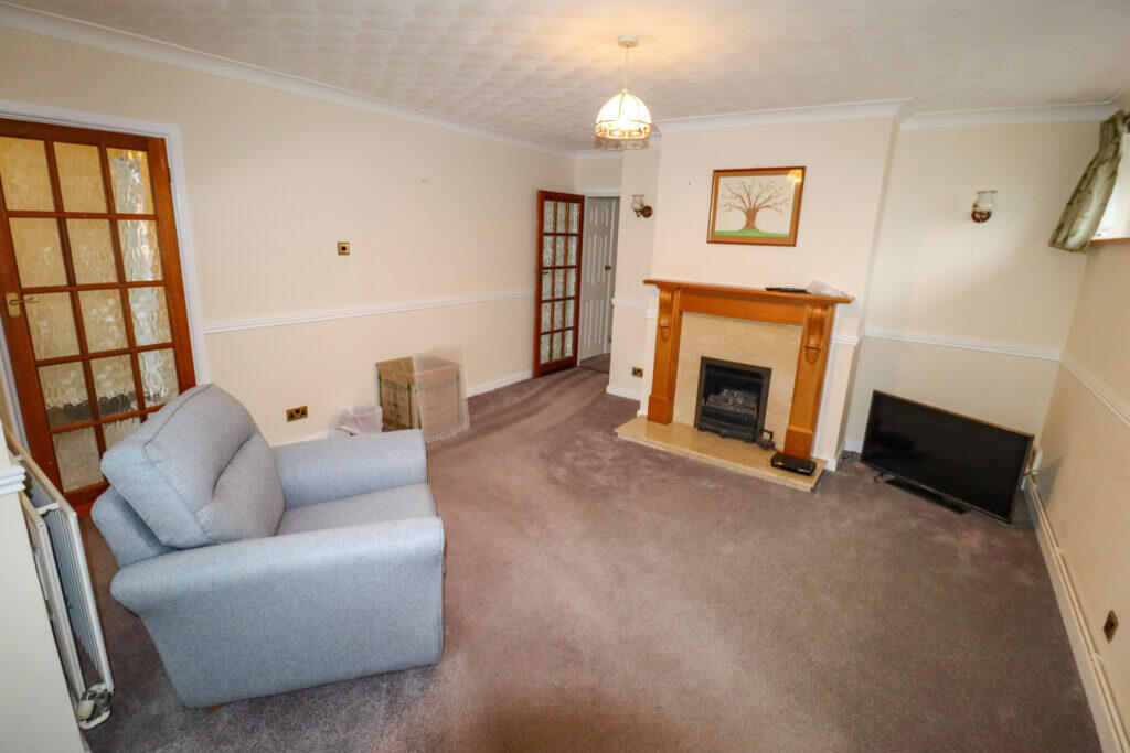
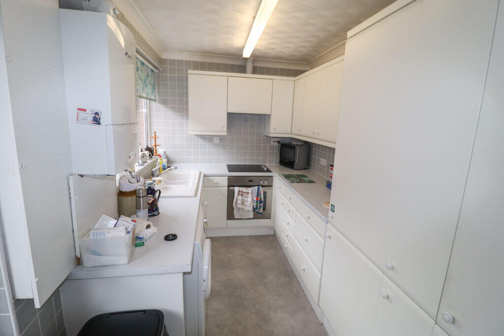
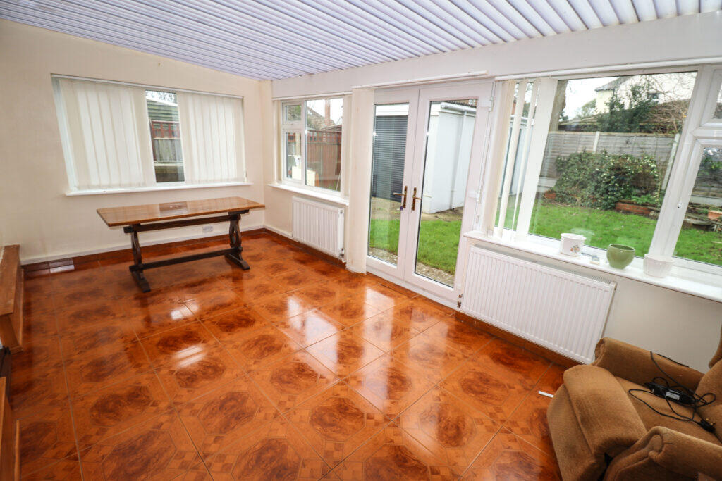
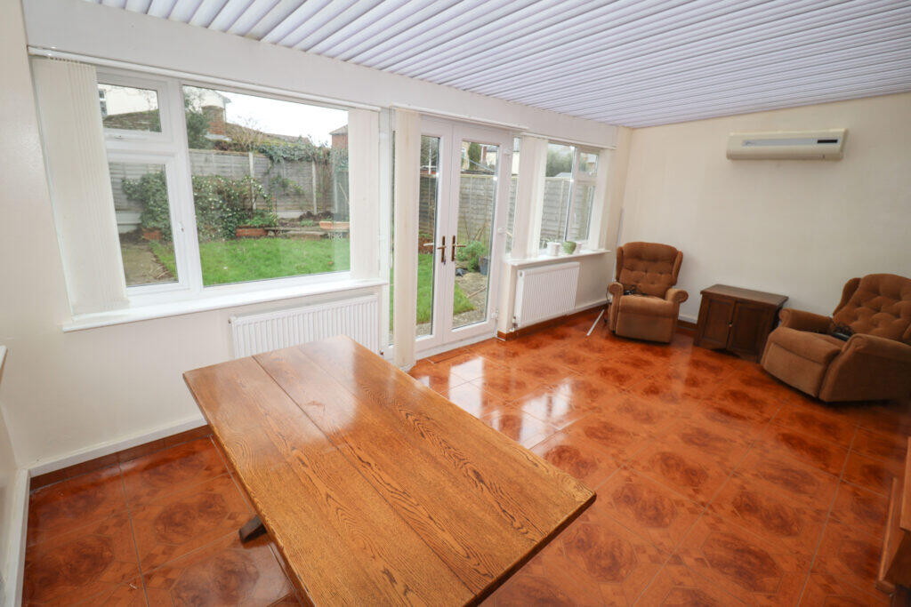
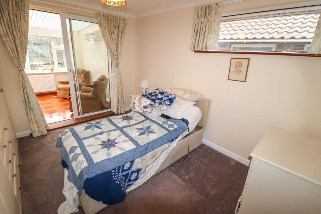
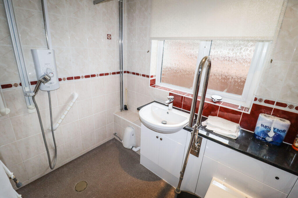
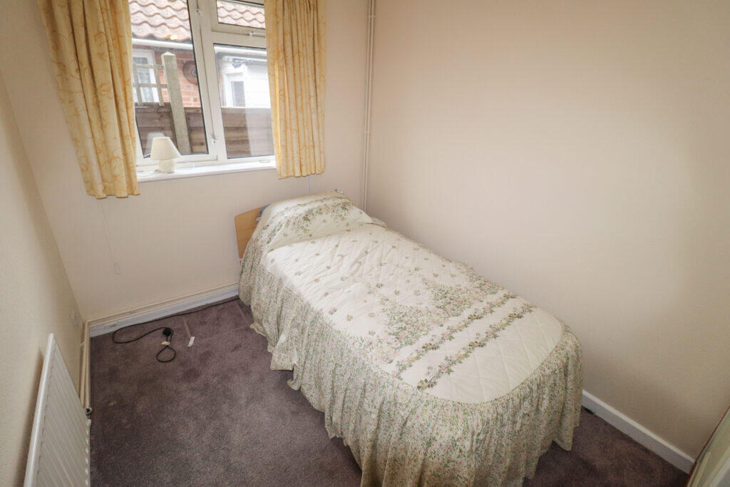
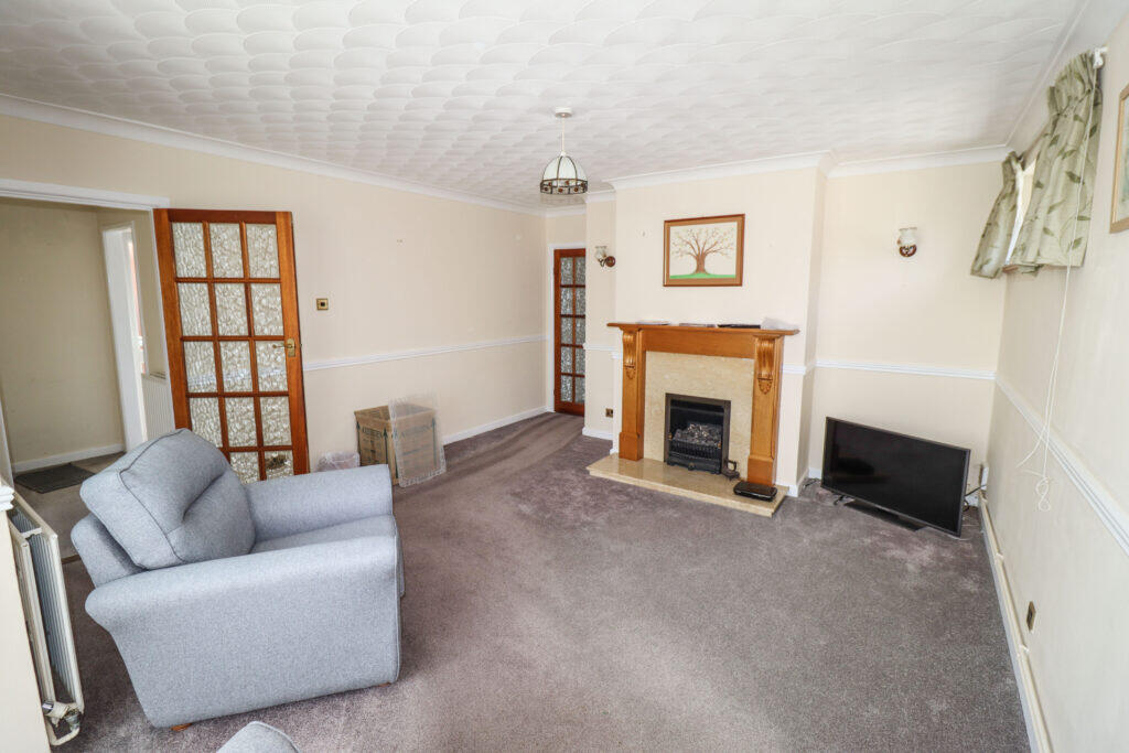
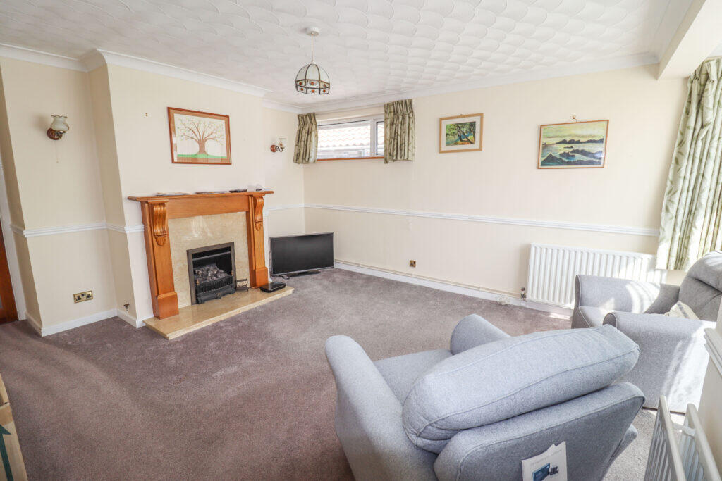
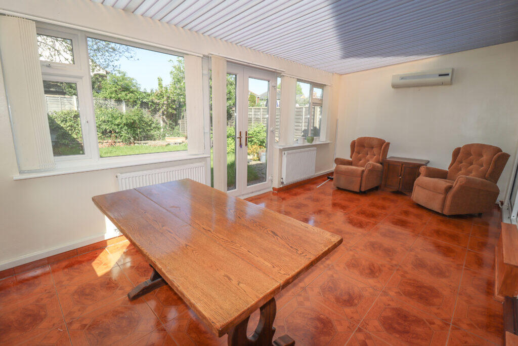
- A single level property featuring a conservatory, three bedrooms, a lounge, a kitchen, and a shower room.
Rooms
- Conservatory:
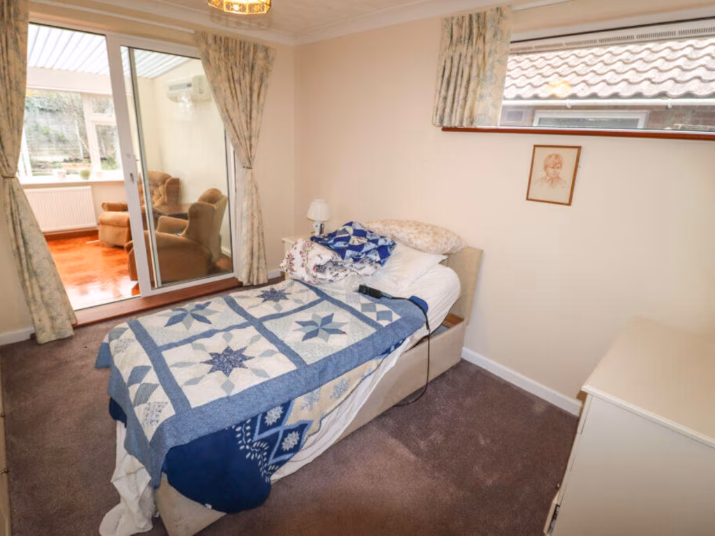
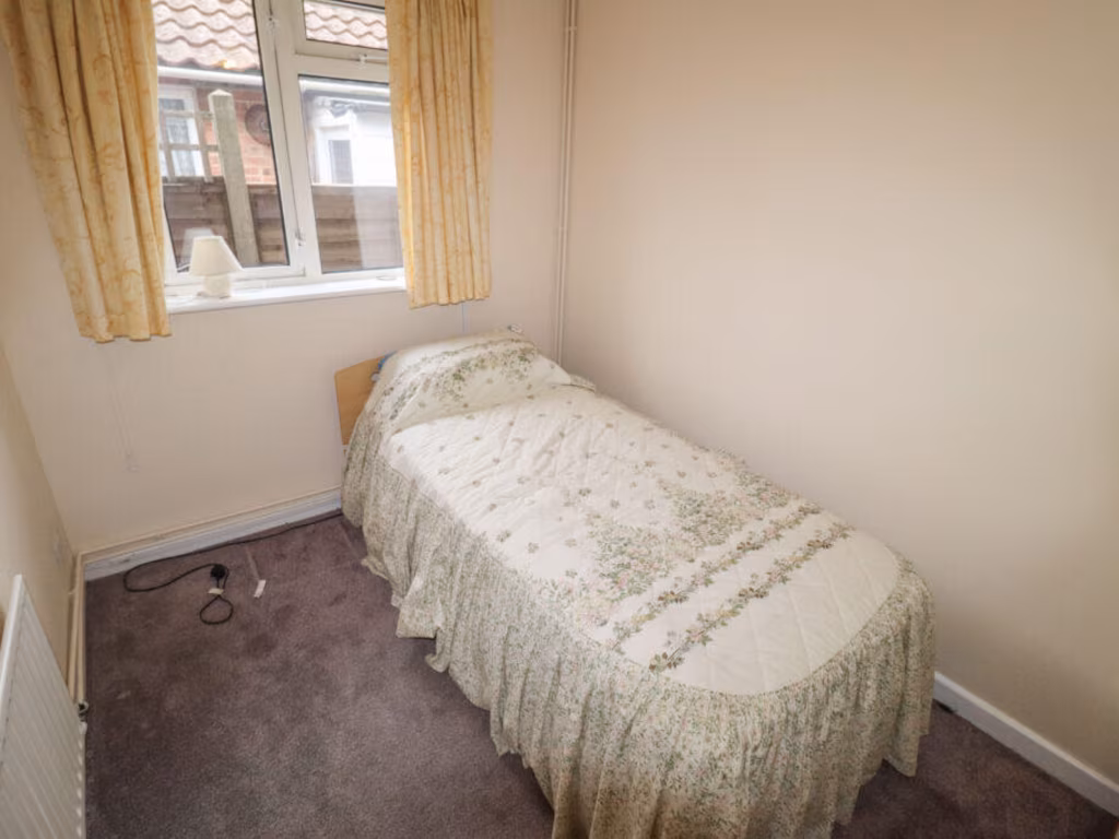
- Bedroom 3:
- Bedroom 1:
- Bedroom 2:
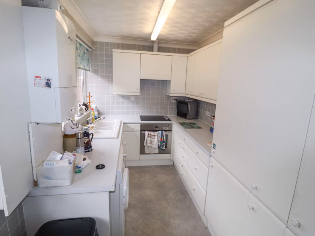
- Kitchen:
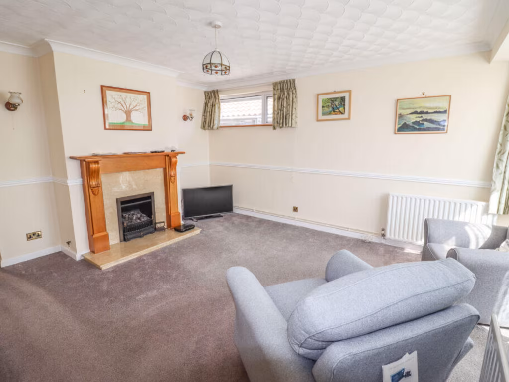
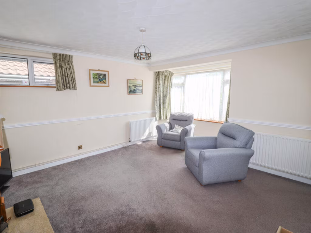
- Lounge:
Textual Property Features
Detected Visual Features
- bungalow
- mid-20th century
- detached
- brick exterior
- single-story
- garden
- paved driveway
- residential area
- contemporary
- garage
- outdoor
- shed
- privacy
- fencing
- lawn
- roof
EPC Details
- Fully double glazed
- Cavity wall, as built, no insulation (assumed)
- Boiler and radiators, mains gas
- Low energy lighting in 86% of fixed outlets
- Suspended, no insulation (assumed)
Nearby Schools
- The Hayling College
- Bosmere Junior School
- Warblington School
- Meon Junior School
- Meon Infant School
- Solent Infant School
- West Wittering Parochial Church of England School
- Mengham Junior School
- Mill Rythe Junior School
- Thorney Island Community Primary School
- Releasing Potential School
- St Thomas More's Catholic Primary School, Havant
- Miltoncross Academy
- Westover Primary School
- Admiral Lord Nelson School
- Bourne Community College
- St James Church of England Controlled Primary School
- Trosnant Infant School
- Milton Park Primary School
- Mengham Infant School
- Mill Rythe Infant School
- Emsworth Primary School
- Fairfield Infant School
- Bidbury Junior School
- Bidbury Infant School
- Trosnant Junior School
- Moorings Way Infant School
- Langstone Junior Academy
Nearest General Shops
- Id: 4600215432
- Tags:
- Addr:
- City: Hayling Island
- Housenumber: 25
- Postcode: PO11 9BG
- Street: Mengham Road
- Name: Heidi's Swiss Patisserie
- Phone: +44 2392 463554
- Shop: bakery
- TagsNormalized:
- Lat: 50.7877281
- Lon: -0.9755027
- FullGeoHash: gcp2cv9evnsq
- PartitionGeoHash: gcp2
- Images:
- FoodStandards: null
- Distance: 262.8
,- Id: 5535723085
- Tags:
- Addr:
- City: Mengham, Hayling Island
- Street: Elm Grove
- Brand: Coral
- Brand:wikidata: Q54621344
- Brand:wikipedia: en:Coral (bookmaker)
- Name: Coral
- Opening_hours: Mo-Fr 09:30-21:00; Sa 09:00-20:00; Su 09:00-19:30
- Shop: bookmaker
- TagsNormalized:
- Lat: 50.7885249
- Lon: -0.9768958
- FullGeoHash: gcp2cvb8sem8
- PartitionGeoHash: gcp2
- Images:
- FoodStandards: null
- Distance: 224.7
,- Id: 1387198907
- Tags:
- Name: Hayling Cycles
- Shop: bicycle
- TagsNormalized:
- Lat: 50.7915191
- Lon: -0.9766969
- FullGeoHash: gcp2cy2f136j
- PartitionGeoHash: gcp2
- Images:
- FoodStandards: null
- Distance: 211.1
}
Nearest Grocery shops
- Id: 4390876413
- Tags:
- Addr:
- City: Hayling Island
- Housename: Higworth Caravan Park
- Street: Manor Road
- Brand: Nisa
- Brand:wikidata: Q16999069
- Brand:wikipedia: en:Nisa (retailer)
- Name: Nisa
- Opening_hours: Mo-Sa 08:00-20:00; Su 08:00-19:00
- Operator: J & J Wilson Supermarket
- Shop: convenience
- TagsNormalized:
- Lat: 50.7966308
- Lon: -0.9847621
- FullGeoHash: gcp2cx4zv6k1
- PartitionGeoHash: gcp2
- Images:
- FoodStandards: null
- Distance: 1013.1
,- Id: 4565556333
- Tags:
- Addr:
- City: Hayling Island
- Housenumber: 12
- Postcode: PO11 9BL
- Street: Mengham Road
- Brand: Sainsbury's Local
- Brand:wikidata: Q13218434
- Brand:wikipedia: en:Sainsbury's Local
- Name: Sainsbury's Local
- Phone: +44 2392 469499
- Shop: convenience
- TagsNormalized:
- sainsburys
- sainsburys local
- convenience
- shop
- Lat: 50.7875034
- Lon: -0.9765965
- FullGeoHash: gcp2cv8fesuf
- PartitionGeoHash: gcp2
- Images:
- FoodStandards: null
- Distance: 310.1
,- Id: 4565564452
- Tags:
- Addr:
- City: Hayling Island
- Street: Elm Grove
- Name: Hayling Fruiterers
- Shop: greengrocer
- TagsNormalized:
- Lat: 50.7882644
- Lon: -0.9768396
- FullGeoHash: gcp2cv8xjfxw
- PartitionGeoHash: gcp2
- Images:
- FoodStandards: null
- Distance: 245
}
Nearest Religious buildings
- Id: 810509294
- Tags:
- Amenity: place_of_worship
- Building: church
- Denomination: anglican
- Name: St Andrew
- Religion: christian
- Wikidata: Q105102329
- TagsNormalized:
- place of worship
- church
- anglican
- christian
- Lat: 50.781558
- Lon: -0.9620525
- FullGeoHash: gcp2fhe2n898
- PartitionGeoHash: gcp2
- Images:
- FoodStandards: null
- Distance: 1301.6
,- Id: 92889804
- Tags:
- Amenity: place_of_worship
- Building: church
- Denomination: anglican
- Name: St. Mary's Church
- Religion: christian
- Wikidata: Q7594346
- TagsNormalized:
- place of worship
- church
- anglican
- christian
- Lat: 50.7954937
- Lon: -0.9768595
- FullGeoHash: gcp2cz09jw2f
- PartitionGeoHash: gcp2
- Images:
- FoodStandards: null
- Distance: 622.5
,- Id: 4600217304
- Tags:
- Addr:
- Amenity: place_of_worship
- Denomination: united_reformed
- Name: Hayling Island United Reformed Church
- Religion: christian
- TagsNormalized:
- place of worship
- united reformed
- church
- christian
- Lat: 50.7878756
- Lon: -0.9774232
- FullGeoHash: gcp2cv8kb6hq
- PartitionGeoHash: gcp2
- Images:
- FoodStandards: null
- Distance: 304.2
}
Nearest Airports
- Id: 100647893
- Tags:
- Aerodrome: international
- Aerodrome:type: public
- Aeroway: aerodrome
- Contact:
- Vhf:
- Approach: 120.225 MHz
- Tower: 118.2 MHz
- Ele: 44ft
- Iata: SOU
- Icao: EGHI
- Is_in: Hampshire, England,UK
- Name: Southampton Airport
- Operator: Southampton International Airport Limited
- Source: Bing;Gagravarr_Airports
- Wikidata: Q8988
- Wikipedia: en:Southampton Airport
- TagsNormalized:
- airport
- international airport
- Lat: 50.9513872
- Lon: -1.3516684
- FullGeoHash: gcp1c5rtrffz
- PartitionGeoHash: gcp1
- Images:
- FoodStandards: null
- Distance: 31956.6
}
Nearest Leisure Facilities
- Id: 92889773
- Tags:
- TagsNormalized:
- Lat: 50.7960919
- Lon: -0.9739812
- FullGeoHash: gcp2cz4u8tff
- PartitionGeoHash: gcp2
- Images:
- FoodStandards: null
- Distance: 674.4
,- Id: 869099323
- Tags:
- Leisure: pitch
- Sport: bowls
- TagsNormalized:
- Lat: 50.7927504
- Lon: -0.9759605
- FullGeoHash: gcp2cy934qzn
- PartitionGeoHash: gcp2
- Images:
- FoodStandards: null
- Distance: 311.3
,- Id: 45824986
- Tags:
- Landuse: recreation_ground
- Leisure: park
- Name: Legion Field
- TagsNormalized:
- Lat: 50.7927436
- Lon: -0.97447
- FullGeoHash: gcp2cyd3jjwt
- PartitionGeoHash: gcp2
- Images:
- FoodStandards: null
- Distance: 300.5
,- Id: 1079042966
- Tags:
- TagsNormalized:
- Lat: 50.7922377
- Lon: -0.9743747
- FullGeoHash: gcp2cy6qprme
- PartitionGeoHash: gcp2
- Images:
- FoodStandards: null
- Distance: 245.1
,- Id: 869131906
- Tags:
- TagsNormalized:
- Lat: 50.7912641
- Lon: -0.9723886
- FullGeoHash: gcp2cy7bt9ye
- PartitionGeoHash: gcp2
- Images:
- FoodStandards: null
- Distance: 216.5
}
Nearest Tourist attractions
- Id: 2116376228
- Tags:
- Name: Funland Hayling Island
- Tourism: theme_park
- Website: https://funland.info/
- Wheelchair: yes
- Wikidata: Q23926547
- Wikipedia: en:Funland Hayling Island
- TagsNormalized:
- Lat: 50.7851541
- Lon: -0.987796
- FullGeoHash: gcp2ct0sywvu
- PartitionGeoHash: gcp2
- Images:
- FoodStandards: null
- Distance: 1063.7
,- Id: 129467218
- Tags:
- Source: Bing
- Tourism: caravan_site
- TagsNormalized:
- Lat: 50.7988168
- Lon: -0.9797524
- FullGeoHash: gcp2cxwsd1g9
- PartitionGeoHash: gcp2
- Images:
- FoodStandards: null
- Distance: 1035.3
,- Id: 129467286
- Tags:
- Addr:
- Country: GB
- Postcode: PO11 0QS
- Street: Manor Road
- Brand: Parkdean Resorts
- Brand:wikidata: Q7138226
- Brand:wikipedia: en:Parkdean Resorts
- Contact:
- Website: https://www.parkdeanresorts.co.uk/location/hampshire/hayling-island/
- Name: Hayling Island Holiday Park
- Operator: Parkdean Resorts UK Limited
- Source: Bing
- Tourism: caravan_site
- TagsNormalized:
- Lat: 50.7967726
- Lon: -0.9831825
- FullGeoHash: gcp2cxk0dhtz
- PartitionGeoHash: gcp2
- Images:
- FoodStandards: null
- Distance: 952
}
Nearest Train stations
- Id: 32343344
- Tags:
- Name: Warblington
- Naptan:
- Network: National Rail
- Operator: Southern
- Public_transport: station
- Railway: station
- Ref:
- Wheelchair: yes
- Wikidata: Q129721
- Wikipedia: en:Warblington railway station
- TagsNormalized:
- Lat: 50.8535025
- Lon: -0.9671209
- FullGeoHash: gcp33cxg07yq
- PartitionGeoHash: gcp3
- Images:
- FoodStandards: null
- Distance: 7076.3
,- Id: 17479415
- Tags:
- Name: Fratton
- Naptan:
- Network: National Rail
- Operator: South Westen Railway
- Public_transport: station
- Railway: station
- Ref:
- Wheelchair: yes
- Wikidata: Q2618118
- Wikipedia: en:Fratton railway station
- TagsNormalized:
- Lat: 50.7964461
- Lon: -1.0732559
- FullGeoHash: gcp0zx4qxrf7
- PartitionGeoHash: gcp0
- Images:
- FoodStandards: null
- Distance: 6957.1
,- Id: 2767116794
- Tags:
- Name: Eastoke Corner
- Public_transport: station
- Railway: station
- Usage: tourism
- TagsNormalized:
- Lat: 50.7815104
- Lon: -0.9669511
- FullGeoHash: gcp2curzsrth
- PartitionGeoHash: gcp2
- Images:
- FoodStandards: null
- Distance: 1098
,- Id: 2767116835
- Tags:
- Name: Beachlands
- Public_transport: station
- Railway: station
- Usage: tourism
- TagsNormalized:
- Lat: 50.7841811
- Lon: -0.9866592
- FullGeoHash: gcp2cscx31t8
- PartitionGeoHash: gcp2
- Images:
- FoodStandards: null
- Distance: 1058.9
,- Id: 2767116819
- Tags:
- Name: Mengham Road
- Public_transport: station
- Railway: station
- Usage: tourism
- TagsNormalized:
- Lat: 50.7839205
- Lon: -0.9786105
- FullGeoHash: gcp2cszmu8zj
- PartitionGeoHash: gcp2
- Images:
- FoodStandards: null
- Distance: 732.3
}
Nearest Hotels
- Id: 92889905
- Tags:
- Building: yes
- Name: The Langstone Hotel
- Tourism: hotel
- TagsNormalized:
- Lat: 50.831767
- Lon: -0.9710709
- FullGeoHash: gcp31vsus2jj
- PartitionGeoHash: gcp3
- Images:
- FoodStandards: null
- Distance: 4646.2
,- Id: 507747352
- Tags:
- Building: yes
- Name: Sinah Warren Hotel
- Tourism: hotel
- TagsNormalized:
- Lat: 50.7927991
- Lon: -1.0129553
- FullGeoHash: gcp2byw3s2jb
- PartitionGeoHash: gcp2
- Images:
- FoodStandards: null
- Distance: 2699.6
,- Id: 412189516
- Tags:
- Amenity: pub
- Name: The Newtown House Hotel
- Tourism: hotel
- TagsNormalized:
- Lat: 50.7933153
- Lon: -0.9875222
- FullGeoHash: gcp2cw8ut04p
- PartitionGeoHash: gcp2
- Images:
- FoodStandards: null
- Distance: 965.4
}
Tags
- bungalow
- mid-20th century
- detached
- brick exterior
- single-story
- garden
- paved driveway
- residential area
- contemporary
- garage
- garden
- outdoor
- shed
- privacy
- fencing
- lawn
- roof
Local Market Stats
- Average Price/sqft: £358
- Avg Income: £42500
- Rental Yield: 3.4%
- Social Housing: 4%
- Planning Success Rate: 92%
AirBnB Data
- 1km average: £90/night
- Listings in 1km: 6
Similar Properties
 2 bedroom detached bungalow for sale in Elm Close Estate, Hayling Island, PO11 — £325,000 • 2 bed • 1 bath • 574 ft²
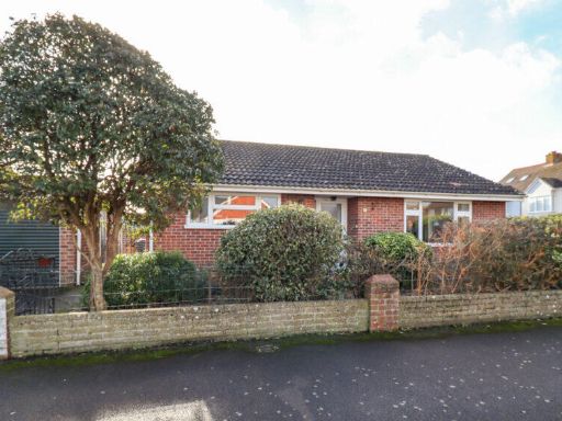 2 bedroom detached bungalow for sale in Sea View Road, Hayling Island, PO11 — £370,000 • 2 bed • 1 bath • 611 ft²
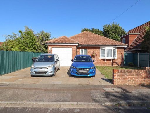 3 bedroom detached bungalow for sale in Burdale Drive, Hayling Island, PO11 — £480,000 • 3 bed • 2 bath • 809 ft²
 1 bedroom semi-detached bungalow for sale in North Crescent, Hayling Island, PO11 — £269,995 • 1 bed • 1 bath • 454 ft²
 2 bedroom detached bungalow for sale in Winston Close, Hayling Island, PO11 — £450,000 • 2 bed • 1 bath • 833 ft²
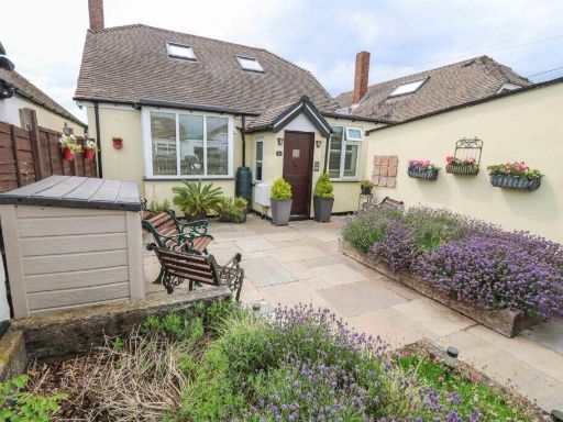 2 bedroom detached bungalow for sale in Elm Close Estate, Hayling Island, PO11 — £410,000 • 2 bed • 1 bath • 662 ft²
Meta
- {
"@context": "https://schema.org",
"@type": "Residence",
"name": "3 bedroom detached bungalow for sale in St Margarets Road,…",
"description": "",
"url": "https://propertypiper.co.uk/property/e1a692b6-4d92-4367-a24b-881130c84f16",
"image": "https://image-a.propertypiper.co.uk/9f463bda-b549-48e7-b563-fa35e82affd9-1024.jpeg",
"address": {
"@type": "PostalAddress",
"streetAddress": "35 ST MARGARETS ROAD HAYLING ISLAND",
"postalCode": "PO11 9BP",
"addressLocality": "Havant",
"addressRegion": "Havant",
"addressCountry": "England"
},
"geo": {
"@type": "GeoCoordinates",
"latitude": 50.79004918254473,
"longitude": -0.9747961538883326
},
"numberOfRooms": 3,
"numberOfBathroomsTotal": 1,
"floorSize": {
"@type": "QuantitativeValue",
"value": 754,
"unitCode": "FTK"
},
"offers": {
"@type": "Offer",
"price": 375000,
"priceCurrency": "GBP",
"availability": "https://schema.org/InStock"
},
"additionalProperty": [
{
"@type": "PropertyValue",
"name": "Feature",
"value": "bungalow"
},
{
"@type": "PropertyValue",
"name": "Feature",
"value": "mid-20th century"
},
{
"@type": "PropertyValue",
"name": "Feature",
"value": "detached"
},
{
"@type": "PropertyValue",
"name": "Feature",
"value": "brick exterior"
},
{
"@type": "PropertyValue",
"name": "Feature",
"value": "single-story"
},
{
"@type": "PropertyValue",
"name": "Feature",
"value": "garden"
},
{
"@type": "PropertyValue",
"name": "Feature",
"value": "paved driveway"
},
{
"@type": "PropertyValue",
"name": "Feature",
"value": "residential area"
},
{
"@type": "PropertyValue",
"name": "Feature",
"value": "contemporary"
},
{
"@type": "PropertyValue",
"name": "Feature",
"value": "garage"
},
{
"@type": "PropertyValue",
"name": "Feature",
"value": "garden"
},
{
"@type": "PropertyValue",
"name": "Feature",
"value": "outdoor"
},
{
"@type": "PropertyValue",
"name": "Feature",
"value": "shed"
},
{
"@type": "PropertyValue",
"name": "Feature",
"value": "privacy"
},
{
"@type": "PropertyValue",
"name": "Feature",
"value": "fencing"
},
{
"@type": "PropertyValue",
"name": "Feature",
"value": "lawn"
},
{
"@type": "PropertyValue",
"name": "Feature",
"value": "roof"
}
]
}
High Res Floorplan Images
Compatible Floorplan Images
FloorplanImages Thumbnail