ME15 9XD - 5 bedroom detached house for sale in Norrington Road, Loose…
View on Property Piper
5 bedroom detached house for sale in Norrington Road, Loose, Maidstone, ME15
Property Details
- Price: £600000
- Bedrooms: 5
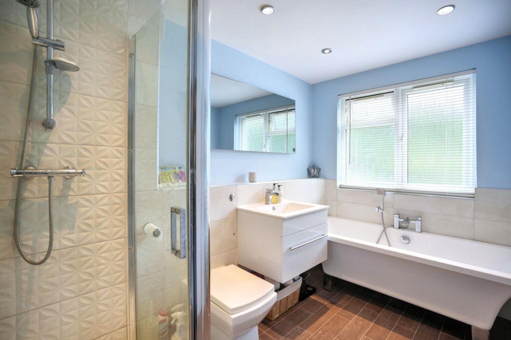
- Bathrooms: 2
- Property Type: undefined
- Property SubType: undefined
Image Descriptions
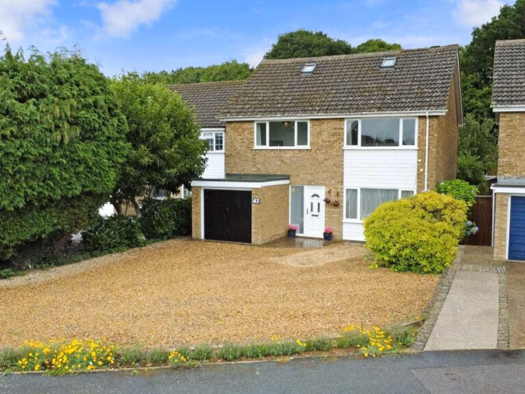
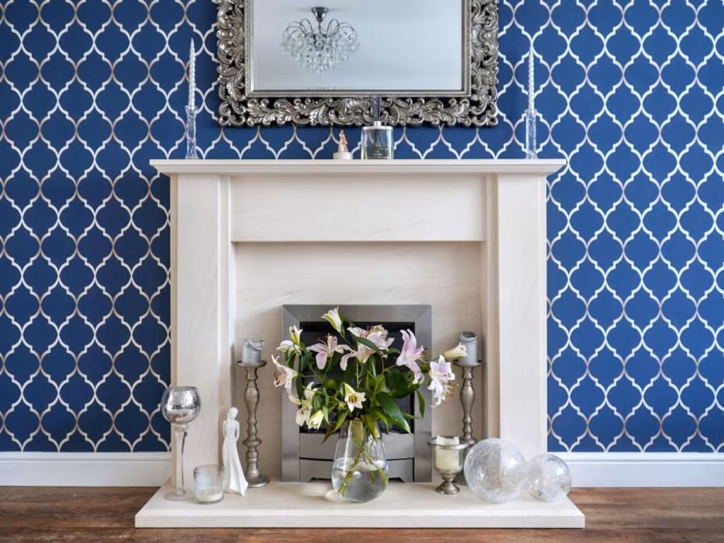
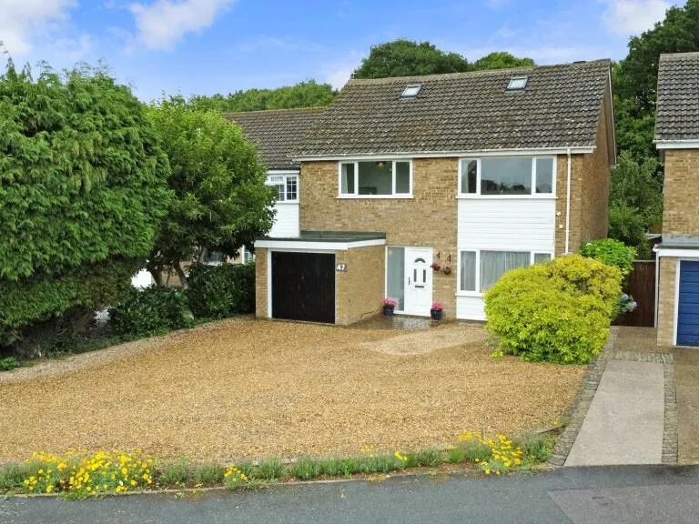
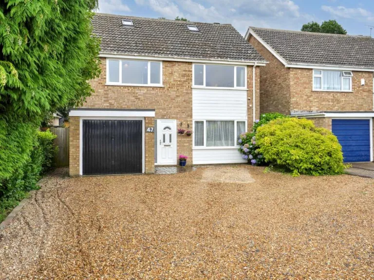
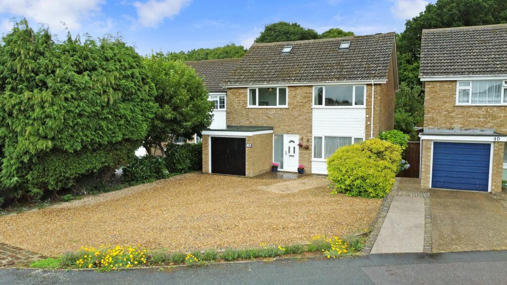
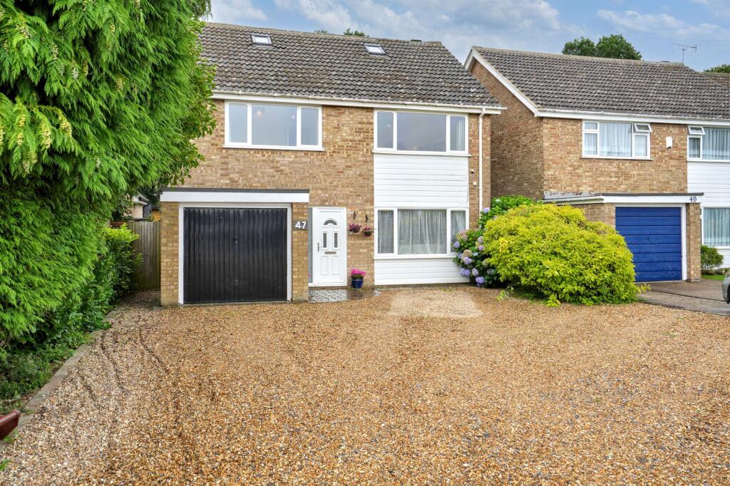
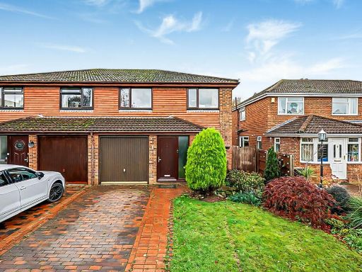
- front exterior of a detached house 1970s
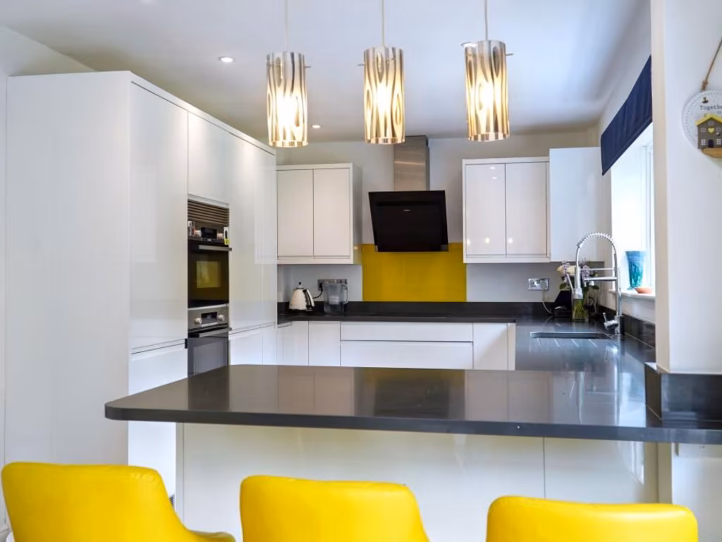
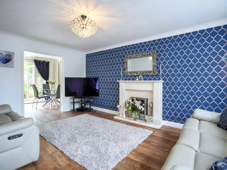
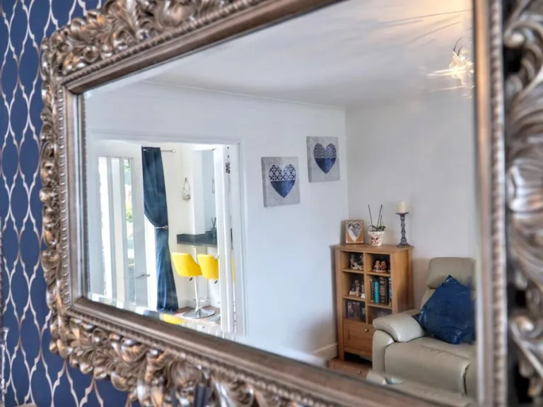
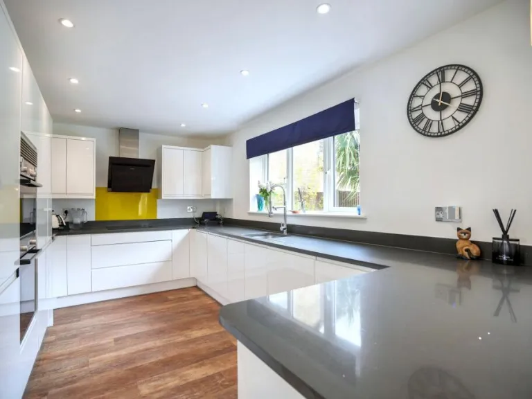
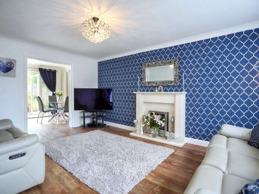
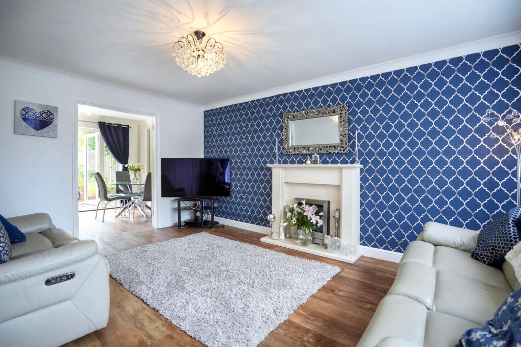
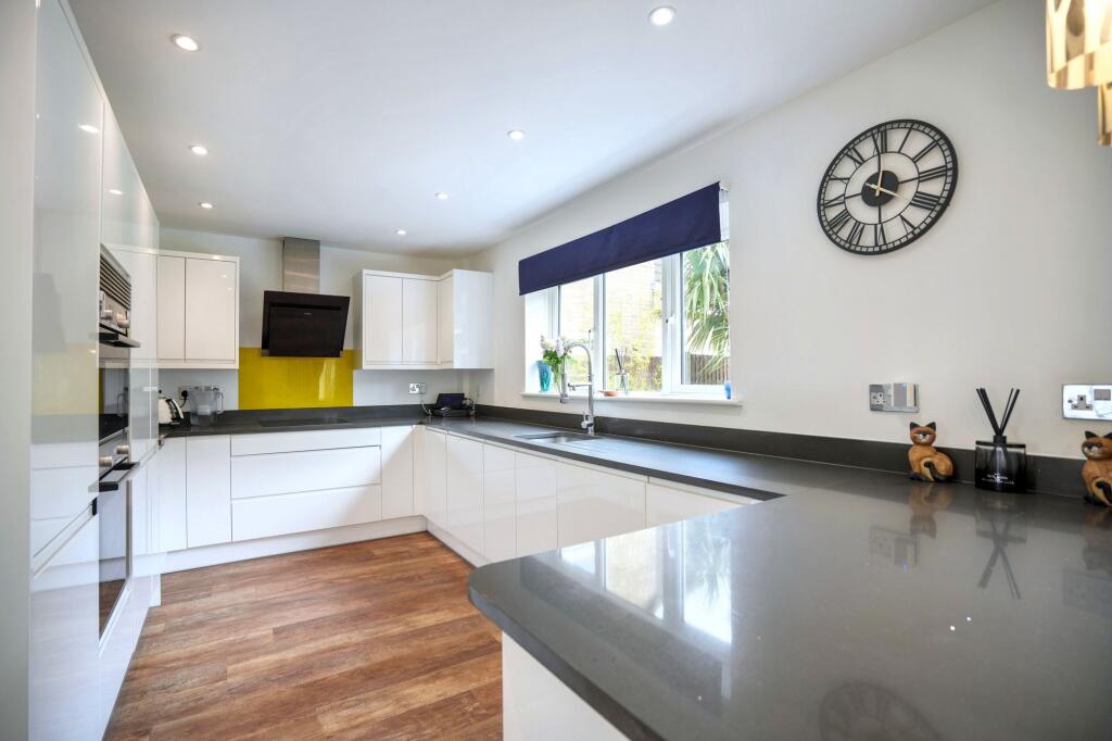
- living room contemporary
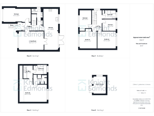
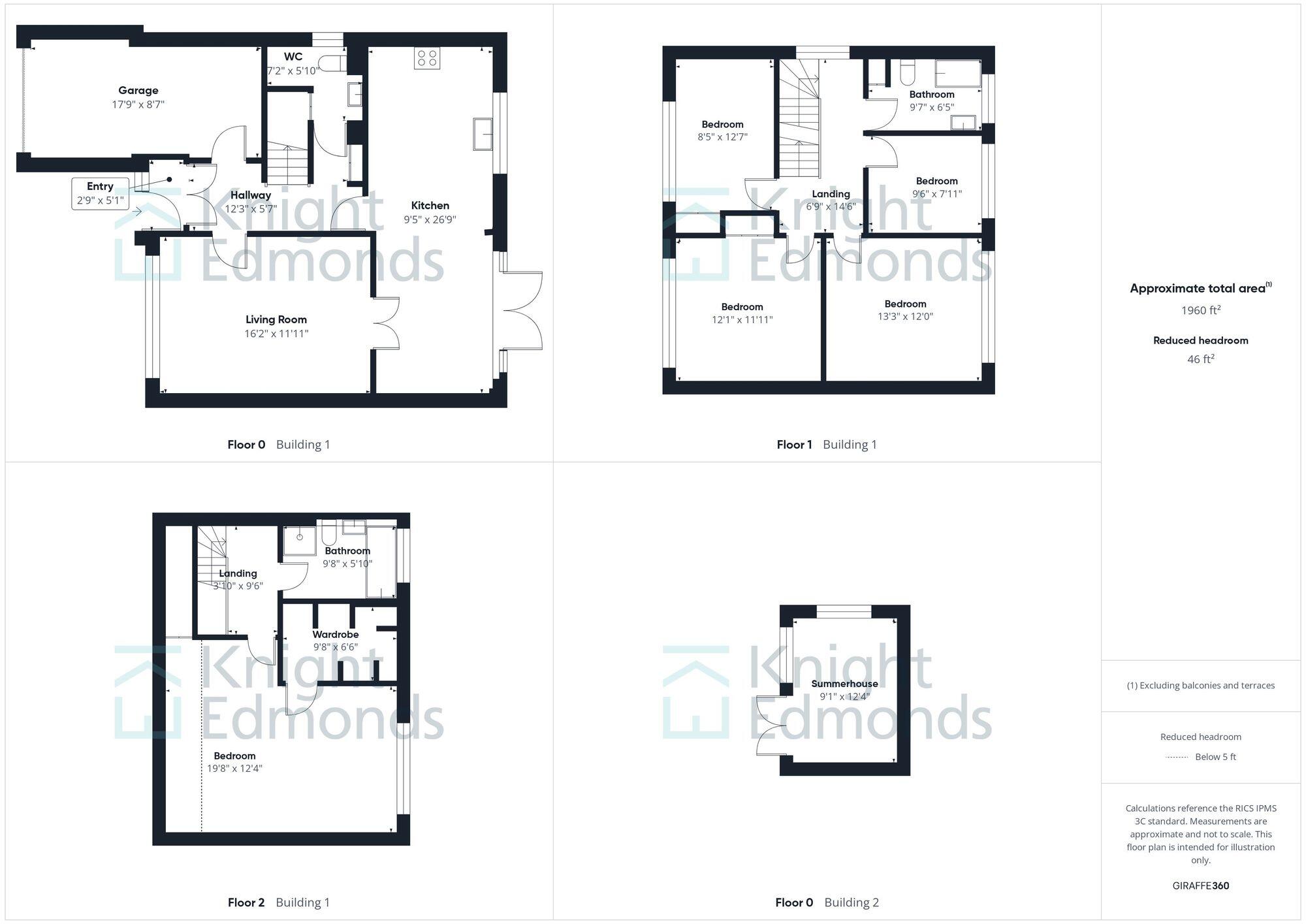
Floorplan Description
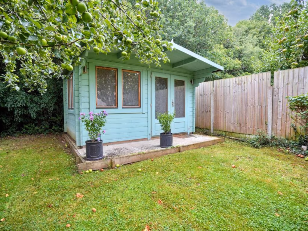
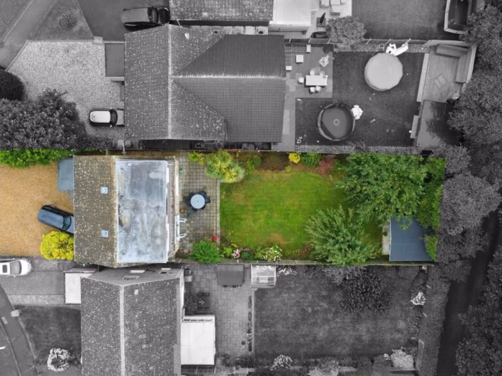
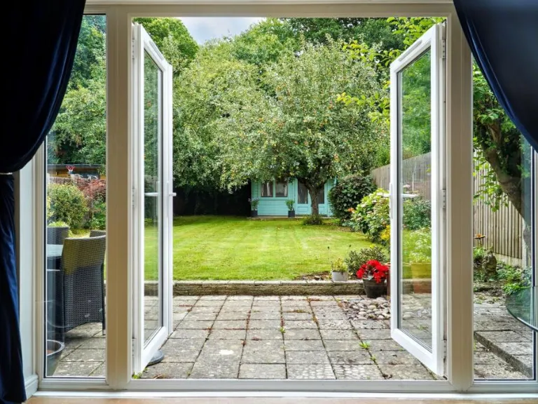
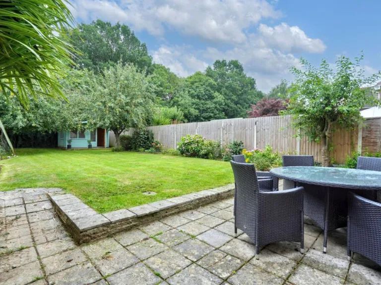
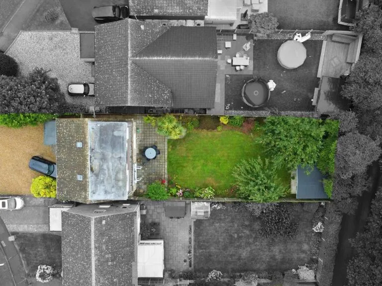
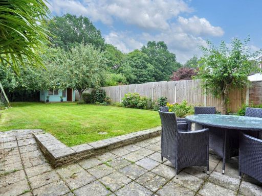
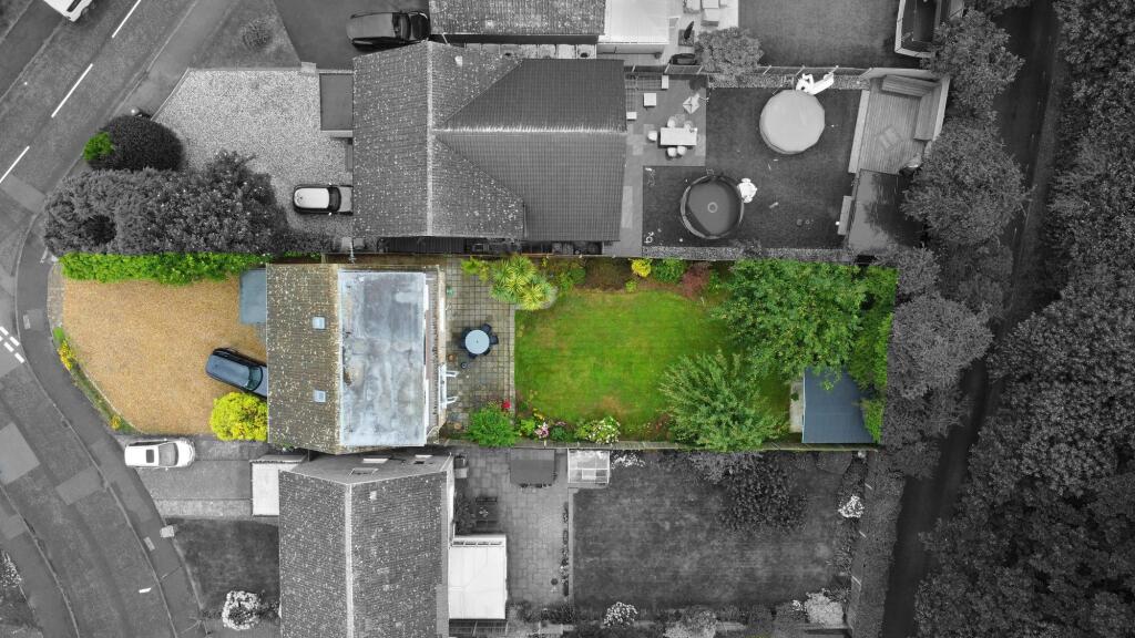
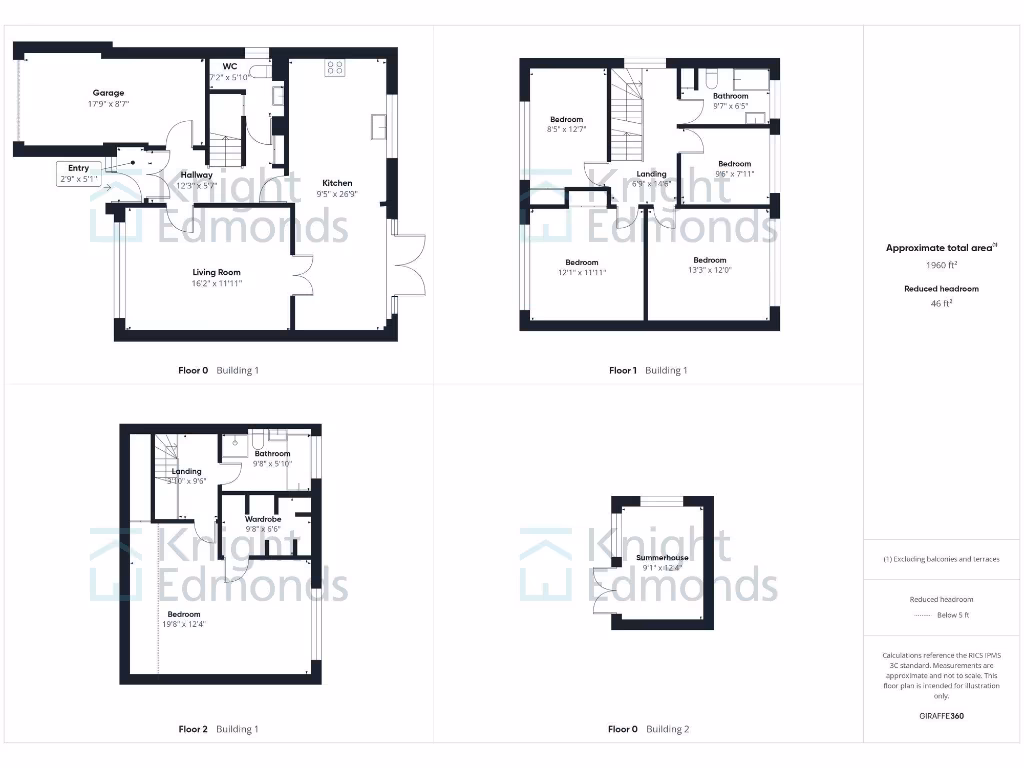
- A multi-story home with a separate summerhouse unit.
Rooms
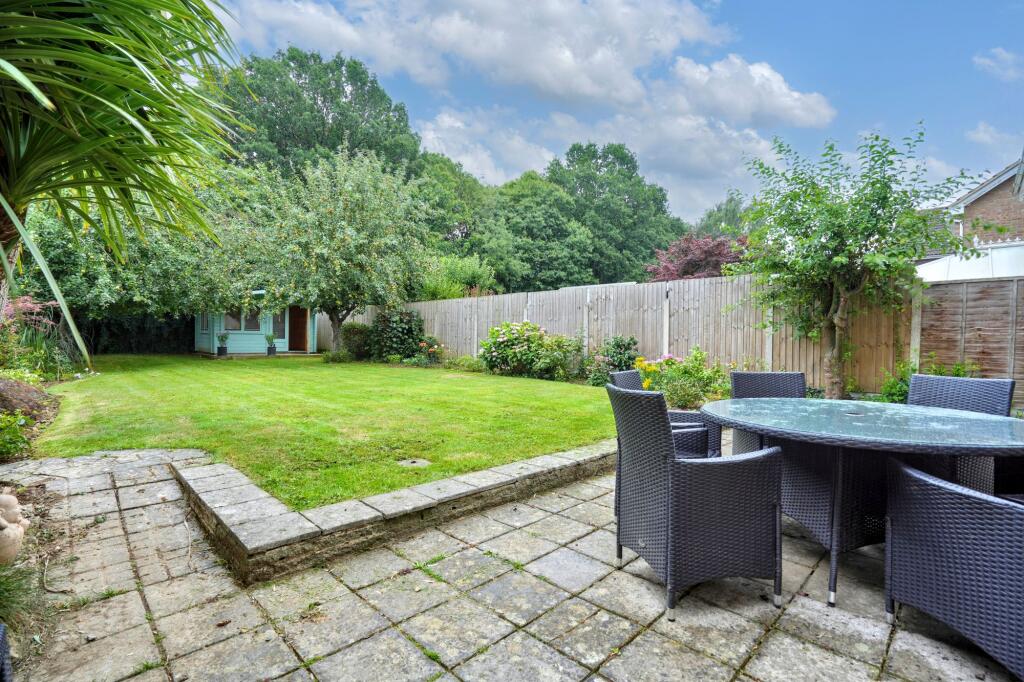
- Garage: average
- Entry: small
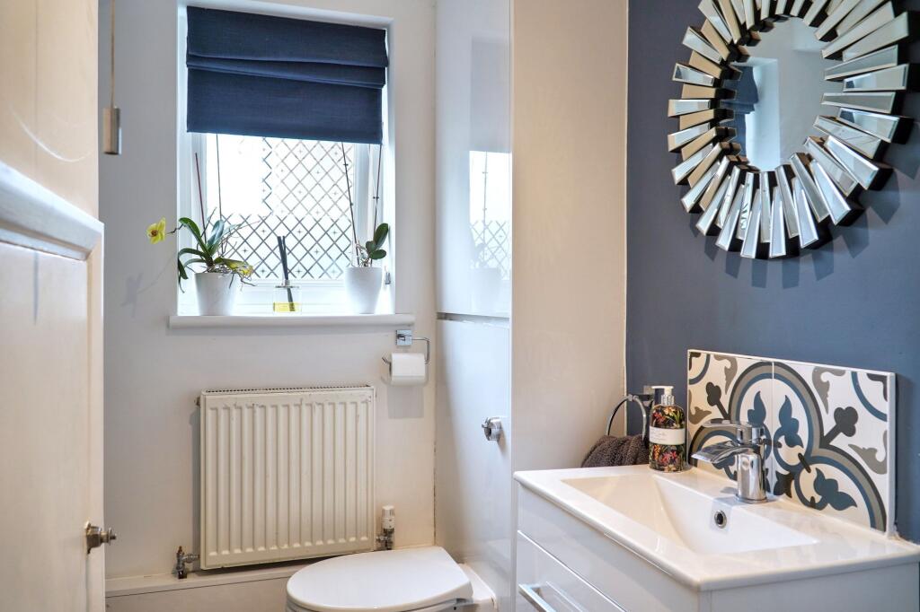
- WC: small
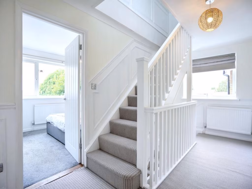
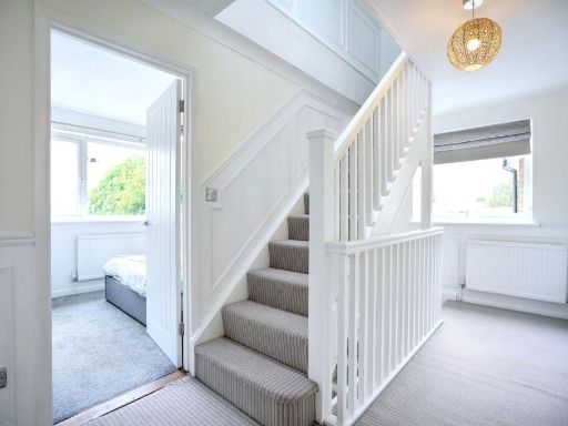
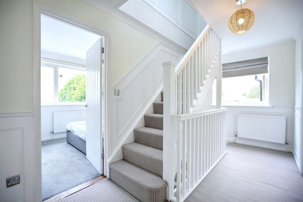
- Hallway: average
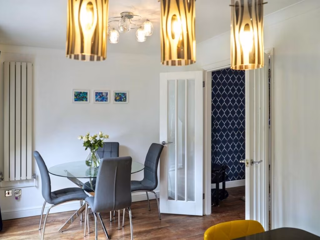
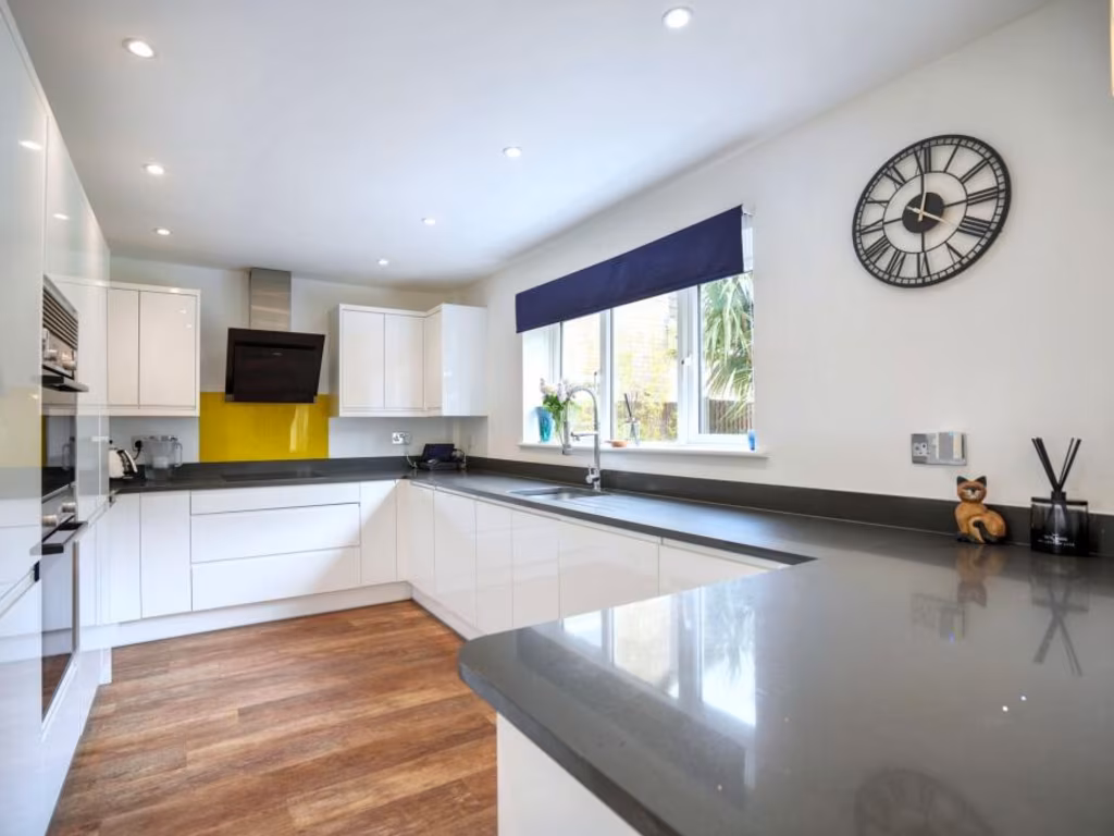
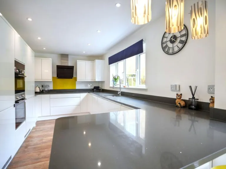
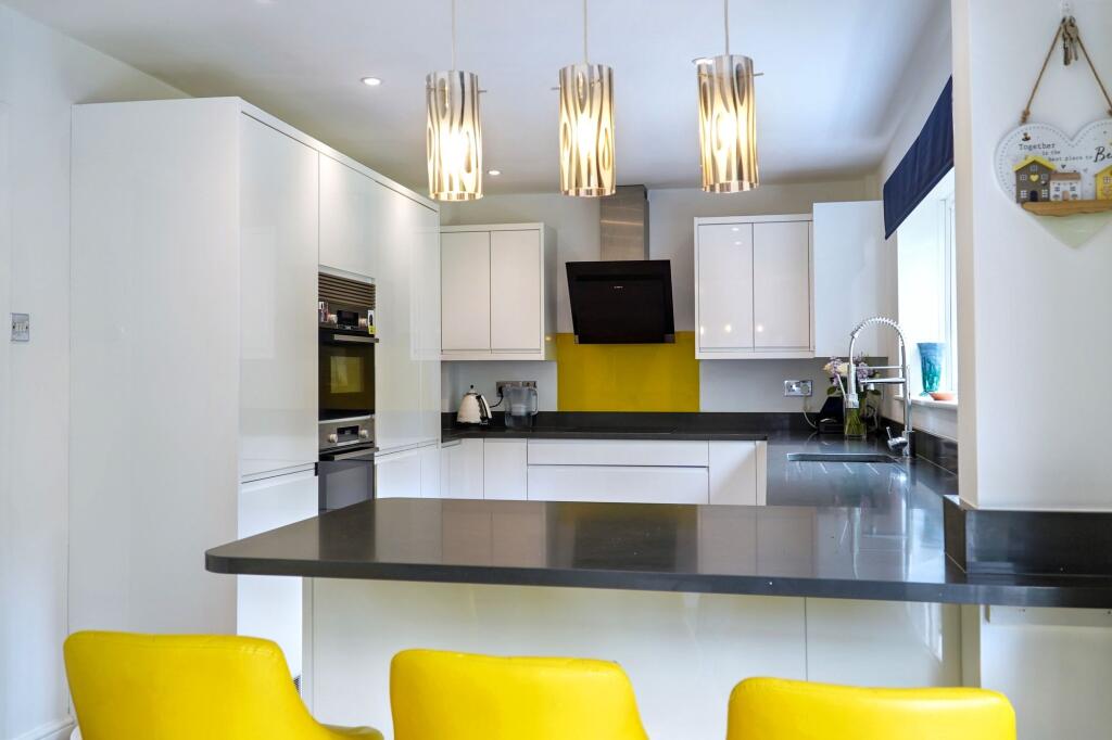
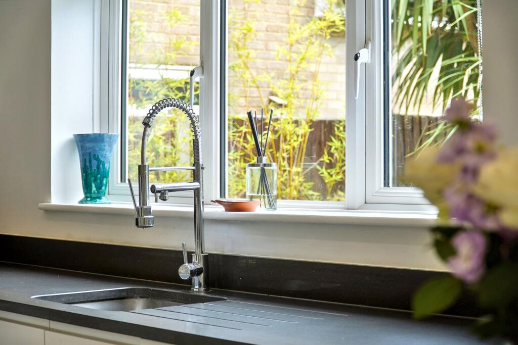
- Kitchen: average
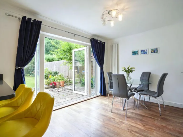
- Living Room: average
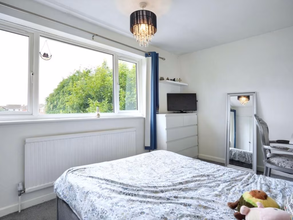
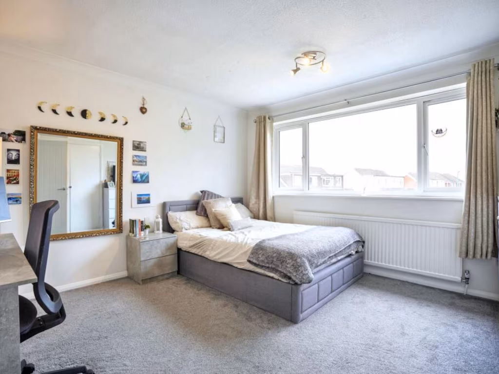
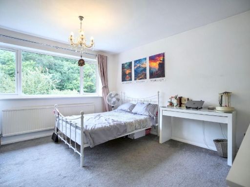
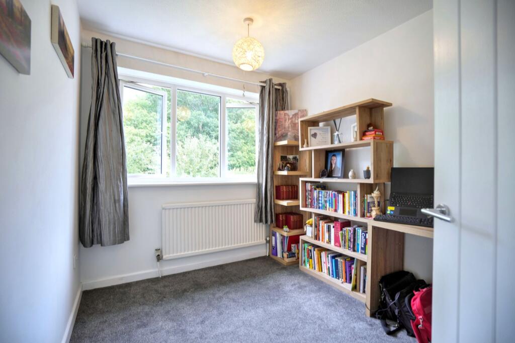
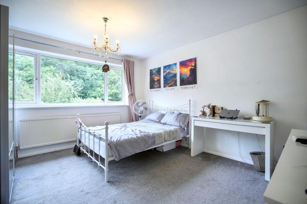
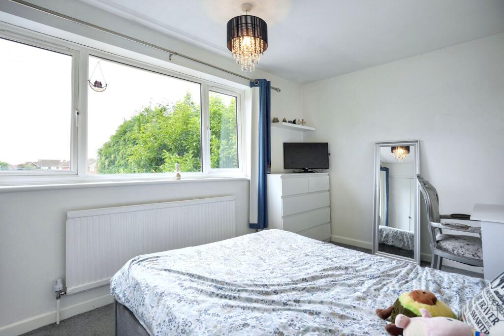
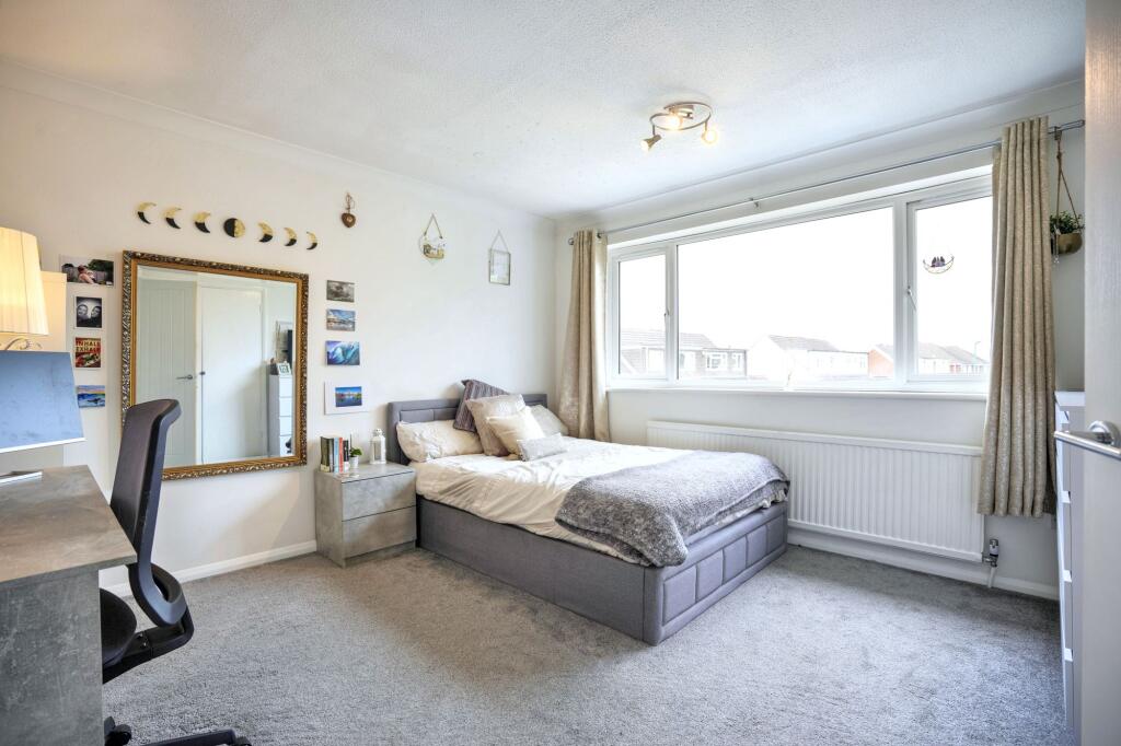
- Bedroom: small
- Bedroom: small
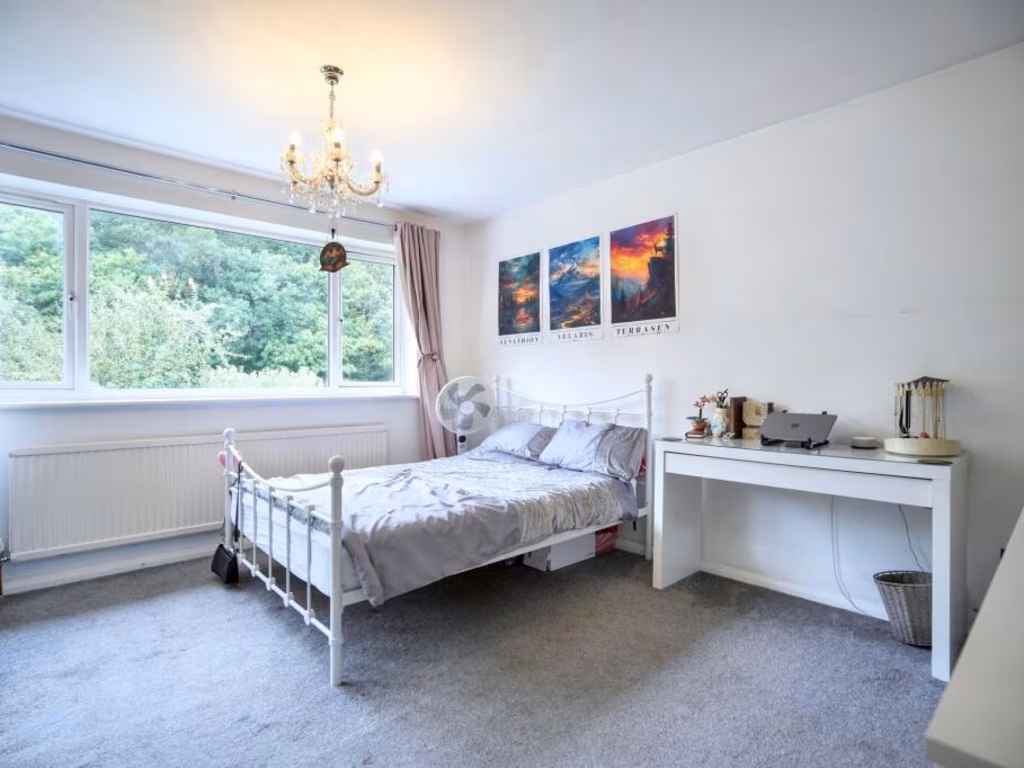
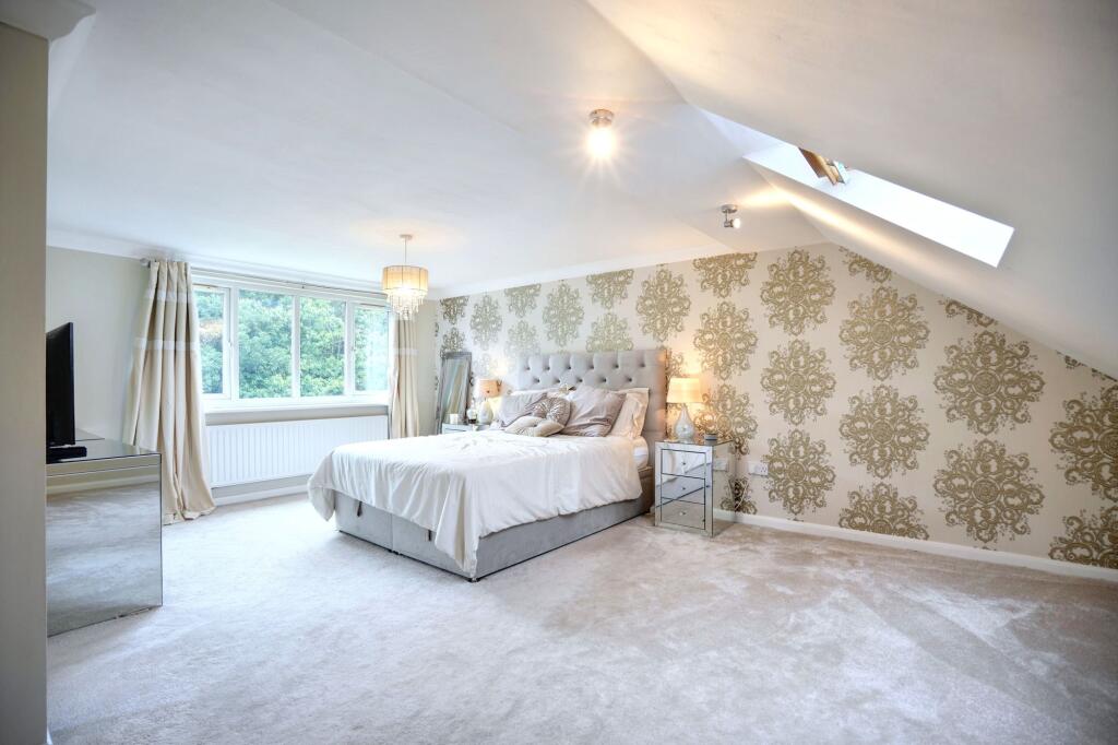
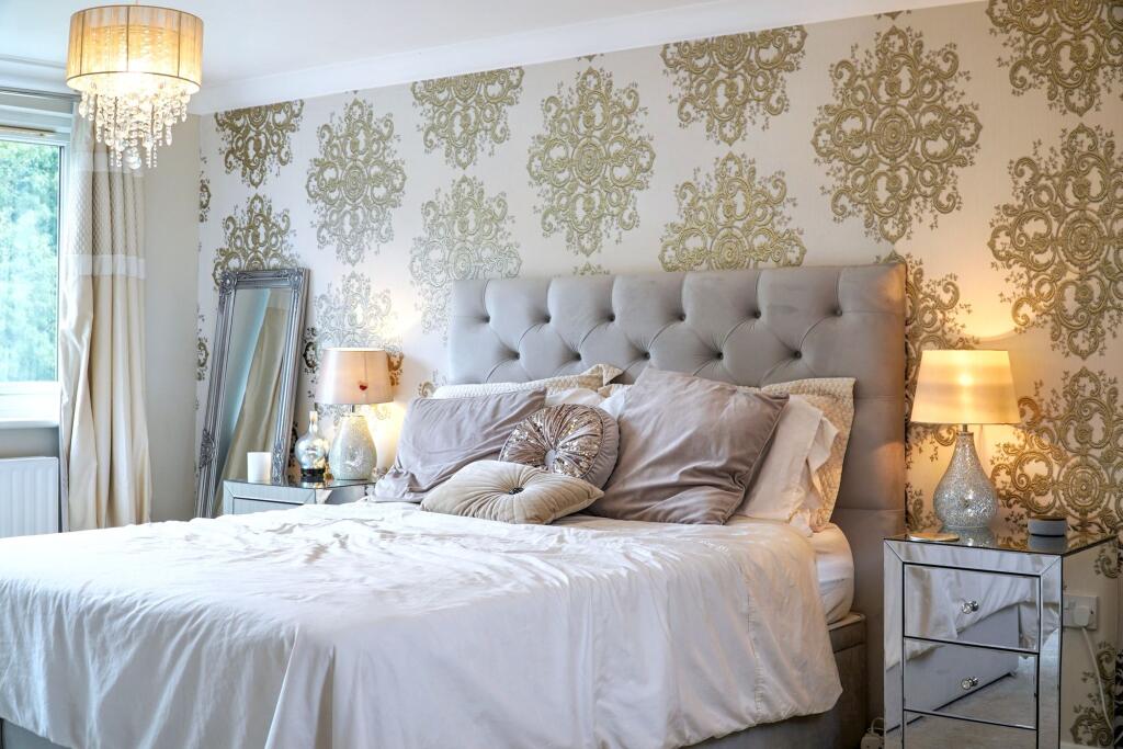
- Bedroom: average
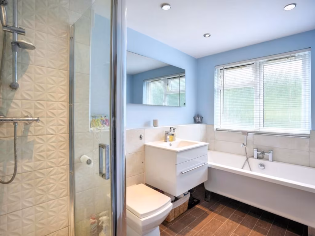
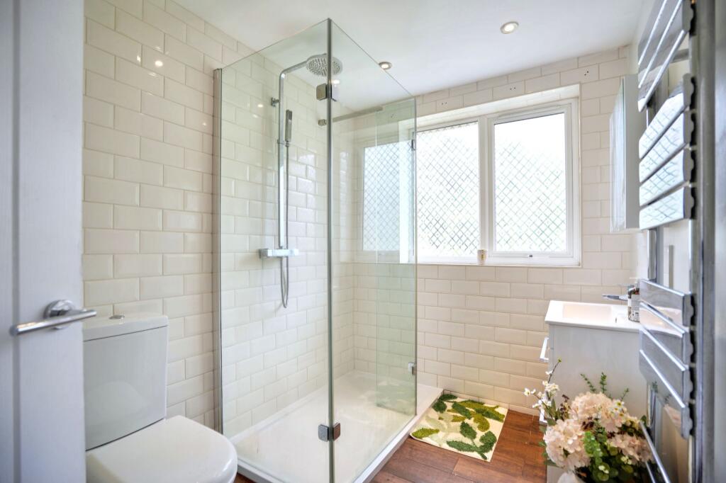
- Bathroom: small
- Landing: small
- Landing: small
- Wardrobe: small
- Bathroom: small
- Bedroom: average
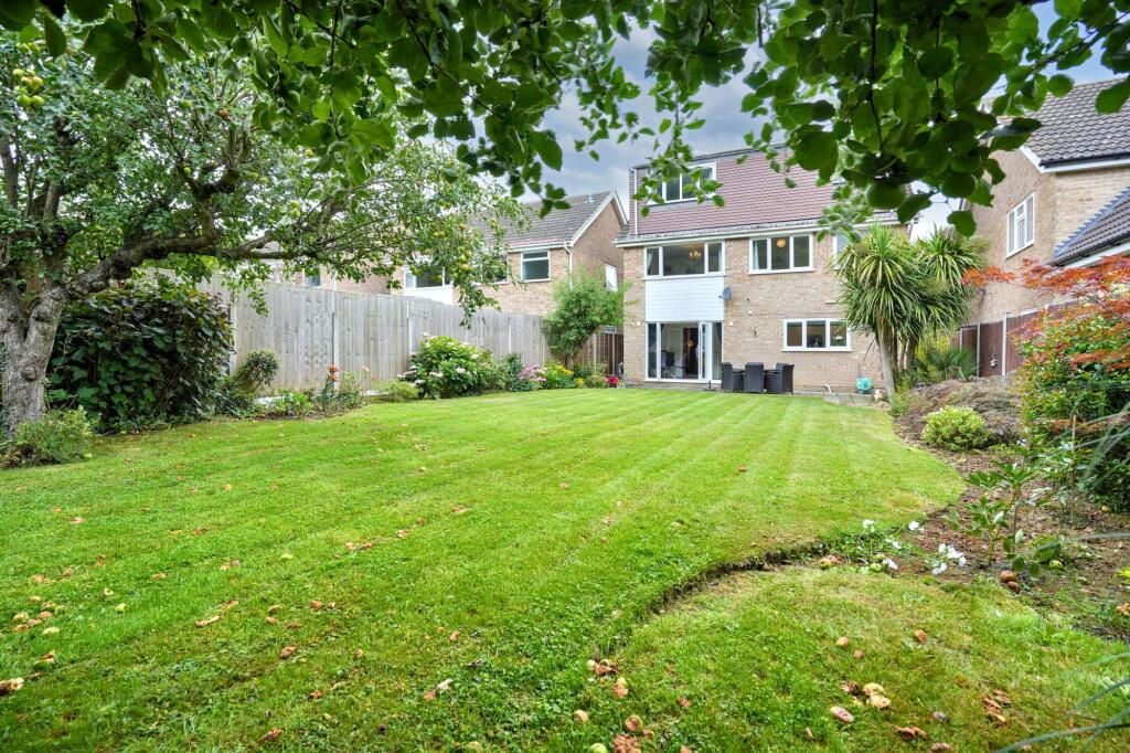
- Bedroom: large
- Summerhouse: small
Textual Property Features
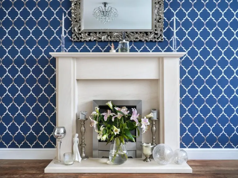
Detected Visual Features
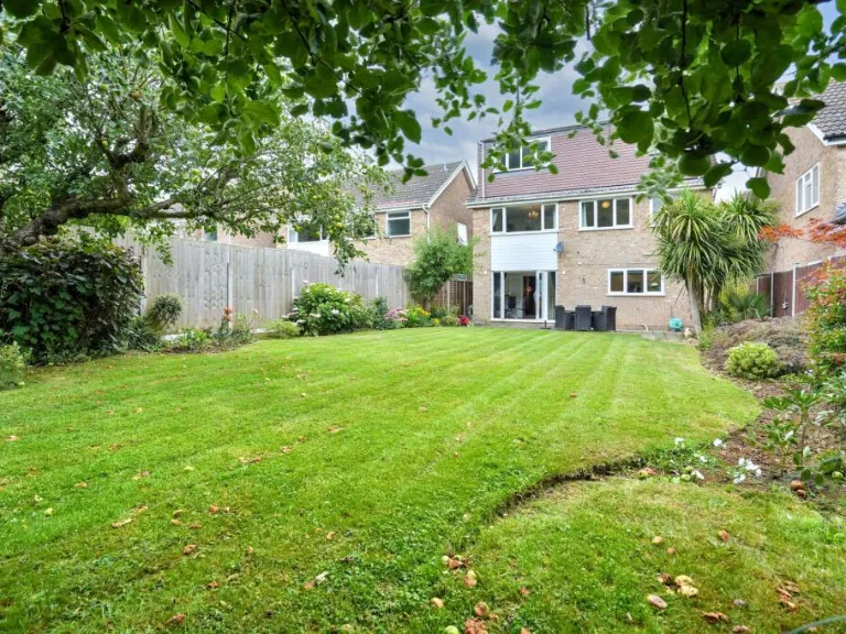
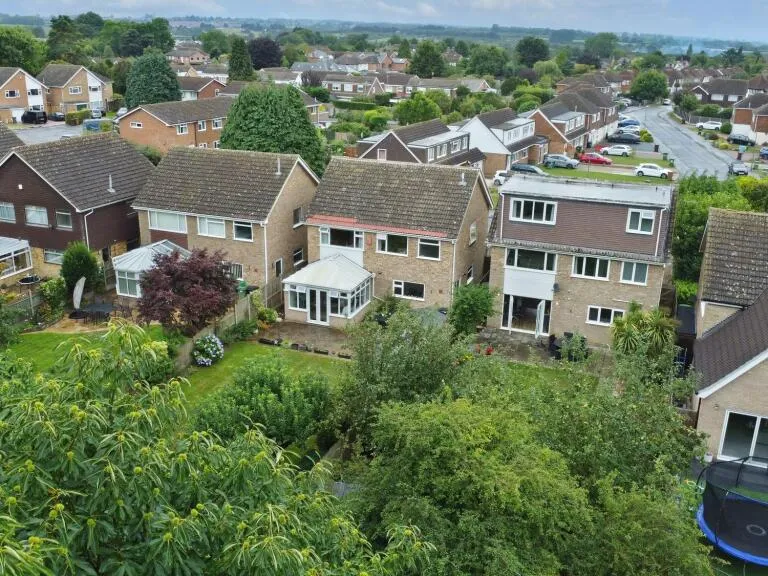
- 1970s
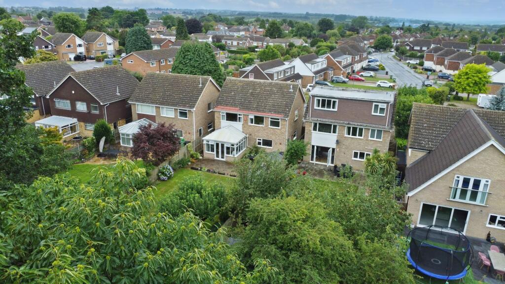
- detached
- two-storey
- garage
- driveway
- brick
- modernization
- family home
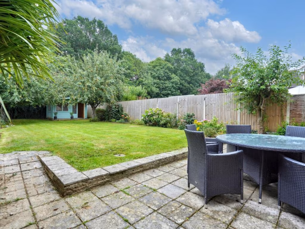
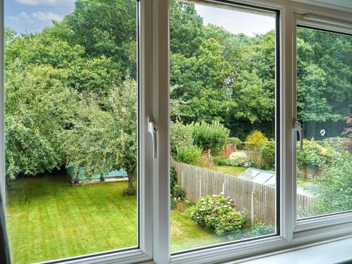
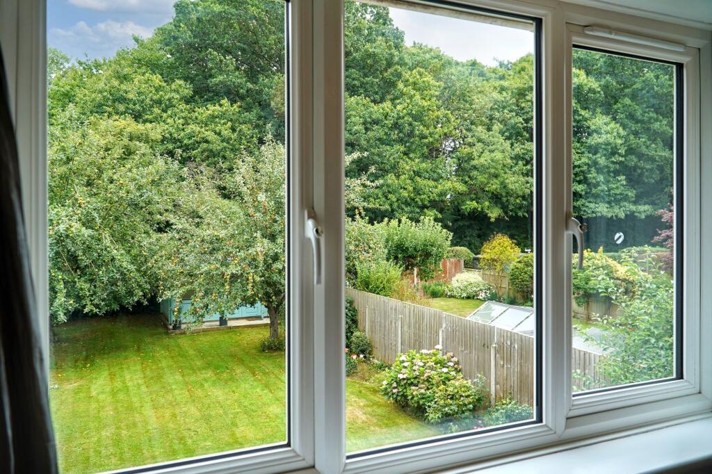
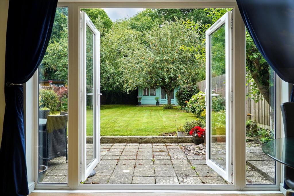
- garden
- window
- garage door
- contemporary
- standard ceiling height
- mid-sized
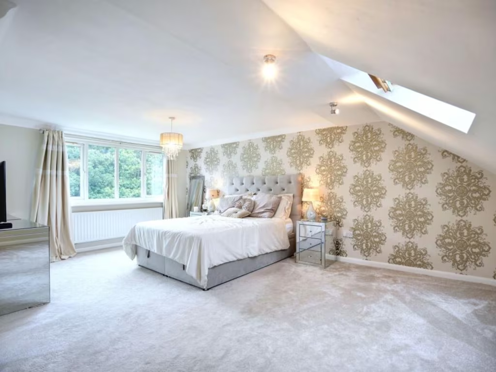
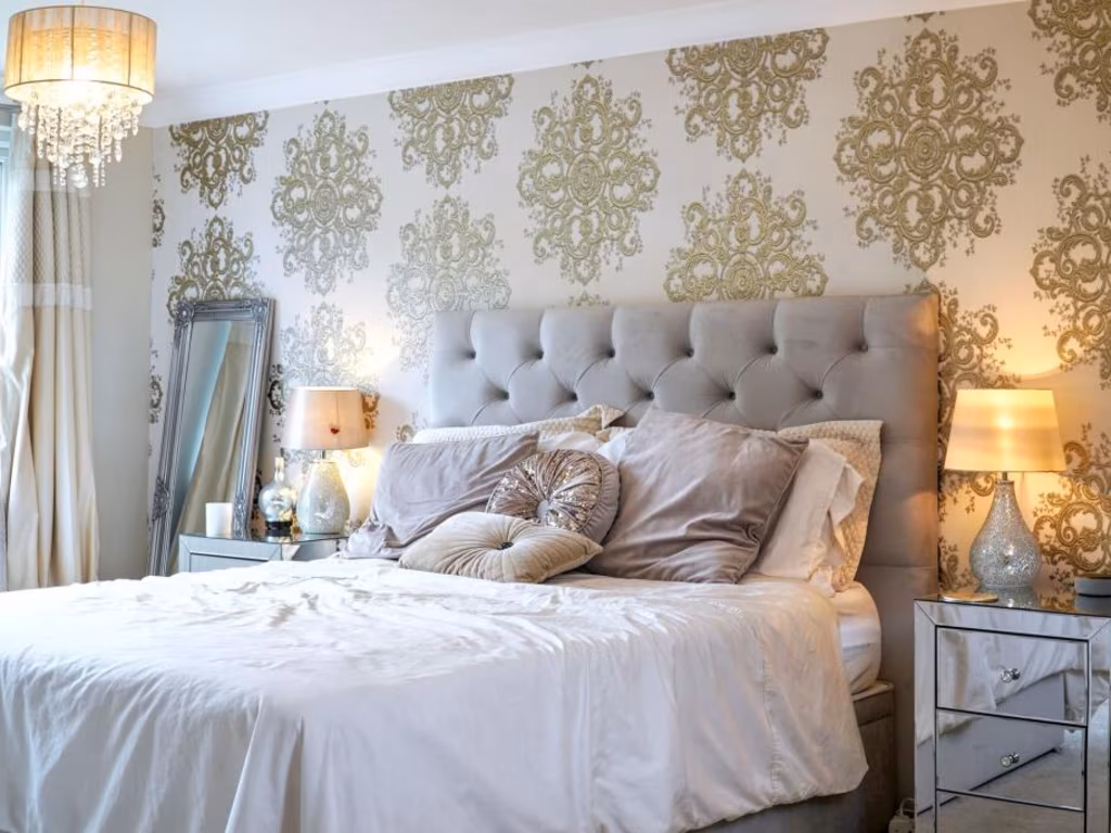
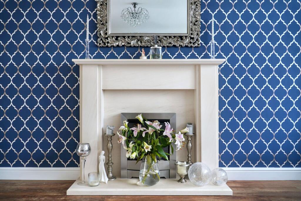
- wallpaper feature wall
- wood flooring
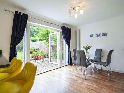
- sliding doors
- modern light fixture
- decorative fireplace
EPC Details
- Fully double glazed
- Cavity wall, filled cavity
- Boiler and radiators, mains gas
- Low energy lighting in 77% of fixed outlets
- Solid, no insulation (assumed)
Nearby Schools
- Molehill Primary Academy
- South Borough Primary School
- St Michael's Church of England Infant School Maidstone
- School of Science and Technology Maidstone
- Maidstone, St John's Church of England Primary School
- MEPA ACADEMY
- Brunswick House Primary School
- Boughton Monchelsea Primary School
- Cornwallis Academy
- Langley Park Primary Academy
- Loose Primary School
- Senacre Wood Primary School
- New Line Learning Academy
- Oaks Primary Academy
- Park Way Primary School
- Maidstone Grammar School
- Valley Invicta Primary School At East Borough
- Coxheath Primary School
- OneSchool Global UK - Maidstone Campus
- The Holy Family Catholic Primary School
- Tree Tops Primary Academy
- Tiger Primary School
- Greenfields Community Primary School
- Archbishop Courtenay Primary School
- Valley Park School
- Invicta Grammar School
- Maidstone, St Michael's Church of England Junior School
Nearest General Shops
- Id: 4215630494
- Tags:
- Addr:
- City: Maidstone
- Housenumber: 1
- Parentstreet: Loose Road
- Postcode: ME15 9QD
- Street: Boughton Parade
- Fhrs:
- Name: Lucky Newsagent
- Shop: newsagent
- Source:
- TagsNormalized:
- Lat: 51.2528231
- Lon: 0.5276828
- FullGeoHash: u107s421rfsy
- PartitionGeoHash: u107
- Images:
- FoodStandards:
- Id: 849229
- FHRSID: 849229
- LocalAuthorityBusinessID: 16/500151/MIXED
- BusinessName: Lucky News
- BusinessType: Retailers - other
- BusinessTypeID: 4613
- AddressLine1: 1 Boughton Parade
- AddressLine2: Loose Road
- AddressLine3: Maidstone
- AddressLine4: Kent
- PostCode: ME15 9QD
- RatingValue: 4
- RatingKey: fhrs_4_en-GB
- RatingDate: 2016-02-17
- LocalAuthorityCode: 185
- LocalAuthorityName: Maidstone
- LocalAuthorityWebSite: http://www.maidstone.gov.uk/
- LocalAuthorityEmailAddress: EHAdmin@midkent.gov.uk
- Scores:
- Hygiene: 10
- Structural: 0
- ConfidenceInManagement: 5
- NewRatingPending: false
- Geocode:
- Longitude: 0.52770400000000
- Latitude: 51.25269800000000
- Distance: 749.2
,- Id: 4215646489
- Tags:
- Name: Doo-Das Hair
- Shop: hairdresser
- TagsNormalized:
- Lat: 51.2526508
- Lon: 0.5276267
- FullGeoHash: u107s420qddf
- PartitionGeoHash: u107
- Images:
- FoodStandards: null
- Distance: 732
,- Id: 6733529789
- Tags:
- Name: The Dolly Tub
- Shop: laundry
- TagsNormalized:
- Lat: 51.2525936
- Lon: 0.5276147
- FullGeoHash: u107s40pyrfj
- PartitionGeoHash: u107
- Images:
- FoodStandards: null
- Distance: 726.1
}
Nearest Grocery shops
- Id: 4224113392
- Tags:
- Name: Southern News & General Stores
- Shop: convenience
- TagsNormalized:
- Lat: 51.251833
- Lon: 0.5384793
- FullGeoHash: u107s605e6pk
- PartitionGeoHash: u107
- Images:
- FoodStandards: null
- Distance: 812.7
,- Id: 4224064891
- Tags:
- Brand: Best-one
- Brand:wikidata: Q4896532
- Name: Best-one
- Shop: convenience
- TagsNormalized:
- Lat: 51.2517233
- Lon: 0.5382681
- FullGeoHash: u107s4pfyt9y
- PartitionGeoHash: u107
- Images:
- FoodStandards: null
- Distance: 793.8
,- Id: 695718254
- Tags:
- Addr:
- City: Maidstone
- Housenumber: 411
- Postcode: ME15 9QB
- Street: Loose Road
- Brand: Sainsbury's Local
- Brand:wikidata: Q13218434
- Brand:wikipedia: en:Sainsbury's Local
- Building: yes
- Fhrs:
- Name: Sainsbury's Local
- Opening_hours: 06:00-23:00
- Payment:
- Cash: yes
- Credit_cards: yes
- Debit_cards: yes
- Shop: convenience
- Source:
- Website: https://stores.sainsburys.co.uk/4360/maidstone-loose-road-local
- TagsNormalized:
- sainsburys
- sainsburys local
- convenience
- shop
- Lat: 51.2530896
- Lon: 0.5278158
- FullGeoHash: u107s426furu
- PartitionGeoHash: u107
- Images:
- FoodStandards:
- Id: 1026503
- FHRSID: 1026503
- LocalAuthorityBusinessID: 18/500005/MIXED
- BusinessName: Sainsbury's
- BusinessType: Retailers - supermarkets/hypermarkets
- BusinessTypeID: 7840
- AddressLine1: 411 Loose Road
- AddressLine2: Maidstone
- AddressLine3: Kent
- AddressLine4: null
- PostCode: ME15 9QB
- RatingValue: 5
- RatingKey: fhrs_5_en-GB
- RatingDate: 2020-01-13
- LocalAuthorityCode: 185
- LocalAuthorityName: Maidstone
- LocalAuthorityWebSite: http://www.maidstone.gov.uk/
- LocalAuthorityEmailAddress: EHAdmin@midkent.gov.uk
- Scores:
- Hygiene: 5
- Structural: 0
- ConfidenceInManagement: 0
- NewRatingPending: false
- Geocode:
- Longitude: 0.52901899814606
- Latitude: 51.25420761108400
- Distance: 775.2
}
Nearest Supermarkets
- Id: 880687308
- Tags:
- Brand: Tesco Express
- Brand:wikidata: Q98456772
- Brand:wikipedia: en:Tesco
- Building: yes
- Contact:
- Website: https://www.tesco.com/store-locator/maidstone/2-loose-rd
- Name: Tesco Express
- Shop: supermarket
- TagsNormalized:
- tesco
- tesco express
- supermarket
- shop
- Lat: 51.2661039
- Lon: 0.5264996
- FullGeoHash: u107euxqsq6t
- PartitionGeoHash: u107
- Images:
- FoodStandards: null
- Distance: 2214.9
,- Id: 406187449
- Tags:
- Addr:
- City: Tovil
- Postcode: ME15 6RQ
- Street: Farleigh Hill
- Alt_name: Tesco Maidstone Tovil Superstore
- Brand: Tesco
- Brand:wikidata: Q487494
- Brand:wikipedia: en:Tesco
- Building: yes
- Contact:
- Website: https://www.tesco.com/store-locator/maidstone/farleigh-hill
- Name: Tesco
- Opening_hours: Mo-Sa 06:00-22:00 Su 10:00-16:00
- Shop: supermarket
- TagsNormalized:
- Lat: 51.26142
- Lon: 0.5103263
- FullGeoHash: u107eege7mqc
- PartitionGeoHash: u107
- Images:
- FoodStandards: null
- Distance: 2195.7
,- Id: 55384078
- Tags:
- Addr:
- City: Maidstone
- Postcode: ME15 9NN
- Street: Sutton Road
- Alt_name: Morrisons Maidstone
- Brand: Morrisons
- Brand:wikidata: Q922344
- Brand:wikipedia: en:Morrisons
- Building: yes
- Contact:
- Website: https://my.morrisons.com/storefinder/315
- Dispensing: yes
- Name: Morrisons
- Opening_hours: Mo-Sa 07:00-23:00; Su 10:00-16:00
- Shop: supermarket
- TagsNormalized:
- Lat: 51.2463471
- Lon: 0.5471721
- FullGeoHash: u107s3n7w53p
- PartitionGeoHash: u107
- Images:
- FoodStandards: null
- Distance: 1144
}
Nearest Religious buildings
- Id: 472166382
- Tags:
- Amenity: place_of_worship
- Building: church
- Denomination: anglican
- Name: St Martin's Church
- Religion: christian
- Wikidata: Q105092621
- TagsNormalized:
- place of worship
- church
- anglican
- martins
- christian
- Lat: 51.2531032
- Lon: 0.5468057
- FullGeoHash: u107s6q4vqzv
- PartitionGeoHash: u107
- Images:
- FoodStandards: null
- Distance: 1346.4
,- Id: 865407901
- Tags:
- Amenity: place_of_worship
- Building: church
- Denomination: anglican
- Name: All Saints
- Religion: christian
- Wikidata: Q17545304
- TagsNormalized:
- place of worship
- church
- anglican
- christian
- Lat: 51.2408545
- Lon: 0.5159463
- FullGeoHash: u107e8pew7t7
- PartitionGeoHash: u107
- Images:
- FoodStandards: null
- Distance: 1197.9
,- Id: 766176525
- Tags:
- Amenity: place_of_worship
- Building: church
- Denomination: evangelical
- Name: The Beacon
- Religion: christian
- TagsNormalized:
- place of worship
- church
- evangelical
- christian
- Lat: 51.2525397
- Lon: 0.5444272
- FullGeoHash: u107s6hrwjfk
- PartitionGeoHash: u107
- Images:
- FoodStandards: null
- Distance: 1174.7
}
Nearest Medical buildings
- Id: 543966461
- Tags:
- Addr:
- City: Maidstone
- Housename: Bob Prowse Health Club
- Housenumber: 3
- Postcode: ME15 6AZ
- Street: Armstrong Road
- Building: yes
- Leisure: fitness_centre
- Name: Bob Prowse Health Club
- Opening_hours: Mo-Fr 06:30-22:00, Sa-Su 09:00-17:00
- Sport: weightlifting;running
- TagsNormalized:
- fitness
- fitness centre
- leisure
- health
- club
- running
- sports
- Lat: 51.2614249
- Lon: 0.5267639
- FullGeoHash: u107egze6qpw
- PartitionGeoHash: u107
- Images:
- FoodStandards: null
- Distance: 1697.5
,- Id: 121218753
- Tags:
- Amenity: hospital
- Healthcare: hospital
- TagsNormalized:
- Lat: 51.2556929
- Lon: 0.5438074
- FullGeoHash: u107s6gfp9sj
- PartitionGeoHash: u107
- Images:
- FoodStandards: null
- Distance: 1379.9
,- Id: 4215581694
- Tags:
- Amenity: doctors
- Name: Loose Medical Centre
- Operator: The Mote Medical Practice
- Wheelchair: yes
- TagsNormalized:
- Lat: 51.252602
- Lon: 0.5284345
- FullGeoHash: u107s42b13mr
- PartitionGeoHash: u107
- Images:
- FoodStandards: null
- Distance: 712.1
,- Id: 4215578697
- Tags:
- Amenity: pharmacy
- Dispensing: yes
- Healthcare: pharmacy
- Level: 0
- Name: Paydens Pharmacy
- Wheelchair: yes
- TagsNormalized:
- Lat: 51.252418
- Lon: 0.5276034
- FullGeoHash: u107s40nyp1w
- PartitionGeoHash: u107
- Images:
- FoodStandards: null
- Distance: 707.8
}
Nearest Leisure Facilities
- Id: 1026518389
- Tags:
- TagsNormalized:
- Lat: 51.2493669
- Lon: 0.5345661
- FullGeoHash: u107s1tm0q3m
- PartitionGeoHash: u107
- Images:
- FoodStandards: null
- Distance: 427.4
,- Id: 1026518391
- Tags:
- TagsNormalized:
- Lat: 51.249889
- Lon: 0.5327811
- FullGeoHash: u107s1gbnxy2
- PartitionGeoHash: u107
- Images:
- FoodStandards: null
- Distance: 417.2
,- Id: 951914866
- Tags:
- Access: private
- Leisure: swimming_pool
- TagsNormalized:
- swimming
- swimming pool
- pool
- leisure
- Lat: 51.2474121
- Lon: 0.5258084
- FullGeoHash: u107ecqcu4p0
- PartitionGeoHash: u107
- Images:
- FoodStandards: null
- Distance: 362.3
,- Id: 1026518386
- Tags:
- TagsNormalized:
- Lat: 51.2484762
- Lon: 0.5335455
- FullGeoHash: u107s1s8082k
- PartitionGeoHash: u107
- Images:
- FoodStandards: null
- Distance: 305.7
,- Id: 951914863
- Tags:
- TagsNormalized:
- Lat: 51.247944
- Lon: 0.5330253
- FullGeoHash: u107s1khumhm
- PartitionGeoHash: u107
- Images:
- FoodStandards: null
- Distance: 237.3
}
Nearest Tourist attractions
- Id: 311174402
- Tags:
- Addr:
- Name: Roslin Villa
- Source: photo
- Tourism: guest_house
- TagsNormalized:
- Lat: 51.2686686
- Lon: 0.5062278
- FullGeoHash: u107et0teuwb
- PartitionGeoHash: u107
- Images:
- FoodStandards: null
- Distance: 3010.1
,- Id: 907788417
- Tags:
- Building: yes
- Museum: history
- Name: Museum of Carriages
- Tourism: museum
- Wikidata: Q17964487
- TagsNormalized:
- Lat: 51.2712896
- Lon: 0.5221334
- FullGeoHash: u107evshyt4g
- PartitionGeoHash: u107
- Images:
- FoodStandards: null
- Distance: 2835.7
,- Id: 670061254
- Tags:
- Access: private
- Addr:
- City: Maidstone
- Country: GB
- Postcode: ME15 0QG
- Street: Stockett Lane
- Caravans: no
- Email: warden@hamletwood.org.uk
- Name: Hamlet Wood Scout Campsite
- Phone: +44 1622 744226
- Scout: yes
- Shower: yes
- Tents: yes
- Tourism: camp_site
- Website: https://www.hamletwood.org.uk/
- TagsNormalized:
- Lat: 51.243981
- Lon: 0.499183
- FullGeoHash: u107e2emzf3v
- PartitionGeoHash: u107
- Images:
- FoodStandards: null
- Distance: 2212.2
}
Nearest Train stations
- Id: 6692612517
- Tags:
- Addr:
- Postcode: ME14 4PH
- Street: Ware Street
- Name: Bearsted
- Naptan:
- Network: National Rail
- Public_transport: station
- Railway: station
- Ref:
- Wikidata: Q2513832
- Wikipedia: en:Bearsted railway station
- TagsNormalized:
- Lat: 51.2759153
- Lon: 0.577672
- FullGeoHash: u107tnkxuerm
- PartitionGeoHash: u107
- Images:
- FoodStandards: null
- Distance: 4633
,- Id: 6688355481
- Tags:
- Name: Maidstone Barracks
- Naptan:
- Network: National Rail
- Postal_code: ME16 0SQ
- Public_transport: station
- Railway: station
- Ref:
- Wikidata: Q2913119
- Wikipedia: en:Maidstone Barracks railway station
- TagsNormalized:
- Lat: 51.2770433
- Lon: 0.5141731
- FullGeoHash: u107ewwqmjem
- PartitionGeoHash: u107
- Images:
- FoodStandards: null
- Distance: 3601
,- Id: 6692612534
- Tags:
- Name: Maidstone East
- Naptan:
- Network: National Rail
- Postal_code: ME14 1QN
- Public_transport: station
- Railway: station
- Ref:
- Wikidata: Q952299
- Wikipedia: en:Maidstone East railway station
- TagsNormalized:
- Lat: 51.2776262
- Lon: 0.5199007
- FullGeoHash: u107eyf9fd64
- PartitionGeoHash: u107
- Images:
- FoodStandards: null
- Distance: 3557.2
,- Id: 6688355479
- Tags:
- Name: East Farleigh
- Naptan:
- Network: National Rail
- Public_transport: station
- Railway: station
- Ref:
- Source: NPE
- Train: yes
- Wikidata: Q3065808
- Wikipedia: en:East Farleigh railway station
- TagsNormalized:
- Lat: 51.2552513
- Lon: 0.4844783
- FullGeoHash: u107e48z3pm5
- PartitionGeoHash: u107
- Images:
- FoodStandards: null
- Distance: 3367.8
,- Id: 6688355480
- Tags:
- Name: Maidstone West
- Naptan:
- Network: National Rail
- Postal_code: ME16 8RJ
- Public_transport: station
- Railway: station
- Ref:
- Source: NPE
- Wikipedia: en:Maidstone West railway station
- TagsNormalized:
- Lat: 51.2703088
- Lon: 0.5157564
- FullGeoHash: u107etrx1yrb
- PartitionGeoHash: u107
- Images:
- FoodStandards: null
- Distance: 2859.5
}
Nearest Hotels
- Id: 907770034
- Tags:
- Brand: Premier Inn
- Brand:wikidata: Q2108626
- Brand:wikipedia: en:Premier Inn
- Building: yes
- Internet_access: yes
- Internet_access:fee: customers
- Internet_access:operator: Virgin Media
- Internet_access:ssid: Premier Inn Free Wi-Fi
- Name: Premier Inn Maidstone Town Centre
- Tourism: hotel
- TagsNormalized:
- Lat: 51.2716355
- Lon: 0.5138912
- FullGeoHash: u107etwnyt95
- PartitionGeoHash: u107
- Images:
- FoodStandards: null
- Distance: 3044.9
,- Id: 311174410
- Tags:
- Name: Grange Park Hotel
- Source: photo
- Tourism: hotel
- TagsNormalized:
- Lat: 51.2688304
- Lon: 0.5061247
- FullGeoHash: u107et0w9d9v
- PartitionGeoHash: u107
- Images:
- FoodStandards: null
- Distance: 3029
,- Id: 255074827
- Tags:
- Addr:
- Name: Stone Court Hotel
- Tourism: hotel
- TagsNormalized:
- Lat: 51.2715769
- Lon: 0.5247389
- FullGeoHash: u107evwne69t
- PartitionGeoHash: u107
- Images:
- FoodStandards: null
- Distance: 2834.6
}
Tags
- 1970s
- detached
- two-storey
- garage
- driveway
- brick
- modernization
- family home
- garden
- window
- garage door
- contemporary
- standard ceiling height
- mid-sized
- wallpaper feature wall
- wood flooring
- sliding doors
- modern light fixture
- decorative fireplace
Local Market Stats
- Average Price/sqft: £359
- Avg Income: £51900
- Rental Yield: 4.3%
- Social Housing: 11%
- Planning Success Rate: 81%
AirBnB Data
- 1km average: £136/night
- Listings in 1km: 2
Similar Properties
 4 bedroom semi-detached house for sale in Ellingham Leas, Maidstone, ME15 9AQ, ME15 — £450,000 • 4 bed • 1 bath • 1735 ft²
 4 bedroom detached house for sale in Sutton Road, Maidstone, Kent, ME15 — £450,000 • 4 bed • 3 bath • 1357 ft²
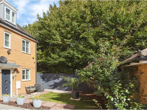 3 bedroom semi-detached house for sale in Roman Way, Maidstone, ME17 — £385,000 • 3 bed • 2 bath • 1337 ft²
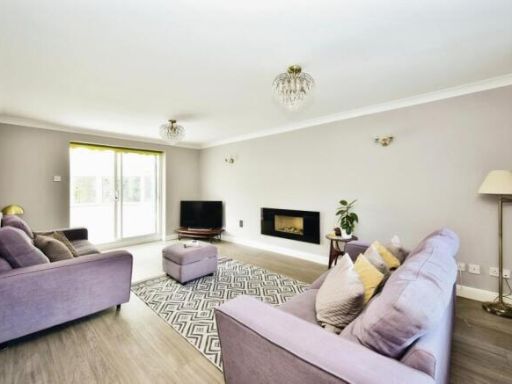 5 bedroom detached house for sale in Yeoman Park, Bearsted, Maidstone, ME15 — £650,000 • 5 bed • 2 bath • 1343 ft²
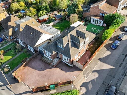 6 bedroom detached house for sale in Snodhurst Avenue, Horsted, Chatham, ME5 0TB, ME5 — £600,000 • 6 bed • 4 bath • 2024 ft²
 5 bedroom detached house for sale in Heathfield Road, Maidstone, ME14 — £845,000 • 5 bed • 3 bath • 2300 ft²
Meta
- {
"@context": "https://schema.org",
"@type": "Residence",
"name": "5 bedroom detached house for sale in Norrington Road, Loose…",
"description": "",
"url": "https://propertypiper.co.uk/property/e057ceb8-3902-4fcc-b758-451b56005793",
"image": "https://image-a.propertypiper.co.uk/5ce3249a-c79c-41e1-b417-0458451dfc0e-1024.jpeg",
"address": {
"@type": "PostalAddress",
"streetAddress": "47 NORRINGTON ROAD MAIDSTONE",
"postalCode": "ME15 9XD",
"addressLocality": "Maidstone",
"addressRegion": "Maidstone and The Weald",
"addressCountry": "England"
},
"geo": {
"@type": "GeoCoordinates",
"latitude": 51.246362409328064,
"longitude": 0.5307361766809336
},
"numberOfRooms": 5,
"numberOfBathroomsTotal": 2,
"floorSize": {
"@type": "QuantitativeValue",
"value": 1846,
"unitCode": "FTK"
},
"offers": {
"@type": "Offer",
"price": 600000,
"priceCurrency": "GBP",
"availability": "https://schema.org/InStock"
},
"additionalProperty": [
{
"@type": "PropertyValue",
"name": "Feature",
"value": "1970s"
},
{
"@type": "PropertyValue",
"name": "Feature",
"value": "detached"
},
{
"@type": "PropertyValue",
"name": "Feature",
"value": "two-storey"
},
{
"@type": "PropertyValue",
"name": "Feature",
"value": "garage"
},
{
"@type": "PropertyValue",
"name": "Feature",
"value": "driveway"
},
{
"@type": "PropertyValue",
"name": "Feature",
"value": "brick"
},
{
"@type": "PropertyValue",
"name": "Feature",
"value": "modernization"
},
{
"@type": "PropertyValue",
"name": "Feature",
"value": "family home"
},
{
"@type": "PropertyValue",
"name": "Feature",
"value": "garden"
},
{
"@type": "PropertyValue",
"name": "Feature",
"value": "window"
},
{
"@type": "PropertyValue",
"name": "Feature",
"value": "garage door"
},
{
"@type": "PropertyValue",
"name": "Feature",
"value": "contemporary"
},
{
"@type": "PropertyValue",
"name": "Feature",
"value": "standard ceiling height"
},
{
"@type": "PropertyValue",
"name": "Feature",
"value": "mid-sized"
},
{
"@type": "PropertyValue",
"name": "Feature",
"value": "wallpaper feature wall"
},
{
"@type": "PropertyValue",
"name": "Feature",
"value": "wood flooring"
},
{
"@type": "PropertyValue",
"name": "Feature",
"value": "sliding doors"
},
{
"@type": "PropertyValue",
"name": "Feature",
"value": "modern light fixture"
},
{
"@type": "PropertyValue",
"name": "Feature",
"value": "decorative fireplace"
}
]
}
High Res Floorplan Images
Compatible Floorplan Images
FloorplanImages Thumbnail