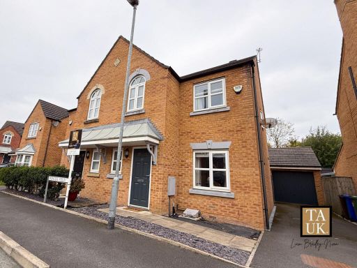
M34 5FW - 3 bedroom semidetached house for sale in Princess Fold, Man…
View on Property Piper
3 bedroom semi-detached house for sale in Princess Fold, Manchester, M34
Property Details
- Price: £320000
- Bedrooms: 3
- Bathrooms: 2
- Property Type: undefined
- Property SubType: undefined
Image Descriptions
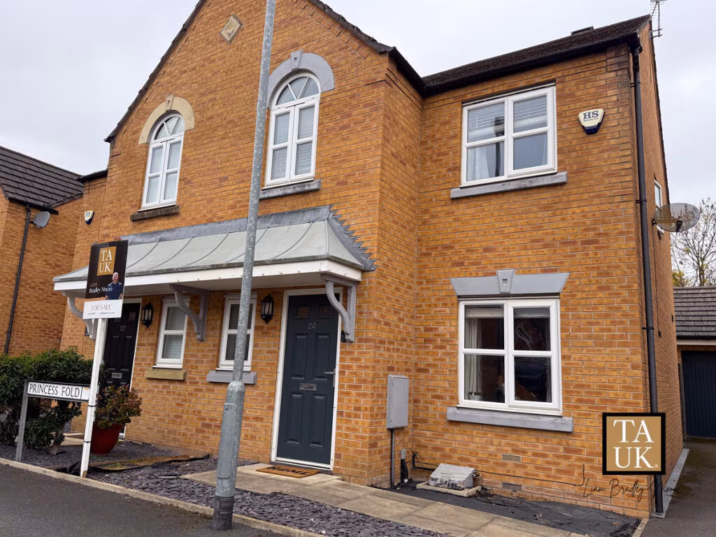
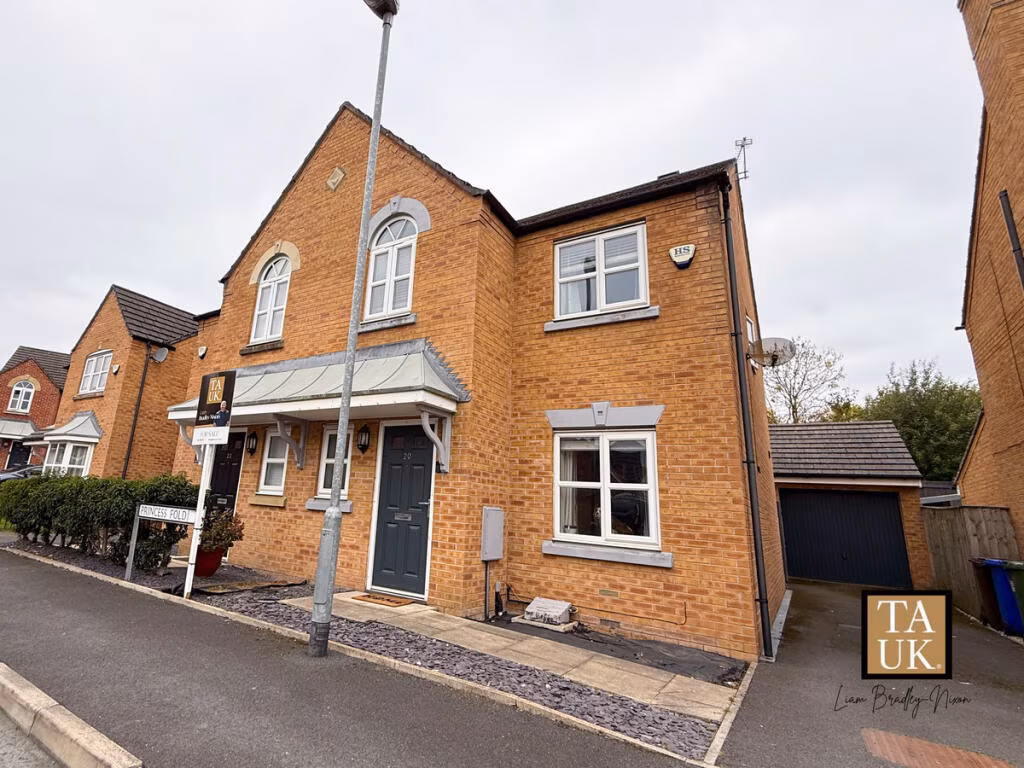
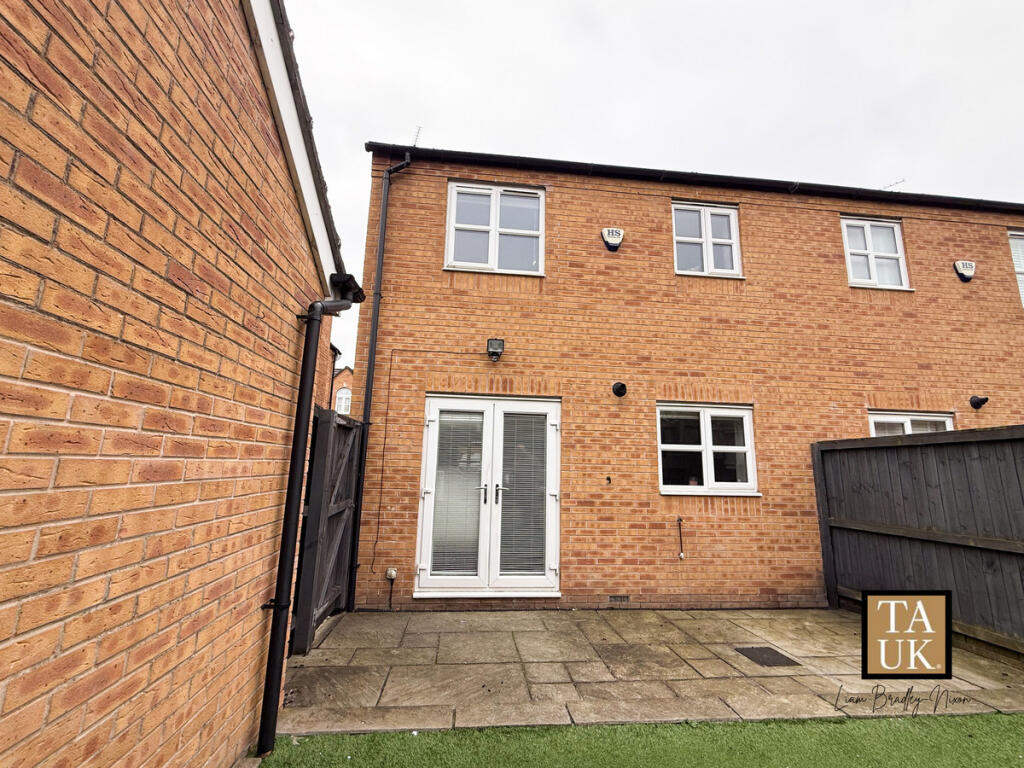
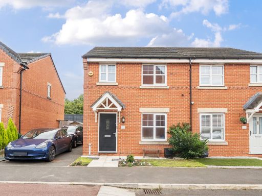
- residential property contemporary townhome
- semi-detached house modern
Floorplan Description
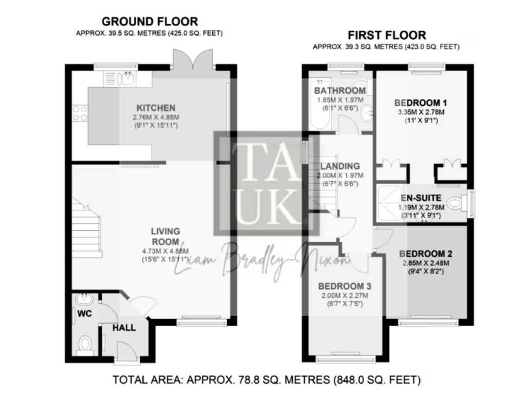
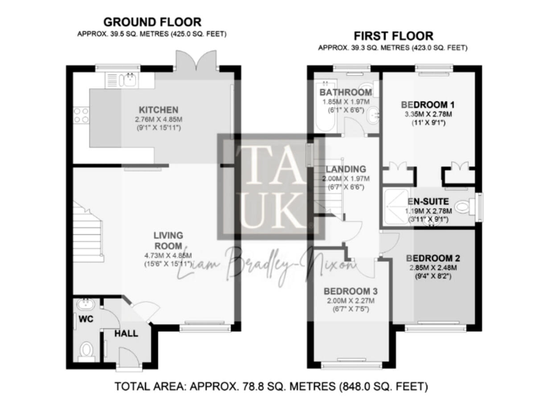
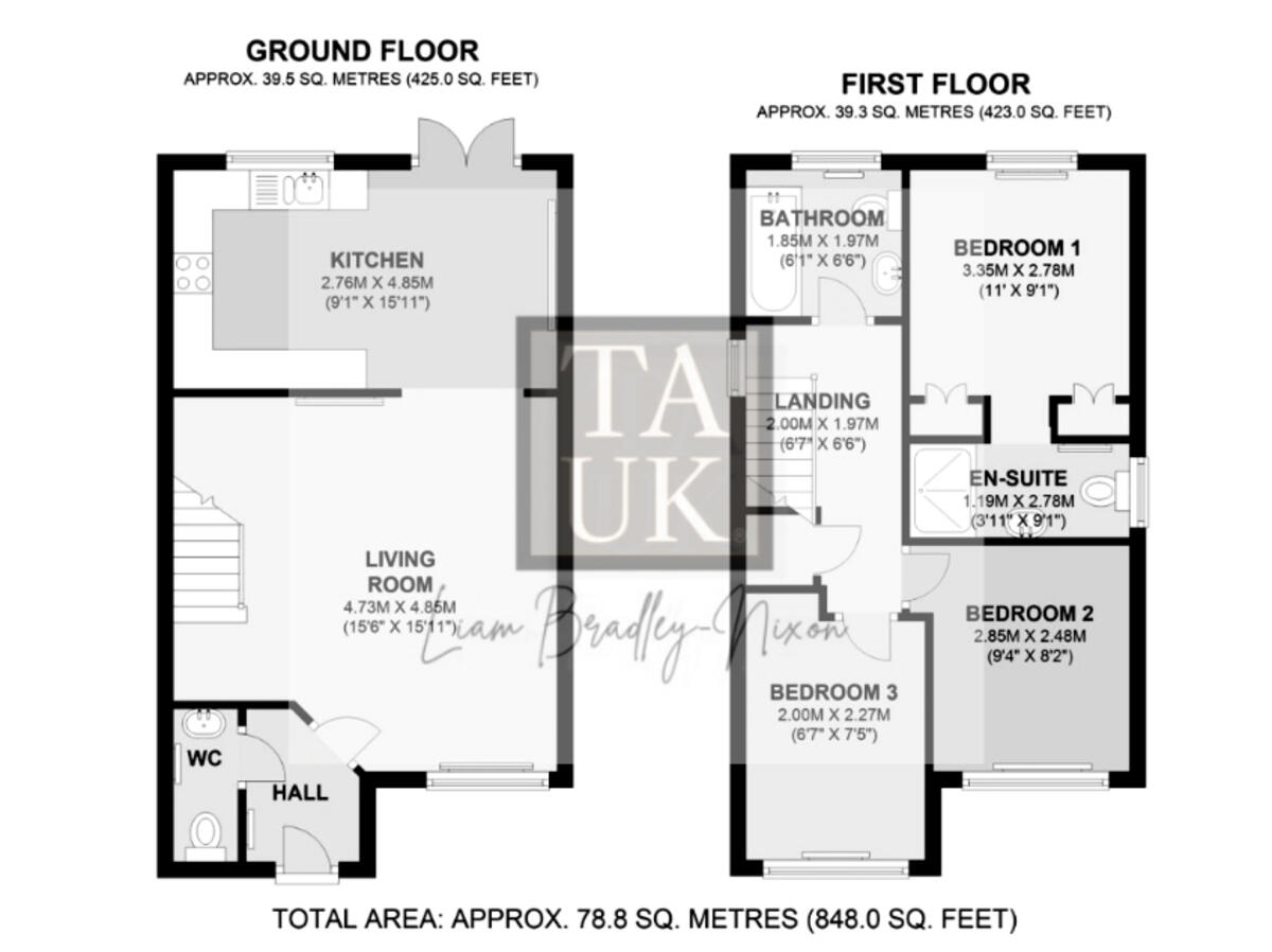
- Two-storey property with kitchen, living room and WC on ground floor; three bedrooms and bathrooms on first floor.
Rooms
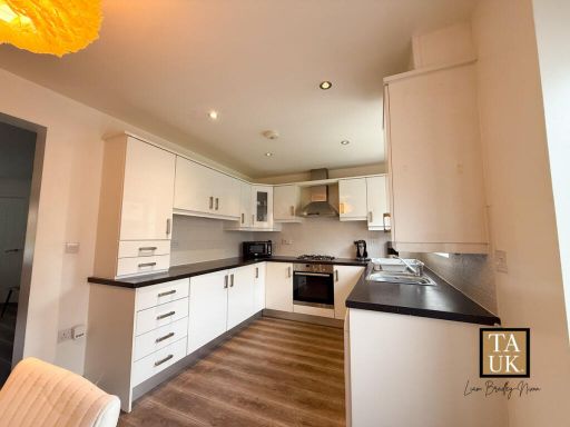
- KITCHEN:
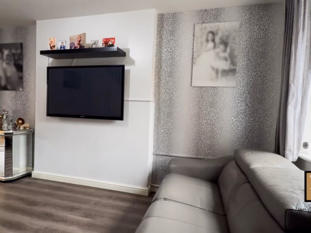
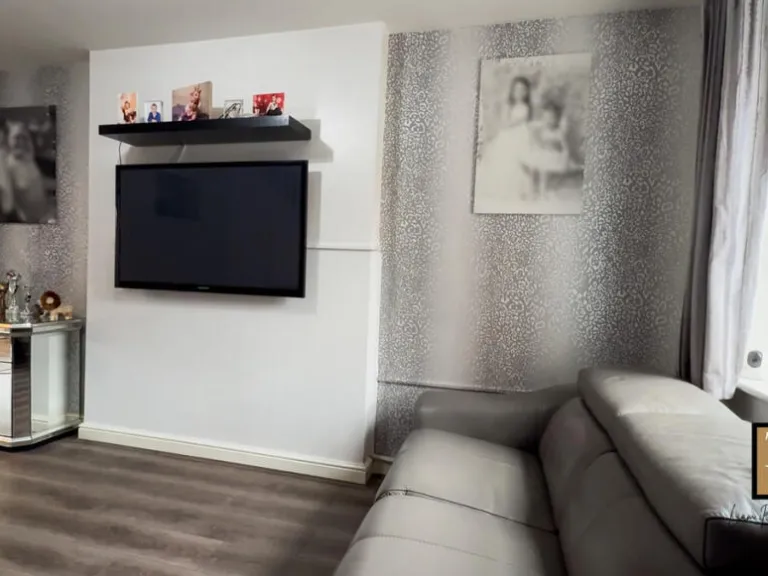
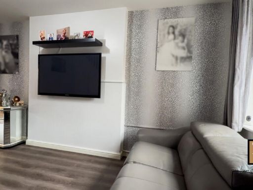
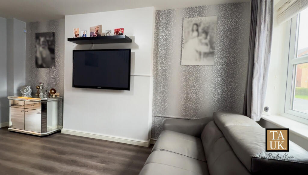
- LIVING ROOM:
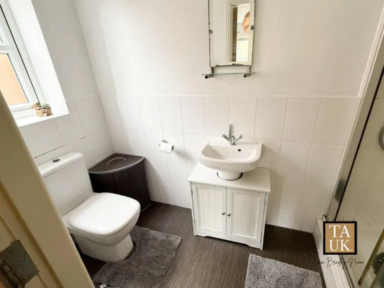
- WC:
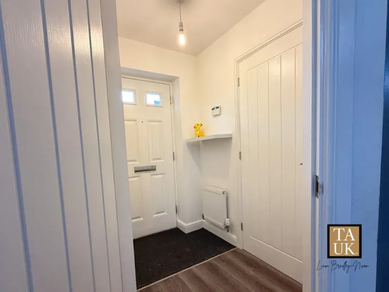
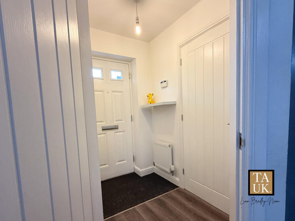
- HALL:
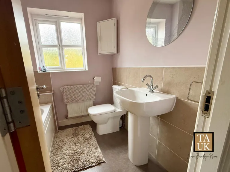
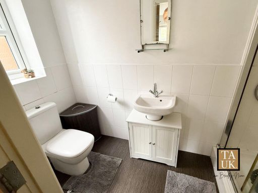
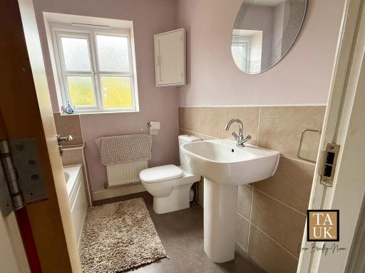
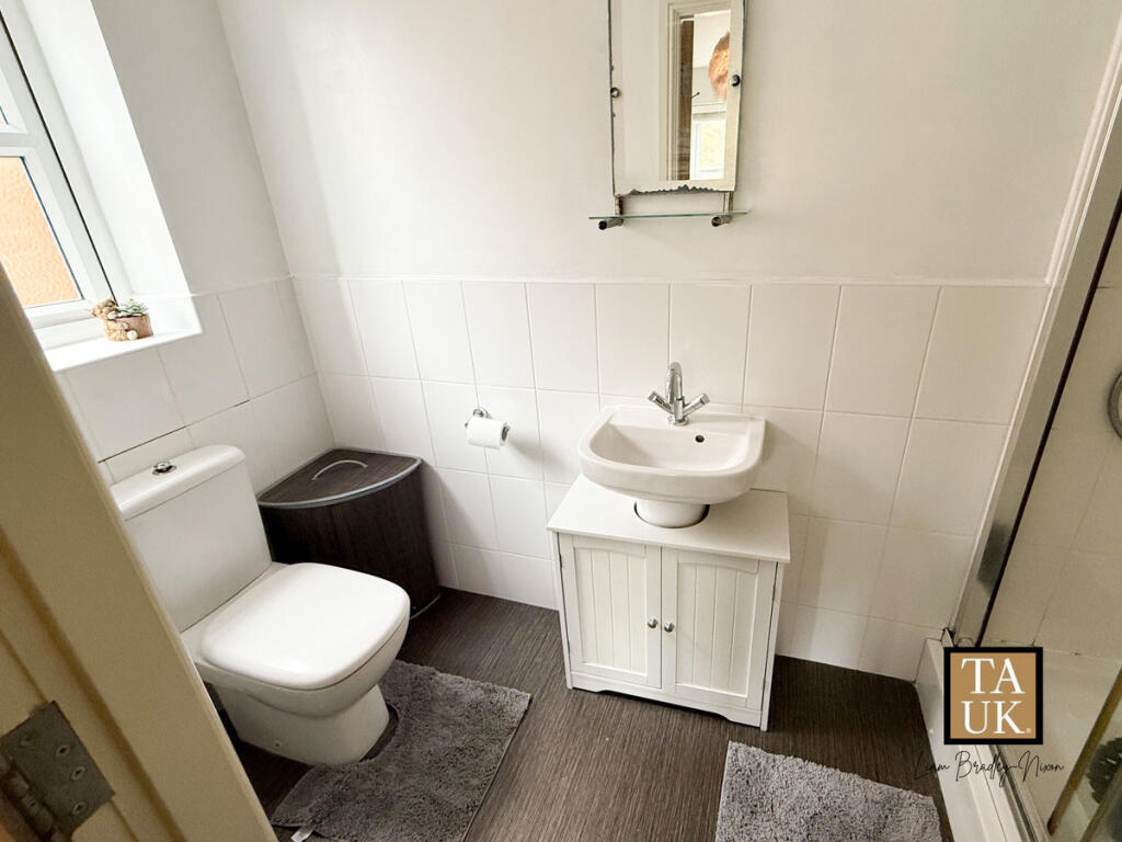
- BATHROOM:
- LANDING:
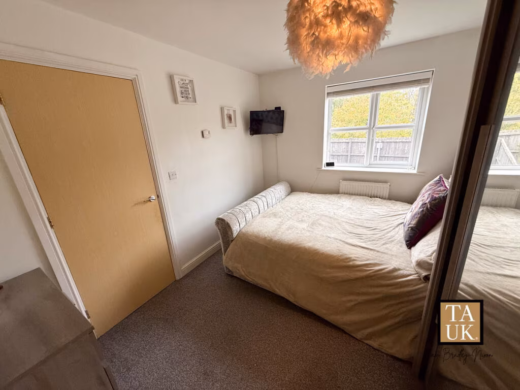
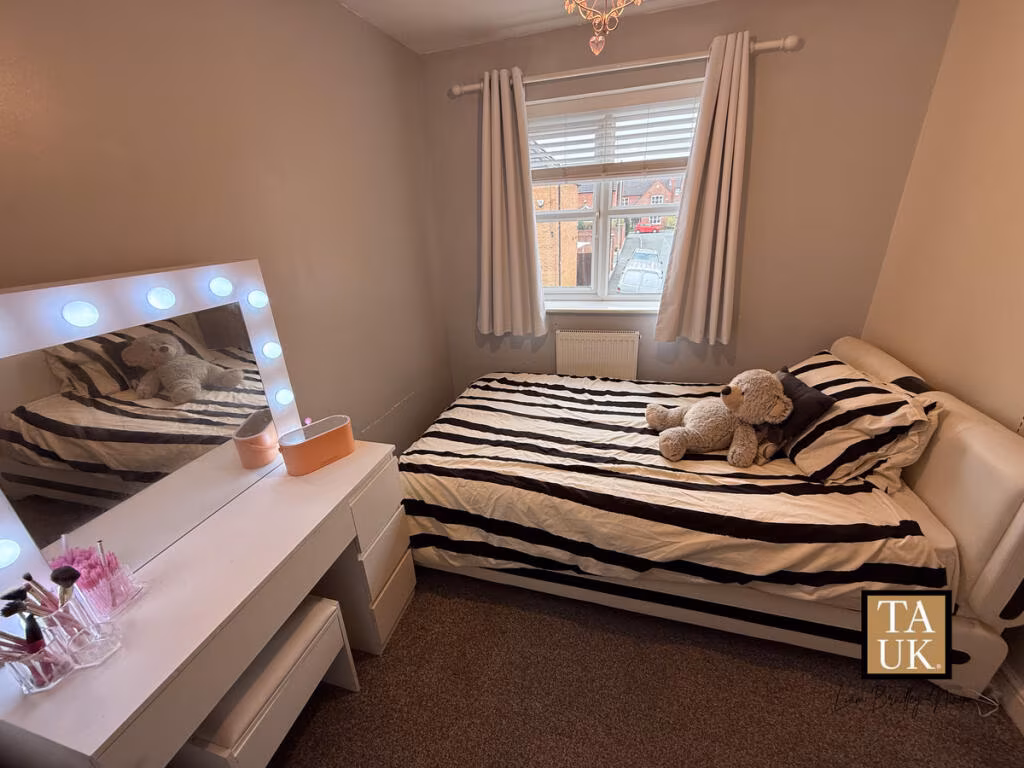
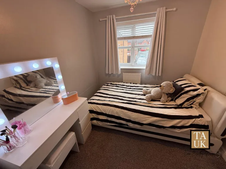
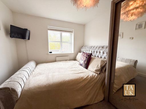
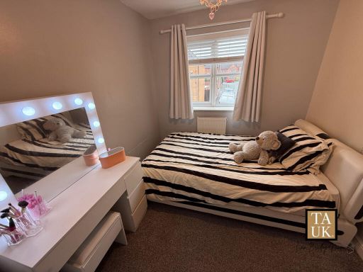
- BEDROOM 1:
- EN-SUITE:
- BEDROOM 2:
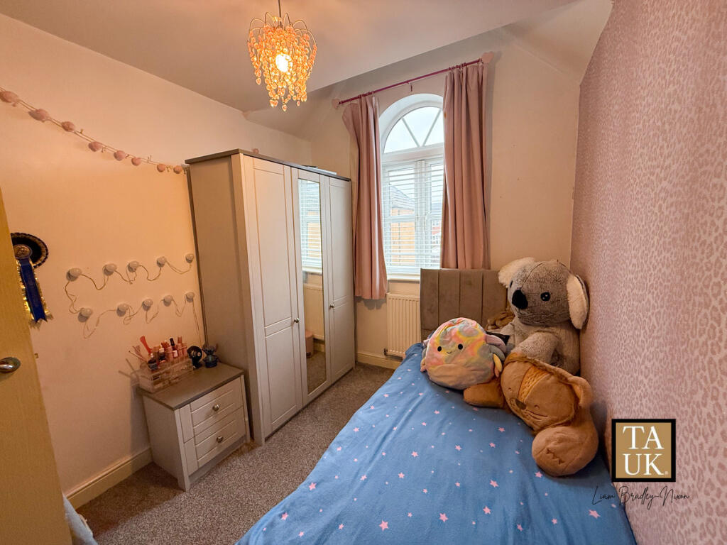
- BEDROOM 3:
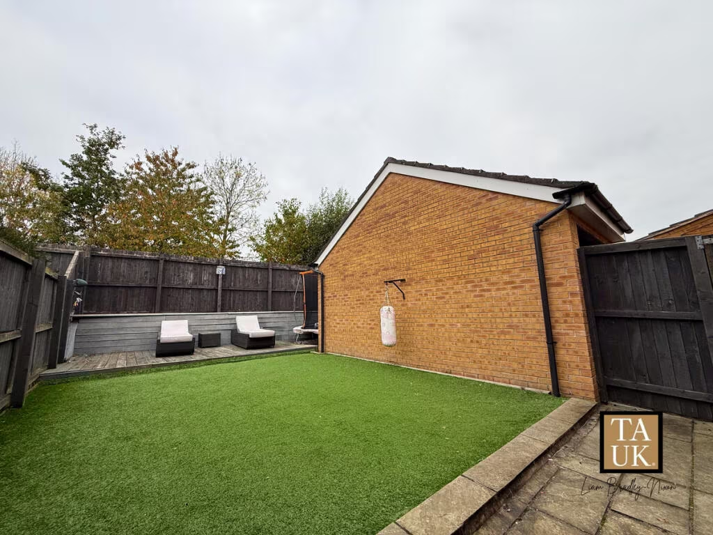
Textual Property Features
Detected Visual Features
- modern
- low-maintenance
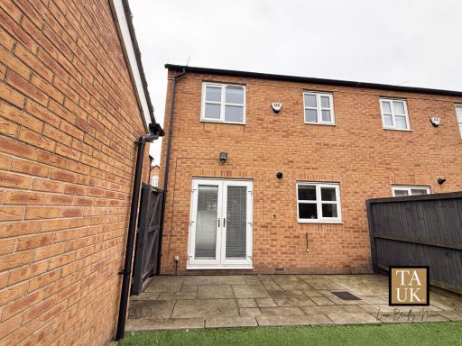
- brick facade
- semi-detached
- energy-efficient
- good condition
- double glazing
- quiet street
- two-story
- brick exterior
- garage
- porch
- double-glazed windows
- roof
- driveway
EPC Details
- Fully double glazed
- Cavity wall, as built, insulated (assumed)
- Boiler and radiators, mains gas
- Low energy lighting in all fixed outlets
- Solid, insulated (assumed)
Nearby Schools
- Greswell Primary School and Nursery
- Russell Scott Primary School
- Audenshaw Primary School
- Fairfield High School for Girls
- Fairfield Road Primary School
- Aldwyn Primary School
- Dane Bank Primary School
- St Thomas More RC College
- Oasis Academy Aspinal
- Denton West End Primary School
- Abbey Hey Primary Academy
- St Anne's RC Primary School
- St Stephen's CofE Primary School
- Manchester Road Primary Academy
- Droylsden Academy
- Moorside Primary School
- Ashton West End Primary Academy
- St Mary's RC Primary School
- Denton Community College
- Audenshaw School
- Poplar Street Primary School
- St Clement's CofE Primary School
- St Peter's CofE Primary School
- St Mary's CofE Primary School
- Greenside Primary School
- Woodhouses Voluntary Primary School
- Wright Robinson College
- Laurus Ryecroft
Nearest General Shops
- Id: 990576932
- Tags:
- TagsNormalized:
- Lat: 53.4722839
- Lon: -2.1503618
- FullGeoHash: gcw2pn64sunn
- PartitionGeoHash: gcw2
- Images:
- FoodStandards: null
- Distance: 792.9
,- Id: 269256560
- Tags:
- Name: Nisa
- Shop: supermarket
- TagsNormalized:
- Lat: 53.4785459
- Lon: -2.1358065
- FullGeoHash: gcw2prkz05e0
- PartitionGeoHash: gcw2
- Images:
- FoodStandards: null
- Distance: 710.4
,- Id: 371722726
- Tags:
- Addr:
- City: Manchester
- Housenumber: 126
- Postcode: M34 5PX
- Street: Manchester Road
- Building: yes
- Contact:
- Name: Lockwood and Greenwood
- Opening_hours: Mo-Fr 09:00-18:00; Sa 9:00-17:00; Su 10:30-17:00; PH 10:30-17:00
- Operator: Lockwood and Greenwood Limited
- Payment:
- Second_hand: yes
- Shop: car
- Website: https://www.lockwoodandgreenwood.co.uk/sales/
- TagsNormalized:
- Lat: 53.474238
- Lon: -2.1416354
- FullGeoHash: gcw2pq8w022y
- PartitionGeoHash: gcw2
- Images:
- FoodStandards: null
- Distance: 301.3
}
Nearest Grocery shops
- Id: 5646103870
- Tags:
- Name: Superchoice
- Shop: convenience
- TagsNormalized:
- Lat: 53.4673064
- Lon: -2.1205211
- FullGeoHash: gcw2ptrvsk2f
- PartitionGeoHash: gcw2
- Images:
- FoodStandards: null
- Distance: 1308.1
,- Id: 376509814
- Tags:
- Building: retail
- Name: Mike's News
- Shop: convenience
- TagsNormalized:
- Lat: 53.4753116
- Lon: -2.1557501
- FullGeoHash: gcw2nyyhr2s4
- PartitionGeoHash: gcw2
- Images:
- FoodStandards: null
- Distance: 1195.9
,- Id: 4531657493
- Tags:
- Brand: Iceland
- Brand:wikidata: Q721810
- Brand:wikipedia: en:Iceland (supermarket)
- Contact:
- Website: https://www.iceland.co.uk/store-finder/store?StoreID=1352&StoreName=DROYLSDEN
- Name: Iceland
- Name:en: Iceland
- Name:fr: Iceland
- Shop: frozen_food
- TagsNormalized:
- iceland
- frozen food
- food
- shop
- Lat: 53.480783
- Lon: -2.1468598
- FullGeoHash: gcw2ppusns93
- PartitionGeoHash: gcw2
- Images:
- FoodStandards: null
- Distance: 1093.4
}
Nearest Supermarkets
- Id: 255416006
- Tags:
- Addr:
- City: Manchester
- Postcode: M11 1DA
- Street: Ashton Old Road
- Brand: Morrisons
- Brand:wikidata: Q922344
- Brand:wikipedia: en:Morrisons
- Building: supermarket
- Contact:
- Website: https://my.morrisons.com/storefinder/391
- Name: Morrisons
- Shop: supermarket
- TagsNormalized:
- Lat: 53.4738715
- Lon: -2.1658047
- FullGeoHash: gcw2nwwgvh4u
- PartitionGeoHash: gcw2
- Images:
- FoodStandards: null
- Distance: 1822.9
,- Id: 255416005
- Tags:
- Addr:
- Country: GB
- Housenumber: 1270
- Postcode: M11 1JJ
- Street: Ashton Old Road
- Brand: Lidl
- Brand:wikidata: Q151954
- Brand:wikipedia: en:Lidl
- Building: supermarket
- Fhrs:
- Name: Lidl
- Shop: supermarket
- Wheelchair: yes
- TagsNormalized:
- Lat: 53.4726295
- Lon: -2.1652362
- FullGeoHash: gcw2nwrkdkdg
- PartitionGeoHash: gcw2
- Images:
- FoodStandards:
- Id: 861084
- FHRSID: 861084
- LocalAuthorityBusinessID: 964751
- BusinessName: Lidl
- BusinessType: Retailers - supermarkets/hypermarkets
- BusinessTypeID: 7840
- AddressLine1: null
- AddressLine2: 1270 Ashton Old Road
- AddressLine3: Manchester
- AddressLine4: null
- PostCode: M11 1JJ
- RatingValue: 5
- RatingKey: fhrs_5_en-GB
- RatingDate: 2016-08-18
- LocalAuthorityCode: 415
- LocalAuthorityName: Manchester
- LocalAuthorityWebSite: http://www.manchester.gov.uk
- LocalAuthorityEmailAddress: envhealth@manchester.gov.uk
- Scores:
- Hygiene: 5
- Structural: 5
- ConfidenceInManagement: 0
- NewRatingPending: false
- Geocode:
- Longitude: -2.16438500000000
- Latitude: 53.47268700000000
- Distance: 1777.6
,- Id: 624427812
- Tags:
- Brand: Tesco
- Brand:wikidata: Q487494
- Brand:wikipedia: en:Tesco
- Building: yes
- Contact:
- Website: https://www.tesco.com/store-locator/manchester/manchester-rd
- Name: Tesco
- Shop: supermarket
- TagsNormalized:
- Lat: 53.4807438
- Lon: -2.1484327
- FullGeoHash: gcw2ppgecvhr
- PartitionGeoHash: gcw2
- Images:
- FoodStandards: null
- Distance: 1146.7
}
Nearest Religious buildings
- Id: 2887956081
- Tags:
- Amenity: place_of_worship
- Name: The Dream Centre
- Religion: christian
- TagsNormalized:
- place of worship
- christian
- church
- Lat: 53.477168
- Lon: -2.1461367
- FullGeoHash: gcw2ppjpp6sk
- PartitionGeoHash: gcw2
- Images:
- FoodStandards: null
- Distance: 742.4
,- Id: 838845369
- Tags:
- Amenity: place_of_worship
- Name: Trinity Church
- Religion: christian
- TagsNormalized:
- place of worship
- church
- christian
- Lat: 53.4714296
- Lon: -2.1276494
- FullGeoHash: gcw2pw4twhvt
- PartitionGeoHash: gcw2
- Images:
- FoodStandards: null
- Distance: 717.5
,- Id: 1442639020
- Tags:
- Amenity: place_of_worship
- Denomination: EFCC
- Name: Droylsden Independent Church
- Religion: christian
- Source: http://www.droylsdenindchurch.co.uk/search/label/finding%20us
- TagsNormalized:
- place of worship
- church
- christian
- Lat: 53.4776849
- Lon: -2.1443741
- FullGeoHash: gcw2ppqd07nb
- PartitionGeoHash: gcw2
- Images:
- FoodStandards: null
- Distance: 714.2
}
Nearest Medical buildings
- Id: 5622782789
- Tags:
- Amenity: pharmacy
- Brand: Boots
- Brand:wikidata: Q6123139
- Brand:wikipedia: en:Boots (company)
- Dispensing: yes
- Healthcare: pharmacy
- Name: Boots
- TagsNormalized:
- pharmacy
- boots
- health
- healthcare
- Lat: 53.4590784
- Lon: -2.1179845
- FullGeoHash: gcw2pgctxqs2
- PartitionGeoHash: gcw2
- Images:
- FoodStandards: null
- Distance: 1999.7
,- Id: 1131252256
- Tags:
- Amenity: doctors
- Healthcare: doctor
- TagsNormalized:
- doctor
- doctors
- health
- healthcare
- Lat: 53.4726445
- Lon: -2.1610534
- FullGeoHash: gcw2ny6kez3v
- PartitionGeoHash: gcw2
- Images:
- FoodStandards: null
- Distance: 1500.9
,- Id: 1505706440
- Tags:
- Addr:
- Housenumber: 72
- Postcode: M43 6DE
- Street: Market Street
- Amenity: pharmacy
- Branch: Chemist
- Brand: Boots
- Brand:wikidata: Q6123139
- Brand:wikipedia: en:Boots (company)
- Dispensing: yes
- Healthcare: pharmacy
- Name: Boots
- Opening_hours: Mo,Tu,Th,Fr 08:30-18:15; We 08:30-18:00
- Phone: +44 161 370 1626
- TagsNormalized:
- pharmacy
- boots
- health
- healthcare
- Lat: 53.4787062
- Lon: -2.1457638
- FullGeoHash: gcw2ppt8016s
- PartitionGeoHash: gcw2
- Images:
- FoodStandards: null
- Distance: 859.8
,- Id: 1505698923
- Tags:
- Amenity: pharmacy
- Brand: Well Pharmacy
- Brand:wikidata: Q7726524
- Brand:wikipedia: en:Well Pharmacy
- Dispensing: yes
- Healthcare: pharmacy
- Name: Well Pharmacy
- Old_name: Co-Op Pharmacy
- TagsNormalized:
- pharmacy
- well pharmacy
- health
- healthcare
- Lat: 53.4791637
- Lon: -2.1428901
- FullGeoHash: gcw2ppxden9m
- PartitionGeoHash: gcw2
- Images:
- FoodStandards: null
- Distance: 815
}
Nearest Airports
- Id: 1224469
- Tags:
- Addr:
- City: Manchester
- Country: GB
- Postcode: M90 1QX
- Aerodrome: international
- Aeroway: aerodrome
- Arp: yes
- Atis: 128.175
- Iata: MAN
- Icao: EGCC
- Name: Manchester Airport
- Note: rough sketched outline referring to Yahoo imagery - true boundary is where?
- Old_name: Ringway
- Operator: Manchester Airport PLC
- Size: 18720000
- Source:
- Tower_frequency: 118.625,119.400
- Type: multipolygon
- Website: https://www.manchesterairport.co.uk/
- Wikidata: Q8694
- Wikipedia: en:Manchester Airport
- TagsNormalized:
- airport
- international airport
- Lat: 53.3503197
- Lon: -2.2798822
- FullGeoHash: gcqrs05u4ukt
- PartitionGeoHash: gcqr
- Images:
- FoodStandards: null
- Distance: 16494.3
}
Nearest Leisure Facilities
- Id: 360301360
- Tags:
- Leisure: pitch
- Sport: rugby_union
- Surface: grass
- TagsNormalized:
- pitch
- leisure
- rugby
- rugby union
- sports
- Lat: 53.4771579
- Lon: -2.1387304
- FullGeoHash: gcw2pr4x5bz0
- PartitionGeoHash: gcw2
- Images:
- FoodStandards: null
- Distance: 535.8
,- Id: 360301745
- Tags:
- Leisure: pitch
- Sport: rugby_union
- Surface: grass
- TagsNormalized:
- pitch
- leisure
- rugby
- rugby union
- sports
- Lat: 53.4765774
- Lon: -2.1388198
- FullGeoHash: gcw2pr4e9us3
- PartitionGeoHash: gcw2
- Images:
- FoodStandards: null
- Distance: 471.7
,- Id: 371722731
- Tags:
- Leisure: pitch
- Sport: soccer
- TagsNormalized:
- Lat: 53.4746033
- Lon: -2.1387075
- FullGeoHash: gcw2pqf8hs81
- PartitionGeoHash: gcw2
- Images:
- FoodStandards: null
- Distance: 252.2
,- Id: 1102376160
- Tags:
- Access: yes
- Leisure: playground
- Name: King's Grange Playground
- Playground:
- TagsNormalized:
- Lat: 53.4701553
- Lon: -2.1380434
- FullGeoHash: gcw2pmgn5zrk
- PartitionGeoHash: gcw2
- Images:
- FoodStandards: null
- Distance: 244.4
,- Id: 628375061
- Tags:
- TagsNormalized:
- Lat: 53.4736633
- Lon: -2.138247
- FullGeoHash: gcw2pqdfxjr6
- PartitionGeoHash: gcw2
- Images:
- FoodStandards: null
- Distance: 147
}
Nearest Tourist attractions
- Id: 380800562
- Tags:
- TagsNormalized:
- Lat: 53.4958601
- Lon: -2.1284094
- FullGeoHash: gcw2rdd5urng
- PartitionGeoHash: gcw2
- Images:
- FoodStandards: null
- Distance: 2696.9
,- Id: 4395245780
- Tags:
- Addr:
- City: Manchester
- Country: GB
- Housenumber: 866
- Place: Debdale Park
- Postcode: M18 7LH
- Street: Hyde Road
- Name: Clyde Mount Guest House
- Source: survey
- Tourism: guest_house
- TagsNormalized:
- Lat: 53.457745
- Lon: -2.1586585
- FullGeoHash: gcw2ngsjgtgw
- PartitionGeoHash: gcw2
- Images:
- FoodStandards: null
- Distance: 2106.3
,- Id: 3415808025
- Tags:
- Addr:
- City: Manchester
- Housename: Donkey Assisted Therapy Centre
- Postcode: M18 8RJ
- Street: Greenfold, Abbey Hey
- Name: The Donkey Sanctuary
- Tourism: attraction
- TagsNormalized:
- Lat: 53.4647068
- Lon: -2.1562782
- FullGeoHash: gcw2nuvy7pdq
- PartitionGeoHash: gcw2
- Images:
- FoodStandards: null
- Distance: 1457.5
}
Nearest Train stations
- Id: 3715250498
- Tags:
- Name: Reddish North
- Naptan:
- Network: National Rail
- Public_transport: station
- Railway: station
- Ref:
- Wikidata: Q4412893
- Wikipedia: en:Reddish North railway station
- TagsNormalized:
- Lat: 53.4496862
- Lon: -2.1566096
- FullGeoHash: gcw2nfjwgrem
- PartitionGeoHash: gcw2
- Images:
- FoodStandards: null
- Distance: 2793.5
,- Id: 6367868937
- Tags:
- Name: Gorton
- Naptan:
- Network: National Rail
- Old_name: Gorton and Openshaw
- Public_transport: station
- Railway: station
- Ref:
- Source: NPE
- Wikipedia: en:Gorton railway station
- TagsNormalized:
- Lat: 53.4689321
- Lon: -2.1677485
- FullGeoHash: gcw2nttrpg3e
- PartitionGeoHash: gcw2
- Images:
- FoodStandards: null
- Distance: 1980.4
,- Id: 29927228
- Tags:
- Name: Denton
- Naptan:
- Network: National Rail
- Note: One train per week: Fridays at 09:31
- Public_transport: station
- Railway: station
- Ref:
- Crs: DTN
- Stanox: 32520
- Tiploc: DNTON
- Train: yes
- Wikidata: Q5259635
- Wikipedia: en:Denton railway station
- TagsNormalized:
- Lat: 53.4574018
- Lon: -2.1309424
- FullGeoHash: gcw2pe87cmyn
- PartitionGeoHash: gcw2
- Images:
- FoodStandards: null
- Distance: 1732.9
,- Id: 5374842618
- Tags:
- Name: Guide Bridge
- Naptan:
- Network: National Rail
- Public_transport: station
- Railway: station
- Ref:
- Source: npe
- Train: yes
- Wikidata: Q1854597
- Wikipedia: en:Guide Bridge railway station
- TagsNormalized:
- Lat: 53.4745495
- Lon: -2.1135802
- FullGeoHash: gcw2pyszy482
- PartitionGeoHash: gcw2
- Images:
- FoodStandards: null
- Distance: 1659.6
,- Id: 6367868938
- Tags:
- Name: Fairfield
- Naptan:
- Network: National Rail
- Public_transport: station
- Railway: station
- Ref:
- Source: NPE
- Wikidata: Q3190561
- Wikipedia: en:Fairfield railway station (England)
- TagsNormalized:
- Lat: 53.4713232
- Lon: -2.1449235
- FullGeoHash: gcw2pnnj59j5
- PartitionGeoHash: gcw2
- Images:
- FoodStandards: null
- Distance: 447.6
}
Nearest Hotels
- Id: 3520793834
- Tags:
- Brand: Holiday Inn Express
- Brand:wikidata: Q5880423
- Brand:wikipedia: en:Holiday Inn Express
- Name: Holiday Inn Express Manchester East
- Tourism: hotel
- TagsNormalized:
- Lat: 53.4602803
- Lon: -2.1625829
- FullGeoHash: gcw2nu1k8nt3
- PartitionGeoHash: gcw2
- Images:
- FoodStandards: null
- Distance: 2089.4
,- Id: 592060448
- Tags:
- Brand: Premier Inn
- Brand:wikidata: Q2108626
- Brand:wikipedia: en:Premier Inn
- Building: yes
- Internet_access: wlan
- Internet_access:fee: customers
- Internet_access:operator: Virgin Media
- Internet_access:ssid: Premier Inn Free Wi-Fi
- Name: Premier Inn
- Tourism: hotel
- TagsNormalized:
- Lat: 53.4556392
- Lon: -2.1342831
- FullGeoHash: gcw2p7mcet7h
- PartitionGeoHash: gcw2
- Images:
- FoodStandards: null
- Distance: 1877.1
,- Id: 61697675
- Tags:
- Addr:
- Postcode: M34 5QL
- Street: Lapwing Lane
- Town: Audenshaw
- Brand: Travelodge
- Brand:wikidata: Q9361374
- Brand:wikipedia: en:Travelodge UK
- Building: yes
- Fhrs:
- Authority: Tameside
- Id: 17522
- Local_authority_id: 06/00006/COM
- Internet_access: wlan
- Internet_access:fee: customers
- Internet_access:ssid: Travelodge WiFi
- Name: Travelodge Ashton-under-Lyne
- Source: OS_OpenData_StreetView
- Source:addr: FHRS Open Data
- Tourism: hotel
- TagsNormalized:
- Lat: 53.4802397
- Lon: -2.1246237
- FullGeoHash: gcw2pxubuxm8
- PartitionGeoHash: gcw2
- Images:
- FoodStandards: null
- Distance: 1264.9
}
Tags
- modern
- low-maintenance
- brick facade
- semi-detached
- energy-efficient
- good condition
- double glazing
- quiet street
- modern
- semi-detached
- two-story
- brick exterior
- garage
- porch
- double-glazed windows
- roof
- driveway
Local Market Stats
- Average Price/sqft: £233
- Avg Income: £38200
- Rental Yield: 5%
- Social Housing: 14%
- Planning Success Rate: 90%
AirBnB Data
- 1km average: £99/night
- Listings in 1km: 1
Similar Properties
 3 bedroom semi-detached house for sale in Waterhouses Street, Audenshaw, Manchester, M34 — £325,000 • 3 bed • 2 bath • 850 ft²
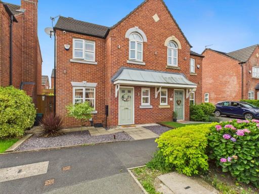 3 bedroom semi-detached house for sale in Consort Way, Audenshaw, Manchester, M34 5FQ, M34 — £320,000 • 3 bed • 2 bath • 913 ft²
 2 bedroom semi-detached house for sale in Heron Drive, Manchester, M34 — £229,950 • 2 bed • 1 bath • 765 ft²
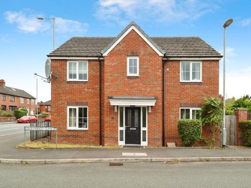 4 bedroom detached house for sale in Greenwood Close, MANCHESTER, Lancashire, M34 — £375,000 • 4 bed • 2 bath • 1249 ft²
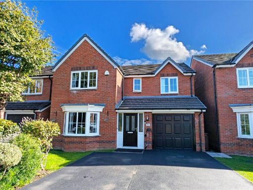 4 bedroom detached house for sale in Greenwood Close, Audenshaw, Manchester, Greater Manchester, M34 — £475,000 • 4 bed • 2 bath • 1587 ft²
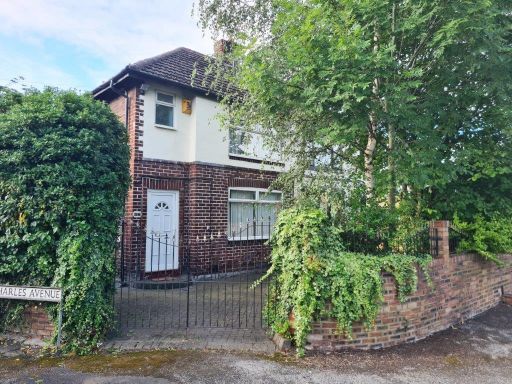 3 bedroom semi-detached house for sale in Manchester Road, Audenshaw, M34 — £250,000 • 3 bed • 1 bath • 837 ft²
Meta
- {
"@context": "https://schema.org",
"@type": "Residence",
"name": "3 bedroom semidetached house for sale in Princess Fold, Man…",
"description": "",
"url": "https://propertypiper.co.uk/property/e0140e75-cb1d-4215-acdb-81157c989404",
"image": "https://image-a.propertypiper.co.uk/0f35afae-2e7c-432b-8121-ff15b6ce9a54-1024.jpeg",
"address": {
"@type": "PostalAddress",
"streetAddress": "28, Princess Fold, Audenshaw",
"postalCode": "M34 5FW",
"addressLocality": "Tameside",
"addressRegion": "Denton and Reddish",
"addressCountry": "England"
},
"geo": {
"@type": "GeoCoordinates",
"latitude": 53.47234356792685,
"longitude": -2.138381458999151
},
"numberOfRooms": 3,
"numberOfBathroomsTotal": 2,
"floorSize": {
"@type": "QuantitativeValue",
"value": 848,
"unitCode": "FTK"
},
"offers": {
"@type": "Offer",
"price": 320000,
"priceCurrency": "GBP",
"availability": "https://schema.org/InStock"
},
"additionalProperty": [
{
"@type": "PropertyValue",
"name": "Feature",
"value": "modern"
},
{
"@type": "PropertyValue",
"name": "Feature",
"value": "low-maintenance"
},
{
"@type": "PropertyValue",
"name": "Feature",
"value": "brick facade"
},
{
"@type": "PropertyValue",
"name": "Feature",
"value": "semi-detached"
},
{
"@type": "PropertyValue",
"name": "Feature",
"value": "energy-efficient"
},
{
"@type": "PropertyValue",
"name": "Feature",
"value": "good condition"
},
{
"@type": "PropertyValue",
"name": "Feature",
"value": "double glazing"
},
{
"@type": "PropertyValue",
"name": "Feature",
"value": "quiet street"
},
{
"@type": "PropertyValue",
"name": "Feature",
"value": "modern"
},
{
"@type": "PropertyValue",
"name": "Feature",
"value": "semi-detached"
},
{
"@type": "PropertyValue",
"name": "Feature",
"value": "two-story"
},
{
"@type": "PropertyValue",
"name": "Feature",
"value": "brick exterior"
},
{
"@type": "PropertyValue",
"name": "Feature",
"value": "garage"
},
{
"@type": "PropertyValue",
"name": "Feature",
"value": "porch"
},
{
"@type": "PropertyValue",
"name": "Feature",
"value": "double-glazed windows"
},
{
"@type": "PropertyValue",
"name": "Feature",
"value": "roof"
},
{
"@type": "PropertyValue",
"name": "Feature",
"value": "driveway"
}
]
}
High Res Floorplan Images
Compatible Floorplan Images
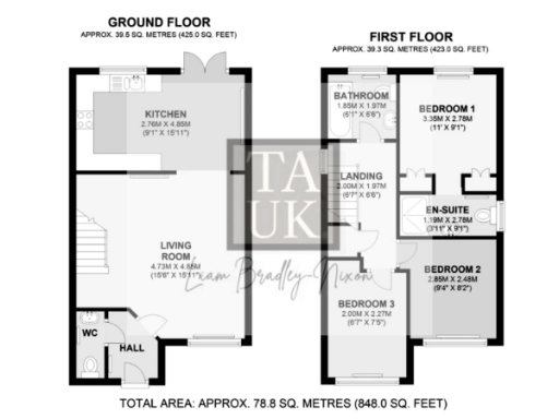
FloorplanImages Thumbnail