NR29 4SW - 4 bedroom detached house for sale in The Oaks, Martham, NR29
View on Property Piper
4 bedroom detached house for sale in The Oaks, Martham, NR29
Property Details
- Price: £675000
- Bedrooms: 4
- Bathrooms: 1
- Property Type: undefined
- Property SubType: undefined
Brochure Descriptions
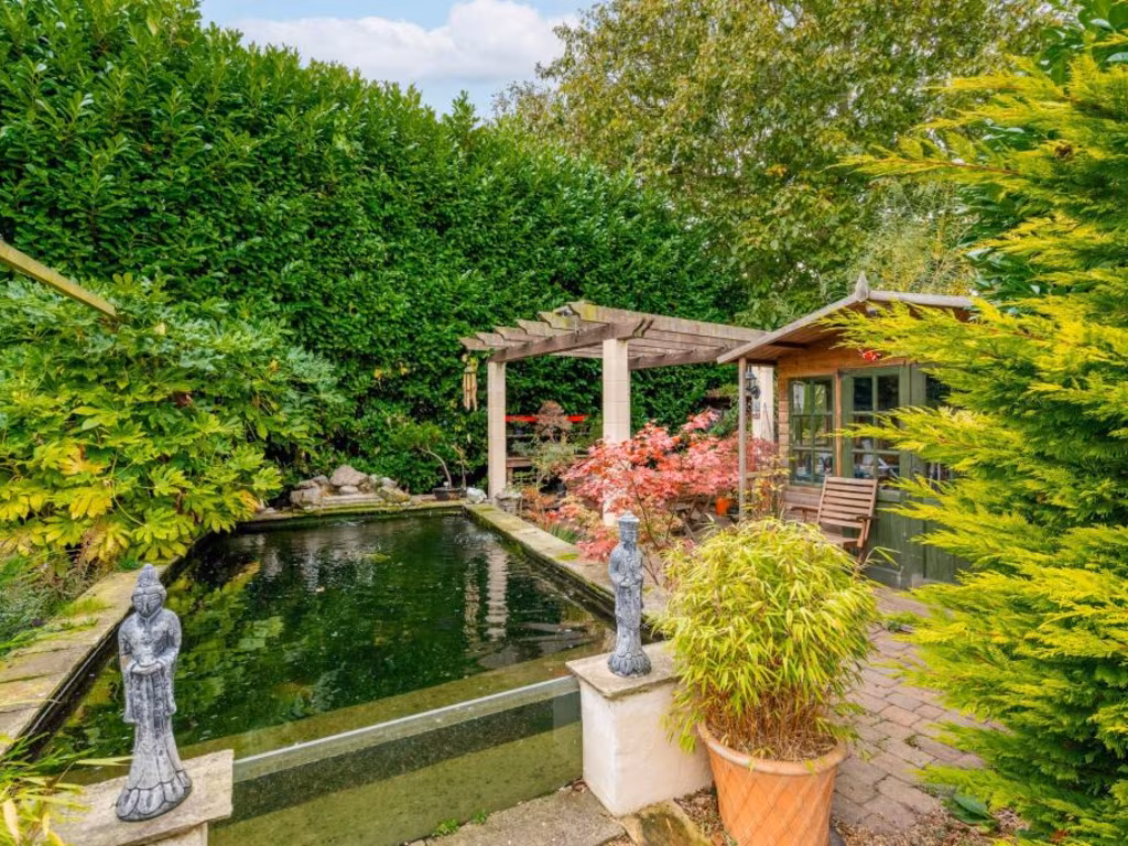
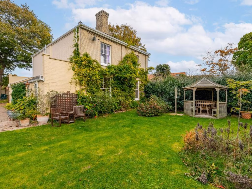
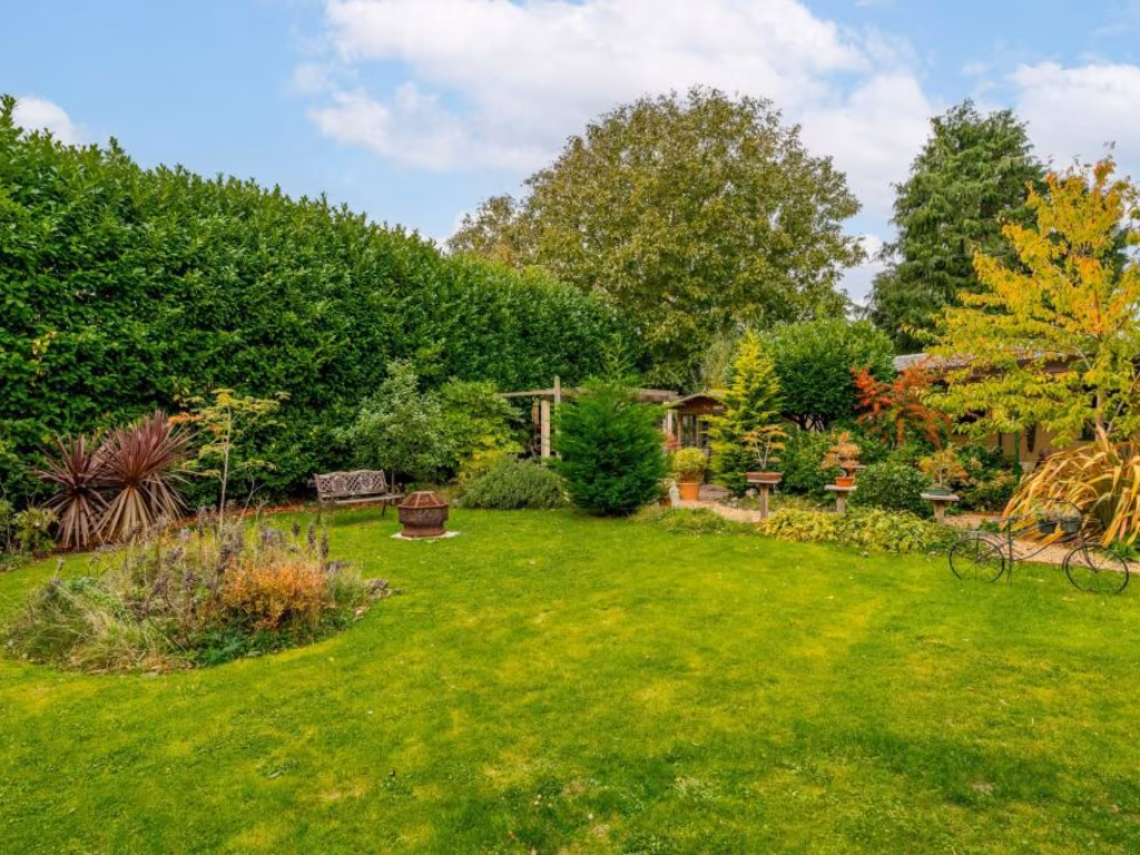
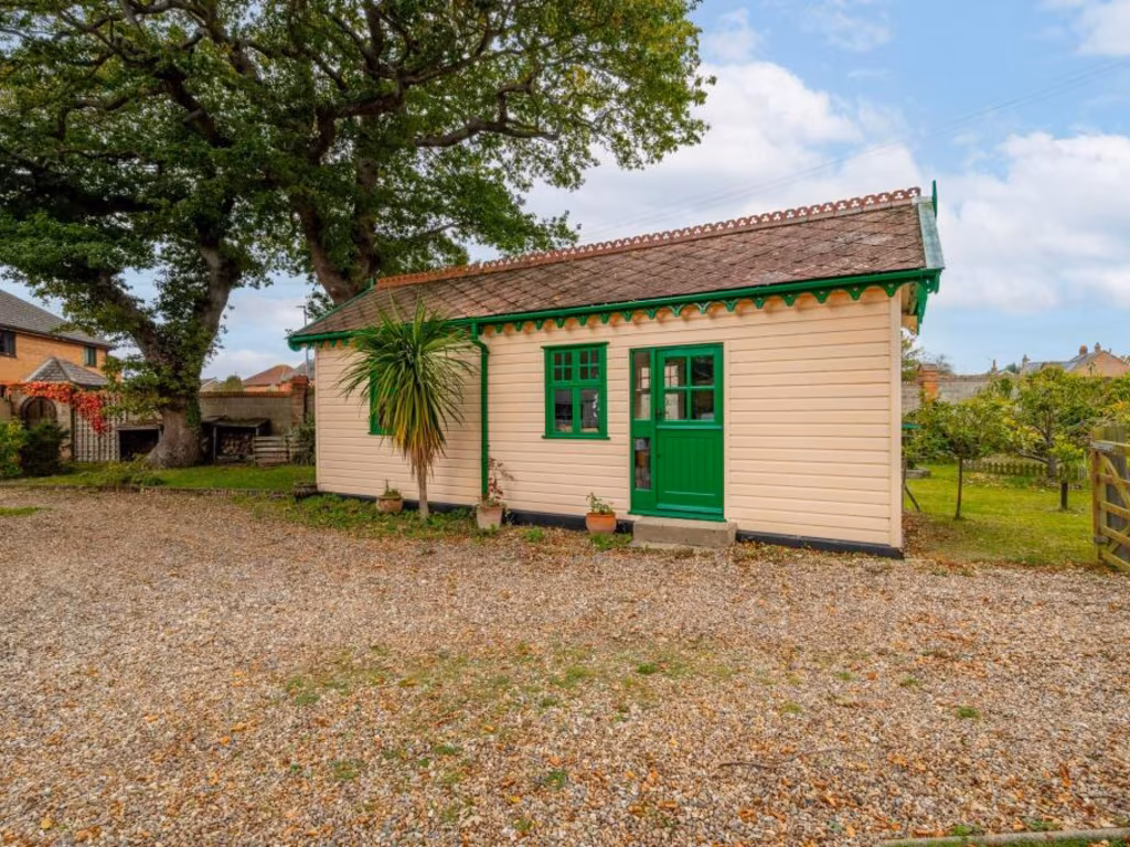
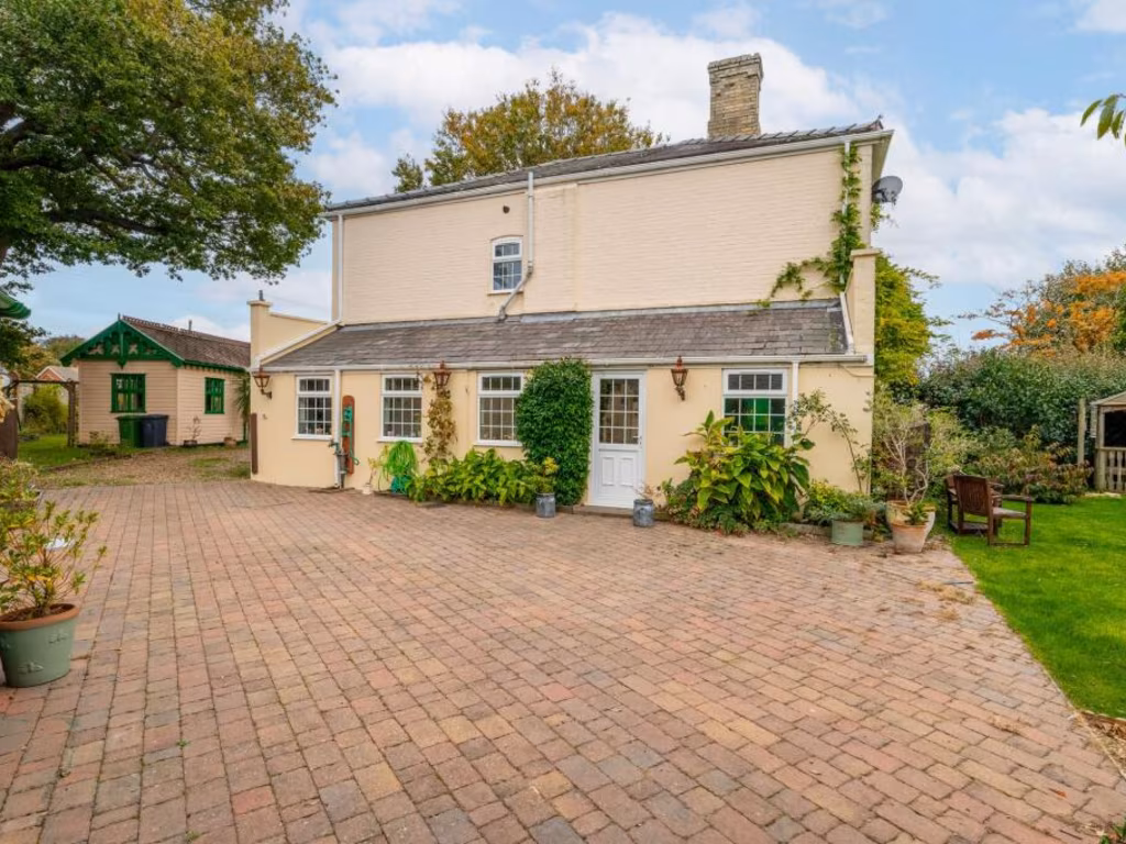
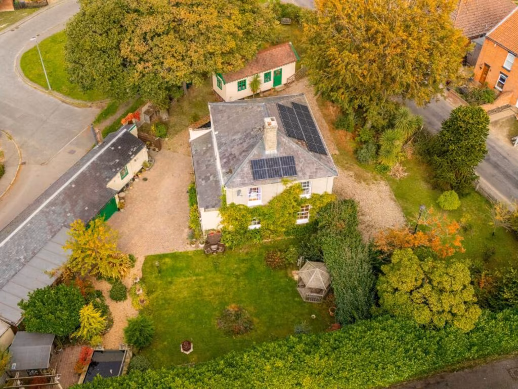
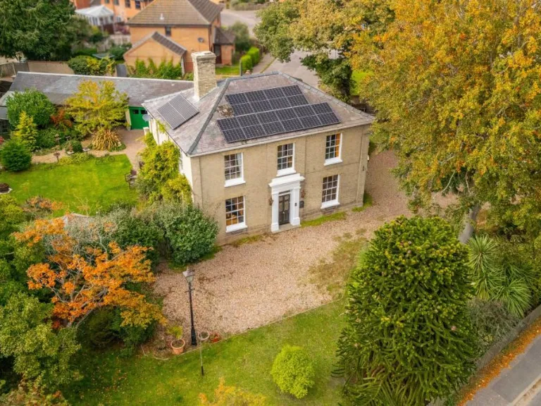
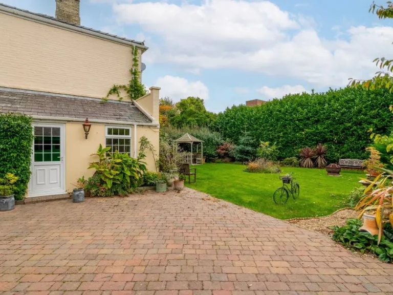
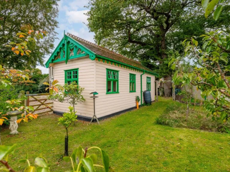
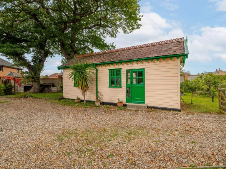
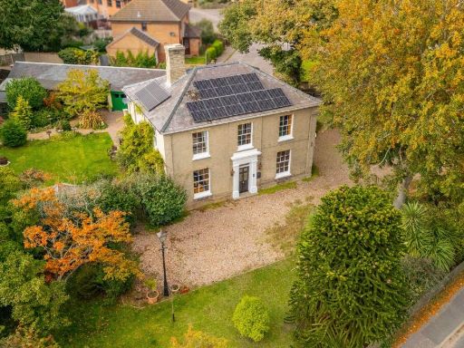
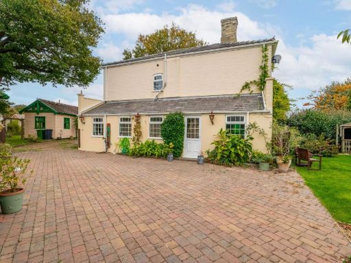
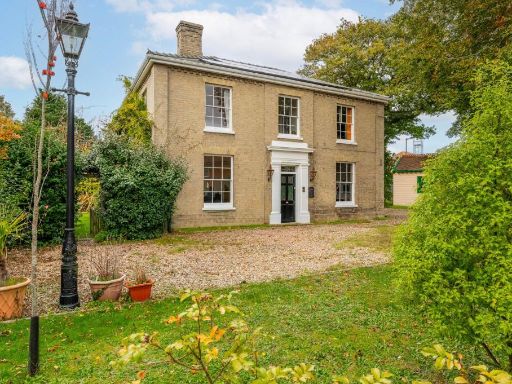
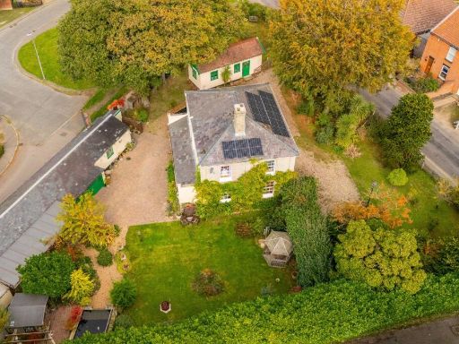
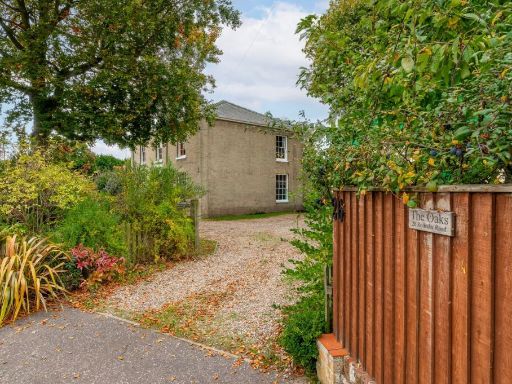
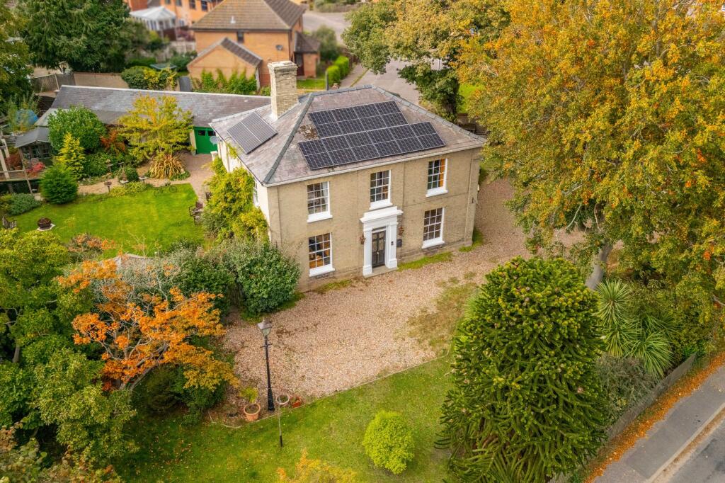
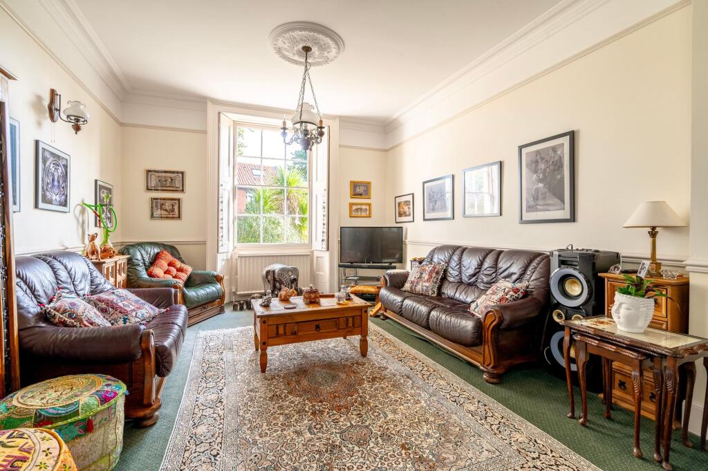
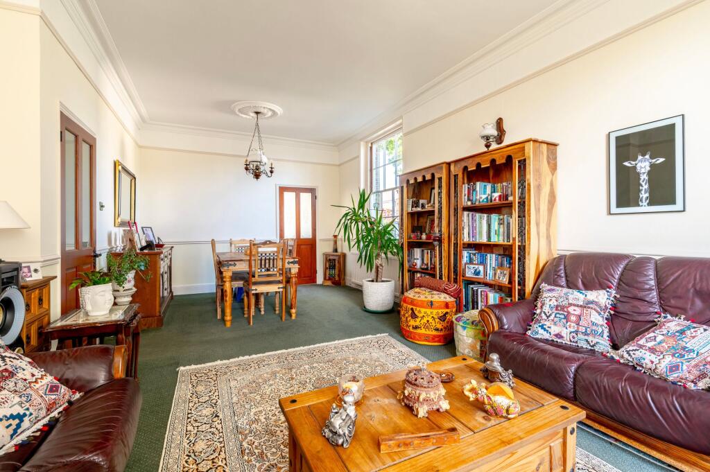
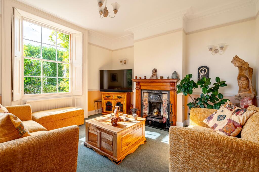
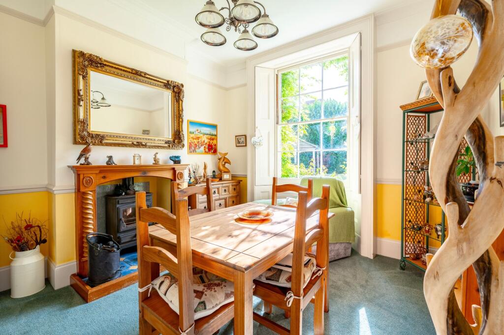
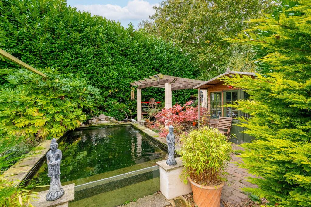
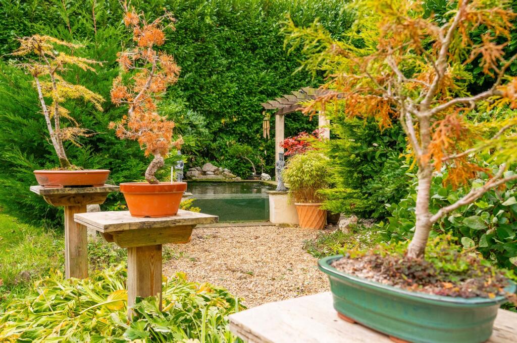
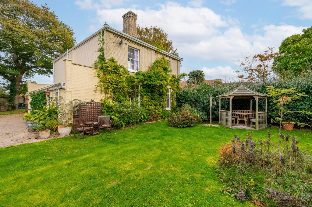
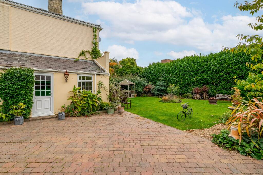
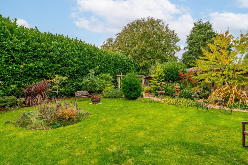
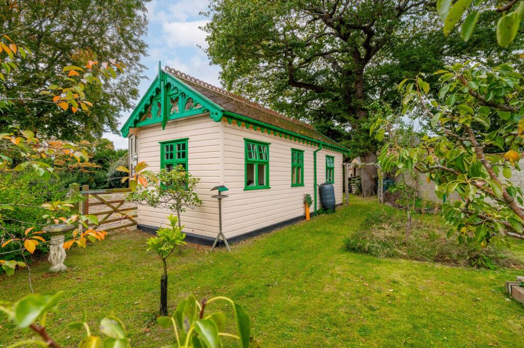
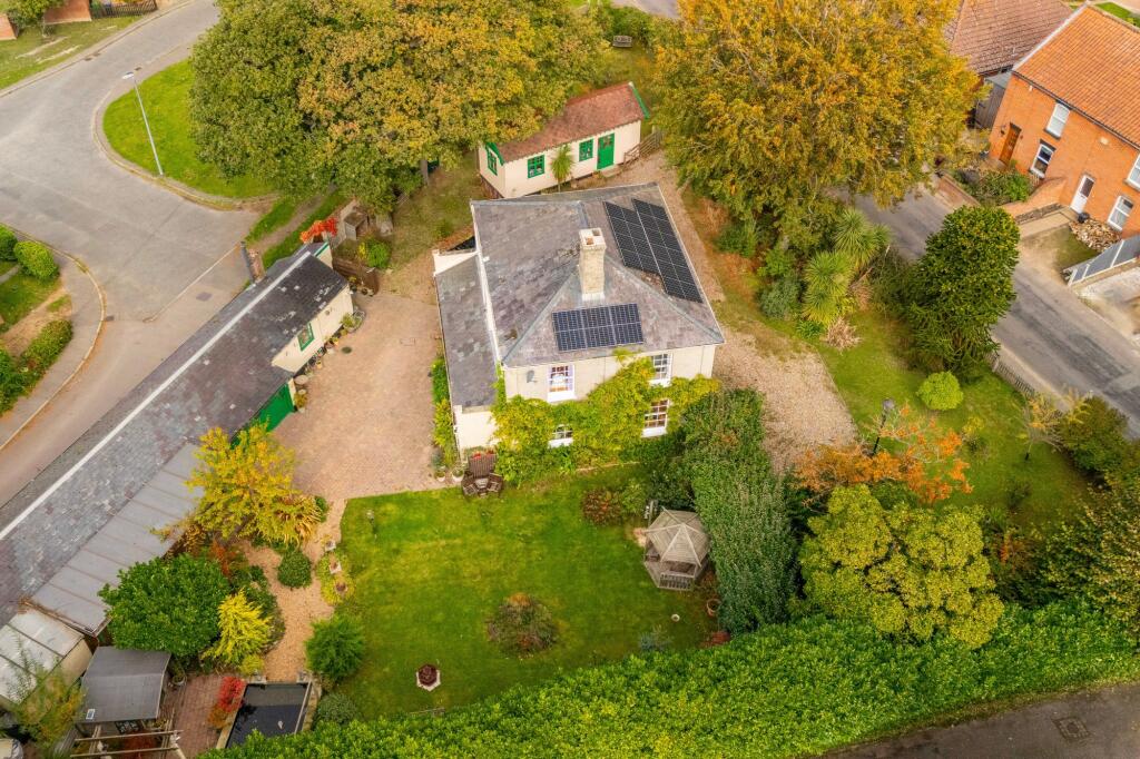
- Substantial detached Georgian/Regency-style two-storey house set within large, mature grounds. The property appears to retain period proportions and symmetry with a central entrance and sash-style windows. Externally the home sits behind a gravel driveway with space for multiple vehicles and mature specimen trees and hedging providing privacy. Extensive rear/side gardens are evident and include established planting beds, lawn areas and an outbuilding/garage. The roof has been fitted with solar PV panels. Overall garden size is large; the house footprint and plot suggest a medium-to-large sized residential property suitable for a family. No interior fittings or room counts are shown in the images.
- No residential property is shown in the image — this is a Norfolk Mortgages advertisement for mortgage and protection services featuring staff photos and contact details. No rooms, exterior, garden, view or property size can be inferred from the image, so a property valuation or description cannot be provided.
Image Descriptions
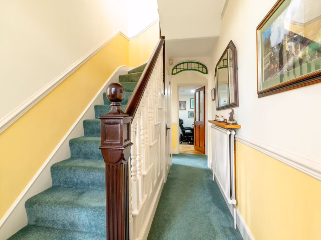
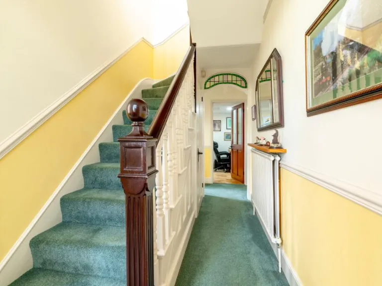
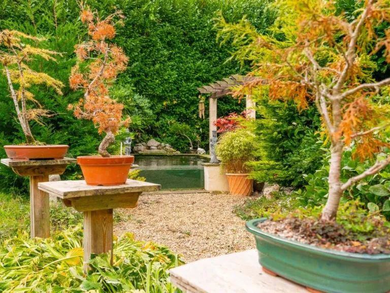
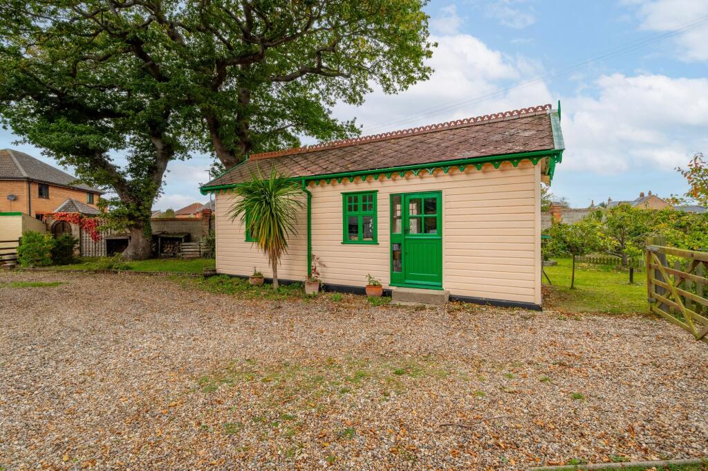
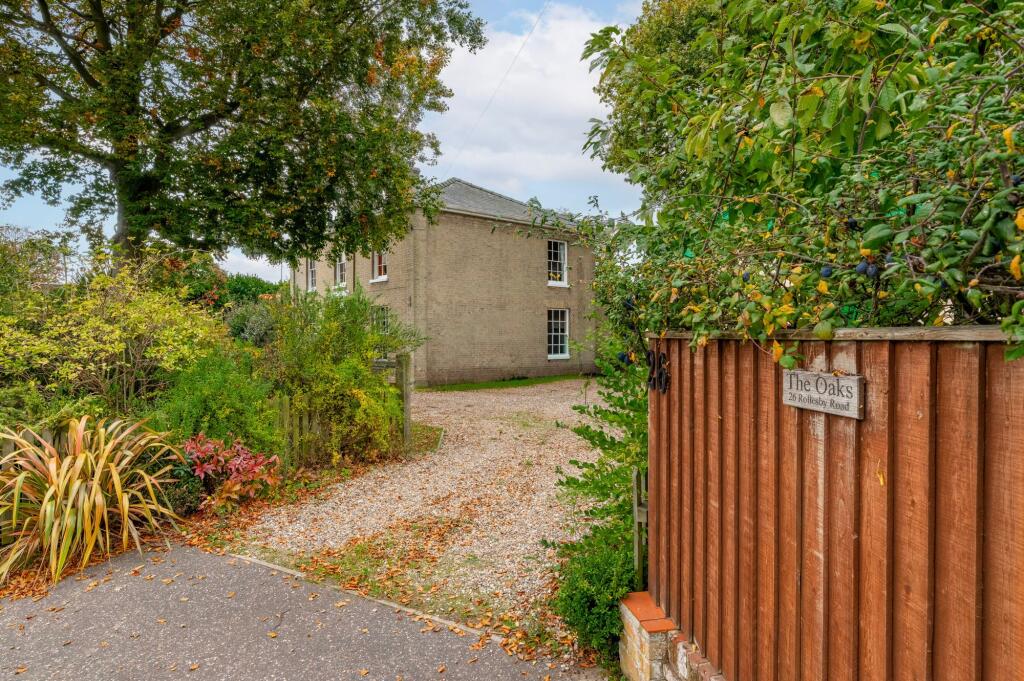
- house and garden Georgian
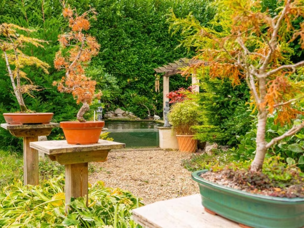
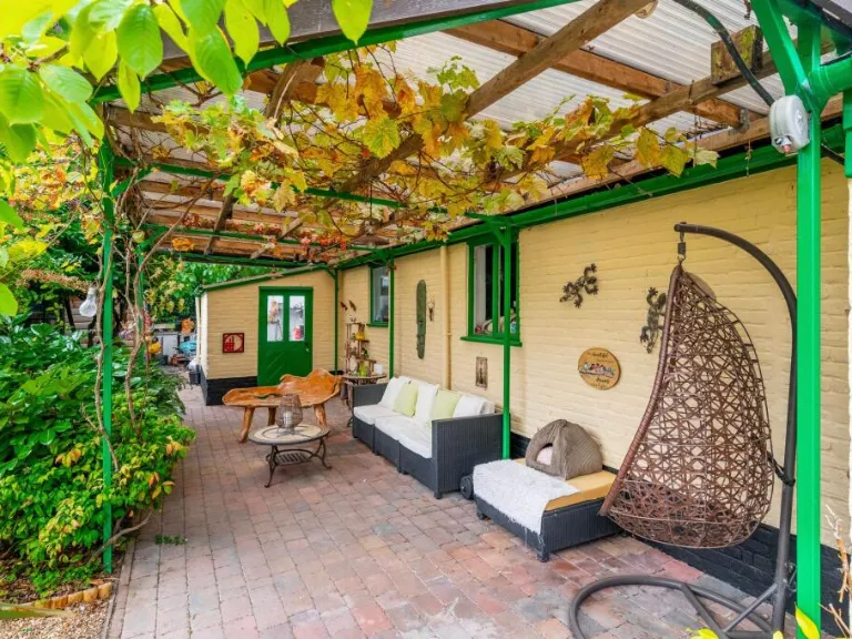
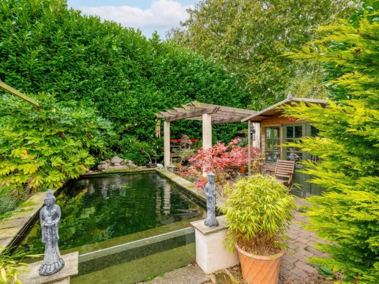
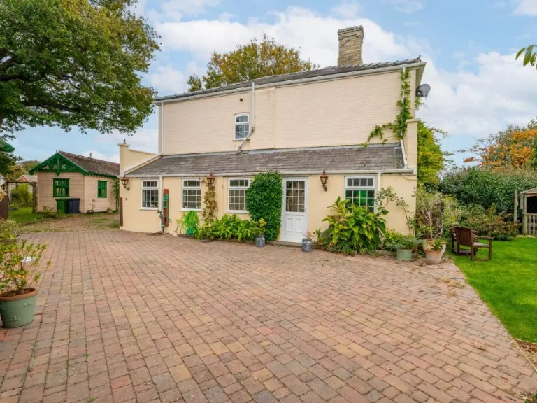
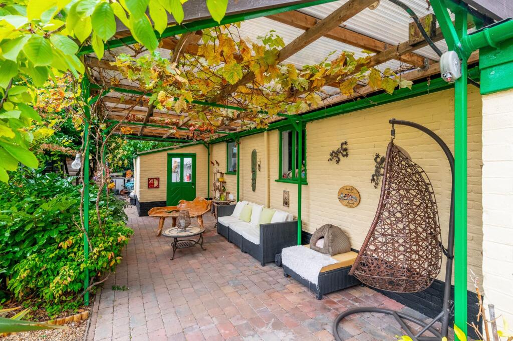
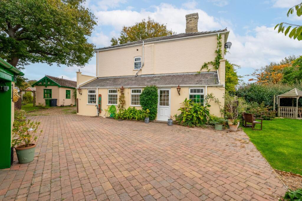
- patio rustic
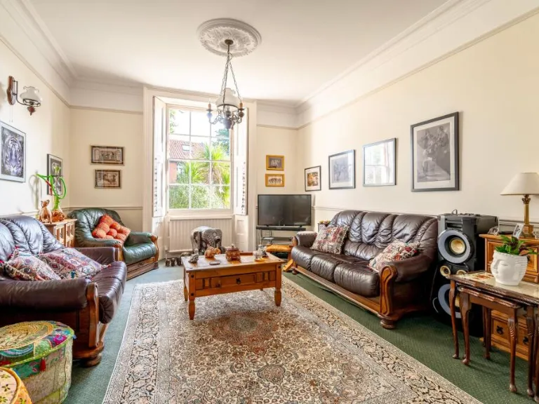
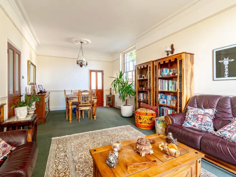
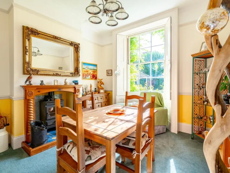
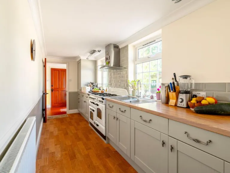
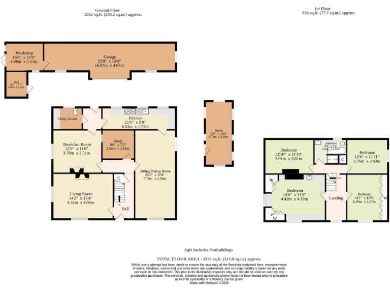
Rooms
- Workshop:
- Shed:
- Garage:
- Studio:
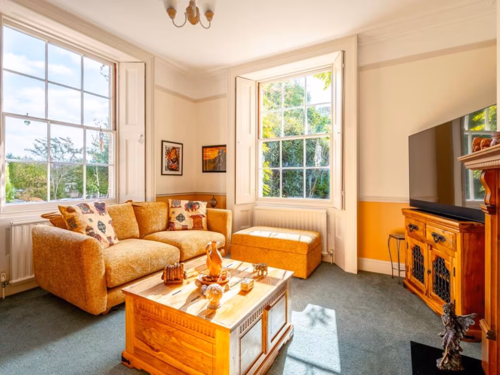
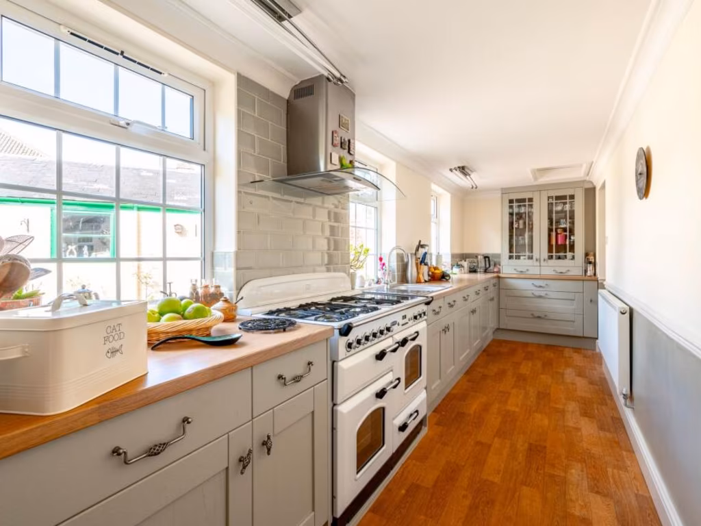
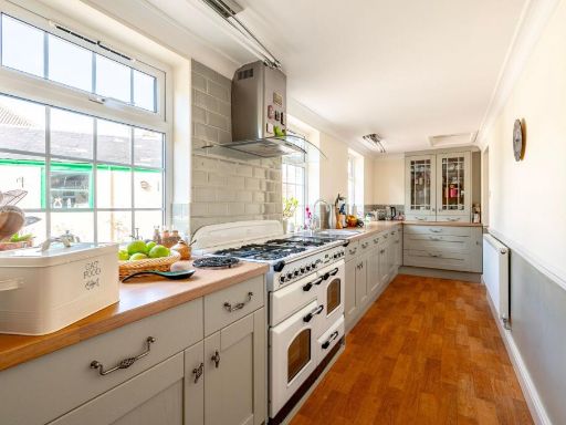
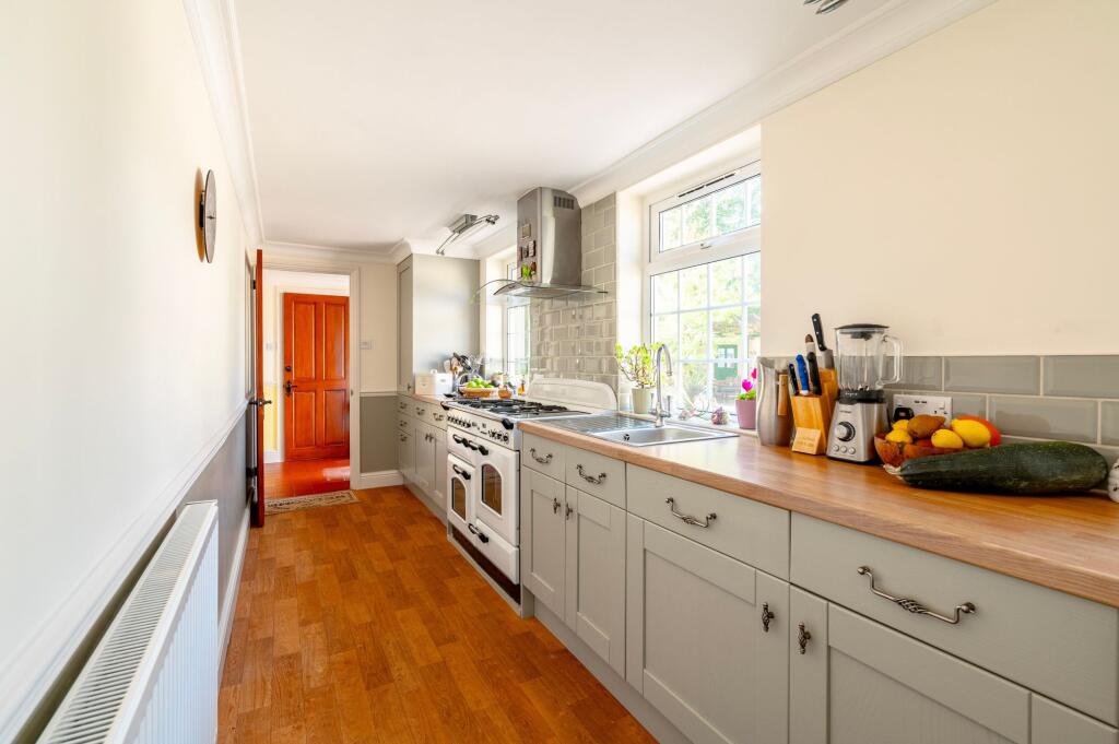
- Kitchen:
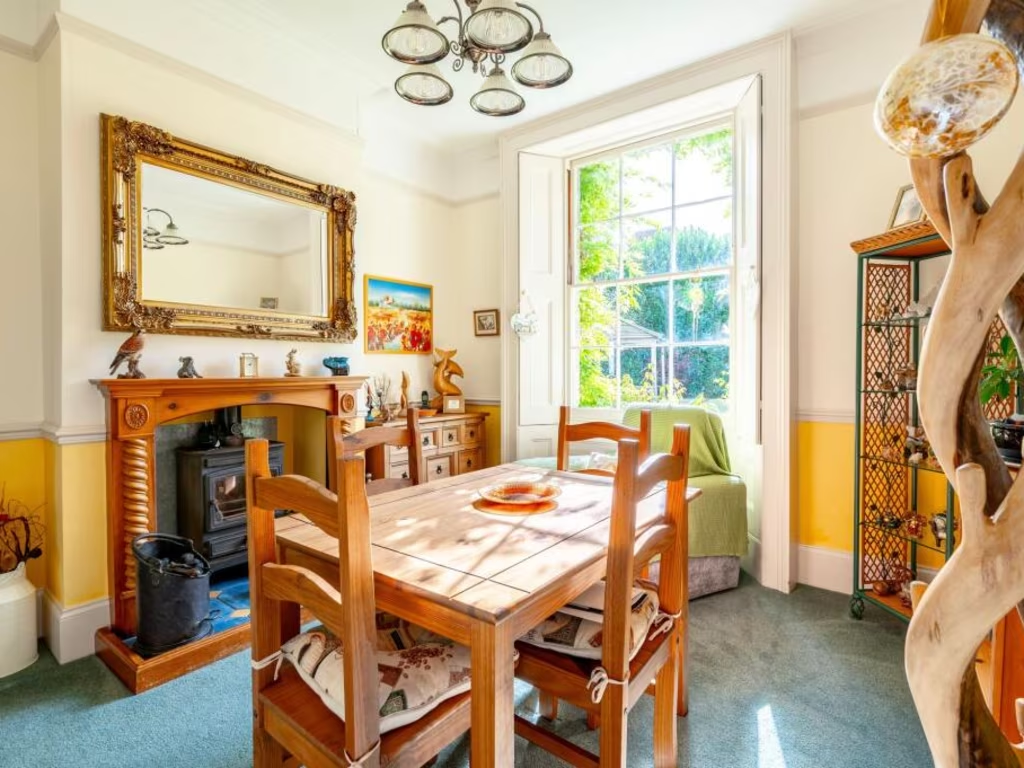
- Breakfast Room:
- Study:
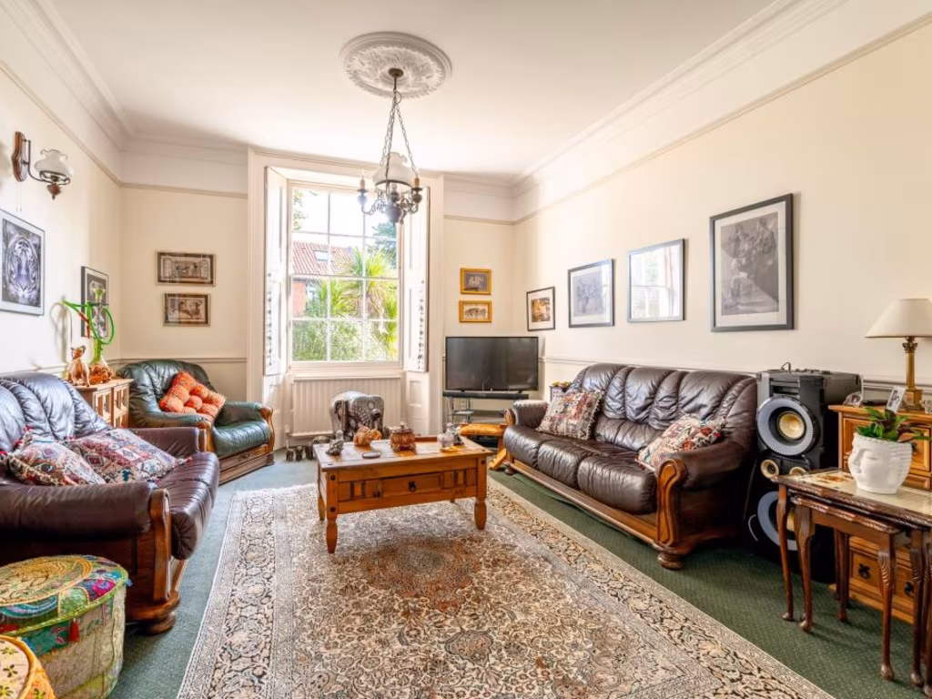
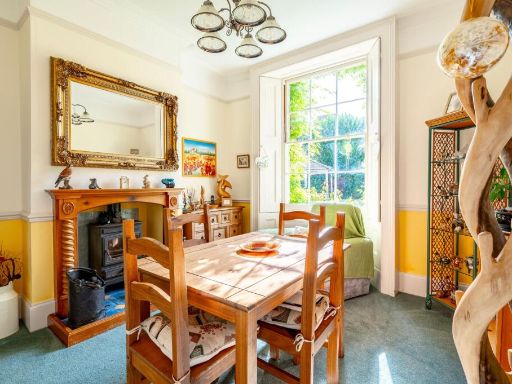
- Sitting/Dining Room:
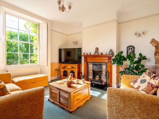
- Living Room:
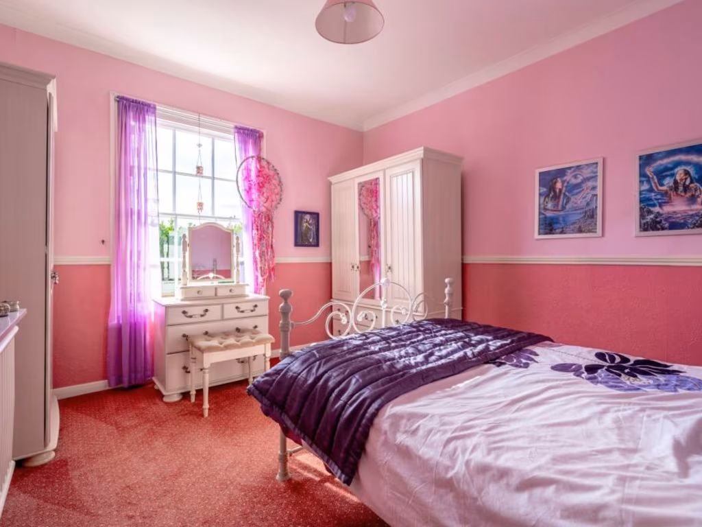
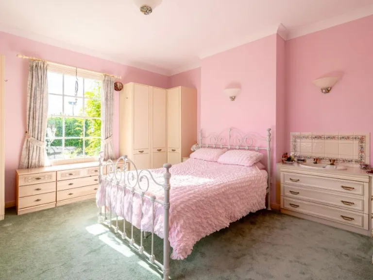
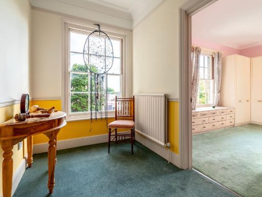
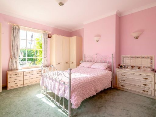
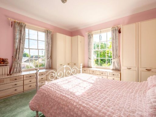
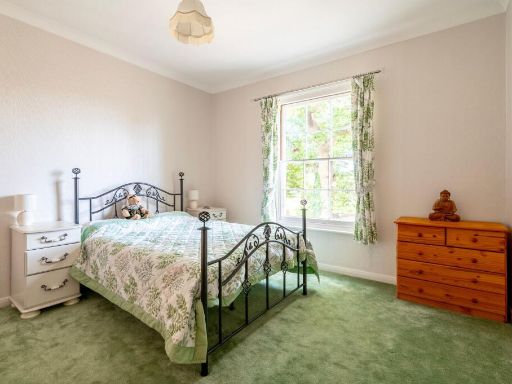
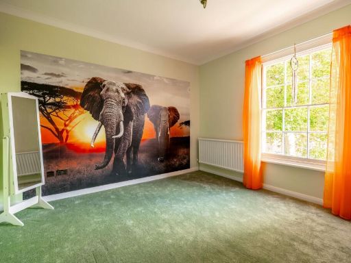
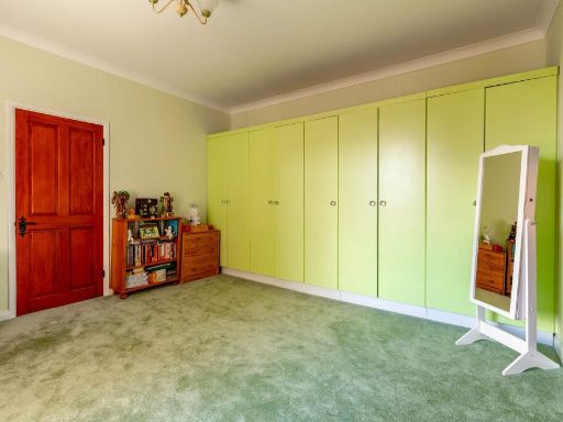
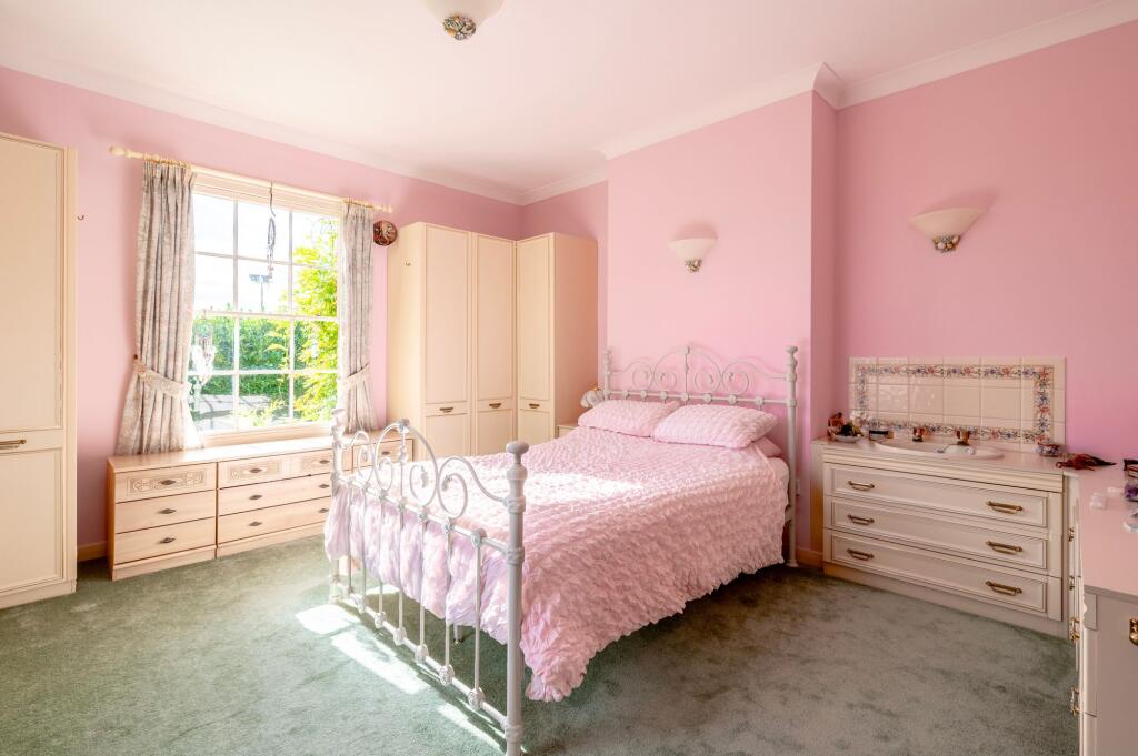
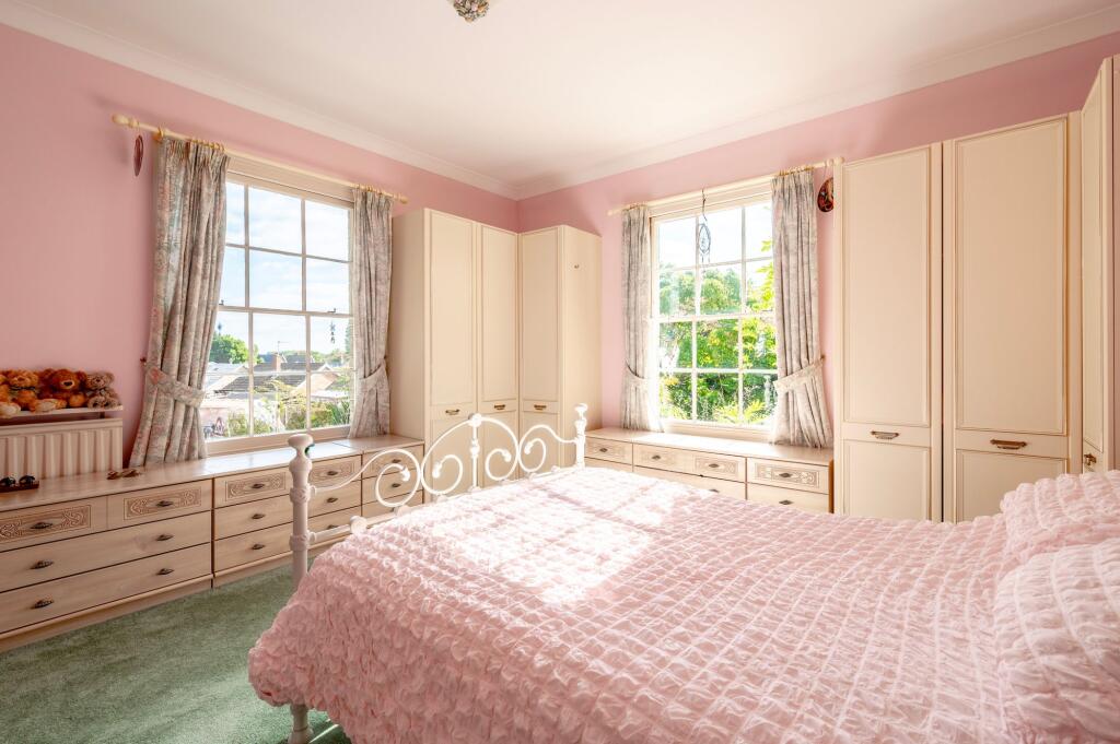
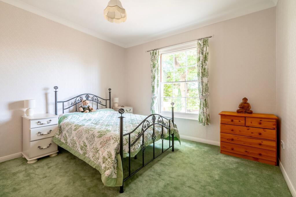
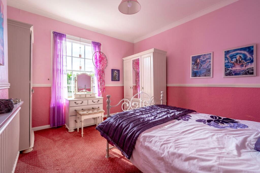
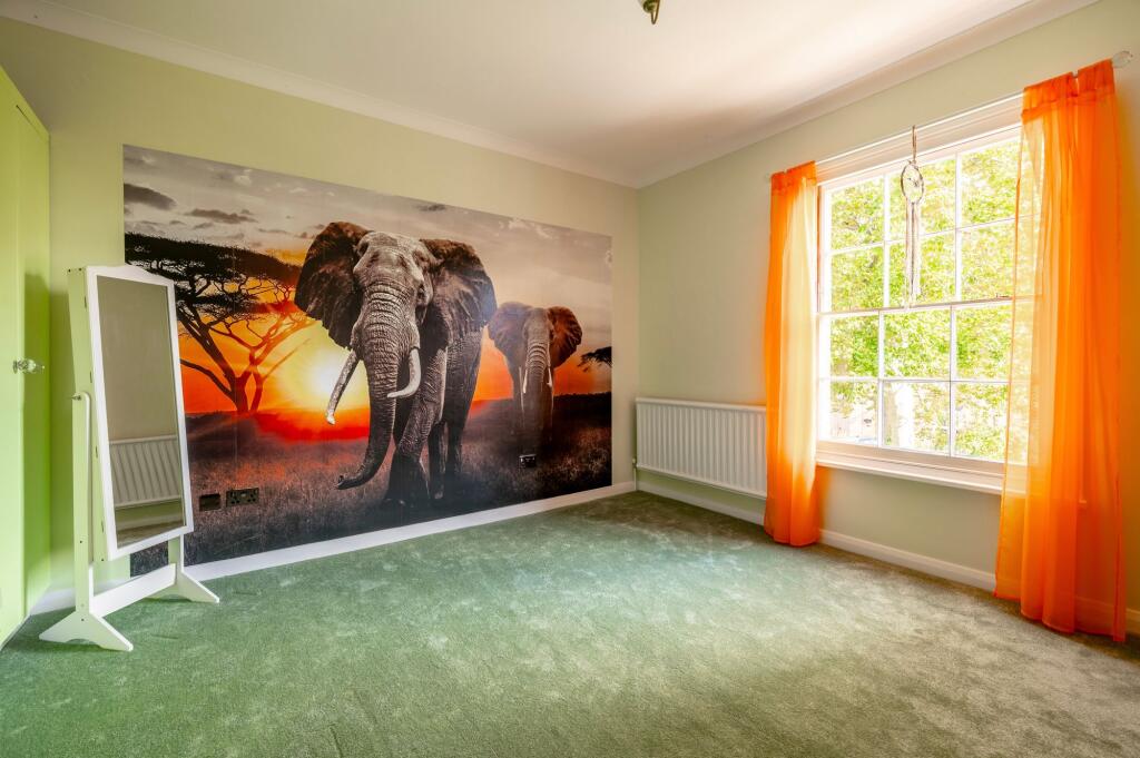
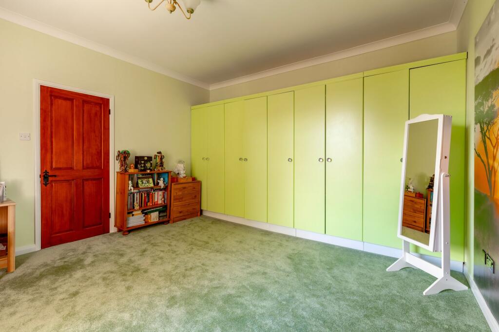
- Bedroom:
- Bedroom:
- Bedroom:
- Bedroom:
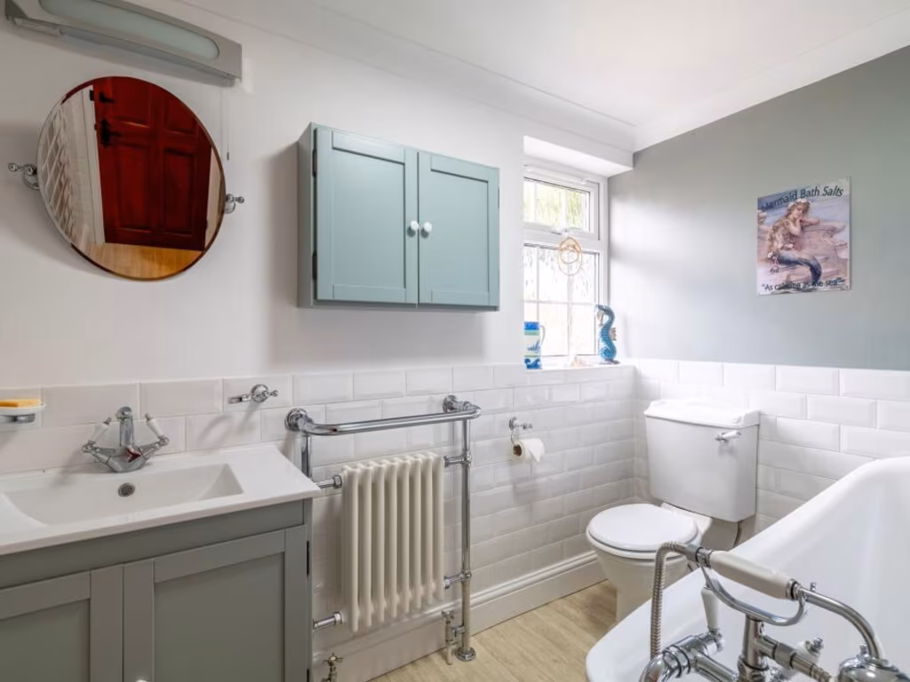
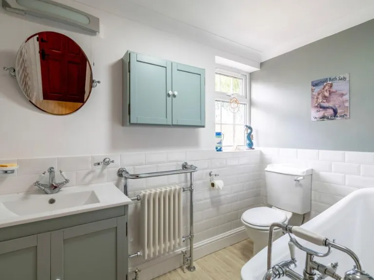
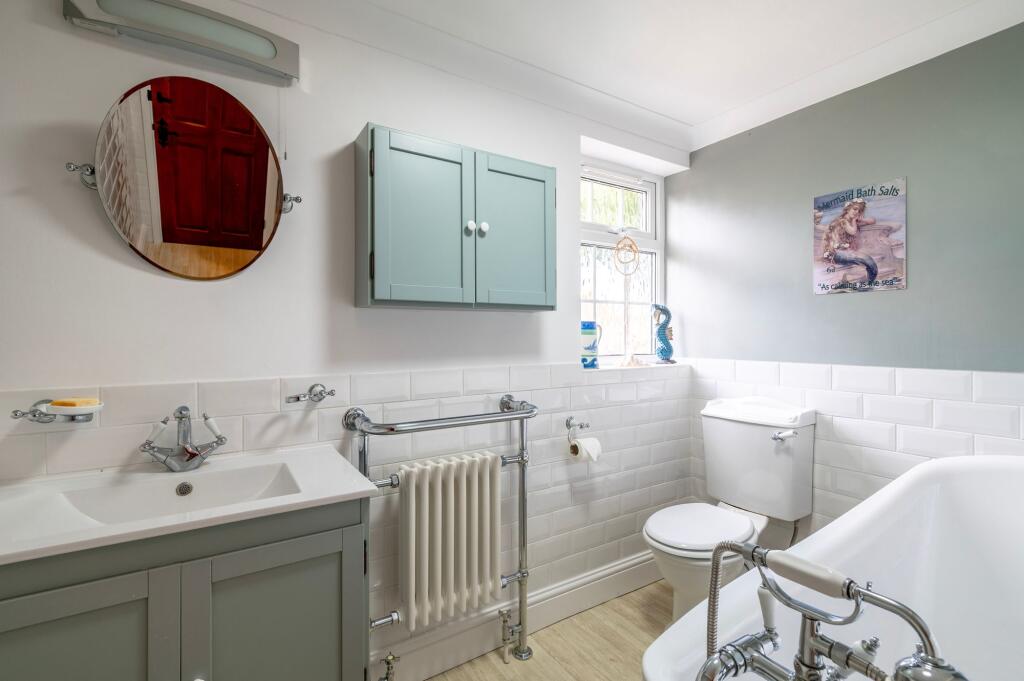
- Bathroom:
Textual Property Features
Detected Visual Features
- Georgian
- period property
- solar panels
- detached
- gravel driveway
- high ceilings
- spacious rooms
- garden
- landscaped
- heritage
- traditional architecture
- chimney
- patio
- covered
- outdoor
- brick
- rustic
- vines
- garden-style
- decorative
- green paint
- high maintenance
EPC Details
- Fully double glazed
- Cavity wall, filled cavity
- Boiler and radiators, oil
- Low energy lighting in all fixed outlets
- Solid, no insulation (assumed)
Nearby Schools
- Acle Church of England Primary Academy
- Caister Junior School
- Caister Academy
- Ludham Primary School and Nursery
- Flegg High Ormiston Academy
- Caister Infant With Nursery School
- Ormesby Village Junior School
- Hemsby Primary School
- Ormesby Village Infant School
- Rollesby Primary School
- Martham Academy and Nursery
- Winterton Primary School and Nursery
- Acle Academy
- Filby Primary School
- Fleggburgh CofE Primary School
Nearest General Shops
- Id: 3733418806
- Tags:
- Addr:
- City: Rollesby
- Housename: Hall Farm
- Postcode: NR29 5DR
- Street: Martham Road
- Name: CGars
- Shop: tobacco
- TagsNormalized:
- Lat: 52.688075
- Lon: 1.6205795
- FullGeoHash: u135szs461p9
- PartitionGeoHash: u135
- Images:
- FoodStandards: null
- Distance: 1640.5
,- Id: 2988603085
- Tags:
- Name: Martham DIY
- Shop: doityourself
- TagsNormalized:
- Lat: 52.7018602
- Lon: 1.6252196
- FullGeoHash: u135ufp6w6g9
- PartitionGeoHash: u135
- Images:
- FoodStandards: null
- Distance: 436.8
,- Id: 9447027317
- Tags:
- Name: Chapman's Butchers
- Shop: butcher
- TagsNormalized:
- Lat: 52.7033167
- Lon: 1.6348355
- FullGeoHash: u135v4q7n6md
- PartitionGeoHash: u135
- Images:
- FoodStandards: null
- Distance: 318
}
Nearest Grocery shops
- Id: 663796560
- Tags:
- Addr:
- City: Filby
- Country: GB
- Postcode: NR29 3AA
- Street: Main Road
- Alt_name: Filby Post Office Stores
- Name: Thompsons Stores
- Operator: Mace
- Shop: convenience
- TagsNormalized:
- Lat: 52.6625271
- Lon: 1.6439493
- FullGeoHash: u135t6vj6y96
- PartitionGeoHash: u135
- Images:
- FoodStandards: null
- Distance: 4382.6
,- Id: 9851341317
- Tags:
- Name: Coop
- Shop: convenience
- TagsNormalized:
- Lat: 52.6976632
- Lon: 1.6915413
- FullGeoHash: u135y3rdpu2t
- PartitionGeoHash: u135
- Images:
- FoodStandards: null
- Distance: 4057.3
,- Id: 2988581921
- Tags:
- TagsNormalized:
- Lat: 52.7032904
- Lon: 1.6331455
- FullGeoHash: u135v4m4zj3t
- PartitionGeoHash: u135
- Images:
- FoodStandards: null
- Distance: 251.7
}
Nearest Religious buildings
- Id: 384482958
- Tags:
- Amenity: place_of_worship
- Building: church
- Denomination: anglican
- Listed_status: Grade II*
- Material: stone
- Material:roof: thatch;slate
- Name: Saint Mary's Church
- Opening_hours: Mo-Su sunrise-sunset
- Religion: christian
- Short_name: Saint Mary
- Tower: round
- Website: https://www.achurchnearyou.com/west-somerton-st-mary/
- Wikidata: Q17554467
- TagsNormalized:
- place of worship
- church
- anglican
- christian
- Lat: 52.7169187
- Lon: 1.6638469
- FullGeoHash: u135vugd63yj
- PartitionGeoHash: u135
- Images:
- FoodStandards: null
- Distance: 2785.7
,- Id: 256196396
- Tags:
- Amenity: place_of_worship
- Building: church
- Denomination: anglican
- Listed_status: Grade II*
- Material: stone
- Name: Saint George's Church
- Religion: christian
- Short_name: Saint George
- Tower: round
- Website: https://www.achurchnearyou.com/rollesby-st-george/
- Wikidata: Q17554452
- TagsNormalized:
- place of worship
- church
- anglican
- christian
- Lat: 52.6842554
- Lon: 1.6178514
- FullGeoHash: u135syfh49j2
- PartitionGeoHash: u135
- Images:
- FoodStandards: null
- Distance: 2102.6
,- Id: 217551162
- Tags:
- Amenity: place_of_worship
- Building: church
- Denomination: anglican
- Listed_status: Grade I
- Material: stone
- Name: Saint Mary The Virgin
- Religion: christian
- Short_name: Saint Mary
- Source: Bing
- Spire: yes
- Tower: square
- Website: https://www.achurchnearyou.com/st-mary-martham/
- Wikidata: Q17535990
- TagsNormalized:
- place of worship
- church
- anglican
- christian
- Lat: 52.7079088
- Lon: 1.6327559
- FullGeoHash: u135v5hvvfr4
- PartitionGeoHash: u135
- Images:
- FoodStandards: null
- Distance: 747.2
}
Nearest Medical buildings
- Id: 1711402461
- Tags:
- TagsNormalized:
- Lat: 52.7084265
- Lon: 1.5349396
- FullGeoHash: u135fgm8ydvg
- PartitionGeoHash: u135
- Images:
- FoodStandards: null
- Distance: 6562.7
,- Id: 1256325403
- Tags:
- Amenity: pharmacy
- Name: Co-operative
- TagsNormalized:
- Lat: 52.6734926
- Lon: 1.6866837
- FullGeoHash: u135wkujqddw
- PartitionGeoHash: u135
- Images:
- FoodStandards: null
- Distance: 4825.5
,- Id: 9448206396
- Tags:
- Amenity: pharmacy
- Brand: Well Pharmacy
- Brand:wikidata: Q7726524
- Brand:wikipedia: en:Well Pharmacy
- Healthcare: pharmacy
- Name: Well Pharmacy
- TagsNormalized:
- pharmacy
- well pharmacy
- health
- healthcare
- Lat: 52.6975331
- Lon: 1.6914023
- FullGeoHash: u135y3r9ks0v
- PartitionGeoHash: u135
- Images:
- FoodStandards: null
- Distance: 4049.5
,- Id: 384428174
- Tags:
- Addr:
- City: Fleggburgh
- Postcode: NR29 3AW
- Street: Mill Lane
- Amenity: doctors
- Building: yes
- Name: Fleggburgh Surgery
- Phone: +44 1493 369232
- Source: OS_OpenData_VectorMapLocal
- Website: https://www.fleggburghsurgery.co.uk/
- TagsNormalized:
- Lat: 52.6731266
- Lon: 1.6139305
- FullGeoHash: u135ssz5pq3z
- PartitionGeoHash: u135
- Images:
- FoodStandards: null
- Distance: 3344.1
}
Nearest Leisure Facilities
- Id: 6865097703
- Tags:
- TagsNormalized:
- Lat: 52.7068433
- Lon: 1.6297676
- FullGeoHash: u135v4fz87dz
- PartitionGeoHash: u135
- Images:
- FoodStandards: null
- Distance: 637.1
,- Id: 217639472
- Tags:
- Leisure: pitch
- Sport: bowls
- TagsNormalized:
- Lat: 52.6988924
- Lon: 1.629467
- FullGeoHash: u135v1d933dd
- PartitionGeoHash: u135
- Images:
- FoodStandards: null
- Distance: 297.1
,- Id: 217639462
- Tags:
- Leisure: pitch
- Sport: multi
- TagsNormalized:
- Lat: 52.7007984
- Lon: 1.6309553
- FullGeoHash: u135v1gskhb7
- PartitionGeoHash: u135
- Images:
- FoodStandards: null
- Distance: 65.1
,- Id: 217639455
- Tags:
- Leisure: pitch
- Sport: skateboard
- TagsNormalized:
- pitch
- leisure
- skateboard
- sports
- Lat: 52.7007511
- Lon: 1.6312418
- FullGeoHash: u135v1gu4sn1
- PartitionGeoHash: u135
- Images:
- FoodStandards: null
- Distance: 58.4
,- Id: 217639468
- Tags:
- Leisure: playground
- Source: Bing
- TagsNormalized:
- Lat: 52.7007047
- Lon: 1.6315091
- FullGeoHash: u135v1u5bgmk
- PartitionGeoHash: u135
- Images:
- FoodStandards: null
- Distance: 58.3
}
Nearest Tourist attractions
- Id: 3693832593
- Tags:
- Name: White House
- Phone: +44 1692670403
- Tourism: camp_site
- TagsNormalized:
- Lat: 52.7052351
- Lon: 1.585097
- FullGeoHash: u135u4dnprvv
- PartitionGeoHash: u135
- Images:
- FoodStandards: null
- Distance: 3165.9
,- Id: 2269422144
- Tags:
- Addr:
- Postcode: NR29 4DR
- Street: Winterton Road
- Name: Three Acres B&B
- Tourism: guest_house
- Website: http://www.three-acres.co.uk/
- TagsNormalized:
- Lat: 52.7188136
- Lon: 1.6628942
- FullGeoHash: u135vv4vk5pu
- PartitionGeoHash: u135
- Images:
- FoodStandards: null
- Distance: 2874.9
,- Id: 3695106458
- Tags:
- Name: Cowtrott
- Phone: +44 1493740760
- Tourism: caravan_site
- TagsNormalized:
- Lat: 52.6897946
- Lon: 1.6336047
- FullGeoHash: u135tpvs39xg
- PartitionGeoHash: u135
- Images:
- FoodStandards: null
- Distance: 1278
}
Nearest Train stations
- Id: 263373156
- Tags:
- Name: Somerleyton
- Naptan:
- Network: National Rail
- Public_transport: station
- Railway: station
- Ref:
- Source: NPE
- Wikidata: Q1920909
- Wikipedia: en:Somerleyton railway station
- TagsNormalized:
- Lat: 52.5101587
- Lon: 1.6521998
- FullGeoHash: u134tx5jg513
- PartitionGeoHash: u134
- Images:
- FoodStandards: null
- Distance: 21291
,- Id: 114975239
- Tags:
- Name: North Walsham
- Naptan:
- Network: National Rail
- Public_transport: station
- Railway: station
- Ref:
- Source: NPE
- Wikidata: Q217655
- Wikipedia: en:North Walsham railway station
- TagsNormalized:
- Lat: 52.8168567
- Lon: 1.3844999
- FullGeoHash: u12urx00mpty
- PartitionGeoHash: u12u
- Images:
- FoodStandards: null
- Distance: 21020
,- Id: 253006650
- Tags:
- Name: Buckenham
- Naptan:
- Network: National Rail
- Public_transport: station
- Railway: station
- Ref:
- Request_stop: yes
- Source: NPE
- Toilets:
- Wikidata: Q2064742
- Wikipedia: en:Buckenham railway station
- TagsNormalized:
- Lat: 52.5977147
- Lon: 1.4701518
- FullGeoHash: u1351rnech8t
- PartitionGeoHash: u135
- Images:
- FoodStandards: null
- Distance: 15846.8
,- Id: 283317149
- Tags:
- Name: Cantley
- Naptan:
- Network: National Rail
- Public_transport: station
- Railway: station
- Ref:
- Source: NPE
- Wikidata: Q2149282
- Wikipedia: en:Cantley railway station
- TagsNormalized:
- Lat: 52.5787207
- Lon: 1.5136275
- FullGeoHash: u13547wjnpfm
- PartitionGeoHash: u135
- Images:
- FoodStandards: null
- Distance: 15777.8
,- Id: 1699243929
- Tags:
- Name: Great Yarmouth
- Name:lt: Didysis Jarmutas
- Naptan:
- Network: National Rail
- Operator: Greater Anglia
- Platforms: 4
- Public_transport: station
- Railway: station
- Ref:
- Wikidata: Q280999
- Wikipedia: en:Great Yarmouth railway station
- TagsNormalized:
- Lat: 52.6119213
- Lon: 1.7206879
- FullGeoHash: u135r1sywuvz
- PartitionGeoHash: u135
- Images:
- FoodStandards: null
- Distance: 11606.1
}
Nearest Hotels
- Id: 685509192
- Tags:
- Addr:
- Postcode: NR12 9QT
- Street: Staithe Road
- Building: yes
- Fhrs:
- Name: Sutton Staithe Hotel
- Source: OS Vectormap
- Source:addr: FSA Food Hygiene Ratings Database
- Tourism: hotel
- TagsNormalized:
- Lat: 52.7589771
- Lon: 1.5289544
- FullGeoHash: u13h4u3r74pj
- PartitionGeoHash: u13h
- Images:
- FoodStandards: null
- Distance: 9435.4
,- Id: 96577330
- Tags:
- Addr:
- City: Norwich
- Postcode: NR13 3BE
- Street: New Road
- Town: Acle
- Brand: Travelodge
- Brand:wikidata: Q9361374
- Brand:wikipedia: en:Travelodge UK
- Building: yes
- Fhrs:
- Authority: Broadland
- Id: 690617
- Local_authority_id: 3367
- Name: Travelodge
- Source:
- Tourism: hotel
- TagsNormalized:
- Lat: 52.6376572
- Lon: 1.5523919
- FullGeoHash: u1357q6kt67r
- PartitionGeoHash: u135
- Images:
- FoodStandards: null
- Distance: 8860
,- Id: 387221177
- Tags:
- Addr:
- City: Great Yarmouth
- Country: GB
- Postcode: NR29 5JN
- Street: Tower Road
- Amenity: cattery
- Building: yes
- Email: bastwicktowercathotel@hotmail.co.uk
- Mobile: +44 7769 755495
- Name: Bastwick Tower Cat Hotel
- Opening_hours: Mo-Sa 09:00-12:00
- Phone: +44 1692 670467
- Source: OS_OpenData_VectorMapLocal
- Website: http://www.bastwicktowercathotel.co.uk/
- TagsNormalized:
- Lat: 52.7063206
- Lon: 1.5903449
- FullGeoHash: u135u4yh9dr0
- PartitionGeoHash: u135
- Images:
- FoodStandards: null
- Distance: 2837.9
}
Tags
- Georgian
- period property
- solar panels
- detached
- gravel driveway
- high ceilings
- spacious rooms
- garden
- landscaped
- heritage
- traditional architecture
- chimney
- patio
- covered
- outdoor
- brick
- rustic
- vines
- garden-style
- decorative
- green paint
- high maintenance
Local Market Stats
- Average Price/sqft: £278
- Avg Income: £39500
- Social Housing: 9%
- Planning Success Rate: 84%
AirBnB Data
- 1km average: £80/night
- Listings in 1km: 1
Similar Properties
 4 bedroom detached house for sale in Rollesby Road, Martham, NR29 — £695,000 • 4 bed • 1 bath • 3013 ft²
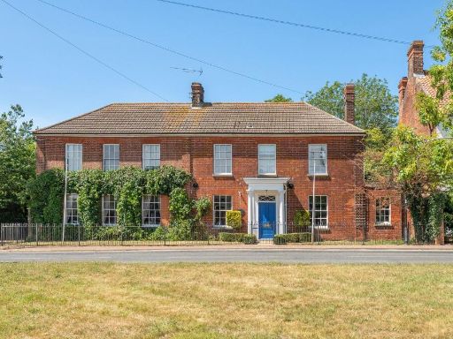 4 bedroom detached house for sale in The Green, Martham, NR29 — £650,000 • 4 bed • 3 bath • 2752 ft²
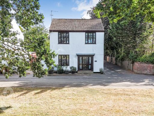 4 bedroom detached house for sale in The Green, Martham, Great Yarmouth, NR29 — £450,000 • 4 bed • 3 bath • 1838 ft²
 4 bedroom detached house for sale in White Street, Martham, NR29 — £670,000 • 4 bed • 2 bath • 2930 ft²
 4 bedroom detached house for sale in Somerton Road, Martham, NR29 — £425,000 • 4 bed • 2 bath • 1953 ft²
 4 bedroom detached house for sale in Rollesby Road, Martham, Great Yarmouth, NR29 — £695,000 • 4 bed • 1 bath • 2968 ft²
Meta
- {
"@context": "https://schema.org",
"@type": "Residence",
"name": "4 bedroom detached house for sale in The Oaks, Martham, NR29",
"description": "",
"url": "https://propertypiper.co.uk/property/dbe9a9a1-e633-4986-a55e-9f2a1418cdb1",
"image": "https://image-a.propertypiper.co.uk/7abd723f-26ab-4d61-8426-8db891c1f5b9-1024.jpeg",
"address": {
"@type": "PostalAddress",
"streetAddress": "26 ROLLESBY ROAD MARTHAM GREAT YARMOUTH",
"postalCode": "NR29 4SW",
"addressLocality": "Great Yarmouth",
"addressRegion": "Great Yarmouth",
"addressCountry": "England"
},
"geo": {
"@type": "GeoCoordinates",
"latitude": 52.70122476380282,
"longitude": 1.6316164990435347
},
"numberOfRooms": 4,
"numberOfBathroomsTotal": 1,
"floorSize": {
"@type": "QuantitativeValue",
"value": 3378,
"unitCode": "FTK"
},
"offers": {
"@type": "Offer",
"price": 675000,
"priceCurrency": "GBP",
"availability": "https://schema.org/InStock"
},
"additionalProperty": [
{
"@type": "PropertyValue",
"name": "Feature",
"value": "Georgian"
},
{
"@type": "PropertyValue",
"name": "Feature",
"value": "period property"
},
{
"@type": "PropertyValue",
"name": "Feature",
"value": "solar panels"
},
{
"@type": "PropertyValue",
"name": "Feature",
"value": "detached"
},
{
"@type": "PropertyValue",
"name": "Feature",
"value": "gravel driveway"
},
{
"@type": "PropertyValue",
"name": "Feature",
"value": "high ceilings"
},
{
"@type": "PropertyValue",
"name": "Feature",
"value": "spacious rooms"
},
{
"@type": "PropertyValue",
"name": "Feature",
"value": "garden"
},
{
"@type": "PropertyValue",
"name": "Feature",
"value": "landscaped"
},
{
"@type": "PropertyValue",
"name": "Feature",
"value": "heritage"
},
{
"@type": "PropertyValue",
"name": "Feature",
"value": "traditional architecture"
},
{
"@type": "PropertyValue",
"name": "Feature",
"value": "chimney"
},
{
"@type": "PropertyValue",
"name": "Feature",
"value": "patio"
},
{
"@type": "PropertyValue",
"name": "Feature",
"value": "covered"
},
{
"@type": "PropertyValue",
"name": "Feature",
"value": "outdoor"
},
{
"@type": "PropertyValue",
"name": "Feature",
"value": "brick"
},
{
"@type": "PropertyValue",
"name": "Feature",
"value": "rustic"
},
{
"@type": "PropertyValue",
"name": "Feature",
"value": "vines"
},
{
"@type": "PropertyValue",
"name": "Feature",
"value": "garden-style"
},
{
"@type": "PropertyValue",
"name": "Feature",
"value": "decorative"
},
{
"@type": "PropertyValue",
"name": "Feature",
"value": "green paint"
},
{
"@type": "PropertyValue",
"name": "Feature",
"value": "high maintenance"
}
]
}
High Res Floorplan Images
Compatible Floorplan Images
FloorplanImages Thumbnail