WA3 2ET - 2 bedroom semidetached bungalow for sale in Hilary Avenue,…
View on Property Piper
2 bedroom semi-detached bungalow for sale in Hilary Avenue, Lowton, WA3 2ET, WA3
Property Details
- Price: £209950
- Bedrooms: 2
- Bathrooms: 1
- Property Type: undefined
- Property SubType: undefined
Brochure Descriptions
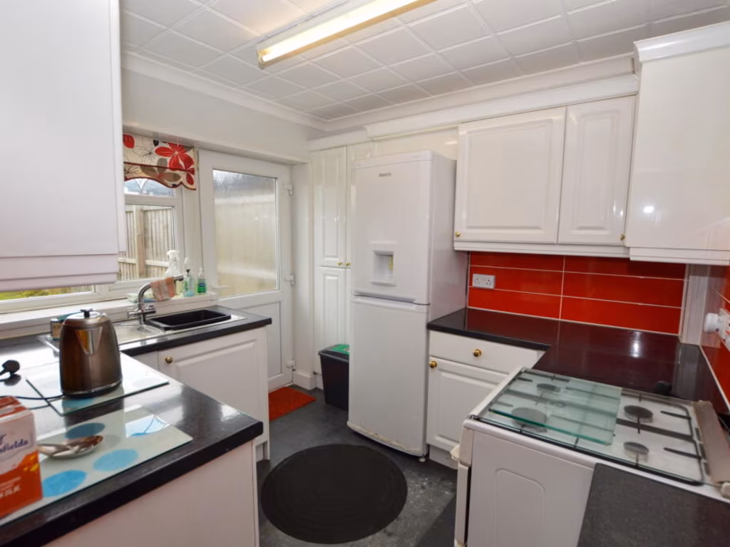
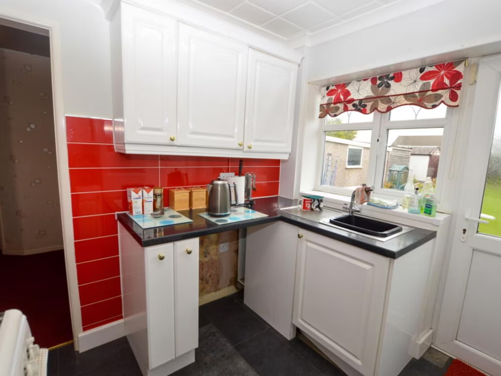
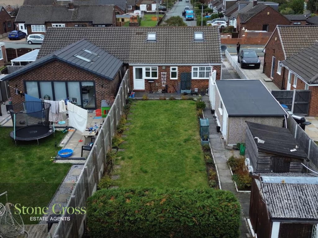
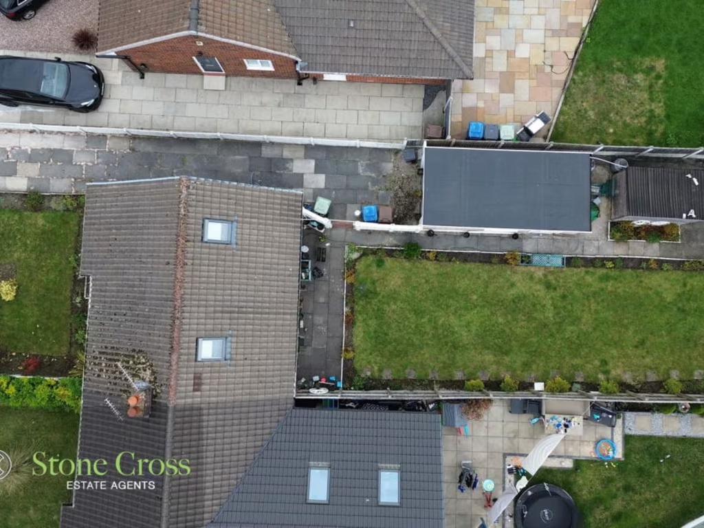
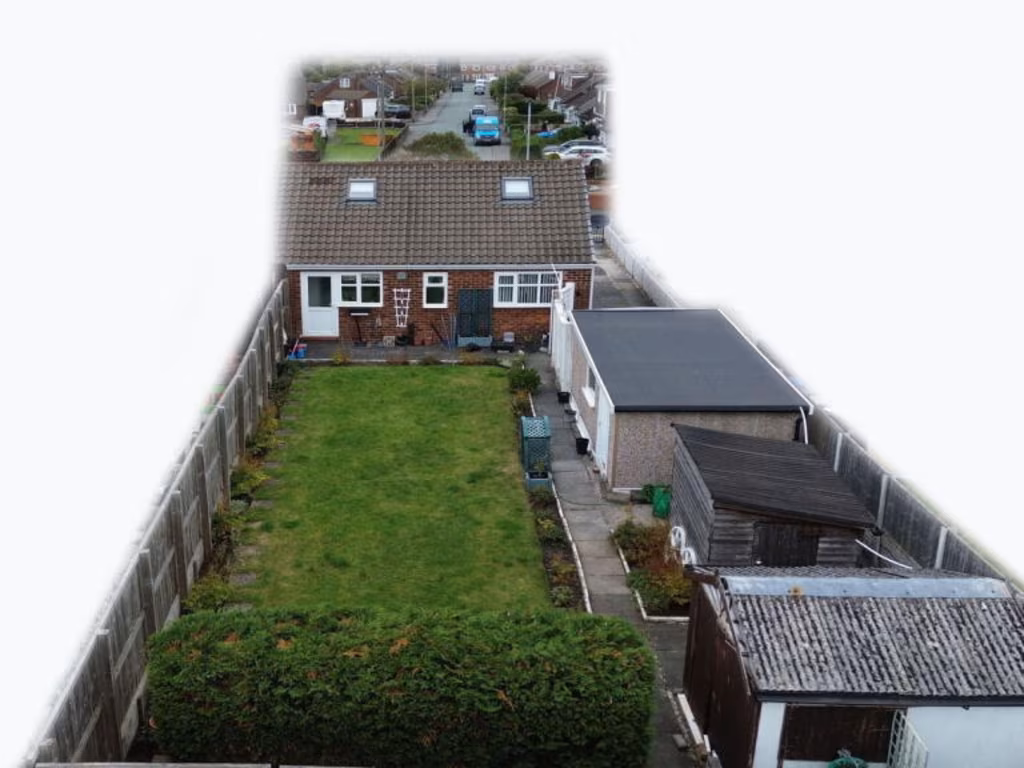
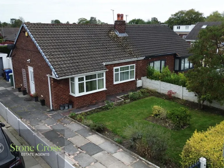
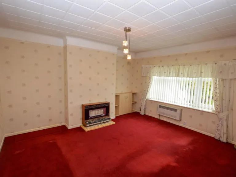
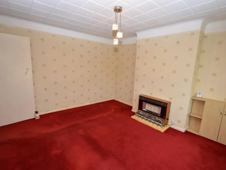
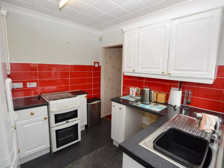
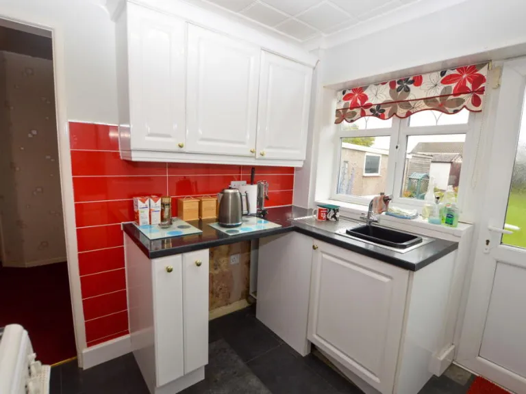
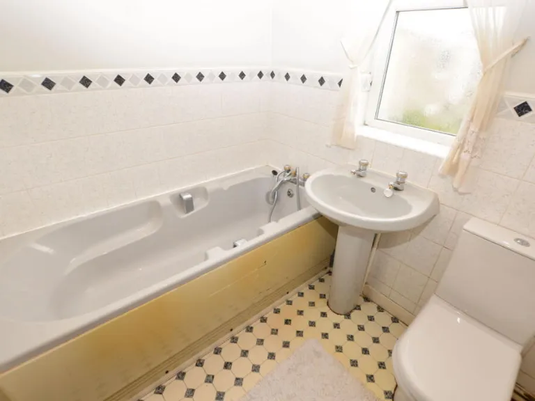
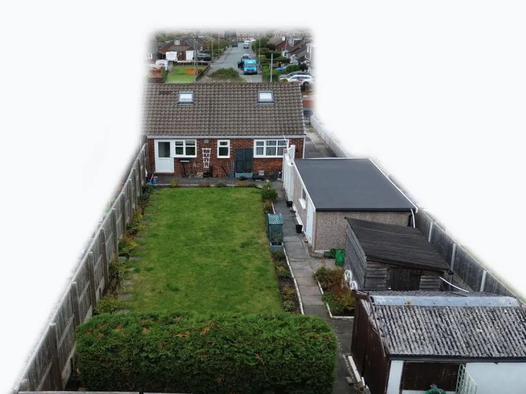
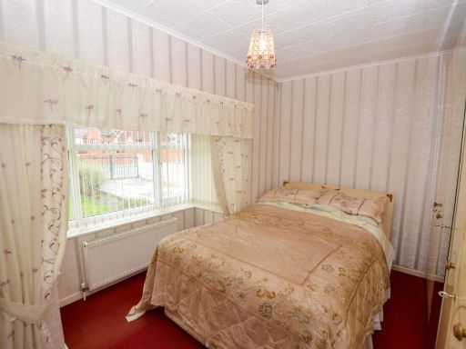
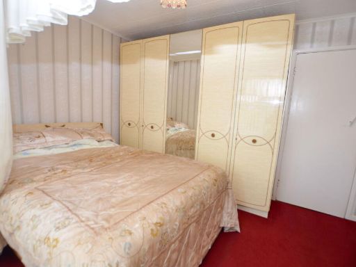
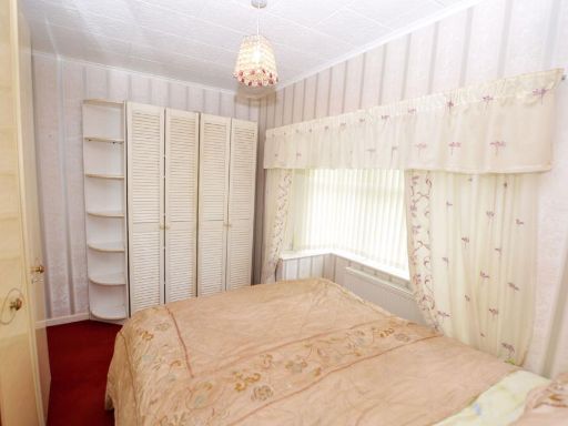
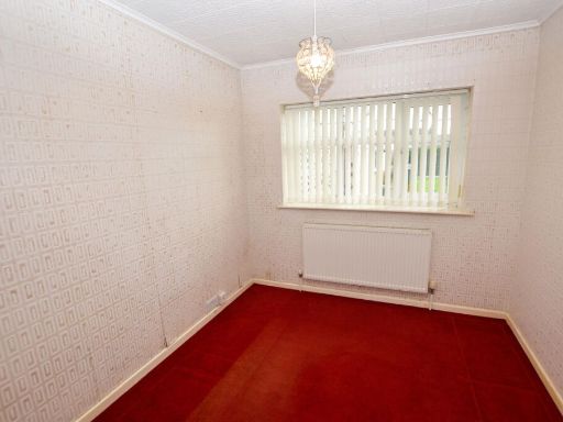
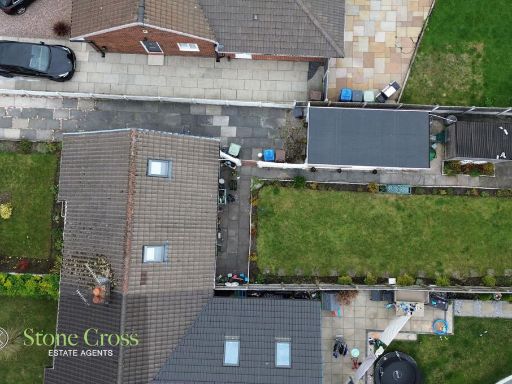
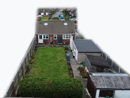
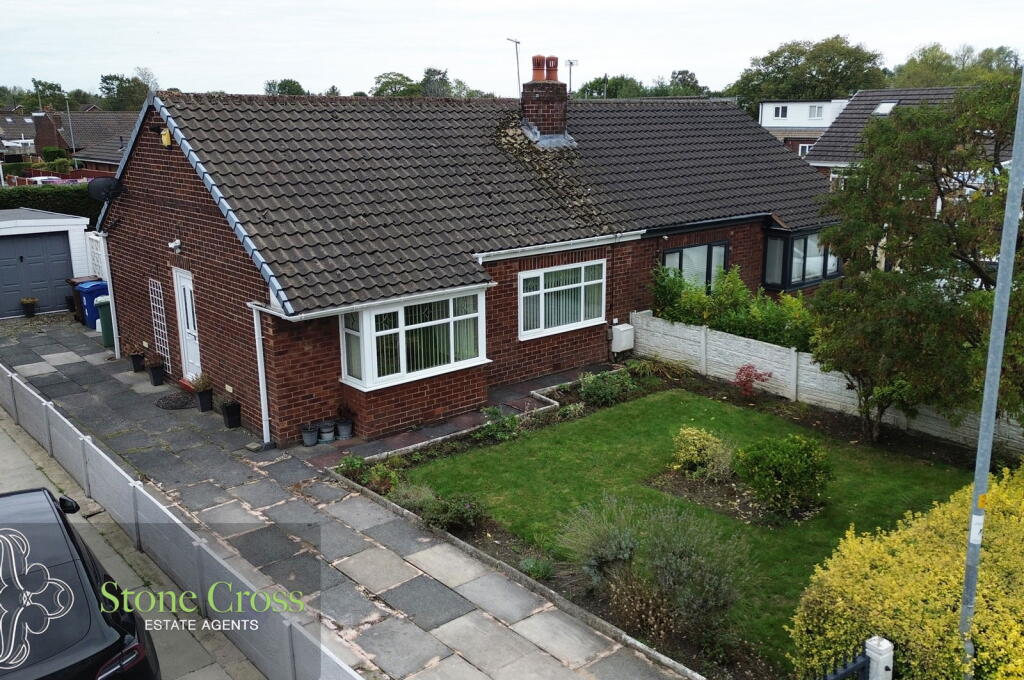
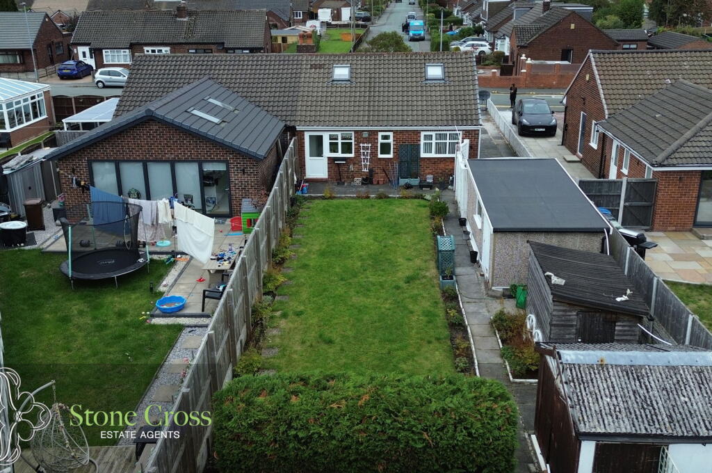
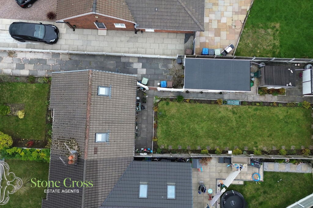
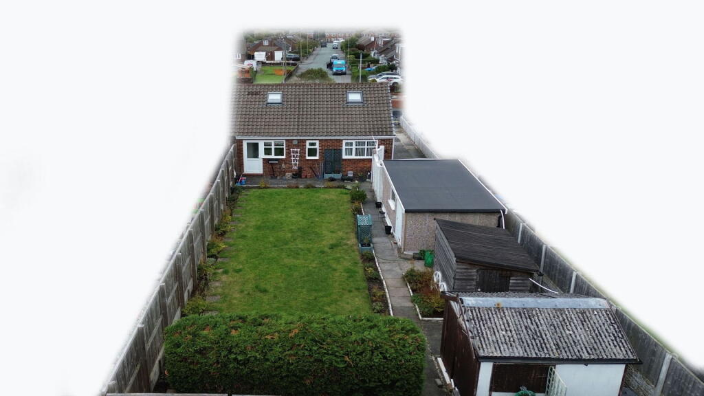
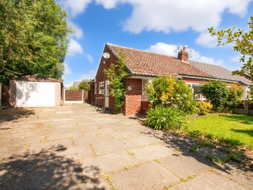
- Two-bedroom semi-detached bungalow located on Hilary Avenue in Lowton (WA3 2ET). Single-storey residence with a welcoming entrance, lounge, kitchen, two bedrooms and a bathroom. Property benefits from a boarded loft with two skylights and integral lighting (potential for further accommodation subject to consents). Substantial rear garden with good potential to extend the main property, plus a front garden and paved driveway providing off-road parking. Detached garage with workbench and integral lighting and electricity supply. Well-positioned within an established residential area close to local shops, schools and good road links (A580 and National Motorway network). Overall plot appears to be average to above-average for the area; garden described as substantial to the rear.
- Map-based listing showing a single dwelling location at the edge of a sizable open green space/field with a small watercourse (stream) running nearby. The property icon sits within or adjacent to a suburban residential neighbourhood (Golborne / Lowton area) made up of short streets and cul-de-sacs. Based solely on the image: appears to be a single house plot with a relatively large garden / grounds (large garden relative to surrounding plots). Overall property footprint appears to be a standard single-family dwelling (average house size) set on a large plot backing onto open green space.
Image Descriptions
- exterior bungalow
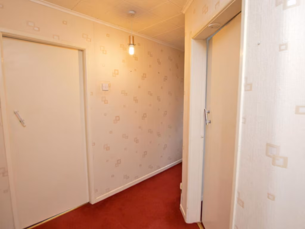
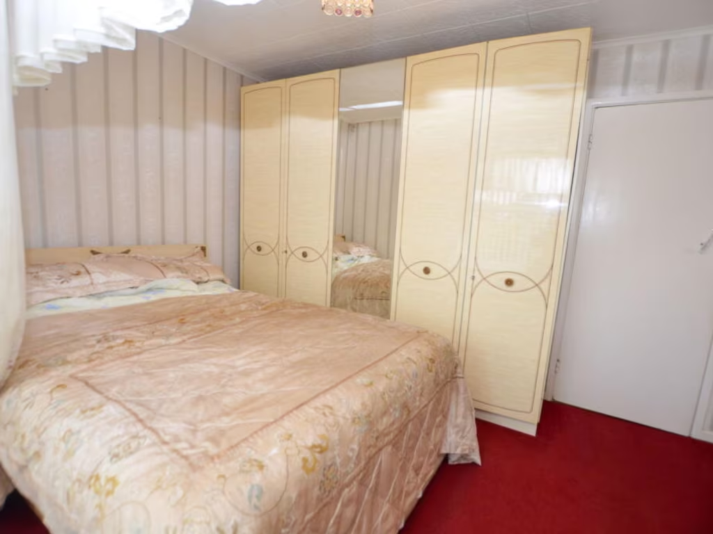
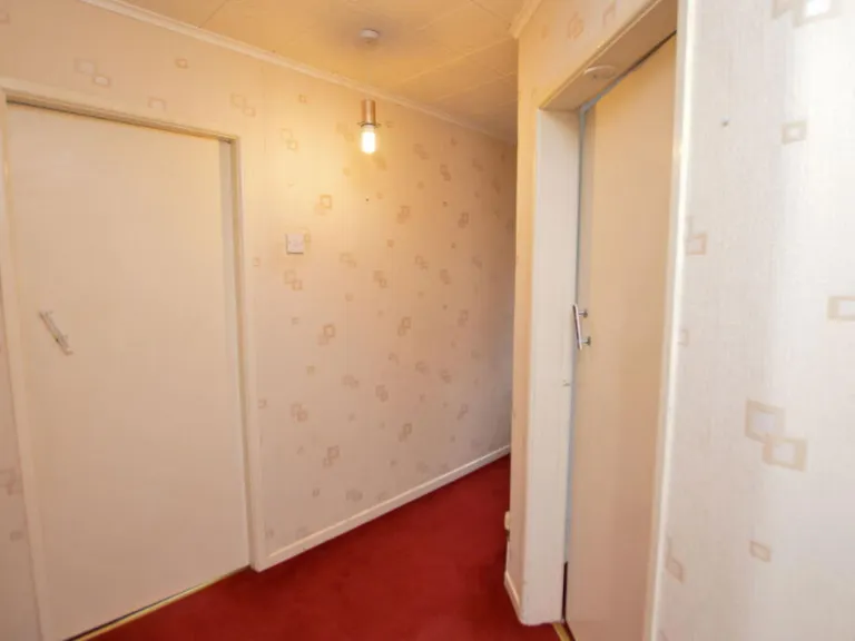
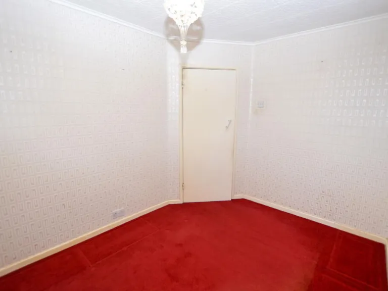
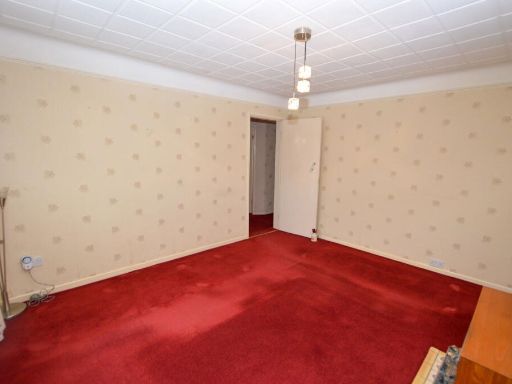
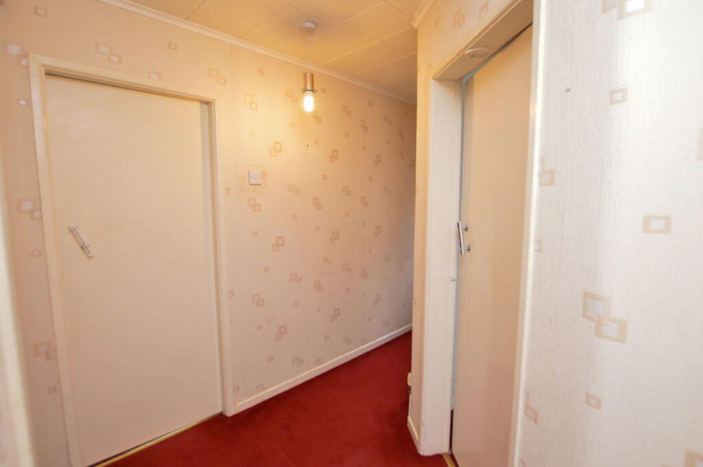
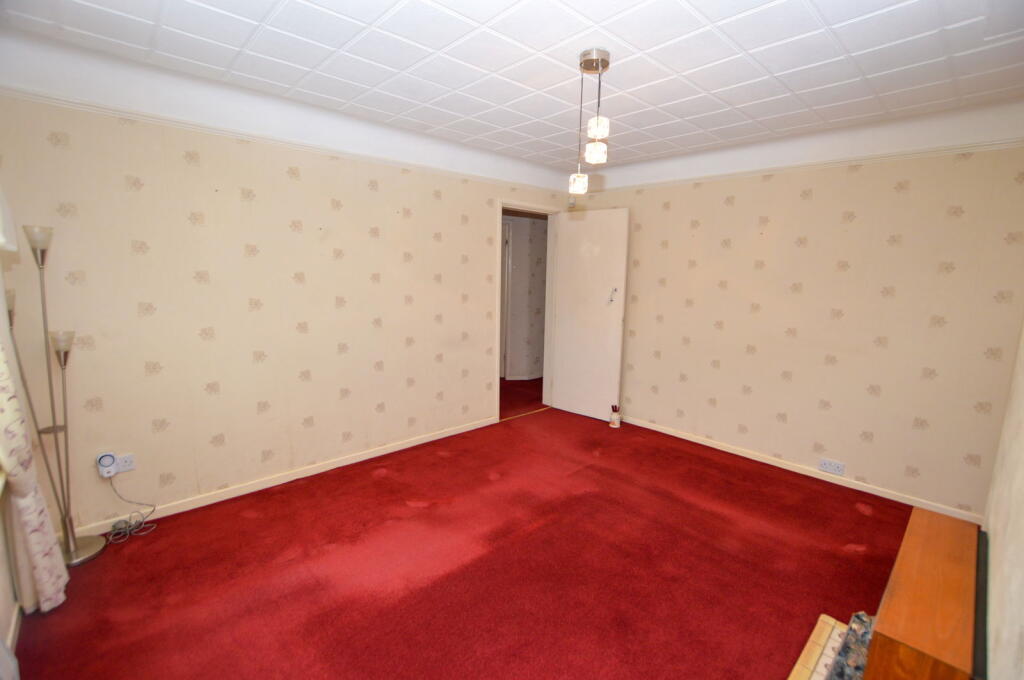
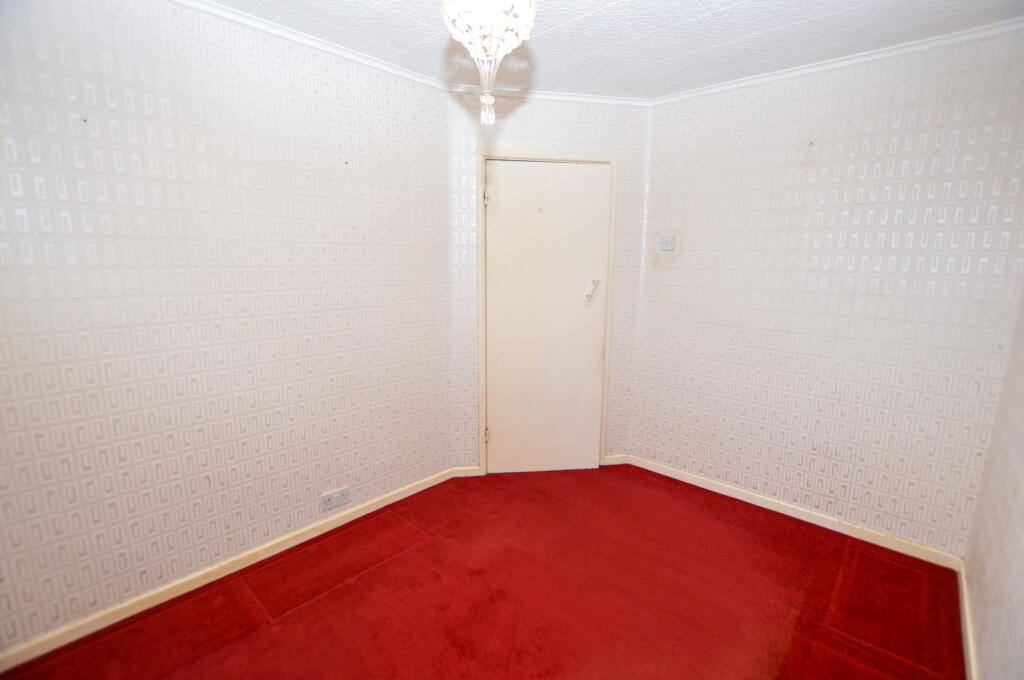
- hallway Mid-century modern
Rooms
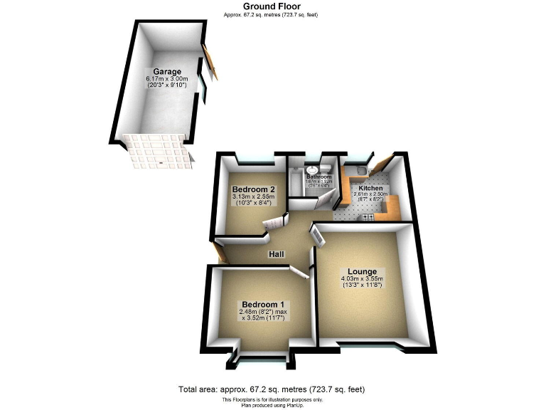
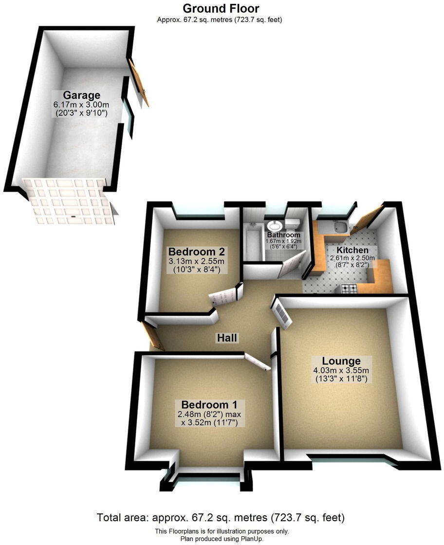
- Garage:
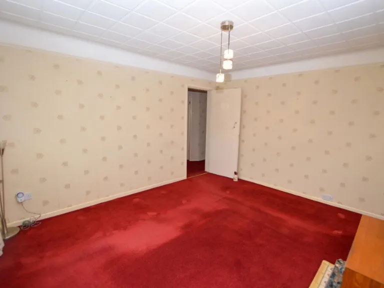
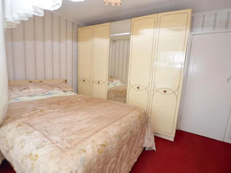
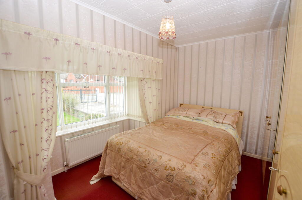
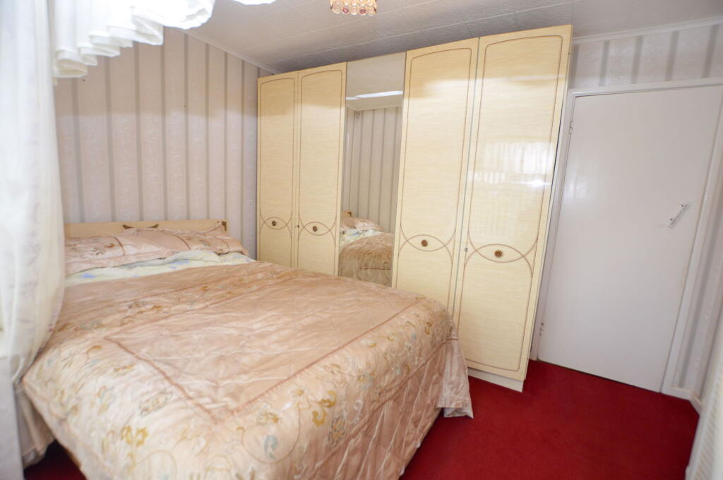
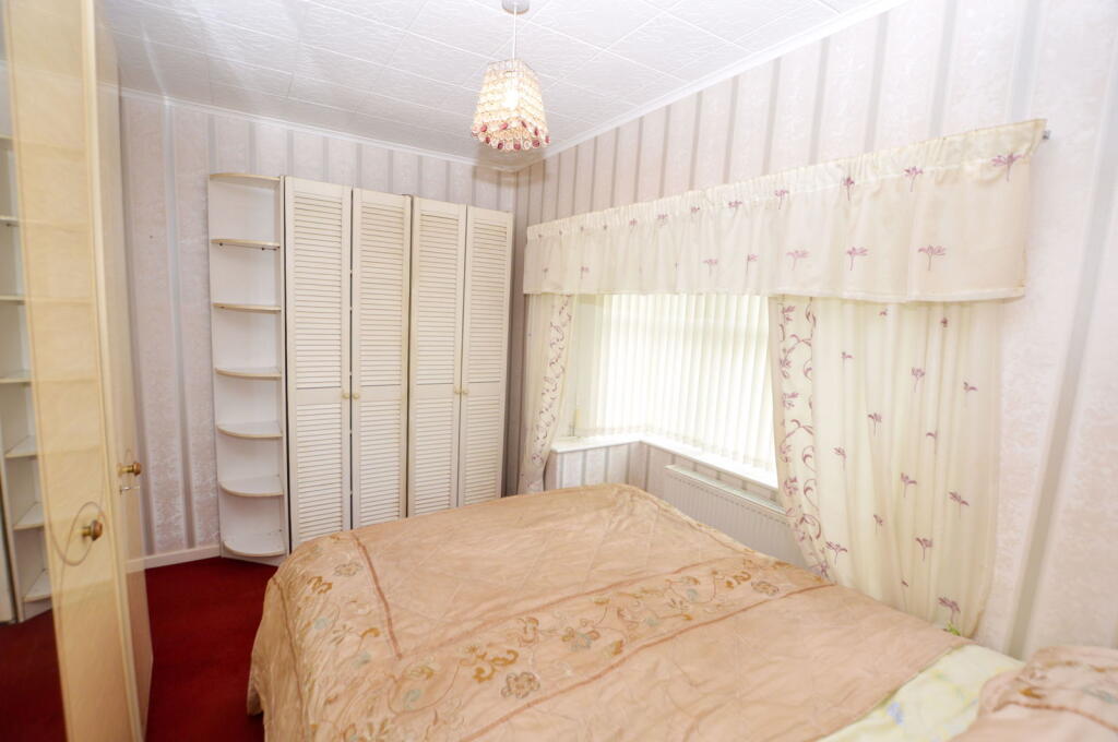
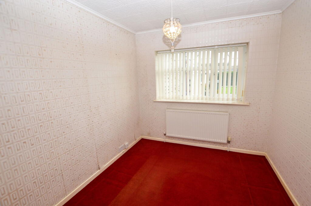
- Bedroom 2:
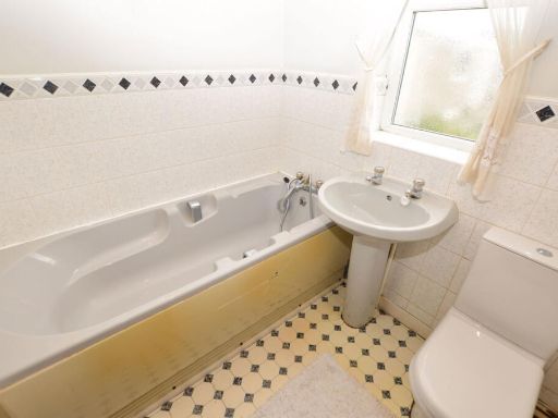
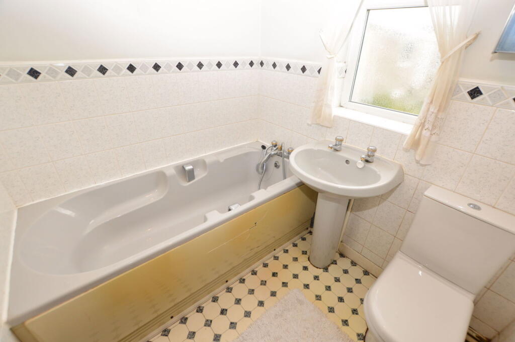
- Bathroom:
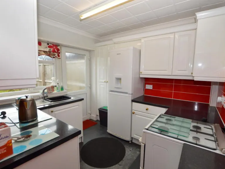
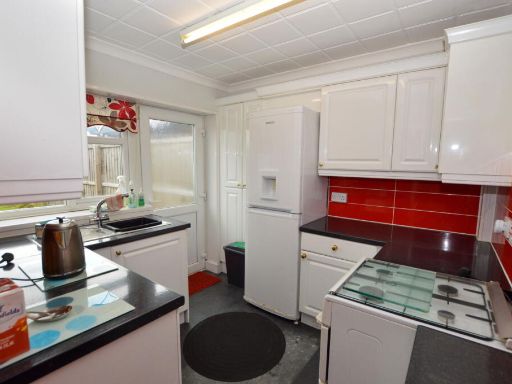
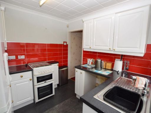
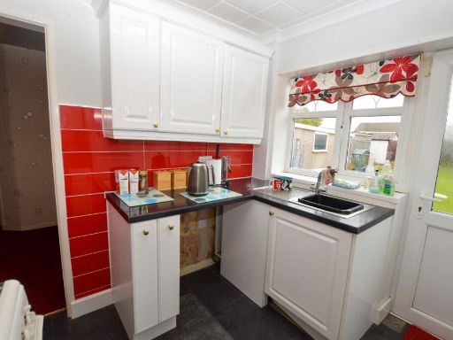
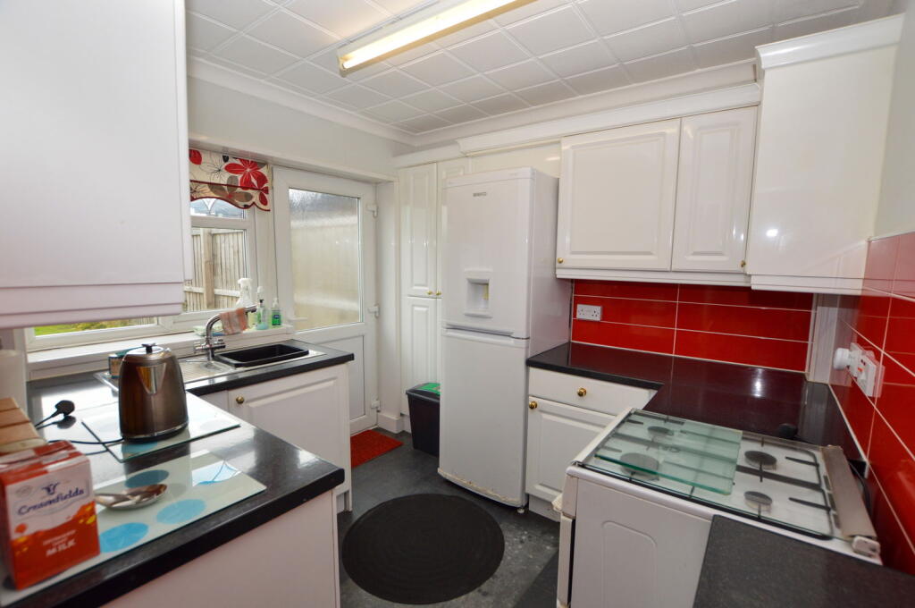
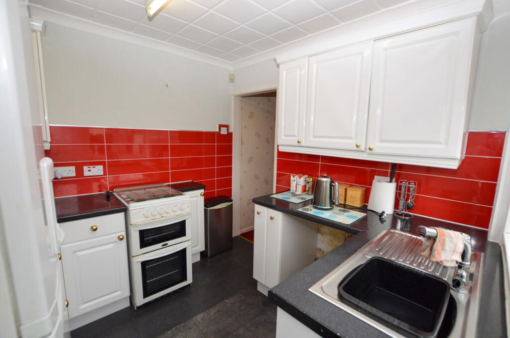
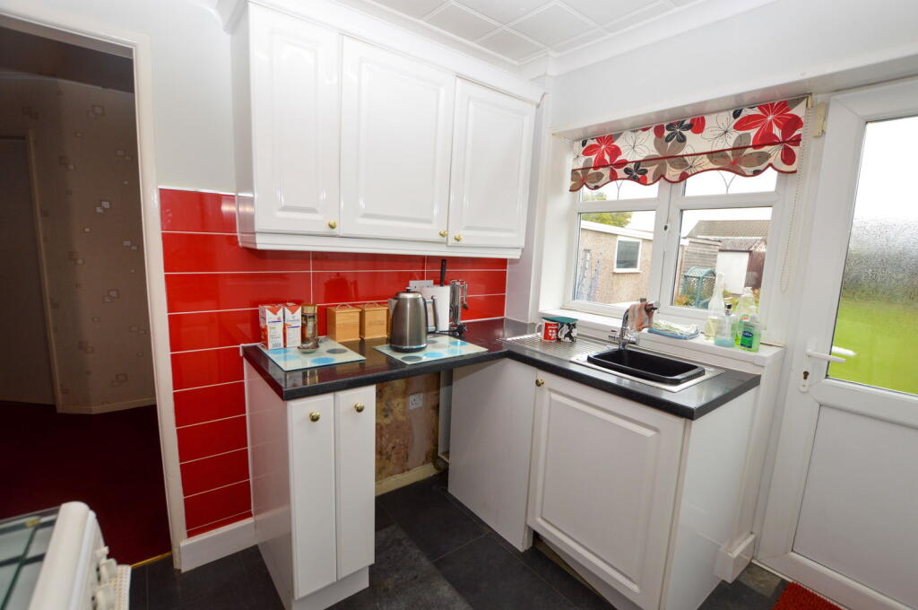
- Kitchen:
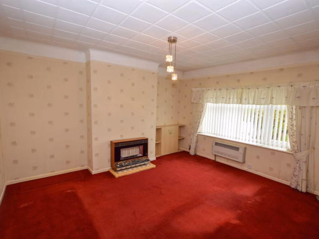
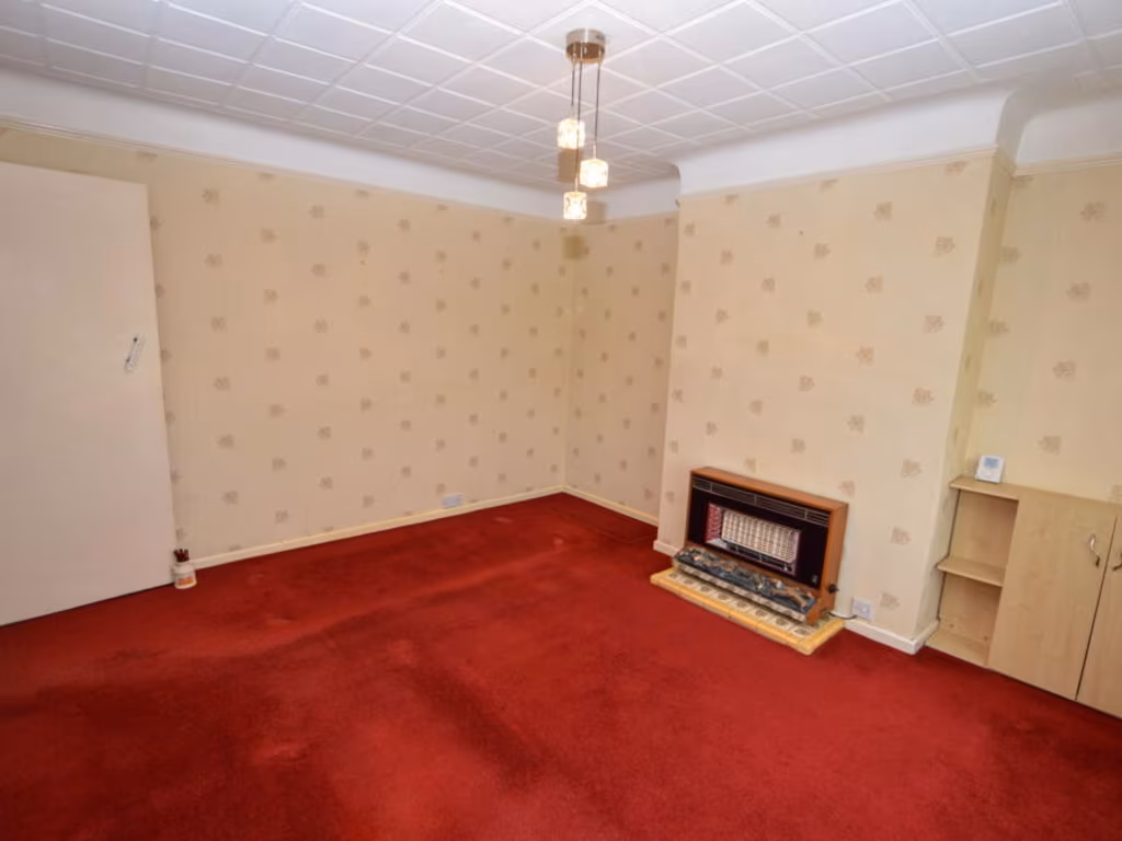
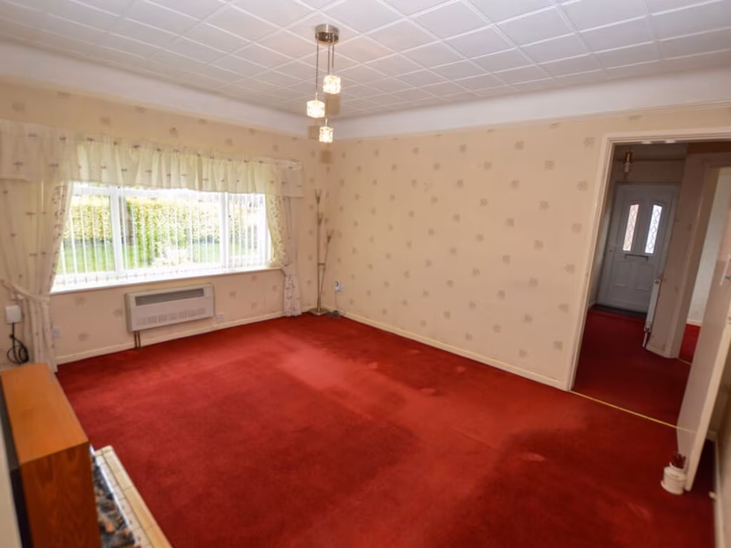
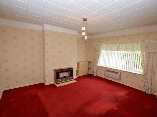
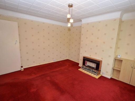
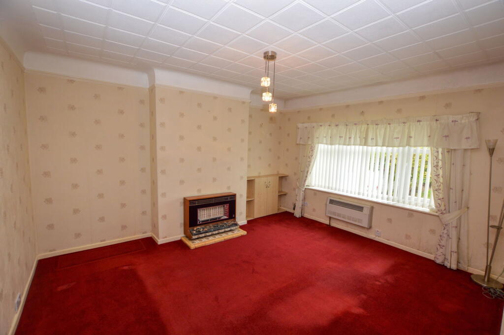
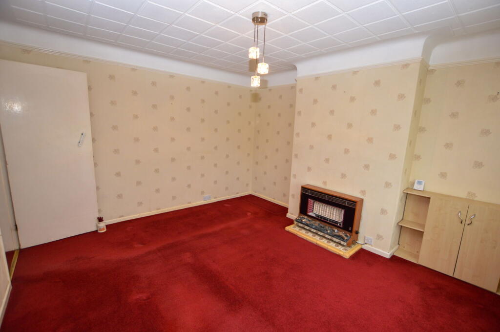
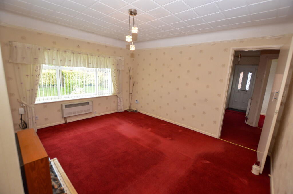
- Lounge:
- Bedroom 1:
- Hall:
Textual Property Features
- Has Garden
- Chain Free
- Success
Detected Visual Features
- bungalow
- single-story
- brick
- tile roof
- garden
- residential
- chimney
- greenery
- hallway
- mid-century modern
- dated wallpaper
- ceiling tiles
- red carpet
- standard ceiling
- compact space
EPC Details
- Fully double glazed
- Cavity wall, filled cavity
- Boiler and radiators, mains gas
- Low energy lighting in 62% of fixed outlets
- Solid, no insulation (assumed)
Nearby Schools
- St Peter's CofE Primary School
- All Saints Catholic Primary School, Golborne, Wigan
- Golborne Community Primary School
- St Wilfrids Catholic Primary School
- Leigh St Peter's CofE Primary School
- St John's Church of England Primary School, Abram
- Platt Bridge Community School
- St Mary's CofE Primary School
- Croft Primary School
- St Lewis Catholic Primary School
- Lowton Junior and Infant School
- Lowton St Mary's CofE (Voluntary Aided) Primary School
- Lowton West Primary School
- Gilded Hollins Community School
- St Thomas CofE Junior and Infant School
- Holy Family Catholic Academy
- St Luke's CofE Primary School
- St Catherine's Catholic Primary School, Lowton
- Lowton Church of England High School
- Newton Westpark Primary School
- Bickershaw CofE Primary School
- St John's Church of England Primary School, Hindley Green
- Three Towers Alternative Provision Academy
- Hope Academy
- Green Meadow Independent Primary School
- Golborne High School
Nearest Bars And Restaurants
- Id: 1050958768
- Tags:
- Addr:
- City: Lowton
- Housenumber: 1
- Postcode: WA3 2DP
- Street: Golborne Road
- Amenity: pub
- Building: yes
- Name: Hare and Hounds
- TagsNormalized:
- Lat: 53.4750266
- Lon: -2.5817301
- FullGeoHash: gcw0jqb4976w
- PartitionGeoHash: gcw0
- Images:
- FoodStandards: null
- Distance: 606.8
,- Id: 987007008
- Tags:
- Amenity: fast_food
- Building: yes
- Cuisine: fish_and_chips
- Name: Golborne Fry
- TagsNormalized:
- Lat: 53.478148
- Lon: -2.5856765
- FullGeoHash: gcw0jpmhv37f
- PartitionGeoHash: gcw0
- Images:
- FoodStandards: null
- Distance: 579.1
,- Id: 1052513579
- Tags:
- Amenity: pub
- Building: yes
- Name: Rams Head
- TagsNormalized:
- Lat: 53.4753934
- Lon: -2.5811445
- FullGeoHash: gcw0jqbkwzz4
- PartitionGeoHash: gcw0
- Images:
- FoodStandards: null
- Distance: 552.8
,- Id: 987009566
- Tags:
- Addr:
- City: Lowton
- Housenumber: 220B
- Street: Slag Lane
- Amenity: fast_food
- Building: yes
- Cuisine: fish_and_chips
- Name: Sol's Chippy
- TagsNormalized:
- Lat: 53.4779789
- Lon: -2.5765931
- FullGeoHash: gcw0jr7gc1bf
- PartitionGeoHash: gcw0
- Images:
- FoodStandards: null
- Distance: 213.3
,- Id: 987010190
- Tags:
- Addr:
- City: Lowton
- Housenumber: 2
- Street: Crow Wood Road
- Amenity: fast_food
- Building: yes
- Name: Lowton Lunch Box
- TagsNormalized:
- Lat: 53.4780177
- Lon: -2.5767327
- FullGeoHash: gcw0jr7sjc0c
- PartitionGeoHash: gcw0
- Images:
- FoodStandards: null
- Distance: 207
}
Nearest General Shops
- Id: 987009567
- Tags:
- Addr:
- City: Lowton
- Housenumber: 220A
- Street: Slag Lane
- Building: yes
- Name: C & K Opticians
- Shop: optician
- TagsNormalized:
- Lat: 53.47802
- Lon: -2.5765215
- FullGeoHash: gcw0jr7u49qr
- PartitionGeoHash: gcw0
- Images:
- FoodStandards: null
- Distance: 210.2
,- Id: 987009568
- Tags:
- Addr:
- City: Lowton
- Housenumber: 218
- Street: Slag Lane
- Building: yes
- Name: Lowton Meats
- Shop: butcher
- TagsNormalized:
- Lat: 53.4780717
- Lon: -2.5764667
- FullGeoHash: gcw0jr7u7gp5
- PartitionGeoHash: gcw0
- Images:
- FoodStandards: null
- Distance: 205.7
,- Id: 987010188
- Tags:
- Addr:
- City: Lowton
- Housenumber: 4
- Street: Crow Wood Road
- Building: yes
- Name: Cohen's Chemist
- Shop: chemist
- TagsNormalized:
- chemist
- cohens chemist
- shop
- Lat: 53.4780676
- Lon: -2.5768159
- FullGeoHash: gcw0jr7s7f6g
- PartitionGeoHash: gcw0
- Images:
- FoodStandards: null
- Distance: 200.5
}
Nearest Grocery shops
- Id: 988403564
- Tags:
- Brand: Morrisons Daily
- Brand:wikidata: Q99752411
- Building: yes
- Contact:
- Website: https://my.morrisons.com/storefinder/31390
- Name: Morrisons Daily
- Operator: McColl's
- Operator:website: https://www.mccolls.co.uk/storelocator/lowton-newton-road/
- Operator:wikidata: Q16997477
- Shop: convenience
- TagsNormalized:
- morrisons
- morrisons daily
- convenience
- shop
- Lat: 53.4720025
- Lon: -2.5609413
- FullGeoHash: gcw0jwr0vxxz
- PartitionGeoHash: gcw0
- Images:
- FoodStandards: null
- Distance: 1394.7
,- Id: 996699089
- Tags:
- Building: yes
- Name: Hooton's
- Shop: convenience
- TagsNormalized:
- Lat: 53.4808102
- Lon: -2.5938486
- FullGeoHash: gcw0hzzhqcw7
- PartitionGeoHash: gcw0
- Images:
- FoodStandards: null
- Distance: 1093.9
,- Id: 9402279699
- Tags:
- Brand: Premier
- Brand:wikidata: Q7240340
- Brand:wikipedia: en:Premier Stores
- Shop: convenience
- TagsNormalized:
- Lat: 53.4763549
- Lon: -2.5876199
- FullGeoHash: gcw0jp5f254f
- PartitionGeoHash: gcw0
- Images:
- FoodStandards: null
- Distance: 779.3
}
Nearest Supermarkets
- Id: 32466162
- Tags:
- Addr:
- City: Warrington
- Country: GB
- Postcode: WA3 3RW
- Street: Edge Green Lane
- Brand: Asda
- Brand:wikidata: Q297410
- Brand:wikipedia: en:Asda
- Building: retail
- Contact:
- Website: https://storelocator.asda.com/north-west/warrington/edge-green-lane
- Fhrs:
- Name: Asda
- Nohousenumber: yes
- Opening_hours: Mo-Sa 07:00-22:00; Su 10:00-16:00
- Operator: Asda Stores Ltd
- Shop: supermarket
- Wheelchair: yes
- TagsNormalized:
- asda
- retail
- supermarket
- shop
- Lat: 53.4810156
- Lon: -2.6050495
- FullGeoHash: gcw0hxzj3zyk
- PartitionGeoHash: gcw0
- Images:
- FoodStandards:
- Id: 53431
- FHRSID: 53431
- LocalAuthorityBusinessID: 120359
- BusinessName: Asda Superstore (Golborne)
- BusinessType: Retailers - supermarkets/hypermarkets
- BusinessTypeID: 7840
- AddressLine1: Edge Green Lane
- AddressLine2: Golborne
- AddressLine3: Warrington
- AddressLine4: null
- PostCode: WA3 3RW
- RatingValue: 5
- RatingKey: fhrs_5_en-GB
- RatingDate: 2018-04-27
- LocalAuthorityCode: 434
- LocalAuthorityName: Wigan
- LocalAuthorityWebSite: http://www.wigan.gov.uk/
- LocalAuthorityEmailAddress: comm@wigan.gov.uk
- Scores:
- Hygiene: 0
- Structural: 0
- ConfidenceInManagement: 0
- NewRatingPending: false
- Geocode:
- Longitude: -2.60538600000000
- Latitude: 53.48123500000000
- Distance: 1834.4
,- Id: 32337126
- Tags:
- Brand: Lidl
- Brand:wikidata: Q151954
- Brand:wikipedia: en:Lidl
- Building: yes
- Name: Lidl
- Shop: supermarket
- TagsNormalized:
- Lat: 53.4723396
- Lon: -2.597832
- FullGeoHash: gcw0hyk6fns4
- PartitionGeoHash: gcw0
- Images:
- FoodStandards: null
- Distance: 1588.5
,- Id: 9136056323
- Tags:
- Brand: Co-op Food
- Brand:wikidata: Q3277439
- Brand:wikipedia: en:Co-op Food
- Name: Co-op Food
- Operator: The Co-operative Group
- Operator:wikidata: Q117202
- Shop: supermarket
- TagsNormalized:
- co-op
- co-op food
- food
- supermarket
- shop
- Lat: 53.4742797
- Lon: -2.580927
- FullGeoHash: gcw0jq8wk01r
- PartitionGeoHash: gcw0
- Images:
- FoodStandards: null
- Distance: 660.5
}
Nearest Religious buildings
- Id: 9136056326
- Tags:
- Amenity: community_centre
- Name: Church Lane Community Centre
- TagsNormalized:
- Lat: 53.4744496
- Lon: -2.5812707
- FullGeoHash: gcw0jq8rhpch
- PartitionGeoHash: gcw0
- Images:
- FoodStandards: null
- Distance: 651.5
,- Id: 9251005684
- Tags:
- Addr:
- Country: GB
- Postcode: WA3 2RZ
- Amenity: post_office
- Brand: Post Office
- Brand:wikidata: Q1783168
- Brand:wikipedia: en:Post Office Ltd
- Contact:
- Website: https://www.postoffice.co.uk/branch-finder/3274349/church-lane
- Name: Church Lane Post Office
- Ref:
- TagsNormalized:
- Lat: 53.4748438
- Lon: -2.581322
- FullGeoHash: gcw0jqb3dc6u
- PartitionGeoHash: gcw0
- Images:
- FoodStandards: null
- Distance: 612.9
,- Id: 835462075
- Tags:
- Amenity: place_of_worship
- Building: church
- Denomination: anglican
- Name: St Luke
- Religion: christian
- Wikidata: Q26456547
- TagsNormalized:
- place of worship
- church
- anglican
- christian
- Lat: 53.475371
- Lon: -2.5804832
- FullGeoHash: gcw0jqbuw7sm
- PartitionGeoHash: gcw0
- Images:
- FoodStandards: null
- Distance: 536.9
}
Nearest Medical buildings
- Id: 9136041945
- Tags:
- Amenity: dentist
- Healthcare: dentist
- Name: Lowton Dental Practice
- TagsNormalized:
- dentist
- health
- healthcare
- dental
- Lat: 53.4746211
- Lon: -2.58164
- FullGeoHash: gcw0jqb05rve
- PartitionGeoHash: gcw0
- Images:
- FoodStandards: null
- Distance: 644.3
,- Id: 988297431
- Tags:
- Addr:
- City: Lowton
- Housenumber: 36
- Street: Braithwaite Road
- Amenity: doctors
- Building: yes
- Healthcare: doctor
- Healthcare:speciality: general
- Name: Braithwaite Surgery
- TagsNormalized:
- doctor
- doctors
- health
- healthcare
- general
- surgery
- Lat: 53.4764967
- Lon: -2.5749686
- FullGeoHash: gcw0jrhgnvs0
- PartitionGeoHash: gcw0
- Images:
- FoodStandards: null
- Distance: 404.7
,- Id: 1084924833
- Tags:
- Addr:
- City: Lowton
- Housenumber: 36A
- Street: Braithwaite Road
- Amenity: pharmacy
- Brand: Cohens Chemist
- Brand:wikidata: Q107998495
- Building: yes
- Dispensing: yes
- Healthcare: pharmacy
- Name: Cohens Chemist
- TagsNormalized:
- pharmacy
- chemist
- cohens chemist
- health
- healthcare
- Lat: 53.4766074
- Lon: -2.5748143
- FullGeoHash: gcw0jrj5f6pk
- PartitionGeoHash: gcw0
- Images:
- FoodStandards: null
- Distance: 397.7
,- Id: 987009807
- Tags:
- Amenity: doctors
- Building: yes
- Healthcare: doctor
- Name: Slag Lane Medical Centre
- TagsNormalized:
- doctor
- doctors
- health
- healthcare
- Lat: 53.4781561
- Lon: -2.5763526
- FullGeoHash: gcw0jr7uydu7
- PartitionGeoHash: gcw0
- Images:
- FoodStandards: null
- Distance: 199.3
}
Nearest Airports
- Id: 116737532
- Tags:
- Addr:
- City: Liverpool
- Country: GB
- Postcode: L24 1YD
- Street: Speke Hall Avenue
- Aerodrome: international
- Aerodrome:type: public
- Aeroway: aerodrome
- Iata: LPL
- Icao: EGGP
- Is_in: Liverpool,England,UK
- Name: Liverpool John Lennon Airport
- Old_name: Speke Airport
- Operator: Liverpool Airport plc
- Source: wikipedia
- Website: https://www.liverpoolairport.com/
- Wikidata: Q8727
- Wikipedia: en:Liverpool John Lennon Airport
- TagsNormalized:
- airport
- international airport
- Lat: 53.3357677
- Lon: -2.8518179
- FullGeoHash: gcmzrj7r7gdr
- PartitionGeoHash: gcmz
- Images:
- FoodStandards: null
- Distance: 24238.4
,- Id: 1224469
- Tags:
- Addr:
- City: Manchester
- Country: GB
- Postcode: M90 1QX
- Aerodrome: international
- Aeroway: aerodrome
- Arp: yes
- Atis: 128.175
- Iata: MAN
- Icao: EGCC
- Name: Manchester Airport
- Note: rough sketched outline referring to Yahoo imagery - true boundary is where?
- Old_name: Ringway
- Operator: Manchester Airport PLC
- Size: 18720000
- Source:
- Tower_frequency: 118.625,119.400
- Type: multipolygon
- Website: https://www.manchesterairport.co.uk/
- Wikidata: Q8694
- Wikipedia: en:Manchester Airport
- TagsNormalized:
- airport
- international airport
- Lat: 53.3503197
- Lon: -2.2798822
- FullGeoHash: gcqrs05u4ukt
- PartitionGeoHash: gcqr
- Images:
- FoodStandards: null
- Distance: 24416.9
}
Nearest Leisure Facilities
- Id: 469230508
- Tags:
- Leisure: park
- Name: Braithwaite Park
- Source: local knowledge
- TagsNormalized:
- Lat: 53.4759279
- Lon: -2.5733676
- FullGeoHash: gcw0jqypu5qp
- PartitionGeoHash: gcw0
- Images:
- FoodStandards: null
- Distance: 510
,- Id: 469230509
- Tags:
- Leisure: playground
- Name: Braithwaite Playground
- Wheelchair: yes
- TagsNormalized:
- Lat: 53.4766453
- Lon: -2.5742896
- FullGeoHash: gcw0jrjkn9nw
- PartitionGeoHash: gcw0
- Images:
- FoodStandards: null
- Distance: 410.2
,- Id: 446153342
- Tags:
- Leisure: pitch
- Sport: bowls
- TagsNormalized:
- Lat: 53.4788872
- Lon: -2.5833744
- FullGeoHash: gcw0jpwc550k
- PartitionGeoHash: gcw0
- Images:
- FoodStandards: null
- Distance: 409.3
,- Id: 1052312415
- Tags:
- TagsNormalized:
- Lat: 53.478747
- Lon: -2.5825255
- FullGeoHash: gcw0jpx2qbcr
- PartitionGeoHash: gcw0
- Images:
- FoodStandards: null
- Distance: 360.2
,- Id: 976302408
- Tags:
- Leisure: pitch
- Name: Golborne Parkside ARLFC
- Sport: rugby_league
- TagsNormalized:
- pitch
- leisure
- rugby
- rugby league
- sports
- Lat: 53.4792281
- Lon: -2.5822356
- FullGeoHash: gcw0jpxejd9t
- PartitionGeoHash: gcw0
- Images:
- FoodStandards: null
- Distance: 327.1
}
Nearest Tourist attractions
- Id: 2004753208
- Tags:
- Name: Leigh Town Hall Archives
- Operator: Wigan Council
- Tourism: museum
- Website: https://archives.wigan.gov.uk/
- TagsNormalized:
- Lat: 53.4973242
- Lon: -2.5192064
- FullGeoHash: gcw0qdvsd0p9
- PartitionGeoHash: gcw0
- Images:
- FoodStandards: null
- Distance: 4313.2
,- Id: 1131962212
- Tags:
- Addr:
- City: Leigh
- Housenumber: 63
- Street: Findlay Street
- Building: yes
- Description: Homeless hostel service
- Name: Riverside Project
- Operator: Springboard
- Source: survey;local knowledge
- Tourism: hostel
- Website: https://homeless.org.uk/homeless-england/service/riverside-railway-road-project/
- TagsNormalized:
- Lat: 53.4983577
- Lon: -2.5264561
- FullGeoHash: gcw0qe06929y
- PartitionGeoHash: gcw0
- Images:
- FoodStandards: null
- Distance: 3949.7
,- Id: 1089753964
- Tags:
- Addr:
- City: Wigan
- Street: Kenyon Lane
- Building: yes
- Guest_house: bed_and_breakfast
- Name: Five Acres
- Tourism: guest_house
- Website: https://www.facebook.com/Five-Acres-Guest-House-281864578622171/
- TagsNormalized:
- Lat: 53.4627824
- Lon: -2.5628212
- FullGeoHash: gcw0jstg3byp
- PartitionGeoHash: gcw0
- Images:
- FoodStandards: null
- Distance: 2127.7
}
Nearest Train stations
- Id: 9777001563
- Tags:
- Name: Hindley
- Naptan:
- Network: National Rail
- Public_transport: station
- Railway: station
- Ref:
- Source: npe
- Train: yes
- Wikidata: Q2147566
- Wikipedia: en:Hindley railway station
- TagsNormalized:
- Lat: 53.542391
- Lon: -2.5748804
- FullGeoHash: gcw0t7j50cn5
- PartitionGeoHash: gcw0
- Images:
- FoodStandards: null
- Distance: 6957.7
,- Id: 24832738
- Tags:
- Name: Garswood
- Naptan:
- Network: National Rail
- Public_transport: station
- Railway: station
- Ref:
- Source: npe
- Wikipedia: en:Garswood railway station
- TagsNormalized:
- Lat: 53.4880481
- Lon: -2.6719929
- FullGeoHash: gcw071nq6nce
- PartitionGeoHash: gcw0
- Images:
- FoodStandards: null
- Distance: 6325.2
,- Id: 24832755
- Tags:
- Name: Bryn
- Naptan:
- Network: National Rail
- Public_transport: station
- Railway: station
- Ref:
- Source: NPE
- Wikipedia: en:Bryn railway station
- TagsNormalized:
- Lat: 53.4997249
- Lon: -2.6476163
- FullGeoHash: gcw07g246pd1
- PartitionGeoHash: gcw0
- Images:
- FoodStandards: null
- Distance: 5144.9
,- Id: 6003537488
- Tags:
- Name: Earlestown
- Naptan:
- Network: National Rail
- Old_name: Newton Junction
- Public_transport: station
- Railway: station
- Ref:
- Wikipedia: en:Earlestown railway station
- TagsNormalized:
- Lat: 53.4512184
- Lon: -2.6376153
- FullGeoHash: gcw05frrgj73
- PartitionGeoHash: gcw0
- Images:
- FoodStandards: null
- Distance: 5100.5
,- Id: 6003537487
- Tags:
- Name: Newton-le-Willows
- Naptan:
- Network: National Rail
- Old_name: Newton Bridge
- Public_transport: station
- Railway: station
- Ref:
- Wheelchair: yes
- Wikipedia: en:Newton-le-Willows railway station
- TagsNormalized:
- Lat: 53.4531451
- Lon: -2.6128853
- FullGeoHash: gcw0hdc75k7w
- PartitionGeoHash: gcw0
- Images:
- FoodStandards: null
- Distance: 3785
}
Nearest Hotels
- Id: 37921978
- Tags:
- Brand: Holiday Inn Express
- Brand:wikidata: Q5880423
- Brand:wikipedia: en:Holiday Inn Express
- Building: yes
- Name: Holiday Inn Express
- Tourism: hotel
- TagsNormalized:
- Lat: 53.4884963
- Lon: -2.5325794
- FullGeoHash: gcw0q37c4d7u
- PartitionGeoHash: gcw0
- Images:
- FoodStandards: null
- Distance: 3117.9
,- Id: 267439228
- Tags:
- Addr:
- City: Lane Head
- Housenumber: 322
- Postcode: WA3 1HD
- Street: Newton Road
- Brand: Travelodge
- Brand:wikidata: Q9361374
- Brand:wikipedia: en:Travelodge UK
- Building: yes
- Internet_access: wlan
- Internet_access:fee: customers
- Internet_access:ssid: Travelodge WiFi
- Name: Travelodge
- Phone: 0871 559 1851
- Tourism: hotel
- Wheelchair: limited
- TagsNormalized:
- Lat: 53.4668019
- Lon: -2.5694911
- FullGeoHash: gcw0jt2fww28
- PartitionGeoHash: gcw0
- Images:
- FoodStandards: null
- Distance: 1541
,- Id: 32337031
- Tags:
- Brand: Premier Inn
- Brand:wikidata: Q2108626
- Building: yes
- Internet_access: wlan
- Internet_access:fee: customers
- Internet_access:operator: Virgin Media
- Internet_access:ssid: Premier Inn Free Wi-Fi
- Name: Premier Inn
- Tourism: hotel
- TagsNormalized:
- Lat: 53.4686575
- Lon: -2.588789
- FullGeoHash: gcw0jjdvsb5j
- PartitionGeoHash: gcw0
- Images:
- FoodStandards: null
- Distance: 1453.8
}
Tags
- bungalow
- single-story
- brick
- tile roof
- garden
- residential
- chimney
- greenery
- hallway
- mid-century modern
- dated wallpaper
- ceiling tiles
- red carpet
- standard ceiling
- compact space
Local Market Stats
- Average Price/sqft: £244
- Avg Income: £43400
- Rental Yield: 4%
- Social Housing: 6%
- Planning Success Rate: 81%
Similar Properties
 3 bedroom semi-detached bungalow for sale in Hilary Avenue, Lowton, Warrington, Cheshire, WA3 — £245,000 • 3 bed • 1 bath • 960 ft²
 2 bedroom detached bungalow for sale in Barnton Close, Warrington, WA3 — £279,950 • 2 bed • 2 bath • 726 ft²
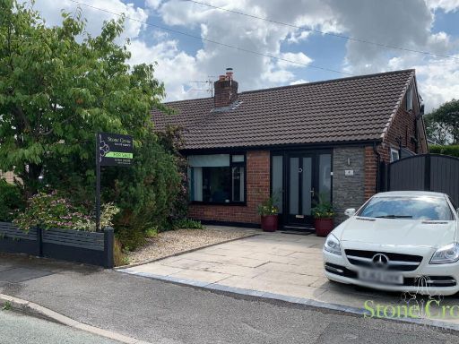 2 bedroom semi-detached bungalow for sale in Broughton Avenue, Lowton, WA3 2PR, WA3 — £274,000 • 2 bed • 2 bath • 887 ft²
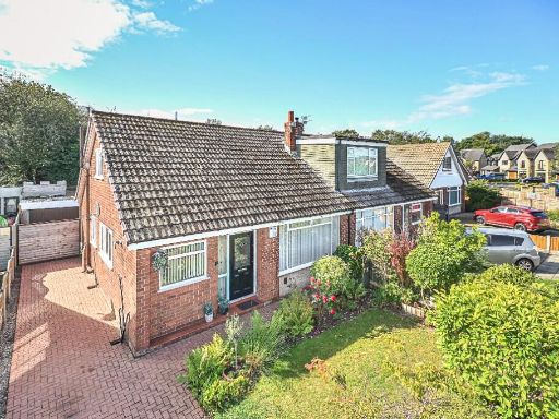 2 bedroom semi-detached house for sale in Wensley Road, WA3 — £235,000 • 2 bed • 1 bath • 1203 ft²
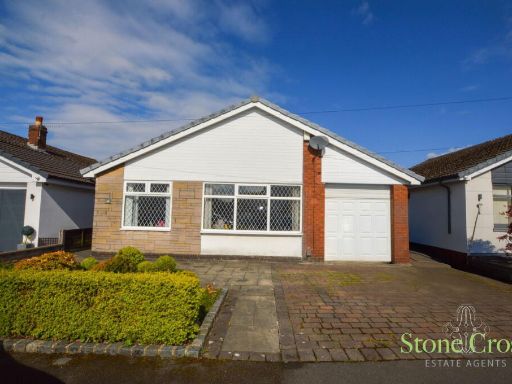 3 bedroom detached bungalow for sale in Rosedale Avenue, Lowton, WA3 2RW, WA3 — £259,950 • 3 bed • 1 bath • 981 ft²
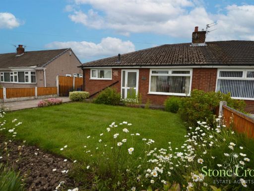 3 bedroom semi-detached bungalow for sale in Carlton Road, Lowton, WA3 2EP, WA3 — £219,950 • 3 bed • 1 bath • 819 ft²
Meta
- {
"@context": "https://schema.org",
"@type": "Residence",
"name": "2 bedroom semidetached bungalow for sale in Hilary Avenue,…",
"description": "",
"url": "https://propertypiper.co.uk/property/db9743f4-6a29-4412-8bf8-2a029685ff8d",
"image": "https://image-a.propertypiper.co.uk/ebcec3a2-8c0f-47fa-a186-09b7cd5a2aa7-1024.jpeg",
"address": {
"@type": "PostalAddress",
"streetAddress": "Hilary Avenue, Lowton, WA3 2ET",
"postalCode": "WA3 2ET",
"addressLocality": "Wigan",
"addressRegion": "Leigh",
"addressCountry": "England"
},
"geo": {
"@type": "GeoCoordinates",
"latitude": 53.47983664099371,
"longitude": -2.577398914213057
},
"numberOfRooms": 2,
"numberOfBathroomsTotal": 1,
"floorSize": {
"@type": "QuantitativeValue",
"value": 723,
"unitCode": "FTK"
},
"offers": {
"@type": "Offer",
"price": 209950,
"priceCurrency": "GBP",
"availability": "https://schema.org/InStock"
},
"additionalProperty": [
{
"@type": "PropertyValue",
"name": "Feature",
"value": "bungalow"
},
{
"@type": "PropertyValue",
"name": "Feature",
"value": "single-story"
},
{
"@type": "PropertyValue",
"name": "Feature",
"value": "brick"
},
{
"@type": "PropertyValue",
"name": "Feature",
"value": "tile roof"
},
{
"@type": "PropertyValue",
"name": "Feature",
"value": "garden"
},
{
"@type": "PropertyValue",
"name": "Feature",
"value": "residential"
},
{
"@type": "PropertyValue",
"name": "Feature",
"value": "chimney"
},
{
"@type": "PropertyValue",
"name": "Feature",
"value": "greenery"
},
{
"@type": "PropertyValue",
"name": "Feature",
"value": "hallway"
},
{
"@type": "PropertyValue",
"name": "Feature",
"value": "mid-century modern"
},
{
"@type": "PropertyValue",
"name": "Feature",
"value": "dated wallpaper"
},
{
"@type": "PropertyValue",
"name": "Feature",
"value": "ceiling tiles"
},
{
"@type": "PropertyValue",
"name": "Feature",
"value": "red carpet"
},
{
"@type": "PropertyValue",
"name": "Feature",
"value": "standard ceiling"
},
{
"@type": "PropertyValue",
"name": "Feature",
"value": "compact space"
}
]
}
High Res Floorplan Images
Compatible Floorplan Images
FloorplanImages Thumbnail