WR2 6DB - 3 bedroom semidetached house for sale in 15 Riverview Close…
View on Property Piper
3 bedroom semi-detached house for sale in 15 Riverview Close, St. John's, Worcester. WR2 6DB, WR2
Property Details
- Price: £300000
- Bedrooms: 3
- Bathrooms: 1
- Property Type: undefined
- Property SubType: undefined
Brochure Descriptions
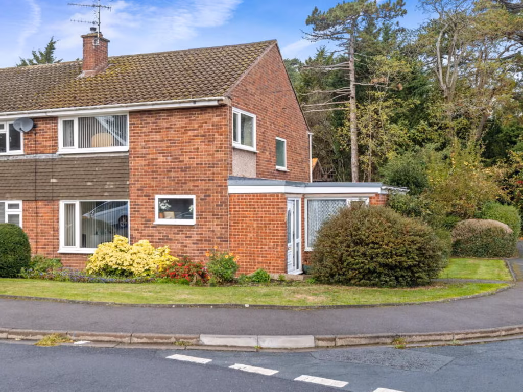
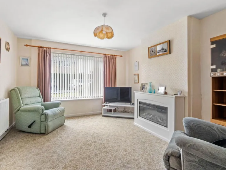
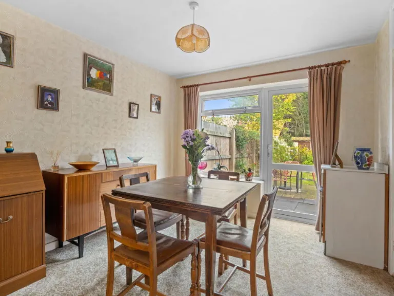
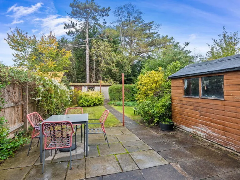
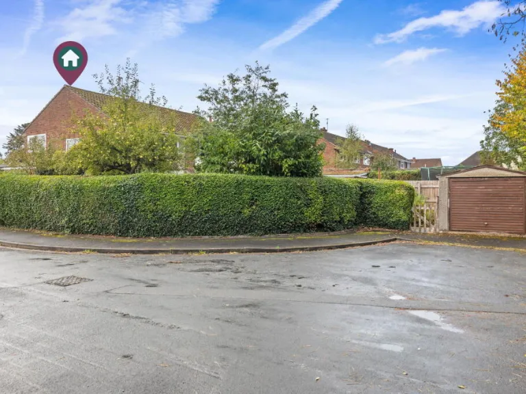
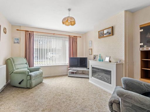
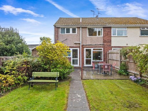
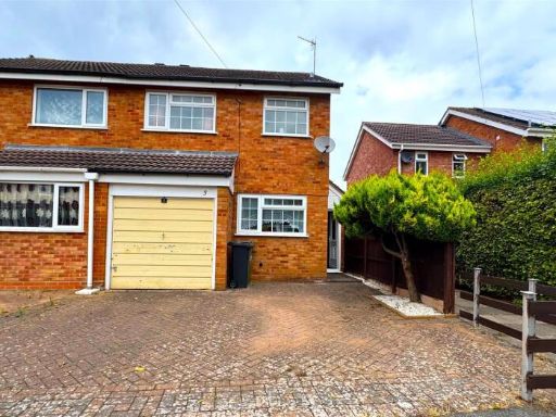
- Two-storey semi‑detached brick property set on a corner/cul‑de‑sac plot with a single‑storey side extension/utility/porch. Constructed in traditional red brick with a pitched tiled roof, the house benefits from large, mature front and side shrubbery and a lawned verge. The dwelling appears to offer good natural light to the front living room (large window) and likely provides family accommodation over two floors. The corner position gives a wider-than-average plot and potential for private side/rear garden space (medium to large) and off‑street parking to the side. Overall the property is typical of suburban family homes of its era and would appeal to buyers seeking a well‑located, low‑maintenance plot with scope for internal improvement or extension subject to planning.
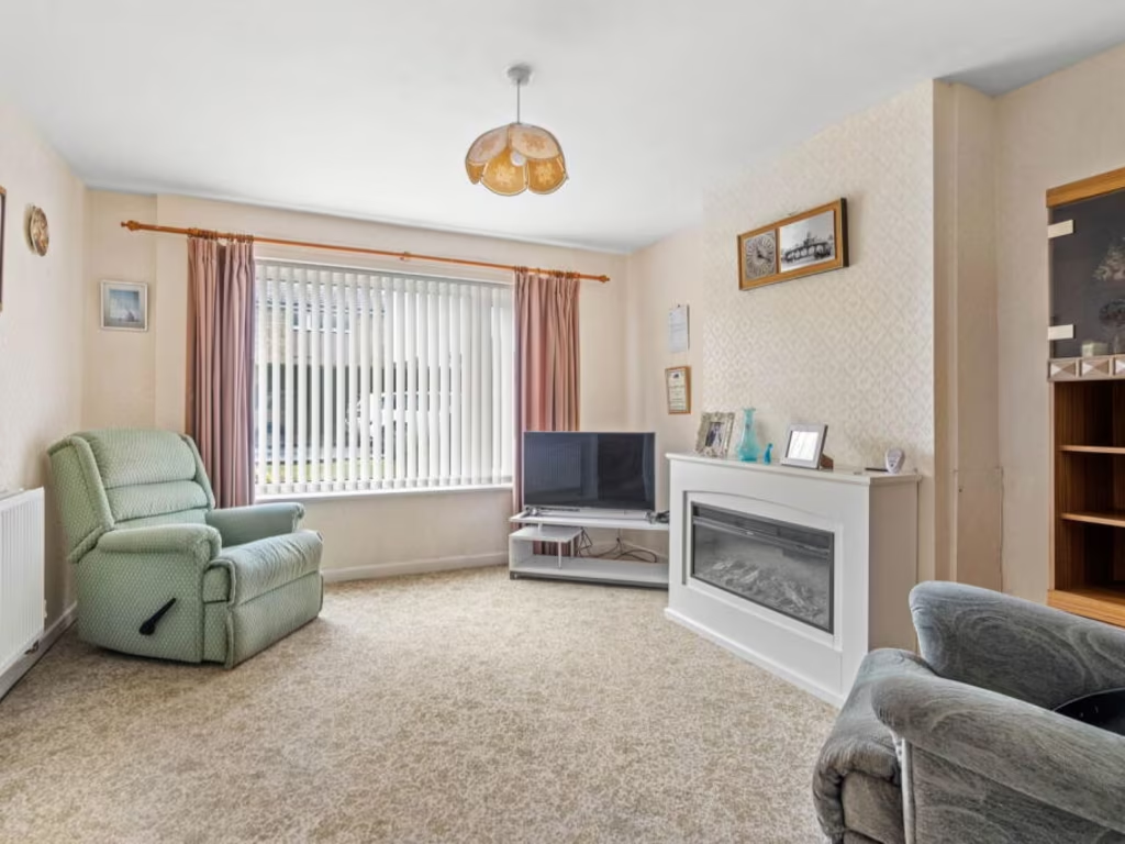
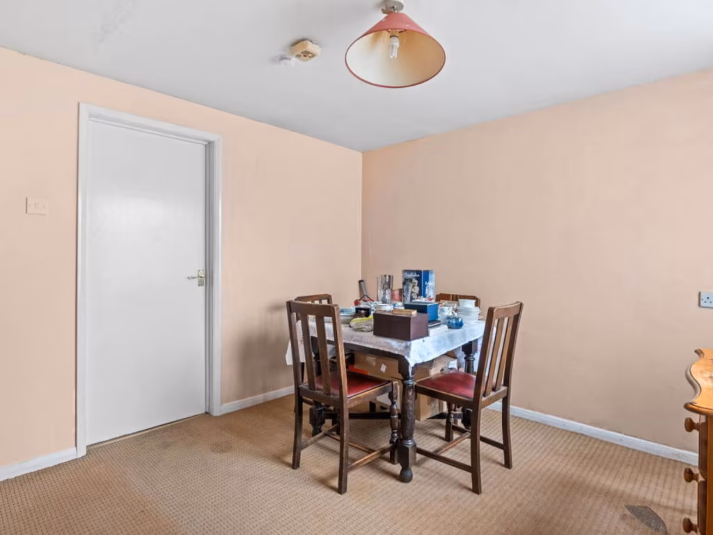
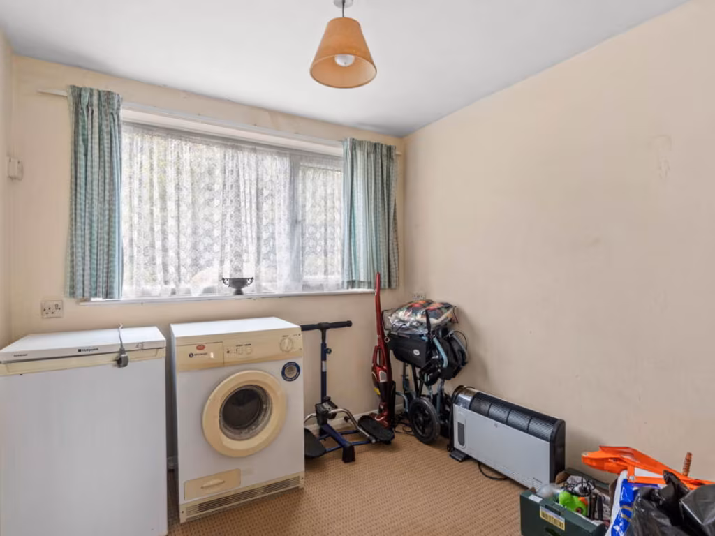
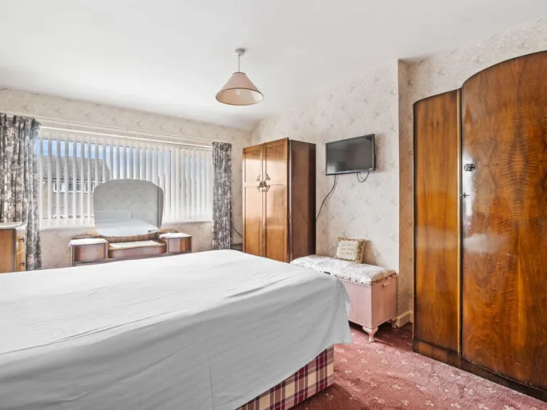
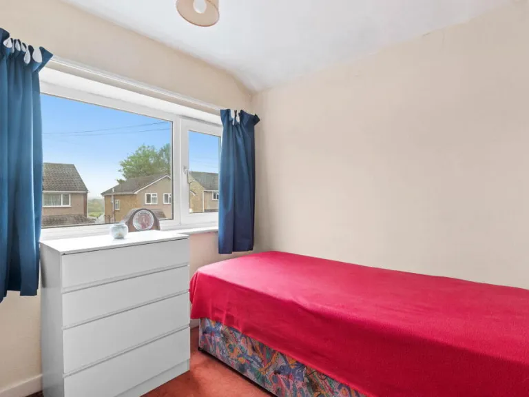
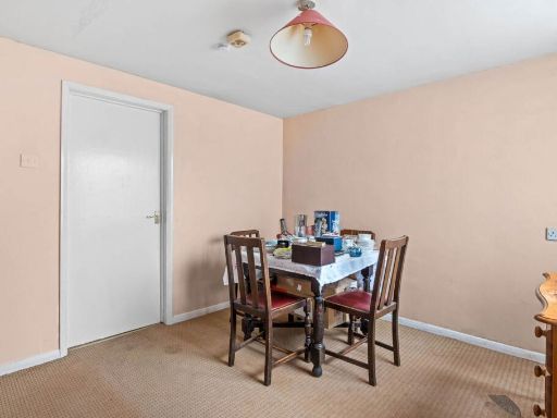
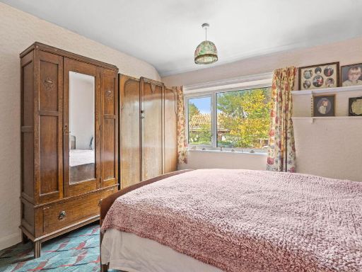
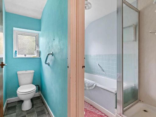
- 3/4-bedroom semi-detached family home on a corner plot. The published particulars and floorplan indicate ground and first-floor accommodation with scope for improvement and modernisation, plus potential annexe accommodation. The site benefits from a generous plot with mature hedging, garage and off-street parking (driveway seen), and a private rear garden of average-to-large size. Popular residential location noted with local school catchment; offered with no onward chain. EPC currently C (score 68) with potential to improve. Overall accommodation footprint suggests a comfortable family house requiring cosmetic and some updating works.
Image Descriptions
- semi-detached house mid-20th century
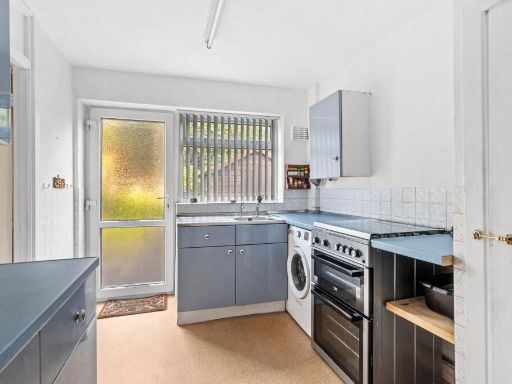
- kitchen mid-20th century
Floorplan Description
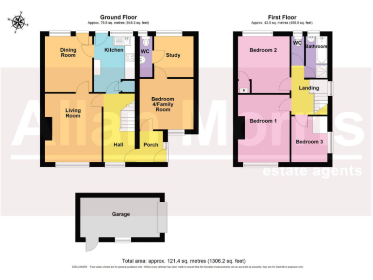
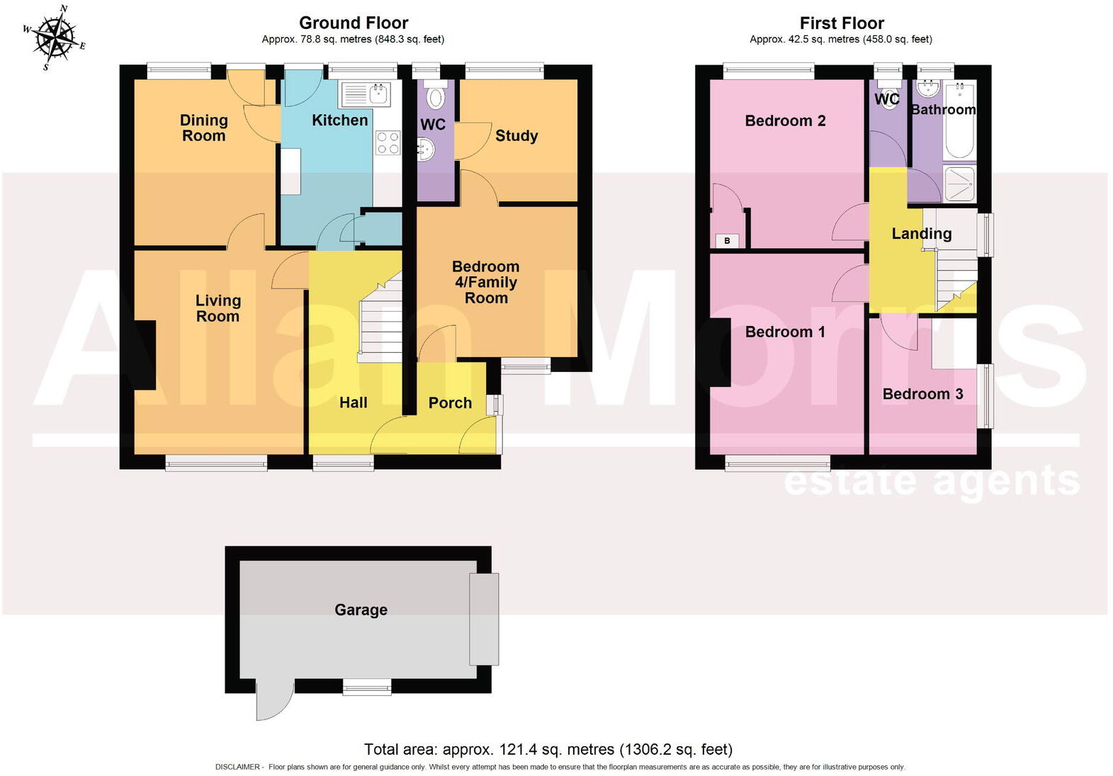
- Two-storey house with ground-floor living/dining/kitchen and first-floor three bedrooms and bathroom.
Rooms
- Dining Room:
- Kitchen:
- WC:
- Study:
- Living Room:
- Bedroom 4/Family Room:
- Hall:
- Porch:
- Bedroom 2:
- Bedroom 1:
- Bedroom 3:
- Bathroom:
- Landing:
Textual Property Features
- Has Garden
- Chain Free
- Success
Detected Visual Features
- semi-detached
- mid-century
- brick exterior
- pitched roof
- garage potential
- garden
- corner plot
- residential area
- renovation potential
- kitchen
- mid-20th century
- small room
- standard ceiling
- dated
- needs modernization
- tiled backsplash
- single side window
- solid door
- functional layout
- compact space
- painted cabinets
EPC Details
- Full secondary glazing
- Cavity wall, filled cavity
- Boiler and radiators, mains gas
- Low energy lighting in 83% of fixed outlets
- Suspended, no insulation (assumed)
Nearby Schools
- Christopher Whitehead Language College
- Newbridge School
- St George's CofE Primary School
- Claines CofE Primary School
- The King's School
- Honeywell Primary School
- St Clement's CofE Primary
- Royal Grammar School Worcester
- Hollymount School
- Bishop Perowne CofE College
- Hallow CofE Primary School
- Pitmaston Primary School
- Stanley Road Primary School
- Oldbury Park Primary School
- Broadheath CofE Primary School
- Tudor Grange Primary Academy Perdiswell
- Northwick Manor Primary School
- North Worcester Primary School
- The River School
- Grimley and Holt CofE Primary School
- Cherry Orchard Primary School
- Rushwick CofE Primary School
- Blessed Edward Oldcorne Catholic College
- St Barnabas CofE Primary School
- Tudor Grange Academy Worcester
Nearest General Shops
- Id: 2723400387
- Tags:
- Name: Treasure Trove
- Shop: antiques
- TagsNormalized:
- Lat: 52.2044625
- Lon: -2.2267557
- FullGeoHash: gcq2vrd90c4s
- PartitionGeoHash: gcq2
- Images:
- FoodStandards: null
- Distance: 1144.1
,- Id: 2723400285
- Tags:
- Name: Barbourne Bicycles
- Shop: bicycle
- TagsNormalized:
- Lat: 52.2043939
- Lon: -2.2271181
- FullGeoHash: gcq2vrd28kk7
- PartitionGeoHash: gcq2
- Images:
- FoodStandards: null
- Distance: 1122.9
,- Id: 266955478
- Tags:
- Addr:
- Housenumber: 12
- Street: Ombersley Road
- Building: yes
- Name: No 12
- Shop: hairdresser
- TagsNormalized:
- Lat: 52.2082604
- Lon: -2.2267668
- FullGeoHash: gcq3j24x0t4k
- PartitionGeoHash: gcq3
- Images:
- FoodStandards: null
- Distance: 1092.6
}
Nearest Grocery shops
- Id: 891993304
- Tags:
- Building: retail
- Shop: convenience
- TagsNormalized:
- Lat: 52.1965168
- Lon: -2.2470796
- FullGeoHash: gcq2uy5dxrbn
- PartitionGeoHash: gcq2
- Images:
- FoodStandards: null
- Distance: 1263.5
,- Id: 3830502684
- Tags:
- Addr:
- City: Worcester
- Housenumber: 46-48
- Postcode: WR1 1HU
- Street: Barbourne Road
- Brand: Sainsbury's Local
- Brand:wikidata: Q13218434
- Brand:wikipedia: en:Sainsbury's Local
- Fhrs:
- Name: Sainsbury's Local
- Opening_hours: Mo-Su 07:00-23:00
- Shop: convenience
- Source:
- TagsNormalized:
- sainsburys
- sainsburys local
- convenience
- shop
- Lat: 52.2042301
- Lon: -2.226662
- FullGeoHash: gcq2vr6xejb6
- PartitionGeoHash: gcq2
- Images:
- FoodStandards:
- Id: 730860
- FHRSID: 730860
- LocalAuthorityBusinessID: 14/01225/FOOD
- BusinessName: Sainsbury's
- BusinessType: Retailers - supermarkets/hypermarkets
- BusinessTypeID: 7840
- AddressLine1: 46-48 Barbourne Road
- AddressLine2: Worcester
- AddressLine3: null
- AddressLine4: null
- PostCode: WR1 1HU
- RatingValue: 5
- RatingKey: fhrs_5_en-GB
- RatingDate: 2021-03-24
- LocalAuthorityCode: 151
- LocalAuthorityName: Worcester City
- LocalAuthorityWebSite: https://www.worcsregservices.gov.uk
- LocalAuthorityEmailAddress: enquiries@worcsregservices.gov.uk
- Scores:
- Hygiene: 0
- Structural: 0
- ConfidenceInManagement: 0
- NewRatingPending: false
- Geocode:
- Longitude: -2.22581800000000
- Latitude: 52.20285700000000
- Distance: 1158.2
,- Id: 5714796885
- Tags:
- Brand: Tesco Express
- Brand:wikidata: Q98456772
- Contact:
- Website: https://www.tesco.com/store-locator/worcester/24-28-martley-rd
- Name: Tesco Express
- Operator: Tesco
- Shop: convenience
- TagsNormalized:
- tesco
- tesco express
- convenience
- shop
- Lat: 52.2032894
- Lon: -2.2451008
- FullGeoHash: gcq2uzm4jq7w
- PartitionGeoHash: gcq2
- Images:
- FoodStandards: null
- Distance: 501.7
}
Nearest Supermarkets
- Id: 267326098
- Tags:
- Addr:
- City: Worcester
- Housenumber: 8-10
- Postcode: WR2 5AH
- Street: The Bullring, St Johns
- Branch: Worcester - St Johns
- Brand: Co-op Food
- Brand:wikidata: Q3277439
- Brand:wikipedia: en:Co-op Food
- Building: retail
- Fhrs:
- Name: Co-op Food
- Opening_hours: Mo-Sa 06:00-22:00 Su 10:00-16:00
- Shop: supermarket
- Wheelchair: yes
- TagsNormalized:
- co-op
- co-op food
- food
- retail
- supermarket
- shop
- Lat: 52.1889635
- Lon: -2.2338899
- FullGeoHash: gcq2vhtqdxfv
- PartitionGeoHash: gcq2
- Images:
- FoodStandards: null
- Distance: 2155.2
,- Id: 793530489
- Tags:
- Brand: Co-op Food
- Brand:wikidata: Q3277439
- Brand:wikipedia: en:Co-op Food
- Building: retail
- Check_date:
- Opening_hours: 2022-08-25
- Name: Co-op Food
- Opening_hours: Mo-Su 07:00-23:00
- Operator: The Co-operative Wholesale Society
- Shop: supermarket
- TagsNormalized:
- co-op
- co-op food
- food
- retail
- supermarket
- shop
- Lat: 52.2043622
- Lon: -2.2123208
- FullGeoHash: gcq2vxt03nqn
- PartitionGeoHash: gcq2
- Images:
- FoodStandards: null
- Distance: 2104.8
,- Id: 66770953
- Tags:
- Addr:
- City: Worcester
- Postcode: WR2 5BA
- Street: Tybridge Street
- Branch: Worcester
- Brand: ALDI
- Brand:wikidata: Q41171672
- Brand:wikipedia: en:Aldi
- Building: yes
- Contact:
- Website: https://stores.aldi.co.uk/worcester/tybridge-street
- Fhrs:
- Name: Aldi
- Opening_hours: Mo-Sa 08:00-22:00; Su 10:00-16:00
- Shop: supermarket
- Toilets: yes
- Toilets:wheelchair: yes
- Wheelchair: yes
- TagsNormalized:
- Lat: 52.1908849
- Lon: -2.2313289
- FullGeoHash: gcq2vjp1yq0e
- PartitionGeoHash: gcq2
- Images:
- FoodStandards: null
- Distance: 2012
}
Nearest Religious buildings
- Id: 266834956
- Tags:
- Amenity: place_of_worship
- Building: church
- Denomination: anglican
- Name: Saint George’s
- Religion: christian
- Wikidata: Q26669516
- TagsNormalized:
- place of worship
- church
- anglican
- christian
- Lat: 52.2039915
- Lon: -2.2243848
- FullGeoHash: gcq2vrkq2167
- PartitionGeoHash: gcq2
- Images:
- FoodStandards: null
- Distance: 1313.9
,- Id: 266955350
- Tags:
- Amenity: place_of_worship
- Building: church
- Denomination: anglican
- Name: Barbourne St Stephen
- Religion: christian
- Wikidata: Q26669545
- TagsNormalized:
- place of worship
- church
- anglican
- christian
- Lat: 52.2098382
- Lon: -2.2254943
- FullGeoHash: gcq3j2e2q5r0
- PartitionGeoHash: gcq3
- Images:
- FoodStandards: null
- Distance: 1203.4
,- Id: 880948796
- Tags:
- Amenity: place_of_worship
- Building: church
- Denomination: anglican
- Name: St David's
- Religion: christian
- Source: OS OpenData StreetView
- Source:name: NaPTAN
- Wikidata: Q105105127
- TagsNormalized:
- place of worship
- church
- anglican
- christian
- Lat: 52.197439
- Lon: -2.2472448
- FullGeoHash: gcq2uy7857ug
- PartitionGeoHash: gcq2
- Images:
- FoodStandards: null
- Distance: 1166.9
}
Nearest Medical buildings
- Id: 266834961
- Tags:
- Amenity: retirement_home
- Landuse: residential
- Name: St Oswald's Hospital
- Note: An Ancient Foundation of Almshouses
- TagsNormalized:
- retirement
- retirement home
- residential
- hospital
- Lat: 52.1990162
- Lon: -2.223206
- FullGeoHash: gcq2vqt179ck
- PartitionGeoHash: gcq2
- Images:
- FoodStandards: null
- Distance: 1637.1
,- Id: 7419908751
- Tags:
- Addr:
- City: Worcester
- Housenumber: 15
- Postcode: WR1 1QN
- Street: Shrubbery Avenue
- Amenity: dentist
- Healthcare: dentist
- Name: Epworth House Dental Surgery
- TagsNormalized:
- dentist
- health
- healthcare
- dental
- surgery
- Lat: 52.2030427
- Lon: -2.2240119
- FullGeoHash: gcq2vrk8bb2x
- PartitionGeoHash: gcq2
- Images:
- FoodStandards: null
- Distance: 1373.2
,- Id: 793538461
- Tags:
- Addr:
- City: Worcester
- Housenumber: 7
- Postcode: WR1 1QN
- Street: Shrubbery Avenue
- Amenity: dentist
- Building: yes
- Healthcare: dentist
- Name: Shrubbery Dental Practice
- TagsNormalized:
- dentist
- health
- healthcare
- dental
- Lat: 52.2028101
- Lon: -2.2247723
- FullGeoHash: gcq2vr5zrj1e
- PartitionGeoHash: gcq2
- Images:
- FoodStandards: null
- Distance: 1335.2
,- Id: 266955349
- Tags:
- Amenity: clinic
- Building: yes
- Healthcare: clinic
- Name: Barbourne Health Center
- Opening_hours:
- TagsNormalized:
- Lat: 52.2090731
- Lon: -2.2247213
- FullGeoHash: gcq3j2k5bhxs
- PartitionGeoHash: gcq3
- Images:
- FoodStandards: null
- Distance: 1240.6
}
Nearest Leisure Facilities
- Id: 3048867844
- Tags:
- Leisure: fitness_station
- Sport: fitness
- TagsNormalized:
- fitness
- fitness station
- station
- leisure
- sports
- Lat: 52.2068683
- Lon: -2.2337313
- FullGeoHash: gcq2vpvrn395
- PartitionGeoHash: gcq2
- Images:
- FoodStandards: null
- Distance: 620.3
,- Id: 3048867845
- Tags:
- Leisure: fitness_station
- Sport: fitness
- TagsNormalized:
- fitness
- fitness station
- station
- leisure
- sports
- Lat: 52.2075409
- Lon: -2.2342328
- FullGeoHash: gcq3j0j4fx52
- PartitionGeoHash: gcq3
- Images:
- FoodStandards: null
- Distance: 581.2
,- Id: 426764117
- Tags:
- TagsNormalized:
- swimming
- swimming pool
- pool
- leisure
- Lat: 52.211723
- Lon: -2.2477899
- FullGeoHash: gcq3hbg5qdw7
- PartitionGeoHash: gcq3
- Images:
- FoodStandards: null
- Distance: 575.2
,- Id: 3048867843
- Tags:
- Leisure: fitness_station
- Sport: fitness
- TagsNormalized:
- fitness
- fitness station
- station
- leisure
- sports
- Lat: 52.2068673
- Lon: -2.2345918
- FullGeoHash: gcq2vpuz41rw
- PartitionGeoHash: gcq2
- Images:
- FoodStandards: null
- Distance: 562.1
,- Id: 893305222
- Tags:
- Leisure: garden
- Source: bing
- TagsNormalized:
- Lat: 52.2043611
- Lon: -2.2485642
- FullGeoHash: gcq2uzd8kwjp
- PartitionGeoHash: gcq2
- Images:
- FoodStandards: null
- Distance: 532.4
}
Nearest Tourist attractions
- Id: 266834965
- Tags:
- Addr:
- City: Worcester
- Housename: Shrubbery Terrance
- Housenumber: 40
- Postcode: WR1 1HU
- Street: Barbourne Road
- Building: yes
- Fhrs:
- Name: Wyatt Guest House
- Source:
- Tourism: guest_house
- TagsNormalized:
- Lat: 52.2027089
- Lon: -2.2258764
- FullGeoHash: gcq2vr5nv662
- PartitionGeoHash: gcq2
- Images:
- FoodStandards: null
- Distance: 1271.2
,- Id: 266834962
- Tags:
- Addr:
- Housename: Shrubbery Terrance
- Housenumber: 42
- Postcode: WR1 1HU
- Street: Barbourne Road
- Building: yes
- Fhrs:
- Name: The Barbourne
- Tourism: guest_house
- TagsNormalized:
- Lat: 52.2027631
- Lon: -2.2259042
- FullGeoHash: gcq2vr5phsme
- PartitionGeoHash: gcq2
- Images:
- FoodStandards: null
- Distance: 1266.9
,- Id: 266834941
- Tags:
- Addr:
- Housename: Shrubbery Terrance
- Housenumber: 44
- Postcode: WR1 1HU
- Street: Barbourne Road
- Building: yes
- Fhrs:
- Name: Homeleigh Guest House
- Tourism: guest_house
- TagsNormalized:
- Lat: 52.2028209
- Lon: -2.2259395
- FullGeoHash: gcq2vr5p7z5h
- PartitionGeoHash: gcq2
- Images:
- FoodStandards: null
- Distance: 1262
}
Nearest Train stations
- Id: 21279791
- Tags:
- Addr:
- Name: Malvern Link
- Naptan:
- Network: National Rail
- Public_transport: station
- Railway: station
- Ref:
- Source: NPE
- Wikidata: Q2657768
- Wikipedia: en:Malvern Link railway station
- TagsNormalized:
- Lat: 52.1258094
- Lon: -2.3195676
- FullGeoHash: gcq2e1nyy5jh
- PartitionGeoHash: gcq2
- Images:
- FoodStandards: null
- Distance: 10492.3
,- Id: 21227482
- Tags:
- Name: Droitwich Spa
- Naptan:
- Network: National Rail
- Operator: London Midland
- Platforms: 2
- Public_transport: station
- Railway: station
- Ref:
- Train: yes
- Wikidata: Q2360854
- Wikipedia: en:Droitwich Spa railway station
- TagsNormalized:
- Lat: 52.2683805
- Lon: -2.1583391
- FullGeoHash: gcq3qghm7h3d
- PartitionGeoHash: gcq3
- Images:
- FoodStandards: null
- Distance: 8875.4
,- Id: 7216839133
- Tags:
- Name: Worcestershire Parkway
- Naptan:
- Network: National Rail
- Operator: Great Western Railway
- Public_transport: station
- Railway: station
- Ref:
- Train: yes
- Wheelchair: yes
- Wikipedia: en:Worcestershire Parkway railway station
- TagsNormalized:
- Lat: 52.1561771
- Lon: -2.1600339
- FullGeoHash: gcq2wyepg81g
- PartitionGeoHash: gcq2
- Images:
- FoodStandards: null
- Distance: 8029.2
,- Id: 6609023830
- Tags:
- Name: Worcester Shrub Hill
- Naptan:
- Network: National Rail
- Public_transport: station
- Railway: station
- Ref:
- Wikidata: Q1974749
- Wikipedia: en:Worcester Shrub Hill railway station
- TagsNormalized:
- Lat: 52.1950309
- Lon: -2.2093282
- FullGeoHash: gcq2vtz4nfvr
- PartitionGeoHash: gcq2
- Images:
- FoodStandards: null
- Distance: 2671.1
,- Id: 7209335261
- Tags:
- Name: Worcester Foregate Street
- Naptan:
- Network: National Rail
- Public_transport: station
- Railway: station
- Ref:
- Wikidata: Q1873465
- Wikipedia: en:Worcester Foregate Street railway station
- TagsNormalized:
- Lat: 52.1953289
- Lon: -2.2207959
- FullGeoHash: gcq2vmyggdw8
- PartitionGeoHash: gcq2
- Images:
- FoodStandards: null
- Distance: 2023.1
}
Nearest Hotels
- Id: 1050092693
- Tags:
- Brand: Wetherspoons
- Building: yes
- Name: The Crown Hotel
- Tourism: hotel
- TagsNormalized:
- Lat: 52.1929359
- Lon: -2.2223381
- FullGeoHash: gcq2vmmtzu2t
- PartitionGeoHash: gcq2
- Images:
- FoodStandards: null
- Distance: 2141.1
,- Id: 1459649147
- Tags:
- Addr:
- City: Worcester
- Housenumber: 54
- Postcode: WR1 3NS
- Street: Newport Street
- Fhrs:
- Name: Severn View Hotel
- Source:
- Tourism: hotel
- Wikidata: Q26669447
- TagsNormalized:
- Lat: 52.1922072
- Lon: -2.2270816
- FullGeoHash: gcq2vm639hxe
- PartitionGeoHash: gcq2
- Images:
- FoodStandards: null
- Distance: 2014.8
,- Id: 266848158
- Tags:
- Addr:
- City: Worcester
- Housenumber: 61-62
- Postcode: WR1 1DX
- Street: Foregate Street
- Building: hotel
- Fhrs:
- Name: Whitehouse Hotel
- Source: visual survey;bing
- Source:addr: FHRS Open Data
- Tourism: hotel
- TagsNormalized:
- Lat: 52.1946061
- Lon: -2.2221926
- FullGeoHash: gcq2vmtze5v1
- PartitionGeoHash: gcq2
- Images:
- FoodStandards: null
- Distance: 2010.5
}
Tags
- semi-detached
- mid-century
- brick exterior
- pitched roof
- garage potential
- garden
- corner plot
- residential area
- renovation potential
- kitchen
- mid-20th century
- small room
- standard ceiling
- dated
- needs modernization
- tiled backsplash
- single side window
- solid door
- functional layout
- compact space
- painted cabinets
Local Market Stats
- Average Price/sqft: £282
- Avg Income: £42500
- Rental Yield: 3.3%
- Social Housing: 8%
- Planning Success Rate: 83%
AirBnB Data
- 1km average: £102/night
- Listings in 1km: 2
Similar Properties
 3 bedroom semi-detached house for sale in Dryden Close, Worcester, WR3 — £250,000 • 3 bed • 1 bath • 820 ft²
 4 bedroom semi-detached house for sale in Battenhall Road, WORCESTER, Worcestershire, WR5 — £625,000 • 4 bed • 3 bath • 1319 ft²
 3 bedroom semi-detached house for sale in 16 Ronkswood Hill, Worcester. WR4 9EP, WR4 — £275,000 • 3 bed • 1 bath • 873 ft²
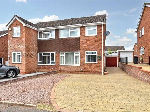 3 bedroom semi-detached house for sale in Ontario Close, Worcester, Worcestershire, WR2 — £300,000 • 3 bed • 1 bath • 794 ft²
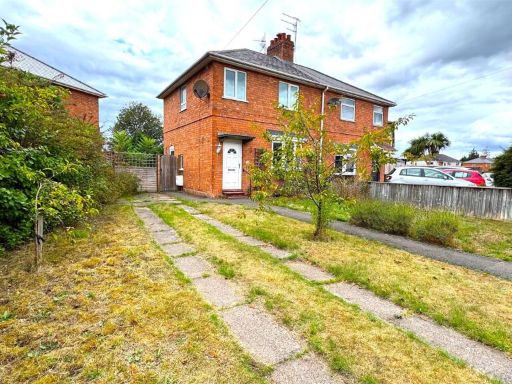 3 bedroom semi-detached house for sale in Boughton Avenue, Worcester, WR2 — £230,000 • 3 bed • 1 bath • 769 ft²
 2 bedroom semi-detached house for sale in Whitewood Close, Worcester, WR5 — £230,000 • 2 bed • 1 bath • 618 ft²
Meta
- {
"@context": "https://schema.org",
"@type": "Residence",
"name": "3 bedroom semidetached house for sale in 15 Riverview Close…",
"description": "",
"url": "https://propertypiper.co.uk/property/d84f757a-e65f-4967-b531-dfaf9d45f673",
"image": "https://image-a.propertypiper.co.uk/7cd1c9eb-f275-4ce7-b73b-924368764e50-1024.jpeg",
"address": {
"@type": "PostalAddress",
"streetAddress": "15, RIVERVIEW CLOSE, WORCESTER",
"postalCode": "WR2 6DB",
"addressLocality": "Worcester",
"addressRegion": "Worcester",
"addressCountry": "England"
},
"geo": {
"@type": "GeoCoordinates",
"latitude": 52.2075675,
"longitude": -2.242762
},
"numberOfRooms": 3,
"numberOfBathroomsTotal": 1,
"floorSize": {
"@type": "QuantitativeValue",
"value": 1306,
"unitCode": "FTK"
},
"offers": {
"@type": "Offer",
"price": 300000,
"priceCurrency": "GBP",
"availability": "https://schema.org/InStock"
},
"additionalProperty": [
{
"@type": "PropertyValue",
"name": "Feature",
"value": "semi-detached"
},
{
"@type": "PropertyValue",
"name": "Feature",
"value": "mid-century"
},
{
"@type": "PropertyValue",
"name": "Feature",
"value": "brick exterior"
},
{
"@type": "PropertyValue",
"name": "Feature",
"value": "pitched roof"
},
{
"@type": "PropertyValue",
"name": "Feature",
"value": "garage potential"
},
{
"@type": "PropertyValue",
"name": "Feature",
"value": "garden"
},
{
"@type": "PropertyValue",
"name": "Feature",
"value": "corner plot"
},
{
"@type": "PropertyValue",
"name": "Feature",
"value": "residential area"
},
{
"@type": "PropertyValue",
"name": "Feature",
"value": "renovation potential"
},
{
"@type": "PropertyValue",
"name": "Feature",
"value": "kitchen"
},
{
"@type": "PropertyValue",
"name": "Feature",
"value": "mid-20th century"
},
{
"@type": "PropertyValue",
"name": "Feature",
"value": "small room"
},
{
"@type": "PropertyValue",
"name": "Feature",
"value": "standard ceiling"
},
{
"@type": "PropertyValue",
"name": "Feature",
"value": "dated"
},
{
"@type": "PropertyValue",
"name": "Feature",
"value": "needs modernization"
},
{
"@type": "PropertyValue",
"name": "Feature",
"value": "tiled backsplash"
},
{
"@type": "PropertyValue",
"name": "Feature",
"value": "single side window"
},
{
"@type": "PropertyValue",
"name": "Feature",
"value": "solid door"
},
{
"@type": "PropertyValue",
"name": "Feature",
"value": "functional layout"
},
{
"@type": "PropertyValue",
"name": "Feature",
"value": "compact space"
},
{
"@type": "PropertyValue",
"name": "Feature",
"value": "painted cabinets"
}
]
}
High Res Floorplan Images
Compatible Floorplan Images
FloorplanImages Thumbnail