DE4 5HS - 2 bedroom detached bungalow for sale in Wirksworth Road, Ma…
View on Property Piper
2 bedroom detached bungalow for sale in Wirksworth Road, Matlock, DE4
Property Details
- Price: £495000
- Bedrooms: 2
- Bathrooms: 1
- Property Type: undefined
- Property SubType: undefined
Brochure Descriptions
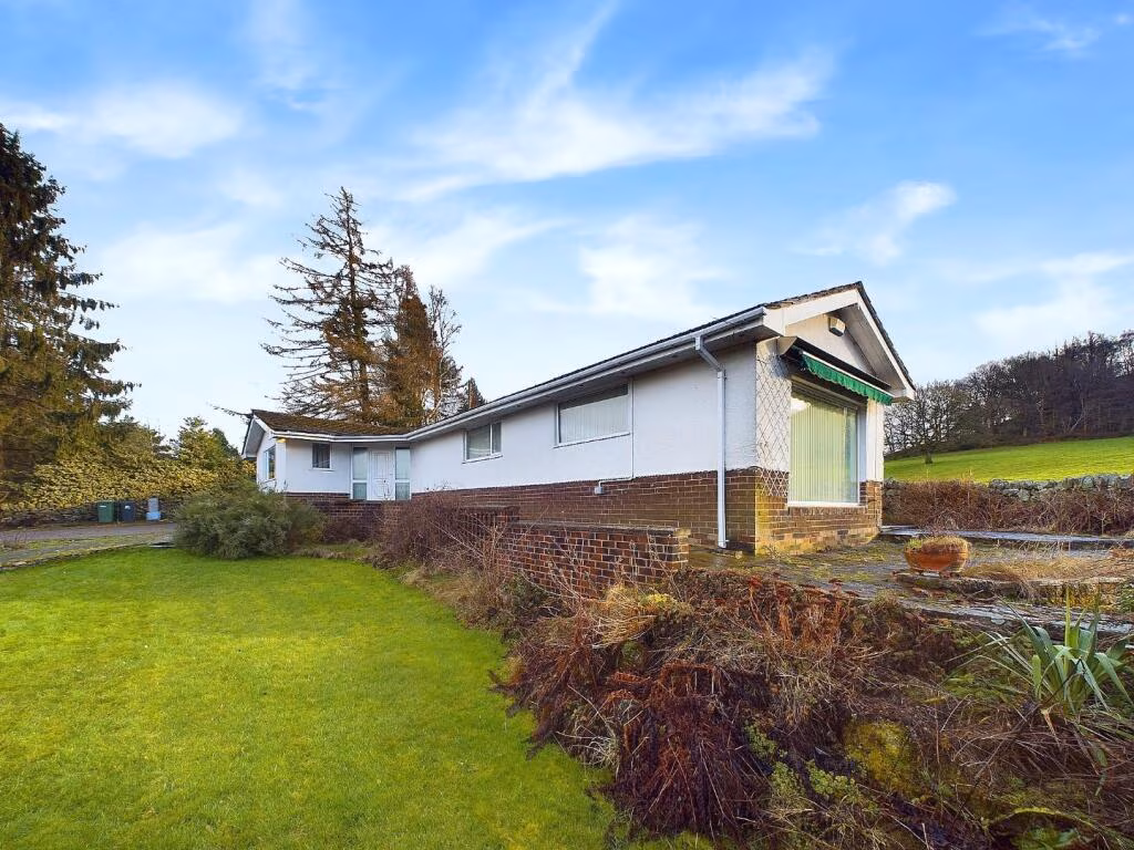
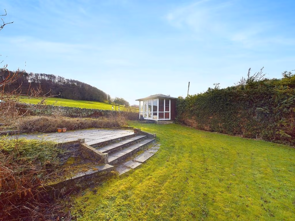
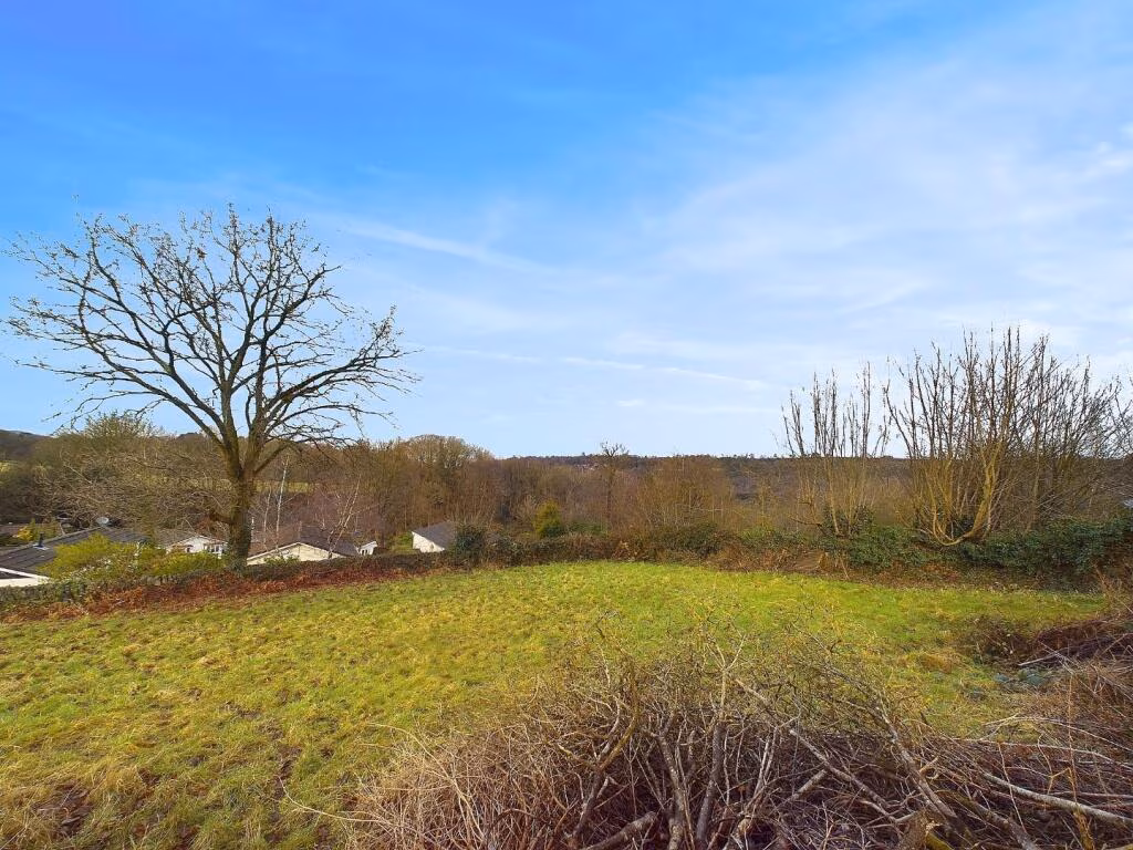
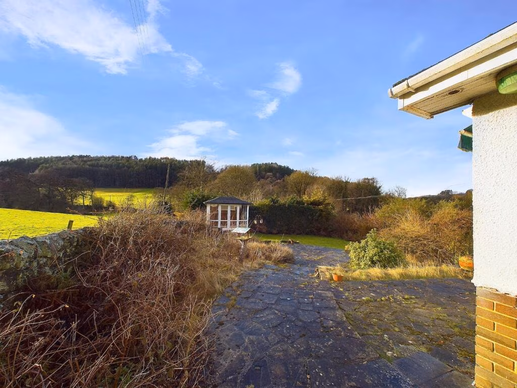
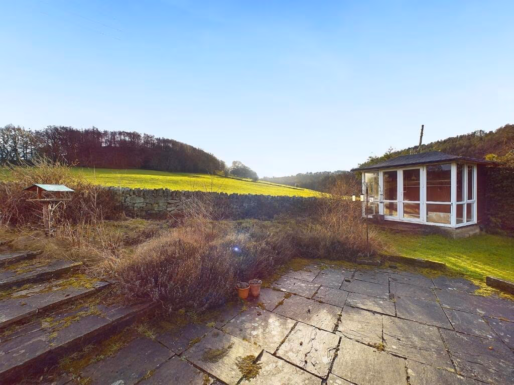
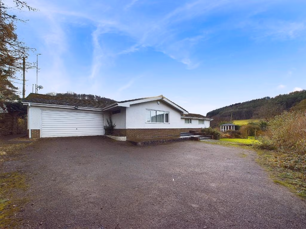
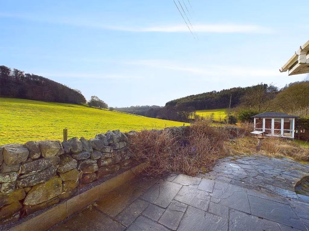
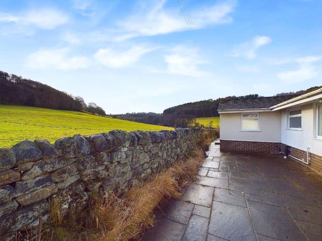
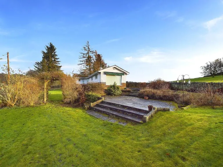
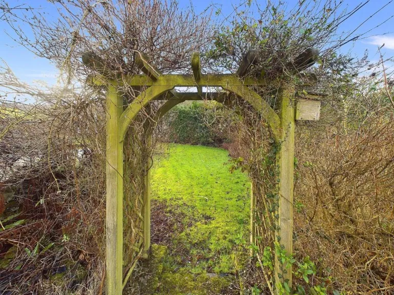
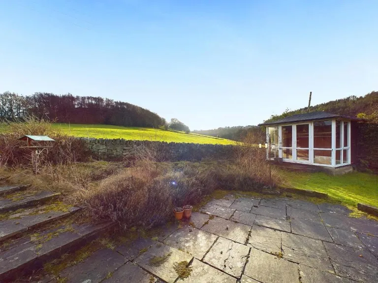
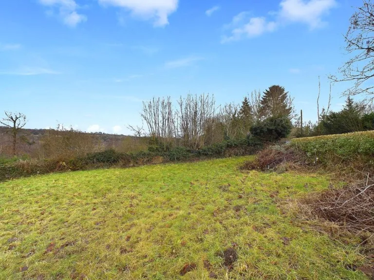
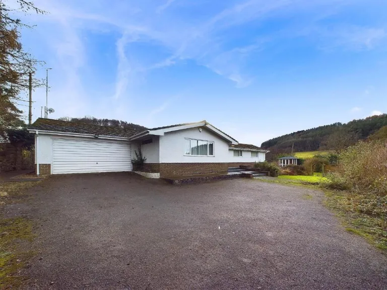
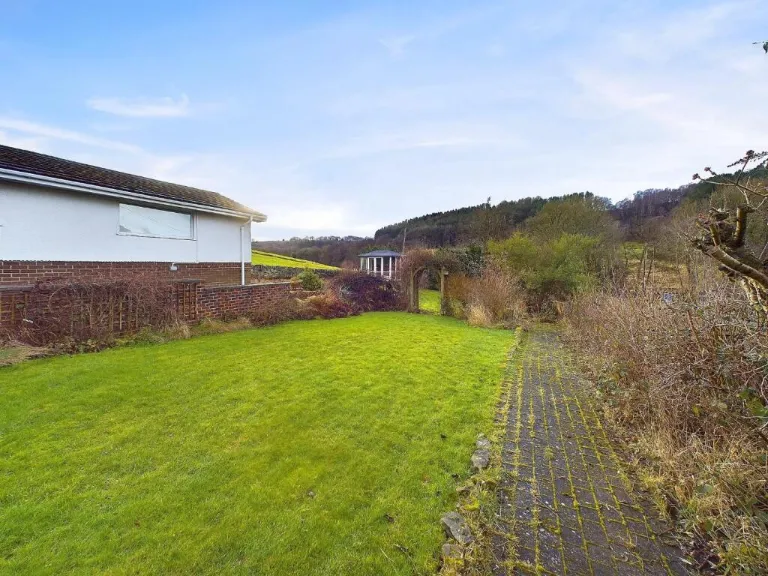
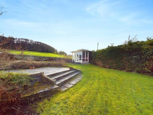
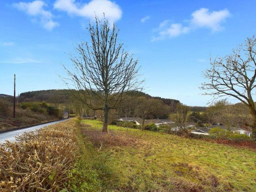
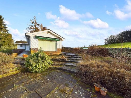
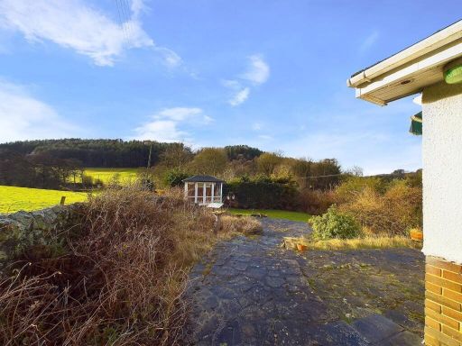
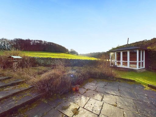
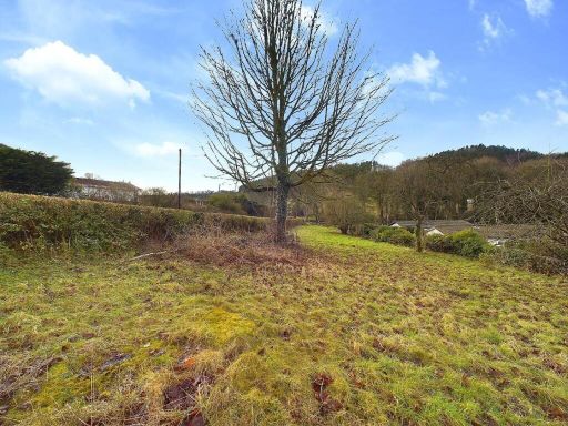
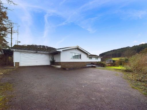
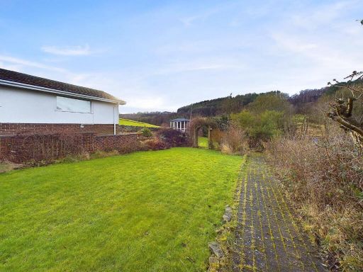
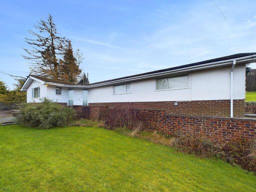
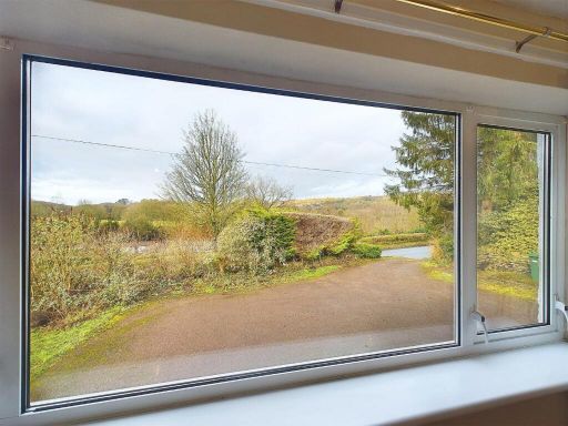
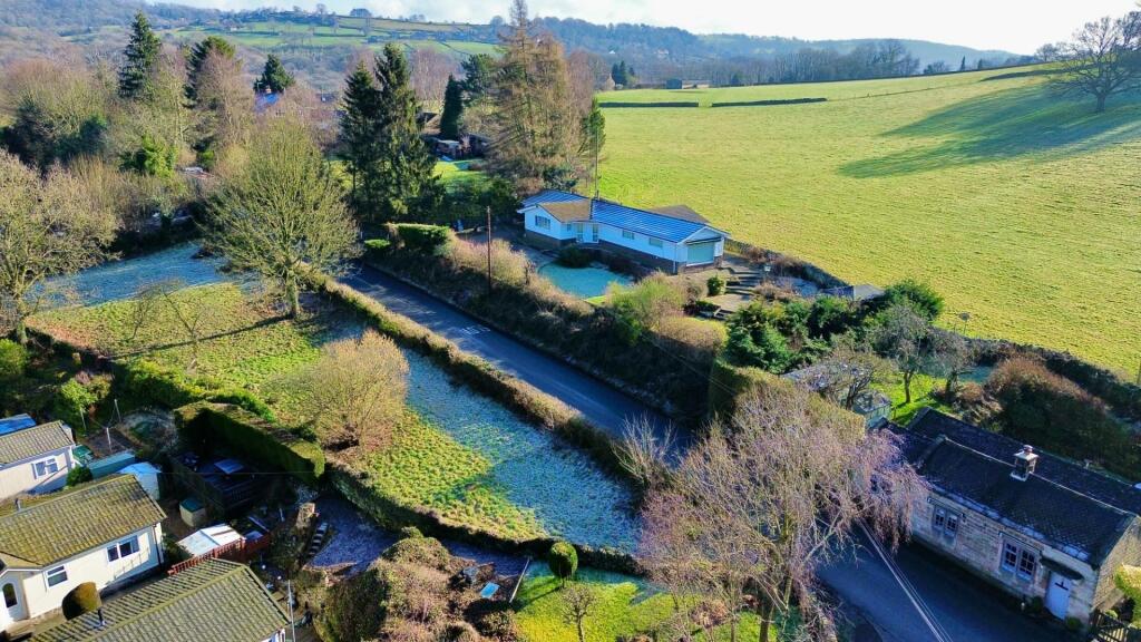
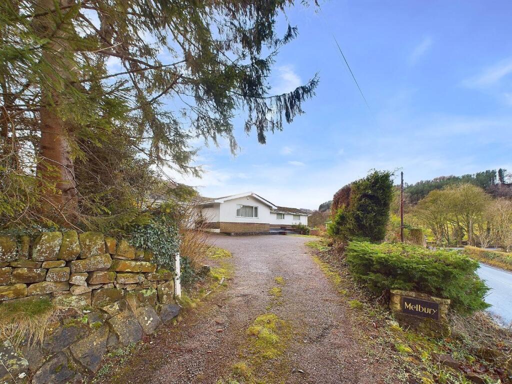
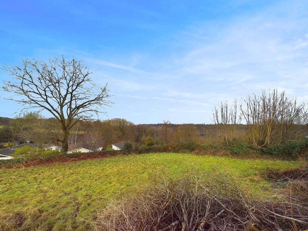
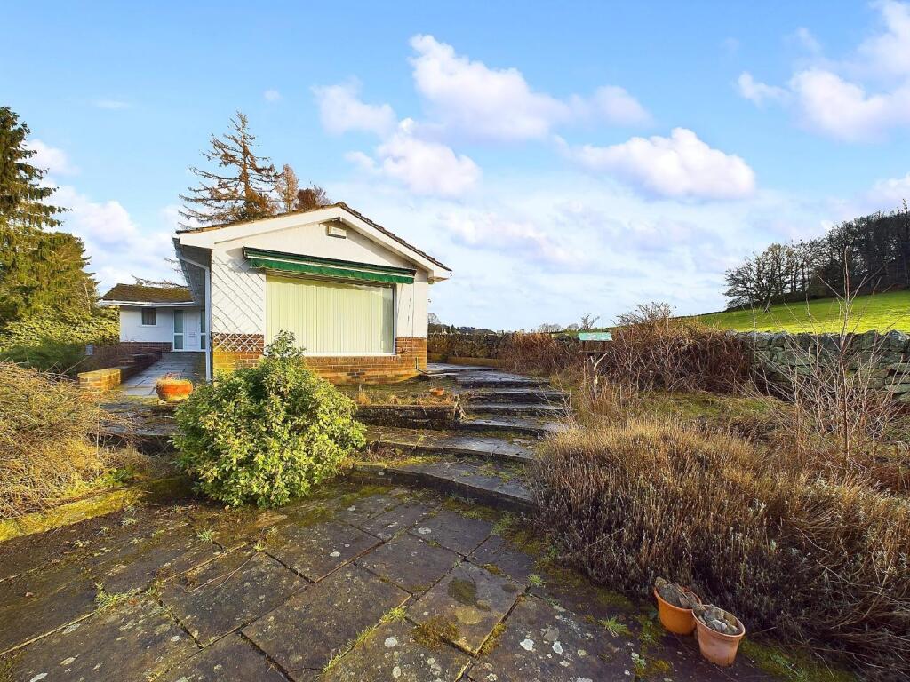
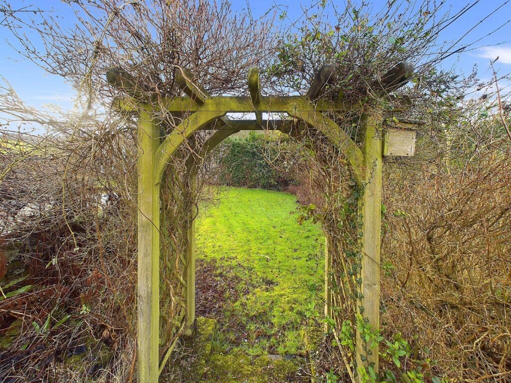
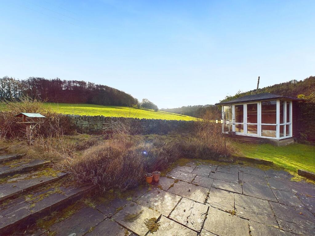
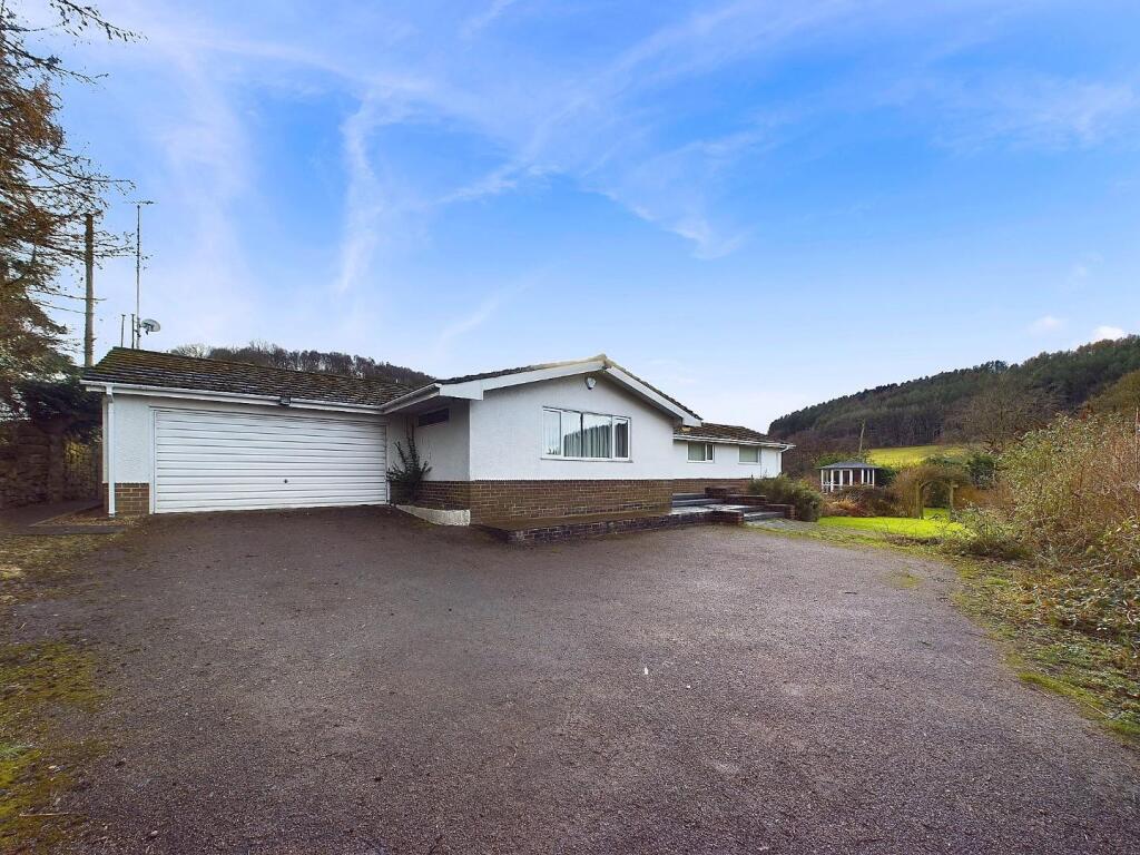
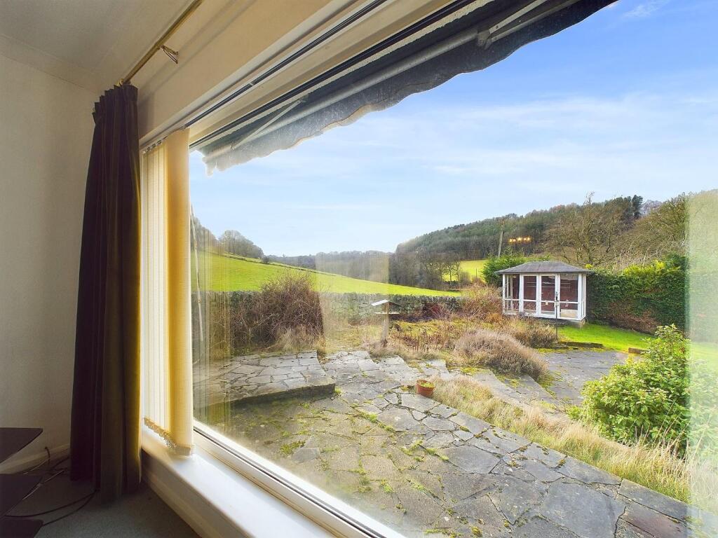
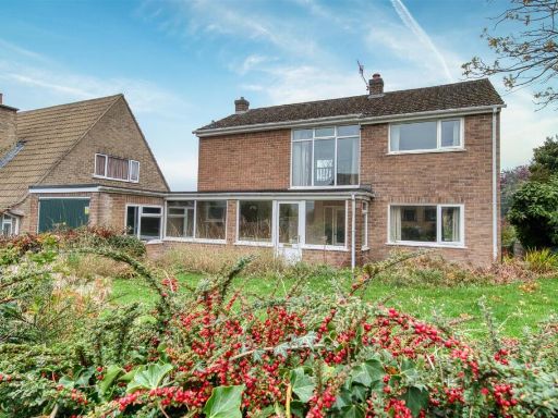
- This picturesque residential property is a countryside retreat named 'Melbury,' located along Wirksworth Road. The house is nestled in a serene location with lush greenery and mature trees in the surroundings, providing an exceptional view of the rural landscape. The driveway, lined with stone walls and greenery, leads up to the property, indicating a generously sized plot. The frontage of the house presents a modern yet comfortable exterior with plenty of natural light likely filling the interiors due to large windows. The property size appears to be large, offering ample outdoor space, which can be ideal for gardening or recreational activities.
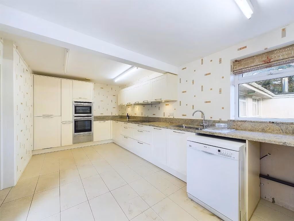
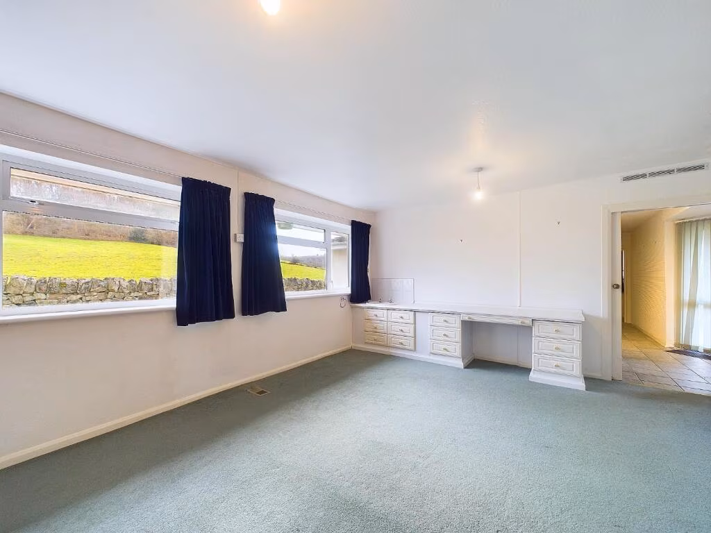
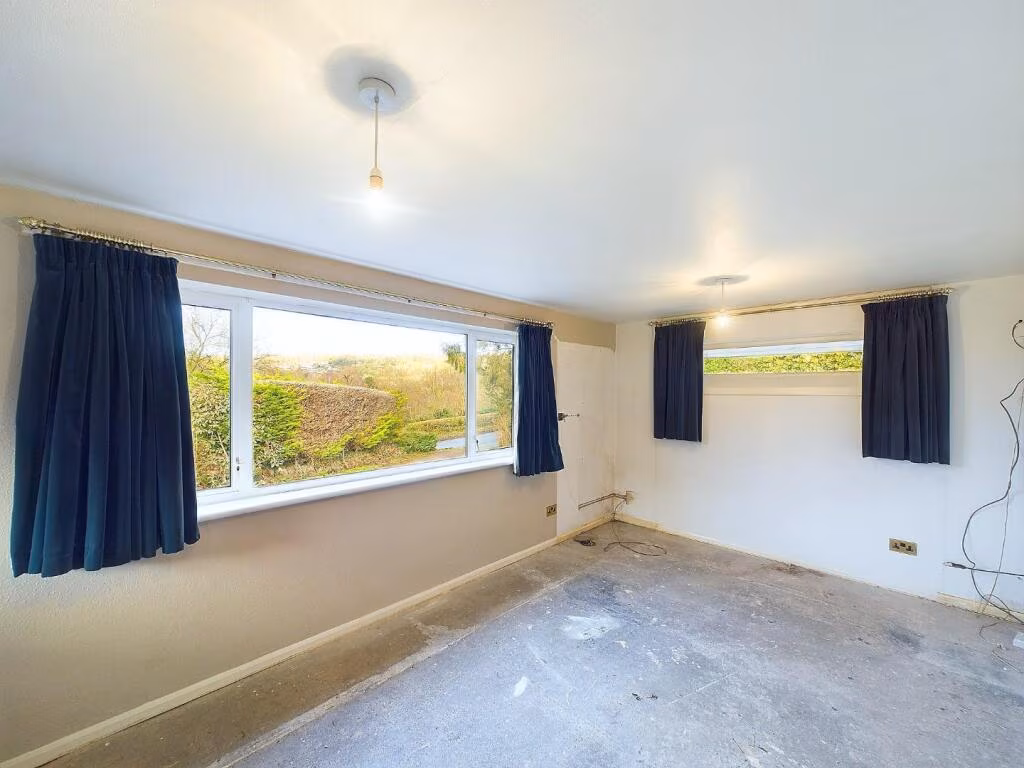
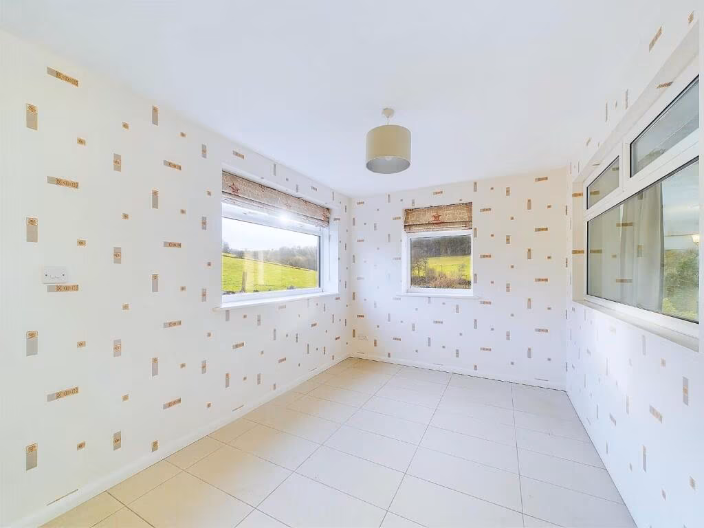
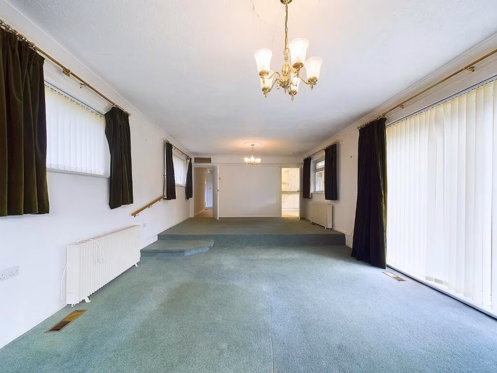
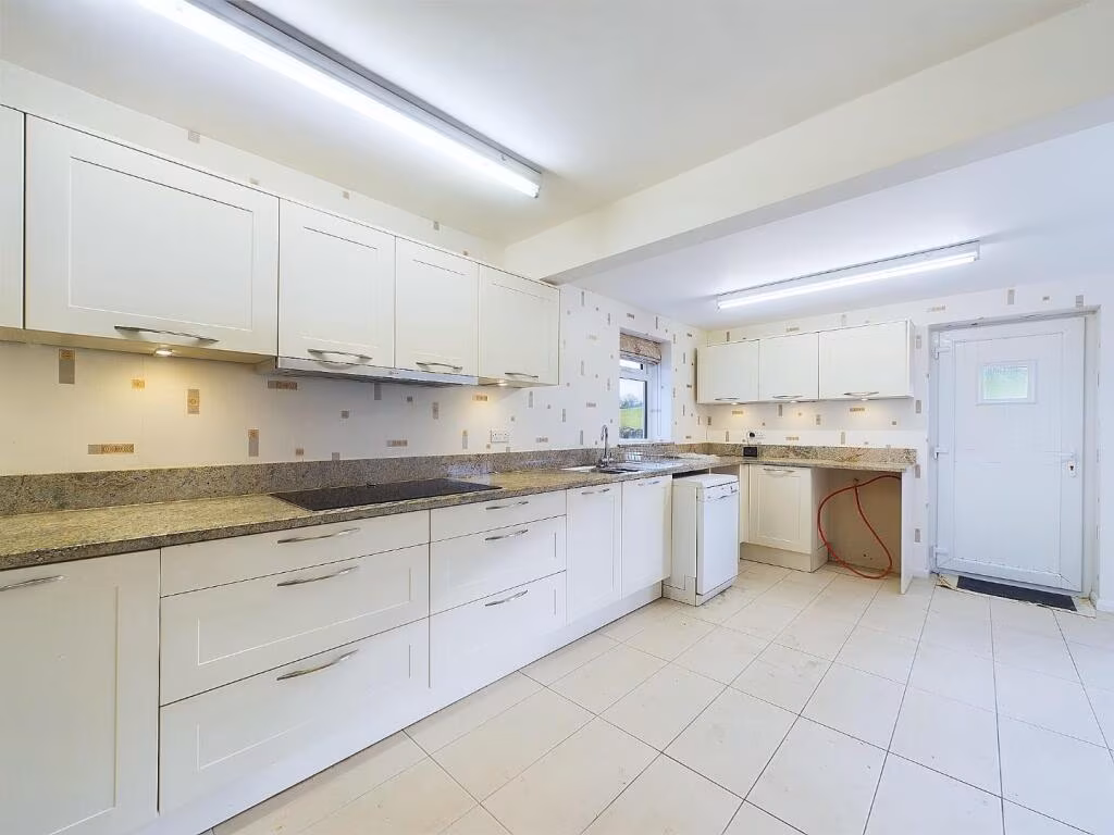
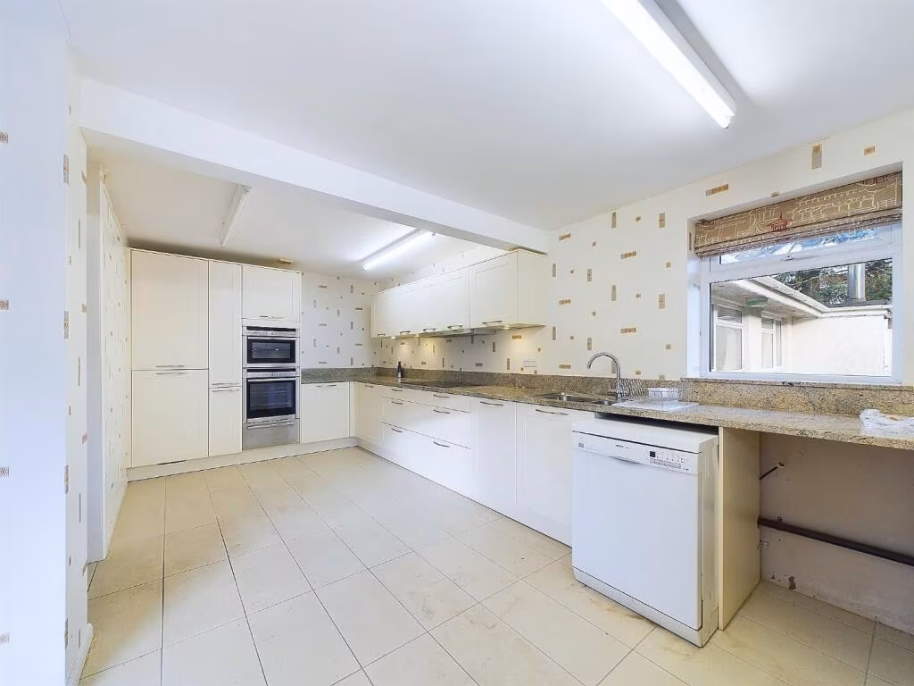
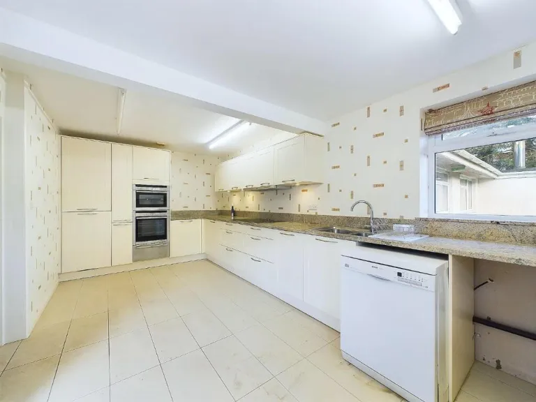
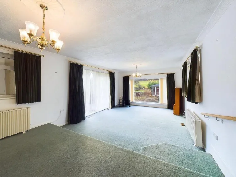
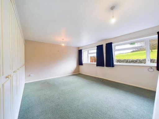
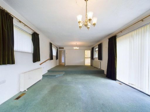
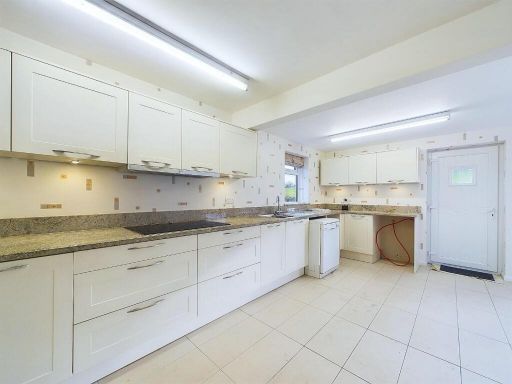
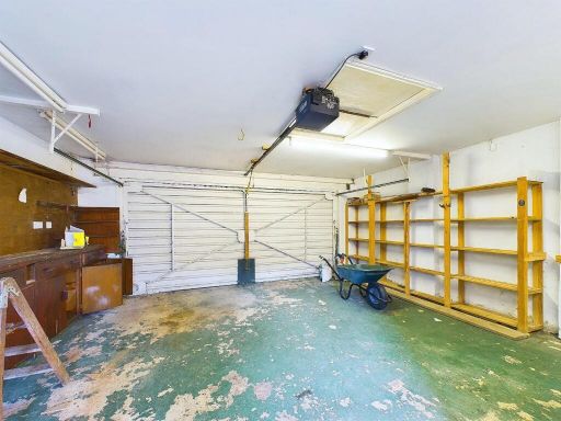
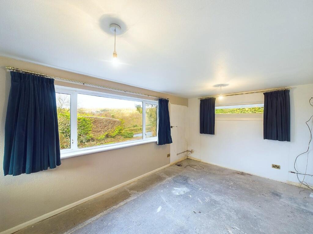
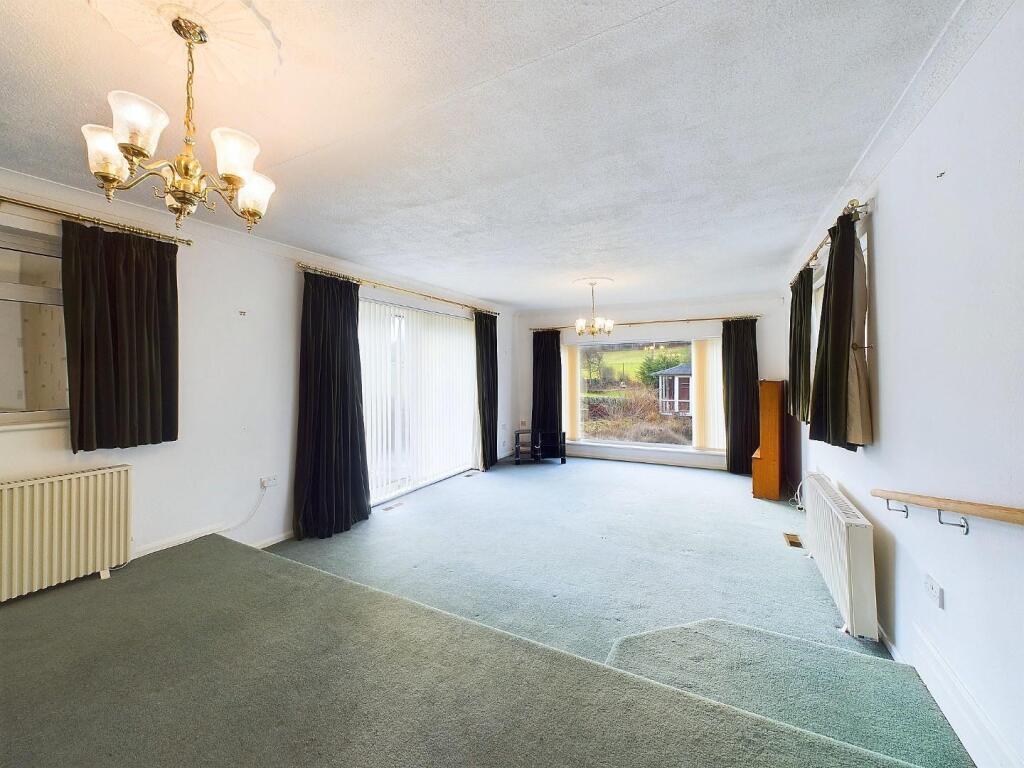
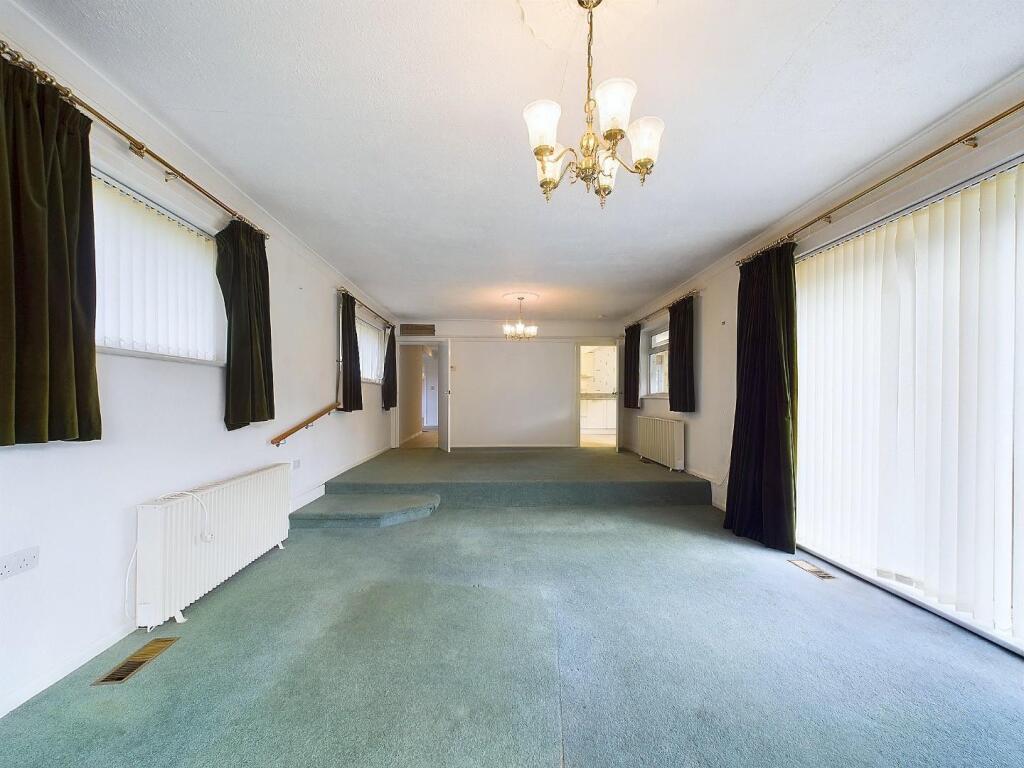
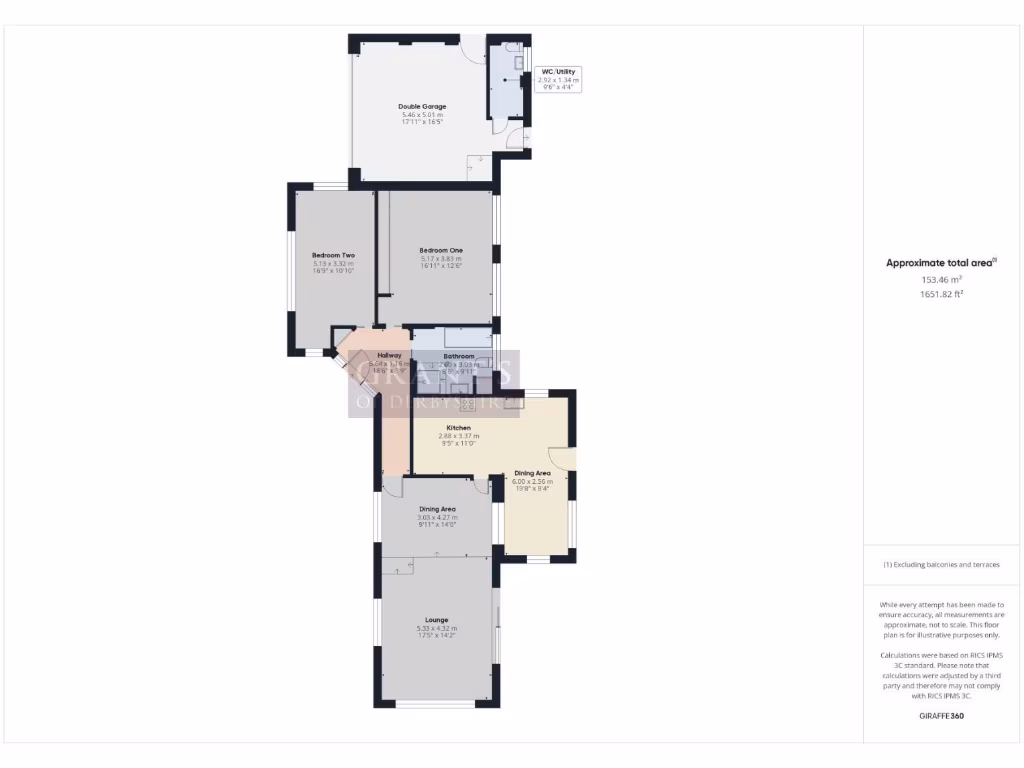
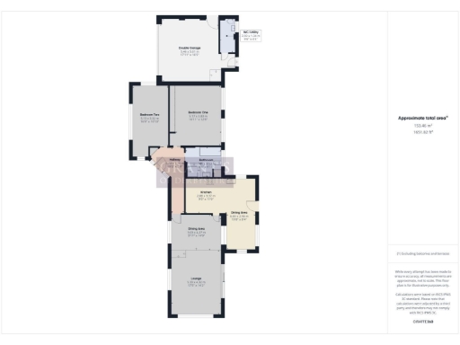
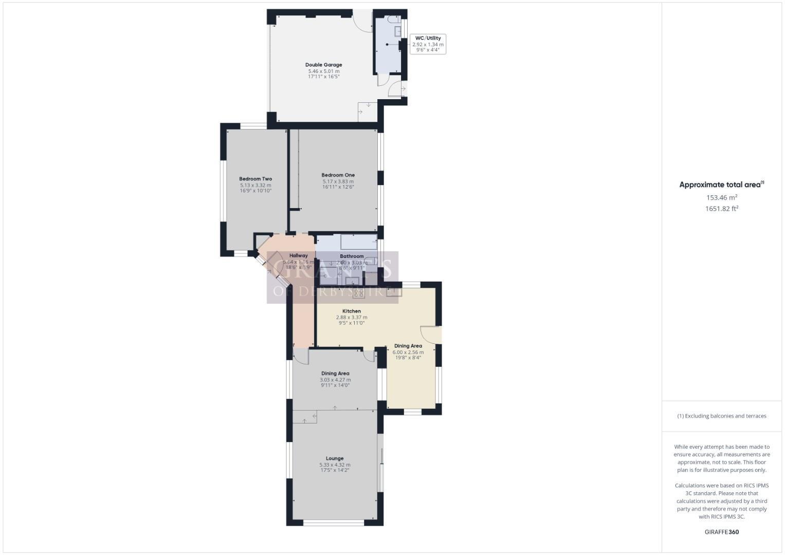
- The property is a comfortable and spacious home occupying a total area of approximately 1653.62 square feet. It features a double garage for secure parking and additional storage. The interior layout consists of an open-plan dining area flowing into a cozy lounge, designed to offer expansive space perfect for family gatherings or entertaining guests. The kitchen is practically laid out with ample food preparation areas. There are two generous bedrooms, each providing enough room for large beds and additional furniture, and a well-sized bathroom. The hallways and utility spaces are conveniently integrated into the overall layout. The property offers overall a large and practical living environment.
Image Descriptions
- country home modern bungalow
- bungalow mid-20th century bungalow
Floorplan Description
- A residential property with a double garage, two bedrooms, a lounge, and dining areas.
Rooms
- Double Garage: large
- W/C Utility: small
- Bedroom Two: average
- Bedroom One: average
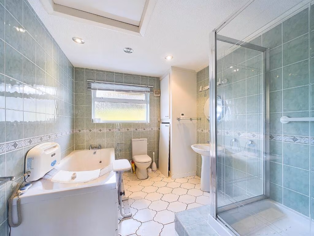
- Bathroom: small
- Dining Area: average
- Dining Area: average
- Kitchen: average
- Lounge: large
- Hallway: small
Textual Property Features
- Has Garden
- Chain Free
- Success
Detected Visual Features
- country home
- modern bungalow
- rural setting
- expansive land
- private location
- detached
- bungalow
- rural
- driveway
- garden
- stone wall
EPC Details
- Fully double glazed
- Cavity wall, as built, partial insulation (assumed)
- Warm air, oil
- Low energy lighting in 10% of fixed outlets
- Solid, no insulation (assumed)
Nearby Schools
- Belper School and Sixth Form Centre
- Pottery Primary School
- St John's CofE Primary School and Nursery
- Crich Junior School
- Crich Church of England Infant School
- Wirksworth Junior School
- Wirksworth CofE Infant School
- Cromford Church of England Primary School
- Tansley Primary School
- St Joseph's Catholic Voluntary Academy
- Heage Primary School
- Wessington Primary School
- Anthony Gell School
- Crich Carr CofE Primary School
- Lea Primary School
- Matlock Bath Holy Trinity CofE Controlled Primary School
- St Giles Church of England Primary School
- All Saints CofE Infant School
- All Saints CofE Junior School
- Highfields School
- Long Row Primary School
- St Elizabeth's Catholic Voluntary Academy
- South Wingfield Primary School
- Middleton Community Primary School
- Bonsall CofE (A) Primary School
- Castle View Primary School
- Ambergate Primary School
- Fritchley CofE (Aided) Primary & Nursery School
- Stretton Handley Church of England Primary School
Nearest Religious buildings
- Id: 770421624
- Tags:
- Addr:
- Amenity: place_of_worship
- Building: church
- Religion: christian
- TagsNormalized:
- place of worship
- church
- christian
- Lat: 53.107542
- Lon: -1.5182364
- FullGeoHash: gcqyj7ymye2g
- PartitionGeoHash: gcqy
- Images:
- FoodStandards: null
- Distance: 1919.8
,- Id: 341468148
- Tags:
- Addr:
- City: Belper
- Postcode: DE56 2SR
- Street: Higg Lane
- Village: Alderwasley
- Amenity: place_of_worship
- Building: yes
- Denomination: anglican
- Name: All Saints' Church
- Religion: christian
- Website: http://wirksworthteamministry.co.uk/alderwasley/
- Wikidata: Q26619947
- TagsNormalized:
- place of worship
- anglican
- church
- christian
- Lat: 53.0751756
- Lon: -1.5155112
- FullGeoHash: gcqvvw03q1bf
- PartitionGeoHash: gcqv
- Images:
- FoodStandards: null
- Distance: 1697.7
,- Id: 1233121500
- Tags:
- Addr:
- Amenity: place_of_worship
- Denomination: methodist
- Ele: 147.0000000
- Name: Holloway Methodist Chapel
- Religion: christian
- TagsNormalized:
- place of worship
- methodist
- chapel
- christian
- church
- Lat: 53.1052997
- Lon: -1.517453
- FullGeoHash: gcqyj7x0bc3h
- PartitionGeoHash: gcqy
- Images:
- FoodStandards: null
- Distance: 1665.8
}
Nearest Medical buildings
- Id: 233844988
- Tags:
- Amenity: doctors
- Building: health_centre
- Healthcare: doctor
- Name: Hannage Brook Medical Centre
- Website: https://hannagebrook.co.uk/
- Wheelchair: yes
- TagsNormalized:
- doctor
- doctors
- health
- health centre
- healthcare
- Lat: 53.0776223
- Lon: -1.5713512
- FullGeoHash: gcqvunrz8cgt
- PartitionGeoHash: gcqv
- Images:
- FoodStandards: null
- Distance: 4059.8
,- Id: 289021533
- Tags:
- Amenity: dentist
- Building: yes
- Healthcare: dentist
- Name: Coach House Dental Practice
- Website: https://www.thecoachhousedental.co.uk/
- TagsNormalized:
- dentist
- health
- healthcare
- dental
- Lat: 53.0820822
- Lon: -1.5700665
- FullGeoHash: gcqvur29wc3d
- PartitionGeoHash: gcqv
- Images:
- FoodStandards: null
- Distance: 3830.1
,- Id: 292556052
- Tags:
- Addr:
- Amenity: dentist
- Building: yes
- Contact:
- Website: https://www.bupa.co.uk/dental/dental-care/practices/platinum-steeple-grange-dental-care
- Healthcare: dentist
- Name: Steeple Grange Dental Practice
- Operator: Bupa
- Operator:wikidata: Q931628
- TagsNormalized:
- dentist
- health
- healthcare
- dental
- Lat: 53.094863
- Lon: -1.5685928
- FullGeoHash: gcqyh39gcpu6
- PartitionGeoHash: gcqy
- Images:
- FoodStandards: null
- Distance: 3650.4
,- Id: 247953895
- Tags:
- Amenity: doctors
- Building: yes
- Healthcare: doctor
- Name: Crich Medical Practice
- TagsNormalized:
- doctor
- doctors
- health
- healthcare
- Lat: 53.0843846
- Lon: -1.4831256
- FullGeoHash: gcqvyr8nbwt2
- PartitionGeoHash: gcqv
- Images:
- FoodStandards: null
- Distance: 2195.8
}
Nearest Leisure Facilities
- Id: 6401597111
- Tags:
- TagsNormalized:
- picnic
- picnic table
- leisure
- Lat: 53.0763736
- Lon: -1.5137717
- FullGeoHash: gcqvvw38q94j
- PartitionGeoHash: gcqv
- Images:
- FoodStandards: null
- Distance: 1563.5
,- Id: 341468107
- Tags:
- TagsNormalized:
- Lat: 53.0770498
- Lon: -1.5133207
- FullGeoHash: gcqvvw6h1p4q
- PartitionGeoHash: gcqv
- Images:
- FoodStandards: null
- Distance: 1489.5
,- Id: 579821479
- Tags:
- Leisure: nature_reserve
- Operator: Wildlife Trusts
- Source: Sign at northwest
- TagsNormalized:
- Lat: 53.0956013
- Lon: -1.5261607
- FullGeoHash: gcqyj3b8mckn
- PartitionGeoHash: gcqy
- Images:
- FoodStandards: null
- Distance: 971.9
,- Id: 579821679
- Tags:
- Leisure: nature_reserve
- Source: Sign at north
- TagsNormalized:
- Lat: 53.0965315
- Lon: -1.5213392
- FullGeoHash: gcqyj3ujwnz7
- PartitionGeoHash: gcqy
- Images:
- FoodStandards: null
- Distance: 820.7
,- Id: 8618545642
- Tags:
- TagsNormalized:
- picnic
- picnic table
- leisure
- Lat: 53.0918077
- Lon: -1.50634
- FullGeoHash: gcqyj9p45wr3
- PartitionGeoHash: gcqy
- Images:
- FoodStandards: null
- Distance: 561.4
}
Nearest Tourist attractions
- Id: 234004059
- Tags:
- Building: yes
- Ele: 75.0
- Historic: building
- Name: Leawood Pump House
- Source: survey;bing
- Tourism: attraction
- Wikidata: Q17642131
- TagsNormalized:
- Lat: 53.0974422
- Lon: -1.5305858
- FullGeoHash: gcqyj4j7nb8s
- PartitionGeoHash: gcqy
- Images:
- FoodStandards: null
- Distance: 1331.3
,- Id: 683615977
- Tags:
- Addr:
- City: Matlock
- Postcode: DE4 5HP
- Name: Haytop Country Park
- Tourism: caravan_site
- TagsNormalized:
- Lat: 53.0799327
- Lon: -1.5074898
- FullGeoHash: gcqvvwym0bw5
- PartitionGeoHash: gcqv
- Images:
- FoodStandards: null
- Distance: 1255.7
,- Id: 480699141
- Tags:
- Former_amenity: pub
- Name: Homesford Cottage
- Note: Was a private house for a few years. Still has pub sign outside and on barn roof opposite. Now signed as a B&B
- Old_name: Homesford Cottage Inn
- Source: survey
- Tourism: guest_house
- TagsNormalized:
- Lat: 53.0947404
- Lon: -1.5178894
- FullGeoHash: gcqyj3weq8gx
- PartitionGeoHash: gcqy
- Images:
- FoodStandards: null
- Distance: 532.2
}
Nearest Train stations
- Id: 2398089855
- Tags:
- Name: Ravenstor
- Public_transport: station
- Railway: station
- Usage: tourism
- Wikidata: Q7296554
- Wikipedia: en:Ravenstor railway station
- TagsNormalized:
- Lat: 53.0901924
- Lon: -1.57288
- FullGeoHash: gcqyh0y8v1pt
- PartitionGeoHash: gcqy
- Images:
- FoodStandards: null
- Distance: 3903.5
,- Id: 1617706532
- Tags:
- Name: Steeple Grange
- Public_transport: station
- Railway: station
- Usage: tourism
- TagsNormalized:
- Lat: 53.0957021
- Lon: -1.5707431
- FullGeoHash: gcqyh3b0zh30
- PartitionGeoHash: gcqy
- Images:
- FoodStandards: null
- Distance: 3805.9
,- Id: 251735751
- Tags:
- Name: Wirksworth
- Naptan:
- Public_transport: station
- Railway: station
- Usage: tourism
- Wikidata: Q8026960
- Wikipedia: en:Wirksworth railway station
- TagsNormalized:
- Lat: 53.0827559
- Lon: -1.5687991
- FullGeoHash: gcqvur3tkqft
- PartitionGeoHash: gcqv
- Images:
- FoodStandards: null
- Distance: 3730.1
,- Id: 6415346592
- Tags:
- Name: Cromford
- Naptan:
- Network: National Rail
- Public_transport: station
- Railway: station
- Ref:
- Source: NPE
- Wikidata: Q2079568
- Wikipedia: en:Cromford railway station
- TagsNormalized:
- Lat: 53.1129115
- Lon: -1.5490661
- FullGeoHash: gcqyhubj0hkd
- PartitionGeoHash: gcqy
- Images:
- FoodStandards: null
- Distance: 3405.5
,- Id: 6415346591
- Tags:
- Name: Whatstandwell
- Naptan:
- Network: National Rail
- Public_transport: station
- Railway: station
- Ref:
- Source: NPE
- Wikidata: Q2313025
- Wikipedia: en:Whatstandwell railway station
- TagsNormalized:
- Lat: 53.0834695
- Lon: -1.5042939
- FullGeoHash: gcqvvz89e7vj
- PartitionGeoHash: gcqv
- Images:
- FoodStandards: null
- Distance: 1028
}
Nearest Bus stations and stops
- Id: 1684132080
- Tags:
- Bus: yes
- Highway: bus_stop
- Public_transport: platform
- TagsNormalized:
- Lat: 53.0836115
- Lon: -1.5049288
- FullGeoHash: gcqvvz84kw7u
- PartitionGeoHash: gcqv
- Images:
- FoodStandards: null
- Distance: 988.5
,- Id: 477821691
- Tags:
- Bus: yes
- Highway: bus_stop
- Public_transport: platform
- TagsNormalized:
- Lat: 53.084865
- Lon: -1.5042368
- FullGeoHash: gcqvvzb9u8pd
- PartitionGeoHash: gcqv
- Images:
- FoodStandards: null
- Distance: 919.7
,- Id: 1684132067
- Tags:
- Bus: yes
- Highway: bus_stop
- Public_transport: platform
- TagsNormalized:
- Lat: 53.0847587
- Lon: -1.5059955
- FullGeoHash: gcqvvxz35u22
- PartitionGeoHash: gcqv
- Images:
- FoodStandards: null
- Distance: 845.3
,- Id: 1684127859
- Tags:
- Bus: yes
- Highway: bus_stop
- Public_transport: platform
- TagsNormalized:
- Lat: 53.0914305
- Lon: -1.509245
- FullGeoHash: gcqyj8vpbpcr
- PartitionGeoHash: gcqy
- Images:
- FoodStandards: null
- Distance: 363.5
,- Id: 1880157292
- Tags:
- Bus: yes
- Highway: bus_stop
- Public_transport: platform
- TagsNormalized:
- Lat: 53.0924554
- Lon: -1.5103806
- FullGeoHash: gcqyj9hjvx48
- PartitionGeoHash: gcqy
- Images:
- FoodStandards: null
- Distance: 351.8
}
Nearest Hotels
- Id: 80581307
- Tags:
- Addr:
- City: Matlock
- Postcode: DE4 3PX
- Street: New Bath Road
- Village: Matlock Bath
- Building: yes
- Fhrs:
- Name: New Bath Hotel
- Source: OS_OpenData_StreetView;survey
- Tourism: hotel
- Website: https://newbathhotelandspa.com/
- Wikidata: Q26676991
- TagsNormalized:
- Lat: 53.1154821
- Lon: -1.5613169
- FullGeoHash: gcqyhmrh4et8
- PartitionGeoHash: gcqy
- Images:
- FoodStandards: null
- Distance: 4190.4
,- Id: 772326708
- Tags:
- Addr:
- City: Alfreton
- Postcode: DE55 7NU
- Street: Inns Lane
- Village: Moorwood Moor
- Amenity: restaurant
- Description:
- Ele: 140
- Fhrs:
- Food: yes
- Name: The White Hart Inn
- Note: Self-describes as a hotel, restaurant and pub
- Outdoor_seating: yes
- Parking: yes
- Postal_code: DE55 7NU
- Real_ale: 3 beers
- Tourism: hotel
- TagsNormalized:
- restaurant
- inn
- hotel
- tourism
- Lat: 53.1005824
- Lon: -1.4619423
- FullGeoHash: gcqyndxmq60b
- PartitionGeoHash: gcqy
- Images:
- FoodStandards: null
- Distance: 3681.8
,- Id: 2626347310
- Tags:
- Name: Alison House
- Tourism: hotel
- TagsNormalized:
- Lat: 53.1068245
- Lon: -1.558502
- FullGeoHash: gcqyhec1sm8e
- PartitionGeoHash: gcqy
- Images:
- FoodStandards: null
- Distance: 3461.7
}
Tags
- country home
- modern bungalow
- rural setting
- expansive land
- private location
- detached
- bungalow
- rural
- detached
- driveway
- garden
- stone wall
Local Market Stats
- Average Price/sqft: £284
- Avg Income: £41800
- Rental Yield: 3.3%
- Social Housing: 6%
- Planning Success Rate: 68%
AirBnB Data
- 1km average: £72/night
- Listings in 1km: 3
Similar Properties
 3 bedroom detached house for sale in Pittywood Road, Wirksworth, Matlock, DE4 — £425,000 • 3 bed • 1 bath • 1411 ft²
 4 bedroom detached house for sale in Cromford Road, Wirksworth, Matlock, DE4 — £650,000 • 4 bed • 5 bath • 3809 ft²
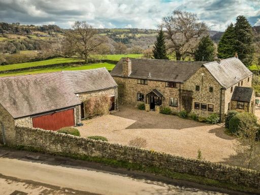 5 bedroom detached house for sale in New Road House, Alderwasley, Belper, Derbyshire, DE56 — £1,150,000 • 5 bed • 3 bath • 3205 ft²
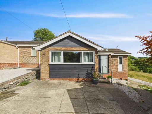 3 bedroom detached bungalow for sale in Memorial Croft, Wirksworth, DE4 — £410,000 • 3 bed • 1 bath • 861 ft²
 3 bedroom cottage for sale in The Lanes, Bolehill, Matlock, DE4 — £550,000 • 3 bed • 2 bath • 1270 ft²
 4 bedroom detached house for sale in Derby Road, Melbourne, DE73 8DE, DE73 — £795,000 • 4 bed • 2 bath • 1938 ft²
Meta
- {
"@context": "https://schema.org",
"@type": "Residence",
"name": "2 bedroom detached bungalow for sale in Wirksworth Road, Ma…",
"description": "",
"url": "https://propertypiper.co.uk/property/d83ddaf3-a343-4237-8e7c-a747bc6a90c2",
"image": "https://image-a.propertypiper.co.uk/7e34ea6d-e2fe-42ef-b8db-95f833df9c78-1024.jpeg",
"address": {
"@type": "PostalAddress",
"streetAddress": "MELBURY WIRKSWORTH ROAD WHATSTANDWELL MATLOCK",
"postalCode": "DE4 5HS",
"addressLocality": "Amber Valley",
"addressRegion": "Derbyshire Dales",
"addressCountry": "England"
},
"geo": {
"@type": "GeoCoordinates",
"latitude": 53.09042907154768,
"longitude": -1.5144267968385623
},
"numberOfRooms": 2,
"numberOfBathroomsTotal": 1,
"floorSize": {
"@type": "QuantitativeValue",
"value": 1651,
"unitCode": "FTK"
},
"offers": {
"@type": "Offer",
"price": 495000,
"priceCurrency": "GBP",
"availability": "https://schema.org/InStock"
},
"additionalProperty": [
{
"@type": "PropertyValue",
"name": "Feature",
"value": "country home"
},
{
"@type": "PropertyValue",
"name": "Feature",
"value": "modern bungalow"
},
{
"@type": "PropertyValue",
"name": "Feature",
"value": "rural setting"
},
{
"@type": "PropertyValue",
"name": "Feature",
"value": "expansive land"
},
{
"@type": "PropertyValue",
"name": "Feature",
"value": "private location"
},
{
"@type": "PropertyValue",
"name": "Feature",
"value": "detached"
},
{
"@type": "PropertyValue",
"name": "Feature",
"value": "bungalow"
},
{
"@type": "PropertyValue",
"name": "Feature",
"value": "rural"
},
{
"@type": "PropertyValue",
"name": "Feature",
"value": "detached"
},
{
"@type": "PropertyValue",
"name": "Feature",
"value": "driveway"
},
{
"@type": "PropertyValue",
"name": "Feature",
"value": "garden"
},
{
"@type": "PropertyValue",
"name": "Feature",
"value": "stone wall"
}
]
}
High Res Floorplan Images
Compatible Floorplan Images
FloorplanImages Thumbnail