BA21 4LN - 3 bedroom detached bungalow for sale in St. Michaels Avenue…
View on Property Piper
3 bedroom detached bungalow for sale in St. Michaels Avenue, Yeovil, BA21
Property Details
- Price: £210000
- Bedrooms: 3
- Bathrooms: 1
- Property Type: undefined
- Property SubType: undefined
Brochure Descriptions
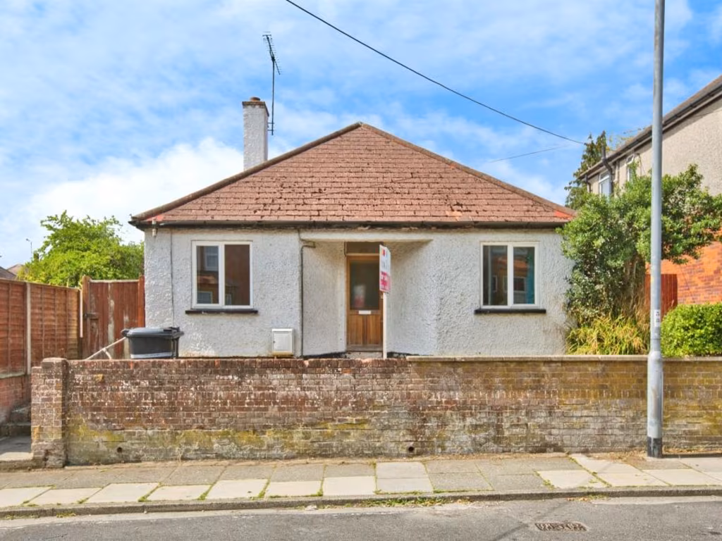
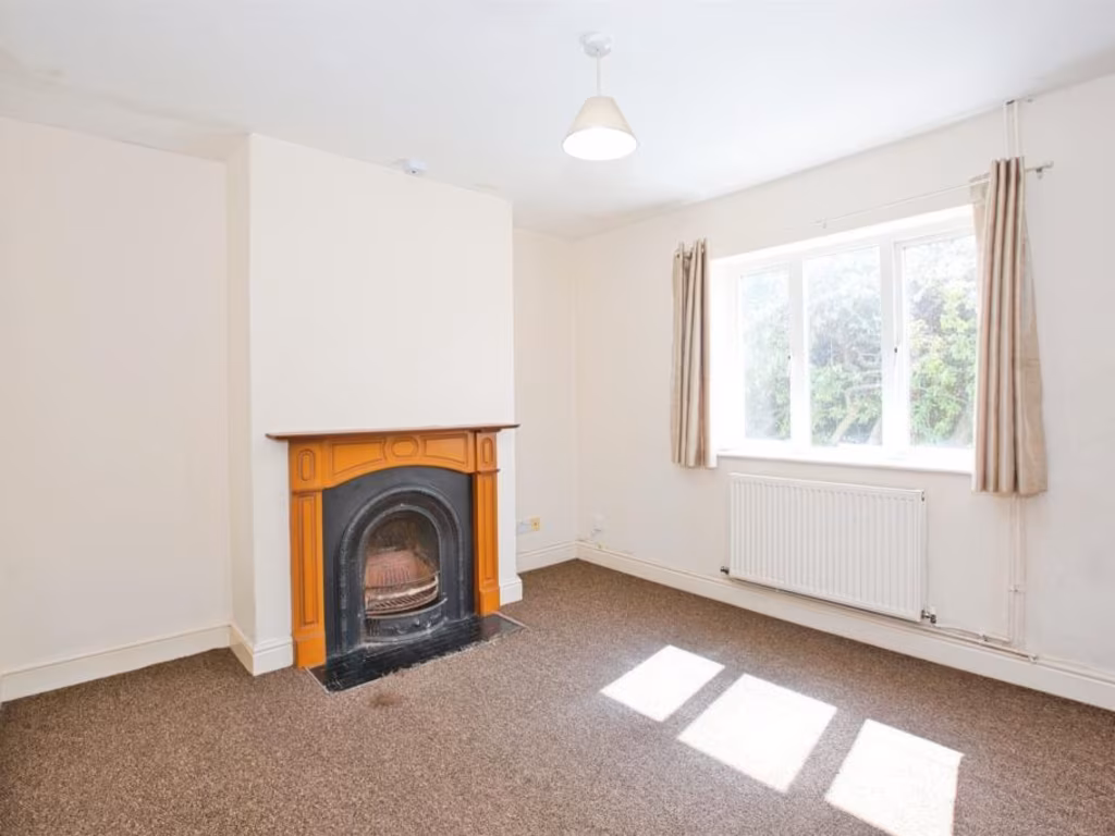
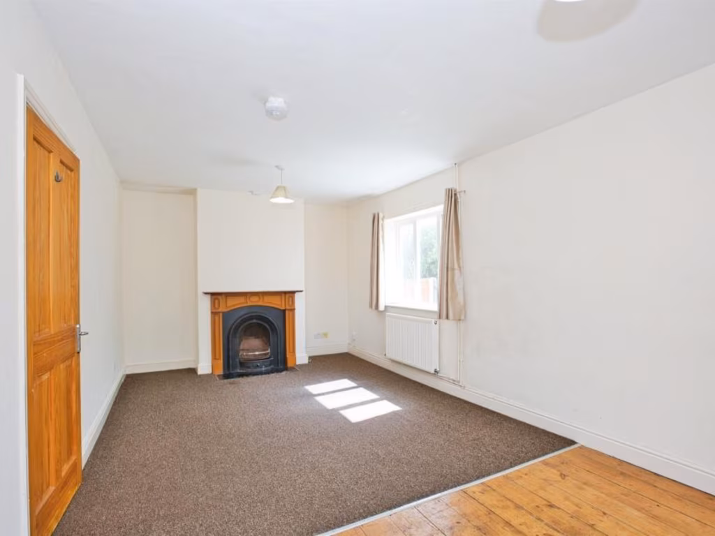
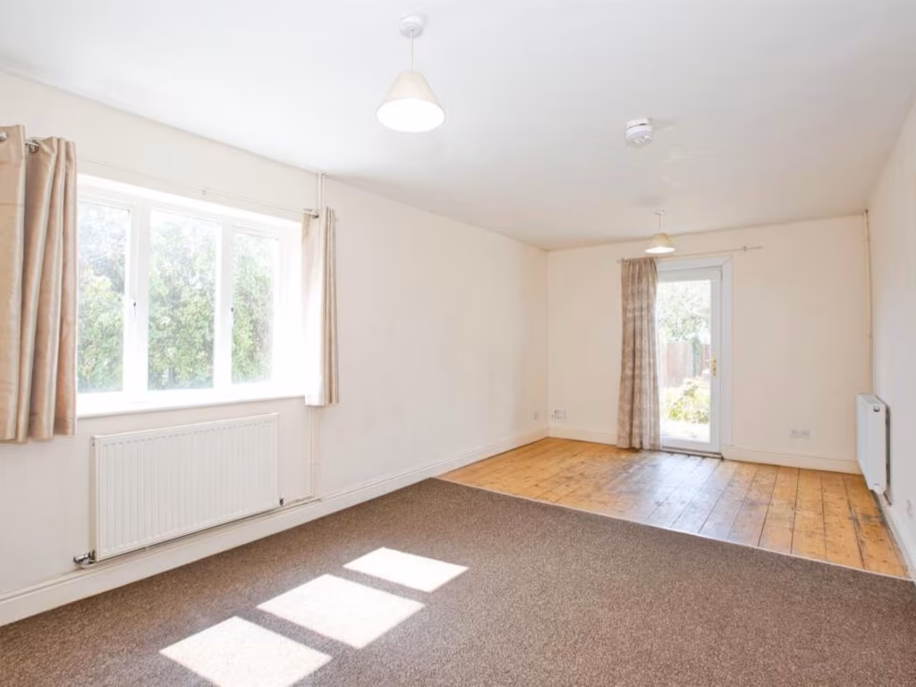
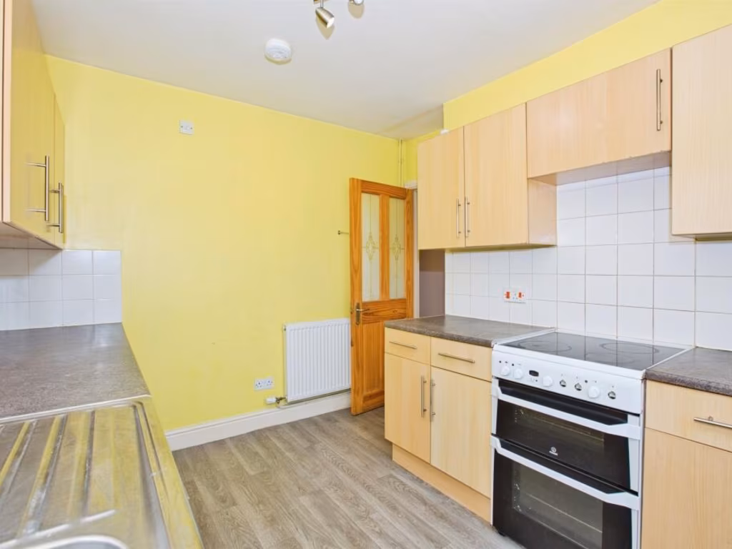
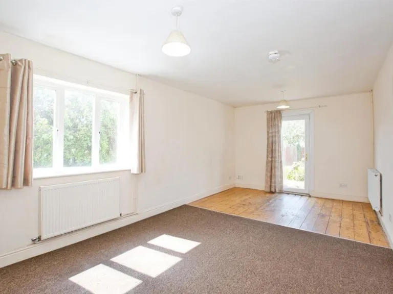
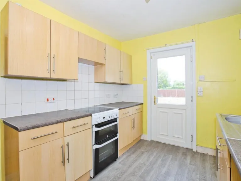
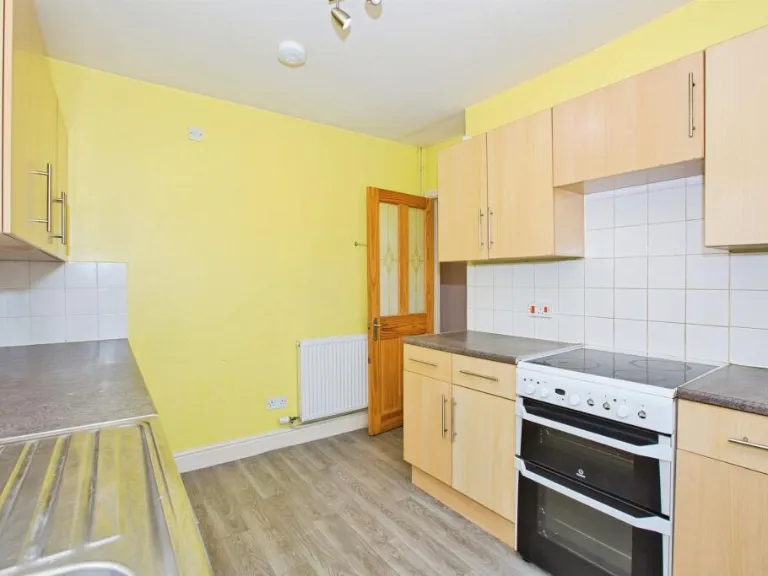
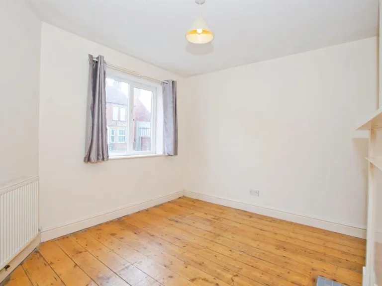
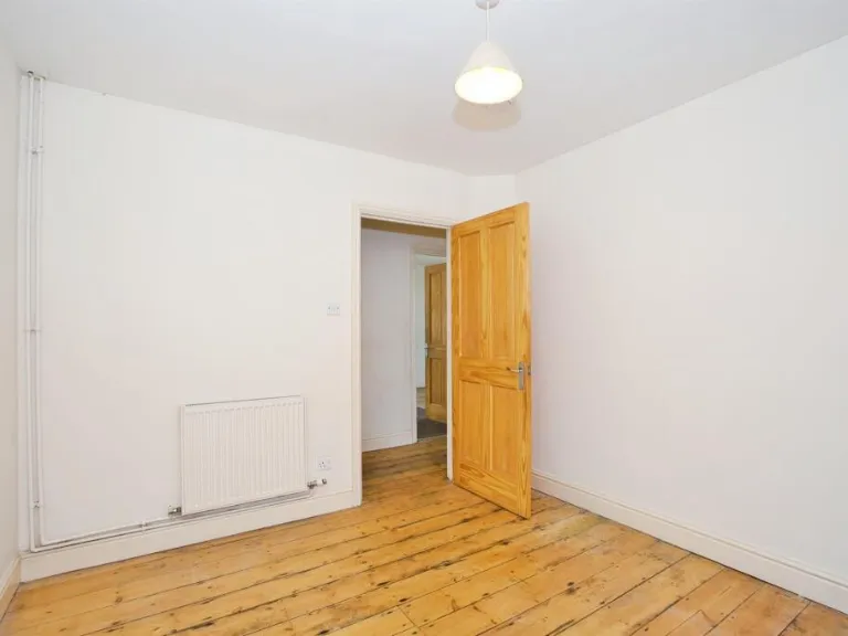
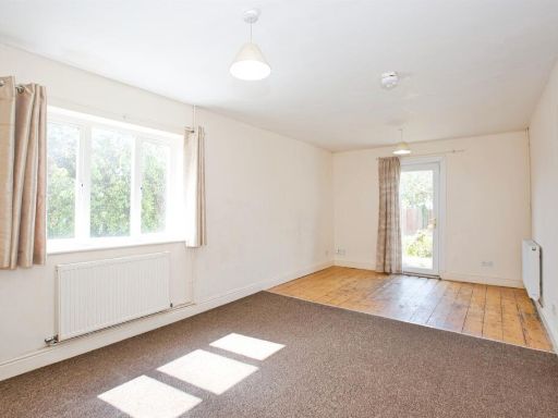
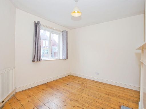
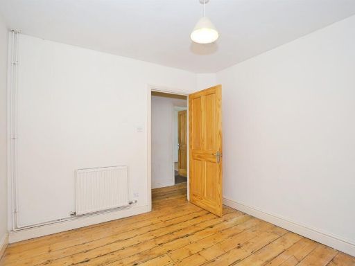
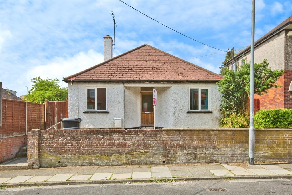
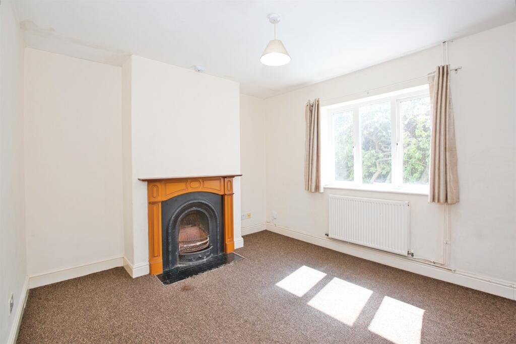
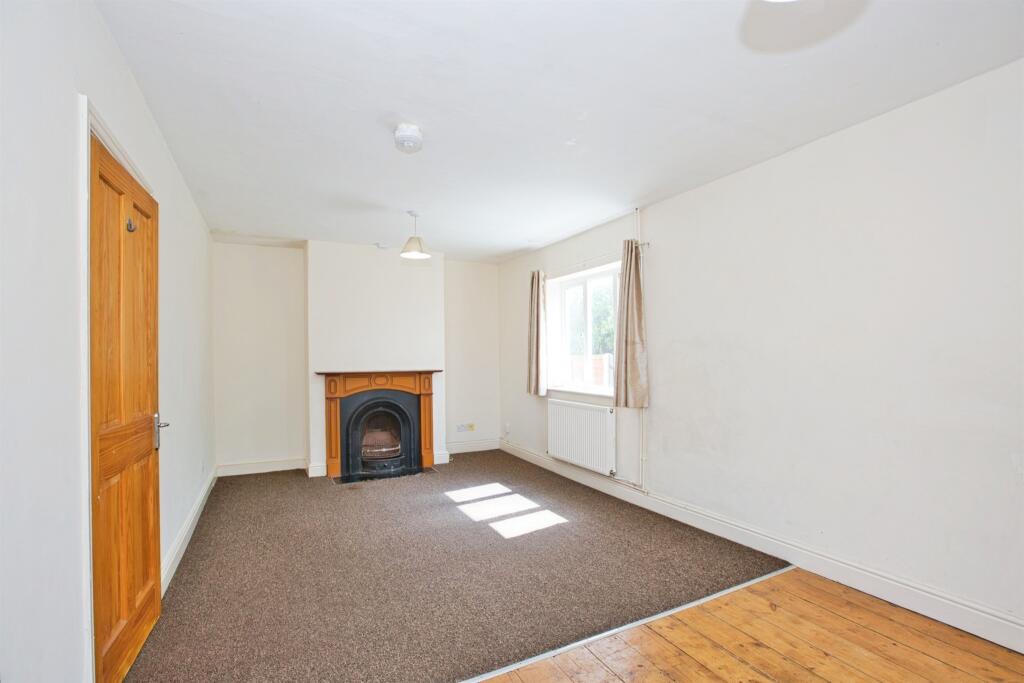
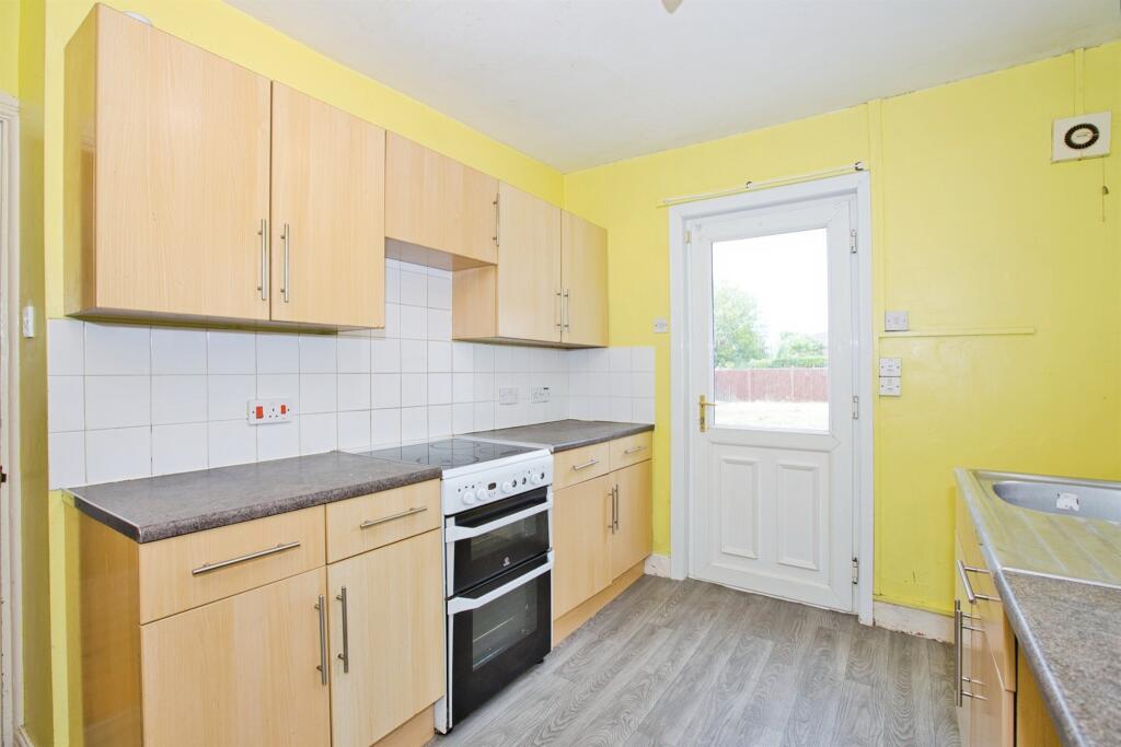
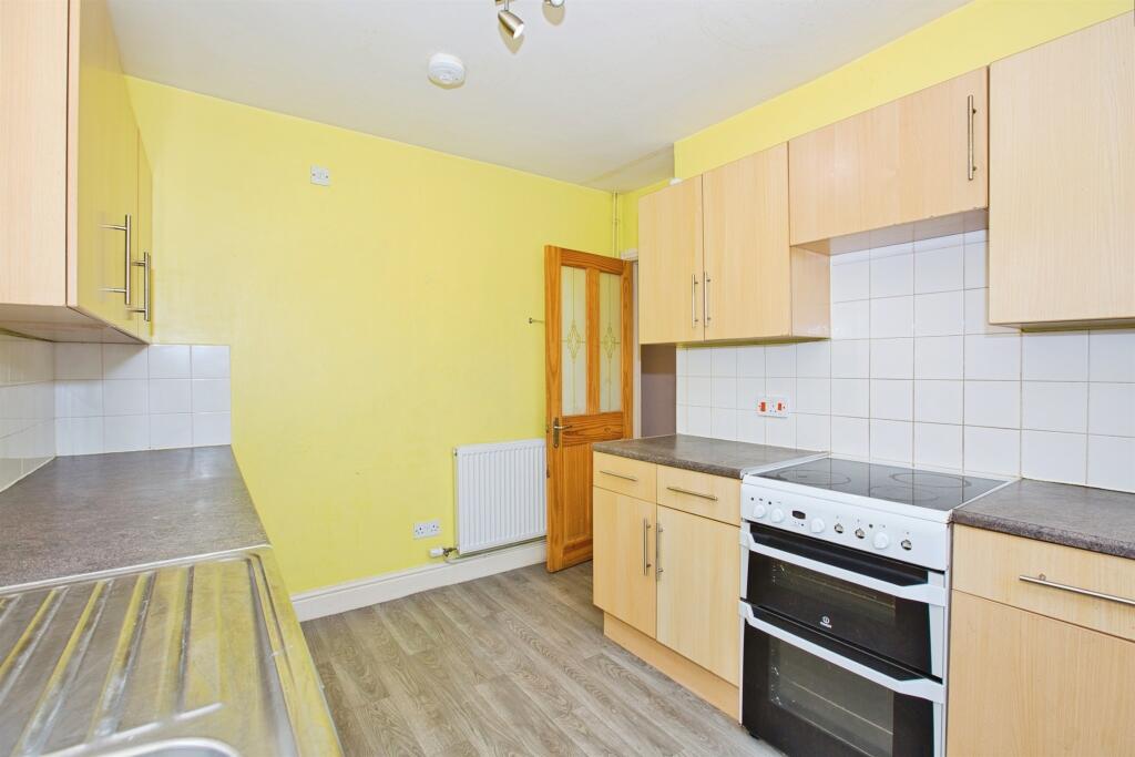
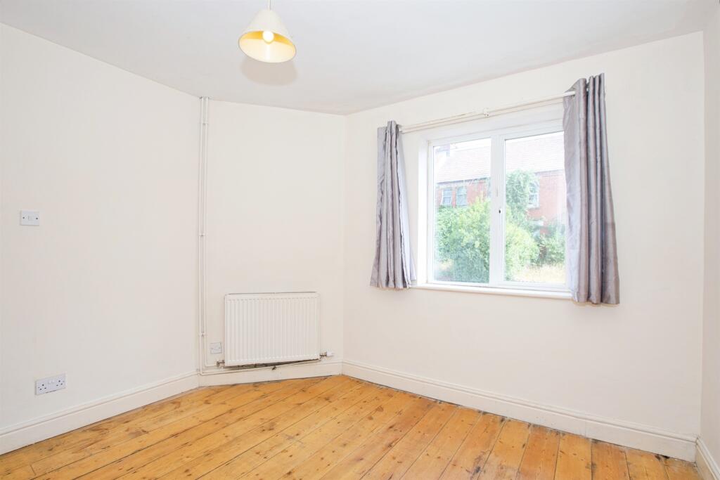
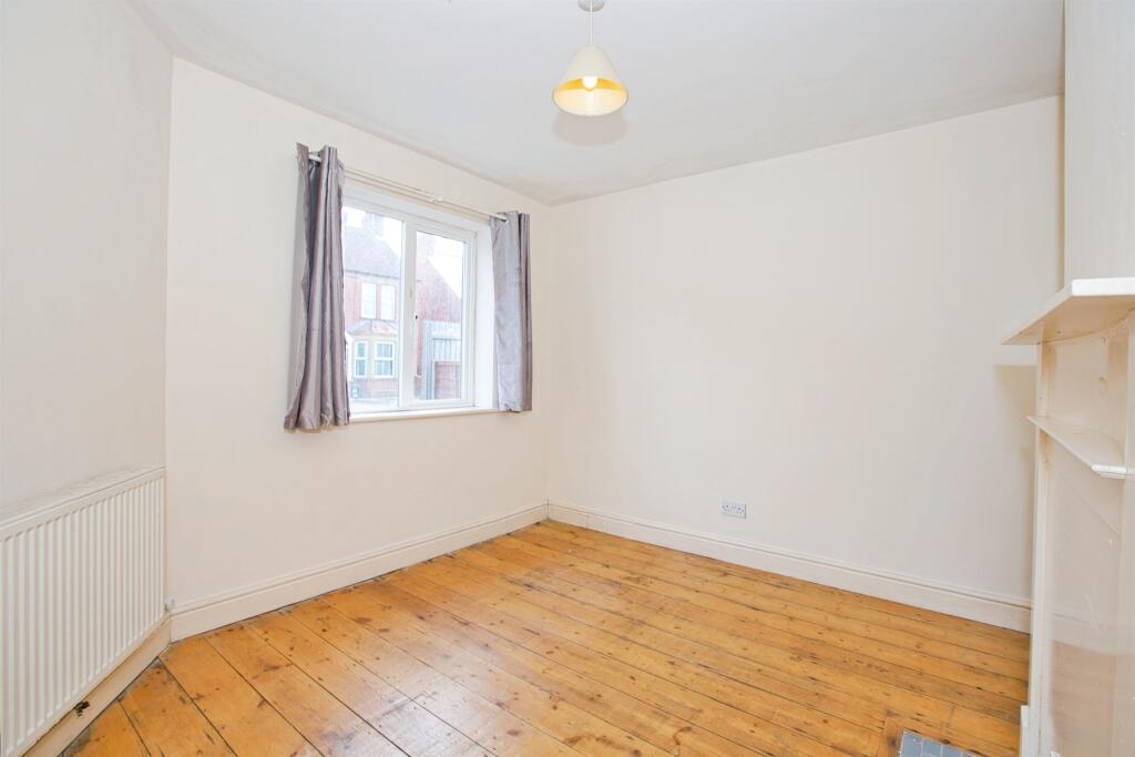
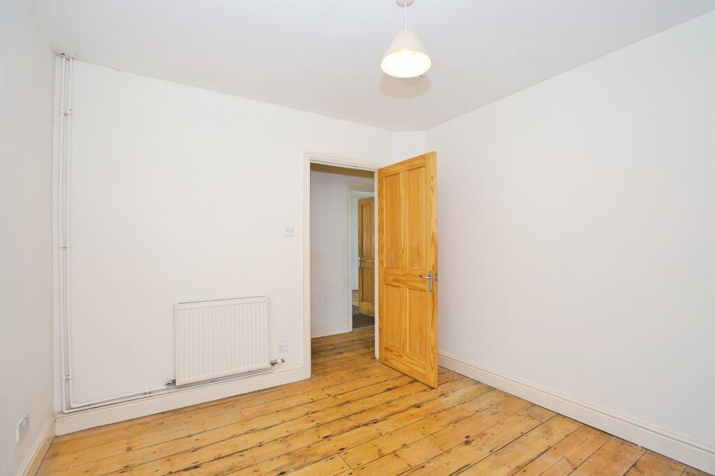
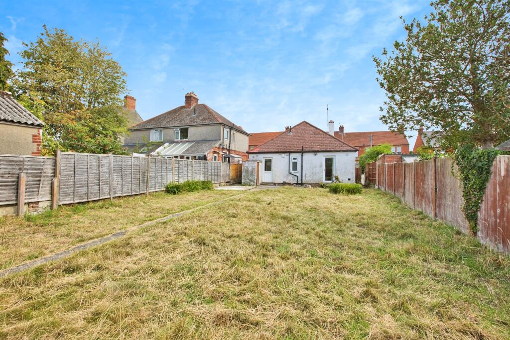
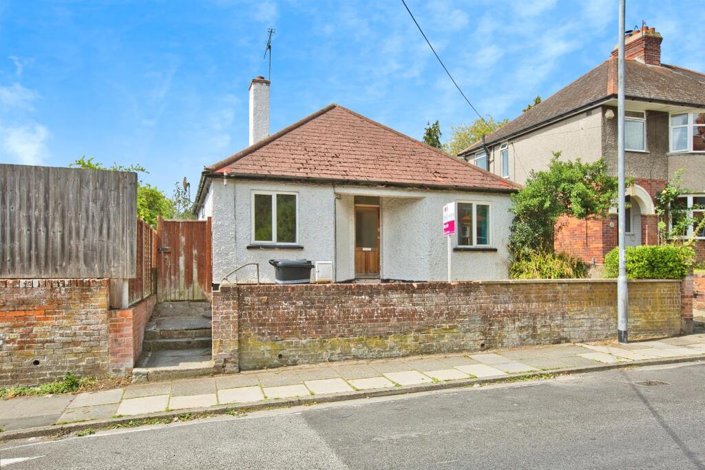
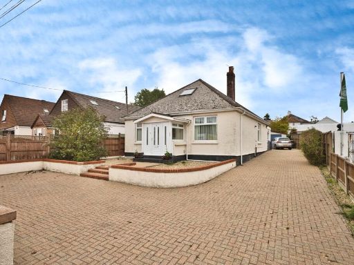
- This property is a detached bungalow, fronted by a medium-height brick wall and situated directly along the pavement of a residential street. The exterior is rendered, and the roof is a simple hipped style with red tiles. The residence appears to have a small front garden space bordered by fences. Internal images show at least two living spaces of moderate size, each with a fireplace and windows that provide good natural light. Room sizes present as average, consistent with a bungalow layout, likely offering single-level accommodation suitable for a small family or individuals seeking manageable space. There is no evidence of expansive garden or exceptional views, and the location is urban/suburban on a quiet street.
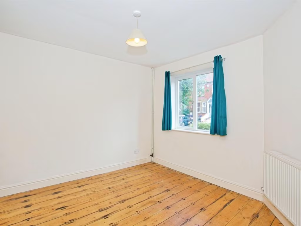
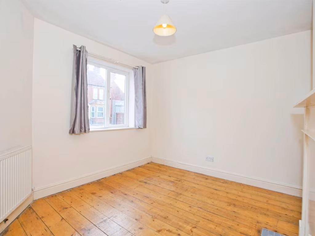
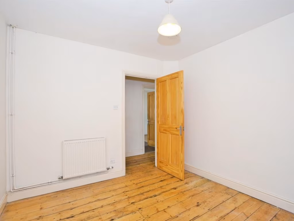
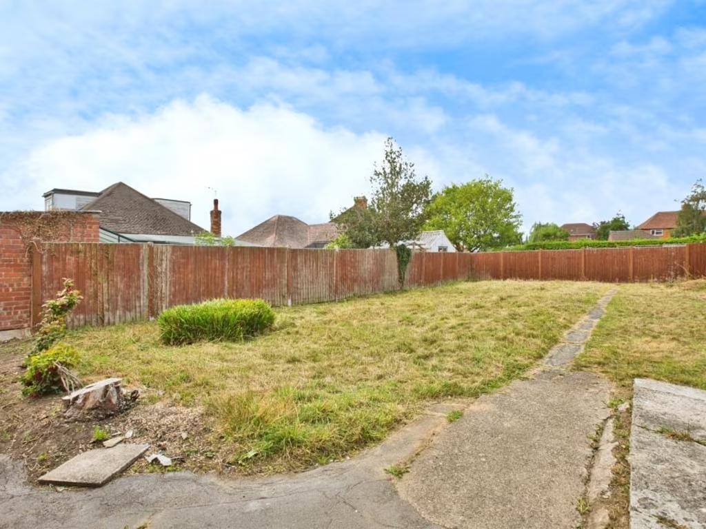
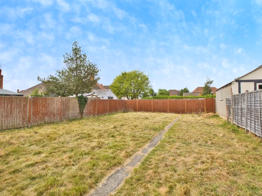
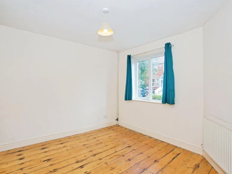
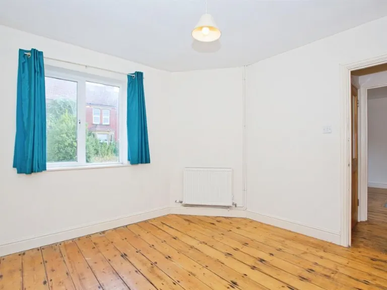
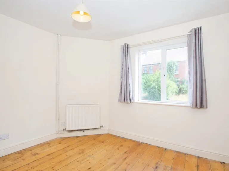
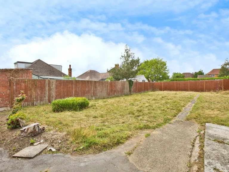
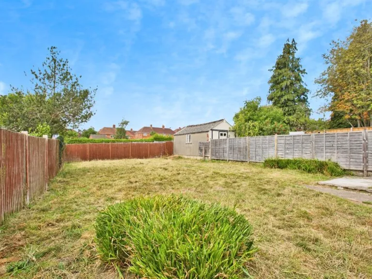
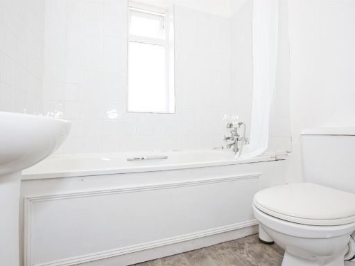
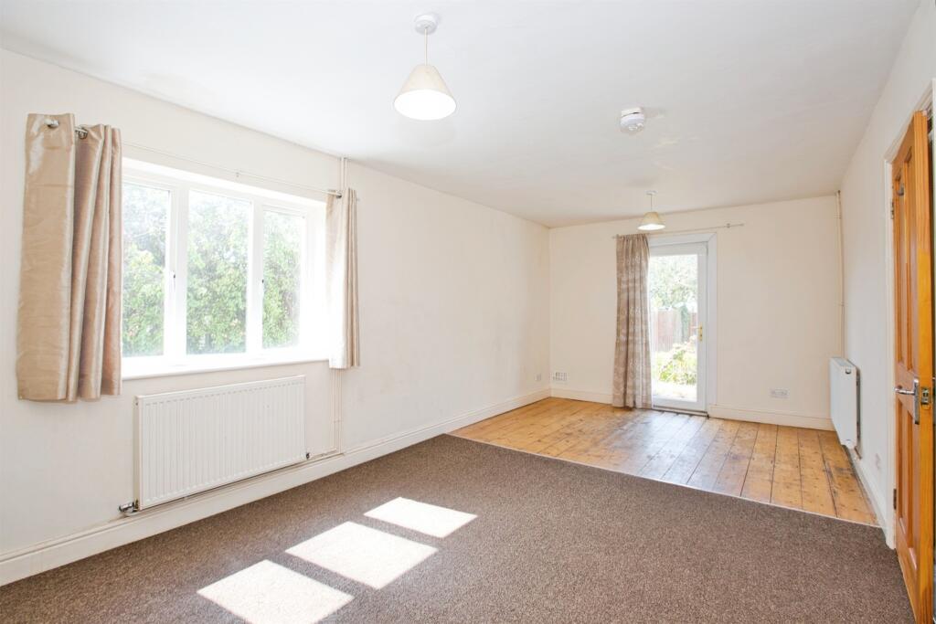
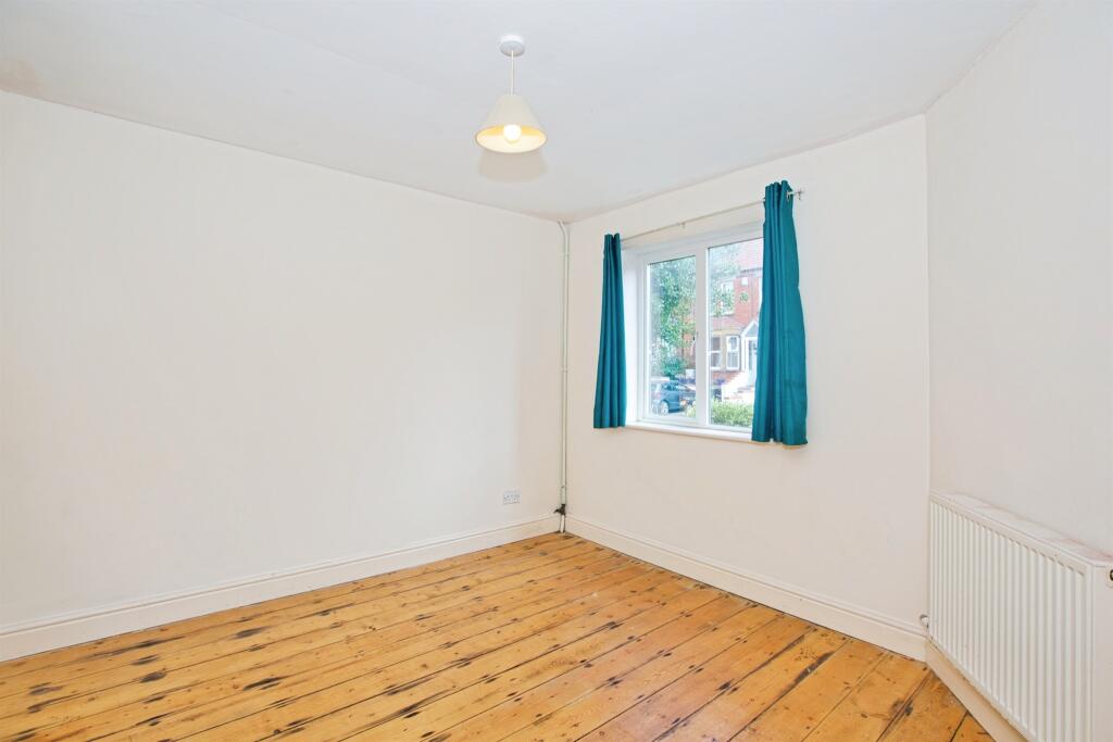
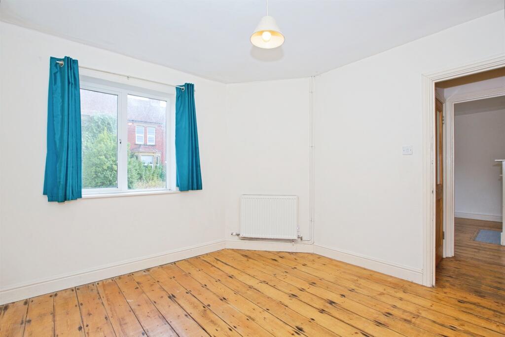
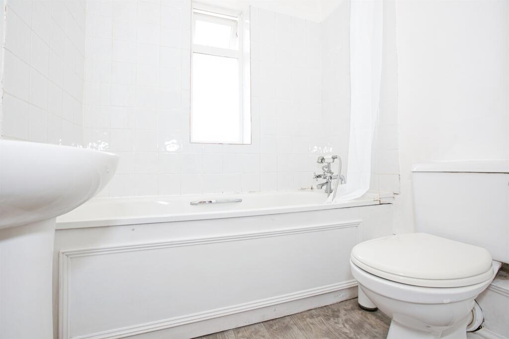
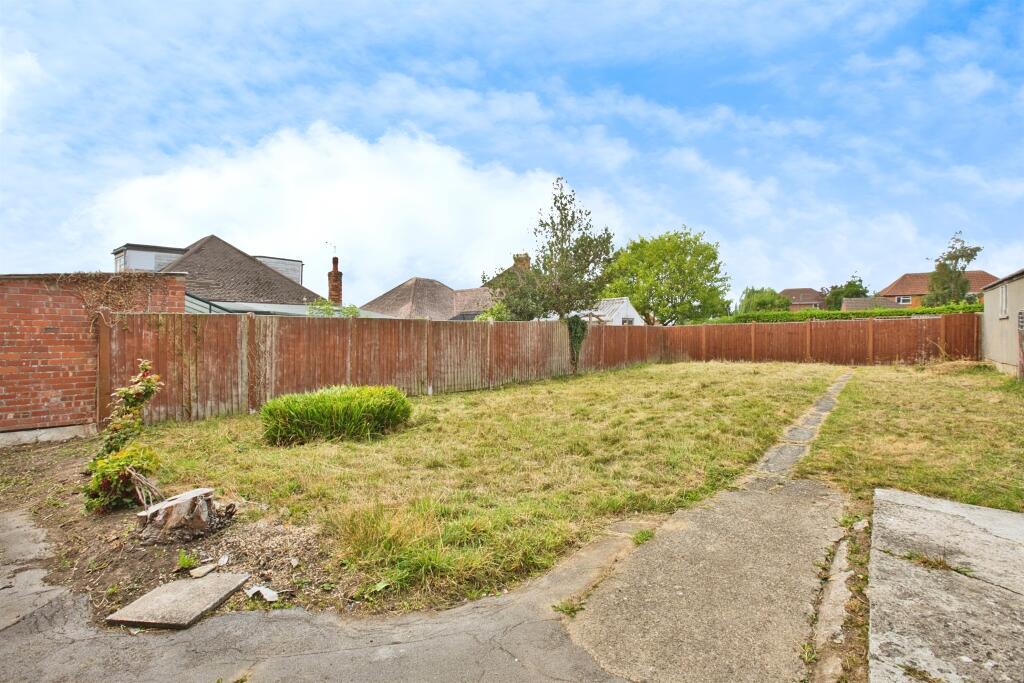
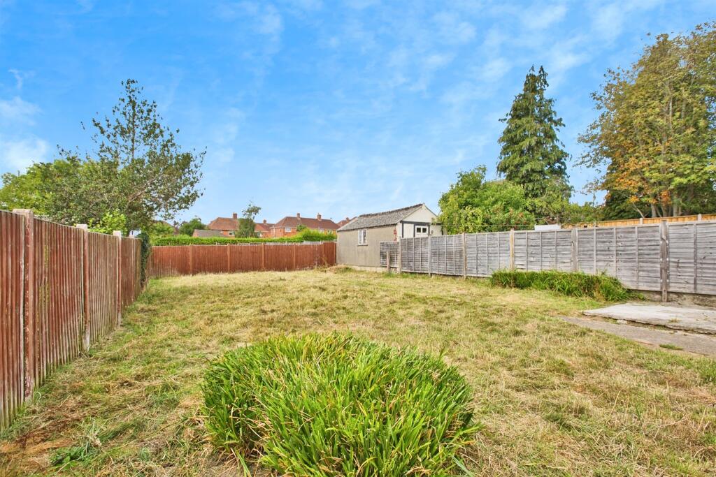
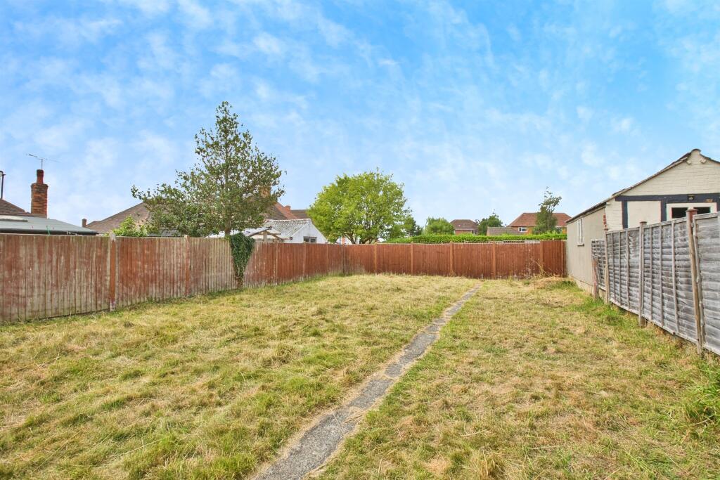
- The property for sale is a detached bungalow situated on St. Michaels Avenue, Yeovil. It features three double bedrooms and a spacious accommodation layout. Based on the images, the interior includes a good-sized living space, separate bathroom, and it appears to have a well-sized rear garden that is enclosed for privacy. The rooms visible in the images have relatively large dimensions for a bungalow, with bright, neutral finishes and wooden flooring in at least one main room. The garden mentioned is likely of average to good size, suitable for families or entertaining, though not pictured. Views are likely suburban or street-based rather than exceptional (no indications of forest, river, or sea views). Overall, this detached bungalow offers generous internal space and is well suited for families or buyers seeking a single-level residence.
Image Descriptions
- single-story bungalow mid-20th century bungalow
- living room mid-century
Floorplan Description
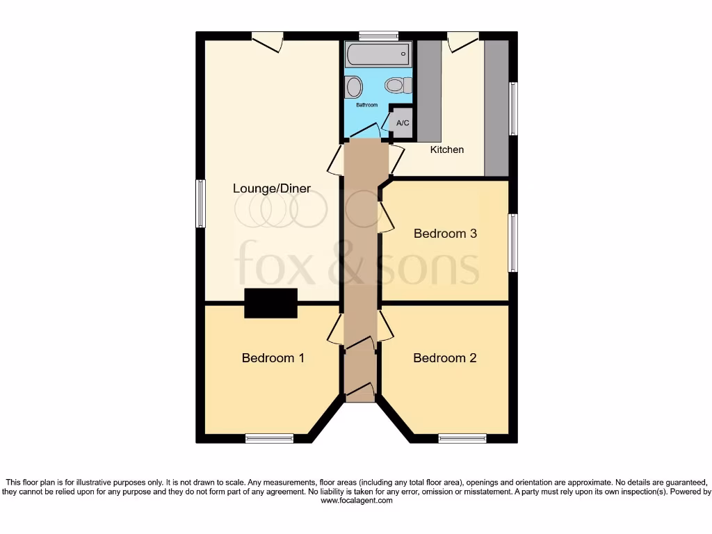
- The property consists of a lounge/diner, kitchen, and three bedrooms.
Rooms
- Lounge/Diner:
- Kitchen:
- Bedroom 1:
- Bedroom 2:
- Bedroom 3:
Textual Property Features
- Has Garden
- Chain Free
- Success
Detected Visual Features
- bungalow
- mid-20th century
- single-story
- potential
- needs work
- quaint
- compact
- front garden
- chimney
- mid-century
- fireplace
- standard ceiling
- medium room
- bright
- radiator
EPC Details
- Fully double glazed
- Cavity wall, filled cavity
- Boiler and radiators, mains gas
- Low energy lighting in 89% of fixed outlets
- Solid, no insulation (assumed)
Nearby Schools
- Countess Gytha Primary School
- West Coker CofE VC Primary School
- Barwick and Stoford Community Primary School
- Sherborne Abbey Church of England Primary School
- Oaklands Primary School
- Kingfisher Primary School
- Westfield Academy
- Milford Infants' School
- Buckler's Mead School
- Primrose Lane Primary School
- St Andrew's Church of England Primary School
- St Mary's Church of England Primary School, Bradford Abbas
- Holy Trinity Church School
- Reckleford Infant School and Nursery
- St Gildas Catholic Primary School
- Preston School Academy
- Birchfield Community Primary School
- Trent Young's CofE Primary School
- Thornford CofE Primary School
- Huish Primary School
- St. Michael's Academy
- Preston CofE Primary School
- Milford Junior School
- Chilthorne Domer Church School
- East Coker Community Primary School
Nearest General Shops
- Id: 8930378688
- Tags:
- Name: Halfords Autocentre
- Operator: Halfords
- Shop: car_parts
- TagsNormalized:
- autocentre
- halfords
- halfords autocentre
- car parts
- shop
- Lat: 50.9429747
- Lon: -2.6259738
- FullGeoHash: gcn1u1zu66u0
- PartitionGeoHash: gcn1
- Images:
- FoodStandards: null
- Distance: 695.5
,- Id: 8930375510
- Tags:
- Name: Bathwick Tyres
- Shop: tyres
- TagsNormalized:
- Lat: 50.9433778
- Lon: -2.6264338
- FullGeoHash: gcn1u1zqxtvj
- PartitionGeoHash: gcn1
- Images:
- FoodStandards: null
- Distance: 672.1
,- Id: 8930378694
- Tags:
- Brand: National Tyres and Autocare
- Brand:wikidata: Q6979055
- Name: National Tyres
- Shop: car_repair
- Short_name: National Tyres
- TagsNormalized:
- national tyres and autocare
- tyres
- car repair
- repair
- shop
- Lat: 50.9430803
- Lon: -2.6244624
- FullGeoHash: gcn1u3buvw6y
- PartitionGeoHash: gcn1
- Images:
- FoodStandards: null
- Distance: 642.8
}
Nearest Grocery shops
- Id: 8330669023
- Tags:
- Brand: Iceland
- Brand:wikidata: Q721810
- Brand:wikipedia: en:Iceland (supermarket)
- Contact:
- Website: https://www.iceland.co.uk/store-finder/store?StoreID=139&StoreName=YEOVIL
- Name: Iceland
- Shop: frozen_food
- TagsNormalized:
- iceland
- frozen food
- food
- shop
- Lat: 50.9421555
- Lon: -2.628872
- FullGeoHash: gcn1u1txwf4f
- PartitionGeoHash: gcn1
- Images:
- FoodStandards: null
- Distance: 880.3
,- Id: 8929248942
- Tags:
- Name: Asian Supermarket
- Shop: convenience
- TagsNormalized:
- Lat: 50.9419552
- Lon: -2.6258042
- FullGeoHash: gcn1u1xyqkdr
- PartitionGeoHash: gcn1
- Images:
- FoodStandards: null
- Distance: 793.3
,- Id: 416525359
- Tags:
- Addr:
- City: Yeovil
- Country: GB
- County: Somerset
- Postcode: BA21 4HA
- Street: Sherborne Road
- Unit: 1
- Alt_name: Farmfoods Yeovil
- Brand: Farmfoods
- Brand:wikidata: Q5435841
- Brand:wikipedia: en:Farmfoods
- Building: yes
- Building:levels: 1
- Fhrs:
- Name: Farmfoods
- Opening_hours: Mo-Fr 08:00-21:00; Sa 08:00-19:00; Su 10:00-16:00
- Shop: frozen_food
- Website: https://www.farmfoods.co.uk/store-finder.php?branch_code=843
- TagsNormalized:
- farmfoods
- frozen food
- food
- shop
- Lat: 50.9426579
- Lon: -2.6236559
- FullGeoHash: gcn1u3cd2rsr
- PartitionGeoHash: gcn1
- Images:
- FoodStandards:
- Id: 111304
- FHRSID: 111304
- LocalAuthorityBusinessID: 40776
- BusinessName: Farm Foods Ltd
- BusinessType: Retailers - supermarkets/hypermarkets
- BusinessTypeID: 7840
- AddressLine1: null
- AddressLine2: Sherborne Road
- AddressLine3: Yeovil
- AddressLine4: Somerset
- PostCode: BA21 4HA
- RatingValue: 5
- RatingKey: fhrs_5_en-GB
- RatingDate: 2022-07-26
- LocalAuthorityCode: 283
- LocalAuthorityName: South Somerset
- LocalAuthorityWebSite: http://www.southsomerset.gov.uk/food
- LocalAuthorityEmailAddress: food.safety@southsomerset.gov.uk
- Scores:
- Hygiene: 0
- Structural: 0
- ConfidenceInManagement: 0
- NewRatingPending: false
- Geocode:
- Longitude: -2.62376200000000
- Latitude: 50.94260800000000
- Distance: 672.1
}
Nearest Religious buildings
- Id: 371507298
- Tags:
- Addr:
- City: Yeovil
- Postcode: BA20 1JZ
- Street: Vicarage Street
- Amenity: place_of_worship
- Building: church
- Denomination: methodist
- Heritage: 2
- Heritage:operator: Historic England
- Historic: heritage
- Listed_status: Grade II
- Name: Vicarage Street Methodist Church
- Ref:
- Religion: christian
- Start_date: 1869
- Website: https://historicengland.org.uk/listing/the-list/list-entry/1056491
- TagsNormalized:
- place of worship
- church
- methodist
- christian
- Lat: 50.9416464
- Lon: -2.6285328
- FullGeoHash: gcn1u1tuwepv
- PartitionGeoHash: gcn1
- Images:
- FoodStandards: null
- Distance: 913.4
,- Id: 3750743120
- Tags:
- Addr:
- City: Yeovil
- Housenumber: 64
- Street: Chelston Avenue
- Amenity: place_of_worship
- Building: chapel
- Denomination: methodist
- Name: Saint Mark's Methodist Church
- Religion: christian
- TagsNormalized:
- place of worship
- chapel
- methodist
- church
- christian
- Lat: 50.9514104
- Lon: -2.6276232
- FullGeoHash: gcn1u5qt7zq1
- PartitionGeoHash: gcn1
- Images:
- FoodStandards: null
- Distance: 538.3
,- Id: 813630139
- Tags:
- Amenity: place_of_worship
- Building: church
- Denomination: anglican
- Name: St Michael & All Angels
- Religion: christian
- Wikidata: Q105091013
- TagsNormalized:
- place of worship
- church
- anglican
- christian
- Lat: 50.9475744
- Lon: -2.6200155
- FullGeoHash: gcn1u6spjhnz
- PartitionGeoHash: gcn1
- Images:
- FoodStandards: null
- Distance: 146.4
}
Nearest Medical buildings
- Id: 9168494864
- Tags:
- Amenity: dentist
- Healthcare: dentist
- Name: Yeovil Dental Clinic
- TagsNormalized:
- dentist
- health
- healthcare
- clinic
- dental
- Lat: 50.942812
- Lon: -2.6338689
- FullGeoHash: gcn1u1f56kmn
- PartitionGeoHash: gcn1
- Images:
- FoodStandards: null
- Distance: 1078.8
,- Id: 56651847
- Tags:
- Addr:
- City: Yeovil
- Housename: Yeovil District Hospital
- Postcode: BA21 4AT
- Street: Higher Kingston
- Amenity: hospital
- Building: yes
- Emergency: yes
- Healthcare: hospital
- Name: Yeovil District Hospital
- Operator: Yeovil District Hospital NHS Foundation Trust
- Operator:type: public
- Operator:wikidata: Q8052494
- Source: OS_OpenData_StreetView
- Wikidata: Q50575533
- Wikipedia: en:Yeovil District Hospital
- TagsNormalized:
- Lat: 50.9446945
- Lon: -2.6344481
- FullGeoHash: gcn1u41wkgm5
- PartitionGeoHash: gcn1
- Images:
- FoodStandards: null
- Distance: 1006.7
,- Id: 9162326813
- Tags:
- Amenity: pharmacy
- Brand: Boots
- Brand:wikidata: Q6123139
- Brand:wikipedia: en:Boots (company)
- Dispensing: yes
- Healthcare: pharmacy
- Name: Boots
- TagsNormalized:
- pharmacy
- boots
- health
- healthcare
- Lat: 50.9413277
- Lon: -2.6298054
- FullGeoHash: gcn1u1t49pfb
- PartitionGeoHash: gcn1
- Images:
- FoodStandards: null
- Distance: 993.2
,- Id: 224884952
- Tags:
- Addr:
- City: Yeovil
- Country: GB
- County: Somerset
- Parentstreet: Old Station Way
- Postcode: BA20 1NP
- Street: Yeo Leisure Park
- Unit: 3
- Brand: Nuffield Health Fitness & Wellbeing
- Brand:wikidata: Q7068711
- Building: yes
- Building:levels: 2
- Leisure: fitness_centre
- Name: Nuffield Health Fitness & Wellbeing
- Website: https://www.nuffieldhealth.com/gyms/yeovil
- TagsNormalized:
- fitness
- health
- nuffield
- nuffield health fitness & wellbeing
- fitness centre
- leisure
- Lat: 50.9408449
- Lon: -2.6248594
- FullGeoHash: gcn1u32xumfb
- PartitionGeoHash: gcn1
- Images:
- FoodStandards: null
- Distance: 888.4
}
Nearest Leisure Facilities
- Id: 4908099137
- Tags:
- TagsNormalized:
- Lat: 50.9531945
- Lon: -2.6270936
- FullGeoHash: gcn1u5xpb7ch
- PartitionGeoHash: gcn1
- Images:
- FoodStandards: null
- Distance: 651.9
,- Id: 371509913
- Tags:
- Leisure: park
- Name: Wyndham Hill
- Source: Natural England Country Parks England Dataset
- TagsNormalized:
- Lat: 50.9429684
- Lon: -2.6192585
- FullGeoHash: gcn1u3usqce7
- PartitionGeoHash: gcn1
- Images:
- FoodStandards: null
- Distance: 637.9
,- Id: 196262823
- Tags:
- Leisure: pitch
- Source: bing
- TagsNormalized:
- Lat: 50.949058
- Lon: -2.6160436
- FullGeoHash: gcn1u6zpcbb9
- PartitionGeoHash: gcn1
- Images:
- FoodStandards: null
- Distance: 382.3
,- Id: 196262827
- Tags:
- TagsNormalized:
- Lat: 50.946529
- Lon: -2.6222144
- FullGeoHash: gcn1u6d91cr5
- PartitionGeoHash: gcn1
- Images:
- FoodStandards: null
- Distance: 229.9
,- Id: 402915814
- Tags:
- TagsNormalized:
- Lat: 50.9466056
- Lon: -2.6222829
- FullGeoHash: gcn1u6d92rsh
- PartitionGeoHash: gcn1
- Images:
- FoodStandards: null
- Distance: 222.9
}
Nearest Tourist attractions
- Id: 692804940
- Tags:
- Addr:
- City: Sherborne
- Country: GB
- Housenumber: 12
- Place: Saxon Maybank
- Postcode: DT9 6JN
- Building: yes
- Tourism: chalet
- TagsNormalized:
- Lat: 50.9373964
- Lon: -2.5882695
- FullGeoHash: gcn1v0g7bfym
- PartitionGeoHash: gcn1
- Images:
- FoodStandards: null
- Distance: 2633.5
,- Id: 4008326307
- Tags:
- Amenity: bbq
- Tourism: picnic_site
- TagsNormalized:
- bbq
- picnic
- picnic site
- tourism
- Lat: 50.936061
- Lon: -2.6354663
- FullGeoHash: gcn1u08uj1vz
- PartitionGeoHash: gcn1
- Images:
- FoodStandards: null
- Distance: 1700.3
,- Id: 2229563863
- Tags:
- TagsNormalized:
- Lat: 50.9401784
- Lon: -2.6231143
- FullGeoHash: gcn1u33uj180
- PartitionGeoHash: gcn1
- Images:
- FoodStandards: null
- Distance: 936.9
}
Nearest Train stations
- Id: 9991604554
- Tags:
- Name: Common Lane
- Network: Gartell Light Railway
- Operator: Gartell Light Railway
- Public_transport: station
- Railway: station
- Train: yes
- Usage: tourism
- TagsNormalized:
- Lat: 50.9949551
- Lon: -2.4024297
- FullGeoHash: gcn6176e5kds
- PartitionGeoHash: gcn6
- Images:
- FoodStandards: null
- Distance: 16180.2
,- Id: 9991604612
- Tags:
- Name: Pinesway Junction
- Public_transport: station
- Railway: station
- Train: yes
- Usage: tourism
- TagsNormalized:
- Lat: 50.9936437
- Lon: -2.4036374
- FullGeoHash: gcn6171ex0nj
- PartitionGeoHash: gcn6
- Images:
- FoodStandards: null
- Distance: 16054.2
,- Id: 6011304340
- Tags:
- Name: Templecombe
- Naptan:
- Network: National Rail
- Public_transport: station
- Railway: station
- Ref:
- Wikidata: Q1901020
- Wikipedia: en:Templecombe railway station
- TagsNormalized:
- Lat: 51.001594
- Lon: -2.4172852
- FullGeoHash: gcn60uxcc4jw
- PartitionGeoHash: gcn6
- Images:
- FoodStandards: null
- Distance: 15463.4
,- Id: 6013523221
- Tags:
- Name: Sherborne
- Naptan:
- Network: National Rail
- Public_transport: station
- Railway: station
- Ref:
- Source: gps_survey
- Wikidata: Q2407888
- Wikipedia: en:Sherborne railway station
- TagsNormalized:
- Lat: 50.943979
- Lon: -2.5129696
- FullGeoHash: gcn1yf445tfp
- PartitionGeoHash: gcn1
- Images:
- FoodStandards: null
- Distance: 7616
,- Id: 42267217
- Tags:
- Name: Yeovil Pen Mill
- Naptan:
- Network: National Rail
- Public_transport: station
- Railway: station
- Ref:
- Source: NPE
- Wikidata: Q2213897
- Wikipedia: en:Yeovil Pen Mill railway station
- TagsNormalized:
- Lat: 50.9446866
- Lon: -2.61304
- FullGeoHash: gcn1ud1nrcbh
- PartitionGeoHash: gcn1
- Images:
- FoodStandards: null
- Distance: 727.7
}
Nearest Bus stations and stops
- Id: 4390654624
- Tags:
- Bus: yes
- Highway: bus_stop
- Public_transport: platform
- TagsNormalized:
- Lat: 50.9569434
- Lon: -2.6332663
- FullGeoHash: gcn1uh6t8qwr
- PartitionGeoHash: gcn1
- Images:
- FoodStandards: null
- Distance: 1249
,- Id: 4390654625
- Tags:
- Bus: yes
- Highway: bus_stop
- Public_transport: platform
- TagsNormalized:
- Lat: 50.9568356
- Lon: -2.6332236
- FullGeoHash: gcn1uh6t16wh
- PartitionGeoHash: gcn1
- Images:
- FoodStandards: null
- Distance: 1238
,- Id: 9160895976
- Tags:
- Bus: yes
- Covered: no
- Highway: bus_stop
- Public_transport: platform
- Shelter: yes
- TagsNormalized:
- Lat: 50.9415128
- Lon: -2.632281
- FullGeoHash: gcn1u1e5z6m0
- PartitionGeoHash: gcn1
- Images:
- FoodStandards: null
- Distance: 1089.6
,- Id: 4508521989
- Tags:
- Bus: yes
- Highway: bus_stop
- Public_transport: platform
- TagsNormalized:
- Lat: 50.944804
- Lon: -2.6357778
- FullGeoHash: gcn1u40wvzv9
- PartitionGeoHash: gcn1
- Images:
- FoodStandards: null
- Distance: 1087
,- Id: 7916713810
- Tags:
- Bus: yes
- Highway: bus_stop
- Public_transport: platform
- TagsNormalized:
- Lat: 50.9447442
- Lon: -2.6332035
- FullGeoHash: gcn1u44w9uth
- PartitionGeoHash: gcn1
- Images:
- FoodStandards: null
- Distance: 925.9
}
Nearest Hotels
- Id: 4254706158
- Tags:
- Addr:
- City: Yeovil
- Housenumber: 8
- Postcode: BA20 1QE
- Street: South Street
- Name: The Keep
- Smoking: separated
- Tourism: hotel
- TagsNormalized:
- Lat: 50.9406477
- Lon: -2.6325911
- FullGeoHash: gcn1u17nb0vz
- PartitionGeoHash: gcn1
- Images:
- FoodStandards: null
- Distance: 1174.9
,- Id: 4022695679
- Tags:
- Brand: Premier Inn
- Brand:wikidata: Q2108626
- Internet_access: wlan
- Internet_access:fee: customers
- Internet_access:operator: Virgin Media
- Internet_access:ssid: Premier Inn Free Wi-Fi
- Name: Premier Inn Yeovil Town Centre
- Tourism: hotel
- TagsNormalized:
- Lat: 50.9409385
- Lon: -2.6256842
- FullGeoHash: gcn1u3803p5y
- PartitionGeoHash: gcn1
- Images:
- FoodStandards: null
- Distance: 895.9
,- Id: 712890046
- Tags:
- Amenity: pub
- Name: Pen Mill Hotel
- TagsNormalized:
- Lat: 50.9448398
- Lon: -2.6157217
- FullGeoHash: gcn1u6pr1q2w
- PartitionGeoHash: gcn1
- Images:
- FoodStandards: null
- Distance: 574
}
Tags
- bungalow
- mid-20th century
- single-story
- potential
- needs work
- quaint
- compact
- front garden
- chimney
- mid-century
- fireplace
- standard ceiling
- medium room
- bright
- radiator
Local Market Stats
- Average Price/sqft: £244
- Avg Income: £44500
- Rental Yield: 4.9%
- Social Housing: 10%
- Planning Success Rate: 76%
AirBnB Data
- 1km average: £73/night
- Listings in 1km: 3
Similar Properties
 4 bedroom detached bungalow for sale in Ilchester Road, YEOVIL, BA21 — £400,000 • 4 bed • 2 bath • 1272 ft²
 3 bedroom detached bungalow for sale in Yew Tree Close, Yeovil, Somerset, BA20 — £250,000 • 3 bed • 1 bath • 790 ft²
 2 bedroom detached bungalow for sale in Beechwood, Yeovil, Somerset, BA20 2NF, BA20 — £290,000 • 2 bed • 1 bath • 924 ft²
 3 bedroom detached bungalow for sale in Stone Lane, Yeovil, BA21 — £340,000 • 3 bed • 1 bath • 1109 ft²
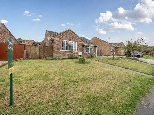 2 bedroom detached bungalow for sale in Lime Tree Avenue, Yeovil, BA20 — £285,000 • 2 bed • 1 bath • 652 ft²
 3 bedroom semi-detached house for sale in St. Michaels Avenue, Yeovil, Somerset, BA21 4NA, BA21 — £270,000 • 3 bed • 1 bath • 845 ft²
Meta
- {
"@context": "https://schema.org",
"@type": "Residence",
"name": "3 bedroom detached bungalow for sale in St. Michaels Avenue…",
"description": "",
"url": "https://propertypiper.co.uk/property/d8214f60-8475-4fc7-9651-ead491ea2614",
"image": "https://image-a.propertypiper.co.uk/acaa4b91-b2ce-496d-9d22-88c1b6e96860-1024.jpeg",
"address": {
"@type": "PostalAddress",
"streetAddress": "105 ST MICHAELS AVENUE YEOVIL",
"postalCode": "BA21 4LN",
"addressLocality": "South Somerset",
"addressRegion": "Yeovil",
"addressCountry": "England"
},
"geo": {
"@type": "GeoCoordinates",
"latitude": 50.94853813433733,
"longitude": -2.6214384575276974
},
"numberOfRooms": 3,
"numberOfBathroomsTotal": 1,
"floorSize": {
"@type": "QuantitativeValue",
"value": 517,
"unitCode": "FTK"
},
"offers": {
"@type": "Offer",
"price": 210000,
"priceCurrency": "GBP",
"availability": "https://schema.org/InStock"
},
"additionalProperty": [
{
"@type": "PropertyValue",
"name": "Feature",
"value": "bungalow"
},
{
"@type": "PropertyValue",
"name": "Feature",
"value": "mid-20th century"
},
{
"@type": "PropertyValue",
"name": "Feature",
"value": "single-story"
},
{
"@type": "PropertyValue",
"name": "Feature",
"value": "potential"
},
{
"@type": "PropertyValue",
"name": "Feature",
"value": "needs work"
},
{
"@type": "PropertyValue",
"name": "Feature",
"value": "quaint"
},
{
"@type": "PropertyValue",
"name": "Feature",
"value": "compact"
},
{
"@type": "PropertyValue",
"name": "Feature",
"value": "front garden"
},
{
"@type": "PropertyValue",
"name": "Feature",
"value": "chimney"
},
{
"@type": "PropertyValue",
"name": "Feature",
"value": "mid-century"
},
{
"@type": "PropertyValue",
"name": "Feature",
"value": "fireplace"
},
{
"@type": "PropertyValue",
"name": "Feature",
"value": "standard ceiling"
},
{
"@type": "PropertyValue",
"name": "Feature",
"value": "medium room"
},
{
"@type": "PropertyValue",
"name": "Feature",
"value": "bright"
},
{
"@type": "PropertyValue",
"name": "Feature",
"value": "radiator"
}
]
}
High Res Floorplan Images
Compatible Floorplan Images
FloorplanImages Thumbnail