ME10 3DD - 2 bedroom terraced house for sale in Vincent Road, Sittingb…
View on Property Piper
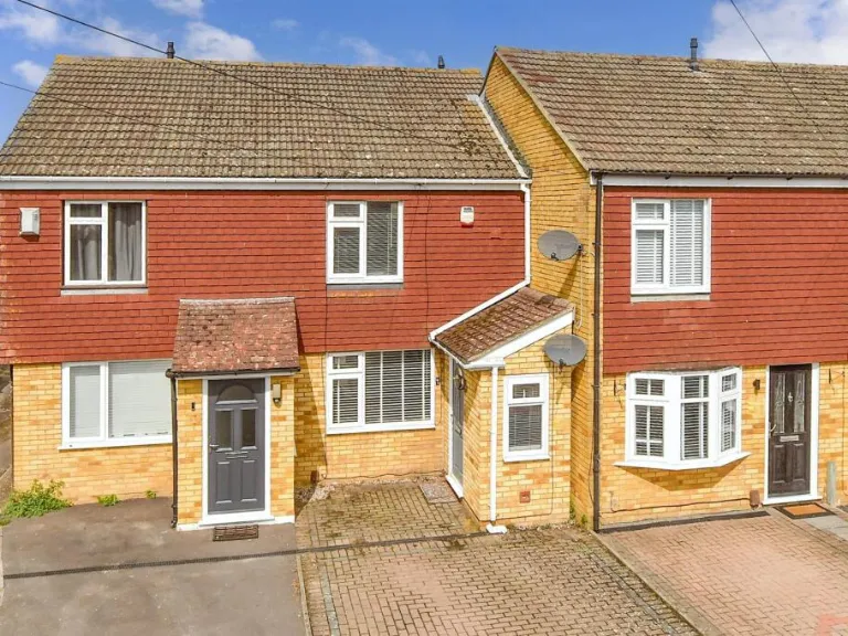
2 bedroom terraced house for sale in Vincent Road, Sittingbourne, Kent, ME10
Property Details
- Price: £260000
- Bedrooms: 2
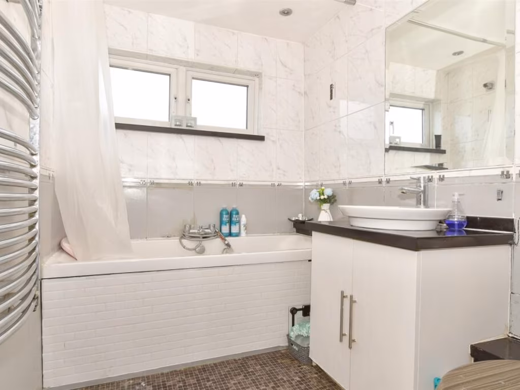
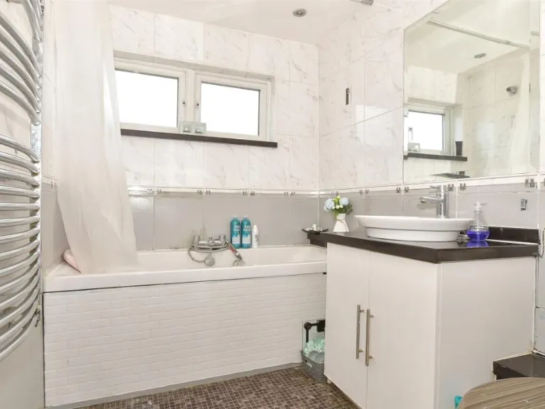
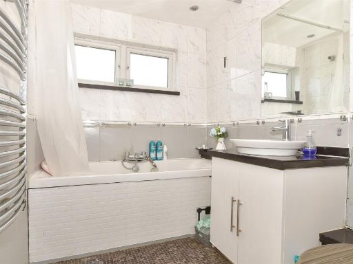
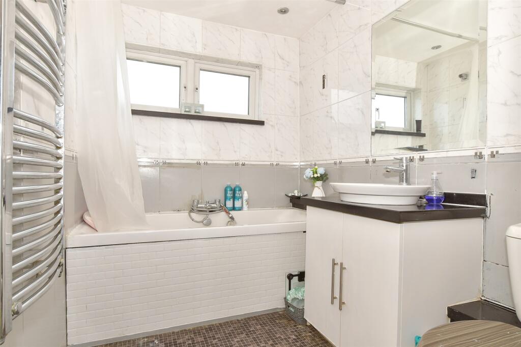
- Bathrooms: 1
- Property Type: undefined
- Property SubType: undefined
Image Descriptions
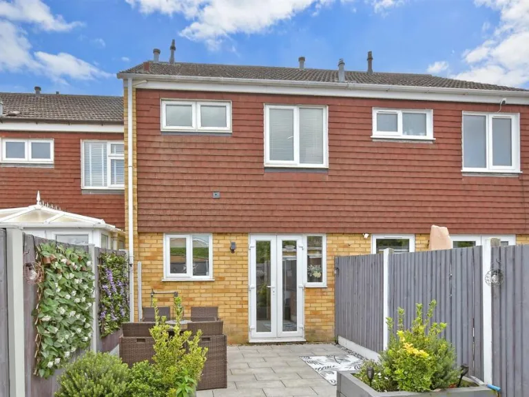
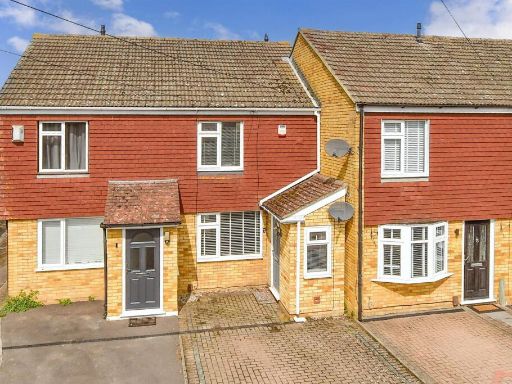
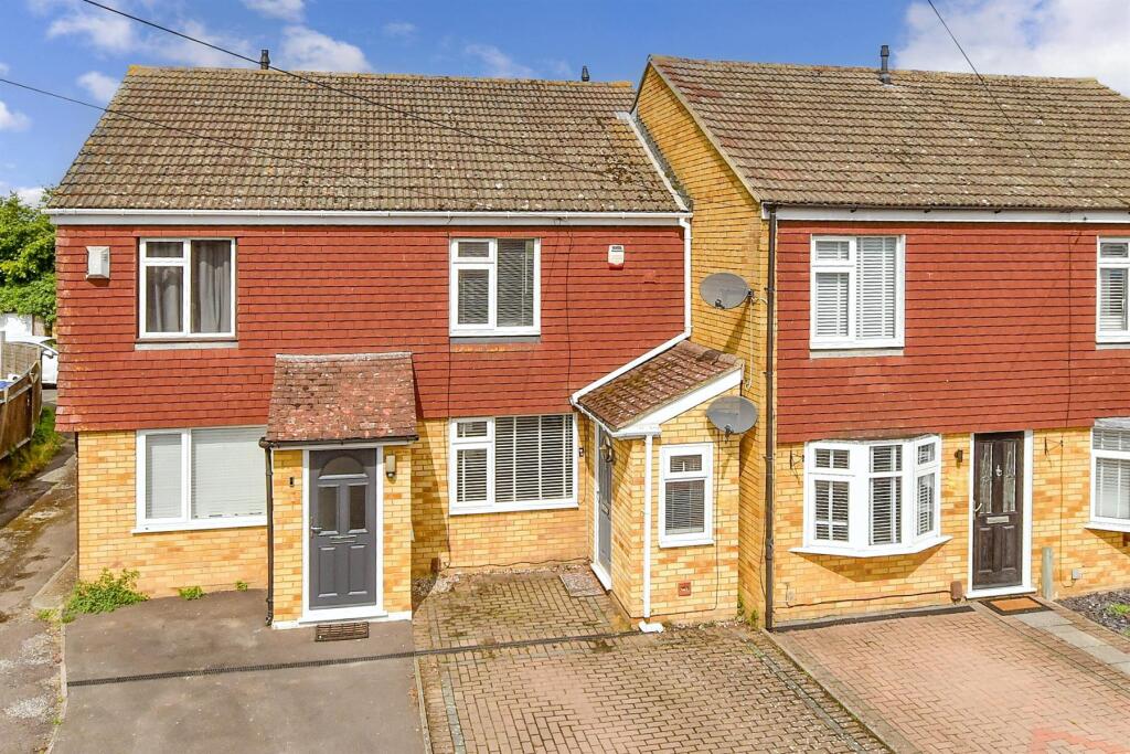
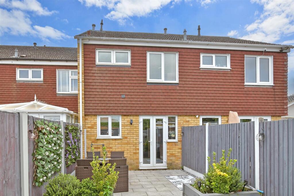
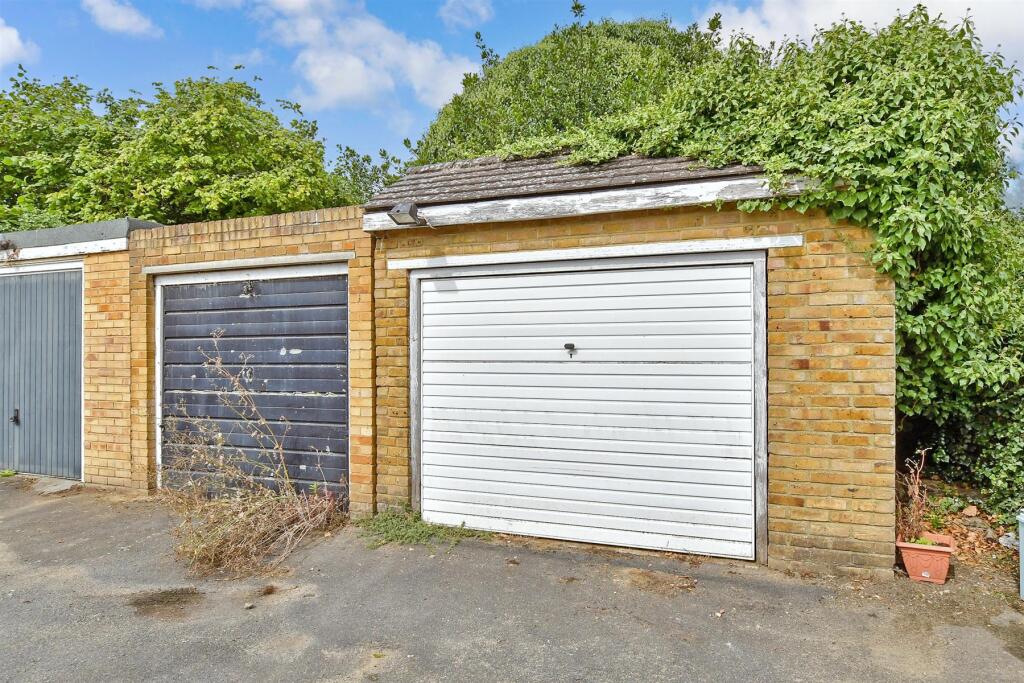
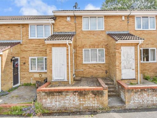
- mid-20th-century terraced house mid-century
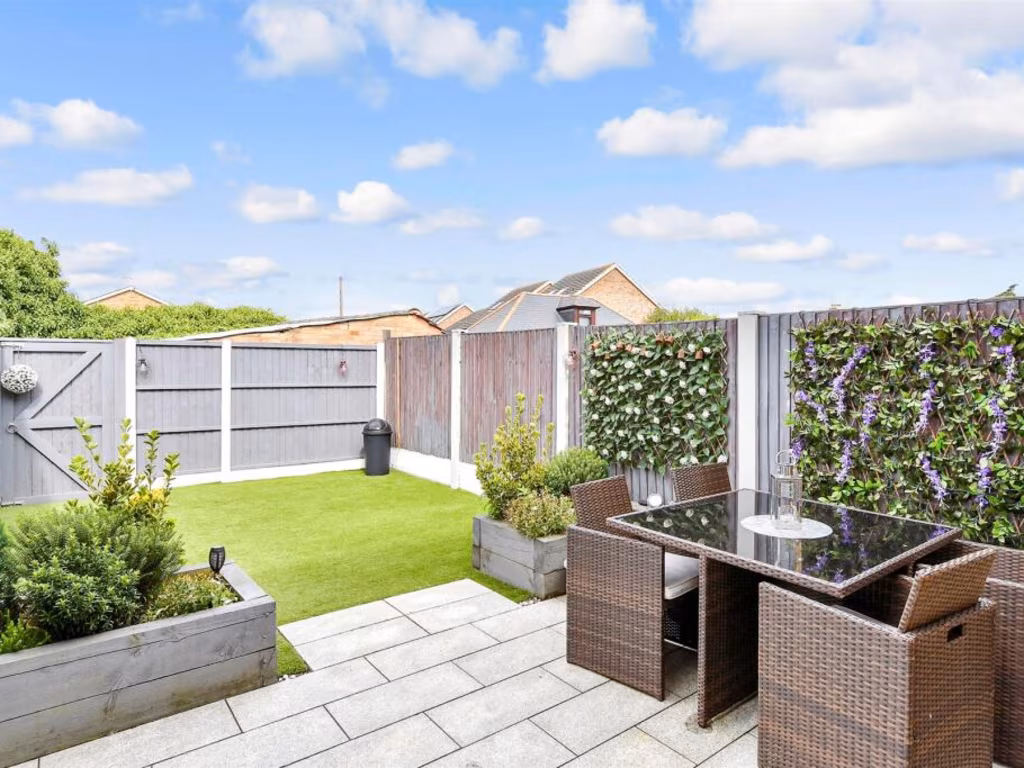
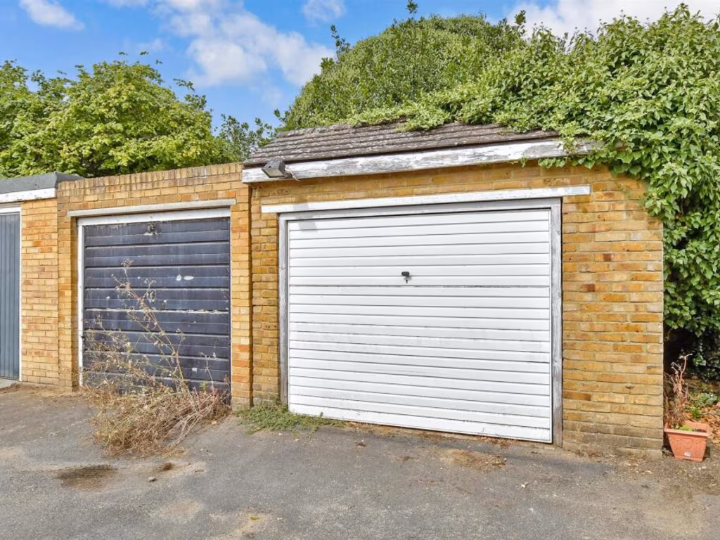
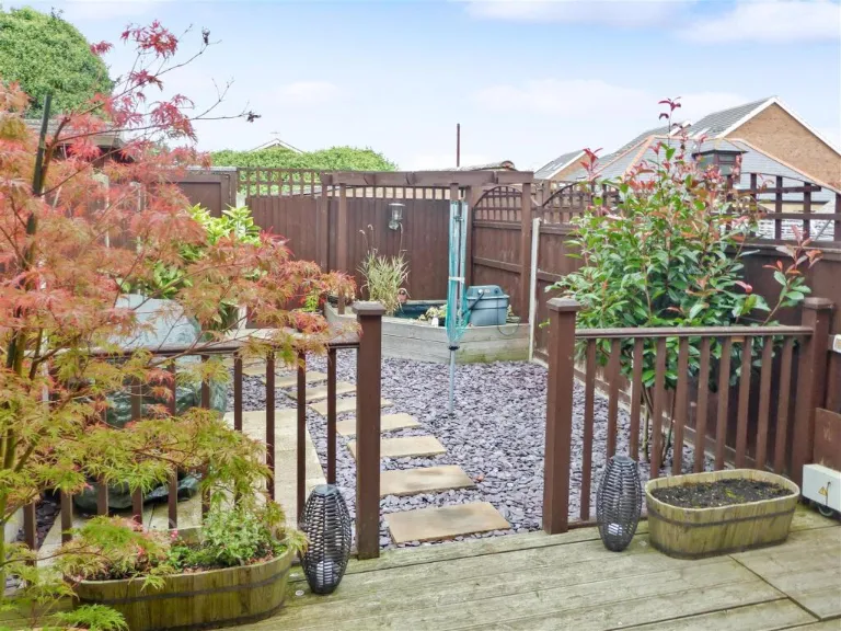
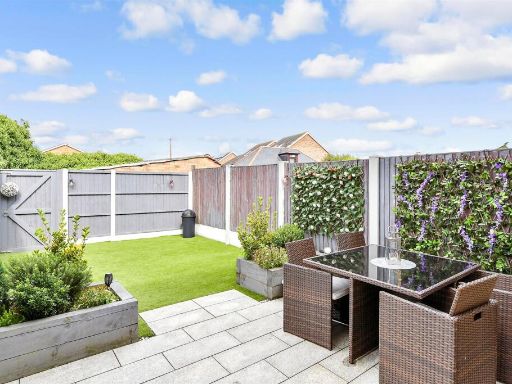
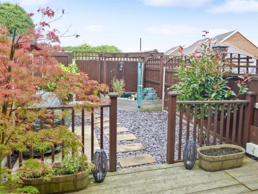
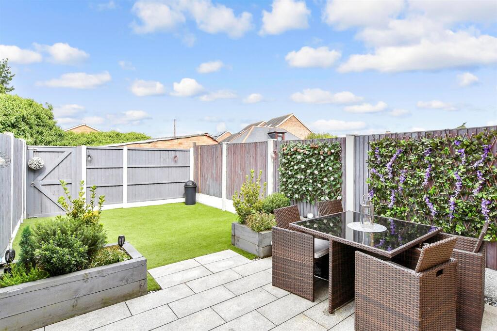
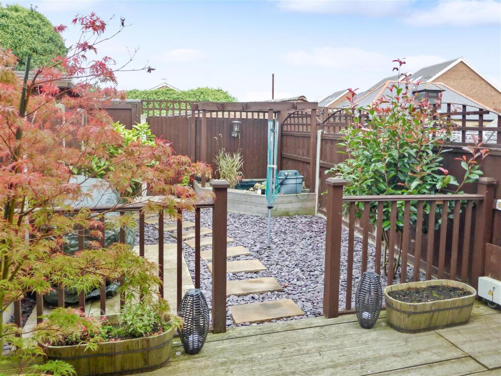
- modern garden Contemporary
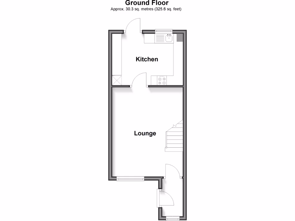
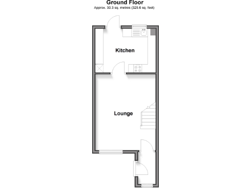
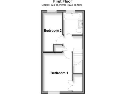
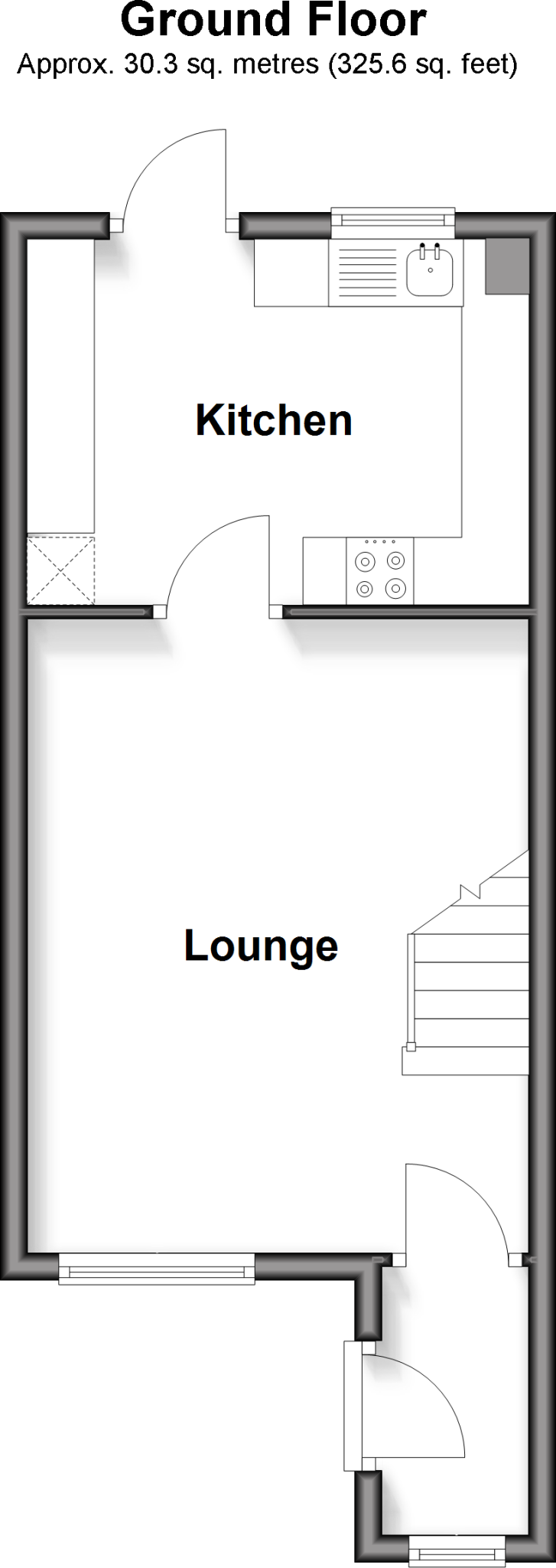
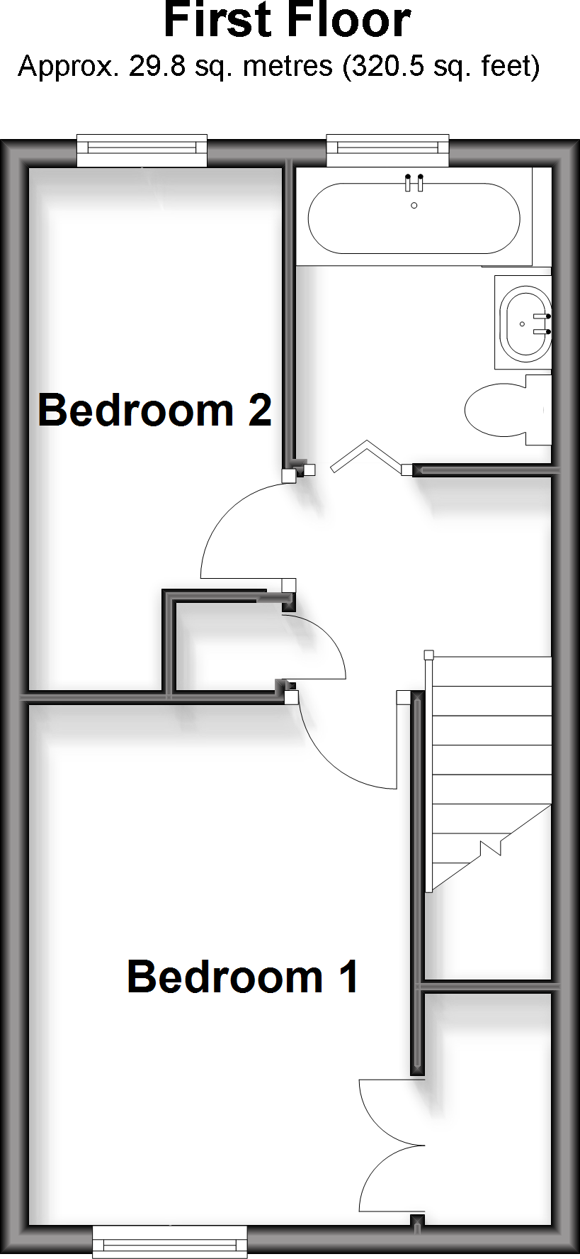
Floorplan Description
- A floor featuring two bedrooms and a bathroom.
Rooms
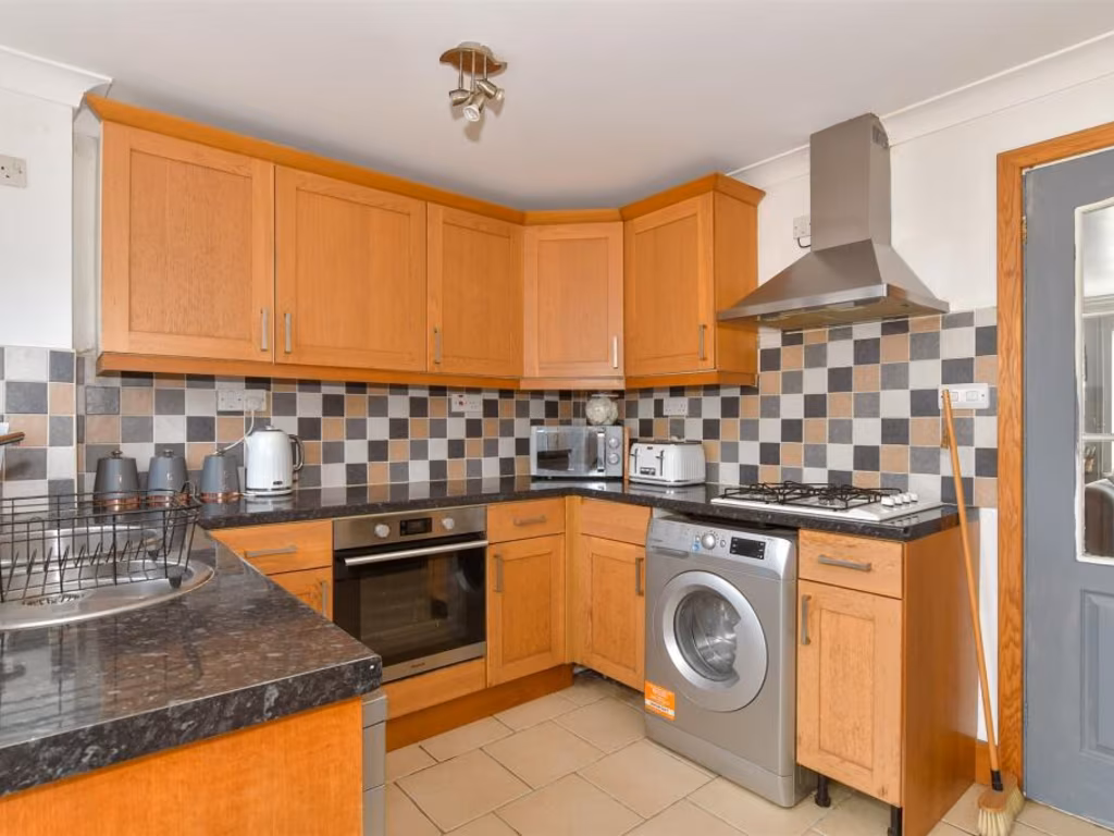
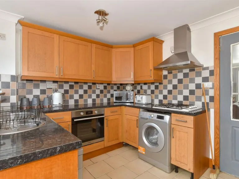
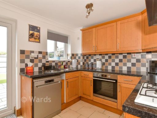
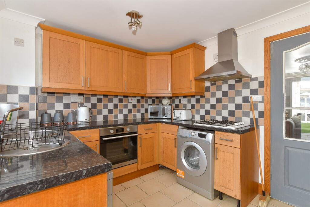
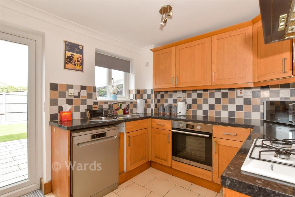
- Kitchen:
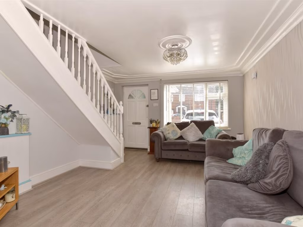
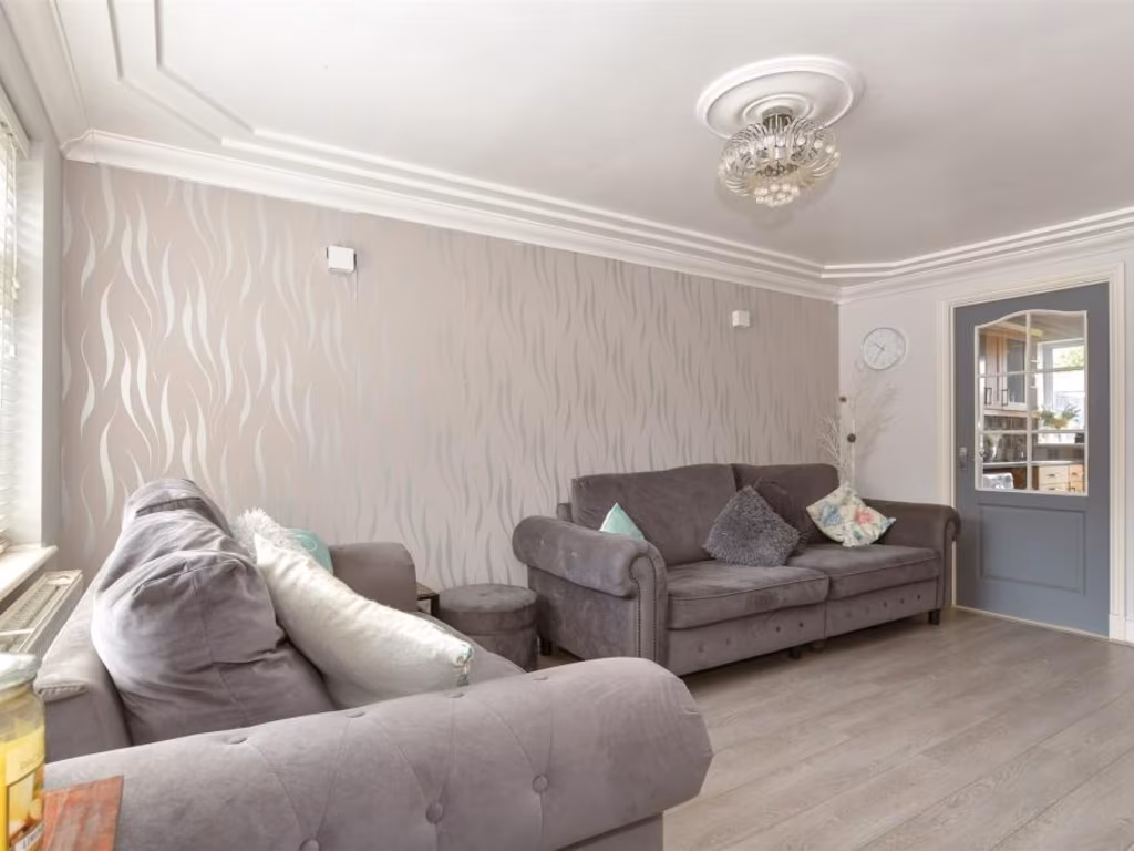
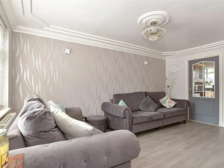
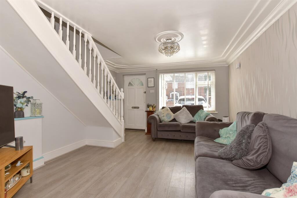
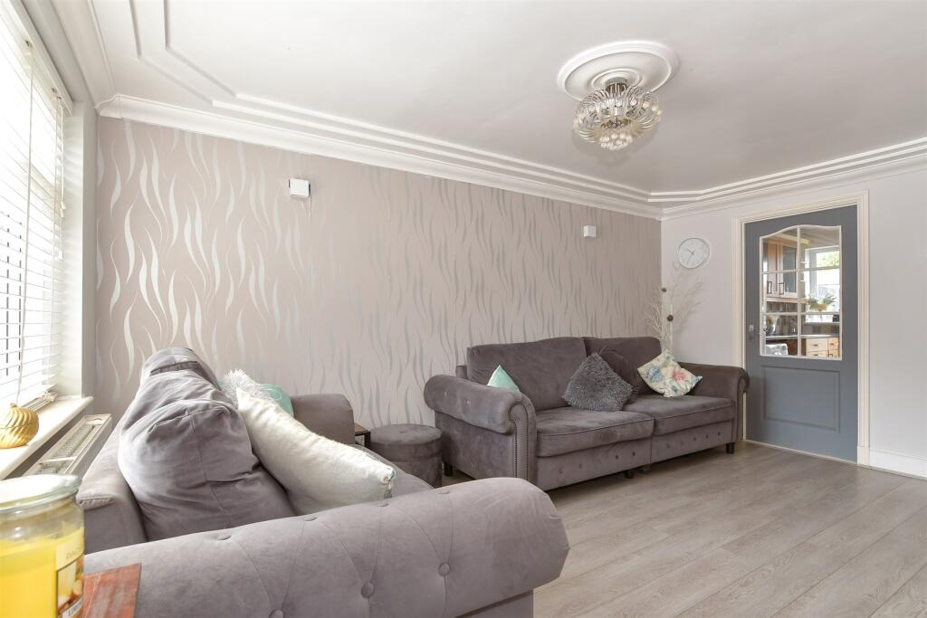
- Lounge:
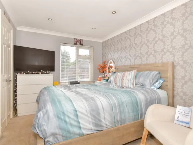
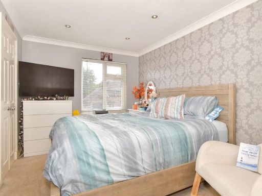
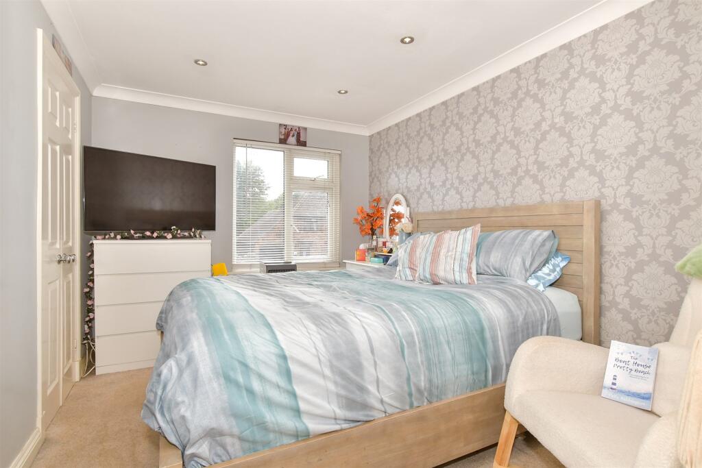
- Bedroom 1:
- Bedroom 2:
Textual Property Features
Detected Visual Features
- mid-20th-century
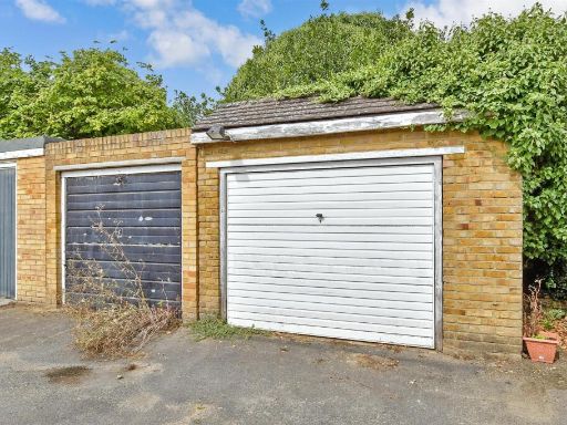
- terraced house
- brick exterior
- standard ceiling height
- medium room size
- residential neighborhood
- garden
- contemporary
- outdoor
- patio
- low-maintenance
- fencing
- private
EPC Details
- Fully double glazed
- Cavity wall, as built, insulated (assumed)
- Boiler and radiators, mains gas
- Low energy lighting in 50% of fixed outlets
- Solid, no insulation (assumed)
Nearby Schools
- Minterne Junior School
- South Avenue Primary School
- Westlands School
- Grove Park Primary School
- Rodmersham School
- St Peter's Catholic Primary School
- VTC Independent School
- Bobbing Village School
- Kemsley Primary Academy
- Lynsted and Norton Primary School
- The Oaks Infant School
- The Sittingbourne School
- Bapchild and Tonge Church of England Primary School and Nursery
- Highsted Grammar School
- Milton Court Primary Academy
- Tunstall Church of England (Aided) Primary School
- Teynham Parochial Church of England Primary School
- Fulston Manor School
- Canterbury Road Primary School
- Lansdowne Primary School
- Borden Grammar School
- Westlands Primary School
- Sunny Bank Primary School
- Regis Manor Primary School
- Iwade School
Nearest Bars And Restaurants
- Id: 553321712
- Tags:
- Amenity: pub
- Name: The Old Oak
- TagsNormalized:
- Lat: 51.3386555
- Lon: 0.7435958
- FullGeoHash: u10s0cvmr510
- PartitionGeoHash: u10s
- Images:
- FoodStandards: null
- Distance: 1035.9
,- Id: 553321757
- Tags:
- Addr:
- Housenumber: 1
- Postcode: ME10 4SG
- Street: Canterbury Road
- Amenity: pub
- Name: The Cherry Tree
- Phone: +44 1795 436767
- Postal_code: ME10 4SG
- Source:
- Phone: http://thecherrytreeinfo.com/contact.htm
- Postal_code: http://thecherrytreeinfo.com/contact.htm
- Url: http://thecherrytreeinfo.com/
- TagsNormalized:
- Lat: 51.3381202
- Lon: 0.7477202
- FullGeoHash: u10s11b6pphx
- PartitionGeoHash: u10s
- Images:
- FoodStandards: null
- Distance: 743.3
,- Id: 529666297
- Tags:
- Addr:
- Housenumber: 1
- Postcode: ME9 9AH
- Street: The Street
- Amenity: pub
- Fhrs:
- Authority: Swale
- Id: 951612
- Inspectiondate: 2017-03-03
- Rating: 4
- Name: Fox and Goose
- TagsNormalized:
- Lat: 51.3348265
- Lon: 0.7668317
- FullGeoHash: u10s13nrh3r0
- PartitionGeoHash: u10s
- Images:
- FoodStandards: null
- Distance: 636.4
,- Id: 67029280
- Tags:
- Addr:
- Housenumber: 104
- Postcode: ME10 3LB
- Street: Murston Road
- Amenity: pub
- Building: yes
- Fhrs:
- Authority: Swale
- Id: 714453
- Inspectiondate: 2014-12-04
- Rating: 5
- Name: The New Inn
- TagsNormalized:
- Lat: 51.3401513
- Lon: 0.7531856
- FullGeoHash: u10s14hqn3zg
- PartitionGeoHash: u10s
- Images:
- FoodStandards: null
- Distance: 517
,- Id: 540393596
- Tags:
- Amenity: fast_food
- Cuisine: fish_and_chips;chinese
- Name: Silver Kitchen
- TagsNormalized:
- fast food
- food
- fish
- chinese
- kitchen
- Lat: 51.3350879
- Lon: 0.7533627
- FullGeoHash: u10s11k8d9gz
- PartitionGeoHash: u10s
- Images:
- FoodStandards: null
- Distance: 379.6
}
Nearest General Shops
- Id: 49799781
- Tags:
- Building: retail
- Landuse: retail
- Shop: car_repair
- Source: OS_OpenData_StreetView
- TagsNormalized:
- retail
- car repair
- repair
- shop
- Lat: 51.340534
- Lon: 0.7426434
- FullGeoHash: u10s0fkb2c5n
- PartitionGeoHash: u10s
- Images:
- FoodStandards: null
- Distance: 1160.1
,- Id: 49799778
- Tags:
- Building: retail
- Landuse: retail
- Shop: car
- Source: OS_OpenData_StreetView
- TagsNormalized:
- Lat: 51.3398543
- Lon: 0.7426206
- FullGeoHash: u10s0fhu266p
- PartitionGeoHash: u10s
- Images:
- FoodStandards: null
- Distance: 1136
,- Id: 553321726
- Tags:
- Name: Joe's Hairdressing for Men
- Shop: hairdresser
- TagsNormalized:
- Lat: 51.3385556
- Lon: 0.7446845
- FullGeoHash: u10s0cykb2mh
- PartitionGeoHash: u10s
- Images:
- FoodStandards: null
- Distance: 959.7
}
Nearest Grocery shops
- Id: 68828995
- Tags:
- Addr:
- Housenumber: 9
- Postcode: ME9 9AB
- Street: Fox Hill
- Building: yes
- Fhrs:
- Authority: Swale
- Id: 713924
- Inspectiondate: 2015-11-10
- Rating: 5
- Name: Bapchild Fruit and Veg
- Shop: greengrocer
- TagsNormalized:
- Lat: 51.3347488
- Lon: 0.7659632
- FullGeoHash: u10s13jy84z8
- PartitionGeoHash: u10s
- Images:
- FoodStandards: null
- Distance: 582.9
,- Id: 4823398974
- Tags:
- Level: 0
- Name: Chris's Convenience Store
- Shop: convenience
- TagsNormalized:
- Lat: 51.3397118
- Lon: 0.752596
- FullGeoHash: u10s14h52zbm
- PartitionGeoHash: u10s
- Images:
- FoodStandards: null
- Distance: 512.1
,- Id: 540393594
- Tags:
- Name: News Plus
- Shop: convenience
- TagsNormalized:
- Lat: 51.3351467
- Lon: 0.7531789
- FullGeoHash: u10s11k2ykfy
- PartitionGeoHash: u10s
- Images:
- FoodStandards: null
- Distance: 387.9
}
Nearest Supermarkets
- Id: 5337326626
- Tags:
- Brand: M&S Foodhall
- Brand:wikidata: Q714491
- Brand:wikipedia: en:Marks & Spencer
- Contact:
- Website: https://www.marksandspencer.com/stores/sittingbourne-foodhall-1968
- Name: M&S Foodhall
- Operator: Marks & Spencer
- Shop: supermarket
- TagsNormalized:
- m&s foodhall
- supermarket
- shop
- Lat: 51.3449611
- Lon: 0.7356968
- FullGeoHash: u10s0epdnfrr
- PartitionGeoHash: u10s
- Images:
- FoodStandards: null
- Distance: 1811.5
,- Id: 48230157
- Tags:
- Brand: Sainsbury's
- Brand:wikidata: Q152096
- Brand:wikipedia: en:Sainsbury's
- Building: retail
- Landuse: retail
- Name: Sainsbury's
- Shop: supermarket
- Source: knowledge
- TagsNormalized:
- sainsburys
- retail
- supermarket
- shop
- Lat: 51.3378397
- Lon: 0.7369497
- FullGeoHash: u10s0cb8s4vw
- PartitionGeoHash: u10s
- Images:
- FoodStandards: null
- Distance: 1480
,- Id: 49799694
- Tags:
- Brand: ALDI
- Brand:wikidata: Q41171672
- Brand:wikipedia: en:Aldi
- Building: yes
- Contact:
- Website: https://stores.aldi.co.uk/sittingbourne/east-street
- Name: ALDI
- Shop: supermarket
- Source: local_knowledge
- TagsNormalized:
- Lat: 51.3386731
- Lon: 0.7450565
- FullGeoHash: u10s0cyt3n63
- PartitionGeoHash: u10s
- Images:
- FoodStandards: null
- Distance: 937.4
}
Nearest Religious buildings
- Id: 405606740
- Tags:
- Addr:
- City: Sittingbourne
- Country: GB
- County: Kent
- Place: Bapchild
- Postcode: ME9 9NL
- Street: School Lane
- Amenity: school
- Contact:
- Phone: +44 1795 424143
- Website: http://www.bapchildprimary.co.uk/
- Denomination: anglican
- Isced:
- Name: Bapchild and Tonge Church of England Primary School
- Ref:
- Religion: christian
- Wikidata: Q66226536
- TagsNormalized:
- school
- anglican
- church
- christian
- Lat: 51.3334773
- Lon: 0.766988
- FullGeoHash: u10s12yx0jex
- PartitionGeoHash: u10s
- Images:
- FoodStandards: null
- Distance: 709.4
,- Id: 663071600
- Tags:
- Amenity: place_of_worship
- TagsNormalized:
- Lat: 51.3325449
- Lon: 0.7651915
- FullGeoHash: u10s12v1wrbj
- PartitionGeoHash: u10s
- Images:
- FoodStandards: null
- Distance: 671.7
,- Id: 68829160
- Tags:
- Amenity: place_of_worship
- Building: yes
- Denomination: anglican
- Name: Bapchild Church
- Religion: christian
- Wikidata: Q17530079
- TagsNormalized:
- place of worship
- anglican
- church
- christian
- Lat: 51.333104
- Lon: 0.7652339
- FullGeoHash: u10s12vjp0pu
- PartitionGeoHash: u10s
- Images:
- FoodStandards: null
- Distance: 632.8
}
Nearest Medical buildings
- Id: 612965166
- Tags:
- Amenity: doctors
- Healthcare: doctor
- Name: Memorial Medical Centre
- TagsNormalized:
- doctor
- doctors
- health
- healthcare
- Lat: 51.3343537
- Lon: 0.737011
- FullGeoHash: u10s0c0sm955
- PartitionGeoHash: u10s
- Images:
- FoodStandards: null
- Distance: 1493.4
,- Id: 612965167
- Tags:
- Amenity: pharmacy
- Dispensing: yes
- Healthcare: pharmacy
- Name: Memorial Pharmacy
- TagsNormalized:
- Lat: 51.3347678
- Lon: 0.7369261
- FullGeoHash: u10s0c0wew7c
- PartitionGeoHash: u10s
- Images:
- FoodStandards: null
- Distance: 1491.9
,- Id: 49799688
- Tags:
- Amenity: doctors
- Building: yes
- Healthcare: doctor
- Source: local_knowledge
- TagsNormalized:
- doctor
- doctors
- health
- healthcare
- Lat: 51.3383706
- Lon: 0.7438503
- FullGeoHash: u10s0cvesvyv
- PartitionGeoHash: u10s
- Images:
- FoodStandards: null
- Distance: 1012.4
,- Id: 49799684
- Tags:
- Amenity: pharmacy
- Dispensing: yes
- Healthcare: pharmacy
- Name: Cooperative
- Source: local_knowledge
- TagsNormalized:
- Lat: 51.3387618
- Lon: 0.7442138
- FullGeoHash: u10s0cvvvqy4
- PartitionGeoHash: u10s
- Images:
- FoodStandards: null
- Distance: 996.6
}
Nearest Airports
- Id: 103894219
- Tags:
- Aerodrome: international
- Aeroway: aerodrome
- Iata: SEN
- Icao: EGMC
- Name: London Southend Airport
- Old_name: Southend Municipal Airport
- Ref: SEN
- Wikidata: Q1415441
- TagsNormalized:
- airport
- international airport
- Lat: 51.5701749
- Lon: 0.6924624
- FullGeoHash: u10mru04p937
- PartitionGeoHash: u10m
- Images:
- FoodStandards: null
- Distance: 26357.3
}
Nearest Leisure Facilities
- Id: 729139053
- Tags:
- TagsNormalized:
- Lat: 51.3444736
- Lon: 0.7638435
- FullGeoHash: u10s16upnzdg
- PartitionGeoHash: u10s
- Images:
- FoodStandards: null
- Distance: 949.6
,- Id: 550167723
- Tags:
- Leisure: park
- Name: Rectory Playing Fields
- TagsNormalized:
- Lat: 51.3341
- Lon: 0.7499552
- FullGeoHash: u10s1144g1z4
- PartitionGeoHash: u10s
- Images:
- FoodStandards: null
- Distance: 640.3
,- Id: 120395214
- Tags:
- Access: yes
- Leisure: playground
- TagsNormalized:
- Lat: 51.3350127
- Lon: 0.7509283
- FullGeoHash: u10s116b1guw
- PartitionGeoHash: u10s
- Images:
- FoodStandards: null
- Distance: 537.5
,- Id: 717276882
- Tags:
- TagsNormalized:
- Lat: 51.3331246
- Lon: 0.7593736
- FullGeoHash: u10s12bvnevz
- PartitionGeoHash: u10s
- Images:
- FoodStandards: null
- Distance: 406.4
,- Id: 717276883
- Tags:
- TagsNormalized:
- Lat: 51.3353674
- Lon: 0.7586204
- FullGeoHash: u10s1326jnh6
- PartitionGeoHash: u10s
- Images:
- FoodStandards: null
- Distance: 151.6
}
Nearest Tourist attractions
- Id: 60588366
- Tags:
- Addr:
- City: Sittingbourne
- Housenumber: 74
- Postcode: ME10 1NS
- Street: London Road
- Building: yes
- Fhrs:
- Authority: Swale
- Id: 771569
- Inspectiondate: 2017-04-25
- Rating: 5
- Name: The Beaumont
- Source: local_knowledge
- Tourism: guest_house
- TagsNormalized:
- Lat: 51.3425723
- Lon: 0.7213878
- FullGeoHash: u10s06tk1t1t
- PartitionGeoHash: u10s
- Images:
- FoodStandards: null
- Distance: 2637.5
,- Id: 69939548
- Tags:
- Building: yes
- Tourism: museum
- TagsNormalized:
- Lat: 51.3453609
- Lon: 0.7442443
- FullGeoHash: u10s0gjuqjhb
- PartitionGeoHash: u10s
- Images:
- FoodStandards: null
- Distance: 1365.1
,- Id: 2114963016
- Tags:
- Addr:
- City: Sittingbourne
- Postcode: ME10 3DL
- Email: secretary@sittingbourne-museum.co.uk
- Museum: history
- Name: Sittingbourne Heritage Museum
- Source: Local Knowledge
- Tourism: museum
- Website: https://www.sittingbourne-museum.co.uk/
- Wikidata: Q113370157
- TagsNormalized:
- Lat: 51.33878
- Lon: 0.7434355
- FullGeoHash: u10s0cvq561x
- PartitionGeoHash: u10s
- Images:
- FoodStandards: null
- Distance: 1049.8
}
Nearest Train stations
- Id: 4373177416
- Tags:
- Name: Warren Wood
- Public_transport: station
- Railway: station
- Usage: tourism
- TagsNormalized:
- Lat: 51.2951704
- Lon: 0.6864127
- FullGeoHash: u107zd5b48f6
- PartitionGeoHash: u107
- Images:
- FoodStandards: null
- Distance: 6797.3
,- Id: 855651597
- Tags:
- Name: Swale
- Naptan:
- Network: National Rail
- Old_name: Kings Ferry Bridge Halt;Swale Halt
- Public_transport: station
- Railway: station
- Ref:
- Train: yes
- Wikidata: Q2191551
- Wikipedia: en:Swale railway station
- TagsNormalized:
- Lat: 51.3889653
- Lon: 0.7468492
- FullGeoHash: u10s2gpf6v7n
- PartitionGeoHash: u10s
- Images:
- FoodStandards: null
- Distance: 5864.4
,- Id: 90219136
- Tags:
- Name: Kemsley Down
- Network: Sittingbourne and Kemsley Light Railway
- Operator: Sittingbourne and Kemsley Light Railway
- Public_transport: station
- Railway: station
- Tourism: heritage_railway
- Train: yes
- Usage: tourism
- TagsNormalized:
- station
- railway
- tourism
- train
- Lat: 51.3618635
- Lon: 0.7567947
- FullGeoHash: u10s1nphd971
- PartitionGeoHash: u10s
- Images:
- FoodStandards: null
- Distance: 2799.5
,- Id: 2315856087
- Tags:
- Name: Sittingbourne Viaduct
- Public_transport: station
- Railway: station
- Train: yes
- Usage: tourism
- Wheelchair: no
- TagsNormalized:
- Lat: 51.345203
- Lon: 0.7336166
- FullGeoHash: u10s0en5qx84
- PartitionGeoHash: u10s
- Images:
- FoodStandards: null
- Distance: 1950.4
,- Id: 3726061852
- Tags:
- Addr:
- Postcode: ME10 3ED
- Street: St. Michaels Road
- Name: Sittingbourne
- Naptan:
- Network: National Rail
- Platforms: 3
- Public_transport: station
- Railway: station
- Ref:
- Train: yes
- Wheelchair: yes
- Wikidata: Q1919614
- Wikipedia: en:Sittingbourne railway station
- TagsNormalized:
- Lat: 51.342078
- Lon: 0.7351464
- FullGeoHash: u10s0dx361hb
- PartitionGeoHash: u10s
- Images:
- FoodStandards: null
- Distance: 1707.8
}
Nearest Hotels
- Id: 68998370
- Tags:
- Building: yes
- Name: Tonge Barn Hotel
- Tourism: hotel
- TagsNormalized:
- Lat: 51.3390541
- Lon: 0.7757916
- FullGeoHash: u10s19uztm24
- PartitionGeoHash: u10s
- Images:
- FoodStandards: null
- Distance: 1251.3
,- Id: 729387167
- Tags:
- Building: yes
- Name: Tonge Barn Hotel
- Tourism: hotel
- TagsNormalized:
- Lat: 51.3389573
- Lon: 0.7755359
- FullGeoHash: u10s19uxp733
- PartitionGeoHash: u10s
- Images:
- FoodStandards: null
- Distance: 1231.7
,- Id: 769817209
- Tags:
- Addr:
- Postcode: ME9 9PP
- Street: London Road
- Fhrs:
- Id: 714644
- Inspectiondate: 2015-06-10
- Rating: 5
- Name: Hempstead House Hotel
- Postal_code: ME9 9PP
- Source: OS_OpenData_StreetView
- Tourism: hotel
- TagsNormalized:
- Lat: 51.3330727
- Lon: 0.7738862
- FullGeoHash: u10s18gsbf76
- PartitionGeoHash: u10s
- Images:
- FoodStandards: null
- Distance: 1163.6
}
Tags
- mid-20th-century
- terraced house
- brick exterior
- standard ceiling height
- medium room size
- residential neighborhood
- garden
- contemporary
- outdoor
- patio
- low-maintenance
- fencing
- private
Local Market Stats
- Average Price/sqft: £322
- Avg Income: £49700
- Rental Yield: 4.6%
- Social Housing: 13%
- Planning Success Rate: 85%
AirBnB Data
- 1km average: £100/night
- Listings in 1km: 1
Similar Properties
 2 bedroom terraced house for sale in Middleton Close, Rainham, Gillingham, Kent, ME8 — £265,000 • 2 bed • 1 bath • 722 ft²
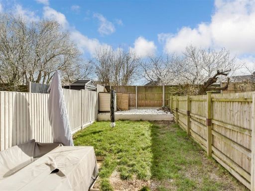 2 bedroom terraced house for sale in Olivine Close, Sittingbourne, Kent, ME10 — £260,000 • 2 bed • 1 bath • 498 ft²
 2 bedroom terraced house for sale in North Street, Sittingbourne, Kent, ME10 — £230,000 • 2 bed • 1 bath • 636 ft²
 2 bedroom terraced house for sale in The Willows, Sittingbourne, Kent, ME10 — £240,000 • 2 bed • 1 bath • 575 ft²
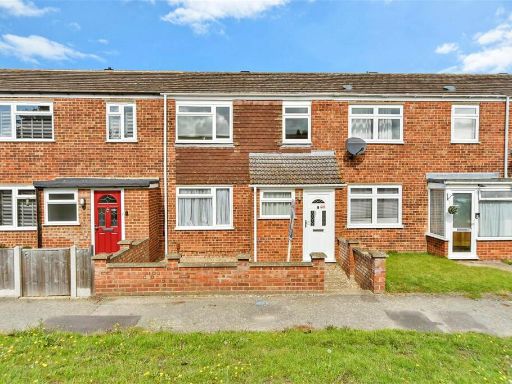 3 bedroom terraced house for sale in Blythe Close, Sittingbourne, Kent, ME10 — £250,000 • 3 bed • 1 bath • 808 ft²
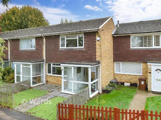 2 bedroom terraced house for sale in Thorpe Walk, Parkwood, Gillingham, Kent, ME8 — £300,000 • 2 bed • 1 bath • 797 ft²
Meta
- {
"@context": "https://schema.org",
"@type": "Residence",
"name": "2 bedroom terraced house for sale in Vincent Road, Sittingb…",
"description": "",
"url": "https://propertypiper.co.uk/property/d780d0fa-1b38-49b3-926d-187e6baebb05",
"image": "https://image-a.propertypiper.co.uk/391ebaff-4a14-4556-8ab3-eb38c7804a46-1024.jpeg",
"address": {
"@type": "PostalAddress",
"streetAddress": "1B VINCENT ROAD SITTINGBOURNE",
"postalCode": "ME10 3DD",
"addressLocality": "Swale",
"addressRegion": "Sittingbourne and Sheppey",
"addressCountry": "England"
},
"geo": {
"@type": "GeoCoordinates",
"latitude": 51.33670210357045,
"longitude": 0.7581768294495153
},
"numberOfRooms": 2,
"numberOfBathroomsTotal": 1,
"floorSize": {
"@type": "QuantitativeValue",
"value": 614,
"unitCode": "FTK"
},
"offers": {
"@type": "Offer",
"price": 260000,
"priceCurrency": "GBP",
"availability": "https://schema.org/InStock"
},
"additionalProperty": [
{
"@type": "PropertyValue",
"name": "Feature",
"value": "mid-20th-century"
},
{
"@type": "PropertyValue",
"name": "Feature",
"value": "terraced house"
},
{
"@type": "PropertyValue",
"name": "Feature",
"value": "brick exterior"
},
{
"@type": "PropertyValue",
"name": "Feature",
"value": "standard ceiling height"
},
{
"@type": "PropertyValue",
"name": "Feature",
"value": "medium room size"
},
{
"@type": "PropertyValue",
"name": "Feature",
"value": "residential neighborhood"
},
{
"@type": "PropertyValue",
"name": "Feature",
"value": "garden"
},
{
"@type": "PropertyValue",
"name": "Feature",
"value": "contemporary"
},
{
"@type": "PropertyValue",
"name": "Feature",
"value": "outdoor"
},
{
"@type": "PropertyValue",
"name": "Feature",
"value": "patio"
},
{
"@type": "PropertyValue",
"name": "Feature",
"value": "low-maintenance"
},
{
"@type": "PropertyValue",
"name": "Feature",
"value": "fencing"
},
{
"@type": "PropertyValue",
"name": "Feature",
"value": "private"
}
]
}
High Res Floorplan Images
Compatible Floorplan Images
FloorplanImages Thumbnail