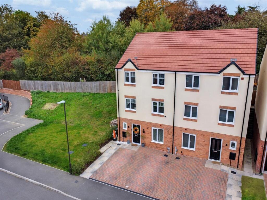
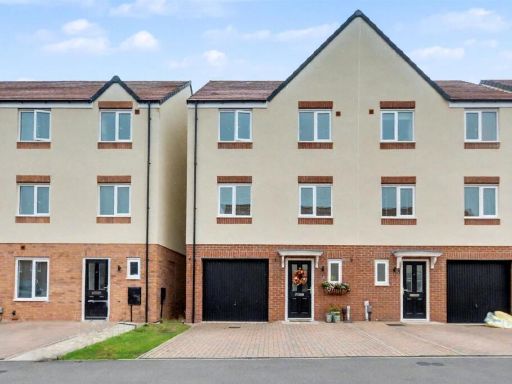
DE7 4SN - 4 bedroom semidetached house for sale in Slater Way, Ilkest…
View on Property Piper
4 bedroom semi-detached house for sale in Slater Way, Ilkeston, DE7
Property Details
- Price: £320000
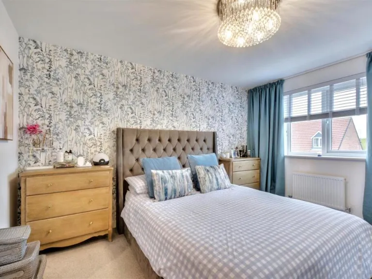
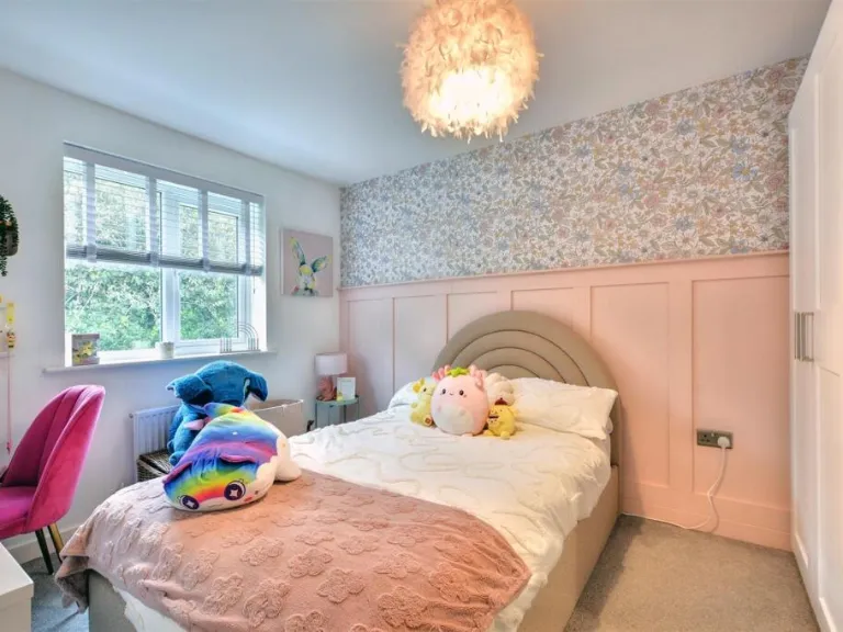
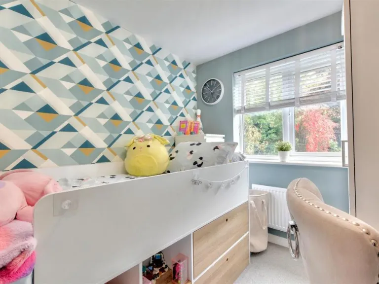
- Bedrooms: 4
- Bathrooms: 3
- Property Type: undefined
- Property SubType: undefined
Image Descriptions
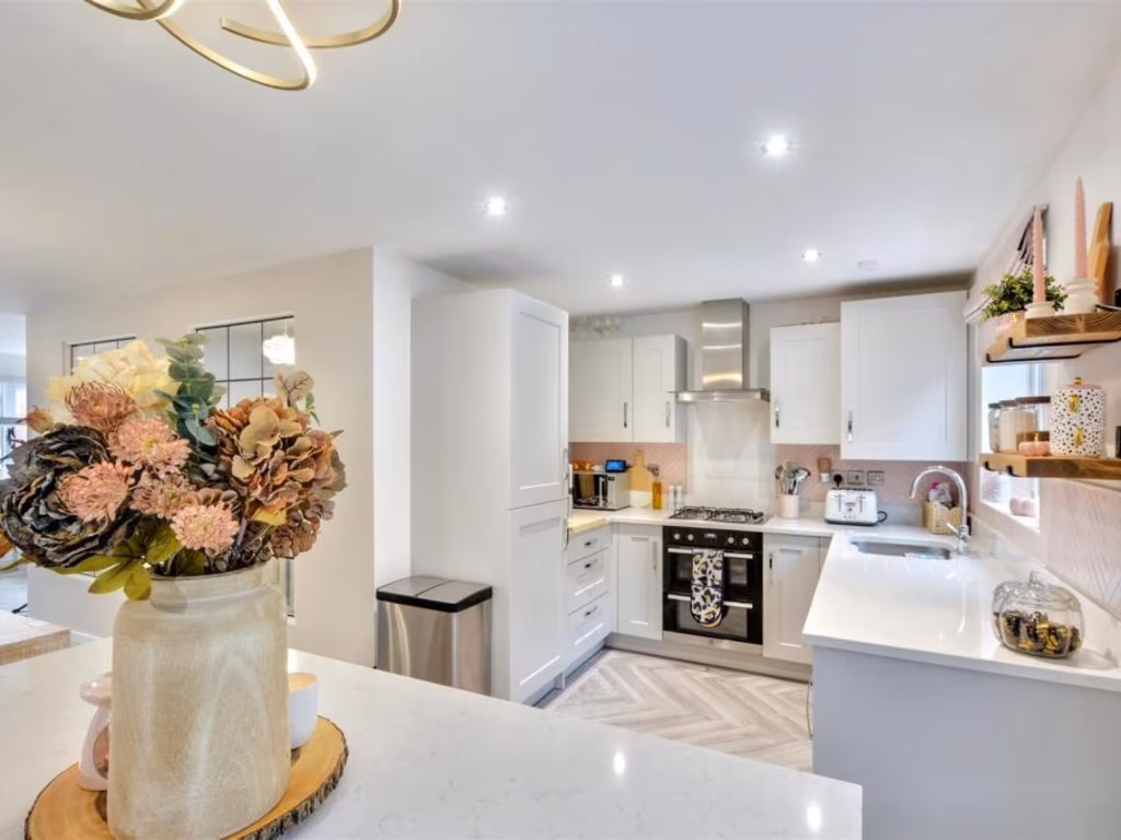
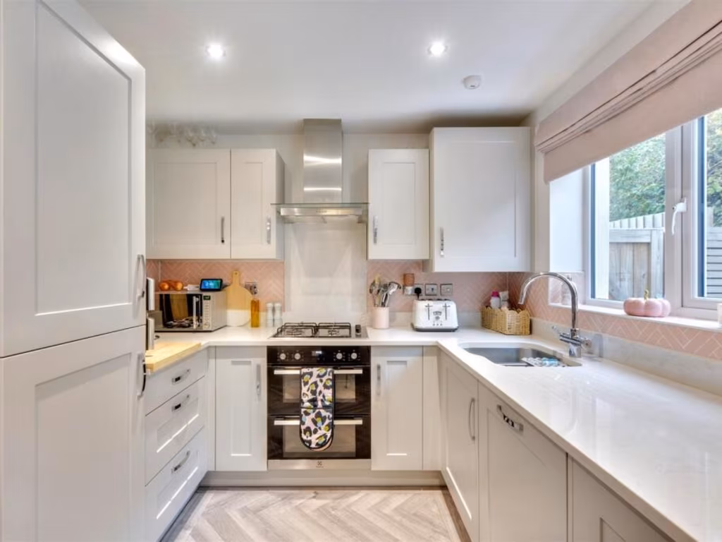
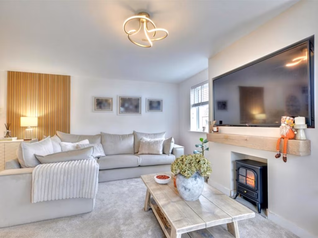
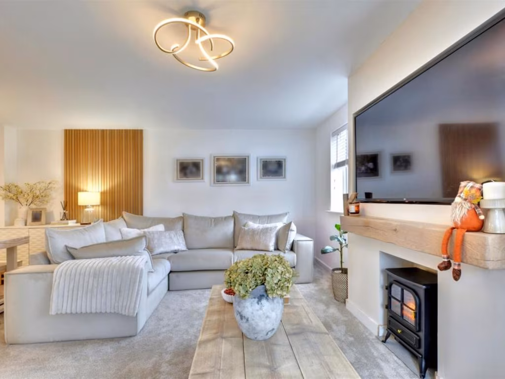
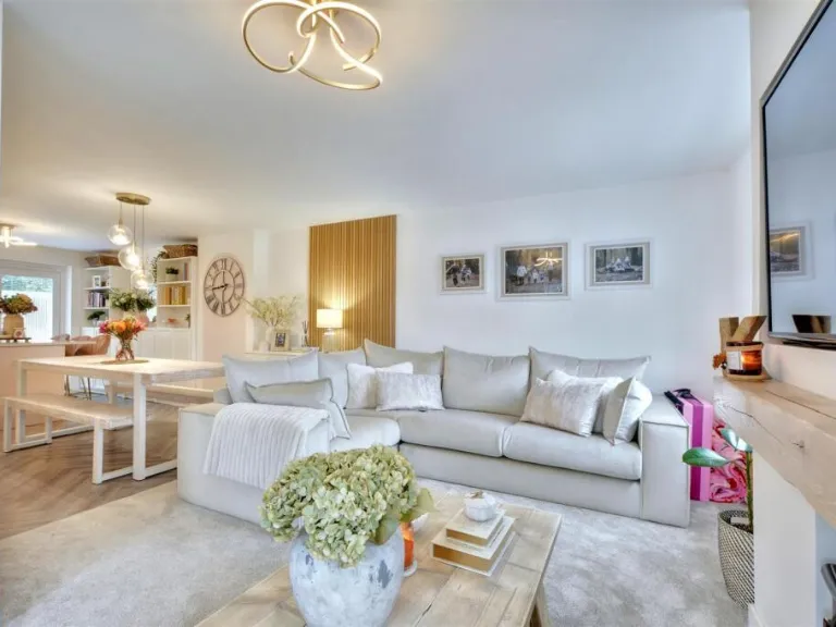
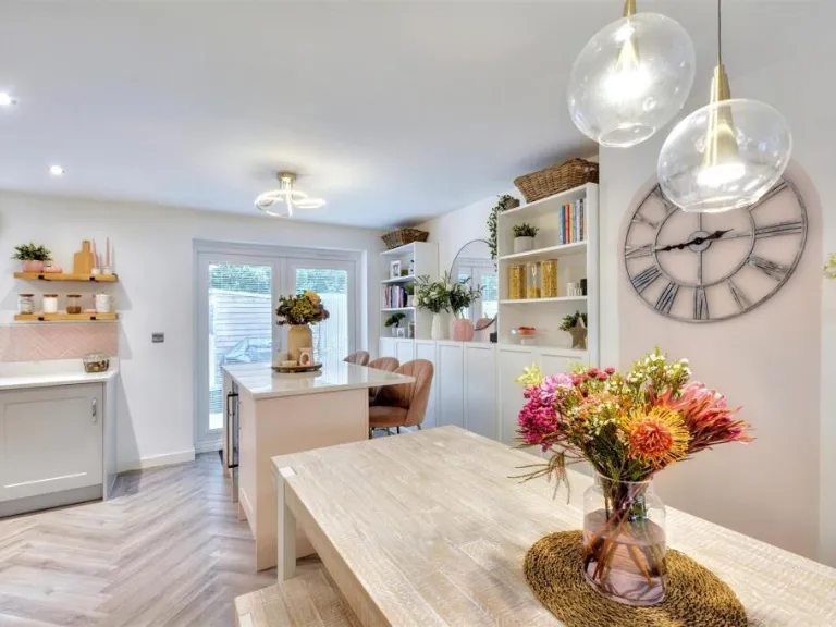
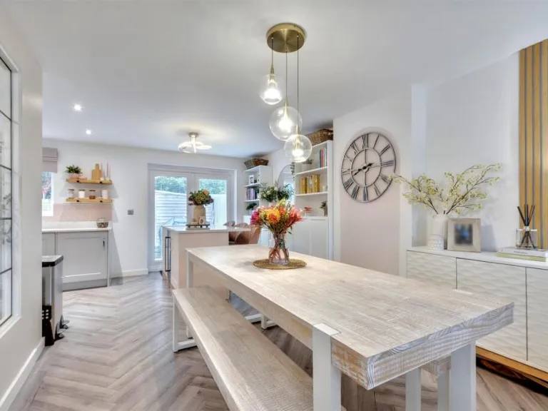
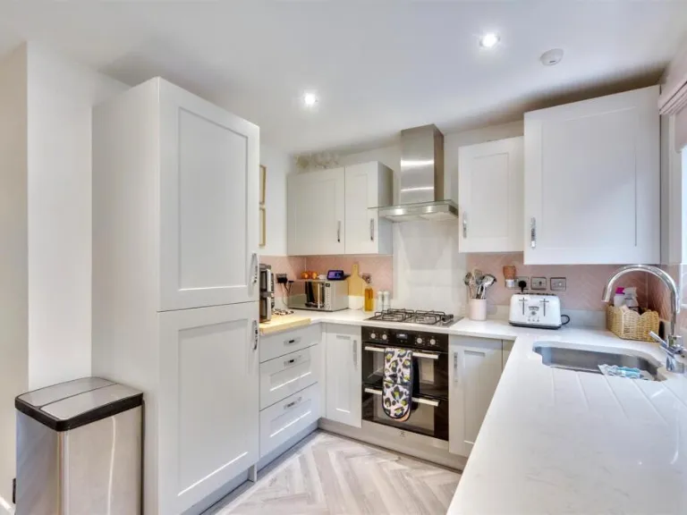
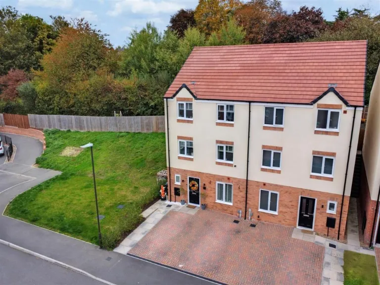
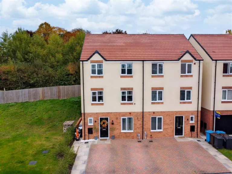
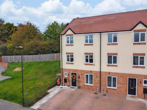
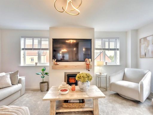
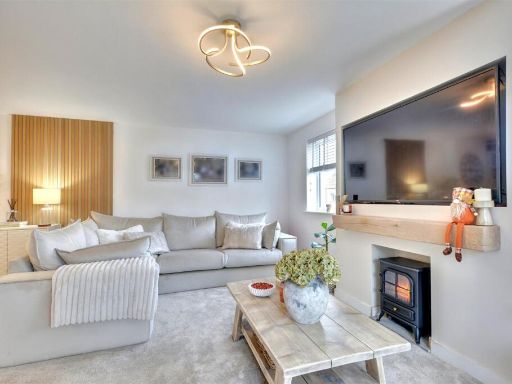
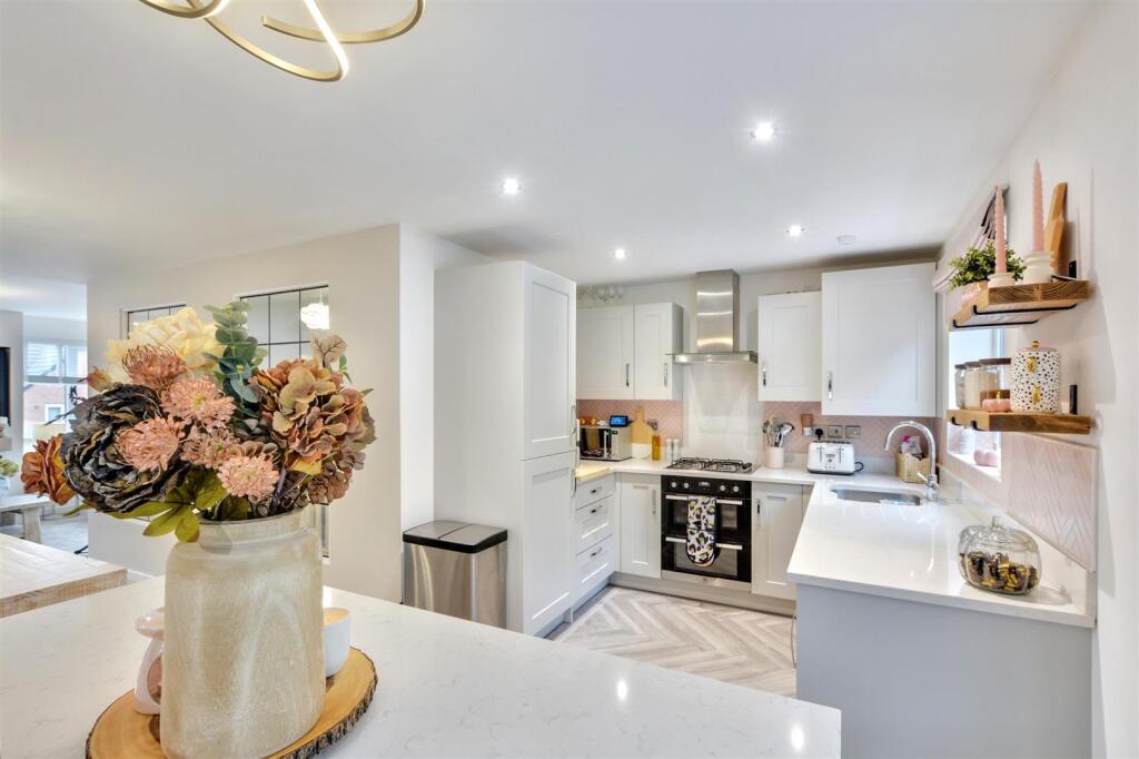
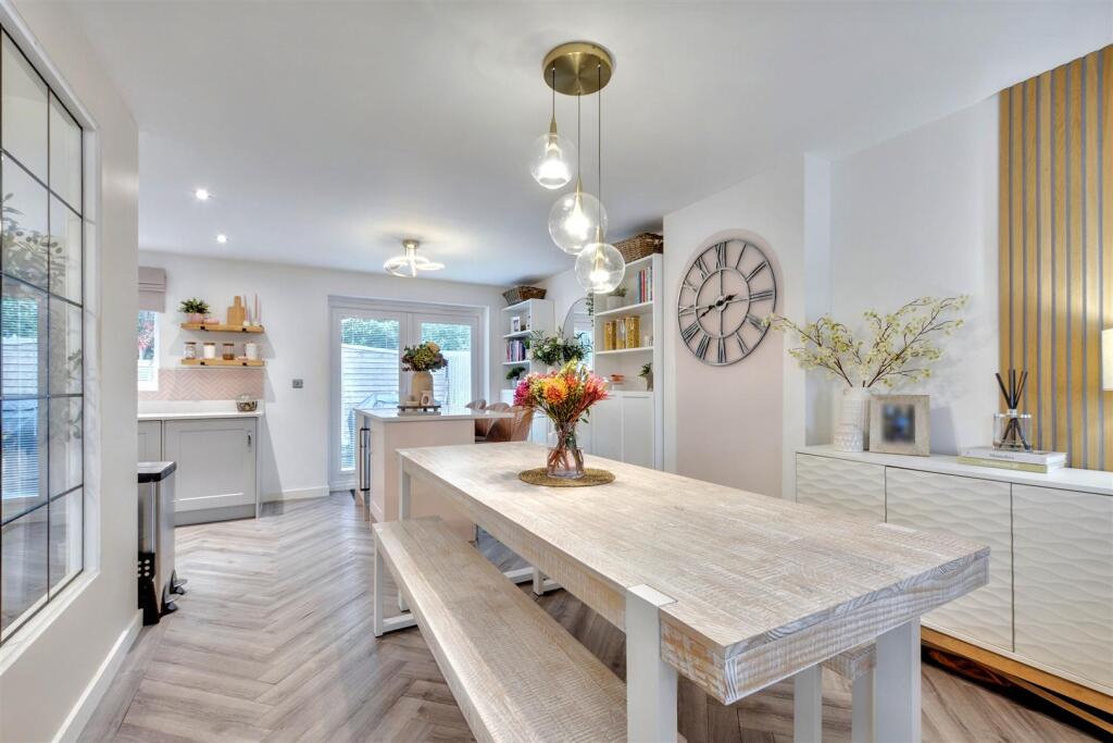
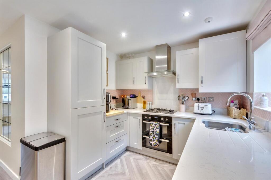
- modern townhouse modern
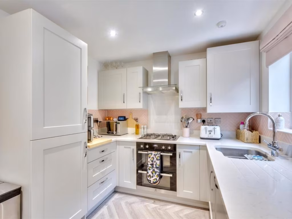
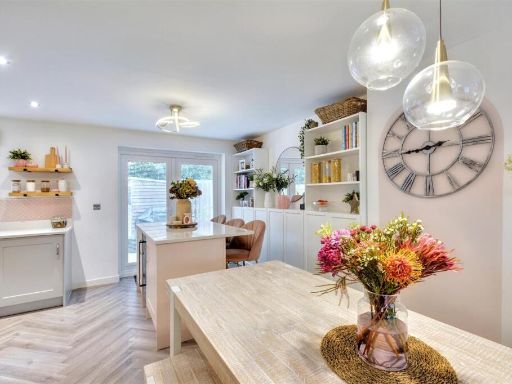
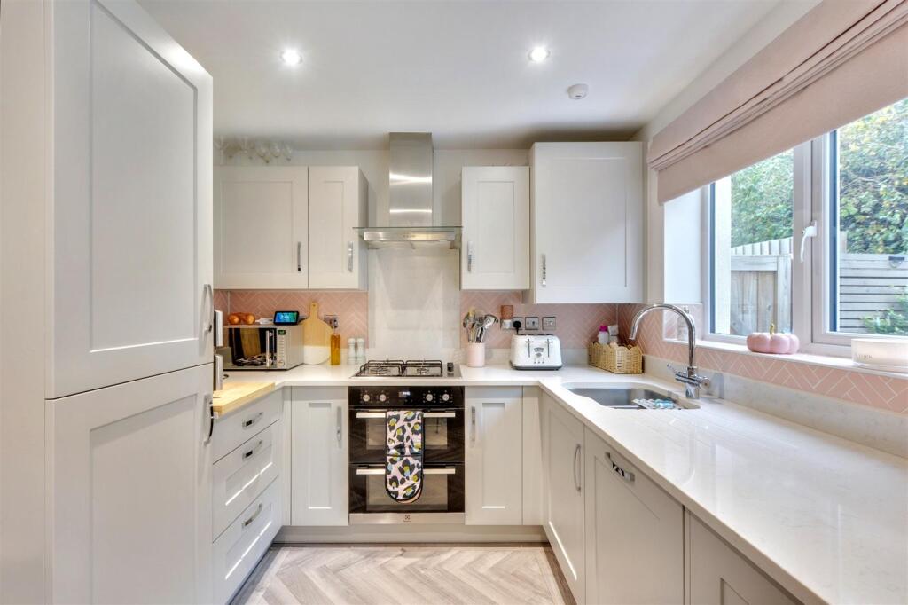
- kitchen modern
Floorplan Description
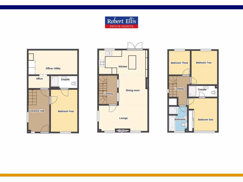
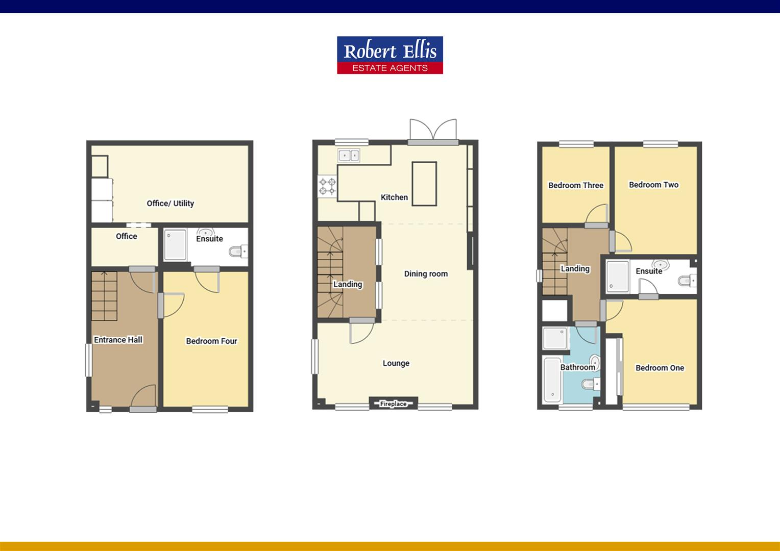
- Three-storey residential property floorplan showing rooms and circulation
Rooms
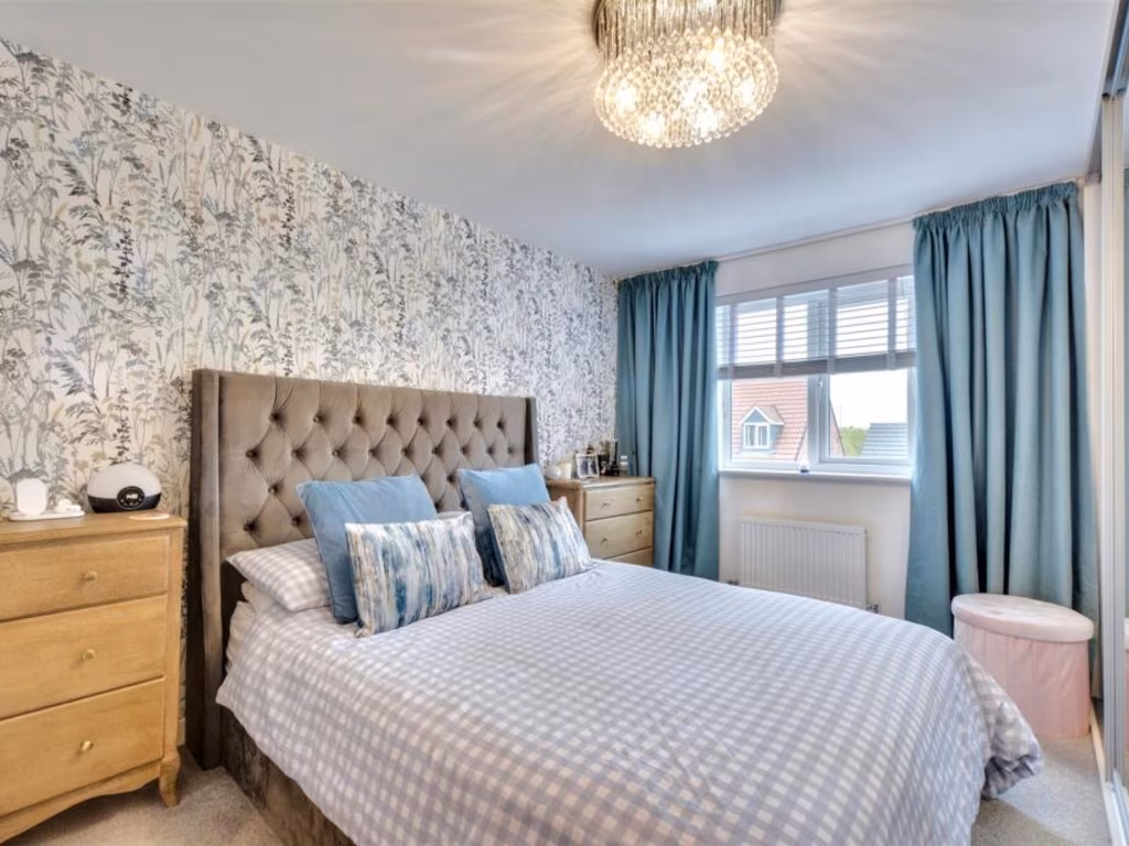
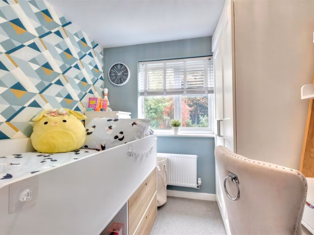
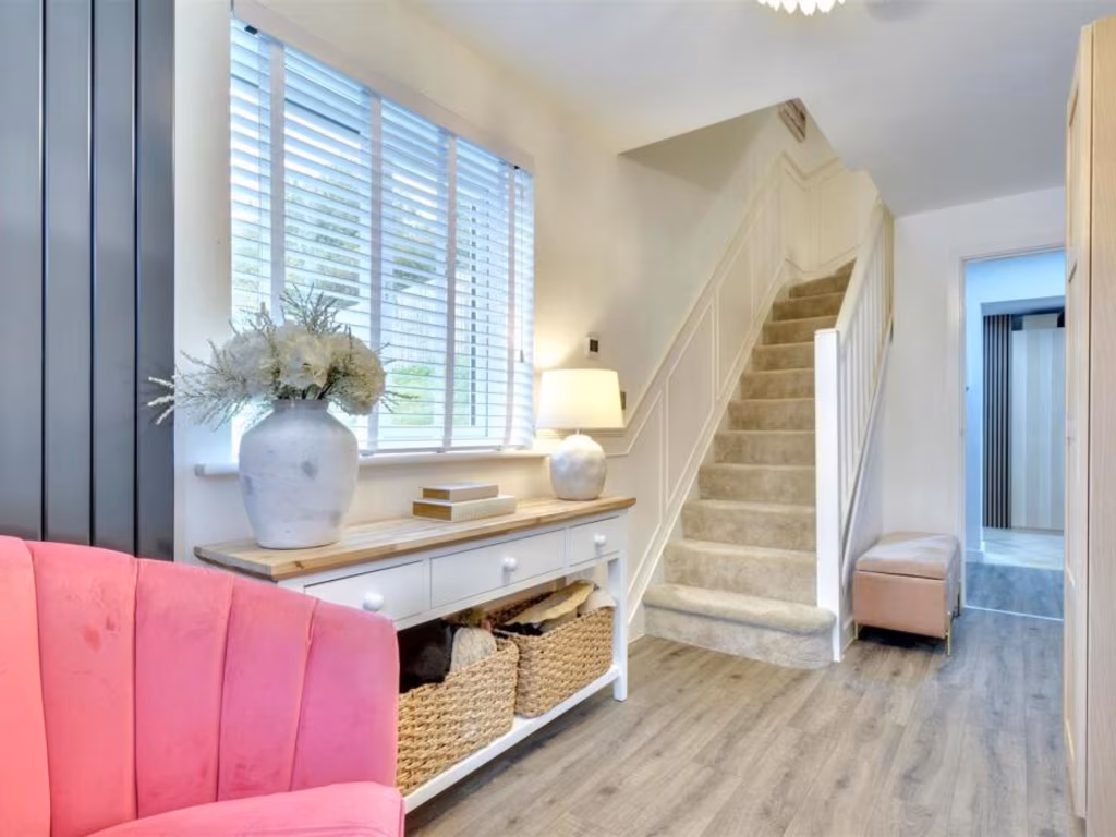
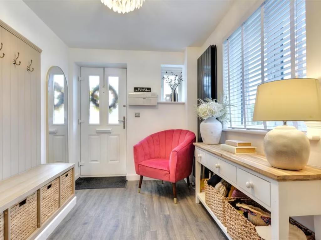
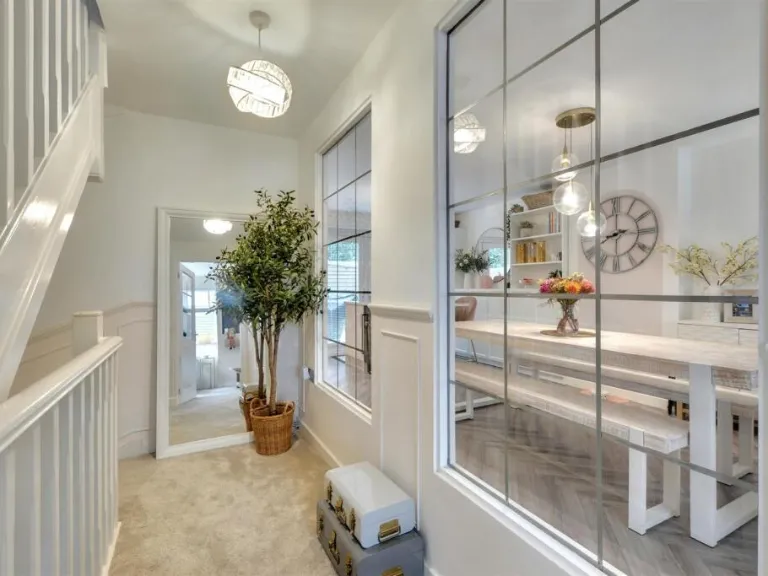
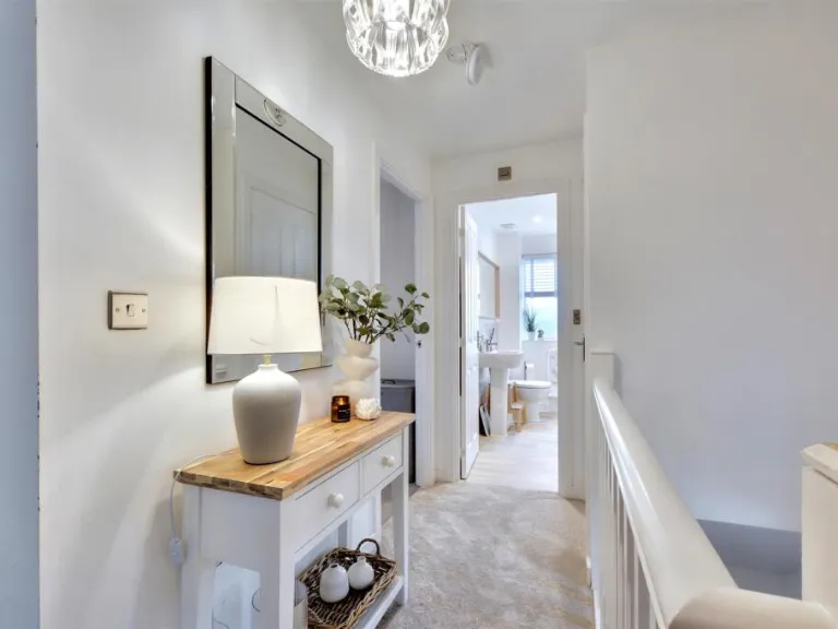
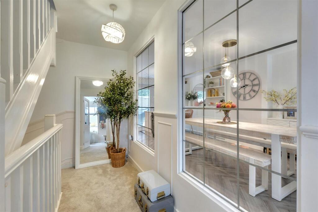
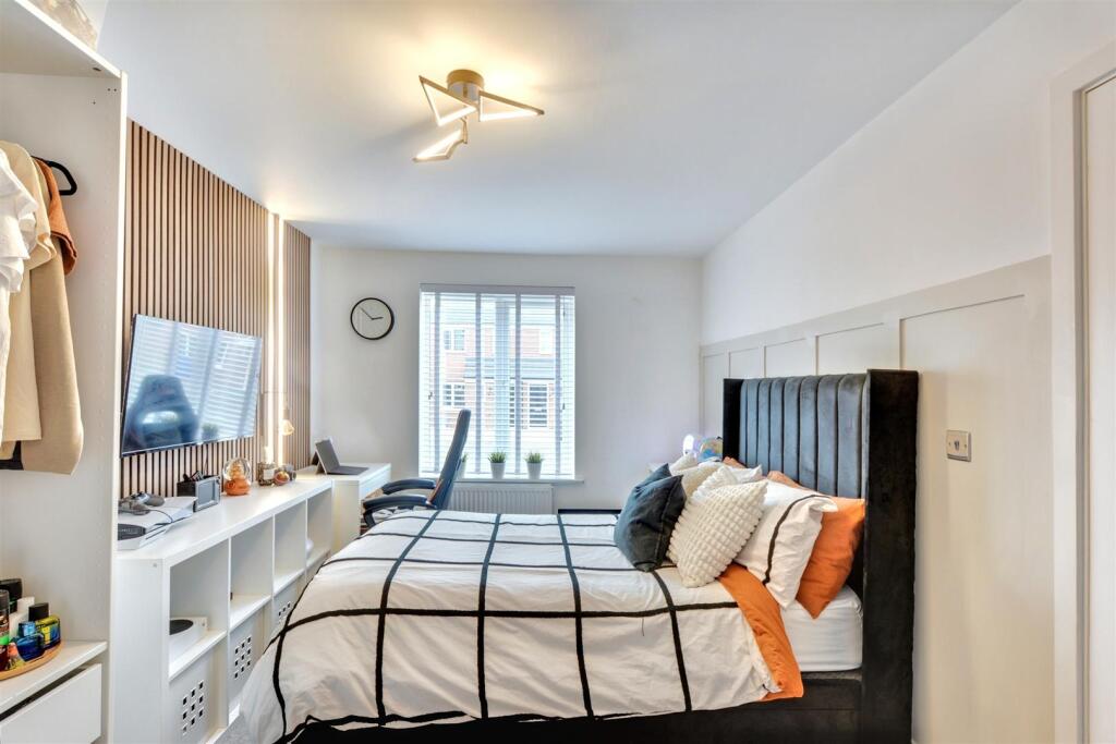
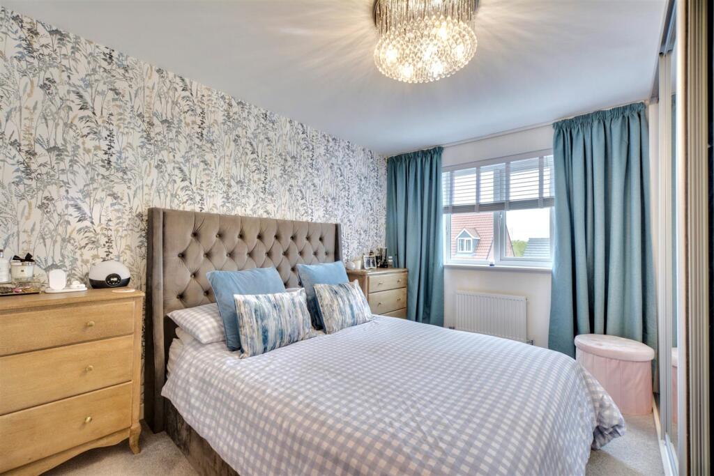
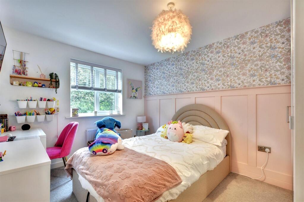
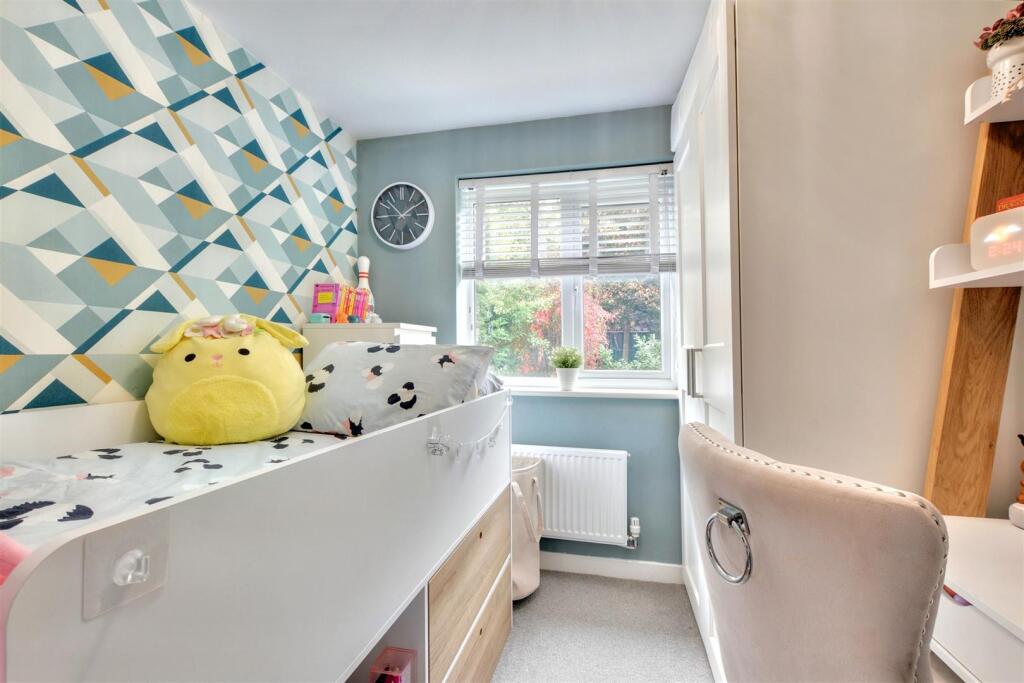
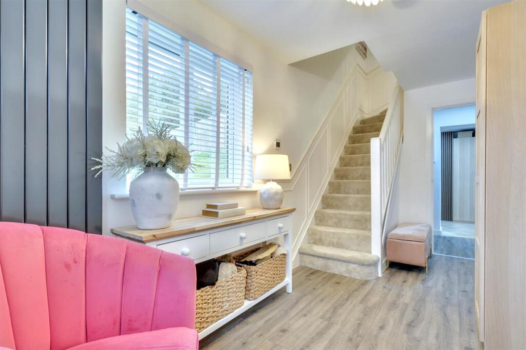
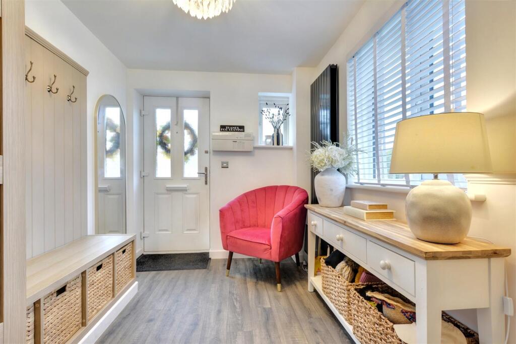
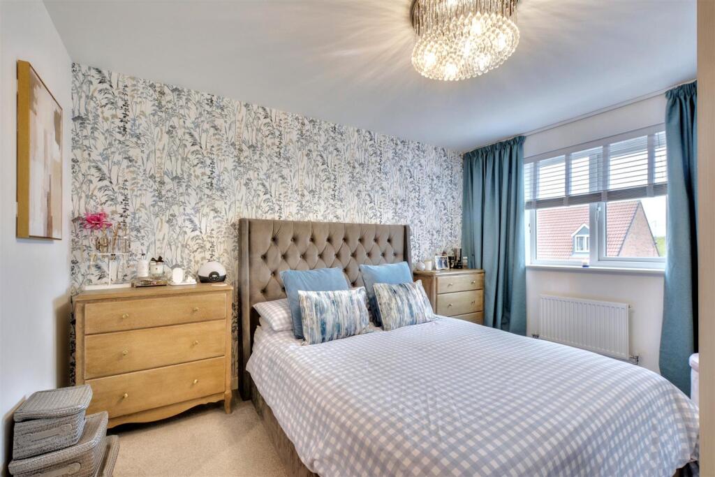
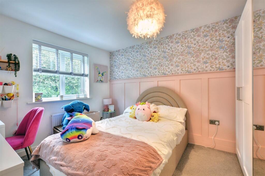
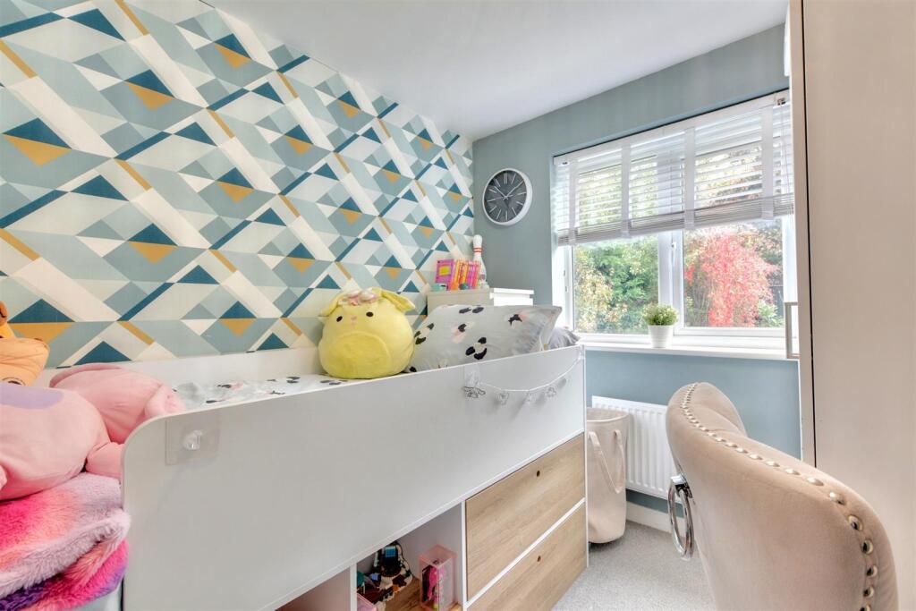
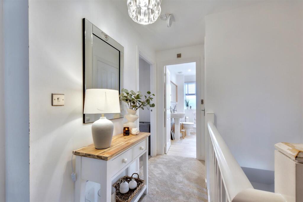
- Entrance Hall:
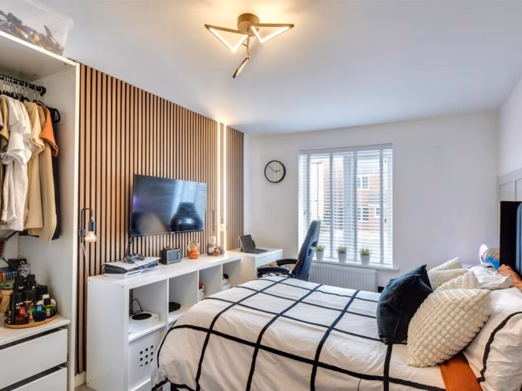
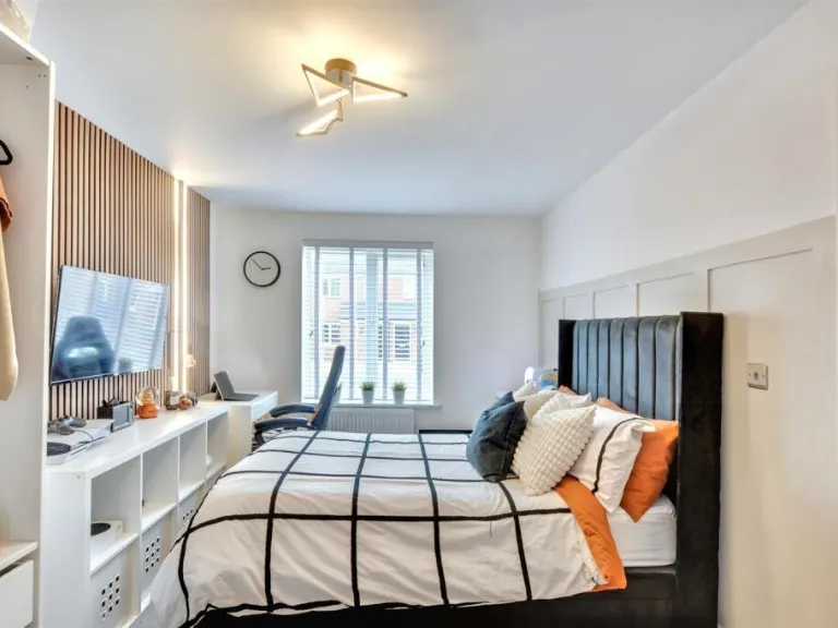
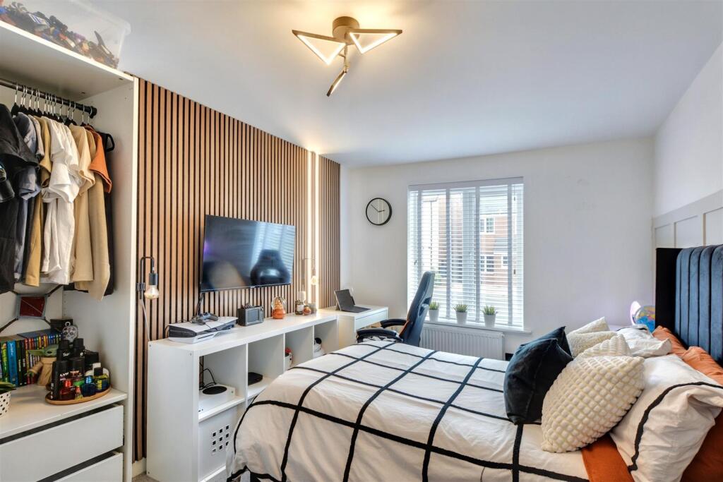
- Bedroom Four:
- Office:
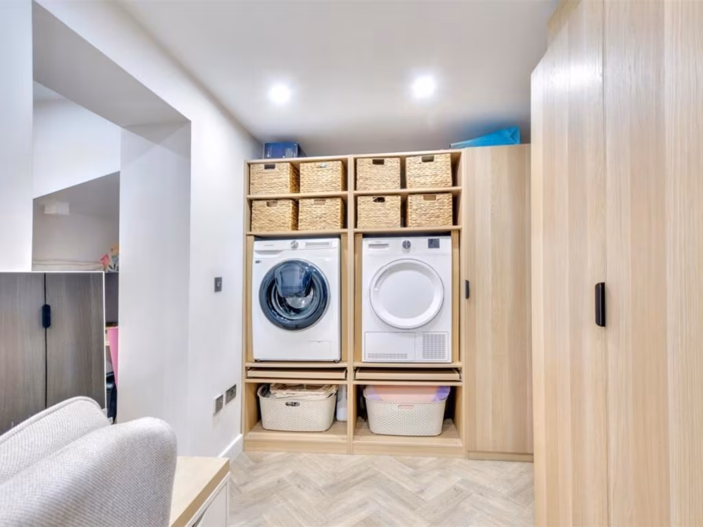
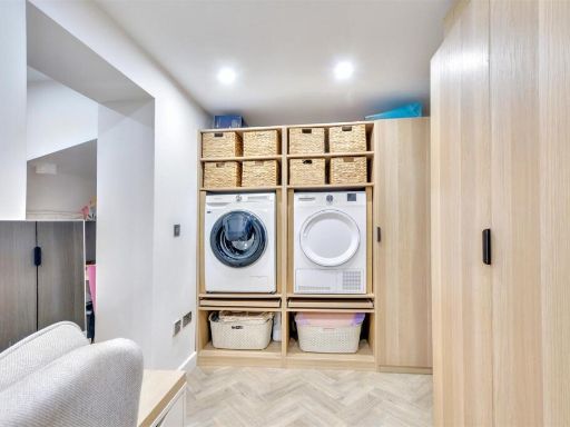
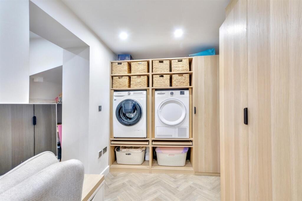
- Office/ Utility:
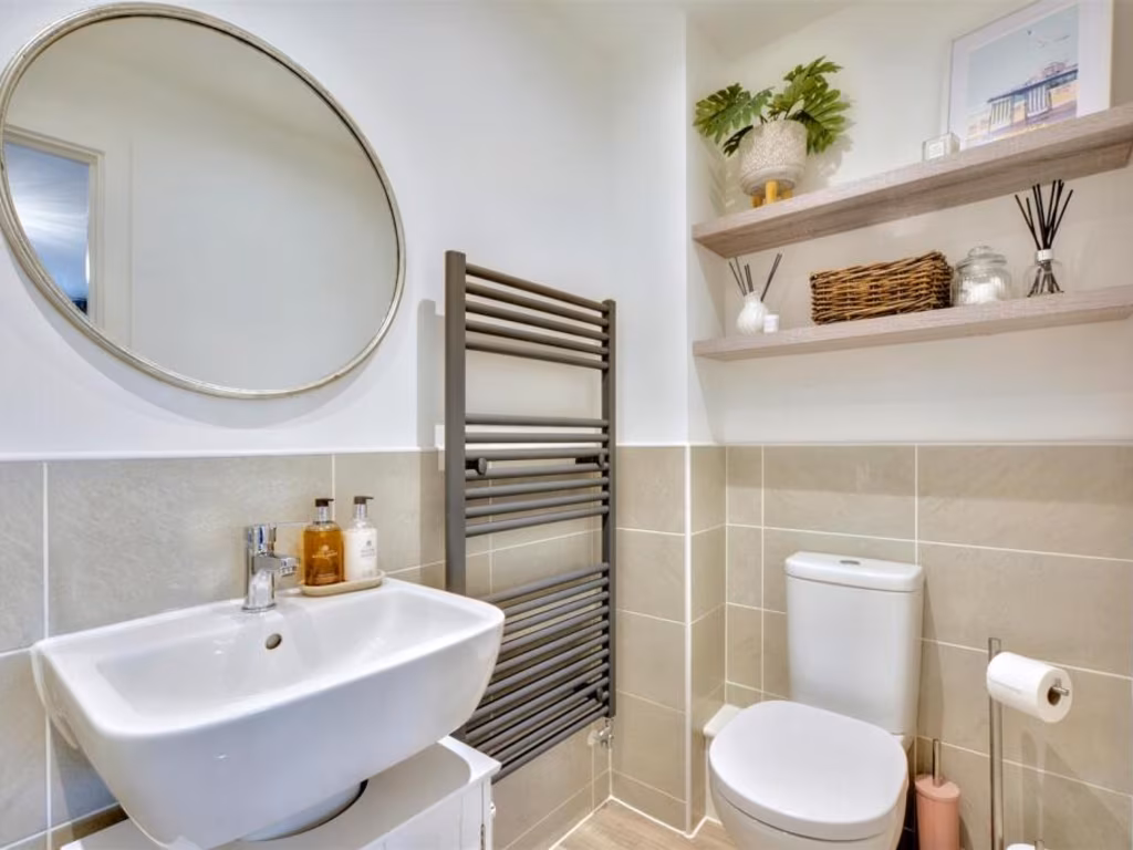
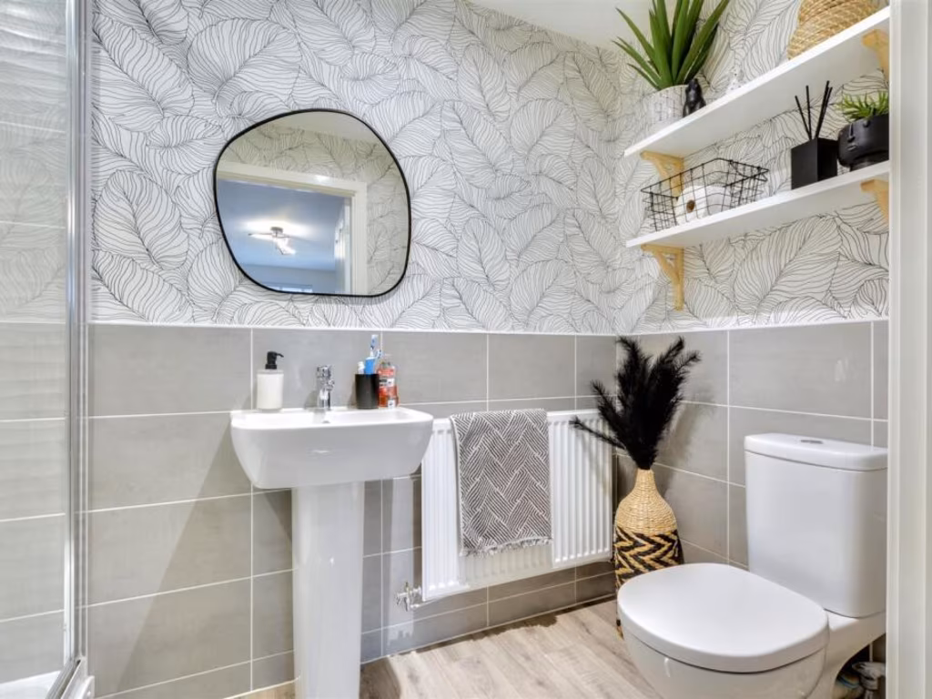
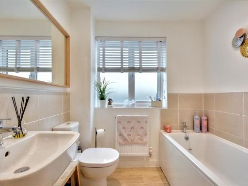
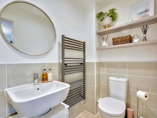
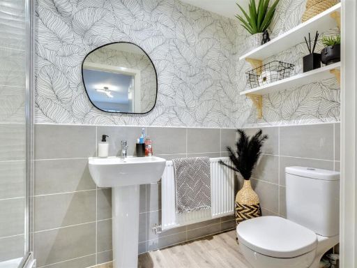
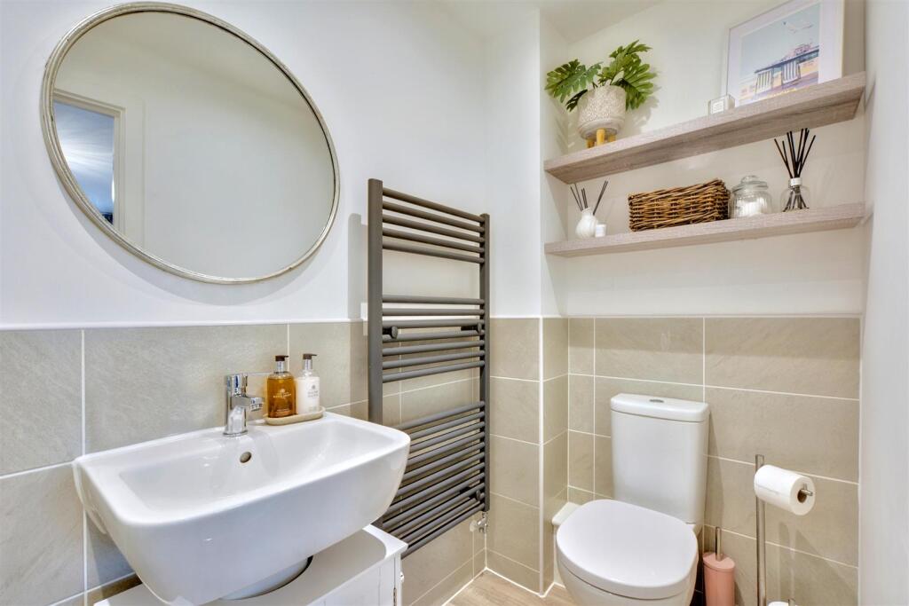
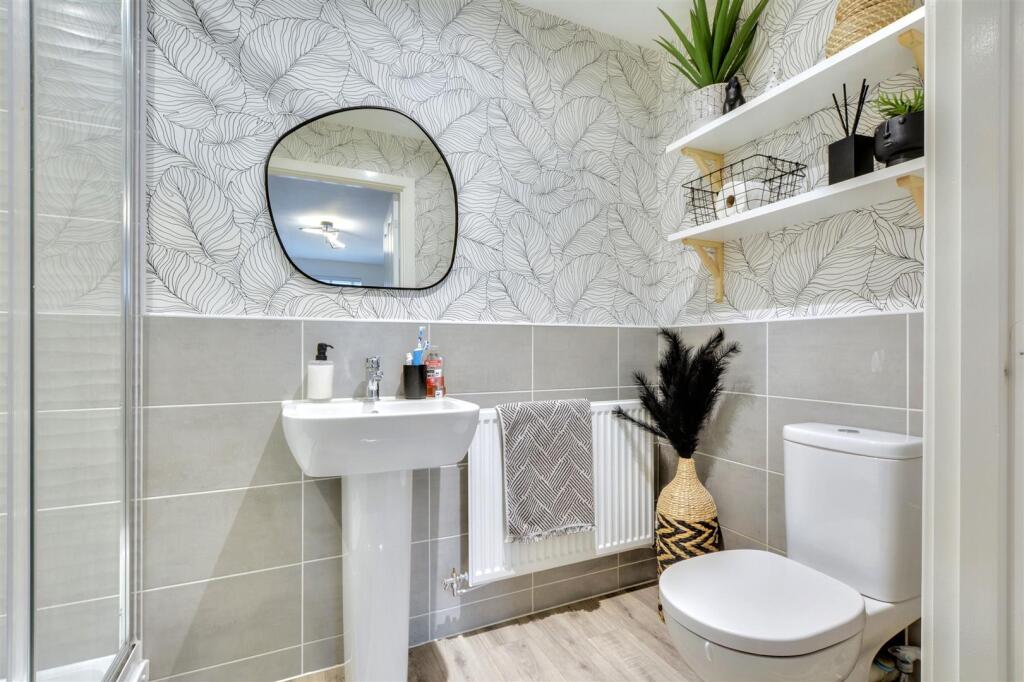
- Ensuite:
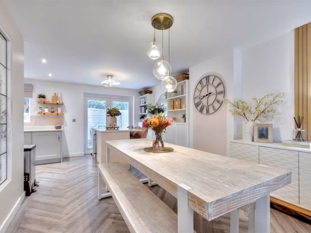
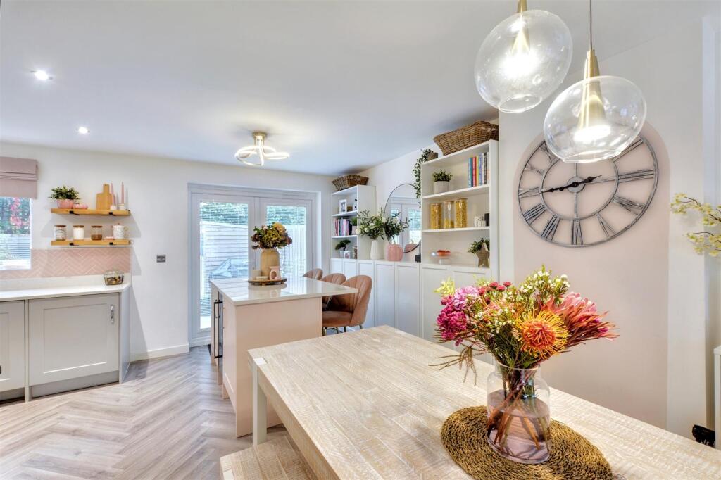
- Kitchen:
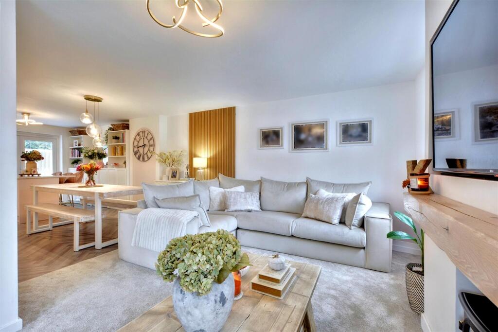
- Dining room:
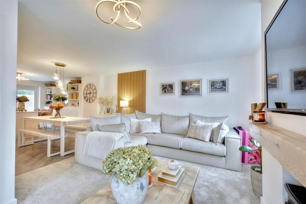
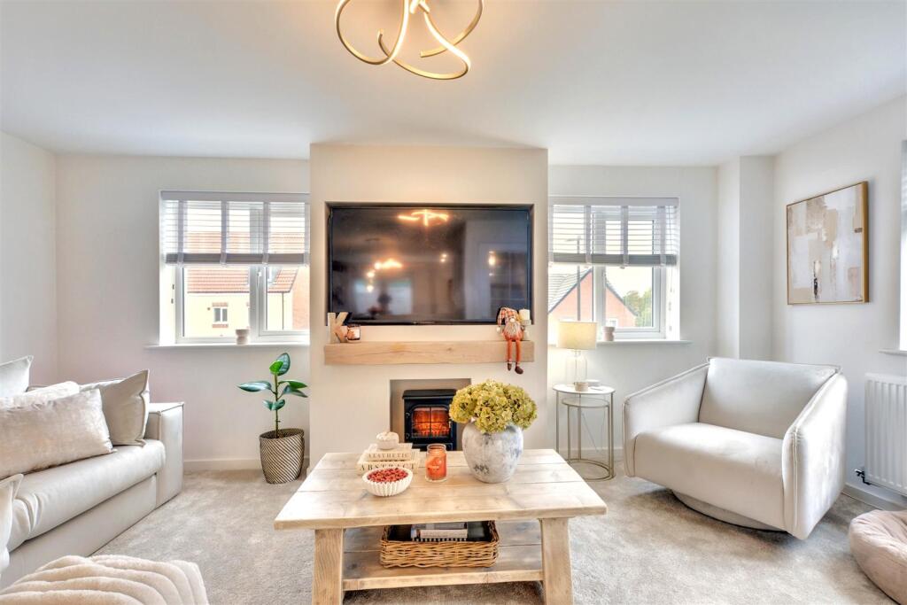
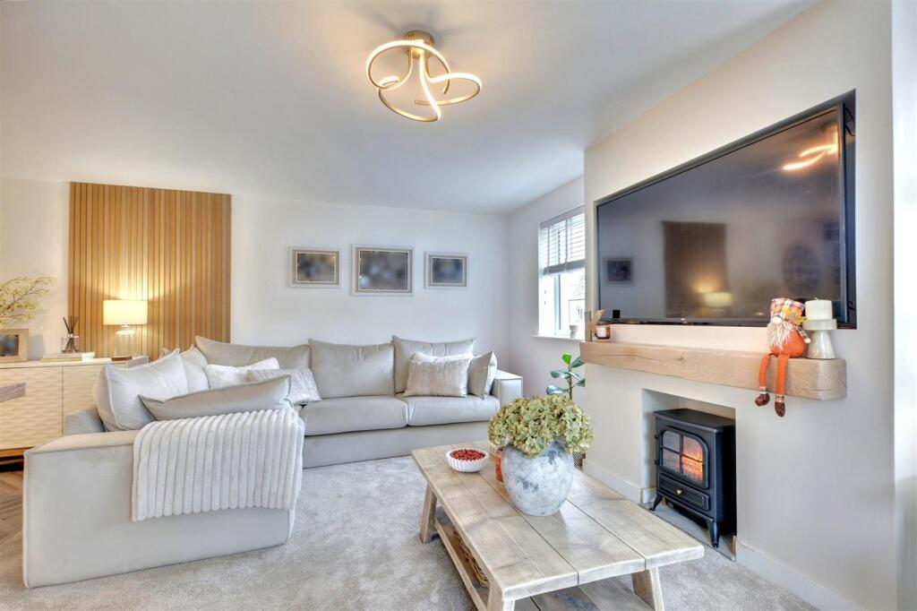
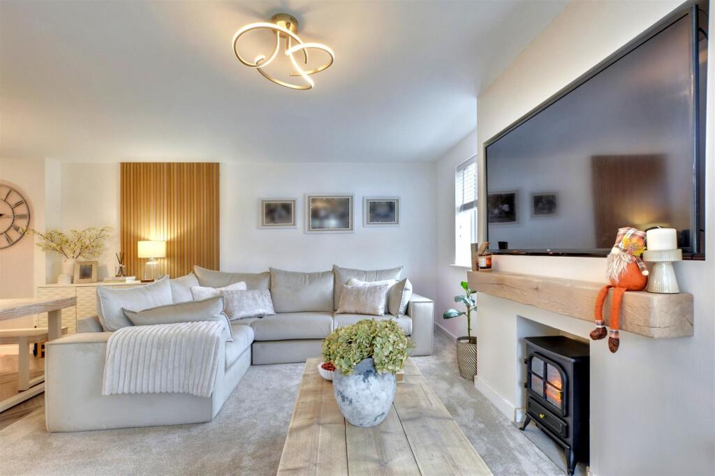
- Lounge:
- Landing:
- Bedroom Three:
- Bedroom Two:
- Bedroom One:
- Ensuite:
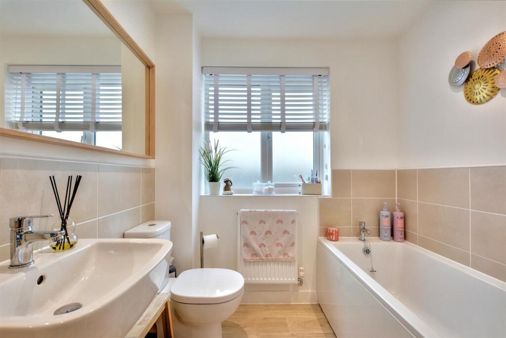
- Bathroom:
- Landing:
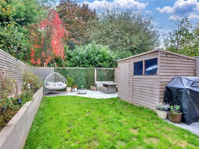
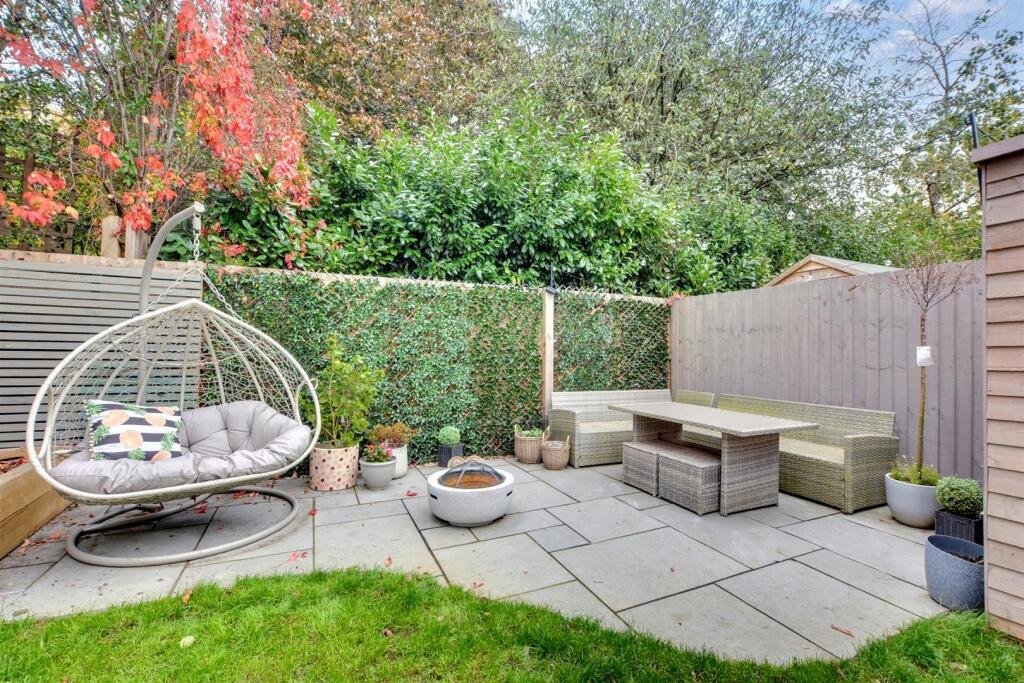
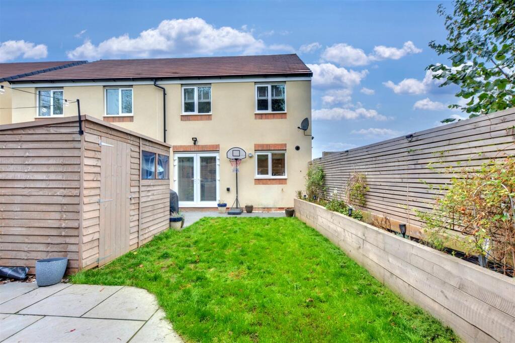
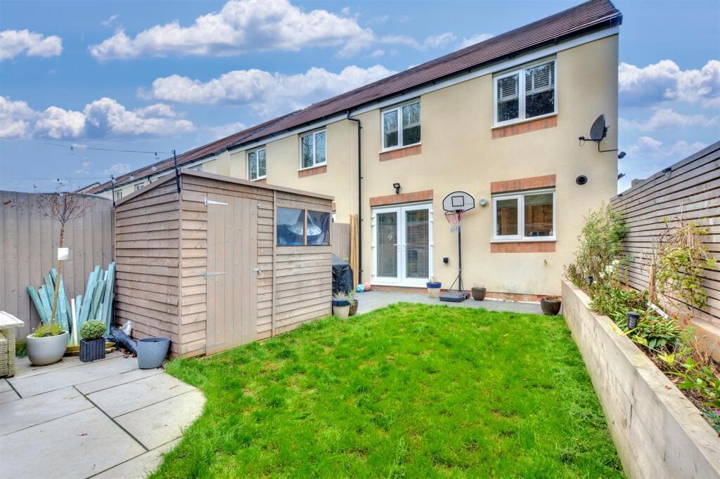
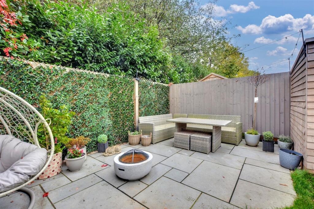
Textual Property Features
- Is New Build
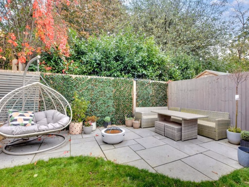
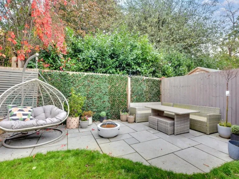
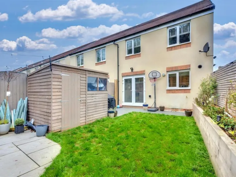
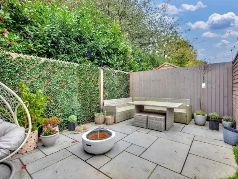
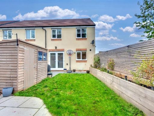
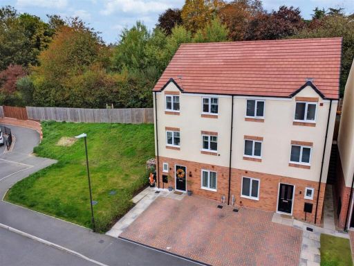
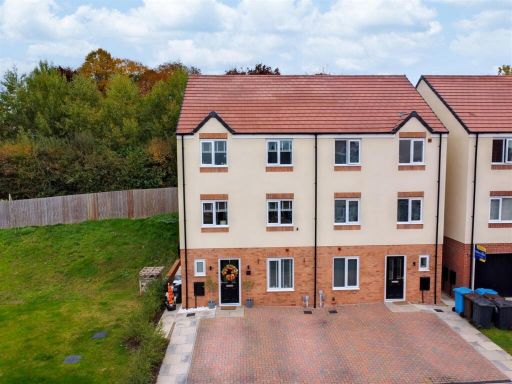
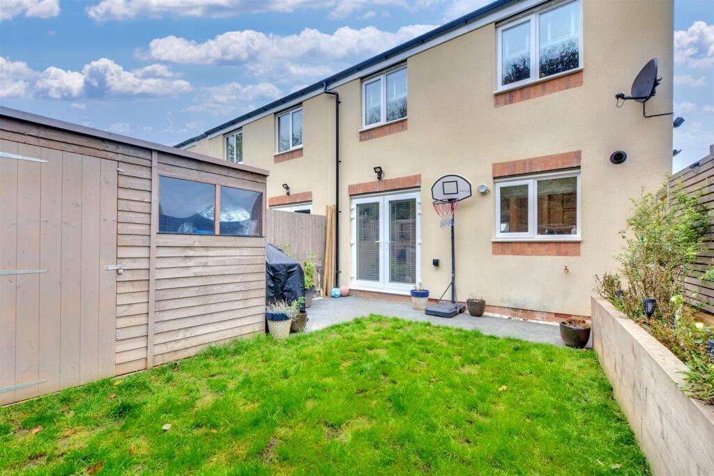
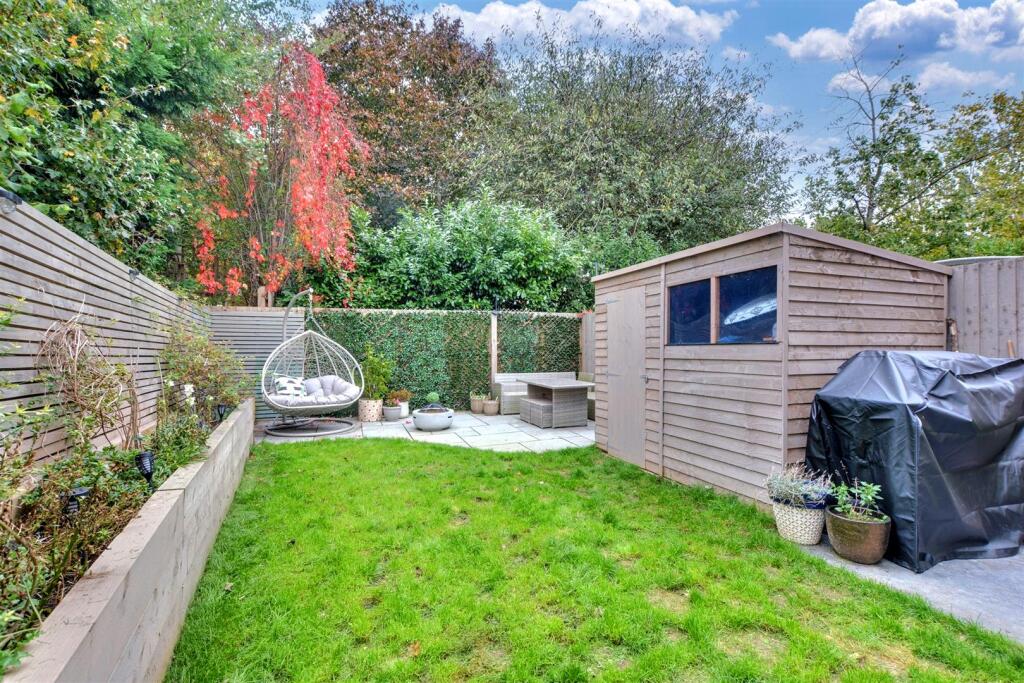
- Has Garden
- Success
Detected Visual Features
- modern
- townhouse
- brick exterior
- driveway
- three-story
- recent construction
- low maintenance
- modern kitchen
- white cabinetry
- built-in appliances
- chevron flooring
- LED lighting
- bright
- sleek
- contemporary
EPC Details
- High performance glazing
- Average thermal transmittance 0.24 W/m-¦K
- Boiler and radiators, mains gas
- Low energy lighting in all fixed outlets
- Average thermal transmittance 0.20 W/m-¦K
Nearby Schools
- Risley Lower Grammar CE (VC) Primary School
- William Lilley Infant and Nursery School
- Fairfield Spencer Academy
- Trowell CofE Primary School
- Hallam Fields Junior School
- Ladywood Primary School
- Kirk Hallam Community Academy
- Charlotte Nursery and Infant School
- Awsworth Primary and Nursery School
- Saint John Houghton Catholic Voluntary Academy
- Larklands Infant School
- Chaucer Infant School
- Mapperley CofE Controlled Primary School
- Cotmanhay Infant and Nursery School
- Friesland School
- Ladycross Infant School
- Albany Junior School
- Albany Infant and Nursery School
- St Thomas Catholic Voluntary Academy
- Chaucer Junior School
- Cotmanhay Junior School
- Cloudside Academy
- Dallimore Primary & Nursery School
- Field House Infant School
- Kensington Junior Academy
- Ormiston Ilkeston Enterprise Academy
- Granby Junior School
Nearest General Shops
- Id: 5593395778
- Tags:
- Addr:
- City: Ilkeston
- Locality: Quarry Hill Industrial Park
- Parentstreet: Eagle Road
- Postcode: DE7 4RB
- Street: Eagle Court
- Unit: 3C, Plot 7
- Car_repair: bodywork; paintwork
- Name: Reem Machine
- Shop: car_repair
- Source:
- Website: https://reemmachine.co.uk/
- TagsNormalized:
- Lat: 52.9554299
- Lon: -1.3053989
- FullGeoHash: gcrj621rwp85
- PartitionGeoHash: gcrj
- Images:
- FoodStandards: null
- Distance: 532.2
,- Id: 352695002
- Tags:
- Addr:
- City: Ilkeston
- Housenumber: 20-22
- Postcode: DE7 4LN
- Street: Lower Stanton Road
- Building: yes
- Name: Shipley Blinds Ltd
- Shop: window_blind
- Source: survey
- Source:addr: Companies House Registered Companies
- Source:addr:postcode: OS Open Data Codepoint
- TagsNormalized:
- Lat: 52.9620983
- Lon: -1.3076008
- FullGeoHash: gcrj61ryddwn
- PartitionGeoHash: gcrj
- Images:
- FoodStandards: null
- Distance: 397.9
,- Id: 352695003
- Tags:
- Addr:
- City: Ilkeston
- Postcode: DE7 4LR
- Street: Lower Stanton Road
- Brand: The Co-operative Funeralcare
- Brand:wikidata: Q7726521
- Brand:wikipedia: en:Co-op Funeralcare
- Building: yes
- Name: The Co-operative Funeralcare
- Shop: funeral_directors
- Source: survey
- Source:addr:postcode: OS Open Data Codepoint
- TagsNormalized:
- funeral
- the co-operative funeralcare
- funeral directors
- shop
- Lat: 52.9608327
- Lon: -1.3068599
- FullGeoHash: gcrj630r5yy8
- PartitionGeoHash: gcrj
- Images:
- FoodStandards: null
- Distance: 323.5
}
Nearest Religious buildings
- Id: 344601299
- Tags:
- Addr:
- City: Ilkeston
- Postcode: DE7 5RG
- Street: Regent Street
- Amenity: place_of_worship
- Building: church
- Denomination: catholic
- Name: Catholic Church of Our Lady and St Thomas of Hereford
- Religion: christian
- Source: survey
- Source:building: MapBox
- Source:start_date: foundation stone
- Start_date: 1921
- TagsNormalized:
- place of worship
- church
- catholic
- christian
- Lat: 52.9666639
- Lon: -1.306113
- FullGeoHash: gcrj662cjmg9
- PartitionGeoHash: gcrj
- Images:
- FoodStandards: null
- Distance: 902
,- Id: 344601410
- Tags:
- Addr:
- City: Ilkeston
- Postcode: DE7 5AJ
- Street: Nottingham Road
- Amenity: place_of_worship
- Building: church
- Denomination: anglican
- Name: Parish Church of St John the Evangelist
- Religion: christian
- Source: survey
- Source:building: Bing
- Website: https://www.achurchnearyou.com/church/13400/
- Wikidata: Q105094718
- TagsNormalized:
- place of worship
- church
- anglican
- evangelist
- parish
- christian
- Lat: 52.9631622
- Lon: -1.2991512
- FullGeoHash: gcrj63tuz948
- PartitionGeoHash: gcrj
- Images:
- FoodStandards: null
- Distance: 896.8
,- Id: 241052390
- Tags:
- HE_ref: 1205580
- Addr:
- City: Ilkeston
- Postcode: DE7 4NF
- Amenity: place_of_worship
- Building: church
- Denomination: anglican
- Listed_status: Grade I
- Name: All Saints Church
- Religion: christian
- Source: survey
- Source:listed_status: Historic England
- Wikidata: Q17525644
- TagsNormalized:
- place of worship
- church
- anglican
- christian
- Lat: 52.9603803
- Lon: -1.3187619
- FullGeoHash: gcrj3cpswd7y
- PartitionGeoHash: gcrj
- Images:
- FoodStandards: null
- Distance: 564.2
}
Nearest Airports
- Id: 11359528
- Tags:
- Aerodrome: international
- Aerodrome:type: public
- Aeroway: aerodrome
- Iata: EMA
- Icao: EGNX
- Is_in: Castle Donington,England,UK
- Name: East Midlands Airport
- Old_name: RAF Castle Donington
- Operator: Manchester Airports Holdings Limited
- Operator:type: private
- Ref: EMA
- Type: multipolygon
- Website: https://www.eastmidlandsairport.com/
- Wikidata: Q8977
- Wikipedia: en:East Midlands Airport
- TagsNormalized:
- airport
- international airport
- Lat: 52.8281122
- Lon: -1.3322143
- FullGeoHash: gcrh99jfj1vh
- PartitionGeoHash: gcrh
- Images:
- FoodStandards: null
- Distance: 14628.6
}
Nearest Leisure Facilities
- Id: 57933801
- Tags:
- Leisure: park
- Source: survey;approximate
- TagsNormalized:
- Lat: 52.9560541
- Lon: -1.3058394
- FullGeoHash: gcrj62357ezx
- PartitionGeoHash: gcrj
- Images:
- FoodStandards: null
- Distance: 461.2
,- Id: 397716966
- Tags:
- Leisure: pitch
- Name: Windsor Crescent Multi-Use Games Area
- Operator: Erewash Borough Council
- Source: survey; Bing
- Sport: multi
- TagsNormalized:
- Lat: 52.9562572
- Lon: -1.3151048
- FullGeoHash: gcrj606kecff
- PartitionGeoHash: gcrj
- Images:
- FoodStandards: null
- Distance: 428.9
,- Id: 306048791
- Tags:
- Leisure: playground
- Source: survey
- TagsNormalized:
- Lat: 52.9626801
- Lon: -1.3126183
- FullGeoHash: gcrj61s1vz0u
- PartitionGeoHash: gcrj
- Images:
- FoodStandards: null
- Distance: 427.4
,- Id: 57933787
- Tags:
- TagsNormalized:
- Lat: 52.962363
- Lon: -1.3120844
- FullGeoHash: gcrj61s84hnc
- PartitionGeoHash: gcrj
- Images:
- FoodStandards: null
- Distance: 383.5
,- Id: 776351799
- Tags:
- Leisure: pitch
- Source:
- Geometry: Esri World Imagery
- Sport: multi
- TagsNormalized:
- Lat: 52.95731
- Lon: -1.3068983
- FullGeoHash: gcrj6286en1g
- PartitionGeoHash: gcrj
- Images:
- FoodStandards: null
- Distance: 315.1
}
Nearest Train stations
- Id: 1587569090
- Tags:
- Name: Long Eaton
- Naptan:
- Network: National Rail
- Public_transport: station
- Railway: station
- Ref:
- Train: yes
- Wheelchair: limited
- Wheelchair:description: Both platforms have a lift available. Sloped access is steep.
- Wikidata: Q2357399
- Wikipedia: en:Long Eaton railway station
- TagsNormalized:
- Lat: 52.8849595
- Lon: -1.2872899
- FullGeoHash: gcrhfeqt5yzp
- PartitionGeoHash: gcrh
- Images:
- FoodStandards: null
- Distance: 8383.2
,- Id: 4292892169
- Tags:
- Is_in:
- Layer: 2
- Name: Beeston
- Naptan:
- Network: National Rail
- Public_transport: station
- Railway: station
- Ref:
- Wheelchair: yes
- Wikidata: Q3299120
- Wikipedia: en:Beeston railway station
- TagsNormalized:
- Lat: 52.9207938
- Lon: -1.2075065
- FullGeoHash: gcrjh9btzncz
- PartitionGeoHash: gcrj
- Images:
- FoodStandards: null
- Distance: 8114.2
,- Id: 6415345182
- Tags:
- Name: Attenborough
- Naptan:
- Network: National Rail
- Public_transport: station
- Railway: station
- Ref:
- Wikidata: Q2098552
- Wikipedia: en:Attenborough railway station
- TagsNormalized:
- Lat: 52.9064132
- Lon: -1.2311523
- FullGeoHash: gcrhgzrd0n4r
- PartitionGeoHash: gcrh
- Images:
- FoodStandards: null
- Distance: 7912.6
,- Id: 3727407363
- Tags:
- Name: Langley Mill
- Naptan:
- Network: National Rail
- Public_transport: station
- Railway: station
- Ref:
- Source: NPE
- Wikidata: Q2145892
- Wikipedia: en:Langley Mill railway station
- TagsNormalized:
- Lat: 53.018474
- Lon: -1.3311974
- FullGeoHash: gcrj9ewwuzgk
- PartitionGeoHash: gcrj
- Images:
- FoodStandards: null
- Distance: 6752.1
,- Id: 7170589239
- Tags:
- Name: Ilkeston
- Naptan:
- Network: National Rail
- Public_transport: station
- Railway: station
- Ref:
- Wikidata: Q15228309
- Wikipedia: en:Ilkeston railway station
- TagsNormalized:
- Lat: 52.9790983
- Lon: -1.2950397
- FullGeoHash: gcrj6s8cx7sr
- PartitionGeoHash: gcrj
- Images:
- FoodStandards: null
- Distance: 2464.6
}
Nearest Bus stations and stops
- Id: 4004947997
- Tags:
- Bus: yes
- Highway: bus_stop
- Name: Longfield Lane / Quarry Hill Road
- Public_transport: platform
- Shelter: no
- TagsNormalized:
- Lat: 52.9584108
- Lon: -1.3074296
- FullGeoHash: gcrj60zcnemc
- PartitionGeoHash: gcrj
- Images:
- FoodStandards: null
- Distance: 225.9
,- Id: 4004948005
- Tags:
- Bus: yes
- Highway: bus_stop
- Name: Quarry Hill Road / Little Hallam Hill
- Public_transport: platform
- Shelter: no
- TagsNormalized:
- Lat: 52.9594264
- Lon: -1.308298
- FullGeoHash: gcrj60zr42w7
- PartitionGeoHash: gcrj
- Images:
- FoodStandards: null
- Distance: 163.4
,- Id: 4004948004
- Tags:
- Bus: yes
- Highway: bus_stop
- Name: Quarry Hill Road / Little Hallam Hill
- Public_transport: platform
- Shelter: no
- TagsNormalized:
- Lat: 52.9593626
- Lon: -1.3084489
- FullGeoHash: gcrj60znwutz
- PartitionGeoHash: gcrj
- Images:
- FoodStandards: null
- Distance: 151.8
,- Id: 4004947995
- Tags:
- Bus: yes
- Highway: bus_stop
- Name: Little Hallam Hill / The Spinney
- Naptan:
- AtcoCode: 100051920
- Bearing: E
- CommonName: The Spinney
- Indicator: Adj
- Landmark: The Spinney
- NaptanCode: dbsjapgm
- Street: Little Hallam Hill
- Public_transport: platform
- Shelter: no
- TagsNormalized:
- Lat: 52.9600933
- Lon: -1.3113508
- FullGeoHash: gcrj61j4gkcy
- PartitionGeoHash: gcrj
- Images:
- FoodStandards: null
- Distance: 127.9
,- Id: 4004947996
- Tags:
- Bus: yes
- Highway: bus_stop
- Name: Little Hallam Hill
- Public_transport: platform
- Shelter: no
- TagsNormalized:
- Lat: 52.9601025
- Lon: -1.3104431
- FullGeoHash: gcrj61jfbqwu
- PartitionGeoHash: gcrj
- Images:
- FoodStandards: null
- Distance: 120.6
}
Nearest Hotels
- Id: 909462
- Tags:
- Addr:
- City: Nottingham
- Postcode: NG10 5NJ
- Street: Bostocks Lane
- Suburb: Sandiacre
- Brand: Holiday Inn
- Brand:wikidata: Q2717882
- Brand:wikipedia: en:Holiday Inn
- Building: hotel
- Fhrs:
- Internet_access: wlan
- Name: Holiday Inn
- Rooms: 92
- Source: Bing;survey
- Source:postcode: Food hygiene open data
- Tourism: hotel
- Type: multipolygon
- TagsNormalized:
- Lat: 52.9186048
- Lon: -1.3018706
- FullGeoHash: gcrj43s10nyv
- PartitionGeoHash: gcrj
- Images:
- FoodStandards: null
- Distance: 4532.8
,- Id: 448057581
- Tags:
- Addr:
- City: Nottingham
- Housenumber: 39
- Postcode: NG9 8AD
- Street: Nottingham Road
- Suburb: Stapleford
- Name: Whiteley Mill Hotel
- Source:
- Tourism: hotel
- Website: https://www.wmhotel.co.uk/
- TagsNormalized:
- Lat: 52.930689
- Lon: -1.2720421
- FullGeoHash: gcrj559xx78d
- PartitionGeoHash: gcrj
- Images:
- FoodStandards: null
- Distance: 4076.5
,- Id: 39224987
- Tags:
- Addr:
- City: Nottingham
- Place: Trowell Services (Northbound)
- Postcode: NG9 3PL
- Street: Waterloo Lane
- Suburb: Trowell
- Brand: Travelodge
- Brand:wikidata: Q9361374
- Brand:wikipedia: en:Travelodge UK
- Building: yes
- Fhrs:
- Authority: Broxtowe
- Id: 566053
- Local_authority_id: 03/02109/COMM
- Internet_access: wlan
- Internet_access:fee: customers
- Internet_access:ssid: Travelodge WiFi
- Name: Travelodge
- Tourism: hotel
- Wheelchair: yes
- TagsNormalized:
- Lat: 52.9623161
- Lon: -1.2681168
- FullGeoHash: gcrj71kxfer9
- PartitionGeoHash: gcrj
- Images:
- FoodStandards: null
- Distance: 2871.9
}
Tags
- modern
- townhouse
- brick exterior
- driveway
- three-story
- recent construction
- low maintenance
- modern kitchen
- white cabinetry
- built-in appliances
- chevron flooring
- LED lighting
- bright
- sleek
- contemporary
Local Market Stats
- Average Price/sqft: £208
- Avg Income: £37000
- Rental Yield: 3.9%
- Social Housing: 8%
- Planning Success Rate: 93%
Similar Properties
 3 bedroom semi-detached house for sale in Slater Way, Ilkeston, DE7 — £270,000 • 3 bed • 2 bath • 1140 ft²
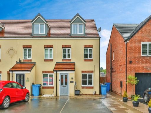 3 bedroom semi-detached house for sale in Slater Way, Ilkeston, DE7 — £240,000 • 3 bed • 2 bath • 938 ft²
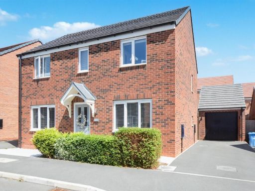 4 bedroom detached house for sale in Elka Road, Ilkeston, DE7 — £325,000 • 4 bed • 2 bath • 1237 ft²
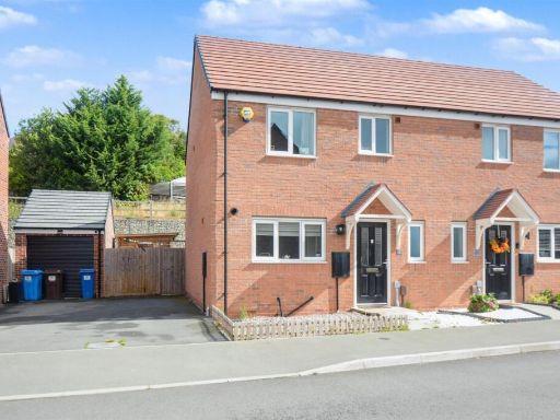 3 bedroom semi-detached house for sale in Slater Way, Ilkeston, Derbyshire, DE7 — £259,995 • 3 bed • 2 bath • 861 ft²
 3 bedroom end of terrace house for sale in Slater Way, Ilkeston, DE7 — £240,000 • 3 bed • 1 bath • 1260 ft²
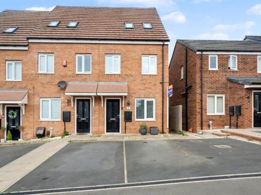 3 bedroom town house for sale in Slater Way, Ilkeston, DE7 — £239,995 • 3 bed • 1 bath • 851 ft²
Meta
- {
"@context": "https://schema.org",
"@type": "Residence",
"name": "4 bedroom semidetached house for sale in Slater Way, Ilkest…",
"description": "",
"url": "https://propertypiper.co.uk/property/d6d8af77-be1a-42ff-9573-a16ec250193c",
"image": "https://image-a.propertypiper.co.uk/3f0d56f6-23b7-46b2-894c-89de821b1daf-1024.jpeg",
"address": {
"@type": "PostalAddress",
"streetAddress": "94, SLATER WAY",
"postalCode": "DE7 4SN",
"addressLocality": "Erewash",
"addressRegion": "Erewash",
"addressCountry": "England"
},
"geo": {
"@type": "GeoCoordinates",
"latitude": 52.9590248386771,
"longitude": -1.310644130191522
},
"numberOfRooms": 4,
"numberOfBathroomsTotal": 3,
"floorSize": {
"@type": "QuantitativeValue",
"value": 1313,
"unitCode": "FTK"
},
"offers": {
"@type": "Offer",
"price": 320000,
"priceCurrency": "GBP",
"availability": "https://schema.org/InStock"
},
"additionalProperty": [
{
"@type": "PropertyValue",
"name": "Feature",
"value": "modern"
},
{
"@type": "PropertyValue",
"name": "Feature",
"value": "townhouse"
},
{
"@type": "PropertyValue",
"name": "Feature",
"value": "brick exterior"
},
{
"@type": "PropertyValue",
"name": "Feature",
"value": "driveway"
},
{
"@type": "PropertyValue",
"name": "Feature",
"value": "three-story"
},
{
"@type": "PropertyValue",
"name": "Feature",
"value": "recent construction"
},
{
"@type": "PropertyValue",
"name": "Feature",
"value": "low maintenance"
},
{
"@type": "PropertyValue",
"name": "Feature",
"value": "modern kitchen"
},
{
"@type": "PropertyValue",
"name": "Feature",
"value": "white cabinetry"
},
{
"@type": "PropertyValue",
"name": "Feature",
"value": "built-in appliances"
},
{
"@type": "PropertyValue",
"name": "Feature",
"value": "chevron flooring"
},
{
"@type": "PropertyValue",
"name": "Feature",
"value": "LED lighting"
},
{
"@type": "PropertyValue",
"name": "Feature",
"value": "bright"
},
{
"@type": "PropertyValue",
"name": "Feature",
"value": "sleek"
},
{
"@type": "PropertyValue",
"name": "Feature",
"value": "contemporary"
}
]
}
High Res Floorplan Images
Compatible Floorplan Images
FloorplanImages Thumbnail