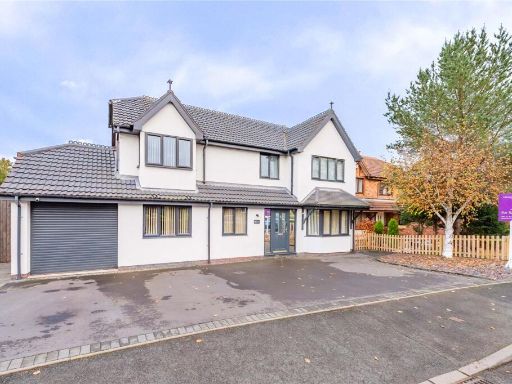
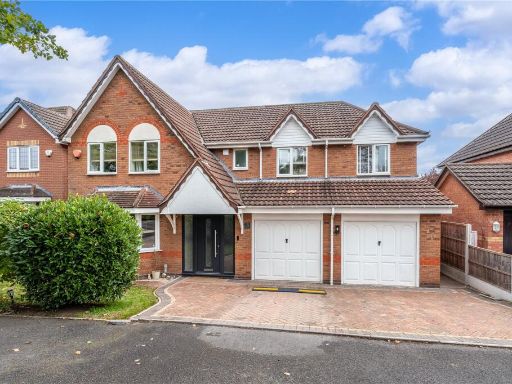
TF2 9GU - 4 bedroom detached house for sale in Finsbury Drive, Priors…
View on Property Piper
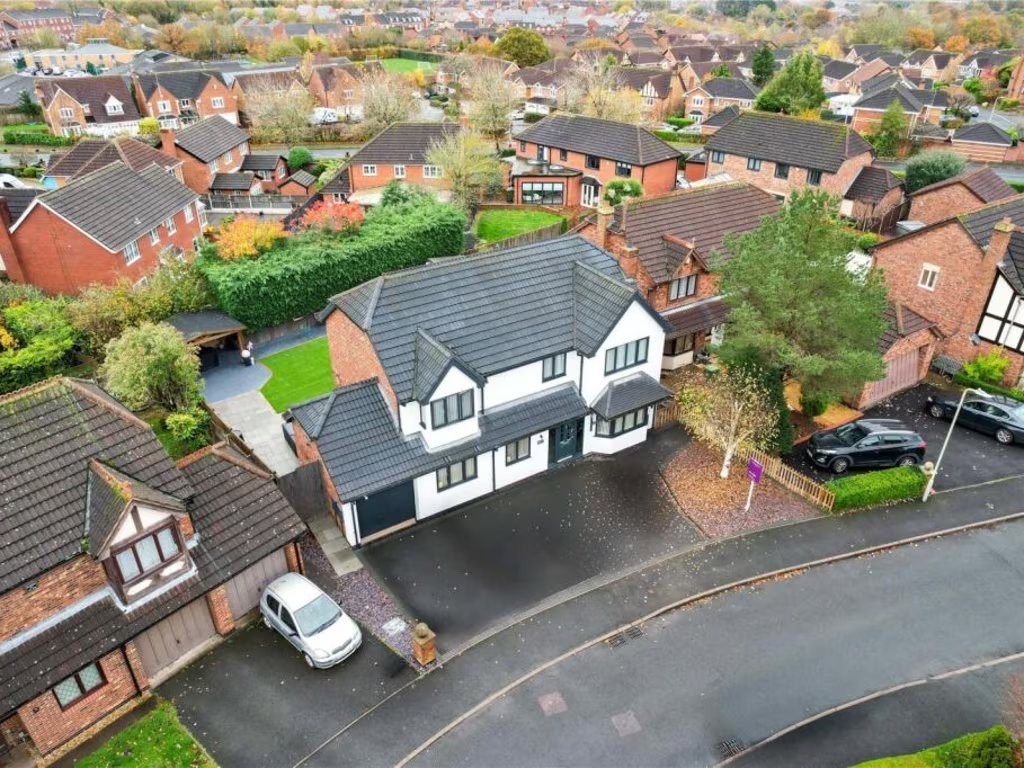
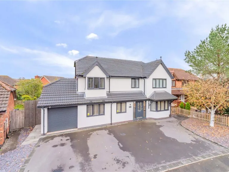
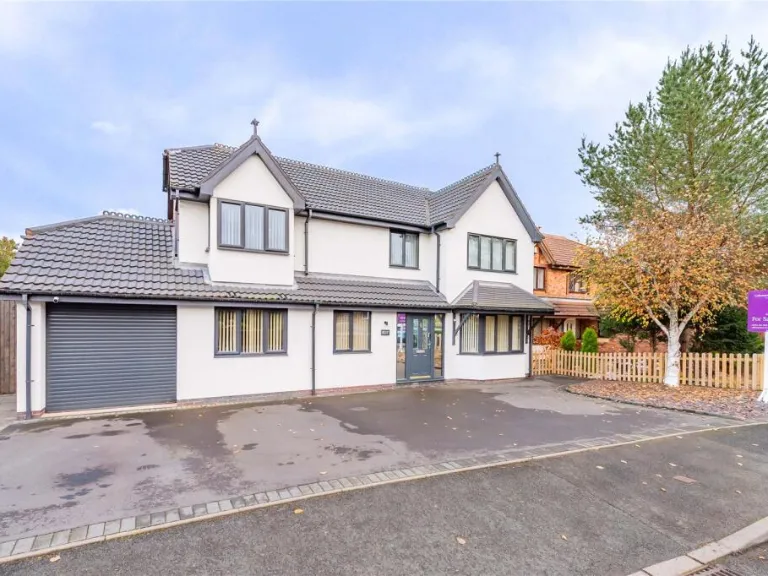
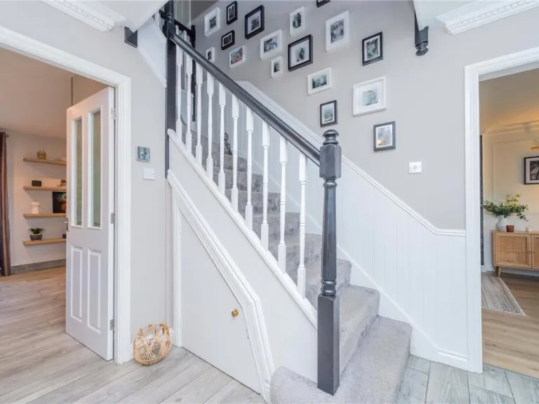
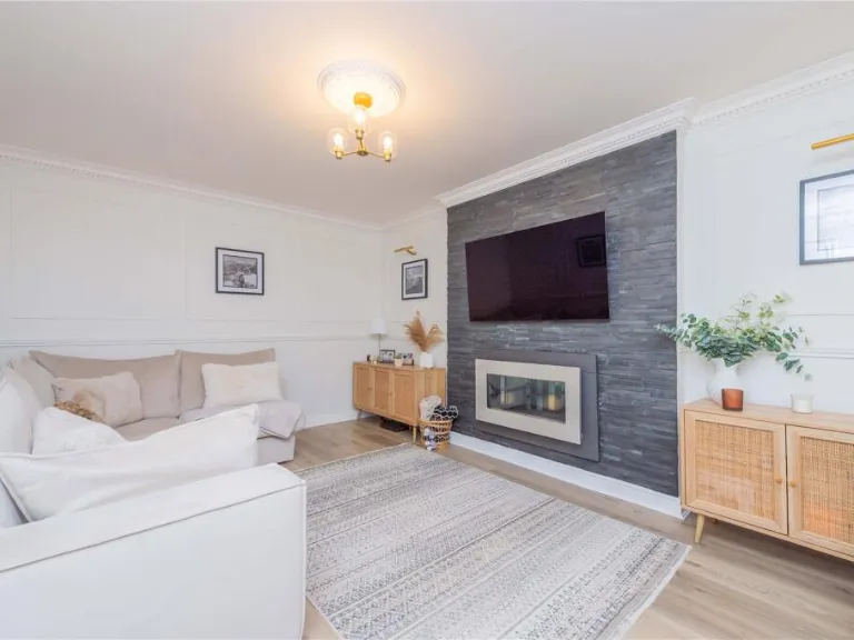
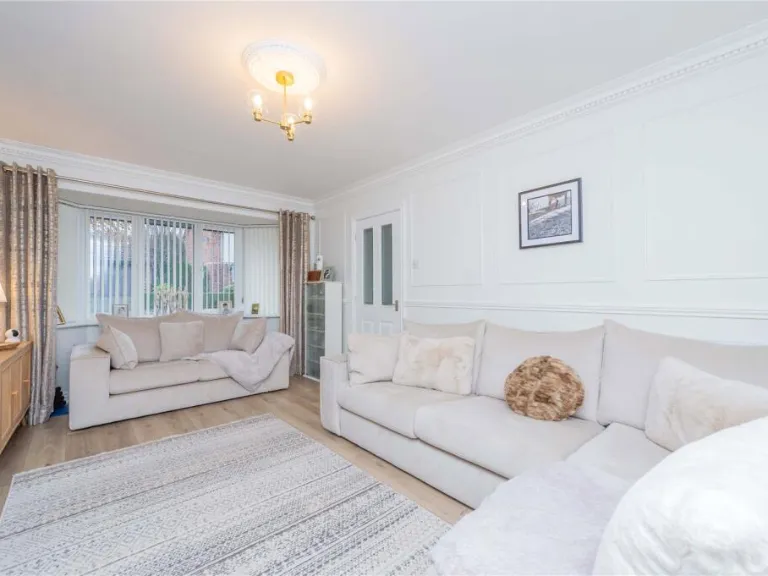
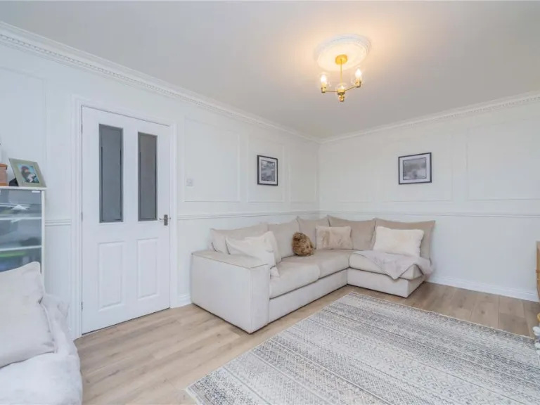
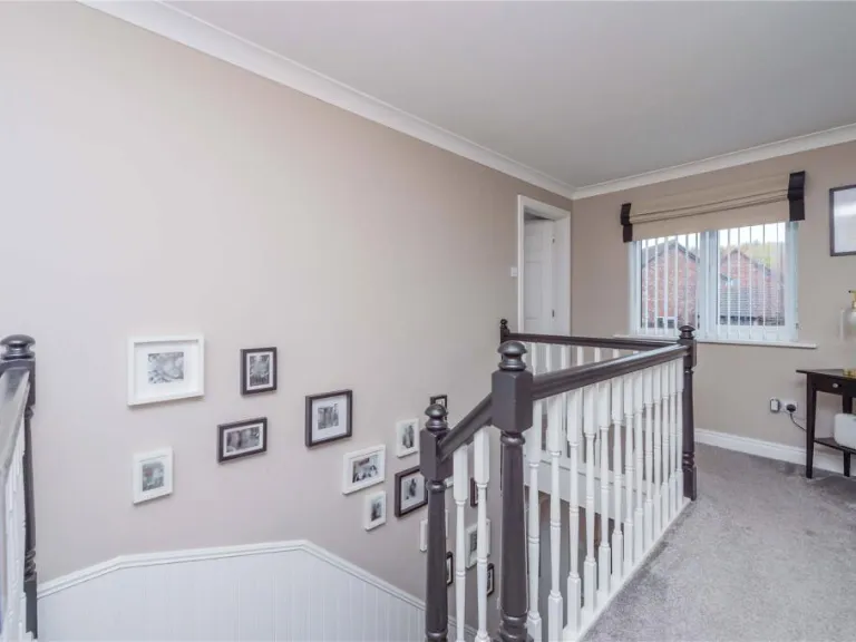
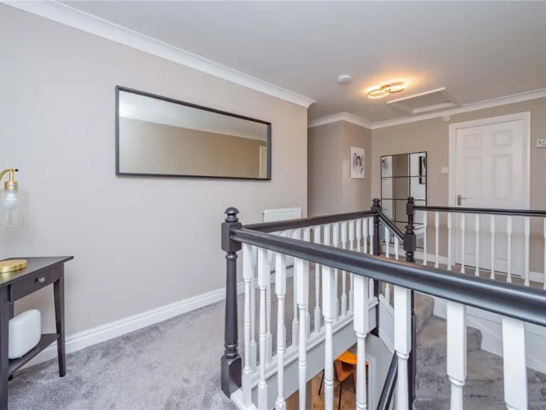
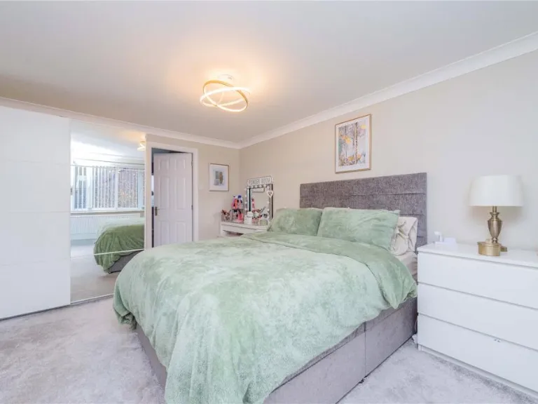
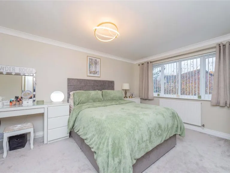
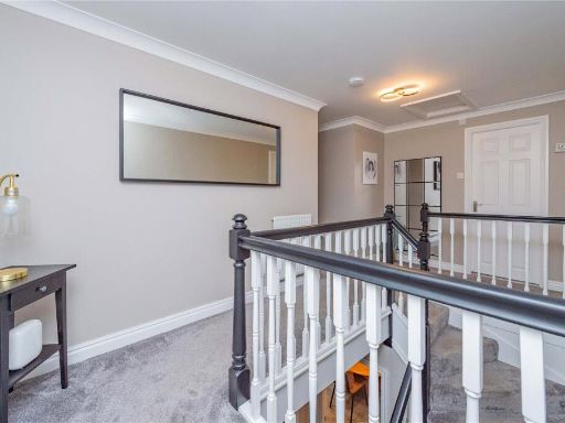
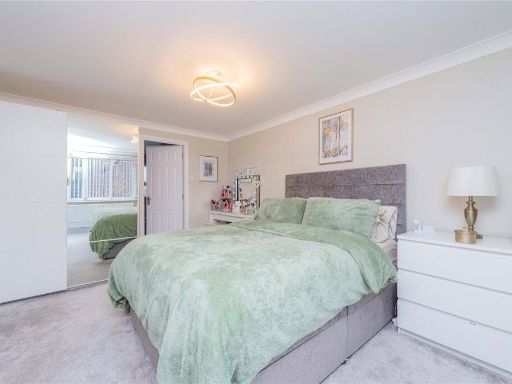
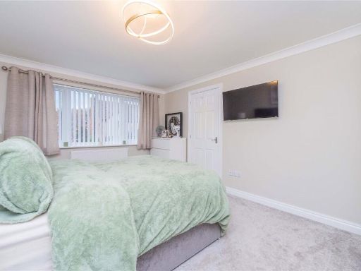
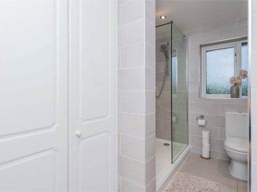
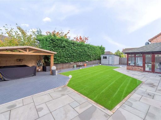
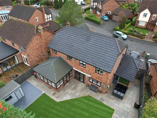
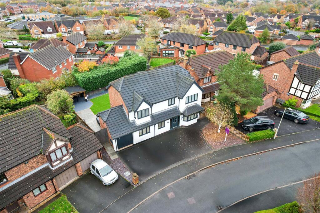
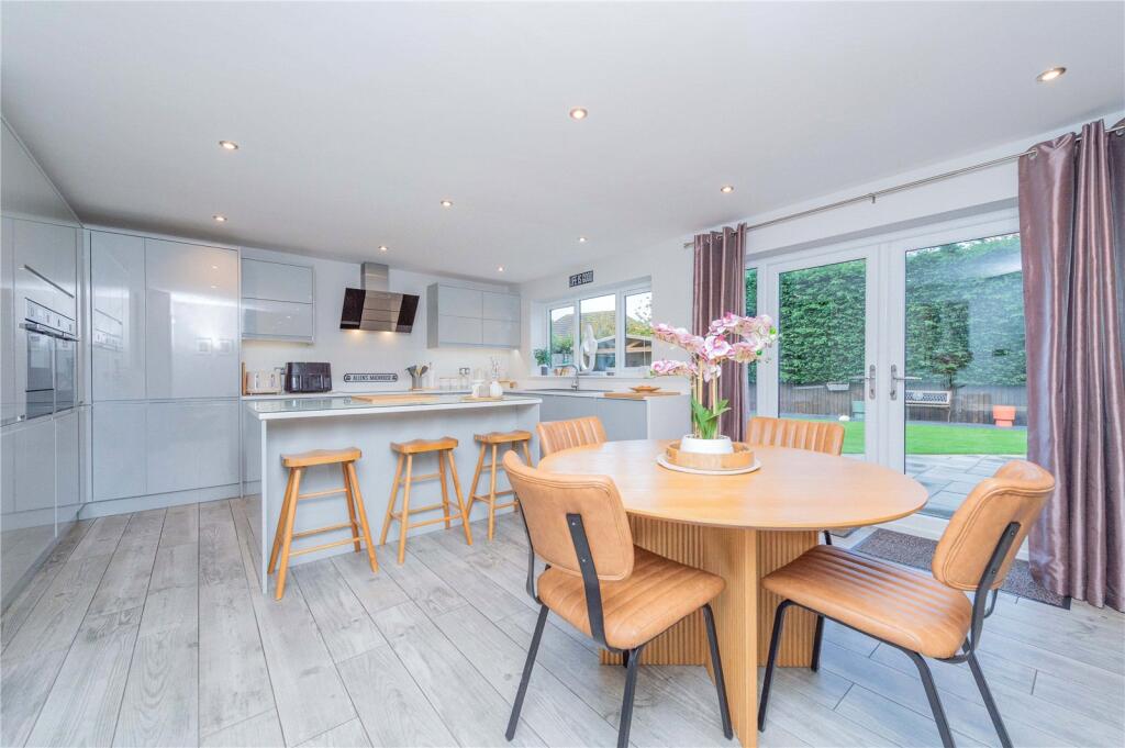
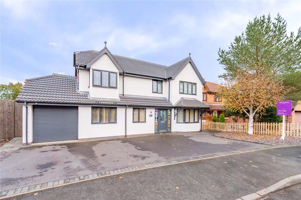
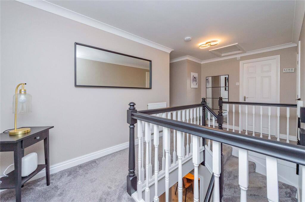
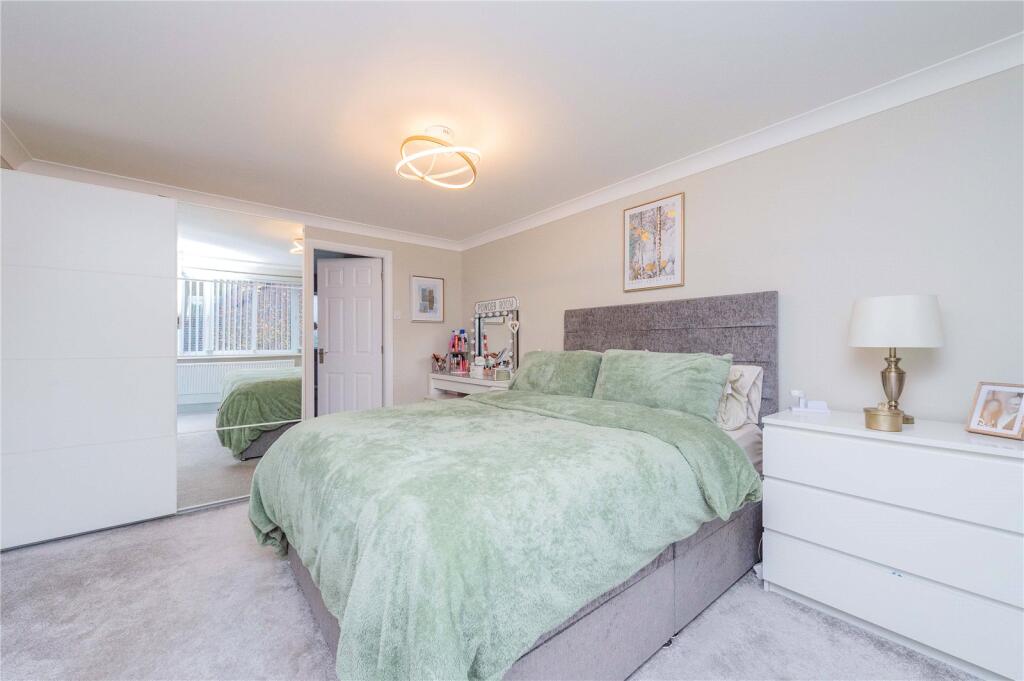
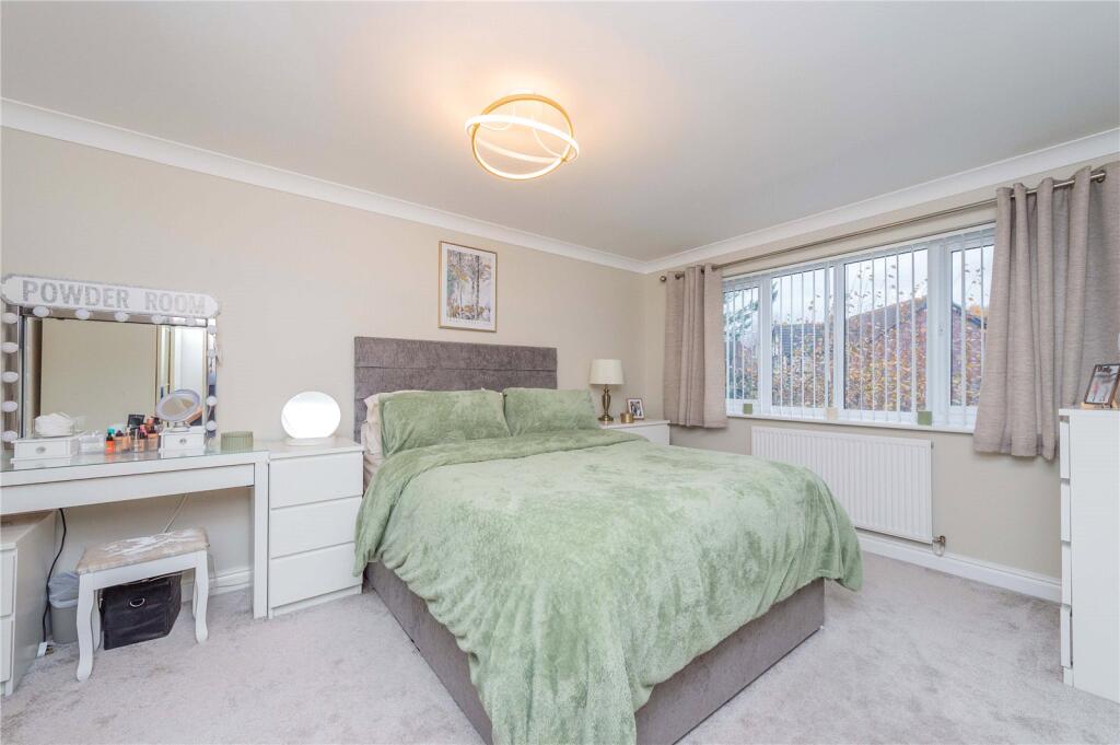
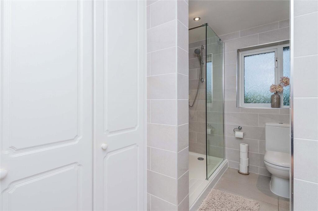
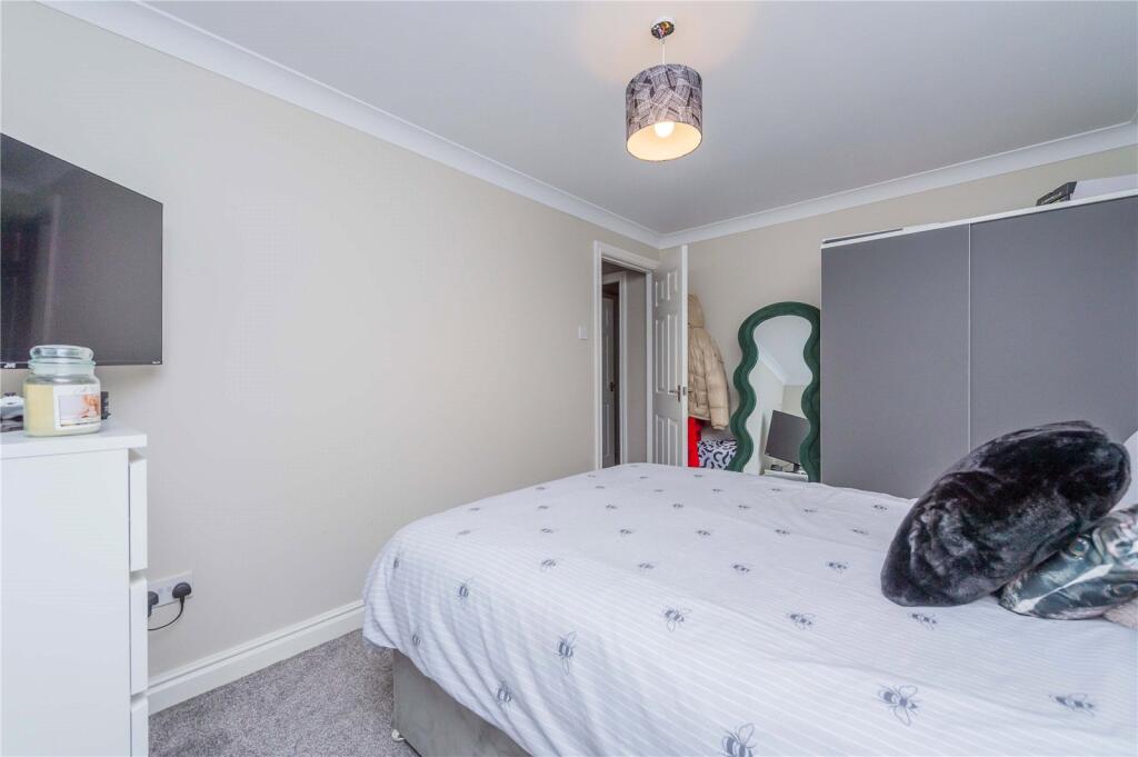
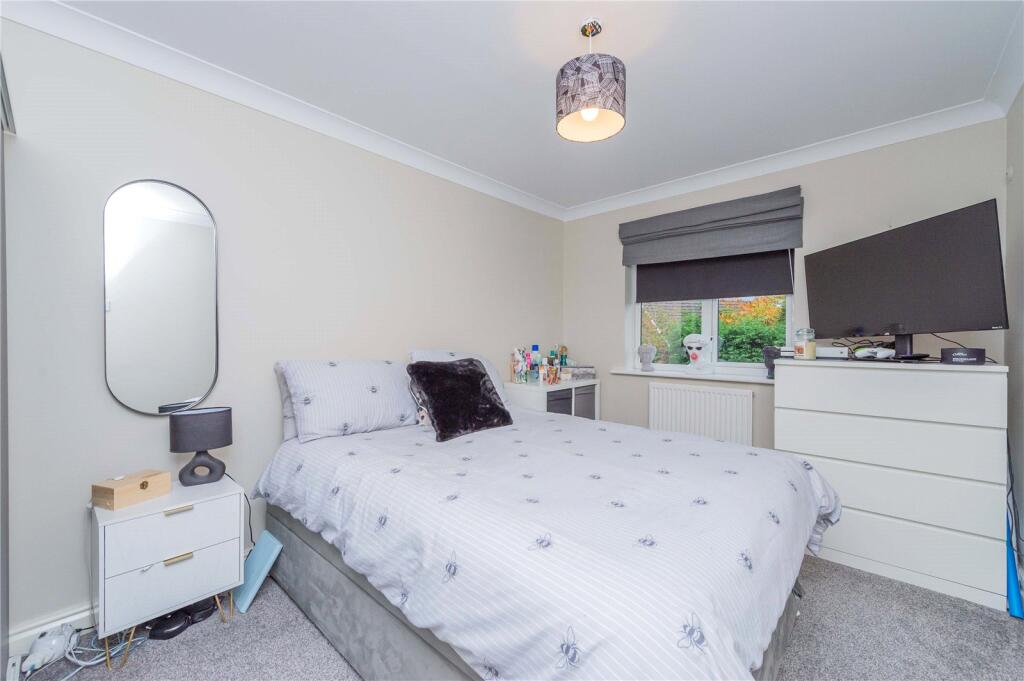
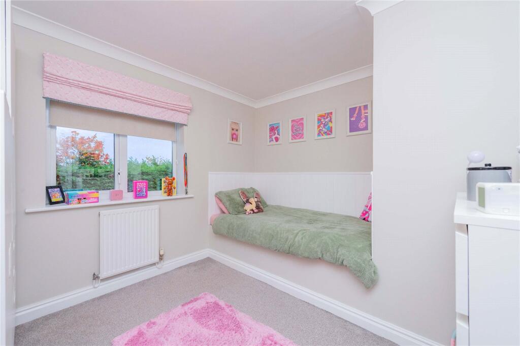
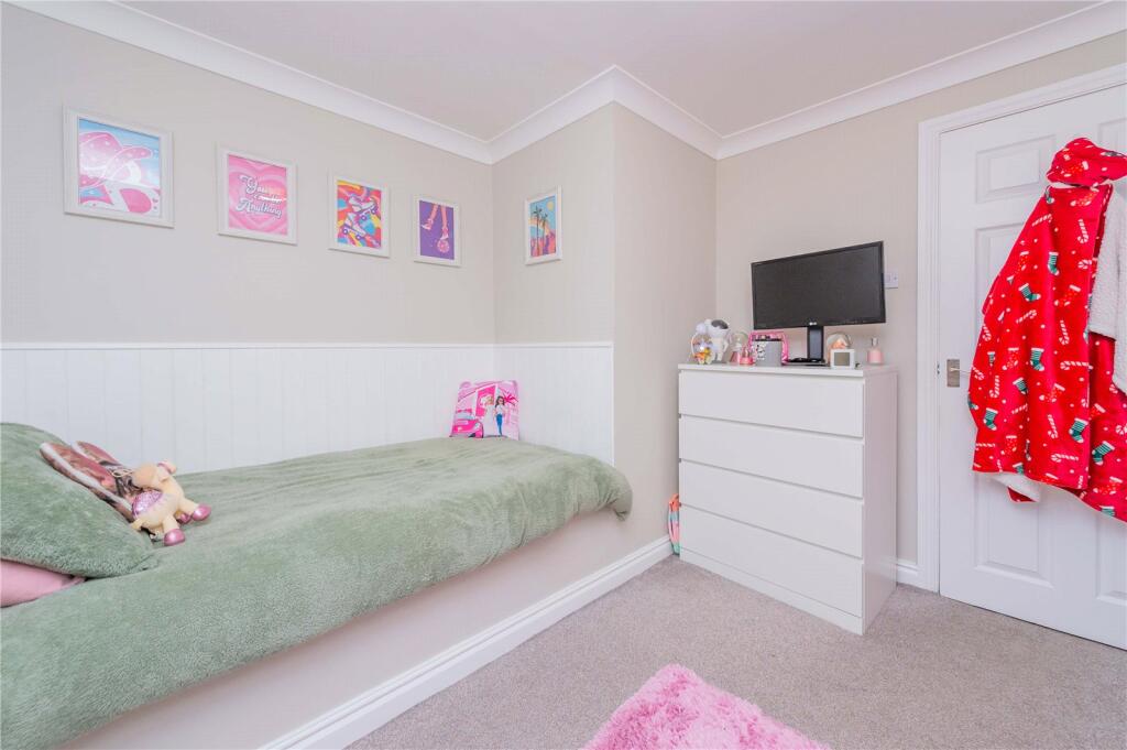
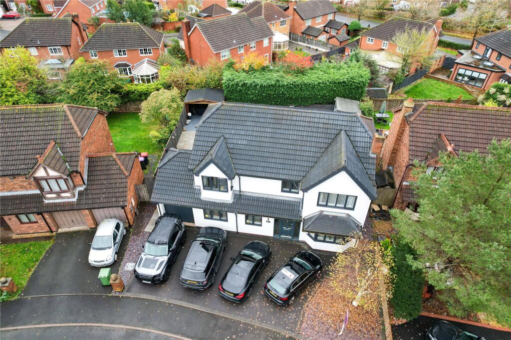
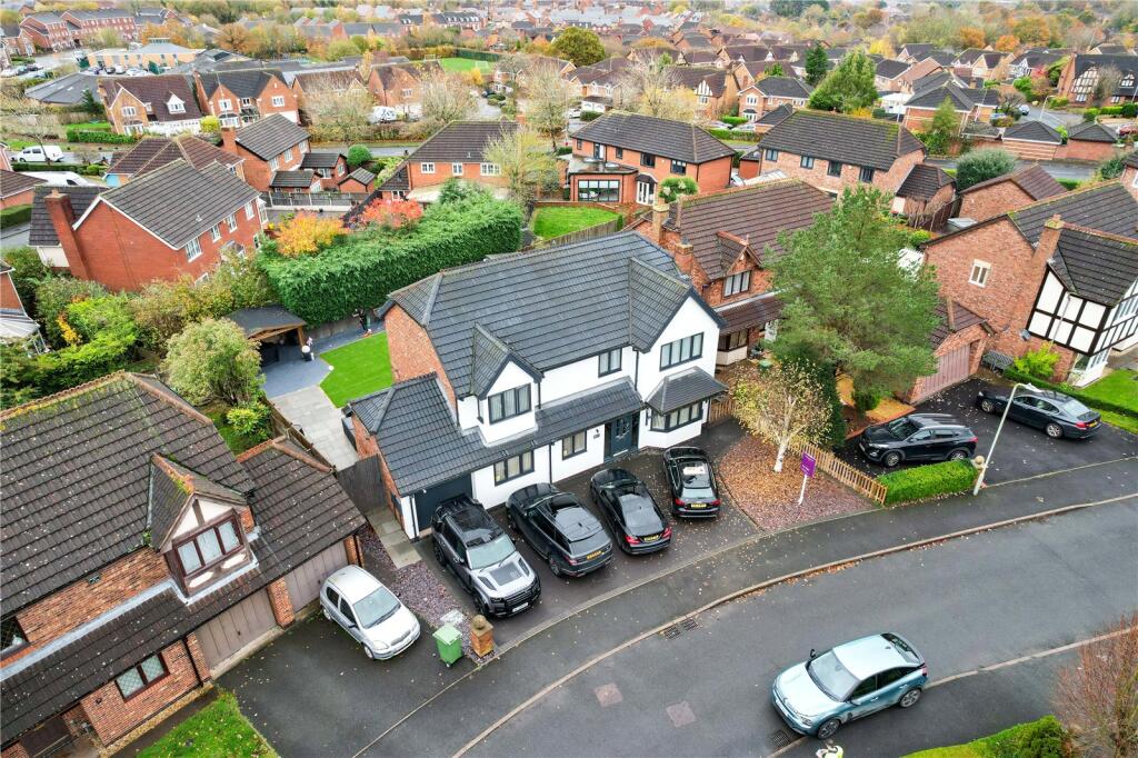
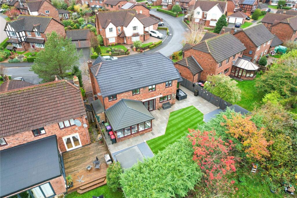
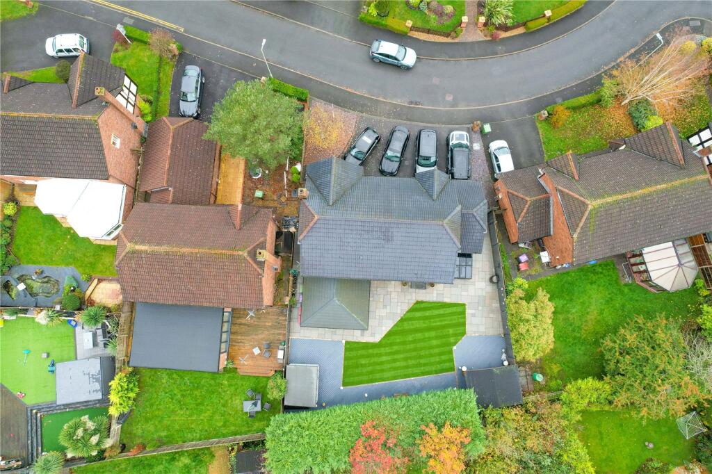
4 bedroom detached house for sale in Finsbury Drive, Priorslee, Telford, Shropshire, TF2
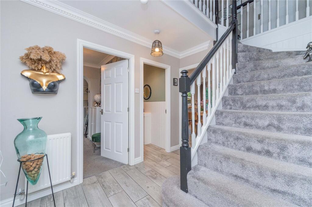
Property Details
- Price: £575000
- Bedrooms: 4
- Bathrooms: 2
- Property Type: undefined
- Property SubType: undefined
Image Descriptions
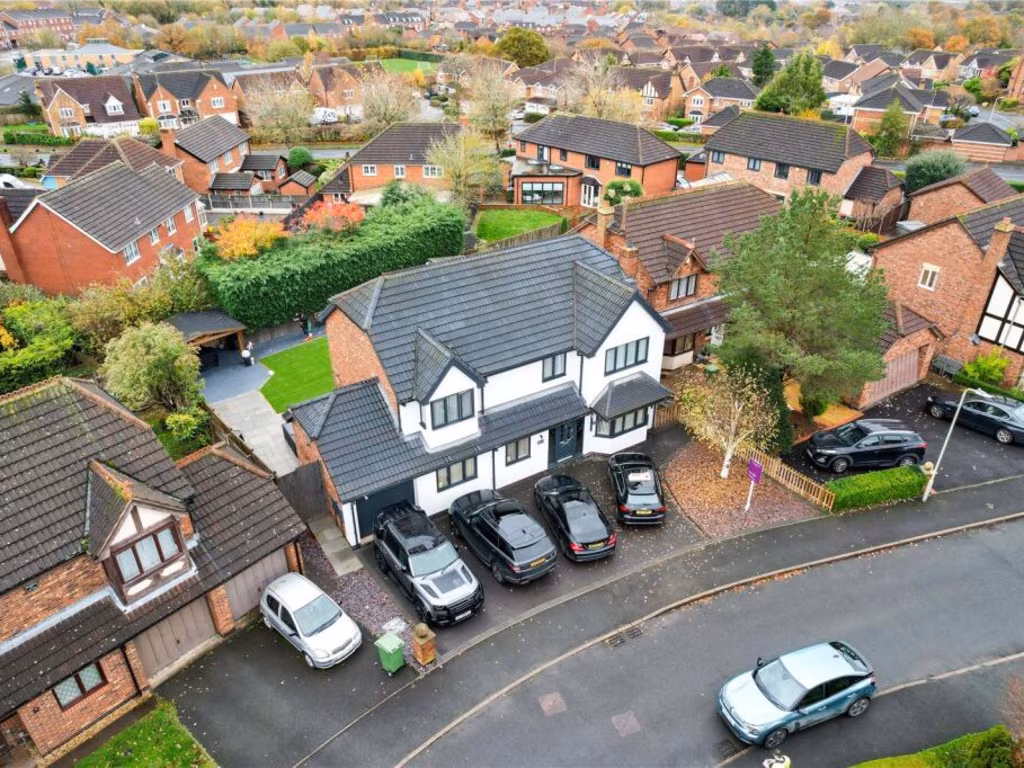
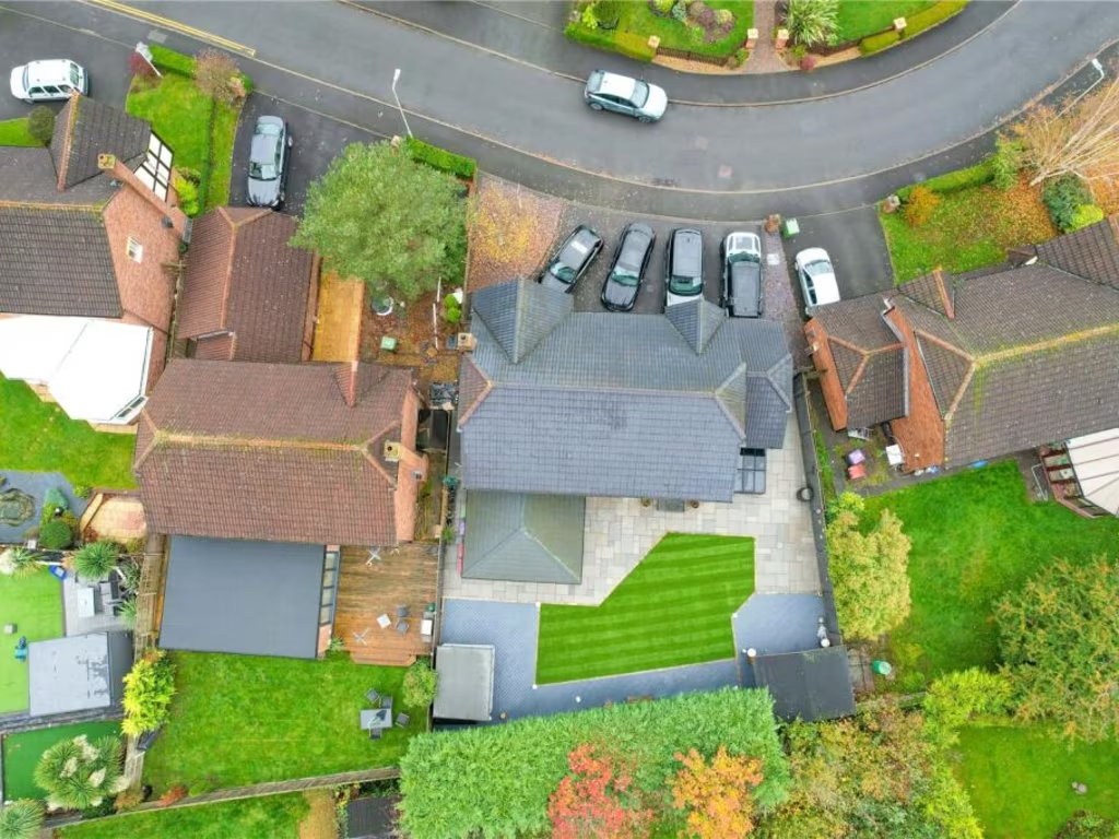
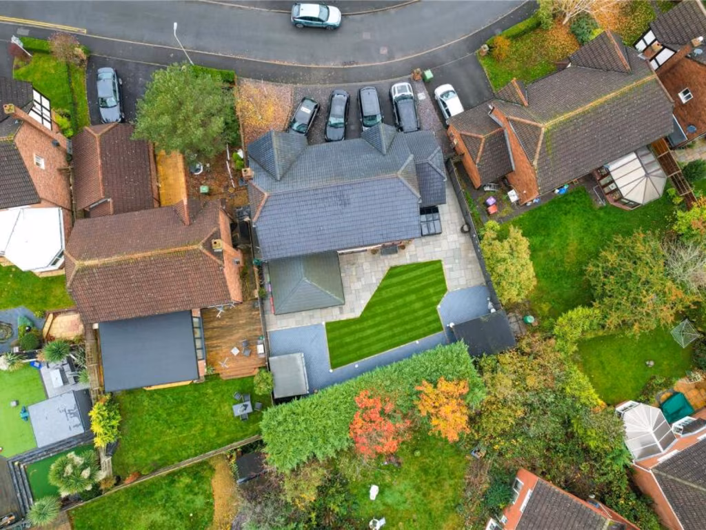
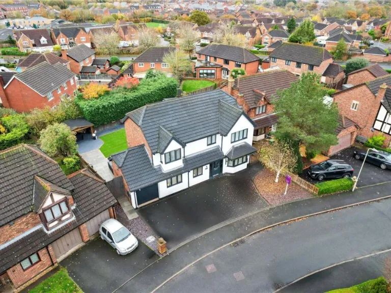
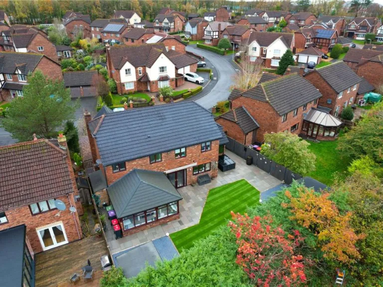
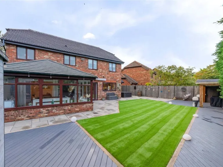
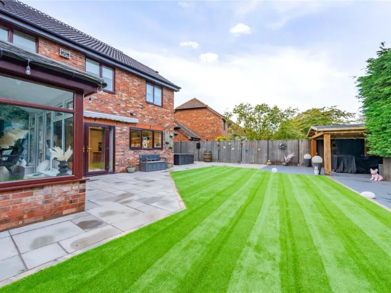
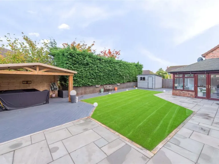
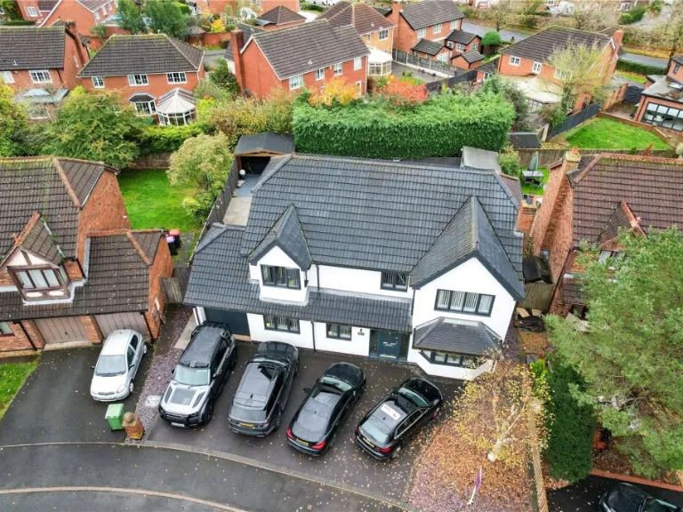
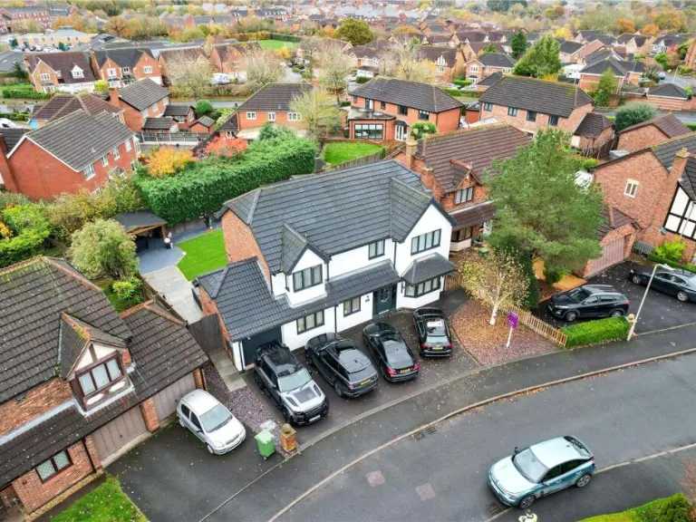
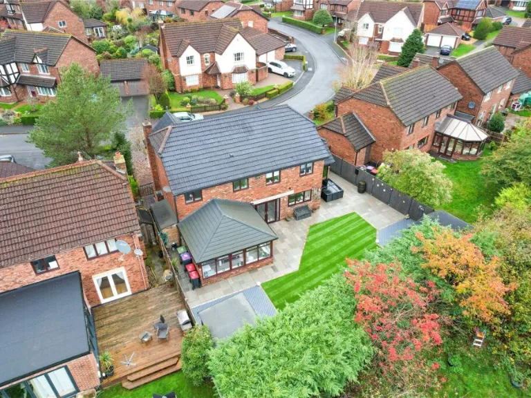
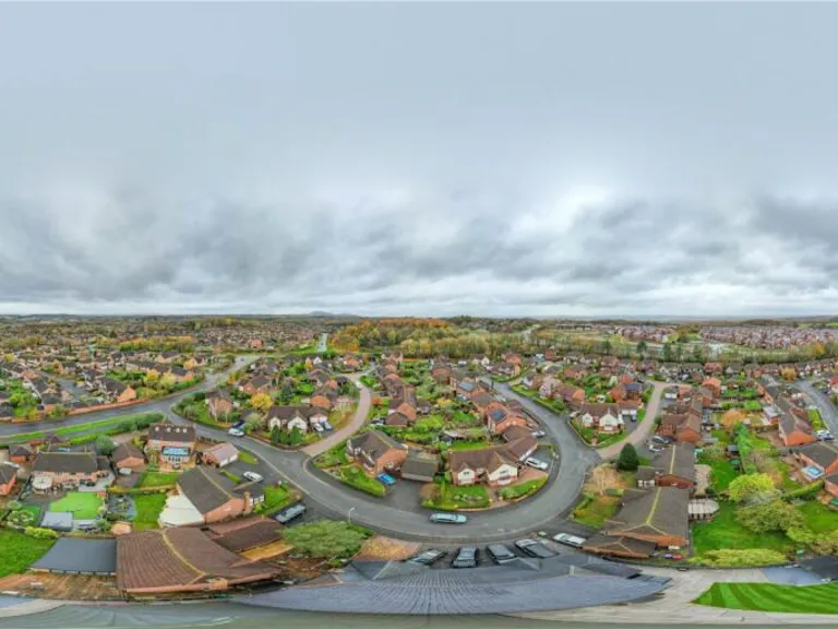
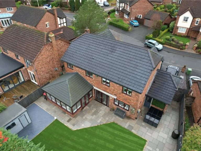
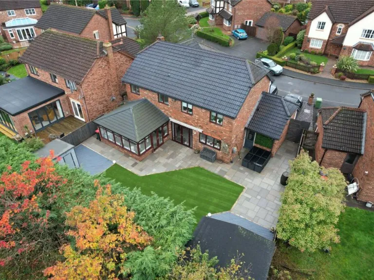
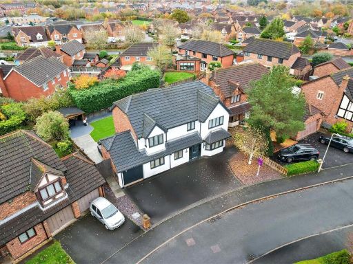
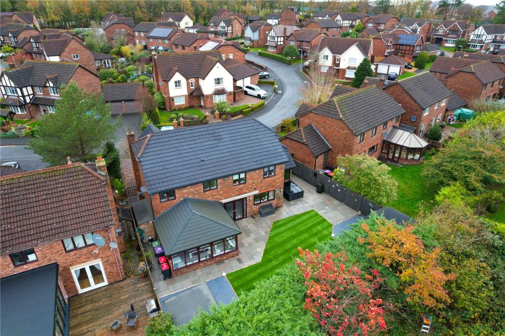
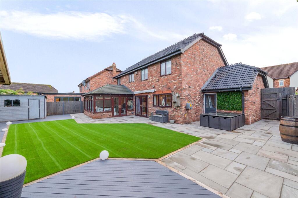
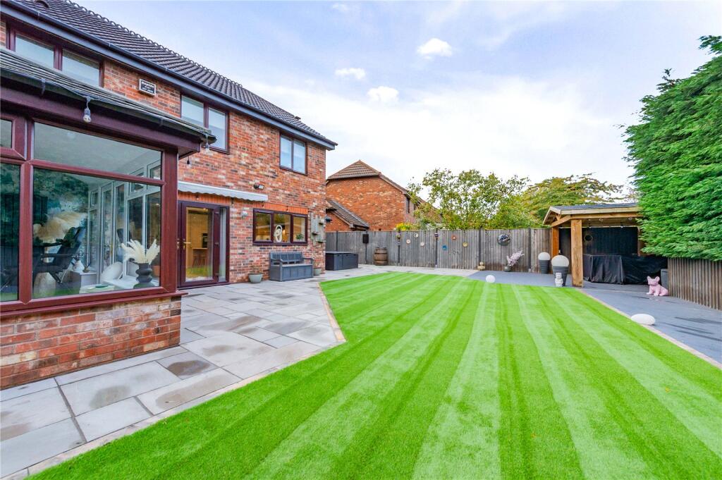
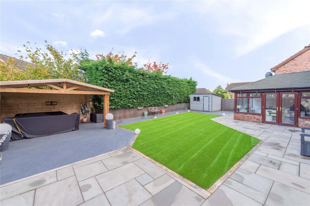
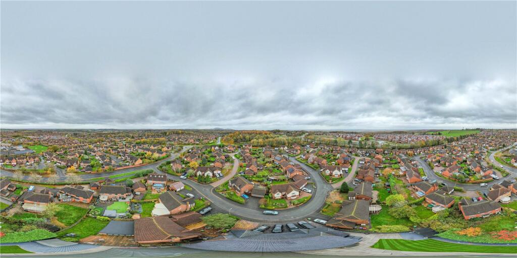
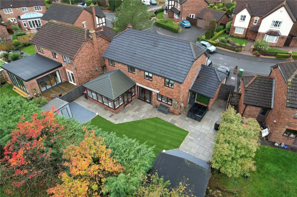
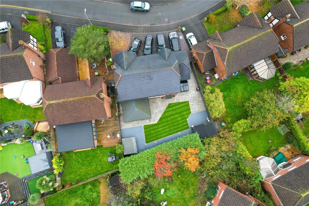
- aerial view of a residential property modern suburban
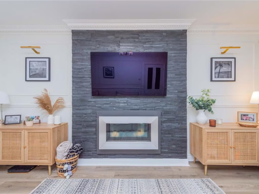
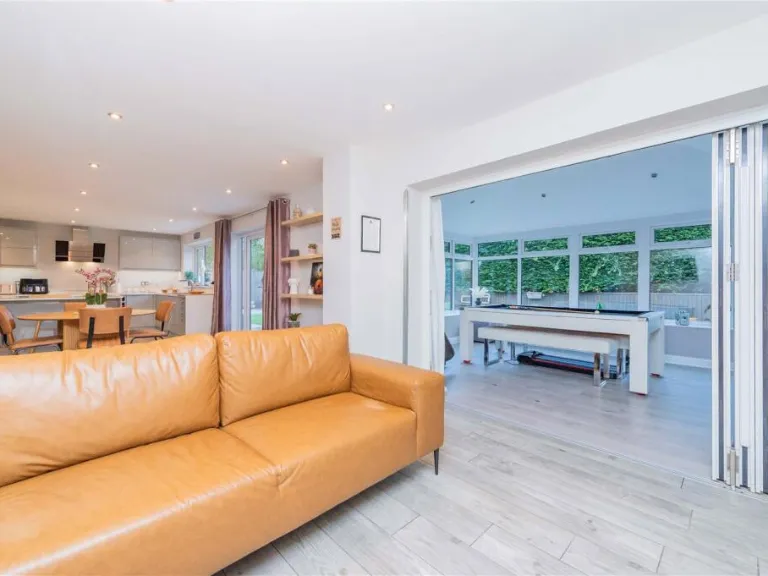
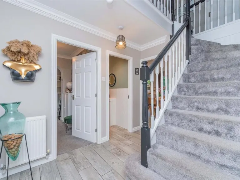
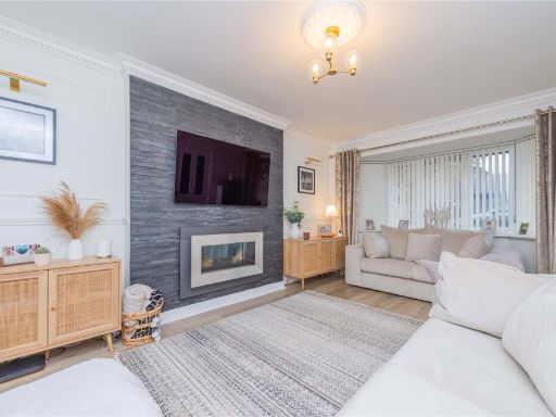
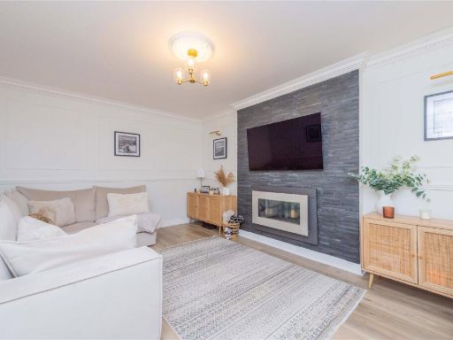
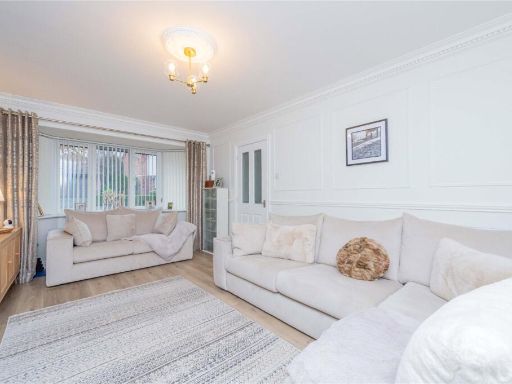
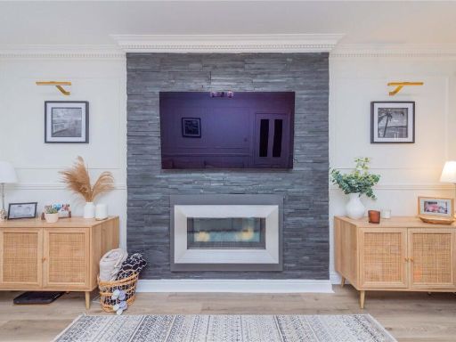
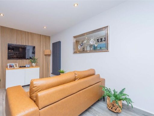
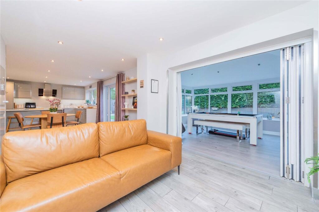
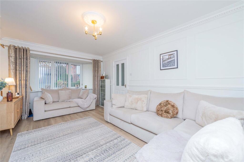
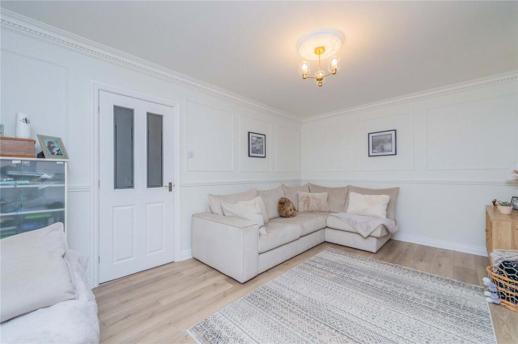
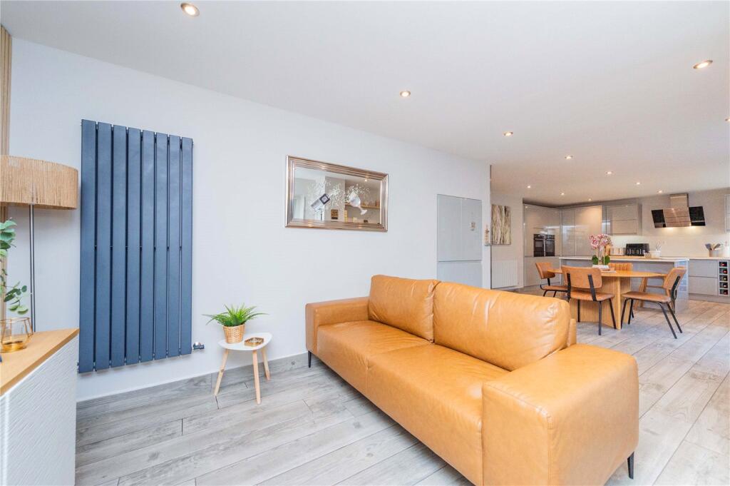
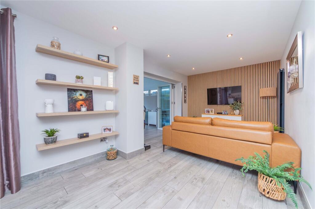
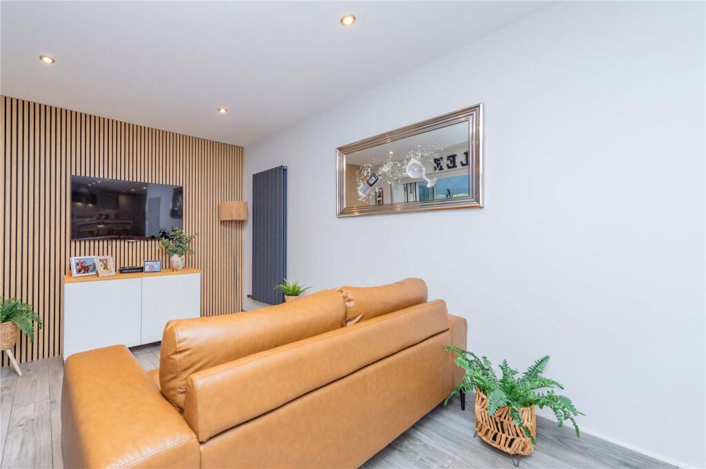
- living room contemporary
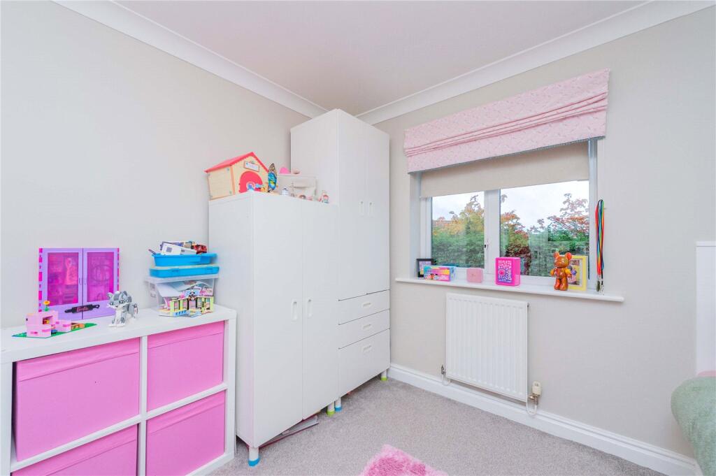
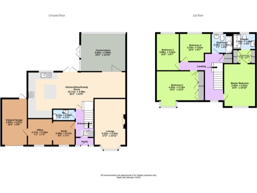
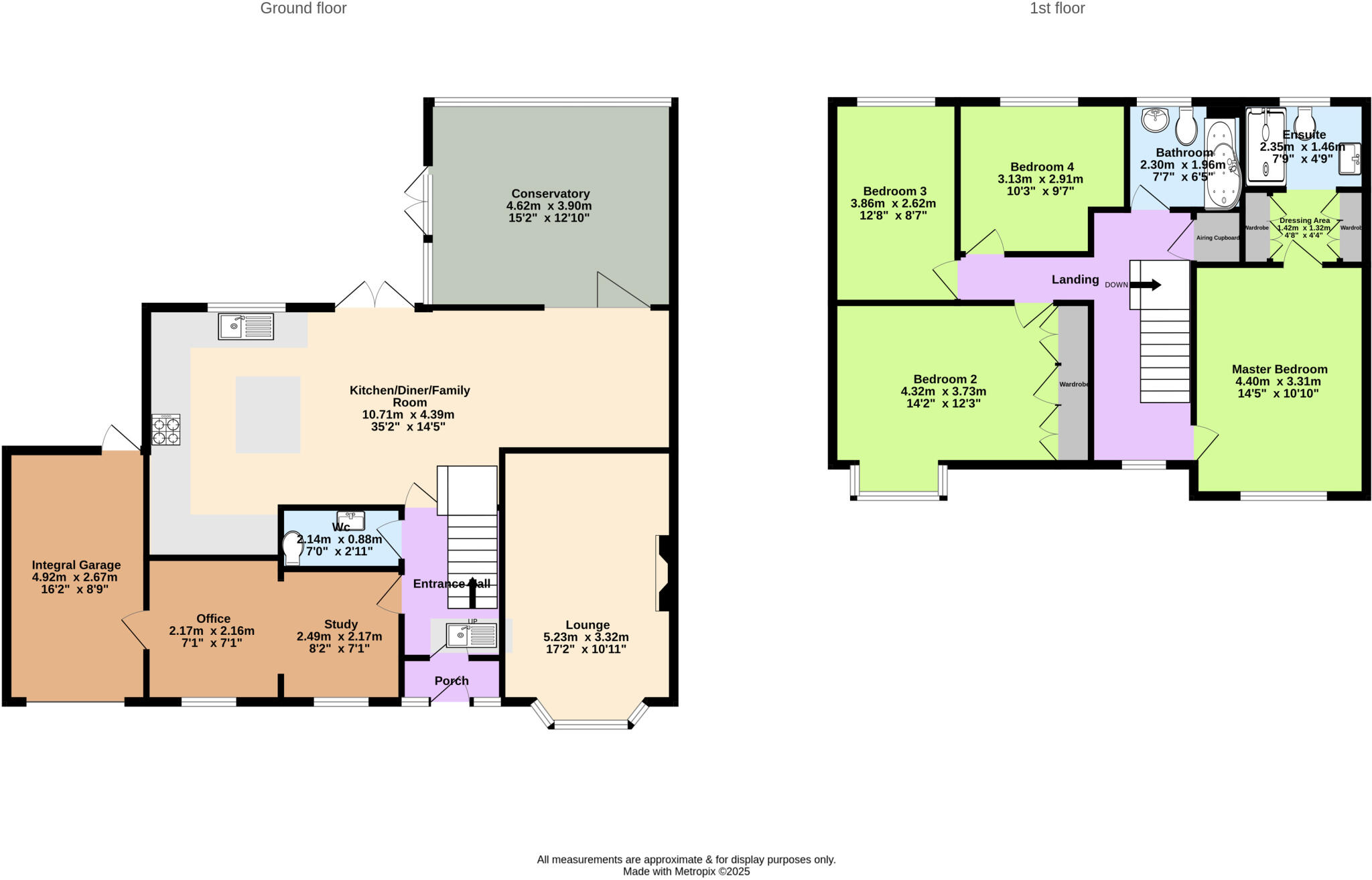
Rooms
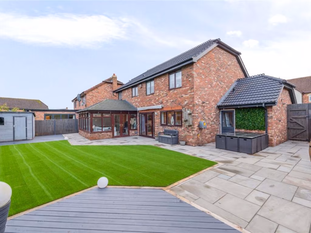
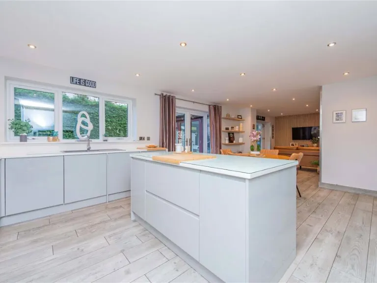
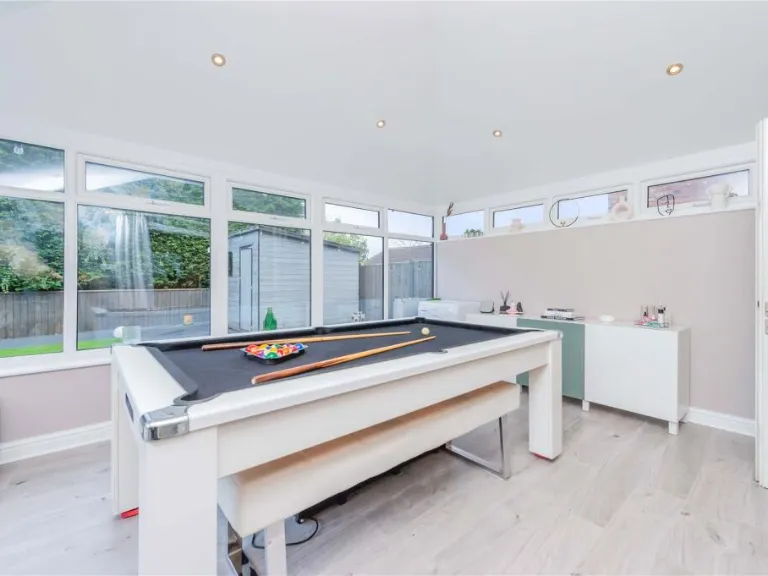
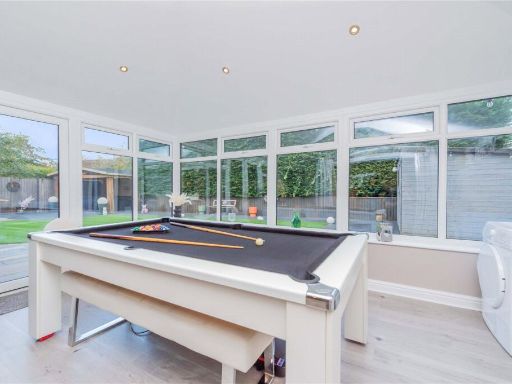
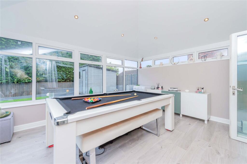
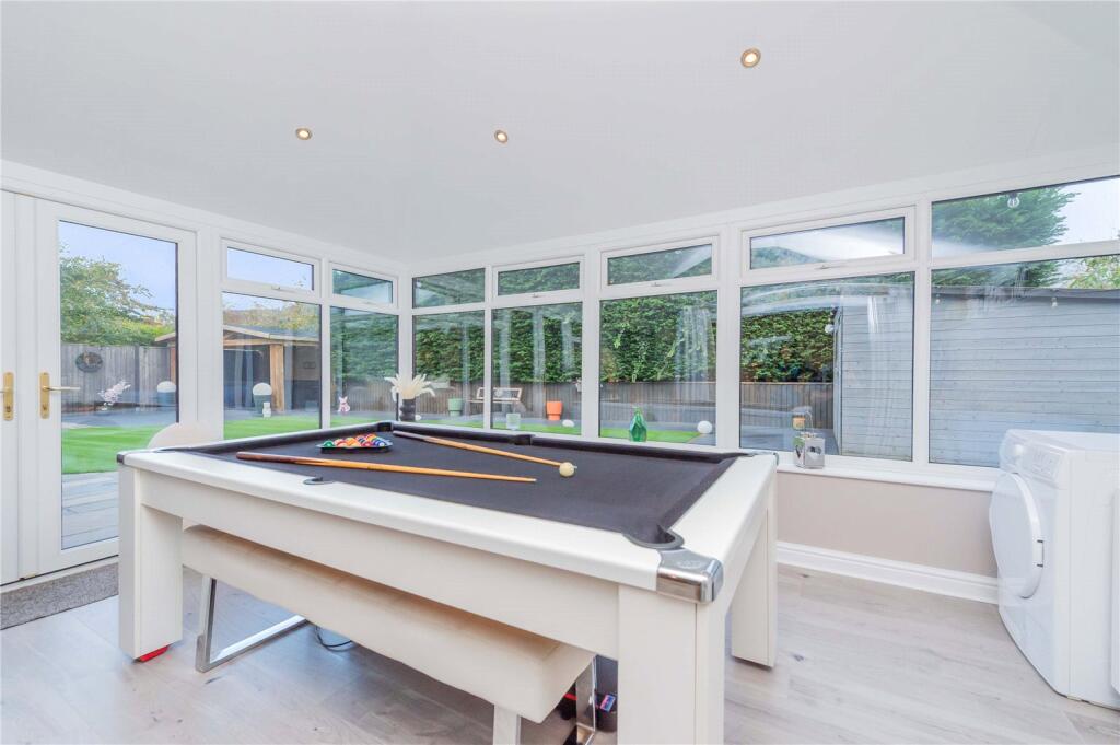
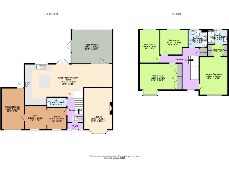
- Conservatory:
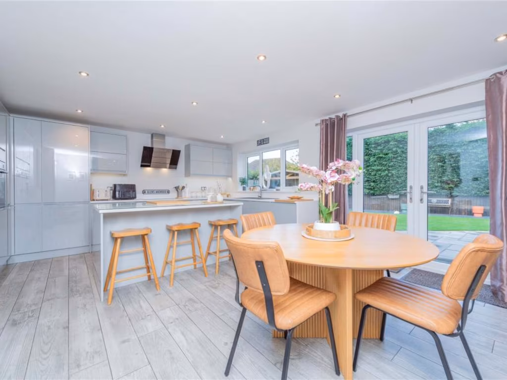
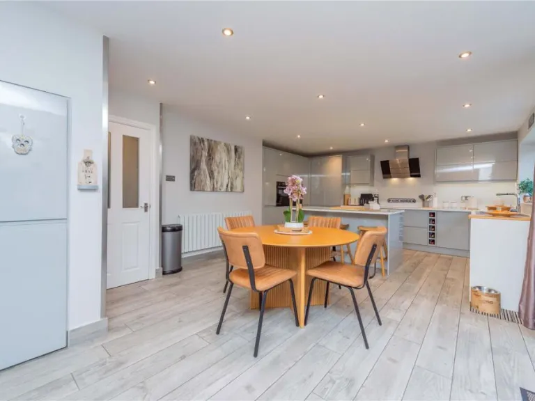
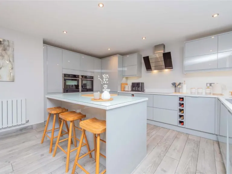
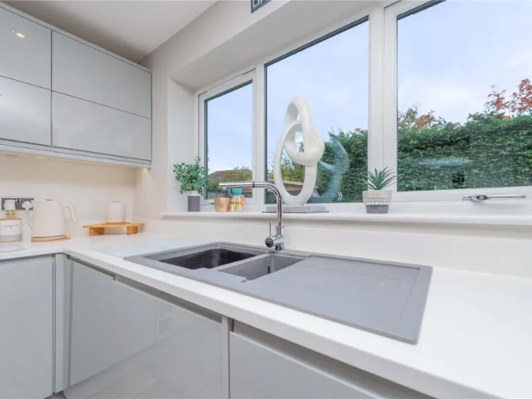
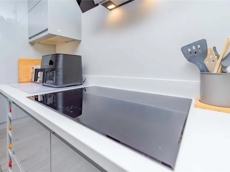
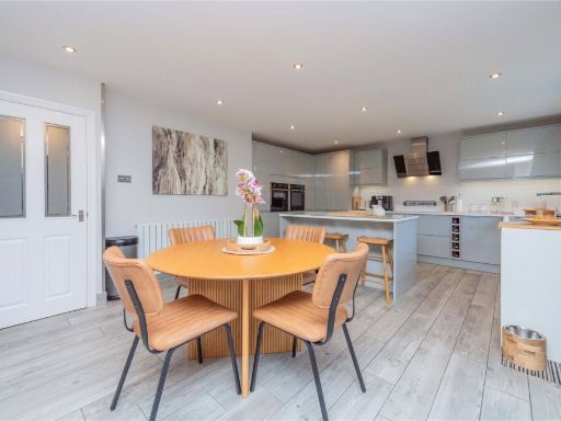
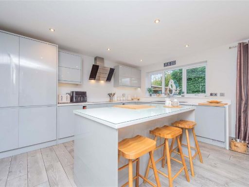
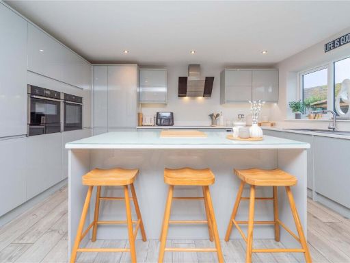
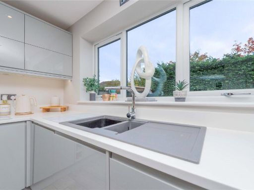
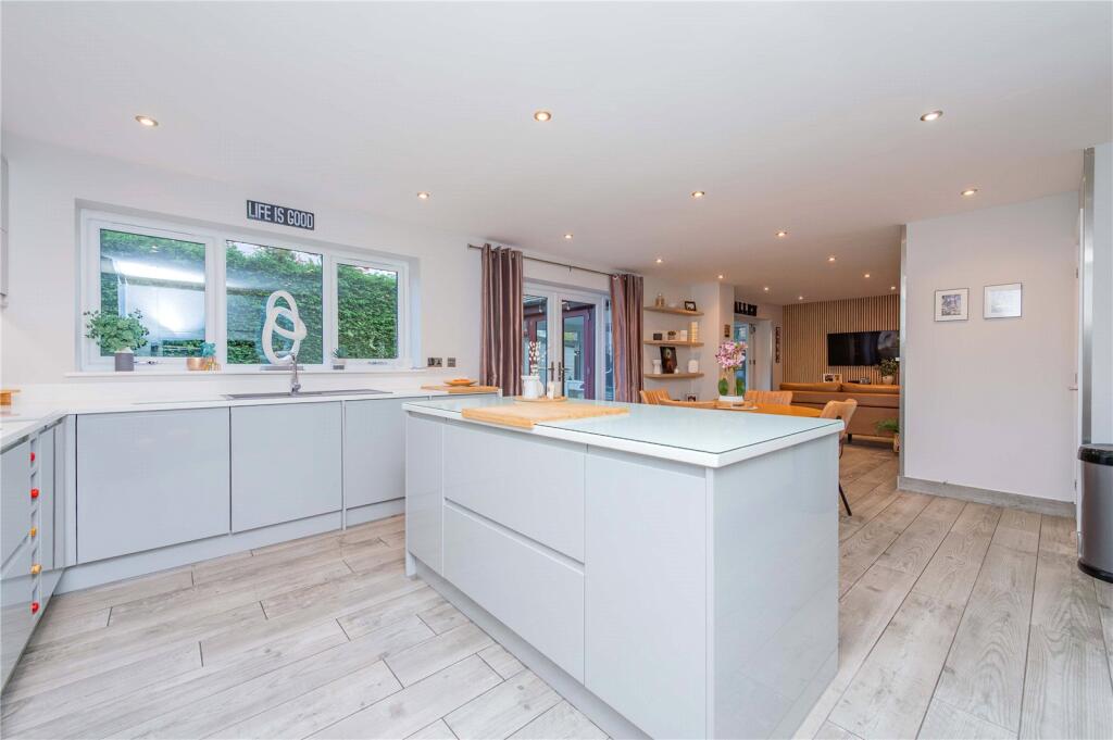
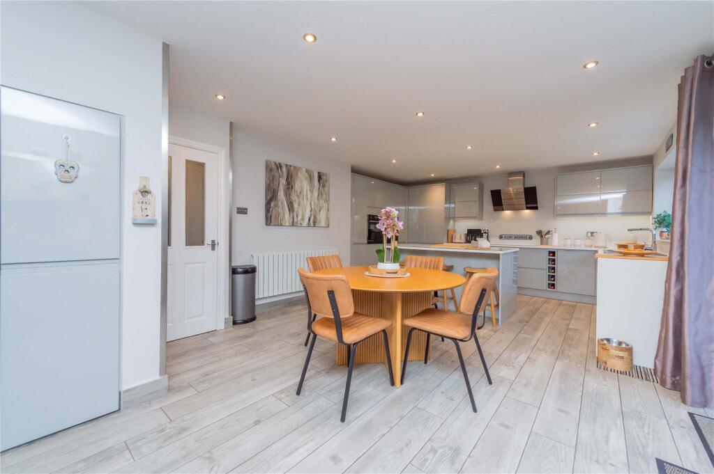
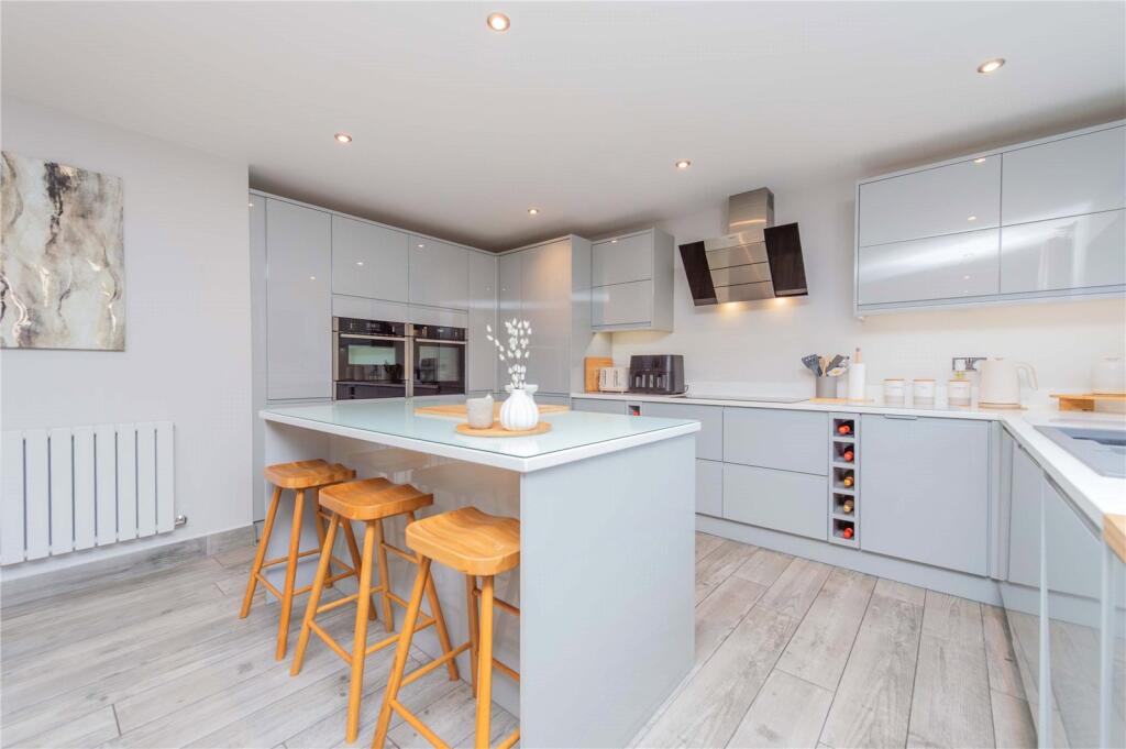
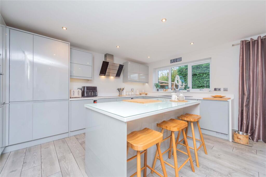
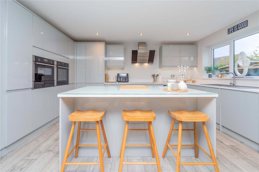
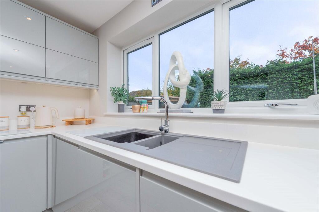
- Kitchen/Diner/Family Room:
- Integral Garage:
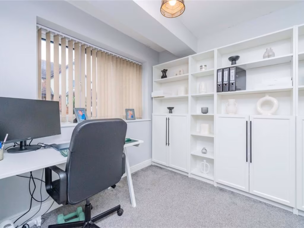
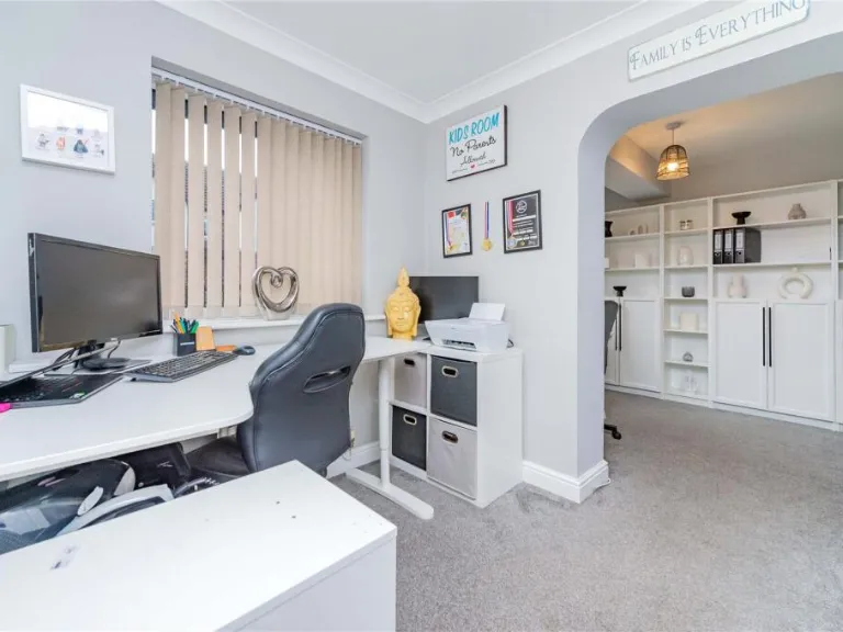
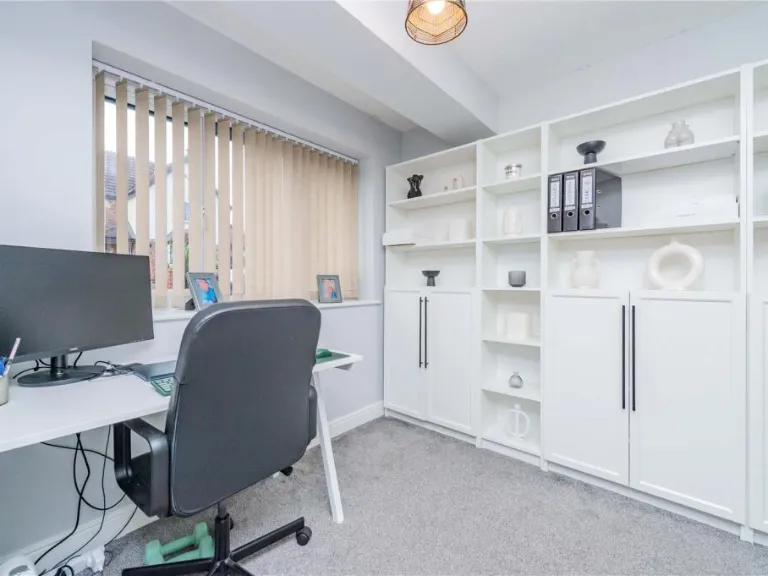
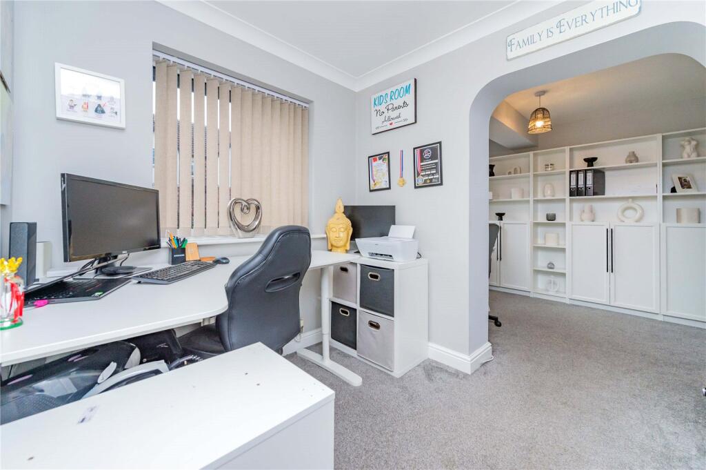
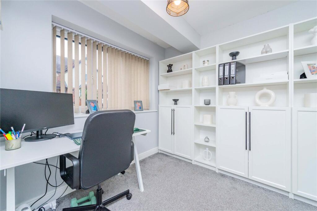
- Office:
- Study:
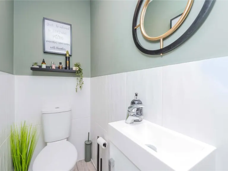
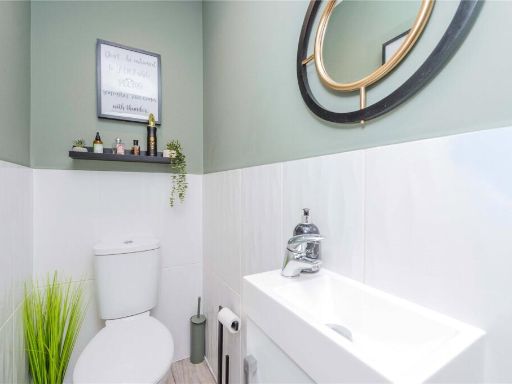
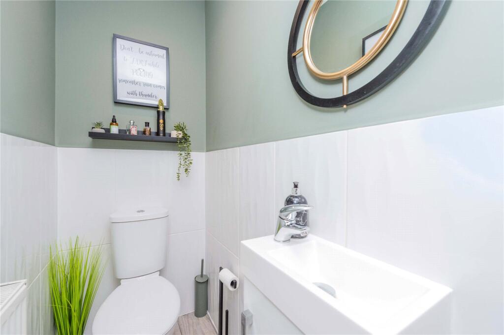
- WC:
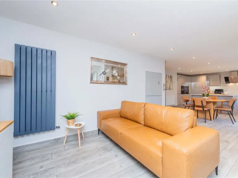
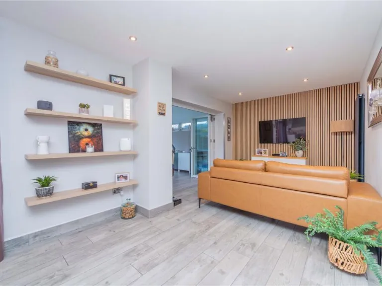
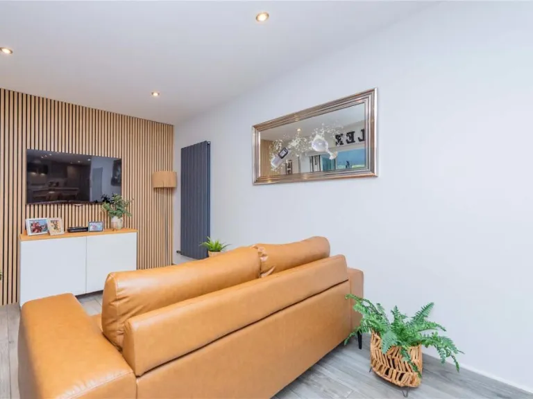
- Lounge:
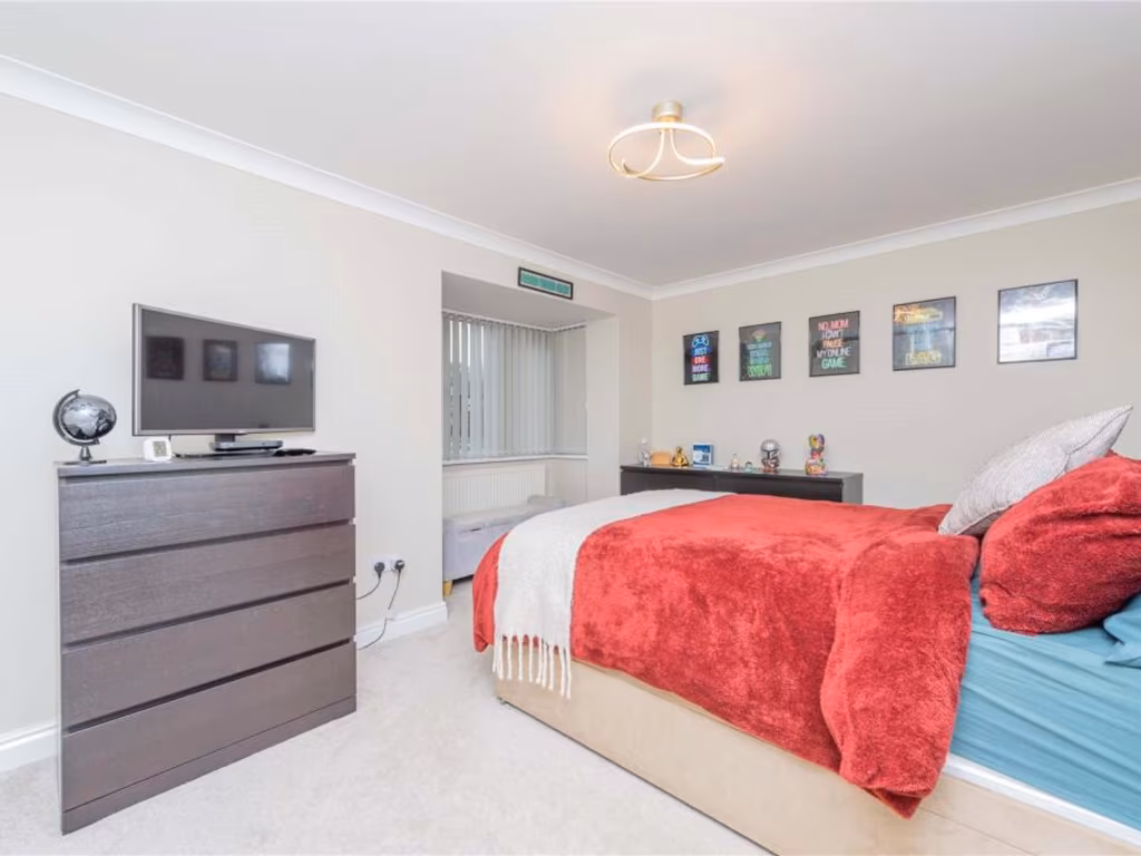
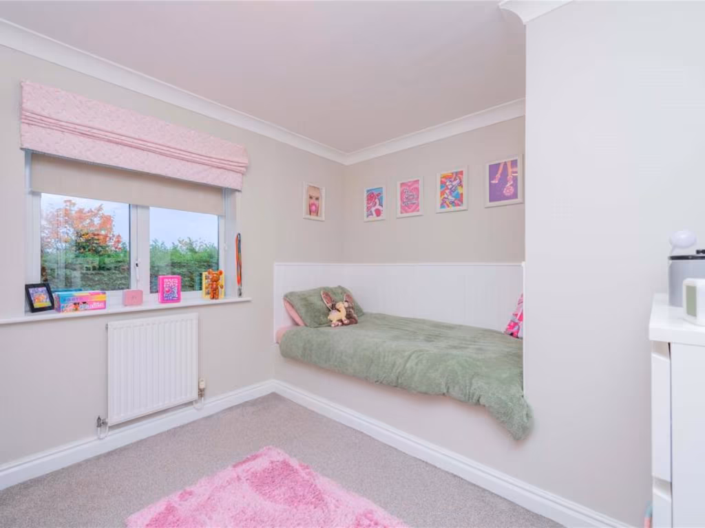
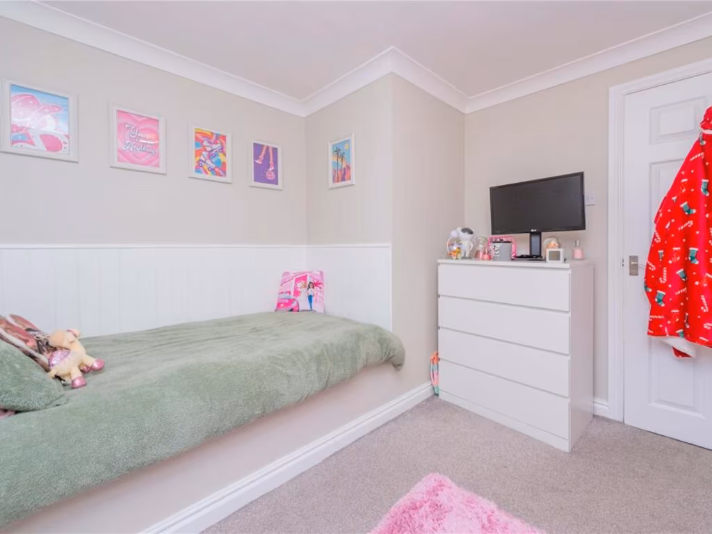
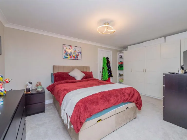
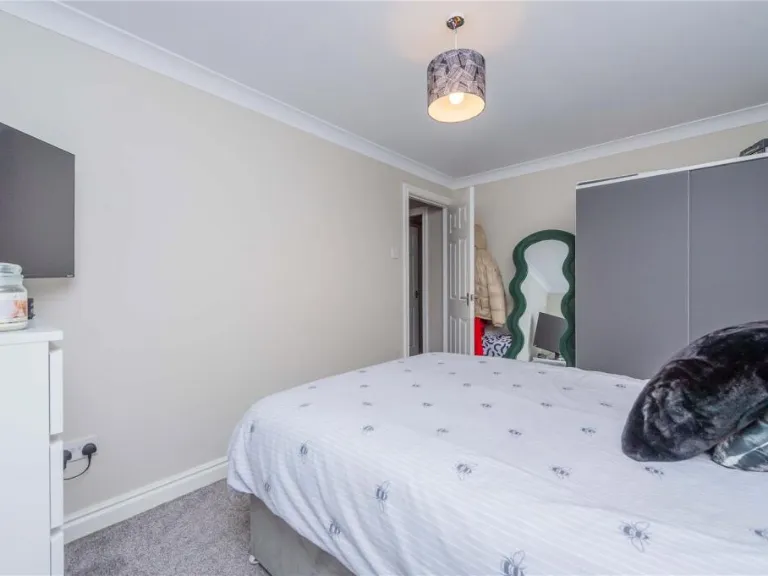
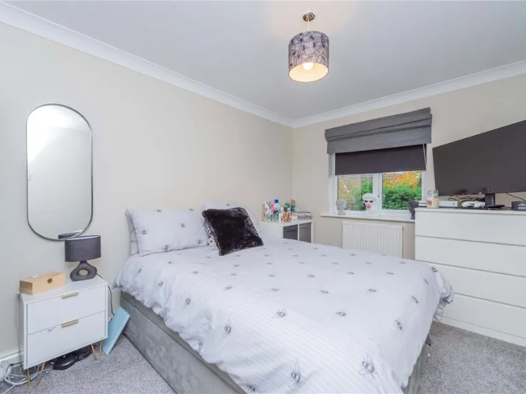
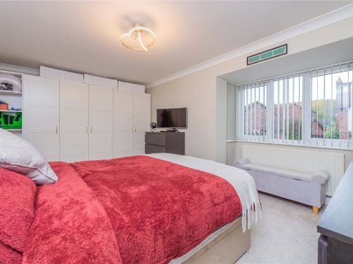
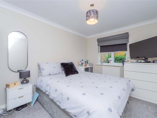
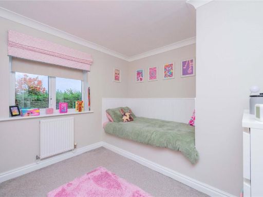
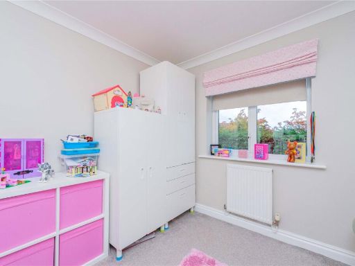
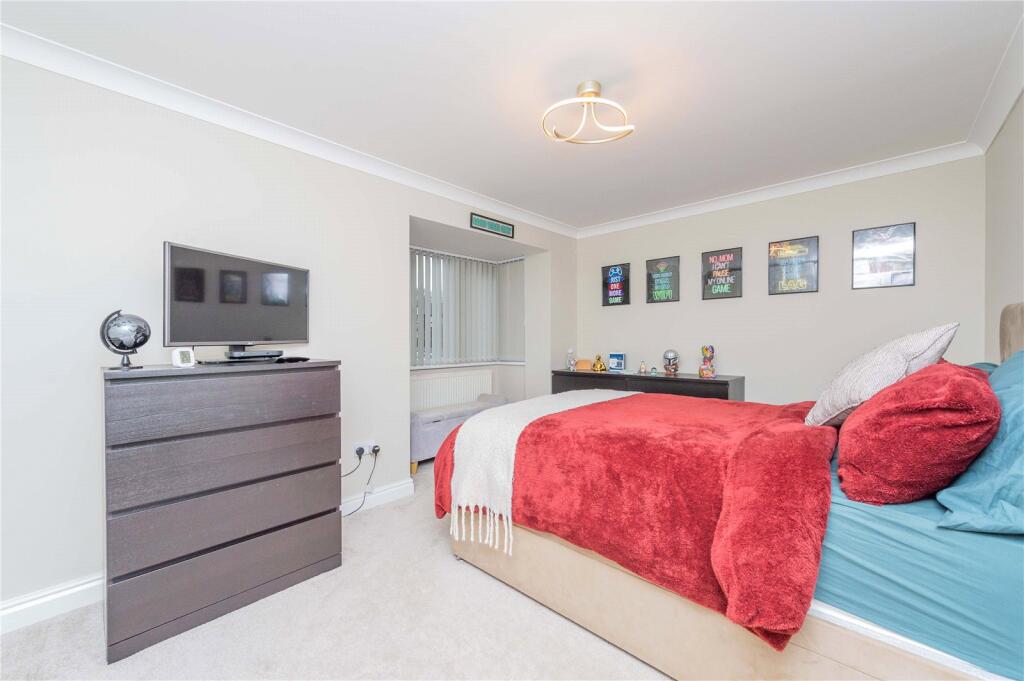
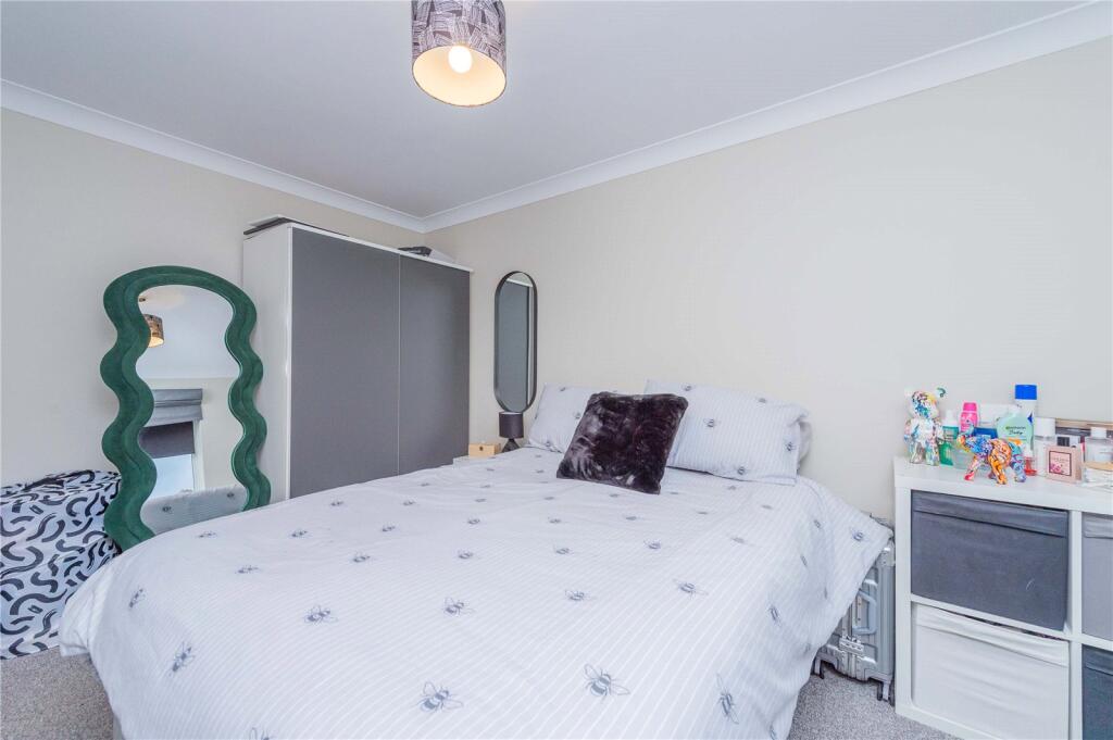
- Bedroom 3:
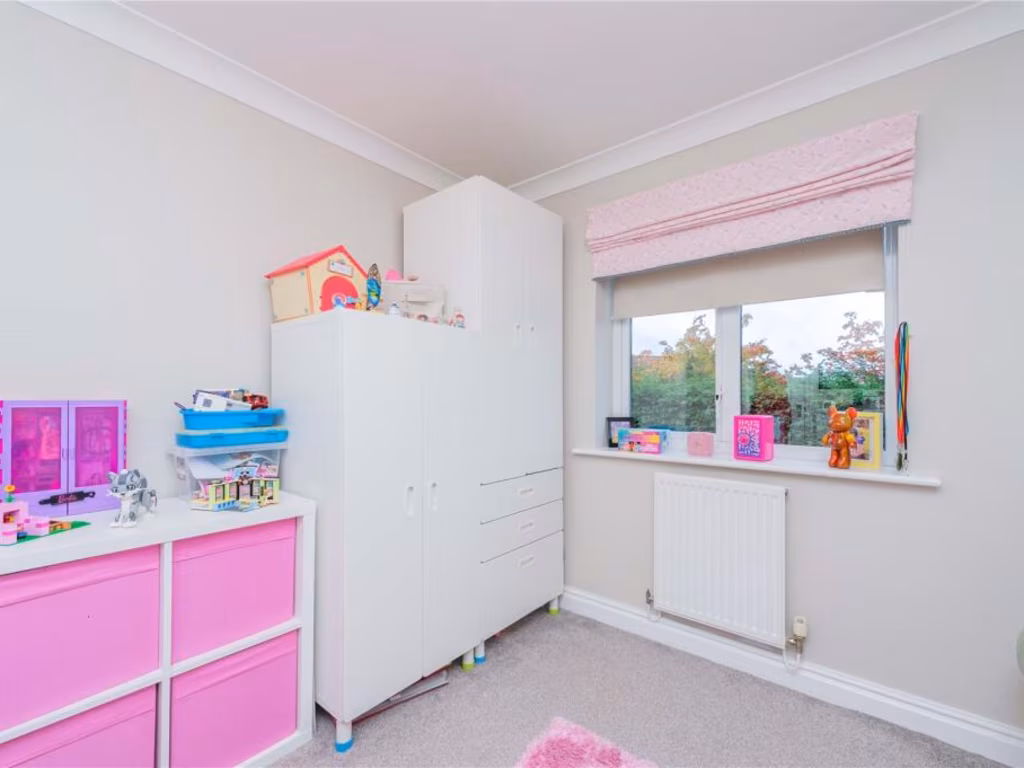
- Bedroom 4:
- Bedroom 2:
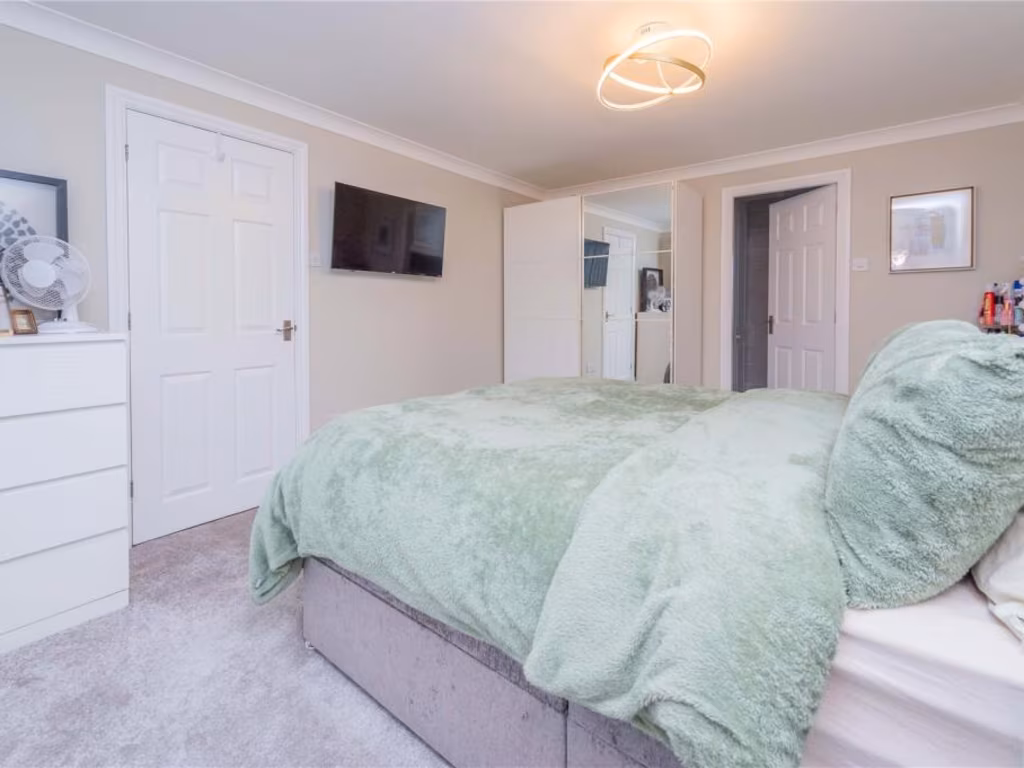
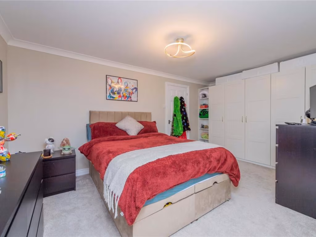
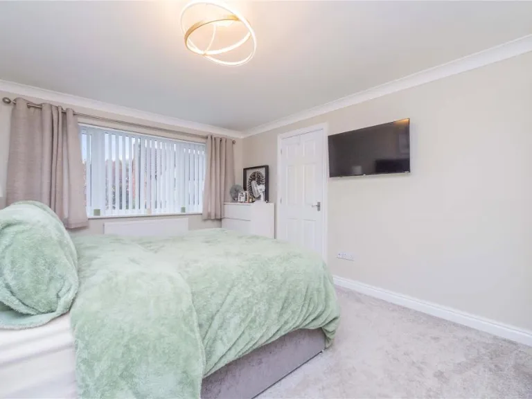
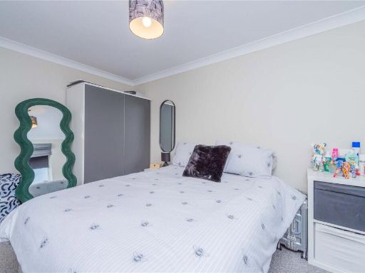
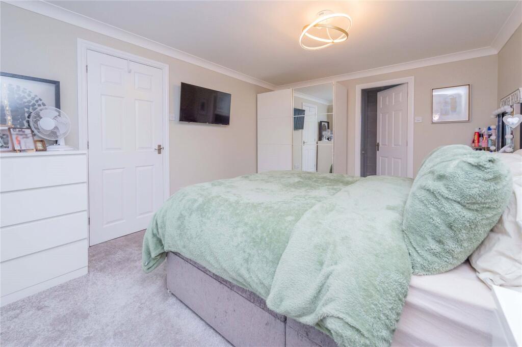
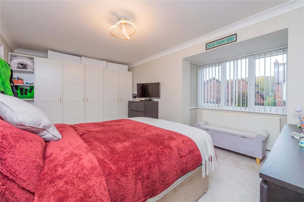
- Master Bedroom:
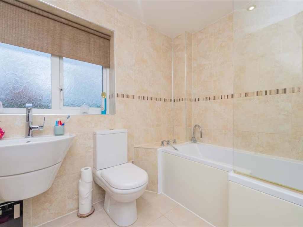
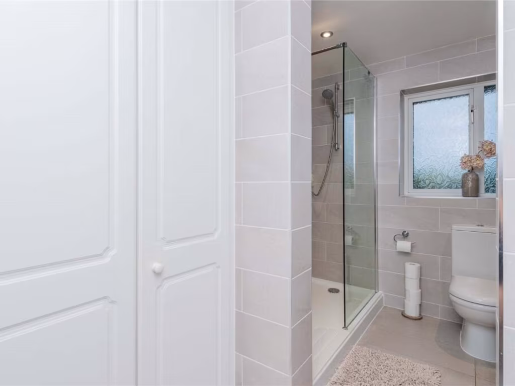
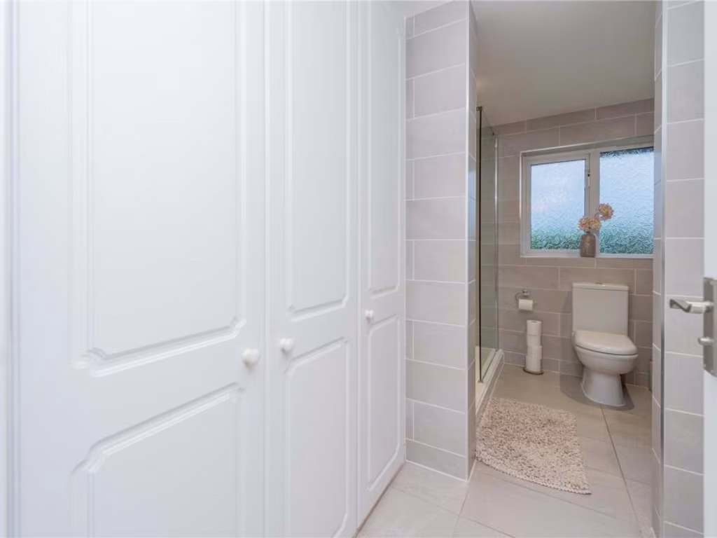
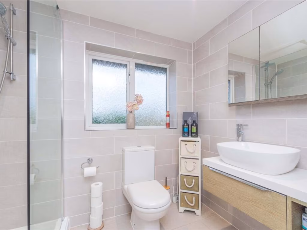
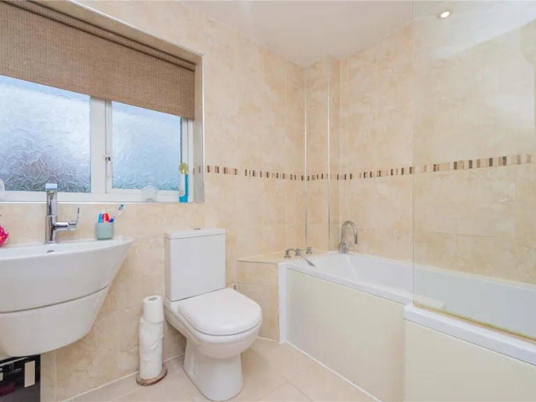
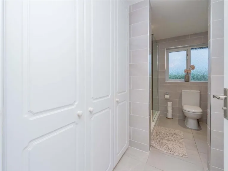
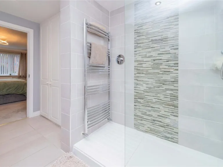
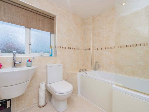
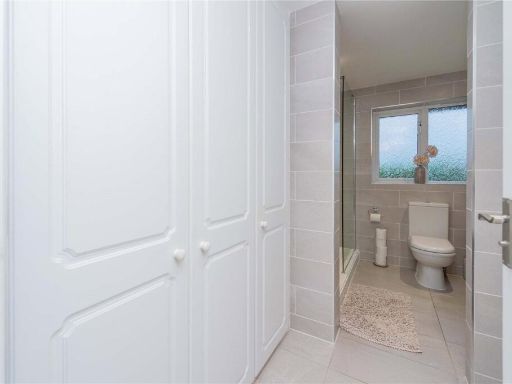
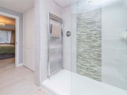
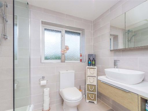
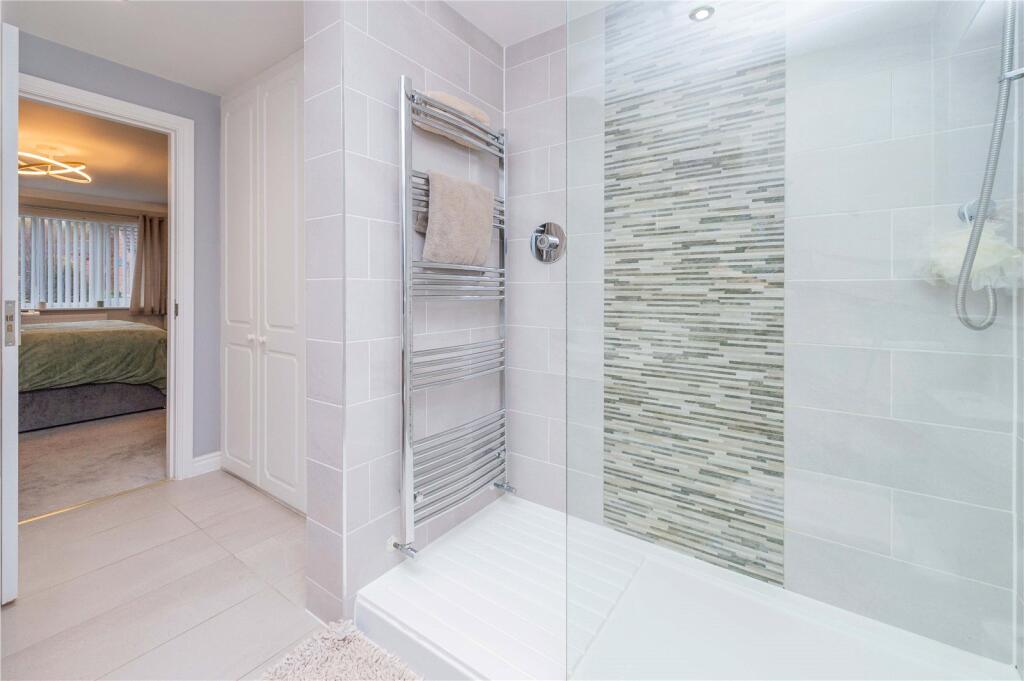
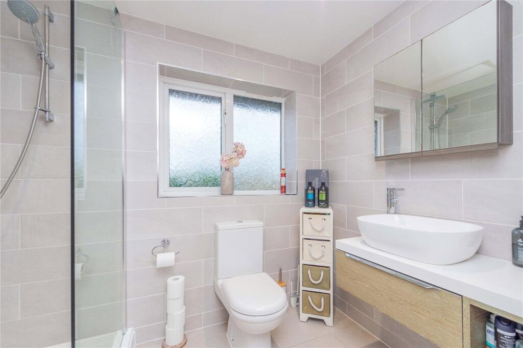
- Bathroom:
- Ensuite:
- Dressing Area:
Textual Property Features
Detected Visual Features
- modern home
- suburban area
- garage
- driveway
- residential neighborhood
- detached house
- contemporary design
- family home
- quiet street
- contemporary
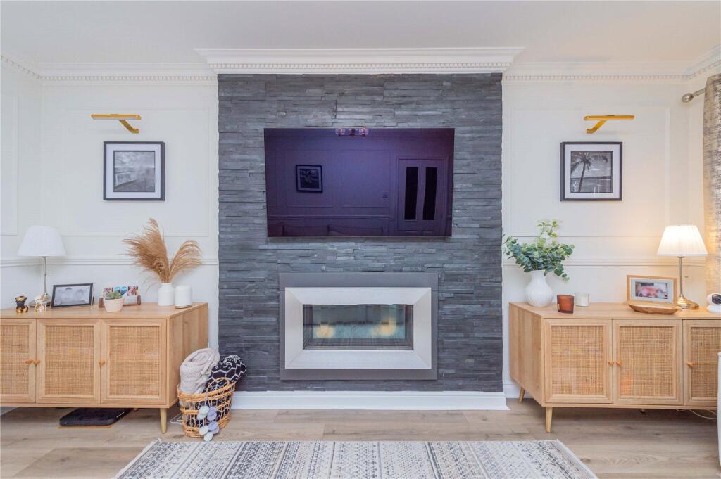
- living room
- fireplace
- feature wall
- modern
- well-maintained
- light fittings
- laminate flooring
EPC Details
- Fully double glazed
- Cavity wall, filled cavity
- Boiler and radiators, mains gas
- Low energy lighting in 68% of fixed outlets
- Solid, limited insulation (assumed)
Nearby Schools
- Holmer Lake Primary School
- Kickstart Academy
- Priorslee Academy
- Wrockwardine Wood Infant School and Nursery
- Wrockwardine Wood Church of England Junior School
- Donnington Wood CofE Voluntary Controlled Junior School
- Grange Park Primary School
- The Telford Langley School
- Old Park Primary School
- Lantern Academy
- Donnington Wood Infant School and Nursery Centre
- Lilleshall Primary School
- Windmill Primary School
- Randlay Primary School
- Hollinswood Primary School
- St George's Church of England Primary School
- Wombridge Primary School
- Teagues Bridge Primary School
- Thomas Telford School
- Holy Trinity Academy
- Redhill Primary Academy
- St Matthew's Church of England Aided Primary School and Nursery Centre
- Muxton Primary School
Nearest General Shops
- Id: 918534317
- Tags:
- Name: Lakeside Plant and Garden Centre
- Shop: garden_centre
- Source: survey
- TagsNormalized:
- Lat: 52.6872863
- Lon: -2.4122763
- FullGeoHash: gcq79p7mtyh2
- PartitionGeoHash: gcq7
- Images:
- FoodStandards: null
- Distance: 823.4
,- Id: 791525410
- Tags:
- Building: yes
- Name: Lakeside Plant and Garden Centre
- Shop: garden_centre
- TagsNormalized:
- Lat: 52.6872916
- Lon: -2.4122811
- FullGeoHash: gcq79p7mtz0b
- PartitionGeoHash: gcq7
- Images:
- FoodStandards: null
- Distance: 822.8
,- Id: 791525409
- Tags:
- Building: yes
- Name: Green Fields
- Shop: farm
- TagsNormalized:
- Lat: 52.6875323
- Lon: -2.4119556
- FullGeoHash: gcq79p7xj7gs
- PartitionGeoHash: gcq7
- Images:
- FoodStandards: null
- Distance: 812.1
}
Nearest Grocery shops
- Id: 4978136413
- Tags:
- Name: WHSmith
- Shop: convenience
- TagsNormalized:
- Lat: 52.6773269
- Lon: -2.4003786
- FullGeoHash: gcq79ms5ej7y
- PartitionGeoHash: gcq7
- Images:
- FoodStandards: null
- Distance: 2189.3
,- Id: 3634923298
- Tags:
- Addr:
- Housenumber: 9
- Postcode: TF2 6AA
- Street: Oxford Street
- Brand: Premier
- Brand:wikidata: Q7240340
- Brand:wikipedia: en:Premier Stores
- Fhrs:
- Name: Premier
- Shop: convenience
- Source:
- TagsNormalized:
- Lat: 52.6945144
- Lon: -2.4500333
- FullGeoHash: gcq7b0xzy16y
- PartitionGeoHash: gcq7
- Images:
- FoodStandards:
- Id: 729232
- FHRSID: 729232
- LocalAuthorityBusinessID: 14/00190/COMM
- BusinessName: Premier Stores
- BusinessType: Retailers - other
- BusinessTypeID: 4613
- AddressLine1: 9 Oxford Street
- AddressLine2: Oakengates
- AddressLine3: Telford
- AddressLine4: Shropshire
- PostCode: TF2 6AA
- RatingValue: 4
- RatingKey: fhrs_4_en-GB
- RatingDate: 2017-03-15
- LocalAuthorityCode: 900
- LocalAuthorityName: Telford and Wrekin Council
- LocalAuthorityWebSite: http://www.telford.gov.uk/
- LocalAuthorityEmailAddress: Food@telford.gov.uk
- Scores:
- Hygiene: 0
- Structural: 5
- ConfidenceInManagement: 10
- NewRatingPending: false
- Geocode:
- Longitude: -2.45036900000000
- Latitude: 52.69462700000000
- Distance: 2115.4
,- Id: 5327452300
- Tags:
- Name: Greyhound Stores
- Shop: convenience
- TagsNormalized:
- Lat: 52.689694
- Lon: -2.447669
- FullGeoHash: gcq78rcetnve
- PartitionGeoHash: gcq7
- Images:
- FoodStandards: null
- Distance: 2001.2
}
Nearest Religious buildings
- Id: 61533956
- Tags:
- Amenity: place_of_worship
- Building: church
- Denomination: anglican
- Name: St Peter
- Religion: christian
- Source: OS_OpenData_StreetView
- Wikidata: Q26284774
- TagsNormalized:
- place of worship
- church
- anglican
- christian
- Lat: 52.6871519
- Lon: -2.4402174
- FullGeoHash: gcq78rrhfufp
- PartitionGeoHash: gcq7
- Images:
- FoodStandards: null
- Distance: 1618.6
,- Id: 398765985
- Tags:
- Addr:
- Postcode: TF2 9LJ
- Street: London Road
- Amenity: school
- Denomination: anglican
- Fhrs:
- Name: St George's Church of England Primary School
- Ref:
- Religion: christian
- Source: bing
- Website: https://www.stgeorgesschool.org.uk/
- Wikidata: Q67149129
- TagsNormalized:
- school
- anglican
- church
- christian
- Lat: 52.6918814
- Lon: -2.4367537
- FullGeoHash: gcq7b8387w8e
- PartitionGeoHash: gcq7
- Images:
- FoodStandards:
- Id: 250274
- FHRSID: 250274
- LocalAuthorityBusinessID: 12630/2013/2/000
- BusinessName: St. Georges C Of E School
- BusinessType: School/college/university
- BusinessTypeID: 7845
- AddressLine1: St Georges C Of E Primary School London Road
- AddressLine2: St Georges
- AddressLine3: Telford
- AddressLine4: Shropshire
- PostCode: TF2 9LJ
- RatingValue: 5
- RatingKey: fhrs_5_en-GB
- RatingDate: 2021-11-03
- LocalAuthorityCode: 900
- LocalAuthorityName: Telford and Wrekin Council
- LocalAuthorityWebSite: http://www.telford.gov.uk/
- LocalAuthorityEmailAddress: Food@telford.gov.uk
- Scores:
- Hygiene: 0
- Structural: 5
- ConfidenceInManagement: 5
- NewRatingPending: false
- Geocode:
- Longitude: null
- Latitude: null
- Distance: 1232.8
,- Id: 495915289
- Tags:
- Amenity: place_of_worship
- Building: church
- Denomination: anglican
- Name: St George
- Religion: christian
- Wikidata: Q26580881
- TagsNormalized:
- place of worship
- church
- anglican
- christian
- Lat: 52.6952734
- Lon: -2.4318085
- FullGeoHash: gcq7b8vhnybj
- PartitionGeoHash: gcq7
- Images:
- FoodStandards: null
- Distance: 904.2
}
Nearest Medical buildings
- Id: 358297927
- Tags:
- Amenity: doctors
- Building: yes
- Healthcare: doctor
- Name: Charlton Medical Centre
- Source: bing
- TagsNormalized:
- doctor
- doctors
- health
- healthcare
- Lat: 52.6935762
- Lon: -2.4493988
- FullGeoHash: gcq7b286kfec
- PartitionGeoHash: gcq7
- Images:
- FoodStandards: null
- Distance: 2070.2
,- Id: 3635693013
- Tags:
- Amenity: clinic
- Healthcare: clinic
- Name: Back to Health
- TagsNormalized:
- Lat: 52.6954425
- Lon: -2.4489255
- FullGeoHash: gcq7b2btpyky
- PartitionGeoHash: gcq7
- Images:
- FoodStandards: null
- Distance: 2048.6
,- Id: 7522865343
- Tags:
- Amenity: pharmacy
- Brand: Asda
- Brand:wikidata: Q297410
- Brand:wikipedia: en:Asda
- Contact:
- Phone: +44 1952 621700
- Website: https://storelocator.asda.com/west-midlands/telford/st-georges-road/pharmacy
- Fixme: Location not accurate
- Operator: Asda Stores Ltd
- TagsNormalized:
- Lat: 52.7085719
- Lon: -2.4342576
- FullGeoHash: gcq7be73ttvy
- PartitionGeoHash: gcq7
- Images:
- FoodStandards: null
- Distance: 1968.7
,- Id: 1639252078
- Tags:
- Addr:
- Postcode: TF2 9NR
- Street: Priorslee Avenue
- Amenity: pharmacy
- Fhrs:
- Healthcare: pharmacy
- Name: Priorslee Pharmacy
- Opening_hours: Mo-Fr 09:00-18:00; Sa 09:00-13:00
- Source:
- TagsNormalized:
- Lat: 52.6850834
- Lon: -2.4241997
- FullGeoHash: gcq78z4bb53s
- PartitionGeoHash: gcq7
- Images:
- FoodStandards:
- Id: 851360
- FHRSID: 851360
- LocalAuthorityBusinessID: 14/00020/COMM
- BusinessName: Priorslee Pharmacy
- BusinessType: Retailers - other
- BusinessTypeID: 4613
- AddressLine1: Priorslee Pharmacy Priorslee Avenue
- AddressLine2: Priorslee
- AddressLine3: Telford
- AddressLine4: Shropshire
- PostCode: TF2 9NR
- RatingValue: Exempt
- RatingKey: fhrs_exempt_en-GB
- RatingDate: 2017-03-21
- LocalAuthorityCode: 900
- LocalAuthorityName: Telford and Wrekin Council
- LocalAuthorityWebSite: http://www.telford.gov.uk/
- LocalAuthorityEmailAddress: Food@telford.gov.uk
- Scores:
- Hygiene: null
- Structural: null
- ConfidenceInManagement: null
- NewRatingPending: false
- Geocode:
- Longitude: -2.42423360000000
- Latitude: 52.68502030000000
- Distance: 1016.7
}
Nearest Leisure Facilities
- Id: 495915292
- Tags:
- Leisure: pitch
- Sport: cricket
- TagsNormalized:
- pitch
- leisure
- cricket
- sports
- Lat: 52.6957451
- Lon: -2.4302528
- FullGeoHash: gcq7b8yqgnb5
- PartitionGeoHash: gcq7
- Images:
- FoodStandards: null
- Distance: 815.7
,- Id: 495915299
- Tags:
- Leisure: pitch
- Name: St Georges Crown Green Bowls Club
- Sport: bowls
- TagsNormalized:
- pitch
- leisure
- bowls
- club
- sports
- Lat: 52.6967405
- Lon: -2.4291736
- FullGeoHash: gcq7b9phu0kv
- PartitionGeoHash: gcq7
- Images:
- FoodStandards: null
- Distance: 789
,- Id: 495915295
- Tags:
- Leisure: pitch
- Name: St Georges Crown Green Bowls Club
- Sport: bowls
- TagsNormalized:
- pitch
- leisure
- bowls
- club
- sports
- Lat: 52.6962818
- Lon: -2.4291021
- FullGeoHash: gcq7b9p4jffj
- PartitionGeoHash: gcq7
- Images:
- FoodStandards: null
- Distance: 763.3
,- Id: 10649746631
- Tags:
- TagsNormalized:
- picnic
- picnic table
- leisure
- Lat: 52.690041
- Lon: -2.4272691
- FullGeoHash: gcq78zbt8x8c
- PartitionGeoHash: gcq7
- Images:
- FoodStandards: null
- Distance: 700.7
,- Id: 1116988506
- Tags:
- Access: yes
- Leisure: playground
- TagsNormalized:
- Lat: 52.6903758
- Lon: -2.4270058
- FullGeoHash: gcq78zbxwtvq
- PartitionGeoHash: gcq7
- Images:
- FoodStandards: null
- Distance: 665.4
}
Nearest Tourist attractions
- Id: 10586226927
- Tags:
- TagsNormalized:
- Lat: 52.6685381
- Lon: -2.4407612
- FullGeoHash: gcq78kn8qphe
- PartitionGeoHash: gcq7
- Images:
- FoodStandards: null
- Distance: 3158.6
,- Id: 443541045
- Tags:
- Name: Furnace House Bed & Breakfast
- Tourism: guest_house
- TagsNormalized:
- Lat: 52.7145316
- Lon: -2.4450776
- FullGeoHash: gcq7bk7s3scv
- PartitionGeoHash: gcq7
- Images:
- FoodStandards: null
- Distance: 2929.9
,- Id: 10595819493
- Tags:
- TagsNormalized:
- Lat: 52.7166751
- Lon: -2.412474
- FullGeoHash: gcq7chg2ck3p
- PartitionGeoHash: gcq7
- Images:
- FoodStandards: null
- Distance: 2600.5
}
Nearest Train stations
- Id: 814684302
- Tags:
- Name: Spring Village
- Public_transport: station
- Railway: station
- Usage: tourism
- TagsNormalized:
- Lat: 52.6628632
- Lon: -2.4825389
- FullGeoHash: gcq5xdbr2thz
- PartitionGeoHash: gcq5
- Images:
- FoodStandards: null
- Distance: 5496.3
,- Id: 367981086
- Tags:
- Name: Horsehay & Dawley
- Public_transport: station
- Railway: station
- Usage: tourism
- Wikidata: Q28970323
- TagsNormalized:
- Lat: 52.6629789
- Lon: -2.4816699
- FullGeoHash: gcq5xe0bhfuc
- PartitionGeoHash: gcq5
- Images:
- FoodStandards: null
- Distance: 5442.5
,- Id: 3711941421
- Tags:
- Name: Shifnal
- Naptan:
- Network: National Rail
- Public_transport: station
- Railway: station
- Ref:
- Wikidata: Q1891199
- Wikipedia: en:Shifnal railway station
- TagsNormalized:
- Lat: 52.6660075
- Lon: -2.3716887
- FullGeoHash: gcq7d58cxxke
- PartitionGeoHash: gcq7
- Images:
- FoodStandards: null
- Distance: 4409.6
,- Id: 3711941420
- Tags:
- Name: Oakengates
- Naptan:
- Network: National Rail
- Public_transport: station
- Railway: station
- Ref:
- Wikidata: Q2384836
- Wikipedia: en:Oakengates railway station
- TagsNormalized:
- Lat: 52.6930906
- Lon: -2.450188
- FullGeoHash: gcq7b0rzd2p2
- PartitionGeoHash: gcq7
- Images:
- FoodStandards: null
- Distance: 2124.1
,- Id: 3711941422
- Tags:
- Name: Telford Central
- Naptan:
- Network: National Rail
- Public_transport: station
- Railway: station
- Ref:
- Wikipedia: en:Telford Central railway station
- TagsNormalized:
- Lat: 52.6811135
- Lon: -2.441178
- FullGeoHash: gcq78qq3srmf
- PartitionGeoHash: gcq7
- Images:
- FoodStandards: null
- Distance: 2055.4
}
Nearest Bus stations and stops
- Id: 7956113796
- Tags:
- Bus: yes
- Highway: bus_stop
- Name: Magna Foods
- Naptan:
- AtcoCode: 3590E040000
- NaptanCode: teladpwd
- Verified: no
- Public_transport: platform
- Source: naptan
- TagsNormalized:
- Lat: 52.6766475
- Lon: -2.4240651
- FullGeoHash: gcq78v6zeny4
- PartitionGeoHash: gcq7
- Images:
- FoodStandards: null
- Distance: 1918.9
,- Id: 7956113835
- Tags:
- Bus: yes
- Highway: bus_stop
- Name: Magna Foods
- Naptan:
- AtcoCode: 3590E039900
- NaptanCode: teladpwa
- Verified: no
- Public_transport: platform
- Source: naptan
- TagsNormalized:
- Lat: 52.6768983
- Lon: -2.424319
- FullGeoHash: gcq78vd9jm8d
- PartitionGeoHash: gcq7
- Images:
- FoodStandards: null
- Distance: 1894.8
,- Id: 5828072067
- Tags:
- Bus: yes
- Highway: bus_stop
- Public_transport: platform
- TagsNormalized:
- Lat: 52.6961244
- Lon: -2.4361223
- FullGeoHash: gcq7b9414jxd
- PartitionGeoHash: gcq7
- Images:
- FoodStandards: null
- Distance: 1208.6
,- Id: 877587133
- Tags:
- Bus: yes
- Highway: bus_stop
- Public_transport: platform
- TagsNormalized:
- Lat: 52.6927971
- Lon: -2.418868
- FullGeoHash: gcq7bbqtu336
- PartitionGeoHash: gcq7
- Images:
- FoodStandards: null
- Distance: 89.4
,- Id: 877586453
- Tags:
- Bus: yes
- Highway: bus_stop
- Public_transport: platform
- TagsNormalized:
- Lat: 52.6930019
- Lon: -2.4187822
- FullGeoHash: gcq7bbqwyr3r
- PartitionGeoHash: gcq7
- Images:
- FoodStandards: null
- Distance: 66
}
Nearest Hotels
- Id: 61539265
- Tags:
- Building: yes
- Name: Mercure Telford Centre Hotel
- Source: OS_OpenData_StreetView
- Tourism: hotel
- TagsNormalized:
- Lat: 52.6811675
- Lon: -2.4465898
- FullGeoHash: gcq78q66n36k
- PartitionGeoHash: gcq7
- Images:
- FoodStandards: null
- Distance: 2334
,- Id: 4849909170
- Tags:
- Brand: Days Inn
- Brand:wikidata: Q1047239
- Brand:wikipedia: en:Days Inn
- Internet_access: wlan
- Name: Days Inn
- Tourism: hotel
- TagsNormalized:
- Lat: 52.6775091
- Lon: -2.3997154
- FullGeoHash: gcq79mssdx6t
- PartitionGeoHash: gcq7
- Images:
- FoodStandards: null
- Distance: 2198.3
,- Id: 456361444
- Tags:
- Addr:
- City: Telford
- Postcode: TF3 4LY
- Street: Euston Way
- Brand: Premier Inn
- Brand:wikidata: Q2108626
- Brand:wikipedia: en:Premier Inn
- Internet_access: wlan
- Internet_access:fee: customers
- Internet_access:operator: Virgin Media
- Internet_access:ssid: Premier Inn Free Wi-Fi
- Name: Premier Inn (Telford Central)
- Operator: Premier Inn
- Stars: 3
- Tourism: hotel
- TagsNormalized:
- Lat: 52.6809102
- Lon: -2.4388897
- FullGeoHash: gcq78w209c2n
- PartitionGeoHash: gcq7
- Images:
- FoodStandards: null
- Distance: 1960.6
}
Tags
- modern home
- suburban area
- garage
- driveway
- residential neighborhood
- detached house
- contemporary design
- family home
- quiet street
- contemporary
- living room
- fireplace
- feature wall
- modern
- well-maintained
- light fittings
- laminate flooring
Local Market Stats
- Average Price/sqft: £233
- Avg Income: £42800
- Rental Yield: 4.5%
- Social Housing: 17%
- Planning Success Rate: 92%
AirBnB Data
- 1km average: £61/night
- Listings in 1km: 1
Similar Properties
 5 bedroom detached house for sale in Abelia Way, Priorslee, Telford, Shropshire, TF2 — £565,000 • 5 bed • 2 bath
 4 bedroom detached house for sale in Everglade Road Priorslee TF2 9QS, TF2 — £425,000 • 4 bed • 2 bath • 1495 ft²
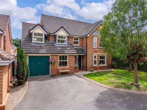 5 bedroom detached house for sale in Swallowfield Close, Priorslee, Telford, Shropshire, TF2 — £550,000 • 5 bed • 2 bath
 4 bedroom detached house for sale in Highgrove Meadows, Priorslee, Telford, Shropshire, TF2 — £550,000 • 4 bed • 2 bath • 1700 ft²
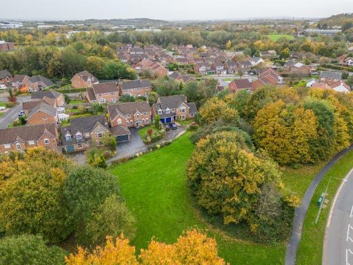 5 bedroom detached house for sale in 4 Swallowfield Close, Priorslee. TF2 9TG, TF2 — £589,950 • 5 bed • 2 bath
 3 bedroom detached house for sale in Ainsdale Drive, Priorslee, Telford, Shropshire, TF2 — £265,000 • 3 bed • 1 bath
Meta
- {
"@context": "https://schema.org",
"@type": "Residence",
"name": "4 bedroom detached house for sale in Finsbury Drive, Priors…",
"description": "",
"url": "https://propertypiper.co.uk/property/d693e610-3617-40f2-ad26-020e63c924ea",
"image": "https://image-a.propertypiper.co.uk/477df89e-c54c-4ccd-93ba-7348aba188c3-1024.jpeg",
"address": {
"@type": "PostalAddress",
"streetAddress": "18 FINSBURY DRIVE PRIORSLEE TELFORD",
"postalCode": "TF2 9GU",
"addressLocality": "Telford and Wrekin",
"addressRegion": "Telford",
"addressCountry": "England"
},
"geo": {
"@type": "GeoCoordinates",
"latitude": 52.693592666023164,
"longitude": -2.4186809211043716
},
"numberOfRooms": 4,
"numberOfBathroomsTotal": 2,
"floorSize": {
"@type": "QuantitativeValue",
"value": 1653,
"unitCode": "FTK"
},
"offers": {
"@type": "Offer",
"price": 575000,
"priceCurrency": "GBP",
"availability": "https://schema.org/InStock"
},
"additionalProperty": [
{
"@type": "PropertyValue",
"name": "Feature",
"value": "modern home"
},
{
"@type": "PropertyValue",
"name": "Feature",
"value": "suburban area"
},
{
"@type": "PropertyValue",
"name": "Feature",
"value": "garage"
},
{
"@type": "PropertyValue",
"name": "Feature",
"value": "driveway"
},
{
"@type": "PropertyValue",
"name": "Feature",
"value": "residential neighborhood"
},
{
"@type": "PropertyValue",
"name": "Feature",
"value": "detached house"
},
{
"@type": "PropertyValue",
"name": "Feature",
"value": "contemporary design"
},
{
"@type": "PropertyValue",
"name": "Feature",
"value": "family home"
},
{
"@type": "PropertyValue",
"name": "Feature",
"value": "quiet street"
},
{
"@type": "PropertyValue",
"name": "Feature",
"value": "contemporary"
},
{
"@type": "PropertyValue",
"name": "Feature",
"value": "living room"
},
{
"@type": "PropertyValue",
"name": "Feature",
"value": "fireplace"
},
{
"@type": "PropertyValue",
"name": "Feature",
"value": "feature wall"
},
{
"@type": "PropertyValue",
"name": "Feature",
"value": "modern"
},
{
"@type": "PropertyValue",
"name": "Feature",
"value": "well-maintained"
},
{
"@type": "PropertyValue",
"name": "Feature",
"value": "light fittings"
},
{
"@type": "PropertyValue",
"name": "Feature",
"value": "laminate flooring"
}
]
}
High Res Floorplan Images
Compatible Floorplan Images
FloorplanImages Thumbnail